Showing 423 items
matching utilities
-
 Kew Historical Society Inc
Photograph, Former Convent of the Good Shepherd, Abbotsford
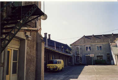
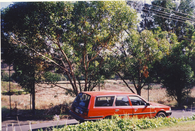
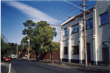
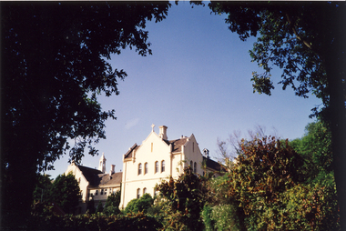
The former Convent of the Good Shepherd at Abbotsford includes ecclesiastical, residential, educational and utility buildings constructed during the late nineteenth and twentieth centuries on a bend of the Yarra River. In 1975 the site was purchased by the Victorian Government as a higher education campus. A proposed redevelopment of the site in the late 1990s led to a community-based heritage battle which resulted in 2004 in the transfer of the convent site south of St Heliers Street to the Abbotsford Convent Foundation for community use. (Source: Heritage Victoria)This photograph is part of a series taken c.1990 by the photographer Rick Lowell. It was taken before the heritage campaign to preserve the site for community use.Colour snapshot of a part or section of the Former Convent of the Good Shepherd, Abbotsfordabbotsford convent, convent of the good shepherd, abbotsford (vic.) -
 Kew Historical Society Inc
Photograph, Former Convent of the Good Shepherd, Abbotsford
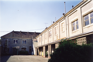
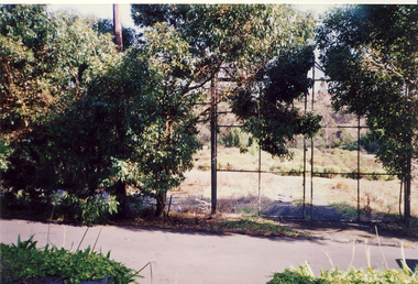
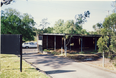
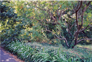
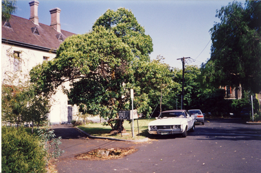
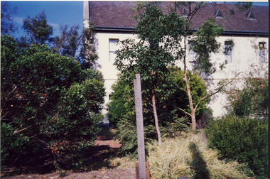
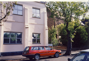
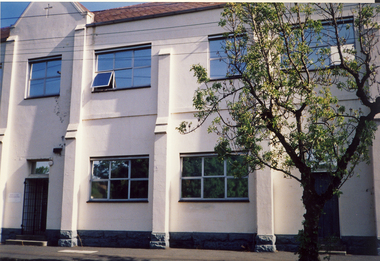
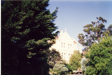
The former Convent of the Good Shepherd at Abbotsford includes ecclesiastical, residential, educational and utility buildings constructed during the late nineteenth and twentieth centuries on a bend of the Yarra River. In 1975 the site was purchased by the Victorian Government as a higher education campus. A proposed redevelopment of the site in the late 1990s led to a community-based heritage battle which resulted in 2004 in the transfer of the convent site south of St Heliers Street to the Abbotsford Convent Foundation for community use. (Source: Heritage Victoria)This photograph is part of a series taken c.1990 by the photographer Rick Lowell. It was taken before the heritage campaign to preserve the site for community use.Colour snapshot of a part or section of the Former Convent of the Good Shepherd, Abbotsfordabbotsford convent, convent of the good shepherd, abbotsford (vic.) -
 Bendigo Historical Society Inc.
Document - TALK BY GEOFF RUSSELL: 'FIXING BENDIGO'S BIG STINK'
... Utilities ...Talk by Geoff Russell: 'Fixing Bendigo's Big Stink' - text of illustrated talk, 28/5/2005. Effluent and drainage problems of Bendigo in early days. Reference to the Bendigo Sewerage Authority (1917) and start of 15 year program to build reticulated sewerage system. Reference to Bendigo's second Royal Commission re investigating the affairs of the Bendigo Sewerage Authority (tendering; pricing; conditions at the works) and outcome of the enquiry. Extension of relevant history to 1992 (Coliban Region Water Authority). Mention of S Gordon Moore; A G Gutteridge; typhoid fever.Geoff Russellbendigo, utilities, bendigo sewage treatment plant, bendigo sewerage, sandhurst municipal council, mayor william beebe, night carts, bendigo mayor giudice, engineer s. gordon moore, cr curnow, bendigo creek. sewage treatment plant epsom. -
 Port Melbourne Historical & Preservation Society
Document - Correspondence Precis, City of Port Melbourne, Town Clerk, Sydney Sims ANDERSON, Sydney Sims Anderson, Town Clerk, Jul 1924
... Utilities ...Found in pages of item 588 (Town Clerk's Report)Town Clerk Syd ANDERSON's 3-page summary of correspondence and invoices received, July 1924One small correction in ink at no. 11 A few figures in pencil on backhealth - general health, fire and fire services, health - hospitals, utilities, local government - city of port melbourne, piers and wharves - princes pier, sandridge lagoon, sydney sims anderson, town clerks, j b steenicken, swallow & ariell ltd -
 Melbourne Tram Museum
Photograph - Y1 class interior photograph, Sutcliffe Pty Ltd, early 1930s
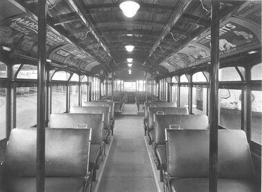
Black and white photograph of the interior a Y1 class tram car, photographed at Glenhuntly Depot. Shows general arrangements of seats, light defuses and internal advertising. Part of W2 class No. 550 is in the background. Advertisements for: Brockhoff's Biscuits, Senitts Ice Cream, Saunders and Madison Utility Chairs of 309 Collins St Melbourne. Also note the paper notice on the window promoting Albert Park. On rear is Sutcliffe Photographers stamp. See item 7672 for another similar photograph. Destination City, 4th Edition and 5th edition.Yields information about the interior of a Y1 class tramcar.Black and white print with photographer's detail on the rear."Sutcliffe" photographers stamp and in pencil "class Y1"tramways, mmtb, y1 class, interiors, trams, tram 550, w2 class, advertisements, glenhuntly depot -
 Kew Historical Society Inc
Book, Plan of General Development, Melbourne : Report of the Metropolitan Town Planning Commission
The 1929 report of the Metropolitan Town Planning Commission covering Melbourne and its suburbs. Includes photographs and 15 folding maps (some in rear pocket) This was a planning scheme to prevent 'misuse' of land and protect property values. It highlighted traffic congestion, the distribution of recreational open space and haphazard intermingling of land uses. The plan identified a number of problems, such as the congestion at St Kilda Junction, that were not addressed until decades later. The plan also recognised the value of Melbourne's waterways as an open space network.xii, 308 p., [25] leaves of plates (24 folded) : ill., maps (some col.), ports., plans ; 34 cm. CONTENTS Part 1 Surveys and studies Part II Communications Part III The execution of improvement schemes - a programme of urgent works Part IV Zoning Part V Public Recreation Part VI Public Utilities Part VII Housing and Land Subdivision Part VIII Civic Art and Amenities Part IX Miscellaneous Part X Legislation Part XI Conclusionnon-fictionThe 1929 report of the Metropolitan Town Planning Commission covering Melbourne and its suburbs. Includes photographs and 15 folding maps (some in rear pocket) This was a planning scheme to prevent 'misuse' of land and protect property values. It highlighted traffic congestion, the distribution of recreational open space and haphazard intermingling of land uses. The plan identified a number of problems, such as the congestion at St Kilda Junction, that were not addressed until decades later. The plan also recognised the value of Melbourne's waterways as an open space network.city planning -- victoria. -- maps, city planning -- victoria -- melbourne, city planning -- victoria, civic improvement -- victoria -- melbourne, melbourne -- (vic.), cartography -
 Kiewa Valley Historical Society
Photographs- Original S.E.C.V. home designs in Mt Beauty – Set of 6 black and white photographs
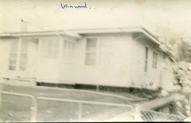
The townships of Mount Beauty and Bogong Village were constructed by the Victorian State Electricity Utility Commission (SEC) from the 1930’s to the 1950’s to house workers on the Kiewa Hydro Electric Scheme. At its peak the Kiewa Scheme employed around 4000 people. Although the towns were built as temporary accommodation for the workers and their families, many stayed and even retired there after the scheme had finished. The Bright Council, now the Alpine Shire took over the control of the township in 1960 and today Mount Beauty is one of the most complete company towns in Victoria.The SECV provided several standard designs for the housing of workers and management in Mt Beauty. At the completion of the scheme the housing was retained and Mount Beauty now exists as one of the best examples of a company town in Victoria.There are many examples of the original houses remaining around the town. This is significant as the houses were only built as temporary accommodation and still remain functional after over 60 or more years of use.Set of 6 black and white photographs of original SECV temporary house designs in Mt Beauty.Written in blue ink on front of photos 1. Winwood 2. Winwood 3. K Type 4. K Type 5. English Precut 6. Cube mt beauty houses, secv housing -
 Charlton Golden Grains Museum Inc
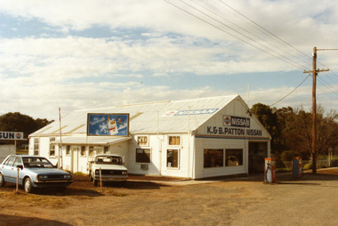
Photograph - Patton's Garage West Charlton c. 1987, Charlton Shire, c.1987
The garage was established in the 1930s by Mr Gamble. Other proprietors were Perc Kimberley 1943-46, Henderson 1946, Neil Rogers. K. & B. Patton ran the garage from 1960s - 2008Colour photo of K. & B. Patton's Garage. The garage is a white, weatherboard single story building with a corrugated iron roof. There small lean-to on the LH side of the building. There is a large entrance and two large windows on the front. There are two petrol pumps at the front of the building. A blue car and a white utility are parked at the LH side of the garage. The signage on the front of the building reads K. & B. PATTON NISSAN and there is a NISSAN sign painted on the roof. There is a sign for Peter Stuyvesant cigarettes on the roof of the lean-to. A telegraph pole and the entrance to Gordon Park is on the right of the photo.perc kimberley, k & b patton, gamble, henderson, neil rogers, business, industry -
 Bendigo Historical Society Inc.
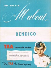
Book - BOOKLET: THE RUSKIN ALL-ABOUT
40 paged booklet - ''The Ruskin All-about'' (covering the Municipality of Bendigo facilities and activities), printed by The Ruskin Press, 1955. ''assisted by the Municipal Council and its officers and office-bearers of other organizations and associations''. Contents: Abbreviations; Baby Health Centres; Bus services; By-laws and regulations; Churches; Classified advertisers; Community activities; Doctors and surgery hours; Facts on the city; Friendly Societies; Hospitals; Magazine section; Maps; Message from the Mayor; Miscellaneous; Municipal services; The Municipality; Public and semi-public utilities; Schools and kindergartens; Sporting and recreation. Information on the forthcoming Olympic Games.Ruskin Publishing Pty. Ltd., 37 Swanston Street Melbourne.bendigo, tourism, guide -
 Bendigo Historical Society Inc.
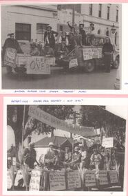
Photograph - GOLDEN SQUARE LAUREL STREET P.S. COLLECTION: MOTHER'S CLUB, 1950's
Two photographs a,b, laminated upon pink cardboard illustrating Easter Fair Floats. [a] Float based upon utility towing trailer in Mitchell St in front of Cliff Morrisons with Hopetown Hotel on right. Numerous placards displayed by adults and children riding on float. Handwritten caption below reads 'Another Mother's Club Easter ' PROTEST' Float. [b] Float carrying fancy dress adults based upon truck tray displaying numerous placards relating to Bendigo Baths protest. Handwritten caption above reads 'Mother's Club- Easter Fair Protest - Mid 1950's.bendigo, institutions, golden square primary school -
 Kiewa Valley Historical Society
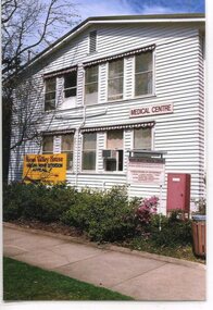
Photographs - Demolition of the old Tawonga District General Hospital. Set of 8 colour photographs
In the early stages of the Kiewa Hydro-Electric Scheme the State Electricity Commission took over the financial and construction responsibility of the Tawonga District General Hospital building at a cost of 27,000 pounds. This included the removal and re-erection of the ex-military Bonegilla ward from Wodonga while in addition they carried out all the necessary building works that allowed the hospital to operate as a functional unit. The work was completed and handed over to the Hospital Committee of Management on September 1, 1949. Local residents raised 3,400 pounds through fund raising. The balance was met by the SEC and the Hospital and Charities Commission. The initial project was to provide for a basic temporary hospital which was later to include an Operating Theatre, Offices, Store, Mortuary and a Nurse’s Home, until the establishment of a permanent medical premises. Following the opening, 455 patients were admitted to the Tawonga District General Hospital and 254 operations were performed in the first year. The hospital relocated to Mount Beauty in the former SEC administration offices located in the town centre. Official opening of the 18 bed Tawonga District General Hospital on April 29 in 1961. The old weatherboard building was demolished around the late 1900’s to early 2000’s and replaced with a new modern brick building. Alpine Health CEO Mr Lyndon Seys oversaw the opening of the new Mount Beauty Hospital in November 2001 alongside Board of Management President Mr Andrew Randell, other board members and politicians. The Kiewa Hydro-Electric Scheme the State Electricity Commission played a pivotal part in the planning and initial funding of the Tawonga District General Hospital, with a view to providing medical support for its many workers on the Hydro scheme. Later, spouse and family members of workers were also able to access medical assistance The hospital was originally located in Tawonga away from the majority of the patients as the Hospital and Charities Board was not prepared to have it within the SEC controlled area and it was not until the gate at Tawonga South was taken down that the hospital was moved to the main centre of population at Mount Beauty.8 Colour photographs of the demolition of the original Tawonga and District Hospital situated in Mt Beauty circa 20001. No inscriptions 2. Side view of Tawonga District General Hospital, 1990’s 3. Demolition of the weatherboard hospital: Nurses station, ward and corridor 4. Demolition of the weatherboard hospital: kitchen & utility rooms 5. Demolition of the weatherboard hospital” front entrance & gardens 7. Demolition of the weatherboard hospital: Matrons House 8. No inscriptions tawonga & district general hospital; kiewa hydro electric scheme; mt beauty; -
 Federation University Historical Collection
Book, Final recommendations Ballarat Study Area Land Conservation Council, Victoria, 1982, 1982
Yellow soft covered report of 95 pages . The contents of the report include: Parks, reference areas, wildlife reserves, water production, harwood production, softwood production, flora Reserves and Flora and Fauna reserves, bushland reserves, historic area and reserves, rivers and streams, Roadside conservation and Highway parks, Education areas and School Plantations, Lake Reserves, geological reserves, recreation, scenic reserves, agriculture, mineral and stone production, utilities and survey, township land, Uncommitted Land, military training, other reserves and public land. Maps include: The Study area 1: 250 000 Supplementary Mapsland conservation authority, ballarat, endowment plantations, pine plantations, langi ghiran state park, mount buangor state park, enfield state park, ballarat-creswick regional park, rossbridge, black lake, flax mill swamp, dereel lagoon, lake bolac, lake wongan, langi ghiran reservoir, gong gong reservoir, pincotts reservoir, beales reservoir, wilsons reservoir, moorabool reservoir, korweinguboora, korweinguborra reservoir, learmonth bores, sago hill, illabarook reservoir, ballarat water commission, dunneworthy, mount cole, mont lonarch, ben major, waterloo, trawalla, linton, ross creek, canadian, shepherds flat, lal lal, mount doran, raglan, chute, carngham, buninyong, watsons hill, enfield, cape clear, illabrook, rokewood junction, mount warrenheip, nerrina, jubilee, golden stream, australasian deep lead mine, happy valley school, piggoreet, berringa, bulldog, ballarat common, wildlife, water, timber, flora, rivers, geology, agriculture, warrenheip, biodiversity -
 Harcourt Valley Heritage & Tourist Centre
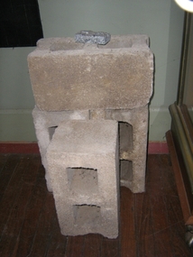
concrete blocks, 1914
Charles Seelenmeyer conducted Concrete Utilities Limited (Harcourt Cement Pipe Factory). Operated in Harcourt circa 1914 to 1930 in premises situated opposite the ANA Hall on what is now the road reserve. Principal raw material was sand from the adjacent waterway ( Barkers Creek.) Principal output was concrete drainage tiles for use in district orchards but concrete blocks were also produced for construction of homes and commercial buildings. At a time of rapid expansion of the orchards this industry provided a vital piece of orchard infrastructure, mostly buried and not now visible but nevertheless a very important feature of the valley’s horticultural industry.. Homes built with these concrete blocks are a distinct part of Harcourt’s housing stock. Harcourt Cement Pipe Co was an example of local initiative to solve a local problem using local materials. A collection of 4 concrete building blocks -
 National Wool Museum
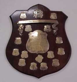
Trophy, Blue Triangle Basketball Association 1931: Collins Bros Challenge Shield B Grade Teams
Acquired when "Classweave Industries" closed down.BLUE TRIANGLE BASKET BALL ASSOCIATION 1931 COLLINS/ BROS/ CHALLENGE SHIELD/ B GRADE TEAMS/ TO BE WON 4 TIMES 1931/ BRIGHT & HITCHCOCKS 1932/ VALLEY B 1933/ FEDERAL B 1937/ RS & S MILL 1938/ GEELONG GIRLS UTILITY CLUB 1941/ WANDERERS 1942/ DONAGHYS 1936/ NOBLE ST GIRLS CLUBtextile mills woollen mills textile mills - staff sporting teams, classweave industries pty ltd federal woollen mills ltd, sport, textile mills, woollen mills, textile mills - staff, sporting teams -
 Bendigo Historical Society Inc.
Photograph - Kangaroo Flat Gold Mine Collection: underground in Swan Decline, Kangaroo Flat Gold Mine, 2000
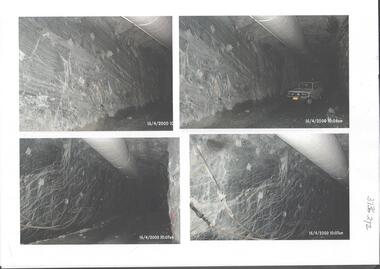
The modern mine is accessed via the Swan Decline, which commences at the Kangaroo Flat site on the southern outskirts of Bendigo and progresses in a north easterly direction between the Deborah and Sheepshead anticlines, reaching a depth of almost 1000 m below the City of Bendigo. Development of this decline commenced in 1998. Swan Decline closed and history preserved In a major rehabilitation milestone at Kangaroo Flat, the Swan Decline Bendigo’s primary gateway to underground mining, was permanently closed in December 2022. Important parts of Bendigo’s gold rush history were also preserved from the onsite office buildings with 19 boxes of records, and 1350 old photos being scanned and provided to the local historical societies and the Goldfields Library Corporation. A volunteer from the Bendigo Historical Society, Kay MacGregor, also scanned approximately 40 bookshelves of newspaper clippings to assist with recording and preserving geological drilling locations.Black and white photocopies of photographs of Swan Decline, showing some stages of underground construction. Eleven images on 3 pages, dated 16/4/2000 (10 a.m.) show decline walls, rock bolts and markout of tunnel shape. One image shows a utility in the tunnel. Final three images on one page, have notations on the photos: 'opposite SP18 LHS decline', 'just up from previous 3 box positions' and 'just up from tank, same side' On bottom RH side 'spots for scale attention, IT required, all lower decline.' All three images dated 12/6/2000.goldmining, kangaroo flat gold mine, western mining corporation, unity mining, swan decline -
 Federation University Historical Collection
Scientific Instument, Capacitor
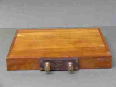
DEFINITION microfarad Posted by: Margaret Rouse WhatIs.com Contributor(s): Kenda, Jack Clements The microfarad (symbolized µF) is a unit of capacitance, equivalent to 0.000001 (10 to the -6th power) farad. The microfarad is a moderate unit of capacitance. In utility alternating-current (AC) and audio-frequency (AF) circuits, capacitors with values on the order of 1 µF or more are common. At radio frequencies (RF), a smaller unit, the picofarad (pF), is often used. This unit is equal to .000000000001 (10^-12) µF. In RF scenarios, capacitances range from about 1 pF to 1,000 pF in tuned circuits, and from about 0.001 µF to 0.1 µF for blocking and bypassing. At audio frequencies (AF), capacitances range from about 0.1 µF to 100 µF. In power-supply filters, capacitances can be as high as 10,000 µF. Capacitor, 1/3 M.F.D. (microfarad) within wooden insulating box. Two terminal posts set in an insulating box. Maker's name and place 1/3 M.F.D No. 34402scientific instrument, capacitor, electrical engineering, laboratory -
 Bendigo Historical Society Inc.
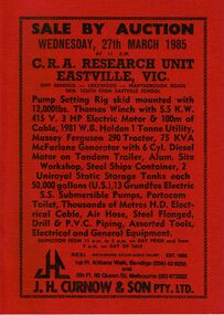
Document - IAN DYETT COLLECTION: AUCTION CATALOGUE - C.R.A. RESEARCH UNIT - EASTVILLE
Red covered auction catalogue with black printing for a sale at C.R.A. Research Unit, Eastville, Vic on 27th March 1985. For sale was Pump Setting Rig skid mounted with 12,000 lbs. Thomas Winch with 5.5 K.W. 415 V. 3 HP Electric Motor & 100m of Cable, 1981 W.B. Holden 1 Tonne Utility, Massey Ferguson 290 Tractor, 75 KVA McFarlane Generator with 6 Cyl. Diesel Motor on Tandem Trailer, Alum. Site Workshop, Steel Ships Container, 2 Uniroyal Static Storage Tanks each 50,000 gallons (U.S.), 13 Groundfos Electric S.S. Submersible Pumps, Portacom Toilet, Thousands of Metres H.D. Electrical Cable, Air Hose, Steel Flanged, Drill & P.V.C. Piping, Assorted Tools, Electrical and General Equipment. J. H. Curnow & Son Pty. Ltd. Were the auctioneers.business, auctioneers, j h curnow & son pty ltd, ian dyett collection - auction catalogue - c.r.a. research unit - eastville vic, j h curnow & son pty ltd, f c dyett, i m dyett, n f dyett, bolton bros pty ltd print -
 Charlton Golden Grains Museum Inc
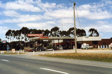
Photograph, Charlton Shire, Charlton Roadhouse c. 1987, c.1987
The Charlton Roadhouse was established in the 1960s (TBC)Colour photograph of the Charlton Roadhouse taken from the other side of the highway looking south east. The highway is visible in the lower part of the photo. The roadhouse is a single storey building with large windows at the front. There is a large roof extending over the petrol pumps. There is a large sign on the roof which reads RESTAURANT. A brown coloured car with a white roof, dark bonnet and towing a trailer is facing toward the photographer. A man is getting the driver's side. A lighter coloured car is facing away from the photographer and a man is beside this car. There is a white Toyota utility parked on the right hand side of the roadhouse in front of the ice storage. There is a small sign for ESSO on the roof edge and a freestanding sign for ESSO close to the entrance to the roadhouse. There is a sign on wheels near the road reading NOW OPEN and another that reads L.P. GAS AUTO GAScharlton roadhouse, business, industry, charlton -
 Vision Australia
Administrative record - Text, Queensland Society of Blind Citizens Minute book: 25/01/1972 - 22/10/1974, 1974-1976
Minutes of the Queensland Society of Blind Citizens committee including centre activities, staffing changes, fund raising appointment and resignation of committee members and life governorships. Some events include: 25/1/1972 - approaching the Townsville branch to ask if any applications for assistance for cyclone damage have been received, no benefits be paid to relatives doing work for members, the payment of 20 cents a week to the Queensland Musical Literary and Self Aid Society for rent of building until the Qld Society of Blind Citizens is formed and incorporated. 24/9/1974 - due to increasing utilities an increase to hostel board from $17 to $21 per week for all residents in employment. 22/10/1974 - call for special general meeting concerning dissolution of QML SAS and transferring assets and liabilities to QSBC, free use by the Coo-ee Fishing Club of the downstairs hall on Fridays and send a 'notice to fence' to the adjoining property in Stephens Road, South Brisbane. 1 book with typed pages stuck inqueensland society of blind citizens, queensland musical literary and self aid society for the blind