Showing 299 items
matching upper yarra valley
-
 Marysville & District Historical Society
Map (item), Taungurung Land and Waters Council Aboriginal Corporation, Unknown
A map of the area in Victoria which is the land of the Taungurung Clan.A map of the area in Victoria which is the land of the Taungurung Clan. Taungurung Land and Waters Council (TLaWC) was registered 16 July 2009 as the Registered Aboriginal Party that represents the interests of the Taungurung people. TLaWC is the corporate representative and ‘face’ of the Taungurung people and serves to uphold their interests with respect to culture and country. The Taungurung people occupy much of central Victoria. Their country encompasses the area between the upper reaches of the Goulburn River and its tributaries north of the Dividing Range. From the Campaspe River to Kilmore in the West, eastwards to Mount Beauty, from Benalla in the north down to the top of the Great Dividing Range, their boundaries with other Aboriginal tribes are respected in accordance with traditional laws.taungurung clan, taungurung land and waters council aboriginal corporation, victoria -
 Marysville & District Historical Society
Photograph (item) - Black and white photograph, Unknown
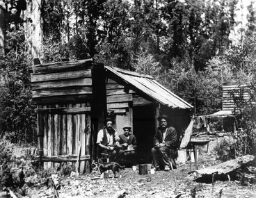
A digital copy of an early black and white photograph of George Locke, Andrew Kirwan and William Chester who were local gold prospectors.A digital copy of an early black and white photograph of George Locke, Andrew Kirwan and William Chester who were local gold prospectors. William Chester and George Locke opened Chester and Locke's Golden Secret Gold Mining Company (N.L.), which was situated on the Yarra Track, Wood's Point, in the Upper Yarra district of Victoria.george locke, andrew kirwan, william chester, chester & locke's golden secret mining company, yarra track, upper yarra district, gold mine -
Marysville & District Historical Society
Document (Item) - Report, John F. Waghorn, Yarra Track, Unknown
A report on the history of the Yarra Track by John Waghorn, a local amateur historian.A report on the history of the Yarra Track by John Waghorn, a local amateur historian. John Waghorn was an amateur historian, an authority on the history of Victoria's postal services. He could tell you how mail was delivered in the high country in the 1880s, where the town of Gobur was, or when the overland Melbourne-Sydney mail service began. He admitted that his hobby has got a little out of hand. He had 30 filing cabinets, and indexes of more than 70,000 postal workers over the past 160 years crammed into three rooms at his home. If an ancestor was a postmaster in a Victorian town, he may have been able to reveal the person's occupation, income and working conditions.yarra track, john waghorn, victoria's postal services, wood's point, sydney road, longwood, merton, mansfield, postmasters, bonnie doon, melville merton mansfield, eltham, healesville, marysville, walhalla, melbourne-warburton-wood's point line, loose bags, heidelberg post office, eltham post office, kangaroo ground post office, yarra glen post office, marysville post office, healesville post office, mansfield post office, jamieson post office, gaffney's creek post office, wood's point post office, postal department, george rieck, stockman, jones, beecher, stockman's reward, big river, mary mcdonald, upper yarra river, donovan's creek, cornelius donovan, bridget buggy, matlock, alexandra, william farrell, jordan diggings, new chum, watts river, black spur, narbethong, granton, acheron river, mount strickland, paradise plains, mount grant, mount arnold, jordan goldfields, william robley, robley's spur, big river crossing, great dividing range, cumberland valley, james mcguigan, w elliot, christopher harrison, james marsh, cobb and co, box hill, lilydale, fehrings, koehlers, shaws, bear creek, cairnsville, cumberland creek, walkers, golden bower mine, collins' mountain home hotel, walsh's creek post office, rosa mcveigh, frank barton, hitchins, matthew kennedy, william morris, e r nichols, t woods, tom burchell, peter kerr, henry kuyper, william podlech, george koehler, henry brockmann, henry petty, thomas smith, jacob butchart, john perry, slingsby davis, royal mail hotel, walter gray, john summers, travellers rest hotel, lockington, the oaks, the springs, st clair, thomas crawford, springvale hotel, john sinclair, saint clair hotel, gould, mathews, willie we have missed you hotel, germany, johan fehring, adelaide, linton, ballarat, gunbower, murray river, anna katerina fehring, 1890s depression, land boom, fehring place, fred baker, alf sparke, fehring's hotel, mcveigh's hotel, wood's point mountaineer, l cox, victorian country directories, letson cox, coburg, maria hayes, setson, fitzroy, richmond, john cox, jordan river, jericho, e. norris, le poidevin, newell, o'brien, alhambra, sinclair, parker, ellis, tripp, quin, vernon, thompson, charsley, james fahie, george locke, william chester, chesterville, kirwan, cumberland reserve, blue spruce, e.s. and a bank, selby joyce, selby charles joy, selby joseph joyce -
 Eltham District Historical Society Inc
Negative - Photograph, Sabina and Will Mills and family, Upper Diamond Creek (Wattle Glen), c.1899
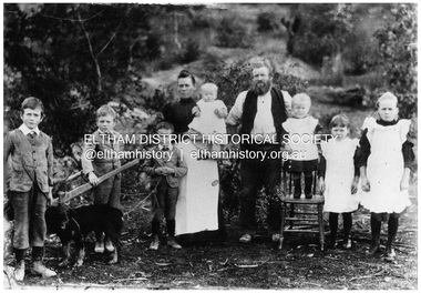
Sabina and William Henry Mills lived at "Golden Valley", Upper Diamond Creek (Wattle Glen) and had nine children in total. Here they are pictured with seven young children. Sabina died in 1916 aged 57 and William died in 1921 age 64. They are buried together at Diamond Creek (Nillumbik) cemetery. Reproduced on p46 of 'Pioneers & Painters'This photo forms part of a collection of photographs gathered by the Shire of Eltham for their centenary project book, "Pioneers and Painters: 100 years of the Shire of Eltham" by Alan Marshall (1971). The collection of over 500 images is held in partnership between Eltham District Historical Society and Yarra Plenty Regional Library (Eltham Library) and is now formally known as 'The Shire of Eltham Pioneers Photograph Collection.' It is significant in being the first community sourced collection representing the places and people of the Shire's first one hundred years.Digital image 4 x 5 inch B&W Neg 20 x 25 cm printsepp, shire of eltham pioneers photograph collection, wattle glen, sabina mills, will mills, mills family, pioneers and painters, upper diamond creek -
 Eltham District Historical Society Inc
Photograph, Peter Bassett-Smith, Upper Yarra Dam, Spring Tour, 22 Oct 1995, 22/10/1995
EXPLORING THE UPPER YARRA (Newsletter No. 105, November 1995, by Bettina Woodburn) We enjoyed the Spring Excursion, this year "Exploring the Upper Yarra" - in spite of the constant rain and the countryside under the cloud cover, especially in the valleys, being mainly shiny shades of green. The occasional fields of buttercups, clumps of arum lilies and splendid rhododendron and other flowering bushes became very special. The Cobb and Co coach was warm and a cosy retreat as we zig-zagged on the highways and byways to glimpse the Yarra River, upstream and down, its secret places, and particularly the many bridges. Russell excelled as 'Poet Laureate', reading from Dacre Smyth's book. This 1979 publication includes paintings of all the bridges along the river with poems and brief descriptions of each one. Some of the bridges are in out of the way places and are not very well known. We looked forward to hearing the poetry as much as seeing the ' constructions'…Big Pat (was he short or tall, lean or fat? He did win the two hundred pound reward for discovering gold and had the creek named after him), about the 'Eddies'?, and the disliked 'meccano' bridge in Warburton, etc. etc. The hot roast lunch in the old Reefton Hotel was also most welcome. It was easy to imagine it peopled by miners and early settlers. Starting by crossing the new (1974) concrete bridge at Warrandyte we headed through Wonga Park with views to the Christmas Hills and to the escarpment of the Yering Gorge, which causes flood waters to back up through the Yarra Glen plain, so avoiding disasters downstream. At the end of a long driveway we found the wooden, privately owned Henley Bridge (1935 after the 1934 floods). This facilitates access to different parts of Henley Farm and to Lilydale. Everard Park, named after Blanche Shallard's father, a State Member for 17 years, below the Highway Yarra crossing was in need of care. It is 10 miles from Yarra Glen by road but, as "Yarra Marra” canoeists well know, 32 winding miles down by water. After more delightful countryside scenes we joined the Warburton Highway at Woori Yallock. From the old Railway Station at Launching Place the Centennial Trail for walkers, cyclists and ' horse riders has replaced the rails. The line from Lilydale was opened in 1901, and the last diesel freight train ran to Warburton in 1965. It continued to rain as we had morning tea in Warburton in a shelter between footbridges. From here we continued upstream past the Bridge to O'Shannasy Lodge and Reservoir, Starvation Creek, and the Peninsular tunnel (miners dug it as at Pound Bend) which we visited (scrambling down those steps!) on our return after lunch. Our furthermost point was the Upper Yarra Dam Reserve (and vast catchment area). Finished in 1957 after ten years work and 100 years after Yan Yean, it supplies much of Melbourne's water. After crossing the 30m Launching Place Bridge to the Eltham side of the Yarra and Healesville, we saw in the distance the Yarra Glen Timber Trestle Bridge over the river flats "the longest for years in the land it was said!" Harry's dream of "better weather over the Divide" unfortunately didn't come true, but I'm sure we 36 members will retain happy memories of a day that was wet and green and filled with Bridges. Bettina Woodburn - October 1995 Record of the Society's history of activities - Spring 1995 excursionColour photographactivities, upper yarra dam, 1995, peter bassett-smith -
 Eltham District Historical Society Inc
Photograph, Peter Bassett-Smith, Upper Yarra Dam, Spring Tour, 22 Oct 1995, 22/10/1995
EXPLORING THE UPPER YARRA (Newsletter No. 105, November 1995, by Bettina Woodburn) We enjoyed the Spring Excursion, this year "Exploring the Upper Yarra" - in spite of the constant rain and the countryside under the cloud cover, especially in the valleys, being mainly shiny shades of green. The occasional fields of buttercups, clumps of arum lilies and splendid rhododendron and other flowering bushes became very special. The Cobb and Co coach was warm and a cosy retreat as we zig-zagged on the highways and byways to glimpse the Yarra River, upstream and down, its secret places, and particularly the many bridges. Russell excelled as 'Poet Laureate', reading from Dacre Smyth's book. This 1979 publication includes paintings of all the bridges along the river with poems and brief descriptions of each one. Some of the bridges are in out of the way places and are not very well known. We looked forward to hearing the poetry as much as seeing the ' constructions'…Big Pat (was he short or tall, lean or fat? He did win the two hundred pound reward for discovering gold and had the creek named after him), about the 'Eddies'?, and the disliked 'meccano' bridge in Warburton, etc. etc. The hot roast lunch in the old Reefton Hotel was also most welcome. It was easy to imagine it peopled by miners and early settlers. Starting by crossing the new (1974) concrete bridge at Warrandyte we headed through Wonga Park with views to the Christmas Hills and to the escarpment of the Yering Gorge, which causes flood waters to back up through the Yarra Glen plain, so avoiding disasters downstream. At the end of a long driveway we found the wooden, privately owned Henley Bridge (1935 after the 1934 floods). This facilitates access to different parts of Henley Farm and to Lilydale. Everard Park, named after Blanche Shallard's father, a State Member for 17 years, below the Highway Yarra crossing was in need of care. It is 10 miles from Yarra Glen by road but, as "Yarra Marra” canoeists well know, 32 winding miles down by water. After more delightful countryside scenes we joined the Warburton Highway at Woori Yallock. From the old Railway Station at Launching Place the Centennial Trail for walkers, cyclists and ' horse riders has replaced the rails. The line from Lilydale was opened in 1901, and the last diesel freight train ran to Warburton in 1965. It continued to rain as we had morning tea in Warburton in a shelter between footbridges. From here we continued upstream past the Bridge to O'Shannasy Lodge and Reservoir, Starvation Creek, and the Peninsular tunnel (miners dug it as at Pound Bend) which we visited (scrambling down those steps!) on our return after lunch. Our furthermost point was the Upper Yarra Dam Reserve (and vast catchment area). Finished in 1957 after ten years work and 100 years after Yan Yean, it supplies much of Melbourne's water. After crossing the 30m Launching Place Bridge to the Eltham side of the Yarra and Healesville, we saw in the distance the Yarra Glen Timber Trestle Bridge over the river flats "the longest for years in the land it was said!" Harry's dream of "better weather over the Divide" unfortunately didn't come true, but I'm sure we 36 members will retain happy memories of a day that was wet and green and filled with Bridges. Bettina Woodburn - October 1995 Record of the Society's history of activities - Spring 1995 excursionColour photographactivities, upper yarra dam, 1995 -
 Eltham District Historical Society Inc
Photograph, View from Breakneck, Yarra Glen, 27 August 2016, 27/08/2016
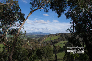
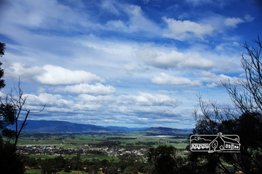
"Until 1865, all wheeled traffic to the Upper Yarra District passed through Christmas Hills along present day Ridge and Muir roads, then followed the hazardous course of "The Breakneck" (now Breakneck Road) to the valley below. To slow the descent of wagons, logs are said to have been dragged behind. In 1865, an easier route was opened on the south side of the Yarra River, and led to the birth of Lilydale". - Christmas Hills Past and Present (Yarra Glen District Historical Society), 2004.Digital copy of colour photographfred mitchell collection, 2016, breakneck, yarra glen -
 Eltham District Historical Society Inc
Photograph, View from Breakneck, Yarra Glen, 27 August 2016, 27/08/2016
"Until 1865, all wheeled traffic to the Upper Yarra District passed through Christmas Hills along present day Ridge and Muir roads, then followed the hazardous course of "The Breakneck" (now Breakneck Road) to the valley below. To slow the descent of wagons, logs are said to have been dragged behind. In 1865, an easier route was opened on the south side of the Yarra River, and led to the birth of Lilydale". - Christmas Hills Past and Present (Yarra Glen District Historical Society), 2004.Digital copy of colour photographfred mitchell collection, 2016, breakneck, yarra glen -
 Puffing Billy Railway
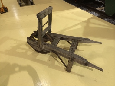
Wheelbarrow - Fritsch, Holzer & Company Brickworks
Used at the brickworks of Fritsch, Holzer & Company of Hawthorn to transport bricks and materials around the works. Fritsch Holzer Originally the company was known as the Upper Hawthorn Brick Company Ltd. It was started by brothers Johann, Martin and Anton Holzer and Gustav Augustus Fritsch. Fritsch had previously been a brick maker in Abbotsford, before moving to Hawthorn. Each had a brick works that operated next door to each other and the two works merged in 1883 to form the largest brick making company in Victoria. At its peak, they employed around eighty people and were making over 250,000 bricks per week. The depression of the 1890s caused a drastic downturn in building. Bricks were not being sold and staff laid off. The company nearly collapsed. To stave off the inevitable, in 1896 a brick co-operative was formed with Hoffman Patent Steam Brick Co., Northcote Brick Co. Ltd., New Northcote Brick Co. Ltd., Chas. Butler & Son and Fritsch, Holzer and Company. Bricks were sold throughout Victoria as the company supplied the State Government, more particularly the building of schools. They continued making bricks until the early 1970s when the works closed. The former site is now the “Ftritsch Holzer Park. The local Council purchased the 14 acre site in 1972 for $1,060.000 and used it for landfill. The site became a park in 1995. Info from Victorian Heritage Bricks, Brick Makers and Brick Works http://rameking2.blogspot.com.au/2013/12/fritsch-holzer.htmlHistoric - Narrow Gauge Industrial Brickworks Equipment - Victoria, AustraliaWheelbarrow - Timber frame with Iron bracing and wheel.puffing billy, pbr,, wheelbarrow - fritsch, holzer & company brickworks, fritsch, holzer & company -
 Puffing Billy Railway
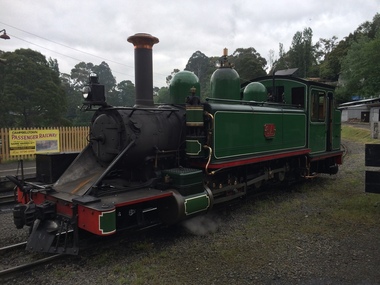
6A - Victorian Railways Na class steam locomotive, 1901
6A Built in 1901 and painted two-tone green, this locomotive was issued to the Colac to Beech Forest line and was used in that line’s construction. Over the years, it saw service on all four lines, but mostly on the Colac to Crowes and Upper Fern Tree Gully to Gembrook lines. It was temporarily withdrawn from service in 1958 and returned to service at Belgrave in 1962 for the reopening of this line where it saw almost continuous service until being withdrawn in 1983. It has been restored, as far as possible, to its original condition with original design side tanks, low bunker, original size windows, etc., but a steel cow-catcher in place of the original style wooden one. It also has its original colour scheme of two-tone green with white lining. Loco: 6A In service Thursday, 18th July 1901 Livery two-tone green Owner Puffing Billy Gauge 762mm / 2' 6' Status Preserved - Operational Service History : Jul 1901 Colac - initial allocation of a new locomotive Jul 1901 - Nov 1908 Colac Mar 1909 - May 1909 Wangaratta Jun 1909 - Other Oct 1909 - Oct 1910 UFTG. Nov 1910 - Feb 1912 Colac May 1912 - Jun 1912 Wangaratta Jul 1912 - Sep 1914 Moe Oct 1914 - Aug 1924 Colac May 1925 - Jul 1927 UFTG. Aug 1927 - Oct 1928 Moe Jan 1929 - Sep 1930 UFTG. Sep 1930 - Jun 1932 Moe Dec 1932 - Workshops May 1933 - Colac Sep 1933 - May 1936 Moe Jun 1936 - Oct 1936 Workshops Oct 1936 - May 1942 UFTG. Sep 1942 - Apr 1949 Colac May 1949 - Apr 1950 Workshops May 1950 - Dec 1957 UFTG. Feb 1958 - Apr 1962 Workshops May 1962 - Belgrave - In Active Service at Puffing Billy Railway BelgraveVictorian Railways - Narrow Gauge NA class steam locomotive number 6A Victorian Heritage Register (VHR) Number H2187 Puffing Billy Locomotives and Rolling Stock Collection Dates that 6A worked on the Gembrook Line Nov-1909 to Nov-1910 May-1925 to Aug-1927 Jan-1929 to Sep-1930 Oct-1936 to Sep-1942 May-1950 to Feb-1958 May-1962 - Returned to Gembrook railway Oct-1977 - Transferred to PBR ownershipSteam Locomotive - with wrought iron frame with cast iron cylinders6Apuffing billy, victorian railways, narrow gauge, steam locomotive, 6a, 6na -
 Puffing Billy Railway
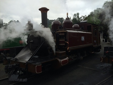
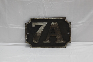
7A - Victorian Railways NA class steam locomotive, 1905
7A Built in 1905 and painted Canadian red & dark brown, this locomotive was issued to the Wangaratta to Whitfield line and saw service on all four lines with most of its service on the Upper Fern Tree Gully to Gembrook line. It was temporarily withdrawn from service in 1958 and returned to service at Belgrave in 1962 for the reopening of this line where it has seen almost continuous service since. 1979 saw the early two-tone green colour scheme applied to this loco as a trial even though it never historically carried it, but its physical configuration was not altered accordingly. It is now painted its original livery of Canadian red & dark brown and will eventually be returned, as far a possible, to its original condition with a low bunker, narrow ash-chute, etc. Loco: 7A In service Saturday, 6th May 1905 Livery Canadian red & dark brown Owner Puffing Billy Gauge 762 / 2' 6" Status Preserved - Operational Service History : May 1905 Wangaratta - initial allocation of a new locomotive May 1905 - Apr 1906 Wangaratta Jul 1906 - Nov 1910 Colac Feb 1911 - Jul 1912 Moe Sep 1912 - Dec 1917 Colac Mar 1918 - Sep 1921 UFTG. Nov 1921 - Sep 1923 Colac Dec 1923 - May 1925 UFTG. Jun 1925 - Aug 1925 Workshops Sep 1925 - Aug 1927 UFTG. Aug 1927 - Feb 1928 Workshops Mar 1928 - May 1928 UFTG. Jul 1928 - Moe Sep 1928 - Mar 1930 UFTG. Apr 1930 - Sep 1930 Workshops Oct 1930 - Oct 1936 UFTG. Nov 1936 - Moe Dec 1936 - Aug 1945 UFTG. Dec 1946 - May 1953 Colac Sep 1953 - Oct 1954 Moe Dec 1954 - Jun 1955 Workshops Nov 1955 - Dec 1957 UFTG. - Stored Feb 1958 - Apr 1962 Workshops May 1962 - Belgrave - In active service at Puffing Billy Railway Belgrave Victorian Railways - Narrow Gauge NA class steam locomotive number 7A Dates that 7A worked on the Gembrook Line Mar-1918 to Nov-1921 Dec-1923 to Jun-1925 Sep-1925 to Aug-1927 May-1928 to Apr-1930 Oct-1930 to Nov-1936 Dec-1936 to Dec-1946 Nov-1955 to Feb-1958 May-1962 - Returned to Gembrook line Oct - 1977 - Transferred to ETRB ownership Steam Locomotive with wrought iron frame with cast iron cylinders7Apuffing billy, 7a, victorian railways, narrow gauge, steam locomotive -
 Puffing Billy Railway
8A, Victorian Railways Na Class Steam Locomotive, 1908
8A Built in 1908 and painted Canadian red & dark brown, this locomotive was issued to the Upper Ferntree Gully to Gembrook line. Over the years, it saw service on the Colac to Crowes and Moe to Walhalla lines, but it saw more service on the Gembrook line than any other. It was withdrawn from service in 1955 at Upper Fern Tree Gully and sold to the Beaumaris City Council where it remained on static display until 1970. After storage at Newport & Ballarat North Workshops, it was brought to Belgrave in 1976 for restoration. It was returned to service in 1982 after a complete rebuild in close to its late 1920s condition with its extended bunker & modified front end including the tapered “stovepipe” smokestack, steel cow-catcher and the all-over Black livery. Loco: 8A In service Monday, 2nd March 1908 Livery Canadian red & dark brown Owner Puffing Billy Gauge 762mm / 2' 6" Status Preserved - Operational Service History : May 1908 - UFTG. - initial allocation of a new locomotive May 1908 - Mar 1910 UFTG. Apr 1910 - Mar 1915 Colac Jun 1915 -Sep 1926 UFTG. Jan 1927 - Jan 1930 Moe Mar 1930 - Oct 1936 UFTG. Nov 1936 - Dec 1936 Moe Jan 1937 - Oct 1954 UFTG. Dec 1954 - Workshops Jan 1955 - Jan 1968 Other Jul 1970 - Apr 1977 Workshops Jul 1982 - Belgrave - In active service at Puffing Billy Railway Belgrave Victorian Railways - Narrow Gauge NA class steam locomotive number 8A Dates that 8A worked on the Gembrook Line Mar-1908 to Apr-1910 - initial allocation of a new locomotive Jun-1915 to Jan-1927 Mar-1930 to Nov-1936 Jan-1937 to Dec-1954 Jul-1982 - Returned to service PBRSteam Locomotive 8Apuffing billy, 8a, victorian railways, narrow gauge, steam locomotive -
 Puffing Billy Railway
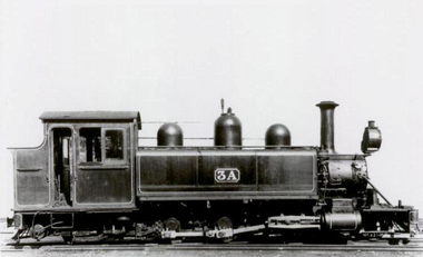
3A, Victorian Railways NA Class Steam Locomotive, 1900
3A Built in 1900. This is the second locomotive to be built at the Victorian Railways Newport Workshops. Painted in the then standard Victorian Railways two-tone green, this locomotive was issued to the Upper Ferntree Gully to Gembrook line and was used on the line’s construction. Over the years, it saw service on the Colac to Crowes and Moe to Walhalla lines, but it saw more service on the Gembrook line than any other. It was withdrawn from service in 1955 at Upper Fern Tree Gully and sold in 1960 to the Lord Mayor’s Camp at Portsea where it remained on static display until obtained by the Puffing Billy Presservation Society in 1977. Number 3A Entered service 6th april 1900 Livery two-tone green Gauge 762mm / 2' 6" Service History : Apr 1900 UFTG. - initial allocation Apr 1900 - Jul 1901 Upper ferntree gully Feb 1902 - Jan 1906 Colac Feb 1906 - Jul 1906 Upper ferntree gully Sep 1907 - Mar 1908 Colac Oct 1908 - Oct 1909 Upper ferntree gully Nov 1909 - Apr 1910 Other Oct 1910 - Nov 1911 Upper ferntree gully Feb 1912 - Oct 1914 Colac Dec 1914 - Oct 1917 Moe Dec 1917 - Jul 1920 Colac Sep 1920 - Jun 1922 Moe Jul 1922 - Jun 1925 Upper ferntree gully Aug 1925 - Mar 1928 Other May 1928 - Nov 1929 Moe Jan 1930 - Apr 1935 Wangaratta Jun 1935 - Sep 1936 Workshops Oct 1936 - May 1949 Upper ferntree gully Nov 1949 - Mar 1950 Workshops Apr 1950 - Jun 1955 Upper ferntree gully Nov 1955 - Mar 1959 Workshops Nov 1960 - Aug 1973 Lord Mayor’s Camp at Portsea Apr 1977 - salvaged from Lord Mayors camp and delivered to Menzies creek station.Victorian Railways - Narrow Gauge NA class steam locomotive number 3A Victorian Heritage Register (VHR) Number H2187 Dates that 3A worked on the Upper ferntree gully to Gembrook Line. Apr 1900 - initial allocation of a new locomotive Apr 1900 to Jul 1901 Feb 1906 to Jul 1906 Oct 1908 to Oct 1909 Oct 1910 to Nov 1911 Oct 1936 to May 1949 Apr 1950 to Jun 1955 Apr 1977 to Belgrave Steam Locomotive3Apuffing billy, victorian railways, 3a, narrow gauge, steam locomotive -
![Decorative object - Commemorative Young Sun special head board 1954 to 2014, {blank], 2014](/media/collectors/52969eff2162ef171c566b9e/items/5583afd92162f11b8cc3b102/item-media/5583b12a2162f11b8cc3cde9/item-fit-380x285.jpg) Puffing Billy Railway
Puffing Billy RailwayDecorative object - Commemorative Young Sun special head board 1954 to 2014, {blank], 2014
Constructed for 50th anniversary of the Young Sun newspaper special trains that ran between Upper Ferntree Gully and Belgrave in 1954. In 1954, special trains sponsored by The Sun newspaper, were run to farewell Puffing Billy. They became the catalyst for the creation of the Puffing Billy Preservation Society, and are the reason we still have the railway today. 60th Anniversary of the First Puffing Billy Young Sun Special - On Saturday, 13 December, 2014, the Puffing Billy Young Volunteers Representatives Team celebrated 60 years (plus two days) since the first Young Sun Special. Locomotive 14A was transformed onto '3A' for the day and it as '3A' that hauled the Recreation Train to Emerald Town StationCommemorative Puffing Billy Railway Locomotive Head Board - used in the Celebrating the 60th anniversary of the Young Sun special trainSmall, circular sign made from hand-painted steel. Yellow background, black text "Young Sun Special"around the upper and lower edges; "1954 - 2014"on left and right respective; centre image of red sunrise with black sunrays, and black rooster image in foreground with black text "DAILY AT DAWN" Young Sun 1954 to 2014 Special young sun, head board, puffing billy, newspaper, signage, 1954 -2014, puffing billy preservation society, young volunteers representatives team, 60th anniversary -
 Puffing Billy Railway
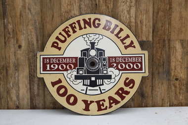
Locomotive Head Board - Puffing Billy 100 Years Celebration, 2000
Historic - Puffing Billy Railway Locomotive Head Board - used in the Celebrating 100 years of the Upper Ferntree Gully to Gembrook railway. Historic - Puffing Billy Railway Locomotive Head Board - used in the Celebrating 100 years of the Upper Ferntree Gully to Gembrook railway. Locomotive Head Board - Puffing Billy 100 Years Celebration Tin head board with cream, red, white and black vinyl.Puffing Billy 18 December 1900 - 18 December 2000 100 Yearspuffing billy, head board, 100 years -
 Puffing Billy Railway
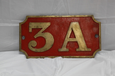
Number Plate - 3A
Loco: 3A In service Monday, 4th June 1900 Livery Not painted Owner Puffing Billy Gauge 762 Status Stored 3A Built in 1900 and painted two-tone green, this locomotive was issued to the Upper Ferntree Gully to Gembrook line and was used in the line’s construction. Over the years, it saw service on the Colac to Crowes and Moe to Walhalla lines, but it saw more service on the Gembrook line than any other. It was withdrawn from service in 1955 at Upper Fern Tree Gully and sold in 1960 to the Lord Mayor’s Camp at Portsea where it remained on static display until 1977. From there it was eventually brought to Belgrave for eventual restoration. When restored, it will be returned, as far as possible to its original condition with wooden cow-catchers, original design side tanks, low bunker, no smoke-box ash chute, etc. It will also have its original colour scheme of two-tone green with white lining.Historic - Victorian Railways Locomotive Number Plate used on Steam Locomotive 3ALocomotive Number Plate from 3A made of cast metal & Brass3Apuffing billy, 3a, number plate -
 Puffing Billy Railway
6A Number Plate
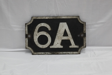
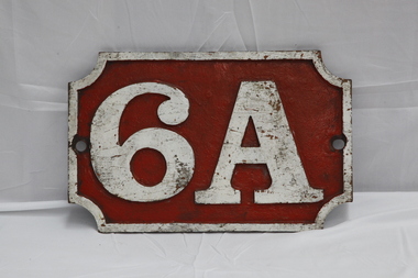
Historic - Victorian Railways Locomotive Number Plate used on Steam Locomotive 6A Loco: 6A In service Thursday, 18th July 1901 Livery Green Owner Puffing Billy Gauge 762 Status Preserved - Operational 6A Built in 1901 and painted two-tone green, this locomotive was issued to the Colac to Beech Forest line and was used in that line’s construction. Over the years, it saw service on all four lines, but mostly on the Colac to Crowes and Upper Fern Tree Gully to Gembrook lines. It was temporarily withdrawn from service in 1958 and returned to service at Belgrave in 1962 for the reopening of this line where it saw almost continuous service until being withdrawn in 1983. It has been restored, as far as possible, to its original condition with original design side tanks, low bunker, original size windows, etc., but a steel cow-catcher in place of the original style wooden one. It also has its original colour scheme of two-tone green with white lining.Historic - Victorian Railways Locomotive Number Plate used on Steam Locomotive 6ANumber Plate 6A Fabricated steel number board made by the Victorian Railways for locomotive 6A. 6A6a, puffing billy, number plate, victorian railways -
 Puffing Billy Railway
6A Number Plate
Historic - Victorian Railways Locomotive Number Plate used on Steam Locomotive 6A Loco: 6A In service Thursday, 18th July 1901 Livery Green Owner Puffing Billy Gauge 762 Status Preserved - Operational 6A Built in 1901 and painted two-tone green, this locomotive was issued to the Colac to Beech Forest line and was used in that line’s construction. Over the years, it saw service on all four lines, but mostly on the Colac to Crowes and Upper Fern Tree Gully to Gembrook lines. It was temporarily withdrawn from service in 1958 and returned to service at Belgrave in 1962 for the reopening of this line where it saw almost continuous service until being withdrawn in 1983. It has been restored, as far as possible, to its original condition with original design side tanks, low bunker, original size windows, etc., but a steel cow-catcher in place of the original style wooden one. It also has its original colour scheme of two-tone green with white lining.Historic - Victorian Railways Locomotive Number Plate used on Steam Locomotive 6A6A Number Plate. Fabricated steel number board made by the Victorian Railways for locomotive 6A. 6Apuffing billy, victorian railways, number plate, 6a -
 Puffing Billy Railway
7A Number Plate
Historic - Victorian Railways Locomotive Number Plate used on Steam Locomotive 7A Loco: 7A In service Saturday, 6th May 1905 Livery Maroon Owner Puffing Billy Gauge 762 Status Preserved - Operational 7A Built in 1905 and painted Canadian red & dark brown, this locomotive was issued to the Wangaratta to Whitfield line and saw service on all four lines with most of its service on the Upper Fern Tree Gully to Gembrook line. It was temporarily withdrawn from service in 1958 and returned to service at Belgrave in 1962 for the reopening of this line where it has seen almost continuous service since. 1979 saw the early two-tone green colour scheme applied to this loco as a trial even though it never historically carried it, but its physical configuration was not altered accordingly. It is now painted its original livery of Canadian Pacific red & dark brown and will eventually be returned, as far a possible, to its original condition with a low bunker, narrow ash-chute, etc.Historic - Victorian Railways Locomotive Number Plate used on Steam Locomotive 7ANumber Plate 7A Fabricated steel number board made by the Victorian Railways for locomotive 7A7apuffing billy, 7a, number plate, victorian railways -
 Puffing Billy Railway
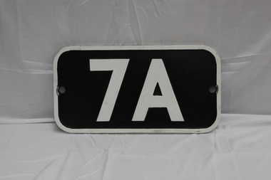
7A Number Plate
Replica of a Victorian Railways replacement number board that 7A carried in the later 40's and 50's. This plate was created for the preservation society's reenactment trains in 2012 for the 50 year celebration of reopening to Menzies Creek. Loco: 7A In service Saturday, 6th May 1905 Livery Maroon Owner Puffing Billy Gauge 762 Status Preserved - Operational 7A Built in 1905 and painted Canadian red & dark brown, this locomotive was issued to the Wangaratta to Whitfield line and saw service on all four lines with most of its service on the Upper Fern Tree Gully to Gembrook line. It was temporarily withdrawn from service in 1958 and returned to service at Belgrave in 1962 for the reopening of this line where it has seen almost continuous service since. 1979 saw the early two-tone green colour scheme applied to this loco as a trial even though it never historically carried it, but its physical configuration was not altered accordingly. It is now painted its original livery of Canadian red & dark brown and will eventually be returned, as far a possible, to its original condition with a low bunker, narrow ash-chute, etc.Historic - Replica Victorian Railways Locomotive Number Plate of the type used on Steam Locomotive 7A in the later 40's and 50's created for the preservation society's reenactment trains in 2012 for the 50 year celebration of reopening to Menzies Creek Number Plate 7A Rectangular black and white number plate. Cast aluminum replica number board.7Apuffing billy, 7a, number plate -
 Puffing Billy Railway
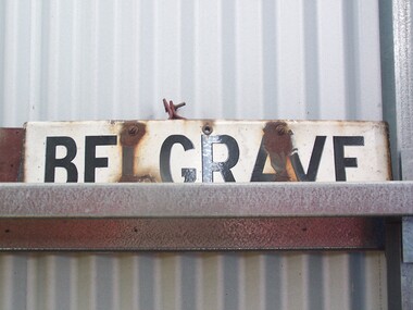
Station Sign - Belgrave
Belgrave railway station is the terminus of the electrified line from Melbourne in Victoria, Australia, serving the eastern Melbourne suburb of Belgrave. Opened as Monbulk on 18 December 1900, it was renamed Belgrave on 21 November 1904. It was upgraded to a Premium station on 2 July 1996. The station was originally on the Upper Ferntree Gully – Gembrook narrow gauge line. It, along with the rest of the line, officially closed on 30 April 1954. However it saw further use between 1955 and early 1958, when trains were operated by the Puffing Billy Preservation Society in co-operation with the Victorian Railways. The station area re-opened on 19 February 1962 when the line as far as Belgrave was converted to broad gauge and used electric traction as part of the suburban network.[1] It has one island platform with two faces. It is serviced by Metro Trains' Belgrave line services The Puffing Billy Railway Belgrave station is located 100 metres north of the station and is accessible via a short footpath. It was required to be located further down the line than the original narrow-gauge station (which was approximately where the current suburban station car park is located). ref: https://en.wikipedia.org/wiki/Belgrave_railway_station photos at http://www.vicrailstations.com/Gembrook/Belgrave/Belgrave.htmlHistoric - Victorian Railways Station sign used at Belgrave StationStation Sign - Belgrave Metal sign - white enamel back ground with black letters Belgravepuffing billy, victorian railways, belgrave station -
 Puffing Billy Railway
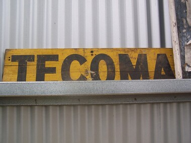
Tecoma Station Sign
Station Sign - Tecoma Tecoma railway station is located on the Belgrave line in Victoria, Australia. It serves the eastern Melbourne suburb of Tecoma opening on 1st December 1924. The station was originally on the Upper Ferntree Gully - Gembrook narrow gauge line. It along with the rest of the line closed on 30 April 1954, reopening on 19 February 1962 when the line as far as Belgrave was converted to broad gauge. ref: https://en.wikipedia.org/wiki/Tecoma_railway_stationHistoric - Victorian Railways Station sign used at Tecoma StationStation Sign - Tecoma wooden rectangle Station name sign pained yellow background with black letters Tecomapuffing billy, station sign, tecoma station, narrow gauge, puffing billy museum -
 Puffing Billy Railway
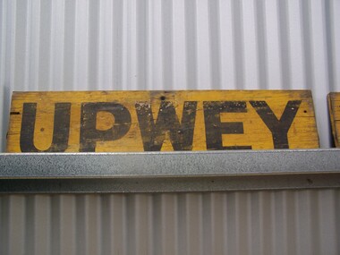
Station Sign - Upwey
Upwey Station Sign; Upwey Railway Station is located on the Belgrave line in Victoria, Australia. This railway serves the Eastern region of Melbourne. Upwey Railway Station opened on the 3rd of June 1901. Upwey Railway Station has a crossing loop in the middle of a six kilometre section of single railway track between Ferntree Gully Railway Station and Belgrave Railway Station. The station was originally on the Upper Ferntree Gully to Gembrook narrow gauge line. The Upper Ferntree Gully to Gembrook Narrow Gauge railway line officially closed on the 30th of April 1954. It saw further use between 1955 and early 1958, when trains were operated by the Puffing Billy Preservation Society in co-operation with the Victorian Railways. The Upper Ferntree Gully to Belgrave section was converted to Broad Guage and re-opened on the 19th of February 1962. This station sign shown here was one of a number used on the Upwey Railway Station while it was Narrow Gauge. Historic - Victorian Railways Station sign used at Upwey StationUpwey wooden rectangle Station name sign pained yellow background with black font.Upweypuffing billy, station sign, upwey station, victorian railways -
 Puffing Billy Railway
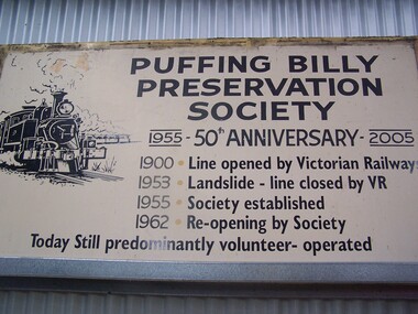
Puffing Billy Preservation Society 50th Anniversary Station Sign, 2005
Puffing Billy Preservation Society 50th Anniversary sign This is the large poster board that was erected at Lakeside to celebrate the 50th Anniversary of the Puffing Billy Preservation Society in 2005. Established in 1955, the Puffing Billy Preservation Society was formed to operate the narrow gauge trains between Upper Fern Tree Gully and Belgrave following the successful Young Sun specials. With the conversion of the Upper Fern Tree Gully to Belgrave line to broad gauge track, the Puffing Billy Preservation Society was the instigator of restoring the Puffing Billy Railway from Belgrave to Menzies Creek in 1962, Menzies Creek to Emerald in 1965 and Emerald to Lakeside in 1975 and in association with the Emerald Tourist Railway Board, Lakeside to Gembrook in 1998. Historic - Puffing Billy Preservation Society - Station Sign - for the 50th Anniversary of the Preservation SocietyPuffing Billy Preservation Society 50th Anniversary sign Large rectangle metal sign - off white back ground with black lettering Puffing Billy Preservation Society 1955 - 50th Anniversary - 2005 1900 . Line opened by Victorian Railways 1953 . Landslide - Line closed by V.R 1955 . Society established 1962 . Re-opened by Society Today still predominantly volunteer - operated puffing billy, preservation society, station sign, 50th anniversary, lakeside station -
 Puffing Billy Railway
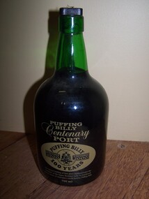
Puffing Billy Centenary Port - 100 Years - PBPS Fund raiser item, 2000
Puffing Billy Centenary Port - 100 Years - PBPS Fund raiser item Puffing Billy Centenary Port Puffing Billy 18 December 1900 - 18 December 2000 - 100 Years - This special bottling of fine port commemorates the Centenary of the Upper Ferntree Gully to Gembrook railway , home of Australia's world famous Puffing Billy 750 mlHistoric - Puffing Billy Railway - Puffing Billy Preservation Society Fund raising item - Centenary Port - 100 Years Puffing Billy Centenary Port - 100 Years - Puffing Billy Preservation Society Fund raising item Green Glass Bottle Yellow painted on Writing and logo Cork with black plastic top Puffing Billy Centenary Port Puffing Billy 18 December 1900 - 18 December 2000 - 100 Years - This special bottling of fine port commemorates the Centenary of the Upper Ferntree Gully to Gembrook railway , home of Australia's world famous Puffing Billy 750 mlpuffing billy, centenary port, pbps fund raiser -
Koorie Heritage Trust
Book, Barraclough, Linda et al, A valley of glens : the people and places of the Upper Macalister River, 1988
Contents: Exploration & the Heyfield run; Glenmaggie, Glenfalloch & Glencairn; Gold & the first farms; The town begins; The farms are established; Selection to the limits; Fire, flood, drought, rabbits & other forms of pestilence; The second exploration; The weir is built; A time of change; Today & tomorrow.ix, 177 p. : ill. ; index; footnotes; sources; 25 cm.Contents: Exploration & the Heyfield run; Glenmaggie, Glenfalloch & Glencairn; Gold & the first farms; The town begins; The farms are established; Selection to the limits; Fire, flood, drought, rabbits & other forms of pestilence; The second exploration; The weir is built; A time of change; Today & tomorrow.upper macalister river -- east gippsland-history -
 Mt Dandenong & District Historical Society Inc.
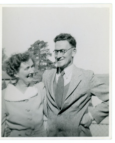
Photograph, Mt Dandenong State School Head Teacher Mr M.F. Morris and His Wife 1938, 1938
Informal photograph of Mr & Mrs M.F. Morris taken in 1938. Mr Morris was Headmaster at Mt Dandenong State School.Black and white informal photograph showing close up of upper bodies of a woman and man.On back of photograph: Mr & Mrs M.F. Morris 1938. Mt Dandenongmt dandenong school, mr m f morris, headmaster