Showing 444 items
matching plotting
-
 Bendigo Military Museum
Administrative record - Army Survey Regiment - Report on Automated Data Processing since 1984
A comprehensive summary of Automated Data Processing at the Army Survey Regiment with a description of each. Textronix 4052, PDP 11/70, Quantex Replay Unit, Automap 1, Automap 2, Konsberg GT5000, RTE 6, Autochart, Plot 79, IGDS, Schut Bundle, DTM - Nucleus, DTM - Graphics, ASMAPS, ASTIS, PAT-B, PRE-B5, PAT-M, PRO-MS.Typed Report, 3 x foolscap photocopy pagesroyal australian survey corps, rasvy, fortuna, army survey regiment, army svy regt, asr -
 Forests Commission Retired Personnel Association (FCRPA)
IBM Port-A-Punch
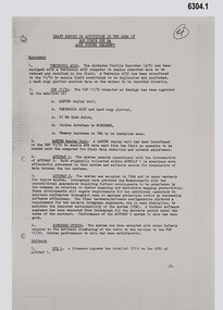
The Forests Commission began using computers in the 1960s for resource inventory under the Chief Forest Assessor Murray Paine IBM introduced the Port-A-Punch in 1958 as a fast, accurate means of manually punching holes in specially scored IBM punched cards. Designed to fit in the pocket, Port-A-Punch made it possible to create punched card documents anywhere. The product was intended for "on-the-spot" recording of data such a assessment plotsThe IBM Port-A-Punch prepared computer data and programming cards. Normally there is a a separate stylus pen, similar to a ball-point pen to punch the holes in the cards, but it is missing This instrument consists of a plastic frame that holds 13 long plastic rectangles along its length. A transparent plastic template which has an array of evenly spaced holes fits over the rectangles, and cards are placed over this. IBM Portapunchforest measurement -
 Greensborough Historical Society
Photograph - Digital image, Grave of Susan E McDowell and William McDowell, Greensborough Cemetery, 03/02/1921
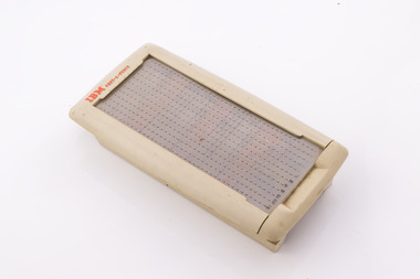
Grave of Susan E McDowell (died 1921) and William McDowell (died 23/09/1929) in Plot# F14/F15 Greensborough Cemetery. [Caption by Bruce McDowell: Susan Elizabeth McDowell was the daughter of William and Mary Poulter (nee Chapman) - grand daughter of James and Susan Chapman (nee Palmer) - William McDowell was the son of James and Alice McDowell (nee Skillen) - William McDowell was born in County Down; Ireland.]Greensborough Cemetery was created when land was given for the cemetery by Mr William Poulter, a local settler, about 1864. The cemetery holds the graves of many early settlers in the district. Digital copy of colour photograph of grave/headstone.susan mcdowell, william mcdowell, greensborough cemetery -
 Williamstown Botanic Gardens- Hobsons Bay City Council
Postcard – Williamstown Botanic Gardens, c1900-1920
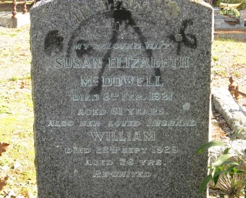
On 18 July 1891, a statue of local MLA Alfred Thomas Clarke was erected in a circular plot at the intersection of the major axial paths. AT Clarke was Williamstown's representative in the Legislative Assembly from 1871 to 1887, and a Commissioner of Trade & Customs in the third Berry Ministry. He did his utmost to defend Williamstown against the Melbourne Harbour Trust and was also the founder of the Advertiser. The statue was sculpted by Enrico Luchinelli in Cararra marble. The likeness was taken from a photograph.The postcards are evidence of the interest the gardens held as a subject for postcard publishers. The text and images provide a snapshot into fashions, social interests and concerns of the time. The professionally produced images provide a pictorial history of Gardens including changing planting styles, various structures and features of the Gardens eg the aviary, cannons, the fountain, the second Curator’s Lodge and gates. The images offer an opportunity to compare garden vistas with the present day. This postcard shows the main east-west axial path with a typical Victorian/Edwardian mown grass strip which in turn borders formal shrub beds with herbaceous plantings. The Cordylines which line the avenue in this image were replaced by Mexican Fan Palms (Washingtonia robusta) planted in 1915, which in turn were replaced with the same species in 1987 A colour image of main east west axial path looking towards the statue of A C Clarke enclosed with a white fence. The path is lined with grass, shrubs and Cordylines. This image is before the Cordylines were replaced with palm trees, which was 1915.Front: ‘The Botanic Gardens, Williamstown’. Reverse: Top ‘POST CARD’ Left side ‘The Space may be used for Correspondence’; Right side: ‘For Address Only.’ Top right corner is a red Victorian one penny stamp. The card is addressed to Mr R Fraser / Collins St. / Essendon from his niece, whose name is unclear. postcard, gardens, post-card, williamstown-botanic-gardens, hobsons-bay-city-council, garden-path, cordylines, clarke, 1891, enrico luchinelli, cararra marble -
 Bendigo Historical Society Inc.
Document - ALBERT RICHARDSON COLLECTION: HERCULES AND ENERGETIC
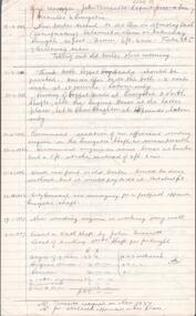
a. Five page handwritten document titled 'Mine Manager John Truscott's Report Hercules and Energetic' Other reports included from Mine Managers on the Hercules and Energetic Mines are: J. Woolcock's report 4.3.1895, F. Youlden 1898 and J. Roberts 1911. b. One page hand drawn plan of titled ' Hercules transverse plotted by A.E. R., .D., A.A., page 23, 24.3.37. Hercules Long, by A.E.K. , W.R.N 24.3.37. Plans show measurements of tramway, height of poppet head, position of ore bins and other buildings on mine site.Albert Richardsonbendigo, mining, hercules and energetic mine -
 Ringwood and District Historical Society
Map, Plan of Country Lands in the Parishes of Nunawading Ringwood and Scoresby - circa 1855
Blueprint copy of Survey Map detailing original Selectors' names and property locations. List of Parish map references including property bearings, distances in Links, and markings on trees. Descriptive remarks include areas marked "Farmer's Common", "Poor soil thickly/moderately timbered with stringy bark", and location of water and firewood reserves."Surveyed and plotted by N.M. Bickford, Superintendant of Mr. Hodgkinson's Field Party". "The land comprised in this survey is of inferior quality, moderately undulating, and thickly wooded. It is watered by Dandenong Creek and Deep Creek." Inset map showing location of (*proposed) cemetery on southern corner of Lillydale Road from Melbourne and Sawmill Road, later Mount Dandenong Road. (*Cemetery did not eventuate.) -
 Warrnambool and District Historical Society Inc.
Three badges, Children's Flower Day, 1. 1941 2. 1918 3. 1919
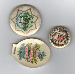
These three badges were issued as fund raisers on Children's Day in 1918,1919 and 1941. The Children's Flower day arose out of the League of Young Gardeners established in 1916 to assist the war effort by encouraging children to cultivate garden plots at home and at school. The Children's Flower Day included lectures and lessons at school related to garden cultivation. Flower shows of produce grown at home and at school and street stalls were run by children to raise funds for the war effort.These badges are of interest as examples of the activities of children in Victoria to assist the War effort in World Wars.1 Cream coloured circular metal and enamel badge featuring Union flag, a wreath of red flowers and leaves around the edge on two sides and text . A clip is on the reverse. 2 Cream coloured oval plastic coated card badge featuring blue flowers and wattle blossom and text. A slot at the top for a pin so it may be attached to clothing. 3 Cream coloured circular badge featuring a six pointed gold star, a coloured image of a house and garden and text. A clip is on the reverse1 EVD CHILDREN'S FLOWER DAY 1941 on face. A.W. PATRICK. N. FITZROY. V. on rim 2 CHILDREN'S FLOWER DAY 1918 3 CHILDREN'S FLOWER DAY 1919 PEACE YEAR and symbol of an flattened semi circle with incomplete rectangle interlaced. children, flowers, war effort, warrnambool -
 Greensborough Historical Society
Photograph - Digital image, Grave of Leslie Iredale and Mary E Iredale, Greensborough Cemetery, 28/07/1963
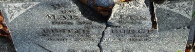
Grave of Leslie G Iredale (died 28/07/1963) and Mary E Iredale (died 03/11/1949) in Plot# F13 Greensborough Cemetery. (Mary E Iredale was born Mary Ellen Louisa McDowell in 1889 - she was the daughter of Susan Elizabeth Poulter (born in Greensborough 1859 - Died in Greensborough 1921) and William McDowell (born in Raffrey, Co. Down 1853 - Died 1929) Information supplied by Bruce McDowell, Mary's Great Nephew).Greensborough Cemetery was created when land was given for the cemetery by Mr William Poulter, a local settler, about 1864. The cemetery holds the graves of many early settlers in the district. Digital copy of colour photograph of grave/headstone.leslie george iredale, mary e iredale, greensborough cemetery -
 Sunbury Family History and Heritage Society Inc.
Photograph
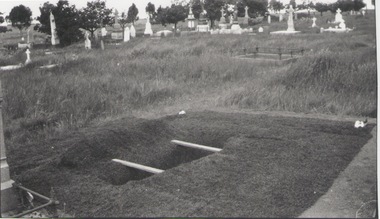
The older fenced-off grave without a headstone is that of Cornelius Ford who had a private funeral when he was buried in Sunbury Cemetery on 7 December 1908, aged seventy-one. He is buried in Section H, plots 1 - 4. The registrar was McMahon and the undertaker was Trask. Cornelius Trask conducted a butcher's business in Brook Street and O'Shanassy Street. He also worked for some time as a publican at the Ball Court Hotel. He was also known as Gus.A non-digital black and white photograph of a recently dug grave in readiness for an internment. A short distance from the recently dug grave is a fenced-off grave without a headstone. There are a number of graves with headstones in the middle distance.ford, cornelius., sunbury cemetery -
 Bendigo Military Museum
Photograph - Technical Tour of the Army Survey Regiment, 1963, c1965
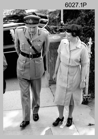
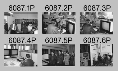
These photographs were most likely taken in 1963 and c1965 on two separate occasions of an Australian Army General’s visit to the Army Survey Regiment, Fortuna, Bendigo. As there are no annotations on the photos, the exact date and the names of the Generals are unknown. Some RASvy personnel are positively identified. The technical tour included the photogrammetric and printing areas of the Regiment. The newly introduced Wild B8 stereo plotter featured in photo .2P and the M.A.N. Ultraman 3 Offset printing press probably featured in the background of photos .3P and .5P.This is a set of photographs of a visiting Australian Army General’s technical tour of the Army Survey Regiment, Bendigo. The photographs were printed on photographic paper and are part of the Army Survey Regiment’s Collection. The photographs were scanned at 300 dpi. .1) - Photo, black & white, c1965. L to R: unidentified General, CAPT Carol Castor .2) - Photo, black & white, c1965. L to R: unidentified, unidentified General, Director Survey - COL Don Macdonald AM, CO – LTCOL Frank Buckland OBE. .3) - Photo, black & white, c1965. L to R: 2LT Dennis Puniard, unidentified, unidentified General, CAPT Reg Smith, MAJ Don Ridge, WO1 Aub Harvey .4) - Photo, black & white, c1965. L to R: CAPT Reg Smith, unidentified General. .5) - Photo, black & white, 1963. L to R: WO2 Ken Rich, MAJ GEN Taylor, MAJ Bill Howarth..1 to .5 - annotated “Visit by General”royal australian survey corps, rasvy, army survey regiment, army svy regt, fortuna, asr, printing, air survey -
 University of Melbourne, Burnley Campus Archives
Slide - 35mm Colour slides, Miscellaneous Burnley, 1975-1979
7. "Ranunculus & Anemone" Apr 75. 5. "Citrus (Pruned) Dec" Jan 75. 4. "Student Veg Plots 1975" Feb 75. 3. "Noel Wilson Carnations 3rd Year 75" Apr 75. 2. "Dendrobium Orchid 75" May 75. Daisy Oct 75. 12. "Downy Mildew" Mar 76. "Indoor Plants Sanservia" Aug 76. School bus Jun 77. Orchid Revolving Protocorms" Nov 77. 8. "Cymbid Back Bulb" May 78. "Budding Citrus in Containers" Mar 79. "Bunkers RMGC" Nov 79.flowers, students, vegetables plots, citrus, indoor plants, school bus, orchids, orchard, diseases -
 Bendigo Military Museum
Photograph - MILITARY PHOTOGRAPH, 1939-42
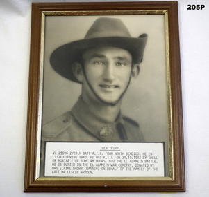
Leonard Jordan TRIPP No VX25096 enlisted in the 2nd AIF on 11.6.1940. Posted to 2/21st Bn on 15.7.1940, hospital 23.1.1941 with Fractured Tibula, rejoin unit 29.4.1941, embark for the Middle East 28.6.1941, disembark 25.7.1941, posted to 2/24th Bn 23.8.1941, DOW’s 24.10.1942. His records offer nothing else re wounding or death. He is buried at El Alamein Box Cemetery grave No 8, plot 4, row A, map reference 1/50000- 88602946. Refer also Cat No 2336.8PPhotograph of Len Tripp VX25096 2/24 Battalion A.I.F. in uniform. Slouch hat. Frame is simple wooden design with gold rim.photography-photographs, portraits, military history -
 Eltham District Historical Society Inc
Negative - Photograph, Experimental plots, Eltham State School, 1908
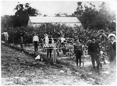
ELTHAM. (1908, October 30). Evelyn Observer and Bourke East Record (Vic. : 1902 - 1917), p. 2 (MORNING.). Retrieved May 3, 2020, from http://nla.gov.au/nla.news-article60648129 The experimental plots at the local State School are now planted and are under the supervision of Mr. H. Heape and the Head Teacher, Mr. Fisher. The artificial manures have been supplied by the Colonial Manure Co., of Collins Street, and the result of the experiments will be anxiously looked for by all concerned. Reproduced on p67 of 'Pioneers & Painters'This photo forms part of a collection of photographs gathered by the Shire of Eltham for their centenary project book,"Pioneers and Painters: 100 years of the Shire of Eltham" by Alan Marshall (1971). The collection of over 500 images is held in partnership between Eltham District Historical Society and Yarra Plenty Regional Library (Eltham Library) and is now formally known as the 'The Shire of Eltham Pioneers Photograph Collection.' It is significant in being the first community sourced collection representing the places and people of the Shire's first one hundred years.Digital image 4 x 5 inch B&W Negsepp, shire of eltham pioneers photograph collection, eltham, experimental plots -
 Bendigo Military Museum
Photograph - Technical Tour of the Army Survey Regiment, Fortuna, Bendigo, c1984
This collection of 10 photos was most likely taken in 1984. It’s evident in these photos the visitors were taken on a tour through the production areas of Air Survey Squadron, with Wild B8 photogrammetic plotting workstations featured in the first three photos and demonstrations of the AUTOMAP 2 production system in the following photos. The AUTOMAP 2 system was an upgrade to the AUTOMAP 1 system comprising Intergraph graphic edit workstation terminals networked to VAX 750/785 main frame computers. Unlike AUTOMAP 1, operators could display digital topographic features on monitors for editing. Successful adaptation of this system meant RASvy was at the forefront of digital mapping/cartographic systems in Australia and overseas. The system comprised Input (B8 feature extraction) Raster Scanning (digitising from compilation sheets, Graphic Edit (cartographic completion) and Plot Verification Sub Systems. CAPT Rob John was the project officer responsible for the acceptance trials and implementation of AUTOMAP 2. The system was operational from 1984 to its ‘Newheart’ upgrade in 1993. Throughout its life, the system was progressively refined with productivity gains, achieved from award winning technical development in-house by talented and innovative Army Survey Regiment personnel.This is a set of 10 photograph of a technical tour of the Army Survey Regiment at Fortuna, Bendigo, c1985. The photographs were printed on 35mm photographic proofing paper and are part of the Army Survey Regiment’s Collection. The photographs were scanned at 600 dpi. .1) - Photo, black & white, c1984, unidentified visitors, CAPT Rob John, MAJ Jim Mitchell, unidentified. .2) - Photo, black & white, c1984, unidentified visitor. .3) - Photo, black & white, c1984, unidentified visitor. .4) - Photo, black & white, c1984, unidentified SGT .5) - Photo, black & white, c1984, L to R: LTCOL Jorge Gruszka, unidentified visitors. .6) - Photo, black & white, c1984, L to R: SGT George Timmins, unidentified visitors. .7) - Photo, black & white, c1984, MAJ John Charland – US Exchange Officer. .8) - Photo, black & white, c1984, L to R: unidentified visitors and personnel, MAJ John Charland – US Exchange Officer. .9) - Photo, black & white, c1984, unidentified visitors and personnel, MAJ John Charland – US Exchange Officer in background. .10) - Photo, black & white, c1984, L to R: MAJ Bob Roche, CAPT Mick Byrne in Officers Mess..1P to .10P No personnel are identifiedroyal australian survey corps, rasvy, army survey regiment, army svy regt, fortuna, asr, air survey, automap -
 Bendigo Military Museum
Photograph - Co-ordinatorgraph Map Grid Production, Army Survey Regiment, Fortuna Bendigo, c1960s to 1970s
This is a set of seven photographs of map grid production using co-ordinatorgraphs at the Army Survey Regiment, Fortuna Bendigo. c1960s to 1970s. The Aristo Co-ordinatorgraph introduced in 1962 was a large heavy steel framed light table with a scribing head that moved in a XY direction using a vernier calibrated measuring scale to 0.001 of an inch. Whilst hand operated it was much quicker and accurate than manual grid and graticule calculation, plotting and scribing. Mapping PNG presented the Regiment with many challenges. WO1 Farrington and CPL John Dean developed computer software for the digitally controlled co-ordinatorgraph, the Calcomp 718 Flatbed Plotter. Much time was saved by automatically plotted cartographic grids and graticules, and automatically draw base compilation sheets complete with aerial triangulated stereo model control. This could be used for a number of maps and was the first step towards map automation. The history of co-ordinatorgraphs is covered in more detail with additional historic photographs, in pages 50 to 51 and page 88 of Valerie Lovejoy’s book 'Mapmakers of Fortuna – A history of the Army Survey Regiment’ ISBN: 0-646-42120-4. SGT Bill Boyd appearing in photo .1P reach the rank of WO1 and for 11 years was the technical warrant officer at the Detachment Army Survey Regiment located at Bonegilla, Victoria. He was awarded the OAM, the Order of Australia Medal for the development of the Flexiflow quality control system. This system comprised a series of job plans and charts linked to a task allocation to resource magnetic planning board. Using critical path analysis and task prioritisation, complex job planning was efficiently scheduled, and re-prioritisations readily made. Reproduction requirements were effectively coordinated by way of weekly courier to the Army Survey Regiment. Supervisors and technicians fully embraced the system as they could understand their role, others around them and the positive production achievements. Bendigo. See page 178 of Valerie Lovejoy’s book for more information on WO1 Boyd’s contribution to RA Svy.This is a set of seven photographs of map grid production using co-ordinatorgraphs at the Army Survey Regiment, Fortuna Bendigo. c1960s to 1970s. The photographs were printed on photographic paper and are part of the Army Survey Regiment’s Collection. The photographs were scanned at 300 dpi. .1) - Photo, black & white, c1960s, L to R: SGT Bill Boyd demonstrating Aristo Co-ordinatorgraph equipment to unidentified technicians (x3) .2) - Photo, black & white, c1960s, Aristo Co-ordinatorgraph equipment. .3) - Photo, black & white, c1960s, unidentified technician operating Aristo Co-ordinatorgraph equipment. .4) - Photo, black & white, c1960s, L to R: PTE Desi Asaris and CPL Kalen Sargent operating Aristo Co-ordinatorgraph equipment. .5) - Photo, black & white, Photo, black & white, c1970s, John Bloor operating Calcomp co-ordinatorgraph equipment. .6) - Photo, black & white, Photo, black & white, c1970s, unidentified technician operating Calcomp co-ordinatorgraph equipment. .7) - Photo, black & white, Photo, black & white, c1970s, L to R: SGT Andy Covington and SGT John Waight operating Calcomp co-ordinatorgraph equipment..7P annotated on back ‘Covington & Waight’.royal australian survey corps, rasvy, army survey regiment, army svy regt, fortuna, asr, carto, air survey -
 Federation University Historical Collection
Book, Bennett H. Brough, A treatise on Mine-Surveying, 1904
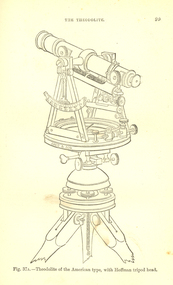
The author, Bennett H. Brough was an associate of theRoyal School of Mines, a member of the COuncil of the Institution of Mining Engineers, a fellow of the geological society and of the Institute of Chemistry, a member of the Mining Institute of Cornwall, and a former instructor of mine-surveying at the Royal School of MinesRed had covered book 372 pages - part of Griffin's Mining Series. Contents include general explanatinos of surveying, an historical sketch, mineral deposits, mining terms, measures of length, measurement distances, the chain, rods, steel bands, measuring wheel, Miner's Dial, Magnetic needle, Fixed needle, German Dial, theodolite, traversing underground. Surface-surveys. plotting the survey, calculation of area, leveling, Telescope, Setting out, Mine-Surveying Problems, Mine Plans, Photographic Surveying, examination Surveying. Illustrations include: Whitelaw's Dial (Fig 22), Theodolite of the American Type with Hoffman tripod head, (fig 37a)mining, surveying, miner's dial, chain, survey, theodolite, scientific instruments -
 University of Melbourne, Burnley Campus Archives
Slide - 35mm Colour slides, Construction Students' Canteen, 1961-1976
1-3, 14-16, 23 slides labelled "Students' Canteen & Recreation Room 1961" under construction. "Ginkgo biloba Aut 1962". Butia capitata "Aut 1962". 9-11 "Ginkgo biloba (& Malus ioensis rubra) 19/5/63". 4-8 slides "Paving - Canteen 28/6/63" Jul 63. "Magnolia alba K. Elliot's Sect. 1968 Rosemary", 2 slides ground prepared for construction? Sep 68. "Japan Ground Cover Soft" Feb 76.17-20 Arboriculture related. 21-22 Pruning Day 1963. BHC Vege Plots/Nursery 1963.students, canteen, recreation room, 1961, ginkgo biloba, paving, orchard, butea palm, malus ioensis rubra, magnolia alba, k elliot, canteen construction, students working outside -
 Bendigo Military Museum
Administrative record - Army Survey Regiment - Operation Rapid Track 1987 Operation Report, Army Survey Regiment, Bendigo, 27 May 1987
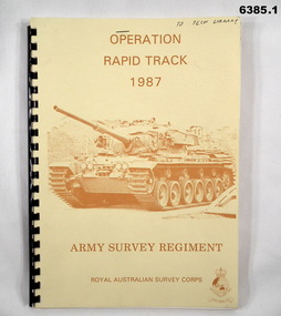
The Survey Operation Report deals with the cartographic completion of four 1:50,000 topographical line maps and one Special 1:50,000 map covering the Puckapunyal Military Training Area. The report covers in detail the digital stereo plotting, field completion (checking) and the cartographic completion including printing. The four 1:50.000 maps are 7823-1 PYALONG, 7824-2 COSTERFIELD, 7923-4 TALLAROOK and 7924-3 NAGAMBIE. Annex A lists personnel and dates involved and is attached as 6385.2. Annex B lists the members of the field completion parties.A4 sized buff coloured light cardboard covered report, plastic spiral binding. Front cover includes text, Survey Corps badge and light brown image of a Centurian tank. "To Tech Library", Page 2 has two small handwritten notes indicating that Phase 2 was the Field Completion Phaseroyal australian survey corps, rasvy, fortuna, army survey regiment, army svy regt, asr -
 Wangaratta RSL Sub Branch
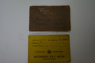
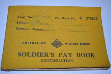
Financial record - Soldier's Pay Book, c1940
Soldier's Pay book issued to John Strobel Green VX32816. Born at Wonthaggi on the 19/4/1913. These books were usually carried by the soldiers in their battle dress breast pocket. They note personal details, rate of pay and promotions, and the place in which the soldier was paid each fortnight – effectively plotting soldiers' movements in the Army. From the pay book GREEN enlisted in June 1940, trained at Puckapunyal before embarking overseas in February 1941 for the Middle East. His mother who resided in West Yallourn was his next of kin.Brown cloth covered booklet with black writing and crest in the middle of the cover.Army No. VX32816. Pay Book No: 119988. Surname: Green. Christian Names: John Strobel. Unit: . Australian Military Forces. Soldier's Pay Book.world war 2, soldier's pay book, army pay book, john strobel green, vx32816 -
 Glen Eira Historical Society
Article - Pearson, William
Four items related to Pearson family. 1.Brief photocopied item giving details relating to William’s pastoral estates. Political arenas he was involved with his business interests including his breeding of race horses, including handwritten note about his champion racehorse, date and author unknown. 2.Handwritten page on the details of his family burial plots at Brighton cemetery, date and author unknown. 3.Handwritten rate book listings from 1876 to 1891, date and source unknown. 4.3 copies of Heraldic sketches pertaining to the Pearson of Kilmany Park and Craigellachie in Scotland.pearson william, ‘craigellachie’, ‘kilmany park’, housenames, pioneers, travers eliza laura, orrong rd, magistrate, studs, mine owners, mansion, long tunnel gold mining co., pearson hugh, pearson henry travers, pearson william jr, inkerman street -
 Greensborough Historical Society
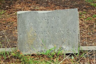
Photograph - Digital Image, Grave of Victor and Mary Bonsak, Greensborough Cemetery, 11/04/1891
Grave of Victor Bonsak (died 11/04/1891) and Mary Bonsak (b1878 died 24/03/1938) in Plot# N3 Greensborough Cemetery. Johann George Bonzak arrived at Port Phillip on December 19th 1849, from Germany. Mary Bonzak, of German birth, applied for a Certificate of Naturalization in Eltham on 13th April 1905. She had 10 children (4 boys and 6 daughters) . Her sister (maybe) Sarah Jane Bonsak (1881-1978) married George Arthur Iredale in 1908. A Bonzak Family lived near the Partington Family of Willis Vale.Greensborough Cemetery was created when land was given for the cemetery by Mr William Poulter, a local settler, about 1864. The cemetery holds the graves of many early settlers in the district. Digital copy of colour photograph of Greensborough Cemeteryvictor bonsak, mary bonsak -
 Warrnambool and District Historical Society Inc.
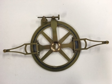
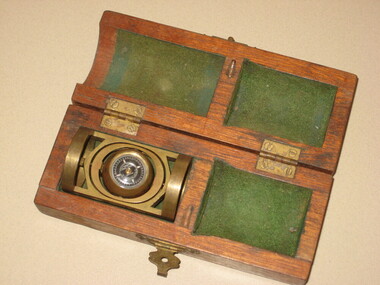
Instruments, Measuring tool, CLate 19th century
This instrument is a folding arm protractor. It is used for measuring angles on the vertical and horizontal planes. The two folding arms have small metal support springs where they are attached to provide support and the other ends have pins with which to mark particular points. A screw mechanism on the rim allows fine tuning of plotting. Chadburn, Brothers were fine instrument makers of Sheffield making optical and nautical instruments during the 19th century. This item was donated by a local resident whose grandfather Carl Spence was a bridge builder who worked on the Warrnambool Breakwater extension c 1919. This item has scientific significance which is possibly linked via the owner to one of Warrnambool's most well known landmarks.Brass, circular instrument with fold out sections which are hinged and a movable section. The circular part is marked in degrees around the circle. Notches on inner rim at 90 degrees intervals. Chadburn ,Brothers Sheffield. Graduated scale measuring 360 degrees.warrnambool, warrnambool breakwater -
Ballarat RSL Sub-Branch Inc.
Letter - confirmation of death
This object relates to Benjamin Staveley TAPNER. He was born on 11/08/1893 in Clifton Hill, VIC. Benjamin Staveley served in the Offier - AIF enlisting on, 11/02/1915 in Clifton Hill, VIC before being discharged from duties with the C COY 22nd BATTN as a Army Commissioned 2nd Lieutenant (2LT) on 29/07/1916. Benjamin Staveley TAPNER was not a prisoner of war. His next of kin is B W TAPNER. Date of death is 29/07/1916 44th Casualty Clearing Station, FRANCE, Buried Puchevillers Military Cemetery, FRANCE,Plot 1, (697).first world war (ww1), 1914 - 1918, literature, ballarat rsl, ballarat -
Ballarat RSL Sub-Branch Inc.
Service Record (copies of excerpts)
This object relates to Benjamin Staveley TAPNER. He was born on 11/08/1893 in Clifton Hill, VIC. Benjamin Staveley served in the Offier - AIF enlisting on, 11/02/1915 in Clifton Hill, VIC before being discharged from duties with the C COY 22nd BATTN as a Army Commissioned 2nd Lieutenant (2LT) on 29/07/1916. Benjamin Staveley TAPNER was not a prisoner of war. His next of kin is B W TAPNER. Date of death is 29/07/1916 44th Casualty Clearing Station, FRANCE, Buried Puchevillers Military Cemetery, FRANCE,Plot 1, (697).first world war (ww1), 1914 - 1918, literature, ballarat rsl, ballarat -
 Wangaratta RSL Sub Branch
Financial record - Soldier's Pay Book, c1940
Soldier's Pay book continuation issued to John Strobel Green VX32816. Born at Wonthaggi on the 19/4/1913. These books were usually carried by the soldiers in their battle dress breast pocket. They note personal details, rate of pay and promotions, and the place in which the soldier was paid each fortnight – effectively plotting soldiers' movements in the Army. From the pay book GREEN enlisted in June 1940, at the age of 27, before embarking overseas on 5 February 1941 for the Middle East. Inside the rear cover are two photographs of GREEN. His mother Kate Green of Yallourn is listed as next of kin.Yellow covered booklet with black writing and Crest in the middle of the cover.Army No. VX32816. Pay Book No: C279807. Surname: Green. Christian Names: John Strobel. Unit: . Australian Military Forces. Soldier's Pay Book. Continuation.wwii, world war 2, pay book, soldier's pay book, army pay book, john strobel green -
Bendigo Military Museum
Manual - National Research Council of Canada, Division of Applied Physics - Strip triangulation of measured points, National Research Council of Canada, Nov 1961, Dec 1966, Oct 1966, Jan 1967
The Royal Australian Survey Corps, Army Survey Regiment used transformations of Aerial Photographic strip and block coordinates to accurately calculate setup parameters for the extraction of topographical features on Wild B8 stereo plotters. This manual describes the methods and "Fortran" computer programming language solutions. Chapter 1 - Transformation and adjustment of strip coordinates by electronic computation. Chapter 2 - An Introduction to Analytical Strip Triangulation with a "Fortran" program. Chapter 3 - A "Fortran" program for the adjustment of Strips and Blocks by Polynomial Transformations. Chapter 4 - A modified "Fortran" (IBM 1620) program for the adjustments of Strip coordinates.Hard Covered Manual containing Chapter 1 - 8 x pages, Chapter 2 - 84 x pages, Chapter 3 - 33 x pages, Chapter 4 - 29 x pages.Distribution stamps and labels on front cover.royal australian survey corps, rasvy, fortuna, army survey regiment, army svy regt -
 Warrnambool and District Historical Society Inc.
Article, Newspaper S McDonald, 1940’s
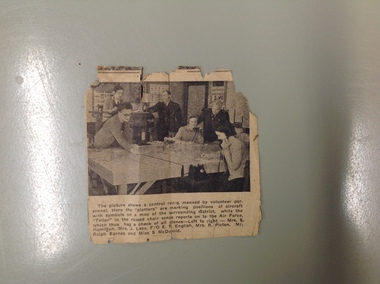
The Volunteers Air Observers was formed in 1941 with the aim of observing aircraft flying over Australia. There were over 24000 civilians volunteering their services and as the military threat to Australia subsided they took on roles as coast and weather watching. This photograph shows a group of local volunteers at their work. Mrs. S Hamilton, Mrs. J Lees, F/O E F English, Mrs. R Picton, Mr. Ralph Barnes and Miss S McDonaldA local item which relates to an organization which operated around Australia in the 1940’s. Small newspaper cutting with photograph with six people around a table. Text is underneath the photo. The back has an advertisement for Fletcher Jones clothingThe picture shows a control room manned by volunteer personnel. Here the plotters are marking positions of aircraft with symbols on a map of the surrounding district while the Teller in the raised chair sends reports on to the Air Force, which thus has a check of all planes left to right Mrs. S Hamilton, Mrs. J Lees, F/O E F English, Mrs. R Picton, Mr. Ralph Barnes and Miss S McDonald volunteer air observers corps,, volunteer air observers corps,, mrs. s hamilton,, mrs. j lees,, f/o e f english, mrs. r picton, mr. ralph barnes, miss s mcdonald warrnambool -
 Federation University Historical Collection
Instrument - Scientific Instrument, Pajari Instruments, Boxed Tropari
This item was most probably used at the Ballarat School of Mines. Pajari Instruments Ltd. grew from a partnership established in 1945 when the first EX-AX surveying instrument that provided accurate azimuth and inclination was made available to the diamond drilling industry. The partnership between Charles Trotter and George Pajari Sr. was known as Trotter-Pajari Instruments and the EX-AX Instrument was dubbed the "TROPARI" by the diamond drilling industry. Charles Trotter, a mechanical engineer, was also a marketing genius who developed substantial demand in Australia, Africa and South America in the 1940's and early 1950's. In fact the sales to each of these continents exceeded those to North America during those early years. Pajari is located in Orillia, Ontario, Canada and offer services and products that assist customers with their individual requirements. After the death of Charles Trotter in 1956, George Pajari Sr. with the assistance of his wife Hilda continued the business under the title of Pajari Instruments. George Sr. set most of the tenets that comprise our present Mission Statement. If it wasn't user friendly or if it had to have experts to operate it, that instrument design was doomed. If the customer wasn't getting good value in his opinion, manufacturing and repair procedures were examined to see where efficiency could be improved to cut costs without sacrificing Quality. George Pajari Jr and his wife Darlene assumed the reins of Pajari Instruments Ltd. in 1981 when George Sr. decided on semi-retirement. George Jr. brought the "client geologist's" perspective to the company. The company moved from Toronto to a 30 hectare (80 acre) site near Orillia shortly afterward. This site provided the high magnetic latitude earth field environment without magnetic pollution that is necessary for accurate compass setting. The park like setting of this location is a positive psychological benefit for our staff. George Sr. passed away in 2002 being preceded by Hilda only by 3 months, George Jr. continues at the helm of the company. With dedication from long term employees/contractors and third generation family members, Pajari Instruments Ltd. continues operations/new product development in Orillia. (http://www.pajari.com/about.html) Brass levelling compass in green velvet lined hinged timber box. Known as a Tropari - a single-shot, micro-mechanical borehole surveying instrument operated by a timing device. Borehole direction is measured from the earth's magnetic field. The Tropari provides both direction and inclination which can be used to define the attitude of the borehole at the survey depth. Regular surveys at intervals as the borehole progresses will allow a plot of the borehole to be drawn from the data. The Tropari is easy to use and maximizes profits by minimizing capital and operational costs. The Basic Survey Train Consists of: PDSI / Tropari Container, 6m (20 ft) Nonmagnetic Rods, Impact Foot, and Connector at Top. (http://www.pajari.com/tropari.html) A sticker on the lid of the hinged box states: "A.E. Parsons 107 Leicester St., Carlton 3053 Telephone 347 5844"scientific instrument, compass -
 Glenelg Shire Council Cultural Collection
Equipment - Surveyors chain, unknown
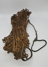
Before metric measurement was introduced land was measured by a tool of chains and links called a surveyor's chain. The first surveyor's chain was designed by the English clergyman and mathematician Edmund Gunter (1581-1626) and introduced in 1620. It comprised of a metal chain made up of 100 links measuring a precise overall length of 66 ft or 22 yards, with each link measuring 7.92 inches (201.168 mm). The Gunter's chain was originally intended to be used in the accurate laying out and measurement of plots of land, for legal and commercial purposes, but was subsequently widely used by surveyors throughout the British Empire and Europe, with an Imperial mile being 80 times the Gunter's chain length. A tool used to survey the land before the introduction of the metric system.Surveyor chain Gunter type, 100 links measuring 66 feet in length. Hand grips at each end of chain. Wire links are approximately eight inches long. Incised tags or markers are attached to each tenth link of chain to assist with the more accurate recording of intermediate distances.surveying tool -
 Forests Commission Retired Personnel Association (FCRPA)
Basal Area Angle Gauge
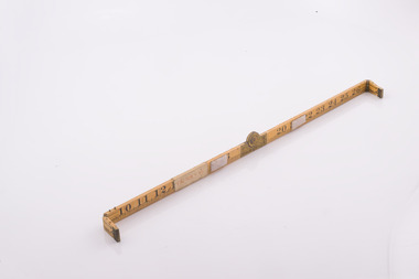
Foresters usually measure the diameter of trees at Breast Height – traditionally 4 foot, 6 inches – now 1.3 m – which is termed Diameter Breast Height Over Bark (DBHOB). Basal Area is the cross section of the tree trunk at breast height, and the sum for the stand or group of trees is expressed square feet per acre (after 1973 it was expressed in square metres per hectare). Lots of skinny trees, or a few fat ones, can have the same Basal Area, but when combined with the number of stems, Basal Area is a good indicator of stand density. Two common methods are used to measure of Basal Area – fixed area plots and angle count sampling. 1. Fixed area plots require setting out a small area, commonly 50 m x 20 m, and measuring all the trees at breast height, and doing some quick sums. 2. Angle count sampling involves a simple sweep of the forest from a fixed sampling point using a relascope, dendrometer sight, angle gauge, or glass wedge prism. This wooden builders ruler has been shaped at one end to create a shallow angle (usually less than 3 degrees). Standing in one spot, a sweep is made with the wedge held to the eye, and trees are counted as either “in” or “out”. The number of trees is multiplied by conversion factor of the wedge (10 in this case) to estimate basal area. It’s very quick and effective.Basal Area Angle Gauge The two ends fold up and one end (on the right) has been reduced in width to create a shallow angle for the viewer Home made by cutting down a wooden builder's ruler Many forestry students made their own Basal Area Angle Gauges and its thought this may be oneforest measurement, forests commission victoria (fcv)