
Showing 21 items matching "bogong high plains map"
-
 Kiewa Valley Historical Society
Maps - Tourist
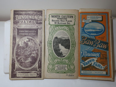
... ...Bogong High Plains Map 1933...Tourist Map of North Eastern Victoria including Bogong High Plains Mt Buffalo Etc. ...Tourist Map of North Eastern Victoria including Bogong High Plains Mt Buffalo Etc. ...These maps were all dated 1933 which was before the construction of the Kiewa Hydro Electric Scheme and when Tawonga was spelt Towonga. North East Victoria in 1933 was before the construction of the Kiewa Hydro Electric Scheme so the townships of Mt Beauty and Bogong are not shown. The description of the Snow Lines was important as skiers, bushwalkers and campers relied on them. The details on the map include "ADB. Numbered from A.1-377 round plates. CD Numbered from C 1-235 square plates. Poles about 3 chains apart 27 to the mile." 3 Tourist location maps (folded) and printed on parchment. 1. Tourist map of the Dandenong Ranges. Brown cover. dated 6-4-33. Govt. printer showing roads, tracks in red and heights of the land. 2. Tourist Map of Warburton, Mt Baw Baw, and Walhalla. Blue and Orange cover. dated 23-5-33 Govt. printer. 3 different maps of each area showin roads, tracks and timber tramways.Also in red and blue. 3. Tourist Map of North Eastern Victoria including Bogong High Plains Mt Buffalo Etc. Green cover. dated June 1933 Govt. printer. Main map and insert titled Bogong High Plains. Showing roads , tracks and tram ways. On insert showing snow poles. Also Red and Blue and mountains.By Authority of H.J. Green - 6 pence. Dept of Lands and Survey, Melbourne1933 maps, tourism maps, bogong high plains map 1933, snow poles -
 Kiewa Valley Historical Society
Map - Bogong High Plains
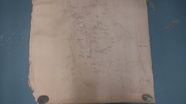
... bogong high plains map...Bogong high Plains showing mountains, places, roads and rivers Historical changes of infrastructure on the Bogong High Plains bogong high plains map Bogong High Plains, hand written and 'copied with considerable simplification from F.C.V. ...Bogong high Plains showing mountains, places, roads and riversHistorical changes of infrastructure on the Bogong High PlainsBogong High Plains, hand written and 'copied with considerable simplification from F.C.V. (Falls Creek V.?) 'Feathetop' L 'Tawonga'. Paper is yellowed, writing is brown.bogong high plains map -
 Kiewa Valley Historical Society
Map - Kiewa Valley, County Map of Bogong, 27/11/1905
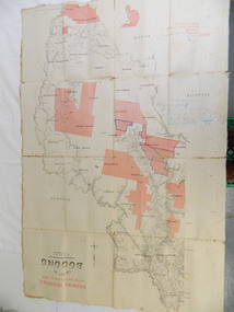
... This map has been owned by the Ryder Family of the Kiewa Valley for possibly over 100 years (1905?). It was used when the family mustered and maintained cattle on their grazing lease on the Bogong High Plains. ...This map has been owned by the Ryder Family of the Kiewa Valley for possibly over 100 years (1905?). It was used when the family mustered and maintained cattle on their grazing lease on the Bogong High Plains. ...This map has been owned by the Ryder Family of the Kiewa Valley for possibly over 100 years (1905?). It was used when the family mustered and maintained cattle on their grazing lease on the Bogong High Plains. Obviously a field map used on these occasions.This map was used by the Ryder Family who lived in the Kiewa Valley and who grazed cattle on their lease on the Bogong High Plains during summer.Showing reserves Under the Forest Act of 1907. This is a paper map which has been mounted or glued on pink and cream floral cotton. It is obvious by its poor condition that it has been used outdoors in the field. It is not in very good condition as it has been folded 4 times (8 divisions) and it is badly worn and cracked in the creases.Photo Lithographed at the Department of Lands and Surveys by T.E.McGauran 27/11/05 Price 1/3d. Scale - 2 miles to an inch. F.S. Hilcke Oct. 2nd 1905.department of lands and surveys map; ryder family; bogong high plains -
 Falls Creek Historical Society
Journal - Ski-Horizon Vol. 2 No 11
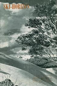
... Page 5 Bogong High Plains locality map, with construction areas and power lines marked. ...Page 5 Bogong High Plains locality map, with construction areas and power lines marked. ...Ski-Horizon is the official journal of the Federation of Victorian Ski Clubs which began publication in 1949. The were 26 original member clubs which included Albury Ski Club, Bogong Ski Club, Myrtleford Ski Club, Tallangatta and District Ski Club and Wangaratta Ski Club. Two pioneers of Falls Creek, Tom Mitchell, M.L.A., and Martin Romuld were Vice-Presidents of the Federation.This Journal is significant because it documents the early development of skiing in Victoria.The journal features stories and events chronicling developments in Victoria and internationally. Items related to the Falls Creek Area in this publication include:- Page 2: Reference to ski instructors and Ski Schools in Victoria including Bob Hymans' School and Ernst and Auriel Forras who operate the Nussen School with Max Denham. Page 5 Bogong High Plains locality map, with construction areas and power lines marked. It is accompanied by a notice regarding safety and access from H. H. C.Williams, Construction Engineer. Page 12 An article referring to Tom Mitchell's stallion "Debtor" and Ernest Forras, Ski Instructor. Page 13: Continuation of Ernest Forras' profile. Page 22 Comment by Toni St. Elmo and the Myrtleford Ski Club Tow. ski history victoria, federation of victorian ski clubs, ernest forras, nissen ski school -
 Kiewa Valley Historical Society
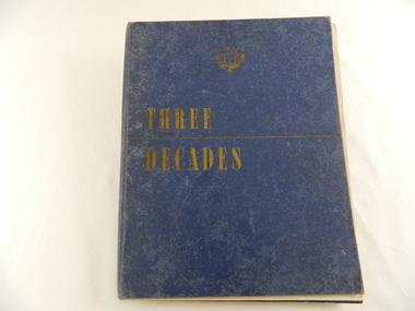
Book - Historical - SECV x3, Three Decades. The Story of the State Electricity Commission of Victoria from its Inception to December 1948, First Published March 1949
... Photos, map and diagrams of the Kiewa Scheme are also included. state electricity commission of victoria. kiewa hydro electric scheme. bogong high plains. pretty valley. kiewa valley. ...At the time of writing this book The State Electricity Commission of Victoria had been in existence for 30 years. This book tells something of its progress and achievements during that period. It includes brown coal and water power. The Commission was to develop and use these natural resources through the expertise and experience of the Commissioners, its staff and employees. Historical: Chapter 5 "The War Years - and Kiewa." describes the early stages of the Kiewa Hydro Electric Scheme. Photos, map and diagrams of the Kiewa Scheme are also included. Hard cover blue bound book with the SECV insignia and the title "Three Decades" both in gold on the front cover. Book includes coloured and black and white photos.Handwritten inside front cover: "Bob Burnett". Title page: hand written in print and crossed out: "L.D.Miller / Tawonga". Not crossed out - "(Cheryl)"state electricity commission of victoria. kiewa hydro electric scheme. bogong high plains. pretty valley. kiewa valley. -
 Kiewa Valley Historical Society
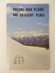
Map - Bogong High Plains & Adjacent Peaks x2, 1976
... bogong high plains. mountains. bushwalkers. walking. map. national park. recreation. cycling. tourism...This map was produced as a result of the 'pressure from walkers' who are interested in climbing the accessible peaks on the Bogong High Plains. ...Blue and white cardboard folded in half containing a folded black and white map of Bogong High Plains and Adjacent Peaks with index....Some of the huts have since been destroyed by fire and Mt Niggerhead has since been renamed to Jaithmathang. bogong high plains. mountains. bushwalkers. walking. map. national park. recreation. cycling. tourism Blue and white cardboard folded in half containing a folded black and white map of Bogong High Plains and Adjacent Peaks with index. ...This map was produced as a result of the 'pressure from walkers' who are interested in climbing the accessible peaks on the Bogong High Plains. Places, huts and rivers are named and indexed. Contours are not given. Heights of mountains are in metres.The Bogong High Plains is a popular walking area and a National Park. This map identifies the mountains and peaks in the area at the time of publication. Some of the huts have since been destroyed by fire and Mt Niggerhead has since been renamed to Jaithmathang.Blue and white cardboard folded in half containing a folded black and white map of Bogong High Plains and Adjacent Peaks with index.bogong high plains. mountains. bushwalkers. walking. map. national park. recreation. cycling. tourism -
 Kiewa Valley Historical Society
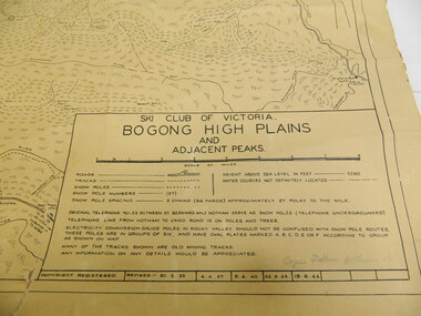
Map - Topographical, Ski Club of Victoria Bogong High Plains and Adjacent Peaks, Early 1930's
... This map has been in the Ryder family for approx. 70 years. Probably used when bush walking and skiing in the early days on the Bogong High Plains. ...This map has been in the Ryder family for approx. 70 years. Probably used when bush walking and skiing in the early days on the Bogong High Plains. ...This map has been in the Ryder family for approx. 70 years. Probably used when bush walking and skiing in the early days on the Bogong High Plains. The Ryder family are farmers in the Kiewa Valley and were involved in taking their cattle up to the Bogong High Plains where they had a lease. The State Electricity Commission of Victoria constructed the Kiewa Hydro Electric Scheme opening up the area during the 1940's and 1950's. This type of map is an early one, used by people in the Kiewa Valley and possibly by surveyors prior to construction.The map is an early topographic map used by farmers living in the Kiewa Valley. It is historically significant as these people were involved in taking cattle up to the High Plains during summer and may have been used for bush walking and skiing.This is a sepia coloured paper map which was originally printed copyright registered. It was revised in 20/6.33/4.4.37/8.4.40/24.8.43/19/6/54. It shows roads / tracks / snow poles / snow pole numbers (27) / Snow pole spacing (3 chains. 66 yards) approximately 27 poles to the mile / height above sea level in feet - 5280. Water courses not definitely located etc.Rocky Valley Dam (Kiewa Hydro Electric Scheme) has been drawn on the map by hand with a biro. There is a wooden rod at the top of the map.topographic map; kiewa valley; ryder family; high plains of victoria -
 Kiewa Valley Historical Society
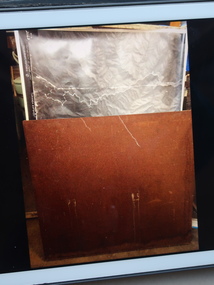
Maps 3D - National Parks
... Maps showing topography National Parks stereoscope Identified and catalogued by National Parks Black and white large aerial photos of the Bogong High Plains area. 14 to 20 of them all on thick paper and the same size as the brown wooden box which holds them. ...Used by the employees of National Parks. The maps show the topography and contours in 3D when used with the stereoscope KVHS 0743. This enables the photographed area to be compared to previous photos and enables the planning of construction of eg. new roads etc. Digital information is now available.These photographs give the topography and contours of vast local areas eg. Mt Feathertop and Tawonga township.when used with a stereoscope. Black and white large aerial photos of the Bogong High Plains area. 14 to 20 of them all on thick paper and the same size as the brown wooden box which holds them. The box hasn't got a lid at the top.Identified and catalogued by National Parksmaps showing topography, national parks, stereoscope -
 Kiewa Valley Historical Society
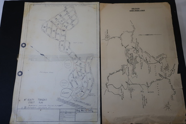
Maps - Bogong High Plains & Mt Beauty Township
... Maps Both have sticky tape marks on their back. Both Foolscap 1. Titled: High Plains Access Tracks & Roads 2. Mt Beauty Street Plan by SECV with Section Nos. and house numbers Maps - Bogong High Plains & Mt Beauty Township ...The SECV continually updated their mapsDuring the development of the KHES the SECV had to continually update their mapsBoth Foolscap 1. Titled: High Plains Access Tracks & Roads 2. Mt Beauty Street Plan by SECV with Section Nos. and house numbersBoth have sticky tape marks on their back.khes maps -
 Kiewa Valley Historical Society
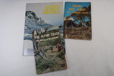
Books x3 - Walking on the Bogong High Plains, 1. The Alpine Track Walhalla to Mt Bogong. 2. Bogong High Plains and Adjacent Peaks both by John Siseman 3. Alpine Safety Manual
... Bogong High Plains and Mt Bogong are at the upper end of the Kiewa Valley where local people and visitors spend their leisure time, walking. bush walking Bogong High Plais Walhalla to Mt Bogong Alpine Track 1. and 2. both written by John Siseman, small (pocket size), includes maps and black & white photos. ...Books were published to guide walkers travelling long distances in remote areas increasing their safety and giving them independence.Bogong High Plains and Mt Bogong are at the upper end of the Kiewa Valley where local people and visitors spend their leisure time, walking.1. and 2. both written by John Siseman, small (pocket size), includes maps and black & white photos. The covers are colored photos with the title at the top. 1. has 78 pages and 2. has 63 pages.The Alpine Safety Manual (in yellow) is twice the size of the others and published by the Department of State Development, Decentralization and Tourism.It has 40 pages, coloured and black & white photos and is held by 2 staples.bush walking, bogong high plais, walhalla to mt bogong, alpine track -
 Kiewa Valley Historical Society
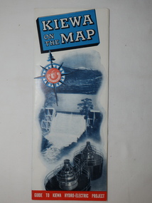
Map - Kiewa on the Map, Guide to Kiewa Hydro-Electric Project
... Bogong High Plains and all other roads within the Kiewa works area. The roads are not open to general tourist traffic. Conducted tours of the Kiewa area are operated by Eastern Road Lines Pty. Ltd., Albury The SECV constructed the KHES and controlled all roads within the Kiewa works area. Map ...Published by the SECV in 1950. They controlled the roads from Mt Beauty to the Bogong High Plains and all other roads within the Kiewa works area. The roads are not open to general tourist traffic. Conducted tours of the Kiewa area are operated by Eastern Road Lines Pty. Ltd., AlburyThe SECV constructed the KHES and controlled all roads within the Kiewa works area.Large colored map folded in half and then in 3. Front third is mostly blue and white with titles.. When opened the cover has black and white photos beside it with print and 'Please Note'. Also in the other half, a 'Road Map to Kiewa' showing the south eastern side of Australia, mostly yellow (the land) and blue (the sea). Inside the map is a close up map of "Ground Plan of Kiewa Hydro Electric Project' with a 'Key Map Showing Distances'.map of kiewa 1950, khes map -
 Kiewa Valley Historical Society
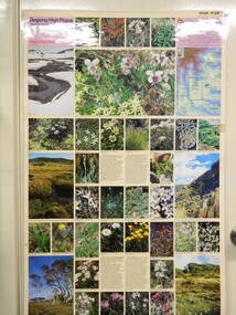
Map / Chart, Vegetation Map & Guide to Alpine Flora: Pretty Valley, 1982
... map is of interest to compare the flora in the area with times prior to 1982 and after 1982. This poster has historical and research value as it shows the flora in the pretty valley area therefore making it significant for people interested in plants. Also for those who would like to compare what plants are still in this area after 1982 and if the cattle grazing, climate change, of bush fires have had on the environment. Thus this poster also has good interpretive capacity of these reasons. pretty valley. bogong. vegetation. plants. flowers. alpine. victorian high plains ...This poster shows Pretty Valley is on the Victorian High Plains where the State Electricity Commission of Victoria worked on the Kiewa Hydro Scheme. Also cattle have grazed in the area over the years. This map is of interest to compare the flora in the area with times prior to 1982 and after 1982.This poster has historical and research value as it shows the flora in the pretty valley area therefore making it significant for people interested in plants. Also for those who would like to compare what plants are still in this area after 1982 and if the cattle grazing, climate change, of bush fires have had on the environment. Thus this poster also has good interpretive capacity of these reasons. Laminated double sided vegetation map and photographic guide to Alpine flora of the Pretty Valley areapretty valley. bogong. vegetation. plants. flowers. alpine. victorian high plains. cattle grazing. s.e.c.v. -
 Kiewa Valley Historical Society
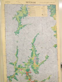
Map / Chart, Vegetation Map & Guide to Alpine Flora: Hotham, 1982
... High Plains. This poster and map enables the comparison to be made of flora in other areas of the Victorian High Plains e.g.. which was previously known as the Bogong High Plains. ...High Plains. This poster and map enables the comparison to be made of flora in other areas of the Victorian High Plains e.g.. which was previously known as the Bogong High Plains. ...This poster shows Mt Hotham is on the Victorian High Plains. This poster and map enables the comparison to be made of flora in other areas of the Victorian High Plains e.g.. which was previously known as the Bogong High Plains. This poster has historical and research value as it shows the flora in Mt Hotham area therefore making it significant for people interested in plants. Also for those who would like to compare what plants are still in this area after 1982 and if the cattle grazing, climate change, of bush fires have had on the environment. Thus this poster also has good interpretive capacity of these reasons.Laminated double sided vegetation map and photographic guide to Alpine flora of the Hotham area.hotham. vegetation. plants. flowers. alpine. high plains of victoria. -
 Kiewa Valley Historical Society
Folder - Bogong High Plains and Falls Creek, 1960's and 1970's
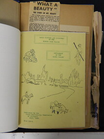
... Bogong High Plains 1962 2. SECV Discovery of Bogong High Plains 1968 3. SECV Kiewa Hydro Electric Scheme 1911 - 1961 4. Newspaper cutting - Mt Beauty 1974 5. McKay Creek Power Station and Clover Power Station 6. Falls Creek and Mt Beauty Tourist Map...Bogong High plains, tourism has created a new focus and different infrastructure/lifestyle for the community. Bogong High Plains; Falls Creek; tourism; A blue folder with a collection of papers & booklets on: 1. Discovery of Bogong High Plains 1962 2. SECV Discovery of Bogong High Plains 1968 3. SECV Kiewa Hydro Electric Scheme 1911 - 1961 4. Newspaper cutting - Mt Beauty 1974 5. McKay Creek Power Station and Clover Power Station 6. Falls Creek and Mt Beauty Tourist Map ...Tourism on the Bogong High Plains developed after/during the State Electricity Commission of Victoria construction of the Kiewa Hydro Electric Scheme.With the completion of the power stations on the Bogong High plains, tourism has created a new focus and different infrastructure/lifestyle for the community.A blue folder with a collection of papers & booklets on: 1. Discovery of Bogong High Plains 1962 2. SECV Discovery of Bogong High Plains 1968 3. SECV Kiewa Hydro Electric Scheme 1911 - 1961 4. Newspaper cutting - Mt Beauty 1974 5. McKay Creek Power Station and Clover Power Station 6. Falls Creek and Mt Beauty Tourist Map & brochures 7. Bogong High Plains Tour 1973bogong high plains; falls creek; tourism; -
 Kiewa Valley Historical Society
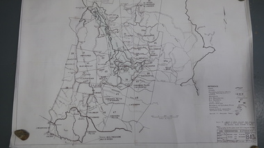
Map - Bogong High Plains - Grazing Runs, Grazing Run Boundaries 1960 - Soil Conservation Authority
... Bogong High Plains were allocated specific areas recorded by the Soil Conservation Authority in 1972. Cattle have been banned in the Alpine National Park due to their impact on the environment. cattlemen grazing runs bogong high plains kiewa valley families White paper with brown print. Bogong High Plains from Feathertop in the west to Mt Nelse in the east showing physical boundaries including the Kiewa Hydro Electric Scheme, roads, rivers and mountains. Names of families with grazing runs and the boundaries are shown. Grazing Run Boundaries 1960 - Soil Conservation Authority Map ...Cattle grazing on the Bogong High Plains during summer commenced in the 1840s and continued for many years. The Soil Conservation Authority recorded each family's area boundaries which were updated in June 1972 and continued to be adjusted until cattle were banned in 2005. The tradition of cattle grazing continues to be controversial.Holders of grazing rights for grazing on the Bogong High Plains were allocated specific areas recorded by the Soil Conservation Authority in 1972. Cattle have been banned in the Alpine National Park due to their impact on the environment.White paper with brown print. Bogong High Plains from Feathertop in the west to Mt Nelse in the east showing physical boundaries including the Kiewa Hydro Electric Scheme, roads, rivers and mountains. Names of families with grazing runs and the boundaries are shown.cattlemen, grazing runs, bogong high plains, kiewa valley families -
 Kiewa Valley Historical Society
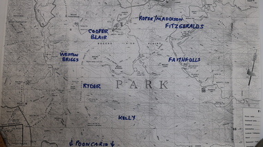
Map - Cattlemen from Kiewa Valley
... Bogong High Plains occurred on most summers since the 1840s. The families were farmers from the Kiewa Valley. The 2003 fires interrupted this tradition which was discontinued altogether in 2005 for environmental reasons. This tradition is still controversial. History of Cattle grazing on the Bogong High Plains and farming in the Kiewa Valley and the families that lived there. cattlemen of the kiewa valley cattle grazing on the bogong high plains 91/92 Until fires in 2003 Families names have been added in blue texta. They are: 'Kelly, Faithful, Weston Briggs, Ryder, Cooper, Blair, Roper, Maddison, Fitzgeralds, Hicks.' Photocopied topographical map ...Cattle grazing on the Bogong High Plains occurred on most summers since the 1840s. The families were farmers from the Kiewa Valley. The 2003 fires interrupted this tradition which was discontinued altogether in 2005 for environmental reasons. This tradition is still controversial.History of Cattle grazing on the Bogong High Plains and farming in the Kiewa Valley and the families that lived there.Photocopied topographical map of part of the Alpine National Park showing 11 families areas for cattle grazing. Dated 1991/92 up to 2003 fires.91/92 Until fires in 2003 Families names have been added in blue texta. They are: 'Kelly, Faithful, Weston Briggs, Ryder, Cooper, Blair, Roper, Maddison, Fitzgeralds, Hicks.'cattlemen of the kiewa valley, cattle grazing on the bogong high plains -
 Falls Creek Historical Society
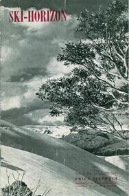
Journal - Ski-Horizon Vol. 2 No 10
... Page 8 - 9 Article - The Old Order Passes on the Bogong High Plains - an extensive response to the State Development Committee's Report "The Alpine Regions of Victoria; Skiing and Tourist Resorts" and suggestions for the construction of roads, ski tows and other facilities. A sketch map...Page 8 - 9 Article - The Old Order Passes on the Bogong High Plains - an extensive response to the State Development Committee's Report "The Alpine Regions of Victoria; Skiing and Tourist Resorts" and suggestions for the construction of roads, ski tows and other facilities. A sketch map ...Ski-Horizon is the official journal of the Federation of Victorian Ski Clubs which began publication in 1949. The were 26 original member clubs which included Albury Ski Club, Bogong Ski Club, Myrtleford Ski Club, Tallangatta and District Ski Club and Wangaratta Ski Club. Two pioneers of Falls Creek, Tom Mitchell, M.L.A., and Martin Romuld were Vice-Presidents of the Federation.This Journal is significant because it documents the early development of skiing in Victoria.The journal features stories and events chronicling developments in Victoria and internationally. Items related to the Falls Creek Area in this publication include:- Page 2: Albury Ski Club is set for a positive year. Present membership of the club is 130 and officials. recently elected are: -President, Mr. Fred Griffith; Vice-President and Booking Officer, Bob Howe; Secretary. Nell Newton; Asst. Sec., Angela Bowler; Treasurer. Sam Roxburgh; Social, Bruce Colquhoun: Trips, June Watson; Bus, Len Egan; Building. John Perger; Equipment, Peter Hadow. Page 3 Toni St. Elmo is planning the monster party the Bogong Ski Club will give at their Falls Creek Lodge on 4th August to the visiting N.Z. team. Page 8 - 9 Article - The Old Order Passes on the Bogong High Plains - an extensive response to the State Development Committee's Report "The Alpine Regions of Victoria; Skiing and Tourist Resorts" and suggestions for the construction of roads, ski tows and other facilities. A sketch map of Falls Creek Village is included.ski history victoria, federation of victorian ski clubs, development of falls creek -
 Falls Creek Historical Society
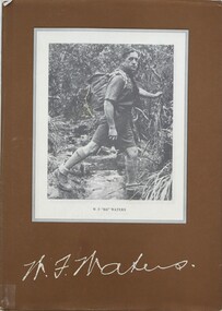
Book - W.F. Waters - A Biography - A Man of the Mountains, Harry Stephenson, 1982
... Bogong High Plains. Becoming a Rover Scout in 1928, his contribution to the scouting movement led to the award of the Silver Wolf, the highest scouting honour in 1961. A book of 96 pages including maps ...A biography of William Francis Waters which outlines his earlier life and sporting success. It details his exploits in hiking and skiing, including being member of the first party to ski across the Bogong High Plains. Becoming a Rover Scout in 1928, his contribution to the scouting movement led to the award of the Silver Wolf, the highest scouting honour in 1961.A book of 96 pages including maps, illustrations, facsimiles and indexnon-fictionA biography of William Francis Waters which outlines his earlier life and sporting success. It details his exploits in hiking and skiing, including being member of the first party to ski across the Bogong High Plains. Becoming a Rover Scout in 1928, his contribution to the scouting movement led to the award of the Silver Wolf, the highest scouting honour in 1961.william francis waters, hiking victoria, scouting victoria -
 Falls Creek Historical Society
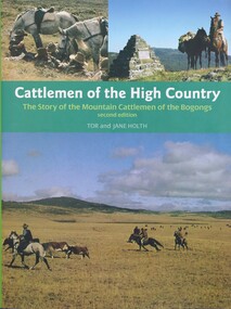
Book - Cattlemen of the High Country, Tor and Jane Holth, 2008
... High Plains Bogong High Plains History A history of the cattlemen of the Bogongs in the Victorian Alps, including their bushcraft, yarns, hut construction, dog and horse training. It looks at the issue of fire and cattle grazing and the struggle of the mountain cattlemen to retain their leases after the bushfires of 2003. This publication provides an enduring record of a special group of Australian pioneers whose lives and qualities of endurance have become part of Australian folklore. Subtitled "The story of the mountain cattlemen of the Bogongs", this publication of 248 pages includes illustrations, photos, portraits, an index and maps ...A history of the cattlemen of the Bogongs in the Victorian Alps, including their bushcraft, yarns, hut construction, dog and horse training. It looks at the issue of fire and cattle grazing and the struggle of the mountain cattlemen to retain their leases after the bushfires of 2003. This publication provides an enduring record of a special group of Australian pioneers whose lives and qualities of endurance have become part of Australian folklore.Subtitled "The story of the mountain cattlemen of the Bogongs", this publication of 248 pages includes illustrations, photos, portraits, an index and maps on the end papers. The original edition was published in 1980 A history of the cattlemen of the Bogongs in the Victorian Alps, including their bushcraft, yarns, hut construction, dog and horse training. It looks at the issue of fire and cattle grazing and the struggle of the mountain cattlemen to retain their leases after the bushfires of 2003. This publication provides an enduring record of a special group of Australian pioneers whose lives and qualities of endurance have become part of Australian folklore.bogong high plains, cattlemen of the high plains, bogong high plains history -
 Falls Creek Historical Society
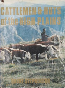
Book - Cattlemen & Huts of the High Plains, Harry Stephenson, 1980
... Bogong High Plains in the 1830s and the Gippslanders moved their herds to Alpine pastures in the 1860s. The cattlemen, the snow plain pastures, the mountain scene and the bush huts are described and illustrated in this volume. It records an era in Australia whose story is becoming lost. On front page: To ORE With many thanks for a fabulous holiday and all the best for the future. Jill, Tony & Emma This volume of 350 pages includes 34 maps ...This book records the development of Victoria's alpine regions by the pioneer cattlemen. They came from the Monaro in the 1830s to reach the Plains of Omeo while others advanced up the Murray tributaries to discover the Bogong High Plains in the 1830s and the Gippslanders moved their herds to Alpine pastures in the 1860s. The cattlemen, the snow plain pastures, the mountain scene and the bush huts are described and illustrated in this volume. It records an era in Australia whose story is becoming lost.This volume of 350 pages includes 34 maps, 326 illustrations and diagrams. It has a brown cloth with white lettering and a pictorial jacket featuring cattlemen on the High Plains. It includes an index and bibliography. The front page has an inscription which indicates it had been given to Ore Frueauf of Falls Creek.non-fictionThis book records the development of Victoria's alpine regions by the pioneer cattlemen. They came from the Monaro in the 1830s to reach the Plains of Omeo while others advanced up the Murray tributaries to discover the Bogong High Plains in the 1830s and the Gippslanders moved their herds to Alpine pastures in the 1860s. The cattlemen, the snow plain pastures, the mountain scene and the bush huts are described and illustrated in this volume. It records an era in Australia whose story is becoming lost.victorian high country, mountain cattlemen, victorian high plains -
 Falls Creek Historical Society
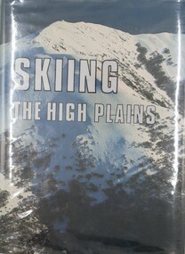
Book - Skiing the High Plains, Harry Stephenson, 1982
... High Plains History History of Skiing Victoria Bogong High Plains This history of the Ski Exploration of Victoria's Alpine Area contains descriptions of all the great pioneering tours of the 1920s and 1930s as recorded and documented by members of those parties at the completion of their trips. Every tour story is accompanied by a map ...This history of the Ski Exploration of Victoria's Alpine Area contains descriptions of all the great pioneering tours of the 1920s and 1930s as recorded and documented by members of those parties at the completion of their trips. Every tour story is accompanied by a map of the route and photos taken along the way. This is an historic document, recapturing and recording achievements by the pioneers who cut the first ski tracks across our Alpine Winter Wonderland, and whose names are a "Who's Who" of the earliest years of Victorian skiing. In addition, this book contains sections of superb full-page photographs of the mountains in winter, taken by noted Australian mountain skier-photographers.The extensive volume of 432 pages including maps and photographs. The endpapers include maps of the High Plains. A dedication and acknowledgements are included and it has been signed by the author. This history of the Ski Exploration of Victoria's Alpine Area contains descriptions of all the great pioneering tours of the 1920s and 1930s as recorded and documented by members of those parties at the completion of their trips. Every tour story is accompanied by a map of the route and photos taken along the way. This is an historic document, recapturing and recording achievements by the pioneers who cut the first ski tracks across our Alpine Winter Wonderland, and whose names are a "Who's Who" of the earliest years of Victorian skiing. In addition, this book contains sections of superb full-page photographs of the mountains in winter, taken by noted Australian mountain skier-photographers. high plains history, history of skiing victoria, bogong high plains
