Showing 289 items matching "central rd"
-
 Bendigo Historical Society Inc.
Document - Kangaroo Flat Gold Mine Collection: Bendigo Goldfield, Recent Operation, J.J. Caldwell, September 1940
... ...Central Rd...Napoleon Line, Napoleon Reefs, Central Napoleon, Nell Gwynne Line, Central Nell Gwynne,New Chum Syncline, North Nell Gwynne, Golden Sovereign, Sheepshead Line, Central Rd, White and Blue, Hercules, Ironbark, Deborah Line, Deborah Consolidated, South Deborah, Deborah, North Deborah, Central Deborah, Monument Hill (New Monument Hill Co) Garden Gully Line, Paddy's Gully Line, South Virginia Extended, South Virginia, North Virginia, East Clarence, Hustlers Line, North Hustlers....Napoleon Line Napoleon Reefs Central Napoleon Nell Gwynne Line Central Nell Gwynne New Chum Syncline North Nell Gwynne Golden Sovereign Sheepshead Line Central Rd White and Blue Hercules Ironbark Deborah Line Deborah Consolidated South Deborah Deborah North Deborah Central Deborah Monument Hill (New Monument Hill Co) Garden Gully Line Paddy's Gully Line South Virginia Extended South Virginia North Virginia East Clarence Hustlers Line North Hustlers. ...Six page document, photocopied extract from the 'Mining and Geological Journal', September 1940, titled 'The Bendigo Goldfield - Recent Operations, by J.J. Caldwell, pages 164 - 169. Reefs and mines discussed: Christmas Line, New Don, Carshalton Line, Golden Carshalton, Forbes Carshalton, New Carshalton. Napoleon Line, Napoleon Reefs, Central Napoleon, Nell Gwynne Line, Central Nell Gwynne,New Chum Syncline, North Nell Gwynne, Golden Sovereign, Sheepshead Line, Central Rd, White and Blue, Hercules, Ironbark, Deborah Line, Deborah Consolidated, South Deborah, Deborah, North Deborah, Central Deborah, Monument Hill (New Monument Hill Co) Garden Gully Line, Paddy's Gully Line, South Virginia Extended, South Virginia, North Virginia, East Clarence, Hustlers Line, North Hustlers.bendigo mining n.l., bendigo, mining, gold, kangaroo flat, christmas line, new don, carshalton line, golden carshalton, forbes carshalton, new carshalton. napoleon line, napoleon reefs, central napoleon, nell gwynne line, central nell gwynne, new chum syncline, north nell gwynne, golden sovereign, sheepshead line, central rd, white and blue, hercules, ironbark, deborah line, deborah consolidated, south deborah, deborah, north deborah, central deborah, monument hill (new monument hill co) garden gully line, paddy's gully line, south virginia extended, south virginia, north virginia, east clarence, hustlers line, north hustlers., j.j. caldwell, mining and geological journal -
 Ringwood and District Historical Society
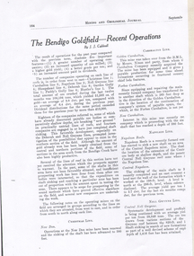
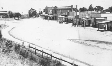
Photograph, Maroondah Highway Central, Ringwood. Warrandyte Rd looking North from Main Street, Ringwood. 1908
... Maroondah Highway Central, Ringwood. Warrandyte Rd looking North from Main Street, Ringwood. 1908...Maroondah Highway Central, Ringwood. Warrandyte Rd looking North from Main Street, Ringwood. 1908 Photograph ...Black and white photograph reproduced from post card. Scene of road looking towards Loughnan Hill, Andrew Kennedy's orchard. Horse and cart in centre of photo, orchard to left of picture. (3 enlarged copies, 2 postcards, a clipping and 1 9x18.5 reproduction) Postcards with correspondence from N Blood, 2 original of the postcards with messages. First reads: "Trust you are well my dear and hope your poor Mater is no worse but better. We arrived home safely..poor little Tim was very tired. Love from all to your sister and mother..self. Your sincere friend, N. Blood" Second Reads: "Miss Hill. Cowes P.O.. 4/3/09 Dear Olive, come at once; I am on my last legs! Very pleased to hear that you have been enjoying yourself as well. Your mother had been very ill and Elvie has lost a stone weight; and ??? looks down in the dumps. Topsy killed canary this morning so I took Topsy for a walk! Had a bush fire up at home on 22 and 23rd Feb. No time to scribble more. Yours to a cinder. Bert." This postcard writing is overstamped J.B.McAlpin, Estate and Financial Agent. District Government Valuer Ringwood. It has a 1d Victorian Stamp affixed. Typed below photograph, "Warrandyte Rd. from Maroondah Hwy. looking north. Mullum Creek bridge in dip - 1908". -
 Ringwood and District Historical Society
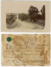
Photograph, Maroondah Highway Central, Ringwood. Whitehorse Rd. looking East from Adelaide St- 1918
... Maroondah Highway Central, Ringwood. Whitehorse Rd. looking East from Adelaide St- 1918. ...Rd. Looking east from Adelaide St. 1918". Image shows Falconer Grocer and Baker store on corner of Adelaide Street. Black and white photograph (3 copies- 2 large, 1 small postcard) Maroondah Highway Central, Ringwood. ...Black and white photograph (3 copies- 2 large, 1 small postcard) Typed below one large photograph, "Whitehorse Rd. Looking east from Adelaide St. 1918". Image shows Falconer Grocer and Baker store on corner of Adelaide Street. -
 Ringwood and District Historical Society
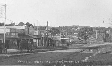
Photograph, Maroondah Highway Central, Ringwood. Whitehorse Rd, looking east towards Warrandyte Rd- 1918
... Maroondah Highway Central, Ringwood. Whitehorse Rd, looking east towards Warrandyte Rd- 1918. ...Rd. 1918". Image shows 2 men and a boy with bicycle in middle of the road. Black and white photograph (3 copies- 2 large, 1 small) Maroondah Highway Central, Ringwood. ...Black and white photograph (3 copies- 2 large, 1 small) Typed below one photograph: "Whitehorse Rd. Looking east towards Warrandyte Rd. 1918". Image shows 2 men and a boy with bicycle in middle of the road. -
 Ringwood and District Historical Society
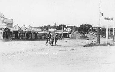
Photograph, Maroondah Highway Central, Ringwood. Whitehorse Rd. Ringwood looking west. 1918
... Maroondah Highway Central, Ringwood. Whitehorse Rd. Ringwood looking west. 1918....Rd. Ringwood looking west - 1918" Image shows a variety of shops on left with a motor vehicle and a horse drawn cart out front. Station Master's house at top left. Black and white photograph (3 copies- 2 large, 1 sepia postcard) Maroondah Highway Central, Ringwood. ...Black and white photograph (3 copies- 2 large, 1 sepia postcard) Typed below one photograph: "Whitehorse Rd. Ringwood looking west - 1918" Image shows a variety of shops on left with a motor vehicle and a horse drawn cart out front. Station Master's house at top left. -
 Blackburn Cricket Club
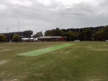
Morton Park - Blackburn Cricket Club's home, Morton Park
... Morton Park is the home of the Blackburn Cricket Club. Located on Central Rd in Blackburn near the railway station Morton Park has two ovals and the scene of many a victory and celebration....Blackburn Cricket Club 35 Central Rd Blackburn melbourne Morton Park is the home of the Blackburn Cricket Club. ...Morton Park is the home of the Blackburn Cricket Club. Located on Central Rd in Blackburn near the railway station Morton Park has two ovals and the scene of many a victory and celebration. -
 Sunshine and District Historical Society Incorporated
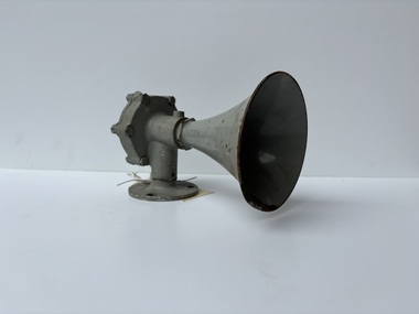
Functional object - Albion Explosive Factory Workshop Crib Time Whistle
... This horm was mounted on a building near the boilerhouse on Central Rd in the Albion Explosive Factory. It would blown at the start and end times of the workshop crib times....This horm was mounted on a building near the boilerhouse on Central Rd in the Albion Explosive Factory. It would blown at the start and end times of the workshop crib times. ...This horm was mounted on a building near the boilerhouse on Central Rd in the Albion Explosive Factory. It would blown at the start and end times of the workshop crib times.A grey painted copper whistle / horn / sirenHurricane Siren Made in Australia R.V.B Engineering Products Ltdalbion explosive factory -
 Bendigo Military Museum
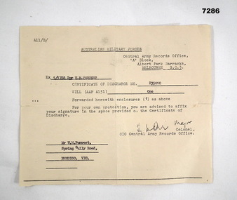
Letter - LETTER, CERTIFICATE OF DISCHARGE, Australian Military Forces, C. 1957
... Forrest, Spring Gully Rd Bendigo Vic" Letter, paper yellowed, A11/B/, Central Army Records Office. ...William Malcolm (Bill) Forrest, served Korea and Malaya. Refer Cat No 7281P for his two service engagements.Letter, paper yellowed, A11/B/, Central Army Records Office. Letter relates to the issue of a Discharge Certificate to 5/1788 William Forrest.Main points.: "5/1788 Spr W.M. Forrest", "P35010" "Mr W.M. Forrest, Spring Gully Rd Bendigo Vic"letter, discharge, korea, malaya -
 Bendigo Military Museum
Print - NSAA LOGO FRAMED, unknown
... Bendigo Military Museum 37 - 39 Pall Mall Bendigo goldfields The Bendigo Branch of the National Servicemen's Association was established Post 2000 and held their meetings at the Bendigo District RSL Sub Branch Havilah Rd. brsl smirsl NSAA On the small brass plaque, "Presented to Bendigo RSL by NSAA Bendigo Sub Branch" National Servicemen's Association Logo framed, square shape, blue and white colours with central map of Australia with crossed swords over with crown, eagle and anchor representing Navy, Army and Airforce. ...The Bendigo Branch of the National Servicemen's Association was established Post 2000 and held their meetings at the Bendigo District RSL Sub Branch Havilah Rd.National Servicemen's Association Logo framed, square shape, blue and white colours with central map of Australia with crossed swords over with crown, eagle and anchor representing Navy, Army and Airforce. The frame has a brass inscribed plaque at the bottom.On the small brass plaque, "Presented to Bendigo RSL by NSAA Bendigo Sub Branch"brsl, smirsl, nsaa, -
 Kiewa Valley Historical Society
12 small black and white photgraphs of Junction Dam and surrounding area, Photo No. 1 c1940, all others c 1948
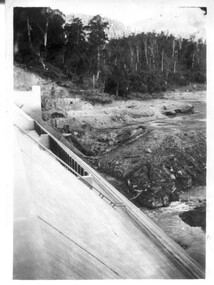
... Rd Mt Beauty high-country Junction Dam is a reinforced slab and buttress type construction and was commenced in February, 1940 by Lewis Construction Company. Stiff leg derricks were erected at appropriate locations at the site of the dam and used for the disposal of excavated material and the placing of concrete. A rock crushing and screening plant was established at a site a short distance upstream from the dam site and concrete was supplied from a central ...Junction Dam is a reinforced slab and buttress type construction and was commenced in February, 1940 by Lewis Construction Company. Stiff leg derricks were erected at appropriate locations at the site of the dam and used for the disposal of excavated material and the placing of concrete. A rock crushing and screening plant was established at a site a short distance upstream from the dam site and concrete was supplied from a central mixing plant placed close to the upstream toe of the structure. The SEC took over the construction in April 1942 and the dam wall was completed in March, 1944. Bogong township was commenced in early 1940 with the construction of a workmen's camp housing 96 men, (known as Junction camp). Construction of housing for families commenced shortly after. Forty houses, plus office, workshops, stores and laboratory accommodation were completed over the next 5 years,Of historical significance as a pictorial record of Junction Dam, Lake Guy and Bogong Village, as the photos were taken only 4 years after completion and one photo taken on completion of the dam wall but before the lake was filled with water.12 small black and white photographs of Junction Dam, Bogong Village and surrounding area.Photo 1 - On the back upper edge in pen 'Junction Dam'. Then '12' in pencil, circular stamp, printed in centre 'Print by Willson White Albury'. Photo 2 - On the back upper edge in pen 'Junction Dam October 1948'. Stamp as no. 1 photo. Stamp '998L' lower centre. Photo 3 - on the back upper edge in pen 'Junction Dam October 1948'. Circular stamp with 'Kodak Print' . Lower centre back is stamped 'velox' and '998L'. Photo 4 - upper back, in ink - 'Junction Dam Spion Kopje in background. October 1948'. Stamps as photo no. 4. Photo 5 - upper back, in ink - 'Lake Guy (orange filter) October 1948'. Centre back, in pencil '29' and circular stamp with words 'Print by Willson White Albury'. Photo 6 - upper back edge 'Junction, Bogong from Radio Receiving Shack Dec. 1948'. In pencil '14'. Photo 7 - On back of photo 'View of Mountains from Little Arthur Fire Track October 1948'. Two circular stamps with 'Kodak Print', another two stamps - 'Velox' and '998L'. Photo 8 - On back in ink 'Loone's Store Bogong with Spion Kopje in background. October 1948'. Lower down, stamps 'Velox' and '998L'. Part of circular stamp with one word 'Kodak'. Photo 9 - on back in ink 'Junction Camp, Bogong Village & Lake Guy from Little Arthur Fire Track. October 1948'. Stamped across writing '998L'. Lower down stamped 'Velox' and circular stamp with words 'Kodak Print'. Photo 10 - on back in ink 'Junction Camp & Bogong Village Lake Guy in Foreground. October 1948'. Stamps as photo 9. Photo 11 - on back in ink 'Junction Camp & Bogong Village, Lake Guy in Foreground. October 1948'. Lower stamp '998L'. Photo 12 - 'Junction of Rocky & Pretty Rivers with tennis courts in foreground October 1948' . Circular stamp with words, 'Print by Willson White Albury'. Number '29' written pencil.junction dam; bogong village; kiewa hydro electric scheme; lake guy -
 Kiewa Valley Historical Society
Papers - 'Operation Key Hold', June 1994
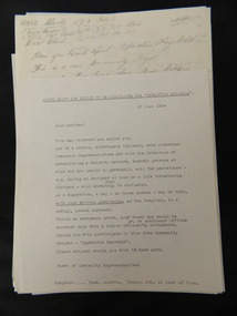
... Kiewa Valley Historical Society Mount Beauty Information Centre 31 Bogong High Plains Rd Mt Beauty high-country 'Operation Key Hold' was set up in June 1994 to establish a security network whereby (with written permission) members of the public could leave their house key at the Hospital in a safely, locked cupboard to be assessed by approved authority in case of emergency. This is similar to the emergency button (hung around the neck) which sounds an alarm at a central ...'Operation Key Hold' was set up in June 1994 to establish a security network whereby (with written permission) members of the public could leave their house key at the Hospital in a safely, locked cupboard to be assessed by approved authority in case of emergency. This is similar to the emergency button (hung around the neck) which sounds an alarm at a central location and alerts appointed acquaintances for assistance - used currently (2015) Operation Key Hold was initiated in Mt Beauty for people at risk of being unable to call for assistance. The letters and notices are examples of setting up a community organisation which began in 1994 locally and became State wide later in the form of a distress alarm which worked by radio contact to a central location. Typed and hand written papers including letters and notices of varying sizes referring to the setting up of 'security network' whereby a house key is left (with written permission) at the Hospital in a safely locked cupboard. This would enable appropriate authorities to render assistance if required.operation-key-hold. community assistance. jan burnett.mt beauty. -
 Kiewa Valley Historical Society
Bottle - Stone Ware
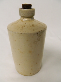
... Rd Mt Beauty high-country Stone ware bottles were used to store items such as ink for ink wells in schools and offices when ink pens were used. Jan may have used this bottle when working at the S.E.C. office. Historical: Ink was used in schools and offices for ink pens before biros were invented. Aesthetic: Stone ware was made in many shapes and sizes. stone ware bottle Cream coloured stone ware bottle used for storing ink. It has straight sides tapering sharply to an opening which is narrow. There is a cork with a central ...Stone ware bottles were used to store items such as ink for ink wells in schools and offices when ink pens were used.Jan may have used this bottle when working at the S.E.C. office. Historical: Ink was used in schools and offices for ink pens before biros were invented. Aesthetic: Stone ware was made in many shapes and sizes.Cream coloured stone ware bottle used for storing ink. It has straight sides tapering sharply to an opening which is narrow. There is a cork with a central core in the opening. Flat base.stone ware bottle -
 Kiewa Valley Historical Society
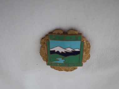
Badge Brass - Mt Beauty Higher Elementary School
... Rd Mt Beauty high-country Schools of this era were very proud of their identity. This was particularly so in country based ones. Schools in isolated or semi-isolated regions provided social cohesion and pride and community involvement that was not so inherent in schools located in larger cities. The exception here being the Greater Public Schools. Mrs Beverly Johnson nee Davis designed the school badges. HES and latter one (Secondary College). Mt Beauty formal secondary education commenced in 1950 with the creation of central ...Schools of this era were very proud of their identity. This was particularly so in country based ones. Schools in isolated or semi-isolated regions provided social cohesion and pride and community involvement that was not so inherent in schools located in larger cities. The exception here being the Greater Public Schools. Mrs Beverly Johnson nee Davis designed the school badges. HES and latter one (Secondary College).Mt Beauty formal secondary education commenced in 1950 with the creation of central classes, with an enrolment of 35 pupils at the Mt Beauty Primary School to serve the children of employees on the Kiewa Hydro Electric Scheme and other people of the district. The Mt Beauty HES was proclaimed on 25th May 1958. In 1962 Mt Beauty High School was proclaimed with 213 pupils. ref. Vision & Realisation Pages 1036-1037. This badge was worn by a local girl.Mt Beauty Higher Elementary School badge made from brass. The front is coloured enamel depicting a scene of sky, mountains, grass and river. On the top it has 'H.E.S.' and on the bottom 'Mount Beauty'. The outside edges are decorated with gold colored ferns. See also KVHS 0371mt beauty higher elementary school, school badge, brass badge -
 Kiewa Valley Historical Society
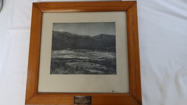
Photo - framed - Mt Beauty Central School
... Rd Mt Beauty high-country The school was built to educate the increasing number of children of the Kiewa Hydro Electric Scheme population. The school opened in 1948 in the Recreation hall and in the new building (photo) in 1950. A new wing was built in 1951 and became the Mt Beauty Higher Elementary School in 1953. By 1958 it had 617 pupils. Mr George Redfern was the Head Teacher for one year in 1951. Mt Beauty State School Kiewa Hydro Electric Scheme Inscription: Mt Beauty Central ...The school was built to educate the increasing number of children of the Kiewa Hydro Electric Scheme population. The school opened in 1948 in the Recreation hall and in the new building (photo) in 1950. A new wing was built in 1951 and became the Mt Beauty Higher Elementary School in 1953. By 1958 it had 617 pupils.Mr George Redfern was the Head Teacher for one year in 1951.Large black and white photo framed in thick wood and backed with cream cardboard. At the bottom on the wooden frame is a metal inscription.Inscription: Mt Beauty Central School / Presented to / Mr G. Redfern / as a token of esteem from / Mothers Club Committee / School Committee / 19.6.52mt beauty state school, kiewa hydro electric scheme -
 Kiewa Valley Historical Society
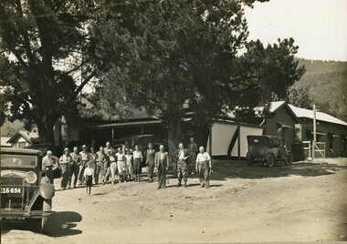
Photos: Bogong Hotel and Kiewa Valley
... Kiewa Valley Historical Society Mount Beauty Information Centre 31 Bogong High Plains Rd Mt Beauty high-country The Bogong Hotel was a central point for social gatherings in the Kiewa Valley. ...The Bogong Hotel was a central point for social gatherings in the Kiewa Valley. It was 125 years old when it was burnt down in December 2011. See KVHS 0965See KVHS 0965Black and white photos framed with thick brown cardboard that is framed by two rows of lines around the photo thus forming a frame. The cardboard is folded in half to form a 'card' enabling the photo to stand. 1. People standing outside the Bogong Pub. The pub is behind trees. Two old/vintage cars are partially in the photo. 2.The Kiewa Valley showing paddocks, trees lining the Kiewa River and mountains in the background.bogong pub, kiewa valley -
 Kiewa Valley Historical Society
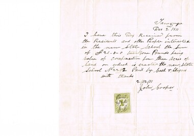
Letter Commerce, Confirmation of Payment, 02/12/1911
... Kiewa Valley Historical Society Mount Beauty Information Centre 31 Bogong High Plains Rd Mt Beauty high-country This document (dated 1911), is a receipt covering the compensation for the three acres of land required to establish the Tawonga School from its original site (since 1880) to a more central site (since 1911), within the township. ...This document (dated 1911), is a receipt covering the compensation for the three acres of land required to establish the Tawonga School from its original site (since 1880) to a more central site (since 1911), within the township. This receipt clearly shows the era in which the community involvement and social commitment of landholders was at a higher level, in the early 20th century, than at the latter part. Matters involving community welfare in relatively isolated rural regions was of high priority to every person whether town folk or grazier/farmer or miner. The letter of acceptance of the amount of twenty one pounds for three acres was signed by John Cooper on behalf of Ada Ryder (parent at the school), did not require State Government Compulsory Acquisition process (as it may have, had it been in the latter part of the century and if it were in a city or large town. This social benevolency was part of the period (up to the late 1900's) of the rural Australian environment. This was well before international land investments changed the picture of the socio-economics of country towns.A4 letter of confirmation of payment on pre-lined paper and with a margin. Both margin and lines are coloured in light grey. The page has been folded four times and shows faintly, horizontal lines, of manufacture. The letter is framed with a glass front.This receipt for the compensation of money is hand written in ink and reads: "Tawonga Dec 2 1911, I have this Day Received from the Residents and other People interested in the new State School the Sum of (Pounds sign) 21-0-0 twentyone Pounds being value of compensation for three Acres of land on which is erected the new State School No.2282 Paid by Cash & Cheques with thanks 2/12/11 (Signed) John Cooper" Below this is affixed a Victoria 1 pence stamp duty stamp, on which is written(freehand) Paid 2/12/11 Initialed J Cfinancial letters, receipts, school acquisitons, stamp duty -
 Emerald Museum & Nobelius Heritage Park
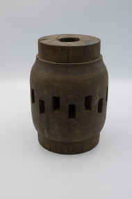
Vehicle - Wooden Hub of Jinker Wheel, late 19th to early 20th centuries
... Rd Emerald yarra-valley-and-the-dandenong-ranges The donor's grandfather had a dairy (Robertson) at Marysville, where he had a jinker dray and other types of machinery. The dairy operated c1880-c1950. This hub is representative of horse or bullock-drawn vehicles used for transporting heavy loads on local farms in the late 19th to early 20th centuries. jinker dray dairy Marysville Timber-turned hub of a jinker wheel. There are 16 oblong spoke holes. The hub was the central ...The donor's grandfather had a dairy (Robertson) at Marysville, where he had a jinker dray and other types of machinery. The dairy operated c1880-c1950.This hub is representative of horse or bullock-drawn vehicles used for transporting heavy loads on local farms in the late 19th to early 20th centuries.Timber-turned hub of a jinker wheel. There are 16 oblong spoke holes. The hub was the central part of a large wheel which would have connected the wheel to the axle and held the spokes in place. The rectangular openings visible in the hub are where the spokes would have been inserted.jinker dray, dairy, marysville -
 Emerald Museum & Nobelius Heritage Park
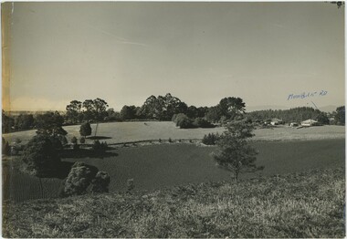
Photograph - Main Road Looking Toward the Dandenongs, 20th Century
... central background. On the left side a hill rises on the horizon, while on the right are several buildings with higher hills or mountains rising in the far background. On the right, handwritten text in blue pen accompanies an arrow pointing to a roadway - 'Monbulk Rd'. ...Rd / looking towards / the Dandenongs / Nth WEST" A black and white picture printed on glossy photograph paper. The photograph is taken from atop a grassy hill, looking down at a plowed field with occasional trees. Behind the field is a road with fences on either side, continuing across the view from left to right. Behind the road are pastures with scattered animals (two horses or cows, possibly several sheep) leading in to a line of trees in the central ...This photograph appears to be taken from a hill. While Main Road and Monbulk Road are both in Monbulk, the reference to Madigan's abattoir indicates that the annotations are more likely to be referring to Main Street and Emerald-Monbulk Road in Emerald. It's difficult to determine whether the annotation means it is taken from Main Street or looking down to Main Street, but the absence of buildings in this relatively recent photograph indicate that it is likely the former. It could have been taken from Main Street, looking down at Madigan Way and the undeveloped land behind it. However, it is difficult to confidently assess any of this information, as it is to determine when this picture was taken.The photograph likely captures a unique perspective on an area of Emerald that has since been transformed by time.A black and white picture printed on glossy photograph paper. The photograph is taken from atop a grassy hill, looking down at a plowed field with occasional trees. Behind the field is a road with fences on either side, continuing across the view from left to right. Behind the road are pastures with scattered animals (two horses or cows, possibly several sheep) leading in to a line of trees in the central background. On the left side a hill rises on the horizon, while on the right are several buildings with higher hills or mountains rising in the far background. On the right, handwritten text in blue pen accompanies an arrow pointing to a roadway - 'Monbulk Rd'. The reverse features more writing, both in blue pen and in pencil. The extreme left side of the object is discoloured by yellow tape.Obverse, Pen: "MONBULK RD" Reverse, Pencil: "Lefthand side where trees situated / Madigan's abattoir." Reverse, Pen: "Main Rd / looking towards / the Dandenongs / Nth WEST"emerald -
 Victoria Police Museum
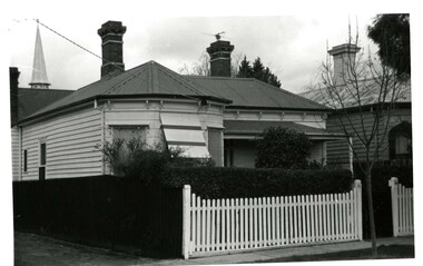
Police Stations (Armadale)
... Central Business District, located within the City of Stonnington local government area. Armadale Police Station opened, in Melbourne Police District, on 11 May 1885. Its original location is unknown, but in 1890 it is listed in the Sands & McDougall directory as at 295 Hight Street. From 1985-1920 it was located at 20/22 Auburn Grove, 1925-1930 at 769 High Street and 1935-1946 at 3 Cheel Street. The station closed on 28 January 1946. The sub-division east of Orrong Rd...Central Business District, located within the City of Stonnington local government area. Armadale Police Station opened, in Melbourne Police District, on 11 May 1885. Its original location is unknown, but in 1890 it is listed in the Sands & McDougall directory as at 295 Hight Street. From 1985-1920 it was located at 20/22 Auburn Grove, 1925-1930 at 769 High Street and 1935-1946 at 3 Cheel Street. The station closed on 28 January 1946. The sub-division east of Orrong Rd ...Armadale is an inner suburb of Melbourne, Victoria, Australia, 7 km south-east of Melbourne's Central Business District, located within the City of Stonnington local government area. Armadale Police Station opened, in Melbourne Police District, on 11 May 1885. Its original location is unknown, but in 1890 it is listed in the Sands & McDougall directory as at 295 Hight Street. From 1985-1920 it was located at 20/22 Auburn Grove, 1925-1930 at 769 High Street and 1935-1946 at 3 Cheel Street. The station closed on 28 January 1946. The sub-division east of Orrong Rd was incorporated into Malvern Sub-district and west of Orrong Road into Prahran Sub-district. In a special 1930 issue of the Victoria Police Gazette the Armadale Police Station was described as a seven-roomed brick dwelling with a tiled roof on land measuring 127' x 104' x 98'. There was also a bathroom and W.C., a wash-house, office, and a lock-up (one cell). This is probably a description of the Cheel Street police station. It was staffed by one senior constable and three foot constables.12 photographs comprising 8 coloured images and 4 black and white images 1 sketch plan of Old Armadale Police Stationpolice stations; armadale police station -
 Orbost & District Historical Society
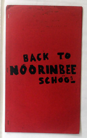
magazine, Back To Noorinbee School, 1974-1975
... Noorinbee School, situated on the Bombala Rd approximately 6.5 km north of Cann River, was opened on 26th of July 1900, with Albert Le Page as head teacher until 30th of September 1904. The school still functions. A school bus runs daily to take the older children to the central...Orbost & District Historical Society Ruskin Street Orbost gippsland Noorinbee School, situated on the Bombala Rd approximately 6.5 km north of Cann River, was opened on 26th of July 1900, with Albert Le Page as head teacher until 30th of September 1904. The school still functions. A school bus runs daily to take the older children to the central ...Noorinbee School, situated on the Bombala Rd approximately 6.5 km north of Cann River, was opened on 26th of July 1900, with Albert Le Page as head teacher until 30th of September 1904. The school still functions. A school bus runs daily to take the older children to the central classes at Cann River. "Noorinbee" is an Aboriginal word of unknown origin, The historical school is still at the front of the school yard. The Old Noorinbee School was been shifted twice. The first time they used a bullock team in 1924. The second time they used trucks and tractors in 1991. It was the first public building for the Cann Valleyand was first used as a hall and a church until it became the Noorinbee school in 1900. It was built in 1898. This item is a useful reference / research tool for the history of Noorinbee and its surrounds.A stapled paper back magazine with a red cover which has the title "BACK TO NOORINBEE SCHOOL" in black print. It contains a collection of articles relating to Orbost and Noorinbee and contains examples of children's work.noorinbee magazine-back-to-noorinbee-school -
 Upper Yarra Museum
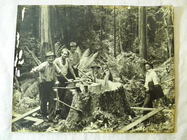
PH Timber Fellers, Fallers in Powelltown bush including George Potter
... rear of photo, writen description; central figure is Mr George Potter Manager VHC Powelltown Died c1949 presented by Mrs A G Potter daughter in-law of above 76 Bluff Rd Black Rock ...Upper Yarra Museum Old Railway Station 2415C Warburton Highway Yarra Junction yarra-valley-and-dandenong-ranges Mr George Potter Manager of the Victorian Hardwood Company mill at Powelltown is sitting in centre of photograph axe ferns powelltown timber fallers george potter victorian hardwood company rear of photo, writen description; central figure is Mr George Potter Manager VHC Powelltown Died c1949 presented by Mrs A G Potter daughter in-law of above 76 Bluff Rd Black Rock Image of three fallers with axes and two others around stump of large tree. ...Mr George Potter Manager of the Victorian Hardwood Company mill at Powelltown is sitting in centre of photograph Image of three fallers with axes and two others around stump of large tree. Black and white photograph A3 mounted on cardboardrear of photo, writen description; central figure is Mr George Potter Manager VHC Powelltown Died c1949 presented by Mrs A G Potter daughter in-law of above 76 Bluff Rd Black Rock axe, ferns, powelltown, timber, fallers, george potter, victorian hardwood company -
 Eltham District Historical Society Inc
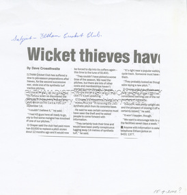
Document - Folder, Cricket, Diamond Valley Leader, Wicket thieves, 15 September 2004
... Eltham District Historical Society Inc 728 Main Rd Eltham melbourne crime theft Eltham Central Park eltham cricket club Lionel Draper A synthetic turf practice pitch has been stolen from the Eltham Cricket Club located at Eltham Central Park. ...A synthetic turf practice pitch has been stolen from the Eltham Cricket Club located at Eltham Central Park.Part photocopy of newspaper articlenon-fictionA synthetic turf practice pitch has been stolen from the Eltham Cricket Club located at Eltham Central Park. crime, theft, eltham central park, eltham cricket club, lionel draper -
 Eltham District Historical Society Inc
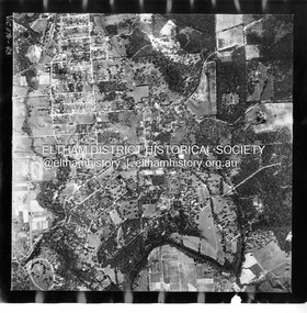
Photograph - Aerial Photograph, Landata, Eltham, Vic, Apr. 1972
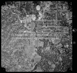
... Eltham District Historical Society Inc 728 Main Rd Eltham melbourne Centred on present day Diamond Creek Trail at the Eltham Leisure Centre bounded by Central Park to north, Main Road at Falkiner Street to south, MacMahon Ball Paddock to east and Grand Boulevard at Buena Vista Drive to west. ...Centred on present day Diamond Creek Trail at the Eltham Leisure Centre bounded by Central Park to north, Main Road at Falkiner Street to south, MacMahon Ball Paddock to east and Grand Boulevard at Buena Vista Drive to west. Historic Aerial Imagery Source: Landata.vic.gov.au Aerial Photo Details: Project No :985 Project : MELBOURNE 1972 Run : 28 Frame : 207 Date : 04/1972 Film Type : B/W Camera : RC10 Flying Height : 5700 Scale : 9600 Film Number : 2635 GDA2020 : 37°43'25"S, 145°08'20"E MGA2020 : 335985, 5823223 (55) Melways : 21 G7 (ed. 42)aerial photo, neil webster collection, 1972-04, eltham, buena vista drive, central park, diamond creek trail, eltham leisure centre, falkiner street, grand boulevard, macmahon ball paddock, main road, melway 21g7 -
 Eltham District Historical Society Inc
Photograph - Aerial Photograph, Landata, Montmorency, Feb. 1956
... Rd Eltham melbourne Centred on present day Tahlee Place Reserve and Sherbourne Preschool, Montmorency bounded by Progress Road to north, Withers Way to south, Main Road to east and Leach Street to west. Historic Aerial Imagery Source: Landata.vic.gov.au Aerial Photo Details: Project No :250 Project : MELBOURNE OUTER SUBURBS PROJECT Run : 17 Frame : 114 Date : 02/1956 Film Type : B/W Camera : EAG9 Flying Height : 10000 Scale : 12000 Film Number : 1176 GDA2020 : 37°42'50"S, 145°08'02"E MGA2020 : 335512, 5824286 (55) Melways : 21 F5 (ed. 42) Aerial Photo 1956-02 Neil Webster Collection Central Park Eltham leach street Main Road Melway 21F5 Montmorency Progress Road Withers Way Sherbourne Preschool Tahlee Place Reserve Digital jpg and electronic PDF file Montmorency Photograph Aerial Photograph Landata ...Centred on present day Tahlee Place Reserve and Sherbourne Preschool, Montmorency bounded by Progress Road to north, Withers Way to south, Main Road to east and Leach Street to west. Historic Aerial Imagery Source: Landata.vic.gov.au Aerial Photo Details: Project No :250 Project : MELBOURNE OUTER SUBURBS PROJECT Run : 17 Frame : 114 Date : 02/1956 Film Type : B/W Camera : EAG9 Flying Height : 10000 Scale : 12000 Film Number : 1176 GDA2020 : 37°42'50"S, 145°08'02"E MGA2020 : 335512, 5824286 (55) Melways : 21 F5 (ed. 42)aerial photo, 1956-02, neil webster collection, central park, eltham, leach street, main road, melway 21f5, montmorency, progress road, withers way, sherbourne preschool, tahlee place reserve -
 Eltham District Historical Society Inc
Photograph - Aerial Photograph, Landata, Eltham, Feb. 1956
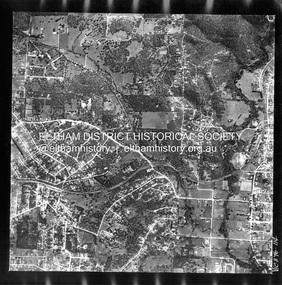
... Eltham District Historical Society Inc 728 Main Rd Eltham melbourne Centred on present day Mount Plaeasant Road near Dalton Street, Eltham bounded by Luck Street to north, Eltham Lower Park to south, Reynolds Road to east and Central Park to west Historic Aerial Imagery Source: Landata.vic.gov.au Aerial Photo Details: Project No :250 Project : MELBOURNE OUTER SUBURBS PROJECT Run : 18 Frame : 93 Date : 02/1956 Film Type : B/W Camera : EAG9 Flying Height : 10000 Scale : 12000 Film Number : 1176 GDA2020 : 37°43'02"S, 145°09'38"E MGA2020 : 337871, 5823961 (55) Melways : 22 B6 (ed. 42) Aerial Photo 1956-02 Neil Webster Collection Eltham Central Park Eltham Lower Park Luck Street Melway 22B6 Nyora Road Reynolds Road Dalton Street Mount Pleasant Road Digital jpg and electronic PDF file Eltham Photograph Aerial Photograph Landata ...Centred on present day Mount Plaeasant Road near Dalton Street, Eltham bounded by Luck Street to north, Eltham Lower Park to south, Reynolds Road to east and Central Park to west Historic Aerial Imagery Source: Landata.vic.gov.au Aerial Photo Details: Project No :250 Project : MELBOURNE OUTER SUBURBS PROJECT Run : 18 Frame : 93 Date : 02/1956 Film Type : B/W Camera : EAG9 Flying Height : 10000 Scale : 12000 Film Number : 1176 GDA2020 : 37°43'02"S, 145°09'38"E MGA2020 : 337871, 5823961 (55) Melways : 22 B6 (ed. 42)aerial photo, 1956-02, neil webster collection, eltham, central park, eltham lower park, luck street, melway 22b6, nyora road, reynolds road, dalton street, mount pleasant road -
 Eltham District Historical Society Inc
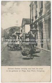
Photograph - Postcard, Chinese Coolies carrying coal from the ships to the godowns on Praya, East Point, Hongkong, c.1910s - c.1920s
... Rd Eltham melbourne Published by M. Sternberg, Wholesale and Retail Postcard Dealer at No. 51 Queen's Road Central and at No. 34 Queen's Road Central, Kongkong. ...Published by M. Sternberg, Wholesale and Retail Postcard Dealer at No. 51 Queen's Road Central and at No. 34 Queen's Road Central, Kongkong.This item, a souvenir from Hongkong from between the wars (circa 1923) was brought home to Research, Victoria by Bill Teagle who was serving in the Royal Australian Navy (1919-1945). According to Bill's neice Valerie Waller (nee Feldbauer, daughter of Violet and Theodore 'Curly' Feldbauer), her Uncle Bill would always bring some sort of souvenir home from his travels for family members. The item ( along with a series of postcards from Japan of the Great Kanto Earthquake of 1 September 1923) was possibly given by Bill Teagle to his sister Margaret Rose (formerly Ingram) who later married Richard Edward (Eddie) Fielding in early 1948. (Eddie had been engaged to someone else before he went to war, but his fiancée broke it off before his return to Australia.) It was cared for by the Teagle/Fielding family for approximately one hundred years. It is of particular significance given the family's connection to the Eltham War Memorial through 'Curly' Feldbauer and the significance of that memorial to the local community and represents that despite the horrors of war, former friends then foes can become friends again.tom fielding collection, postcard, hongkong, m. sternberg -
 Eltham District Historical Society Inc
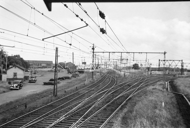
Photograph, George Coop, View looking south from the Newport Signal Box, Newport Railway Station, c.1951
... Eltham District Historical Society Inc 728 Main Rd Eltham melbourne The pair of lines running to trhe left head to Williamstown. the central pair of lines are heading into the Newport Workshops and various stored trains are visible in the background and the pair of lines diverging to the right are heading to Geelong. ...The pair of lines running to trhe left head to Williamstown. the central pair of lines are heading into the Newport Workshops and various stored trains are visible in the background and the pair of lines diverging to the right are heading to Geelong. One of several photos at Newport taken the same day in the early 1950s when George Coop was a secondary school student.Digital TIFF file Scan of Kopdak 620 black and white negative transparencygeorge coop collection, newport railway station, newport signal box -
 Eltham District Historical Society Inc
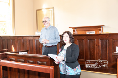
Photograph, Peter Pidgeon, Official opening of the restored Eltham Courthouse, 730 Main Road, Eltham, 23 Mar 2022
... Eltham District Historical Society Inc 728 Main Rd Eltham melbourne Eltham Courthouse Officially Reopened (Jim Connor, EDHS Newsletter No. 263 April 2022) In the Conservation Management Plan prepared in 2006 for the Eltham Justice Precinct there is mention that more than 350 court houses have been built by the Public Works Department since 1856, when the Department was established. It also states Eltham was in an early group of 'Victorian Free Classical' structures, featuring a projecting entry porch and gabled roof. Characteristically, this group shares a simple, rectangular shape, central ...Eltham Courthouse Officially Reopened (Jim Connor, EDHS Newsletter No. 263 April 2022) In the Conservation Management Plan prepared in 2006 for the Eltham Justice Precinct there is mention that more than 350 court houses have been built by the Public Works Department since 1856, when the Department was established. It also states Eltham was in an early group of 'Victorian Free Classical' structures, featuring a projecting entry porch and gabled roof. Characteristically, this group shares a simple, rectangular shape, central placement of the court room with smaller-scale offices set back at the sides or rear of the court room, arched openings, and decorative string courses. The Statement of Significance listed in the Victorian Heritage Register states: ‘The Eltham Court House dates from the time when the town was largely self-contained. It was initiated in response to itinerant gold prospectors who turned to crime when their quest was unsuccessful. This type of localised solution is characteristic of the self reliance preserved in Eltham today. The court house is an important symbol of the spirit which makes Eltham distinctive as a community.’ It also states: ‘The Eltham Court House, built in 1860, is one of only two intact examples in the state of this simple design with projecting entry.’ So with this background it is most appropriate this valued historic building has recently been the subject of a total restoration, as detailed in previous newsletters. This was a major project undertaken by Nillumbik Shire Council. At a small function in the Eltham Courthouse, on 23rd March 2022, Nillumbik Shire Council Mayor Fran Eyre declared the fully restored building officially reopened. In doing so the Mayor spoke about the earlier law and order function of the court and the importance of this building to the Eltham community. Wingrove Ward Councillor Geoff Paine then highlighted the importance of historical societies and groups within the shire and their valued activities in recording and preserving their local history. EDHS president Jim Connor thanked everyone involved with the project and provided an overview of the history of the courthouse. Michael Ioannides, Council’s project manager, spoke about how the restoration process proceeded and those involved in undertaking the works required. Cr. Natalie Duffy, various council officers, EDHS executive committee members, as well as representatives of the head contractor Ducon Building Services and the heritage advisors, RBA architects and Conservation Consultants, were also in attendance, as was a representative of Nillumbik U3A. After the formal part there was some light hearted interpretation of how past legal proceedings may, or may not have, occurred within this courthouse, before some refreshments were shared in the former second courthouse at the rear, which is now utilised by Nillumbik U3A. This was a successful celebration of a very worthwhile project.Born digital image (38)conservation consultants, cr. geoff paine, cr. natalie duffy, ducon building services, eltham courthouse, eltham district historical society, eltham justice precinct, jim connor, mayor cr. fran eyre, michael ioannides, nillumbik shire council, nillumbik u3a, opening ceremony, rba architects, restoration project -
 Eltham District Historical Society Inc
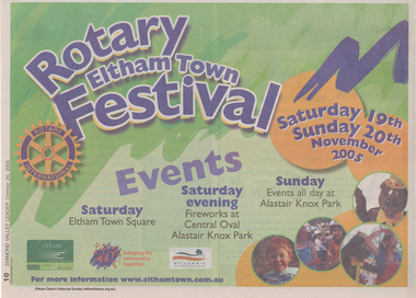
Newspaper - Newspaper clipping, Diamond Valley News, Advertisement; Events, Rotary Eltham Town Festival 19-20 November 2005, Diamond Valley Leader, 26 October 2005, p10, 26 Oct 2005
... Eltham District Historical Society Inc 728 Main Rd Eltham melbourne Advertising for 2005 Eltham Festival held Saturday 19th and Sunday 20th November at Eltham Town Square, fireworks at Central Oval/Alistair Knox Park and events all day Sunday at Alistair Knox Park eltham festival 2005 Eltham Community Festival Rotary Club of Eltham Rotary Eltham Town Festival Newsprint Advertisement; Events, Rotary Eltham Town Festival 19-20 November 2005, Diamond Valley Leader, 26 October 2005, p10 Newspaper Newspaper clipping Diamond Valley News ...Advertising for 2005 Eltham Festival held Saturday 19th and Sunday 20th November at Eltham Town Square, fireworks at Central Oval/Alistair Knox Park and events all day Sunday at Alistair Knox ParkNewsprinteltham festival, 2005, eltham community festival, rotary club of eltham, rotary eltham town festival -
 Eltham District Historical Society Inc
Photograph - Aerial Photograph, Montmorency Shopping Village, Were Street, Montmorency, 1994
... Eltham District Historical Society Inc 728 Main Rd Eltham melbourne Aerial photographs of Montmorency Shopping Village with a central focus on the former Montmorency Theatre and Bingo Hall situated at 41-43 Werte Street. ...Aerial photographs of Montmorency Shopping Village with a central focus on the former Montmorency Theatre and Bingo Hall situated at 41-43 Werte Street. In 1993 Eltham Shire Council issued a permit to Michael Muzur, Terry Lant and Andrew McMillan to redevelop the former Montmorency Theatre/Bingo Hall at 41-43 Were Street as an alcohol-free youth entertainment centre. Ron McCormack, retired former JP on behalf of 41 Joint Appellants consisting of local residents and traders successfully lobbied the community and won an Appeal to have the permit cancelled as unsuitable development. The Administrative Appeal Tribunal found that the proposed development came withing the Eltham Planning Scheme definition of an 'amusement parlour' and that the playing of pool an amusement machines would be the focus of the centre and unlikely to attract older age groups. The tribunal was not satisfied the applicants had sufficient knowledge or where with all required for the successful running of this type of operation. With respect to the objectors, the Tribunal did not accept that a responsibly managed and attractive amusement parlour could not coexist near the adjoining residential area and without detriment to the commercial centre. At a Council meeting on June 7, 1994 councillors requested a report outlining criteria to be used to assess planning applications for youth entertainment venues given the Tribunal's view that a poorly managed facility in a small neighbourhood shopping centre, particularly in such close proximity to a residential area would not only have the potential to increase perceived youth problems, but could jeopardise the prospects of future proposals. Ron McCormack moved to Montmorency from Coburg in the early 1980s and from then sat on the bench at Eltham Courthouse when Police requested assistance out of hours, until the eventuial closure of the Courthouse. montmorency theatre, montmorency bingo hall, 41-43 were street, youth entertainment centre, eltham shire council, planning permit, administrative appeals tribunal, ron f mccormack, aerial photograph