
Showing 26 items matching "charts maps plans"
-
 Port Melbourne Historical & Preservation Society
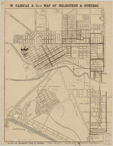
Photograph - Map of Melbourne and Suburbs - W Fairfax & Co, c 1890
... ...Charts Maps Plans...Sandridge / Port Melbourne Map Charts Maps Plans Built Environment Photograph in black and white, partly effected by some markings in watercolour. ...This map was printed and published by W Fairfax & Co and was an inclusion in Bradshaw's Guide to Victoria which was a monthly colonial travel handbook and railway timetable published in Melbourne from 1856 to 1942. A handwritten note at the bottom right of the map suggests it's date as "1860?". This date is doubtful as the map's description includes the suburb of North Melbourne, this name dates only to 1887 prior to that it was known as Hotham. However the map uses the name Sandridge which was changed to Port Melbourne in 1884, so it is most likely a reprint of an earlier map (perhaps 1860) which has only been partially updated in terms of suburb names. The map includes Melbourne and surrounding suburbs including Sandridge, Emerald Hill, St Kilda, Windsor, Prahran, Richmond and Collingwood.Photograph in black and white, partly effected by some markings in watercolour.sandridge / port melbourne map, charts maps plans, built environment -
 Port Melbourne Historical & Preservation Society
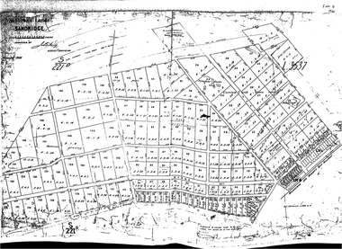
Photograph - Map of allotments Sandridge (West), Nov 1866
... ...Charts Maps Plans...Local Government - Borough of Sandridge Charts Maps Plans Fishermans Bend Built Environment Single black and white photo Photograph Map of allotments Sandridge (West) ...This is a survey map of the western side of Sandridge which is dated November 1866. The layout of allotments as proposed in this map largely did not proceed as shown. The survey was prepared by John Hardy - Assistant Survey.Single black and white photolocal government - borough of sandridge, charts maps plans, fishermans bend, built environment -
 Mrs Aeneas Gunn Memorial Library
Book, McMillan and Co et al, The cruise of Her Majesty's ship Bacchante, 1879-1882 v.1, 1886
... Ill, charts, maps, plans, p.675....Australia - Description and Travel Voyages around the world A description of a world cruise taken by Prince Albert Victor and Prince George of Wales. Ill, charts, maps, plans, p.675. The cruise of Her Majesty's ship Bacchante, 1879-1882 v.1. ...A description of a world cruise taken by Prince Albert Victor and Prince George of Wales.Ill, charts, maps, plans, p.675.non-fictionA description of a world cruise taken by Prince Albert Victor and Prince George of Wales.australia - description and travel, voyages around the world -
 Mrs Aeneas Gunn Memorial Library
Book, McMillan and Co et al, The cruise of Her Majesty's ship Bacchante, 1879-1882 v.2, 1886
... Ill, charts, maps, plans, p.803....Australia - Description and Travel Voyages around the world A description of a world cruise taken by Prince Albert Victor and Prince George of Wales. Ill, charts, maps, plans, p.803. The cruise of Her Majesty's ship Bacchante, 1879-1882 v.2. ...A description of a world cruise taken by Prince Albert Victor and Prince George of Wales.Ill, charts, maps, plans, p.803.non-fictionA description of a world cruise taken by Prince Albert Victor and Prince George of Wales.australia - description and travel, voyages around the world -
 Victorian Aboriginal Corporation for Languages
Book, Private lives, public records : family history resources at Public Record Office Victoria, 2003
... colour photographs, b&w photographs, charts, letters, records, maps, plans...genealogy local history family history public records bibliographies catalogues Victorian history colour photographs, b&w photographs, charts, letters, records, maps, plans Intended as a key resource for both first-time and experienced genealogists. ...Intended as a key resource for both first-time and experienced genealogists. It offers an introduction to the role, services and collection of Public Record Office Victoria, and a guide for family history researchers using the archives.colour photographs, b&w photographs, charts, letters, records, maps, plansgenealogy, local history, family history, public records, bibliographies, catalogues, victorian history -
 Melbourne Tram Museum
Document - Report, Hawthorn Tramways Trust (HTT), "Hawthorn Tramways Trust - Report and Statement of Accounts, Dec. 1919
... Appendices includes the Engineers and Manager's Report, Statistics, accounts, funding, auditor reports various charts and maps. Includes a plan of the track reconstruction - cross section - see image i2 Audited by R. ...Appendices includes the Engineers and Manager's Report, Statistics, accounts, funding, auditor reports various charts and maps. Includes a plan of the track reconstruction - cross section - see image i2 Audited by R. ...Photocopy of Report - 27 foolscap pages - titled "Hawthorn Tramways Trust - Report and Statement of Accounts for Twelve Months ending 30th September 1919" Gives listings of Trust Members and Officers, Per way issues, Rollingstock, MMTB formation, coal and power supply problems, wages, fares, track problems Finance, Operation and General matters, finance statements, balance sheet and Auditors Report. Appendices includes the Engineers and Manager's Report, Statistics, accounts, funding, auditor reports various charts and maps. Includes a plan of the track reconstruction - cross section - see image i2 Audited by R. Oehr and L. CallawayHas the stamp of the Tramway Museum Society on the rear of the first page.trams, tramways, htt, reports, construction, finances, operations, mmtb -
 Flagstaff Hill Maritime Museum and Village
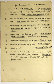
Document - Report, Jet Probings, Warrnambool Harbour, 16-10-1929
... The results could determine plans for future engineering works. document depth warrnambool harbour 1929 soundings jet probe jet probing seabed map of seabed underwater engineering warrnambool jetty warrnambool breakwater breakwater upgrade leading lights chart the harbour Flagstaff Hill Warrnambool Flagstaff Hill Maritime Museum & Village Maritime Museum Maritime Village shipwreck coast Lady Bay Port of Warrnambool Breakwater Jetty Pier VHR H2024 Royal Commission 1923 Public Works Water Commission Harbour Trust Victorian Harbours Report, titled 'Jet Probings, Warrnambool Harbour'. ...This report lists the depths of water and the consistency of the seabed surrounding the Warrnambool Harbour in October 1929, The information, often referred to as 'soundings', was obtained by Jet Probing,. In earlier days a lead line was used to perform a similar task. The author of the document is unknown. Jet Probing is a method used for underwater archaeology, cable installation and coastal engineering. A jet probe is a machine that produces a strong jet of water that penetrates the layers of sediment on the seabed, determining their depth, thickness and consistency. It provides a survey of the seabed and can be used as an aid to engineering design and construction. The report mentions lining up with the wooden jetty, the end of the breakwater and the leading lights. It mentions sand, loose rock and rock. It tells of stopping work due to the water being too rough, the pipe choking, difficulty in connecting pipes, and pipe joint breaking as it tried to get through the sand, The report in the document is significant for its connection with the Warrnambool Harbour, Warrnambool Breakwater, Warrnambool Jetty and Lady Bay. The report gives figures for the depth and consistency of the water and seabed at a particular point in time and can be used to compart with similar figures taken at different times. The results could determine plans for future engineering works.Report, titled 'Jet Probings, Warrnambool Harbour'. Two pages of cream coloured paper with hand written notes in pen and ink. Report covers three days of Jet Probings, with resulting figures and comments, for the depths of the surroundings of the Warrnambool Harbour. The report is in point form, with some underlining. Dates of recordings are 14-10-29, 15-10-29 and 16-10-29. (1929) The situation of the harbour had become a real problem by 1910 and required continuous dredging. In 1914 the Breakwater was extended but proved to be a failure because the work began to subside and by 1920 about two thirds of the harbour was silted up. Alterations made in the 1920's increased the silting problem. The soundings and Jet Probings were done after the Royal Commission of 1923, when the damaged stonework on the seaward side of the Warrnambool Breakwater, caused by the action of the sea, was the subject of enquiry. A conference between the Public Works, Water Commission and the Harbour Trust concluded that it would less costly to make repairs to prevent further damage rather than replaced the damage portion of the wall. A contract was raised in late 1924 to deposit rubble on the damaged side of the breakwater to minimise the Southern Ocean’s destructive action and work had started by August 1925. By the 1940's the harbour was no longer used. More alterations were made in the 1950's and 1960's. document, depth, warrnambool harbour, 1929, soundings, jet probe, jet probing, seabed, map of seabed, underwater engineering, warrnambool jetty, warrnambool breakwater, breakwater upgrade, leading lights, chart the harbour, flagstaff hill, warrnambool, flagstaff hill maritime museum & village, maritime museum, maritime village, shipwreck coast, lady bay, port of warrnambool, breakwater, jetty, pier, vhr h2024, royal commission, 1923, public works, water commission, harbour trust, victorian harbours -
 Flagstaff Hill Maritime Museum and Village
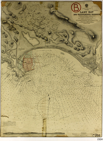
Document - Navigation Chart, Admiralty Office, Lady Bay and Warrnambool Harbour, 1893
... Map...chart...Navigation chart...plan...The chart is a historical record of structures existing in 1893; the Warrnambool Jetties, Warrnambool Breakwater in Lady Bay, the leading lights (lighthouses), streets, roads, bridges and many buildings. It also shows the lay of the land and seabed. Flagstaff Hill Warrnambool Flagstaff Hill Maritime Museum & Village Maritime Museum Maritime Village shipwreck coast Map chart Navigation chart plan ...This navigation cart of Lady Bay and Warrnambool Harbour was originally surveyed in 1870 but this version includes the update for magnetic variation in 1893. Since the printing of the chart several annotations have been added. These include an additional stamp dated 15-8-1910, a handwritten comment across the top of the page dated August 1910, and another handwritten comment regarding the ‘Proposed Extension of Dock’ dated 19-2-1925, plus connected drawings, notes and figures. The 1925 proposal on this chart may have been a reaction to the Royal Commission of 1923, when the damaged stonework on the seaward side of the Warrnambool Breakwater, caused by the action of the sea, was the subject of enquiry. A conference between the Public Works, Water Commission and the Harbour Trust concluded that it would less costly to make repairs to prevent further damage rather than replaced the damage portion of the wall. A contract was raised in late 1924 to deposit rubble on the damaged side of the breakwater to minimise the Southern Ocean’s destructive action and work had started by August 1925. The Breakwater construction had begun in 1874 and was completed in 1890. The Victorian Government had commissioned Sir John Coode, a British harbour engineer, to present a plan to complete the Warrnambool Breakwater but his original plan was too expensive. He prepared a revised plan for a shorter structure. The construction proved to be too short to protect adequately from the weather and didn't allow enough depth for larger vessels to come into port. The decreasing trade was further affected by siltation in the bay due to the breakwater, and the completion of the railway line. The situation of the harbour became a real problem by 1910 and required continuous dredging. In 1914 the Breakwater was extended but proved to be a failure because the work began to subside and by 1920 about two thirds of the harbour was silted up. Alterations made in the 1920's increased the silting problem and by the 1940's the harbour was no longer used. More alterations were made in the 1950's and 1960's. This chart is significant for its strong connection to the maritime history of Warrnambool Harbour and Lady Bay and the Warrnambool Breakwater. The Warrnambool Breakwater is registered as a place of significance on the Victorian Heritage Database (VHR H2024). The Warrnambool Breakwater is one of the most important late 19th century maritime engineering projects in Victoria and significant in the development of Victorian coastal shipping. It is also significant for its connection with British harbour engineer, Sir John Coode. The chart is a historical record of structures existing in 1893; the Warrnambool Jetties, Warrnambool Breakwater in Lady Bay, the leading lights (lighthouses), streets, roads, bridges and many buildings. It also shows the lay of the land and seabed. Navigation Chart: Lady Bay and Warrnambool Harbour, Australia - South Coast - Victoria. Surveyed by Nav. Lieut. H.J. Stanley, R.N., 1870. Updated for Magnetic Variation, 1893. The rectangular chart is printed on heavy cream paper. Stamps are shaped rectangular, oval and round. Around the Breakwater and Jetty area are handwritten notes, dotted and joined lines, numbers and signatures, and shading of red and green. The chart shows the surrounds of Warrnambool Harbour, Lady Bay, the Breakwater and Jetty, roads, bridges and the streets in Warrnambool. It has sounding details, and angles of line from the leading lights.Stamp, rectangular, including "AUG 1910" Stamp, double oval " - - - -CHART" Stamp, hand drawn, red circle, with "B" inside Hand written note "22-8-1910 - - - - - of surveying C. Ca - - - request of 15-8-10 [initials] " Notes and lines in red pen, including a grid of sounding numbers: "1300" "1050" "1200" "Possible Extension of Dock" "19-2-25" "Dock Dredged to 20 Ft" Notes and lines in blue pen "Extension of Dock to accommodate vessels drawing 20 Feet" and "Light not visible south of this line" Red dots (4) with yellow highlight at both leading lights, breakwater and jettyflagstaff hill, warrnambool, flagstaff hill maritime museum & village, maritime museum, maritime village, shipwreck coast, map, chart, navigation chart, plan, lady bay, warrnambool harbour, port of warrnambool, breakwater, jetty, pier, dock extension, proposed extension, vhr h2024, 1870, 1893, 1910, 1925, warrnambool town late 1800s, warrnambool streets late 1800s royal commission, 1923, public works, water commission, harbour trust, victorian harbours, sir jon coode -
 Flagstaff Hill Maritime Museum and Village
Document - Plan, Victorian Harbours Warrnambool, Victorian Harbours, Warrnambool, Plan to Accompany Sir John Coode's Report, 28-02-1879
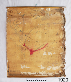
... plan of warrnambool...victorian harbours...warrnambool harbour...warrnambool breakwater...port of warrnambool...vhd vhr h2024...Flagstaff Hill Maritime Museum & Village...Maritime Village...Map...chart...While the Warrnambool Breakwater is a demonstration of the engineering skills of the nineteenth century, it also demonstrates the limitations of knowledge relating to sedimentology at the time and the confidence apparent in a number of nineteenth century plans which assumed that natural forces could be overcome or contained by engineering. flagstaff hill warrnambool maritime museum shipwreck coast great ocean road sir john coode borough of warrnambool surveyor plan of warrnambool victorian harbours warrnambool harbour warrnambool breakwater port of warrnambool vhd vhr h2024 Flagstaff Hill Maritime Museum & Village Maritime Village Map chart plan Lady Bay Breakwater Jetty Pier VHR H2024 proposed works 1879 Stamped "VICTORIAN HARBOURS / WARRNAMBOOL / PLAN / to accompany / SIR JOHN GOODE'S REPORT / DATED 28 FEB 1879" Signature "John Coode" Plan of Warrnambool Harbour, Port of Warrnambool, dated 28 Feb 1879. ...This plan is of great significance to the local history of Warrnambool, in particular the Breakwater and its impact on Warrnambool's maritime and trade history. The plan shows the existing jetties at the Port of Warrnambool, plus the partially erected Breakwater and proposed works to the Breakwater by both the Borough of Warrnambool Surveyor and Sir John Coode. The plan was signed 28th February 1879 by Sir John Coode. The legend at the bottom left describes the existing works and the proposed works. The Warrnambool Breakwater Sir John Coode was a British harbour engineer. He was brought to Melbourne by the Melbourne Harbour Trust to advise on works to improve the Port of Melbourne. The Victorian Government commissioned him to present a plan to complete the Warrnambool Breakwater. His original plan was too expensive so he prepared a revised plan for a shorter structure. The work was completed in 1890. The construction proved to be too short to protect adequately from the weather and didn't allow enough depth for larger vessels to come into port. The decreasing trade was further affected by siltation in the bay due to the breakwater, and the completion of the railway line. The situation of the harbour became a real problem that, by 1910, required continuous dredging. In 1914 the Breakwater was extended but proved to be a failure because the work began to subside and by 1920 about two thirds of the harbour was silted up. Alterations made in the 1920's increased the silting problem and by the 1940's the harbour was no longer used. More alterations were made in the 1950's and 1960's. The Warrnambool Breakwater is registered as a place of significance on the Victorian Heritage Database. This plan of the proposed works for the existing Warrnambool Breakwater is of great significance to the local history of Warrnambool, in particular the Breakwater and its impact on Warrnambool's maritime and trade history. The Warrnambool Breakwater is registered as a place of significance on the Victorian Heritage Database (VHR H2024). It is historically significant to Victoria as one of the most important maritime engineering projects in Victoria in the late 19th century. The Warrnambool Breakwater is of historical significance as one of the most important maritime engineering projects in Victoria in the late nineteenth century. It is evidence of Victoria's nineteenth century investment in regional port infrastructure and the development of Victorian coastal shipping. It is of significance for its association with the English civil engineer Sir John Coode, the most distinguished harbour engineer of the nineteenth century, who was brought to Victoria to advise on works to improve the Port of Melbourne, but was retained by the Government to advise on improvements to the harbours at Portland, Geelong, Port Fairy, and Lakes Entrance, as well as Warrnambool. His projects for Melbourne, Lakes Entrance and Warrnambool were major engineering projects of the nineteenth century. The breakwater is historically significant as a reminder of Warrnambool's early maritime history as a Western District port, and as one of Victoria's major 'outer ports'. While the Warrnambool Breakwater is a demonstration of the engineering skills of the nineteenth century, it also demonstrates the limitations of knowledge relating to sedimentology at the time and the confidence apparent in a number of nineteenth century plans which assumed that natural forces could be overcome or contained by engineering.Plan of Warrnambool Harbour, Port of Warrnambool, dated 28 Feb 1879. Plan shows existing Breakwater and work proposed by both Warrnambool Borough Surveyor and Sir John Coode. Plan has gold coloured quarter-dowel rods top and bottom and a metal ring at the top. Stamped with title. Signed by Sir John Coode.Stamped "VICTORIAN HARBOURS / WARRNAMBOOL / PLAN / to accompany / SIR JOHN GOODE'S REPORT / DATED 28 FEB 1879" Signature "John Coode"flagstaff hill, warrnambool, maritime museum, shipwreck coast, great ocean road, sir john coode, borough of warrnambool surveyor, plan of warrnambool, victorian harbours, warrnambool harbour, warrnambool breakwater, port of warrnambool, vhd vhr h2024, flagstaff hill maritime museum & village, maritime village, map, chart, plan, lady bay, breakwater, jetty, pier, vhr h2024, proposed works, 1879 -
 Orbost & District Historical Society
map, 1985
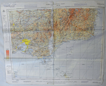
... map of eastern Victoria. A World Aeronautical Chart. It shows elevations, longitude etc and is designed for pre-flight planning as well as pilotage. ...map of eastern Victoria. A World Aeronautical Chart. It shows elevations, longitude etc and is designed for pre-flight planning as well as pilotage. map C.J.Thompson ...An aeronautical chart is a map designed to assist in navigation of aircraft. Using these charts and other tools, pilots are able to determine their position, safe altitude, best route to a destination, navigation aids along the way, alternative landing areas in case of an in-flight emergency, and other useful information such as radio frequencies and airspace boundaries. World aeronautical charts have a scale of 1:1,000,000 and cover relatively large areas. Orbost Aero Club began in 1969 with Basil Dowie as Chair, David Nixon as Secretary/Treasurer. The group went into recess from 1977-1991 closing in 1997. The mid 1960s were boom years in flying training in Australia and the number of Aero Clubs grew rapidly. The Club played a significant role in the establishment of the small airport at Marlo and in the ongoing operation and development of the airport over the years particularly for patient transfer by aerial ambulance. The Orbost Aero Club Club played a significant role in the establishment of the small airport at Marlo and in the ongoing operation and development of the airport over the years.A laminated map of eastern Victoria. A World Aeronautical Chart. It shows elevations, longitude etc and is designed for pre-flight planning as well as pilotage. Top left hand corner - D.F.N.Nixon VH-FWD 12 Kristine Ct Cheletenham 27/7/87orbost-aero-club aeronautical-map -
 Bendigo Military Museum
Map - RASvy " Map Makers Exhibition 2025 "- Map display, RAN Hydrographic Office, 1972 - 1992
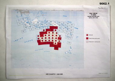
... CHART. NP 43-7 SOLOMON ISLANDS. MERCATOR PROJECTION. Used for the planning of RAAF flights. .6 RAAF AIR STAFF PLANNING CHART NS 137-1 DARWIN NORTH WEST. AZIMUTHAL EQUIDISTANT PROJECTION. This series of charts were used for planning by the staff. The whole chart was produced by joining the four quadrant maps...CHART. NP 43-7 SOLOMON ISLANDS. MERCATOR PROJECTION. Used for the planning of RAAF flights. .6 RAAF AIR STAFF PLANNING CHART NS 137-1 DARWIN NORTH WEST. AZIMUTHAL EQUIDISTANT PROJECTION. This series of charts were used for planning by the staff. The whole chart was produced by joining the four quadrant maps ...All of these Charts / Maps were used for the RSL Museum display " The Mapmakers " ( of RASvy. ) 10 Jun - 10 Aug 2025. .1 Catalogue of Tactical Pilotage Charts, 1:500 000 Scale. Digital Data Base available as at 30Jun 92. This catalogue page shows the extent of the Australian area of responsibility for aeronautical charting. .2 RAAF PLOTTING CHART. NP 22-2 (Navigational Plotting) Tasmania. MERCATOR PROJECTION. This series of charts were used for the training of RAAF Navigators. These charts were produced and printed at the Army Survey Regiment, Bendigo. .3 RAAF PLOTTING CHART AUSTRALIA - SOUTHEAST. NP 27 is Based on LAMBERT CONFORMAL CONIC PROJECTION. This series of charts was used by RAAF Navigators for the planning of RAAF flights. These charts were produced and printed at the Army Survey Regiment, Bendigo. .4 RAAF LONG RANGE PLOTTING CHART. NP 43-4 AUSTRALIA WESTERN. MERCATOR PROJECTION. This series of maps were used for the planning of RAAF flights. Of Particular note these charts were used to plot "Rhumb Lines or loxodromes" where a course crosses all Meridians (Lines of latitude and longitude) at the same angle. On Mercator projection charts Rhumb lines are conveniently shown as straight lines and are also lines of constant compass bearing. Rhumb lines are usually longer than the shortest distance between two points. The shortest distance between two points on the earth's surface is called a "Great Circle Route" which is a route on a circular path on the surface of the earth where the centre of that circle is also the centre of the earth. Great Circle Routes on a Mercator Projection are however curves and harder to plot. These charts were produced and printed at the Army Survey Regiment, Bendigo. .5 RAAF LONG RANGE PLOTTING CHART. NP 43-7 SOLOMON ISLANDS. MERCATOR PROJECTION. Used for the planning of RAAF flights. .6 RAAF AIR STAFF PLANNING CHART NS 137-1 DARWIN NORTH WEST. AZIMUTHAL EQUIDISTANT PROJECTION. This series of charts were used for planning by the staff. The whole chart was produced by joining the four quadrant maps together. The charts are based on a single point of tangency (in this case Darwin) and shows radius (distance) in nautical miles to and from that point. A series of charts were produced centred on each of the major airfields in Northern Australia. These charts were produced and printed at the Army Survey Regiment, Bendigo. .7 RAAF AIR STAFF PLANNING CHART NS 137-2 DARWIN NORTH EAST. AZIMUTHAL EQUIDISTANT PROJECTION. Used for the planning by the staff. The charts are based on a point of tangency and show radius in nautical miles. .8 RAAF AIR STAFF PLANNING CHART NS 137-4 DARWIN SOUTH WEST. AZIMUTHAL EQUIDISTANT PROJECTION. Used for the planning by the staff. The charts are based on a point of tangency and show radius in nautical miles. .9 RAAF AIR STAFF PLANNING CHART NS 137-3 DARWIN SOUTH EAST. AZIMUTHAL EQUIDISTANT PROJECTION. Used for the planning by the staff. The charts are based on a point of tangency and show radius in nautical miles. .10 TACTICAL PILOTAGE CHART. TPC R-13B. LAMBERT CONFORMAL PROJECTION. Used by pilots for flight planning and could be used in flight if necessary for visual navigation using major ground features shown on the chart. These charts also contained aeronautical information such as airfields, radio navigation beacons and obstructions. Contours and height information was shown in feet to be compatible with aircraft altimeters. Each graticule square also contained a Maximum Safe Elevation Figure (MEF) also in feet. Coverage of this series over Australia's area of interest were produced and printed at the Army Survey Regiment, Bendigo. .11 HYDROGRAPHIC CHART. AUS 158. PORT PHILLIP SOUTH and WEST CHANNELS. PROJECTION TRANSVERSE MERCATOR. Used by all people needing to navigate a vessel. Hydrographic charts were printed at the Army Survey Regiment, Bendigo. .12 HYDROGRAPHIC CHART. AUS 157. GEELONG HARBOUR and APPROACHES. PROJECTION TRANSVERSE MERCATOR. Used by all people needing to navigate a vessel. .13 EN ROUTE CHART. AUSTRALIA ERC HIGH. H1 and H2. LAMBERT CONFORMAL CONIC PROJECTION. This series of charts were regularly produced by the RAAF Aeronautical Information Service (AIS) and contained current aeronautical information for pilots. These charts were printed at the Army Survey Regiment, Bendigo..1 Tactical Pilotage Chart Series Catalogue. Current as at 30 Jun 92. .2 Extract of Navigational Plotting Chart " NP22-2 Tasmania " .3 Extract of Navigational Plotting Chart " NP 27 RAAF PLOTTING CHART AUSTRALIA - SOUTHEAST " .4 Extract of Navigational Plotting Chart " RAAF LONG RANGE PLOTTING CHART NP43-4 AUSTRALIA WESTERN " .5 Extract of Navigational Plotting Chart " RAAF LONG RANGE PLOTTING CHART NP43-7 SOLOMON ISLANDS " .6 Extract of Navigational Series " RAAF AIR STAFF PLANNING CHART NS 137-2 DARWIN NORTH WEST " .7 Extract of Navigational Series " RAAF AIR STAFF PLANNING CHART NS 137-1 DARWIN NORTH EAST " .8 Extract of Navigational Series " RAAF AIR STAFF PLANNING CHART NS 137-4 DARWIN SOUTH WEST " .9 Extract of Navigational Series " RAAF AIR STAFF PLANNING CHART NS 137-3 DARWIN SOUTH EAST " .10 Extract of Tactical Pilotage Chart " TPC R-13B " .11 Extract of Hydrographic Chart " PORT PHILLIP SOUTH and WEST CHANNELS " .12 Extract of Hydrographic Chart " GEELONG HARBOUR and APPROACHES " .13 Extract of En Route Chart " AUSTRALIA ERC HIGH " " H1 and H2 " royal australian survey corps, rasvy, fortuna, detachment - army survey regiment, army svy regt, asr -
 Bendigo Military Museum
Administrative record - American - Australian Officer Exchange - Mid Tour Report ASR 1981, Major D Bowen US Army Corps of Engineers, Major David Bowen US Army Corps of Engineers, 07.1981
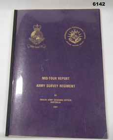
... Army Survey Regiment Organisation Chart, "Map Production Story"- 8 pages, Bowen to Gram No1- WestPoint to Australia 2 pages, Enclosure 9 - Use Addresses (USA). Armed Forces of Australia - Badges of Rank, Enclosure 5 - Recommended Changes 2 pages, Enclosure 6 - Technical Services R&D Tasks, Married Quarter Floor Plan....Army Survey Regiment Organisation Chart, "Map Production Story"- 8 pages, Bowen to Gram No1- WestPoint to Australia 2 pages, Enclosure 9 - Use Addresses (USA). Armed Forces of Australia - Badges of Rank, Enclosure 5 - Recommended Changes 2 pages, Enclosure 6 - Technical Services R&D Tasks, Married Quarter Floor Plan. ...American - Australian Officer Exchange - Mid Tour Report ASR 1981, Major D Bowen US Army Corps of Engineers. A two-year exchange program existed between the Australian Survey Corps and the US Army Corps of Engineers. This is a report by the US Exchange Officer in 1981 half way through the exchange tour.Clear film plastic covers front and back, Light Purple cardboard covers. Contains Cover Letter to American Embassy, Canberra ACT. Page 2 is Information page with references. Table of Contents page. Actual Report is pages numbered 1-19. Booklet "Lansells Fortuna (green cover edition) pages 1-16, only some pages are numbered. Army Survey Regiment Organisation Chart, "Map Production Story"- 8 pages, Bowen to Gram No1- WestPoint to Australia 2 pages, Enclosure 9 - Use Addresses (USA). Armed Forces of Australia - Badges of Rank, Enclosure 5 - Recommended Changes 2 pages, Enclosure 6 - Technical Services R&D Tasks, Married Quarter Floor Plan.royal australian survey corps, rasvy, fortuna, army survey regiment, army svy regt, asr -
 Eltham District Historical Society Inc
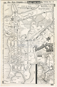
Document - Folder, Survey Maps and Technical Drawings
... Map: Yea, Victoria, Sheet 7923-I, Edition 1, Series R-754, 1:50,000, Royal Australian Survey Corps, 1961 20. World Aeronautical Chart: Darwin (3109), ICAO 1: 1,000,000, Division of National Mapping, Department of National Development, Canberra, A.C.T., Nov. 1961 21. World Aeronautical Chart: Roper River (3110), ICAO 1: 1,000,000, Division of National Mapping, Department of National Development, Canberra, A.C.T., Oct. 1962 Technical Drawings 22. House Plan...Map: Yea, Victoria, Sheet 7923-I, Edition 1, Series R-754, 1:50,000, Royal Australian Survey Corps, 1961 20. World Aeronautical Chart: Darwin (3109), ICAO 1: 1,000,000, Division of National Mapping, Department of National Development, Canberra, A.C.T., Nov. 1961 21. World Aeronautical Chart: Roper River (3110), ICAO 1: 1,000,000, Division of National Mapping, Department of National Development, Canberra, A.C.T., Oct. 1962 Technical Drawings 22. House Plan ...alan gardiner collection, maps -
 Bendigo Military Museum
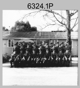
Photograph - Detachment - Army Survey Regiment, Bonegilla, Victoria, c1973
... A major focus of production in the 1970s was the cartographic completion of the Papua-New Guinea 1:100,000 map series and the Flexiflow quality control system was developed as a tool to coordinate production. The Flexiflow system comprised a series of job plans and charts linked to a task allocation to resource magnetic planning board. ...A major focus of production in the 1970s was the cartographic completion of the Papua-New Guinea 1:100,000 map series and the Flexiflow quality control system was developed as a tool to coordinate production. The Flexiflow system comprised a series of job plans and charts linked to a task allocation to resource magnetic planning board. ...This is a set of six photographs of personnel from the Detachment - Army Survey Regiment taken in front of its main map production building at Bonegilla, Victoria in c1974. This cartographic map production sub-unit of the Army Survey Regiment operated in buildings owned by the School of Military Survey from 17th of June 1970 to the 30th of September 1985. A total of 800 topographic maps ranging in scale from 1:25,000 to 1: 250,000 scale were completed. A major focus of production in the 1970s was the cartographic completion of the Papua-New Guinea 1:100,000 map series and the Flexiflow quality control system was developed as a tool to coordinate production. The Flexiflow system comprised a series of job plans and charts linked to a task allocation to resource magnetic planning board. Using critical path analysis and task prioritisation, complex job planning was efficiently scheduled, and re-prioritisations readily made. Reproduction requirements were effectively coordinated by way of weekly courier to the Army Survey Regiment at Bendigo. Supervisors and technicians fully embraced the system as they could understand their role, others around them and the positive production achievements. WO1 Bill Boyd (who does not appear in this photograph) was the technical warrant officer for 11 years at the Detachment was awarded the OAM, the Order of Australia Medal for leading the development and the implementation of the Flexiflow system. By mid-1982, production of maps at these scales was undertaken digitally on Bendigo’s AUTOMAP 2 system and the Detachment reverted to production of small-scale large format RAAF aeronautical charts. Detachment personnel managed to produce 18 charts in the following two years, which was an impressive achievement for the staff, given major differences in format, specification and scales. Development of digital production of aeronautical charts in 1984-85 led to gradual reduction in production output and contracting out production was instigated to meet the shortfall and as a consequence the Detachment closed in September 1985. See pages 177 to 180 of Valerie Lovejoy’s book 'Mapmakers of Fortuna – A history of the Army Survey Regiment’ ISBN: 0-646-42120-4. for more information on the history of the Detachment at Bonegilla.This is a set of six photographs of the Detachment - Army Survey Regiment taken in front of the main map production building at Bonegilla, Victoria in c1974. The photographs were printed on photographic paper and are part of the Army Survey Regiment’s Collection. The photographic print and proofs were scanned at 600 dpi. .1) to .3) - Photo, black & white c1973. Back Row L to R: Peter Simpson, Chris Edwards, Ted Dudzinski, Terry Genge, Colin Harden, Rowan Gillies, Bob Rowley OAM, Steve Hansen, Stu Thaxter. Centre Row L to R: Kevin Boehm, Dennis McCarthy, Peter Cross, unidentified, Brian Ryan, unidentified, Ian Marner, unidentified, Phil Smalley. Front Row L to R: Geoff Haynes, Bruce Wetzig, Dave Thompson, unidentified, OC Bob Roche, Ike Lever, John McCulloch, Dick Barwald, unidentified. .4) - Photo, black & white c1973. Back Row L to R: Peter Simpson, Chris Edwards, unidentified (x2), Colin Harden, Rowan Gillies, Bob Rowley OAM, Steve Hansen, Stu Thaxter. Centre Row L to R: Kevin Boehm, Dennis McCarthy, Peter Cross, unidentified, Brian Ryan, unidentified, Ian Marner, Phil Smalley, unidentified, Dick Barwald. Front Row L to R: Geoff Haynes, Bruce Wetzig, Dave Thompson, unidentified, OC Bob Roche, Ike Lever, John McCulloch, unidentified (x2). .5) - Photo, black & white c1973. Back Row L to R: Geoff Haynes, unidentified, John McCulloch, Bruce Wetzig. Front Row L to R: Dave Thompson, Ike Lever, unidentified. .6) - Photo, black & white c1973. L to R: OC Bob Roche, unidentified.There are no personnel annotated.royal australian survey corps, rasvy, army survey regiment, detachment - army survey regiment, army svy regt, asr -
 Bendigo Historical Society Inc.
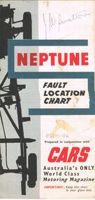
Map - J W SWATTON COLLECTION: MAPS
... Map of the City of Ballarat, Victoria, Road Condition Map of Victoria including Melbourne-Cairns & Melbourne-Adelaide, Neptune Fault Location Chart, Grampians District Map, Racv Tour Planning Map Showing Road Conditions for Victoria, NSW and Queensland and Mt Macedon & District. ...Map of the City of Ballarat, Victoria, Road Condition Map of Victoria including Melbourne-Cairns & Melbourne-Adelaide, Neptune Fault Location Chart, Grampians District Map, Racv Tour Planning Map Showing Road Conditions for Victoria, NSW and Queensland and Mt Macedon & District. ...Seven maps of various sizes. Map of the City of Ballarat, Victoria, Road Condition Map of Victoria including Melbourne-Cairns & Melbourne-Adelaide, Neptune Fault Location Chart, Grampians District Map, Racv Tour Planning Map Showing Road Conditions for Victoria, NSW and Queensland and Mt Macedon & District. Two of the maps have J W swatton & J Swatton written on them.j w swatton collection, racv, mobil, neptune, a r blair, j ewins & sons pty ltd, berry anderson & co -
 Warrnambool and District Historical Society Inc.
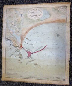
Map - Warrnambool Port 1879, 1879
... chart is somewhat faded and dirty but the main colours of red, green and brown are still clearly discernible. The title of the plan is printed in an oval inset at the top of the chart. The plan shows two possible Breakwater designs, one from the Borough Surveyor (Andrew Kerr?) and one from Sir John Coode. Map ...The port facilities in Warrnambool Bay were in constant use from the first years of Warrnambool’s settlement but there were also difficulties for the shipping trade – a small and unsafe anchorage, the lack of loading facilities and little natural protection from the southerly gales. From the 1870s on there was local agitation for some sort of Breakwater to be built and an Andrew Kerr design was approved by the Warrnambool Council but no funds were made available from the Victorian Government. Throughout the 1870s the building of a Breakwater was a major political issue in the district with preliminary work being funded and started in 1874. In 1879 the Government agreed to a further inspection of the area and an official report. Sir John Coode (1816-1892) was commissioned to make this report. He had come to Australia in 1872 to advise on harbour construction. Coode recommended a 1800 feet long Breakwater and wharf connected to the shore and it was this proposal that the plan described herein and drawn up in 1879 was to accompany. The original plan was eventually modified because of the cost and a Breakwater was completed in 1890 under the direction of the engineer, Arthur Dudley Dobson, with extensions early in the 20th century. This plan is of great interest as it shows in simple graphic form the original plans proposed by Sir John Coode for the Warrnambool Breakwater. It is therefore of great historical importance. The Breakwater was not the maritime success that it was hoped it would be but it is today a significant feature of our foreshore. This is a Plan drawn up in 1879 by Victorian Harbours to accompany Sir John Coode’s Report on the proposed Warrnambool Breakwater. The chart detail is hand-drawn and hand-tinted on canvas with the names of places, geographical and marine features and local points of interest added in print. The edges of the chart are rubbed and the chart is somewhat faded and dirty but the main colours of red, green and brown are still clearly discernible. The title of the plan is printed in an oval inset at the top of the chart. The plan shows two possible Breakwater designs, one from the Borough Surveyor (Andrew Kerr?) and one from Sir John Coode.Victorian Harbours Warrnambool Plan to accompany Sir John Coode’s report Dated 28th Feby 1879 warrnambool breakwater, andrew kerr, sir john coode, arthur dudley dobson, warrnambool, warrnambool harbour, warrnambool history, warrnambool beach -
 Sunshine and District Historical Society Incorporated
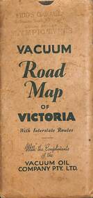
Map - Joseph 'Joe' Wlodarczyk Collection - Vacuum Road Map Of Victoria
... maps to chart their journeys, especially when venturing beyond familiar territory. Maps helped identify highways, towns, and landmarks, enabling drivers to choose efficient or scenic routes. These maps were indispensable tools for travel, planning...maps to chart their journeys, especially when venturing beyond familiar territory. Maps helped identify highways, towns, and landmarks, enabling drivers to choose efficient or scenic routes. These maps were indispensable tools for travel, planning ...Road travelers relied on foldable paper maps to chart their journeys, especially when venturing beyond familiar territory. Maps helped identify highways, towns, and landmarks, enabling drivers to choose efficient or scenic routes. These maps were indispensable tools for travel, planning, and exploration. This map also identified the location of Vacuum Oil Company Dealerships throughout Victoria. These paper-based maps were used before Global Positioning System "GPS" revolutionized navigation. - Envelope - Pidd's Garage Melbourne Road Newport Local Dealer Olympic Tyres Vacuum Road Map of Victoria with Interstate Routes with the compliments of the Vacuum Oil Company Pty Ltd. Map - Vacuum Road Guide of Victoria Visit Melbourne Centenary 1934-5 Vacuum Oil Company Pty Ltdmap, vacuum oil company, pidd's garage, melbourne road, newport, joseph 'joe' wlodarczyk -
 Clunes Museum
Map - PLAN / MAP
... .1 MAP, TOWN OF CLUNES, PARISH OF CLUNES, COUNTY OF TALBOT, STAMPED BOROUGH OF CLUNES .2 PLAN OF SUBDIVISION OF PART OF CLUNES COMMON, BOROUGH OF CLUNES, PARISH OF CLUNES,COUNTY OF TALBOT. P. CAMPBELL. ASSISTANT SURVEYOR, MARCH 1904 ON RIGHT HAND BOTTOM CORNER C71/1 CLUNES COMMON. MARKED: CHARTED...OF LANDS AND SURVEY, MELBOURNE PRICE 1/- 10.11.08 .1 MAP, TOWN OF CLUNES, PARISH OF CLUNES, COUNTY OF TALBOT, STAMPED BOROUGH OF CLUNES .2 PLAN OF SUBDIVISION OF PART OF CLUNES COMMON, BOROUGH OF CLUNES, PARISH OF CLUNES,COUNTY OF TALBOT. P. CAMPBELL. ASSISTANT SURVEYOR, MARCH 1904 ON RIGHT HAND BOTTOM CORNER C71/1 CLUNES COMMON. MARKED: CHARTED ....1 MAP, TOWN OF CLUNES, PARISH OF CLUNES, COUNTY OF TALBOT, STAMPED BOROUGH OF CLUNES .2 PLAN OF SUBDIVISION OF PART OF CLUNES COMMON, BOROUGH OF CLUNES, PARISH OF CLUNES,COUNTY OF TALBOT. P. CAMPBELL. ASSISTANT SURVEYOR, MARCH 1904 ON RIGHT HAND BOTTOM CORNER C71/1 CLUNES COMMON. MARKED: CHARTED R.L.A.7/2/57.1 PHOTO LITHOGRAPHED. DEPARTMENT OF LANDS AND SURVEY, MELBOURNE .2 PHOTO LITHOGRAPHED AT THE DEP. OF LANDS AND SURVEY, MELBOURNE PRICE 1/- 10.11.08map town of clunes, borough of clunes, parish of clunes, county of talbot -
Moorabbin Air Museum
Document (series) - Nomad Development Material - Collection of Vilem Gottlieb
... 106 Nomad Nomad Series N22 Maintenance Manual figure 203 - Horizontal Stabiliser Trim Control System 107 Nomad Nomad series N22 - N24 108 Map of Portartlington 109 Folder Nomad GAF Nomad N22B Float Plan - Performance Summary 1981 110 Disc Case Nomad 5 computer discs 111 Disc Case 5 computer discs 112 Metal Plate Nomad GAF N24A - 98F 113 Folder Engineering Standard Method for Weighing Aircraft with Portable Electronic Weighing Kits 1988 114 Stapled book Hartzell Propellor Inc Blade Specifications 1981 115 Nomad GAF Brochure: Nomad - The Australian N22B and N24A Turboprop 116 Bound book Nomad ASTA Nomad Performance Torque Charts - N24A-21021 1992 117 Photocopy Nomad SFTE Copy of article: Australian Searchmaster II Delivered to United States - Volume 21, January 1990 1990 118 Photography Nomad Air Safaris Nomad N24A near Mt Cook New Zealand 119 Bound book Nomad GAF N22C - Nomad Performance Summary for DOA Normal Catagory (sic) Operations 120 Stapled book Nomad GAF N24A - Performance Summary for Air Taxi and Commercial Operations to United States FAA/FAR 135 121 Technical Drawings Nomad N22A 122 Bound book Nomad ASTA Acceptance Test Schedule for Nomad N22S Searchmaster Series II Aircraft (does not include radar or FLIR) 1989 123 Manila Folder Nomad GAF Folder of paperwork pertaining to the delivery of aircraft to US Customs 1987 124 Suspension folder Nomad ASTA Project Note N2/120 - Nomad Horizontal stabiliser report 1991 125 Nomad ASTA Army Nomad Modification Program - Acceptance Test Plan 1991 126 Nomad ASTA Memo: Discussion points raised by ARDU 1991 127 Nomad ASTA Minute: NMP Acceptance Test Plan (ATP) 1991 128 Suspension folder Copies of the Civil Aviation Regulations 129 Blank Aircraft weighing and balance sheets 130 Print out of the Computerised track and balance for the H60 helicopter 1989 131 ASTA Letter: Seahawk Flying program 1990 132 ASTA Letter: Training for panel operator 1990 133 ASTA Memo: RAN Seahawk flight operations role 1990 134 Memo: Avionics Course detail 1990 135 Bound book Jetstream Handley Page Flight Manual 1972 136 Bound book Jetstream Handley Page Flight Manual 1969 137 Folder Jetstream Lots of Jetstream data and papers 138 Suspension folder American Jet Industries Publication/brochure 139 Metro II Swearingen Brochure: Metro II by Swearingen 140 Cheyenne IIIA Piper Aircraft Specifications and Performance 19855 141 Australian Light Wing Howard Huges Engineering Brochure: Australian Light Wing 1993 142 SAAB MFI 15 SAAB Brochure: SAAB MFI 15 King Air Exec-Liner Beechcraft Brochure: Beechcraft King Air Exec-Liner 1986 International Corporate Aviation Publication: British Aerospace 125-800 Turbine Islander Article: Turbine Islander in the air 1981 ...106 Nomad Nomad Series N22 Maintenance Manual figure 203 - Horizontal Stabiliser Trim Control System 107 Nomad Nomad series N22 - N24 108 Map of Portartlington 109 Folder Nomad GAF Nomad N22B Float Plan - Performance Summary 1981 110 Disc Case Nomad 5 computer discs 111 Disc Case 5 computer discs 112 Metal Plate Nomad GAF N24A - 98F 113 Folder Engineering Standard Method for Weighing Aircraft with Portable Electronic Weighing Kits 1988 114 Stapled book Hartzell Propellor Inc Blade Specifications 1981 115 Nomad GAF Brochure: Nomad - The Australian N22B and N24A Turboprop 116 Bound book Nomad ASTA Nomad Performance Torque Charts - N24A-21021 1992 117 Photocopy Nomad SFTE Copy of article: Australian Searchmaster II Delivered to United States - Volume 21, January 1990 1990 118 Photography Nomad Air Safaris Nomad N24A near Mt Cook New Zealand 119 Bound book Nomad GAF N22C - Nomad Performance Summary for DOA Normal Catagory (sic) Operations 120 Stapled book Nomad GAF N24A - Performance Summary for Air Taxi and Commercial Operations to United States FAA/FAR 135 121 Technical Drawings Nomad N22A 122 Bound book Nomad ASTA Acceptance Test Schedule for Nomad N22S Searchmaster Series II Aircraft (does not include radar or FLIR) 1989 123 Manila Folder Nomad GAF Folder of paperwork pertaining to the delivery of aircraft to US Customs 1987 124 Suspension folder Nomad ASTA Project Note N2/120 - Nomad Horizontal stabiliser report 1991 125 Nomad ASTA Army Nomad Modification Program - Acceptance Test Plan 1991 126 Nomad ASTA Memo: Discussion points raised by ARDU 1991 127 Nomad ASTA Minute: NMP Acceptance Test Plan (ATP) 1991 128 Suspension folder Copies of the Civil Aviation Regulations 129 Blank Aircraft weighing and balance sheets 130 Print out of the Computerised track and balance for the H60 helicopter 1989 131 ASTA Letter: Seahawk Flying program 1990 132 ASTA Letter: Training for panel operator 1990 133 ASTA Memo: RAN Seahawk flight operations role 1990 134 Memo: Avionics Course detail 1990 135 Bound book Jetstream Handley Page Flight Manual 1972 136 Bound book Jetstream Handley Page Flight Manual 1969 137 Folder Jetstream Lots of Jetstream data and papers 138 Suspension folder American Jet Industries Publication/brochure 139 Metro II Swearingen Brochure: Metro II by Swearingen 140 Cheyenne IIIA Piper Aircraft Specifications and Performance 19855 141 Australian Light Wing Howard Huges Engineering Brochure: Australian Light Wing 1993 142 SAAB MFI 15 SAAB Brochure: SAAB MFI 15 King Air Exec-Liner Beechcraft Brochure: Beechcraft King Air Exec-Liner 1986 International Corporate Aviation Publication: British Aerospace 125-800 Turbine Islander Article: Turbine Islander in the air 1981 Nomad Development Material - Collection of Vilem Gottlieb Document Nomad Development Material - Collection of Vilem Gottlieb ...Donation from Anna Gottlieb -
Moorabbin Air Museum
Manual - RAAF training manuals, Royal Australian Air Force Flying - Volume 7 Air Navigation
... RAAF Training Manuals Basic navigation principles Maps & charts The sun & moon Time Flight planning Overview of air navigation for RAAF trainees, circa 1967 Royal Australian Air Force Flying - Volume 7 Air Navigation Manual RAAF training manuals ...Overview of air navigation for RAAF trainees, circa 1967non-fictionOverview of air navigation for RAAF trainees, circa 1967basic navigation principles, maps & charts, the sun & moon, time, flight planning -
Whitehorse Historical Society Inc.
Map, Yarran Dheran Charts, 1974
... Paul Thompson July 1974 Yarran Dheran Master Plan Section 2 Yarran Dheran Yarran Dheran Advisory Committee Thompson Paul Charts relating to the formation of Yarran Dheran Rolled charts of various dimensions Yarran Dheran Charts Map Thompson, Paul ...Charts relating to the formation of Yarran DheranRolled charts of various dimensionsnon-fictionCharts relating to the formation of Yarran Dheranyarran dheran, yarran dheran advisory committee, thompson paul -
Whitehorse Historical Society Inc.
Map, Yarran Dheran Landscaping, 1974
... Yarran Dheran Landscape Development January 1974 Paul Thompson - 6 sheets Detailed planting and named species of plants - 14 sheets One hand painted watercolour Yarran Dheran Thompson Paul Landscape Planning Charts relating to landscaping Yarran Dheran Charts of various dimensions Yarran Dheran Landscaping Map Thompson, Paul ...Charts relating to landscaping Yarran DheranCharts of various dimensionsnon-fictionCharts relating to landscaping Yarran Dheranyarran dheran, thompson paul, landscape planning -
University of Melbourne, Burnley Campus Archives
Book (item) - Register, Orchard, 1955-1959
... map of the Orchard. Bound in a green cardboard quarto binder, which is held together with a metal clip. Compiled under the principalship of Thomas Hugh Kneen (1946-67). Includes a number of diagrams and inserts. Hand-drawn diagram inserts : "Rough plan of crops section - Burnley Gardens 22.2.55" , Apple and pear block, Apples in old stone fruit block, Re-organisation of Apple Block. Other inserted roneo charts...map of the Orchard. Bound in a green cardboard quarto binder, which is held together with a metal clip. Compiled under the principalship of Thomas Hugh Kneen (1946-67). Includes a number of diagrams and inserts. Hand-drawn diagram inserts : "Rough plan of crops section - Burnley Gardens 22.2.55" , Apple and pear block, Apples in old stone fruit block, Re-organisation of Apple Block. Other inserted roneo charts ...ORCHARD on name sticker on front page. Brand of folio - No. 01310H Norman Bros. Pty. Ltd. 60-62 Elizabeth St., Melbourneorchard, field station, history, fruit tree blocks, planting plans, newspaper cutting, red delicious apple, preston prolific fig -
 Melbourne Tram Museum
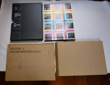
Document - Report, The Metropolitan Transportation Committee, "Melbourne Transportation Study - The Transportation Plan - Volume 3", 1969
... Report titled "Melbourne Transportation Study - The Transportation Plan - Volume 3", presented in a black vinyl covered slip case, paper cover, bound, sewn with end papers, fold out maps, 74 pages. Each sheet within the report has rounded edges. Contained within a printed cardboard packing case. Includes many tables, graphs, charts...Report titled "Melbourne Transportation Study - The Transportation Plan - Volume 3", presented in a black vinyl covered slip case, paper cover, bound, sewn with end papers, fold out maps, 74 pages. Each sheet within the report has rounded edges. Contained within a printed cardboard packing case. Includes many tables, graphs, charts ...Report titled "Melbourne Transportation Study - The Transportation Plan - Volume 3", presented in a black vinyl covered slip case, paper cover, bound, sewn with end papers, fold out maps, 74 pages. Each sheet within the report has rounded edges. Contained within a printed cardboard packing case. Includes many tables, graphs, charts and coloured sheets. Report prepared by The Metropolitan Transportation Committee - 1969, looking at the planning of all forms of transport for Melbourne with a timeframe of 1985. Chaired by Vernon Wilcox, Minister of Transport. Included Robert Risson - Chairman of MMTB. Set the basis for a very extensive freeway system that was only partly followed. Includes trams, trains (city loop), buses, parking, travel and population predictions, costs and implementation.Has numerous AETA stamps throughout the book. Inside front cover and on packing case "A12" in red ink.trams, tramways, melbourne, road transport, tramways, railways, public transport, transportation plan -
 Bendigo Military Museum
Mixed media - SOLDIERS MEMORIAL INSTITUTE RESTORATION & REDEVELOPEMENT 2009 - 2015
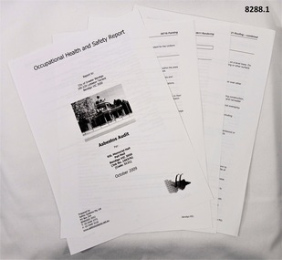
... plans, maps, fund raising relating to Phase 2. Items involve, RSL, C of GB, Heritage, SED, Political Parties, Government. .3) .4) Conservation Management plans Returned Soldiers Memorial Hall Pall Mall Bendigo, both 65 pages, A4, Colour and B & W, contains Contents, maps, diagrams, charts, photos put together by "Context PTY LTD Brunswick Victoria. .3) Draft copy dated 19.12.2012, has green Texta markings throughout and biro notes. .4) Final report with corrections dated 24.1.2013. .5) .6) Soldiers Memorial Institute Museum Business Plan, January 2013, A4 17 pages, In Colour & B & W, contents, maps and planning. .5) Revised edition in plastic insert folder. .6) Revised edition for presentation purposes. .7) .8) Business Planning documents by Ian Ross SED Advisory 2013. .7) Business Plan A4, B & W, 12 pages, copy of the initial plan dated 19.8.2013. .8) Bendigo Soldiers Memorial Institute Museum Business Plan December 2013, updated presentation version, plastic covers, A4, Colour & B & W, 31 pages, covers, Vision, Priorities, strategic actions/interventions, action/outcome plan. ...plans, maps, fund raising relating to Phase 2. Items involve, RSL, C of GB, Heritage, SED, Political Parties, Government. .3) .4) Conservation Management plans Returned Soldiers Memorial Hall Pall Mall Bendigo, both 65 pages, A4, Colour and B & W, contains Contents, maps, diagrams, charts, photos put together by "Context PTY LTD Brunswick Victoria. .3) Draft copy dated 19.12.2012, has green Texta markings throughout and biro notes. .4) Final report with corrections dated 24.1.2013. .5) .6) Soldiers Memorial Institute Museum Business Plan, January 2013, A4 17 pages, In Colour & B & W, contents, maps and planning. .5) Revised edition in plastic insert folder. .6) Revised edition for presentation purposes. .7) .8) Business Planning documents by Ian Ross SED Advisory 2013. .7) Business Plan A4, B & W, 12 pages, copy of the initial plan dated 19.8.2013. .8) Bendigo Soldiers Memorial Institute Museum Business Plan December 2013, updated presentation version, plastic covers, A4, Colour & B & W, 31 pages, covers, Vision, Priorities, strategic actions/interventions, action/outcome plan. ...These records, plans, maps and documentation revolve around the Soldiers Memorial Institute Pall Mall Bendigo. (Now Bendigo Military Museum) This sequence of events regarding works begins in 2009 and goes through to 2015.It can be broken up into Phase 1 (P1) ongoing Works and Phase 2 (P2) Redevelopment/Revitalisation as one followed the other and overlapped. The following list by date/year is a very brief outline of the discussions, meetings, planning and works completed. October 2009 P1. Asbestos Audit carried out. 2010 P1. First assessments of Asbestos in the Office, Foyer, Passage & Meeting room. Asbestos was removed from the Men’s toilet. This would also include a new Trap door over the Mine situated under the Billiard room. 11.10.2011 P1. New trap door installed in the Billiard room. 15.10.2011 P1. Mine is checked with ground penetrating Radar. June 2011 P1. Asbestos removal in the kitchen. (Not in use) Following on : Asbestos in the Meeting room & Passage is clear, carpet in the Office to come up, asbestos removal in the Women’s toilets. Structural damage to the front wall of the Office and Fireplace wall, false ceiling in the office (refer Cat No 8218) At this point a group being CoGB Property Manager, Heritage, Contractors, Museum Curator/Chairman Sub Committee Peter Ball (C/C) RSL Secretary Paul Penno, RSL Club Manager Erik & Maiintenance Ken to be involved. C/C Peter to Co Ordinate a time line of works, Museum closures and draw up basic plans for Office upgrade. 1.9.2011 P1. Due to Office walls damage talks decided to upgrade the Office, the room is stripped and the false ceiling comes down. 15.9.2011 P1. Foyer, asbestos tiles removed. 20.9.2011 P1. Floor and timber finish approved by Property Manager. Some works being done in the kitchen. Phase 2 beginnings. P2. During 2011 the Sec RSL Paul discussed with C/C Peter a broader upgrade of the entire building with emphasis on the Rear Fibro addition which incorporated the stage, toilets and storage. Sec Paul, Pres Cliff Richards, C/C Peter met to form a plan forward. 20.10.2011 P2. Letter to C of GB regarding this phase and request for a meeting. 22.11.2011 P2. Meeting between 2 x C o GB and Sec Paul, Pres Cliff, C/C Peter RSL. C/C Peter to draw up a Dot point plan. 23.11.2011 P1. Office is completed enough to move in. 2.1.2012 P1. Works in the kitchen had begun but now to be fully gutted. 20.2.2012 P1. C/C Peter to draw up a basic plan of kitchen for use by the Museum/RSL. Mid July 2012 PI. Kitchen completed enough for use. 23.10.2012 P2. Meeting with C of GB and 3 x Museum to draw up a Business plan, a new Conservation Management Plan (CMP), $ commitment discussed. 10.12.2012 P2. Facilitator Murray Poustie RSL Historian, C/C Peter and 2 x Museum Sub Committee Marg Andrea and John Young to put together a business plan. 4.1.2013 P2. New CMP arrives, number of issues with. 15.1.2013 P2. Meeting with C of GB, Heritage, C/C Peter and M Poustie re corrections CMP. 16.1.2013 P2. First meeting of Museum group with basic plans put together. 23.1.2013 P2. Second meeting of Museum group, alterations made. 30.1.2023 P2. New CMP arrives. 7.2.2013 P1. Final Kitchen finished with Air con installed. 8.2.2013 P2. Plans adopted by Museum group. 13.2.2013 P2. Plans put to Bendigo RSL. 15.3.2013 P2. Plans updated with meeting between C/C Peter, Sec Paul, Pres Cliff, Manager Erik, forwarded to Council. 26.3.2013 P2. Scope of planning arrives back from C of GB. August 2013 P2. New Working group formed, Sec Paul, C/C Peter, Sub/comm member John. Meeting with Ian Ross & 1 SED & W/Group to develope the Business plan further, one item that no works to be done before 1.1.2016 due to 2015 being Centenary of Anzac. A 2nd meeting a week later. P1. At this point the Rotunda was not part of the initial process 23.9.2013 P1. Inspection of the North front wall by C of GB, Heritage & C/C Peter. Asbestos sample taken & positive. Water damage/cracks as in Office Walls. 11.10.2013 P1. C of GB, Heritage have another look at Rotunda. No works before to be done until the dryer months. 11.10.2013 P2. First meeting with Concept planners Lovell Chen x 3, Council x 3, Heritage x 2, SED x 1 & Museum x 3 group. Introductory meeting so all up to date, Museum walk through. 12.11.2013 P2. 2nd meeting of the above with draft proposals of extension upgrade of SMI presented. 18.12.2013 P2. 3rd meeting with above, number of small changes made. 2014 P2. Sec Paul, Pres Cliff, C/C Peter met with full Council to put the case to them. 2014 P1. Meeting with Council, Contractors, C/C Peter re Rotunda maintenance, asbestos removal to be on 30.5.2014 to fit in with current Museum Bookings. 4.11.2014 P2. An Orientation day was held for prospective detailed Planning. 11.11.2014, C/C Peter met with C of GB group to choose the tender for the final detailed drawings, Lovell Chen chosen, to be finalised by April 2015. 20.1.2015 P2. Bore holes drilled at rear of SMI re possible below ground structure. 18.2.2015 P2 1st meeting of Working group, 4 x Lovell Chen, various Council departments x 10, Museum x 3, Art Gallery x 1. 17.3.2015 P2. 2nd meeting of W/Group, a meeting with SED and SED presentation to the RSL. 5.5.2015 P2. 3rd meeting of the W/group with latest plans & possibly final. 4.6.2015 P2. 4th meeting of the W/group, planning permit & Heritage applications will now go ahead. On paper still 2 years planning & 4 years construction. P1. The Rotunda completed with new membrane and touch up painting. 30.6.2015 P2. Final meeting of W/group, from now on just planning, approvals, Heritage & Public objections. Fund raising to begin. Further to this scope. 3.8.2015 P2. Sec Paul & C/C Peter put the plans to Committee BDRSL and are approved. 5.8.2015 P2. Plans signed by Sec Paul and forwarded to C of GB Council. .1) Occupational Health and Safety Report re Asbestos in the Soldiers Memorial Institute Hall Pall Mall Bendigo for the City of Greater Bendigo - prepared by “Safety Systems PTY LTD Bendigo - October 2009”. 55 pages double sided, all print in B & W. .2) Correspondence, 80 pages A4 dated 20.10.2011 to 23.12.2013, letters, emails, plans, maps, fund raising relating to Phase 2. Items involve, RSL, C of GB, Heritage, SED, Political Parties, Government. .3) .4) Conservation Management plans Returned Soldiers Memorial Hall Pall Mall Bendigo, both 65 pages, A4, Colour and B & W, contains Contents, maps, diagrams, charts, photos put together by "Context PTY LTD Brunswick Victoria. .3) Draft copy dated 19.12.2012, has green Texta markings throughout and biro notes. .4) Final report with corrections dated 24.1.2013. .5) .6) Soldiers Memorial Institute Museum Business Plan, January 2013, A4 17 pages, In Colour & B & W, contents, maps and planning. .5) Revised edition in plastic insert folder. .6) Revised edition for presentation purposes. .7) .8) Business Planning documents by Ian Ross SED Advisory 2013. .7) Business Plan A4, B & W, 12 pages, copy of the initial plan dated 19.8.2013. .8) Bendigo Soldiers Memorial Institute Museum Business Plan December 2013, updated presentation version, plastic covers, A4, Colour & B & W, 31 pages, covers, Vision, Priorities, strategic actions/interventions, action/outcome plan. Appendix A, Appendix B. Photos, plans, potential funding and where from. .9) Letter, documents, drawing relating to the replacement of the Balcony Membrane of the Soldiers Memorial Institute. The letter is 4 pages from Meagan, Heritage C of GB to Sec Paul, C/C Peter regarding the replacement of the Membrane dated 18.2.2014. 15 pages of Membrane works prepared by Lovell Chen to be carried out, dated 14.2.2014. The drawing shows the detail of how the replacement will be. .10) Photographs of the Soldiers memorial Institute (55), taken during phase 2, A4, colour showing external walls and roofing and damage, internal taken in the loft, all rooms, damage to areas. .11) Three folders, spiral bound, plastic covers, Colour and B & W images, the 3 front pages are all different. Contents are plans, sketches, proposals, from Demolition maps to final specifications. Folder 1. 11 pages, one sided dated December 2013, Lovell Chen. Folder 2. 14 pages, one sided dated December 2014, Lovel Chen. Folder 3. 21 pages, one sided dated December 2104 and May 2015, Lovel Chen.brsl, smirsl, restoration, asbestos, business, plans, conservation -
 Bendigo Military Museum
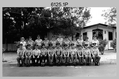
Photograph - Army Survey Regiment’s Officers, Warrant Officers and Sergeants and Squadrons, at Fortuna, Bendigo, 1982
... Typical tasks were flight planning the acquisition of aerial photography, pugging, mensuration and block adjustments, photogrammetric extraction of topographic features from aerial photography, digital feature editing, map compilation, operating the scanner/plotter, operating the AUTOMAP 1 system and computer programming by civilians. Cartographic Squadron was responsible for the production of the following military products: Joint Operation Graphics, small-scale RAAF Air Charts...Typical tasks were flight planning the acquisition of aerial photography, pugging, mensuration and block adjustments, photogrammetric extraction of topographic features from aerial photography, digital feature editing, map compilation, operating the scanner/plotter, operating the AUTOMAP 1 system and computer programming by civilians. Cartographic Squadron was responsible for the production of the following military products: Joint Operation Graphics, small-scale RAAF Air Charts ...This is a set of six staff photographs of the Army Survey Regiment’s Officers, Warrant Officers and Sergeants, and each of its four Squadrons at Fortuna, Bendigo in December 1982. Note - Air Survey Squadron’s photo was probably taken in July 1982 as they appear in winter dress. Air Survey Squadron was responsible for aerotriangulation, photogrammetric feature extraction and the AUTOMAP 1 system. Typical tasks were flight planning the acquisition of aerial photography, pugging, mensuration and block adjustments, photogrammetric extraction of topographic features from aerial photography, digital feature editing, map compilation, operating the scanner/plotter, operating the AUTOMAP 1 system and computer programming by civilians. Cartographic Squadron was responsible for the production of the following military products: Joint Operation Graphics, small-scale RAAF Air Charts, large-scale topographic line maps and orthophotomaps. Cartographic technician tasks were scribing, compiling, retouching, masking, type setting, type stickup, terrain embossing, correcting and proving quality control. Headquarters Squadron was responsible for the planning and coordination of map production and contracts. It also performed administrative and support functions such as personnel administration, pay, finance, transportation, records, map Library, kitchens, messes and facility maintenance. It was staffed by Army personnel from RASvy, RACT, AACC, RAAOC and RAEME corps. Other supporting staff at this time included the RAAF Liaison Officer, RAN Liaison Officer and several civilians employed in administration, the Q-Store and grounds maintenance. A component of the Army Svy Regt’s cartographic map production was carried out by the Detachment, a sub-unit located at Bonegilla next to the School of Military Survey. Lithographic Squadron was responsible for the reproduction of map materials and printing of military map products. The main tasks undertaken by photographic technicians were photographic enlargements, reductions and duplication of map reproduction material and processing of aerial photography. Printing technician tasks included platemaking, offset printing, map stock despatching and proofing.This is a set of six staff photographs of the Army Survey Regiment’s Officers, Warrant Officers and Sergeants, and its four Squadrons, at Fortuna, Bendigo, 1982. The black and white photographs are printed on photographic paper and scanned at 300 dpi. are part of the Army Survey Regiment’s Collection. Film negatives were scanned at 600 dpi. .1) - Photo, black & white, 1982, Officer of the Army Survey Regiment. Back Row L to R: Karen Byrne, Bob McHenry, Rob John, Ian Rose, Neil Taylor, Chris Gehrmann, Graeme Wastell, Bob Williams, Chris Mazur, Struan Robinson and Dave Sankey. Front Row L to R: Bruce Keeley, Duncan Burns, Mick Byrne, John Charland, unidentified, Jim Mitchell, CO LTCOL Peter Eddy, Graham Baker, Stan Vote, John Bloor, Roger Rix and Peter ‘Blue’ Blaskett. .2) - Photo, black & white, 1982, Warrant Officers and Sergeants of the Army Survey Regiment. Back Row L to R: Greg Gilbert, Mick Sarson, Don Musgrave, Stu Thaxter, Greg Buckingham, Bob Rogister, Don Mawson, Bill Jones, Doug Carswell, Max Colletti, unidentified, George Austen, John Cain, unidentified, Bob Clisby, Rick Warren, Bob Croxton, unidentified, Greg Francis-Wright, Bruce Gordon, Brett Van Leeuwin, Col Cuskelly, unidentified, Garran Hill, Steve Egan, Bruce Wetzig, Dennis Learmonth, unidentified, Mick Davey, John McCracken, Bruce Bowers, Barry Lutwyche, Alan Glanville, Cliff Webb, Kevin Boehm, Dave Critchlow, Noel McNamara and Gavin Neilson. Middle Row L to R: Les Dixon, Rob Bogumil, Bill Friswell, unidentified, Heather Slater, Pat Lumsden, unidentified (x2), Phil Meagher, George Graham, unidentified, Jim Beard, Kevin Kennedy, Rowan Gillies, Don Williams, Gary Warnest, Jim Gill, Peter Barrett and Ralph Chant. Front Row L to R: John Bennett, Kevin Macquire, Dick Manley, Alan Bunn, Noel Coulthard, Jim Jefferies, Jeff Lynch, Dave Thompson, Jim Mitchell, Graeme Birrell, RSM WO1 Bob Mason, Graham Squire, Ken Slater, Mick Dempster, Ted Burgess, Don Musgrave, Brian Mead, Peter Biorac and John Barrie. .3) - Photo, black & white, 1982, Air Survey Squadron, Army Survey Regiment. Back Row L to R: Greg Gilbert, Rob Straube, Wayne Lloyd, Steve Drummond, Eric Nicolson, Cliff Webb, Harald Mai, Geoff Havelberg, Bruce Gordon, Greg Buckingham, Brett ‘Dutchy’ Van Leeuwin, Bob Croxton, Peter Tangey, Scheryl Delforce, Marianne Degroot, Annette Godden, Peter Jones, and Barry Miller. Middle Row L to R: Ken Talbot-Smith, Mick Davey, Steve Coulson, unidentified, Greg Byers, Mark Casey, Ian Nelson, Mark Lander, Nick Van Dalen, Kristin Isaac, Santina Argetto, Lorraine Talbot-Smith, Terry Wicker, Max Colletti, Bruce Bowers, Peter Peterson, unidentified and Dave Irving. Front Row L to R: George Timmins, Alan Glanville, Les Dixon, Chris Parkinson, Jim Jefferies, Neil Taylor, unidentified, Chris Gehrmann, OC MAJ Graham Baker, Bruce Keeley, Duncan Burns, Graeme Birrell, Mick Dempster, Ted Burgess, Ray Lawson, Don Musgrave, Kevin Kennedy, Allan Strain and Jim Gill. .4) - Photo, black & white, 1982, Cartographic Squadron, Army Survey Regiment. Back Row L to R: Don Williams, Cathy Regan, Denise Marshall, Di Soutar, Ian Fitzgerald, Alan Staley, Andy Godden, John Tempest, Dan Cirsky, Robin Marshall, Jamie McCrae, Stuart Hibbert, Dave Lawler, Barry Hogan, Gerry Gates, Warren Hall, Peter McCurdy, Tom Bloxham, Ben Taresenko, Dave Upton and Scott Payne. Middle Row L to R: Jan Minchin, Megan Reynolds, Gayle Humphries, Carla Dell, George Holland, Bob Bright, Fiona Mackie, Ian McKenzie, Brad Peppler, Gina Neilson, Gai Amato, Ginny Rowe, Jackie Van Beurkereng, Tracy Parker, Carmel Butler, Ilen Isaac, Greg Else, Dennis Learmonth and Terry McIntyre. Front Row L to R: Bob Rogister, Bill Friswell, Stu Thaxter, Col Cuskelly, John Bennett, Struan Robinson, Bob Williams, John Barrie, OC CAPT Mick Byrne, Roger Rix, Gary Warnest, Ian Rose, Karen Byrne, Rowan Gillies, Dave Critchlow, Noel McNamara and Barry Lutwyche. .5) - Photo, black & white, 1982, Headquarters Squadron, Army Survey Regiment. Back Row L to R: unidentified (x3), Don Mawson, Doug Carswell, unidentified (x3), Rick Warren, unidentified (x4), Bruce Wetzig, Kevin Boehm and unidentified. Middle Row L to R: Dave Murphy, unidentified, Bob Sheppard, unidentified, Pat Lumsden, unidentified (x6), Jim Beard, Heather Slater, Penny Knott and Graham Dudley. Front Row L to R: unidentified, Dick Manley, Kevin Macquire, Bob McHenry, John Charland, unidentified, RSM WO1 Bob Mason, CO LTCOL Peter Eddy, Jim Mitchell, Rob John, John Bloor, Peter ‘Blue’ Blaskett, Dave Thompson, Graham Squire, Alan Bunn, and John McCracken. .6) - Photo, black & white, 1982, Lithographic Squadron, Army Survey Regiment. Back Row L to R: Neville Carr, Paul Baker, Kim Reynolds, Gary Drummond, Chad Hardwick, unidentified, Roy Hicks, Jim Ash, Greg Rowe, Gary Kerr, Peter Dillon, Peter Breukel, Brian Fauth, Paul Davis, Josh Degroot, Alan Virtue, Gary Tremain, Warren Shirley, Mark Doherty, unidentified, Le-Anne Shirley, Steve Egan and Russ Mollenhauer. Middle Row L to R: Terry Winzar, Keith Quinton, Rhys De Laine, unidentified, Stuart Ridge, Mick Gillham, Graham Hales, John Whaling, unidentified, Ken Peters, Laurie Justin, unidentified, Martin Van der Maele, Di Chalmers, and Frank Lenane. Front Row L to R: Gavin Neilson, John Cain, Peter Barrett, Greg Francis-Wright, George Austen, Ralph Chant, Jeff Lynch, OC CAPT Stan Vote, Ken Slater, Noel Coulthard, George Graham, Garran Hill, Rob Bogumil and Bill Jones.No personnel are identified. No personnel are identified. .1P – Annotated on front “OFFICERS MESS DEC ’82” .2P – Annotated on back “SGTS MESS DEC ’82” .4P– Annotated on front “CARTO SQN DEC ’82” .5P– Annotated on front “HQ SQN DEC ’82”royal australian survey corps, rasvy, army survey regiment, army svy regt, fortuna, asr, air survey, carto, litho
