
Showing 409 items matching "environmental planning"
-
 Stawell Historical Society Inc
Map, Shire of Stawell, Shire of Stawell Interim development Order, C 1930
... Guttering Haskings & Davey Pty Ltd Division of Urban and Environmental Planning...Planning Map Local Development Guttering Haskings & Davey Pty Ltd Division of Urban and Environmental Planning Coloured Map of Stawell Shire showing Zoning Areas Shire of Stawell Interim development Order Map Shire of Stawell ...Planning MapColoured Map of Stawell Shire showing Zoning AreasGuttering Haskings & Davey Pty Ltd Division of Urban and Environmental Planninglocal development -
 Broadmeadows Historical Society & Museum
Book - Report, Landscape Advisory Service, The Greening of Broadmeadows: Priority Tree Planting Study, July 1990
... ...environmental planning...The study reflects local government responses to issues of landscape management, amenity, and environmental sustainability, documenting strategic approaches to tree planting within the suburb. As an official council report, it provides insight into planning priorities and environmental policy at the local level during the period of its creation....This report documents local government environmental planning practices in Broadmeadows and provides evidence of policy approaches to urban greening during the period of its creation. ...A municipal planning report produced for the City of Broadmeadows focusing on urban greening policy and implementation through strategic tree planting.Comb bound report with blue card front and back covers. Adhesive plastic cover applied to the front, with a title cut out window.non-fictionA municipal planning report produced for the City of Broadmeadows focusing on urban greening policy and implementation through strategic tree planting.urban greening, tree planting, environmental planning, broadmeadows, municipal reports -
 Broadmeadows Historical Society & Museum
Book - Report, Broadmeadows Environment Management Strategy
... Environmental management...Urban planning...Produced during the early 1990s period of increased local government engagement with environmental policy and sustainability planning in Victoria....Produced during the early 1990s period of increased local government engagement with environmental policy and sustainability planning in Victoria. The report is significant as documentary evidence of early local environmental governance and policy development within the City of Broadmeadows. ...One bound report, 40 pages, plastic comb binding. Blue paper covers. Front cover laminated; rear cover protected with a clear plastic sheet.environmental management, urban planning, local government policy, broadmeadows, municipal sustainability -
Marysville & District Historical Society
THE TRIANGLE NEWS-VOL 39 NO 18-MAY 18 2012
... plan submissions reminder...sesquicentenary meeting 150th anniversary...local history centre...councillor comment...men's big breakfast...b.u.i.l.t...marysville & district historical society meeting...working bee activities...notice of application for planning permit...sample wines...dalrymples guest cottages official opening...marysville & triangle community recovery committee...marysville villains lunch with lindy & bill...bill o'shea...lindy burns...australian centre for grief & bereavement...alexandra annual truck ute & rod show...real estate...john bertrand...gary pert...terry and sharen donovon...rebuild dalrymples...comedy festival road show...marysville community centre...australian red cross...acoustic concert...narbethong hall...planning & environmental...marysville victoria australia string theory best upcoming young traditional group marysville golf & bowls club marysville cultural community cafe culture services 2012 what's on when in may the committee of management of the gallipoli park precinct marysville & district chamber of commerce agm creative triangle triangle bushwalkers marysville fire brigade home based child care annual conference agm advertisements mayor's chair church notices marysville lady golfers win at mansfield marysville beer & platter garden maryton park b & b cathedral ranges people & parks foundation marysville pharmacy marysville medical centre draft budget and council plan submissions reminder sesquicentenary meeting 150th anniversary local history centre councillor comment men's big breakfast b.u.i.l.t marysville & district historical society meeting working bee activities notice of application for planning permit sample wines dalrymples guest cottages official opening marysville & triangle community recovery committee marysville villains lunch with lindy & bill bill o'shea lindy burns australian centre for grief & bereavement alexandra annual truck ute & rod show real estate john bertrand gary pert terry and sharen donovon rebuild dalrymples comedy festival road show marysville community centre australian red cross acoustic concert narbethong hall planning & environmental act 1987 murrindindi planning scheme buxton hotel social club restoring sense of place pathways bushfire recovery program THE TRIANGLE NEWS-VOL 39 NO 18-MAY 18 2012 ...marysville, victoria, australia, string theory, best upcoming young traditional group, marysville golf & bowls club, marysville cultural community, cafe culture services 2012, what's on when in may, the committee of management of the gallipoli park precinct, marysville & district chamber of commerce agm, creative triangle, triangle bushwalkers, marysville fire brigade, home based child care annual conference agm, advertisements, mayor's chair, church notices, marysville lady golfers win at mansfield, marysville beer & platter garden, maryton park b & b, cathedral ranges, people & parks foundation, marysville pharmacy, marysville medical centre, draft budget and council plan submissions reminder, sesquicentenary meeting 150th anniversary, local history centre, councillor comment, men's big breakfast, b.u.i.l.t, marysville & district historical society meeting, working bee activities, notice of application for planning permit, sample wines, dalrymples guest cottages official opening, marysville & triangle community recovery committee, marysville villains lunch with lindy & bill, bill o'shea, lindy burns, australian centre for grief & bereavement, alexandra annual truck ute & rod show, real estate, john bertrand, gary pert, terry and sharen donovon, rebuild dalrymples, comedy festival road show, marysville community centre, australian red cross, acoustic concert, narbethong hall, planning & environmental act 1987, murrindindi planning scheme, buxton hotel social club, restoring sense of place, pathways bushfire recovery program -
Marysville & District Historical Society
THE TRIANGLE NEWS-VOL 41 NO 47-NOVEMBER 28 2014
... ...planning & environmental act 1987...marysville victoria australia council makes code red policy preparation murrindindi shire council what's on when in november the committee of management of the gallipoli park precinct marysville community market creative triangle marysville cemetary trust buxton post office trading hours marysville golf report church notices triangle community dinner mayor's chair by councillor margaret rae councillor comment cr john kennedy advertisements great victorian bike ride road closures & event information marysville triangle real estate planning & environmental act 1987 murrindindi planning scheme racv marysville marathon festival emotions anonymous international payment of rates installment interruption to mobile library service real estate australia day celebrations 2015 holly eradication program working bee & training days christmas cake workshop nye at the bunker residential & rural real estate council meeting dates 2015 australia day nominations narbethong christmas party narbethong marysville police report new planning scheme directions for murrindindi shire narbethong hall THE TRIANGLE NEWS-VOL 41 NO 47-NOVEMBER 28 2014 ...marysville, victoria, australia, council makes code red policy preparation, murrindindi shire council, what's on when in november, the committee of management of the gallipoli park precinct, marysville community market, creative triangle, marysville cemetary trust, buxton post office trading hours, marysville golf report, church notices, triangle community dinner, mayor's chair by councillor margaret rae, councillor comment cr john kennedy, advertisements, great victorian bike ride, road closures & event information, marysville triangle real estate, planning & environmental act 1987, murrindindi planning scheme, racv marysville marathon festival, emotions anonymous international, payment of rates installment, interruption to mobile library service, real estate, australia day celebrations 2015, holly eradication program, working bee & training days, christmas cake workshop, nye at the bunker, residential & rural real estate, council meeting dates 2015, australia day nominations, narbethong christmas party, narbethong marysville police report, new planning scheme directions for murrindindi shire, narbethong hall -
Marysville & District Historical Society
THE TRIANGLE NEWS-VOL 41 NO 48-DECEMBER 5 2014
... ...planning & environmental act 1987...marysville victoria australia marysville ugly duckling comes of age the tower motel vibe hotel & conference centre what's on when in december donation accepted by peter cobb the committee of management of the gallipoli park precinct public notice proposed sale of land buxton tennis courts buxton post office trading hours marysville golf report church notices promote your community group on line mayor's chair by councillor margaret rae murrindindi shire council half day council office and library closures planning & environmental act 1987 murrindindi planning scheme marysville & triangle community men's shed advertisements great victorian bike ride road closures & event information open gardens marysville marysville triangle real estate THE TRIANGLE NEWS-VOL 41 NO 48-DECEMBER 5 2014 ...marysville, victoria, australia, marysville ugly duckling comes of age, the tower motel, vibe hotel & conference centre, what's on when in december, donation accepted by peter cobb, the committee of management of the gallipoli park precinct, public notice proposed sale of land, buxton tennis courts, buxton post office trading hours, marysville golf report, church notices, promote your community group on line, mayor's chair by councillor margaret rae, murrindindi shire council, half day council office and library closures, planning & environmental act 1987, murrindindi planning scheme, marysville & triangle community men's shed, advertisements, great victorian bike ride, road closures & event information, open gardens marysville, marysville triangle real estate -
Marysville & District Historical Society
THE TRIANGLE NEWS-VOL 41 NO 49-DECEMBER 12 2014
... ...planning & environmental act 1987...marysville victoria australia community lends a helping hand murrindindi shire council helping hands program what's on when in december triangle news christmas break the committee of management of the gallipoli park precinct creative triangle best wishes to derek reynolds advertisments t temporary closure of alexandra swimming pool buxton post office trading hours marysville golf report church notices christmas services mayor's chair by councillor margaret rae councillor comment cr christine challen planning & environmental act 1987 murrindindi planning scheme marysville patisserie looking for casual employees real estate nye at el kanah 2015 season tickets marysville cultural community emotions anonymous international vision marysville 87.6fm broadcasts marysville triangle real estate residential & rural real estate nye at the bunker marysville community golf & bowls club mindfulness in marysville get well soon derek reynolds police officer australia day celebrations 2015 THE TRIANGLE NEWS-VOL 41 NO 49-DECEMBER 12 2014 ...marysville, victoria, australia, community lends a helping hand, murrindindi shire council, helping hands program, what's on when in december, triangle news christmas break, the committee of management of the gallipoli park precinct, creative triangle, best wishes to derek reynolds, advertisments, t, temporary closure of alexandra swimming pool, buxton post office trading hours, marysville golf report, church notices, christmas services, mayor's chair by councillor margaret rae, councillor comment cr christine challen, planning & environmental act 1987, murrindindi planning scheme, marysville patisserie looking for casual employees, real estate, nye at el kanah, 2015 season tickets marysville cultural community, emotions anonymous international, vision marysville 87.6fm broadcasts, marysville triangle real estate, residential & rural real estate, nye at the bunker, marysville community golf & bowls club, mindfulness in marysville, get well soon derek reynolds police officer, australia day celebrations 2015 -
Marysville & District Historical Society
THE TRIANGLE NEWS-VOL 41 NO 50-DECEMBER 19 2014
... ...planning & environmental act 1987...marysville victoria australia council's fire preparation works underway what's on when in december triangle news christmas break the committee of management of the gallipoli park precinct creative triangle ugfm radio christmas show temporary closure of alexandra swimming pool buxton post office trading hours marysville golf report church notices mayor's chair by councillor margaret rae christmas holiday closures marysville & triangle community men's shed advertisements marysville sub branch rsl marysville patisserie looking for casual employees real estate marysville cultural community sessions 2015 emotions anonymous international jer's tradies golf day 2014 planning & environmental act 1987 murrindindi planning scheme campfire safety a top priority in hume region intrepid triangle bushwalkers marysville triangle real estate nye at the bunker marysville community golf & bowls club sponsor a post trevor harrow oval racv energy breakthrough challenge australia day street stall buxton bootcamp australia day celebrations the upper goulburn landcare network ugln council to trial reuse of disposed materials council looking forward to working with new cabinet media release festive video wraps up victoria's climate outlook 2014 notice of application for planning permit murrindindi shire council THE TRIANGLE NEWS-VOL 41 NO 50-DECEMBER 19 2014 ...marysville, victoria, australia, council's fire preparation works underway, what's on when in december, triangle news christmas break, the committee of management of the gallipoli park precinct, creative triangle, ugfm radio christmas show, temporary closure of alexandra swimming pool, buxton post office trading hours, marysville golf report, church notices, mayor's chair by councillor margaret rae, christmas holiday closures, marysville & triangle community men's shed, advertisements, marysville sub branch rsl, marysville patisserie looking for casual employees, real estate, marysville cultural community sessions 2015, emotions anonymous international, jer's tradies golf day 2014, planning & environmental act 1987, murrindindi planning scheme, campfire safety a top priority in hume region, intrepid triangle bushwalkers, marysville triangle real estate, nye at the bunker, marysville community golf & bowls club, sponsor a post trevor harrow oval, racv energy breakthrough challenge, australia day street stall, buxton bootcamp, australia day celebrations, the upper goulburn landcare network, ugln, council to trial reuse of disposed materials, council looking forward to working with new cabinet, media release, festive video wraps up victoria's climate outlook 2014, notice of application for planning permit, murrindindi shire council -
 Greensborough Historical Society
Book, Nillumbik Shire Council, Live local Plant local: Nillumbik Shire, 2001_
... ...environmental and cultural planning section...A guide to indigenous vegetation in the Nillumbik Shire. nillumbik shire council environmental and cultural planning section chris delaney indigenous plants native gardens 56 pages, illus. ...Nillumbik Shire is known for its natural vegetation. This text encourages locals to plant indigenous plants in their gardens.A guide to indigenous vegetation in the Nillumbik Shire.56 pages, illus. (some col.). Cover has yelloe flowers in band on orange background with shire logo.nillumbik shire council, environmental and cultural planning section, chris delaney, indigenous plants, native gardens -
 Bendigo Historical Society Inc.
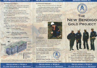
Flyer - Kangaroo Flat Gold Mine Collection: New Bendigo Gold Project, Bendigo Mining NL, P.O. Box 2113, Mail Centre, Not dated
... ...environmental study...project planning...Brochure details stages of New Bendigo Gold Project including: project planning, decline construction and exploration, mining and production and environmental philosphy. ...Bendigo mining gold Kangaroo Flat environmental study project planning decline construction and exploration mining and production Colour trifold information brochure (2 copies). ...Colour trifold information brochure (2 copies). On front: 'New Bendigo Gold Project.' On front: four miners dressed in overalls and hard hats. Brochure details stages of New Bendigo Gold Project including: project planning, decline construction and exploration, mining and production and environmental philosphy. A detailed map of the Bendigo Mining N.L. Carshalton Mine Site and a brief history of Bendigo gold discovery is included. bendigo mining n.l., bendigo, mining, gold, kangaroo flat, environmental study, project planning, decline construction and exploration, mining and production -
 Port Melbourne Historical & Preservation Society
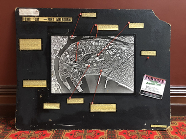
Mixed media, Robert Frost, Toxic Flat - Port Melbourne, 1987
... ...environmental issues...town planning...Produced by Robert Frost of Alfred Street for use in Bay Street informational stalls by Port Melbourne 'Residents' Picket Group' against the SCDC Bayside development, 1988 public action campaigns environmental issues town planning - proposals shelved - bayside fishermans bend industry - manufacturing robert frost residents picket group british petroleum group elders ixl glazebrook paints csiro state electricity commission Large black display board with captions of environmental information connected by string to points on an aerial photo of Port Melbourne/Fishermen's Bend; indicates sources of contamination in Port Melbourne and on the bend. ...Produced by Robert Frost of Alfred Street for use in Bay Street informational stalls by Port Melbourne 'Residents' Picket Group' against the SCDC Bayside development, 1988Large black display board with captions of environmental information connected by string to points on an aerial photo of Port Melbourne/Fishermen's Bend; indicates sources of contamination in Port Melbourne and on the bend.public action campaigns, environmental issues, town planning - proposals shelved - bayside, fishermans bend, industry - manufacturing, robert frost, residents picket group, british petroleum group, elders ixl, glazebrook paints, csiro, state electricity commission -
Port Melbourne Historical & Preservation Society
Photograph - Cleanup of former COR/BP site, Port Melbourne, Alison Kelly, 1989
... environmental issues...town planning...Photographed and displayed at Missions to Seamen building in 1989 by Alison Kelly environmental issues town planning - proposals shelved - bayside alison kelly In ink on back: 'A Kelly 70 Station St Port Melbourne 645 2324' Display panel with three captioned photos of 1988/89 cleanup of soil on site of former BP tank farm, labelled 'Cleanup in progress at the former BP site in Port Melbourne' Mounted on white board in photocorners, covered in mylar Photograph Cleanup of former COR/BP site, Port Melbourne Alison Kelly ...Photographed and displayed at Missions to Seamen building in 1989 by Alison KellyDisplay panel with three captioned photos of 1988/89 cleanup of soil on site of former BP tank farm, labelled 'Cleanup in progress at the former BP site in Port Melbourne' Mounted on white board in photocorners, covered in mylarIn ink on back: 'A Kelly 70 Station St Port Melbourne 645 2324'environmental issues, town planning - proposals shelved - bayside, alison kelly -
 Whitehorse Historical Society Inc.
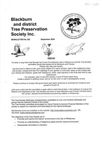
Newsletter - Blackburn and District Tree Preservation Society Inc, Blackburn and District Tree Preservation Society Inc, Blackburn and District Tree Preservation Society Inc Newsletter, 2020
... ...Environmental issues...Civic Planning...Blackburn and District Tree Preservation Society PAYNE Anne Environmental issues Civic Planning Newsletter No.255 of the Blackburn and District Tree Preservation Society Inc. ...Newsletter No.255 of the Blackburn and District Tree Preservation Society Inc. Sep 2020.Paper and print, 12 ppnon-fictionNewsletter No.255 of the Blackburn and District Tree Preservation Society Inc. Sep 2020.blackburn and district tree preservation society, payne anne, environmental issues, civic planning -
Marysville & District Historical Society
THE TRIANGLE NEWS-VOL 42 NO 19-MAY 1 2015
... ...planning & environmental act 1987...marysville victoria australia cafe culture series what's on when in may advertisements buxton progress assocn gallipoli park precinct creative triangle mayor's chair cr margaret rae church notices beyond blue community information evening alexandra shire hall lions triangle tool library marysville & triangle community men's shed community meeting inviting public buxton memorial hall marysville golf report marysville triangle real estate residential and rural real estate taliska scottish band at el kanah australia's biggest morning tea influenza vaccine marysville saddletramps ralph wait memorial ride dinner dance adventurous cooks cfa annual 2015 challenge marysville jazz & blues weekend planning & environmental act 1987 murrindindi planning scheme von guerard expert coming back upper goulburn landcare network farm chemical users course triangle community dinner mercy ships fundraising launch intrepid triangle bushwalkers lest we forget marysville & district historical society australian open gardens narbethong farms change smoke alarm batteries buxton anglican church special service the committee of management of the gallipoli park precinct anzac day at marysville THE TRIANGLE NEWS-VOL 42 NO 19-MAY 1 2015 ...marysville, victoria, australia, cafe culture series, what's on when in may, advertisements, buxton progress assocn, gallipoli park precinct, creative triangle, mayor's chair cr margaret rae, church notices, beyond blue community information evening, alexandra shire hall, lions triangle tool library, marysville & triangle community men's shed, community meeting inviting public, buxton memorial hall, marysville golf report, marysville triangle real estate, residential and rural real estate, taliska scottish band at el kanah, australia's biggest morning tea, influenza vaccine, marysville saddletramps, ralph wait memorial ride dinner dance, adventurous cooks, cfa annual 2015 challenge, marysville jazz & blues weekend, planning & environmental act 1987, murrindindi planning scheme, von guerard expert coming back, upper goulburn landcare network, farm chemical users course, triangle community dinner, mercy ships fundraising launch, intrepid triangle bushwalkers, lest we forget, marysville & district historical society, australian open gardens, narbethong farms, change smoke alarm batteries, buxton anglican church special service, the committee of management of the gallipoli park precinct, anzac day at marysville -
Whitehorse Historical Society Inc.
Document, Parkswide - Annual Report 2001 - 2002, 1/06/2002 12:00:00 AM
... Includes community interaction report and feedback and environmental action plan progress report....Includes community interaction report and feedback and environmental action plan progress report. City of Whitehorse Parkswide end of financial year report. ...City of Whitehorse Parkswide end of financial year report. Includes community interaction report and feedback and environmental action plan progress report.City of Whitehorse Parkswide end of financial year report. Includes community interaction report and feedback and environmental action plan progress report.City of Whitehorse Parkswide end of financial year report. Includes community interaction report and feedback and environmental action plan progress report.city of whitehorse. parkswide, business and finance, parks and reserves -
 Peterborough History Group
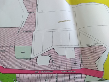
Map - Peterborough Planning Map
... A3 size printed copies (2) of planning, environmental and other overlays for the town of Peterborough in 2012...Planning information as at 2012 Showing the changing face of Peterborough peterborough town planning maps moyne shire zoning map A3 size printed copies (2) of planning, environmental and other overlays for the town of Peterborough in 2012 Map Peterborough Planning Map ...Planning information as at 2012Showing the changing face of PeterboroughA3 size printed copies (2) of planning, environmental and other overlays for the town of Peterborough in 2012peterborough, town planning, maps, moyne shire zoning map -
 Eltham District Historical Society Inc
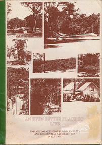
Book, An Even Better Place to Live: enhancing neighbourhood amenity and residential satisfaction in Eltham, April 1987
... Bruce IV School of Environmental Planning, The University of Melbourne. ...Bruce IV School of Environmental Planning, The University of Melbourne. ...Report submitted to Eltham Shire Council April 1987 by Dr. R. Bruce IV School of Environmental Planning, The University of Melbourne. "The aim of this report is to identify major factors which impact on neighbourhood amenity and hence contribute to residents' satisfactions with their living conditions" - Page 2 Contents include: Summary, Introduction, In the Residents' Own Words, Psychological constructs of neighbourhood amenity, physical characterisitics of impacting neighbourhood amenity, most and least liked places in Eltham, glossary, literature cited, data.Bound paper copy book. Printing on one side of page. 30 pagesplanning,neighbourhood,1987 -
 Whitehorse Historical Society Inc.
Document - Report, Blackburn Lake Sanctuary - Environmental Assessment and Master Plan, 1/11/1976
... Blackburn Lake Sanctuary - Environmental Assessment and Master Plan...Blackburn Lake Sanctuary : an environmental assessment and master plan - climate, by Winty Calder and Jeremy Pike. ...Blackburn Lake Sanctuary - Environmental Assessment and Master Plan Document Report ...Blackburn Lake Sanctuary : an environmental assessment and master plan - climate, by Winty Calder and Jeremy Pike. Centre for Environmental Studies, University of Melbourne, November 1976.blackburn lake sanctuary, calder, winty, pike, jeremy, climate -
 Robin Boyd Foundation
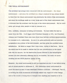
Document - Manuscript, Robin Boyd, The Visual Environment, 1970
... Discusses how the architect has broadened the visual perception of environment - from loud and gimmicky (as copied from America) to acceptance and recognition of how to incorporate environmental design into architectural plans....Discusses how the architect has broadened the visual perception of environment - from loud and gimmicky (as copied from America) to acceptance and recognition of how to incorporate environmental design into architectural plans. Original manuscript a lecture given at a seminar on the environment conducted in July 1970 by the Institute of Business Administration and the Victorian Employers Federation. ...Discusses how the architect has broadened the visual perception of environment - from loud and gimmicky (as copied from America) to acceptance and recognition of how to incorporate environmental design into architectural plans.Original manuscript a lecture given at a seminar on the environment conducted in July 1970 by the Institute of Business Administration and the Victorian Employers Federation. The lecture was condensed into two articles published in "The Age" as 'Spoilers of our environment'. The manuscript appears to be Part 1 titled 'Legal vandalism', published in "The Age" on 09.07,1970. Part 2 was titled ' The more optimistic view of the future', published in "The Age" on 10.07.1970 as 'Digger-cult curse'. Typewritten, quarto, 15 pagesenvironment, visual environment, architect, australia, visual pollution, urban ugliness, robin boyd, manuscript -
 Eltham District Historical Society Inc
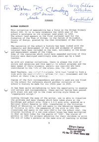
Folder, Unpublished collection of Eltham State School No. 209 items, 1856-1995 by Harry Gilham (EDHS)
... Wayfinding In The Environment; The role of aesthetics research in participatory planning design by Victoria Sharp for the School of Environmental Planning, The University of Melbourne, February 1987 4 pages, A4 photocopy extracts copied include: Synopsis Spefic Design Concerns p37 (relative to Eltham Gateway) Summary p38 4. ...Wayfinding In The Environment; The role of aesthetics research in participatory planning design by Victoria Sharp for the School of Environmental Planning, The University of Melbourne, February 1987 4 pages, A4 photocopy extracts copied include: Synopsis Spefic Design Concerns p37 (relative to Eltham Gateway) Summary p38 4. ...Contents 1. Draft chronology - Eltham Primary School Chronology 1856-1995; Harry Gilham (EDHS) 1995 127 pages, A4 photocopies This collection of memorabilia has a focus on the Eltham State School No. 209. It was prepared to help celebrate the 140th year of the school's existence on its original land grant of 1856, which appeared on the first surveyed land for the formation of the Town of Eltham, in the Parish of Nillumbik, County of Evelyn, granted by the then Government of New South Wales. It is inscribed in Harry Gilham's writing on page 1 - "For Eltham P.S Chronology 209 - 150th Anniv. book; Harry Gilham Collection; Unpublished" and stamped "Eltham District Historical Society" Pages 3 and 4 missing. This manuscript was a major source reference for the book "We Did Open A School In Little Eltham; Eltham Primary School 209, 1856-2006, A History" Source references from Inspector's Register of State Schools; photocopies held by EDHS in A3 binders 2. Renovation of Eltham Primary School Residence; Application of a Grant from National Estate Grants program, 17 April 1989 10 pages A4 photocopy 3. Wayfinding In The Environment; The role of aesthetics research in participatory planning design by Victoria Sharp for the School of Environmental Planning, The University of Melbourne, February 1987 4 pages, A4 photocopy extracts copied include: Synopsis Spefic Design Concerns p37 (relative to Eltham Gateway) Summary p38 4. File Record, State School No 209 - Eltham; National Trust of Australia File No B3260; 29 March 2000 1 page A4 5. Notes by Harry Gilham concerning Eltham State School No 209 1 page handwritten lined pad sheet 6. Notes by Harry Gilham concerning Eltham State School No 209 and feedback on 150th Anniversary book 1 page, A4 green 144 A4 pages As noted150th anniversary, chronology, eltham gateway, eltham primary school, eltham state school, harry gilham, national trust of australia, planning, renovation, school residence, state school no. 209, victoria sharp -
 Kew Historical Society Inc
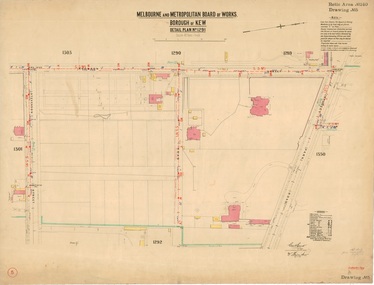
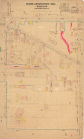
Plan, Melbourne & Metropolitan Board of Works : Borough of Kew : Detail Plan No.1291, 1905
... The plans, at a scale of 40 feet to 1 inch (1:480), provide a detailed historical record of Melbourne streetscapes and environmental features. ...The plans, at a scale of 40 feet to 1 inch (1:480), provide a detailed historical record of Melbourne streetscapes and environmental features. ...The Melbourne and Metropolitan Board of Works (MMBW) plans were produced from the 1890s to the 1950s. They were crucial to the design and development of Melbourne's sewerage and drainage system. The plans, at a scale of 40 feet to 1 inch (1:480), provide a detailed historical record of Melbourne streetscapes and environmental features. Each plan covers one or two street blocks (roughly six streets), showing details of buildings, including garden layouts and ownership boundaries, and features such as laneways, drains, bridges, parks, municipal boundaries and other prominent landmarks as they existed at the time each plan was produced. (Source: State Library of Victoria). This plan forms part of a large group of MMBW plans and maps that was donated to the Society by the Mr Poulter, City Engineer of the City of Kew in 1989. Within this collection, thirty-five hand-coloured plans, backed with linen, are of statewide significance as they include annotations that provide details of construction materials used in buildings in the first decade of the 20th century as well as additional information about land ownership and usage. The copies in the Public Record Office Victoria and the State Library of Victoria are monochrome versions which do not denote building materials so that the maps in this collection are invaluable and unique tools for researchers and heritage consultants. A number of the plans are not held in the collection of the State Library of Victoria so they have the additional attribute of rarity.Original survey plan, issued by the MMBW to a contractor with responsibility for constructing sewers in the area identified on the plan within the Borough of Kew. The plan was at some stage hand-coloured, possibly by the contractor, but more likely by officers working in the Engineering Department of the Borough and later Town, then City of Kew. The hand-coloured sections of buildings on the plan were used to denote masonry or brick constructions (pink), weatherboard constructions (yellow), and public buildings (grey). A detail plan of part of Studley Park bordered by the major streets of Hodgson Street, Stevenson Street and Studley Park Road. Included on the plan are a number of significant Studley Park mansions in existence at the beginning of the 20th century. The unnamed street shown in the middle of the plan is McEvoy Street. The most important house still extant is Campion House, formerly named Dalsraith [Dalswraith] and Glendalough, owned since the 1940s by the Society of Jesus. Campion House can be seen on the corner of Hodgson and Studley Park Road. Its stables at the rear of the block have now been incorporated into a contemporary residence. An interesting feature of the plan is the 1910 annotation by Ed Seitz, professional designing engineer. Is Seitz the contractor who modified the MMBW original?melbourne and metropolitan board of works, detail plans, mmbw 1291, cartography -
 Kew Historical Society Inc
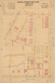
Plan, Melbourne and Metropolitan Board of Works, Melbourne & Metropolitan Board of Works : Borough of Kew : Detail Plan No.1294 & 1295, 1904
... The plans, at a scale of 40 feet to 1 inch (1:480), provide a detailed historical record of Melbourne streetscapes and environmental features. ...The plans, at a scale of 40 feet to 1 inch (1:480), provide a detailed historical record of Melbourne streetscapes and environmental features. ...The Melbourne and Metropolitan Board of Works (MMBW) plans were produced from the 1890s to the 1950s. They were crucial to the design and development of Melbourne's sewerage and drainage system. The plans, at a scale of 40 feet to 1 inch (1:480), provide a detailed historical record of Melbourne streetscapes and environmental features. Each plan covers one or two street blocks (roughly six streets), showing details of buildings, including garden layouts and ownership boundaries, and features such as laneways, drains, bridges, parks, municipal boundaries and other prominent landmarks as they existed at the time each plan was produced. (Source: State Library of Victoria). This plan forms part of a large group of MMBW plans and maps that was donated to the Society by the Mr Poulter, City Engineer of the City of Kew in 1989. Within this collection, thirty-five hand-coloured plans, backed with linen, are of statewide significance as they include annotations that provide details of construction materials used in buildings in the first decade of the 20th century as well as additional information about land ownership and usage. The copies in the Public Record Office Victoria and the State Library of Victoria are monochrome versions which do not denote building materials so that the maps in this collection are invaluable and unique tools for researchers and heritage consultants. A number of the plans are not held in the collection of the State Library of Victoria so they have the additional attribute of rarity.Original survey plan, issued by the MMBW to a contractor with responsibility for constructing sewers in the area identified on the plan within the Borough of Kew. The plan was at some stage hand-coloured, possibly by the contractor, but more likely by officers working in the Engineering Department of the Borough and later Town, then City of Kew. The hand-coloured sections of buildings on the plan were used to denote masonry or brick constructions (pink), weatherboard constructions (yellow), and public buildings (grey).The streets and built structures in MMBW Detail Plan 1294 & 1295 were surveyed in 1903 and released to contractors in 1904. This plan is one of two in the collection where the lithographers amalgamated two separate plans. Both plans include sections of Studley Park. Dominating the south and west corners of Kew Junction are the Clifton and Kew Hotels. The Kew Hotel, owned by Patrick O’Shaughnessy was one of the oldest in Kew. MMBW plans were amended over time to take account of new subdivisions such as that which created Merrion Place. Of the four mansions shown in Studley Park Road, three remain – ‘Field Place’, the home of Frances Henty, ‘Leaghur’ and ‘Darley’. ‘Byram’ (later ‘Goathland’, then ‘Tara Hall’) was an architectural marvel. Designed in 1888 by E.G. Kilburn for the paper magnate George Ramsden, it was demolished in 1960. While an earlier sale of the southern section of Byram had created Tara Avenue in 1927, the demolition of the house in 1960 enabled the extension of Tara Avenue northward.melbourne and metropolitan board of works, detail plans, mmbw 1294, mmbw 1295, cartography -
 Kew Historical Society Inc
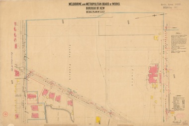
Plan, Melbourne & Metropolitan Board of Works : Borough of Kew : Detail Plan No.1296, 1904
... The plans, at a scale of 40 feet to 1 inch (1:480), provide a detailed historical record of Melbourne streetscapes and environmental features. ...The plans, at a scale of 40 feet to 1 inch (1:480), provide a detailed historical record of Melbourne streetscapes and environmental features. ...The Melbourne and Metropolitan Board of Works (MMBW) plans were produced from the 1890s to the 1950s. They were crucial to the design and development of Melbourne's sewerage and drainage system. The plans, at a scale of 40 feet to 1 inch (1:480), provide a detailed historical record of Melbourne streetscapes and environmental features. Each plan covers one or two street blocks (roughly six streets), showing details of buildings, including garden layouts and ownership boundaries, and features such as laneways, drains, bridges, parks, municipal boundaries and other prominent landmarks as they existed at the time each plan was produced. (Source: State Library of Victoria)This plan forms part of a large group of MMBW plans and maps that was donated to the Society by the Mr Poulter, City Engineer of the City of Kew in 1989. Within this collection, thirty-five hand-coloured plans, backed with linen, are of statewide significance as they include annotations that provide details of construction materials used in buildings in the first decade of the 20th century as well as additional information about land ownership and usage. The copies in the Public Record Office Victoria and the State Library of Victoria are monochrome versions which do not denote building materials so that the maps in this collection are invaluable and unique tools for researchers and heritage consultants. A number of the plans are not held in the collection of the State Library of Victoria so they have the additional attribute of rarity.Original survey plan, issued by the MMBW to a contractor with responsibility for constructing sewers in the area identified on the plan within the Borough of Kew. The plan was at some stage hand-coloured, possibly by the contractor, but more likely by officers working in the Engineering Department of the Borough and later Town, then City of Kew. The hand-coloured sections of buildings on the plan were used to denote masonry or brick constructions (pink), weatherboard constructions (yellow), and public buildings (grey). This area was once known as O’Shaughnessy’s Paddock. O’Shaughnessy was the licensee of the Kew Hotel. The ‘Paddock’ or farm was for many years the closest farm to Melbourne. By 1903, when this plan was surveyed and lithographed, little of the farm remained. The area is dominated by a ‘clay hole’, on the site of the current Foley Reserve. It was used by Smart’s Brickyard from the 1880s until 1911, when the Council purchased it for a rubbish dump. It is notable as the site is one of the few industrial operations to have existed in Kew. By 1903, urban development was characterised by larger houses fronting Barkers Road and brick and weatherboard villas in Foley Street. Nearer the pit, weatherboard houses predominated. Foley Street bisected the triangular block and continued right to Denmark Street. At this stage, a house impeded the through road, only allowing access via a right of way to High Street.melbourne and metropolitan board of works, detail plans, mmbw 1296, cartography -
 Kew Historical Society Inc
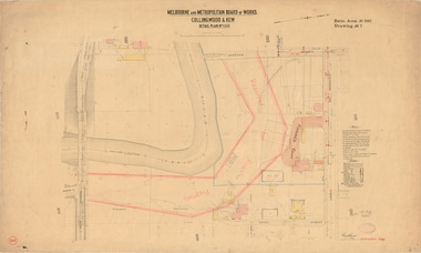
Plan, Melbourne & Metropolitan Board of Works : Borough of Kew : Detail Plan No.1297, 1904
... The plans, at a scale of 40 feet to 1 inch (1:480), provide a detailed historical record of Melbourne streetscapes and environmental features. ...The plans, at a scale of 40 feet to 1 inch (1:480), provide a detailed historical record of Melbourne streetscapes and environmental features. ...The Melbourne and Metropolitan Board of Works (MMBW) plans were produced from the 1890s to the 1950s. They were crucial to the design and development of Melbourne's sewerage and drainage system. The plans, at a scale of 40 feet to 1 inch (1:480), provide a detailed historical record of Melbourne streetscapes and environmental features. Each plan covers one or two street blocks (roughly six streets), showing details of buildings, including garden layouts and ownership boundaries, and features such as laneways, drains, bridges, parks, municipal boundaries and other prominent landmarks as they existed at the time each plan was produced. (Source: State Library of Victoria)This plan forms part of a large group of MMBW plans and maps that was donated to the Society by the Mr Poulter, City Engineer of the City of Kew in 1989. Within this collection, thirty-five hand-coloured plans, backed with linen, are of statewide significance as they include annotations that provide details of construction materials used in buildings in the first decade of the 20th century as well as additional information about land ownership and usage. The copies in the Public Record Office Victoria and the State Library of Victoria are monochrome versions which do not denote building materials so that the maps in this collection are invaluable and unique tools for researchers and heritage consultants. A number of the plans are not held in the collection of the State Library of Victoria so they have the additional attribute of rarity.Original survey plan, issued by the MMBW to a sewage contractor with responsibility for constructing sewers in the area identified on the plan within the Borough of Kew. The plan was at some stage hand-coloured, possibly by the contractor, but more likely by officers working in the Engineering Department of the Borough and later Town, then City of Kew. The hand-coloured sections of buildings on the plan were used to denote masonry or brick constructions (pink), weatherboard constructions (yellow), and public buildings (grey). This plan of Kew encompasses the area bounded by Barkers Road, High Street and Stevenson Street. Because of the angle created by High Street, a number of houses on the northern side of High Street are shown. The area is dominated by one of the great original landholdings in Kew, described here as the ‘Findon Paddock’. ‘Findon’, the house from which the name of the paddock was taken fronts Stevenson Street and was clearly a rambling structure. The best-known occupant of Findon was Henry ‘Money Miller’ who bought the house in 1871. Miller was a member of Victoria’s first parliament and assisted in the framing of its constitution. Findon was to be subdivided as early as 1912, when the Findon Subdivision was advertised to be sold by auction. In the plan of the subdivision, the original house is not shown, so, presumably it had previously been demolished. Fincham & Son moved the organ, built by Henry Willis, which was installed in the house, first to ‘Whernside’ in Toorak, and later to the Box Hill Methodist Church.melbourne and metropolitan board of works, detail plans, mmbw 1297, cartography, kew (vic.) — municipal collection -
 Kew Historical Society Inc
Plan, Melbourne & Metropolitan Board of Works : Borough of Kew : Detail Plan No.1301, 1910
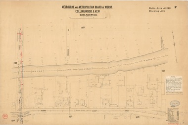
... The plans, at a scale of 40 feet to 1 inch (1:480), provide a detailed historical record of Melbourne streetscapes and environmental features. ...The plans, at a scale of 40 feet to 1 inch (1:480), provide a detailed historical record of Melbourne streetscapes and environmental features. ...The Melbourne and Metropolitan Board of Works (MMBW) plans were produced from the 1890s to the 1950s. They were crucial to the design and development of Melbourne's sewerage and drainage system. The plans, at a scale of 40 feet to 1 inch (1:480), provide a detailed historical record of Melbourne streetscapes and environmental features. Each plan covers one or two street blocks (roughly six streets), showing details of buildings, including garden layouts and ownership boundaries, and features such as laneways, drains, bridges, parks, municipal boundaries and other prominent landmarks as they existed at the time each plan was produced. (Source: State Library of Victoria)This plan forms part of a large group of MMBW plans and maps that was donated to the Society by the Mr Poulter, City Engineer of the City of Kew in 1989. Within this collection, thirty-five hand-coloured plans, backed with linen, are of statewide significance as they include annotations that provide details of construction materials used in buildings in the first decade of the 20th century as well as additional information about land ownership and usage. The copies in the Public Record Office Victoria and the State Library of Victoria are monochrome versions which do not denote building materials so that the maps in this collection are invaluable and unique tools for researchers and heritage consultants. A number of the plans are not held in the collection of the State Library of Victoria so they have the additional attribute of rarity.Original survey plan, issued by the MMBW to a contractor with responsibility for constructing sewers in the area identified on the plan within the Borough of Kew. The plan was at some stage hand-coloured, possibly by the contractor, but more likely by officers working in the Engineering Department of the Borough and later Town, then City of Kew. The hand-coloured sections of buildings on the plan were used to denote masonry or brick constructions (pink), weatherboard constructions (yellow), and public buildings (grey). Throughout its history, the land in what is known today as Studley Ward of the City of Boroondara has been subject to continuing subdivision. This is evident in Plan 1301, where later hands have modified the original map to include streets created subsequent to the printing of the plan in 1904. Other annotations such as the ‘Reserved for Road Purposes’ beside the Yarra never eventuated. The plan continued to be modified to at least 1953, when a later hand noted that a particular site was ‘Property site P. McIntyre house’ in Swinton Avenue. Two significant houses in the area are outlined on the plan: ‘Swinton’ on the corner of the streets then named Effey and Maud Streets (now Swinton Avenue) and ‘Fairhaven’ [unnamed] in Stevenson Street. The gardens of the two David Syme owned mansions of ‘Blythswood’ and ‘Rockingham’, stretching down to the River Yarra, are also represented.melbourne and metropolitan board of works, detail plans, mmbw 1301, cartography -
 Kew Historical Society Inc
Plan, Melbourne & Metropolitan Board of Works : Borough of Kew : Detail Plan No.1302, 1910
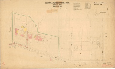
... The plans, at a scale of 40 feet to 1 inch (1:480), provide a detailed historical record of Melbourne streetscapes and environmental features. ...The plans, at a scale of 40 feet to 1 inch (1:480), provide a detailed historical record of Melbourne streetscapes and environmental features. ...The Melbourne and Metropolitan Board of Works (MMBW) plans were produced from the 1890s to the 1950s. They were crucial to the design and development of Melbourne's sewerage and drainage system. The plans, at a scale of 40 feet to 1 inch (1:480), provide a detailed historical record of Melbourne streetscapes and environmental features. Each plan covers one or two street blocks (roughly six streets), showing details of buildings, including garden layouts and ownership boundaries, and features such as laneways, drains, bridges, parks, municipal boundaries and other prominent landmarks as they existed at the time each plan was produced. (Source: State Library of Victoria)This plan forms part of a large group of MMBW plans and maps that was donated to the Society by the Mr Poulter, City Engineer of the City of Kew in 1989. Within this collection, thirty-five hand-coloured plans, backed with linen, are of statewide significance as they include annotations that provide details of construction materials used in buildings in the first decade of the 20th century as well as additional information about land ownership and usage. The copies in the Public Record Office Victoria and the State Library of Victoria are monochrome versions which do not denote building materials so that the maps in this collection are invaluable and unique tools for researchers and heritage consultants. A number of the plans are not held in the collection of the State Library of Victoria so they have the additional attribute of rarity.Original survey plan, issued by the MMBW to a contractor with responsibility for constructing sewers in the area identified on the plan within the Borough of Kew. The plan was at some stage hand-coloured, possibly by the contractor, but more likely by officers working in the Engineering Department of the Borough and later Town, then City of Kew. The hand-coloured sections of buildings on the plan were used to denote masonry or brick constructions (pink), weatherboard constructions (yellow), and public buildings (grey). The absence of buildings and or property in Kew facing the Yarra is the most notable feature of this plan. Walmer Street and its bridge stretched, then and now, from Studley Park Road to Victoria Street, Richmond. On the Richmond side of the Yarra, there was evidence in 1904 of industry (‘Wool shed’; Soap Works’) and entertainment (‘Skittle Alley’). In reality, another Plan (No.1303) shows Chinese Gardens bordering the Yarra on the Kew side and buildings in Young Street.melbourne and metropolitan board of works, detail plans, mmbw 1302, cartography -
 Kew Historical Society Inc
Plan, Melbourne & Metropolitan Board of Works : Borough of Kew : Detail Plan No.1350, 1910
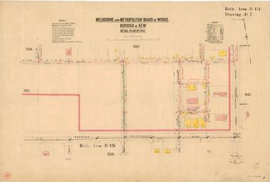
... The plans, at a scale of 40 feet to 1 inch (1:480), provide a detailed historical record of Melbourne streetscapes and environmental features. ...The plans, at a scale of 40 feet to 1 inch (1:480), provide a detailed historical record of Melbourne streetscapes and environmental features. ...The Melbourne and Metropolitan Board of Works (MMBW) plans were produced from the 1890s to the 1950s. They were crucial to the design and development of Melbourne's sewerage and drainage system. The plans, at a scale of 40 feet to 1 inch (1:480), provide a detailed historical record of Melbourne streetscapes and environmental features. Each plan covers one or two street blocks (roughly six streets), showing details of buildings, including garden layouts and ownership boundaries, and features such as laneways, drains, bridges, parks, municipal boundaries and other prominent landmarks as they existed at the time each plan was produced. (Source: State Library of Victoria). This plan forms part of a large group of MMBW plans and maps that was donated to the Society by the Mr Poulter, City Engineer of the City of Kew in 1989. Within this collection, thirty-five hand-coloured plans, backed with linen, are of statewide significance as they include annotations that provide details of construction materials used in buildings in the first decade of the 20th century as well as additional information about land ownership and usage. The copies in the Public Record Office Victoria and the State Library of Victoria are monochrome versions which do not denote building materials so that the maps in this collection are invaluable and unique tools for researchers and heritage consultants. A number of the plans are not held in the collection of the State Library of Victoria so they have the additional attribute of rarity.Original survey plan, issued by the MMBW to a contractor with responsibility for constructing sewers in the area identified on the plan within the Borough of Kew. The plan was at some stage hand-coloured, possibly by the contractor, but more likely by officers working in the Engineering Department of the Borough and later Town, then City of Kew. The hand-coloured sections of buildings on the plan were used to denote masonry or brick constructions (pink), weatherboard constructions (yellow), and public buildings (grey). MMBW Plan No. 1350 depicts the western end of Studley Park on the north side of the Studley Park Road. ‘Raheen’, then the home of Sir Henry Wrixon is named, the plan identifying those parts of the house that were built of brick and timber. The two houses between Raheen and the River Yarra are also shown. Other parts of the plan show neighbouring streets: Yarra Street, Studley Park Avenue, Studley Street and Fenwick Street. Each, apart from Fenwick Street was subsequently renamed. At the corner of Fenwick and Stawell Streets, the home of Joseph Butterworth Coombs, later called ‘Hope Mansell’, is represented but unnamed.melbourne and metropolitan board of works, detail plans, mmbw 1350, cartography -
 Kew Historical Society Inc
Plan, Melbourne & Metropolitan Board of Works : Borough of Kew : Detail Plan No.1561, 1905
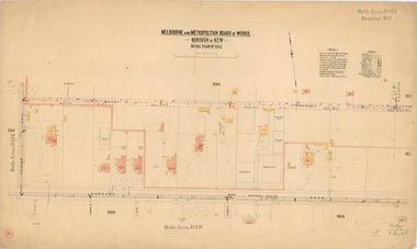
... The plans, at a scale of 40 feet to 1 inch (1:480), provide a detailed historical record of Melbourne streetscapes and environmental features. ...The plans, at a scale of 40 feet to 1 inch (1:480), provide a detailed historical record of Melbourne streetscapes and environmental features. ...The Melbourne and Metropolitan Board of Works (MMBW) plans were produced from the 1890s to the 1950s. They were crucial to the design and development of Melbourne's sewerage and drainage system. The plans, at a scale of 40 feet to 1 inch (1:480), provide a detailed historical record of Melbourne streetscapes and environmental features. Each plan covers one or two street blocks (roughly six streets), showing details of buildings, including garden layouts and ownership boundaries, and features such as laneways, drains, bridges, parks, municipal boundaries and other prominent landmarks as they existed at the time each plan was produced. (Source: State Library of Victoria). This plan forms part of a large group of MMBW plans and maps that was donated to the Society by Mr Poulter, City Engineer of the City of Kew in 1989. Within this collection, thirty-five hand-coloured plans, backed with linen, are of statewide significance as they include annotations that provide details of construction materials used in buildings in the first decade of the 20th century as well as additional information about land ownership and usage. The copies in the Public Record Office Victoria and the State Library of Victoria are monochrome versions which do not denote building materials so that the maps in this collection are invaluable and unique tools for researchers and heritage consultants. A number of the plans are not held in the collection of the State Library of Victoria so they have the additional attribute of rarity.Original survey plan, issued by the MMBW to a contractor with responsibility for constructing sewers in the area identified on the plan within the Borough of Kew. The plan was at some stage hand-coloured, possibly by the contractor, but more likely by officers working in the Engineering Department of the Borough and later Town, then City of Kew. The hand-coloured sections of buildings on the plan were used to denote masonry or brick constructions (pink), weatherboard constructions (yellow), and public buildings (grey). MMBW Detail Plan 1561 outlines those residences in the area bordered by Burke Road, Loxton Street, Mount Street and Barkers Road that had been constructed by 1905 when the land was surveyed. At this time, the area nearest Burke Road had been subdivided and developed whereas the lands to the west were as yet undeveloped. The houses represented are not named on the Plan.melbourne and metropolitan board of works, detail plans, mmbw 1561, cartography -
 Kew Historical Society Inc
Plan, Melbourne and Metropolitan Board of Works, Borough of Kew : Detail Plan No.1562, 1905
... The plans, at a scale of 40 feet to 1 inch (1:480), provide a detailed historical record of Melbourne streetscapes and environmental features. ...The plans, at a scale of 40 feet to 1 inch (1:480), provide a detailed historical record of Melbourne streetscapes and environmental features. ...The Melbourne and Metropolitan Board of Works (MMBW) plans were produced from the 1890s to the 1950s. They were crucial to the design and development of Melbourne's sewerage and drainage system. The plans, at a scale of 40 feet to 1 inch (1:480), provide a detailed historical record of Melbourne streetscapes and environmental features. Each plan covers one or two street blocks (roughly six streets), showing details of buildings, including garden layouts and ownership boundaries, and features such as laneways, drains, bridges, parks, municipal boundaries and other prominent landmarks as they existed at the time each plan was produced. (Source: State Library of Victoria). This plan forms part of a large group of MMBW plans and maps that was donated to the Society by the Mr Poulter, City Engineer of the City of Kew in 1989. Within this collection, thirty-five hand-coloured plans, backed with linen, are of statewide significance as they include annotations that provide details of construction materials used in buildings in the first decade of the 20th century as well as additional information about land ownership and usage. The copies in the Public Record Office Victoria and the State Library of Victoria are monochrome versions which do not denote building materials so that the maps in this collection are invaluable and unique tools for researchers and heritage consultants. A number of the plans are not held in the collection of the State Library of Victoria so they have the additional attribute of rarity.Original survey plan, issued by the MMBW to a contractor with responsibility for constructing sewers in the area identified on the plan within the Borough of Kew. The plan was at some stage hand-coloured, possibly by the contractor, but more likely by officers working in the Engineering Department of the Borough and later Town, then City of Kew. The hand-coloured sections of buildings on the plan were used to denote masonry or brick constructions (pink), weatherboard constructions (yellow), and public buildings (grey). MMBW detail plan No.1562, in contrast to No.1561 includes the names of a large number of houses: in Barkers Road: ‘Ashwick’, ‘Owasso’, ‘Anadiha’, ‘Eurobin’, ‘Carlsruhe’, ‘Arlington’ and ‘Altyre’. Unnamed but clearly represented on the plan is what was then known as the ‘Auburn Heights Recreation Club’, which at this stage included a Bowling Green, a Croquet Green and two Tennis Courts. On the plan, Brougham Place, as it was then known, is represented. It was later renamed Daniell Place. The aforementioned Arlington is now the junior campus of Preshil. melbourne and metropolitan board of works, detail plans, mmbw 1562, cartography -
 Kew Historical Society Inc
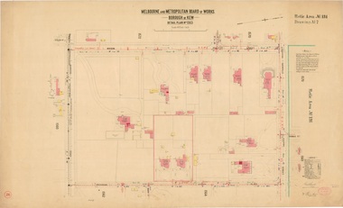
Plan, Melbourne & Metropolitan Board of Works : Borough of Kew : Detail Plan No.1563, 1905
... The plans, at a scale of 40 feet to 1 inch (1:480), provide a detailed historical record of Melbourne streetscapes and environmental features. ...The plans, at a scale of 40 feet to 1 inch (1:480), provide a detailed historical record of Melbourne streetscapes and environmental features. ...The Melbourne and Metropolitan Board of Works (MMBW) plans were produced from the 1890s to the 1950s. They were crucial to the design and development of Melbourne's sewerage and drainage system. The plans, at a scale of 40 feet to 1 inch (1:480), provide a detailed historical record of Melbourne streetscapes and environmental features. Each plan covers one or two street blocks (roughly six streets), showing details of buildings, including garden layouts and ownership boundaries, and features such as laneways, drains, bridges, parks, municipal boundaries and other prominent landmarks as they existed at the time each plan was produced. (Source: State Library of Victoria)This plan forms part of a large group of MMBW plans and maps that was donated to the Society by the Mr Poulter, City Engineer of the City of Kew in 1989. Within this collection, thirty-five hand-coloured plans, backed with linen, are of statewide significance as they include annotations that provide details of construction materials used in buildings in the first decade of the 20th century as well as additional information about land ownership and usage. The copies in the Public Record Office Victoria and the State Library of Victoria are monochrome versions which do not denote building materials so that the maps in this collection are invaluable and unique tools for researchers and heritage consultants. A number of the plans are not held in the collection of the State Library of Victoria so they have the additional attribute of rarity.Original survey plan, issued by the MMBW to a contractor with responsibility for constructing sewers in the area identified on the plan within the Borough of Kew. The plan was at some stage hand-coloured, possibly by the contractor, but more likely by officers working in the Engineering Department of the Borough and later Town, then City of Kew. The hand-coloured sections of buildings on the plan were used to denote masonry or brick constructions (pink), weatherboard constructions (yellow), and public buildings (grey). This plan covers the area between Barkers Road, Wrixon Street, Sackville Street and Brougham Place, much of it now occupied by Carey Baptist Grammar and Preshil schools. This was an area of large and prestigious homes in 1903, some with formally laid-out gardens, such as ‘Tower Hill’ and ‘Opawa’. ‘Kalimna’ was built in 1890-91 for William H. Jarman, an accountant, and ‘Blackhall’ at the same time for W.H. Roberts. Blackhall was to be acquired by the Salvation Army in 1915 and renamed ‘Catherine Booth Girls’ Home’. The Home accommodated girls, aged between 4 and 16. Kalimna and Blackhall are of significance as typical and intact late Victorian mansions and as such are two key Victorian buildings to have been built in Kew. Both Blackhall and Kalimna are now part of Preshil. ‘Fairview’ was for a long time occupied by the Sisters of St. Joseph of Cluny as a care home for the elderly, but it is now part of Carey Grammar School, as are the grounds of ‘Wagga Merne’, ‘Weemutta’, ‘Blakely’, ‘Daheim’ and ‘Mildura’ (later ‘Urangeline’), the last being particularly impressive in 1903, with a tennis court, conservatory, outhouses, and two bathrooms!melbourne and metropolitan board of works, detail plans, mmbw 1563, cartography
