Showing 58 items matching "field survey section"
-
 Bendigo Military Museum
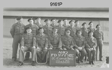
Photograph - Group photograph AHQ Field Survey Section, Hampstead Barracks, SA, 1953
... Group photograph AHQ Field Survey Section, Hampstead Barracks, SA ...Group photograph AHQ Field Survey Section, Hampstead Barracks, SA ......Field Survey Section...This photograph was taken on 22 July 1953 at AHQ Field Survey Section, Central Command, Hampstead Barracks, Adelaide, SA of a group of Royal Australian Survey Corps soldiers in uniform. ....1) - This black & white photograph was taken on 22 July 1953 at AHQ Field Survey Section, Central Command, Hampstead Barracks, Adelaide, SA of a group of RASvy soldiers in uniform. ...Group photograph AHQ Field Survey Section, Hampstead Barracks, SA Photograph Group photograph AHQ Field Survey Section, Hampstead Barracks, SA ...This photograph was taken on 22 July 1953 at AHQ Field Survey Section, Central Command, Hampstead Barracks, Adelaide, SA of a group of Royal Australian Survey Corps soldiers in uniform. The unit, with an establishment of three officers and twenty-two other ranks was formed in Adelaide at Largs Bay in February 1952 to take responsibility for mapping of Woomera and military mapping in all parts of the state. The occasion may have been to commemorate the Section’s relocation to Hampstead Barracks, possibly taken at the beginning of their short tenure (approx 1 year), after moving from Largs Bay, before subsequently relocating to Keswick Barracks in 1954. The soldiers are grouped in three rows with an information board at front, a corrugated iron building in the background and a dog in the lower right corner. Rear row is unidentified soldiers; centre row is unidentified soldiers and front row is an unidentified Staff Sergeant; unidentified Sergeant; Lt NRJ Hillier; Maj WB Relf (OC); unidentified WO2; unidentified Staff Sergeant. .1) - This black & white photograph was taken on 22 July 1953 at AHQ Field Survey Section, Central Command, Hampstead Barracks, Adelaide, SA of a group of RASvy soldiers in uniform. The soldiers are grouped in three rows with an information board at front, a corrugated iron building in background and a dog in the lower right corner. This photo was scanned at 300 dpi.royal australian survey corps, rasvy, central command, field survey section, adelaide, hampstead barracks -
 Bendigo Military Museum
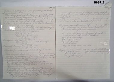
Administrative record - 1 Fd Svy Sect - Fortuna 1946, 1 Field Survey Section, 1946?
... Record talking about the formation of 1 Field Survey Section at "Fortuna." It lists the personnel involved and where they were located for work and where they were housed, Their initial task was to complete a levelling survey from the Murray River at Yarrawonga to the Murrumbidgee River. ...1 Field Survey Section...Record talking about the formation of 1 Field Survey Section at "Fortuna." It lists the personnel involved and where they were located for work and where they were housed, Their initial task was to complete a levelling survey from the Murray River at Yarrawonga to the Murrumbidgee River. ...Admin. Record talking about the formation of 1 Field Survey Section at "Fortuna." It lists the personnel involved and where they were located for work and where they were housed, Their initial task was to complete a levelling survey from the Murray River at Yarrawonga to the Murrumbidgee River. The section was transferred to Colac in October 1946 with increased manning. The section conducted surveys for training maps of Cola and beeac.Two A4 pages of handwritten reportroyal australian survey corps, fortuna -
 Bendigo Military Museum
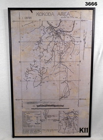
Map - MAP, KOKODA MOUNTED, 2nd Aust Field Survey Section, 4.9.1942
... 2nd Aust Field Survey Section...Map MAP, KOKODA MOUNTED 2nd Aust Field Survey Section ...Map was compiled from aerial photos without ground control or inspection & with information received from Major CAMERON.Laminated map of Kokoda area on board backing with black border. Black printing on cream / fawn background. White hanging strap on back. Information ledger bottom LHS. Kokoda inset bottom RHS.Printed at top: “KOKODA AREA” Printed at bottom “RHS: K11”map, kokoda, mounted -
 Bendigo Military Museum
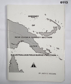
Booklet - History of the New Guinea Survey Section 1967 by LT Jack Viccars, Lt Jack Stewart Viccars, Circa 1967
... Military surveying in New Guinea began in in WWII with the formation of the New Guinea Force Field Survey Section which later became 8th Australian Field Survey Section and later 2 Field Survey Section of 6th Army Topographical Survey Section. ...Bendigo Military Museum 37 - 39 Pall Mall Bendigo goldfields Military surveying in New Guinea began in in WWII with the formation of the New Guinea Force Field Survey Section which later became 8th Australian Field Survey Section and later 2 Field Survey Section of 6th Army Topographical Survey Section. ...Military surveying in New Guinea began in in WWII with the formation of the New Guinea Force Field Survey Section which later became 8th Australian Field Survey Section and later 2 Field Survey Section of 6th Army Topographical Survey Section. This history was written by LT Jack Viccars and member of the Unit.A4 Booklet, Black and white, 43 Pages, 4 Annexes, Map Indexes, Gloss Paper Cover, Bound by staplesForward by Brigadier D. Macdonald (Retd) AM, Royal Australian Survey Corps 1936-1967, Preface by LT Jack J.S. Viccarsroyal australian survey corps, rasvy, fortuna, army survey regiment, asr -
 Bendigo Military Museum
Photograph - 4th Field Survey Squadron Adventurous Training, Wilpena pound, Flinders Ranges, SA, 1989
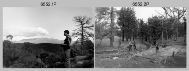
... Field Survey Squadron adventurous training held at Wilpena pound, in the Flinders Ranges of South Australia in 1989. It is evident the training focussed on teamwork, leadership, abseiling, rock climbing, field craft and living off the land survival skills. Elements from units of the Army Reserve also participated in the training. In this photo set, one of 4th Field Survey’s sections...Field Survey Squadron adventurous training held at Wilpena pound, in the Flinders Ranges of South Australia in 1989. It is evident the training focussed on teamwork, leadership, abseiling, rock climbing, field craft and living off the land survival skills. Elements from units of the Army Reserve also participated in the training. In this photo set, one of 4th Field Survey’s sections ...This is a set of 43 photographs of a 4th Field Survey Squadron adventurous training held at Wilpena pound, in the Flinders Ranges of South Australia in 1989. It is evident the training focussed on teamwork, leadership, abseiling, rock climbing, field craft and living off the land survival skills. Elements from units of the Army Reserve also participated in the training. In this photo set, one of 4th Field Survey’s sections participated in abseiling and trekked to the highest mountain in the Flinders Ranges – St. Mary’s Peak. Refer to items 6553.56P for additional colour photographs taken during the adventurous training exercise.This is a set of 43 photographs of 4th Field Survey Squadron personnel undergoing adventurous training held at Wilpena pound, in the Flinders Ranges of South Australia in 1989. The black & white photographs are on 35mm negative film and are part of the Army Survey Regiment’s Collection. The photographs were scanned at 96 dpi. .1) - Photo, black & white, 1989. L to R: SGT Laurie Justin, SGT Stu Symonds. .2) - Photo, black & white, 1989. L to R: SGT Stu Symonds, CPL Roger Graf, SSGT Max Coletti, SPR Cheryl Deluca-Cardillo, SPR Andrew Quin. .3) & .4) - Photo, black & white, 1989. Wilpena Pound topography. .5) - Photo, black & white, 1989. SGT Stu Symonds. .6) - Photo, black & white, 1989. Abseiling ropes and equipment. .7) to .16) - Photo, black & white, 1989. Abseiling activities, unidentified soldier. .17) to .18) - Photo, black & white, 1989. Abseiling activities, CPL Michelle Griffith. .19) - Photo, black & white, 1989. L to R: unidentified (x5), SGT Mick Hogan, unidentified (x3). .20) - Photo, black & white, 1989. L to R: CPL Roger Graf, CPL Michelle Griffith, SPR Cheryl Deluca-Cardillo, SGT Laurie Justin, SSGT Max Coletti, SPR Andrew Quin. SGT Stu Symonds. .21) - Photo, black & white, 1989. L to R: unidentified (x2), SGT Stu Symonds. .22) & .23) - Photo, black & white, 1989. Wilpena Pound topography. .24) - Photo, black & white, 1989. SSGT Max Coletti. .25) - Photo, black & white, 1989. SSGT Max Coletti, SPR Cheryl Deluca-Cardillo, SGT Stu Symonds. .26) - Photo, black & white, 1989. SGT Stu Symonds. .27) - Photo, black & white, 1989. L to R: CPL Michelle Griffith, SPR Cheryl Deluca-Cardillo, SSGT Max Coletti, SGT Laurie Justin, SPR Andrew Quin, CPL Roger Graf, SGT Stu Symonds. .28) &.29) - Photo, black & white, 1989. Wilpena Pound topography. .30) - Photo, black & white, 1989. SGT Stu Symonds. .31) - Photo, black & white, 1989. CPL Michelle Griffith. .32) - Photo, black & white, 1989. L to R: CPL Michelle Griffith, SGT Stu Symonds, SSGT Max Coletti, SGT Laurie Justin. .33) - Photo, black & white, 1989. L to R: CPL Michelle Griffith, SGT Stu Symonds, CPL Roger Graf (standing), SSGT Max Coletti, SGT Laurie Justin. .34) - Photo, black & white, 1989. L to R: SGT Stu Symonds, CPL Michelle Griffith, CPL Roger Graf (standing), SSGT Max Coletti, SGT Laurie Justin. .35) to .37) - Photo, black & white, 1989. Wilpena Pound topography. .38) - Photo, black & white, 1989. SPR Cheryl Deluca-Cardillo. .39) - Photo, black & white, 1989. L to R: CPL Michelle Griffith, SGT Stu Symonds, SPR Andrew Quin, SGT Laurie Justin. .40) &.41) - Photo, black & white, 1989. Wilpena Pound topography. .1P to .43P – There are no personnel identified. ‘1989 ADV TRAINING’ annotated on negatives sleeve.royal australian survey corps, rasvy, 4 fd svy sqn -
 Bendigo Military Museum
Photograph - 4th Field Survey Squadron Adventurous Training, Wilpena pound, Flinders Ranges, SA, 1989
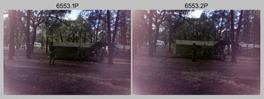
... Field Survey Squadron adventurous training held at Wilpena pound, in the Flinders Ranges of South Australia in 1989. It is evident the training focussed on teamwork, leadership, abseiling, rock climbing, field craft and living off the land survival skills. Elements from units of the Army Reserve also participated in the training. In this photo set, one of 4th Field Survey’s sections...Field Survey Squadron adventurous training held at Wilpena pound, in the Flinders Ranges of South Australia in 1989. It is evident the training focussed on teamwork, leadership, abseiling, rock climbing, field craft and living off the land survival skills. Elements from units of the Army Reserve also participated in the training. In this photo set, one of 4th Field Survey’s sections ...This is a set of 55 photographs of a 4th Field Survey Squadron adventurous training held at Wilpena pound, in the Flinders Ranges of South Australia in 1989. It is evident the training focussed on teamwork, leadership, abseiling, rock climbing, field craft and living off the land survival skills. Elements from units of the Army Reserve also participated in the training. In this photo set, one of 4th Field Survey’s sections participated in abseiling and trekked to the highest mountain in the Flinders Ranges – St. Mary’s Peak. Refer to item 6552.43P for black & white photographs taken during the adventurous training exercise.This is a set of 55 photographs of 4th Field Survey Squadron personnel undergoing adventurous training held at Wilpena pound, in the Flinders Ranges of South Australia in 1989. The colour photographs are on 35mm negative film and are part of the Army Survey Regiment’s Collection. The photographs were scanned at 96 dpi. .1) & 2)- Photo, colour, 1989. Base camp. WO1 Bill Griggs 2nd from left, remainder unidentified. .3) - Photo, colour, 1989. Old homestead inside Wilpena Pound. SPR Cheryl Deluca-Cardillo, 2nd from left, remainder unidentified. .4) - Photo, colour, 1989. Wilpena Pound topography. .5) - Photo, colour, 1989. Abseiling activities, unidentified personnel. .6) & .7) - Photo, colour, 1989. Flinders Ranges topography. .8) - Photo, colour, 1989. Abseiling activities. L to R: SSGT Max Coletti, SGT Stu Symonds. .9) - Photo, colour, 1989. Abseiling activities, unidentified personnel. .10) - Photo, colour, 1989. Flinders Ranges topography. .11) - Photo, colour, 1989. Abseiling activities. L to R: unidentified, CPL Michelle Griffith, SGT Stu Symonds. .12) - Photo, colour, 1989. Abseiling activities. L to R: unidentified, SPR Andrew Quin, SGT Laurie Justin, SGT Stu Symonds. .13) - Photo, colour, 1989. Abseiling activities. L to R: SGT Stu Symonds SGT Laurie Justin. .14) - Photo, colour, 1989. Abseiling activities. L to R: unidentified, SGT Stu Symonds. .15) - Photo, colour, 1989. Abseiling activities. SGT Laurie Justin. .16) - Photo, colour, 1989. Abseiling activities. SGT Stu Symonds. .17) & .18) - Photo, colour, 1989. Abseiling activities. SPR Cheryl Deluca-Cardillo. .19) - Photo, colour, 1989. Abseiling activities. L to R: SPR Cheryl Deluca-Cardillo, unidentified. .20) - Photo, colour, 1989. Abseiling activities. SSGT Max Coletti. .21) - Photo, colour, 1989. Abseiling activities. SPR Andrew Quin. .22) - Photo, colour, 1989. Abseiling activities. CPL Michelle Griffith. .23) - Photo, colour, 1989. Abseiling activities. CPL Michelle Griffith. .24) - Photo, colour, 1989. Flinders Ranges topography, unidentified personnel. .25) - Photo, colour, 1989. Flinders Ranges topography, unidentified SGT. .26) to .30) - Photo, colour, 1989. Flinders Ranges topography. .31) - Photo, colour, 1989. Flinders Ranges topography, unidentified personnel. .32) & .33) - Photo, colour, 1989. Flinders Ranges topography. L to R: unidentified, CPL Michelle Griffith, SGT Stu Symonds, CPL Roger Graf, SSGT Max Coletti, SGT Laurie Justin. .34) - Photo, colour, 1989. St. Mary’s Peak. L to R: unidentified, CPL Michelle Griffith, CPL Steve Nokes, SGT Stu Symonds. .35) - Photo, colour, 1989. St. Mary’s Peak. SGT Stu Symonds. .36) & .37) - Photo, colour, 1989. St. Mary’s Peak. CPL Steve Nokes. .38) - Photo, colour, 1989. Flinders Ranges topography. .39) - Photo, colour, 1989. St. Mary’s Peak. SGT Laurie Justin. .40) - Photo, colour, 1989. St. Mary’s Peak. SPR Cheryl Deluca-Cardillo. .41) - Photo, colour, 1989. St. Mary’s Peak. SPR Andrew Quin. .42) - Photo, colour, 1989. Flinders Ranges topography, SGT Stu Symonds. .43) - Photo, colour, 1989. Social activities. L to R: unidentified (x6), CPL Perry Langeberg, SGT Laurie Justin. .44) - Photo, colour, 1989. Social activities. L to R: CPL Perry Langeberg, SGT John Zuringer, SGT Laurie Justin, SGT Mick Hogan, unidentified, SGT Stu Symonds. .45) - Photo, colour, 1989. Social activities. L to R: unidentified (x6), CPL Perry Langeberg, SGT John Zuringer. .46) - Photo, colour, 1989. Social activities. L to R: CPL Jamie McRae, SGT Laurie Justin, SGT Mick Hogan, unidentified, SGT Stu Symonds, SPR Cheryl Deluca-Cardillo, WO1 Bill Griggs. .47) - Photo, colour, 1989. Social activities. L to R: SGT Laurie Justin, unidentified, CPL Steve Nokes, SGT Stu Symonds, SPR Cheryl Deluca-Cardillo, WO1 Bill Griggs, unidentified (x2). .48) - Photo, colour, 1989. Social activities. L to R: CPL Steve Nokes, WO1 Bill Griggs, SPR Cheryl Deluca-Cardillo, unidentified (x2), CPL Steve Ellis, CPL Michelle Griffith, SGT Gill Park. .49) - Photo, colour, 1989. Social activities. L to R: CPL Perry Langeberg, SGT John Zuringer, CPL Jamie McRae, SGT Laurie Justin, SGT Mick Hogan, unidentified, SGT Stu Symonds. .50) - Photo, colour, 1989. Sheep cooking in fire pit. L to R: WO2 Peter Symmans, unidentified (x5), CPL Steve Ellis. .51) - Photo, colour, 1989. Sheep cooking in fire pit. L to R: WO2 Peter Symmans, unidentified. .52) - Photo, colour, 1989. Sheep cooking in fire pit. Unidentified personnel. .53) - Photo, colour, 1989. Cooked sheep removed from fire pit. L to R: unidentified. WO2 Peter Symmans, unidentified. .54) - Photo, colour, 1989. Cooked sheep removed from fire pit. L to R: CPL Michelle Griffith, SGT Gill Park, unidentified, SSGT Max Coletti, unidentified, SPR Cheryl Deluca-Cardillo. .55) - Photo, colour, 1989. Cooked sheep removed from fire pit. L to R: unidentified, CPL Michelle Griffith, WO2 Peter Symmans..1P to .55P – There are no personnel identified. ‘1989 ADV TRAINING’ annotated on negatives sleeve.royal australian survey corps, rasvy, 4 fd svy sqn -
 Bendigo Military Museum
Photograph - 4 Fd Svy Sqn Closure Ceremony 25 Nov 1995, 4 Fd Svy Sqn, Keswick Barracks, Adelaide, 25.11.1995
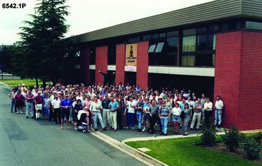
... In February 1952, Army HQ Field Survey Section (Central Command Detachment) was established in Adelaide in a drill hall at Largs Bay. ...In February 1952, Army HQ Field Survey Section (Central Command Detachment) was established in Adelaide in a drill hall at Largs Bay. ...Between 1915 and 1951, military topographical mapping in SA was conducted by Royal Australian Survey Corps (RASvy) units based outside the state. In February 1952, Army HQ Field Survey Section (Central Command Detachment) was established in Adelaide in a drill hall at Largs Bay. It was tasked with providing map coverage in the Woomera and Southern areas of the state. The section was subsequently reorganised as Central Command Field Survey Section moving firstly to Hampstead Barracks, Hampstead in 1953 and then into accommodation at Keswick Barracks in 1954. In 1957 the Section commenced mapping operations in the NT. The Unit was relocated to the old cavalry stables in 1961 and was redesignated Central Command Survey Unit and remained there till 1973. In 1970 the Unit was redesignated 4 Fd Svy Sqn and engaged in operations conducted in PNG from 1972 to 1974 inclusive. In 1973 the Squadron moved into a brand new two-storey specially designed and purpose built building adjacent to the old building. The old building then became the Squadron Q and Map store with an interconnecting lobby to the new building. Since 1975 the Unit was involved in the 1:50,000 Mapping Programme in WA, NT, QLD, SA and conducted many other operations within Australia and overseas. Post disbandment of the Corps the old Squadron building (cavalry stables) now houses the Army Museum of South Australia (AMOSA). The Royal Australian Survey Corps was amalgimated into the Royal Australian Engineer Corps in July 1996. In the lead up to this amalgamation, 4 Field Survey Squadron Keswick Barracks, Adelaide, South Australia was disbanded in 1995. A closing Ceremony was held on 25 November 1995 at 4 Fd Svy Sqn Keswick Barracks attended by about 208 former members of the Unit. A photo was taken of attendees at that event on the day and a list was prepared of attendees. All attendees were sent a copy of the photograph and the list of names as a momento of the Unit and the ceremony..1P A4 Print of an original photo of attendees at the 4 Fd Survey Sqn Closure Ceremony at Keswick Barracks 25 Nov 1995. .2P A4 Print of the names of the attendees at the 4 Fd Survey Sqn Closure Ceremony at Keswick Barracks 25 Nov 1995. Approx 208 attendees.royal australian survey corps, rasvy, fortuna, army survey regiment, army svy regt, asr, 4 fd svy sqn -
 Bendigo Military Museum
Photograph - WRAAC Personnel posted to the Army Headquarters Survey Regiment, Fortuna Bendigo, c1950s – 1960s
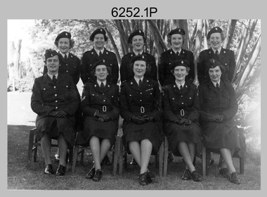
... In February 1957 female positions from the disbanded Southern Command Field Survey Section in Melbourne were transferred to newly established positions at the Army Headquarters Survey Regiment, Bendigo. ...In February 1957 female positions from the disbanded Southern Command Field Survey Section in Melbourne were transferred to newly established positions at the Army Headquarters Survey Regiment, Bendigo. ...This is a collection of seven photographs of Women’s Royal Australian Army Corps (WRAAC) personnel posted to the Army Headquarters Survey Regiment, Fortuna, Bendigo circa 1957 to 1964. After the disbandment of the Australian Women's Army Service (AWAS) in 1947 there was only one or two of civilian women in administrative positions at Fortuna. In February 1957 female positions from the disbanded Southern Command Field Survey Section in Melbourne were transferred to newly established positions at the Army Headquarters Survey Regiment, Bendigo. They were accommodated at the newly acquired ‘Turriff’ mansion in Carpenter Street, Bendigo. Their first Officer Commanding (OC) was CAPT Beryl Perry from 1957 to September 1960. Her replacement as OC was CAPT Carol Castor who served in several positions up to June 1967. The main areas of employment in these early days were in administrative positions, draughting in and retouching in Lithographic Squadron. WO2 MA McLaren was the first female to reach the rank of WO2 as a Cartographic Squadron section commander in June 1961. WO1 Marj Knight served at Fortuna from 1959 to 1978 was the first female to reach the rank of WO1. WO1 Knight served in the senior Squadron Sergeant-Major and Technical Warrant Officer positions of Cartographic Squadron. She was also the first female PMC of the Army Survey Regiment SGT’s Mess. The WRAAC uniform seen in this collection was replaced in 1979. As the Australian Army implemented the disbandment of the WRAAC as a separate corps in 1980, WRAAC personnel posted to Royal Australian Survey Corps units were integrated into RA Svy.This is a collection of seven photographs of Women’s Royal Australian Army Corps (WRAAC) personnel posted to the Army Headquarters Survey Regiment, Fortuna Bendigo circa 1957 to 1964. The photographs were printed on photographic paper and are part of the Army Survey Regiment’s Collection. The photographs were scanned at 300 dpi. .1) - Photo, black & white, c1957. Back row – unidentified personnel, Front row – centre: CAPT Beryl Perry, unidentified personnel. .2) - Photo, black & white, c1958. Back row – unidentified personnel, Front row L to R: unidentified, SGT Margaret McLaren, CAPT Beryl Perry, unidentified (x2). .3) - Photo, black & white 1959. Back row – L to R: PTE Gwen Hill, PTE Hilary Clarkson, PTE Helen Paisley, PTE Pam Carseldine, PTE Margaret Ross, PTE Barbara Minto, PTE Margaret Taylor. Front row L to R: PTE Barbara Hawkin, PTE Joan Murray, SGT Margaret McLaren, CAPT Carol Castor, CPL Jenny Murray, CPL Julie Williams, PTE Phillipa Bowman. .4) - Photo, black & white, October 1963. L to R: WO2 Margaret McLaren, PTE Kay Brown, CAPT Carol Castor, PTE Helen Pasley, PTE Bev Madex, CPL Marj Knight. .5) - Photo, black & white, October 1963. L to R: PTE Bev Madex, PTE Helen Pasley, PTE Kay Brown, WO2 MA McLaren, CPL Marj Knight. .6) - Photo, black & white, August 1963. Back row – L to R: PTE Hollingsworth, PTE GM Hill, PTE PE Sykes, PTE Nola Strawbridge, PTE Jan Cruickshank, PTE Margaret Taylor, PTE Prescott, PTE RR Hutton, PTE BJ Madex, PTE BM Fuhrmann, PTE Cockburn. Front row – L to R: PTE NA Falot, LCPL JA Hurst, SGT Marj Knight, CAPT Carol Caster, CPL Jennifer Murray, LCPL A Burrows, unidentified. .7) - Photo, black & white, 1964. Back row – L to R: PTE Dianne Fowler, PTE Leslie Mortimer, PTE Marlene Penglase, PTE Marg Cooper, PTE Irene Rankins, PTE Elaine Veith, PTE Lyn Ireland, PTE Marg Murphy, PTE Nola Downes, PTE Joan Lawler, PTE Henni Schunck. Front row – L to R: PTE Loretta Hall, LCPL Jo McNamara, SGT Marj Knight, CAPT Carol Caster, CPL Nola Strawbridge, PTE Mary McHugh, PTE Kalen Sargent..1P to .3P, .7P - no annotation, .4P to .6P - Personnel (surnames, no rank) annotated on back.royal australian survey corps, rasvy, army survey regiment, army svy regt, fortuna, asr, wraac -
 Warrnambool and District Historical Society Inc.
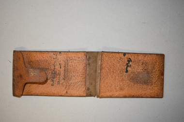
Artefact, Field Wallet, Early 20th century
... surveying business of Rolf Crawley in Warrnambool. The Warrnambool and District Historical Society acquired the wallet, along with several ledgers and other Crawley memorabilia from the estate of Michael Hand. This wallet is of interest as it was owned and used by Rolf Crawley when he was doing field work in connection with his surveying and engineering jobs either in private practice or as the Shire of Warrnambool engineer in the 20th century. Rolf Crawley, Warrnambool Shire of Warrnambool ‘Rolf L. Crawley L. S. Shire Hall Warrnambool’ This is a brown leather wallet in two sections ...This is a field wallet that belonged to Rolf Crawley. He was an engineer, surveyor and architect in private practice in Warrnambool and also the engineer for the Shire of Warrnambool from 1935 to 1968. His grandfather, father and uncle were also engineers, working in that capacity or as the Shire Secretary for the Shire of Warrnambool, with the Crawley family recording a total of 132 years service to the Shire. The Shire of Warrnambool existed from 1863 to 1994. The wallet came into the possession of Michael Hand who took over the private surveying business of Rolf Crawley in Warrnambool. The Warrnambool and District Historical Society acquired the wallet, along with several ledgers and other Crawley memorabilia from the estate of Michael Hand. This wallet is of interest as it was owned and used by Rolf Crawley when he was doing field work in connection with his surveying and engineering jobs either in private practice or as the Shire of Warrnambool engineer in the 20th century. This is a brown leather wallet in two sections that fold over and close with a flap or tongue that inserts into a strip of leather stitched into the cover. The two sections have extra pieces of leather that are stitched on to make compartments. These contain three pieces of thick card folded over. These cards have rough notes and figures handwritten on them. Inside the wallet is a hand-printed name. The wallet is much scuffed and stained. ‘Rolf L. Crawley L. S. Shire Hall Warrnambool’rolf crawley, warrnambool, shire of warrnambool -
 Bendigo Military Museum
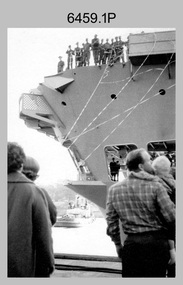
Photograph - A Section, 1st Topographic Survey Troop, Vung Tau, Vietnam, 1966
... External personnel deployed were: WO2 Snow Rollston from Northern Command Field Survey Unit, T/CPL Peter Clarke – orderly room corporal, T/CPL Alan Carew – Technical Storeman, SPR Stan Johns – Map Storeman, SPR Boots Campbell – batman/driver and PTE BNF Brunning – cook. The ship featured in photos .1P and .2P was the aircraft carrier HMAS Sydney on its 4th voyage to Vietnam. On board were SGT Stan Campbell and SPR Brian Firns, tasked to manage A Section’s...External personnel deployed were: WO2 Snow Rollston from Northern Command Field Survey Unit, T/CPL Peter Clarke – orderly room corporal, T/CPL Alan Carew – Technical Storeman, SPR Stan Johns – Map Storeman, SPR Boots Campbell – batman/driver and PTE BNF Brunning – cook. The ship featured in photos .1P and .2P was the aircraft carrier HMAS Sydney on its 4th voyage to Vietnam. On board were SGT Stan Campbell and SPR Brian Firns, tasked to manage A Section’s ...This is a set of 12 photographs of A Section, 1st Topographic Survey Troop taken from the 25th of May to the 12th of June 1966 during their deployment to Vung Tau, Vietnam. Led by OC CAPT Bob Skitch, the ten personnel from A Section 1st Topo Svy Tp and six personnel from supporting units were the first contingent from the Royal Australian Survey Corps deployed to provide topographic support to the Australian Task Force in Vietnam. They arrived in Saigon, Vietnam on the 10th of June 1966 enroute to the Australian Reinforcement Unit (ARU) “back beach” camp in Vung Tau. The ten RA Svy technical personnel from 1st Topo Svy Tp deployed were: WO2 David Christie, SGT Stan Campbell, SGT Dave King, CPL Jim Roberts, CPL Dennis Duquemin, CPL Des Ceruti, SPR Derek Chambers, SPR Brian Firns, SPR Joe O’Connor and SPR Ron Smith. External personnel deployed were: WO2 Snow Rollston from Northern Command Field Survey Unit, T/CPL Peter Clarke – orderly room corporal, T/CPL Alan Carew – Technical Storeman, SPR Stan Johns – Map Storeman, SPR Boots Campbell – batman/driver and PTE BNF Brunning – cook. The ship featured in photos .1P and .2P was the aircraft carrier HMAS Sydney on its 4th voyage to Vietnam. On board were SGT Stan Campbell and SPR Brian Firns, tasked to manage A Section’s stores and equipment. The rest of A Section deployed to Vietnam by air on the chartered Qantas 707B ‘City of Longreach'. A Section’s main tasks were to establish a Theatre Grid, map compilation and map revision; Engineer Survey Support in the camp and to the civil community; give assistance to the Cordon Search Missions by producing large scale plots from aerial photos with every house and fence etc plotted; and then reproduce these by silk screening usually, within a 24-hour period. RA Svy’s support concluded with the withdrawal of Australian troops from Vietnam in 1972. More information on the A Section, 1st Topographic Survey Troop and the Army Survey Regiment’s supporting role is provided in pages 89 to 94 of Valerie Lovejoy’s book 'Mapmakers of Fortuna – A history of the Army Survey Regiment’ ISBN: 0-646-42120-4.This is a set of 12 photographs of A Section, 1st Topographic Survey Troop (1st Topo Svy Tp), taken from the 25th of May to the 12th of June 1966 during their deployment to Vung Tau, Vietnam. The black and white photographs were printed on photographic paper and are part of the Army Survey Regiment’s Collection. The photographs were scanned at 300 dpi. .1) &.2) - Photo, black & white, 1966. HMAS Sydney departing Woolloomooloo wharf en-route to Vietnam. .3) - Photo, black & white, 1966. A Section 1 Topo Svy Tp relaxing in a bar before deployment. OC CAPT Bob Skitch in centre of photo. .4) - Photo, black & white, 1966. Unidentified A Section 1 Topo Svy Tp personnel and troops from other units relaxing in a bar before deployment. .5) - Photo, black & white, 1966. A Section 1 Topo Svy Tp personnel arrival by bus at Saigon (Tan Son Nhut) Airport. OC CAPT Bob Skitch 4th from right. .6) - Photo, black & white, 1966. A Section 1 Topo Svy Tp personnel boarding the USAF Hercules aircraft enroute from Saigon (Tan Son Nhut) Airport to Vung Tau Airfield. OC CAPT Bob Skitch on left. .7) - Photo, black & white, 1966. A Section 1 Topo Svy Tp personnel and troops from other units boarding the USAF Hercules aircraft enroute from Saigon (Tan Son Nhut) Airport to Vung Tau Airfield. .8) & .9) - Photo, black & white, 1966. A Section 1 Topo Svy Tp personnel arrive at the Australian Reinforcement Unit (ARU) “back beach” camp. .10) - Photo, black & white, 1966. A Section 1 Topo Svy Tp personnel in oppressive conditions work on map products. .11) - Photo, black & white, 1966. Group photo of A Section 1 Topo Svy Tp. OC CAPT Bob Skitch on far right. .12) - Photo, black & white, 1966. Group photo of A Section 1 Topo Svy Tp. OC CAPT Bob Skitch 3rd from right.Annotated with the photo set - ‘ DET 1 Topo Svy Tp Vung Tau 25 May to 12 of Jun 66’royal australian survey corps, rasvy, army survey regiment, army svy regt, fortuna, asr, 1st topographical survey troop -
 Bendigo Military Museum
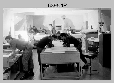
Photograph - Army Survey Regiment – Map Production, Fortuna, Bendigo, 1986
... Survey Regiment’s map production and facilities were taken at Fortuna Villa, Bendigo, April 1986. Photos .1P to .3P were taken in Cartographic Squadron’s Correcting Section in the Attic. located on the top floor of Fortuna Photos .4P to .5P were taken in Cartographic Squadron’s Proving Section, located in the Ballroom also on the top floor facing the lake. The technicians were probably involved in a rapid response map production, as they all were wearing field...Survey Regiment’s map production and facilities were taken at Fortuna Villa, Bendigo, April 1986. Photos .1P to .3P were taken in Cartographic Squadron’s Correcting Section in the Attic. located on the top floor of Fortuna Photos .4P to .5P were taken in Cartographic Squadron’s Proving Section, located in the Ballroom also on the top floor facing the lake. The technicians were probably involved in a rapid response map production, as they all were wearing field ...These 17 photographs of the Army Survey Regiment’s map production and facilities were taken at Fortuna Villa, Bendigo, April 1986. Photos .1P to .3P were taken in Cartographic Squadron’s Correcting Section in the Attic. located on the top floor of Fortuna Photos .4P to .5P were taken in Cartographic Squadron’s Proving Section, located in the Ballroom also on the top floor facing the lake. The technicians were probably involved in a rapid response map production, as they all were wearing field uniforms. As ‘Regiment Overcrowding’ is annotated on the plastic sleeve holding the negatives, it seems the photos were taken when the unit was at its capacity to demonstrate the lack of suitable work areas. The Army Survey Regiment’s Duty Room, RAP and Carpark appearing in Photo .10P was probably taken from the top steps near the SGT’s accommodation block. Two of the photos in this set are also published in item 6096.5P.This is a set of 17 photograph of Map Production and car park was taken at the Army Survey Regiment, Fortuna, Bendigo, in April 1986. The black & white photographs are on 35mm negative film and are part of the Army Survey Regiment’s Collection. The photographs were scanned at 96 dpi. .1) - Photo, black & white, 1986. Correcting Section, Attic: L to R: CPL Andy Lucas, SPR Chris Gordon, unidentified, SPR Jan (Crighton) Minchin, CPL Robin Marshall, CPL Frank Downie, SPR Gayle Humphrey, unidentified (x2), Jason Wells at rear. .2) - Photo, black & white, 1986. Correcting Section, Attic: L to R: CPL Andy Lucas, SPR Chris Gordon, unidentified, SPR Jan (Crighton) Minchin, CPL Robin Marshall, CPL Frank Downie, SPR Gayle Humphrey, unidentified, Jason Wells, unidentified. .3) - Photo, black & white, 1986. Correcting Section, Attic: L to R: CPL Andy Lucas, CPL Robin Marshall, SPR Chris Gordon, unidentified, CPL Frank Downie, SPR Gayle Humphrey, unidentified, SPR Jan (Crighton) Minchin at rear., Jason Wells on phone. .4) & .5) - Photo, black & white, 1986. Proving Section, Ballroom: On left front to back: SGT Alan Staley, SGT Roger Rees, SGT Greg Anderson. On right front to back: SGT Denis McCarthy, SGT Tim Allanson, SSGT Adrian ‘Charlie’ Creedy. .6) - Photo, black & white, 1986. Records & Proofing buildings. .7) - Photo, black & white, 1986. Technical Services temporary buildings. .8) - Photo, black & white, 1986. Q-store and transport buildings. .9) - Photo, black & white, 1986. Technical Services temporary buildings in front of transport compound. .10) - Photo, black & white, 1986. Army Survey Regiment Duty Room, RAP and Carpark at Fortuna. .11) - Photo, black & white, 1986. Records & Proofing buildings. .12) - Photo, black & white, 1986. Other Ranks (OR’s) car park and barracks with kitchen in background. .13) - Photo, black & white, 1986. Other Ranks kitchen, parade ground and SGT’s/Officers barracks in background. .14) - Photo, black & white, 1986. Fortuna Villa taken from the steps near the SGT’s accommodation block. .15) - Photo, black & white, 1986. Fortuna Villa taken from the steps near the OR’s s accommodation block. .16) - Photo, black & white, 1986. Fortuna Villa taken from the roadway near the OR’s accommodation block. .17) - Photo, black & white, 1986. 20’ x 30’ Army tents set up on the basketball court..1P to .17P – ‘Regiment Overcrowding’ and the date are annotated on the plastic sleeve.royal australian survey corps, rasvy, army survey regiment, army svy regt, fortuna, asr -
 Bendigo Military Museum
Photograph - CSP In-house Bid Announcement, Army Survey Regiment, Fortuna, Bendigo, 1994
... Section 81B of the Public Service Act 1992 with the remaining 40 positions filled by Public Service recruitment. Other options offered to Survey Corps personnel were postings to 1st Topographic Survey Squadron in Enoggera, QLD, transfer to another Corps in the Australian Army or discharge from the ADF. The In-House bid also proposed 143 Survey Corps military positions to remain at Fortuna to perform ‘core strategic non-sovereign tasks.’ However, Army subsequently decided to abolish the 143 positions, disband 4th Field...Section 81B of the Public Service Act 1992 with the remaining 40 positions filled by Public Service recruitment. Other options offered to Survey Corps personnel were postings to 1st Topographic Survey Squadron in Enoggera, QLD, transfer to another Corps in the Australian Army or discharge from the ADF. The In-House bid also proposed 143 Survey Corps military positions to remain at Fortuna to perform ‘core strategic non-sovereign tasks.’ However, Army subsequently decided to abolish the 143 positions, disband 4th Field ...This is a set of 14 photographs of an All-Staff meeting held by the lake at the Army Survey Regiment, Fortuna, Bendigo on the 24th of April 1994. At this meeting CO LTCOL Duncan Burns announced that under Defence’s Commercial Support Program (CSP), the In-House bid submitted in 1993 by a team led by then CO LTCOL Bob McHenry was successful. The In-House bid proposed the establishment of an organisation based at Fortuna to carry out non-core production with 150 of the 373 Survey Corps positions converted to Defence civilian positions. 110 of the Defence civilian positions would be filled voluntarily by military personnel under Section 81B of the Public Service Act 1992 with the remaining 40 positions filled by Public Service recruitment. Other options offered to Survey Corps personnel were postings to 1st Topographic Survey Squadron in Enoggera, QLD, transfer to another Corps in the Australian Army or discharge from the ADF. The In-House bid also proposed 143 Survey Corps military positions to remain at Fortuna to perform ‘core strategic non-sovereign tasks.’ However, Army subsequently decided to abolish the 143 positions, disband 4th Field Survey Squadron, Adelaide, SA and lastly, the demise of the Royal Australian Survey Corp in June 1996. This period of the Army Survey Regiment’s history is covered in more detail in pages 160 to 162 of Valerie Lovejoy’s book 'Mapmakers of Fortuna – A history of the Army Survey Regiment’ ISBN: 0-646-42120-4.This is a set of 14 photograph of an All-Staff Meeting held at the Army Survey Regiment, Fortuna, Bendigo on the 24th of April 1994, to announce the success of Army’s Defence’s Commercial Support Program (CSP) In-house Bid. The Black and white photos are on photographic paper and scanned at 300 dpi. They are part of the Army Survey Regiment’s Collection. .1) to .3) - Photo, black & white, 1994. CO LTCOL Duncan Burns briefing Army Survey Regiment personnel and civilians. .4) to .5P - Photo, black & white, 1994. D-SVY COL Simon Lemon briefing Army Survey Regiment personnel and civilians. .6) - Photo, black & white, 1994. L to R: D-SVY COL Simon Lemon, unidentified civilian. .7) - Photo, black & 1994. L to R: SCMA WO1 Alan Hancox, unidentified civilian. .8) - Photo, black & 1994. RSM WO1 Phil Meagher. .9) - Photo, black & 1994. WO2 Rob Bogumil. .10) - Photo, black & 1994. Left Row: all unidentified. Centre Row L to R: unidentified (x2), SGT Jim Ash, CPL Steve Linane, CPL Andrew Quin, SGT Craig Kellet, unidentified. Back row L to R: unidentified (x2), SGT Barry Miller, SSGT Steve Winner, SPR Shane Campbell, SPR Karen McQuaigue, CPL Geoff Webb. .11) - Photo, black & 1994. L to R: CPL Warren ‘Waldo’ Shirley, COL COMDT COL Don Swiney MBE. .12) - Photo, black & 1994. L to R: LT Scott Seefeld, CAPT Bin Fashar Sutiman (Indonesian Army), LT Darren Radford, CAPT Gary Warnest, unidentified US exchange officer. .13) - Photo, black & 1994. L to R: unidentified, SGT Mark Host, LT Anthony Chamberlayne, unidentified (x2), Mr Tony Spurling. .14) - Photo, black & 1994. L to R: unidentified US exchange officer, CAPT Bill Griggs, CAPT Matt Jackson CSM, LT Darren Radford, unidentified, LT Scott Seefeld, SGT Mark Host, LT Gordon Muir, CAPT Gary Warnest, LT Anthony Chamberlayne, unidentified (x2), LT Colin Davidson.No personnel are identified. Annotated with date on folder sleeve.royal australian survey corps, rasvy, army svy regt, army survey regiment, fortuna, asr -
 Bendigo Military Museum
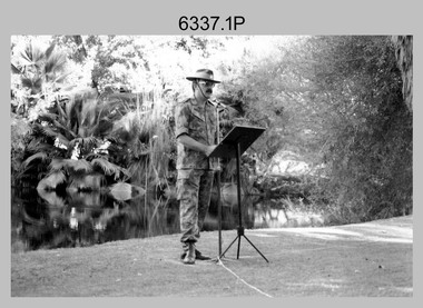
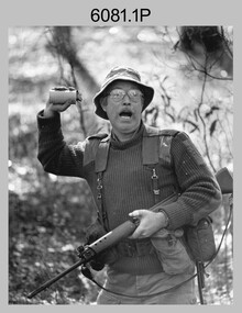
Photograph - Army Survey Regiment - Regimental Training Field Phase, c1986
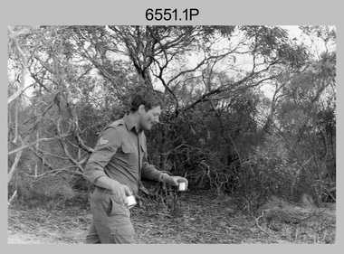
... Survey Regiment personnel undertaking regimental training in the Wellsford Forest, Bendigo, c1986. The aim of the training was to provide personnel a practical knowledge of infantry and minor tactics at the section level, navigation and map reading, RATEL and Survival in the Field. ...Survey Regiment personnel undertaking regimental training in the Wellsford Forest, Bendigo, c1986. The aim of the training was to provide personnel a practical knowledge of infantry and minor tactics at the section level, navigation and map reading, RATEL and Survival in the Field. ...This is a set of eight photographs of Army Survey Regiment personnel undertaking regimental training in the Wellsford Forest, Bendigo, c1986. The aim of the training was to provide personnel a practical knowledge of infantry and minor tactics at the section level, navigation and map reading, RATEL and Survival in the Field. According to administrative instructions accompanying these photos, Air Survey, Cartographic, Lithographic and Headquarters Squadrons trained separately for one week from April to June 1986. Annotations on the back of photos .1P to .8P indicate Headquarters Squadron’s 4 Section in the ‘Axedale’ Forest. *Note - The forest was incorrectly named – It was most likely the training was in the Wellsford Forest. Sections were established for the period of regimental training only. This is a set of eight photographs of the Army Survey Regiment undertaking regimental training in the Wellsford Forest, Bendigo. c1986. The photographs were printed on photographic paper and are part of the Army Survey Regiment’s Collection. The photographs were scanned at 300 dpi. .1) - Photo, black & white, c1986, SGT Bruce Wetzig. .2) - Photo, black & white, c1986, PTE Tony Seely. .3) - Photo, black & white, c1986, SGT Bill Claydon. .4) - Photo, black & white, c1986, SGT Bill Claydon. .5) - Photo, black & white, c1986, SGT Gregory Smith. .6) - Photo, black & white, c1986, unidentified personnel. .7) - Photo, black & white, c1986, unidentified personnel. .8) - Photo, black & white, c1986, Mack water tanker..1P to .5P – Personnel are identified .6 to .8P – No personnel are identified Annotated ‘4 Section, Headquarters Squadron Axedale Forest’royal australian survey corps, rasvy, army survey regiment, army svy regt, fortuna, asr -
 Bendigo Military Museum
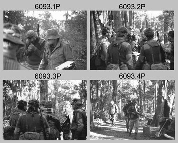
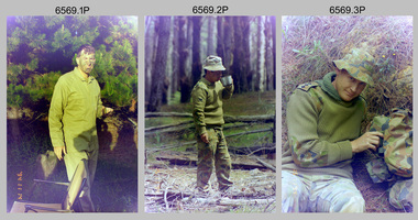
Photograph - Army Survey Regiment - Regimental Training Field Phase, c1988
... Survey Regiment personnel undertaking regimental training in the Wellsford Forest, Bendigo, c1988. The aim of the training was to provide personnel a practical knowledge of infantry and minor tactics at the section level, navigation and map reading, RATEL and Survival in the Field. ...Survey Regiment personnel undertaking regimental training in the Wellsford Forest, Bendigo, c1988. The aim of the training was to provide personnel a practical knowledge of infantry and minor tactics at the section level, navigation and map reading, RATEL and Survival in the Field. ...This is a set of 31 photographs of Army Survey Regiment personnel undertaking regimental training in the Wellsford Forest, Bendigo, c1988. The aim of the training was to provide personnel a practical knowledge of infantry and minor tactics at the section level, navigation and map reading, RATEL and Survival in the Field. This is a set of 31 photographs of the Army Survey Regiment undertaking regimental training in the Wellsford Forest, Bendigo. c1988. The photographs were printed on photographic paper and negatives are on 35mm film. They are part of the Army Survey Regiment’s Collection. The photographs were scanned at 300 dpi and negatives at 96 dpi .1) - Photo, black & white, c1988, unidentified personnel. .2) - Photo, black & white, c1988, CPL Terry ‘TJ’ Wicker 3rd from right. .3) - Photo, black & white, c1988, unidentified personnel. .4) - Photo, black & white, c1988, unidentified personnel. .5) - Photo, black & white, c1988, L to R: CPL Steve Coulson, unidentified. .6) - Photo, black & white, c1988, L to R: SPR Kerron South, unidentified – radio, unidentified personnel, SPR Wally Twidale. .7) - Photo, black & white, c1988, unidentified – radio, .8) - Photo, black & white, c1988, L to R: CPL John Bettridge, SPR Wally Twidale, SPR Shane ‘Soupy’ Campbell. .9) - Photo, black & white, c1988, SPR Kerron South .10) - Photo, black & white, c1988, L to R: unidentified, CPL Terry ‘TJ’ Wicker, unidentified. .11) - Photo, black & white, c1988, unidentified personnel. .12) - Photo, black & white, c1988. .13) - Photo, black & white, c1988. .14) - Photo, black & white, c1988, L to R: unidentified personnel, SPR Kerron South .15) - Photo, black & white, c1988, unidentified, CPL Terry ‘TJ’ Wicker, unidentified. .16) - Photo, black & white, c1988, L to R: unidentified personnel, SPR Jim Ash. .17) - Photo, black & white, c1988, MAJ Rene van den Tol .18) - Photo, black & white, c1988, L to R: WO2 Pat Lumsden, SPR Sue (Foote) Bourne. .20) - Photo, black & white, c1988, vehicles. .21) - Photo, black & white, c1988, tentage. .21) - Photo, black & white, c1988, L to R: MAJ Roger Rix, CAPT Dave Sankey, MAJ Bob Roche, unidentified. .23) - Photo, black & white, c1988, L to R: WO2 Alan Bunn, unidentified. .24) - Photo, black & white, c1988, unidentified personnel. .25) - Photo, black & white, c1988, unidentified personnel. .26) - Photo, black & white, c1988, unidentified personnel. .27) - Photo, black & white, c1988, L to R: unidentified personnel, WO2 Rob Bogumil. .28) - Photo, black & white, c1988, unidentified personnel. .29) - Photo, black & white, c1988, unidentified personnel. .30) - Photo, black & white, c1988, L to R: SPR Sue (Foote) Bourne, SPR Tracy (Parker) Ash. .31) - Photo, black & white, c1988, L to R: SPR Tracy (Parker) Ash, SPR Sue (Foote) Bourne..1P to .31P – No personnel are identifiedroyal australian survey corps, rasvy, army survey regiment, army svy regt, fortuna, asr -
 Bendigo Military Museum
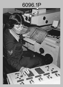
Photograph - Army Survey Regiment – Map Production, Fortuna, Bendigo, c1980s
... Survey Squadron, where aerotriangulation and digital photogrammetric extraction of topographic features from aerial photography were undertaken. Photo .4P was taken in Cartographic Squadron’s Correcting Section, located in the Attic. The technicians were probably involved in a rapid response map production, as they all were wearing field...Survey Squadron, where aerotriangulation and digital photogrammetric extraction of topographic features from aerial photography were undertaken. Photo .4P was taken in Cartographic Squadron’s Correcting Section, located in the Attic. The technicians were probably involved in a rapid response map production, as they all were wearing field ...These five photographs of map production and the car park area were taken at Fortuna, Bendigo, c1980s. The first three photographs were taken in Air Survey Squadron, where aerotriangulation and digital photogrammetric extraction of topographic features from aerial photography were undertaken. Photo .4P was taken in Cartographic Squadron’s Correcting Section, located in the Attic. The technicians were probably involved in a rapid response map production, as they all were wearing field uniforms. The Army Survey Regiment’s Duty Room, RAP and Carpark appear in Photo .5P. It was probably taken from the top steps near the SGT’s accommodation block in 1986. Photos .4P and .5P are also published with item 6395.17P.This is a set of five photograph of Map Production and car park, at the Army Survey Regiment, Fortuna, Bendigo, c1980s. The photographs were printed on photographic paper and is part of the Army Survey Regiment’s Collection. Photograph .1P was scanned at 200 dpi. The others were scanned at 300 dpi. .1) - Photo, black & white, c1980s: CPL Marrianne (Van De Zee) De Groot measuring aerial photographs with a stecometer. .2) - Photo, colour, c1980s: Two unidentified technicians assessing a flight line diagram. .3) - Photo, black & white, c1980s: SPR Scheryl Delforce digitising map features on an AUTOMAP 1 Graticon table. .4) - Photo, black & white, 1986: L to R: CPL Andy Lucas, SPR Chris Gordon, unidentified, SPR Jan (Crighton) Minchin, SPR Robin Marshall, CPL Frank Downie, SPR Gayle Humphrey, unidentified technicians in the Attic, Fortuna. .5) - Photo, black & white, 1986: Army Survey Regiment Duty Room, RAP and Carpark at Fortuna. .1P - Annotated on back ‘Maryanne Degroot’ .2P, .4P to .5P – no annotation .3P - Annotated on back ‘Scheryl Delforce’royal australian survey corps, rasvy, army survey regiment, army svy regt, fortuna, asr, air survey, carto, aerotrig -
 Bendigo Military Museum
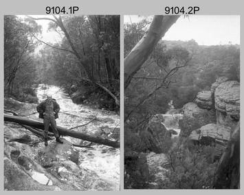
Photograph - Army Survey Regiment Regimental Training Reconnaissance, unknown location, Victoria, 1990
... Survey Regiment officers in 1990 assessing the potential of an unknown Victorian location for a future regimental training exercise or adventurous training. The aim of regimental training was typically to provide personnel a practical knowledge of infantry and minor tactics (IMT) at the section level, navigation and map reading, RATEL and survival in the Field. ...Survey Regiment officers in 1990 assessing the potential of an unknown Victorian location for a future regimental training exercise or adventurous training. The aim of regimental training was typically to provide personnel a practical knowledge of infantry and minor tactics (IMT) at the section level, navigation and map reading, RATEL and survival in the Field. ...This is a set of six photographs of Army Survey Regiment officers in 1990 assessing the potential of an unknown Victorian location for a future regimental training exercise or adventurous training. The aim of regimental training was typically to provide personnel a practical knowledge of infantry and minor tactics (IMT) at the section level, navigation and map reading, RATEL and survival in the Field. The unidentified terrain may have been in the Grampians or the sub-alpine high country in north-eastern Victoria.This is a set of six photographs of Army Survey Regiment officers in 1990 assessing the potential of an unknown Victorian location for a future regimental training exercise. Black and white photographs are on 35mm negative film and scanned at 2400 dpi. They are part of the Army Survey Regiment’s Collection. .1) - Photo, black and white, 1990. LT Marty Lyons in unknown Victorian terrain. .2) - Photo, black and white, 1990. Unknown Victorian terrain. .3) - Photo, black and white, 1990. LT Craig Hersant in unknown Victorian terrain. .4) - Photo, black and white, 1990. Unknown Victorian terrain. .5) - Photo, black and white, 1990. LT Craig Hersant in unknown Victorian terrain. .6) - Photo, black and white, 1990. LT Marty Lyons in unknown Victorian terrain.There are no personnel identified.royal australian survey corps, rasvy, army survey regiment, army svy regt, fortuna -
 4th/19th Prince of Wales's Light Horse Regiment Unit History Room
Booklet, Australian Army Manual of Land Warfare Part 2 Artillery Training Vol 3 Pam 3 Gun Regiments Survey within the Unit 1983, 1983
... Soft covered booklet describing the principles and process of battery survey in a field artillery battery and that within the regiment, and the role organisation duties and deployment of a regimental survey section ...4th/19th Prince of Wales's Light Horse Regiment Unit History Room 4/19 PWLH Regiment, Building 78 Simpson Barracks Macleod melbourne artillery survey 7610-66-108-8454 Soft covered booklet describing the principles and process of battery survey in a field artillery battery and that within the regiment, and the role organisation duties and deployment of a regimental survey section Australian Army Manual of Land Warfare Part 2 Artillery Training Vol 3 Pam 3 Gun Regiments Survey within the Unit 1983 Booklet ...Soft covered booklet describing the principles and process of battery survey in a field artillery battery and that within the regiment, and the role organisation duties and deployment of a regimental survey section 7610-66-108-8454artillery, survey -
 Bendigo Military Museum
Photograph - 4th Field Survey Squadron Regimental Training, Murray Bridge Training Area, SA, 1988
... This is a set of eight photographs of 4th Field Survey Squadron personnel undergoing regimental training held at the Murray Bridge Training Area of South Australia in 1988. The aim of regimental training was typically to provide personnel a practical knowledge of infantry and minor tactics at the section level, navigation and map reading, RATEL and survival in the Field....Bendigo Military Museum 37 - 39 Pall Mall Bendigo goldfields This is a set of eight photographs of 4th Field Survey Squadron personnel undergoing regimental training held at the Murray Bridge Training Area of South Australia in 1988. The aim of regimental training was typically to provide personnel a practical knowledge of infantry and minor tactics at the section level, navigation and map reading, RATEL and survival in the Field. ...This is a set of eight photographs of 4th Field Survey Squadron personnel undergoing regimental training held at the Murray Bridge Training Area of South Australia in 1988. The aim of regimental training was typically to provide personnel a practical knowledge of infantry and minor tactics at the section level, navigation and map reading, RATEL and survival in the Field.This is a set of eight photographs of 4th Field Survey Squadron personnel undergoing regimental training held at the Murray Bridge Training Area of South Australia in 1988. The black and white photographs are on 35mm negative film and are part of the Army Survey Regiment’s Collection. The photographs were scanned at 96 dpi. .1) - Photo, black & white, 1988. CPL Steve McGuiness. .2) - Photo, black & white, 1988. L to R: Unidentified, SPR Charmian McKean. .3) - Photo, black & white, 1988. SPR Andrew Quin. .4) - Photo, black & white, 1988. L to R: Unidentified, LT Geoff ‘GT’ Ford. .5) & .6) - Photo, black & white, 1988. Unidentified personnel. .7) - Photo, black & white, 1988. L to R: Unidentified (x2), SPR Perry Langeberg, SGT Laurie Justin (3rd from right), remainder unidentified. .8) - Photo, black & white, 1988. L to R: Unidentified, SGT Laurie Justin, remainder unidentified..1P to .8P – There are no personnel identified. ‘1988 REGT ADV TRAINING MURRAY BRIDGE’ annotated on negatives sleeve.royal australian survey corps, rasvy, 4 fd svy sqn -
 Bendigo Military Museum
Photograph - 4th Field Survey Squadron Regimental Training - Exercise ‘Fuggy Hollow’ in SA, 1994
... This is a set of 30 photographs of 4th Field Survey Squadron personnel undergoing regimental training in 1994, at Second Valley Conservation Park in South Australia. The aim of Exercise ‘Fuggy Hollow’ was typically to provide personnel a practical knowledge of infantry and minor tactics (IMT) at the section level, navigation and map reading, RATEL and survival in the Field....Bendigo Military Museum 37 - 39 Pall Mall Bendigo goldfields This is a set of 30 photographs of 4th Field Survey Squadron personnel undergoing regimental training in 1994, at Second Valley Conservation Park in South Australia. The aim of Exercise ‘Fuggy Hollow’ was typically to provide personnel a practical knowledge of infantry and minor tactics (IMT) at the section level, navigation and map reading, RATEL and survival in the Field. ...This is a set of 30 photographs of 4th Field Survey Squadron personnel undergoing regimental training in 1994, at Second Valley Conservation Park in South Australia. The aim of Exercise ‘Fuggy Hollow’ was typically to provide personnel a practical knowledge of infantry and minor tactics (IMT) at the section level, navigation and map reading, RATEL and survival in the Field.This is a set of 30 photographs of 4th Field Survey Squadron personnel undergoing regimental training in 1994, at Second Valley Conservation Park in South Australia. The colour photographs are on 35mm negative film and are part of the Army Survey Regiment’s Collection. The photographs were scanned at 96 dpi. .1) - Photo, colour, 1994. Unidentified soldier. .2) - Photo, colour, 1994. CPL Phuc ‘Charlie’ Tran. .3 to .5) - Photo, colour, 1994. CAPT Chris Topovsek. .6) & .7) - Photo, colour, 1994. Unidentified soldiers. .8) - Photo, colour, 1994. L to R: SPR Fran Calvert, unidentified (x2), SPR Mark Linford, unidentified. .9) to .17) - Photo, colour, 1994. Unidentified soldiers. .18) & .19) - Photo, colour, 1994. L to R: LT Andrew Caudle, SSGT Brian Collings, OC Maj Peter Demaine. .20) - Photo, colour, 1994. WO2 Peter Hammer. .21) - Photo, colour, 1994. L to R: CAPT Chris Topovsek, SSGT Brian Collings, WO2 Peter Hammer .22) - Photo, colour, 1994. SSGT Brian Collings. .23) - Photo, colour, 1994. L to R: unidentified, SPR Fran Calvert. .24) - Photo, colour, 1994. L to R: SPR Mark Sinderberry, SGT Steve McGuiness, unidentified. .25) - Photo, colour, 1994. SPR Mark Linford. .26) - Photo, colour, 1994. L to R: unidentified (x2), SPR Fran Calvert, unidentified. .27 & .28) - Photo, colour, 1994. L to R: SSGT Brian Collings, WO2 Peter Hammer. .29) - Photo, colour, 1994. WO2 Simon ‘Andy’ Capp. .30) - Photo, colour, 1994. SGT H. Evertz..1P to .30P – There are no personnel identified. ‘1994 EX FUGGY HOLLOW (IMTs) Second Valley Conservation Park’ annotated on negatives sleeve.royal australian survey corps, rasvy, 4 fd svy sqn -
Federation University Historical Collection
Document, Zelda Martin, Central Victorian Goldmining towns - Boom Towns or Ghost Towns?, c1996
... sections copied. Contains information on Branches of Government. General / Finance / Gold / Gazette / Commission and Warrant / Statistic. *Gold Fields Act. In accordance with the Act the gold fields are divided into six districts - Ballaarat, Castlemaine , Sandhurst, Avoca, Ararat, and Beechworth.. Official staff in each gold district consists of a Resident Warden, Wardens, Wardens' Clerks, Bailiffs, Chinese Protectors, Chinese Interpreters, and Mining Surveyors. *Gold Receiver *Gaols *Police magistrates and Clerks of Petty Sessions, etc. *Field Branch *Immigration and Emigration Overland - Chinese - 1859 *Population on the Goldfields *The Geological Survey...sections copied. Contains information on Branches of Government. General / Finance / Gold / Gazette / Commission and Warrant / Statistic. *Gold Fields Act. In accordance with the Act the gold fields are divided into six districts - Ballaarat, Castlemaine , Sandhurst, Avoca, Ararat, and Beechworth.. Official staff in each gold district consists of a Resident Warden, Wardens, Wardens' Clerks, Bailiffs, Chinese Protectors, Chinese Interpreters, and Mining Surveyors. *Gold Receiver *Gaols *Police magistrates and Clerks of Petty Sessions, etc. *Field Branch *Immigration and Emigration Overland - Chinese - 1859 *Population on the Goldfields *The Geological Survey ...Zelda Martin was a PhD candidate at the University of Melbourne.[.1] 4th item in light blue display book titled Research Approach/Overview of Chapters/Confirmation of Canditure/Chapters1,2,3&4 of proposed thesis. *Twenty-seven page article on Victorian goldfields towns titled: Central Victorian Goldmining Towns - Boom Towns or Ghost Towns. The article was written during the author's PhD study. It outlines the context methodology, and resources and the chapters of the proposed thesis: (1) Central Victorian Goldmining Towns - The Context (2) Contemporary Views of the Factors Necessary for Town Growth (3) Outward Manifestations of Town Growth (4) The Trappings of Government (5-9) The Main Towns and Their Hinterland. [.2] 5th item in Light Blue display book as above item. *Chapter 1 of proposed thesis titled 'Pick, Shovel and Tin Dish Mining.' Covers in Section A: Central Victoria - Pre 1851: Aborigines in Central Victoria, Squatters, and Government. Section B: The years 1851-1854: The Early Gold Rushes, Government Reaction, Township Surveys, Legislation, Town Development, Local Government and Early Settlement. [.3] 6th item in Light Blue display book as above item. *2A of proposed thesis titled 'Contemporary Views of the Factors Necessary for Town Growth'. Similar information to Chapter 1 plus extra re towns and maps. Sections: Introduction, Context of Place - Geographical Towns Listed, The Context of Time - Pre1851 Aborigines, Governance of Port Phillip, The Squatters, The Villages of Central Victorian Highlands, Conclusion, Condensed Version of Chapter2B. [.4] 7th item in Light Blue display book as above item. *Chapter2B of proposed thesis. Sections: Area of Research, Schools, Banks, Newspapers, Progress Association, Town Development - Sandhurst (Bendigo), Ballarat, Castlemaine,, Maryborough, Ararat and Stawell. [.5] 8th item in Light Blue display book as above item. *Chapter 3 of proposed thesis titled 'Outward Manifestations of Town Growth'. Sections: Introduction, Contemporary Writing, Educationalists, The Bankers, The Townsfolk, Current Theory, General Theories of Urban Development, and Conclusion. [.6] 9th item in Light Blue display book as above item. *Chapter 4 of proposed thesis titled 'Trappings of Government' Sections: Introduction, Early Government Attitudes to Mining and Town Development, Law and Order, Township Surveys, Legislation, Local Government, Transport and Communication, The People and Lobbyists. [.7] 10th item in Light Blue display book as above item. *'The Rise and Fall of Central Victorian Goldmining Towns'. Includes a map showing main Goldfields, a table showing towns and villages at two points in time - 1857 and 1871; a Bibliography of Primary and Secondary Sources. [.8] Resource No1. Black display book titled Local Towns 1 : Alma: *Brief history *Directory *Maps Amphitheatre / Mountain Hut: *Brief History Post Office Directory Ararat: *Brief History *Post Office Directory 1869 - Alphabetical Listing by Occupation *Ararat - Prominent Citizens of 1858 *Langi-Morgala Museum Avoca: *Brief History *Excerpts from 'Avoca The Early Years', Margery and Betty Beavis; pg1 - Beginnings; pg11 - The Midas Touch; pg25 - Local Gold Escorts; pg27 - A Town is Born; pg51- The Administration of Justice; pg53 - The Ways of the Law; pg61 - News of the Day; pg65 - A Time to Play; pg72 - Land Ownership *Post Office Directory (Bailliere's) 1869 *Tourism Map and Information of area *Historic Avoca - A 5.5km Tour *Avoca & the Pyrenees Region - information pamphlet Ballarat: *Early History of Ballarat - Ballarat Historical Society, Publication No.1: origin of the name; Ballaarat - the Beginning; Fabulous Yields from the Ballaarat Goldfield; *Streetscape Lydiard Street. *Hand drawn map showing Leigh River, Old Portland Bay Road, plaque on road to Colac; etc. *Newspaper article re 'The Theatre Royal' ( which stood in the vicinity of the current Owen Williams store) - 'The News'15/04/1998 *Article - 'Ballarat's Mechanics' Institute Lives On' Ballarat Courier, 14/09/1985 *Article - Standing the Test of Time' The News 17/11/1993 re The Mechanics Institute & picture of the Reading Room *'Ballarat a Study of a City, Phyllis Reichl, pub. Nelson, 1968; no.3 place, time and people field studies series *Investigator Vol.33 No.2, 1998 Geelong Historical Society. Article on pg75 describes Ballarat in 1861 *Folded poster - 'Ballarat 100' a history of telegraph communication, pub. Telecom. Beaufort (Fiery Creek): *Brief history *Post Office Directory [.9] Resource No.2 Black Folder Titled Towns cont.No2 Bendigo (Sandhurst): *'Family & Local History at the Bendigo Library - 1851-2001 150 years of gold'. *Bendigo Government Camp in 1853 illustration; key to sketch and names of Government officers stationed there *Excerpts from 'Bendigo and Vicinity' Adolph Haman *The Bendigo Goldfield Registry - pgs 1-7 Introduction *Excerpt: 'Breaking the Grip' *Excerpt: The Most Go-Ahead Place *Excerpts from 'History of Bendigo' - anti license agitation; laying out of town; proposed railway; gold calls and dividends; the Sandhurst Municipality; journalism *Bibliography Blackwood: *Excerpts from 'Aspects of Early Blackwood - The Goldfield, the Landmarks, the Pioneers' Alan J Buckingham and Margaret F Hitchcock, JG Publishing,1980 Buninyong: *A Brief History *Investigator Vol1 No.2 Feb 1966 Geelong Historical Society. Pg3 - Article re gold escort route - Mt Alexander to Adelaide - (see a simple monument on the Western Highway a few miles out of Horsham. Pg 15 - Ballarat Excursion - re the finding of gold. *Three articles published by Buninyong and District Historical Society Inc: (Magpie Exploration; Finding Gold In The Green Hills; Magpie Exploration; Burnt Bridge to Cargarie to Mt Mercer) *Copies of newspaper articles/items *Buninyong Street Directory Carisbrook: *In the Beginning There Was Carisbrook *The History of the Carisbrook Racecourse Carngham / Snake Valley: *Brief History *Directory Castlemaine: *Directory 1865-1866 - Alphabetical and Street *Poster - Castlemaine A Contemporary Guide "The Great Centre" 1866 - A Contemporary Guide to the Fascinating Past *Pamphlet - Castlemaine District Community Hospital *Map - Castlemaine, Maldon & Surrounding Districts *Map and Information - The Dry Diggings Track - a 55kl walk among historic goldfields relics ( Castlemaine Fryerstown Vaughan Mt Franklin Hepburn Daylesford) *Postcard - Former Court House *Directory 1867 - Alphabetical, Trade [.10] Resource No.3 Grey folder Titled Towns 3 Creswick to Maryborough Creswick: *Brief History *Booklet - "Creswick Cemetery Walk" *Booklet - The Buried Rivers of Gold Heritage Trail Creswick *Creswick Historical Museum Information Sheet *Chronological History of Creswick *Alphabetical Directory of the Borough of Creswick *Creswick's Creek Directory 1856 *Historic Creswick Walking Tour *A Brief Account of the Schools of Creswick - Past and Present *100 Years of Railway Travel in Creswick *The Berry Deep Leads *The Spence Home at Jackass Gully in the Creswick State Forest ( William Guthrie Spence - Pioneer) *The New Australian Mine and the 1882 Disaster *Creswick District News, Issue 7, July August 1999 *The Creswick Miners Walk - Information and Map *Maps Chewton: *Brief History *Directory Clunes: *Brief History *Clunes Street Directory Daylesford: *Brief History *Notable Bushfires in Daylesford District Over More Than a Century - "Black Thursday" 1851; 1862; 1899; the Disastrous Hepburn Fire of 1906; 1939; 1944; 1969. *Post Office Directory -Daylesford and Hepburn Dunolly / Inkerman: *Brief History *Directory *Pamphlet - Goldfields Historical Museum *Pamphlet - Historic Dunolly - Victoria's Best Kept Secret *Map of Gold Workings at Dunolly Area - showing where the main gold rushes occurred *Brief History - Inglewood *Directory - Inglewood - Name Occupation, Dwelling Kingower: *Brief History *Directory - Name / Ocupation / Dwelling Linton / Happy Valley / Piggoreet: *Brief History *Directory - Lintons McIvor: *"A History of the Shire and the Township of Heathcote" by J.O. Randell Majorca: *Brief History *Official Post Office Directory 1869 - Name / Occupation/ Address Maldon (Tarrangower): *Brief History Part 1 *Brief History Part 2 *Post Office Directory *List - Alphabetical Order by Names plus Business and Trade (Tarrangower Times Oct/1858) *List - Alphabetical Order by Trade plus Name and Business *Directory - Name / Occupation / Dwelling Maryborough: *Worsley Cottage - built by Arthur Worsley, a contractor in stonework in 1894 [.11] Resource No. 4 Blue Display Book titled Towns 4 Moliagul to Stawell Moliagul: *Brief History *Moligul Legislative Assembly (Voting?) List - Names and Occupations *Moliagul Victorian Post Office Directory 1868 - Name / Ocupation / Address / Comments *"The Welcome Stranger" gold nugget *The Sunday School *The Welcome Stranger Discovery Walk - information and map Moonambel (Mountain Creek) Redbank *Brief History *List of names extracted from advertisments of the Pioneer and Mountain Creek Advertiser 16/02/1861. *Bailliere's Directory 1869 - Alphabetical List of Name / Occupation / Place St Arnaud: *Brief History Sebastapol: *Brief History *Directory 1869 - Alphabetical by Name; plus occupation and address. Browns and Scarsdale: *Brief History *Browns Street Directory - Name and Occupation Smythesdale: *Brief Description *Smythesdale Street Directory -Name and Occupation Stawell (Pleasant Creek) *Brief History *Victorian Official Post Office Directory - Name /Occupation / Dwelling *Chronology - 1841-1920 *Production of gold statistics - 1879 - 1900 *Big Hill *Extracts from "The Golden Years of Stawell". Chapt 1 - Stawell's Coming Out. Capt. 2 - The Gold Rush. Caapt.3 - Cradle of Democracy. Chapt.4 - The Reefs Becomes Stawell. Chapt. 5 - Rushing In. Chapt.6 - The Pioneers. Chapt 7 - The Decade of Optimism. [.12] Resource No. 5: Blue Display Book titled 'Towns Steiglitz to the The Golden Triangle. Steiglitz: Brief History Victorian Post Office Directory 1869 *Map of Steiglitz *List of maps relevant to Steiglitz history *Information 6 tables of data from "Reports of Mining Surveyors Talbot (Back Creek) Brief History Taradale: Post office Directory 1869 - Name/Occupation/Street. Also list in alphabetical order by Occupation Taradale *Chronological Reference to Taradale Mines *Water - The Coliban System of Waterworks *Joseph Brady *The Syphon Tarnagulla (Sandy Creek) *Brief History *Tarnagulla Businessmen Cameos to give depth to advertisments in 'The Tarnagulla Courier' various issues 1864-1871 *Directory - Name/Occupation /Address *List - Name/Business/Trade Wedderburn (Koorong) *Brief History *List - Name/Occupation The Golden Triangle: *The Early Rushes - Wedderburn / Moliagul / Sandy Creek - Tarnagulla / Jones Creek - Waanyarra / Kingower / Dunolly - Goldsborough / Inglweood *Census of 1857 - Population / Occupations *1858-1871 - A Time of Consolidation- Wedderburn / Moliagul / Sandy Creek- Tarnagulla / Arnold *Census 1871 - Population *Information gleaned from the census data - Demographics / Population / Occupations / marital / Birthplace / Religion / Literacy/ Occupation and Housing Cameos *Graphs - Birthplace of settlers /Male-Female Ratio / Married males / Children under 15 as Percentage of Population / Religion *Census 1857 - Statistical data *Maps *Bibliography [.13] Resource No. 6 - Black Display Book Information and Research in Central Victoria including: *Banking - Research from ANZ Bank Archives *Institutions - also includes articles listed from the Ballarat Times Newspaper *Australian mining History Association - A.M.H.A. Bibliography *Australia's Mining History * Bibliography - Land Surveys Victoria - *1853 Administration (Statistics and Other) includes: schools / ministers of religion / police / military / local administration / licences for sale of spirits / distances between various Victorian gold fields. * Victoria Government Gazette (Copy) - N0. 116, 12/12/1854 includes: Gold Felds Commission of Enquiry & No. 85, 15/09/1854 - Addresses presented to the Lieutenant Governor (Sir Charles Hotham) during his tour through the Gold Fields of Victoria,1854. Addresses on behalf of : the people of Bendigo; Members of the Church of England, Bendigo; Members of the Wesleyan Church on the Bendigo Gold Fields; Bendigo Gold District General Hospital; the Bendigo Prospecting Association; Committee of the Bendigo Local Exhibition; Bendigo District Medical Association; Coloured Americans Resident at Bendigo; German Inhabitants of Bendigo; Landowners, Inhabitants, and Miners of Castlemaine; Inhabitants of Forest Creek; Inhabitants of Heathcote and Gold Miners of McIvor; Residents and landholders of the District of Bacchus Marsh; Inhabitants of Kilmore and Vicinity. *Gold Fields Correspondence 1853: letter from Lieutenant Colonel Valiant, (Officer commanding the Troops in Victoria) to the Lieutenant Governor re threatened disturbance at Sandhurst (Bendigo) regarding the Gold License Fee. * Extracts from a book "Victoria" re Gold Fields Commission of Enquiry involving mainly Ballarat and Castlemaine and a chapter titled 'A Tour to the Victorian Gold-Fields' *Lists of central Victorian newspapers - listed by date published 1851to 1874; by first date available to State Library. *A list of cities and towns showing County, population in 1861 &1871, and municipal status. [.14] Resource no.7. Black display book. *Reference: Papers presented to Parliament Victoria - 1859-1860 4 volumes - relevant sections copied. Contains information on Branches of Government. General / Finance / Gold / Gazette / Commission and Warrant / Statistic. *Gold Fields Act. In accordance with the Act the gold fields are divided into six districts - Ballaarat, Castlemaine , Sandhurst, Avoca, Ararat, and Beechworth.. Official staff in each gold district consists of a Resident Warden, Wardens, Wardens' Clerks, Bailiffs, Chinese Protectors, Chinese Interpreters, and Mining Surveyors. *Gold Receiver *Gaols *Police magistrates and Clerks of Petty Sessions, etc. *Field Branch *Immigration and Emigration Overland - Chinese - 1859 *Population on the Goldfields *The Geological Survey - The Government Geologist is assisited by staff from four branches - the office Branch; the Publishing Branch; the Field Branch and the Museum Branch. *Commission to Enquire Into Sludge dated 10/02/1859 (Some sections copied) - Report to the Honorable Chief Commissioner of Public Works, Melbourne re the mode of carrying the sludge from the puddling mills in Sandhurst without interfering with the drainage of the town and the roads in the neighbourhood. [.15] Resource No.8: Camel display book titled Resource No. 8. Aborigines *Lists of book titles - +"Readings in Victorian prehistory" +"The Aborigines of Port Phillip" +Aboriginal languages and clans" +"A History of the Port Phillip District" +"Langi Ghiran 1: Aboriginal Rock...." +"Koorie History: sources for aboriginal studies in the State Library of Victoria", ed. Tom Griffiths, Melb. Friends of the State Library, 1989 +"The Public Lands of Australia Felix"; settlement and land appraisal in Victoria1834-91 with special reference to the Western Plains", J.M.Powell, Melb. Oxford University Press 1970 +*Bibliography of the Victorian Aborigines' from the earliest manuscripts to 31st December 1970, Massoa, Aldo, Melb. Hawthorn Press, 1971 +"Aborigines in Colonial Victoria, 1836-1886", M.F. Christie, Sydney University Press, 1979 +"Urban and Industrial Australia: readings in Human Geography" ed J.M. Powell, Melb. Sorrett Pub. 1974 *Extracts: -Processes of Pioneer Settlement - The Squatting Occupation of Victoria, 1834-60. J.M. Powell -Areal Variations in the Class Structure of the Central-Place Hierarchy. P. Scott - Volume1 and Volume 2: Notes Relating to the Habits of the Natives of Other Parts of Australia and Tasmania. Compiled from various sources for the Government of Victoria by R Brough Smyth. John Curry, O'Neil, Melb. 1st pub. Melb. 1876. p31-45 - Numbers and Distribution of the Aborigines in Victoria -Victorian Aborigines 1835-1901 - A Resource Guide to the Holdings of the Public Record Office, Victoria; published by the Government Information Centre 1984. *History of the Aboriginal Artefacts Displayed in the Daylesford Museum. F. G. Powell (4 page pamphlet) *Letter to Zelda Martin from Peter Lovett, Cultural Officer, Ballarat & District Aboriginal Co- Operative, 05/02/1997 *Map: Ian Clarke Victorian Tribunal Boundary Map - Clans of Central Victoria. *Victorian Rock Art and Mythology - Article about Mount Langhi Ghiran and myths of the Tjapwarong people. *Two Aboriginal myths relating to the Grampians - 'The Monster Emu' / 'The Aquisition of Fire', by the Aborigines in the Grampians Areas *Article titled (chapter 8) Ballarat - information re camping sites in the region. Lake Wendouree / Lake Burrumbeet (includes a myth) / Mt Bunninyong / Lal Lal / Pitfield / Mount Elephant / Mount Egerton / Meredith / Lake Goldsmith / Lake Learmonth / Ercildoune *Notes on the Aborigines of the Wider Ballarat Region plus European names=Aboriginal names. John Morris 26/07/1995 *Role of Aborigines in Town Development in Central Victoria. Mentions Native Police Force est. in Port Phillip 1842 and Central Board for Aborigines est. 1860 *The Grave of King Billy. (Frank Wilson) Pamphlet. *Camping Places in Central and Northern Victoria. Article re Lake Burrumbeet site. *Programme for the Unveiling of Memorial Cairn for Edward Stone Parker 1802-1865. Note portrait not accurate. Accurate portrait is available in the book "A Successful Failure A Trilogy The Aborigines and Early Settlers", Edgar Morrison, Graffiti Publications, 2002. * Large envelope addressed to Mr G Netherway containing newspaper cuttings regarding the life of Edward Stone Parker, the unveiling of the Memorial Cairn as mentioned above, articles titled 'Episodes from Our Early Days' (Edgar Morrison, Yandoit)- The Black's School, A School At Last and The Final years. Also a typed page titled 'Historical Background to E.S.Parker's Career. Includes an interesting tale titled 'When the cat lay doggo' re laying power leads for the unveiling ceremony at the memorial site. [.16] green display folder titled 'Research Aids' *List of references to Commissioners' & W'ardens' Reports (formerly held at La Trobe Library Archives, now at Public Records Office [PRO]). Indicates town referred to / date of report / name of camp if different to town. * Archive information re Anglican Records *Movement around the Goldfields - Miners and Storekeepers - usefulness of newspapers in providing information - areas covered - Castlemaine, Maldon, Ararat, Stawell, Tarnagulla, Dunolly. *Port Phillip /Victoria Directories 1839/1867 - Chronological list of Directories included in this series. *"Notes on the History of Local Government in Victoria" A.W. Greig Melb. University Press 1925 - Photo-copied extract p5-p40. (Source - Deakin University Library) - Introduction by W.Harrison Moore. Section 1 - Development in New South Wales Before Separation. Section 2 - Development in Victoria After Its Separation from New South Wales. Hand written notations: 'roads, markets, and local government 1855 on' ;'opportunity of squatters in parliament' and 'opportunities of matters in parliament p33' * Notes on the Establishment of Surveyor General's Department 1851and Commissioner of Crown Lands and Survey. * Newspaper articles from The Argus, 1849, re the discovery of gold in the Pyrenees region. * Excerpt - a report on schools - A.B.Orlebar, Inspector; re the need for permanent school buildings rather than tents. *Excerpt from - 'Approaches to Urban History', Sean Glynn: The Case for Caution * Except from - 'The Urban Sprinkle', Weston Bate: Country Towns and Australian Regional History *Reference- 'The History of Land Tenure in the Colony of Victoria', John Quick. References the Haines Land Bill, land tenure and Land Leagues. [.17] Light blue envelope folder titled 'Birtchnell's Ballarat, etc. Directory 1862 *Contains various directories for Smythesdale, Buninyong, Clunes, Brown's and Creswick. [.18] Red envelope folder no.2 titled Victorian Gazetteer *Selected pages from 1869 Victorian Gazetteer on A4 paper (with a handwritten note questioning if some pages are from 1868 Victorian Gazetteer as appears to be different sizes - A3 pages.) Information includes locations and descriptions of towns, hotels, banks, communications and populations. (Does not include names, residences and occupations) [.19] Red Envelope folder titled Bailliere's Official Post Office Directory 1868 (or1869 or a mixture of both?) *Preface *Contains a selection of pages of towns highlighted in yellow in the the index *Work on this directory was commenced in 1867. *Information includes: Municipalities - mayors and councilors; lists of towns naming male inhabitants and their occupations. [.20]Yellow manila folder titled Post Grad Seminar Presentation 1996 *Gives some background to Zelda Martin's proposed thesis and why she chose the topic Gold Mining Towns Boom or Bust [.21] A3 display book - No. 1A * A list of 'Relevant Newspapers collected: The Tarrangower Times and Maldon Advertiser (first published 1858) Includes dates 1858-1867. The Mount Alexander Mail. Includes dates 1854-1866 The Tarnagulla Courier. Includes dates from1864-1871 Dunolly and Burnt Creek Express. Includes dates from 1862-1871 * Selection of newspaper pages from The Mount Alexander Mail 1854 to 1856, mostly showing advertisements for businesses and services provided to that community. [.22] A3 display book - No. 1B * Selection of newspaper pages from The Mount Alexander Mail 1857 to 1866, mostly showing advertisements for businesses and services provided to that community. [.23] A3 display book -No. 2 * Selection of newspaper pages from The Tarnagulla Courier 1864 to 1871, mostly showing advertisements for businesses and services provided to that community. [.24] A3 display book - No. 3 *Selection of newspaper pages from The Tarrangower Times (and Maldon and Newstead) Advertiser 1858 to1867, mostly showing advertisements for businesses and services provided to that community. [.25] A3 display book - No.4 * Selection of newspaper pages from The Dunolly and Burnt Creek Express; and The Dunolly and Betbetshire Express 1862 to 1871, mostly showing advertisements for businesses and services provided for that community. [.26] A3 display book - No.5 Includes: * Bryce Ross's Diggings Directory. Includes instructions for using this directory. This directory was used by "all persons having connexion or desiring to communicate with 'working parties, private friends, or Stores at the Diggings." As a directory for each area wwas completed it was published in each month's issue of Bonwick's "Digger's Magazine." Years c1852/1853. This Directory commences first at the head of Forest Creek. Includes a directory for Bendigo and Ballarat. Of interest at the end of the Bendigo and Ballarat directory is a list of the number of storekeepers, butchers, doctors, smiths, eating houses, lemonade sellers and chapels. * The Castlemaine Directory and Book of General Information Comprehending Glass's Model Calendar for the Two Years 1862 and1863. "zelda martin, victorian goldfield towns, bendigo, castlemaine, ballarat, maldon, stawell, ararat, maryborough, creswick, avoca, heathcote, banks, bank of australasia, union bank of australia, government camp, sandhurst, water supply, tarnagulla, talbot, back creek, mountain creek, police court, carisbrook, dunolly, thompson's foundry, charles clacy, anthony trollope, robert cecil, mount alexander, urbanisation, national schools, education, govenrment, industry, railway, transport, settlement, land settlement in central victoria, steiglitz, joseph brady, the new australian mine, berry deep leads, william guthrie spence, creswick state forest, arthur worsley, worsley cottage, the welcome stranger, moliagul, moonambel, redbank, st arnaud, sebastapol, brown's, scarsdale, clunes, chewton, daylesford, bushfires, inkerman, inglewood, kingower, lintons, happy valley, piggoreet, mcivor, majorca, tarrangower, taradale, the coliban system, the syphon, sandy creek, wedderburn, koorong, arnold, jones creek, waanyarra, the golden triangle, census 1857, blackwood, buninyong, durham lead, magpie, carngham, snake valley, alma, amherst, daisy hill, amphitheatre, mountain hut, beaufort, fiery creek, counties, population, gold fields commission of enquiry1854, william westgarth, gold license fee, lieutenant colonel valiant, administration of the victorian gold fields, commission to enquire into sludge 1859, e.s. parker, edward stone parker, edgar morrison, mount franklin protectorate, dja dja wurrung, memorial cairn, franklinford, mt franklin memorial cairn, jajowurrong, dja dja wurung, tjaowarong, wothowurong, assistant protectors, daylesford museum, buluk, rock art - grampians, aboriginal mythology - grampians, aborigines, first nations people, mount franklin, aboriginal artifacts, lake burrumbeet, native police force, central board of aborigines, yandoit, commissioners' reports, wardens' reports, port phillip/victoria directories 1839-1867, local government - victoria 1853/1854, surveyor general's department - 1850's, victorian schools 1850's, a.b.orlebar, haines land bill, william charles haines, wilson gray, land tenure, land leagues, victorian gazetteer, the tarrangower times and maldon advertiser - 1858-1867, the mount alexander mail 1854-1866, the tarnagulla courier 1864, dunolly and burnt creek express 1862-1871, bryce rose's diggings directory, the castlemaine directory 1862-1863 -
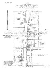 Eltham District Historical Society Inc
Document - Survey Plan, Country Roads Board, SP 6800, Eltham-Yarra Glen Road; Bridge St to Henry St, 1958
... Plan of Survey of Part of Crown Portions 12 and 13 Section 4 Parish of Nillumbik, County of Evelyn Eltham-Yarra Glen Road., Shire of Eltham Shows Surveyor field notes, property ownership and building type and construction....Plan of Survey of Part of Crown Portions 12 and 13 Section 4 Parish of Nillumbik, County of Evelyn Eltham-Yarra Glen Road., Shire of Eltham Shows Surveyor field notes, property ownership and building type and construction. 1958 A.M. ...1958 C.R.B. Plan of Survey of Part of Crown Portions 12 and 13 Section 4 Parish of Nillumbik, County of Evelyn Eltham-Yarra Glen Road., Shire of Eltham Shows Surveyor field notes, property ownership and building type and construction.1958, a.m. gahan, a.s & s.j. davis, annie ellen davies, bridge street, country roads board, d.a. lyon, dave lyon, eltham, flora towell, g.e. gallagher, henry street, j. lyon, k. greene, main road, p.a. gahan, survey plan, w.l. chynoweth pty ltd, york street, neil webster collection -
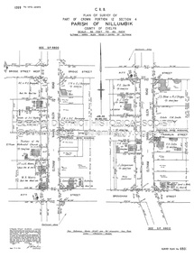 Eltham District Historical Society Inc
Document - Survey Plan, Country Roads Board, SP 6801, Eltham-Yarra Glen Road; Brougham St to Bridge St, 1958
... Plan of Survey of Part of Crown Portion 12 Section 4 Parish of Nillumbik, County of Evelyn Eltham-Yarra Glen Road, Shire of Eltham Shows Surveyor field notes, property ownership and building type and construction....Plan of Survey of Part of Crown Portion 12 Section 4 Parish of Nillumbik, County of Evelyn Eltham-Yarra Glen Road, Shire of Eltham Shows Surveyor field notes, property ownership and building type and construction. ...1958 C.R.B. Plan of Survey of Part of Crown Portion 12 Section 4 Parish of Nillumbik, County of Evelyn Eltham-Yarra Glen Road, Shire of Eltham Shows Surveyor field notes, property ownership and building type and construction.a.j. collis, a.s. & c.g.h. fitzpatrick, board of land & works, bridge street, brougham steet, commonwealth bank of australia, country roads board, eltham, eltham rsl sub-branch, f.h. collis, f.m. smith, f.n. & e.j. burgoyne, franklin street, h.c. & r.e. burgoyne, j. jorgenson, j.f. & j.e. morris, j.n. & h.c. burgoyne, j.s. blow, john street, main road, p.e. smith, pitt street, r.j. dripps, s.j. taylor, survey plan, trustees of the eltham methodist church, 1958, eltham-yarra glen road, neil webster collection -
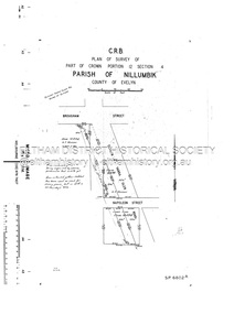 Eltham District Historical Society Inc
Document - Survey Plan, Country Roads Board, SP 6802, Eltham-Yarra Glen Road; Brougham St to Dalton St, 1958
... Plan of Survey of Part of Crown Portion 12 Section 4 Parish of Nillumbik, County of Evelyn Eltham-Yarra Glen Road, Shire of Eltham Shows Surveyor field notes, property ownership and building type and construction....Plan of Survey of Part of Crown Portion 12 Section 4 Parish of Nillumbik, County of Evelyn Eltham-Yarra Glen Road, Shire of Eltham Shows Surveyor field notes, property ownership and building type and construction. 1958 Eltham-Yarra Glen Road A.F. ...1958 C.R.B. Plan of Survey of Part of Crown Portion 12 Section 4 Parish of Nillumbik, County of Evelyn Eltham-Yarra Glen Road, Shire of Eltham Shows Surveyor field notes, property ownership and building type and construction.1958, eltham-yarra glen road, a.f. munday, bible street, brougham steet, country roads board, dalton street, eltham, j.p. & e.a. sanders, j.w. & e. m. graham, l.c. skipper, l.m. jarrold, main road, napoleon street, survey plan, neil webster collection, franco and co -
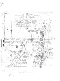 Eltham District Historical Society Inc
Document - Survey Plan, Country Roads Board, SP 6313, Eltham-Yarra Glen Road; Luck St to Henry St, 1956
... Plan of Survey of Part of Crown Portion 13 Section 4 Parish of Nillumbik, County of Evelyn Eltham-Yarra Glen Road, Shire of Eltham Shows Surveyor field notes, property ownership and building type and construction....Plan of Survey of Part of Crown Portion 13 Section 4 Parish of Nillumbik, County of Evelyn Eltham-Yarra Glen Road, Shire of Eltham Shows Surveyor field notes, property ownership and building type and construction. ...1956 C.R.B. Plan of Survey of Part of Crown Portion 13 Section 4 Parish of Nillumbik, County of Evelyn Eltham-Yarra Glen Road, Shire of Eltham Shows Surveyor field notes, property ownership and building type and construction.eltham-yarra glen road, country roads board, eltham, main road, survey plan, 1956, a.l. lyon, a.w. brinkkotter, arthur street, c.r. burkett, dudley street, e.n. staff, eltham war memorial trust, henry street, luck street, pryor street, the board of land & works, the equity trustees executors and agency coy ltd, the roman catholic trusts corporation, victorian railways commision, neil webster collection -
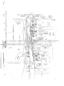 Eltham District Historical Society Inc
Document - Survey Plan, Country Roads Board, SP 6559-6560, Eltham-Yarra Glen Road; Elsa Ct to Luck St, 1957
... Plan of Survey of Part of Crown Portion 13 Section 4 and Crown Allotment 1 Section 1 Parish of Nillumbik, County of Evelyn Eltham-Yarra Glen Road, Shire of Eltham Shows Surveyor field notes, property ownership and building type and construction....Plan of Survey of Part of Crown Portion 13 Section 4 and Crown Allotment 1 Section 1 Parish of Nillumbik, County of Evelyn Eltham-Yarra Glen Road, Shire of Eltham Shows Surveyor field notes, property ownership and building type and construction. ...1957 C.R.B. Plan of Survey of Part of Crown Portion 13 Section 4 and Crown Allotment 1 Section 1 Parish of Nillumbik, County of Evelyn Eltham-Yarra Glen Road, Shire of Eltham Shows Surveyor field notes, property ownership and building type and construction.eltham-yarra glen road, country roads board, eltham, main road, survey plan, 1957, a.m. & a.a. iowerson, a.mcg. hepburn, cecil street, coffee lounge, diamond street, e.g. murrell, elsa court, h.b. woodhead, j.c. & s.i. harding, la ronde, luck street, r.m. & v.m. white, r.n. mowatt, the board of land & works, w.g. hains, neil webster collection -
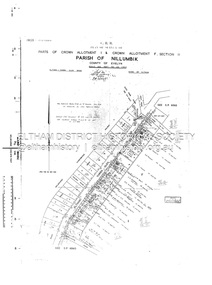 Eltham District Historical Society Inc
Document - Survey Plan, Country Roads Board, SP 6561, Eltham-Yarra Glen Road; Park Rd to Bellevue Rd, 1957
... Plan of Survey of Parts of Crown Allotment 1 & Crown Allotment F, Section II Parish of Nillumbik, County of Evelyn Eltham-Yarra Glen Road, Shire of Eltham Shows Surveyor field notes, property ownership and building type and construction....Plan of Survey of Parts of Crown Allotment 1 & Crown Allotment F, Section II Parish of Nillumbik, County of Evelyn Eltham-Yarra Glen Road, Shire of Eltham Shows Surveyor field notes, property ownership and building type and construction. ...1957 C.R.B. Plan of Survey of Parts of Crown Allotment 1 & Crown Allotment F, Section II Parish of Nillumbik, County of Evelyn Eltham-Yarra Glen Road, Shire of Eltham Shows Surveyor field notes, property ownership and building type and construction.eltham-yarra glen road, country roads board, eltham, main road, survey plan, 1957, a.r. thomas, b. & b.d. hearn, b.g. anderson, bellevue road, e.m. pitts, f.a. m. macrae, g.e. & b. moulder, j. bromley, j.m. & s.g. johnstone, k.f. pitts, l.c. docksey, m. & e.c.w. baart, m.p. bromley, n.r. ord, p.j. & g.e. murphy, park road, r.a. bruce, r.a. macbeth, r.w. shearing, railway road, s.e. & y.p. houghton, w.k. bell, w.s.r. & f.n. toley, neil webster collection -
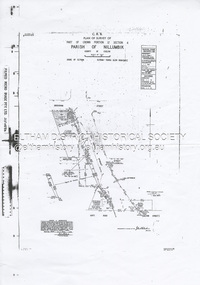 Eltham District Historical Society Inc
Document - Survey Plan, Country Roads Board et al, SP 12272A, Eltham-Yarra Glen Road; Brougham St to Dalton St, 1970-1976
... Plan of Survey of Part of Crown Portion 12 Section 4 Parish of Nillumbik, County of Evelyn Eltham-Yarra Glen Road, Shire of Eltham Shows Surveyor field notes, property ownership and building type and construction. ...Plan of Survey of Part of Crown Portion 12 Section 4 Parish of Nillumbik, County of Evelyn Eltham-Yarra Glen Road, Shire of Eltham Shows Surveyor field notes, property ownership and building type and construction. ...1970 C.R.B. Plan of Survey of Part of Crown Portion 12 Section 4 Parish of Nillumbik, County of Evelyn Eltham-Yarra Glen Road, Shire of Eltham Shows Surveyor field notes, property ownership and building type and construction. John L. Roberts, Licensed Surveyor as noted 4 June 1970 Amendments in black by John L. Roberts, L.S. 20-12-76 See also EDHS_05783 (1958)eltham-yarra glen road, 1970, 1976, a.f. munday, brougham street, dalton street, eltham, eltham clinic, g.t. & e.a. donnelly, jarrold cottage, l.m. jarrold, m.s.m. skipper, main road eltham, map, maria street, matcham skipper, mobil service centre (eltham), mobil service station, napoleon street, survey plan, white cloud cottage, country roads board -
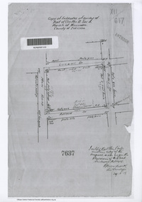 Eltham District Historical Society Inc
Document - Photocopy, Survey Field Notes of Part of Crown Portion 13, Section 4 at Eltham, Parish of Nillumbik, County of Evelyn, 29 May 1919
... Survey Field Notes of Part of Crown Portion 13, Section 4 at Eltham, Parish of Nillumbik, County of Evelyn...Woodcock, Licensed Surveyor, 29 May 1919 1919 Application 7637 Arthur Street Bible Street Luck Street Main Road Eltham Map Neil Webster Collection Survey Plan Surveyor Field Notes A3 printouts, 2 pages Survey Field Notes of Part of Crown Portion 13, Section 4 at Eltham, Parish of Nillumbik, County of Evelyn Document Photocopy ...Portion of land bounded by: Main Road, Luck Street, Bible Street, Arthur Street Application 7637 R.H. Woodcock, Licensed Surveyor, 29 May 19191919, application 7637, arthur street, bible street, luck street, main road eltham, map, neil webster collection, survey plan, surveyor field notes -
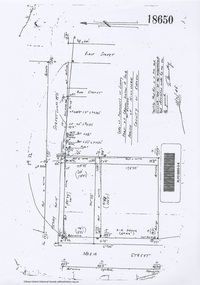 Eltham District Historical Society Inc
Document - Photocopy, Survey Field Notes of Part of Crown Portion 13, Section 4 at Eltham, Parish of Nillumbik, County of Evelyn, 18 October 1946
... Survey Field Notes of Part of Crown Portion 13, Section 4 at Eltham, Parish of Nillumbik, County of Evelyn...Connolly, Licensed Surveyor, 18 October 1946 Map Neil Webster Collection Survey Plan Surveyor Field Notes 1946 Application 18650 Bible Street henry street Main Road Eltham Maria Street Rose Street A3 printout, 1 page Survey Field Notes of Part of Crown Portion 13, Section 4 at Eltham, Parish of Nillumbik, County of Evelyn Document Photocopy ...Portion of land bounded by: Main Road, Henry Street, Bible Street Application 18650 W. Connolly, Licensed Surveyor, 18 October 1946map, neil webster collection, survey plan, surveyor field notes, 1946, application 18650, bible street, henry street, main road eltham, maria street, rose street -
![Document - Photocopy, Survey Field Notes of Part of Crown Portion 13, Section 4 at Eltham, Parish of Nillumbik, County of Evelyn [Bourke sic], 30 September 1949](/media/collectors/4f729f7b97f83e03086018a5/items/6869da03f3688aa02254c5c2/item-media/6869da22f3688aa02254c6da/item-fit-380x285.jpg?cb=6) Eltham District Historical Society Inc
Eltham District Historical Society IncDocument - Photocopy, Survey Field Notes of Part of Crown Portion 13, Section 4 at Eltham, Parish of Nillumbik, County of Evelyn [Bourke sic], 30 September 1949
... Survey Field Notes of Part of Crown Portion 13, Section 4 at Eltham, Parish of Nillumbik, County of Evelyn [Bourke sic]...Eltham District Historical Society Inc 728 Main Rd Eltham melbourne Portion of land bounded by: Main Road, Arthur Street, Dudley Street Application 21718 Erwin Dillon, Licensed Surveyor, 30 September 1949 Map Neil Webster Collection Survey Plan Surveyor Field Notes 1949 Application 21718 Arthur Street Dudley Street Main Road Eltham A3 printout, 1 page Survey Field Notes of Part of Crown Portion 13, Section 4 at Eltham, Parish of Nillumbik, County of Evelyn [Bourke sic] Document Photocopy ...Portion of land bounded by: Main Road, Arthur Street, Dudley Street Application 21718 Erwin Dillon, Licensed Surveyor, 30 September 1949map, neil webster collection, survey plan, surveyor field notes, 1949, application 21718, arthur street, dudley street, main road eltham