
Showing 53 items matching "gippsland coast"
-
 Lakes Entrance Historical Society
Book - Shipwrecks on the East Gippsland Coast by Don Love, Love, Don, 2003
... Shipwrecks on the East Gippsland Coast by Don Love...Shipwrecks on the East Gippsland Coast by Don Love ...Stories Exploring the fate of 129 ships lost along the East Gippsland Coast from Corner Inlet to Cape Howe between 1797 - 1945 plus second pic with details about the author...Stories Exploring the fate of 129 ships lost along the East Gippsland Coast from Corner Inlet to Cape Howe between 1797 - 1945 plus second pic with details about the author Shipwrecks Ships and Shipping Hardcover book with aqua coloured cover Shipwrecks on the East Gippsland Coast by Don Love Book Shipwrecks on the East Gippsland Coast by Don Love Love, Don ...Stories Exploring the fate of 129 ships lost along the East Gippsland Coast from Corner Inlet to Cape Howe between 1797 - 1945 plus second pic with details about the authorHardcover book with aqua coloured cover shipwrecks, ships and shipping -
 Lakes Entrance Historical Society
Book, Lakes Entrance Regional Family History Resource Centre, Casting the Net. Early Fishing Families of the Gippsland Coast, 2001
... Early Fishing Families of the Gippsland Coast....Memories of stories told by members and descendants of fishing families from he Gippsland Lakes and Gippsland coast, including Mallacoota. Introduction gives a brief overview of the early fishing industry....Early Fishing Families of the Gippsland Coast. Book Lakes Entrance Regional Family History Resource Centre ...Memories of stories told by members and descendants of fishing families from he Gippsland Lakes and Gippsland coast, including Mallacoota. Introduction gives a brief overview of the early fishing industry.settlers, township, fishing industry -
Lakes Entrance Historical Society
Book, Don Love, Shipwrecks on the South Gippsland Coast, 2005
... Shipwrecks on the South Gippsland Coast...The second book in the series this one exploring the fate of 84 ships lost along the South Gippsland Coast 1839-1945...The second book in the series this one exploring the fate of 84 ships lost along the South Gippsland Coast 1839-1945 Shipwrecks Maritime History Hardcove with brown jacket. 127 pages Shipwrecks on the South Gippsland Coast Book Don Love ...The second book in the series this one exploring the fate of 84 ships lost along the South Gippsland Coast 1839-1945Hardcove with brown jacket. 127 pagesshipwrecks, maritime history -
Phillip Island and District Historical Society Inc.
Book, LOVE, Don, Shipwrecks on the South Gippsland Coast, 2005
... Shipwrecks on the South Gippsland Coast...Shipwrecks on the South Gippsland Coast Book LOVE, Don Don Love ...Maps on endpapers. Includes bibliographical references and indexes.shipwrecks, victoria, south gippsland, history -
Phillip Island and District Historical Society Inc.
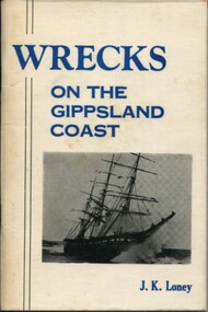
Book, LONEY, J. K. (Jack Kenneth), Wrecks on the Gippsland coast, 1971
... Wrecks on the Gippsland coast...shipwrecks victoria gippsland Cowes Public Library Wrecks on the Gippsland coast Book LONEY, J. K. (Jack Kenneth) J. ...Cowes Public Libraryshipwrecks, victoria, gippsland -
 Inverloch Historical Society
004438 Book - Loney, JK (1976); Wrecks on the Gippsland Coast (5th Edition) - from E Henderson
... 004438 Book - Loney, JK (1976); Wrecks on the Gippsland Coast (5th Edition) - from E Henderson...004438 Book - Loney, JK (1976); Wrecks on the Gippsland Coast (5th Edition) - from E Henderson ... -
Lakes Entrance Historical Society
Book, Loney Jack, Wrecks on the Gippsland Coast, 1968
... Wrecks on the Gippsland Coast...Wrecks on the Gippsland Coast Book Loney Jack ...Shipwrecks and incidents along the coast and in Bass Strait from Point Nepean to Cape Howe. Indexes of Ships and Localities included. Some ship illustrated.A J and H Murrell stamped on first pageshipwrecks, ships and shipping, lighthouses -
Lakes Entrance Historical Society
Book, Fletcher Meredith, Squires Debra, Barraclough Linda, Gippsland Heritage Journal Vol 1 No. 1, 1986
... Early discovery of Bass Straight and Gippsland coast and social history of Gippsland Victoria...Explorers Township Bibliography Early discovery of Bass Straight and Gippsland coast and social history of Gippsland Victoria Gippsland Heritage Journal Vol 1 No. 1 Book Fletcher Meredith, Squires Debra, Barraclough Linda ...Early discovery of Bass Straight and Gippsland coast and social history of Gippsland Victoriaexplorers, township, bibliography -
Lakes Entrance Historical Society
Book, LERHS, S.S. Glenelg, 2008c
... Information on the disastrous foundering and loss of life from the S S Glenelg on the Gippsland coast near Lakes Entrance Victoria...Shipwrecks Ships and Shipping Information on the disastrous foundering and loss of life from the S S Glenelg on the Gippsland coast near Lakes Entrance Victoria S.S. ...Information on the disastrous foundering and loss of life from the S S Glenelg on the Gippsland coast near Lakes Entrance Victoriashipwrecks, ships and shipping -
Lakes Entrance Historical Society
Book, Harvey, Peter, Clonmel Disaster to Discovery, 1999
... A study of the wooden paddle steamer Clonmel, wrecked on the South Gippsland coast in January 1841, at what became known as Port Albert....Ships and Shipping Settlers Historic Sites Conservation A study of the wooden paddle steamer Clonmel, wrecked on the South Gippsland coast in January 1841, at what became known as Port Albert. ...A study of the wooden paddle steamer Clonmel, wrecked on the South Gippsland coast in January 1841, at what became known as Port Albert.ships and shipping, settlers, historic sites, conservation -
Lakes Entrance Historical Society
Book, M Holding, Inquests into Drownings Britt, Johnstone, Bahn, Challinor, 2015c
... Inquests and Inquiries also other information on the drownings of four seamen James Britt, John A Johnstone and August Bahn at the Lakes Entrance Bar and Charles Challinor from the schooner Julius lost off the Gippsland Coast Victoria...Ships and Shipping Inquests Inquests and Inquiries also other information on the drownings of four seamen James Britt, John A Johnstone and August Bahn at the Lakes Entrance Bar and Charles Challinor from the schooner Julius lost off the Gippsland Coast Victoria Inquests into Drownings Britt, Johnstone, Bahn, Challinor Book M Holding ...Inquests and Inquiries also other information on the drownings of four seamen James Britt, John A Johnstone and August Bahn at the Lakes Entrance Bar and Charles Challinor from the schooner Julius lost off the Gippsland Coast Victoriaships and shipping, inquests -
 Lakes Entrance Historical Society
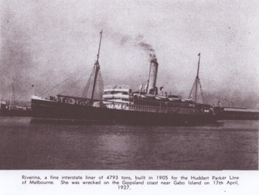
Photograph - Steamer Riverina c1920
... She was wrecked on the Gippsland coast near Gabo Island on 17ty April 1927...She was wrecked on the Gippsland coast near Gabo Island on 17ty April 1927 Ships and Shipping Timber Industry Jetties Riverina a fine interstate liner of 4793 tons built in 1905 for Huddart Parker Line of Melbourne. ...She was wrecked on the Gippsland coast near Gabo Island on 17ty April 1927Black and white photograph of the Huddart Parker Line steamer Riverina at an unknown port Australia. Plus second photo when wrecked.Riverina a fine interstate liner of 4793 tons built in 1905 for Huddart Parker Line of Melbourne. ships and shipping, timber industry, jetties -
 Orbost & District Historical Society
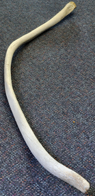
Animal specimen - Bone
... ...Gippsland coast...Bones Whales Whaling trade maritime history Gippsland coast seafaring H.G.Wellings Large, bowed bone flat ends with minor deterioration at tip. ...Whales are sometimes beached on the coastline near Orbost, Marlo. Large, bowed bone flat ends with minor deterioration at tip.bones, whales, whaling trade, maritime history, gippsland coast, seafaring, h.g.wellings -
 Lakes Entrance Historical Society
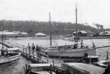
Photograph - Broomes Federal guest house, Venga next, Robin Hood Inn, Lakes Entrance Victoria c1920
... Also in album is photocopy of page from Don Loves book 'Shipwrecks on the East Gippsland Coast', of the SS Bogong 1896...Also in album is photocopy of page from Don Loves book 'Shipwrecks on the East Gippsland Coast', of the SS Bogong 1896 Ships and Shipping Waterways Retail Trade Black and white photograph showing boats at jetty, Eva on right and other tourist type boats, several people on jetty and boats. ...Also in album is photocopy of page from Don Loves book 'Shipwrecks on the East Gippsland Coast', of the SS Bogong 1896Black and white photograph showing boats at jetty, Eva on right and other tourist type boats, several people on jetty and boats. Broomes Federal guest house on left, Venga next, dark house on site of Robin Hood Inn, Kalimna Heights in background. Lakes Entrance Victoriaships and shipping, waterways, retail trade -
 Lakes Entrance Historical Society
Photograph - Hero, Bergin T, 1904
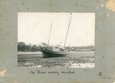
... Reference 'Wrecks along the Gippsland Coast', 8th Edition p84, Jack Loney....Reference 'Wrecks along the Gippsland Coast', 8th Edition p84, Jack Loney. Boats and Boating Shipwrecks The Hero safely beached 1.11.1904 Black and white photograph mounted on card, of auxiliary ketch Hero aground as seen from water Lakes Entrance Victoria Photograph Hero Bergin T ...The date on the photo 1.11.1904, appears to identify this as the 'Hero' aground October 1904 when her cables parted while sheltering from a gale near Cape Woolamai, Victoria. Reference 'Wrecks along the Gippsland Coast', 8th Edition p84, Jack Loney.Black and white photograph mounted on card, of auxiliary ketch Hero aground as seen from water Lakes Entrance VictoriaThe Hero safely beached 1.11.1904boats and boating, shipwrecks -
 Victorian Aboriginal Corporation for Languages
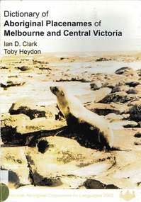
Book, Ian D Clark et al, Dictionary of Aboriginal placenames of Melbourne and Central Victoria, 2002
... Coast...Greater Geelong...South Gippsland...Daung Wurrung Woiwurrung Dja Dja Wurrung Wathawurrung Wadawurrung Boon Wurrung Jardwadjali Melbourne Yarra Baw Baw Central Goldfields Bass Coast Greater Geelong South Gippsland Surf Coast Yarra Ranges Golden Plains Mornington Peninsula Yarra Ranges Ballarat Frankston Greater Dandenong Queenscliffe Moorabool Boroondara maps, b&w photographs Dictionary including Indigenous and European place names. ...Dictionary including Indigenous and European place names. Origins are given.maps, b&w photographsdaung wurrung, woiwurrung, dja dja wurrung, wathawurrung, wadawurrung, boon wurrung, jardwadjali, melbourne, yarra, baw baw, central goldfields, bass coast, greater geelong, south gippsland, surf coast, yarra ranges, golden plains, mornington peninsula, yarra ranges, ballarat, frankston, greater dandenong, queenscliffe, moorabool, boroondara -
Victorian Aboriginal Corporation for Languages
Book, Leon Costermans, Trees of Victoria and adjoining areas, 1994
... Gippsland...South Coast NSW...trees East Gippsland South Coast NSW Mallee Colour photographs, illustrations, maps Format features leaf identification, map of location, seeds and bark etc., in black and white drawings. ...Format features leaf identification, map of location, seeds and bark etc., in black and white drawings.Colour photographs, illustrations, mapstrees, east gippsland, south coast nsw, mallee -
 Orbost & District Historical Society
black and white photograph
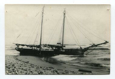
... The “Glengarry” beached at Marlo The schooner Glengarry was a well-known trader on the Gippsland coast and had been stranded on a number of previous occasions including at the Natural Entrance joining the Gippsland Lakes to Bass Strait – Ninety Mile Beach, Lakes Entrance, c 1877 . ...The “Glengarry” beached at Marlo The schooner Glengarry was a well-known trader on the Gippsland coast and had been stranded on a number of previous occasions including at the Natural Entrance joining the Gippsland Lakes to Bass Strait – Ninety Mile Beach, Lakes Entrance, c 1877 . ...The “Glengarry” beached at Marlo The schooner Glengarry was a well-known trader on the Gippsland coast and had been stranded on a number of previous occasions including at the Natural Entrance joining the Gippsland Lakes to Bass Strait – Ninety Mile Beach, Lakes Entrance, c 1877 . In May 1898, the vessel struck a submerged object while crossing the Snowy River bar at Marlo and was beached, eventually becoming a total loss. Until t he railway came to East Gippsland goods were shipped from Marlo to Melbourne. This is a pictorial record of a well-known trading ship involved in that river transport.Three copies of a black / white photograph of the Schooner Glengarry wrecked in 1891 at the Snowy River entrance at Marlo.schooner-glengarry shipping transport-orbost -
 Lakes Entrance Historical Society
Photograph - Shipwrecks Exhibition Lakes Entrance January 2025
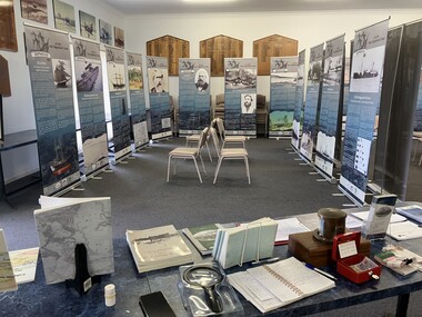
... Twenty five banners were produced for the display telling the stories of shipwrecks along the East Gippsland coast. The exhibition was well attended and enjoyed by many. ...Twenty five banners were produced for the display telling the stories of shipwrecks along the East Gippsland coast. The exhibition was well attended and enjoyed by many. ...The Lakes Entrance Regional Historical Society held a shipwrecks exhibition in the Coast Guard building during the month of January 2025. Twenty five banners were produced for the display telling the stories of shipwrecks along the East Gippsland coast. The exhibition was well attended and enjoyed by many. The Orbost and Mallacoota Historical Societies have displayed part of the exhibition during 2025 and it is expected to be displayed at Paynesville in February and March 2026.Colour photograph of part of display at Shipwrecks Exhibition exhibition, shipwrecks, maritime history -
Lakes Entrance Historical Society
Book, Love Don, Maritime Incidents on the Gippsland Lakes, 2015
... A list of boating accidents which have occurred in the Gippsland Lakes and nearby coast, highlighting the dangers faced by mariners from late 1700 to 1999...Boats and Boating Trades A list of boating accidents which have occurred in the Gippsland Lakes and nearby coast, highlighting the dangers faced by mariners from late 1700 to 1999 Maritime Incidents on the Gippsland Lakes Book Love Don ...A list of boating accidents which have occurred in the Gippsland Lakes and nearby coast, highlighting the dangers faced by mariners from late 1700 to 1999boats and boating, trades -
 Flagstaff Hill Maritime Museum and Village
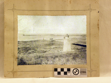
Photograph - Historical, maritime, Brookes' Photographic Union, Warrnambool Harbour (from the battery), 1895
... Gippsland and the Western Victoria. This photograph was taken and published just after the construction of the Warrnambool Breakwater. The image records a snapshot of the construction of the Warrnambool Breakwater, a construction that changed the history of the Port of Warrnambool, It is also a record of the Flagstaff Hill area and at that time. Flagstaff Hill Flagstaff Hill Maritime Museum and Village Warrnambool Maritime Museum Maritime Village Great Ocean Road Shipwreck Coast ...This photograph shows the Lower Light at Flagstaff Hill, Warrnambool, in 1895, part of the Lady Bay Lighthouse Complex. The photograph is part of the Western Victoria collection produced in 1891 by Brookes' Photographic Union in Victoria. Brookes' Photographic Union was a collaboration of two brothers, Frederick Augustus Brookes and his brother Albert Edward Brookes. Frederick arrived in Victoria in the early 1880's. He and Albert formed the organisation to produce collections of photographs including the districts of Geelong, Gippsland and the Western Victoria. This photograph was taken and published just after the construction of the Warrnambool Breakwater. The image records a snapshot of the construction of the Warrnambool Breakwater, a construction that changed the history of the Port of Warrnambool, It is also a record of the Flagstaff Hill area and at that time.Photograph, sepia coloured rectangular shape, mounted between two sheets of cream card. Border of photograph is decorated with pen lines and design in corners. Subject is the Warrnambool Harbour, with a lighthouse on a hill in the foreground, a light coloured picket fence, the harbour with a moored vessel and a jetty. Produced by the Brookes' Photographic Union, and with the heading of Western Victoria. Inscriptions are on the reverse, on two stickers, a printed white label and a handwritten name.Stickers: "F.PA 60/2-74" "138" Label: "WESTERN VICTORIA / BROOKES' PHOTOGRAPHIC UNION / WARRNAMBOOL HARBOUR / (FROM THE BATTERY) Hand written in black: "B. Fisher"flagstaff hill, flagstaff hill maritime museum and village, warrnambool, maritime museum, maritime village, great ocean road, shipwreck coast, western district, western victoria, brookes' photographic union, frederick brookes, albert brookes, photograph, warrnambool harbour, warrnambool history, lady bay, port of warrnambool, b. fisher, 1895, maritime history, breakwater, warrnambool jetty -
 Flagstaff Hill Maritime Museum and Village
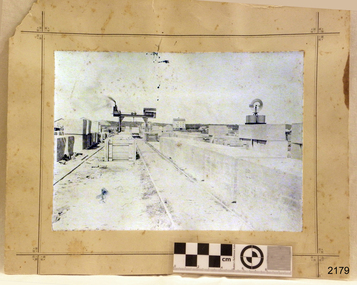
Photograph - Historical, maritime, Brookes' Photographic Union, Harbour Works, Warrnambool, 1891
... Gippsland and the Western Victoria. This photograph was taken during the construction of the Warrnambool Breakwater and published the year after it was completed. The project began with the Government of 1874 approving the plan, and was completed in 1890. The image records a snapshot of the construction of the Warrnambool Breakwater, a construction that changed the history of the Port of Warrnambool, Flagstaff Hill Flagstaff Hill Maritime Museum and Village Warrnambool Maritime Museum Maritime Village Great Ocean Road Shipwreck Coast Western District Western Victoria Brookes' Photographic Union Frederick Brookes Albert Brookes Photograph Warrnambool Harbour Harbour Works concrete bolcks Breakwater Warrnambool History Breakwater History 1891 Lady Bay Port of Warrnambool B. ...This photograph records the making and placing of the concrete blocks for the construction of the Warrnambool Breakwater in the Warrnambool Harbour, completed in 1890. Each block weighed 20 to 30-plus tons. The huge Titan steam powered crane in the photograph played a massive role in the construction. It was able to lift the concrete blocks with its overhanging, counterbalanced arm and roll on its wheels along the rails to the required position. It then lowered the blocks into position on the concrete foundation already laid on the seabed. There are many details in the photograph that help to tell other aspects of Warrnambool's history. It appears that the photograph was once owned by B. Fisher. The photograph is part of the Western Victoria collection produced in 1891 by Brookes' Photographic Union in Victoria. Brookes' Photographic Union was a collaboration of two brothers, Frederick Augustus Brookes and his brother Albert Edward Brookes. Frederick arrived in Victoria in the early 1880's. He and Albert formed the organisation to produce collections of photographs including the districts of Geelong, Gippsland and the Western Victoria.This photograph was taken during the construction of the Warrnambool Breakwater and published the year after it was completed. The project began with the Government of 1874 approving the plan, and was completed in 1890. The image records a snapshot of the construction of the Warrnambool Breakwater, a construction that changed the history of the Port of Warrnambool, Photograph, sepia coloured rectangular shape, mounted between two sheets of cream card. Border of photograph is decorated with pen lines and design in corners. Subject is the Warrnambool Breakwater construction with the Titan steam crane on rail lines, concrete blocks, a windmill and tanks, sheds, and a multi-storey building in the background. Produced by the Brookes' Photographic Union, Western Victoria. Inscriptions are on the reverse, on two stickers, a printed white label and a handwritten name.Stickers: "137" "F.Pn 61/2-74" Label: "WESTERN VICTORIA / BROOKES' PHOTOGRAPHIC UNION / HARBOUR WORKS, / WARRNAMBOOL." "The subject of this picture is the making of concrete blocks for the Breakwater. These blocks weigh from 20 to 30 tons each, and are lifted about by the large piece of machinery seen in the picture." Hand written: "B. Fisher"flagstaff hill, flagstaff hill maritime museum and village, warrnambool, maritime museum, maritime village, great ocean road, shipwreck coast, western district, western victoria, brookes' photographic union, frederick brookes, albert brookes, photograph, warrnambool harbour, harbour works, concrete bolcks, breakwater, warrnambool history, breakwater history, 1891, lady bay, port of warrnambool, b. fisher, titan crane, steam crane, concrete blocks -
 The Beechworth Burke Museum
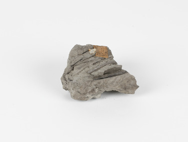
Geological specimen - Fossiliferous Mudstone, Unknown
... Cape Paterson is a cape and seaside village located near the town of Wonthaggi, 132 kilometres southeast of Melbourne, in the Bass Coast Shire of Gippsland, Victoria, Australia. These dark, fossiliferous Mudstones were deposited in slow-moving water associated with sedimentary basins & continental shelves. ...Cape Paterson is a cape and seaside village located near the town of Wonthaggi, 132 kilometres southeast of Melbourne, in the Bass Coast Shire of Gippsland, Victoria, Australia. These dark, fossiliferous Mudstones were deposited in slow-moving water associated with sedimentary basins & continental shelves. ...This specimen was found in Cape Patterson, Vic. Cape Paterson is a cape and seaside village located near the town of Wonthaggi, 132 kilometres southeast of Melbourne, in the Bass Coast Shire of Gippsland, Victoria, Australia. These dark, fossiliferous Mudstones were deposited in slow-moving water associated with sedimentary basins & continental shelves. They are rich in carbon which makes them almost black. This is typical of an anoxic, reducing environment such as deep water or stagnant conditions where carbon-rich material would remain unoxidised during subsequent deposition & diagenesis. it has an imprint of a leaf in the rock itself, displaying the fossil of the plant. This specimen is unique due to the leaf impression within the stone itself. Imprint fossils are formed from an organism moving in some way, leaving behind a trace or track. These tracks are preserved when the clay/silt dries slowly and is covered by other sediment. Plants can also leave imprint fossils when they are covered by sediment. The leaf tissue degrades, leaving an imprint of where the leaf once was. This specimen is part of a larger collection of geological and mineral specimens collected from around Australia (and some parts of the world) and donated to the Burke Museum between 1868-1880. A large percentage of these specimens were collected in Victoria as part of the Geological Survey of Victoria that begun in 1852 (in response to the Gold Rush) to study and map the geology of Victoria. Collecting geological specimens was an important part of mapping and understanding the scientific makeup of the earth. Many of these specimens were sent to research and collecting organisations across Australia, including the Burke Museum, to educate and encourage further study.These dark, fossiliferous Mudstones were deposited in slow moving water associated with sedimentary basins & continental shelves. They are rich in carbon which makes them almost black. This is typical of an anoxic, reducing environment such as deep water or stagnant conditions where carbon rich material would remain unoxidised during subsequent deposition & diagenesis. FOSSILIFEROUS MUDSTONE / Locality: Cape Patterson, Victoria | Descriptive catalogue / Pg 27 No 95 / "Grey Clay, / Cape Paterson with leaf impressions' / 15/4/21 C. William /mudstone, cape patterson, leaf imprint, fossilised leaf, fossiliferous mudstone -
 Federation University Historical Collection
Article - Article - Women, Federation University: Women of Note; Professor Helen Bartlett, Vice-Chancellor Ballarat, 2017 - 2020
... gippsland...regional universities network...university of the sunshine coast...Gippsland Campus from 2008 to 2012. She is the current Chair of the Regional Universities Network and Vice-Chancellor of the University of Sunshine Coast. ...Gippsland Campus from 2008 to 2012. She is the current Chair of the Regional Universities Network and Vice-Chancellor of the University of Sunshine Coast. ...Professor Helen Bartlett was Vic-Chancellor of Federation University Ballarat from 2017 to 2020. Prior to this she was Pro Vice Chancellor and Chief Executive of Monash University Malaysia from 2013 to 2017, and Pro Vice-Chancellor and President of Monash University’s Gippsland Campus from 2008 to 2012. She is the current Chair of the Regional Universities Network and Vice-Chancellor of the University of Sunshine Coast. Professor Helen Bartlett is an experienced leader and passionate advocate for regional education. Professor Bartlett led a period of transformation at Federation University Australia, enhancing its profile as a multi-campus institution, its innovative approach to regional higher education and focus on responding to the needs of its communities. Professor Bartlett was also Chair of the Victorian Vice-Chancellors’ Committee in the year prior to her move to Queensland and worked closely with the Victorian Government as universities shaped their response to the COVID-19 pandemic.women of note, professor helen bartlett, federation university, vice-chancellor, monash university malaysia, pro vice-chancellor, chief executive, president, monash university gippsland, regional universities network, university of the sunshine coast, victorian vice-chancellors' committee -
 Flagstaff Hill Maritime Museum and Village
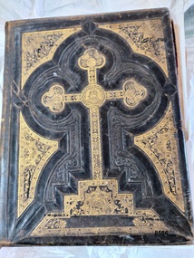
Book - Bible, Thomas Kelly & Sons, The Holy Bible - Douay Bible and Rheims Testament, 1880
... The donor found the Bible in a box of secondhand books on a market stall in Gippsland and recognised its links to the Shipwreck Coast through the name of previous owners (a well-known Warrnambool name) and the story of it being found on a beach near Peterborough. ...The donor found the Bible in a box of secondhand books on a market stall in Gippsland and recognised its links to the Shipwreck Coast through the name of previous owners (a well-known Warrnambool name) and the story of it being found on a beach near Peterborough. ...The Douay (Douai) Rheims Bible is an English translation of the Latin Vulgate Bible (which had been the Latin Bible used by the Catholic Church since the 4th century). It was produced by Roman Catholic scholars in exile from Elizabethan Protestant England at the English College of Douai (then in the Spanish Netherlands but later part of France). The New Testament translation was published in 1582 at Rheims where the English College had temporarily located in 1578. The Old Testament was translated shortly afterwards but was not published until 1609-1610 in Douay (which makes it older than the King James version). The completed work was the only authorized Bible in English for Roman Catholics until the 20th Century. Its purpose was to uphold the Catholic tradition in the face of the Protestant Reformation and was produced as an alternative to the several Protestant translations then in existence. Prior to it being published, the Roman Catholic practice had restricted personal use of the Bible, in the Latin Vulgate, to the clergy. Bishop Richard Challoner issued a series of revisions (1749 - 1772) intended to make the translation more easily understandable and subsequent editions (including this one) were based upon this revision. In 1871, an edition of the Douay - Rheims Bible was published by Thomas Kelly & Sons of Philadelphia (and later, New York). Thomas Kelly described himself as a "Publisher, Printer, Binder, Lithographer and Steel Plate Engraver". In 1876, Thomas Kelly won an award (a Diploma of Honor and a Medal of Merit) for "the Best Catholic Bibles and Prayer Books" at the International Centennial Exhibition held in Philadelphia and his firm continued to print editions of the Bible throughout the 1870's but little is known of him after 1880 when this edition was published. This Bible has been in the Kermond family from 1888 until 1984 when Laurence Kermond (its last owner) died. The Kermonds were an old Warrnambool family with ties to the district going back to the mid 1840's. Joseph Kermond's mother, Catherine (1818 - 1895) and her husband John Kermond,, an ex-convict (1809 - 1877), had moved from Tasmania around 1843 and were living in the Warrnambool area in 1844 where their eldest son was born. They had six more children born at Port Fairy (or Belfast as it was then called). Catherine is buried at the Tower Hill cemetery. The last owner of the Bible was Laurence Kermond (1918 - 1984). He was the great grandson of John and Catherine Kermond and was a well known painter who lived in the Merimbula and Paynesville areas of N.S. W. and Victoria during the 1970's and early 1980's. The story of Joseph Kermond finding the Bible on a beach on the Shipwreck Coast near Peterborough on the southern coast of Victoria, Australia is plausible as it was not uncommon for items from shipwrecks to be washed ashore. However this Bible would not have come from the wreck of the Loch Ard as the dates don't align. The Loch Ard was wrecked in 1878 and this Bible was printed in 1880. It appears to have been printed for the Australian market as there is a page (with an engraved portrait) dedicated to the "Most Rev. Roger Bede Vaughan, O. S. B. Archbishop of Sydney, N. S. W.". It may also have been aimed at the Irish immigrants as the four "Family Register" pages are decorated with borders of shamrocks. The donor found the Bible in a box of secondhand books on a market stall in Gippsland and recognised its links to the Shipwreck Coast through the name of previous owners (a well-known Warrnambool name) and the story of it being found on a beach near Peterborough. This Bible is a rare example of Douay and Reims Catholic Bible of the late 19th century that was once a treasured item belonging to the Kermond family - one of Warrnambool's early settlers. It also has a most unusual story attached to it - being found (and rescued) washed up on a local beach and almost one hundred years later, being rescued again from a secondhand book stall.This Catholic Bible is an 1880 edition of a "Douay Bible and Rheims Testament", printed and published by Thomas Kelly of New York. Its full title is "The Holy Bible translated from the Latin Vulgate Diligently Compared with The Hebrew, Greek and Other Editions in Various Languages". It is revised with annotations by the Right Rev. R. Challoner D.D. The Bible has brown leather embossed front and back covers decorated with identical ornate gilt patterns and a central picture of a cross. It has two coloured illustrations and numerous black and white lithographs and engravings including portraits of past popes, events and places from Bible stories and decorative borders. The Bible includes the Old and New Testaments, approbations from Pope Pius the Sixth and Archbishops of the United States and other countries (including Archbishop Vaughan of Sydney), a Family Register with handwritten notes on births, deaths and marriages from the Kermond family (as well as a description of how they obtained the bible), a Catholic dictionary of the Bible, a history of the Holy Scriptures, a chronological list of heretics (Theological history) and a description of the "Centennial Award - Diploma of Honor and medal of Merit" won by Thomas Kelly (for the "Best Catholic Bible") at the Centennial Exhibition at Philadelphia in 1876. The Records section has a note on the Memoranda page written by William John Kennard in 1920.Spine: HOLY BIBLE Title Page: THE/ HOLY BIBLE /TRANSLATED FROM/ THE LATIN VULGATE/ DILIGENTLY COMPARED WITH/THE HEBREW, GREEK AND OTHER EDITIONS/ IN VARIOUS LANGUAGES/ THE OLD TESTAMENT WAS FIRST PUBLISHED BY THE ENGLISH COLLEGE AT DOUAY, A.D. 1600 / AND THE NEW TESTAMENT, BY THE ENGLISH COLLEGE AT RHEIMS, A.D. 1582./ REVISED WITH ANNOTATIONS/ BY THE RIGHT REV. R. CHALLONER D.D./ TOGETHER WITH REFERENCES, AND AN HISTORICAL AND CHRONOLOGICAL INDEX./ NOW CAREFULLY CORRECTED ACCORDING TO THE CLEMENTINE EDITION OF THE SCRIPTURES/ NEW YORK / THOMAS KELLY, PUBLISHER/ 17 BARCLAY STREET. / 1880 Dedication Page: DEDICATION OF THE ORIGINAL EDITION/ TO/ THAT LOYAL, RELIGIOUS AND ENLIGHTENED BODY OF MEN / THE/ CATHOLICS OF THE UNITED STATES OF AMERICA/ IN ADMIRATION OF THE STEADY ZEAL WITH WHICH THEY HAVE KEPTTHE/DEPOSIT OF FAITH/ BEQUEATHED THEM BY THEIR FOREFATHERS/ AND HANDED DOWN, WITHOUT INTERRUPTION OT ADULTERATION, TO THEIR GRATEFUL POSTERITY/ THIS EDITION/ OF THE/DOUAY BIBLE AND RHEIMS TESTAMENT/ IS / WITH GRATITUDE FOR PAST FAVORS AND HOPES OF FUTURE ENCOURAGEMENT/ MOST RESPECTFULLY ENSCRIBED. Handwritten note: ""This Holy Book was found . on the beach . near Peterborough Vic. having been washed ashore . from the wreck of the Loch Ard, (sailing ship) in the year 1888 . By .Joseph . Kermond; and presented to . his mother . Catherine Kermond , who in turn passed it - on . to her youngest . son ; one Jacob Kermond. He in turn presented . it to his son . William John Kermond , (the writer), 23/3/20)" [Original punctuation]flagstaff hill maritime museum and village, warrnambool, shipwreck coast, peterborough, kermond, kermond family, loch ard, bible, douay and rheims bible, catholic bible, thomas kelly and sons publiisher, douai, rheims, holy bible, religious bible, catherine kermond, john kermond, william john kermond' -
 Orbost & District Historical Society
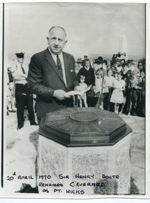
black and white photograph, April 20 1970
... coast. Although Cook named the promontory Point Hicks it was changed to Cape Everard in 1843.. In 1970 the Victorian government changed the name Cape Everard to 'Point Hicks'. It lies on dry land, about 22 nautical miles (41 km) northeast of Cook's phantom Point Hicks, where it preserves the story of Cook's first landfall in Australia. This is a contemporary pictorial record of a significant event in East Gippsland's ...Sir Henry Bolte, premier of Victoria, renamed Cape Everard at Point Hicks during the Centenary of Cook's Landings on April 20, 1970. There is no land feature at Cook's coordinates of 38°0'S and 148°53'E, a point which lies several miles out to sea and under 50 fathoms of water. Captain Cook invented Point Hicks so that he could conceal Bass Strait and the insularity of Tasmania. The Admiralty had issued its usual instructions to hide strategically important discoveries that could become security risks. Captain Hicks was James Cook`s senior lieutenant. There has been some dispute as to whether Zachary Hicks actually saw Point Hicks or whether he saw Ram Head about 20 kilometres further up the coast. Although Cook named the promontory Point Hicks it was changed to Cape Everard in 1843.. In 1970 the Victorian government changed the name Cape Everard to 'Point Hicks'. It lies on dry land, about 22 nautical miles (41 km) northeast of Cook's phantom Point Hicks, where it preserves the story of Cook's first landfall in Australia. This is a contemporary pictorial record of a significant event in East Gippsland's history.A black / white photograph of a man in a suit making a speech with the audience standing behind him. He is standing in front of an octagonal-shaped directional marker set ointo a stone support. There is a policeman behind him. In the background to the right is a lighthouse.on front - "20th April 1970, Sir Henry Bolte renames C. Everard as Pt Hicks" handwritten in block letterscook-james-point-hicks cape-everard bolte-henry -
 Orbost & District Historical Society
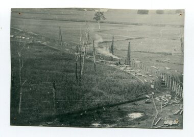
black and white photograph, 1916
... coast east of Bairnsdale. The Snowy floodplain bridges were initially built in the context of an early twentieth-century interest in American-style 'Developmental Railways', designed to open remote areas to closer settlement, even if that meant running at a loss. The line was closed in August 1987. (information from Victorian Heritage Database) This item is associated with the history of the Orbost-Bairnsdale railway line and therefore reflects the role that the rail line played in the social and economic history of Orbost. orbost-railway east-gippsland-railway viaduct-orbost transport railway A black / white photograph of the farming flats at Orbost during the construction of the East Gippsland railway. black and white photograph ...This photograph shows the pile drivers at work in the construction of the viaduct across the Snowy River flats. The Snowy River Floodplain Railway Bridges, two sequential and exceptionally long and low timber railway bridges on the Snowy River floodplain just west of Orbost, were built in 1916, and provided the original terminus point for the Bairnsdale-Orbost railway. The bridges are 770 metres and 183 metres long respectively. The shorter bridge is of uniformly 4.57 metre timber-beam construction, and has a sweeping curve in its deck. The longer bridge has a combination of 4.57 metre and 6.1 metrespans, and two 3.66 metre spans. The bridges are constructed from 'Southern Mahogany', Eucalyptus Botryoides, which grew along the coast east of Bairnsdale. The Snowy floodplain bridges were initially built in the context of an early twentieth-century interest in American-style 'Developmental Railways', designed to open remote areas to closer settlement, even if that meant running at a loss. The line was closed in August 1987. (information from Victorian Heritage Database)This item is associated with the history of the Orbost-Bairnsdale railway line and therefore reflects the role that the rail line played in the social and economic history of Orbost.A black / white photograph of the farming flats at Orbost during the construction of the East Gippsland railway.orbost-railway east-gippsland-railway viaduct-orbost transport railway -
 Orbost & District Historical Society
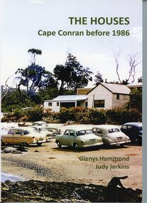
Book - THE HOUSES Cape Conran before 1986, Glenys Hammond and Judy Jenkins, THE HOUSES Cape Conran before 1986. Written by Glenys Hammond and Judy Jerkins, 2025
... Cape Conran is on the coast of East Gippsland, Victoria. This book contains memories and photographs and diagrams and letters of the settlement. ...Cape Conran is on the coast of East Gippsland, Victoria. This book contains memories and photographs and diagrams and letters of the settlement. ...Written in 2025, this book tells the story of a settlement at Cape Conran from early 20th Century until 1986. Cape Conran is on the coast of East Gippsland, Victoria. This book contains memories and photographs and diagrams and letters of the settlement. These were mainly holiday houses and occupied beachfront land by way of permissive occupancies (leases). In the 1980s, the occupants were asked by the Victorian Government to relinquish these leases and demolish the houses. The land then became part of a Coastal Park.This book is significant because it is a history of a beach settlement of holiday houses at Cape Conran from 1900-1986.Book of 152 pages. Front cover has a coloured photo of a house surrounded by native vegetation in a beach setting. ln front of the house are cars on the beach. Back cover has a coloured photo of houses, with cars and people on the beach in front of the houses. The background is smokey, possibly from a bushfire.on front cover: THE HOUSES Cape Conran before 1986. Glenys Hammond Judy Jenkinsglenys hammond, judy jenkins, cape conran coastal park, holiday houses, cape conran -
 Orbost & District Historical Society
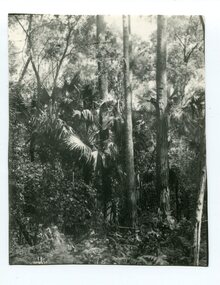
black and white photograph, first half 20th century
... coast of Australia and it occurs further south than any other Australian palm species. It is the only palm that is found naturally in Victoria. The early settlers supplemented their meagre rations with the hearts of the Cabbage Tree Palm. This is the southernmost stand of Cabbage Tree Palms in Australia and the only location in Victoria where these palms grow naturally. This is a pictorial record of a rare native Australian palm. cabbage-tree-palm-east-gippsland ...Livistona australis - the Cabbage Tree Palm, is a fan palm that grows naturally in the lowland forest and swamps of southern Queensland and along the east coast of Australia and it occurs further south than any other Australian palm species. It is the only palm that is found naturally in Victoria. The early settlers supplemented their meagre rations with the hearts of the Cabbage Tree Palm.This is the southernmost stand of Cabbage Tree Palms in Australia and the only location in Victoria where these palms grow naturally. This is a pictorial record of a rare native Australian palm.A black / white photograph of small palm trees in a dense bush surrounding.cabbage-tree-palm-east-gippsland -
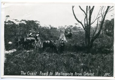 Orbost & District Historical Society
black and white photograph, late 19th century - early 20th century
... This road is still in use in East Gippsland as a part of many four-wheel-drive touring routes. on front - "The Coast Road to Mallacoota from Orbost JPC" A large black / white photograph of two horse - drawn wagons on a narrow sandy bush track. ...Prior to the sealing of the Princes Highway west of Orbost, the road surface was anything but good, even by C1917 when cars started to use the road. From Orbost the old road via Marlo to Sydenham was abandoned for the new location which traversed more rugged country via Cabbage Tree, Bell Bird and Club Terrace to Cann River, and the reason for this diversion was on account of settlements being established at Murrungowar and Club Terrace, at which latter place there was a temporary rush to obtain gold. This road was constructed by the Public Works department and a maximum grade of 1 in 19 was adopted, and as speed was not to be catered for the grade followed in and out round the spurs and gullies, resulting in a maze of turns and twists which required a good deal of skill on the part of the horse driver to negotiate." - Bairnsdale Advertiser, Friday, May 2, 1947. (More information from Newsletter February 2010)n the late 1800's early 1900's transporting goods by road was difficult and at times impossible because roads as thoroughfares did not exist.The means of travelling along the roads in the 1800's was by bullock wagon, horse pulled dray, pack horse or simply by foot. This road is still in use in East Gippsland as a part of many four-wheel-drive touring routes.A large black / white photograph of two horse - drawn wagons on a narrow sandy bush track. It is surrounded by scrub. There is one man standing beside a horse not harnessed to a wagon.on front - "The Coast Road to Mallacoota from Orbost JPC"
