
Showing 249 items matching "historic landscapes"
-
 Federation University Historical Collection
Reports, John Beetham et al, Ballarat Historic Landscapes Trees and Gardens, 1983, 1983
... Ballarat Historic Landscapes Trees and Gardens, 1983...Report on Ballarat's historic landscapes. Sections on Ballarat East Town Hall Gardens, and Ballarat School of Mines garens only....Ballarat Historic Landscapes Trees and Gardens, 1983 Reports John Beetham Peter Lumley John Dyke Roger Spencer Eve Almond Lisa Green Lisa Morcom ...Report on Ballarat's historic landscapes. Sections on Ballarat East Town Hall Gardens, and Ballarat School of Mines garens only.ballarat east town hall gardens, ballarat school of mines botanical garden -
 Federation University Historical Collection
Book, Trav Munro, Through the Lens: A Photographic Journey Through the University's Historic Landscapes, 2016, 2016
... Through the Lens: A Photographic Journey Through the University's Historic Landscapes, 2016...Brown soft covered books featuring beautiful photographs featuring Federation University's historic landscape, and items from the Federation University Historical Collection. ...Through the Lens: A Photographic Journey Through the University's Historic Landscapes, 2016 Book Trav Munro ...Brown soft covered books featuring beautiful photographs featuring Federation University's historic landscape, and items from the Federation University Historical Collection. federation university, federation university historical collection, historic campuses, enrolment book, ballarat east plan, ballarat schhol of mines associates boards, assay kilns, stained glass, former ballarat gaol, smb campus, leather tools, camp st, arts academy, former ballarat post office, post office gallery, mace, federation university mace, former stawell school of mines, jacarandah restaurant, ballarat mechanics' institute -
 Federation University Historical Collection
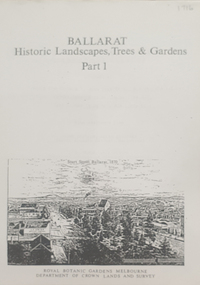
Book, Peter Lumley et al, Ballarat: Historic Landscapes, Trees & Gardens, 1983, 1983
... Ballarat: Historic Landscapes, Trees & Gardens, 1983...Lisa Green and Lisa Morcom of Ballarat College of Advanced Educatiion contributed to this report. ballarat trees nursery r.u. nicholls francis moss ballarat botanical gardens Victoria Park Lake Wendouree Ballaarat Old Cemetery Eastern Oval Ballarat East Town Hall Gardens Ballarat School of Mines Botanical gardens Eureka Stckade Recreation Reserve Ballarat Observatory Yarrowee Creek Black Hill Reserve Sovereign Hill Ballarat Avenue of Honour Victoria Street plantings Bridge Mall Plantings george longley 275 page landscape study of Ballarat including Trees in the Victorian Landscape; Plant sources early Ballarat nurseries, Botanical Gardens, Lake Wendouree, Fairy Gardens, Victoria Park, Ballaarat Old Cemetery, Eastern Oval, City Oval, Ballarat East Town Hall Gardens, Eureka Stockade, Observatory, Yarrowee, Black Hill, Sovereign Hill, Cheek Channels, Canadian Creek, Poverty Point Reserve, Goldmining Relics, Woah Hawp, Buninyong, street plantings, Russell, Victoria, Bridge Mall, Sturt Street Gardens, Avenue of Honour, Webster, Elms, Ballarat: Historic Landscapes, Trees & Gardens, 1983 Book Book Peter Lumley John Dyke Roger Spencer Eve Almond ...Lisa Green and Lisa Morcom of Ballarat College of Advanced Educatiion contributed to this report.275 page landscape study of Ballarat including Trees in the Victorian Landscape; Plant sources early Ballarat nurseries, Botanical Gardens, Lake Wendouree, Fairy Gardens, Victoria Park, Ballaarat Old Cemetery, Eastern Oval, City Oval, Ballarat East Town Hall Gardens, Eureka Stockade, Observatory, Yarrowee, Black Hill, Sovereign Hill, Cheek Channels, Canadian Creek, Poverty Point Reserve, Goldmining Relics, Woah Hawp, Buninyong, street plantings, Russell, Victoria, Bridge Mall, Sturt Street Gardens, Avenue of Honour, Webster, Elms, ballarat, trees, nursery, r.u. nicholls, francis moss, ballarat botanical gardens, victoria park, lake wendouree, ballaarat old cemetery, eastern oval, ballarat east town hall gardens, ballarat school of mines botanical gardens, eureka stckade recreation reserve, ballarat observatory, yarrowee creek, black hill reserve, sovereign hill, ballarat avenue of honour, victoria street plantings, bridge mall plantings, george longley -
 Greensborough Historical Society
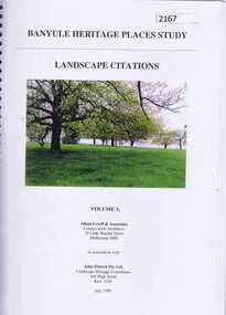
Book, Banyule Heritage Places Study. Vol. 3: Landscape Citations, 1999_07
... historic landscapes...This volume (3) of the Banyule Heritage Places Study: Landscape Citations deals significant vegetation and landscapes within the City of Banyule. historic landscapes city of banyule 127 pages, colour illus., maps. ...This volume (3) of the Banyule Heritage Places Study: Landscape Citations deals significant vegetation and landscapes within the City of Banyule.127 pages, colour illus., maps. Spiral binding.historic landscapes, city of banyule -
 Buninyong & District Historical Society
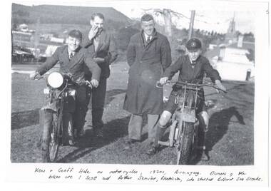
Photograph - Ken and Geoff Hale on motor-cycles, Learmonth St. Buninyong, 1930's
... historic, landscape, social, people...historic, landscape, social, people Buninyong Hale Family Learmonth St "Ken & Geoff Hale on motor-cycles, 1930's, Buninyong. ...historic, landscape, social, peopleCopy of B/W Photocopy of original photo,Ken and Geoff Hale in school uniforms seated on motor-bikes, owners of bikes, Scott and Arthur Senior standing between them in winter coats. Learmonth st, west of Warrenheip intersection, bank and town hall, Shops, some houses and Mount in background."Ken & Geoff Hale on motor-cycles, 1930's, Buninyong. Owners of the bikes are ? Scott and Arthur Senior, electricians, who started Ballarat Sea Scouts"buninyong, hale family, learmonth st -
 Buninyong & District Historical Society
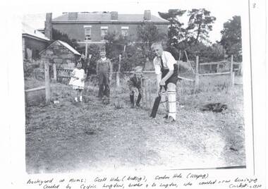
Photograph - Phoito, Hale family children playing cricket behind Dr. Longden''s house, Learmonth St. Buninyong, 1930's, Hale family children playing cricket behind Dr. Longden''s house, Learmonth St. Buninyong, 1930's
... historic, landscape, social, people...historic, landscape, social, people Buninyong Hale Family Learmonth St "Backyard at Mum's: Geoff Hale (batting), Gordon HAle (keeping) Coached by Cedric Longden, brother of Dr. ...historic, landscape, social, peopleCopy of B/W Photocopy of original photo, Hale family children playing cricket behind Dr. Longden''s house, Learmonth St. Buninyong, 1930's."Backyard at Mum's: Geoff Hale (batting), Gordon HAle (keeping) Coached by Cedric Longden, brother of Dr. Longden, who coached & ran Buninyong Cricket. c1930"buninyong, hale family, learmonth st -
 Buninyong & District Historical Society
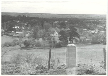
Photograph - Photograph of Buninyong from Mt. Innes, 1993
... historic, buildings, landscape...historic, buildings, landscape Buninyong Mt. Innes George Innes B/W photograph of Buninyong town from Mt Innes, looking west, with George Innes monuments in foreground. ...historic, buildings, landscapeB/W photograph of Buninyong town from Mt Innes, looking west, with George Innes monuments in foreground. Now known as Birdwood Park, earlier named Birdwood Grove in 1917 as part of the Avenue of Honor. The land was donated to Buninyong by George Innes.buninyong, mt. innes, george innes -
 Buninyong & District Historical Society
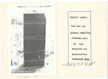
Photograph - Photograph of Buninyong from Mt. Innes, 1993. mounted on paper, Monument to George Innes, Mt. Innes, 1993
... historic, public land, landscape, ...historic, public land, landscape, Buninyong Mt. Innes George Innes Mount Innes The gift of George Innes Esq. ...historic, public land, landscape, B/W photograph of George Innes monument on Mt. Innes, now known as Birdwood Park, mounted next to drawing showing inscription, which is illegible in photo. George Innes donated the land for the reserve.Mount Innes The gift of George Innes Esq. Cairney Hill to the borough of Buninyong February 1894buninyong, mt. innes, george innes -
Lakes Entrance Historical Society
Book, Johnston Chris, Nowa Nowa Workshop Report East Gippsland Heritage Workshop, 1993
... Report on 1993 heritage workshop condcted at Nowa Nowa, Victoria where 97 historic areas and cultural landscapes were identified....Heritage Social History Report on 1993 heritage workshop condcted at Nowa Nowa, Victoria where 97 historic areas and cultural landscapes were identified. Nowa Nowa Workshop Report East Gippsland Heritage Workshop Book Johnston Chris ...Report on 1993 heritage workshop condcted at Nowa Nowa, Victoria where 97 historic areas and cultural landscapes were identified.heritage, social history -
 Flagstaff Hill Maritime Museum and Village
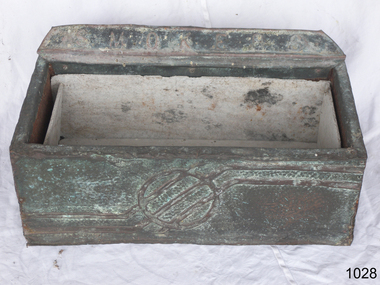
Functional object - Floor ash Tray, 1900 to 1960s
... landscapes. As time went on, and the onset of women smoking both cigars and cigarettes became less of a departure from the average person, ashtrays saw a decline in design and aesthetics beginning more of a shift towards practicality. The subject item is a primitive form of ashtray used in public spaces any time from the 1920-1960s and is not associated with an historic ...The word ashtray came into use around the 1920 and is a receptacle for ash from cigarettes and cigars and are typically made of fire retardant material such as glass, heat resistant plastic, pottery, metal, or stone. The most common ashtray design is a shallow cylinder with a flat base, designed to rest on a table. Other ashtrays, particularly in public places, are either wall or floor mounted. While simple, utilitarian forms of ashtrays existed long before the 19th century, it was during the start of the 20th century that the design, aesthetics and their popularity took off. As more women began to smoke. in the early 1900s, the ashtray went closer to being an art form as many women avoided the use of the traditional ashtray as it failed to reflect their feminine values, regarded as an item rather basic in design the general societal through of the time was that smoking was an activity exclusive to men. What emerged were detailed, often very fancy ashtrays acceptable to women depicting either pastoral scenes or vibrantly coloured landscapes. As time went on, and the onset of women smoking both cigars and cigarettes became less of a departure from the average person, ashtrays saw a decline in design and aesthetics beginning more of a shift towards practicality. The subject item is a primitive form of ashtray used in public spaces any time from the 1920-1960s and is not associated with an historic person or event. However the item could have come from the Warrnambool Town Hall given the inscription on the base of the item.Ash tray-large rectangular floor model with cement sheet lining. Made from a wooden box covered with textured metal on the outsideThe metal has a relief design embossed at the top back "smokers" and "Town Hall" printed on bottom.flagstaff hill, warrnambool, flagstaff-hill-maritime-museum, maritime-museum, shipwreck-coast, flagstaff-hill-maritime-village, ash tray, town hall, cigarette tray, smoker's ash tray -
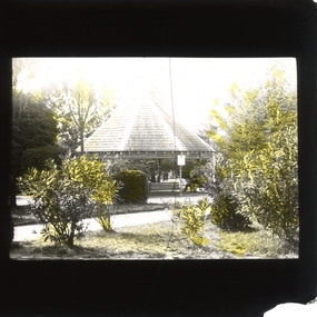 The Beechworth Burke Museum
Photograph - Lantern Slide, c1900
... landscape of Beechworth's Town Hall Gardens c. 1900. In the foreground is a variety of shrubs and trees (including Sequoia) with many of the original plantings on the National Trust Significant Tree Register. The background depicts an original wooden and metal rotunda that dates to 1876, with a man sitting on a bench. This glass slide has social and historical significance as it represents the Beechworth's historic ...This glass slide captures the landscape of Beechworth's Town Hall Gardens c. 1900. In the foreground is a variety of shrubs and trees (including Sequoia) with many of the original plantings on the National Trust Significant Tree Register. The background depicts an original wooden and metal rotunda that dates to 1876, with a man sitting on a bench.This glass slide has social and historical significance as it represents the Beechworth's historic Town Hall Gardens in c.1900 and how they were a place for local residents to come, sit, enjoy, and relax.Thin translucent sheet of glass with a rectangular image printed on the front and framed in a black backing. It is held together by metals strips to secure the edges of the slide.burke museum, beechworth, lantern slide, slide, glass slide, plate, burke museum collection, photograph, monochrome, town hall gardens, beechworth town hall, rotunda -
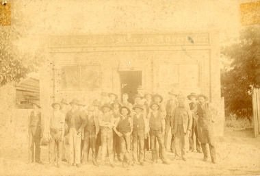 The Beechworth Burke Museum
Photograph, Farrell & Martin Landscape Photographers, c1900
... historic significance for its relationship to the history of the Ovens and Murray Advertiser, which is a key example of of successful nineteenth-century business in Beechworth. Ovens and Murray advertiser the ovens and murray advertiser Newspaper printing Ford Street richard warren journalism advertising 1800s 1800s Beechworth #beechworth local business advertiser workmen hats printers journalists Obverse: The Owens and Murray Advertiser Reverse: Parkinson (crossed out) BMM 7725 15/ Failey/ [logo Farrell and Martin Landscape Photographers] Faded sepia rectangular photograph printed on photographic material, mounted on board. ...This photograph shows a group of workmen standing outside the Ford Street office of the Ovens and Murray Advertiser in Beechworth. The Advertiser was a local paper, first printed as a weekly in 1855, and then as a daily in 1857. It continues to be printed today, albeit in a different form. The Advertiser was launched by architect Francis Hodgson Nixon with assistance from businessman John Henry Gray, and newspaperman Richard Warren. Warren was sole owner from 1860 until his death in 1906, and it responsible for much of the paper’s success. Its goals included coverage of local events, as well as of global news, and the promotion of economic liberty, arts, and sciences. Beyond these initial goals, the Advertiser was instrumental in local politics, particularly Beechworth’s association with conservatism and constitutionalism in the 1860s and 1870s. Numerous other papers sprung up to contest the Advertiser’s hold during the latter half of the nineteenth-century, but none were able to completely oust it from its post. As well as representing a key chapter in Beechworth’s history, the Advertiser can be used as a key source for the stories and figures of historic Beechworth. This photograph has historic significance for its relationship to the history of the Ovens and Murray Advertiser, which is a key example of of successful nineteenth-century business in Beechworth.Faded sepia rectangular photograph printed on photographic material, mounted on board. Obverse: The Owens and Murray Advertiser Reverse: Parkinson (crossed out) BMM 7725 15/ Failey/ [logo Farrell and Martin Landscape Photographers]ovens and murray advertiser, the ovens and murray advertiser, newspaper, printing, ford street, richard warren, journalism, advertising, 1800s, 1800s beechworth, #beechworth, local business, advertiser, workmen, hats, printers, journalists -
Federation University Historical Collection
Book, Maldon Historic Reserve Management Plan, 1989, 1989
... This book was prepared by the Royal Botanic Gardens, Mebourne maldon geology flora vermin parkin's reef derby hill beehive reef long gully union hill mount tarrengower eaglehawk gully porcupine flat neggetty range peg leg gully sandy creek smiths creek landscape Soft covered report of 83 pages, including 10 folded leaves of plates , and 11 maps (some coloured). Maldon Historic ...This book was prepared by the Royal Botanic Gardens, Mebourne Soft covered report of 83 pages, including 10 folded leaves of plates , and 11 maps (some coloured). maldon, geology, flora, vermin, parkin's reef, derby hill, beehive reef, long gully, union hill, mount tarrengower, eaglehawk gully, porcupine flat, neggetty range, peg leg gully, sandy creek, smiths creek, landscape -
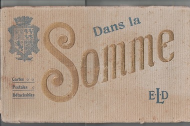 Lara RSL Sub Branch
Postcards Booklet, Picture Postcard Booklet. Dans La Somme....E L D....Cartes.....Postales......Detachables
... HISTORIC......ARTISTIC THEFront cover has a Coat of Arms showing Lions Rampart & aCrown. Manufacturer E.LE DELEY.127,boulevard de Sebastopol,PARIS . A n oblong (landscape ...This item presented to LARA R S L &is one of several Items issued to J W McINTYRE !st w w..HISTORIC......ARTISTICA n oblong (landscape)beige with age cardboard cover ......with approx . 20 postcards (each separated with tissue). Overall the colour is beige.AFrench publication .THEFront cover has a Coat of Arms showing Lions Rampart & aCrown. Manufacturer E.LE DELEY.127,boulevard de Sebastopol,PARIS . -
Federation University Historical Collection
Booklet, Ballarat and UNESCO Historic Urban Landscape Approach, 2013, 2013
... Ballarat and UNESCO Historic Urban Landscape Approach, 2013......historic urban landscape (hul)...Ballarat and UNESCO Historic Urban Landscape Approach, 2013 Booklet Booklet City of Ballarat ...Full colour booklet with a photograph of the Ballarat Botanical Gardens on the cover. Anne Beggs Sunter is in a red jumper on the first page, under the verandah of the Buninyong Cake Shop. unesco, historic urban landscape (hul), league of historical cities, urban heritage, ron van oers, burke and wills time capsule, ballarat heritage award, peel st story, landscape -
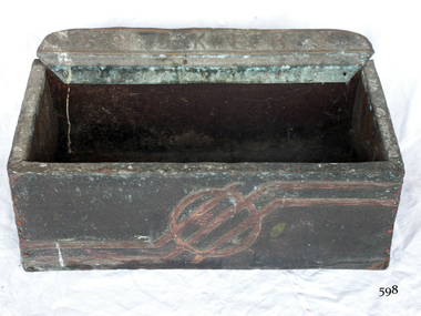 Flagstaff Hill Maritime Museum and Village
Functional object - Floor ash Tray, 1900 to 1960s
... landscapes. As time went on, and the onset of women smoking both cigars and cigarettes became less of a departure from the average person, ashtrays saw a decline in design and aesthetics beginning more of a shift towards practicality. The subject item is a primitive form of ashtray used in public spaces any time from the 1900 -1960s and is not associated with an historic ...The word ashtray came into use around the 1920 and is a receptacle for ash from cigarettes and cigars and are typically made of fire retardant material such as glass, heat resistant plastic, pottery, metal, or stone. The most common ashtray design is a shallow cylinder with a flat base, designed to rest on a table. Other ashtrays, particularly in public places, are either wall or floor mounted. While simple, utilitarian forms of ashtrays existed long before the 19th century, it was during the start of the 20th century that the design, aesthetics and their popularity took off. As more women began to smoke. in the early 1900s, the ashtray went closer to being an art form as many women avoided the use of the traditional ashtray as it failed to reflect their feminine values, regarded as an item rather basic in design the general societal through of the time was that smoking was an activity exclusive to men. What emerged were detailed, often very fancy ashtrays acceptable to women depicting either pastoral scenes or vibrantly coloured landscapes. As time went on, and the onset of women smoking both cigars and cigarettes became less of a departure from the average person, ashtrays saw a decline in design and aesthetics beginning more of a shift towards practicality. The subject item is a primitive form of ashtray used in public spaces any time from the 1900 -1960s and is not associated with an historic person or event. However the item could have come from the Warrnambool Town Hall given the inscription on the base of the item.Ash tray-large rectangular floor model made from a wooden box covered with textured metal on the outsideThe metal has a relief design embossed at the top back "smokers" and "Town Hall" printed on bottom.flagstaff hill, warrnambool, flagstaff-hill-maritime-museum, maritime-museum, shipwreck-coast, flagstaff-hill-maritime-village, ash tray -
 City of Moorabbin Historical Society (Operating the Box Cottage Museum)
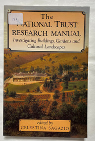
Book, Sagazio, Celestina, The National Trust research manual : investigating buildings, gardens and cultural landscapes, 1992
... historic sites xiv, 177 p. : ill., plans :Includes index. Bibliography: p. 147-168. The National Trust research manual : investigating buildings, gardens and cultural landscapes Book Sagazio, Celestina Allen & Unwin ...xiv, 177 p. : ill., plans :Includes index. Bibliography: p. 147-168.non-fictionhistoric buildings, historic gardens, historic sites -
 Flagstaff Hill Maritime Museum and Village
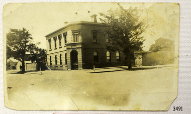
Photograph - Building, Bank of Australasia Warrnambool, ca. 1860
... historic building Roberts & Co. James Cust bank of australasia warrnambool Label with: "AH2 2 / W.BOOL" Writing in pen: "D. K. Frew / --- / ---- / ----" Black and white (or sepia) rectangular photograph, landscape orientation. ...This sepia coloured photograph show the image of the former Bank of Australasia in Warrnambool. The two-storey building was built for the bank on the corner of Timor and Kepler Streets and opened there for business in 1860. It is now one of the City's Historic Buildings. The Bank of Australasia was incorporated by Royal Charter of England in March 1834. It came to Australia on 14th December 1835, opening in Sydney. The Acting Superintendent of the Bank of Australasia in Sydney at that time was David Charters McArthur. He was Superintendent from 1867-to 1876. The Melbourne branch of the Bank of Australasia opened on 28th August 1838 in a two-roomed brick cottage on the north side of Little Collins Street. Two huge mastiff dogs were kept in the backyard and let loose at night to guard the bank. The government also provided an armed military sentinel. Due to the bank's rapid growth, a new building for the Melbourne branch was opened in 1840 at 75 Collins Street West. By 1879 the bank had been upgraded to a magnificent two-storey building on the corners of Collins and Queens Streets, with the entry on Collins Street. In 1951 the Bank of Australasia amalgamated with the Union Bank to form the Australia and New Zealand Bank, now known as the ANZ. Then in 1970, the ANZ merged with both the ES&A and the London Bank of Australia to form the ANZ Banking Group Limited. The ANZ Banking Group Ltd kindly donated a variety of historic items from the Bank of Australasia. BANK of AUSTRALASIA, WARRNAMBOOL – In 1854 Warrnambool had two banks, the Union Back and the Bank of Australasia. Later, completely different bank businesses opened; in 1867 the National Bank of Australasia, then in 1875 the Colonial Bank of Australasia. The original Warrnambool branch of the Bank of Australasia was established in July 1854, and operated from a leased cottage on Merri Street, close to Liebig Street. The bank later bought a stone building previously erected by drapers Cramond & Dickson on the corner of Timor and Gibson Streets. Samuel Hannaford was a teller and then Manager at the Warrnambool branch from 1855 to 1856 and the Warrnambool Council chose that bank for its dealings during 1856-57. In 1859 Roberts & Co. was awarded the contract to build the new Bank of Australasia branch for the sum of £3,000. The land was on a sand hill on the northeast corner of Timor and Kepler Streets and had been bought in 1855 from investor James Cust. The new building opened on May 21, 1860. The bank continued to operate there until 1951 when it merged with the Union Bank to form the ANZ Bank, which continued operating from its Liebig Street building. Warrnambool City Council purchased the former Bank of Australasia building in 1971 and renovated it, then on 3rd December 1973 it was officially opened as the Art Gallery by Cr. Harold Stephenson and Gallery Director John Welsh. The Gallery transferred to the purpose-built building in Liebig Street in 1986 and the old bank building is now the Gallery club. Staff at the Bank of Australasia in Warrnambool included the following men but others were also involved: Samuel Hannaford, Teller then Manager from 1855-1856; W H Palmer, Manager from January 1857 until November 1869 when the Teller Basil Spence was promoted to Manager; H B Chomley, Manager from April 1873 and still there in 1886; A Butt, Manager in 1895-1904; J R McCleary Accountant and Acting Manager for 12 months, until 1900; A Kirk, Manager 1904; J Moore, staff until his transfer to Bendigo in December 1908; J S Bath was Manager until 1915; C C Cox, Manager until April 1923; Richard C Stanley, Manager 1923 to April 1928. The photograph is significant historically for its connection with the Bank of Australasia. The early Australian bank was established in 1834 by Royal Charter and opened in Sydney, Australia, in Sydney in 1835. The bank had many Australian offices in November 1877, particularly on the east and south coasts. Victoria had 45 percent of all Offices. The photograph has local historical significance for its association with the Warrnambool Bank of Australasia, which was established early in Warrnambool's history. It was Warrnambool Council’s first bank. The bank continued to operate until the organisation's merger in 1951 when it became the ANZ Bank Group of today. The Bank was an integral part of the growth of local commerce and the community.Black and white (or sepia) rectangular photograph, landscape orientation. Image of a two-storey building on a street corner. It is the former Bank of Australasia, Warrnambool, on the corner of Timor and Kepler Streets that was built in 1860. The reverse has a round, serrated-edged red label with an inscription, covered in opaque tape, plus four lines of handwritten text. There are several pin holes through the photograph.Label with: "AH2 2 / W.BOOL" Writing in pen: "D. K. Frew / --- / ---- / ----"flagstaff hill, warrnambool, shipwrecked coast, flagstaff hill maritime museum, maritime museum, shipwreck coast, flagstaff hill maritime village, great ocean road, bank of australasia, boa, union bank, australia & new zealand bank, anz bank, david charters mcarthur, d c mcarthur, commerce, banking, samuel hannaford, w h palmer, basil spence, h b chomley, a butt, j r mccleary, a kirk, j moore, j s bath, c c cox, richard c stanley, historic building, roberts & co., james cust, bank of australasia warrnambool -
 Greensborough Historical Society
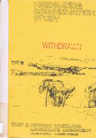
Book, Heidelberg Conservation Study: Part 2: Historic Riverland Landscape Assessment. Revised 1987, 1987_
... Heidelberg Conservation Study: Part 2: Historic Riverland Landscape Assessment. Revised 1987....Heidelberg Conservation Study: Part 2: Historic Riverland Landscape Assessment. Revised 1987. ...Report prepared by Loder and Bayly and Marilyn McBriar on behalf of City of Heidelberg and Heidelberg Heritage Advisory Committee. Area covered is from Darebin Parklands in the south to Plenty River at Yallambie in the north. Revised 1987.This study identifies neighbourhood character, documents past development and the capacity of the environment for future development with particular emphasis on the river precincts - Plenty River, Yarra River and Darebin Creek.Part three of set of three books. Paperback, 333 pages, Illus., maps. 2 copies.Stamps: Yarra Plenty Regional Library Service, and, Withdrawnheidelberg, macleod, heidelberg heritage advisory committee, marilyn mcbriar, plenty river, yarra river, darebin creek -
 Glenelg Shire Council Cultural Collection
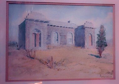
Work on paper - Watercolour, Florence Tatham Mellblom, Portland Shire Hall, n.d
... historic places of Portland. She was married (1932) to Karl Enoch Mellblom. Female Artist Women Female Landscape Portland Landscape Portland Shire Bottom Right - F. ...From Antiques Reporter: Florence Tatham Mellblom, (Australian, 1900 - 1983), Visit Portland The First Victorian Settlement, during the Centenary Celebrations from 15th to 23rd November 1934', 1934 colour lithograph, signed 'F. Mellblom' in image lower left, 63.5 x 101.5 cm. Linen-backed. Text continues in lower margin: 'Arbuckle, Waddell Pty Ltd Print, Melb.', Mellblom (nee Henry) was a painter, naturalist and photographer. She was born at Portland, Victoria, and studied art in Ballarat. She was a talented etcher from childhood, and joined the Portland Camera club. She also produced many watercolour paintings of the historic places of Portland. She was married (1932) to Karl Enoch Mellblom.A bluestone building on an arid landscape. Yellow grass in the foreground with one tree standing at the front. There is a blue sky behind. The left hand wing has a door which is slightly open. Above each wing is an engraved piece of stone. Left - Portland, right - Shire. An old rickety fence to the left of the building.Bottom Right - F. Mellblomfemale artist, women, female, landscape, portland landscape, portland shire -
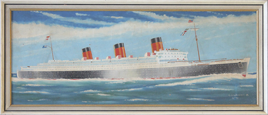 Mission to Seafarers Victoria
Painting, C V Wright, RMS Queen Mary, 1971
... Fulfills previous MTSV acquisition policy regarding collection of modern, historic and contemporary marine paintings. marine painting ocean liners rms queen mary royal mail ships p & o steamships ww2 artwork-paintings hobbies bosun c.v. wright at lower right corner single uc word in white paint : "CV WRIGHT (artist symbol of crossed anchors) / 3 ? '71" Long framed unglazed landscape ...RMS Queen Mary a retired ocean liner by 1971 that sailed primarily on the North Atlantic Ocean from 1936 to 1967 for the Cunard Line (known as Cunard-White Star Line when the vessel entered service ( Wikipedia) Maritime ArtLong framed unglazed landscape format painting predominantly depicting in foreground an ocean liner painted black hull and white superstructure with three funnel stacks painted red with black trim, under full sail against a blue sky. The back of the painting is covered with brown paper in places damaged. Hangs on a cotton cord threaded between two screw in eyelet hooks. Brown paper backingat lower right corner single uc word in white paint : "CV WRIGHT (artist symbol of crossed anchors) / 3 ? '71"marine painting, ocean liners, rms queen mary, royal mail ships, p & o steamships, ww2, artwork-paintings, hobbies, bosun, c.v. wright -
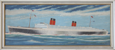 Mission to Seafarers Victoria
Painting, RMS Queen Elizabeth, 1971
... Fulfills previous MTSV acquisition policy regarding collection of modern, historic and contemporary marine paintings. marine painting ocean liners rms queen mary royal mail ships p & o steamships ww2 artwork-paintings hobbies bosun c.v.wright at lower right corner single uc word in white paint : "CV WRIGHT (artist symbol of crossed anchors) / 3 ? '71" Long framed unglazed landscape ...RMS Queen Elizabeth that sailed primarily on the North Atlantic Ocean from 1939 to 1968 for the Cunard Line , later owned by the Queen Corpration and then the Seawise University. Queen Elizabeth was a slightly larger ship (than the Queen Mary) , the largest passenger liner ever built at that time and for 56 years thereafter. She also has the distinction of being the largest-ever riveted ship by gross tonnage. She first entered service in February 1940 as a troopship in World War II, and it was not until October 1946 that she served in her intended role as an ocean liner. With the decline in popularity of the transatlantic route, both ships were replaced by the smaller. Queen Elizabeth was sold to a succession of buyers, and finally was sold to Hong Kong businessman of the Orient Overseas line in 1970. In 1972, whilst she was undergoing refurbishment in Hong Kong harbour, fire broke out aboard under unexplained circumstances, and the ship was capsized by the water used to fight the fire.Marine artLong framed unglazed landscape format painting predominantly depicting in foreground an ocean liner painted black hull and white superstructure with two funnel stacks painted red with black trim, under full sail against a blue sky. The back of the painting is covered with brown paper in places damaged. Hanging cord missing . Remnant Brown paper backing.at lower right corner single uc word in white paint : "CV WRIGHT (artist symbol of crossed anchors) / 3 ? '71"marine painting, ocean liners, rms queen mary, royal mail ships, p & o steamships, ww2, artwork-paintings, hobbies, bosun, c.v.wright -
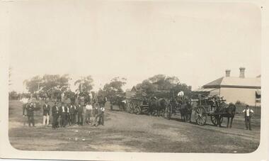 Phillip Island and District Historical Society Inc.
Photograph, Wood Day for Warley Hospital
... landscapes. Community activity to supply community facility. local history photographs buildings historic warley hospital black & white photograph Jessie Smith Collection Stan McFee Horse & Drays in right background. ...From Jessie Smith's collection of local events and landscapes. Community activity to supply community facility.Horse & Drays in right background. Group of men in left foreground. Wood day at Warley Hospital.local history, photographs, buildings, historic, warley hospital, black & white photograph, jessie smith collection, stan mcfee -
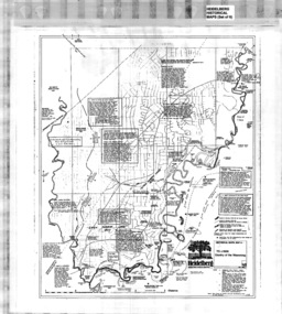 Greensborough Historical Society
Poster - Map, Heidelberg: Historic River Landscape Assessment, Historical Maps. Map A To 1838. Country of the Wawarang, 1985c
... Heidelberg: Historic River Landscape Assessment, Historical Maps. ...Bounded by Shire of Diamond Valley to the North, Darebin Creek to the West and Plenty River to the East. heidelberg heidelberg - maps Black an white sketch map on white paper Heidelberg: Historic River Landscape Assessment, Historical Maps. ...Geographical area of around 35 sq. kilometres marked with physical features such as major roads, rivers, vegetation and properties, with contemporary notes on landowners, descriptions and comments on the land and its development. Bounded by Shire of Diamond Valley to the North, Darebin Creek to the West and Plenty River to the East.Black an white sketch map on white paperheidelberg, heidelberg - maps -
 Greensborough Historical Society
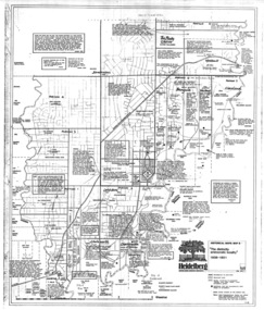
Map, Heidelberg: Historic River Landscape Assessment. Historical Maps. Map B 1838-1851, "The Distinctly aristocratic locality", 1985c
... Heidelberg: Historic River Landscape Assessment. Historical Maps. ...Bounded by Shire of Diamond Valley to the North, Darebin Creek to the West and Plenty River to the East heidelberg heidelberg - maps Black and white sketch map on white paper Heidelberg: Historic River Landscape Assessment. Historical Maps. ...Geographical area of around 35 sq. kilometres marked with physical features such as major roads, rivers, vegetation and properties, with contemporary notes on landowners, descriptions and comments on the land and its development. Bounded by Shire of Diamond Valley to the North, Darebin Creek to the West and Plenty River to the EastBlack and white sketch map on white paperheidelberg, heidelberg - maps -
 Greensborough Historical Society
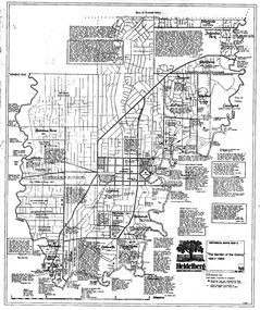
Map, Heidelberg. Historic River Landscape Assessment. Historical maps: Map C 1851-1863. "The Garden of the colony", 1985c
... Heidelberg. Historic River Landscape Assessment. Historical maps: Map C 1851-1863. ...Bounded by Shire of Diamond Valley to the North, Darebin Creek to the West and Plenty River to the East. heidelberg heidelberg - maps Black and white sketch map on white paper Heidelberg. Historic River Landscape Assessment. Historical maps: Map C 1851-1863. ...Geographical area of around 35 sq. kilometres marked with physical features such as major roads, vegetation and properties, with locations and notes of the increasing number of farms, gardens orchards and vineyards which had become established in addition to pastoral runs. Bounded by Shire of Diamond Valley to the North, Darebin Creek to the West and Plenty River to the East.Black and white sketch map on white paperheidelberg, heidelberg - maps -
 Greensborough Historical Society
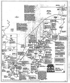
Map, Heidelberg: Historic River Landscape Assessment. Historical maps. Map D 1864 -1901 "Sleepy Hollow" and "Sleeping beauty", 1985c
... Heidelberg: Historic River Landscape Assessment. Historical maps. ...Second copy 600 x 430 cm printed in black on semi-opaque paper Heidelberg: Historic River Landscape Assessment. Historical maps. ...Geographical area of c. 35 sq. kilometres marked with physical features such as major roads, rivers, vegetation and properties, with locations and notes on the increasing number of farms, orchards and vineyards that had been developed in addition to pastoral runs. Bounded by Shire of Diamond Valley to the North, Darebin Creek to the West, and Plenty River to the East.Black and white sketch on white paper. Second copy 600 x 430 cm printed in black on semi-opaque paperheidelberg, heidelberg - maps -
 Greensborough Historical Society
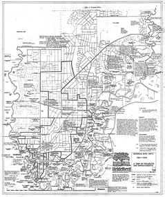
Map, Heidelberg: Historic River Landscape Assessment. Historical maps. Map E 1901-1934 "A Time of projects and improvements", 1985c
... Heidelberg: Historic River Landscape Assessment. Historical maps. ...Bounded by Shire of Diamond Valley to the North, Darebin Creek to the West and Plenty River to the East. heidelberg heidelberg - maps Black and white sketch map on white paper Heidelberg: Historic River Landscape Assessment. Historical maps. ...Geographical area of around 35 sq. kilometres marked with physical features such as major roads, railways (new extension to Eltham), rivers and properties, also housing sub-divisions and community facilities such as hospitals, parks and sporting reserves and indications of new small scale industries such as dairying. Bounded by Shire of Diamond Valley to the North, Darebin Creek to the West and Plenty River to the East. Black and white sketch map on white paperheidelberg, heidelberg - maps -
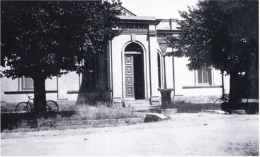 The Beechworth Burke Museum
Photograph, George Peach, c. 1930
... This item is significant because it shows the historic Burke Museum in a historic context, which can be used to document the changes in the building and the surroundings which have occurred over time. Burke Museum Robert O'Hara Burke robert o'hara burke museum Copy of a black and white landscape photograph on photographic paper. ...Black and White photograph taken of the Robert O'Hara Burke Memorial Museum. The museum is named in honor of explorer and former Beechworth Superintendent Robert O'Hara Burke following his death in 1861.This item is significant because it shows the historic Burke Museum in a historic context, which can be used to document the changes in the building and the surroundings which have occurred over time.Copy of a black and white landscape photograph on photographic paper.burke museum, robert o'hara burke, robert o'hara burke museum -
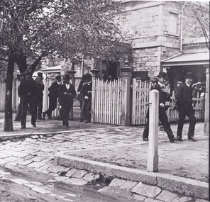 The Beechworth Burke Museum
Photograph, c1860
... historic significance as it contributes to an understanding of the legal systems in Beechworth at that time. Specifically, the popularity of the Court House as a large number of people are pictured in the photo, which may represent the frequent use or interest in a signifiant trial that may have occurred at the place. Beechworth Courthouse court house beechworth bowler hats trial legal law court proceedings circuit court Court of Assize assize County Courts General Sessions Black and white landscape ...The photo depicts men dressed in formal suits and in bowler hats walking out the front of the Beechworth Court House. Beechworth became known as the legal headquarters of north-east Victoria after the establishment of the Circuit Court in 1857. This was later known as the Court of Assize and dealt with cases surpassing the reach of the General Sessions and County Courts. The Court House was built a year after for these proceedings and was extended in 1865. As the image is undated the year is not known, however it can be assumed it was taken after 1857 as the Court House is pictured.The photograph holds historic significance as it contributes to an understanding of the legal systems in Beechworth at that time. Specifically, the popularity of the Court House as a large number of people are pictured in the photo, which may represent the frequent use or interest in a signifiant trial that may have occurred at the place.Black and white landscape photograph printed on paper.beechworth courthouse, court house, beechworth, bowler hats, trial, legal, law, court, proceedings, circuit court, court of assize, assize, county courts, general sessions
