Showing 142 items matching "new concrete bridge"
-
 Eltham District Historical Society Inc
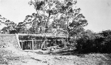
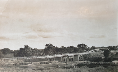
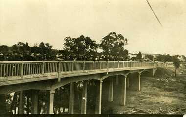
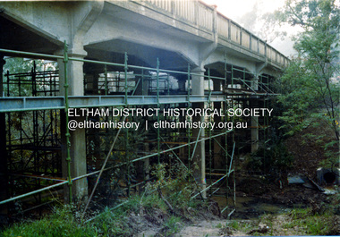
Negative - Photograph, Construction of the new concrete bridge over the Diamond Creek on Main Road, Eltham, c.May 1926
... Construction of the new concrete bridge over the Diamond Creek on Main Road, Eltham...Construction of the new concrete bridge over the Diamond Creek on Main Road, Eltham, c.May 1926. ...Eltham District Historical Society Inc 728 Main Rd Eltham melbourne Construction of the new concrete bridge over the Diamond Creek on Main Road, Eltham, c.May 1926. ...Construction of the new concrete bridge over the Diamond Creek on Main Road, Eltham, c.May 1926. Viewed from present day Wingrove Park. The original long suspension bridge over the Diamond Creek on Main Road at Eltham collapsed during flooding of the Diamond Creek on October 13 and 14, 1923. The original bridge was built around 1840 for the coach road when Cobb & Co.'s coach was the only conveyance between Eltham and Melbourne. Widespread damage was done in Melbourne and surrounding areas by floods resulting from the overflow of the Yarra at many points along its banks. A temporary bridge rigged up was severely damaged by the flooding of the creek and was closed to vehicular traffic in April 1924. A new concrete bridge was constructed to replace it and by May 1926 all the concrete piles and abutments had been completed. The bridge was finally completed and opened for traffic in September 1926, almost three years after it initially collapsed.This photo forms part of a collection of photographs gathered by the Shire of Eltham for their centenary project book,"Pioneers and Painters: 100 years of the Shire of Eltham" by Alan Marshall (1971). The collection of over 500 images is held in partnership between Eltham District Historical Society and Yarra Plenty Regional Library (Eltham Library) and is now formally known as the 'The Shire of Eltham Pioneers Photograph Collection.' It is significant in being the first community sourced collection representing the places and people of the Shire's first one hundred years.Digital image 4 x 5 inch B&W Neg Print 9 x 12.5 cmshire of eltham pioneers photograph collection, eltham, eltham lower park, main road bridge, eltham south, bridge, diamond creek (creek), wingrove park, bridge construction -
 Eltham District Historical Society Inc
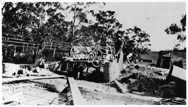
Negative - Photograph, Construction of the new concrete bridge over the Diamond Creek on Main Road, Eltham, c.May 1926
... Construction of the new concrete bridge over the Diamond Creek on Main Road, Eltham...Construction of the new concrete bridge over the Diamond Creek on Main Road, Eltham, c.May 1926. ...Eltham District Historical Society Inc 728 Main Rd Eltham melbourne Construction of the new concrete bridge over the Diamond Creek on Main Road, Eltham, c.May 1926. ...Construction of the new concrete bridge over the Diamond Creek on Main Road, Eltham, c.May 1926. Viewed from northern approach looking south east towards Eltham Park (Eltham Lower Park), showing the power lines that used to run in front of the park. The original long suspension bridge over the Diamond Creek on Main Road at Eltham collapsed during flooding of the Diamond Creek on October 13 and 14, 1923. The original bridge was built around 1840 for the coach road when Cobb & Co.'s coach was the only conveyance between Eltham and Melbourne. Widespread damage was done in Melbourne and surrounding areas by floods resulting from the overflow of the Yarra at many points along its banks. A temporary bridge rigged up was severely damaged by the flooding of the creek and was closed to vehicular traffic in April 1924. A new concrete bridge was constructed to replace it and by May 1926 all the concrete piles and abutments had been completed. The bridge was finally completed and opened for traffic in September 1926, almost three years after it initially collapsed.This photo forms part of a collection of photographs gathered by the Shire of Eltham for their centenary project book,"Pioneers and Painters: 100 years of the Shire of Eltham" by Alan Marshall (1971). The collection of over 500 images is held in partnership between Eltham District Historical Society and Yarra Plenty Regional Library (Eltham Library) and is now formally known as the 'The Shire of Eltham Pioneers Photograph Collection.' It is significant in being the first community sourced collection representing the places and people of the Shire's first one hundred years.Digital image 4 x 5 inch B&W Negshire of eltham pioneers photograph collection, bridge, bridge construction, cement mixer, diamond creek (creek), eltham, eltham lower park, eltham south, main road bridge -
 Eltham District Historical Society Inc
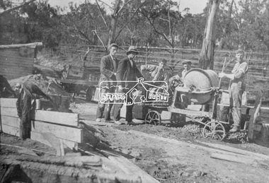
Photograph, Construction of the new concrete bridge over the Diamond Creek on Main Road, Eltham, c.May 1926
... Construction of the new concrete bridge over the Diamond Creek on Main Road, Eltham...Construction of the new concrete bridge over the Diamond Creek on Main Road, Eltham, c.May 1926. ...Eltham District Historical Society Inc 728 Main Rd Eltham melbourne Construction of the new concrete bridge over the Diamond Creek on Main Road, Eltham, c.May 1926. ...Construction of the new concrete bridge over the Diamond Creek on Main Road, Eltham, c.May 1926. Viewed from northern approach looking east, the access drive running off Antoinette Boulevard parallel to Main Road is visible as well as the power lines that used to run in front of Eltham Park (Eltham Lower Park). Also visible is a tree situated beside the roadway. It is believed this is the same tree that remains today as a dead tree trunk immediately adjacent to the road verge armco near the corner of Antoinette Boulevard. The original long suspension bridge over the Diamond Creek on Main Road at Eltham collapsed during flooding of the Diamond Creek on October 13 and 14, 1923. The original bridge was built around 1840 for the coach road when Cobb & Co.'s coach was the only conveyance between Eltham and Melbourne. Widespread damage was done in Melbourne and surrounding areas by floods resulting from the overflow of the Yarra at many points along its banks. A temporary bridge rigged up was severely damaged by the flooding of the creek and was closed to vehicular traffic in April 1924. A new concrete bridge was constructed to replace it and by May 1926 all the concrete piles and abutments had been completed. The bridge was finally completed and opened for traffic in September 1926, almost three years after it initially collapsed.This photo forms part of a collection of photographs gathered by the Shire of Eltham for their centenary project book,"Pioneers and Painters: 100 years of the Shire of Eltham" by Alan Marshall (1971). The collection of over 500 images is held in partnership between Eltham District Historical Society and Yarra Plenty Regional Library (Eltham Library) and is now formally known as the 'The Shire of Eltham Pioneers Photograph Collection.' It is significant in being the first community sourced collection representing the places and people of the Shire's first one hundred years.Photo print 9 x 12.5 cmshire of eltham pioneers photograph collection, eltham, bridge, diamond creek (creek), eltham south, main road bridge, wingrove park, antoinette boulevard, significant tree, cement mixer, bridge construction -
 Flagstaff Hill Maritime Museum and Village
Postcard - Postcard Folder - scenes, George Rose, Rose Stereographic Company, Rose Series Picturesque Views of Warrnambool Australia [Warrnambool], 1880-1942
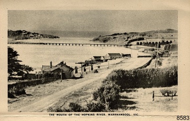
... bridge...suspension footbridge...Merri River mouth...Hopkins River mouth...Proudfoot's...Fanny Nelson...Nelson's boatsheds...Nelson's Boathouse...boathouse...Hopkins River boathouses...Flett's boathouse...Flett...George Rose...image of a rose...Rose Series...Rose Stereograph Co...Rose Stereographic Company...Lighograph...Armadale Victoria...Lady Bay beach...beach scene...Lower Light...concrete footbridge...1922 footbridge...Viaduct Road...Rose postcard...new...Vic. f. The New Concrete Bridge and Breakwater. Warrnambool. Vic. g. ...Vic. f. The New Concrete Bridge and Breakwater. Warrnambool. Vic. g. ...This postcard folder contains lithographs of photographs taken locally by Georg Rose between 1880 and 1942. He reproduced them at his company's premises, the Rose Stereographic Company at Armadale, Victoria. The postcard folder was purchased as a Warrnambool souvenir by the donor's parents around 1945 to 1950. Interestingly, the city on the cover is printed as "Warrambool", which is a location in New South Wales, but the postcards within all have the locations and text of Warrnambool. The photographs include the 'new' concrete bridge, built in 1922 to replace the original bridge, built in 1872. The boathouses belonging to Proudfoots and to Flett/Fanny Nelson are also pictured on the Hopkins River mouth. The twelve photographs included locations connected to other items in our Collection. The photographs are titled: - b. The Avenue and War Memorial. Warrnambool. Vic. c. The Blow-hole. Thunder Point. Warrnambool. Vic. d. Botanical Gardens. Warrnambool. Vic. e. Eagle Rock. Warrnambool. Vic. f. The New Concrete Bridge and Breakwater. Warrnambool. Vic. g. Liebig Street. Warrnambool. Vic. h. Looking to Thunder Point. Warrnambool. Vic. i. The Beach. Warrnambool. Vic. j. Hopkins Falls. Warrnambool. Vic. k. Shelly Beach. Warrnambool. Vic. l. The Mouth of the Hopkins River. Warrnambool. Vic. m. Panorama of Warrnambool. Vic. [Kepler Street towards Presbyterian Church on Spence St] George Rose, 1861-1942: - famous for his Late 19th and early 20th century photography. He was born in Clunes, Victoria, and was in his 20th year when he founded Rose Stereograph Company in 1880. He took the opportunity of a popular trend of the times to produce stereographs, pairs of almost duplicate photographs which appeared to be in 3D when viewed in a handheld stereo viewer. By the 1920s these lost their popularity, so he used his photographic skills to produce cards and postcards of scenes and people. The photographs in this postcard folder were taken between 1880 and 1942 by the renowned Victorian photographer George Rose. The locations match photographs and postcards in our collection that were taken at different times. A comparison between them shows the changes over time in the land and bay, the buildings and other structures, transportation and even the fashions of the times, building the story of our local history.This copy of a postcard folder has a blue-grey textured rectangular card cover with a sketch of a rose on the front along with the name of the postcard series. the location of the series' focus, the producer's details and lines for adding an address. The folded cover contains a long, concertinaed page with six titled photographs on each side, totalling twelve in all. Interestingly, the cover has the location name of "Warrambool", a place in NSW, instead of Warrnambool, the location of all of the photographs inside. The folder contains scenes from Warrnambool and nearby popular areas including Lady Bay, Port of Warrnambool, Warrnambool Breakwater, Viaduct, Merri River Footbridge, the Hopkins River Mouth, with Proudfoot’s and the Fanny Nelson/Flett boathouses. The cover has a sketch of a rose and inscriptions. The photographs for the lithographs were taken prior between 1880 and 1942 by well-known Victorian photographer, George Rose, Rose Stereograph Company of Armadale, Victoria.Image: [Rose with rosebud and leaves] Printed: "Rose Series / Picturesque Views of / WARRAMBOOL / AUSTRALIA" [correct spelling is WARRNAMBOOL] "PUBLISHED BY / ROSE STEREOGRAPH CO / ARMADALE. VIC." Printed lines (3) for an address. Printed rectangle [ ] for attaching a stamp.flagstaff hill maritime museum and village, great ocean road, shipwreck coast, warrnambool, flagstaff hill, flagstaff hill maritime museum, flagstaff hill maritime village, warramble, postcard, postcard folder, warrnambool scenes, picturesque views of warrnambool, picturesque views of warramble, lady bay, port of warrnambool, breakwater, warrnambool breakwater, viaduct, merri river footbridge, merri river suspension bridge, suspension footbridge, merri river mouth, hopkins river mouth, proudfoot's, fanny nelson, nelson's boatsheds, nelson's boathouse, boathouse, hopkins river boathouses, flett's boathouse, flett, george rose, image of a rose, rose series, rose stereograph co, rose stereographic company, lighograph, armadale victoria, lady bay beach, beach scene, lower light, concrete footbridge, 1922 footbridge, viaduct road, rose postcard, new concrete bridge, 1945, 1890, 1922, small footbridge, 1872 footbridge, 1872, merri river estuary, stingray bay, postcards -
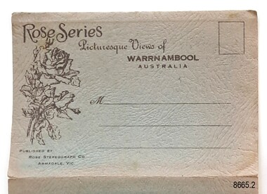
 Flagstaff Hill Maritime Museum and Village
Postcard - Postcard Folder, scenes, George Rose, Rose Stereographic Company, Rose Series Picturesque Views of Warrnambool Australia, 1880-1942
... bridge...suspension footbridge...Merri River mouth...Hopkins River mouth...Proudfoot's...Fanny Nelson...Nelson's boatsheds...Nelson's Boathouse...boathouse...Hopkins River boathouses...Flett's boathouse...Flett...George Rose...image of a rose...Rose Series...Rose Stereograph Co...Rose Stereographic Company...Lighograph...Armadale Victoria...Lady Bay beach...beach scene...Lower Light...concrete footbridge...1922 footbridge...Viaduct Road...Rose postcard...new...Vic. . The New Concrete Bridge and Breakwater. Warrnambool. Vic. . ...Vic. . The New Concrete Bridge and Breakwater. Warrnambool. Vic. . ...GEORGE ROSE 1861-1942: - George Rose was a well-known Victorian photographer, famous for his late 19th and early 20th century photography. He was born in Clunes, Victoria, and was in his 20th year when he founded Rose Stereograph Company in 1880. He took the opportunity of a popular trend of the times to produce stereographs, pairs of almost duplicate photographs that appeared in 3D when viewed in a handheld stereo viewer. By the 1920s, these lost their popularity, so he used his photographic skills to produce cards and postcards of scenes and people. The twelve photographs in the Rose postcard folders include locations connected to other items in our Collection, including the Valentine postcard folder in this set. The photographs are titled: - . The Avenue and War Memorial. Warrnambool. Vic. . The Blow-hole. Thunder Point. Warrnambool. Vic. . Botanical Gardens. Warrnambool. Vic. . Eagle Rock. Warrnambool. Vic. . The New Concrete Bridge and Breakwater. Warrnambool. Vic. . Liebig Street. Warrnambool. Vic. . Looking to Thunder Point. Warrnambool. Vic. . The Beach. Warrnambool. Vic. . Hopkins Falls. Warrnambool. Vic. . Shelly Beach. Warrnambool. Vic. . The Mouth of the Hopkins River. Warrnambool. Vic. . Panorama of Warrnambool, Vic. [Kepler Street towards Presbyterian Church on Spence St] The photographs in this postcard folder were taken between 1880 and 1942 by the renowned Victorian photographer George Rose. The locations match photographs and postcards in our collection that were taken at different times. A comparison between them shows the changes over time in the land and bay, the buildings and other structures, transportation and even the fashions of the times, building the story of our local history.Postcard folder, Rose Series, blue cover. One of a set of three containing images of Warrnambool and district before 1942. Green folder, textured cardboard folder containing a Z-folded strip of white matte photographic paper with six black and white photographs on each side. Titles are printed below the images. The folder is secured by placing two tabs into two slots on the back cover to hold the cover in place and create an envelope shape. Three horizontal lines are printed on the front for the receiver’s address. There is a logo of a long-stemmed rose on the left side and inscriptions on the front cover. The lithograph photographs were taken between 1880 and 1942 by well-known Victorian photographer George Rose and published by Rose Stereograph Company of Armadale, Victoria. The folder contains scenes of popular areas at Warrnambool and nearby locations including Lady Bay, the Port of Warrnambool, the Warrnambool Breakwater, the Viaduct, the Merri River Footbridge, the Hopkins River Mouth, and Proudfoot’s and the Fanny Nelson/Flett boathouses. Image: [Rose with rosebud and leaves] Printed: "Rose Series / Picturesque Views of / WARRNAMBOOL / AUSTRALIA" "PUBLISHED BY / ROSE STEREOGRAPH CO / ARMADALE. VIC." flagstaff hill maritime museum and village, great ocean road, shipwreck coast, warrnambool, flagstaff hill, flagstaff hill maritime museum, flagstaff hill maritime village, warramble, postcard, postcard folder, warrnambool scenes, picturesque views of warrnambool, picturesque views of warramble, lady bay, port of warrnambool, breakwater, warrnambool breakwater, viaduct, merri river footbridge, merri river suspension bridge, suspension footbridge, merri river mouth, hopkins river mouth, proudfoot's, fanny nelson, nelson's boatsheds, nelson's boathouse, boathouse, hopkins river boathouses, flett's boathouse, flett, george rose, image of a rose, rose series, rose stereograph co, rose stereographic company, lighograph, armadale victoria, lady bay beach, beach scene, lower light, concrete footbridge, 1922 footbridge, viaduct road, rose postcard, new concrete bridge, 1945, 1890, 1922, small footbridge, 1872 footbridge, 1872, merri river estuary, stingray bay, postcards -
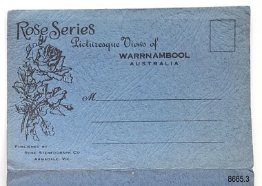
 Flagstaff Hill Maritime Museum and Village
Postcard - Postcard Folder, scenes, George Rose, Rose Stereographic Company, Rose Series, Picturesque Views of Warrnambool Australia, 1880-1942
... bridge...suspension footbridge...Merri River mouth...Hopkins River mouth...Proudfoot's...Fanny Nelson...Nelson's boatsheds...Nelson's Boathouse...boathouse...Hopkins River boathouses...Flett's boathouse...Flett...George Rose...image of a rose...Rose Series...Rose Stereograph Co...Rose Stereographic Company...Lighograph...Armadale Victoria...Lady Bay beach...beach scene...Lower Light...concrete footbridge...1922 footbridge...Viaduct Road...Rose postcard...new...Vic. . The New Concrete Bridge and Breakwater. Warrnambool. Vic. . ...Vic. . The New Concrete Bridge and Breakwater. Warrnambool. Vic. . ...GEORGE ROSE 1861-1942: - George Rose was a well-known Victorian photographer, famous for his late 19th and early 20th century photography. He was born in Clunes, Victoria, and was in his 20th year when he founded Rose Stereograph Company in 1880. He took the opportunity of a popular trend of the times to produce stereographs, pairs of almost duplicate photographs that appeared in 3D when viewed in a handheld stereo viewer. By the 1920s, these lost their popularity, so he used his photographic skills to produce cards and postcards of scenes and people. The twelve photographs in the Rose postcard folders include locations connected to other items in our Collection, including the Valentine postcard folder in this set. The photographs are titled: - . The Avenue and War Memorial. Warrnambool. Vic. . The Blow-hole. Thunder Point. Warrnambool. Vic. . Botanical Gardens. Warrnambool. Vic. . Eagle Rock. Warrnambool. Vic. . The New Concrete Bridge and Breakwater. Warrnambool. Vic. . Liebig Street. Warrnambool. Vic. . Looking to Thunder Point. Warrnambool. Vic. . The Beach. Warrnambool. Vic. . Hopkins Falls. Warrnambool. Vic. . Shelly Beach. Warrnambool. Vic. . The Mouth of the Hopkins River. Warrnambool. Vic. . Panorama of Warrnambool, Vic. [Kepler Street towards Presbyterian Church on Spence St] This postcard folder shows scenes and places of interest in and around Warrnambool. The George Rose postcard folders in this set were produced in Victoria and include pictures taken by the renowned photographer between 1880 and 1942. Other postcards in our collection have photographs of the same or similar locations at different periods in time. Each postcard records a moment in history and is significant as a way to compare and show the changes in the local environment and community, building a story of the local history. The images record changes in the coastline, land, bay, buildings and other structures, roads, transportation and even the fashions of the times. This copy folder is one of a set of three. This folder has a green-grey textured rectangular card cover with a sketch of a rose on the front. The cover also contains the name of the postcard series, the location of the series' focus, the producer's details, and lines for adding an address. The folded cover contains a long, concertinaed page with six titled photographs on each side, totalling twelve. The folder contains scenes from Warrnambool and nearby popular areas, including Lady Bay, the Port of Warrnambool, the Warrnambool Breakwater, the Viaduct, the Merri River Footbridge, the Hopkins River Mouth, and Proudfoot’s and the Fanny Nelson/Flett boathouses. The cover has a sketch of a rose and inscriptions. The lithograph photographs were taken between 1880 and 1942 by well-known Victorian photographer George Rose, Rose Stereograph Company of Armadale, Victoria.Image: [Rose with rosebud and leaves] Printed: "Rose Series / Picturesque Views of / WARRNAMBOOL / AUSTRALIA" "PUBLISHED BY / ROSE STEREOGRAPH CO / ARMADALE. VIC."flagstaff hill maritime museum and village, great ocean road, shipwreck coast, warrnambool, flagstaff hill, flagstaff hill maritime museum, flagstaff hill maritime village, warramble, postcard, postcard folder, warrnambool scenes, picturesque views of warrnambool, lady bay, port of warrnambool, breakwater, warrnambool breakwater, viaduct, merri river footbridge, merri river suspension bridge, suspension footbridge, merri river mouth, hopkins river mouth, proudfoot's, fanny nelson, nelson's boatsheds, nelson's boathouse, boathouse, hopkins river boathouses, flett's boathouse, flett, george rose, image of a rose, rose series, rose stereograph co, rose stereographic company, lighograph, armadale victoria, lady bay beach, beach scene, lower light, concrete footbridge, 1922 footbridge, viaduct road, rose postcard, new concrete bridge, 1945, 1890, 1922, small footbridge, 1872 footbridge, 1872, merri river estuary, stingray bay, postcards, green-grey postcard folder, shipwrecked coast, maritime museum, souvenir, warrnambool local scenes, photography, local history, tourism, photographs, visitors, travel, scenes, mid-20th century, 1940s, 1950s, concertina fold, z-fold, 1880s, collection, correspondence, rose stereograph co armadale, victorian photographer, soldiers’ memorial, hopkins river, the cliffs at shelly beach, the road to sandy beach, pier, botanic gardens, post office, municipal buildings, merri river, proudfoot’s -
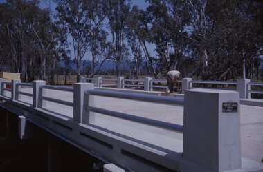 Stawell Historical Society Inc
Slide, Ian McCann, Finishing Touches
... A Man painting the new Concrete Bridge....Stawell Historical Society Inc 46 Longfield St Stawell grampians Bridges Campbells Bridge A Man painting the new Concrete Bridge. Finishing Touches Slide Ian McCann ...A Man painting the new Concrete Bridge.bridges, campbells bridge -
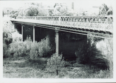
 Ballarat Heritage Services
Photograph, Bridge
... A new concrete bridge over a creek near Carisbrook....EM22 bridge landscape river Carisbrook A new concrete bridge over a creek near Carisbrook. ...Associated with Carisbrook.A new concrete bridge over a creek near Carisbrook.em22, bridge, landscape, river, carisbrook -
 Charlton Golden Grains Museum Inc
Photograph - 1925 Official New Bridge Opening over Avoca River
... Postcard - Kodak Australia - Opening of the new concrete bridge over Avoca River Charlton...Postcard - Kodak Australia - Opening of the new concrete bridge over Avoca River Charlton Unframed sepia postcard 1925 Official opening new bridge over Avoca River. ...Unframed sepia postcard 1925 Official opening new bridge over Avoca River. Bridge crowded with people, bank littered with debrisPostcard - Kodak Australia - Opening of the new concrete bridge over Avoca River Charlton -
 Kew Historical Society Inc
Photograph - Former Chandler Highway Bridge, 2001
... In the 2010s a new concrete bridge was erected beside it to increase vehicular capacity. ...In the 2010s a new concrete bridge was erected beside it to increase vehicular capacity. ...In the 2010s a new concrete bridge was erected beside it to increase vehicular capacity. ...The heritage listed Fairfield Bridge was originally constructed for the Outer Circle Railway to bridge the Yarra River between East Kew and Fairfield stations. In the 1930s it was converted for vehicular traffic. In the 2010s a new concrete bridge was erected beside it to increase vehicular capacity. Original colour print positive of the (former) Chandler Highway bridge in 2001. The point of view is from the Fairfield side of the river looking towards Kew. The heritage listed bridge was originally constructed for the Outer Circle Railway to bridge the Yarra River between East Kew and Fairfield stations. In the 1930s it was converted for vehicular traffic. In the 2010s a new concrete bridge was erected beside it to increase vehicular capacity. Ink inscription on reverse: "Chandler Highway bridge / (Originally Outer Circle Railway Bridge) / From Fairfield side towards Kew / July 2001"bridges -- kew (vic), fairfield bridge, chandler highway bridge, outer circle railway viaduct -
 Flagstaff Hill Maritime Museum and Village
Postcard - Postcard Folder set, George Rose, Rose Stereographic Company, 1880-1942
... bridge...suspension footbridge...Merri River mouth...Hopkins River mouth...Proudfoot's...Fanny Nelson...Nelson's boatsheds...Nelson's Boathouse...boathouse...Hopkins River boathouses...Flett's boathouse...Flett...George Rose...image of a rose...Rose Series...Rose Stereograph Co...Rose Stereographic Company...Lighograph...Armadale Victoria...Lady Bay beach...beach scene...Lower Light...concrete footbridge...1922 footbridge...Viaduct Road...Rose postcard...new...Flagstaff Hill Maritime Museum and Village Great Ocean Road Shipwreck Coast Warrnambool Flagstaff Hill Flagstaff Hill Maritime Museum Flagstaff Hill Maritime Village Warramble postcard postcard folder Warrnambool Scenes Picturesque views of Warrnambool Picturesque views of Warramble Lady Bay Port of Warrnambool Breakwater Warrnambool Breakwater Viaduct Merri River footbridge Merri River suspension bridge suspension footbridge Merri River mouth Hopkins River mouth Proudfoot's Fanny Nelson Nelson's boatsheds Nelson's Boathouse boathouse Hopkins River boathouses Flett's boathouse Flett George Rose image of a rose Rose Series Rose Stereograph Co Rose Stereographic Company Lighograph Armadale Victoria Lady Bay beach beach scene Lower Light concrete footbridge 1922 footbridge Viaduct Road Rose postcard new concrete bridge 1945 1890 1922 small footbridge 1872 footbridge 1872 Merri River Estuary Stingray Bay postcards Shipwrecked coast Maritime Museum Souvenir Warrnambool local scenes Hopkins River Botanic Gardens Soldiers’ Memorial Pier Post Office Municipal Buildings Merri River Proudfoot’s The Cliffs at Shelly Beach The Road to Sandy Beach tourism photographs visitors travel scenes local history mid-20th century 1940s 1950s Rose Stereograph Co Armadale. ...Each postcard folder in this set has no address, message or postage stamp. Postcard folders such as these were popular as holiday souvenirs in the early to mid-20th century and were kept in good condition by collectors. The size is convenient for posting to friends and relatives and packing as holiday luggage. Postcards in the early-to-mid-19th century were an inexpensive way to remember and share holiday scenes, as few people could afford a camera and the price of developing the photographs. The images on these postcards were produced from black and white lithographs of photographs taken at Warrnambool and the surrounding district during the early to mid-20th century. Publishing firms such as Melbourne-based Valentine and Rose purchased photographs from local photographers and reproduced them for sale. This set of postcard folders shows that more than one publishing company had access to the same or almost the same images. The photographs include street scapes, the Warrnambool Breakwater and Pier, Botanical Gardens, beach scenes, cliff formations, the Hopkins River, municipal buildings, the Post Office and the Soldiers’ Memorial. The postcard folders in this set of three are significant as a record of local history from the late 19th century to the mid-20th century. The locations of the images match photographs and postcards in our collection that were taken at different times and provide a historical record of the Warrnambool and southwest Victorian locations, growth and changes.. The images record changes in the coastline, land, bay, buildings and other structures, roads, transportation and even the fashions of the times. Set of three postcard folders containing black and white images of photographed scenes showcasing Warrnambool and district between 1880 and 1942. The images were produced from lithographs of the original photographs and are printed on both sides of long strips of white photographic paper that are Z-folded into covers of textured card. Some of the images are repeated in all three folders. Folder 8665.1 - the cream-coloured folder was produced by The Valentine Publishing Co. Pty. Ltd. Melbourne and contains 15 photographs, some of which are also in the blue and the green folders. Folders 8665.2, the green folder, and 8665.3, the blue folder, were published by Rose Stereograph Co, Armadale, Vic. Each contains the same twelve images, but they are presented in a different order. flagstaff hill maritime museum and village, great ocean road, shipwreck coast, warrnambool, flagstaff hill, flagstaff hill maritime museum, flagstaff hill maritime village, warramble, postcard, postcard folder, warrnambool scenes, picturesque views of warrnambool, picturesque views of warramble, lady bay, port of warrnambool, breakwater, warrnambool breakwater, viaduct, merri river footbridge, merri river suspension bridge, suspension footbridge, merri river mouth, hopkins river mouth, proudfoot's, fanny nelson, nelson's boatsheds, nelson's boathouse, boathouse, hopkins river boathouses, flett's boathouse, flett, george rose, image of a rose, rose series, rose stereograph co, rose stereographic company, lighograph, armadale victoria, lady bay beach, beach scene, lower light, concrete footbridge, 1922 footbridge, viaduct road, rose postcard, new concrete bridge, 1945, 1890, 1922, small footbridge, 1872 footbridge, 1872, merri river estuary, stingray bay, postcards, shipwrecked coast, maritime museum, souvenir, warrnambool local scenes, hopkins river, botanic gardens, soldiers’ memorial, pier, post office, municipal buildings, merri river, proudfoot’s, the cliffs at shelly beach, the road to sandy beach, tourism, photographs, visitors, travel, scenes, local history, mid-20th century, 1940s, 1950s, rose stereograph co armadale. vic, valentine publishing co. pty. ltd melbourne, valentine publishing co. pty. ltd sydney -
 Flagstaff Hill Maritime Museum and Village
Postcard - Postcard Folder, scenes, Valentine & Sons Co. Publishing Ltd, Warrnambool Photographic Souvenir, Early-to-mod 20th century
... bridge...suspension footbridge...Merri River mouth...Hopkins River mouth...Proudfoot's...Fanny Nelson...Nelson's boatsheds...Nelson's Boathouse...boathouse...Hopkins River boathouses...Flett's boathouse...Flett...George Rose...image of a rose...Rose Series...Rose Stereograph Co...Rose Stereographic Company...Lighograph...Armadale Victoria...Lady Bay beach...beach scene...Lower Light...concrete footbridge...1922 footbridge...Viaduct Road...Rose postcard...new...Flagstaff Hill Maritime Museum and Village Great Ocean Road Shipwreck Coast Warrnambool Flagstaff Hill Flagstaff Hill Maritime Museum Flagstaff Hill Maritime Village Warramble postcard postcard folder Warrnambool Scenes Picturesque views of Warrnambool Picturesque views of Warramble Lady Bay Port of Warrnambool Breakwater Warrnambool Breakwater Viaduct Merri River footbridge Merri River suspension bridge suspension footbridge Merri River mouth Hopkins River mouth Proudfoot's Fanny Nelson Nelson's boatsheds Nelson's Boathouse boathouse Hopkins River boathouses Flett's boathouse Flett George Rose image of a rose Rose Series Rose Stereograph Co Rose Stereographic Company Lighograph Armadale Victoria Lady Bay beach beach scene Lower Light concrete footbridge 1922 footbridge Viaduct Road Rose postcard new concrete bridge 1945 1890 1922 small footbridge 1872 footbridge 1872 Merri River Estuary Stingray Bay postcards concertina fold Z fold Shipwrecked coast Maritime Museum Souvenir Warrnambool local scenes photography local history tourism photographs visitors travel scenes mid-20th century 1940s 1950s Z-fold 1880s collection correspondence Valentine Publishing Co. ...This postcard folder is one of three in a set of postcards that were published in Victoria, Australia, and collected together. The Valentine Publishing Co. Pty. Ltd. produced this folder. Valentine and Sons was a printing and photography business based in Dundee, Scotland, and in Canada. In the early 1900s, at the height of the postcard craze, the firm published large numbers of postcards in the U.K., Canada, U.S., Australia and South Africa. From around 1900 or earlier, the firm bought many lithographic images for its postcards from local and national photographers who sold publishing rights to Valentines, and the business was famous for publishing photographs of popular sites worldwide. Postcard titles in this folder include many of those in the Rose postcard folders plus the following titles that are not duplicated. . Municipal Buildings and Post Office . Soldiers’ Memorial . Hopkins River . The Cliffs at Shelly Beach . The Road to Sandy Beach . The Breakwater and Pier This Valentine postcard folder was produced in Australia. It includes pictures from the early-to-mid 20th century. It is one of three in a set, with images of the same locations as other images in our collection but at different periods in time. Each postcard records a moment in history and is significant as a way to compare and show the changes in the local environment and community, building a story of the local history. The images record changes in the coastline, land, bay, buildings and other structures, roads, transportation and even the fashions of the times.Postcard folder, Valentine Publishing, cream cover. One of a set of three displaying images of Warrnambool and district around the mid-20th century. Print on the front and back covers is in brown ink. The front has an image of two laughing kookaburras on a branch, three address lines and an outline for a postage stamp. The back cover has the publisher’s details and a line for a return address. The cover opens like a book, and then the double-sided, Z-folded page of photographs drops downward. Titles are printed below each of the fifteen black and white photographs inside. The folder is secured on the back cover by placing a tab into a slot. The folder was produced by The Valentine Publishing Co. Pty. Ltd. Melbourne“WARRNAMBOOL / PHOTOGRAPHIC SOUVENIR” Symbol: [Two facing kookaburras standing on a branch with beaks open] “Published by The Valentine Publishing Co. Pty. Ltd. Melbourne” flagstaff hill maritime museum and village, great ocean road, shipwreck coast, warrnambool, flagstaff hill, flagstaff hill maritime museum, flagstaff hill maritime village, warramble, postcard, postcard folder, warrnambool scenes, picturesque views of warrnambool, picturesque views of warramble, lady bay, port of warrnambool, breakwater, warrnambool breakwater, viaduct, merri river footbridge, merri river suspension bridge, suspension footbridge, merri river mouth, hopkins river mouth, proudfoot's, fanny nelson, nelson's boatsheds, nelson's boathouse, boathouse, hopkins river boathouses, flett's boathouse, flett, george rose, image of a rose, rose series, rose stereograph co, rose stereographic company, lighograph, armadale victoria, lady bay beach, beach scene, lower light, concrete footbridge, 1922 footbridge, viaduct road, rose postcard, new concrete bridge, 1945, 1890, 1922, small footbridge, 1872 footbridge, 1872, merri river estuary, stingray bay, postcards, concertina fold, z fold, shipwrecked coast, maritime museum, souvenir, warrnambool local scenes, photography, local history, tourism, photographs, visitors, travel, scenes, mid-20th century, 1940s, 1950s, z-fold, 1880s, collection, correspondence, valentine publishing co. pty. ltd melbourne, valentine publishing co. pty. ltd sydney, municipal buildings and post office, soldiers’ memorial, hopkins river, the cliffs at shelly beach, the road to sandy beach, the breakwater and pier -
 Lakes Entrance Historical Society
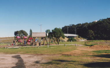
Photograph - Apex Park Lakes Entrance Victoria, 2000 c
... Colour photographs of Apex Park showing new adventure playground and barbeque area, new concrete bridge over North Arm in background Lakes Entrance Victoria. ...Lakes Entrance Historical Society 4 Marine Parade Lakes Entrance gippsland Also a photograph of Apex Park new slides Recreational Facilities Parks Colour photographs of Apex Park showing new adventure playground and barbeque area, new concrete bridge over North Arm in background Lakes Entrance Victoria. ...Also a photograph of Apex Park new slides Colour photographs of Apex Park showing new adventure playground and barbeque area, new concrete bridge over North Arm in background Lakes Entrance Victoria. recreational facilities, parks -
 Clunes Museum
Book, NSW ROADS AND TRAFFIC AUTHORITY, ORAL HISTORY PROGRAM - A VITAL LINK THE EUSTON TO ROBINVALE MURRAY RIVER CROSSING, 2007
... SPIRAL BOUND WITH IMAGES OF AN OLD IRON BRIDGE AND A NEW CONCRETE BRIDGE ON THE FRONT COVER DETAILING AN ORAL HISTORY PROJECT WITHIN THE TITLE OF THE BOOK. 81 PAGES AND AN ORAL HISTORY CD IS ATTACHED TO THE BACK PAGE...Clunes Museum 36 Fraser Street enter building through Collins Place Clunes goldfields EUSTON TO ROBINVALE RIVER CROSSING ORAL HISTORY AN ORAL HISTORY PROJECT ABOUT A VITAL LINK BETWEEN EUSTON AND ROBINVALE SPIRAL BOUND WITH IMAGES OF AN OLD IRON BRIDGE AND A NEW CONCRETE BRIDGE ON THE FRONT COVER DETAILING AN ORAL HISTORY PROJECT WITHIN THE TITLE OF THE BOOK. 81 PAGES AND AN ORAL HISTORY CD IS ATTACHED TO THE BACK PAGE ORAL HISTORY PROGRAM - A VITAL LINK THE EUSTON TO ROBINVALE MURRAY RIVER CROSSING Book BOOK NSW ROADS AND TRAFFIC AUTHORITY FRANK HEIMANS CINETEL PRODUCTIONS PTY LTD ...AN ORAL HISTORY PROJECT ABOUT A VITAL LINK BETWEEN EUSTON AND ROBINVALESPIRAL BOUND WITH IMAGES OF AN OLD IRON BRIDGE AND A NEW CONCRETE BRIDGE ON THE FRONT COVER DETAILING AN ORAL HISTORY PROJECT WITHIN THE TITLE OF THE BOOK. 81 PAGES AND AN ORAL HISTORY CD IS ATTACHED TO THE BACK PAGEnon-fictionAN ORAL HISTORY PROJECT ABOUT A VITAL LINK BETWEEN EUSTON AND ROBINVALEeuston to robinvale, river crossing, oral history -
 Eltham District Historical Society Inc
Photograph - Colour Print, Russell Yeoman, Upgrading the old Silver Street Railway Bridge, Eltham, c.1988
... Original 1901 wooden railway bridge in process of being upgraded to a new concrete bridge...Original 1901 wooden railway bridge in process of being upgraded to a new concrete bridge railways bridges silver street eltham Railway Bridge Silver Street Bridge Colour photograph Upgrading the old Silver Street Railway Bridge, Eltham Photograph Colour Print Russell Yeoman ...Original 1901 wooden railway bridge in process of being upgraded to a new concrete bridgeColour photographrailways, bridges, silver street, eltham, railway bridge, silver street bridge -
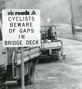 Lakes Entrance Historical Society
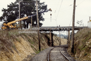
Photograph, Lakes Post Newspaper, 1991
... Black and white photograph taken when work commenced on the construction of the new concrete bridge on the Princes Highway, Toorloo Arm, near Lakes Entrance. ...Lakes Entrance Historical Society 4 Marine Parade Lakes Entrance gippsland Date made January 1991 Bridges Waterways Black and white photograph taken when work commenced on the construction of the new concrete bridge on the Princes Highway, Toorloo Arm, near Lakes Entrance. ...Date made January 1991Black and white photograph taken when work commenced on the construction of the new concrete bridge on the Princes Highway, Toorloo Arm, near Lakes Entrance. Road works in distance, crane beside present bridge, Vicroads warning sign to cyclists in foreground. Toorloo Arm Victoriabridges, waterways -
 Kew Historical Society Inc
Photograph - Outer Circle Railway Viaduct
... In the 2010s a new concrete bridge was erected beside it to increase vehicular capacity....In the 2010s a new concrete bridge was erected beside it to increase vehicular capacity. ...The heritage listed Fairfield Bridge was originally constructed for the Outer Circle Railway to bridge the Yarra River between East Kew and Fairfield stations. In the 1930s it was converted for vehicular traffic. In the 2010s a new concrete bridge was erected beside it to increase vehicular capacity.Print copy, enlarged from original snapshot, of the former railway viaduct crossing the Yarra and linking Kew and Fairfield. The original photo predates the conversion of the viaduct into the Chandler Highway Bridge in the 1930s, when the Bridge was adapted to carry vehicular traffic. The date on the reverse indicates the date of donation rather than the date on which the photograph was taken. CHANDLER HIGHWAY BRIDGE OVER RIVER / (ORIGINALLY PART OF OUTER CURCLE RAILWAY) / OCTOBER 1977railway viaduct -- kew (vic.), fairfield bridge, fairfield railway viaduct, outer circle railway, sir john monash -
 Kew Historical Society Inc
Photograph - Chandler Highway Bridge, 1977
... In the 2010s a new concrete bridge was erected beside it to increase vehicular capacity....In the 2010s a new concrete bridge was erected beside it to increase vehicular capacity. chandler highway bridge outer circle railway viaduct bridges -- kew (Vic.) ...The heritage listed Fairfield Bridge was originally constructed for the Outer Circle Railway to bridge the Yarra River between East Kew and Fairfield stations. In the 1930s it was converted for vehicular traffic. In the 2010s a new concrete bridge was erected beside it to increase vehicular capacity.Print copy of the Chandler Highway Bridge, [formerly the Fairfield Viaduct of the Outer Circle Railway] showing the original position of the walkway beside the bridge. The POV is from the Fairfield side looking towards Kew. CHANDLER HWY BRIDGE OVER YARRA / OCTOBER 1977 / ORIGINALLY BUILT FOR OUTER CIRCLE RWYchandler highway bridge, outer circle railway viaduct, bridges -- kew (vic.) -
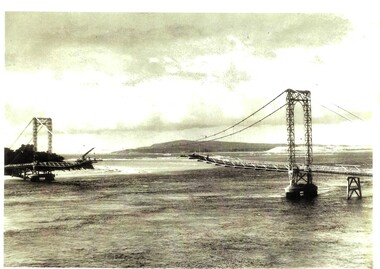 Phillip Island and District Historical Society Inc.
Photograph, Phillip Island bridge being demolished
... It was demolished in early 1970 following the opening of the new concrete bridge in November 1969. The demolition of the old, narrow bridge caused significant local disruption, including poor fishing conditions for at least two seasons. ...It was demolished in early 1970 following the opening of the new concrete bridge in November 1969. The demolition of the old, narrow bridge caused significant local disruption, including poor fishing conditions for at least two seasons. ...Built in 1940, a suspension bridge opened between San Remo, Victoria on the mainland to Newhaven, Victoria on Phillip Island. It was demolished in early 1970 following the opening of the new concrete bridge in November 1969. The demolition of the old, narrow bridge caused significant local disruption, including poor fishing conditions for at least two seasons. HistoricalPhotocopy of photograph of Phillip Island bridge being demolished showing centre span missing. phillip island bridge, demolition -
 Eltham District Historical Society Inc
Photograph, Fay Bridge, Centenary celebration, Monash Bridge, Hurstbridge, 7 November 2017
... It was replaced by a new concrete bridge designed by Sir John Monash over the Diamond Creek near Hurst's home of 'Mia Mia' at Hurstbridge. ...It was replaced by a new concrete bridge designed by Sir John Monash over the Diamond Creek near Hurst's home of 'Mia Mia' at Hurstbridge. ...The area of Hurstbridge was originally known as Hurst’s-bridge after the timber bridge built over the Diamond Creek near Hurst’s station in late 1881/early 1882. It was replaced by a new concrete bridge designed by Sir John Monash over the Diamond Creek near Hurst's home of 'Mia Mia' at Hurstbridge. The official opening of the new Monash bridge at Hurstbridge was held 3 November 1917.fay bridge collection, 2017-11-07, hurstbridge, hurstbridge heritage trail, monash bridge, ruins -
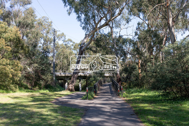
 Eltham District Historical Society Inc
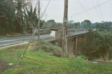
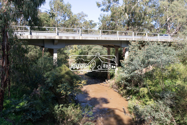
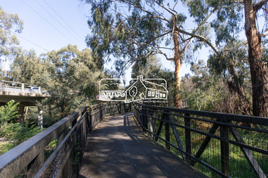
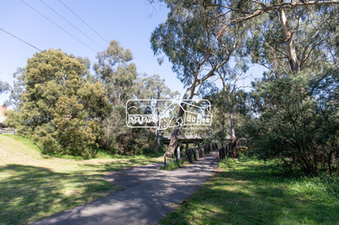
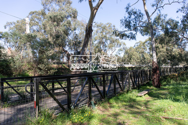
Photograph, Peter Pidgeon, Main Road Bridge, Eltham South, 8 Sep. 2021
... A temporary bridge was rigged up but further damaged in April 1924. A new concrete bridge was built and opened in October 1926. ...A temporary bridge was rigged up but further damaged in April 1924. A new concrete bridge was built and opened in October 1926. ...The original timber bridge over the Diamond Creek was built around 1840. It was destroyed by floodwaters in October 1923. A temporary bridge was rigged up but further damaged in April 1924. A new concrete bridge was built and opened in October 1926. The bridge decking was widened along with Main Road to Dalton Street by the Road Construction Authority in 1984., The uygraded bridge was opened in October 1984, 78 years after its original opening. Born Digitaleltham south, main road bridge, diamond creek (creek) -
 Eltham District Historical Society Inc
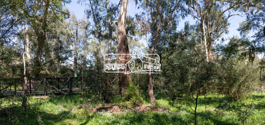
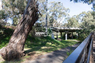
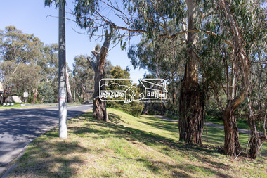
Photograph, Peter Pidgeon, Manna Gums, Main Road Bridge, Eltham South, 8 Sep. 2021
... A temporary bridge was rigged up but further damaged in April 1924. A new concrete bridge was built and opened in October 1926. ...A temporary bridge was rigged up but further damaged in April 1924. A new concrete bridge was built and opened in October 1926. ...The original timber bridge over the Diamond Creek was built around 1840. It was destroyed by floodwaters in October 1923. A temporary bridge was rigged up but further damaged in April 1924. A new concrete bridge was built and opened in October 1926. The bridge decking was widened along with Main Road to Dalton Street by the Road Construction Authority in 1984., The uygraded bridge was opened in October 1984, 78 years after its original opening.These trees are not only significant for the natural environment but also present a navigational beacon back in time as the environmental landscape is developed around them.Born Digitaleltham south, main road bridge, manna gum, diamond creek trail -
 Eltham District Historical Society Inc
Photograph, Hurstbridge - Construction of new bridge
... In early November 1917 the new reinforced concrete bridge across the Diamond Creek at Hurstbridge was officially opened with "some 500 spectators", some who had arrived by train for the occassion....Eltham District Historical Society Inc 728 Main Rd Eltham melbourne In early November 1917 the new reinforced concrete bridge across the Diamond Creek at Hurstbridge was officially opened with "some 500 spectators", some who had arrived by train for the occassion. ...In early November 1917 the new reinforced concrete bridge across the Diamond Creek at Hurstbridge was officially opened with "some 500 spectators", some who had arrived by train for the occassion.This photo forms part of a collection of photographs gathered by the Shire of Eltham for their centenary project book, "Pioneers and Painters: 100 years of the Shire of Eltham" by Alan Marshall (1971). The collection of over 500 images is held in partnership between Eltham District Historical Society and Yarra Plenty Regional Library (Eltham Library) and is now formally known as 'The Shire of Eltham Pioneers Photograph Collection.' It is significant in being the first community sourced collection representing the places and people of the Shire's first one hundred years.Digital imagesepp, shire of eltham pioneers photograph collection, hurstbridge, bridge, bridge construction -
 Eltham District Historical Society Inc
Photograph, Ruth H. Pendavingh, Reconstruction of Main Road from Main Road Bridge to Mount Pleasant Road, Eltham, 1984
... A temporary bridge was rigged up but further damaged in April 1924. A new concrete bridge was built and opened in October 1926. ...A temporary bridge was rigged up but further damaged in April 1924. A new concrete bridge was built and opened in October 1926. ...The original timber bridge over the Diamond Creek was built around 1840. It was destroyed by floodwaters in October 1923. A temporary bridge was rigged up but further damaged in April 1924. A new concrete bridge was built and opened in October 1926. The bridge decking was widened along with Main Road to Dalton Street by the Road Construction Authority in 1984. The upgraded bridge was re-opened October 25, 1984, 78 years after its original opening. (EDHS Chronology of known local events 1835- early 2000)Three colour photograph prints 1984, bridge construction, diamond creek (creek), eltham south, main road, main road bridge, road construction -
 Eltham District Historical Society Inc
Photograph, Peter Pidgeon, Manna Gum, Main Road Bridge, Eltham South, 8 Sep. 2021
... A temporary bridge was rigged up but further damaged in April 1924. A new concrete bridge was built and opened in October 1926. ...A temporary bridge was rigged up but further damaged in April 1924. A new concrete bridge was built and opened in October 1926. ...This significant tree located near the Main Road Bridge and Diamond Creek Trail footbridge over the Diamond Creek at Eltham dates back to the early 1900s. The original timber bridge over the Diamond Creek was built around 1840. It was destroyed by floodwaters in October 1923. A temporary bridge was rigged up but further damaged in April 1924. A new concrete bridge was built and opened in October 1926. The bridge decking was widened along with Main Road to Dalton Street by the Road Construction Authority in 1984., The uygraded bridge was opened in October 1984, 78 years after its original opening.These trees are not only significant for the natural environment but also present a navigational beacon back in time as the environmental landscape is developed around them.Born Digitaleltham south, main road bridge, manna gum, significant tree, diamond creek trail -
 Eltham District Historical Society Inc
Photograph, Peter Pidgeon, Manna Gum, Main Road Bridge, Eltham South, 8 Sep. 2021
... A temporary bridge was rigged up but further damaged in April 1924. A new concrete bridge was built and opened in October 1926. ...A temporary bridge was rigged up but further damaged in April 1924. A new concrete bridge was built and opened in October 1926. ...This significant tree located near the Main Road Bridge and Diamond Creek Trail footbridge over the Diamond Creek at Eltham dates back to the early 1900s. The original timber bridge over the Diamond Creek was built around 1840. It was destroyed by floodwaters in October 1923. A temporary bridge was rigged up but further damaged in April 1924. A new concrete bridge was built and opened in October 1926. The bridge decking was widened along with Main Road to Dalton Street by the Road Construction Authority in 1984., The uygraded bridge was opened in October 1984, 78 years after its original opening.These trees are not only significant for the natural environment but also present a navigational beacon back in time as the environmental landscape is developed around them.Born Digitaleltham south, main road bridge, manna gum, significant tree, diamond creek trail