Showing 121 items matching "regional maps"
-
 National Vietnam Veterans Museum (NVVM)
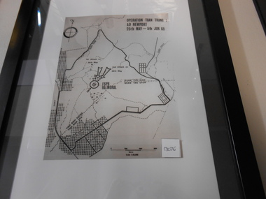
Photograph, Operation Toan Thang 1
... Photograph in black frame with inner white matting and outer blackm matting of FSB Balmoral Regional Map....National Vietnam Veterans Museum (NVVM) 25 Veterans Drive Newhaven phillip-island-and-the-bass-coast Photograph Toan Thang FSB Balmoral Battle of Coral-Balmoral Photograph in black frame with inner white matting and outer blackm matting of FSB Balmoral Regional Map. Operation Toan Thang 1 Photograph Photograph ...Photograph in black frame with inner white matting and outer blackm matting of FSB Balmoral Regional Map.photograph, toan thang, fsb balmoral, battle of coral-balmoral -
 Victorian Aboriginal Corporation for Languages
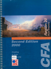
Map, Country Fire Authority, Region 20 rural directory, 2000
... ...regional maps...Victorian Aboriginal Corporation for Languages 33 Saxon Street Brunswick melbourne Kerang regional maps atlas fire protection maps Region 20 rural directory Map Country Fire Authority ...mapskerang, regional maps, atlas, fire protection -
 Victorian Aboriginal Corporation for Languages
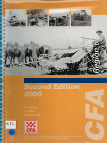
Map, Country Fire Authority, Region 6 rural directory, 2000
... ...Victorian regional maps...Victorian Aboriginal Corporation for Languages 33 Saxon Street Brunswick melbourne Colac Lismore Cressy Lake Corangamite Camperdown Terang Cobden Peterborough Port Campbell Apollo Bay Forrest Victorian regional maps fire protection maps, b&w photographs Region 6 rural directory Map Country Fire Authority ...maps, b&w photographscolac, lismore, cressy, lake corangamite, camperdown, terang, cobden, peterborough, port campbell, apollo bay, forrest, victorian regional maps, fire protection -
 Victorian Aboriginal Corporation for Languages
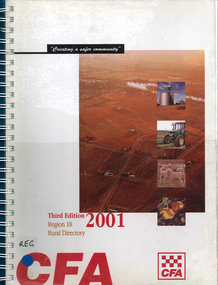
Map, Country Fire Authority, Region 18 rural directory, 2001
... ...Victorian regional maps...Victorian Aboriginal Corporation for Languages 33 Saxon Street Brunswick melbourne Swan Hill Mildura Mallee fire protection emergency services Victorian regional maps Maps, colour photographs Region 18 rural directory Map Country Fire Authority ...Maps, colour photographsswan hill, mildura, mallee, fire protection, emergency services, victorian regional maps -
 Victorian Aboriginal Corporation for Languages
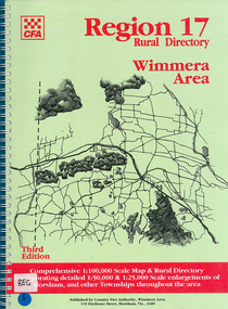
Map, Country Fire Authority, Region 17 rural directory : Wimmera area, 1997
... ...Victorian regional maps...Victorian Aboriginal Corporation for Languages 33 Saxon Street Brunswick melbourne Horsham Wimmera West Wimmera Hindmarsh Yarramback Grampians fire protection emergency services Victorian regional maps maps Region 17 rural directory : Wimmera area Map Country Fire Authority ...mapshorsham, wimmera, west wimmera, hindmarsh, yarramback, grampians, fire protection, emergency services, victorian regional maps -
 Victorian Aboriginal Corporation for Languages
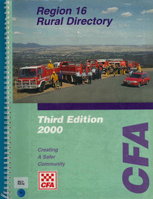
Map, Country Fire Authority, Region 16 rural directory, 2000
... ...Victorian regional maps...Victorian Aboriginal Corporation for Languages 33 Saxon Street Brunswick melbourne Ararat fire protection emergency services maps Victorian regional maps maps, colour photographs Region 16 rural directory Map Country Fire Authority ...maps, colour photographsararat, fire protection, emergency services, maps, victorian regional maps -
 Victorian Aboriginal Corporation for Languages
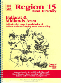
Map, Country Fire Authority, Region 15 rural directory : Ballarat &? Midlands Area : fully detailed maps &? roads index of Ballarat &? the developing areas surrounding, 1996
... ...Victorian regional maps...Victorian Aboriginal Corporation for Languages 33 Saxon Street Brunswick melbourne Ballarat fire protection Victorian regional maps emergency services maps Region 15 rural directory : Ballarat &? ...mapsballarat, fire protection, victorian regional maps, emergency services -
 Victorian Aboriginal Corporation for Languages
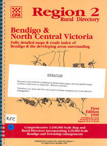
Map, Country Fire Authority, Region 2 rural directory : Bendigo &? North Central Victoria: fully detailed maps &? roads index of Bendigo &? the developing areas surrounding, 1996
... ...Victorian regional maps...Victorian Aboriginal Corporation for Languages 33 Saxon Street Brunswick melbourne Bendigo Loddon fire protection Victorian regional maps directories maps Region 2 rural directory : Bendigo &? ...mapsbendigo, loddon, fire protection, victorian regional maps, directories -
 Wodonga & District Historical Society Inc
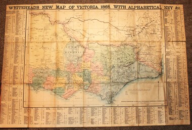
Map - Whiteheads New Map of Victoria, E. Whitehead & Co., engravers & lithographers, 1868
... His series of maps of Victoria became one of the most successful and most profitable series of regional maps of Australia ever produced....His series of maps of Victoria became one of the most successful and most profitable series of regional maps of Australia ever produced. This is a very early map of Victoria showing Belvoir (Wodonga) Victoria Cartography Rare maps Victoria Whiteheads maps A detailed early map of Victoria with counties clearly marked and shaded and a detailed index. ...Edward Whitehead was a printer and publisher active in Melbourne during the latter half of the 19th century. Whitehead founded his printing business at 67 Collins Street East in 1864 and, though not focused on maps, began publishing his own series of maps of Victoria in 1867. He focussed on producing highly detailed folding maps of Victoria which included a very detailed index of place names. His series of maps of Victoria became one of the most successful and most profitable series of regional maps of Australia ever produced.This is a very early map of Victoria showing Belvoir (Wodonga)A detailed early map of Victoria with counties clearly marked and shaded and a detailed index. It also shows roads, post office towns, railways, telegraphs, gold mining areas and notes on topography. Relief shown by hachures and spot heights. Includes a list of towns with distances from Melbourne on 3 sides of map. It is produced on paper mounted on linen.victoria cartography, rare maps victoria, whiteheads maps -
 Tatura Irrigation & Wartime Camps Museum
Book, Emergence of Bioregionalism in the MD Basin, 1993
... An exploratory essay on he ongoing history of Murray Darling Basin includes legacies, explorations, soil erosion, irrigation divsity, land degradation, change, regionalism, conservation, maps of Vic. NSW and Queensland...Tatura Irrigation & Wartime Camps Museum 49 Hogan Street Tatura the-murray An exploratory essay on he ongoing history of Murray Darling Basin includes legacies, explorations, soil erosion, irrigation divsity, land degradation, change, regionalism, conservation, maps of Vic. NSW and Queensland murray darling basin legacies erosion degradation diversity tatura murray river books rural industry Gloosy cover, brown marbled scenes from Berri Irrigation Area Reiver Murray, South Australia on back. ...An exploratory essay on he ongoing history of Murray Darling Basin includes legacies, explorations, soil erosion, irrigation divsity, land degradation, change, regionalism, conservation, maps of Vic. NSW and QueenslandGloosy cover, brown marbled scenes from Berri Irrigation Area Reiver Murray, South Australia on back. Maps, water scenes, Pyap Estates on front.murray darling basin, legacies, erosion, degradation, diversity, tatura, murray river, books, rural, industry -
 National Vietnam Veterans Museum (NVVM)
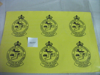
Memorabilia, Stickers
... Vietnam Veterans Association of Australia,Victorian Regional State Branch. Vietnam map in centre with Anzac Badge and Australian Flag either side....Vietnam Veterans Association of Australia,Victorian Regional State Branch. Vietnam map in centre with Anzac Badge and Australian Flag either side. ...Twelve yello stickers (round) with black printing. Circle with crown at top. Vietnam Veterans Association of Australia,Victorian Regional State Branch. Vietnam map in centre with Anzac Badge and Australian Flag either side.stickers, vietnam veterans association of vic -
 Victorian Aboriginal Corporation for Languages
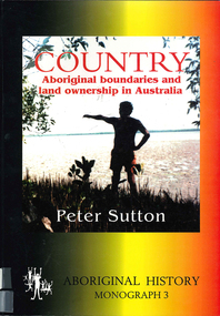
Book, Peter Sutton, Country : Aboriginal boundaries and land ownership in Australia, 1995
... Australias extant and imputed traditional Aboriginal territories; uses anthropological and linguistic evidence to expose inaccuracies and lacunae in book and map; appended are comments on the Davis map by regional specialists....Australias extant and imputed traditional Aboriginal territories; uses anthropological and linguistic evidence to expose inaccuracies and lacunae in book and map; appended are comments on the Davis map by regional specialists. Country : Aboriginal boundaries and land ownership in Australia Book Peter Sutton ...Critique of Davis and Prescott Aboriginal frontiers and boundaries in Australia and map, Davis, S. Australias extant and imputed traditional Aboriginal territories; uses anthropological and linguistic evidence to expose inaccuracies and lacunae in book and map; appended are comments on the Davis map by regional specialists.Maps, colour photographsindigenous land boundaries -
 Warrnambool and District Historical Society Inc.
Map - Map of Proposed Alterations to Warrnambool Harbour 1925, Warrnambool Harbour Committee, Warrnambool Harbour Proposed Wharves and Basin in Lake Pertobe with Eastern Wall, 1925
... regional ports. The Warrnambool Breakwater was completed in 1890 but failed to provide the shipping conditions needed to continue Warrnambool as a viable port. Many plans and proposals for port improvement such as this one were produced in the late 19th century and the first half of the 20th century with the port officially closed in the 1940s. Still today the Breakwater and Warrnambool Harbour conditions remain a source of contention. This map ...This map was printed in 1925 and contains the Warrnambool Harbour alterations proposed by the Warrnambool Harbour Committee incorporating the original designs of Captain Menzies, the Warrnambool Harbour Master and the City Engineer, Mr A. Lavercombe. The main features of the proposal were the extension of the Eastern Wall to almost enclose the harbour and a basin in Lake Pertobe. The design was to be placed before the Victorian Royal Commission on the Outer Ports which was established partly to examine the allegations of unsatisfactory work carried out in Warrnambool when the Breakwater was extended 300 feet in 1914 and also to make recommendations regarding all regional ports. The Warrnambool Breakwater was completed in 1890 but failed to provide the shipping conditions needed to continue Warrnambool as a viable port. Many plans and proposals for port improvement such as this one were produced in the late 19th century and the first half of the 20th century with the port officially closed in the 1940s. Still today the Breakwater and Warrnambool Harbour conditions remain a source of contention.This map is significant as it shows a 1925 design for Warrnambool Harbour hitherto little-known. It also has markings showing land sites of the time (BayView Hotel, Woollen Mill etc.)This is a map made of thick yellow paper pasted onto a cloth backing. It has two cloth tags at the top for tying up the map when folded. It appears to be a hand-drawn map copied with printed material added. The map is shaded green and red in some areas. Attached by nails to the map are wooden frames, rounded at the bottom and partly curved at the top. The map is torn and partly detached at the top. The top frame has a cord attached for hanging the map.warrnambool harbour, captain menzies, a.lavercombe city engineer, warrnambool breakwater, royal commission on outer ports -
 Warrnambool and District Historical Society Inc.
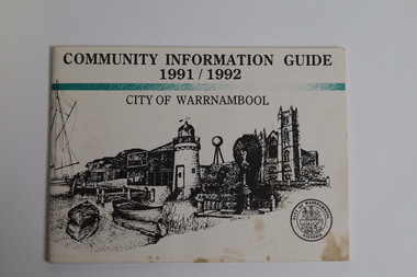
Booklet - Booklet Collection: City of Warrnambool Tourist Guides, Collett, Bain and Gaspar, Warrnambool
... map of the City of Warrnambool. The rear cover has photos of The Twelve Apostles and Hopkins Falls. [.9] 4 loose photocopied pages with Warrnambool Library and Corangamite Regional Library Service Warrnambool City Library black ink stamps. ...map of the City of Warrnambool. The rear cover has photos of The Twelve Apostles and Hopkins Falls. [.9] 4 loose photocopied pages with Warrnambool Library and Corangamite Regional Library Service Warrnambool City Library black ink stamps. ...This is a collection of sixteen tourist guides dating from the mid 1970's to 2013. These contain listings of businesses, accommodation, eateries and events in Warrnambool and district. They also include maps of Warrnambool and surrounds, advertising and photographs of various attractions. While mainly covering Warrnambool a small number of the guides cover the South West Region. These directories have mainly been published by the Warrnambool City Council and are a selection of the types of information provided to visitors at the Tourist information centre during this time period.These tourist guides give snapshots of the City of Warrnambool for the years covered and will be useful for research.[.1] An 8 page paper booklet with black printing and a black & white photo of the pond at the Botanical Gardens on the front cover. [.2] two photocopied A4 black and white pages from the book "On the Trail" K Winser 1956 (Main Roads of Australia) [.3] A trifold colour brochure with a stylised map of the coast on the yellow and blue front cover. The inside has stylised colour drawings on Warrnambool attractions. The rear cover has coloured photographs of bush, Liebig Street and Fletcher Jones gardens [.4] A trifold black and white brochure with a black line drawing of a whale on the front cover. [.5] A trifold white card with mauve printing. The front cover has a line drawing of the former Timor Street post office and a map of businesses and landmarks in Timor Street. The reverse side contains a brief history of Warrnambool. [.6] A 98 page stapled booklet with a foreword by Vanda Savill. There are 4 pages of coloured photographs. The remainder are black and white photographs. The front cover is purple with white writing in the lower third. There is an outline of the coast and five colour photographs of district attractions. The inside middle page has a map of the Western wonderland region. The content covers towns in this area. Content relating to Warrnambool is in the last six pages. [.7] Twelve loose photocopied black and white pages. The front cover has the Warrnambool Premier Town 1988-1991 logo and a photo of a Southern Right Whale and calf. The bottom right hand corner has a Standard Warrnambool logo. [.8] 44 page booklet printed with blue ink. The staples have been removed. The glossy front cover has blue printing with a coloured photo of Flagstaff Hill Maritime Village pond. The centre pages has a fold out map of the City of Warrnambool. The rear cover has photos of The Twelve Apostles and Hopkins Falls. [.9] 4 loose photocopied pages with Warrnambool Library and Corangamite Regional Library Service Warrnambool City Library black ink stamps. The front page line drawing illustrations of Warrnambool attractions [.10] A single sheet of glossy white paper folded in half to make four pages. The front page has a Warrnambool premier town logo 1979-1982 and blue printing and a visitor survey. [.11] A conference pack of light card folded to make a pocket containing three brochures, a shipwreck coast tourist directory and a Australian Heritage Parks Association conference program dated 24 to 27 May 1992. The front cover of the pack has green writing over a stylised upward arrow. There is a City of Warrnambool logo in the top right hand corner and two film strips diagonally across the cover containing photographs of Warrnambool. The rear cover has a coloured Warrnambool Premier Town logo. [.12] A 63 page stapled booklet with coloured photographs of Warrnambool. The front cover has black writing on white background. There is a coloured photograph of Flagstaff Hill in the middle of the cover and a Warrnambool City and Visit Victoria logos on the lower edge. The middle pages has a coloured of the city of Warrnambool with an inset map of Allansford. [.13] A single large sheet of white paper folded in ten to make a brochure. The front cover has black printing. The rear cover has a purple ink stamp for the City of Warrnambool Tourist Information Centre. When folded out the reverse side has a green, grey and white map of the South West Region of Victoria. [.14] A 48 page colour booklet on glossy paper. The front cover has white writing on a blue background and includes photographs of the Twelve Apostles, the Promenade walk, Flagstaff Hill and a southern right whale's tail. The rear cover has photographs of The Twelve apostles, a passenger train from Melbourne passing the Lake Pertobe playground, and a rural scene. There is white writing and a white Warrnambool City logo on a blue background. The centre pages have a stylised green and blue map of the city of Warrnambool. [.15] A 48 page colour booklet on glossy paper. The front cover has white writing over colour photographs of two people at a lookout, Flagstaff Hill, three southern right whales and a child at the Lake Pertobe playground. The lower edge has blue upper case writing on a white background. The rear cover has a colour photograph of the Twelve Apostles. The lower white border on the rear covers has a a blue and green City of Warrnambool logo and blue writing. The centre pages have a stylised green and blue map of the city of Warrnambool. [.16] A 64 page colour booklet on glossy paper. The front cover has black writing on a black background and there is a photograph of a southern right whale's tail. The lower edge has the Warrnambool City and Visit Victoria Logos. The centre pages have maps of Warrnambool and surrounds. [.1] This week in Warrnambool Vol 2 No. 5 Thurs 1st Feb. For the time of your life [.2] Warrnambool Way [.3] Warrnambool The Holiday Host on the South West Coast with compliments City of Warrnambool and Warrnambool Chamber of Commerce [.4] MMI Insurance presents Whales Giants of the Deep Whale Watcher's Logbook Warrnambool [.5] Warrnambool History began in Timor Street [.6] Western Wonderland Tourist Association [.7] A Premier Arrow Tour of Warrnambool Victoria's Premier Town Australia's Southern Right Whale Nursery [.8] Warrnambool The Heart of Victoria's Great Southwest Visitor's Handbook [.9] What to see in Warrnambool Victoria's Premier City 1979-1982 [.10] Win a Free Holiday & $200 Cash in Victoria's Premier Town [.11] Advancing Warrnambool together! [.12] Great Ocean Road Warrnambool Official Visitor Guide [.13] Tourist guide to the South West Region Victoria All it needs is you [.14] Warrnambool visitor guide 2005 the great ocean road experience attractions accommodation entertainment dining [.15] Warrnambool Visitor Guide 2006 the great ocean road experience Attractions Accommodation Entertainment Dining [.16] Official Visitors' Guide Warrnambool Victoria Australia Discover the Great Ocean Road warrnambool, warrnambool tourist guides -
 Warrnambool and District Historical Society Inc.
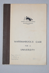
Booklet, Warrnambool's Case for a university, 1961
... regional campus at Sherwood Park after a merger with the Warrnambool Institute of Advanced Education. This booklet has some historical significance as it contains the information collated on the campaign in Warrnambool and the Western District for a university to be established in the Warrnambool area. deakin university history of warrnambool This is a soft cover booklet of 48 pages. It has a beige-coloured cover with black printing. The booklet has been bound with brown tape. It has printed information, black and white photographs, a fold-out map ...The information in this booklet was prepared by a University Investigation Committee formed in Warrnambool in 1961 to present the case for the establishment of a university in the Warrnambool area. The chairman of this committee was the Mayor of Warrnambool, Cr P. O’Sullivan and the secretary was W. L. George of Warrnambool. This submission was unsuccessful at the time but campaigning for a university continued. In 1961 Warrnambool Technical School in Timor Street was offering both secondary and tertiary courses in the technical and trades areas and in 1969 the tertiary section of this Technical School became the Warrnambool Institute of Advanced Education. The tertiary section was relocated in 1984 to Sherwood Park, a 94 hectare site on the Princes Highway five kilometres from Warrnambool’s C.B.D. In 1990 Deakin University established a regional campus at Sherwood Park after a merger with the Warrnambool Institute of Advanced Education. This booklet has some historical significance as it contains the information collated on the campaign in Warrnambool and the Western District for a university to be established in the Warrnambool area.This is a soft cover booklet of 48 pages. It has a beige-coloured cover with black printing. The booklet has been bound with brown tape. It has printed information, black and white photographs, a fold-out map, graphs and tables.deakin university, history of warrnambool -
 Bendigo Military Museum
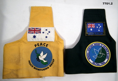
Uniform - BRASSARDS, PEACEKEEPER
... Regional Assistance Mission to Solomon Islands" and "Helpen Frew". 1. PNG Peace Keeping Mission Brassard. Bright yellow brassard. Stitched on white Australian ensign on arm picture of dove carrying a twig overlaid over a map of Bougainville in green. ...Brassards were worn by Peacekeeping Forces to identify their identity. Belonged to Gary Clift R.127835 M8073771. For RAMSI was deployed as ship's company HMAS BRUNEI. For PNG was deployed from HMAS TARAKAN & BRUNEI.1. PNG Peace Keeping Mission Brassard. Bright yellow brassard. Stitched on white Australian ensign on arm picture of dove carrying a twig overlaid over a map of Bougainville in green. Blue background. 2. RAMSI brassard for Solomon Island Peace Keeping Mission. Dark green with Australian Flag sewn onto sleeve. As is RAMSI emblem (yellow border, white dove over map os islands).1. Embroidered "Peace" & "Peace Monitorial Group". 2. Embroidered patch "Regional Assistance Mission to Solomon Islands" and "Helpen Frew".peace keepers, uniform, brassards, ramsi -
 Kiewa Valley Historical Society
Report - Alpine Study Area Volume 2 Maps, Land Conservation Council, 1970s
... regional reviews. They provide a framework for use of Public Land in Victoria. The Land Conservation Council was established by the Land Conservation Act 1970. These maps ...The Victorian Environmental Assessment Council and the former Environment Conservation Council (ECC) and Land Conservation Council (LCC) have completed 36 land use investigations over more than 35 years, including 27 regional reviews. They provide a framework for use of Public Land in Victoria. The Land Conservation Council was established by the Land Conservation Act 1970.These maps provide an assessment of the Alpine area at the time the maps were created. Some of the topics eg. Rainfall and water resources may change over the years thus providing a comparative analysis. Others may provide information for future development such as mineral exploration, building of a dam / tunnel etc.Blue box shaped folder containing 9 of 10 Maps of the Alpine Study Area produced by the Land Conservation Council. Maps include 1. Public land and descriptive blocks. 2. Physiography. 3. Topography. 4. Geology (missing). 5. Rainfall and water resources. 6. Vegetation 7. Land systems. 8. Recreation. 9. Primary production. 10. Minerals Ex library item. Stamped in red "Discarded From Stock / Swan Hill Regional Libraryalpine area, maps of alpine area, land conservation council -
 Yendon History Group
Boxed set of four (4) coasters - coaster 3
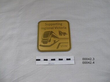
... Geelong Ballarat Railway railway 150th anniversary Supporting regional Victoria / V/Line Gold aluminium coaster, backed with royal blue felt. Embossed with a picture of a modern intercity train and a map of Victoria. ...Part of the contents of a souvenir gift bag given to those who rode on the re-enactment train for the 150th anniversary of the Geelong to Ballarat railway on 10 April 2012.Gold aluminium coaster, backed with royal blue felt. Embossed with a picture of a modern intercity train and a map of Victoria. Identical to coaster 4Supporting regional Victoria / V/Linegeelong ballarat railway, railway 150th anniversary -
 Yendon History Group
Boxed set of four (4) coasters - coaster 4
... Geelong Ballarat Railway railway 150th anniversary Supporting regional Victoria V/Line Gold aluminium coaster, backed with royal blue felt. Embossed with a picture of a modern intercity train and a map of Victoria. ...Part of the contents of a souvenir gift bag given to those who rode on the re-enactment train for the 150th anniversary of the Geelong to Ballarat railway on 10 April 2012.Gold aluminium coaster, backed with royal blue felt. Embossed with a picture of a modern intercity train and a map of Victoria. Identical to coaster 3.Supporting regional Victoria V/Linegeelong ballarat railway, railway 150th anniversary -
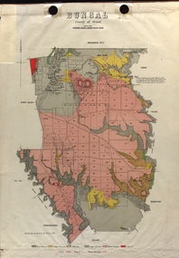 Federation University Historical Collection
Map - Plan, E.J. Dunn, Bungal County of Grant Parish Plan
... Bungal County of Grant Parish Plan Map Plan E.J. Dunn Geological Survey of Victoria State Regional Boundaries Committee Crown Lands and Survey ...E.J. Dunn was the surveyor of this parish plan.Colour geological plan of Bungal in the County of Grant, Victoria. The areas circled in red ar craters.plan, bungal, bungeltap, black horse co. egerton, egerton, mount egerton, sister rose shaft, south learmonth co, kerrit bareet, bungaeeltap, yaloak, eastern moorabool river, corong, bungal station preemptive right, lal lal, western moorabool river, moorabool rover, borhoneychurck, mount egerton battery, bungal creek -
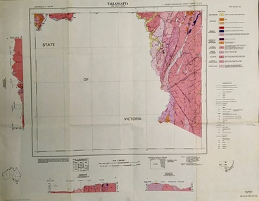 Federation University Historical Collection
Map - Geological, Tallangatta, New South Wales: 1:250,000 Geological Series, SJ 55-3, 1966, 1966
... Regional Geology. Topographical base compiled from Snowy Mountains Hydro Electrical Authority, Department of Lands, County maps and Snowy Lease Map. ...Regional Geology. Topographical base compiled from Snowy Mountains Hydro Electrical Authority, Department of Lands, County maps and Snowy Lease Map. ...Compiled by the Geological Survey of N.S.W., Division of Regional Geology. Topographical base compiled from Snowy Mountains Hydro Electrical Authority, Department of Lands, County maps and Snowy Lease Map. Other sheet adjoin this map. There are 13 formation sections grouped into 9 - Quaternary, Tertiary, Middle Devonian, Lower to Middle Devonian, Lower Devonian, Upper Silurian, Silurian, Upper Ordovician and Ordovician.Large coloured map showing geological features, faults, bores, rivers and mineral deposits.Scale of map, longitude and latitude, river names. "Tallangatta 1:250,00" written in black pen.tallangatta, new south wales, geological survey, topographical base, snowy mountains hydro electrical authority, department of lands, snowy lease map, department of mines, quaternary, tertiary, middle devonian, lower to middle devonian, lower devonian, uper siluran, silurian, upper ordovician, ordovician -
Glen Eira Historical Society
Document - BRIGHTON GENERAL CEMETERY
... Cemeteries Brighton Authors Journalists Occupations People Documents Pamphlets Tourist Leaflets Migrants Widowers Knowles Marion Cambridge Ada Buckley Herbert Browne Thomas Alexander Walstab George Alexander Cunningham Edward Sheldon Dow John Lament Dexter Caroline Lynch Caroline Brighton General Cemetery People Associated With Culture Brighton Cemetorians East Brighton North Road People By Circumstance Knowles Joseph Cross George Frederick Ribbledon Herbert Horseracing Equestrian Events Pioneers Squatters Civil Servants Police Boldrewood Rolf Robbery Under Arms The Miner’s Right Babes In The Bush Communication Activities The Age The Herald The Argus Edward Wilson Estate Burketown The Leader Walstab Mary Anne Nolan Anne Jackson Maval Mary Sir Graham Barry Ministry Dow Marion Jane Orr Marion Jane McKenzie David Dexter William Ladies Almanack: The Southern Cross Or Australian Album And New Years Gift Institute Of Hygiene Lynch William Mayors Bombala Cheltenham Pioneer Cemetery Cheltenham Memorial Park Bunurong Memorial Park Cheltenham And Regional Cemeteries Trust Springvale Cemetery Southern Metropolitan Cemeteries Trust Manson Johanna Religious Groups Groups (People) Funerals Cremation Joynt William Donovan Boyd Arthur Peeler Walter Soldiers Armed Forces McCubbin Frederick Casey James Joseph Buckley Maurice Vincent Ogg Charles Catani Carlo Sutton Henry Newland James Ernest Laver Frank Joseph Furphy John Boyd Guy Ballantyre George Frederick Gordon Adam Lindsay McCoy Frderick Higin Batham George Monash John Bent Thomas Miller Septimus Cohen Godfrey Abraham Creswell William Rooke Guilfoyle William Boyd Theodore Penleigh Heinze Bernard Taylor Joseph Leslie Theodore Taylor Squizzy Tritschke Alma Elder James Alexander MacKenzie Breen Marie Boyd William Merrie Boyd Doris Maps East Brighton Hawthorn Road East Brighton Sheffield Road East Brighton Sussex Road Presbyterian Religion Baptist Religion Jewish Religion Roman Catholic Religion Methodist Religion Church of England Anglican Religion Document BRIGHTON GENERAL CEMETERY ...This file contains two brochures from the Brighton General Cemetery, one black and white dated 2013, the other in colour and undated. The first provides eight short biographies of notable writers and journalists interned at the cemetery, the other containing a map with the location of thirty-four notable internments unrelated to literature. Both provide a brief history of the cemetery with the first also including images of some of the people discussed and what appears to be the cemetery emblem. The second brochure displays a colour photograph of a structure in the cemetery.cemeteries, brighton, authors, journalists, occupations, people, documents, pamphlets, tourist leaflets, migrants, widowers, knowles marion, cambridge ada, buckley herbert, browne thomas alexander, walstab george alexander, cunningham edward sheldon, dow john lament, dexter caroline, lynch caroline, brighton general cemetery, people associated with culture, brighton cemetorians, east brighton north road, people by circumstance, knowles joseph, cross george frederick, ribbledon herbert, horseracing, equestrian events, pioneers, squatters, civil servants, police, boldrewood rolf, robbery under arms, the miner’s right, babes in the bush, communication activities, the age, the herald, the argus, edward wilson estate, burketown, the leader, walstab mary anne, nolan anne, jackson maval mary, sir graham barry ministry, dow marion jane, orr marion jane, mckenzie david, dexter william, ladies almanack: the southern cross or australian album and new years gift, institute of hygiene, lynch william, mayors, bombala, cheltenham pioneer cemetery, cheltenham memorial park, bunurong memorial park, cheltenham and regional cemeteries trust, springvale cemetery, southern metropolitan cemeteries trust, manson johanna, religious groups, groups (people), funerals, cremation, joynt william donovan, boyd arthur, peeler walter, soldiers, armed forces, mccubbin frederick, casey james joseph, buckley maurice vincent, ogg charles, catani carlo, sutton henry, newland james ernest, laver frank joseph, furphy john, boyd guy, ballantyre george frederick, gordon adam lindsay, mccoy frderick, higin batham george, monash john, bent thomas, miller septimus, cohen godfrey abraham, creswell william rooke, guilfoyle william, boyd theodore penleigh, heinze bernard, taylor joseph leslie theodore, taylor squizzy, tritschke alma, elder james alexander mackenzie, breen marie, boyd william merrie, boyd doris, maps, east brighton hawthorn road, east brighton sheffield road, east brighton sussex road, presbyterian religion, baptist religion, jewish religion, roman catholic religion, methodist religion, church of england, anglican religion -
Glen Eira Historical Society
Document - History of the City of Caulfield
... Regional Planning, University of Melbourne, 1968 by L. Alwis, P. Rowe, N. Wootten. Melbourne, ‘City of Caulfield: An Illustrated City Report’. 4/Typewritten document (undated) titled ‘The Structure of Local Government in Victoria with notes on the history of the City of Caulfield’. 8 pages, 2 copies. This document also includes a map...Regional Planning, University of Melbourne, 1968 by L. Alwis, P. Rowe, N. Wootten. Melbourne, ‘City of Caulfield: An Illustrated City Report’. 4/Typewritten document (undated) titled ‘The Structure of Local Government in Victoria with notes on the history of the City of Caulfield’. 8 pages, 2 copies. This document also includes a map ...This file contains 4 items: 1/Typewritten document titled ‘The City of Caulfield’. Author and date unknown. 1 page (back and front), 2 copies. Document covers topics such as origins of the name ‘Caulfield’, early settlement and the Caulfield Cup. 2/Typewritten document titled ‘History of Caulfield Council’. Author and date unknown. 6 pages, 3 copies. Document covers subjects such as early settlement, Aboriginal influence, Caulfield Road Board, Shire of Caulfield, Borough and town boundaries, coat of arms, and Freedom of Entry to the City. 3/Typewritten document (undated + author unknown) titled ‘The Structure of Local Government in Victoria with a history of the City of Caulfield’. 13 pages. Covers the following subjects: Powers, Planning, Public Works, Trading Undertakings, Health Services, Municipalities, Wards Electors or Ratepayers, Voters Roll, Councillors, Officers, Finance, Nature of Soil and Vegetation, Parks and Gardens and Reserves, Coat of Arms, Boundaries, How Did Caulfield get its Name, Aboriginal Influence, Caulfield Road Board, Shire of Caulfield, Borough and Town and the City of Caulfield. Also covered is early settlement. Note at the end of the document mentions that the historical content contained in the last section was based upon a thesis for the Department of Town and Regional Planning, University of Melbourne, 1968 by L. Alwis, P. Rowe, N. Wootten. Melbourne, ‘City of Caulfield: An Illustrated City Report’. 4/Typewritten document (undated) titled ‘The Structure of Local Government in Victoria with notes on the history of the City of Caulfield’. 8 pages, 2 copies. This document also includes a map/diagram of the city with boundaries and wards showing locations of railway stations and parks. Document covers the structure of local government and its functions then goes on to focus on City of Caulfield with subjects similar to those covered in item 3. Document signed off by Deputy Town Clerk.city of caulfield, caulfield john, caulfield baron, caulfield racecourse, elsternwick, ripponlea, st. mary’s church, caulfield council, kooyong road, neerim road, bambra road, greenmeadows house, caulfield park, paddy’s swamp, dandenong road, caulfield grammar school, chisholm institute of technology, murrumbeena, glen eira road, alma road, orrong road, balaclava road, inkerman road, ‘grosmont’, caulfield school room, caulfield road board, caulfield road district, crimean war, victorian amateur turf club, caulfield cup, glenhuntly road, north road, glenhuntly station, ormond station, outer circle railway, local government, gardenvale, carnegie, rosstown, poath road, nepean highway, hotham street, ormond park, princes park, ross william murray, caulfield institute of technology, ‘ross’ folly’, hawthorn road, glenhuntly, ormond, morris t. w., lloyd charles du plan, meals on wheels, shire of caulfield, caulfield railway station, caulfield rsl, bouran road, murrum murrumbeen, kooyong road, great dandenong road, neerim road, trams, prahran and malvern tramways trust, fisher andrew, mackinnon reserve, dover street, ‘glen eira’, blair max cr., insignia, third ordnance services unit, schools, street lighting, lampriere, mr. bevan, the caulfield leader, davies j. henry, curraweena road, st. georges road, o’neill college, hope george, market gardens, koornang reserve, packer reserve, murrumbeena reserve, hopetoun gardens, greenmeadows gardens, mirambeena, caulfield technical college, hart john, langdon h. j., ‘rosecraddock’, judge webb, ‘crotonhurst’, service james, ‘kilwinning’, ricketson henry, grimwade frederick sheppard, airdrie, jenner, st. aubin’s, caulfield john p. t., harlston, lempriere, lord reserve, ‘cantala’ -
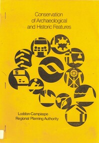 Bendigo Historical Society Inc.
Book - CONSERVATION OF ARCHAEOLOGICAL AND HISTORIC FEATURES, 1977
... Conservation of archaeological and historic features Loddon-Campaspe Regional Planning Authority. 51 pages, with photos, and maps....History House 11 Mackenzie Street Bendigo goldfields BENDIGO Buildings historic and archaeological heritage history buildings historic features heritage features Loddon Campaspe Regional Planning Authority Conservation of archaeological and historic features Loddon-Campaspe Regional Planning Authority. 51 pages, with photos, and maps. Book CONSERVATION OF ARCHAEOLOGICAL AND HISTORIC FEATURES ...Conservation of archaeological and historic features Loddon-Campaspe Regional Planning Authority. 51 pages, with photos, and maps.Loddon Campaspe Regional Planning Authoritybendigo, buildings, historic and archaeological, heritage, history, buildings, historic features, heritage features -
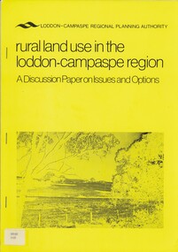 Bendigo Historical Society Inc.
Book - RURAL LAND USE IN THE LODDON-CAMPASPE REGION, 1976
... History House 11 Mackenzie Street Bendigo goldfields BOOK Rural land use loddon campaspe rural land use agriculture Loddon-Campaspe regional planning authority RURAL LAND USE IN THE LODDON-CAMPASPE REGION - a discussion paper on issues and options. 30 pages, with maps. ...RURAL LAND USE IN THE LODDON-CAMPASPE REGION - a discussion paper on issues and options. 30 pages, with maps.Loddon-Campaspe regional planning authoritybook, rural, land use, loddon campaspe, rural, land use, agriculture -
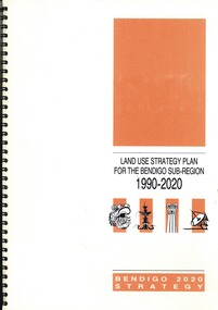 Bendigo Historical Society Inc.
Book - LAND USE STRATEGY PLAN FOR THE BENDIGO SUV-REGION 1990-2020, 1991
... Prepared by three consulting firms for the Loddon-Campaspe Regional Planning Authority Inside front cover are: 1 Cover sheet, 3 stapled reports covering Bendigo 2020 land use strategy plan, Issues Report, Environment, also a 5 page booklet planning for the future with information and maps....Prepared by three consulting firms for the Loddon-Campaspe Regional Planning Authority Inside front cover are: 1 Cover sheet, 3 stapled reports covering Bendigo 2020 land use strategy plan, Issues Report, Environment, also a 5 page booklet planning for the future with information and maps. ...Land Use Strategy Plan for the Bendigo Sub-Region, 1990 - 2020. Bendigo 2020 Strategy. Prepared by three consulting firms for the Loddon-Campaspe Regional Planning Authority Inside front cover are: 1 Cover sheet, 3 stapled reports covering Bendigo 2020 land use strategy plan, Issues Report, Environment, also a 5 page booklet planning for the future with information and maps.Loddon-Campaspe Regional Planning Authoritybendigo, planning, 2020 strategy. -
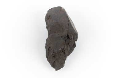 The Beechworth Burke Museum
Geological specimen - Brown coal
... regional and state industries that were reliant on coal imports at the time. The significance of the stie is reduced by the poor state of preservation of the coal mining and processing fabric". This specimen is part of a larger collection of geological and mineral specimens collected from around Australia (and some parts of the world) and donated to the Burke Museum between 1868-1880. A large percentage of these specimens were collected in Victoria as part of the Geological Survey of Victoria that begun in 1852 (in response to the Gold Rush) to study and map ...This particular specimen was recovered from the Lal Lal Coal and Iron Mine in Victoria, 19km from Ballarat. Brown Coal was discovered here in 1857, just alongside the Geelong to Ballarat Railway line. This discovery of lignite (brown coal) was the first in Victoria, which would bring important benefits to the region and state, both of which had previously been reliant on coal imports. In the 1860s, iron ore was found just 5km from Lal Lal, and the area was converted into an Iron Ore Mine. The Lal Lal Iron Mining Company took over operations in 1874, who then peaked iron production in 1884. This mine continued operations until June 1884, when the blast furnace was extinguished and never recommenced. The blast furnace at Lal Lal is considered one of the most important and highly significant sites ion early industrial history in Australia, as it is the only remaining best furnace from the nineteenth century in the Southern Hemisphere. The furnace ruins are 17 metres high, and are clearly visible today on Iron Mine Road, Lal Lal, near the Bungal Dam. This specimen of Lignite (brown coal) is significant, as it was mined from the area where brown coal was first discovered in Victoria, leading to an important and controversial future of the mining and use of brown coal in this State. The Victorian Heritage Database has listed the Lal Lal Coal Mine with local significance, with their Statement of Significance stating: "The Lal Lal coal mine is historically significant as the site of the first discovery of lignite (brown coal) in Victoria, and one that promised important benefits to regional and state industries that were reliant on coal imports at the time. The significance of the stie is reduced by the poor state of preservation of the coal mining and processing fabric". This specimen is part of a larger collection of geological and mineral specimens collected from around Australia (and some parts of the world) and donated to the Burke Museum between 1868-1880. A large percentage of these specimens were collected in Victoria as part of the Geological Survey of Victoria that begun in 1852 (in response to the Gold Rush) to study and map the geology of Victoria. Collecting geological specimens was an important part of mapping and understanding the scientific makeup of the earth. Many of these specimens were sent to research and collecting organisations across Australia, including the Burke Museum, to educate and encourage further study.A hand-sized light-weight, soft and combustable sedimentary rock specimen, that is dark brown in colour. The specimen has jagged edges, as though parts of the rock have crumbled away. Brown coal, or Lignite, is formed naturally from compressed peat, and is typically found in natural basins. The stages to the formation of coal ('coalification') begin with plant material and wood, which will decay if it is not subjected to deep burial or heating, and turn into Peat. Peat, when sufficiently compressed naturally, will turn into Brown Coal (Lignite), and finally into Black Coal (sub-bituminous, bituminous and anthracite). Each successive stage has a higher energy content and lower water content. It is brownish-black in colour. Brown Coal has a high moisture content, between 50 and 75 percent, and a low carbon content. Some Brown Coals may be stratified, with layers of plant matter, which means little coalification has occurred beyond the peat natural processing stage. When Brown Coal is submerged in dilute nitric acid or boiling potassium hydroxide solution, it reacts to produce a reddish solution, of which higher-ranked coals do not. When brown coal is pulverised and burned in boilers, the steam is used to drive turbines, which generates electricity. It is the lowest rank of coal, as when burned, it creates a relatively low heat content, which in turn does not create a great output of steam. burke museum, beechworth, indigo shire, beechworth museum, geological, geological specimen, mineralogy, brown coal, brown coal specimen, lignite, lal lal, lal lal coal mine, lal lal iron mine, ballarat, blast furnace -
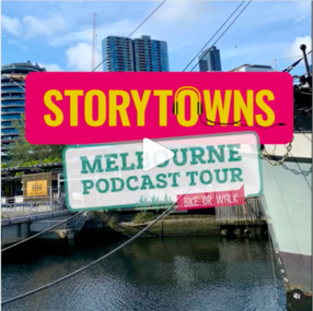 Mission to Seafarers Victoria
Document - Media release, Podcast reveals unique Melbourne experiences, April 2022
... And if you’re feeling adventurous this weekend, take a road trip through regional Australia and let us jazz up your adventure, where the local folks are the true stars of the story. Sue Dight was interviewed to add to t The interview was a to way to put the Mission to Seafarers on the map and increase its visitation. ...In April 2022, the City of Melbourne partnering Storytown, with launched the "Melbourne Podcast Tour". Storytown, an application created by Jarrod Pickford offering audio guides. This self-guided tour takes you along the Yarra River, from Southbank to Docklands, taking around 1.5 hours to complete by bike or 2 hours by foot. From their website: "Told by locals Discover Australia through the voices of its locals! Storytowns collaborates with communities to craft immersive audio guides, offering authentic travel tales from the heart of each neighborhood. Simply grab your headphones, download our app and explore Melbourne’s suburbs with with our fresh-out-the-oven “Railway Stories” audio guides! And if you’re feeling adventurous this weekend, take a road trip through regional Australia and let us jazz up your adventure, where the local folks are the true stars of the story. Sue Dight was interviewed to add to tThe interview was a to way to put the Mission to Seafarers on the map and increase its visitation. Unfortunately the tour is not avalaible anymore (as from 2023).Digital copy of a media releasecom, city of melbourne, app, storytown, sue dight, on the map, marketing, audioguide, jarrod pickford, audio guides, self-guides tour, podcast, radio interview -
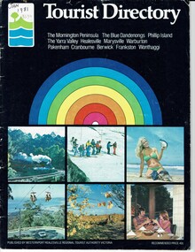 Phillip Island and District Historical Society Inc.
Booklet, Tourist Directory 1981 and Guide to Phillip Island & surrounds 1995
... Phillip Island and District Historical Society Inc. phillip-island-and-the-bass-coast Historical Tourism Tourist brochure Accomodation restaurants Map of Phillip Island Tourist Directory, Published by Westernport Healesville Regional Tourist Authority Victoria. ...HistoricalLarge black booklet with brightly coloured cover with tourist photos. Inside is black type with descriptions, maps, advertisements and photos. Guide is smaller with white and red writing and maps. Inside it has red writing on history, climate and information on Phillip Island and small advertisements of attractions.Tourist Directory, Published by Westernport Healesville Regional Tourist Authority Victoria. Printed by Standard Newspapers, Cheltenham. Guide to Phillip Island & surrounds.Phillip Island Information Centre RMB 1305 Newhaven.tourism, tourist brochure, accomodation, restaurants, map of phillip island -
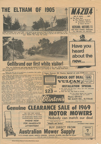 Eltham District Historical Society Inc
Folder, Pioneers & Painters; Shire of Eltham Historical Society research notes, background information, etc, 1969-1986, 1969-1986
... The public campaign received generous response and the material collected became the genesis for the Shire of Eltham Pioneers Photograph collection now held in partnership between Eltham District Historical Society and Yarra Plenty Regional Library (Eltham Library). a.g. thomas a.r. thomas alan marshall bridge road charles joseph latrobe council members d.w. lachlan eltham district road board eltham shire council ernie orford f. barrett francis rogerson g. bransprone james donaldson james johnston john bell john thomson joseph tice gellibrand lower plenty bridge m.b. watson main road map patrick turnbull peter morris pioneers and painters post office rev. longfield sepp shire of eltham pioneers photograph collection shire secretary st margaret's church thomas armstrong thomas bell thomas sweeney william bell (1796-1870) Centenary Celebrations Christmas Hills Clifton Pugh David Newbury Dudley Street Eltham gareth jones roberts Hurstbridge John Perceval Joy Peck Kangaroo Ground Kinglake Lower Plenty Luther Haley General Store Montmorency Neil Douglas Panton Hill Peter Glass Research (Vic.) ...Material pertaining to the production of a history of the Shire of Eltham, "Pioneers & Painters: One Hundred Years of Eltham and its Shire" in recognition of the shire's centenary in 1971 Item Title Caption 04768-1 Newspaper clipping - The Eltham of 1905; Gellibrand our first white visitor? Diamond Valley News, 24 June 1969, p5 04768-2 Newspaper clipping - The Eltham of 1905; Gellibrand our first white visitor? Heidelberger, 25 June 1969 04768-3 Notes on Eltham District Road Board Members 1866-1871 04768-4 Notes on Eltham District Road Board Members 1866-1871 04768-5 Map showing Gellibrand's likely route through district 12-13 February 1836 and Hoddles's route of Febrary 1838 04768-6 Notes by Shire Secretary, M.B. Watson regarding meeting with Reverend Longfield regarding history of St Margaret's Church 04768-7 Alan Marshall's notes from discussion with Mr. F. Barrett regarding SEPP images 611, 635 and 636 SEPP_0611 SEPP_0635 SEPP_0636 04768-8 Transcripts of letter from local residents to Charles Joseph Latrobe requesting a bridge over the Plenty River dated 10 April 1849 and his reply dated 5 May 1849; from Latrobe Library Archives - Land Branch Records 04768-9 Notes on history of Eltham Shire, Centenary events and publication of Pioneers & Painters for release in conjunction of opening of new Library 04768-10 Newspaper clipping - Glossy record of shire's romantic past and the people who made it by Fab Calafuri, Diamond Valley News, Tuesday, December 16, 1986, p18 SEPP_0755-3 Letter: Acknowledgement from Colin J. Bock, Eltham Shire Secretary to A.R. Thomas of Bendigo for copy of 1913 photograph of Shire of Eltham Councilors, 21 May 1973 A.R. Thomas' father Mr. A.G. Thomas, C.E., was the Shire Secretary at the time in 1913. Cross Ref: SEPP_0755 The idea to develop a book on the history of the Shire of Eltham to be edited by noted author, Alan Marshall in celebration of the shire's centenary was initiated in 1969. The Shire of Eltham Historical Society undertook significant research in conjunction with Alan Marshall locating material at various institutions and other societies; interviewing longer term residents and a public campaign through the local press to acquire photographic material for duplication and use in the book. The public campaign received generous response and the material collected became the genesis for the Shire of Eltham Pioneers Photograph collection now held in partnership between Eltham District Historical Society and Yarra Plenty Regional Library (Eltham Library).Paper documents of various sizes and newspaper clippingsa.g. thomas, a.r. thomas, alan marshall, bridge road, charles joseph latrobe, council members, d.w. lachlan, eltham district road board, eltham shire council, ernie orford, f. barrett, francis rogerson, g. bransprone, james donaldson, james johnston, john bell, john thomson, joseph tice gellibrand, lower plenty bridge, m.b. watson, main road, map, patrick turnbull, peter morris, pioneers and painters, post office, rev. longfield, sepp, shire of eltham pioneers photograph collection, shire secretary, st margaret's church, thomas armstrong, thomas bell, thomas sweeney, william bell (1796-1870), centenary celebrations, christmas hills, clifton pugh, david newbury, dudley street, eltham, gareth jones roberts, hurstbridge, john perceval, joy peck, kangaroo ground, kinglake, lower plenty, luther haley general store, montmorency, neil douglas, panton hill, peter glass, research (vic.), sheila ferguson, shire of eltham, st andrews, yarra glen