Showing 476 items matching "victoria land use"
-
 Greensborough Historical Society
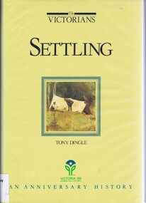
Book, Settling: The Victorians. By Tony Dingle, 1984_
... victoria land use...Greensborough Historical Society 34A Glenauburn Road Lower Plenty Lower Plenty melbourne Part 2 of a 3-part series deals with land use from Aboriginal land use to European settlement. Published to commemorate the 150th anniversary of European settlement in Victoria. victoria land use victoria history victoria social conditions tony dingle Hard cover. 274 pages, illus., maps, end maps. ...Part 2 of a 3-part series deals with land use from Aboriginal land use to European settlement.Published to commemorate the 150th anniversary of European settlement in Victoria.Hard cover. 274 pages, illus., maps, end maps.victoria land use, victoria history, victoria social conditions, tony dingle -
 Greensborough Historical Society
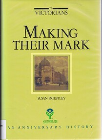
Book, Making their mark: The Victorians; by Susan Priestley, 1984_
... victoria land use...Published to commemorate the 150th anniversary of the European settlement of Victoria victoria land use victoria economic conditions victoria history victoria social conditions susan priestley melbourne suburbs Hard cover. 382 pages, illus., maps. ...This text deals with the economic development of Victoria in the 19th and early 20th century.Published to commemorate the 150th anniversary of the European settlement of VictoriaHard cover. 382 pages, illus., maps.victoria land use, victoria economic conditions, victoria history, victoria social conditions, susan priestley, melbourne suburbs -
 Bacchus Marsh & District Historical Society
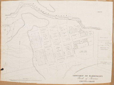
Map, Maddingley Township, Parish of Parwan, 1880s
... Maddingley Victoria Maps...Land Use... Maps Maddingley Victoria Maps Land Use Maddingley Victoria History Bottom of Map: Surveyor-General's Office, Melbourne, Sept 6th, 1856 A single page paper map showing land allotments, streets, rivers, creeks, park lands, the railway line and Bacchus Marsh railway station in the township of Maddingley. ...This map is dated Sept. 6th 1856. However places in the township of Maddingley which did not appear until the late 1880s such as the Bacchus Marsh Railway Station and line are shown on this map in their correct locations. This suggests the map has been derived from an earlier map. An earlier date of 1843 with a surveyor's name preceding it can also be seen on the map. The map is important because it indicates the location and dimensions of early but now discontinued use of land such as the showgrounds and police paddock and a site reserved for the Church of England which was not ultimately used for a permanent church. A single page paper map showing land allotments, streets, rivers, creeks, park lands, the railway line and Bacchus Marsh railway station in the township of Maddingley. The map is pasted into a bound volume containing 76 maps or plans in total. Bottom of Map: Surveyor-General's Office, Melbourne, Sept 6th, 1856bacchus marsh victoria maps, maddingley victoria maps, land use, maddingley victoria history -
 Bacchus Marsh & District Historical Society
Map, Gaynor Street Land Sales, Maddingley, circa 1880s-1890s
... Maddingley Victoria Maps...Land Use...Features present on the map such as the Bacchus Marsh Railway Station indicate the land sale must have taken place some time after 1887 when the Railway Station opened. Bacchus Marsh Victoria Maps Maddingley Victoria Maps Land Use Maddingley Victoria History Land Sales Bacchus Marsh Land Sales Maddingley A single page paper map showing land allotments for sale in the Maddingley area of Bacchus Marsh. ...This map was produced for a major sale of land in the Maddingley area of Bacchus Marsh. The precise date of the sale has not been determined. Features present on the map such as the Bacchus Marsh Railway Station indicate the land sale must have taken place some time after 1887 when the Railway Station opened. A single page paper map showing land allotments for sale in the Maddingley area of Bacchus Marsh. Locations shown include Gaynor Street, Maddingley Road South, Parwan Road, Mitchem Street, Typpynge Street, Finn Street and East Maddingley Road. . The map is pasted into a bound volume containing 76 maps or plans in total. High resolution digital image stored on BMDHS computer network. bacchus marsh victoria maps, maddingley victoria maps, land use, maddingley victoria history, land sales bacchus marsh, land sales maddingley -
 Bacchus Marsh & District Historical Society
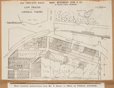
Map, Gaynor Street Area Land Sales, Maddingley, 1888
... Maddingley Victoria Maps...Land Use...land in the Maddingley area of Bacchus Marsh in 1888. The sale was conducted by two firms from Melbourne, Carney and Kelly 12 Swanston Street Melbourne. and 'Richardson, Kerr & Co. 40 Flinders Lane Melbourne. 136 blocks were for sale. Bacchus Marsh Victoria Maps Maddingley Victoria Maps Land Use ...This map was produced for a major sale of land in the Maddingley area of Bacchus Marsh in 1888. The sale was conducted by two firms from Melbourne, Carney and Kelly 12 Swanston Street Melbourne. and 'Richardson, Kerr & Co. 40 Flinders Lane Melbourne. 136 blocks were for sale.A single page paper map showing land allotments for sale in the Maddingley area of Bacchus Marsh. Locations shown include Gaynor Street, Maddingley Road South, Parwan Road, Mitchem Street, Typpynge Street, Finn Street and East Maddingley Road. . The map is pasted into a bound volume containing 76 maps or plans in total. High resolution digital image stored on BMDHS computer network. bacchus marsh victoria maps, maddingley victoria maps, land use, maddingley victoria history, land sales bacchus marsh, land sales maddingley -
 Bacchus Marsh & District Historical Society
Map, Maddingley Township, Parish of Parwan, circa 1890s
... Maddingley Victoria Maps...Land Use...Bacchus Marsh Victoria Maps Maddingley Victoria Maps Land Use Maddingley Victoria History A single page paper map showing land allotments, streets, rivers, creeks, park lands, the railway line and Bacchus Marsh railway station in the township of Maddingley. ...Maddingley is a locality or township within the broader township area of Bacchus Marsh. This map is not dated. However features in Maddingley which appeared in the 1880s and 1890s are present in the map, These include the Bacchus Marsh Railway Station and the Bacchus Marsh Showgrounds. The main residential and commercial area of Maddingley is shown on this map in an area bounded by Bacchus Street, Barry Street, Griffith Street and Maddingley Road. Other streets visible are Franklin Street, Inglis Street, Labilliere Street, McCrae Street, Moore Street and part of Station Street.A single page paper map showing land allotments, streets, rivers, creeks, park lands, the railway line and Bacchus Marsh railway station in the township of Maddingley. The map is pasted into a bound volume containing 76 maps or plans in total. bacchus marsh victoria maps, maddingley victoria maps, land use, maddingley victoria history -
 Bacchus Marsh & District Historical Society
Map, Maddingley Township, Parish of Parwan, County of Grant, 1856
... Maddingley Victoria Maps...Land Use...Bacchus Marsh Victoria Maps Maddingley Victoria Maps Land Use Maddingley Victoria History Two inscriptions: 1. ...Maddingley is a locality or township within the broader township area of Bacchus Marsh. This map is dated 1856 but is based on an earlier survey in 1843. The main area of Maddingley shown on this map is an area bounded by Bacchus Street, Moore Street, Griffith Street and Franklin Street. Other streets visible are Inglis Street, Labilliere Street, McCrae Street. The area to the east of Franklin Street is not sub-divided and is described as an 'alluvial flat. A single page paper map showing land allotments, streets, and natural watercourses in the township of Maddingley. The map is pasted into a bound volume containing 76 maps or plans in total. Two inscriptions: 1. A.J. Skene Surveyor, 1843. ; 2. Surveyor-General's Office Melbourne, Sept 6, 1856. (Lithographed by R. Meikle)bacchus marsh victoria maps, maddingley victoria maps, land use, maddingley victoria history -
 Whitehorse Historical Society Inc.
Pamphlet, Scoresby EES, 1/07/1998 12:00:00 AM
... victoria...libraries...transport...land use...Whitehorse Historical Society Inc. 2-10 Deep Creek Road Mitcham melbourne freeways scoresby transport corridor environment effects statement ringwood south eastern freeway frankston burwood highway dandenong victoria libraries transport land use springvale road burwood burwood tram services Information bulletin on the Scoresby Transport Corridor Information bulletin on the Scoresby Transport Corridor on exhibition for public comment. ...Information bulletin on the Scoresby Transport CorridorInformation bulletin on the Scoresby Transport Corridor on exhibition for public comment. It covers major possible transport projects in the area between Ringwood and Frankston including freeways, extensions to the Burwood tram line and the Glen Waverley Rail line.Information bulletin on the Scoresby Transport Corridorfreeways, scoresby transport corridor environment effects statement, ringwood, south eastern freeway, frankston, burwood highway, dandenong, victoria, libraries, transport, land use, springvale road burwood, burwood, tram services -
 Surrey Hills Historical Society Collection
Document, Copy of title, 391 Mont Albert Road, Surrey Hills
... Historical search statement from Land Use Victoria is dated 15/09/2020. The reference is Vol 5414, Fol 1082747. ...Note that the road was subsequently re-numbered and became 293 Mont Albert Road. 391 Mont Albert Road had previously been the home of the Sherar family and had originally been built for Charles J Currie, a solicitor. 391 Mont Albert Road Victoria Melba Turner Amy Lillian Hughes Muriel Harper Gilchrist Mosgiel Hospital 293 Mont Albert Road Sherar family Charles J Currie Quamby Elizabeth Maitland Anderson Three pages relating to the title of 391 Mont Albert Road. Historical search statement from Land Use ...Victoria Melba Turner (known as Melba) and Elizabeth Maitland Anderson trained together at the Melbourne Hospital, completing their training just months apart; Melba in October 1914 and Elizabeth in May 1915. Both were registered on 31.3.1925 and listed at 391 Mont Albert Road, the site of Mosgiel Private Hospital. Note that the road was subsequently re-numbered and became 293 Mont Albert Road. 391 Mont Albert Road had previously been the home of the Sherar family and had originally been built for Charles J Currie, a solicitor. Three pages relating to the title of 391 Mont Albert Road. Historical search statement from Land Use Victoria is dated 15/09/2020. The reference is Vol 5414, Fol 1082747. 391 mont albert road, victoria melba turner, amy lillian hughes, muriel harper gilchrist, mosgiel hospital, 293 mont albert road, sherar family, charles j currie, quamby, elizabeth maitland anderson -
 Kiewa Valley Historical Society
Photographs – Skiers at Falls Creek – Set of 10 black and white photographs
... After World War II, the Kiewa Hydro-Electric Scheme was started in the Kiewa River valley by the State Electricity Commission of Victoria. On land previously used only for summer cattle grazing in the natural alpine grasslands, the first ski lodge was built in 1948 by workers from the hydro scheme as skiing was a popular recreation. ...Kiewa Valley Historical Society Mount Beauty Information Centre 31 Bogong High Plains Rd Mt Beauty high-country After World War II, the Kiewa Hydro-Electric Scheme was started in the Kiewa River valley by the State Electricity Commission of Victoria. On land previously used only for summer cattle grazing in the natural alpine grasslands, the first ski lodge was built in 1948 by workers from the hydro scheme as skiing was a popular recreation. ...After World War II, the Kiewa Hydro-Electric Scheme was started in the Kiewa River valley by the State Electricity Commission of Victoria. On land previously used only for summer cattle grazing in the natural alpine grasslands, the first ski lodge was built in 1948 by workers from the hydro scheme as skiing was a popular recreation. Many of the hydro employees were of European background and had grown up enjoying skiing and snow sports in their homelands and were keen to continue to pursue their winter sports interests. The first lift, a rope tow, was built in 1951 and the first chairlift in Australia was constructed there in 1957. Two T-Bars were opened in 1961. In 1964, the Victorian Municipal Directory recorded that Falls Creek had 29 ski club lodges and 16 commercial lodges.Employees of the State Electricity Commission of Victoria in the Kiewa River Valley were the earliest skiers on the Bogong High Plains and built one of the first ski lodges at Falls Creek. They were amongst those pivotal in the development of the skiing and tourist industry at Falls Creek and on the Bogong High Plains. Set of 10 black and white photographs of various skiers at Falls Creek Victoria1. From Left-John Robertson Myrtleford; Bill Bridgford, St Trinians; Girl not known; Roy Wolpole, Myrtleford; Fin McAuliffe, Myrtleford; Looking on foreground, Toni St Elmo 2. Falls Creek. Property of State Electricity Commission of Victoria Publicity Photo Negative No PB4046. Publicity Branch, 15 William St Melbourne. 3. Avic Lajons 4. No markings 5. Bill Bridgeford (lower person on slope) 6. Max Lawrence? Facing skiers 7. 6575. Indistinguishable red stamp on back 8. 6875. Ces Dobson on tractor 9. From left on tow. John Robertson (Myrtleford); Bill Bridgeford (St Trinians); Girl unknown; Roy Walpole (Myrtleford); Vin McAuliffe (Myrtleford); Looking on foreground Toni Beveridge. 10. From Left 1; 2; 3. Bill Bridgeford; 4. George McPherson ? (Myrtleford); 5. John Robertson (Myrtleford); 6. Elsbeth Rollenson? (Myrtleford); 7; 8; 9. 11. Bogong. Looking N.E from Big River fire track. Skiers on way to Falls Creek. Spion Kop on left. Going around Ropers Cerner near the 18 mile post falls creek, skiing, bogong high plains -
 Kiewa Valley Historical Society
Photographs –Collection of 10 copies and original black and white photographs and printed articles relating to skiing on the Bogong High Plains
... After World War II, the Kiewa Hydro-Electric Scheme was started in the Kiewa River Valley by the State Electricity Commission of Victoria. On land previously used only for summer cattle grazing in the natural alpine grasslands, the first ski lodge was built in 1948 by workers from the hydro scheme as skiing was a popular recreation. ...Kiewa Valley Historical Society Mount Beauty Information Centre 31 Bogong High Plains Rd Mt Beauty high-country After World War II, the Kiewa Hydro-Electric Scheme was started in the Kiewa River Valley by the State Electricity Commission of Victoria. On land previously used only for summer cattle grazing in the natural alpine grasslands, the first ski lodge was built in 1948 by workers from the hydro scheme as skiing was a popular recreation. ...After World War II, the Kiewa Hydro-Electric Scheme was started in the Kiewa River Valley by the State Electricity Commission of Victoria. On land previously used only for summer cattle grazing in the natural alpine grasslands, the first ski lodge was built in 1948 by workers from the hydro scheme as skiing was a popular recreation. Many of the hydro employees were of European background and had grown up enjoying skiing and snow sports in their homelands and were keen to continue to pursue their winter sports interests. The first lift, a rope tow, was built in 1951 at Falls Creek and the first chairlift in Australia was constructed there in 1957. Two T-Bars were opened in 1961. In 1964, the Victorian Municipal Directory recorded that Falls Creek had 29 ski club lodges and 16 commercial lodges. The area became a popular tourist destination for both winter and summer sports.: Employees of the State Electricity Commission of Victoria in the Kiewa River Valley were the earliest skiers on the Bogong High Plains and built one of the first ski lodges at Falls Creek. They were amongst those pivotal in the development of the skiing and tourist industry at Falls Creek and on the Bogong High Plains. Collection of 10 copies and original black and white photographs and printed articles relating to skiing on the Bogong High Plains. Some pieces have been enlarged to A3 poster size copies for display purposes 1. Copy of black and white photograph of group of skiers at Falls Creek 2. Copy of photograph of early skier on Bogong High Plains with temporary buildings and tents in the background 3. Copy of photograph of 3 skiers on Mt McKay 4. Copy of SECV photograph of Rocky Valley Camp under snow 5. Early sepia photograph of Falls Creek village with skiers in the foreground 6. Copy of a page from booklet (SECV?) promoting the benefits of owning a holiday home in the Bogong Village area 7. Copy of a page from booklet (SECV?) promoting the benefits of holidaying in and around Falls Creek/Mt Beauty 8. Panoramic view of ski fields with skis in the foreground 9. Photograph of young skier (identity unknown) 10. Photograph of 2 male skiers (identity unknown) performing a small jump 1. Bogong Ski Club Members & Friends 1944 2. Jack Neve – electrician. Rocky Valley 3. 17.5.55 Skiers ascending Mt McKay 4. State Electricity Commission of Victoria. Date:17.8.55 No:K8132 Kiewa Hydro Electric Works. Rocky Valley Camp – From Engineering Office 5 & 9 No markings 6 & 7 Short article relating to photos on each page 8. Handwritten signature on rear of photo (Sandra Conea) 10 Faded unreadable photographers stamp and handwritten numbers 6875 on rear secv; bogong high plains; skiers; falls creek; tourism -
 Kiewa Valley Historical Society
Photographs – Bogong High Plains - Set of 16 black and white photographs mounted back and front on 3 pieces of heavy black card likely removed from a photograph album
... After World War II, the Kiewa Hydro-Electric Scheme was started in the Kiewa River Valley by the State Electricity Commission of Victoria. On land previously used only for summer cattle grazing in the natural alpine grasslands, the first ski lodge was built in 1948 by workers from the hydro scheme as skiing was a popular recreation. ...Kiewa Valley Historical Society Mount Beauty Information Centre 31 Bogong High Plains Rd Mt Beauty high-country After World War II, the Kiewa Hydro-Electric Scheme was started in the Kiewa River Valley by the State Electricity Commission of Victoria. On land previously used only for summer cattle grazing in the natural alpine grasslands, the first ski lodge was built in 1948 by workers from the hydro scheme as skiing was a popular recreation. ...After World War II, the Kiewa Hydro-Electric Scheme was started in the Kiewa River Valley by the State Electricity Commission of Victoria. On land previously used only for summer cattle grazing in the natural alpine grasslands, the first ski lodge was built in 1948 by workers from the hydro scheme as skiing was a popular recreation. Many of the hydro employees were of European background and had grown up enjoying skiing and snow sports in their homelands and were keen to continue to pursue their winter sports interests. The first lift, a rope tow, was built at Falls Creek in 1951 and the first chairlift in Australia was constructed there in 1957. Two T-Bars were opened in 1961. In 1964, the Victorian Municipal Directory recorded that Falls Creek had 29 ski club lodges and 16 commercial lodges. The area became a popular tourist destination for both winter and summer sports.Employees of the State Electricity Commission of Victoria in the Kiewa River Valley were the earliest skiers on the Bogong High Plains and built one of the first ski lodges at Falls Creek. They were amongst those pivotal in the development of the skiing and tourist industry at Falls Creek and on the Bogong High Plains. Black and white photographs of varying sizes mounted decoratively on heavy black Card. Some pages display a brief description printed in white ink 1. 4 photographs- displayed diagonally across page. 2 pictures of a group of men standing in the snow in front of a car with a loaded trailer behind. 1 photo of skiers. 1 photo of show hanging in tree branches. 2. 2 photographs- showing Upper Kiewa Road with snow in the background 3. 3 photographs- of skiers and 1 photo of 2 of men posing in the snow & 1 photo of 2 men posing shirtless in warmer weather. 4. 2 photographs- arranged diagonally on page showing early buildings and construction at Bogong Village 5. 2 photographs- 1 showing view of Bogong Village from higher up the mountain. 1 showing early Bogong High Plains road 6. 1 photograph- showing view down along Kiewa Valley from higher up in the mountains 1. Handwritten in white ink – A TRIP TO THE PLAINS 2. Handwritten in white ink – UPPER KIEWA ROAD MT FAINTER IN BACKGROUND 3 – 6. No markings bogong village; upper kiewa road; bogong high plains; falls creek; skiers -
 Kiewa Valley Historical Society
Souvenir Postcard Folder – Falls Creek Ski Village
... After World War II, the Kiewa Hydroelectric Scheme was started in the Kiewa River valley by the State Electricity Commission of Victoria. On land previously used only for summer cattle grazing in the natural alpine grasslands, the first ski lodge was built in 1948 by workers from the scheme. ...Kiewa Valley Historical Society Mount Beauty Information Centre 31 Bogong High Plains Rd Mt Beauty high-country After World War II, the Kiewa Hydroelectric Scheme was started in the Kiewa River valley by the State Electricity Commission of Victoria. On land previously used only for summer cattle grazing in the natural alpine grasslands, the first ski lodge was built in 1948 by workers from the scheme. ...After World War II, the Kiewa Hydroelectric Scheme was started in the Kiewa River valley by the State Electricity Commission of Victoria. On land previously used only for summer cattle grazing in the natural alpine grasslands, the first ski lodge was built in 1948 by workers from the scheme. The first lift, a rope tow, was built in 1951 and the first chairlift in Australia was constructed there in 1957. Falls Creek Post Office opened on 9 June 1958 (with telegraph and telephone facilities only until 1964) .Despite strong opposition from the head of the Kiewa scheme, who didn't want tourists clogging up his roads and destroying his "dry" construction camps by bringing in booze, Falls Creek boomed as much as Hotham, partly owing to its relatively good access road. Early lodges included Bogong (c.1946), Skyline (1947), Albury (1949), Myrtleford (1949) and Dawn (c.1950).The souvenir postcard photographed and produced by an enterprising local businessman Mr S K Pearce, was produced as a memento for skiers and other visitors to the Falls Creek and Mt Beauty area to send to family and friends as a reminder of their visit to the region, or to keep as a personal souvenir. It presented an excellent promotional opportunity for enterprising local businessmen to promote the area to skiers and tourists near and far. It also presents an excellent pictorial history of the falls creek area around the late 1950’s to early 1960’sColour postcard folder (unused) containing 13 photographs of the Falls Creek ski area and surrounds. Inside cover has a brief description of the area and the services available to visitors Printed on front cover- FALLS CREEK SKI VILLAGE. Your Souvenir Folder Photo of skiing slopes of the village Inside front flap - a brief description of the Falls Creek area and the services available to visitors 1. Diana Lodge parking area and Spion Kopje 2. Winterhaven Lodge 3. Ski Hirage Centre and skiing slopes 4. Ski Lodges from main road 5. Nelse and Arundel Lodges 6. Day visitors’ shelter and parking area 7. Summit T-Bar lift 8. Spur T-bar looking towards Village and Spion Kopje 9. T-bar lower station and Snow Crystal Inn 10. ‘Akja’ rescue sled in use 11. Falls Creek road and Grand Coeur Lodge annex 12. Rope tows and beginner slopes 13. Back cover- Published by Nucolorvue Pty Ltd Mentone Vic. Printed in Australia For S.K.Pearce Pty Ltd Tawonga and Mt Beauty falls creek, snow, bogong high plains, victorian alps -
 Warrnambool and District Historical Society Inc.
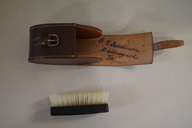
Clothes brush & holder, Mid 20th century
... land. George Tomlinson’s father, also William, continued to farm in the area and was known as a fine judge of cattle and sheep. This case and brush are of interest as an example of the brushes men used in the mid 20th century. The items are also of interest as they belonged to a member of a well-known Ballangeich family (Tomlinsons) Men’s Toiletries Ballangeich history of warrnambool ‘G.E. Tomlinson Ballangeich Victoria ...The brush in this case could have been used as a hair brush or a clothes brush. It is enclosed in a leather case and was probably an item made for travellers. The brush and case belonged to George Tomlinson of Ballangeich. Ballangeich is a small settlement on the Hopkins Highway about 27 kilometres from Warrambool. George Tomlinson’s grandfather, William Tomlinson , established a farming property at Ballangeich in 1865 and opened a hotel, ‘Half Way House’ on part of the land. George Tomlinson’s father, also William, continued to farm in the area and was known as a fine judge of cattle and sheep. This case and brush are of interest as an example of the brushes men used in the mid 20th century. The items are also of interest as they belonged to a member of a well-known Ballangeich family (Tomlinsons).1 This is a piece of brown leather rolled over and stitched with yellow thread to form a container or case. The case has a closing mechanism – a leather strap and metal buckle. .2 Inside the leather case is a brush with a brown Bakelite back with horsehair inserted. ‘G.E. Tomlinson Ballangeich Victoria’men’s toiletries, ballangeich, history of warrnambool -
 Warrnambool and District Historical Society Inc.
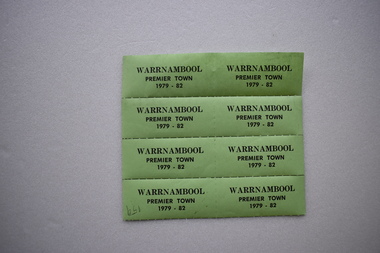
Label, Warrnambool Premier Town, 1979
... used during the period 1979 to 1982 when Warrnambool was the official Premier Town in Victoria. The title was awarded by the Premier of Victoria with scores allocated for heritage and environment, community participation, industrial and commercial development, tourism, land use and public works and community facilities. ...used during the period 1979 to 1982 when Warrnambool was the official Premier Town in Victoria. The title was awarded by the Premier of Victoria with scores allocated for heritage and environment, community participation, industrial and commercial development, tourism, land use and public works and community facilities. ...These labels or stickers were produced as part of the celebrations and promotional material to be used during the period 1979 to 1982 when Warrnambool was the official Premier Town in Victoria. The title was awarded by the Premier of Victoria with scores allocated for heritage and environment, community participation, industrial and commercial development, tourism, land use and public works and community facilities. Warrnambool won the inaugural award in 1958, in 1979-82 and in 1988-91.These labels are of minor interest as reminders of one of the times when Warrnambool was awarded the title of Victoria’s Premier Town.These are eight green labels on a perforated sheet. They have black printing and an adhesive backing and are designed to be detached and used separately as stickers or labels.Warrnambool Premier Town 1979-82warrnambool premier town 1979-1982, history of warrnambool, label -
 Warrnambool and District Historical Society Inc.
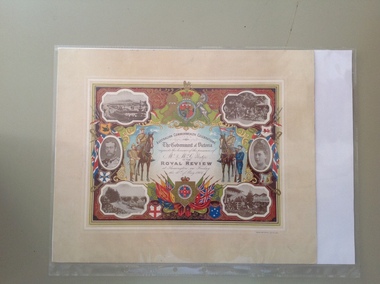
Certificate - Royal Review 1901 G Rolfe, 1901
... Victoria. The certificate was intended to be kept as a souvenir of the event and framed. This particular certificate was issued to George Rolfe and his wife of Warrnambool. George Rolfe (1836-1919), a tea merchant from Melbourne, began buying blocks of land near the mouth of the Hopkins River in Warrnambool in the 1870s. By the early 1880s he had acquired 50 acres of land in the town and several farming properties. He used...Victoria. The certificate was intended to be kept as a souvenir of the event and framed. This particular certificate was issued to George Rolfe and his wife of Warrnambool. George Rolfe (1836-1919), a tea merchant from Melbourne, began buying blocks of land near the mouth of the Hopkins River in Warrnambool in the 1870s. By the early 1880s he had acquired 50 acres of land in the town and several farming properties. He used ...This certificate was sent to those who had been present at one of the celebrations in connection with the Federation of the six States of Australia in 1901 – The Royal Review at Flemington Racecourse on 10th May 1901. The invitation to attend the event was issued by the Government of Victoria. The certificate was intended to be kept as a souvenir of the event and framed. This particular certificate was issued to George Rolfe and his wife of Warrnambool. George Rolfe (1836-1919), a tea merchant from Melbourne, began buying blocks of land near the mouth of the Hopkins River in Warrnambool in the 1870s. By the early 1880s he had acquired 50 acres of land in the town and several farming properties. He used the buildings on the land near the mouth of the Hopkins River as holiday accommodation and called the property, Lyndoch. He improved the property by adding stables, chaff and bone sheds, jetty, boathouse, reservoir, water well and windmill and extensive gardens and he spent most of his later life in the Warrnambool area. Lyndoch today is the site of an aged care facility. This certificate is of considerable importance for two reasons: 1. It is an important memento of a signal event on Australia’s history – the Federation of the six States in 1901 and the subsequent celebrations. 2. The certificate was issued to a prominent Warrnambool person, George Rolfe and his wife.This is multi-coloured sheet of paper mounted on card. There are four black and white photographs of the Royal Review at Flemington and photographs of the Duke and Duchess of Cornwall and York. The images include the Royal Crest, the shields of the six Australian States, a shield of Victoria with a background of flags, cannon and ammunition, two mounted soldiers with a soldier and sailor standing nearby and swords and bayonets. There is also much colour decoration around the edges of the certificate. The names of Mr and Mrs Rolfe are handwritten in black ink. ‘Australian Commonwealth Celebrations’ ‘The Government of Victoria requests the honour of the presence of Mr & Mrs G. Rolfe at the Royal Review at Flemington on Friday the 10th of May 1901’ federation of australian states, george rolfe of lyndoch, history of warrnambool, george rolfe -
 Warrnambool and District Historical Society Inc.
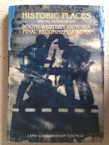
Book, Historic Places of South West Victoria
... Front Cover – Historic Places - Special Investigation - South-Western Victoria - Final Recommendations – Land Conservation Council Spine – Historic Places – South-Western Victoria – Final Recommendations – Land Conservation Council Back Cover – Historic Places, Final Rec., code used for retail sales ...This is a useful book as it lists the declared historic sites in the region and researchers will find the information helpful. warrnambool south west historic places aboriginal historic places Front Cover – Historic Places - Special Investigation - South-Western Victoria - Final Recommendations – Land Conservation Council Spine – Historic Places – South-Western Victoria – Final Recommendations – Land Conservation Council Back Cover – Historic Places, Final Rec., code used for retail sales This is a soft-cover book with a multi-coloured cover featuring a photograph of the Pioneers Memorial, Deep Lead. ...This is the third in a series of booklets produced by the Land Conservation Council in 1997 (176 pages). Booklets One and Two (1996) contained A Descriptive Report and Proposed Recommendations. The Final Recommendations include information on processes for protection of historic places, lists of significant places in the south-western region and aboriginal historic places. Attached inside the back cover are two maps showing the location of the significant places.This is a useful book as it lists the declared historic sites in the region and researchers will find the information helpful. This is a soft-cover book with a multi-coloured cover featuring a photograph of the Pioneers Memorial, Deep Lead. It has a red-coloured spine and back cover.Front Cover – Historic Places - Special Investigation - South-Western Victoria - Final Recommendations – Land Conservation Council Spine – Historic Places – South-Western Victoria – Final Recommendations – Land Conservation Council Back Cover – Historic Places, Final Rec., code used for retail sales warrnambool, south west historic places, aboriginal historic places -
 Kiewa Valley Historical Society
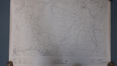
Report - Alpine Study Area Volume 2 Maps, Land Conservation Council, 1970s
... The Victorian Environmental Assessment Council and the former Environment Conservation Council (ECC) and Land Conservation Council (LCC) have completed 36 land use investigations over more than 35 years, including 27 regional reviews. They provide a framework for use of Public Land in Victoria. ...Kiewa Valley Historical Society Mount Beauty Information Centre 31 Bogong High Plains Rd Mt Beauty high-country The Victorian Environmental Assessment Council and the former Environment Conservation Council (ECC) and Land Conservation Council (LCC) have completed 36 land use investigations over more than 35 years, including 27 regional reviews. They provide a framework for use of Public Land in Victoria. ...The Victorian Environmental Assessment Council and the former Environment Conservation Council (ECC) and Land Conservation Council (LCC) have completed 36 land use investigations over more than 35 years, including 27 regional reviews. They provide a framework for use of Public Land in Victoria. The Land Conservation Council was established by the Land Conservation Act 1970.These maps provide an assessment of the Alpine area at the time the maps were created. Some of the topics eg. Rainfall and water resources may change over the years thus providing a comparative analysis. Others may provide information for future development such as mineral exploration, building of a dam / tunnel etc.Blue box shaped folder containing 9 of 10 Maps of the Alpine Study Area produced by the Land Conservation Council. Maps include 1. Public land and descriptive blocks. 2. Physiography. 3. Topography. 4. Geology (missing). 5. Rainfall and water resources. 6. Vegetation 7. Land systems. 8. Recreation. 9. Primary production. 10. Minerals Ex library item. Stamped in red "Discarded From Stock / Swan Hill Regional Libraryalpine area, maps of alpine area, land conservation council -
 Kiewa Valley Historical Society
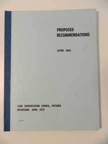
Report - Alpine Area Proposed Recommendations, Land Conservation Council, Victoria Melbourne, April 1978, April 1978
... use of public land were received & included those representing a wide cross-section of the community. These were considered in the final report. Of interest for research on the changing ideas regarding the use of public land and the environment. alpine area land conservation council alpine study area report Blue book bound by dark blue cloth tape. It has 92 pages with maps at the end and an empty folder inside the back cover. Land Conservation Council, Victoria ...The Land Conservation Council was established by the Land Conservation Act 1970. It makes recommendations to the Minister for Conservation with respect to the use of public land. Notices showing the boundary of the study area ... published in the Victorian Government Gazette Sept. 1973. A descriptive report was published in July 1977. Submissions (1538) on the future use of public land were received & included those representing a wide cross-section of the community. These were considered in the final report.Of interest for research on the changing ideas regarding the use of public land and the environment.Blue book bound by dark blue cloth tape. It has 92 pages with maps at the end and an empty folder inside the back cover.alpine area, land conservation council, alpine study area report -
 Kiewa Valley Historical Society
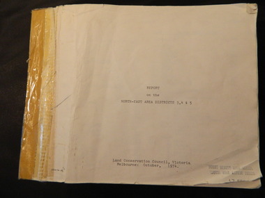
Report - Land Conservation Council x2, Land Conservation Council, Victoria Melbourne, April 1978, October 1974
... Land Conservation Act 1970 established the Land Conservation Council to investigate and recommend to the Minister use of public land in Victoria. ...Kiewa Valley Historical Society Mount Beauty Information Centre 31 Bogong High Plains Rd Mt Beauty high-country Land Conservation Act 1970 established the Land Conservation Council to investigate and recommend to the Minister use of public land in Victoria. ...Land Conservation Act 1970 established the Land Conservation Council to investigate and recommend to the Minister use of public land in Victoria. It describes and assesses the natural resources:-Physiography, Geology, Topography, Land Systems, Outdoor Recreation, Public land and blocks. Primary Production. Vegetation.North East Victoria includes the Kiewa Valley. This report gives an understanding of the development of the area.Thick heavy book with 312 pages with black and white photos. Back half has a folder with heavy cardboard attached to thick cardboard back cover. Inside folder are 9 maps with color each with a different title.Stamped on Front Cover: "Mount Beauty High School" Has a library borrowing slip at the back of the last page.land conservation council, environment, public land, kiewa valley, planning -
 Kiewa Valley Historical Society
Maps - Tawonga and Feathertop
... Victoria 1968. Cream paper with black print. Legend: Roads, tracks etc, rivers, Parishes and use of land. 2. ...use of land in 1968 and of Feathertop in 1969. Historical use of land in Tawonga and Feathertop. tawonga map 1968 tawonga parishes feathertop map 1969 1. Topographical Map - Tawonga 803 Forests Commission of Victoria ...Plan of Tawonga showing roads etc, rivers, use of land in 1968 and of Feathertop in 1969.Historical use of land in Tawonga and Feathertop.1. Topographical Map - Tawonga 803 Forests Commission of Victoria 1968. Cream paper with black print. Legend: Roads, tracks etc, rivers, Parishes and use of land. 2. Feathertop 813. 1969tawonga map 1968, tawonga parishes, feathertop map 1969 -
 Kiewa Valley Historical Society
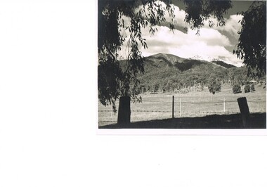
Photograph Farm Land, Mount Beauty Acreage before Golf Course, Circa 1950
... The development of cleaner energy supplies to a growing population has its downside ,which ever way the intrusion into the "natural" landscape is made. mount beauty in the 1940s - 1950s grazing in the kiewa valley sec victoria nil Black and white photograph detailing surveyor posts for construction of golf course. Land used ...This photograph is a "snap shot" in time circa 1950s detailing the rural environment before the effects of the Kiewa Valley Hydro Scheme altered the basic rural setting of the valley. The golfing fairway was being mapped out on previous grazing land, before the laying of a golf course, for use by the construction workers and auxiliary administration employees of the Victorian State Electricity Commission. This photograph details a dramatic period in time which saw an enormous change to the exclusively rural area of the Kiewa Valley region in the mid 1900s. This change presented both physical and mental challenges to the existing quiet rural inhabitants of the valley. The State of Victoria had to make adjustments to the changing demands imposed by population and industrial expansions. The development of cleaner energy supplies to a growing population has its downside ,which ever way the intrusion into the "natural" landscape is made.Black and white photograph detailing surveyor posts for construction of golf course. Land used, before establishment of the Mount Beauty Village, as farming/grazing cattle and viewed towards Mount Bogong and its Alpine ranges. The photo is on 200gms paper and not on photographic paper.nilmount beauty in the 1940s - 1950s, grazing in the kiewa valley, sec victoria -
 Kiewa Valley Historical Society
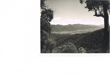
Photograph of Kiewa Valley Panorama, Farming lands within the Kiewa Valley in1950s, Circa 1950
... The time when land was exclusively used in agriculture is over and the impact of cheaper rural produce from Asian markets will see a shift of land useage and population activities. The Kiewa Valley is loosing its hiding place and is becoming more and more a source of untapped residential land. kiewa valley in the early1900s grazing in the kiewa valley sec victoria Black and white photograph of farming/grazing land useage, before the establishment of the Mount Beauty Village. ...This photograph shows how (early to mid1900s), before the establishment of the Mount Beauty "gated" village, the Kiewa Valley was farmed and the scarce population was spread out over acres of productive land. This photograph catches a time before (what appeared to the local farmers as the invasion by a mass of construction workers) when this remote valley was part of a "lay back" rural landscape,occasionally visited by friends and some wayward tourists. The mountain ranges provided an adequate barrier against the way-would traveller. The immigration numbers coming into Australia was still quite small ( due to the "white" Australia policy) which was in force before World War II. After World War II a mass of displaced European refugees and migrants boosted the Australian population and provided for a greater degree of diverse professions and rural related work force.This photograph depicts the borderline in time between an exclusively rural based population and respective activities(early 1900s)to the present (2000 on wards) integrated village, tourist and retiree/holiday area. The time when land was exclusively used in agriculture is over and the impact of cheaper rural produce from Asian markets will see a shift of land useage and population activities. The Kiewa Valley is loosing its hiding place and is becoming more and more a source of untapped residential land. Black and white photograph of farming/grazing land useage, before the establishment of the Mount Beauty Village. Small pockets of residentual houses can be viewed. Road access (unsealed dirt) was typical of that provided in rural regions in the 1950s. The photo is on 200gms paper and not on photographic paper.kiewa valley in the early1900s, grazing in the kiewa valley, sec victoria -
 Kiewa Valley Historical Society
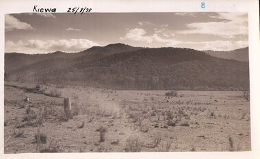
Photograph Farm Land, Kiewa, 25/8/38, circa 1938
... land has been cleared of natural vegetation and used for grazing cattle. kiewa mt. beauty construction grazing secv Handwritten in the upper left hand corner, in black ink, 'Kiewa 25/8/38'. The number 8 has been stamped in the upper right hand side of the photograph. On the back have been stamped the words Velox, indicating the type of photographic paper. Black and white photograph of farmland, cattle in the distance, hills in the background Kiewa, 25/8/38 Photograph Farm Land possibly the State Electricity Commission of Victoria ...This photograph was taken in august, 1938 some eight years prior to the establishment of Mt. Beauty as a township. The area was still being used for grazing cattle and the land was eventually acquired from the local land owners by the State Electricity Commission. The construction of the road, from Tawonga to the High Plains, was commenced in April of 1938. This allowed men and heavy equipment to be transported to the work sites for the construction of the Kiewa Hydro Electric Scheme. Prior to this access was by bridle trail, either on horse back or by foot. By 1946 housing construction had commenced for the new town of Mt. Beauty and by 1948 street construction in the southern part of the town was completed as far as Hill Street.This is an important photograph as it shows the upper Kiewa Valley and the site for Mt. Beauty as it was before the establishment of the town. The land has been cleared of natural vegetation and used for grazing cattle.Black and white photograph of farmland, cattle in the distance, hills in the backgroundHandwritten in the upper left hand corner, in black ink, 'Kiewa 25/8/38'. The number 8 has been stamped in the upper right hand side of the photograph. On the back have been stamped the words Velox, indicating the type of photographic paper.kiewa, mt. beauty, construction, grazing, secv -
 Orbost & District Historical Society
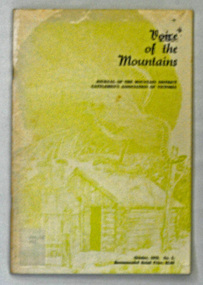
journal, Enterprise Press, Voice of the Mountains, October 1979
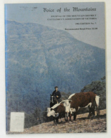
... land use and marketing." (ref Mountain Cattlemen's Association web-site) Since 1972, the Mountain Cattlemen’s Association of Victoria, have produced a journal, “The Voice of the Mountains”. ...land use and marketing." (ref Mountain Cattlemen's Association web-site) Since 1972, the Mountain Cattlemen’s Association of Victoria, have produced a journal, “The Voice of the Mountains”. ..."The Association was officially launched in November 1967 with the aim of preserving and maintaining good relations and understanding within the cattle industry and between that industry and all bodies and organisations with which the industry is associated in the spheres of Government, and land use and marketing." (ref Mountain Cattlemen's Association web-site) Since 1972, the Mountain Cattlemen’s Association of Victoria, have produced a journal, “The Voice of the Mountains”. This journal commemorates the activities and history of the previous twelve months and bygone years of cattlemen and their families. This item was used in the library of Orbost Secondary College.The journals form a part of Victoria’s history and are a useful research tool.A 48 pp book covered in clear contact. It has a pale green cover with a picture of a hut and a lyre bird. It is titled :"Voice of the Mountains, Journal of the Mountain District Cattlemen's Association of Victoria, October 1979 No 5" and is priced at $2.00.journal-voice-of--the-mountains cattle-industry cattlemen-history -
 Orbost & District Historical Society
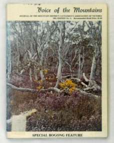
journal, Mansfield Courier, Voice of the Mountains, 1981
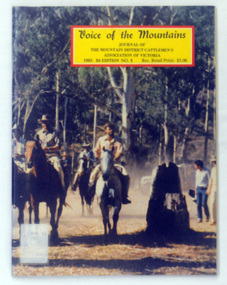
... land use and marketing." (ref Mountain Cattlemen's Association web-site) Since 1972, the Mountain Cattlemen’s Association of Victoria, have produced a journal, “The Voice of the Mountains”. ...land use and marketing." (ref Mountain Cattlemen's Association web-site) Since 1972, the Mountain Cattlemen’s Association of Victoria, have produced a journal, “The Voice of the Mountains”. ..."The Association was officially launched in November 1967 with the aim of preserving and maintaining good relations and understanding within the cattle industry and between that industry and all bodies and organisations with which the industry is associated in the spheres of Government, and land use and marketing." (ref Mountain Cattlemen's Association web-site) Since 1972, the Mountain Cattlemen’s Association of Victoria, have produced a journal, “The Voice of the Mountains”. This journal commemorates the activities and history of the previous twelve months and bygone years of cattlemen and their families. This item was used in the library of Orbost Secondary College. The journals form a part of Victoria’s history and are a useful research tool.Two copies of a 48 pp book covered in clear contact. On the front cover is a coloured photograph of a scene at Bogong. In black print it is titled :"Voice of the Mountains, Journal of the Mountain District Cattlemen's Association of Victoria,1981 Edition 5" and is priced at $2.50.journal-voice-of-the-mountains cattle-industry cattlemen-history -
 Orbost & District Historical Society
journal, Mansfield Courier, Voice of the Mountains, 1982
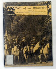
... land use and marketing." (ref Mountain Cattlemen's Association web-site) Since 1972, the Mountain Cattlemen’s Association of Victoria, have produced a journal, “The Voice of the Mountains”. ...land use and marketing." (ref Mountain Cattlemen's Association web-site) Since 1972, the Mountain Cattlemen’s Association of Victoria, have produced a journal, “The Voice of the Mountains”. ..."The Association was officially launched in November 1967 with the aim of preserving and maintaining good relations and understanding within the cattle industry and between that industry and all bodies and organisations with which the industry is associated in the spheres of Government, and land use and marketing." (ref Mountain Cattlemen's Association web-site) Since 1972, the Mountain Cattlemen’s Association of Victoria, have produced a journal, “The Voice of the Mountains”. This journal commemorates the activities and history of the previous twelve months and bygone years of cattlemen and their families. This item was used in the library of Orbost Secondary College. The journals form a part of Victoria’s history and are a useful research tool.A 48 pp book covered in clear contact.On the front cover is a photograph, "Mustering Herefords on the Bluff". In black print it is titled :"Voice of the Mountains, Journal of the Mountain District Cattlemen's Association of Victoria, October 1982 Edition No 7" and is priced at $3.00.journal-voice-of-the-mountains cattle-industry cattlemen-history -
 Orbost & District Historical Society
journal, Mansfield Courier, Voice of the Mountains, 1984
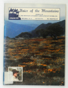
... land use and marketing." (ref Mountain Cattlemen's Association web-site) Since 1972, the Mountain Cattlemen’s Association of Victoria, have produced a journal, “The Voice of the Mountains”. ...land use and marketing." (ref Mountain Cattlemen's Association web-site) Since 1972, the Mountain Cattlemen’s Association of Victoria, have produced a journal, “The Voice of the Mountains”. ..."The Association was officially launched in November 1967 with the aim of preserving and maintaining good relations and understanding within the cattle industry and between that industry and all bodies and organisations with which the industry is associated in the spheres of Government, and land use and marketing." (ref Mountain Cattlemen's Association web-site) Since 1972, the Mountain Cattlemen’s Association of Victoria, have produced a journal, “The Voice of the Mountains”. This journal commemorates the activities and history of the previous twelve months and bygone years of cattlemen and their families. This item was used in the library of Orbost Secondary College. The journals form a part of Victoria’s history and are a useful research tool.A 56 pp book covered in clear contact. On the front cover is a photograph of mountain cattlemen before the start of the 1st Annual Cattlemen's Cup.. It is titled :"Voice of the Mountains, Journal of the Mountain District Cattlemen's Association of Victoria, 1983-84 Edition no 8" and is priced at $3.00.journal-voice-of-the-mountains cattle-industry cattlemen-history -
 Orbost & District Historical Society
journal, E-Gee Printers, Voice of the Mountains, 1986
... land use and marketing." (ref Mountain Cattlemen's Association web-site) Since 1972, the Mountain Cattlemen’s Association of Victoria, have produced a journal, “The Voice of the Mountains”. ...land use and marketing." (ref Mountain Cattlemen's Association web-site) Since 1972, the Mountain Cattlemen’s Association of Victoria, have produced a journal, “The Voice of the Mountains”. ..."The Association was officially launched in November 1967 with the aim of preserving and maintaining good relations and understanding within the cattle industry and between that industry and all bodies and organisations with which the industry is associated in the spheres of Government, and land use and marketing." (ref Mountain Cattlemen's Association web-site) Since 1972, the Mountain Cattlemen’s Association of Victoria, have produced a journal, “The Voice of the Mountains”. This journal commemorates the activities and history of the previous twelve months and bygone years of cattlemen and their families. This item was used in the library of Orbost Secondary College. The journals form a part of Victoria’s history and are a useful research tool.A 44 pp book covered in clear contact. It has a brown cover with a photograph , "On the Road to Ringwood - protest ride against the establishment of Alpine national Park". It is titled :"Voice of the Mountains, Journal of the Mountain District Cattlemen's Association of Victoria Inc., 1986 Edition no 10" and is priced at $4.00. journal-voice-of-the-mountains cattlemen-history cattle-industry -
 Orbost & District Historical Society
journal, E-Gee Printers, Voice of the Mountains, 1988
... land use and marketing." (ref Mountain Cattlemen's Association web-site) Since 1972, the Mountain Cattlemen’s Association of Victoria, have produced a journal, “The Voice of the Mountains”. ...land use and marketing." (ref Mountain Cattlemen's Association web-site) Since 1972, the Mountain Cattlemen’s Association of Victoria, have produced a journal, “The Voice of the Mountains”. ..."The Association was officially launched in November 1967 with the aim of preserving and maintaining good relations and understanding within the cattle industry and between that industry and all bodies and organisations with which the industry is associated in the spheres of Government, and land use and marketing." (ref Mountain Cattlemen's Association web-site) Since 1972, the Mountain Cattlemen’s Association of Victoria, have produced a journal, “The Voice of the Mountains”. This journal commemorates the activities and history of the previous twelve months and bygone years of cattlemen and their families. This item was used in the library of Orbost Secondary College. The journals form a part of Victoria’s history and are useful research tool.A 48 pp book covered in clear contact. On the front cover is a photograph of a view over Howitt, in the High Country with an inset of Jim Commins. It is titled :"Voice of the Mountains, Journal of the Mountain District Cattlemen's Association of Victoria, October 1988 No 11" and is priced at $4.00.journal-voice-of-the-mountains cattlle-industry cattlemen-history