Showing 485 items
matching first survey
-
 Bendigo Military Museum
Photograph - AUTOMAP 1 Production – Army Survey Regiment, Fortuna, Bendigo, c1979
This collection of 19 photos was most likely taken in 1980. The AUTOMAP 1 computer assisted cartography and mapping system was introduced in 1975. The components of AUTOMAP 1 were the Input Sub-System of four Wild B8s stereoplotters and three Gradicon digitising tables, the Optical Line Following Sub-System – Gerber OLF, the Verification Sub-System – Gerber 1442 drum plotter, the General Purpose Sub-system – HP21MX computer and the Output Sub-System – Gerber 1232 flatbed plotter). The first map was published in 1978 (Strickland 3665-3, 1:50,000). AUTOMAP 1 was the first computer assisted cartography and mapping system utilised by the Survey Corps and was the first system used by Australian mapping organisations. The history of the AUTOMAP 1 system is covered in more detail with additional historic photographs, in pages 116-118 of Valerie Lovejoy’s book 'Mapmakers of Fortuna – A history of the Army Survey Regiment’ ISBN: 0-646-42120-4. See items 6122.20P, 6410.24P, 6184.20P, 6200.5P, and 6222.17P for additional photographs of the AUTOMAP 1 system.This is a set of 19 photographs of Air Survey Squadron military and civilian personnel operating AUTOMAP 1 equipment at the Army Survey Regiment at Fortuna, Bendigo, c1979. The photographs were on 35mm negative film and were scanned at 96 dpi. They are part of the Army Survey Regiment’s Collection. .1) - Photo, colour, c1979, Gradicon edit table, SSGT John Bennett. .2) - Photo, colour, c1979, Gradicon edit table. .3) - Photo, colour, c1979, HP21MX computer General Purpose Sub-system. .4) - Photo, colour, c1979, HP21MX computer General Purpose Sub-system. L to R: CAPT Graham Baker, SPR Ian Belmont. .5) - Photo, colour, c1979, Gerber verification drum plotter. 1130 System administration, unidentified. .6) - Photo, colour, c1979, Gerber Optical Line Follower (OLF). .7) - Photo, colour, c1979, Gerber OLF .8) - Photo, black & white, c1979, Programming and system administration, L to R: WO1 Don Taylor, Robert Cox, Tony Spurling, SSGT John Bennett, SGT Alan Toogood. .9) to .14) - Photo, black & white, c1979, .15) - Photo, black & white, c1979, Gerber OLF, unidentified. .16) - Photo, black & white, c1979, Gerber verification drum plotter, unidentified using Gradicon edit table. .17) to .18) - Photo, black & white, c1979, - Photo, black & white, c1979, Programming and system administration, SSGT John Bennett. .19)- Photo, black & white, c1979, - Photo, black & white, c1979, HP21MX computer General Purpose Sub-system..1P to .19P No personnel are identified.royal australian survey corps, rasvy, army survey regiment, army svy regt, fortuna, asr, automap 1 -
 Bendigo Military Museum
Photograph - AUTOMAP 1 Production – Army Survey Regiment, Fortuna, Bendigo, c1980
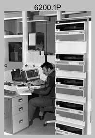
This collection of five photos was most likely taken in c1980. The AUTOMAP 1 computer assisted cartography and mapping system was introduced in 1975. The components of AUTOMAP 1 were the Input Sub-System of four Wild B8s stereoplotters and three Gradicon digitising tables, the Optical Line Following Sub-System – Gerber OLF, the Verification Sub-System – Gerber 1442 drum plotter, the General Purpose Sub-system – HP21MX computer and the Output Sub-System – Gerber 1232 flatbed plotter). The first map was published in 1978 (Strickland 3665-3, 1:50,000). AUTOMAP 1 was the first computer assisted cartography and mapping system utilised by the Survey Corps and was the first system used by Australian mapping organisations. The history of the AUTOMAP 1 system is covered in more detail with additional historic photographs, in pages 116-118 of Valerie Lovejoy’s book 'Mapmakers of Fortuna – A history of the Army Survey Regiment’ ISBN: 0-646-42120-4. See items 6410.24P, 6122.20P, 6183.19P, 6184.20P and 6222.17P for more photos of the AUTOMAP 1 computer system.This is a set of five photographs of Air Survey Squadron military personnel operating AUTOMAP 1 equipment at the Army Survey Regiment at Fortuna, Bendigo, c1980. Black and white photos are on photographic paper and were scanned at 300 dpi. They are part of the Army Survey Regiment’s Collection. .1) - Photo, black & white, c1980, SGT Cliff Webb operating AUTOMAP 1 terminal. .2) - Photo, black & white, c1980, HP21MX computer General Purpose Sub-system. .3) - Photo, black & white, c1980, Gerber verification drum plotter. .4) and .5) - Photo, black & white, c1980, unidentified personnel operating AUTOMAP 1 terminal. .1P to .5P - No personnel are identified.royal australian survey corps, rasvy, army survey regiment, army svy regt, fortuna, asr, automap 1 -
 Bendigo Historical Society Inc.
Book - HISTORY OF THE WEDDERBURN GOLDFIELDS, 1888
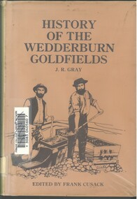
... was surveyed 1856/57. The first public crushing works was established... was surveyed 1856/57. The first public crushing works was established ...Gold was first discovered in 1852 on what was then named Korong or Mt Korong goldfields. It was soon found that the area was not suitable for alluvial mining because of a lack of water but quartz mining was more successful. The township of Wedderburn was surveyed 1856/57. The first public crushing works was established in 1859.Hardcover book with printed dust jacket and plastic cover. 92 pages with black and white illustrations, fold out map and index. Covers the history of the Wedderburn Goldfields and the discovery of gold generally in Australia from the 1850s until c1880s. Written by Joshua R Gray and edited by Frank Cusack.Joshua R Gray and Frank Cusack.gold, goldfields, goldfield -
 Canterbury History Group
Article, Don Gibb, The Elgar's Special Survey
Copy of a talk given by Don Gibb to the Canterbury History Group in June 2015 on the Elgar Survey which will be the basis of the second chapter of his forthcoming book on the social history of Canterbury. Includes maps and a list of the first Boroondara ratepayers.canterbury, mcwilliam. gwen, land subdivision, port phillip district, maps, gibb> don -
 Bendigo Historical Society Inc.
Document - REPORT FROM THE SELECT COMMITTEE UPON THE CLAIMS OF HENRY FRENCHAM, 1890
( x ref 5673 , 8235 , Box 83 , 9077 ) Reports from the Gold Enquiry Select Committee from September 4th 1890 - 23rd October, including a list of witnesses, Minutes of Evidence 11th September 1890, 18th September 1890 and 25th September 1890; also, Appendices A - T, and also a location map drawn from memory by W. (William) Sandbach 18th Sep 1890 and Lithographed at the Department of Lands and Survey Melbourne by S. B. Bonney 28th October 1890. This enquiry covers the opinions of Robert Atkinson, Henry Frencham and Robert Francis Walker in relation to who was the first person to locate gold in the Bendigo field. Members of the Committee were Mr Bailes, in the chair, Mr Burrowes, Mr Cameron, Mr A, Young, Mr Gordon, and Mr Foster. Other name at the enquiry were, David Dunlop, John Paton, William Steward, Christian Asquith, James Graham, Ben. Bannister, Mr Fenton, T. J. Rossiter, P. P. Farrell, Thomas Robinson. Other persons who had made claims were; Patrick Peter Farrell, Frederich Fenton, Mrs. Margaret Kennedy, William Henry Johnson, Edward Pepperell, Henry Byass, William Sandbach, William Steward, Mrs John Barnett, widow of Christian Asquith's son, Robert Francis Walker, David Dunlop, John Paton.gold enquiry, henry frencham, gold discovery, david dunlop, john paton, william steward, christian asquith, james graham, ben. bannister, mr fenton, t. j. rossiter, p. p. farrell, patrick peter farrell, frederich fenton, mrs. margaret kennedy, william henry johnson, edward pepperell, henry byass, william sandbach, mrs john barnett, thomas robinson -
 Bendigo Historical Society Inc.
Administrative record - Land purchase records - Maitland NSW, 1888-1889
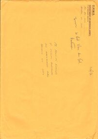
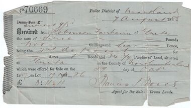
Northumberland County was one of the original Nineteen Counties in New South Wales and is now one of the 141 Cadastral divisions of New South Wales. The Greta area was first colonized by Europeans around Anvil Creek in the 1830s. When the town was surveyed in 1842 it was given the name Greta, possibly after a small river in Cumberland, England. Coal mining was established in the area in 1862 with the development of a railway station.Robinson Fairbairn Collection: Two documents. 1. Receipt for payment from Robinson Fairbairn of Greta for purchase of land at Greta, NSW. Dated 7th August 1888. Receipt for £3/11/11 includes Interest noted at top. 2. Invoice to Mr. Robinson Fairburn for land purchase in account with Sparke and Clift, Auctioneers, West Maitland. mining, robinson fairbairn collection, maitland, northumberland, greta nsw, sparke and clift, coal -
Bendigo Historical Society Inc.
Map - SECTIONS ACROSS BENDIGO GOLDFIELD
Map in three sections showing sections across Bendigo Gold Field, showing anticlines, synclines, faults, stratigraphical zones and mines along the reef lines. Key shows rock types Castlemaine, Bendigo B1, B2, B3 and B4, and Lancefieldian. First part of map shows sections A-A, B-B and C-C. Reef lines drawn with mines listed: Fault line shown are the Carshalton, Stafford, New Chum, Virginia and Clarence. A datum line shows 600 ft above sea level. On bottom of plan: ' Prepared in the Geological Survey Office, Bendigo, under the direction of H. Herman, late Director of Geological Survey, from surveys by H.S. Whitelaw, Field Geologist, assisted by E.S. Usher, A.J.J. Moore and R.A. Keble.' Second section of map shows sections D-D, and E-E. Fault lines listed are the Tambour Major fault, Carshalton fault, Stafford fault, Nell Gwynne fault, New Chum fault, Deborah fault. Third section shows sections F-F and G-G. Fault lines listed are the Bird Reef fault, Kangaroo Gully fault, Langdon fault, Carshalton fault, Nell Gwynne fault, Spring Gully fault, Hustlers fault, Gravel Hill fault, Ordes fault, Thanet fault. This map forms part of the Geological Survey of Victoria, Structure of Bendigo Goldfield report, No. 47, 1923. H.Herman, late Director of Geological Survey.Geological Survey of Victoriabendigo, gold mining, reef line maps -
 Mont De Lancey
Book, Australian Primary Producers Union Wandin Branch Minute Book
This blank book was used by The Australian Primary Producers Union Wandin Branch. Minutes of the first meeting were taken Nov 20th 1947 in the Seville Hall and the last minutes were on 23.11.1954.A large green paper patterned covered Minute Book with orange tape on the spine. This blank book was used by The Australian Primary Producers Union Wandin Branch. Minutes of the first meeting were taken Nov 20th 1947 in the Seville Hall and the last minutes were on 23.11.1954. The book is filled with Minutes of meetings and has two paper insertions - a paper photopcopy of an Invoice Wandin Yallock April 30th1909. Mr Aitken for The Evelyn Preserving Co. Limited Manufacturers of Pure Jams and Jellies. Terms Cash. On the same paper The Colonial Bank of Australasia Limited stating a Sale and acknowledgement receipt of a letter and the enclosure of a remittance, signed by the manager. The second insertion is dated Sept 1950 - a Survey of cost of Production Berry Fruit Wandin Silvan Area. Youngberries. Based on Land at 100 pounds per acre and average 2 ton crop. Full details are listed.non-fictionThis blank book was used by The Australian Primary Producers Union Wandin Branch. Minutes of the first meeting were taken Nov 20th 1947 in the Seville Hall and the last minutes were on 23.11.1954. meetings, reports, proceedings, minutes of meetings -
 Bendigo Historical Society Inc.
Document - DRAINAGE PROBLEMS - VICTORIA QUARTZ DRAINAGE PROBLEMS
Handwritten notes from the Bendigo Advertiser 5/7/1910 Page 3. 'New Chum Mines. Yesterday, Mr H. V. Whetelaw, officer in charge of the local survey branch, Mines Dep't accompanied by Inspector Ross, made their first inspection. Water has reached the 3224 ft. level. Now 1530 feet of water in shaft, including the workings below the 3324 ft. level. Bailing been carried on at the Victoria Quartz, Lansell's 180, 222, and New Chum Consolidated. It will take a week or more to get the Lazarus plant in readiness. Then the shaft will have to examined. At Lansell's 222, the water is 18 ft. below the No 18 level, New Chum Consolidated - 18 ft. below, the 1910 ft. Plat.' Bendigo Advertiser- New Chum Mines - 5/7/1910 Page 3. Document from Albert Richardson Collection of mining history.gold, drainage problems, new chum drainage association, victoria quartz drainage problems, bendigo advertiser 5/7/1910 page 3, mr h v whitelaw, mines dept, inspector ross, victoria quartz, lansell's 180, 222, new chum consolidated, lazarus, albert richardson -
 Bendigo Military Museum
Photograph - Army Survey Regiment - Regimental Training, 1986
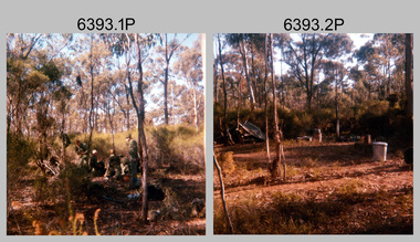
This is a set of 32 photographs of the Army Survey Regiment personnel undertaking military skills revision at Fortuna Villa, Bendigo (photos .29P to .32P) and most likely the Wellsford Forest in 1986. It is evident in the photo set they participated in lessons on the handling of the M30 Grenade and SLR Rifle at Fortuna before the field exercise. Other military skills such as first aid, navigation minor infantry tactics were probably included in the training.This is a set of 32 photographs of the Army Survey Regiment undertaking Regimental Training at Wellsford Forest and Fortuna Villa in 1986. The photographs were printed on photographic paper and are part of the Army Survey Regiment’s Collection. The photographs were scanned at 300 dpi. .1) - Photo, colour, 1986. Unidentified soldiers preparing their meal. .2) - Photo, colour, 1986. Hootchie accommodation. .3) - Photo, colour, 1986. Hootchie accommodation L to R: CPL Roger Pearson and unidentified soldier. .4) & .5) - Photo, colour, 1986. Unidentified personnel enjoying bush cricket. .6) - Photo, colour, 1986. Unidentified soldier with SLR rifle. .7) - Photo, colour, 1986. Unidentified soldiers enjoying a tea break. .8) - Photo, colour, 1986. Unidentified soldier on the shovel. .9) - Photo, colour, 1986. Unidentified soldiers preparing their meal. .10) - Photo, colour, 1986. Hootchie accommodation. .11) & .12) - Photo, colour, 1986. Unidentified soldiers undertaking training. .13) - Photo, colour, 1986. Hootchie accommodation, unidentified soldiers. .14) - Photo, colour, 1986. Unidentified soldier struggles to set-up their stretcher. .15) - Photo, colour, 1986, Unidentified soldier struggles to set-up their hootchie. .16) - Photo, colour, 1986. Unidentified soldiers undertaking training. .17) - Photo, colour, 1986. Hootchie accommodation. .18) - Photo, colour, 1986. SPR Dave Lawler takes a break. .19) & .20) - Photo, colour. 1986. Unidentified soldier tickles an echidna’s tummy. .21)- Photo, colour, 1986. Ablutions set-up. .22) & .23) - Photo, colour, 1986. Unidentified soldier’s hootchie accommodation. .24) - Photo, colour, 1986. Unidentified soldiers undertaking training. .25) to .28) - Photo, colour, 1986. Unidentified soldiers undertaking grenade training. .29) - Photo, colour, 1986. Unidentified soldiers taking a break from training at Fortuna. .30) to .32) - Photo, colour, 1986. Unidentified soldiers undertaking training at Fortuna..1P to .32P No personnel are identified. Some photographs are annotated ‘Regt Training 1986’royal australian survey corps, rasvy, army survey regiment, army svy regt, fortuna, asr -
 Bendigo Military Museum
Souvenir - Souvenir Booklet of Land Headquarters Cartographic Company, Australian Survey Corps "Fortuna" Bendigo 1942-45, Land Headquarters Cartographic Company, Australian Survey Corps, 1945
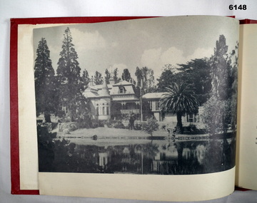
A Souvenir Booklet recording the Section photos and a Nominal roll of those who served 1942-45 at the Land Headquarters Cartographic Company, Australian Survey Corps located at "Fortuna Villa" Bendigo was produced at the end of WWII. Each member of the unit was presented with a copy of the booklet. The booklet besides being a great memory for those who served is a very valuable resource as it names the individuals in the photographs and very importantly records a Nominal Roll of unit members and their Military details. This booklet is one of those original booklets. The booklet has been reprinted on a number of occasions with different coloured covers. The first and original booklet had a red cover. Editions with brown, dark blue and black exist. The black covered edition was the last reprint. This booklet was donated by Carol Hargrave of Grenfell, NSW after discovering it in an old trunk that she purchased. A black covered edition was donated by a local Bendigo Antique Dealer in September 2024.A4 sized red cloth covered hard covered book mainly containing sub-unit photographs of section members and includes their names. 23 x double sided pages of photographs and 2 double sided pages of a Nominal Roll of those who served at Fortuna 1942 - 45. Each of the 50 pages were scanned at 600 dpi in JPEG (.jpg) format and stored on the attached 16GB USB Memory Stick. The images have been converted into MPEG-4 (.mp4) video format, 9Mb in size that runs for 4 Minutes and is also stored on the memory stick.royal australian survey corps, rasvy, fortuna, army survey regiment, army svy regt, asr -
 Melbourne Tram Museum
Document - Report, Melbourne & Metropolitan Tramways Board (MMTB), "Survey of Passengers April 1974 - first Z3 tram in service", 25/09/1979 12:00:00 AM
Photocopy of an A4 page with hand written headings, titled "Survey of Passengers April 1974 - first Z3 tram in service", giving response to the questionnaire completed by 110 passengers and comments received. Signed R. Dunning? 25-9-1979.trams, tramways, z3 class, surveys, new trams -
 National Vietnam Veterans Museum (NVVM)
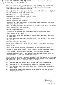
Equipment - Dumpy level in case
Standard issue item as used by Australian servicemen during the Vietnam conflict (1962-1972). This level was first issued for use in WW2.Khaki metal instrument with lens-viewfinder and numbers on circular range finding wheels. Object is stored in a khaki metal box with canvas carry straps. Inside the box, attachments prevent it from slipping. red label attached to strap says the object cannot be repaired.place/date/McBc = GdBg/ McB6 = GdBg/ BuBl COR. Inside box: scientific instruments MFGI and Repair Co. Pty Ltd/ 573 Burwood Road, Hawthorn 815527surveying tool, dumpy level, survey, surveyor, level -
 Bendigo Military Museum
Booklet - A survey of the North Australian Coast on AK121 Aroetta, NT Force, NT Coastal Recce Unit RAE, 6 Aust Army Topo Survey Corps, AKA121 Aroetta, 28 Mar 1945
The work of the Australian Survey Corps is to make maps for the Army. At the outbreak of war very little of the mainland had been mapped, especially the northern parts. The best maps in existence of the N.T. coast in Dec "41 were those made by Matt Flinders in 1801 -1802. The Army soon got out new maps of all important areas including much of the inland. Later it was decided to bring the complete coastline up to date. Several parties put in between them six months on the coast during the dry season of "45 but a couple more months would be needed to complete the program when the "wet" interrupted the work. A small section from Buckingham Bay - Groote Eylandt was still untouched and this diary covers that section of the N.T. Coast. A survey party of four men was chosen who were to be transported from place to place by the AK121 Aroetta - a ketch of 25 tons belonging to an army unit called N.T. Coastal Recce whose work it was to patrol the coast and as well do air - sea rescue. The survey party: Lieut Jack Worsley (the Loot) Sgt Jack Love, Spr Jack Cook, Spr Pat Hede. Crew of Aroetta: Liet Ralph Warne (Skipper), Sgt Buckley (Buck) (First Mate and Orderly Rm), Sgt Jim Terjesen (Jumbo) Bosun, WO2 Tom Davis (Engineer), Cpl Kevin Monk (Artificer), L/Cpl Jack Cox (Deck Hand), Spr Jack Andrews (Signals), Spr Laurie Rament (Ass. Engineer), Spr McKenzie (Mac) (Cook). The complete history is not available after July 31 1945. The remainder of the notes are very badly water-damaged and in some places unreadable.A4 Booklet, plain paper with text and diagrams and half tone photograph of Lt Jack Worsley with plastic binderSigned by George Barton Maj. for LtCol GS. NT Forceroyal australian survey corps, rasvy, fortuna, army survey regiment, army svy regt, asr -
 Bendigo Military Museum
Photograph - Army Survey Regiment - Regimental Training Military Skills Revision, c1984
... Rifle, and lessons in first aid. Royal Australian Survey Corps ...This is a set of 25 photographs of the Army Survey Regiment personnel undertaking military skills revision, at the Army Survey Regiment, Fortuna, Bendigo, c1984. It is evident in the photos that they participated in lessons on the handling of the M30 Grenade and SLR Rifle, and lessons in first aid.This is a set of 25 photographs of the Army Survey Regiment undertaking military skills revision, part of Regimental Training at Fortuna Villa c1984. Colour photos are printed on photographic paper and scanned at 300 dpi. The photos are also stored on 35mm negative film. They are part of the Army Survey Regiment’s Collection. .1) & .2) - Photo, colour, c1984. Pre-training briefings on the parade ground. .3) - Photo, colour, c1984. Rifle revision training. L to R: unidentified personnel, WO2 Ralph Chant – instructor, SGT John Zuringer – instructor. .4) & .5) - Photo, colour, c1984. Rifle revision training. L to R: unidentified personnel, WO2 Ralph Chant – instructor. .6) - Photo, colour, c1984. Rifle revision training. L to R: WO2 Tony Clark – instructor, unidentified, SPR Sherri (Dally) Burke, CPL Robin Marshall, CPL Roger Pearson, SPR Bob Hopper, unidentified, CPL Dan Cirsky. .7) - Photo, colour, c1984. Rifle revision training. WO2 Tony Clark – instructor. .8) to .14) - Photo, colour, c1984. Hand grenade training. Unidentified soldier throwing grenade. .15) - Photo, colour, c1984. Hand grenade training. L to R: unidentified (x2) SPR Jann (Caithness) Lambdon-Young throwing grenade, WO2 Ian ‘Rock’ Thistleton. .16) - Photo, colour, c1984. Hand grenade training. L to R: unidentified soldier throwing grenade, WO2 Ian ‘Rock’ Thistleton. .17) - Photo, colour, c1984. Hand grenade training. L to R: unidentified, unidentified soldier throwing grenade. .18) - Photo, colour, c1984. Navigation revision L to R: CPL Gary Tremain, SPR Jim Humphrey. .19) & .20) - Photo, colour, c1984. Navigation revision. Unidentified personnel. .21) - Photo, colour, c1984. Navigation revision. SPR Tracy (Parker) Ash. .22) - Photo, colour, c1984. Navigation revision. Unidentified (x2), CPL Gary Tremain. .23) - Photo, colour, c1984. Navigation revision. L to R: CPL Lorraine (Daly) Talbot-Smith, SPR Jim Humphrey, unidentified (x4), SGT Gavin Neilson. .24) - Photo, colour, c1984. Navigation revision. L to R: CPL Lea-anne (Smallshaw) Shirley, CPL Lorraine (Daly) Talbot-Smith, unidentified, CPL Gary Tremain, unidentified. .25) - Photo, colour, c1984. First Aid revision. L to R: SGT Bruce Wetzig – instructor, CPL Ken Peters, unidentified..1P to .25P No personnel are identifiedroyal australian survey corps, rasvy, army survey regiment, army svy regt, fortuna -
 Bendigo Military Museum
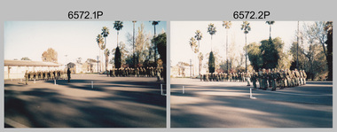
Photograph - Army Survey Regiment – Presentation to Charity Organisation, 1984
These photographs of a presentation to a charity organisation were taken in the grounds of Fortuna Villa, Army Survey Regiment in 1984. SPR Tracy (Parker) Ash was the unit’s Miss Golden North section entrant in the Miss Australia Quest. MAJ Bob Roche, RSM Bob Mason and SPR Parker presented a fundraising cheque to the unidentified representative from the Spastic Society. The the newspaper article is from the Bendigo Advertiser. The following wording is taken from the article: ‘Tracy Parker is a sapper in the Army, and a cartographic technician stationed at Fortuna, Bendigo. Originally from Melbourne, Tracy, 23, is the latest entrant in the Miss Golden North segment of the Miss Australia Quest. The highlight of Tracy’s quest will be an open day at Fortuna, once the magnificent home of Bendigo’s Quartz King, George Lansell. This open day at Fortuna, on Sunday, August 26, between 10 am and 4 pm, will give district residents a rare opportunity of inspecting this magnificent building and its gardens. Tracy said there will be handicrafts, rides, competitions and refreshments available at the open day. The main attraction, apart from the building and gardens, would be a hot air balloon. Admission to the open day would be: Adults $2, children and pensioners $1, family party $5. All proceeds from the open day at Fortuna will go to the Spastic Society. Tracy, like all other Miss Australia candidates work hard for the Spastic Society in fundraising activities. Getting further involved in fundraising, Tracy and her strong committee have organised a 6km fun run for Sunday August 19. Entry forms are available at Bendigo sports stores, and at the end of the fun run will be a barbecue. Apart from her vocation in the Army, and fundraising for the Spastic Society, Tracy Parker has a great love of horses, and associated activities of riding, jumping and showing her horses. Tracy is keen to do well in her fundraising, and with the Australian Army, or more particularly, the ranks of Fortuna behind her, Tracy looks like succeeding.’The first three items are photographs of a presentation to a charity organisation at the Army Survey Regiment, Bendigo in 1984. The fourth item is an article from the Bendigo Advertiser describing Army Survey Regiment’s fund-raising activities. The photographs were printed on photographic paper and are part of the Army Survey Regiment’s Collection. The photographic proof prints were scanned at 600 dpi. Photos .1P and .2P were scanned at 300 dpi. The newspaper article was scanned at 762 dpi. .1) to .3P) - Photo, black & white, 1984, L to R: MAJ Bob Roche, Regional Coordinator Mrs Jan Lamborn, SPR Tracy (Parker) Ash, RSM WO1 Bob Mason. .4) – Bendigo Advertiser newspaper article with photo, black & white, 1984, SPR Tracy (Parker) Ash. .1P to .2P – ‘Presentation of Certificate of Appreciation from Spastic Society. Presented by Regional Coordinator Mrs Jan Lamborn to MAJ Roche, SPR Tracy Ash (entrant in Miss Australia Quest (1984) and WO1 Mason.' .3P – No personnel identified. .4P – SPR Tracy Parker named in newspaper article.royal australian survey corps, rasvy, army survey regiment, army svy regt, fortuna, asr -
 Bendigo Military Museum
Photograph - RASvy Surveyors in the field, c1950s – 1960s
... -portable systems that improved geodetic survey efficiencies ...This is a set of 1photographs of surveyors in the field measuring distances using chains, taking observations using theodolites and operating electric distance measurement equipment. They were probably employed in establishing mapping and geodetic control operations or the surveyors may have been in training. The photos were most likely taken in the 1950s and 1960s. Photos .1P to .6P feature personnel setting up geodetic survey chaining equipment to measure distances. The surveyor in Photo .5P is LTCOL Howard Angus Johnson MBE who served from 1936 to 1954. The RA Svy surveyor in photos .7P to .12P were using a theodolite to take angular measurements. They were usually supported by an observer who recording their readings on a booking form. The surveyor in Photo .10P and .11P is LTCOL Jorge Gruszka, who served from 1955 to 1985. He was CO of the Army Survey Regiment from 1982 to 1985. The surveyor in photo .13P is cutting an identification blaze on a tree using a hammer and chisel. The tellurometer in Photos .14P to .16P was a MRA1 microwave Electronic Distance Measuring instrument (EDM) introduced in 1958. It and later models were man-portable systems that improved geodetic survey efficiencies for rapid network extension and densification replacing triangulation with EDM and theodolite traverse sometimes using Bilby Towers to extend line lengths. The surveyor with the slouch hat is Colonel James ‘Jim’ Leslie Stedman, who served from 1941 to 1978. He was Director of Military Survey from 1975 to 1978 and was appointed as Colonel Commandant (honorary appointment, Retd) of the Royal Australian Survey Corps from 1978 to 1983. Jim Stedman is demonstrating EDM equipment.This is a set of 17 photographs of surveyors in the field measuring distances using chains, taking observations using theodolites and operating electric distance measurement (EDM) equipment. c1950s – 1960s. The photographs were printed on photographic paper and are part of the Army Survey Regiment’s Collection. The photographs were scanned at 300 dpi. .1) - Photo, black & white, c1950s, unidentified personnel using geodetic survey chaining equipment. .2) to .4) - Photo, black & white, c1950s, geodetic survey chaining equipment. .5) – Photo, black & white, c1950s, Jim Stedman using geodetic survey chaining equipment to measure distances. .6) - Photo, black & white, c1950s, Unidentified personnel geodetic survey chaining equipment. .7) – Photo, black & white, mounted on card, c1950s. Unidentified surveyor undertaking observations on a coral reef using a theodolite. .8) – Photo, black & white, c1950, unidentified surveyor undertaking observations with a Tavistock theodolite. .9) – Photo, black & white, mounted on green card, c1950s. Unidentified surveyor undertaking observations using a plane table. .10) – Photo, black & white, c1955, Jorge Gruszka undertaking observations with a theodolite. 7/55 Basic Survey Course Balcombe. .11) – Photo, black & white, c1950s, Jorge Gruszka undertaking observations with a theodolite. .12) – Photo, black & white, c1946-1948, unidentified surveyor undertaking observations with a theodolite to gain control for the mapping of the Snowy Mountain Diversion Scheme. .13) – Photo, black & white, c1950s, unidentified surveyor cutting a blaze in a tree. .14) and .15) – Photo, black & white, c1960s, Jim Stedman demonstrating EDM equipment. .16) – Photo, black & white, c1960s, L to R: Jim Stedman (probably) and unidentified surveyor demonstrating EDM equipment. .17) – Photo, black & white, 1956, Operation Cutlass - Surveyors SPR W. Crane and J.A. Campbell undertaking observations with a theodolite in extreme conditions..1P on back - First Order Chaining Equipment .2P on back - First Order Chaining Equipment .3P on back - Full catenary 1800 – 1960 replaced by EDM .4P on back - First Order Chaining Equipment .5P on back - H.A. Johnson, Benambra baseline? 1st Order Chaining .6P on back - Chaining .7P on front - Difficult observing conditions especially when the tide is in. The station is sighted (sic) on a coral reef. .8P on back - Tavistock. .10P on back of duplicate in Photo Folder 14 – George (sic) Gruszka 7/55 Basic Survey Course Balcomme (sic) 1955/56 .14P and .15P on back - Jim Stedman demonstrating early EDM equipment.royal australian survey corps, rasvy, army survey regiment, army svy regt, fortuna, asr, surveying -
 Bendigo Military Museum
Photograph - WRAAC Personnel posted to the Army Headquarters Survey Regiment, Fortuna Bendigo, c1950s – 1960s
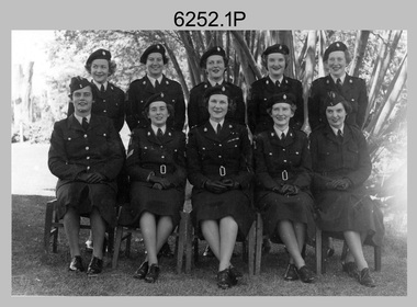
This is a collection of seven photographs of Women’s Royal Australian Army Corps (WRAAC) personnel posted to the Army Headquarters Survey Regiment, Fortuna, Bendigo circa 1957 to 1964. After the disbandment of the Australian Women's Army Service (AWAS) in 1947 there was only one or two of civilian women in administrative positions at Fortuna. In February 1957 female positions from the disbanded Southern Command Field Survey Section in Melbourne were transferred to newly established positions at the Army Headquarters Survey Regiment, Bendigo. They were accommodated at the newly acquired ‘Turriff’ mansion in Carpenter Street, Bendigo. Their first Officer Commanding (OC) was CAPT Beryl Perry from 1957 to September 1960. Her replacement as OC was CAPT Carol Castor who served in several positions up to June 1967. The main areas of employment in these early days were in administrative positions, draughting in and retouching in Lithographic Squadron. WO2 MA McLaren was the female to reach the rank of WO2 as a Cartographic Squadron section commander in June 1961. WO1 Marj Knight served at Fortuna from 1959 to 1978 was the first female to reach the rank of WO1. WO1 Knight served in the senior Squadron Sergeant-Major and Technical Warrant Officer positions of Cartographic Squadron. She was also the first female PMC of the Army Survey Regiment SGT’s Mess. The WRAAC uniform seen in this collection was replaced in 1979. As the Australian Army implemented the disbandment of the WRAAC as a separate corps in 1980, WRAAC personnel posted to Royal Australian Survey Corps units were integrated into RA Svy.This is a collection of seven photographs of Women’s Royal Australian Army Corps (WRAAC) personnel posted to the Army Headquarters Survey Regiment, Fortuna Bendigo circa 1957 to 1964. The photographs were printed on photographic paper and are part of the Army Survey Regiment’s Collection. The photographs were scanned at 300 dpi. .1) - Photo, black & white, c1957. Back row – unidentified personnel, Front row – centre: CAPT Beryl Perry, unidentified personnel. .2) - Photo, black & white, c1958. Back row – unidentified personnel, Front row L to R: unidentified, SGT Margaret McLaren, CAPT Beryl Perry, unidentified (x2). .3) - Photo, black & white 1959. Back row – L to R: PTE Gwen Hill, PTE Hilary Clarkson, PTE Helen Paisley, PTE Pam Carseldine, PTE Margaret Ross, PTE Barbara Minto, PTE Margaret Taylor. Front row L to R: PTE Barbara Hawkin, PTE Joan Murray, SGT Margaret McLaren, CAPT Carol Castor, CPL Jenny Murray, CPL Julie Williams, PTE Phillipa Bowman. .4) - Photo, black & white, October 1963. L to R: WO2 Margaret McLaren, PTE Kay Brown, CAPT Carol Castor, PTE Helen Pasley, PTE Bev Madex, CPL Marj Knight. .5) - Photo, black & white, October 1963. L to R: PTE Bev Madex, PTE Helen Pasley, PTE Kay Brown, WO2 MA McLaren, CPL Marj Knight. .6) - Photo, black & white, August 1963. Back row – L to R: PTE Hollingsworth, PTE GM Hill, PTE PE Sykes, PTE Nola Strawbridge, PTE Jan Cruickshank, PTE Margaret Taylor, PTE Prescott, PTE RR Hutton, PTE BJ Madex, PTE BM Fuhrmann, PTE Cockburn. Front row – L to R: PTE NA Falot, LCPL JA Hurst, SGT Marj Knight, CAPT Carol Caster, CPL Jennifer Murray, LCPL A Burrows, unidentified. .7) - Photo, black & white, 1964. Back row – L to R: PTE Dianne Fowler, PTE Leslie Mortimer, PTE Marlene Penglase, PTE Marg Cooper, PTE Irene Rankins, PTE Elaine Veith, PTE Lyn Ireland, PTE Marg Murphy, PTE Nola Downes, PTE Joan Lawler, PTE Henni Schunck. Front row – L to R: PTE Loretta Hall, LCPL Jo McNamara, SGT Marj Knight, CAPT Carol Caster, CPL Nola Strawbridge, PTE Mary McHugh, PTE Kalen Sargent..1P to .3P, .7P - no annotation, .4P to .6P - Personnel (surnames, no rank) annotated on back.royal australian survey corps, rasvy, army survey regiment, army svy regt, fortuna, asr, wraac -
 Stawell Historical Society Inc
Photograph, Indigenous or First Nations People at Carrs Plains 1874
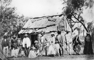
Photo taken at Carrs Plains in 1874 of Indigenous or First Nation People outside a wood and bark hut. In 1861, William Dennis of Carrs Plains Station, a staunch Methodist became Honorary, Aboriginal Protector for the area. One of his main tasks to give Government supplied food and clothing to the Aboriginals. Many district, remaining Aborigines became based at Carrs Plains, and their dead were buried in a cemetery on the station. The cemetery is show on survey map of Wirchilleva Borough, in corner of camping & water reserve near surveyed Bismarck township. In a Protector's report 1869, Dennis wrote that only one male worked regularly on the property, a Bullock driver.Black and white photograph of a wood and bark hut with a group of men, women and children out the front. Reproduction rights reserved Copied by State Library of Victoriastawell aboriginal portrait -
 Bendigo Historical Society Inc.
Document - VICTORIA HILL - SPECIAL FEATURES
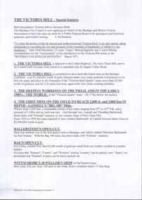
Four hand written pages and typed copy, titled The Victoria Hill - Special Features. Notes mention the Victoria Hill, the deepest workings on the field,the first mine on the field to 2,000 and 3,000 feet in depth, Ballerstedt's Open-Cut, Rae;s Open-Cut, Wittscheibe's Jeweller's Shop, the Adventure, the richest cross-section of the whole of the Bendigo Goldfield, the first mine to pay dividends from ore mined below 1,000 feet to 1,500 feet from the surface, the tallest poppet legs on the field, Lazarus Mine, Barnet Lazarus, Mt Alvernia Hospital, Central Red White & Blue. Notes prepared by Albert Richardson.document, gold, victoria hill, victoria hill, victoria hill - special features, john neill macartney, the argus, the australasian, bendigo goldfields registry, victoria reef quartz mine, the deepest workings on the field, the first mine on the field to reach 2, 000 and 3, 000 feet in depth, lansell's 'big 180' mine, hot water, george lansell, theodore ballerstedt, fortuna, ballerstedt's open-cut, rae's open-cut, wittscheibe's jeweller's shop, adventure, advance, cinderella, the private pioneer coy, new chum & victoria mine, a h q survey regiment, tallest poppet legs, lazarus mine, barnet lazarus, mt alvernia hospital, central redwhite and blue, hudson's, burrowes & sterry, b c v 8 television station, swan hill's channel 11 -
 Stawell Historical Society Inc
Photograph, Great Western 1866
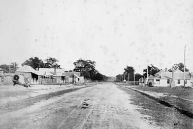
Great Western. Part of a collection of Photographs by Mr. O.G. Armstrong as commissioned by the Shire of Stawell for the Inter-colonial and Paris Exhibition in Melbourne in 1866. Great Western began as a changing station on Concongella, northeast of the present Township. The gold rush in Great Western began in 1858 and soon after a post office and store opened. A Township was surveyed and lots sold in October 1858. The gold soon passed and the diggers went on, leaving a small settlement. In 1863 Jean Pierre Trouette and Emile Bampied, his brother-in-law, planted the first vines and build the first winery, thus setting a firm foundation upon which the present wine industry has been built. Telegraph poles and wires visible. Bakery visible in distance on right of road, looking west. stawell -
 Bendigo Historical Society Inc.
Newspaper - JENNY FOLEY COLLECTION: TIME FOR A BREAK
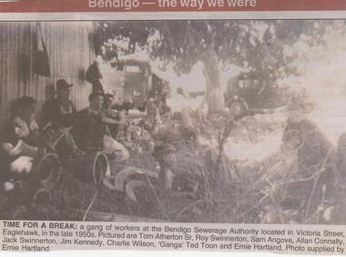
The inaugural meeting of the Bendigo Sewerage Authority was held in February 1917. It had government approval to borrow 5000 pounds for the initial setup including the provision of a sewerage treatment plan. Surveys for the provision of a sewerage system were first undertaken in 1916.Bendigo Advertiser ''The way we were'' from 2002. Time for a break: a gang of workers at the Bendigo Sewerage Authority located in Victoria Street, Eaglehawk, in the late 1950s. Pictured are Tom Atherton Sr, Roy Swinnerton, Saqm Angove, Allan Connally, Jack Swinnerton, Jim Kennedy, Charlie Wilson, 'Ganga' Ted Toon and Ernie Hartland. Photo supplied by Ernie Hartland. The clip is in a folder.newspaper, bendigo advertiser, the way we were -
 Bendigo Military Museum
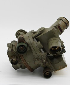
Photograph - Army Survey Regiment Freedom of Entry Parade Rehearsal, Fortuna. Bendigo, 1980
This set of 38 black and white photographs were taken at the Army Survey Regiment’s parade rehearsal held at Fortuna, Bendigo in 1980. The rehearsal was for the Freedom of Entry parade held 1-2 weeks later in 1980. The exact date for the Freedom of Entry parade is not known. The Freedom of Entry to the City of Bendigo was an honour first conferred by the Bendigo City Council to the Army Survey Regiment in 1970. The Freedom of Entry parade in 1980 was the fourth time the unit exercised its right of freedom of entry. The Regiment also exercised its Freedom of Entry with anniversary parades in 1977, 1980 and 1995. Refer to items 6020.8P, 6021.25P, 6248P, 6266, 6409.2, 6430.39P, 6490.53P and 6491.21P for more Army Survey Regiment Freedom of Entry photographs, documents and certificates. See item 6471.2P for photos of Lithographic Squadron taken on the same day of this parade rehearsal. This set of 38 black and white photographs of the Army Survey Regiment (Army Svy Regt) were taken in a rehearsal for the Freedom of Entry parade to the City of Bendigo, held 1-2 weeks later in 1980. The photographs are on 35mm negative film and were scanned at 96 dpi. They are part of the Army Survey Regiment’s Collection. .1) - Photo, black & white, 1980. WO1 John McCulloch observes the rehearsal. .2) - Photo, black & white, 1980. RSM WO1 Aub Harvey, WO1 Dave Thomson and WO1 Roger Rix observe the rehearsal. .3) - Photo, black & white, 1980. Under command of SSM WO1 Bob Mason, Air Survey Squadron marches onto the parade ground - Front rank L to R: SPR Peter Jones, SPR Barry Miller, CPL Alan Hawkins. .4) - Photo, black & white, 1980. Air Survey Squadron marches on the parade ground - L to R: SPR Peter Jones, CPL Lyall Camp, SPR Barry Miller, SPR Geoff Havelberg, unidentified, CPL Alan Hawkins, CPL Peter Treble, unidentified (x2), SGT Mick Hogan, SGT Bruce Hammond, unidentified, SPR Steve Linane, SPR Jamie McRae, unidentified (x2). .5) - Photo, black & white, 1980. Air Survey Squadron formed up – CAPT Peter Ralston on far left. .6) - Photo, black & white, 1980. Air Survey Squadron inspection – L to R: CAPT Peter Ralston, CPL Alan Hawkins, CO LTCOL Bob Skitch, SGT Mick Hogan, SGT Bruce Hammond, SPR Jamie McRae. .7) - Photo, black & white, 1980. Air Survey Squadron inspection – L to R: SPR Peter Jones, unidentified, CPL Paul Hopes, unidentified, SGT Rick van der Bom, LTCOL Bob Skitch, SPR Steve Linane, CPL Mick Minchin, unidentified, SPR Gae (Robinson) Amato, unidentified, SPR Chris ‘CPL Peter Treble, Charlie’ Brown, SPR Ginny (Turner) Rowe. .8) - Photo, black & white, 1980. Lithographic Squadron marches onto the parade ground - Front rank L to R: SPR Brian Fauth, SPR Roy Hicks, SPR Per Andersen, commanded by LT Steve Cooper. .9) - Photo, black & white, 1980. Lithographic Squadron marches onto the parade ground - L to R: SSM WO1 Ken Slater, Front rank SPR Brian Fauth, SPR Roy Hicks, SPR Per Andersen, LT Steve Cooper. .10) - Photo, black & white, 1980. Lithographic Squadron inspection - L to R: CAPT Stan Vote, LT Steve Cooper, CO LTCOL Bob Skitch, SPR Neville Carr, SPR Laurie Justin, SPR Keith Quinton. .11) - Photo, black & white, 1980. Lithographic Squadron inspection - L to R: unidentified, LT Steve Cooper, CPL Frank Lenane, CPL Mick ‘Buddha’ Ellis, SPR Martin van de Maele, CO LTCOL Bob Skitch, unidentified (x2), SPR Garry Hudson, remainder unidentified. .12) - Photo, black & white, 1980. Lithographic Squadron inspection - L to R: LT Steve Cooper, CPL Rob Bogumil, unidentified, CO LTCOL Bob Skitch, CPL Bill Jones, CPL John ‘Flash’ Anderson, CPL Warren ‘Waldo’ Shirley, unidentified. .13) - Photo, black & white, 1980. Lithographic Squadron inspection - L to R: unidentified (x4), CO LTCOL Bob Skitch, unidentified, CPL Bill Jones, LT Steve Cooper, CPL Warren ‘Waldo’ Shirley. .14) - Photo, black & white, 1980. Lithographic Squadron performs form - right file L to R: SPR Brian Fauth, SPR Roy Hicks, SPR Per Andersen. .15) - Photo, black & white, 1980. Lithographic Squadron completes form at the halt. .16) - Photo, black & white, 1980. Lithographic Squadron marches in column of route – right file L to R: SPR Keith Quinton, SPR John Whaling, SPR Martin van de Maele, SPR John Whaling, SPR Garry Hudson, unidentified. Centre marker: CPL Warren ‘Waldo’ Shirley, remainder unidentified. .17) - Photo, black & white, 1980. Lithographic Squadron marches in column of route – right file L to R: SPR John Whaling, SPR Martin van de Maele, SPR John Whaling, SPR Garry Hudson, unidentified. Centre marker CPL Warren ‘Waldo’ Shirley, remainder unidentified. .18) - Photo, black & white, 1980. Lithographic Squadron marches in column of route – L to R: SPR Per Andersen, CPL Josh Degroot, SPR Neville Carr, SPR Laurie Justin, SPR Keith Quinton, SPR John Whaling, SPR Martin van de Maele, SPR John Whaling, SPR Garry Hudson, unidentified. .19) - Photo, black & white, 1980. Lithographic Squadron marches in column of route – L to R: SPR Per Andersen, CPL Josh Degroot, SPR Neville Carr, SPR Laurie Justin, SPR Keith Quinton, SPR Martin van de Maele, SPR John Whaling, SPR Garry Hudson, unidentified (x2), CPL Warren ‘Waldo’ Shirley, unidentified. .20) - Photo, black & white, 1980. Lithographic Squadron rehearses ‘rest on arms reverse.’ .21) - Photo, black & white, 1980. Cartographic Squadron marches onto the parade ground in column of route - L to R: SPR Cheryl Lofthouse, unidentified, SSM WO1 Gordon Lowery, unidentified, SPR Megan (McBurney) Reynolds, unidentified (x6), SPR Peter Main, CPL Stu Symonds, SPR Greg Else, SPR Rod Skidmore. .22) - Photo, black & white, 1980. Cartographic Squadron marches onto the parade ground in column of route - L to R: SPR Rod Skidmore, SPR Greg Else, CPL Phil McGuire, CPL Dennis Learmonth, CPL Brad Peppler, CPL Trevor Bottomley, SPR Gina (Coore) Neilson, SPR Carla Dell, CPL Lynn Johnson, commanded by CAPT Bob Williams. .23) - Photo, black & white, 1980. Cartographic Squadron inspection - L to R: unidentified officer, CAPT Bob Williams, SPR Greg Else, CO LTCOL Bob Skitch, CPL Phil McGuire, CPL Dennis Learmonth, CPL Brad Peppler, CPL Trevor Bottomley. .24) - Photo, black & white, 1980. Cartographic Squadron inspection - L to R: RSM WO1 Aub Harvey, unidentified officer, CAPT Bob Williams, CO LTCOL Bob Skitch. Front rank L to R: SPR Rod Skidmore, CPL Phil McGuire, CPL Dennis Learmonth, CPL Brad Peppler, CPL Trevor Bottomley, SPR Gina (Coore) Neilson, SPR Carla Dell, CPL Lynn Johnson. Centre rank L to R: CPL Terry Danger, SPR John Martin, SPR Bob Sheppard. SPR Megan (McBurney) Reynolds. .25) - Photo, black & white, 1980. Cartographic Squadron inspection - Front rank L to R: CPL Phil McGuire, CAPT Bob Williams, CPL Brad Peppler, CO LTCOL Bob Skitch, CPL Trevor Bottomley, SPR Gina (Coore) Neilson, SPR Carla Dell, CPL Lynn Johnson. .26) - Photo, black & white, 1980. Cartographic Squadron inspection - L to R: WO1 Roger Rix, RSM WO1 Aub Harvey, unidentified officer. Front rank L to R: SPR Rod Skidmore, SPR Greg Else, CPL Phil McGuire, CPL Brad Peppler, CPL Trevor Bottomley, SPR Gina (Coore) Neilson, SPR Carla Dell, CPL Lynn Johnson. Centre rank L to R: CPL Terry Danger, SPR John Martin, SPR Bob Sheppard. SPR Megan (McBurney) Reynolds. .27) - Photo, black & white, 1980. Cartographic Squadron inspection - L to R: CPL Dennis Learmonth, CPL Brad Peppler, CO LTCOL Bob Skitch, CPL Trevor Bottomley, SPR Gina (Coore) Neilson, SPR Carla Dell, CPL Lynn Johnson. .28) - Photo, black & white, 1980. Cartographic Squadron inspection - L to R: CAPT Bob Williams, unidentified, CO LTCOL Bob Skitch, SPR John Martin, SPR Bob Sheppard, SPR Megan (McBurney) Reynolds, rear rank L to R: SPR Peter Main, unidentified (x3). .29) - Photo, black & white, 1980. Cartographic Squadron rehearses ‘reverse arms’ - L to R: SPR Peter Main, CPL Stu Symonds, SPR Rod Skidmore, SPR Greg Else, remainder unidentified. .30) - Photo, black & white, 1980. Cartographic Squadron rehearses ‘rest on arms reverse.’ - Front rank L to R: SPR Rod Skidmore, SPR Greg Else, CPL Phil McGuire, CPL Dennis Learmonth, CPL Brad Peppler, CPL Trevor Bottomley. remainder unidentified. Centre rank L to R: unidentified (x2), SPR John Martin, SPR Bob Sheppard, SPR Megan (McBurney) Reynolds. Rear rank L to R: unidentified (x3), SPR Carla Dell on far right. .31) - Photo, black & white, 1980. Cartographic Squadron marches in column of route. .32) - Photo, black & white, 1980. Cartographic Squadron marches in column of route. Left file L to R: SPR Rod Skidmore, SPR Greg Else, CPL Phil McGuire, CPL Dennis Learmonth, CPL Brad Peppler, CPL Trevor Bottomley, SPR Gina (Coore) Neilson, SPR Carla Dell, CPL Lynn Johnson. Centre file L to R: unidentified (x2), SPR Dan Cirsky, SPR Bob Sheppard. Commanded by CAPT Bob Williams (foreground). .33) - Photo, black & white, 1980. Cartographic Squadron rehearses ‘order arms.’ Front rank L to R: SPR Rod Skidmore, SPR Greg Else, CPL Phil McGuire, CPL Dennis Learmonth, CPL Brad Peppler, CPL Trevor Bottomley, SPR Gina (Coore) Neilson, SPR Carla Dell, CPL Lynn Johnson. Centre rank L to R: unidentified (x2), SPR Dan Cirsky, SPR Megan (McBurney) Reynolds, SPR Ilen Isaac. Rear rank L to R: SPR Cathy Regan, unidentified, SPR Cheryl Lofthouse. .34) - Photo, black & white, 1980. Cartographic Squadron rehearses ‘right dress.’ Front rank L to R: SPR Rod Skidmore, SPR Greg Else, CPL Phil McGuire, CPL Dennis Learmonth, CPL Brad Peppler, CPL Trevor Bottomley, SPR Gina (Coore) Neilson, SPR Carla Dell, CPL Lynn Johnson. Centre rank L to R: SPR John Martin, SPR Bob Sheppard. SPR Megan (McBurney) Reynolds, SPR Ilen Isaac. Rear rank L to R: unidentified (x2), SPR Cathy Regan, unidentified, SPR Cheryl Lofthouse. Commanded by CAPT Bob Williams (far left). 35) - Photo, black & white, 1980. Air Survey Squadron section rehearses marching with reverse arms. L to R: SPR Bob Hopper, CPL Rick Downie, CPL Paul Hopes, unidentified (x2, SGT Rick van der Bom, SPR Steve Hilton, CPL Peter Treble, unidentified, SPR John Lane, remainder unidentified. .36) - Photo, black & white, 1980. Air Survey Squadron section rehearses marching with reverse arms. L to R: CPL Alan Hawkins, CPL John Smith, SPR Dave Jobe, unidentified (x2), SGT Mick Hogan, SPR Barry Miller, WO1 Dave Thomson. .37) - Photo, black & white, 1980. Cartographic Squadron sections practice drill. .38) - Photo, black & white, 1980. Air Survey Squadron rest break from drill practice. L to R: unidentified (x2), CPL Noel McNamara, SSGT Peter Warwick, SSGT Greg Buckingham (facing away), SGT Jim Beard, unidentified, SPR Sharon (Jones) Treble (foreground), unidentified, SGT Bruce Gordon, SPR Kristin (Isaac) Skidmore.There are no personnel identified. royal australian survey corps, rasvy, army survey regiment, army svy regt, fortuna, asr -
 Bendigo Historical Society Inc.
Document - ALBERT RICHARDSON COLLECTION: VICTORIA HILL IRONBARK
Three page document hand written by Albert Richardson, on the history of Victoria Hill, Ironbark. 'one of the richest areas on Bendigo field. In the first six years, £1,200,000 worth of gold was obtained. Almost every claim returned a fortune.' Page three title: Other features on Victoria Hill. 'Adjacent to Central Nell Gwynne area as the mining museum. Adjacent to the New Chum Hill on direct south side of the Calder Highway. This hill reached by a short and excellent access road gives a magnificent view of Bendigo and Golden Square, and a very good view of another tourist attraction, Lansells 'Fortuna' now Survey Regiment's headquarters. This hill is the centre of another rich area. The Lazarus mine 3,360 feet deep with 24 saddle reefs in 2,200 feet. The New Chum United, Lansell's 222with its 120 ft high poppet legs. BCV 8, John Brown Knitwear factory, Esposito's Gold Mines Hotel, Central Nell Gwynne and Manchester tram loops are mentioned.Albert Richardsonbendigo, mining, victoria hill -
 Wyndham Art Gallery (Wyndham City Council)
Photograph, Destiny Deacon, Daisy and Heather discuss race, 2016
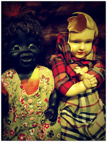
The sarcastic title of this work pokes fun at the old fashioned idea that race should not be the subject of polite conversation. Deacon uses a white and a Black dolly to represent the unequal power dynamics that exist within Australian society. The dolls stand in for people who, based on the colour of their skin, experience the impact of racial inequality in vastly different ways. The cracked head of the white doll reveals an empty void. Symbolically violent, perhaps this emptiness suggests the dolls will never be able to fully comprehend one another’s experiences.This work was curated in RACE 2016 at Wyndham Art Gallery. Destiny Deacon (1956–2024) was a descendant of the KuKu (Far North Queensland) and Erub/Mer (Torres Strait) people. She exhibited nationally and internationally since the early 1990s in solo and group shows. Deacon held two major retrospectives, in 2004 and 2020, at the Museum of Contemporary Art, Sydney and at the National Gallery of Victoria, Melbourne respectively. Her 2004 survey show, Walk & don’t look blak, toured to the Metropolitan Museum of Photography in Tokyo, the Tjibao Cultural Centre in Noumea, New Caledonia and Wellington City Gallery in New Zealand. In 2022, she was the recipient of the Red Ochre Award for Lifetime Achievement at First Nations Arts Awards. In the same year, Deacon’s work was shown at the Australian Embassy in Paris in an exhibition titled Destiny - The art of Destiny Deacon. In 2023, Deacon was included in the Sharjah Biennial 15, Thinking Historically in the Present, conceived by the late Okwui Enwezor and curated by Hoor Al Qasimi. In 2024, Deacon's work was exhibited in the 24th Biennale of Sydney, Ten Thousand Suns, curated by Cosmin Costinas and Inti Guerrero. Deacon’s work is held in most major public collections in Australia as well as Tate, London, Museum Moderner Kunst (MUMOK), Stifting Ludwig, Vienna, Austria and Museum Sammlung Essl, Austria.first nations photography, australian photography, australian indigenous art, race, racism, colonisation -
 Bendigo Military Museum
Document - Royal Australian Survey Corps - School of Military Survey Precis - Corrections to 1st Order Astronomical Observations 1964, School of Military Survey, Balcombe, 1964
This is a precis produced by the Royal Australian Survey Corps School of Military Survey in 1964. This is a very technical precis that describes the corrections that need to be applied to First Order Astronomical Theodolite Observations. First Order Astronomical positioning is the highest order and the most accurate determination of position using the stars and for that reason small allowances and corrections are needed to maintain/ improve relative accuracy.A 26 x page foolscap sized paper Precis, stapled and two hole punched. The precis does not have a protective cover and pages are discoloured. The precis contains typed text, tables and diagrams.royal australian survey corps, rasvy, fortuna, army survey regiment, army svy regt, asr, astronomy -
 Ballarat Heritage Services
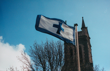
Photograph - Photograph - Colour, Flag of St Alipius', Ballarat East, 2004, 23/09/2004
"Centenary of Fnrst Mass at Ballarat Friday last marked the centenary of the arrival of the first priest and the celebration of the first Mass in Ballarat. The Rev. Patrick Dunne reached the diggings on October 17, and on Sunday, October 19, 1851, in a bark hut near Brown Hill, he celebrated Mass. Worshippers had to kneel on quartz gravel. The weather had been the worst experienced in Victoria for a number of years, and most of the creeks between Melbourne and Ballarat were flowing torrents, but Father Dunne (who came from the Coburg mission), carrying the barest necessities and the sacred vestments, set out for Ballarat on horseback. He had to ford and swim his horse across the creeks. When most of his congregation left for the Castlemaine diggings Father Dunne returned to Melbourne. In August, 1852, Rev. Matthew Downing became Ballarat's first resident priest. He built a large wooden structure with a canvas roof which served as a church, but later erected at the Gravel Pits the first permanent church. This church was the largest of any house of worship on any goldfield in the colony. It cost £ 100, contributed solely by Father Downing and his flock. Soon after he got the authorities to survey a large piece of land at the back of the township as a burial ground and procured a grant of £500 for fencing it. A grant of £250 was also obtained for the improvement of the chapel and fittings of a school, where Michael Campion Carey opened the first school. Rev. Patrick Smyth succeeded Father Downing, who was followed by Rev. P. Madden, who in 1857 began to plan the erection of St. Patrick's Church. The foundation stone of this was laid by Bishop Goold on February 12, 1858, and the church was opened for the first time on November 8, 1863." (Melbourne Advocate 25 October 1951)Two colour photographs showing the St Alipius' Catholic Church flag - a blue cross and border on white. st alipius, church, ballarat east, flag -
 Ballarat Heritage Services
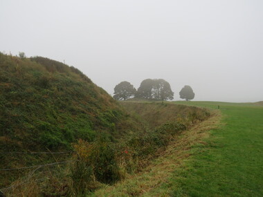
Photograph - Photograph - Colour, Earth Banks, Old Sarum, England, 01 November 2016
William the Conqueror inherited Old Sarum from the last Saxon king of England. It was an ideal site for a royal castle. It was here in 1070 that William paid off his army after a long and bitter campaign in northern England. It was here in 1086 that he called together all the major landholders in England so they could swear allegiance to him. It was a crucial moment. The Domesday Book was being written, a threatened Viking invasion had only just been averted and William's eldest son was in armed rebellion. Old Sarum was an important place where this Norman king of England held power. In 1794 the Ordnance Survey set out to check the accuracy of the first mapping of Southern England, which had begun ten years earlier. From a point just below Old Sarum Lieutenant William Mudge laid out a base-line 36,574 feet (11,253 metres) long. From each end of the line the positions of distant places were plotted using a huge theodolite made in 1791 by Jesse Ramsden. The accuracy of the process, which was repeated all over England, depended on Jesse Ramsden's craftsmanship and on William Mudge's surveying skill in setting out this first base-line from Old Sarum. The nearer end of Mudge's line is marked by an inscribed stone beside the modern A345 at Old Sarum. Colour photograph of Earth Banks, Old Sarum, Englandordnance survey, william mudge, jesse ramsden, william the conqueror, old sarum, saxon, 1086, england -
 Bendigo Military Museum
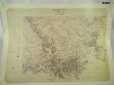
Map - Australian Topographical Survey SYDNEY / 56III Southern Half, NE Plane Table Field sheet 1915, Australian Survey Corps, 6 Dec 1915
This is a unique example of a hand drawn plane table sheet produced in the first year of the Australian Survey Corps by original members of the Corps. Roseblade and Lynch 5 Dec 1915. Of interest is the documented times that it took to create the original field sheet. Also of interest is the fact that this field sheet that was used to create the actual SYDNEY map sheet was contoured, many map sheets produced up until now were purely planimetric and lacked contouring that was needed for military use. This is a reproduction print of a photograph of the original field sheet and was printed at the Army Survey Regiment, Bendigo.Reprinted coloured Image of Australian Topographical Survey SYDNEY /56 III Southern Half, hand drawn NE Plane Table field sheet. Includes an itemized summary of work performed by HA Roseblade CSM Australian Survey Corps 1915, Signed by J Lynch Lieutenant.royal australian survey corps, rasvy, fortuna, army survey regiment, army svy regt, asr -
 City of Moorabbin Historical Society (Operating the Box Cottage Museum)
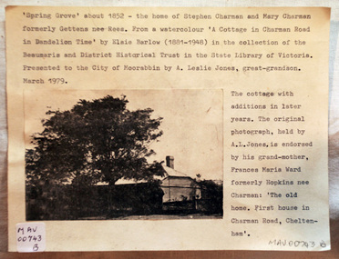
Document - Photograph, photocopy, of ‘Spring Grove’ 19th C house, Charman Road, Cheltenham, c1979
In 1852 Stephen Charman purchased 160 acres bounded by Charman Rd and Balcombe Road in an area called Spring Grove , later Cheltenham. A spring ran through the land providing a good source of water. Stephen aged 21 years had arrived in Melbourne 1842 as one of Henry Dendy’s emigrants . His Ship passage was paid by the Colonial Land and Emigration Commission and in return he was required to work on the land of the Henry Dendy Special Survey Brighton 1841. However Henry Dendy could not provide enough work for all the emigrants that arrived and Stephen had to obtain other work. Then sadly his young wife Harriett and their infant died. 1850 Stephen married widow Mary Gettens, a Publican in Little Collins Street, with 5 children. Stephen & Mary built a wattle and daub hut and established a market garden producing marigolds for Martin & Pleasance Pharmacists, Melbourne. They had 7 more children and built a weatherboard cottage that was used for early Methodist Church services. Stephen donated 1 acre to the Methodist Church in 1855 for Chapel , School and Cemetery. This is the weatherboard cottage in the photocopy showing the building extension, The road between Cheltenham and Mentone bears their name. Mary died in 1870 and Stephen remarried 1878 and died in Gippsland 1906. The original Photograph is endorsed by Francis Marie Ward , formerly Hopkins nee Charman who was the grandmother of Mr A.L Jones A photocopy of a black and white photograph of ‘Spring Grove’ , that was the first house in Charman Road , Cheltenham c1852 , showing later extensions. spring grove cottage 1852, schumer l, cheltenham, charman stephen, early settlers, jones a l, gettens mary, rees mary, charman mary, moorabbin, brighton, henry dendy special survey 1841, ward frances marie, charman frances marie