Showing 10880 items
matching land
-
 Melton City Libraries
Photograph, 'Melton South Chaff Mill employees, Unknown
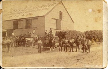
Charles E “Ernie” Barrie started constructing a Chaff mill on the corner of Brooklyn and Station road in 1900. It soon became a thriving business and was ideally located close to the railway line. Ernie and his father William and other Barrie brothers had been operated travelling chaff cutters in the district of Melton and Werribee. Within a short time the mill expanded into two big sheds in partnership with his brother James E known as “Ted”. The eldest brother William was in the Manager living in Melton South. In 1906 Ernie applied for a railway crossing on Brooklyn Road to have direct access for railway trucks to be shunted to the mill to be loaded. The Mill was also had the first phone to be connected, No 1, and No’s 2, 3 were the Golden Fleece and Macs Hotels. In 1906 Ernie married Jessie Lang daughter of the Head Teacher at Melton State School No 430 (1896 –1917). The Barrie house on the north side of the mill was completed in August 1906. It survived for almost 60 years until demolition. Chaff mills were very susceptible to fires and often burnt down and would be rebuilt again ready for the peak of the harvesting season. The final demise of the Mill occurred in a spectacular blaze on the night of Friday 2nd December 1977, just before the earth tremor as reported in the local paper. Brian Dobson the local photographer lived close by and captured the night blaze. A video was also taken of the action by the fire brigade. My parents Bon and Edna Barrie were living at 19 First Avenue, and took colour slides of the smouldering ruins in the half -light. Ironically Bon had spent the first year of his life (born in April 1909 and sister Mary born October 1907) at the house beside the mill. Trethowan’s Chaff mill in Brooklyn road was also destroyed by fire, which stated in the evening on Tuesday April 28th 1987. It was established in 1910 by Dixon Brothers, followed by, Ebbot & Kebby, Robinson, Trethowan and Butler and was with the Trethowan family when it burnt down. Melton South was small a community referred to as Melton Railway Station. Member of the community raised the idea to have a public hall. In 1909 Cr Barrie, Mr Nesbitt and Delany formed a committee to build a community hall. Cr Barrie donated the land and The Exford Hall was completed in September 1910 later to be named Victoria Hall. It was demolished in 1992. Colour slide in Barrie archive. In April 1910 the Ernie sold the Mill to Glover Onians (HSK Ward) family moved away to a property in Trundle NSW. Ernie had acquired 640 acres (a square mile) and leased a further 1920 acres of adjoining land. It was the practise of the farmers in the area at the time to buy up or lease the surrounding land from the 640 acre crown land blocks to make up acerage for a viable wheat farm. His wife Jessie found the climate to be very hot and when the Darlingsford property at Melton was put up for sale in the latter part of 1910 and was passed in at the auction. My grandfather saw this an opportunity to return to Melton. The negotiations to Darlingsford were finalised on May 11th 1911. Barrie bothers with connections to Chaff mills and farming in Melton from the 1900s William Henry, Charles Ernest, James Edwin, Samuel John, Robert, Arthur Roger, Albert Walter. Three grandsons and a great-grandson are in business earthmoving and farming in Melton today. (2013) Memoirs by Wendy BarrieEmployees at Chaff Mill, it was located on the corner of Brooklyn and Station Road, Melton South. local identities, agriculture -
 Glen Eira Historical Society
Album - Album page, Bureel (Kooyong Road), Circa 1972
This photograph is part of the Caulfield Historical Album 1972. This album was created in approximately 1972 as part of a project by the Caulfield Historical Society to assist in identifying buildings worthy of preservation. The album is related to a Survey the Caulfield Historical Society developed in collaboration with the National Trust of Australia (Victoria) and Caulfield City Council to identify historic buildings within the City of Caulfield that warranted the protection of a National Trust Classification. Principal photographer thought to be Trevor Hart, member of Caulfield Historical Society. Most photographs were taken between 1966-1972 with a small number of photographs being older and from unknown sources. All photographs are black and white except where stated, with 386 photographs over 198 pages. From: Glen Eira Heritage Management Plan 1996 by Andrew Ward In 1856, John Allee, a builder from Brighton, purchased C.A. 37 on the south-west corner of Glenhuntly and Kooyong Roads. The land comprised just over 45 acres. By 1863, Francis John Sidney Stephen, a lawyer and cousin of J. Wilberforce Stephen, owned most of lot 37. By 1866, Stephen had a built a "small mansion" named ''Burreel". It was a brick house and Stephen lived there until 1882. By 1884, Mrs Buxton of Hillside Terrace, East Melbourne, had purchased the property. Richard Buxton, a gentleman was listed as occupant and the house described as "brick, eight rooms". NAV was £300. Richard Buxton continued residency in 1887 however in 1888, George Allen, music seller, became occupant. At that time the house had thirteen rooms on twenty-three acres of land. Twelve people lived there and NAV was £920. In 1900, Daniel Luxton, stock and sharebroker and the Honourable John Taverner, M.H.A. leased the property. Fourteen people lived there. Mrs Buxton continued as owner. By 1910, ownership had passed to Mrs Mary Neate, who converted the house to a nursing home. The land had been subdivided by 1913 and sold by ''Buxtons Estate". Burreel Avenue, Baxter, Buxton and Hoddle Streets were created. "Burreel" was rated to Burreel Avenue and stood on lot 13 with frontages to Burreel Avenue and Kooyong Road of 198' and 214'. The house had ten rooms. NAV was £60. Mary Neate, a nurse, continued as owner/ operator of ''Burreel" nursing home in 1927. At that time there were sixteen rooms and fourteen residents. NAV was £100. Mrs Neat remained there until 1947. In 1948, the house was turned into apartments. In the 1980's, the Alexander family purchased it and restored it to a private residence.Burreel 331 Kooyong Road, ELSTERNWICK VIC 3185 - Property No B4950 National Trust https://vhd.heritagecouncil.vic.gov.au/places/65648 This is a large and substantially intact example of the grand villas of nineteenth century Melbourne. The bulk of the house most probably was built in 1866-1868 for Francis John Sidney Stephen, a prominent and highly regarded Melbourne solicitor and a member of an illustrious legal family. Stephen conducted a lucrative private practice and in 1845 was appointed first solicitor to the City of Melbourne; a position he held until his death in 1895. He took an active part in the development of Caulfield and was Shire President in 1874 and 1877. He was a resident at Burreel from 1868 to 1882. The house has evolved in stages, the rear wings possibly remaining from a house built during the 1850s. The existing ornate cast iron verandah was probably built between 1882 and 1888 during the residence of Richard Buckhurst Buxted, a notable boom period auctioneer and real estate agent. George Allan, the founder of Allan's music store, was another important occupier from 1888 to 1991. Bureel's essentially residential quality has been retained and the interior has been well preserved. The significance of this building does not rest in any single unusual outstanding architectural feature, or in its association with a particularly prominent member of society in the past, but rather in the consistent integrity of both the interior and exterior, which results in the survival of an outstanding example of this type of residential building and its associations with two notable citizens. Classified:11/08/1990Page 113 of photograph album with 1 photograph of Burreel in its garden.Handwritten: Bureel [top left] / 113 [bottom left]trevor hart, caulfield, caulfield north, kooyong road, thomas king, mansion, 1860's, bureel, burreel, francis john sidney stephen, city of melbourne, shire president, 1850's, verandah, nursing home, john allee, ornamented corner stones, new orleans manner, plaster rendered, mrs luxton, vincent willis, alexander family, victorian architectural style, ornate cast iron work, lawyers, brick houses, richard buxton, richard buckhurst buxton, george allen, george leavis allan, allans music, daniel luxton, john taverner, mary neate, buxtons estate, land subdivision, mary neat, gardens -
 City of Moorabbin Historical Society (Operating the Box Cottage Museum)
Photographs, x 3 Black & White Cheltenham Football Club 1909,1913, 1946, 20thC
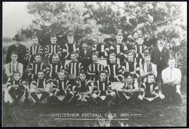
Known as the Rosellas, the early Cheltenham Football Club sides began playing on a regular basis in 1890, and would travel long distances by steam train to play country teams, such as Ballarat where they would arrive at their destination, play the match, socialize then return to the station. Opposition players and supporters would give three hearty cheers on their departure. The Cheltenham home games were played on a paddock on the corner of Park and Charman roads in Cheltenham. In 1907 the Cheltenham progress committee made an application to the board of land works for land in Weatherall Road for recreational service to the public. That application was received and granted, then developed where Cheltenham Recreational Reserve now stands. The land in the early days was virgin bush and the response for voluntary help to clear the area was outstanding. Nearly all the market gardeners in the district along with horses, ploughs, axes, shovels completely cleared the area in three weeks. The Moorabbin council then leveled the playing area and erected a post and rail fence around the ground. Pine tree shrubs were then planted on the west side of the ground. The ground was opened in 1909 and the first Cheltenham side entered in the newly formed Federal Football Association along with seven other foundation members, Mordialloc, Mentone, Moorabbin, Frankston, Glenhuntly, Elsternwick, and Ellindale. The grand final for that year, 1909 was a hard encounter between Cheltenham and Ellindale with Cheltenham coming out victors, thus becoming the inaugural Federal Football Association premiers. Cheltenham went onto win five senior premierships in the Federal Football Association by the end of the 1920s, they won the flags in 1909, 1911, 1913, 1922 and 1925, with the late Percy Woff playing in all 5 premiership sides and was captain in 1922. 1928 saw the start of an outstanding career from our oldest living player Tom Connor. Cheltenham continued to win premierships in the 1920’s and 1930’s with juniors taking out the 1929 and 1933 flags, under the guidance of Woff, and that continued in 1934 when Cheltenham took out the 1st XVIII and 2nd XVIII premierships. Cheltenham produced its only Brownlow medallist in Peter Box who played in the late 1940s, before going to Footscray where he became a champion. The 3rd XVIII went through the season undefeated in 1974 winning the premiership, with Trevor Barker a key player before going to St Kilda the following year. The club won three senior premierships under coach Barry White in 1992, 1993 and 1995. ( from CFNC website 2019) Cheltenham Football Club was formed 1890 and succeeded in winning many Premierships as a member of the Federal Football Association, Outstanding players Peter Box Brownlow Medalist 1956 Footscay VFL, , Trevor Barker and Kevin Roberts St Kilda VFL.3x Black & White photographs of the players in the Australian Rules Cheltenham Football Club 1909, 1913 and 1946 extra photo of Peter Box Folio 10 MAV 01059a) CHELTENHAM FOOTBALL CLUB 1909 Cheltenham Football Club 1909. Back row: A Chandler, committee member; R. Robertson, back-pocket; J. Harris, half back flank; J Adams, ruck and forward-pocked; M. J. Monk, club president; L. Woff, back-pocket; W. Adams, ruck and back-pocket; P. Woff, rover and forward-pocket; A Monk, committee member. Middle row: W. Hore, back pocket and ruck; A. Towns, half-forward flank; W. Carson, full back; F. Andrews, captain-half forward flank; H. Butler, centre half back; J. Warburton, centre half-forward; A. Slater, half-back flank; F. Fisher, half-forward flank; C. Sherwood, trainer. Front Row: G Gouldthorpe, wing; H. King, full-forward; W. Johnston, ruck and forward-pocket; P Spears, rover and forward-pocket; F. Bichl, wing; A. Bichl. rover and forward-pocket; F. Butler, centre player. Courtesy, Lionel Seal. ( from CFC website 2019) b) CHELTENHAM 1913 PREMIERS c) CHELTENHAM -1946 / Back row - J. Fisher, G.Corrigan, N.Hocking, F.Virtue, R.Craven, L.Baker, M.Blundell / 2nd Row - J.Phillips, T.Connor, E.Hawkins, A.Blakely, G.Baker, A.Dark, J.Barker, D.Craven, J.Pickering, P.Cameron,/ W.Hicks, G.Hoskings, R.Beihl, A.Hubbard, R.Kier, C.Russell. / Front Row - Clark Taylor, J.Slade, N.Niel, J.Brooks, T,Butler, H.Hosking, C.Hacusler, E.Hornibrook, W.Briggs, B.Russell, L.Biehl, / W Ripponcheltenham football club, australian rules football, victorian football association, victorian football league, smith j l; smith mary ann, stanley helen, , chaff cutter, horse drawn carts, toll gates brighton, motor cars 1900, steam engines, early settlers, bentleigh, parish of moorabbin, city of moorabbin, county of bourke, moorabbin roads board, shire of moorabbin, henry dendy's special survey 1841, were j.b.; bent thomas, o'shannassy john, king richard, charman stephen, highett william, ormond francis, maynard dennis, market gardeners, vineyards, orchards, cheltenham, two acre village, holloway josiah,, woff percy, connor tom, box peter, barker trevor, white barry, browlow charles, -
 Ballarat and District Irish Association
Image, Life in Ireland - A Farmer's Cabin, c1864
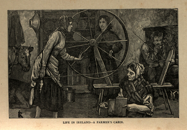
The tenant lived at the mercy of the resident landlord. Home was a one-roomed house, a chimney of wicker work plastered over with mud or just a hole in the roof. The walls might consist of mud too, or sods of grass. Any windows, were rarely glazed and would be open to the elements all year round. The Pig, if any, was kept in the house, the most valuable possession. Sold for cash at local market. The main items in the house were a potato pot and water bucket. As well as mother, father and children, there could well be grandparents all living in the same cramped conditions. The family would sleep on rushes or straw lain on the floor. Most tenants were tenants 'at will ', which meant they could be evicted at the 'will' of the landlord. Some had a lease for the life of the father and the eldest son, and this meant they were relatively safe from eviction as long as they could pay their rent. There was a tradition of passing on a portion of your land from father to each of the sons, who would build a small dwelling, and in turn pass a portion onto their own sons. This cycle of subdivision meant that many families were surviving on a tiny plot of land from which to derive a crop of potatoes for the year. Women worked hard in this environment, rearing children, cooking, cleaning, tending to any animals such a pigs or chicken and when needed, helping in the potato field. Life was dictated by the annual rent due to the landlord. Other typical expenses could be the Hearth Tax (actually charged by the number of fire places in a house) Turf, Hay (for any farm animals) and tithes. A tax known as the tithes were calculated at one tenth the value of everything saleable. Tithes were a bitter issue. They were for the support of the Church of Ireland, Protestant Bishops and Ministers, and a cess tax for the construction and maintenance of Protestant Church buildings. The problem being that the vast majority of those paying the Tax were Catholic and paying to support something that was contrary to their beliefs. Potatoes were the staple diet from September through to the end of Spring of the following year. But the summer months were months of hunger and hardship as they waited for the following harvest to come in Autumn. During these months people had to resort to eating anything they could find; turnips, cabbage, even wild grass, nettles, wild berries and dandelions. Those who lived close to the sea would collect seaweed and use it spread on their land as a form of manure. The dependency of so much of the population on the Potato as their sole source of food was to prove disastrous during the Famine years. [http://www.youririshroots.com/irishhistory/tenant.php, accessed 14 December 2013]A woman spins wools, while another cards fleece in preparation for spinning. I man smokes a pipe by an open fireplace, while a cow takes shelter in the cabin for warmth. ballarat irish, cabin, spinning, wool, cow -
 Surrey Hills Historical Society Collection
Photograph, Mr and Mrs William Tacey
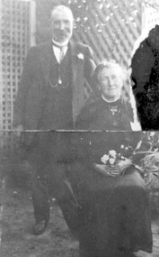
William (1857 - 1920) was a butcher. William was born 7 Nov 1857 on the Buckland (River) near Bright, son of John Joseph Tacey and wife Elizabeth Cooper. This was just a few months after the Buckland River anti-Chinese riots. He had siblings Thomas (1856-1929), Mary Ann (1860-1920), Edward (1863-1952) and Arthur Edward (1870-1896). William died 30 March 1920, Camberwell. He married Florence Margaret Edwards in 1884. Both are buried in Box Hill Cemetery (CE-0162). They had 7 surviving children; 2 died in infancy. William was a butcher in Thornbury but moved to Camberwell with his brothers seeing the opportunity in the new suburbs. They set up shops in Canterbury Road, opposite Highfield Road, Surrey Hills; Burwood; corner of Elgar & Whitehorse Roads, opposite the Whitehorse Hotel and Canterbury Road, Surrey Hills just east of Surrey Hotel. The first directory entries are in 1888 & 1889 for the Surrey Hills shop & Elgar Road. In Surrey Hills a substantial property was developed on land which "was purchased by Edward Tacey on 16 September 1889. Edward Tacey was a butcher and the Sands & MacDougall street directory indicates that a butcher’s shop had been constructed on the site and was operating by 1890. It seems that the family lived for some time at a house located next door to the shop at 627 Canterbury Road (visible on the 1909 MMBW plan, but since demolished). On 15 June 1920 Edward Tacey transferred all three blocks of land to Joseph Tacey, most likely his son * and also a butcher, who carried on business from the same premises. Joseph Tacey died on 20 February 1933, after which administration of his estate (which included the three blocks of land) passed to his widow, Mary Dorothy Tacey." (Context P/L Heritage Assessment) Correction: *Edward Tacey (1863 - 1952) was the brother of William Tacey (1857 - 1920). The property passed to Joseph Charles Tacey (1887 - 1933), his nephew and son of William, not his son. His wife was Mary Dorothy Coates. Albert Arthur Tacey was a brother of Joseph Charles Tacey. Edward later moved from the area and continued in the business in a number of regional Victorian centres. In Surrey Hills the business was continued by other members of the family including Albert Arthur Tacey (1902-1959) who lived at 7 Sunbury Crescent, and daughter Stella Florence Tacey and her husband Roy Morris and their son Harry Tacey Morris. The donor of the Tacey collection of photos was Elaine Merle Tacey (1925-2003), daughter of Albert Arthur Tacey. She married Donald McKenzie. A black and white photograph of a couple in the garden. The man is standing and wearing a 3 piece suit whilst the lady is seated and holding a posy of flowers in her lap.(mr) william tacey, butchers, (mr) edward tacey, (mr) thomas tacey, (mr) joseph tacey, (mrs) stella morris, (mr) roy morris, (miss) florence margaret edwards, (mrs) florence margaret tacey, (mr) albert arthur tacey, (miss) stella tacey, (mr) harry tacey morris -
 Wodonga & District Historical Society Inc
Furniture - Secretaire with Bookcase - the Watson Family of Wodonga
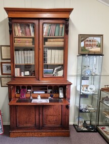
This secretaire once stood proudly in the de Kerilleau homestead at Wodonga. The homestead had been built for William Huon, son of the early pastoralist Paul Huon, in 1870 and named after the family's ancestral estate in France. The original lease of the Wodonga Run was granted to Paul Huon as No. 202 on 7th February 1837, about a year after his cousin Charles Huon had squatted on the land. Kenneth Darnton Watson bought de Kerilleau homestead in 1922 where the Watson family lived for three generations, caring for the land and serving the Wodonga community. Kenneth, his son Ian Darnton Watson and his grandson John Kenneth Darnton Watson all served on the Wodonga Council. John Kenneth Darnton Watson was born on 28 August 1960 in Wodonga. After completing his primary schooling locally, he boarded at Geelong College from 1973. John joined the rowing crews, starting in the 8th VIII crew and reaching the 1st VIII crew in 1978. He received multiple House colours awards for cross country, athletics and rowing and received School colours for rowing. On completion of his schooling, John spent some time jackarooing before studying farm management at Marcus Oldham College. He then returned home to de Kerilleau, Wodonga to manage the family property. In 1984 John married Christine Honybun, daughter of David Lewis Honybun and Marian Josephine Edkins. John and Christine had three sons. John was community minded and involved in a number of local organisations such as Apex and agricultural societies. He was elected to Wodonga City Council in 1997, serving until 2004. Due to increased pressure on available land to cater for the growth of Wodonga, some of the property was sold and in 2003 John donated 200 ha of Huon Hill ‘s western slopes to the City of Wodonga. After this time, he moved away from farming to become a Hungry Jack's franchisee. In 2009, the hard decision was made to sell de Kerilleau and John and his family moved into Wodonga. After sadly losing Christine to cancer in 2017, John became a member and Deputy Chairperson of the Albury Wodonga Regional Cancer Centre Trust Fund Board and Ambassador for the Sunshine Walk. Tragically after his own cancer battle, John Kenneth Darnton Watson passed away on 24 August 2023, aged 62 years following a life of service to the Wodonga community.This item is significant because it was owned by a prominent Wodonga family and came from a Historic Homestead in WodongaA secretaire with bookcase made of cedar. The bottom section has two cupboards with shelves. These doors support the desk when it is fully opened. Above this section is one large drawer, the front of which opens by pressing a small internal button on each side. The open drawer reveals a desk with a leather writing mat and several compartments. The desk is topped by a book shelf with 3 adjustable shelves. It has lockable glass doors.watson family wodonga, de kerilleau homestead, john watson -
 Wodonga & District Historical Society Inc
Decorative object - Silver Tray from John Kenneth Darnton Watson, Wodonga
This silver tray was donated by the family of John Watson and was used when they lived in de Kerilleau Homestead for three generations. de Kerilleau Homestead was built for William Huon, son of the early pastoralist Paul Huon, in 1870 and named after the family's ancestral estate in France. The original lease of the Wodonga Run was granted to Paul Huon as No. 202 on 7th February 1837, about a year after his cousin Charles Huon had squatted on the land. Kenneth Darnton Watson bought de Kerilleau homestead in 1922 where the Watson family lived for three generations, caring for the land and serving the Wodonga community. Kenneth, his son Ian Darnton Watson and his grandson John Kenneth Darnton Watson all served on the Wodonga Council. John Kenneth Darnton Watson was born on 28 August 1960 in Wodonga. After completing his primary schooling locally, he boarded at Geelong College from 1973. John joined the rowing crews, starting in the 8th VIII crew and reaching the 1st VIII crew in 1978. He received multiple House colours awards for cross country, athletics and rowing and received School colours for rowing. On completion of his schooling, John spent some time jackarooing before studying farm management at Marcus Oldham College in Geelong, Victoria. He then returned home to de Kerilleau, Wodonga to manage the family property. In 1984 John married Christine Honybun, daughter of David Lewis Honybun and Marian Josephine Edkins. John and Christine had three sons. John was community minded and involved in a number of local organisations such as Apex and agricultural societies. He was elected to Wodonga City Council in 1997, serving until 2004. Due to increased pressure on available land to cater for the growth of Wodonga, some of the property was sold and in 2003 John donated 200 ha of Huon Hill‘s western slopes to the City of Wodonga. After this time, he moved away from farming to become a Hungry Jack's franchisee. In 2009, the hard decision was made to sell de Kerilleau and John and his family moved into Wodonga. After sadly losing Christine to cancer in 2017, John became a member and Deputy Chairperson of the Albury Wodonga Regional Cancer Centre Trust Fund Board and Ambassador for the Sunshine Walk. Tragically after his own cancer battle, John Kenneth Darnton Watson passed away on 24 August 2023, aged 62 years following a life of service to the Wodonga community.This item is significant because it was owned by a prominent Wodonga family and came from a Historic Homestead in WodongaA circular silver tray with an embossed design around the outer edge.watson family wodonga, de kerilleau homestead, john watson, peter charlesworth -
 Marysville & District Historical Society
Book - Hardcover book, McCarron, Bird & Co, Victoria and its Metropolis-Past and Present-Volume 2, 1888
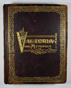
A history of the various colonies and districts of Victoria from the time of the discovery of Australia through until 1888.Hardback. Dark brown cover with the title in gold lettering. There is also a border in gold decorating the outer edge of the front cover. The spine is also decorated in gold along with the title and the volume number.non-fictionA history of the various colonies and districts of Victoria from the time of the discovery of Australia through until 1888.melbourne, victoria, pioneers, colonisation, history, fauna, flora, banking, finance, medicine, western district, south-western district, wimmera district, geelong district, ballarat district, avoca district, coliban district, campase district, loddon district, lower goulburn district, upper goulburn district, ovens district, north-east district, gippsland district, mornington district, westernport district, upper yarra district, evelyn district, bourke district -
![View of the Township of Fernshawe / [by] Nicholas Caire, circa 1876](/media/collectors/550653872162f11fb04854aa/items/57775425d0cdd10a5c17a3fd/item-media/57775483d0cdd10a5c17c7c0/item-fit-380x285.jpg) Kew Historical Society Inc
Kew Historical Society IncPhotograph, Anglo-Australasian Photographic Company, View of the Township of Fernshawe, c. 1876
Nicholas Caire was born on Guernsey in the Channel Islands in 1837. He arrived in Adelaide with his parents in about 1860. In 1867, following photographic journeys in Gippsland, he opened a studio in Adelaide. From 1870 to 1876 he lived and worked in Talbot in Central Victoria. In 1876 he purchased T. F. Chuck's studios in the Royal Arcade Melbourne. In 1885, following the introduction of dry plate photography, he began a series of landscape series, which were commercially successful. As a photographer, he travelled extensively through Victoria, photographing places few of his contemporaries had previously seen. He died in 1918. Reference: Jack Cato, 'Caire, Nicholas John (1837–1918)', Australian Dictionary of Biography, National Centre of Biography, Australian National UniversityAn original, rare photograph from the series 'Views of Victoria: General Series' by the photographer, Nicholas Caire (1837-1918). The series of 60 photographs that comprise the series was issued c. 1876 and reinforced a neo-Romantic view of the Australian landscape to which a growing nationalist movement would respond. Nicholas Caire was active as a photographer in Australia from 1858 until his death in 1918. His vision of the Australian bush and pioneer life had a counterpart in the works of Henry Lawson and other nationalist poets, authors and painters.Albumen silver photograph mounted on board. [Note: This is the first of two copies of this photograph in the collection]printed in ink on support l.c.: VIEW OF THE TOWNSHIP OF FERNSHAWE. / COPYRIGHT REGISTERED. printed in ink on support reverse c.: VIEWS OF VICTORIA. / (GENERAL SERIES.) / No. 14. / VIEW OF THE TOWNSHIP OF FERNSHAWE. / Fernshawe may be considered the most romantic town in the Colony of Victoria. It is situated at the foot of / the Black Spur, and is surrounded by a great many high hills, such as Mounts Riddell, Juliet, Munday, and others, / which form the crossing range into Gipps Land. It has, no doubt, derived its name from the fact that it is the / greatest Fern-growing district in the Colony. printed in ink on support reverse l.c.l.: J.W. FORBES, Agent, printed in ink on support reverse l.c.: ANGLO-AUSTRALASIAN PHOTOGRAPHIC COMPANY, MELBOURNE. printed in ink on support reverse l.c.r.: 10 Temple Court, Collins Street West.nicholas caire (1837-1918), landscape photography, fernshawe -
![View of the Township of Fernshawe / [by] Nicholas Caire, circa 1876](/media/collectors/550653872162f11fb04854aa/items/57775578d0cdd10a5c183f96/item-media/577755dfd0cdd10a5c18731c/item-fit-380x285.jpg) Kew Historical Society Inc
Kew Historical Society IncPhotograph, Anglo-Australasian Photographic Company, View of the Township of Fernshawe, c. 1876
Nicholas Caire was born on Guernsey in the Channel Islands in 1837. He arrived in Adelaide with his parents in about 1860. In 1867, following photographic journeys in Gippsland, he opened a studio in Adelaide. From 1870 to 1876 he lived and worked in Talbot in Central Victoria. In 1876 he purchased T. F. Chuck's studios in the Royal Arcade Melbourne. In 1885, following the introduction of dry plate photography, he began a series of landscape series, which were commercially successful. As a photographer, he travelled extensively through Victoria, photographing places few of his contemporaries had previously seen. He died in 1918. Reference: Jack Cato, 'Caire, Nicholas John (1837–1918)', Australian Dictionary of Biography,An original, rare photograph from the series 'Views of Victoria: General Series' by the photographer, Nicholas Caire (1837-1918). The series of 60 photographs that comprise the series was issued c. 1876 and reinforced a neo-Romantic view of the Australian landscape to which a growing nationalist movement would respond. Nicholas Caire was active as a photographer in Australia from 1858 until his death in 1918. His vision of the Australian bush and pioneer life had a counterpart in the works of Henry Lawson and other nationalist poets, authors and painters.Albumen silver photograph mounted on board. [Note: This is the second of two copies of this photograph in the collection]printed in ink on support l.c.: VIEW OF THE TOWNSHIP OF FERNSHAWE. / COPYRIGHT REGISTERED. printed in ink on support reverse c.: VIEWS OF VICTORIA. / (GENERAL SERIES.) / No. 14. / VIEW OF THE TOWNSHIP OF FERNSHAWE. / Fernshawe may be considered the most romantic town in the Colony of Victoria. It is situated at the foot of / the Black Spur, and is surrounded by a great many high hills, such as Mounts Riddell, Juliet, Munday, and others, / which form the crossing range into Gipps Land. It has, no doubt, derived its name from the fact that it is the / greatest Fern-growing district in the Colony. printed in ink on support reverse l.c.l.: J.W. FORBES, Agent, printed in ink on support reverse l.c.: ANGLO-AUSTRALASIAN PHOTOGRAPHIC COMPANY, MELBOURNE. printed in ink on support reverse l.c.r.: 10 Temple Court, Collins Street West.nicholas caire (1837-1918), landscape photography, fernshawe -
 Lilydale RSL Sub Branch
Certificate - Certificate of Appreciation, 16-110-1939
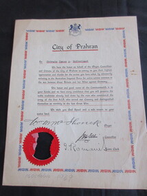
Private James Andrew Sutherland - VX59088 ,POW - Thailand (Burma Railway) and Changi.Paper certificate with "City of Prahran" as heading with Australian Coat of Arms. Blue and red border.To Private James A Sutherland. We have the honour on behalf of the Mayor, Councilors and Citizens of the City of Prahran to convey to you their highest appreciation and thanks for the action you have taken by voluntarily enlisting in the Australian Imperial Force for active service overseas in the war between Great Britain and her Allies against Germany. The honour and good name of the Commonwealth is in your hands, and we have every confidence that you will preserve the noble traditions already laid down by the men who constituted the Army of the first A.I.F. who served our country and distinguished themselves so worthily in the last Great War. We wish you God speed and a safe return to your Native land. Signed Wm M McIlwrick Mayor, J M Ellis Councilor and J Romaiu Town Clerk. -
 Orbost & District Historical Society
black and white photograph, January 1, 1897
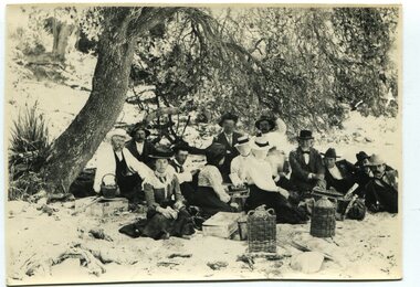
This photograph shows Mr John Bird ( 3rd from left) ; Mr John Gilbert and Mr Lance Herbert among others having a picnic at the popular beach paddock at Old Station, Corringle, on January 1, 1897. Late in 1857 Mr Thomas T. Stirling took over Corringle Run ("Corringle" means "shallow water"). Mr Stirling and his family came from the wester district - Winchelsea. He settled at the Old Station. A few people were employed at the Orbost Stationb and there was settlement on the Orbost flats, Mr T. T. Stirling held the land from Lake Tyrers to Bemm River as a cattle run. About 1888 he became Secretary of the new Tambo Shire.This photograph is a portrait of rural life in the late 19th century. It is an insight into the dress, manners and activities of the first settlers of Orbost.Two copies of a black / white photograph of a group of men and women picnicking on the sand under tall trees.on back - "Beach Paddock - Old Station -1897" with a list of namesold-station-orbost rural-family-life -
 Orbost & District Historical Society
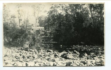
black and white photograph, April 17, 1897
This is the Nowa Nowa crossing off Old Orbost Road, to the first Nowa Nowa Hotel built by Moses Faithfull, in 1890, in background. Moses Faithful came to Australia from England with his parents on the Royal Consort in 1844. After living at Bulla, Pakenham and Wurruk he and his wife moved to Hospital Creek in about 1885 where he took up the first selection of land at Upper Hospital Creek. As well as farming he built the first hotel at Nowa Nowa in 1890. He had charge of the hotel until 1895 when he sold to Mary Stirling. Moses died on 8th July 1901, aged 66, at the residence of his son-in-law, David Price, at Newmerella, and buried in the Orbost cemetery.This hotel was built in 1890 and doubled as a coaching stop on the inland route. Settlement grew up around the hotel. It was sold 1895 to Mary Stirling who husband own the land the hotel stood on. The hotel burned down on 29 July 1955. This is a pictorial record of Nowa Nowa in the late 19th century.A black / white photograph of a creek crossing with large stones in the foreground. A bridge can be seen in the background across the creek.nowa-nowa faithful-moses stirling-hotel -
 Warrnambool and District Historical Society Inc.
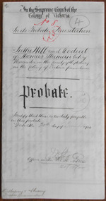
Document - Thomas Sleeman Probate 1900, 1900
Tait collection: item 57 of 62 This document gives details of the Will and Probate of Thomas Sleeman, a Nirranda farmer. He died in 1900 at the age of 85 and left real estate to the value of £600. The main beneficiaries were his sons and £30 was left to Mary Le Couteur, his daughter. He also bequeathed to the Wesleyan Church the half acre of land that the church was on at that time (presumably in the Nirranda district). The document has been drawn up by the law firm of O’Mahony and Murray which operated in Warrnambool early in the 20th century. The document has been passed down to successive lawyers occupying the legal premises in Kepler Street and located there in 2014 in the same building, the premises last occupied by the law firm of Mackay Taylor. This document is of some interest as it gives details of the Will and Probate of Thomas Sleeman, a farmer from Nirranda.This is a piece of white paper folded in two to make four pages. Three of the pages are ruled with blue lines and have margins ruled in blue. There is handwritten material on three pages. A seal of the Supreme Court of Victoria is attached with green ribbon and there are nine red stamps of the Master in Equity of the Supreme Court and one purple stamp of the Savings Bank (Head Office). The document is a little stained and the writing is fading but legible. The document gives details of the Will and Probate of the Nirranda farmer, Thomas Sleeman who died in September 1900. In the Supreme Court of the Colony of Victoria in its Probate Jurisdiction in the Will and Codicil of Thomas Sleeman late of Naranda in the County of Heytesbury in the Colony of Victoria farmer deceased.o’mahony and murray, warrnambool lawyers, thomas sleeman, warrnambool history, tait collection, nirranda -
 Warrnambool and District Historical Society Inc.
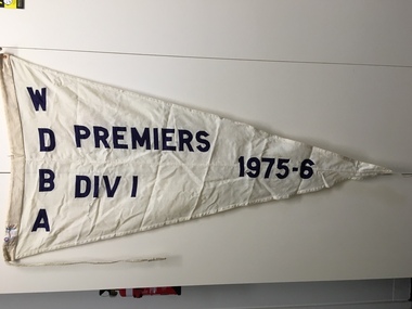
Flag, WarrnamboolDistrict Bowles Club 1975-76, 1976
This is a pennant from the Warrnambool District Bowls Association. This association is a division of the West Coast Bowls Association and the members are the Bowls Clubs of Dennington, Koroit, Lawn Tennis Club, Mortlake, Terang, Port Fairy, Timboon, Warrnambool and City Memorial. This pennant was awarded for the premiers of 1975/76 and, as the pennant came from St.John’s Bowls Club (Presbyterian Church Warrnambool) it is presumed that this club was the winner of this pennant. St. John’s Bowls Club, in Princess Street, Warrnambool, was prominent in the 20th century but has now been disbanded (early 21st century) with the land sold in 2014. The maker of the flag, Evan Evans Pty Ltd, is a well-known Australian flag-making business. It was founded in 1877 and a member of the family was a co-designer of the Australian flag in 1901. This pennant is of some interest as it was awarded by the Warrnambool District Bowls Association to St. John’s Bowls Club in Warrnambool. As the St. John’s Club no longer exists it is an important memento of this Warrnambool sports club. Bowls is a popular sport in Warrnambool. This is a large triangular-shaped pennant from the Warrnambool District Bowls Association (1975-6). It is a white cloth pennant made in two sections with stitched hems on the edges and through the centre. The side holding the cord is made of thicker folded cloth with a white plaited cord inserted. The lettering is made of blue cloth and machine stitched on to the pennant. The material is nylon and wool. There are some dirt smudges and rust marks where the pennant has been attached to a wall. ‘W.D.B.A. Premiers 1975-6’warrnambool district bowls association, st. john’s bowls club, warrnambool, warrnambool -
 Warrnambool and District Historical Society Inc.
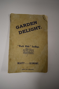
Booklet, Garden Delight, 1932
This booklet is a 1932 catalogue of the Floral Farm in Warrnambool. It was established by Charles Allen Jukes who had first opened a plant nursery at Cudgee on the banks of the Cudgee Creek. Early in the 20th century the nursery, the Floral Farm, was re-located to East Warrnambool with the boundary of the property extending along Raglan Parade, Flaxman and Bostock Streets. . A very high paling fence, topped with vertical slats was erected around the property. The Floral Farm continued for some time (with Charles Allen Jukes dying in 1934) and the nursery land was sub-divided for housing. Charles Allen Jukes’ parents, Alfred and Margaret came to Warrnambool in 1856, with Alfred setting up a law business and at one time being the honorary Town Clerk of Warrnambool. This booklet is of historical interest as it is a catalogue of the plants and seedlings available in the early 1930s from the Jukes Floral Farm in East Warrnambool. The parents of the Floral Farm business, Alfred and Margaret Jukes, were pioneer settlers in Warrnambool.This is a booklet of 40 pages. The cover has blue printing and was once white or buff-coloured but is now much stained. The pages contain information on plants and seedlings and have many black and white photographs. The booklet is dog-eared and crumpled.jukes family, warrnambool, floral farm nursery, warrnambool -
 Eltham District Historical Society Inc
Photograph - Digital Photograph, Alan King, Ore crusher, Golden King mine, Yarrambat, 22 January 2008
Prior to 1929 Yarrambat was known as Tanck's Corner or Reynold's Corner after Frederick Tanck who owned land north of Ironbark Road at the corner of Yan Yean Road, and Thomas Ryenolds who owned the property opposite. Tanck's Corner was at the centre of gold bearing country. Gold was mined here until 1984 when the last operating mine, the Golden King mine in North Oatlands Road closed. It was owned by the Clayton family and in the 1960s was the only private family gold mine in Victoria. Larger mines had their own batteries and stampers to process the ore. Covered under Heritage Overlay, Nillumbik Planning Scheme. Published: Nillumbik Now and Then / Marguerite Marshall 2008; photographs Alan King with Marguerite Marshall.; p23This collection of almost 130 photos about places and people within the Shire of Nillumbik, an urban and rural municipality in Melbourne's north, contributes to an understanding of the history of the Shire. Published in 2008 immediately prior to the Black Saturday bushfires of February 7, 2009, it documents sites that were impacted, and in some cases destroyed by the fires. It includes photographs taken especially for the publication, creating a unique time capsule representing the Shire in the early 21st century. It remains the most recent comprehenesive publication devoted to the Shire's history connecting local residents to the past. nillumbik now and then (marshall-king) collection, battery, clayton family, gold mining, golden king mine, ore crusher, tancks corner. reynolds corner, yarrambat -
 Glen Eira Historical Society
Document - Glenhuntly Road, Elsternwick
Three three page extracts from Andrew Ward’s 1994 Caulfield Conservation Study on commercial buildings in Glen Huntly Road, Elsternwick. The three studies concern Moore’s Buildings 1891 shops at 305-313 Glen Huntly Road, shops at 323-329 Glen Huntly Road and E J Buckeridge’s Buildings 1911 shops at 357-371 Glen Huntly Road. The studies describe the buildings’ architectural features, provide a historical overview and statements of the buildings’ significance, especially in relation to the Land Boom and commercial development between 1890 to the 19020s. All three studies include a black and white photograph (109mm x 152mm; 114mm x 150mm; 110mm x 151mm) of the shop fronts.glen huntly road, moore’s buildings 1891, italianate style, architectural styles, architectural features, verandahs, elsternwick, moore hugh, selwyn street, st georges road, glenmoore, glenmoore estate, corkill french and pugh, jamieson w w, thompson a g, eddy henrietta, valey frank, allen thomas, saddlers, dairy products, green w i, undertakers, delany edward, drapers, herbenstreit huldreich, butcher shops, sincock john, plumbers, allen t, greengrocers, coppel george, painters, dickinson f h, dickinson v, johnson thomas, cole constance, hairdressers, ortner frank, drycleaners, gaffney elodie, ward andrew, long mr, robinson mr, le page mr, byers robert, carter mary, millar c, smythe f c, crook thomas, stancy h, crook’s national stores pty ltd, e j buckeridge’s buildings 1911, kelly walter, staniland grove, buckeridge edward, hannon john, kellett frances, beck miss, armstrong miss, tuck mary, milliners, doherty john, adams herbert, bakeries, perry robert, picture framers, adams clifford, arches, windows, shops, land subdivision, retail trade, property developers, advertising signs -
 Greensborough Historical Society
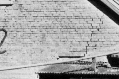
Photograph - Digital Image, Brickwork, Willis Vale, 1950c
Close up photograph of a section of brickwork at Willis Vale. This is the end wall under the roof. Willis Vale built by Edward Maygar, Robert Whatmough lived there mid 19th century and later sold to Partington family. It was located on the Plenty River at Partington's Flat Greensborough. Land use included farming and orchards. The derelict Willis Vale house was vandalized in 1964 and destroyed when a fire originating from North Plenty Gorge - Kurrak Road - was lit by two teenage boys and made its way several kilometres down to Partington's Flat Greensborough. This photo was taken after the Partington's moved house in 1947 across the river where Alan built their new Alwyn house that had access to electricity.Part of Willis Vale, a pioneer home in the Greensborough area.Digital copy of black and white photograph.willis vale -
 Eltham District Historical Society Inc
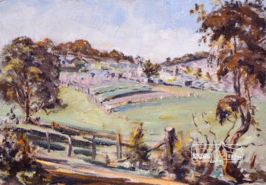
Photograph, Bird family Orchard, Pitt Street, Eltham, c.1980s
View looking northeast from near junction of Wattle Grove and Mount Pleasant Road across to Eucalyptus Road on right and Pitt Street at top. Early pioneer, George Bird Snr. arrived from England in 1852 and lived with his uncle, George Stebbing. He worked for him as bricklayer's assistant in building, among others, the Anglican and Methodist Churches in Eltham. In 1862 he purchased land in the east end of Pitt Street bounded by Eucalyptus Road and Wattle Grove and established a mixed farm and orchard. His son, Arthur Bird succeeded him and also worked on this orchard which then passed to Arthur's son, Harold Bird OAM, where Harold and Yvonne Bird lived in the family home till the mid 2000s A4 size photographic print reproduction of a paintingaos6, wattle grove, pitt street, arthur bird, bird family orchard, eucalyptus road, george bird, harold bird, yvonne bird, eltham -
 Eltham District Historical Society Inc
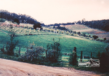
Photograph, Bird family Orchard, Pitt Street, Eltham, c.1980s, 1980s
View looking northeast from near junction of Wattle Grove and Mount Pleasant Road across to Eucalyptus Road on right and Pitt Street at top. Early pioneer, George Bird Snr. arrived from England in 1852 and lived with his uncle, George Stebbing. He worked for him as bricklayer's assistant in building, among others, the Anglican and Methodist Churches in Eltham. In 1862 he purchased land in the east end of Pitt Street bounded by Eucalyptus Road and Wattle Grove and established a mixed farm and orchard. His son, Arthur Bird succeeded him and also worked on this orchard which then passed to Arthur's son, Harold Bird OAM, where Harold and Yvonne Bird lived in the family home till the mid 2000s A4 size photographic printaos6, wattle grove, pitt street, arthur bird, bird family orchard, eucalyptus road, george bird, harold bird, yvonne bird, eltham -
 Orbost & District Historical Society
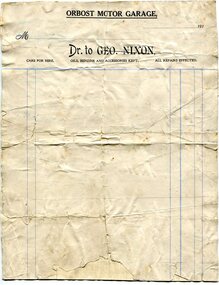
account, 1910 - 1919
This account form was made for the Orbost Motor Garage owned by George Nixon. George Nixon (1862-1941) selected land in Bete Bolong in the 1890's. He married Emily Warren in 1889 in Orbost. He was a shire councillor. He was a prominent breeder of Clydesdales and after a serious fall off a horse walked with a walking stick and special boot for the rest of his life. He was well-known for his interest in cars, horse-racing and politics.He was married to Emily Warren in 1889 in Orbost. Mrs Nixon (Emily)was the first Red Cross president during WW1. They had ten children.both George and Emily are buried in the Orbost Cemetery. (ref:From White Knowle to Pumpkin Point by Hon Peter Nixon A.O.) This item is associated with a prominent Orbost family. George Nixon was the son of James and Alice Nixon. The Nixon families were among the earliest settlers on the Snowy River. It is an example of the early book-keeping of an Orbost business in the early 20th century.A white paper account form. It has black print, blue ruled lines and is unused. t the top is "Orbost Motor Garage" in black capital letters. document-book-keeping nixon-george -
 Orbost & District Historical Society
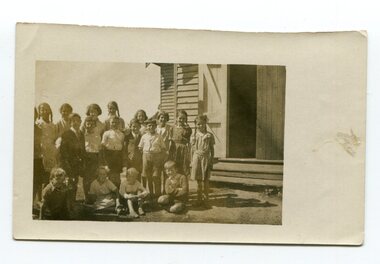
photograph, C1930s
In 1912 the school at Pumpkin Point opened to serve the children of farmers living in the Bete Bolong district. This meant a big change in their way of life because in the past the children had been rowed across the Snowy River each day to attend school at Jarrahmond. Myrtle Bunting was the first HT of the school which had been erected on a block of land purchased from H. Richardson. The school functioned until 1952 when a shortage of pupils caused its closure. As a bus service to Orbost now operated, the school at Pumpkin Point faced permanent closure. J. McKeown bought the building. Students attending the school at this time included Russells, Johnstones, Reeves, Healeys, Kavanaghs, Phillips, Rodwells, Mills, Baileys, Gilberts and Masons.These photographs are associated with the history of education in the Orbost district. There is no longer a school at Bete Bolong.Two small photographs of students standing at the doorway of a school building.photograph-bete-bolong-school eductation-orbost -
 Orbost & District Historical Society
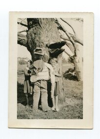
black and white photograph, 1936
In 1912 the school at Pumpkin Point opened to serve the children of farmers living in the Bete Bolong district. This meant a big change in their way of life because in the past the children had been rowed across the Snowy River each day to attend school at Jarrahmond. Myrtle Bunting was the first HT of the school which had been erected on a block of land purchased from H. Richardson. The school functioned until 1952 when a shortage of pupils caused its closure. As a bus service to Orbost now operated, the school at Pumpkin Point faced permanent closure. J. McKeown bought the building. Students attending the school at this time included Russells, Johnstones, Reeves, Healeys, Kavanaghs, Phillips, Rodwells, Mills, Baileys, Gilberts and Masons.This item is associated with the history of education in the Orbost district.A black / white photograph of two Bete Bolong State School pupils - girls - standing against a large tree trunk with a scarecrow between them.on back - handwritten " Hilda Russell & Elsie Morrison on Guy Gawkes at Bete Bolong"education-orbost bete-bolong -
 Orbost & District Historical Society
black and white photograph, 1923
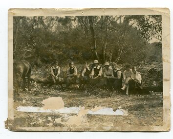
This photograph was taken at the "old station" at Corringle near Orbost. It was a popular picnic spot. Late in 1857 Mr Thomas T. Stirling took over Corringle Run ("Corringle" means "shallow water"). Mr Stirling and his family came from the wester district - Winchelsea. He settled at the Old Station. A few people were employed at the Orbost Stationb and there was settlement on the Orbost flats, Mr T. T. Stirling held the land from Lake Tyrers to Bemm River as a cattle run. About 1888 he became Secretary of the new Tambo Shire. In the photograph L-R are; Hilda Kerr; Myra Malcolm; Marion Nixon; Bess Goudie (teacher); Mary Gilbert; Gwen Hobson (teacher); Pen GilbertOrbost High School / Orbost Secondary College has played a significant part in the education of senior students in the Orbost district . It is the sole senior educational institution. This item is representative of its history. It is a useful reference tool.A black / white photograph of a group of young women sitting on a log in a clearing in a bush setting. Five are in school uniform. On the left is a horseeducation-orbost orbost-higher-elementary-school recreation old-station-corringle -
 Orbost & District Historical Society
black / white photograph, late 19th - early 29th century
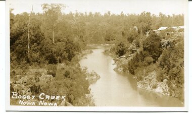
The building in this photograph of Boggy Creek is probably the first Nowa Nowa Hotel built by Moses Faithfull, in 1890. Moses Faithful came to Australia from England with his parents on the Royal Consort in 1844. After living at Bulla, Pakenham and Wurruk he and his wife moved to Hospital Creek in about 1885 where he took up the first selection of land at Upper Hospital Creek. As well as farming he built the first hotel at Nowa Nowa in 1890. He had charge of the hotel until 1895 when he sold to Mary Stirling. Moses died on 8th July 1901, aged 66, at the residence of his son-in-law, David Price, at Newmerella, and buried in the Orbost cemetery.This hotel was built in 1890 and doubled as a coaching stop on the inland route. Settlement grew up around the hotel. It was sold 1895 to Mary Stirling who husband own the land the hotel stood on. The hotel burned down on 29 July 1955. This is a pictorial record of Nowa Nowa in the late 19th century.A black / white photograph / postcard of a creek with a building on the rightside. a windmillis to the left. The banks of the creek are well-vegetated.on front - bottom left -"BOGGY CREEK NOWA NOWA"boggy-creek-nowa-nowa -
 Marysville & District Historical Society
Photograph (Item) - Black and white photograph, Unknown
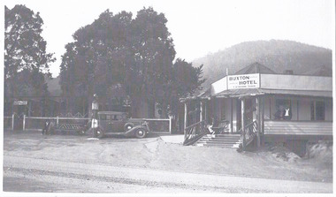
A black and white photograph of the Buxton Hotel in Buxton. Thomas David Robb (1886-1967), was the licensee at the time of the photograph. He, and his wife Alice May Evans, ran the Buxton Hotel for 25 years. The Buxton Hotel was built by William Burchall, probably in the late 1870s. The first owner, who also had land locally, was Frederick Nichols (1833-1904). The Buxton Hotel is located directly opposite the General Store. It was fronted with two huge oak trees and bordered and backed by large pine trees. It was a weatherboard structure with a painted corrugated iron roof. Old split wood shingles were covered by corrugated iron, which overlaid the shingles to make the roof watertight. The wooden shingles date back to the 1850s.A black and white photograph of the Buxton Hotel in Buxton.buxton, victoria, australia, buxton hotel, accommodation, photograph, william burchall, frederick nichols, alice may evans, thomas david robb -
 Marysville & District Historical Society
Ephemera (Item) - Advertisement, BUXTON HOTEL, Unknown
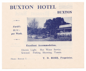
An advertisement regarding the Buxton Hotel in Buxton. Thomas David Robb (1886-1967), was the licensee at the time of the photograph. He, and his wife Alice May Evans, ran the Buxton Hotel for 25 years. The Buxton Hotel was built by William Burchall, probably in the late 1870s. The first owner, who also had land locally, was Frederick Nichols (1833-1904). The Buxton Hotel is located directly opposite the General Store. It was fronted with two huge oak trees and bordered and backed by large pine trees. It was a weatherboard structure with a painted corrugated iron roof. Old split wood shingles were covered by corrugated iron, which overlaid the shingles to make the roof watertight. The wooden shingles date back to the 1850s.An advertisement regarding the Buxton Hotel in Buxton.buxton, victoria, australia, buxton hotel, thomas david robb, alice may evans, accommodation, willam burchall, frederick nichols, advertisement -
 City of Moorabbin Historical Society (Operating the Box Cottage Museum)
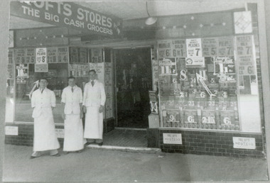
Photograph - Black & White, Crofts Grocery 395 Centre Rd Bentleigh c1937, c1937
After the extension of the Railway line from Caulfield to Mordialloc 1880's the shopping centre moved from the Tucker Rd end to around the East Brighton (Bentleigh) Station area of Centre Road. A variety of shops, forges, estate agents, Coles' and Fossey's variety stores, a Hoyts picture theatre, butchers, traded in Centre Rd. Crofts was one many grocery stores along the strip. Crofts Stores was established by Archibald Crofts (1875-1942) as a single grocery store in South Melbourne. It eventually expanded to include 137 branches throughout Victoria, trading as Crofts Stores. The Lees family had established a Seedling Nursery in Thomas St that has continued until the land sold 2018 for housing development.Crofts Grocery Store was one of the shops in the Centre Road Bentleigh shopping strip that were established after the arrival of the train line 1881Black & White photograph of 3 men outside Crofts Grocery Store 395 Centre Rd Bentleigh c 1937 Mr Jack Lees is centre.Handwritten informationcrofts grocery store bentleigh, lees jack, mordialloc railway line, centre road bentleigh, smith j l, smith mary ann, stanley helen, smith vic, smith harry redvers, chaff cutter, horse drawn carts, toll gates brighton, motor cars 1900, steam engines, early settlers, bentleigh, parish of moorabbin, city of moorabbin, county of bourke, moorabbin roads board, shire of moorabbin, henry dendy's special survey 1841, were j.b., bent thomas, o'shannassy john, king richard, charman stephen, highett william, ormond francis, maynard dennis, market gardeners, vineyards -
 City of Moorabbin Historical Society (Operating the Box Cottage Museum)
Certificate - Document, Certificate of Burial 1890, c1880
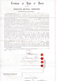
James Jones was the son of Philip Jones, a Chairmaker, and Ann Jones who settled in East Brighton after the sale of land c1852 in the area of the Henry Dendy Special Survey of 1841. Mary Ann Moore was the daughter of Thomas Moore, a Gardener, and Sarah Harris who also settled in Brighton c1852. James and Mary Ann Jones settled and raised their family in East Brighton now Bentleigh. Mr John Herron resided at 4 Vickery St Bentleigh until 1989. Sadly Martha Jones born 1888 died in 1890 and James Jones had to purchase this plot at Brighton General Cemetery for her burial. A further 2 children were interred in 1893 and 1900 then Mary Ann in 1903 and James in 1940 James Jones and Mary Ann Moore were born in Brighton c1857 and c 1859 into pioneer market gardener families in the area of the Dendy Special Survey of 1841. They married in 1883 and raised their family in East Brighton, now Bentleigh. Sadly infectious diseases took the lives of many infants throughout the Colony of Victoria due to the poor state of water supply and sewerage disposal and locally the swamps of the Elster Creek were a constant breeding ground.An original paper Certificate of Right of Burial in The Brighton General Cemetery signed and dated by the Trustees of the Cemetery upon the application of James Jones of East Brighton, Victoria, 22nd April 1890. A plot , Register No. 2844, of 4 feet in width and 8 feet in depth in the Wesleyan Section, No. 199, compartment G in the Brighton General Cemetery. would be supplied upon payment of Two Pounds two shillings and receipt of same is acknowledged. Certificate of Right of Burial / IN THE / BRIGHTON GENERAL CEMETERY. Application of Mr James Jones of East Brighton for a plot to be supplied upon payment of Two Pounds and 2 Shillings and receipt of same acknowledged. Signed by the Trustees of the Cemetery, (4 signatures) in presence of S. Simmonds, dated twenty- second April 1890 Reverse side Dated 22nd April 1890 / Certificate of Right of Burial / IN THE / BRIGHTON GENERAL CEMETERY/ Mr James Jones ( hand written) / DENOMINATION Wesleyan / Compartment G / No. 199 Hand written on right side 3454 (signed) S Simmonds / 4797 (signed) S Simmonds / 36897 20/ 11 / 40 melbourne, brighton, moorabbin, water supply, pioneers, bentleigh, dendy henry, market gardeners, early settlers, jones mary ann, wesleyan church, jones james, vaccination, typhoid, dendys special survey 1841, infectious diseases, elster creek, jones martha, brighton general cemetery