Showing 8873 items matching " construction"
-
 Falls Creek Historical Society
Postcard - Mount Beauty Township
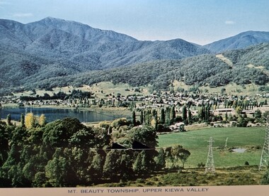
These photographs were taken in and around Mount Beauty and the Kiewa Valley by Samuel Keith Pearce and printed for him as a foldout postcard by NuColor Vue. The postcards state they were printed for S. K. Pearce Pty. Ltd of Tawonga and Mount Beauty. Samuel Keith Pearce was born on 24 June 1917 in Armadale, Victoria. By the late 1940s he owned the Mt Beauty Supermarket, Newsagency, Drapery and Hardware store at Mount Beauty and also a store at Tawonga in partnership with his brother Gordon Cathew Pearce. For some time, they operated as Pearce Brothers. In the early 1960s Keith also opened a mini mart In Falls Creek. As well as being a keen photographer and an astute businessman, Keith Pearce was a well-known identity in the Kiewa Valley, making many contributions to the development of the area over a long period. This included serving as a member of the Bright Shire Council for many years. He worked hard to promote the interests of the Upper Kiewa Valley. As a sign of recognition and appreciation for his contribution to the community, the park opposite the grocery store in Mount Beauty was named the SK Pearce Gardens in his honour. Samuel Keith Pearce died on 7 July 1994 in Mount Beauty, Victoria Mount Beauty was originally established by the State Electricity Commission of Victoria to house construction workers from the Kiewa Hydroelectric Scheme in 1949,[2] passing to the control of the local shire council in 1967 after construction was completed. The town is a launching point for trips to the Falls Creek ski resort, and to the Bogong High Plains. This collection of postcards and images is significant because they were commissioned by a highly successful businessman in Falls Creek, Victoria.A colour image of the township of Mount Beauty in the Upper Kiewa Valley.mt. beauty, kiewa hydroelectric scheme, falls creek, bogong high plains -
 Eltham District Historical Society Inc
Photograph, Time Capsule Ceremony, 10 November 1985, 10/11/1985
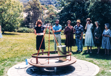
On Sunday, 10 November 1985 a time capsule was lowered into a monument installed near the corner of Main Road and Pitt Street in Eltham, within the gardens at the front of what is now the Eltham Community and Reception Centre. This monument commemorates Victoria’s 150th anniversary and the former location of the Eltham Town Centre, which existed along this section of Main Road, then known as Maria Street. Beneath the site is a time capsule to be opened in the year 2035. A plaque was also erected at this site in October 1987 to commemorate the Shire of Eltham Historical Society’s 20th anniversary. The main feature of this monument is a ‘tyring disc’, a blacksmith’s implement that was found on this site. This consists of a large iron disc that was used as a platform for fitting iron tyres (like the one shown on top of the platform) to wooden-spoked cart wheels. The local blacksmith and wheelwright worked together to assemble the wheel, which was clamped to the platform placed close to the fire. The red-hot iron hoop, previously forged to the correct size, was lifted with tongs by the blacksmith over the outside of the rim, then hammered down amid flames from the scorching timber. The wheelwright drenched the tyre with cold water as soon as it was in position. A clamp placed on the naff (hub) and screwed down tightly kept the spokes at a constant angle as the tyre cooled. An even pressure from the contracting tyre tightened the joints at each end of the spokes and formed a vice-like grip, which would last for the life of the wheel. [from EDHS Newsletter No. 45, November 1985:] TIME CAPSULE CEREMONY: Our 150th Anniversary Monument is now under construction in the gardens in front of the Eltham Community Centre. Further details of the project are given under a separate heading below and this item deals with the proposed ceremony. We propose to formally lower the time capsule into its container underneath the monument as part of the Eltham Community Festival. All members are invited to attend the ceremony at 2.00 p.m. on Sunday, 10th November. Come earlier with a picnic lunch if you like. Local people and firms who have contributed money or services for the monument will also be invited. As part of the Festival programme the public are welcome to attend. This is one of the most significant projects the Society has undertaken and members' participation in its finalization would be most gratifying to the organizing committee. 150TH ANNIVERSARY PROJECTS: We have concentrated our efforts on finishing the monument and time capsule project within the 150th year and have found it necessary to abandon the historical tour project. We have applied to the State 150th Committee to transfer the funds allocated for the tour to construction of the monument. The historical tour project will be continued at a later date and photos of historic houses in the area, taken by Doug Orford, will be available for use in an associated display. At the time of writing, the monument construction is on schedule for the ceremony on 10th November. The concrete base has been completed and the main feature of the monument, which is an old tyring plate or disc, will be lifted into place in the next week. The final ceremony will involve lowering the sealed time capsule into place, bolting down its container lid and then concreting over the lid. The capsule will contain mainly items relating to present day Eltham and its people and is to be opened in the year 2035, a video film made by Joh Ebeli and also details of families and organizations who have contributed to construction of the monument. It is proposed to place the items in the capsule on 5th November and any items members think could be included may be submitted up to that date. The Society has received an excellent response from local people, firms and organizations by way of assistance with this project. Graham Beyer, who originated the project, has arranged many of the donations. He and his firm, Package Handling Equipment, have donated the time capsule itself and have carried out fabrication of sections of the monument. The design of the monument was adapted by Graham Beyer from drawings by Joh Ebeli. Charmac Industries has donated the container for the time capsule and a cast gun metal name plate for the monument. BMG Concrete has donated concrete for the base which was constructed by Caridi Construction Company. Northbourne Garden Supplies has donated materials for the paving around the monument. Robert Becker from Eltham Apex directed construction of the paving by Society members. Terry Hutchinson has agreed to donate the use of his crane to lift the tyring disc into place. Financial contributions have been made by the Eltham Chamber of Commerce and the Rotary Club of Eltham. We are grateful to all who have helped, and members' support for firms who have donated their services would be an appropriate recognition. It is planned to print "Time Capsule Certificates" which can be held by organizations or passed on to descendants by individuals. The certificates will indicate an interest in the contents of the capsule when it is opened in fifty years. Certificates will be distributed to Society members and those who have contributed to the project.Nine colour photographsactivities, 1985, time capsule, eltham, eltham festival -
 Eltham District Historical Society Inc
Photograph, Time Capsule Ceremony, 10 November 1985, 10/11/1985
On Sunday, 10 November 1985 a time capsule was lowered into a monument installed near the corner of Main Road and Pitt Street in Eltham, within the gardens at the front of what is now the Eltham Community and Reception Centre. This monument commemorates Victoria’s 150th anniversary and the former location of the Eltham Town Centre, which existed along this section of Main Road, then known as Maria Street. Beneath the site is a time capsule to be opened in the year 2035. A plaque was also erected at this site in October 1987 to commemorate the Shire of Eltham Historical Society’s 20th anniversary. The main feature of this monument is a ‘tyring disc’, a blacksmith’s implement that was found on this site. This consists of a large iron disc that was used as a platform for fitting iron tyres (like the one shown on top of the platform) to wooden-spoked cart wheels. The local blacksmith and wheelwright worked together to assemble the wheel, which was clamped to the platform placed close to the fire. The red-hot iron hoop, previously forged to the correct size, was lifted with tongs by the blacksmith over the outside of the rim, then hammered down amid flames from the scorching timber. The wheelwright drenched the tyre with cold water as soon as it was in position. A clamp placed on the naff (hub) and screwed down tightly kept the spokes at a constant angle as the tyre cooled. An even pressure from the contracting tyre tightened the joints at each end of the spokes and formed a vice-like grip, which would last for the life of the wheel. [from EDHS Newsletter No. 45, November 1985:] TIME CAPSULE CEREMONY: Our 150th Anniversary Monument is now under construction in the gardens in front of the Eltham Community Centre. Further details of the project are given under a separate heading below and this item deals with the proposed ceremony. We propose to formally lower the time capsule into its container underneath the monument as part of the Eltham Community Festival. All members are invited to attend the ceremony at 2.00 p.m. on Sunday, 10th November. Come earlier with a picnic lunch if you like. Local people and firms who have contributed money or services for the monument will also be invited. As part of the Festival programme the public are welcome to attend. This is one of the most significant projects the Society has undertaken and members' participation in its finalization would be most gratifying to the organizing committee. 150TH ANNIVERSARY PROJECTS: We have concentrated our efforts on finishing the monument and time capsule project within the 150th year and have found it necessary to abandon the historical tour project. We have applied to the State 150th Committee to transfer the funds allocated for the tour to construction of the monument. The historical tour project will be continued at a later date and photos of historic houses in the area, taken by Doug Orford, will be available for use in an associated display. At the time of writing, the monument construction is on schedule for the ceremony on 10th November. The concrete base has been completed and the main feature of the monument, which is an old tyring plate or disc, will be lifted into place in the next week. The final ceremony will involve lowering the sealed time capsule into place, bolting down its container lid and then concreting over the lid. The capsule will contain mainly items relating to present day Eltham and its people and is to be opened in the year 2035, a video film made by Joh Ebeli and also details of families and organizations who have contributed to construction of the monument. It is proposed to place the items in the capsule on 5th November and any items members think could be included may be submitted up to that date. The Society has received an excellent response from local people, firms and organizations by way of assistance with this project. Graham Beyer, who originated the project, has arranged many of the donations. He and his firm, Package Handling Equipment, have donated the time capsule itself and have carried out fabrication of sections of the monument. The design of the monument was adapted by Graham Beyer from drawings by Joh Ebeli. Charmac Industries has donated the container for the time capsule and a cast gun metal name plate for the monument. BMG Concrete has donated concrete for the base which was constructed by Caridi Construction Company. Northbourne Garden Supplies has donated materials for the paving around the monument. Robert Becker from Eltham Apex directed construction of the paving by Society members. Terry Hutchinson has agreed to donate the use of his crane to lift the tyring disc into place. Financial contributions have been made by the Eltham Chamber of Commerce and the Rotary Club of Eltham. We are grateful to all who have helped, and members' support for firms who have donated their services would be an appropriate recognition. It is planned to print "Time Capsule Certificates" which can be held by organizations or passed on to descendants by individuals. The certificates will indicate an interest in the contents of the capsule when it is opened in fifty years. Certificates will be distributed to Society members and those who have contributed to the project.Two colour photographsactivities, 1985, time capsule, eltham, eltham festival -
 Eltham District Historical Society Inc
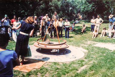
Photograph, Sinking the capsule, Graham Beyer on left and Joh Ebeli, Time Capsule Ceremony, 10 November, 1985, 10/11/1985
On Sunday, 10 November 1985 a time capsule was lowered into a monument installed near the corner of Main Road and Pitt Street in Eltham, within the gardens at the front of what is now the Eltham Community and Reception Centre. This monument commemorates Victoria’s 150th anniversary and the former location of the Eltham Town Centre, which existed along this section of Main Road, then known as Maria Street. Beneath the site is a time capsule to be opened in the year 2035. A plaque was also erected at this site in October 1987 to commemorate the Shire of Eltham Historical Society’s 20th anniversary. The main feature of this monument is a ‘tyring disc’, a blacksmith’s implement that was found on this site. This consists of a large iron disc that was used as a platform for fitting iron tyres (like the one shown on top of the platform) to wooden-spoked cart wheels. The local blacksmith and wheelwright worked together to assemble the wheel, which was clamped to the platform placed close to the fire. The red-hot iron hoop, previously forged to the correct size, was lifted with tongs by the blacksmith over the outside of the rim, then hammered down amid flames from the scorching timber. The wheelwright drenched the tyre with cold water as soon as it was in position. A clamp placed on the naff (hub) and screwed down tightly kept the spokes at a constant angle as the tyre cooled. An even pressure from the contracting tyre tightened the joints at each end of the spokes and formed a vice-like grip, which would last for the life of the wheel. [from EDHS Newsletter No. 45, November 1985:] TIME CAPSULE CEREMONY: Our 150th Anniversary Monument is now under construction in the gardens in front of the Eltham Community Centre. Further details of the project are given under a separate heading below and this item deals with the proposed ceremony. We propose to formally lower the time capsule into its container underneath the monument as part of the Eltham Community Festival. All members are invited to attend the ceremony at 2.00 p.m. on Sunday, 10th November. Come earlier with a picnic lunch if you like. Local people and firms who have contributed money or services for the monument will also be invited. As part of the Festival programme the public are welcome to attend. This is one of the most significant projects the Society has undertaken and members' participation in its finalization would be most gratifying to the organizing committee. 150TH ANNIVERSARY PROJECTS: We have concentrated our efforts on finishing the monument and time capsule project within the 150th year and have found it necessary to abandon the historical tour project. We have applied to the State 150th Committee to transfer the funds allocated for the tour to construction of the monument. The historical tour project will be continued at a later date and photos of historic houses in the area, taken by Doug Orford, will be available for use in an associated display. At the time of writing, the monument construction is on schedule for the ceremony on 10th November. The concrete base has been completed and the main feature of the monument, which is an old tyring plate or disc, will be lifted into place in the next week. The final ceremony will involve lowering the sealed time capsule into place, bolting down its container lid and then concreting over the lid. The capsule will contain mainly items relating to present day Eltham and its people and is to be opened in the year 2035, a video film made by Joh Ebeli and also details of families and organizations who have contributed to construction of the monument. It is proposed to place the items in the capsule on 5th November and any items members think could be included may be submitted up to that date. The Society has received an excellent response from local people, firms and organizations by way of assistance with this project. Graham Beyer, who originated the project, has arranged many of the donations. He and his firm, Package Handling Equipment, have donated the time capsule itself and have carried out fabrication of sections of the monument. The design of the monument was adapted by Graham Beyer from drawings by Joh Ebeli. Charmac Industries has donated the container for the time capsule and a cast gun metal name plate for the monument. BMG Concrete has donated concrete for the base which was constructed by Caridi Construction Company. Northbourne Garden Supplies has donated materials for the paving around the monument. Robert Becker from Eltham Apex directed construction of the paving by Society members. Terry Hutchinson has agreed to donate the use of his crane to lift the tyring disc into place. Financial contributions have been made by the Eltham Chamber of Commerce and the Rotary Club of Eltham. We are grateful to all who have helped, and members' support for firms who have donated their services would be an appropriate recognition. It is planned to print "Time Capsule Certificates" which can be held by organizations or passed on to descendants by individuals. The certificates will indicate an interest in the contents of the capsule when it is opened in fifty years. Certificates will be distributed to Society members and those who have contributed to the project.Colour photographactivities, 1985, time capsule, eltham, eltham festival -
 Eltham District Historical Society Inc
Slide - Photograph, Monument with time capsule, Eltham Community Centre, Main Road, Eltham, c.1997
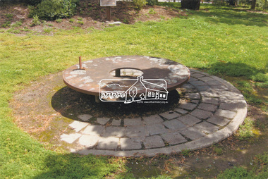
The monument with time capsule was established by the Shire of Eltham Historical Society to commemorate Victoria’s 150th anniversary and mark the former location of the Eltham Town Centre, which existed along this section of Main Road, then known as Maria Street. The unveiling was conducted 10 November 1985 by Cr. Mary Grant (Shire President). The monument was constructed with a concrete base and the main feature is an old tyring plate or disc. The Time Capsule Ceremony involved lowering the sealed time capsule into place, bolting down its container lid and then concreting over the lid. The capsule contains items relating to present day (1985) Eltham and its people including a video film made by Joh Ebeli and also details of families and organizations who have contributed to construction of the monument. It is to be opened in the year 2035. The Society received an excellent response from local people, firms and organizations by way of assistance with this project. Graham Beyer, who originated the project, arranged many of the donations. He and his firm, Package Handling Equipment, donated the time capsule itself and carried out fabrication of sections of the monument. The design of the monument was adapted by Graham Beyer from drawings by Joh Ebeli. Charmac Industries donated the container for the time capsule and a cast gun metal name plate for the monument. BMG Concrete donated concrete for the base which was constructed by Caridi Construction Company. Northbourne Garden Supplies donated materials for the paving around the monument. Robert Becker from Eltham Apex directed construction of the paving by Society members. Terry Hutchinson donated the use of his crane to lift the tyring disc into place. Financial contributions were also made by the Eltham Chamber of Commerce and the Rotary Club of Eltham. In 1987 in commemoration of the Society’s 20th Anniversary, Joh Ebeli suggested the commissioning of a plaque to be added which explains the functions of the various items used in the Society’s Victorian 150th Anniversary Monument and this was unveiled by its designer, Joh Ebeli, on October 10, 1987. Circa 2010-2012 the monument was damaged through vandalism. The mounts for the ring had been broken. At the time of this photo the ring had been removed by Jim Connor, President of the Eltham District Historical Society and placed in safe storage whilst arrangements were made with Neil Carter of Carter Art, Research to undertake the repairs.Colour printeltham, eltham community centre, monument, public art, time capsule, carter art, neil carter -
 Orbost & District Historical Society
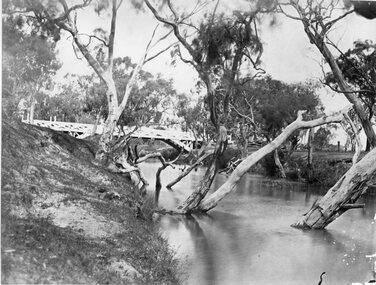
black and white photographs, 1915
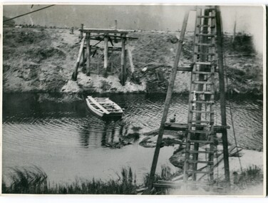
This photograph is of the construction of the first road bridge over the Genoa River - 1915. Before today's timber truss and concrete bridge was constructed between 1926-1928 by contractor J.T. Noble Anderson, two earlier bridges crossed the Genoa River at this location. They provided crucial links in the Princes Highway route from Melbourne to Sydney. The letter on the back of the postcard was written by Gordon ? to Alex ? on 2nd October 1917. "this represents the opening of Genoa Bridge. Mrs Alexander cutting the ribbon and Mr Martin holding it at the other side. Did most of the speaking. The gent holding the roll of paper is who came to open the bridge. I can't think of his name. Hubert is standing up at the right / Gordon " This is a pictorial record associated with the history of Genoa in East Gippsland.1100 -A large black / white photograph on a cream coloured buff card. It is of an unfinished bridge with men working there. A small rowboat can be seen on the far side of the river. 1100.1 - A photograph / postcard of the opening of "Genoa Bridge 1917". There is a ribbon stretched across the timber decking road in front of a group of people. 1100.2 - A black / white photograph of a road bridge across a river.on back - "Princes Highway - the 1st bridge over the Genoa River - 1915" on back of 1100.1 is a hand-written letter.genoa-bridge princes-highway-east-gippsland -
 Warrnambool and District Historical Society Inc.
Certificate - Ticket Book, Main Belfast Road Toll, 2s 6d, 1860s
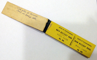
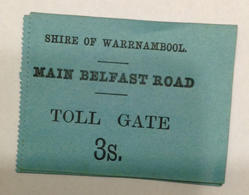
The Shire of Warrnambool operated toll gates from 1866 to 1869 as a means of revenue rai sing for road construction. There were three toll gate locations – on the main Belfast (Port Fairy) Road at Dennington Bridge, on the Woodford Road at Russells Creek and on the Geelong Road at the Allansford Bridge. The toll gates were unpopular and unprofitable for the lessees as travellers were able to avoid the tax by skirting around the gates. They had toll houses besides the gates. The printers of these tickets, Fairfax and Laurie were the lessees at the time of the Warrnambool Examiner newspaper. This paper, founded by Richard Osburne and John Wilkinson, and published with some gaps from 1851 to 1880, is a key source today of Warrnambool’s history at that time. These toll gates tickets are significant because:- 1. They date back to the 1860s and were only issued from 1866 to 1869. 2. They are the only artefacts we hold of the time when toll gates were operating in our local district 3. They are the best example of how the Shire of Warrnambool in its early history raised revenue for road building and maintenance This is a book of toll gate tickets for sale at the Main Belfast (Port Fairy) Road Toll Gate. The tickets (about 50) are yellow and in duplicate with provision to detach the outer ticket for the purchaser to keep. The tickets (two shillings and sixpence) are bound with an adhesive tape and the cover is mottled in pattern (brown and blue). There are also four loose tickets in blue (3 shillings). Back Cover: ‘136’ Tickets in book: ‘Shire of Warrnambool, Main Belfast Road, Toll Gate 2s 6d., Fairfax and Laurie, Printers’ Loose tickets: ‘Shire of Warrnambool, Main Belfast Road, Toll Gate, 3s.’ shire of warrnambool, toll gates -
 Warrnambool and District Historical Society Inc.
Document - Main Belfast Road Toll Gate Ticket Collection, 1860s
The Shire of Warrnambool operated toll gates from 1866 to 1869 as a means of raising revenue for road construction. There were three toll gate locations – on the main Belfast (Port Fairy) Road at Dennington Bridge, on the Woodford Road at Russells Creek and on the Geelong Road at the Allansford Bridge. The toll gates were unpopular and unprofitable for the lessees as travellers were able to avoid the tax by skirting around the gates. They had toll houses besides the tollgates. The printers of these tickets, William Fairfax and Henry Laurie, were the lessees at the time of the Warrnambool Examiner newspaper. This paper, founded by Richard Osburne and John Wilkinson, and published with some gaps from 1851 to 1880, is a key source today of Warrnambool’s history at the time. These toll gate tickets are significant because:- 1. They date back to the 1860s and were only issued from 1866 to 1869 2. They are the only artefacts we hold of the time when toll gates were operating in our local district 3. They are the best example of how the Shire of Warrnambool in its early history raised revenue for road building and maintenance. These are eleven toll gate tickets, ten for the Belfast (Port Fairy) Road toll gate and one for the Woodford Road toll gate. One is mounted on a Swintons store label (6 pence) and four are mounted on cardboard (2 shillings, sixpence, and two shillings and sixpence) and six are loose (three shillings, two shillings and sixpence and threepence). The Belfast Road tickets are yellow, green, blue and cream and the Woodford Road one is white. All have black printing. There is also an undated newspaper cutting with information on the toll gate tickets. Belfast Tickets: Shire of Warrnambool, Main Belfast Road, Toll Gate and the price Woodford Road: Shire of Warrnambool, Woodford Road, Toll Gate, 1s 6d Six of the eleven tickets also have ‘Fairfax and Laurie, Printers’ The sixpence ticket on card has the name R P Christian in ink written on the back of the card. shire of warrnambool, toll gates, r p christian, woodford road, main belfast road, swintons pty ltd -
 Bendigo Military Museum
Photograph - New Printing Building foundation preparation, Lithographic Squadron - Army Survey Regiment, Fortuna, Bendigo, 1987
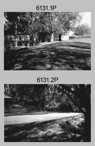
This is a set of 18 photographs of contractors preparing the foundations for the construction of Lithographic Squadron’s new Printing Building at Fortuna, Bendigo on the 2nd of October 1987. The building was purpose built to house a new computer-controlled Heidelberg Speedmaster 102 five colour lithographic offset Printing Press. The print room was named Wayzgoose Hall after a medieval printing house festival. Wayzgoose Hall and the Speedmaster Press printing capability was commissioned by the Commander of the 3rd Military District BRIG P. Davies AM, ADC on Wednesday 27th June 1990. This occasion is covered in more detail in page 145 of Valerie Lovejoy’s book 'Mapmakers of Fortuna – A history of the Army Survey Regiment’ ISBN: 0-646-42120-4.This is a set of 18 photograph of the foundations being prepared for Lithographic Squadron’s new Printing Building, Army Survey Regiment at Fortuna, Bendigo, 2nd October 1987. Black and white photos .1P to .4P are on photographic paper and scanned at 300 dpi. Photographs .5P to.18P are on 35mm negative film and scanned at 96 dpi. They are part of the Army Survey Regiment’s Collection. .1) to .9) - Photo, black & white, 1987. Foundations preparation. .10) - Photo, black & white, 1987. Foundations preparation, Paul Baker. .11) - Photo, black & white, 1987. Foundations preparation, Gary Kerr .12) to .17) - Photo, black & white, 1987. Foundations preparation. .18) - Photo, black & white, 1987. Foundations preparation, Gary Kerr No personnel are identified. Annotated with date on negative sleeve.royal australian survey corps, rasvy, army survey regiment, army svy regt, fortuna, asr, litho, printing -
 Kiewa Valley Historical Society
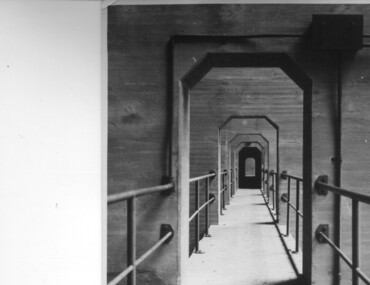
Photograph of Lake Guy Dam, Walkway, Inside Lake Guy Dam, c 1945
Lake Guy Dam is a 'slab and buttress' type wall. A timber frame is built and then filled with concrete. The first batch of concrete was placed in September, 1940. By June, 1941 the buttresses were finished to a height safe from floods and in October of that year a flood of 2,800 cusecs occurred but with only slight damage to the installations. Industrial trouble caused some delays but there was also slow progress on the part of the contractor and the work was taken over by the S.E.C., terminating the contract. The dam was completed in March, 1944. A walkway was made through the dam wall. Lake Guy was named after Mr. L.T. Guy who was the Resident engineer, in charge of construction work and associated activities on the Kiewa Area from 1939 to November 1946.Shows the walkway placed as part of the Lake Guy (Junction) Dam wall. A very good pictorial reference for the future.Black and white photograph of the walkway through Lake Guy (Junction) Dam wall.Handwritten in blue ink on back of photograph "Inside Lake Guy Dam". slab, buttress, dam, mr. l.t. guy -
 Eltham District Historical Society Inc
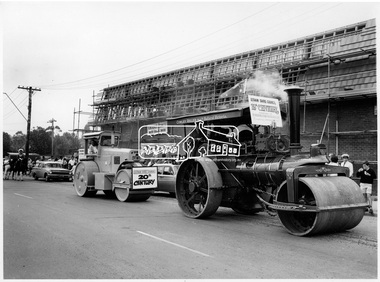
Photograph, Steam Roller and Diesel Roller. Procession of Floats Eltham, 10 Apr 1971
The Procession of floats travelled from the Eltham Shopping Centre to Eltham Lower Park on Saturday 10th April as part of the Shire of Eltham centenary celebrations program. A steam Roller and diesel roller. One of a series of three photgraphs. Participants in the parade included the Eltham Film Society, Scout group, Eltham volunteer fire brigade, riders on horses and horse and carts. A cowley roller from the Melbourne Steam traction engine club and a McDonald roller represented Eltham Shire Council in the 19th and 20th centuries. Another float includes a bark hut with trailer representing pioneers with a banner reading "The trues heroes our pioneers". Eltham Village is under construction by H.M. Keast & Sons, Master Builders. This photo forms part of a collection of photographs gathered by the Shire of Eltham for their centenary project book, "Pioneers and Painters: 100 years of the Shire of Eltham" by Alan Marshall (1971). The collection of over 500 images is held in partnership between Eltham District Historical Society and Yarra Plenty Regional Library (Eltham Library) and is now formally known as 'The Shire of Eltham Pioneers Photograph Collection.' It is significant in being the first community sourced collection representing the places and people of the Shire's first one hundred years.Digital imagesepp, shire of eltham pioneers photograph collection, shire of eltham, shire of eltham centenary, centenary celebrations, parade floats, parade, diesel roller, steam roller, h & m keast & sons, eltham village, main road, eltham, melbourne steam traction club -
 Federation University Historical Collection
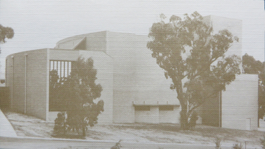
Programme, Opening of the 1870 Founders Hall, 1981, 28/03/1981
On 28 March 1981 the Ballarat College of Advanced Education 1870 Founders hall was opened. The hall was erected from the proceeds of the Centenary Appeal for a sum of approximately $800,000. The hall commemorates the initiative of the founders of the original Ballarat School of Mines and its "descendants", including Ballarat College of Advanced Education, as well as formal technical education in Australia. The hall was build to accommodate 670 persons in a theatre type seating and was intended for multiple purpose use by community groups as well as by the College. Construction of the hall commenced in 1978. It was opened approximately 110 years after the Ballarat School of Mines (26 October 1870) and 10 years after the opening of the Mt Helen Campus (31 October 1870)..1) White card with blue and brown ink relating to the opening of the 1870 Founders Hall by His Excellency the Right Honourable Sir Zelman Cowen, Governor-General of Australia. .2) Souvenir Programme and Entree to inaugural concert in the 1870 Founders Hall. .3) Invitation card to the opening of Founders Hall made out to Mr and Mrs Z.A. Plavinaballarat college of advanced education, founders theatre, founders hall, theatre, zelman cowen, m.b. john, e.j. barker, w.j.c. north, ian gordon, zig plavina, invitation, 1870 founders hall -
 Puffing Billy Railway
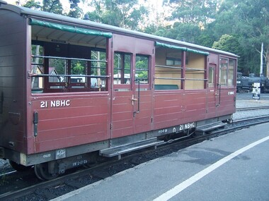
21 NBHC - Passenger Carriage - Excursion Car for wheelchairs and Guard's Van, Between 1979 and 1988
21 NBHC built as 21 NBH. It was converted by the addition of a Guard's Van compartment and modified for Wheelchairs access by Puffing Billy Railway and re classed & numbered 21NBHC Puffing Billy Service History or Notes Between 1997 and 1998 the Puffing Billy railway built six more NBHs, numbered 18-23. These had steel frames, padded seats, and a wide "window sill". At first glance they look the same as the previous NBHs. There are other minor construction differences due to the use of steel framing. 21NBH entered traffic in 1998. The photo on the right shows the exterior of one such NBH. These have a seating capacity of 24 passengers. April 2016 - In for a lift, roller bearings replaced with standard bearings Historic - Puffing Billy Railway Narrow Gauge - Passenger Rolling Stock: Excursion Car 21 NBH which has been converted by the addition of a Guard's Van compartment and modified for Wheelchairs access by Puffing Billy Railway and re classed & numbered 21NBHC21 NBHC Passenger Carriage - Excursion Car - specially modified for Wheelchair access allowing it to carry wheelchairs and to have a Guard's Van compartment. made of wrought iron and timber21NBHCpuffing billy, pbr, rolling stock, 21 nbhc -
 Uniting Church Archives - Synod of Victoria
Photograph, undated
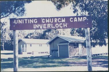
The photograph is from the Brian Walsh Collection 1993. Three blocks of land were purchased in 1946 by Miss F. Ritchie and Mrs H. Grimshaw in Halford St. Inverloch. Three more blocks were purchased in 1948 - 1949. A sixth block was added in 1956. Money was raised by P.F.A. members. Two buildings were purchased from the Government Disposals Authority in 1959. Construction of the camp began in October 1959. Regular working bees were held by P.F.A. members. The first camp was held at the site at Easter 1960. The camp was opened by the Moderator the Rt. Rev. A. Creighton Barr and Flinders Presbytery ministers. In 1998 the decision was taken to sell the site. No buyer was recorded by April 2000.Colour photograph mounted on card showing the exteriors of two camp dormitories in bushland.Uniting Church Camp Inverloch. Gippsland Presbytery. Brian Walsh Collection 1993presbyterian church camp, inverloch, flinders presbytery, p.f.a., miss f. ritchie, mrs. h. grimshaw, rt. rev. creighton barr -
 Sunshine and District Historical Society Incorporated
Replica of McKay Smithy, Opened on 10 October 2001
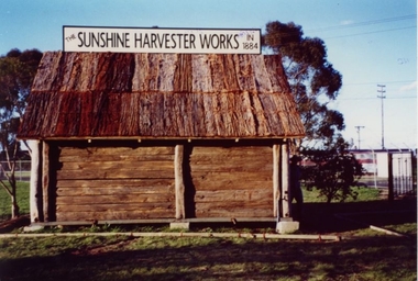
This Smithy is a replica of the building in which the first H. V. McKay harvester was built at Drummartin in northern Victoria in 1884. The original Smithy was moved from Drummartin to Sunshine Victoria where it remained for many years outside the H. V. McKay manufacturing plant. With the construction of the standard gauge railway line the road outside the Smithy was demolished, and the original Smithy was taken to the Melbourne Museum.The original Smithy is now in a fragile state and is no longer on public display at the Melbourne Museum. The site where the original Smithy stood in Sunshine was no longer available so the replica Smithy was erected a few hundred metres away, in the South East corner of Barclay Reserve on King Edward Ave, Albion 3020.The replica Smithy permits the public to view a full sized model of the building which eventually led to the formation of the H. V. McKay Sunshine Harvester Works. This firm grew to being considered the main manufacturing plant in the southern hemisphere, and also led to the local area being renamed in 1907 from Braybrook Junction to Sunshine.Brown wooden building with bark roof. This building is a FULL SIZED REPLICA of the original SMITHY that was used by H. V. McKay.THE SUNSHINE HARVESTER WORKS 1884smithy, h. v. mckay, sunshine harvester works, drummartin, replica, massey harris, massey ferguson -
 Stawell Historical Society Inc
Photograph, Cato Lake with the Swimming Pool c 1950's
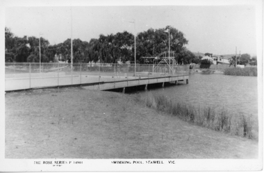
Two black and white post cards of the Olympic swimming pool in Cato lake c 1950's. The Rose Series P 14901 shows the swimming pool and lake with the swimming pool dominating the photograph. Four flag posts are clearly visible and the pool connected to the edge of the lake. The Rose Series P 14012 also shows the Olympic pool but more of the lake and boundary. with seating around the lake. In March 1957 Cato Lake was emptied for construction of the Olympic pool and officially opened on 15.11.1958. Twenty seven years later In January 1985 the pool was found to be leaking and Borough Council in February banned further use of the Olympic pool. Eventually the Olympic pool was demolished in April 1988.Two black & white Rose series post cards of Cato Olympic swimming pool Stawell Vic. c 1950's. Series P 14901 is nearly a complete view of the Olympic pool with four flag posts in view and trees and buildings in the distance. Series P 14012 has only a small section of the Olympic pool in the photograph with just 3 flag poles in view. There are 2 concrete and timber seats in the foreground and Cato lake is very still, reflecting the distance trees.The Rose Series P 14901 Swimming Pool Stawell Vic. and The Rose Series P 14912 Cato Park and swimming pool Stawell, Vic. Both post cards were Published by Rose Stereograph Co., Armadale, Victoria. The "Rose" series De Luxe.stawell -
 Kew Historical Society Inc
Photograph, Floods in North Kew, 1971
Living with natural processes was frequently a challenge to early European settlers and later residents of what was in the 1850s administered by the Borondara Road Board. This was compounded by the area being bounded on three sides by rivers (Yarra River, Koonung Creek and Gardiner's Creek). In 1849, the historian James Bonwick recorded that "our district [Kew] suffered considerably. Mr Wade speaks of 80 acres, out of 100 acres of his cultivated paddock, covered by water." Newspapers continued to describe major flooding in Kew in 1863, 1869, 1878, 1880, 1889, 1891, 1916 and 1934. While the construction of the Upper Yarra dam in 1957 reduced the levels of flowing downstream, local and riverine floods continue.The Kew Historical Society's pictures and map collections testify to the impact of flooding in the district. They have historical importance in documenting the extent of flooding in the district and its affects on homes, services and recreation. Numerous photographs record flooding throughout the Twentieth Century.Floods in North Kew, 1971. Looking northeast towards Kilby Road from River Avenue. Annotation on reverse: map and date "8 Nov. 71 10.30am".floods (kew), yarra river, kew flood, kilby road flood -
 Kew Historical Society Inc
Photograph, Floods in North Kew, 1934
Living with natural processes was frequently a challenge to early European settlers and later residents of what was in the 1850s administered by the Borondara Road Board. This was compounded by the area being bounded on three sides by rivers (Yarra River, Koonung Creek and Gardiner's Creek). In 1849, the historian James Bonwick recorded that "our district [Kew] suffered considerably. Mr Wade speaks of 80 acres, out of 100 acres of his cultivated paddock, covered by water." Newspapers continued to describe major flooding in Kew in 1863, 1869, 1878, 1880, 1889, 1891, 1916 and 1934. While the construction of the Upper Yarra dam in 1957 reduced the levels of flowing downstream, local and riverine floods continue.The Kew Historical Society's pictures and map collections testify to the impact of flooding in the district. They have historical importance in documenting the extent of flooding in the district and its affects on homes, services and recreation. Numerous photographs record flooding throughout the Twentieth Century.Floods in North Kew, 1934. Vicinity of Willsmere Park.floods (kew) -
![Flooding at Chipperfield's Boathouse [East Kew], 1934](/media/collectors/550653872162f11fb04854aa/items/58cbaad5d0cec425b474bfb1/item-media/58cf6fbdd0cf9f331490feb0/item-fit-380x285.jpg) Kew Historical Society Inc
Kew Historical Society IncPhotograph, Flooding at Chipperfield's Boathouse, 1934
Living with natural processes was frequently a challenge to early European settlers and later residents of what was in the 1850s administered by the Borondara Road Board. This was compounded by the area being bounded on three sides by rivers (Yarra River, Koonung Creek and Gardiner's Creek). In 1849, the historian James Bonwick recorded that "our district [Kew] suffered considerably. Mr Wade speaks of 80 acres, out of 100 acres of his cultivated paddock, covered by water." Newspapers continued to describe major flooding in Kew in 1863, 1869, 1878, 1880, 1889, 1891, 1916 and 1934. While the construction of the Upper Yarra dam in 1957 reduced the levels of flowing downstream, local and riverine floods continue.The Kew Historical Society's pictures and map collections testify to the impact of flooding in the district. They have historical importance in documenting the extent of flooding in the district and its affects on homes, services and recreation. Numerous photographs record flooding throughout the Twentieth Century.Floods in North Kew, 1934. Chipperfield's Boathouse and the adding Moorings was located beside the Yarra River near the corner of Willsmere and Kilby Roads. The flood reached the roof of the Moorings, which can be seen in the photo.floods (kew), floods (kew) 1934, yarra river -
 Kew Historical Society Inc
Photograph, Floods in North Kew, 1934
Living with natural processes was frequently a challenge to early European settlers and later residents of what was in the 1850s administered by the Borondara Road Board. This was compounded by the area being bounded on three sides by rivers (Yarra River, Koonung Creek and Gardiner's Creek). In 1849, the historian James Bonwick recorded that "our district [Kew] suffered considerably. Mr Wade speaks of 80 acres, out of 100 acres of his cultivated paddock, covered by water." Newspapers continued to describe major flooding in Kew in 1863, 1869, 1878, 1880, 1889, 1891, 1916 and 1934. While the construction of the Upper Yarra dam in 1957 reduced the levels of flowing downstream, local and riverine floods continue.The Kew Historical Society's pictures and map collections testify to the impact of flooding in the district. They have historical importance in documenting the extent of flooding in the district and its affects on homes, services and recreation. Numerous photographs record flooding throughout the Twentieth Century.Floods in North Kew, 1934. Unidentified location on the Yarra Flood Plain at Kew.floods (kew) 1934, yarra river -
 Kew Historical Society Inc
Photograph, Floods in North Kew, 1934
Living with natural processes was frequently a challenge to early European settlers and later residents of what was in the 1850s administered by the Borondara Road Board. This was compounded by the area being bounded on three sides by rivers (Yarra River, Koonung Creek and Gardiner's Creek). In 1849, the historian James Bonwick recorded that "our district [Kew] suffered considerably. Mr Wade speaks of 80 acres, out of 100 acres of his cultivated paddock, covered by water." Newspapers continued to describe major flooding in Kew in 1863, 1869, 1878, 1880, 1889, 1891, 1916 and 1934. While the construction of the Upper Yarra dam in 1957 reduced the levels of flowing downstream, local and riverine floods continue.The Kew Historical Society's pictures and map collections testify to the impact of flooding in the district. They have historical importance in documenting the extent of flooding in the district and its affects on homes, services and recreation. Numerous photographs record flooding throughout the Twentieth Century.Floods in North Kew, 1934. Chipperfield's Boat House under flood.floods (kew) 1934, yarra river, chipperfield's boat house -
 Kew Historical Society Inc
Photograph, Floods in North Kew, 1934
Living with natural processes was frequently a challenge to early European settlers and later residents of what was in the 1850s administered by the Borondara Road Board. This was compounded by the area being bounded on three sides by rivers (Yarra River, Koonung Creek and Gardiner's Creek). In 1849, the historian James Bonwick recorded that "our district [Kew] suffered considerably. Mr Wade speaks of 80 acres, out of 100 acres of his cultivated paddock, covered by water." Newspapers continued to describe major flooding in Kew in 1863, 1869, 1878, 1880, 1889, 1891, 1916 and 1934. While the construction of the Upper Yarra dam in 1957 reduced the levels of flowing downstream, local and riverine floods continue.The Kew Historical Society's pictures and map collections testify to the impact of flooding in the district. They have historical importance in documenting the extent of flooding in the district and its affects on homes, services and recreation. Numerous photographs record flooding throughout the Twentieth Century.Floods in North Kew, 1934. Flood near the lagoon (Billabong?)floods (kew) 1934, yarra river -
 Kew Historical Society Inc
Photograph, 'Goathland', The Residence of Sir Malcolm D McEacharn, 1901-1911
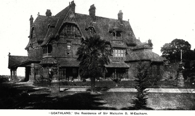
The architect, Edward Kilburn designed Byram in the Arts & Crafts style for the industrialist George Ramsden. Construction began in 1888 and was reputed to have lasted three years. The mansion had frontages to Studley Park Road and Stevenson Street, including gardens laid out with great taste, including pleasure grounds, tennis lawn, fruit and flower garden, and paddock.The size of many of the trees in the garden indicate that many survived from the garden of Clifton Villa, the previous single-storeyed house built on the site by the Stevenson brothers. Byram had views to Melbourne and Port Phillip Bay. The house was demolished in 1960, despite opposition from the National Trust (Victoria), and its gardens subdivided into residential allotments.An early photograph of Goathland (also known as Byram, Lowan and Tara Hall). The photo shows the front of the building during the period of Sir Malcolm McEacharn’s occupation of the house (1901-11). Edward George Kilburn, of Ellerker & Kilburn, had originally designed the house for the industrialist George Ramsden in 1888. When Sir Malcolm McEacharn purchased Byram, he was to rename it as Goathland. This has led to some confusion, as Goathland was also the name used for McEacharn’s other home in St. Kilda. The period of McEacharn’s ownership represented the high point of the mansion’s history. 'Lost Glories: a memorial to forgotten Australian buildings' was published by David Latta in 1986. It tells the story of a number of significant Australian buildings that had previously been demolished. A chapter in the book was devoted to Goathland, later known as Tara Hall. To supplement the text, he sourced photographs from a range of suppliers, chiefly the Royal Women's Hospital which had once owned Tara Hall, but had sold it in 1960. This is one of the photographs donated to KHS by the author."'Goathland', The Residence of Sir Malcolm D McEacharn"byram, goathland, tara hall, lowan, studley park road -- kew (vic.), melbourne mansions, e g kilburn - architect -
 Brighton Historical Society
Dress, Day dress, circa early 1900s
This dress belonged to Mary Grace Medbury (nee Matthews, 1885-1967). Mary was born in Kansas, USA, and as a teenager travelled to Devon, England, before she came to Australia with her family and married Walter Ambrose Medbury (1887-1947). They lived together in Cheel Street, East Oakleigh. Walter, a building contractor, worked on numerous construction projects in the Melbourne area, including the Oakleigh Methodist Church, the HMAS Cerberus naval base and - closer to home - the former Brighton Courthouse, which was built in 1936 and still stands at 15 Boxshall Street. Mary gave the dress to her granddaughter, Fiona Nissen, when Fiona was a teenager. A Brighton local, Fiona donated it to the Society in 2013.White cotton muslin day dress with three-quarter length sleeves and square neckline, both edged with lace. The dress features white floral embroidery on the sleeves, skirt and front of bodice. Hook and eye fastenings at back.mary grace medbury, mary grace matthews, fiona nissen, migration, 1900s -
 Harcourt Valley Heritage & Tourist Centre
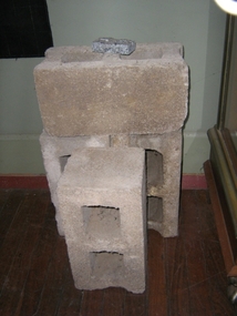
concrete blocks, 1914
Charles Seelenmeyer conducted Concrete Utilities Limited (Harcourt Cement Pipe Factory). Operated in Harcourt circa 1914 to 1930 in premises situated opposite the ANA Hall on what is now the road reserve. Principal raw material was sand from the adjacent waterway ( Barkers Creek.) Principal output was concrete drainage tiles for use in district orchards but concrete blocks were also produced for construction of homes and commercial buildings. At a time of rapid expansion of the orchards this industry provided a vital piece of orchard infrastructure, mostly buried and not now visible but nevertheless a very important feature of the valley’s horticultural industry.. Homes built with these concrete blocks are a distinct part of Harcourt’s housing stock. Harcourt Cement Pipe Co was an example of local initiative to solve a local problem using local materials. A collection of 4 concrete building blocks -
 Wodonga & District Historical Society Inc
Photograph - Codling Collection 01 - Wodonga Powder Magazine
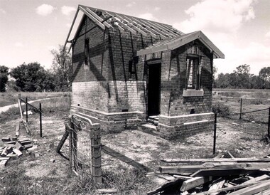
Miss Olive Codling was a Foundation Member and a Life Member of the Wodonga Historical Society. Many of her prize-winning photos are held in the Society Collection. She also held a range of roles and committee positions in a wide range of Wodonga community organisations. THE WODONGA POWDER MAGAZINE was built by Edward Hope in 1877-78 to the order of the Ministry of Trade and Customs. It was built of brick and contains a brick arched ceiling vault to absorb any explosion The Wodonga Powder Magazine stored explosives for use in deep lead gold mining and public works in the district. The original construction cost £330.05.6. In 1993, at a cost of $27,000, Wodonga City Council employed Anton Iskra to carry out restoration of the Powder Magazine.This photo collection is significant as it documents a building which played a significant role in Wodonga and has a local heritage overlay.Black and white images of the ruins of the Wodonga Powder Magazine.wodonga powder magazine, gateway island wodonga, historic buildings wodonga -
 Wodonga & District Historical Society Inc
Award - Trophy - Terminus Hotel Wodonga Dart Club, 1985 - 1992
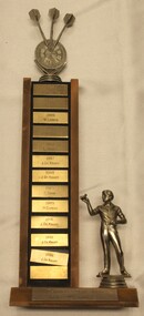
The Terminus Hotel was one of the earliest hotels in Wodonga, with clear links to the establishment of the railway line. It was an important business and meeting place from the original construction in 1873 until 1st June 1998 the Terminus Hotel when it was destroyed by fire. It provided a popular venue for social activities, including competitive darts, both through its own competition and as part of the Albury-Wodonga District Darts Association. The remains of the building were demolished in 1999. This is perpetual trophy for the Terminus Dart club based at the Terminus Hotel in Wodonga. This trophy recognises the winners of the Singles Championship from 1985 to 1992. Engravings on the front of the trophy indicate that the competition was held twice a year for most of the years recorded here.The Terminus Hotel was an important meeting place in Wodonga for more than 100 years. This item is representative of one of the social and sporting activities it provided for members of the local community.A perpetual trophy for the Terminus Dart club based at the Terminus Hotel in Wodonga. This trophy recognises the winners of the Singles Championship from 1985 to 1992. Down the front of the trophy, each name on a separate metal rectangle: 1985: A. Fleming 1985: K.Cook 1986: W. Larsen 1986: J. DeKruif 1987: L. Stokes 1987: J. DeKruiff 1988: J. DeKruiff 1989: C. Shaw 1989: H. Curphy 1991: J. DeKruiff 1992: J. DeKruiff 1992: J. DeKruifterminus hotel wodonga, terminus hotel darts, sport and recreation wodonga, albury-wodonga district darts association -
 Wodonga & District Historical Society Inc
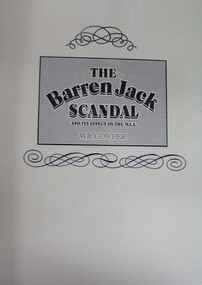
Book - The Barren Jack Scandal and its Effects on the M.I.A, W. R. Cowper, 1987
This book outlines the issues and controversy around the construction of the Barren Jack (Burrinjuck) Water Supply Dam as part of the infrastructure of the Murrumbidgee Irrigation Authority (M.I.A) and its subsequent abandonment. It has now fallen into disrepair,non-fictionThis book outlines the issues and controversy around the construction of the Barren Jack (Burrinjuck) Water Supply Dam as part of the infrastructure of the Murrumbidgee Irrigation Authority (M.I.A) and its subsequent abandonment. It has now fallen into disrepair,irrigation -- government policy, murrumbidgee irrigation area (n.s.w.) -- history, barren jack dam, burrinjuck, yass valley -
 Stawell Historical Society Inc
Photograph, Glenorchy Bridge on the Wimmera River 1866
Glenorchy Bridge Wimmera River. Part of a collection of Photographs by Mr. O.G. Armstrong as commissioned by the Shire of Stawell for the Inter-colonial and Paris Exhibition in Melbourne in 1866. Prior to the construction of this bridge in 1860, there existed two forwards across the Wimmer River at Glenorchy. One was 2 miles on the Stawell side of Glenorchy and 500 metres from the present railway bridge. It was well made, stone floor and can be seen today. The second was located 800 metres downstream of the town and was known as Stuart’s Crossing. These Fords were popular crossing spots for Bullock Drays which were delayed for days during floods before the bridge was built. The original Bridge was built near the site of the present ‘old’ bridge. stawell -
 Glen Eira Historical Society
Document - Grange Road, 77, Glen Huntly
This file contains 4 items about the purchase and construction of this property: 1/ The original contract of sale of land dated 25/09/1936 for Gertrude & Hulbert Gorrie situated on the corner of Grange and Neerim Road. 2/ The original typed building agreement dated 25/09/1936 between the contractor Ernest F Barnard and the purchasers Mr & Mrs Hulbert Gorrie. 3/ The original blueprint plan of a brick villa at the corner of Grange & Neerim Road for Mr & Mrs Hulbert Gorrie. Dated 25/09/1936. 4/ The original specification for the dwelling on the corner of Grange & Neerim Road, Glen Huntly for Mrs Gertrude Gorrie & Mr Hulbert Hopetoun Gorrie by builder Ernest F Barnard.barnard ernest f, gorrie gertrude, gorrie hulbert hopetoun, hobart john bertram, coorigil road, carnegie, holloway st, ormond, chemists, parish of prahran, caulfield county of bourke, building agreement, brick houses, builders, plans, architectural drawings, grange road, glen huntly, holloway street, ormond, emma street, grange road, neerim road, gorrie h.h, gorrie gertrude, gorrie hulbert h, legal documents, barnard ernest franklin, e. j. & h. amos, hintons nursery, real estate agents, murrumbeena, caulfield