Showing 432 items matching "quarry road"
-
 Warrnambool and District Historical Society Inc.
Magazine - Project, Warrnambool: sandstone era of the eighties, 1973
Geographically situated on the coast Warrnambool has large tracts of sedimentary rock, some of which is sandstone. It therefore was a readily available material and as a relatively soft stone it was easily quarried and cut. By the 1880’s Warrnambool had been established for around forty years and was proving to be a settlement of some wealth. Hence the trend to build bigger and grander homes. There are numerous other commercial buildings which are built in sandstone and many of the original quarries are still visible around the Warrnambool area. Most of the properties are situated in the central part of Warrnambool. This collection of photographs is a good cross-section of some of the significant homes and buildings of Warrnambool. It also shows how they look 100 years after being built.A collection of 18 black and white photographs of sandstone houses, mounted on card and tied loosely with string. The addresses of each house are hand-written in black pen beside each photo. Title is written in black pen on cover page.Graeme Blake 1973 in bottom RH corner, Via * Fraser & Chris How in blue pencil.warrnambool, sandstone, sandstone houses, 1880 warrnambool -
 Warrnambool and District Historical Society Inc.
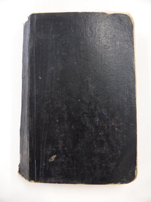
Book, McKenzie Day Book, Early 1900s
This is a 1918 Day Book listing some employees/contractors and the day-to-day tasks undertaken by them. There is a separate page for each employee. The book lists such tasks as ‘carting from the Quarry’, ‘tarring Raglan Parade’, ‘tarring at the Gardens’, ‘screening Liebig Street’, ‘working at the Ladies’ Baths’ and ‘general patching’. The names of the employees/contractors include Niven, Thompson, Jewell, Walters, Mooney, Rodgers, Williams, Dunne and Gee. The name ‘McKenzie’ on the first page is the only clue to the identity of the employer/overseer and so far his identity has not been established. The jobs listed suggest that he was either an employee of the Warrnambool Council in the Public Works area or a contractor hired to do the same sort of work. This note book is of great interest as it lists workers and the jobs covered by them in 1918 in Warrnambool and it will be of greater significance when the identity of McKenzie is established.This is a note book with ruled blue and red lines. The cover is black and is a little torn and scuffed. There are some loose pages. The entries in the book are handwritten, mostly in black ink. ‘McKenzie Day Book November 4th 1918’history of warrnambool, mckenzie contractor, mckenzie warrnambool -
 Kiewa Valley Historical Society
Photographs – Set of 10 black and white photographs and photocopies of original photographs documenting early residents of Bogong Village
Bogong Village, which was known as “The Junction”, is well recorded. The first tent camp was at the junction of Pretty Valley and Rocky Valley streams in the early 40’s. Further downstream were the sawmill, stables and blacksmith’s forge. Horses were the main mode of transport in the early days. The road to Bogong had reached the lookout spur just beyond Roper’s Spur track just before the 1939 fires. The early forties saw rapid growth of the village, with single and married men’s quarters, workshops, mess huts and administrative offices. The facilities necessary for communal living were quickly in place- a post office, police station, co-op store, medical centre, community hall/theatre, tennis courts and school. Much of the temporary accommodation that housed groups such as the Albion Quarrying Company were in the area now under water.This group of photographs are a pictorial record of the early history of the Kiewa Hydro Scheme, the people who worked in the background supplying administrative support and the workers and their families. It also shows a glimpse into how a large group of people from very diverse backgrounds came together to enjoy social activities and share each others companyGroup of 10 black and white photographs and photocopies of original photographs of varying sizes (some official SECV photos) Some Photos are labelled with the date and the names of SECV staff members. Depicting early life at Bogong Village 1. Group photo – Kiewa House Residents 1.8.41 (SECV official photo) 2. Female staff residents 3. Female office staff 4. Kitchen staff – Junction Mess (SECV official photo) 5. Male administration staff Bogong 6. Bogong Social Club fancy dress ball, 1940 7. Wives and children of SECV workers 8. Children in fancy dress 9. Opening of Volunteer Air Observers post 1943 10. Flag raising at opening of Volunteer Air Observers post 1. Printed under photo: STATE ELECTRICITY COMMISSION OF VICTORIA Date: 1.8.41 Time: 12.30pm No:K 435 Kiewa Hydro-Electric Works. Kiewa House Residents Back Row L to R: S.A. Salmon, W. Strachn, T.A Connors, W.J Norman, R.C Grealey, R.D Hegarty, Mrs Hegarty, W.R Morgan, S.A Clarke, P. Morgan, P.J. Harnetty, G.W Crouch. Front Row L to R: W.L Godfrey, R.S Hollands, Pte. R Charlesworth, R.L Dunn, N Caldwell, L.T Davies, I Webber, H.L Kendall, P Tiller, Ricky Hegarty, L.T Guy, M.C Cox, K.F Calder, D.S Gibson 2. Printed on bottom: Staff who lived at Kiewa House and worked in the Administration Office c 1943 Handwritten at bottom Priscilla Johnson (nee Reid) At top of page A GOOD LIFE: WOMEN’S RECOLLECTIONS OF LIFE IN THE UPPER KIEWA VALLEY 3. Printed under photo- Office Staff – Bogong 4. Printed under photo: STATE ELECTRICITY COMMISSION OF VICTORIA Date: 18.5.40 Time: 11.05am No:K 103. Kiewa Hydro-Electric Works. Kitchen Staff- Junction Mess. Opening night of the new staff mess Bogong. 5. Printed under photo -Administration staff Bogong 6. Printed under photo- The social club raised money for patriotic fund from fancy dress nights. (1st Fancy Dress Ball, Bogong 1940) 7. Printed above photo: ---- and family life begins (1942 Bogong) 8. Printed under photo: A favourite photograph 9. Printed under photo: STATE ELECTRICITY COMMISSION OF VICTORIA Date: 24.5.43 Time: 2.8pm No:K 1151 Kiewa Hydro-Electric Works. Bogong- Squadron Leader Leggett speaking at opening of Air Observer’s Post 10. Printed under photo: Raising the flag at the opening of the Volunteer Air Observer’s Post at Bogong - 1943 bogong village; kiewa hydro electric scheme; social activities; community clubs -
 Kiewa Valley Historical Society
Photographs – Set of 9 black and white photographs and photocopies of original photographs depicting the early days of Bogong Village during the 1940’s, circa 1940's
Bogong Village, which was known as “The Junction”, is well recorded. The first tent camp was at the junction of Pretty Valley and Rocky Valley streams in the early 40’s. Further downstream were the sawmill, stables and blacksmith’s forge. Horses were the main mode of transport in the early days. The road to Bogong had reached the lookout spur just beyond Roper’s Spur track just before the 1939 fires. The early forties saw rapid growth of the village, with single and married men’s quarters, workshops, mess huts and administrative offices. The facilities necessary for communal living were quickly in place- a post office, police station, co-op store, medical centre, community hall/theatre, tennis courts and school. Much of the temporary accommodation that housed groups such as the Albion Quarrying Company were in the area now under water.Pictorial history of the early years of Bogong Village including one photo taken following the devastating fires of 1939. Photos show the terrain in which Bogong Village was built, the early construction used for the temporary buildings and the housing and the amount of infrastructure required to accommodate the needs of the residents of the area including workers, their families and other support staff. Set of 9 black and white photographs and photocopies of photographs depicting early buildings at Bogong Village . Photos show very early construction buildings as well as the village in various weather conditions, including snowing and after bush fires. (some official SECV photographs) 1. Bogong Village in heavy snow 2. Bogong Township during heavy snow (SECV Official Photo) 3. VIP Lodge at Bogong in the snow 4. Bogong Village - circa 1940’s 5. Bogong Village under street lights 6. Lewis Construction Camp (SECV Official Photo) 7. Albion Quarrying Co. Camp (SECV Official Photo) 8. Tent camp and early buildings following 1939 fires 9. Typical house – Bogong Village 1. Handwritten under photo – August 1948 2. Printed under photo: STATE ELECTRICITY COMMISSION OF VICTORIA Date: 25.8.48 Time: 9am No:K 4680 Kiewa Hydro-Electric Works. Bogong Township 3. Handwritten on back of photo- V.I.P. Lodge, Bogong 4 – 5. No markings 6. Printed under photo: STATE ELECTRICITY COMMISSION OF VICTORIA Date: 28.11.40 Time: 1.40pm No:K284 Kiewa Hydro-Electric Works. Lewis Construction Camp 7. Printed under photo: STATE ELECTRICITY COMMISSION OF VICTORIA Date: 11.1.41 Time: 10.40am No:K294 Kiewa Hydro-Electric Works. Albion Quarrying Co. Camp – Bogong. Handwritten on back of photo: On the floor of the present dam 8. No markings 9. Printed under photo: STATE ELECTRICITY COMMISSION OF VICTORIA Date: 11.1.46 Time: 1.23pm No:K2181 Kiewa Hydro-Electric Works. Bogong – Typical House bogong village; 1939 fires; kiewa hydro electric scheme; -
 Warrnambool and District Historical Society Inc.
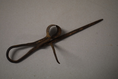
Miners candle holder, Late 19th century
This candle holder has a sharpened point to push or hammer into soft rock and a hook to hang on a ledge or piece of rock. It is intended to be used in a mine and many residents of Warrnambool and district went to the gold mining districts in the 19th century. But it could have been used in the Warrnambool district if a small night light was required in one of the many local quarries or even in the search for coal deposits in the region. It could also have been used in a household.This miner’s candle holder has no known local provenance but it is retained as an interesting example of a candle holder used in the past.This is a thin piece of metal tapering to a point at one end and curving around in a loop at the other end to make a handle. Along the straight metal piece is attached a curved metal hook. At the end of the loop is an open-ended circular piece with a serrated top. The circular piece has a rectangular-shaped end piece which enables the hole in the curved piece to be pushed out or pulled in to make the hole smaller or bigger. The metal is much rusted. 19th century mining, history of warrnambool -
 Warrnambool and District Historical Society Inc.
Tools, Miner's Pick, Early 20th century
This miner’s pick was of the type used to extract limestone at the Warrnambool limestone quarries, mainly for buildings and walls. This pick cut the sides and the top of the block and then it was levered off with a crowbar at an angle of about 30° to 40°. These blocks were then reduced to the required size using cross cut saws. There were about 12 limestone quarries operating in Warrnambool in the 19th century and limestone was extensively quarried for about 85 years to the 1930s when quarrying ceased. Today there has been a small revival in the Warrnambool area in the use of limestone blocks for building. Warrnambool also once had several bluestone quarries on the outskirts of the town. This miner’s pick has a wooden handle with rounded sides tapering to a wider end. The wood is weather-worn and split in places, especially at the top end. The pick is metal with a curved shape that tapers to a point at one end. The metal near the other end has a cavity into which is inserted the wider end of the wooden handle. limestone quarries in warrnambool, quarrying in warrnambool, warrnambool history -
 Warrnambool and District Historical Society Inc.
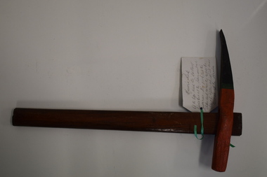
Tool, Miner's Pick
This miner’s pick was of the type used to extract limestone at the Warrnambool limestone quarries, mainly for buildings and walls. This pick cut the sides and across the top of the block and then the block was levered off the strata using a crowbar at an angle of 30° or 40°. These blocks were then reduced to the required size using cross-cut saws. There were about 12 limestone quarries operating in Warrnambool in the 19th century and limestone was extensively quarried for about 85 years to the 1930s when the quarrying ceased. Today there has been a small revival in the use of limestone blocks for building. Warrnambool also once had several bluestone quarries on the outskirts of the town. This miner’s pick is of considerable interest as an example of the type used in quarrying limestone in Warrnambool . Quarrying was once an important industry in Warrnambool. This miner’s pick has a short wooden handle with a metal stud inserted at the bottom end. The handle is rounded on the sides and tapers slightly from the top to the bottom. The metal pick has a curved shape with one blunt end and one sharp end. It has a cavity in the end nearest the blunt end and the wooden handle slots into this. The pick is painted black, green and orange, perhaps for display purposes. A handwritten information tag is attached to the handle. quarrying in warrnambool, limestone quarries in warrnambool -
 Warrnambool and District Historical Society Inc.
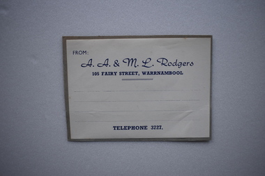
Label, A A&ML Rodgers, Mid 20th century
It is believed that this label comes from the wool shop business of Agnes Ann and Margaret Lillian Rodgers who were the daughters of Charles and Martha Rodgers. Charles was a well known quarry man in Warrnambool. The wool shop was in Fairy Street in the mid 20th century.This label is of interest as a memento of the Rodger's wool shop in Fairy Street, WarrnamboolWhite rectangular label with dark blue text adhered to a piece of grey card.FROM A.A & M.L Rodgers 105 FAIRY STREET, WARRNAMBOOL TELEPHONE 3727wool, rodgers wool shop, warrnambool -
 Eltham District Historical Society Inc
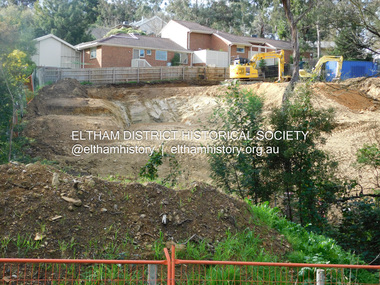
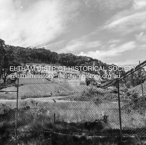
Photograph, Daryl Morrow, Redevelopment of former site of Hassall's Roadside Gallery, Main Road, Eltham, 10 July 2023
This historic site of Australia’s first open-air gallery is being redeveloped in 2023 for multi-housing fronting the Research Creek. In 1955, Ian and Joan Hassall moved to Eltham. They took a property on the corner of Zig Zag Road and Main Road, Eltham, north of the township (later known as 1215 Main Road). In July 1962, they opened their open-air gallery. Hassall’s Roadside Galley, “…cradled in the fold of hills to the north of Eltham” inspired by Ian’s own experience of exhibitions along the Embankment in London. The property included remnants of a stone quarry, paintings were hung on screens and removed at night. Various pedestals, that looked like giant mushrooms displayed sculpture, pottery, and jewellery. It had a small natural amphitheatre at the foot of a little sandstone cliff that fall away to the bed of a stream. To enter the gallery, a visitor crossed a small freestone bridge of oriental design, built by Hassall from local stone. The bridge spanned the stream flowing beneath great willow trees. Near the entrance wooden figures were displayed formed from pieces of local wood, said to speak to Ian Hassall’s sense of fun. Hassall’s Gallery was the first gallery of its kind in Australia. Ian became a full-time artist and when it first opened, he exhibited paintings he had made while touring the outback with writer and fellow Eltham resident Alan Marshall. He also exhibited other Australian artists over time including locals Lindsay Edward and Peter Glass.daryl morrow collection, eltham heights luxury living, hassalls roadside gallery, housing development, real estate development, research creek, 2023-07-10 -
 Eltham District Historical Society Inc
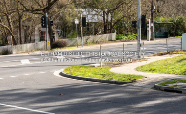
Photograph, Daryl Morrow, Redevelopment of former site of Hassall's Roadside Gallery, Main Road, Eltham, 13 July 2023
This historic site of Australia’s first open-air gallery is being redeveloped in 2023 for multi-housing fronting the Research Creek. In 1955, Ian and Joan Hassall moved to Eltham. They took a property on the corner of Zig Zag Road and Main Road, Eltham, north of the township (later known as 1215 Main Road). In July 1962, they opened their open-air gallery. Hassall’s Roadside Galley, “…cradled in the fold of hills to the north of Eltham” inspired by Ian’s own experience of exhibitions along the Embankment in London. The property included remnants of a stone quarry, paintings were hung on screens and removed at night. Various pedestals, that looked like giant mushrooms displayed sculpture, pottery, and jewellery. It had a small natural amphitheatre at the foot of a little sandstone cliff that fall away to the bed of a stream. To enter the gallery, a visitor crossed a small freestone bridge of oriental design, built by Hassall from local stone. The bridge spanned the stream flowing beneath great willow trees. Near the entrance wooden figures were displayed formed from pieces of local wood, said to speak to Ian Hassall’s sense of fun. Hassall’s Gallery was the first gallery of its kind in Australia. Ian became a full-time artist and when it first opened, he exhibited paintings he had made while touring the outback with writer and fellow Eltham resident Alan Marshall. He also exhibited other Australian artists over time including locals Lindsay Edward and Peter Glass.daryl morrow collection, eltham heights luxury living, hassalls roadside gallery, housing development, real estate development, research creek, 2023-07-13 -
 Eltham District Historical Society Inc
Photograph - Digital Photograph, Alan King, Jarrold Cottage, 701 Main Road, Eltham, 29 January 2008
Jarrold Cottage or White Cloud is known by many to be associated with the Skipper family, and has been since 1944 when Lena Skipper, wife of Mervyn Skipper purchased the cottage. She purchased it from the Estate of Thekla Jarrold who had died in March of the previous year. By the time Thekla died, she had lived in the Jarrold Cottage for 50 years. Thekla Alvenia Sissilia Ellian married John William Jarrold in 1888 at Clifton Hill. They started their family there but when John’s father William (who was married to Hannah Coleman) died in 1893 the family moved to Eltham. William had married Hannah Coleman in 1856 at his home in Eltham. William had arrived in the colony in 1848 so it is believed the Jarrold Cottage goes back at least to 1856 and possibly early 1850s. For a short period of time the cottage was rented to the Police as a temporary Police Station whilst a new and more permanent station was built further up the hill in 1859. The cottage was originally located closer to the Diamond Creek but was subject to flooding so was relocated to its present position on top a mound of rubble placed there from the nearby quarry next to the Dalton Street school (on Main Road). By 1916, John Henry Clark, a photographer who took many early photos of Eltham relocated from Fitzroy to Eltham and boarded with recently widowed Thekla Jarrold and her family. He changed professions from photographer to boot and harness maker around 1931 and Thekla had a small bootmakers shop built ifor him in the corner of her property next to the family home. J.H. Clark remained living at the property until his death in December 1956. At some stage after Clark's death, Lena Skipper is recorded living at the property having relocated from Montsalvat following the death of her husband Mervyn. The property continues to remain within the Skipper family as of 2023. Covered under Heritage Overlay, Nillumbik Planning Scheme. Published: Nillumbik Now and Then / Marguerite Marshall 2008; photographs Alan King with Marguerite Marshall.; p47This collection of almost 130 photos about places and people within the Shire of Nillumbik, an urban and rural municipality in Melbourne's north, contributes to an understanding of the history of the Shire. Published in 2008 immediately prior to the Black Saturday bushfires of February 7, 2009, it documents sites that were impacted, and in some cases destroyed by the fires. It includes photographs taken especially for the publication, creating a unique time capsule representing the Shire in the early 21st century. It remains the most recent comprehenesive publication devoted to the Shire's history connecting local residents to the past. nillumbik now and then (marshall-king) collection, bootmaker's shop, hannah coleman, jarrold cottage, john henry clark, john william jarrold, lena skipper, police station, thekla alvenia sissilia jarrold (nee ellian), white cloud cottage, william jarrold -
 Eltham District Historical Society Inc
Photograph - Digital Photograph, Alan King, Former bootmaker's shop, Main Road Eltham, 29 January 2008
The former bootmaker's shop is one of only three remaining original shops from the early 20th century in what was once Little Eltham, the others being the present day Cafe Zen-Den at 736 Main Road and the former Burgoyne General Store and Post Office, present-day San Antonio Barbershop at 820 Main Road. Jarrold Cottage or White Cloud is known by many to be associated with the Skipper family, and has been since 1944 when Lena Skipper, wife of Mervyn Skipper purchased the cottage. She purchased it from the Estate of Thekla Jarrold who had died in March of the previous year. By the time Thekla died, she had lived in the Jarrold Cottage for 50 years. Thekla Alvenia Sissilia Ellian married John William Jarrold in 1888 at Clifton Hill. They started their family there but when John’s father William (who was married to Hannah Coleman) died in 1893 the family moved to Eltham. William had married Hannah Coleman in 1856 at his home in Eltham. William had arrived in the colony in 1848 so it is believed the Jarrold Cottage goes back at least to 1856 and possibly early 1850s. For a short period of time the cottage was rented to the Police as a temporary Police Station whilst a new and more permanent station was built further up the hill in 1859. The cottage was originally located closer to the Diamond Creek but was subject to flooding so was relocated to its present position on top a mound of rubble placed there from the nearby quarry next to the Dalton Street school (on Main Road). By 1916, John Henry Clark, a photographer who took many early photos of Eltham relocated from Fitzroy to Eltham and boarded with recently widowed Thekla Jarrold and her family. He changed professions from photographer to boot and harness maker around 1931 and Thekla had a small bootmakers shop built ifor him in the corner of her property next to the family home. J.H. Clark remained living at the property until his death in December 1956. At some stage after Clark's death, Lena Skipper is recorded living at the property having relocated from Montsalvat following the death of her husband Mervyn. The property continues to remain within the Skipper family as of 2023. Covered under Heritage Overlay, Nillumbik Planning Scheme. Published: Nillumbik Now and Then / Marguerite Marshall 2008; photographs Alan King with Marguerite Marshall.; p47This collection of almost 130 photos about places and people within the Shire of Nillumbik, an urban and rural municipality in Melbourne's north, contributes to an understanding of the history of the Shire. Published in 2008 immediately prior to the Black Saturday bushfires of February 7, 2009, it documents sites that were impacted, and in some cases destroyed by the fires. It includes photographs taken especially for the publication, creating a unique time capsule representing the Shire in the early 21st century. It remains the most recent comprehenesive publication devoted to the Shire's history connecting local residents to the past. nillumbik now and then (marshall-king) collection, bootmaker's shop, jarrold cottage, john henry clark, lena skipper, thekla alvenia sissilia jarrold (nee ellian), white cloud cottage, shops -
 Eltham District Historical Society Inc
Photograph, Peter Pidgeon, White Cloud Cottage, 701 Main Road, Eltham, 2 Aug. 2022
Jarrold Cottage built c.1853, also known as 'White Cloud", located at 701 Main Road, Eltham, opposite Dalton Street. The house remains intact and is listed on the Victorian Heritage Database and considered historically significant to the Shire of Nillumbik. The cottage was originally located closer to the Diamond Creek but was subject to flooding. It was dragged by horse to the present site shown, which was chosen for the higher ground that had been created as a result of land fill being deposited here from the quarry further around the bend on Main Road (site of present-day Eltham Primary School carpark) where the stone had been quarried for building the State School in Dalton Street. It had previously been rented for use as a Police Station / residence prior to the building of the permanent police house and station at the corner of Maria and Brougham streets in 1859. The cottage was purchased by Lena Skipper after the death of Thekla Jarrold in 1943 and remains in the family to present day (2022). Comparison photo: SEPP_0749 Part of a presentation by Peter Pidgeon to the Society, 13 August 2022 showcasing a series of photographs taken by John Henry Clark over the period 1895 to 1930. John Henry Clark was the youngest of three boys born to William Henry Clark (1823-1877) and Maria White (1843-1914). He and his brothers, William Charles Clark (1872-1945), Clement Kent Clark (1874-1912) operated a photography business (Clark Bros.) from 25 Thomas Street, Windsor near Prahran during the period c.1894 to 1914. Following death of Clement in September 1912 and their mother in 1914, the Clark Bros business appears to have dissolved, the premises demolished, and a new house was under construction in 1915. John set up business independently in 1914 operating out of 29 Moor Street, Fitzroy where he is registered in the 1914 and 1915 Electoral Rolls. By 1916 John had relocated to Eltham where he continued his practice as a photographer and took many of the early images around the district of Little Eltham. Around 1930 John changed professions and opened a small cobbler's shop in 1931 near the pond opposite Dalton Street adjacent to the Jarrold family cottage. He never married and continued his profession as a bootmaker from this little shop, maintaining a close relationship with Mrs Jarrold for the rest of their lives. His bootmaker shop remains today beside the Whitecloud cottage and is one of only three remaining shops in the area from the early 20th century.Comparative photo taken 2022 with one taken from same location over 100 years earlier by noted local photographer J.H. ClarkBorn Digitaleltham, j.h. clark photo (2022), dalton street, main road, bootmaker's shop, jarrold cottage, white cloud cottage, avenue of honour -
 Eltham District Historical Society Inc
Photograph, Peter Pidgeon, White Cloud Cottage, 701 Main Road, Eltham, 2 Aug. 2022
Jarrold Cottage built c.1853, also known as 'White Cloud", located at 701 Main Road, Eltham, opposite Dalton Street. The house remains intact and is listed on the Victorian Heritage Database and considered historically significant to the Shire of Nillumbik. The cottage was originally located closer to the Diamond Creek but was subject to flooding. It was dragged by horse to the present site shown, which was chosen for the higher ground that had been created as a result of land fill being deposited here from the quarry further around the bend on Main Road (site of present-day Eltham Primary School carpark) where the stone had been quarried for building the State School in Dalton Street. It had previously been rented for use as a Police Station / residence prior to the building of the permanent police house and station at the corner of Maria and Brougham streets in 1859. The cottage was purchased by Lena Skipper after the death of Thekla Jarrold in 1943 and remains in the family to present day (2022). Part of a presentation by Peter Pidgeon to the Society, 13 August 2022 showcasing a series of photographs taken by John Henry Clark over the period 1895 to 1930.Born Digitaleltham, dalton street, main road, bootmaker's shop, jarrold cottage, white cloud cottage -
 Eltham District Historical Society Inc
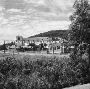
Negative - Photograph, J.A. McDonald, Unidentified quarry, Jan. 1961
Record of various Shire of Eltham infrastructure works undertaken during the period of 1952-1962 involving bridge and road reconstruction projects, sometimes with Eltham Shire Council Project Reference numbers quoted. It was during this period that a number of significant improvements were made to roads and new bridges constructed within the shire that remain in place as of present day (2022). In many situations, the photos provide a tangible visible record of infrastructure that existed throughout the early days of the Shire. The album was put together by or under the direction of the Shire Engineer, J.A. McDonald.1961-01, quarry -
 Eltham District Historical Society Inc
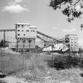
Negative - Photograph, J.A. McDonald, Unidentified quarry, Jan. 1961
Record of various Shire of Eltham infrastructure works undertaken during the period of 1952-1962 involving bridge and road reconstruction projects, sometimes with Eltham Shire Council Project Reference numbers quoted. It was during this period that a number of significant improvements were made to roads and new bridges constructed within the shire that remain in place as of present day (2022). In many situations, the photos provide a tangible visible record of infrastructure that existed throughout the early days of the Shire. The album was put together by or under the direction of the Shire Engineer, J.A. McDonald.1961-01, quarry -
 Eltham District Historical Society Inc
Film - Video (Digital), Geoff Paine, Skipper Cottage: Stories of the Nillumbik Shire with Geoff Paine, June 2020
One of a series of videos "Stories from the Nillumbik Shire with Geoff Paine" A brief overview of the Skipper Cottage or Whitecloud and the Bootmakers cottage (mid 1850s) with Sue Thomas, partner of Adam Skipper who have lived there for about 40 years. Includes a view inside the Bootmaker's cottage. Discusses the flood plain and how the house was moved to its present site on high ground due to flooding. The high ground came about due to dumping of rubble from the quarry where the school car park is which was used to source stone to build the schoolhouse across the road. It was moved on horse and wagon approximately 200 metres. The cottage was previously a Cobb and Co stopping station for mail. When Montsalvat was being built in the 1940s, Lena Skipper who was originally from Sydney invested her money into buying Whitecloud rather than putting money into Montsalvat like many others. Upon her death, Matcham Skipper inherited the house. Seaweed was used as insulation in the ceiling and after Matcham owned it a spark from the fireplace set the seaweed on fire and gutted the front of the house which is now all one big room. Also illustrates some of the changes to the house over the years and its construction. The Elm forest has grown naturally from suckers spread from one tree.MP4 Digital file 00:05:50; 674MBvideo recording, bootmakers cottage, lena skipper, lena thomas, matcham skipper, school residence, skipper house, whitecloud cottage -
 Eltham District Historical Society Inc
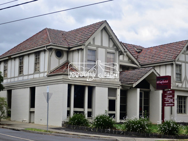
Photograph, Jim Connor, Main Road, Eltham, 14 Jan 2017
The Eltham Hotel is the oldest continually operating hotel in the Eltham district. Initially referred to as the Little Eltham Hotel, it has been known as the Eltham Hotel since the 1850s through to present time with a very brief period as the Eltham Tavern in the late 1980s. Benjamin Oliver Wallis was a prominent Eltham resident, publican and Councillor during the second half of the nineteenth century. He owned the house that is now the Nillumbik Living and Learning Centre at 739 Main Road Eltham and one stage the Eltham Hotel. Wallis migrated to Melbourne in 1853 but his wife and children remained in Cornwall for a further 10 years. Later in 1853 Richard Warren engaged Wallis to build the Eltham Hotel and it opened in 1854. The hotel was constructed of hard basaltic blue stone quarried in the Eltham district and cemented together with mud, and partly of bricks made at Eltham. The Fountain of Friendship Hotel on the opposite side of Maria Street (Main Road) opened shortly after. The hotel was a well-known resting place for gold diggers during the gold rush at Woods’ Point and Warren would buy the gold from the diggers. In 1858 Warren fell into financial difficulties and had to sell the hotel. Wallis bought the hotel and obtained a publican’s licence in 1861. In the 1850s the Fountain had been the more popular hotel but after that the Eltham Hotel became more popular. It is understood that in about 1857 Wallis probably built the “Living and Learning house” for tanner John Pearson. In 1868 Pearson became bankrupt and Wallis acquired the house and he lived there until his death in 1896. For some of this time the house was in the name of Benjamin’s son Richard but he died in 1888 and ownership reverted to his father. Wallis was a member of the Eltham Jockey Club and in 1867 his wife Anna rode her horse Charlotte in the Annual Races. Anna was also an angler and is reported to have caught a large perch in the Yarra River. She died in 1887. On 16th September 1886 Wallis sold the hotel to Christopher Watson (Snr). Watson died in 1887 and the hotel passed to his son Christopher Watson (Jr) who owned it until his death in 1909 at which time his wife Emily took over the license. Upon her death, their son Herbert applied for the license in January 1915. In July 1925, Herbert Watson demolished the original building and, in its place, erected a modern hotel which remains the foundation of the present Eltham Hotel. The contractors at the time commented on how well the original building had been constructed. A description of the new building was detailed in the Advertiser newspaper of January 8, 1926: “The new building consists of. two stories. designed in English tavern style, and contains-all told, 24 rooms. On the second floor, in front uninviting the two gables is a deep balcony, which will be much appreciated by visitors. The lower story is wholly of brick, and the upper one of wood and fibrous cement plaster. The rooms are spacious and lofty, and the windows are large and of latest style, and light the rooms splendidly. The entrance hall is 8 feet wide. The bar is a very commodious room and is furnished in the most up-to-date and convenient manner. The dining room, a very attractive apartment, is 30 feet by 15 feet 6 inches, and the bar parlor is also a large and well furnished room. A large cellar, an indispensable adjunct to an hotel, has been excavated beneath the bar. On the upper story are 12 bedrooms, and among other conveniences are two bath rooms in which hot and cold water can be used. All the rooms have been supplied with the necessary appliances for electric lighting, which will be one of the progressive evidences which Eltham will shortly enjoy.” “In the yard a brick garage to accommodate three cars at once, has been erected. This, as well as the hotel, is roofed with tiles.” “From the front of the hotel (especially the balcony) a lovely view of the country west and, north may be obtained.” “It may be added that it Is intended to have an ornamental garden, a tennis court. and a kiosk in connection with the hotel, and the property will have a rustic fence round it.” The hotel has since undergone several modifications and extensionsTomorrow's history documented todayeltham, jim connor collection, main road, eltham gateway, eltham hotel, pitt street -
 Eltham District Historical Society Inc
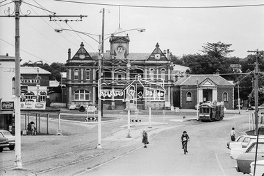
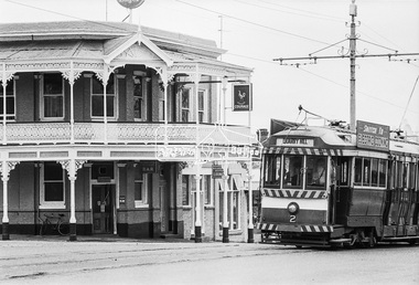
Photograph, Bendigo Tramways No. 2 en route to Quarry Hill outside Eaglehawk Town Hall, January 1972, Jan 1972
... , High Street, Loddon Valley Highway, Milk bar, Quarry Hill... bar, Quarry Hill, Sailors Gully Road, Tram Digital TIFF file ...Viewed from High Street (Loddon Valley Highway) looking northwest from near Napier StreetDigital TIFF file Scan of 35mm Ilford FP3 black and white negative transparencybendigo, bendigo tramways no. 2, eaglehawk, eaglehawk mechanics institute, eaglehawk town hall, george coop collection, high street, loddon valley highway, milk bar, quarry hill, sailors gully road, tram -
 Eltham District Historical Society Inc
Photograph, Bendigo Tramways No. 2 en route from Quarry Hill outside the Victoria Hotel near the intersection of High Street at Victoria Street, Eaglehawk, January 1972, Jan 1972
... victoria hotel, Pub, quarry hill, sailors gully road, tram... bar, street new victoria hotel, Pub, quarry hill, sailors ...Looking northwest across High Street, Eaglehawk at the intersection with Victoria Street. The Victoria Hotel is the present day New Victoria HotelDigital TIFF file Scan of 35mm Ilford FP3 black and white negative transparencybendigo, bendigo tramways no. 2, eaglehawk, eaglehawk mechanics institute, eaglehawk town hall, george coop collection, high street, loddon valley highway, milk bar, street new victoria hotel, pub, quarry hill, sailors gully road, tram, victoria hotel -
 Eltham District Historical Society Inc
Binder, Eltham District History, Eltham Road Board, 1856-1871; Research by Keith Chappel, 1971-1974
... pound eltham quarry eltham racecourse eltham roads board eltham ...Eltham District History, Eltham Road Board, 1856-1871Two binders containing 486 A4 pages (photocopied) of mostly handwritten notes from research undertaken of Public Office Records of Victoria various holdings. Some photocopies from source reference books. Includes 20 page subject index (handwritten) at front and 5 pages of notes and sources at rear and a photocopy of short biography of Keith Chappel.a. foley, a. harkness, a. mackie, a. mcintyre, a. von ziegler, a.a. vivian, a.d. kinninmont, a.d. quadri, a.h. grimshaw, a.w. page, aboriginal reserve, aborigines, abraham quarman, abraham rooks, abraham taylor, adam goudie, aenaes harrison, agnes black, agnes charlton, agnes dalrymple, ah chong, ah cock, ah hein, ah lie, ah sing, albert lunson, albert ness, albert parker, albert ramseyor, alert hunt, alex cameron, alex eason, alex mcandrew, alexander crichton, alexander donaldson, alexander falconer, alexander innes, alexander james, alexander mcdonald, alexander miller, alexander thompson, alexander walker, alexander white, alfred armstrong, alfred burgess, alfred davey, alfred deschamp, alfred eddy, alfred hinley, alfred hooper, alfred hubbard, alfred lowman, alfred smith, alfred whelpton, alice power, allen heeps, allwood, amelia neuman, amos taylor, anderson, andersons creek, andrew brown, andrew byrne, andrew harkness, andrew herbert, andrew ross, andrew smith, angus mcdonald, ann emmott, ann mcphee, ann odea, ann plunkett, ann snell, ann tatty, annie ashmore, annie herbert, annie stuart, anthony beale, anthony currie, ants nest, archibald mcphee, arthur connor, arthur lyttle, arthur rooke, arthur young, arthurs creek, arthurs creek school, august ostling, b.o. wallis, barkers creek, barr, belton, benjamin bain, benjamin jenken, benjamin lawford, benjamin rice, benjamin shaw, benjamin smith, benjamin wallis, benjamin walton, berry, bismark hotel, black calf gully, black thursday, boomers gully, bridget bunker, bridget hailes, bridget kearse, bruno hirt, burns, bushranger, c. twiss, c.h. bade, caleb sherar, caledonia, caledonia diggings, campbell hunter, carl euman, caroline davey, catherine kennedy, cathren brock, cecilia farman, chamberlain, chapman, charles caldwell, charles campbell, charles dale, charles draper, charles fowler, charles green, charles hawkins, charles hempel, charles hirt, charles hirtson, charles jefer, charles jesse, charles kerchevell, charles lidgerwood, charles morris, charles peake, charles prince, charles rielly, charles roberts, charles rowand, charles simms, charles souter, charles swan, charles verso, charles wells, charles whelpton, charles williams, charles wingrove, charles woodley, charleys gully, charlotte beltison, charlotte goodwin, ching ah hock, christine brennan, christine mckenzie, christmas hills hotel, christmas hills school, christopher battaila, christopher twiss, chune grove, church of england, church of england school, clarissa milton, cleir hills, colin amos, constable quirke, constable talty, cornelius haley, cornelius stewart, cottles bridge, councillors hotel, cricket, cucksons brewery, d. nicholson, d.w. morrissey, dalry, daniel charleston, daniel harding, daniel jepps, daniel mccarthy, daniel mckenzie, daniel mcloughlin, daniel oloughlin, david boyd, david christian, david clark, david creighton, david rogers, david rolfe, david sharp, david shawcross, david smith, david stevenson, diamond accommodation store, diamond reef mine, dickson, dixon bertram, donald cameron, donald mcmillan, donaldson, dougald mcphee, dr barclay, dugald mcphee, dugald taylor, duncan fraser, duncan smith, dungey, e. hildebrand, e. stichlins, e.f. falkiner, e.j. hughes, e.m. garsed, e.w. morrissey, edith staff, edmund clarke, edmund cuckson, edmund hall, edmund picket, edward bage, edward beltison, edward bunker, edward ford, edward hindley, edward jackson, edward jones, edward kelly, edward qualtrough, edward staff, edward tresain, edward weller, edward whelpton, edward whilpson, edwin biley, edwin cartwright, edwin cohen, edwin deschamp, edwin mcleish, edwin rodda, edwin smith, effie rodda, eliza bellamy, eliza dawson, eliza howell, eliza nield, eliza smith, elizabeth cockshutt, elizabeth eiles, elizabeth fitch, elizabeth gillespie, elizabeth harris, elizabeth herbert, elizabeth hollow, elizabeth le juge, elizabeth plunkett, elizabeth whelpton, ellen hurst, ellen kearse, ellen quarman, ellen sweeney, ellen white, ellis, eltham cemetery, eltham hotel, eltham lower park, eltham market, eltham police station, eltham pound, eltham quarry, eltham racecourse, eltham roads board, eltham school, emile hude, emily anderson, emily blamire, emily coutie, emma smith, emma taylor, ephraim wyett, ernest baillie, ernest henrick, ernest steer, esther porter, ethel baillie, evan jones, evelyn hotel, evelyn observer, ewen cameron, ewen jones, f. chrimes, f. grundel, f.e. falkiner, f.r. howard, fanny benson, fanny white, felix hude, felix noisette, ferdinand ramseyer, flora vale, florence hurst, fogarty, forbes mackenzie, fords creek, frances kearse, francis baker, francis hales, francis raselli, francis steer, frank eiles, frank rogerson, frank tanner, fraser, fred hurst, frederick falkiner, frederick hurst, frederick muller, frederick nink, frederick walker, frederick wharington, friedrich muller, fryers gully, furphy, g. donaldson, g. houghton, g. turnbull, geanetta hude, george assender, george bear, george beare, george benson, george bird, george boston, george brain, george brandt, george burley, george buswell, george coutie, george eiles, george ewings, george ford, george godber, george goodman, george gray, george griffiths, george hall, george herbert, george horn, george kirk, george langhorne, george mann, george mclelland, george mosely, george neumayer, george orchard, george parish, george porter, george purcell, george ralph, george reid, george rocke, george rogers, george rolfe, george stebbing, george stebbings, george stebbins, george switzer, george symons, george thompson, georgina hilton, glenda moriss, glengloy, gold, goulstone, greensborough police station, gulf station, h. jennings, h. mann, h.h. farquason, hannah sunderland, happy valley, harkness, harold scarce, harriet hunt, harriet smith, harry hollow, hazel glen, healesville, heinrich hirt, helena peters, henrietta hill, henry arthur, henry ashmore, henry austin, henry brown, henry dendy, henry dineen, henry fowler, henry gardner, henry green, henry griffin, henry hart, henry hirst, henry hirt, henry hopkinson, henry hude, henry hurst, henry inch, henry jones, henry mills, henry scarce, henry st paul, henry stevens, henry stooke, henry thomson, henry vogt, henry wallace, henry wilson, herbert rodda, herman henrick, hermann lampe, hermann steinmann, hester staff, hitchill, holbert, honoree hude, hotel de france, hugh mccann, humphrey peers, humphrey spicer, hurstbridge, hurstbridge general store, i.h. clarke, ida adelskold, ignatz kinzel, ira pimm, irene donaldson, isaac briggs, isaac hickson, isaac hill, isaac kerr, isaac varby, isaac williams, isabella donaldson, isabelle herbert, j. dungate, j. eccleston, j. harkness, j. hartley, j. hude, j. irvine, j. jones, j. manduell, j. mason, j. mcdonald, j. mcnamara, j. nichenson, j. renahen, j. scott, j. seymour, j.a. goold, j.a. panton, j.c. hughes, j.d. thompson, j.f. hughes, j.f. johnstone, j.g. walter, j.h. taylor, j.p. morris, jack ewart, jacob belsham, jacob goldstein, jacob morast, jam loon, james alexander, james anderson, james andrew, james andrews, james baines, james batchelor, james bond, james bradford, james brennan, james brock, james brown, james brunning, james buchanan, james cockburn, james cowan, james dalrymple, james donaldson, james duckworth, james goodwin, james harding, james harrison, james hartley, james hawkins, james hewish, james holinger, james hughes, james inglis, james jamieson, james johnson, james johnston, james kaye, james kew, james lindsay, james lindsey, james lynan, james macpherson, james mann, james martley, james mayger, james mccutcheon, james mcmahon, james mcpherson, james mess, james miller, james mitton, james morton, james murdoch, james murdock, james nickinson, james orford, james purcell, james qualtrough, james rudall, james simpson, james smith, james spence, james stonachan, james stuart, james suman, james surman, james sutherland, james thompson, james thomson, james walker, james walters, james watts, jane cleave, jane donaldson, jane mess, jane sadler, jane shaw, jane thomson, janefield, jean borelli, jeanette hudi, jeanne hude, johann muller, john ainsworth, john andrew, john baillie, john barr, john beale, john bell, john bellin, john blake, john blyth, john brock, john brown, john byers, john cameron, john candler, john carter, john cobbock, john cockshank, john cockshutt, john coleman, john connell, john crozier, john darroch, john dennis, john donaldson, john elsworthy, john fenton, john fitch, john gardner, john gast, john graham, john grimshaw, john haines, john haley, john harper, john harris, john hassall, john hayes, john heales, john herbert, john holland, john holman, john hood, john horner, john horton, john hughes, john jardine, john johns, john johnston, john jones, john kearse, john kilpatrick, john knell, john lawrey, john macadam, john mandell, john manduell, john marker, john mccoll, john mccolly, john mcdonald, john mcintyre, john mckimmie, john mcnamara, john mitchell, john moore, john morgan, john muller, john murray, john pearson, john peterson, john petty, john pullen, john quinn, john rawlings, john ryder, john sabelberg, john scott, john semar, john serman, john seymour, john shawcross, john smith, john staff, john steer, john stephens, john sweeney, john thompson, john thomson, john trahy, john walker, john weller, john wells, john williams, john williamson, john yates, john yeoman, john young, johnn mcdonnell, joseph bull, joseph burns, joseph caldwell, joseph caudwell, joseph coutie, joseph elliott, joseph emmott, joseph fayver, joseph furphy, joseph hall, joseph hibbert, joseph hilton, joseph johns, joseph lithgow, joseph panton, joseph rodda, joseph sands, joseph sanson, joseph schubert, joseph scott, joseph shaw, joseph smith, joseph spedder, joseph stevenson, joseph verco, joseph wilson, josiah hollis, josiah hullis, josiah thomas, judith furphy, julie williams, junction hotel, kangaroo forest, kangaroo ground, kangaroo ground cemetery, kangaroo ground general store, kangaroo ground hotel, kangaroo ground police station, kangaroo ground post office, kangaroo ground school, kate bolger, kath scarce, katherine kearse, kidd, kinglake, kinglake hotel, kingstown, l. storey, lan quan, lang, latimour, laura henrick, laurence paterson, leon berlioz, levinia henrick, lillian gillan, linton, little eltham, long gully, louis henrick, louis le juge, louis smith, louisa steinmann, louise miller, lower plenty bridge hotel, lucy tidell, lydia qualtrough, m.j. careton, m.s. adams, macrudden, maggs, mail coach, maplestone, margaret graham, margaret hollins, margaret kearse, margaret kennedy, margaret kinrade, margaret lynch, margaret mcbirney, margaret steinmann, marguerite borelli, maria reilly, maria st paul, maria trew, marian trew, marianne miller, marie wright, marion hillier, mark bunker, martha herbert, martin brennan, mary alexander, mary beltison, mary bradford, mary bridgman, mary brock, mary bull, mary eiles, mary hopkinson, mary kearse, mary lean, mary mcinerney, mary miller, mary parmington, mary pearson, mary pickles, mary robertson, mary rodda, mary ross, mary smith, mary surman, mary weller, matilda jordan, matilda mcmillan, matthias watson, mawson, mechanics institute, michael callanan, michael fenton, michael kearse, michael mctyne, michael merritt, michael oday, michael odea, midgley hall, mills, minnie watts, miss bellon, morgans gully, mount joy, mr donnan, mr omeare, mr page, mrs greenaway, mrs havard, mrs hude, mrs morris, muller, murrays bridge, n.d. whyte, ned kelly, new caledonia creek, nicholas rodda, nillumbik, norman mcphee, old caledonia gully, oliver gourlay, one tree hill, owen finnegan, panton hill, panton hill hotel, panton hill post office, panton hill school, parambool, patrick armstrong, patrick bourke, patrick burke, patrick callaghan, patrick green, patrick harrington, patrick kearse, patrick lynch, patrick mcintyre, patrick o'callaghan, patrick rodgers, patrick sheahan, peach grove, perinella bull, perry, peter carrucan, peter flyn, peter ford, peter lawlor, peter patterson, peter snodgrass, peter watson, philip korfman, phillip gakden, phillip kaufman, phillip korfman, pierce brennan, pierce power, poo long, pound bend, pretty hill, queenstown, queenstown cemetery, queenstown police station, queenstown school, r. mackie, r.a. davidson, rebecca noisette, rebecca weller, reefers hotel, research, research gully, research gully hotel, research hotel, research school, rev dobinson, rhoda coutie, richard brook, richard capper, richard dunstan, richard goulding, richard heales, richard lane, richard matthews, richard rodda, richard searle, richard smith, richard wallis, richard warren, richard woolcott, robert alice, robert bourke, robert burke, robert charlton, robert clarke, robert cunningham, robert dugdale, robert grant, robert hall, robert harris, robert hempel, robert hill, robert hurst, robert lowman, robert mcadam, robert mckee, robert nink, robert norman, robert pontessey, robert sharp, robert smith, robert steel, robert stevenson, robert strong, robert surnam, robert wood, robina joyce, rogerson, roman catholic church, rossiter, rudolph muller, ruth mess, ruth sadler, ruth stevenson, s. smith, s. stewart, salters rush, sam deacon, samuel bird, samuel brace, samuel cameron, samuel candler, samuel cole, samuel cracknell, samuel dagley, samuel flier, samuel furphy, samuel merriman, samuel moseley, samuel mosley, samuel smith, sarah howard, sarah moseley, sarah raston, sarah walters, second watery gully school, self, shin hun, simon armstrong, smiths gully, smiths gully mechanics institute, smiths gully school, sophia greenaway, spanish gully, st andrews, st andrews hotel, st helena, stack, stanley smith, stephen gonnet, stephenson turner, stephensons bridge, steven anderson, stevensons corner, sumner, susan dickson, susan street, susan walke, sutherland, t. davidson, t. mclaughlin, t. symons, t.a. aldwell, t.b. drummond, t.b. henderson, t.e. johnston, t.h. subelly, tarrawarra, theis, theodore sabelberg, theresa lynch, thomas anderson, thomas armstrong, thomas baillie, thomas batt, thomas bell, thomas benson, thomas bibbs, thomas boardman, thomas bradford, thomas bull, thomas cattery, thomas cochrane, thomas cook, thomas cottle, thomas cousins, thomas downward, thomas edwards, thomas evans, thomas grierson, thomas haines, thomas harmer, thomas hunniford, thomas huntford, thomas hurry, thomas jardine, thomas jones, thomas kearse, thomas kennedy, thomas marland, thomas martin, thomas mcinerney, thomas morrison, thomas mundy, thomas murphy, thomas murray, thomas peacock, thomas plunkett, thomas postlethwaite, thomas prior, thomas qualtrough, thomas smith, thomas stone, thomas sunderland, thomas swatling, thomas sweeney, thomas symons, thomas walke, thomas wall, thomas wright, thomas young, tim shaw, toll gate, tom collins, tommys hut, true, upper diamond creek, upper diamond creek school, view hill, virtue hall, w. cockayne, w. craig, w. foster, w. marriott, w. ridley, w. trenoweth, w.a. page, w.b. andrew, w.b. burnley, w.b. phillips, w.c. shortt, w.w. herbert, walter barlow, walter hillier, walter joyce, walter knell, walter mckimmie, walter mcnicoll, walter thomson, walter wippell, warburton carr, warrandyte, warrens hotel, watery gully, watsons creek, watsons creek hotel, wattle glen school, wellers hotel, weymss donaldson, whipstick gully, white cloud, wild dog creek, wild dog gully, wiliam albert, william aitken, william albert, william anderson, william andrews, william barr, william barrow, william bell, william bond, william bowden, william bremmer, william brewer, william bridgman, william burnley, william buswell, william cant, william clarke, william cleave, william crozier, william dawson, william dodging, william ellis, william finn, william fitzgibbon, william ford, william foster, william garland, william ghosley, william golding, william goodwin, william graham, william gray, william grimshaw, william hall, william harding, william herbert, william hoilett, william hopkinson, william howitt, william howlett, william hubbard, william hunt, william inglis, william jarrold, william joyce, william kidd, william kilpatrick, william kommer, william lodge, william mclaughlin, william mcmurray, william mitton, william moore, william mosley, william murphy, william nicholson, william normage, william norman, william nuttall, william phillips, william quarman, william ronald, william sadler, william scott, william seaville, william sharp, william smith, william spicer, william taylor, william thomson, william tobin, william underwood, william walsh, william walshe, william walters, william watkins, william west, william wilmot, william wilson, william wolverston, william woods, wolfe, woodley, yarra bank, yow yow creek, a. brewer, a. easson, a. edwards, a. melville, a.m. ross, a.r. larrimour, aborigine reserve, advertisements, agricultural district, alan bernhard horsley, albert frederick charles glover, albert h price, albert h.c. price, albert henry charles price, alex easson, alexander campbell, alexander melville, alexander thomas haley, alexander thomson, alfred j. lowman, alice may peake, alie haley, alistair knox, alistair samuel knox, allandale road, allendale road, allwood run, andrew, andrew mckay, anton william brinkkotter, archibald brown, argus, arthur chichester allen, arthur edwin cracknell, arthur john braid, arthur robert traynor, atlas of australia 1886, b. lawford, b. mess, barry thale houston, basil y hall, basil yaldwyn hall, bell street, benjamin baxter, benjamin bowater, benjamin thomas taylor, benjaomin o. wallis, bible street, billis, bolton street, brewery, brisbane street, buckingham, bushrangers, c. brown, c. carroll, c. hirt, c.s. haley, c.s. wingrove, c.t. harris, caledonia run, cam, cattle, charis meta alexander pelling, charles brown, charles ellis, charles hicks bath, charles newman, clara gonnet, claude bryan gibbs, clifford henry goulding seear, coleraine, colin t. bell, collectors, collingwood, commissioner airey, coplin thomas bell, cornelius john stewart, cornelius sharp haley, cornelius sharpe haley, county of evelyn, culla hill, cutto hill, d. ryan, daily news newspaper, dalton street, daniel jepp, derek cecil o'beirne, diamond creek, diamond creek post office, diamond creek railway station, diamond creek run, diamond creek station, diamond creek township, divisions, doctor, donald alfred neil, donald charles maling, donald ingersole, donald kennedy, douglas anderson, e. cameron, e. falkiner, e. stooke, e.t. peers, edward dumaresq, edward heller, edward james, edward wilson, edwin stooke, elections, electoral districts, electoral roll, electrified railway, eltham, eltham district description, eltham district history, eltham district road board, eltham post office, eltham railway station, eltham road district, eltham road district board, eltham shire council, eltham shire councillors, eltham shire history, eltham town common, eltham village, eltham-hurstbridge railway, ely street, eric dudley butler, eric nichol staff, eric percival harmer, ernest james andrews, eve may edwards, evelyn and mornington division, evelyn division, everard albert hale, ewn hugh cameron, f. stone, f.d. wickham, flour mill, fountain of friendship hotel, francis bradley, francis joseph favier, francis regiereals(?), francis watson rosier, frank haley, frank wayne maas, franklin william nankervis, frederick charles barrett, frederick edward falkiner, frederick eldred griffith, frederick filed durham, frederick gration, frederick kirk gration, frederick vincent squire, fredrick ninck, g. drabble, g. haley, g. hodgkins, g. lee, g. thomas, g. thomson, g.d. boursiquot, g.f. belcher, garden hill, geoffrey charles dreverman, geology, george d'arley boursiquot, george ellis parker, george fletcher, george frederick belcher, george haley, george hirt, george louie cresp, george love, george robertson, george turnbull, george wise, godalmin street, gold mining, goodman, gordon melville, government gazette, graham lindsay bride, grazing, greenhill, greensborough, grierson, gun maker, h. g. james, h. stooke, h. taylor, h.g. jhones, h.t. beams, harold edward bartlett, heatherleigh, heidelberg, helen louise wells, henry creswell, henry gilbert jones, henry holloway, henry peers, herbert eric rundle, herbert hewitt, herbert rutter, hoddle, holiday resort, horace hilton, house of assembly, hugh larimour, hurst, i. barrow, i. rooks, ian g smedley, ian gordon smedley, industry, isaac rooks, isidore t. wilmor, j. alison, j. brown, j. cameron, j. carfrae & co., j. ferguson, j. frank, j. garthwaite, j. greaves, j. greitzner, j. irish, j. lindsay, j. murray, j. o'brien, j. stevenson, j. wilson, j.b. phipps, j.b. rodda, j.f. imley, j.g. foxton, j.g. fraser, j.h.f. hawke, j.k. zahn, j.m. holloway, j.p. imley, jack cato, jack clendinnen gill, jacob belcham, jacob greitzner, jakeb greitzner, james bailey, james cox, james d mealy, james darley mealy, james frank, james frederick mackay, james graham, james johnstone, james kay bryce, james mclaren, james murray, james oliver white, james pearson imley, james pearsons imley, james rosier, james ryan, jane thompson, jersey, johann karl zahn, john a porter, john alexander hampton lewis, john alison, john b. wilson, john barter bennett, john blackmore phipps, john blakemore phipps, john carfrae, john dane, john g. foxton, john gerald searle, john greaves, john green foxton, john greenlaw foxton, john henry sabelberg, john johnstone, john lee smith, john lindsay, john lindsay beale, john mann, john mason, john pape, john porter, john samuel lithgow, john stevenson, john verran mcconnell, john wilson, jonathan scott, joseph anderson panton, joseph bromley shallard, joseph garthwaite, joseph smedley, joseph walter henry bradbury, josiah morris holloway, k.e. dunstan, m kinglake, keelbundora, kenneth chareles crompton, kenneth donald macmillan, kenneth frederick hines, kenyon, kerby street, kinglake school, krelbundora, l. jenyns, l.m. bill, lancefield, land act 1862, land act 1865, land act 1869, land alienation, land settlement, legislative council, leopold kershaw lawry, leslie christopher docksey, leslie edward clarke, little eltham school, m. o'shea, m.h. fitzpatrick, mail run, mail service, main road, map, margaret moody, martin fogarty, mary leak, maxwell alexander spence, medical practitioner, michael o'shea, miss haley, moira, morang, mr. ford, mrs galbraith, n. gillies, n. rodda, name, names, neil stewart roberts, norman ernest charles williams, opening, orchard district, p. ryan, p.a.c o'farrell, p.p. cotter, parish of nillumbik, parish of nillumbik 1856, patrick costello, patrick turnbull, percy downer, peter andrew charles o'farrell, peter fair, peter graham, petr lawlor, phillip cumming, photographer, plenty river, polling place, polling places, porter street, portrait, post office, post office directory 1868, princes bridge, proclamation, r. boston, r. hepburn, r. lane, r. wadeson, r.d. mess, r.s.h. moody, radley (rodney) douglas quin, rag mill, railway lines, raymond clive duncan, registrar, research state school no. 2959, reserve for aborigines, reynolds road, richard jones and co, richard robert woolcott, river plenty, robert alan bell, robert benn (ship), robert cadden, robert cunningham white, robert david taylor, robert hepburn, robert kenneth marshall, robert miller, robert reid, robert stewart hull moody, robinia joyce, rodda family, rosemount, rupert norman maskell, ryans road, s. evans, s. wekey, samuel evans, samuel phillips, samuel ramsden, samuel w. scott, searle, shire of diamond valley, sigismund wekey, sly grog seller, sources, south province, south yarra, st kilda, stanley simpson addison, strathbogie, strippers of bark, stuart alexander donaldson, sweeneys lane, sweeny, sylvia ruth houston, t. archer, t. huntley, t. murray, t. stephens, t. watkins, t.a. stork, t.b. daling, t.b. darling, t.c. darling, t.milthorpe, t.p. cross, tannery, tenders, terence alphonsus collins, the explorers and early colonists of victoria, the story of the camera in australia, thomas bell darling, thomas clarke, thomas darling, thomas foster chuck, thomas grant, thomas henry bowman, thomas herbert power, thomas irvine, thomas maltby, thomas mccombie, thomas scarce, thomas sweeny, thornton street, town of eltham, vaccinations act, victorian government gazette, virtue hall station, virtue hill, w. archer, w. brown, w. gordon, w. inglis, w. jones, w. matthew, w. mcdonald, w. williams, w. wilson, w.r. belcher, w.t. fitzpatrick, walter craig, walter wipple, warringal, water wheel, wattle glen, whittlesea, william acland, william adams, william b. burnley, william buckingham, william c. farrell, william cleve, william craig, william frederick ford, william george gray, william henry hull, william john taylor, william john turner clarke, william johnson, william jones, william lorimer, william morris, william redmond belcher, william thomas cochrane, william vasey houghton, william walker, william wandliss herbert, william white, willie haley, willie stanley dawson, yan yean, yarra flats, yarra river, yielima, york street, yow yow gully, zig zag road, frederick george hurst, grimshaw, mrs s marshall, mrs mcclelland, bushfire -
 Phillip Island and District Historical Society Inc.
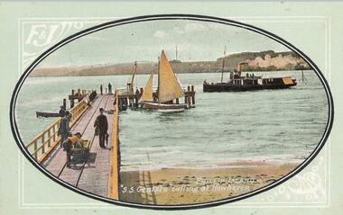
Photograph - Post Card, Early 20th Century
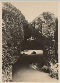
A Collection of postcards showing different views around Phillip Island. 10 of a collection of 11 postcards donated by M. Trott. Photo 1. S.S. Genista coming into Newhaven pier with another boat and people at the pier. Photo 2. The Granite Quarry at Cape Woolamai. Photo 3. View of the Newhaven pier with San Remo in the distance Photo 4. Milking Time, Newhaven. Photo 5. Wool Team on road to Cowes. Photo 6. View of the Cowes Jetty and Cowes in the background taken from a Steamer. Photo 7. View of Back Beach near The Nobbies. Photo 8. Cowes Jetty and Jetty Shed with Govt Steamer "Lady Loch" in the distance. Photo 9. Cape Woolamai coastline. Photo 10. Fisherman's Hut, Cowes with Jetty and boats in the background. 1. "S. S. Genista" calling at Newhaven. Phillip Island. 2. Phillip Island Granite Quarry, Cape Woollami 3. Phillip Island. Newhaven, San Remo in distance. 4. Phillip Island - Milking Time, Newhaven. 5. Phillip Island - Wool Team on road to Cowes. 6. Phillip Island - Cowes from Steamer. 7. Phillip Island - Back Beach. 8. Phillip Island - Cowes Jetty. Govt Steamer "Lady Loch" in distance. 9. Phillip Island - Cape Woollami. Home of Mutton Bird. 10. Phillip Island - Fisherman's Hut, Cowes.cowes jetty, newhaven jetty, granite quarry cape woolamai, phillip island coastline, fisherman's hut cowes, ss genista, lady loch steamer, m trott -
 Phillip Island and District Historical Society Inc.
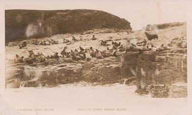
Photographs, 1930's
13 photographs collected in the 1930's by Reg & Nell Price who lived at Sale, Gippsland at the time.Photograph 224-01. Sepia photograph of seals on Seal Rocks, Phillip Island Photograph 224-02. Black & White photograph of the dirt road to the Back Beach, Phillip Island. Photograph 224-03. Black & White photograph of the Cowes Pier/Jetty with the Cenotaph in the foreground. Photograph 224-04. Black & White photograph of Forrest Caves, Phillip Island. Photograph 224-05. Black & White photograph of Cape Woolamai Quarry. People and a small boat working. Photograph 224-06. Black & White photograph of the Cowes Pier taken through the trees on the foreshore. Photograph 224-07. Black & White photograph of Lover's Walk, Cowes with foot bridge in foreground. Photograph 224-08. Black & White photograph of rocky seascape at The Nobbies, Phillip Island. Photograph 224-09. Black & White photograph of Forrest Caves, Phillip Island. Photograph 224-10. Black & White photograph of Cowes Pier with the Ferries "Alvina" and "Genista". Many people also on the pier. Photograph 224-11. Black & White photograph of The Pinnacles, Cape Woolamai. Photograph 224-12. Black & White photograph of The Sentinel, Cape Woolamai. Photograph 224-13. Black & White photograph of the beach and pier at Cowes, Phillip Island.On the back of each photograph description of the photo.seal rocks phillip island, seals on seal rocks phillip island, phillip island early roads, cowes pier phillip island, cowes jetty, cowes cenotaph, phillip island, forrest caves, phillip island, cape woolamai quarries phillip island, lover's walk cowes, the nobbies phillip island, seascape, ferries, "alvina", ferry "genista" - cowes jetty, the pinnacles, the sentinel cape woolamai, reg & nell price, david price -
 Phillip Island and District Historical Society Inc.
Photographs, Valentine's et al, Circa 1930
A collection of photographs/postcards donated by Dorothy Hurst. Her grandfather, Rev. Garthshore Stirling Home, was the vicar at the Anglican Church in Cowes - possibly in the early 1930's.235-01. Black & White photograph of Forrest Caves, Phillip Island. 235-02 & 03. Black & White photographs (identical) of two koalas up a tree. 235-04. Black & White photograph of the road to the Back Beach, Phillip Island. 235-05. Black & White photograph of a view of Cowes Pier taken through the trees on the foreshore. 235-06. Black & White photograph of Cape Woolamai Granite quarrie with people on the granite and in a boat. 235-07. Black & White photograph of waves breaking over the rock possibly near the Nobbies, Phillip Island. 235-08. Black & White photograph of The Vicarage at Cowes, Phillip Island - 1930's 235-09. Black & White photograph of a coastal scene at Phillip Island. 235-10. Black & White photograph of a coastal scene of the beach at Cowes. 235-11. Black & White photograph of waves breaking over the rocks near The Nobbies. 235-12. Black & White photograph of The Nobbies with Seal Rocks faintly in the distance. 235-13. Black & White photograph of The Nobbies with Seal Rocks in the background. 235-14. Black & White photograph of The Isle of Wight Hotel in the background. Cenotaph in foreground with a crowd of people, portable organ/piano plus music stands, people standing, children and others sitting on grass for Anzac Day or Remembrance Day. Possibly 1920s from fashions.235-01 Forrest Cave, Phillip Island 235-02 & 03 Native Bear (Koala) 235-04 The Road to the Back Beach, Cowes. 235-05 A Glimpse Thro' the Ti-Tree, Cowes. 235-06 The Quarries, Cape Wollomai, Phillip Island 235-07 The Beach near the Nobbies, Phillip Island. 235-10 The Beach at Cowes, Phillip Island. Valentine's Series M4847forrest caves, phillip island, wildlife - koalas, the nobbies phillip island, seal rocks phillip island, granite quarries, cape woolamai granite quarry, cowes cenotaph, phillip island, cowes pier phillip island, cowes beach phillip island, the isle of wight hotel cowes phillip island, cowes anglican church vicarage,phillip island, rev garthshore stirling home, dorothy hurst -
 Greensborough Historical Society
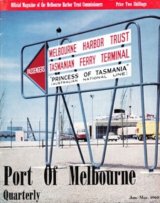
Article - Article, Journal, Melbourne Harbor Trust, "The Word is Progress": by Robin Hay, 1960_03
The opening of Reid's Lightweight Aggregate Pty Ltd ( a subsidiary of Reid's Quarries Ltd) in Greensborough, circa 1960. Explains the method of manufacture and uses of shalite in building industry. Reid's later became Albion Reid before being taken over by Boral. The shalite quarry, now closed, was on the site now called Blue Lake in Yellow Gum Park, Plenty.7 photocopied pages, text and colour and black nd white illustrations.reids quarries, shalite, aggregate, yellow gum park, plenty -
 Greensborough Historical Society
Newsletter, Greenhills and North Greensborough Progress Association, Community News: official journal of the Greenhills and Nth. Greensborough Progress Association and the Apollo Parkways Progress Association. July 1978. Edition No. 6/78, 07/1978
Orchids can still be found!, Yandell Bushland Reserve: a management study, School news, This and that, Did you know?, From the Council Chamber, A quarry in Plenty???, The restoration of access from Pinehills to Greensborough,Newsletter, 16 p., illus., map.greenhills and north greensborough progress association, greenhills, apollo parkways progress association, apollo parkways -
Mortlake and District Historical Society
Mt. Shadwell Bush Inn, photograph
This Mount Shadwell Bush Inn erected in 1854 was situated adjacent to one of the main routes to the diggings (Great Western Road), and was originally built from tufa stone obtained from a local quarry. It did a great trade after if first became licensed ub 1855, when it provided a valuable service to the travelling public and to the increasing agricultural population of the area. At that time it contained three sitting rooms, several large reception rooms, fourteen bedrooms, a bar and two taprooms and was the first known hostelry in Mortlake. In 1863 a bluestone addition (probably done by local architect Andrew Kerr) increased the size of the hotel to 23 rooms with a detached billiard room and ballroom, kitchen, servant's apartments, laundry, storeroom, 12 stalled stable, out office, and stock yards for travelling cattle. The present hotel with its 1928 rendered facade, has had an almost uninterrupted licence since 1855 -
Glenelg Shire Council Cultural Collection
Photograph - Photograph - Earth moving machinery in quarry, n.d
Port of Portland Authority archivesFront: (no inscriptions) Back: no 15 (pencil, upper left) 12088 (blue pen, upper right) 52 % (pencil, centre) 41/4 x 6 (red pen, centre)port of portland archives -
 Glenelg Shire Council Cultural Collection
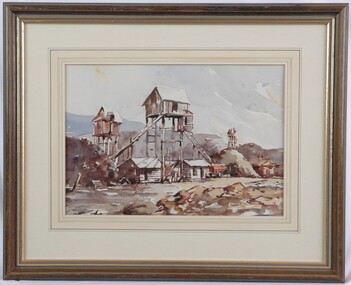
Painting, Noel Jones, Stone Quarry, 1974
NoneView of a quarry. In the centre of the image a conveyor belt runs up from a pile of rubble to a small hut on tall stilts. A conveyor belt runs down from this hut to an orange truck. Below and to either side of the stilted building are two wooden buildings with tin rooves. A stilted tower is depicted in maroon to the left, and another in the distance to the right. Mounds, painting in brown, yeloow, grey and shades of blue run across the centre of the image, below a sky washed with blue and highlighted with orange. Mounted in a decorative matt, in wooden frame with glass.Front: N. W. Jones 74 (lower left, blue paint) Back: 1974 (upper left, pencil)