Showing 711 items
matching map folding
-
 Melbourne Tram Museum
Document - Report, Melbourne & Metropolitan Tramways Board (MMTB), "Section to Section trips compiled from information obtained by the Melbourne Metropolitan Transportation Study 1964 Card survey.", Mar. 1967
... ". Dated 3/1967. Contains a large fold out map of each route... a large fold out map of each route showing passenger numbers ...Report - Foolscap landscape format, red tape binding - approx. 30 pages with notes, diagrams, charts, maps showing passenger traffic for parts of each route. Titled "Section to Section trips compiled from information obtained by the Melbourne Metropolitan Transportation Study 1964 Card survey from tram and bus routes based on the Central Business area of Melbourne". Dated 3/1967. Contains a large fold out map of each route showing passenger numbers for the day.In top right hand corner "Lees" in inktrams, tramways, mmtb, tramways, melbourne, surveys, passengers, maps -
 Melbourne Tram Museum
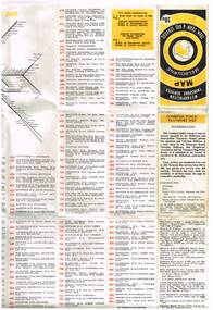
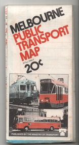
Map, Ministry of Transport, "Metropolitan Transport Services Map - Melbourne Tram, Train and Bus Services", 10/1971
... Fold out map (27 sections 9 across x 3 deep), coloured... corner and "4 G 33" along bottom edge. Fold out map (27 sections ...Fold out map (27 sections 9 across x 3 deep), coloured of Melbourne's Tram and Bus routes, route numbers, rail lines, detailed for the central part of Melbourne. On rear description of routes, private bus routes and map of Melbourne metro lines. Has contact details for bookings and lost property etc. Priced at 10c. Launched in a newspaper advert 26/10/1971. Has map scale in miles. 2nd copy added 16/7/2014On front cover in ink "#1" in top right hand corner and "4 G 33" along bottom edge.trams, tramways, melbourne, map, tram & bus services, railways, mmtb, minister for transport -
 Melbourne Tram Museum
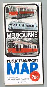
Map, Ministry of Transport, "Melbourne Transport Services Map - Tram, Train and Bus Services", 1976
... Fold out map (27 sections 9 across x 3 deep), coloured... corner and "4 G 33 " along bottom edge. Fold out map (27 sections ...Fold out map (27 sections 9 across x 3 deep), coloured of Melbourne's Tram and Bus routes, route numbers, rail lines, detailed for the central part of Melbourne and insert section for Frankston. On rear description of routes, private bus routes and map of Melbourne metro lines. Has contact details for bookings and lost property etc. Priced 20c Has a bus, silver train and a Z class tram on the cover. On bottom of outside cover, "No. 5 1976"On front cover in ink "5" in top right hand corner and "4 G 33 " along bottom edge.trams, tramways, melbourne, map, tram & bus services, railways, mmtb, minister for transport -
 Melbourne Tram Museum
Map, Ministry of Transport, "Melbourne Transport Services Map - Tram, Train and Bus Services", 1977
... Fold out map (27 sections 9 across x 3 deep), coloured... corner and "4 G 33 " along bottom edge. Fold out map (27 sections ...Fold out map (27 sections 9 across x 3 deep), coloured of Melbourne's Tram and Bus routes, route numbers, rail lines, detailed for the central part of Melbourne and insert section for Frankston. On rear description of routes, private bus routes and map of Melbourne metro lines. Map No. 7, 1977. Has contact details for bookings and lost property etc. Priced 20c. 1977, route 59 showing as terminating opposite Essendon Airport.On front cover in ink "" in top right hand corner and "4 G 33 " along bottom edge.trams, tramways, melbourne, map, tram & bus services, railways, mmtb, minister for transport -
 Melbourne Tram Museum
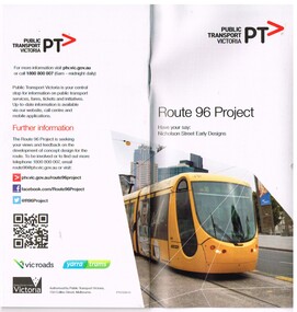
Pamphlet, Public Transport Victoria (PTV), "Route 96 Project - Have your say: Nicholson Street Early Designs", 2013
... . .2 - fold out full colour map, 8 folds, printed both sides... - fold out full colour map, 8 folds, printed both sides providing ...Set of two pamphlets involved the concept of the "Route 96 Project - Have your say: Nicholson Street Early Designs". Notes the introduction of the E class tram. .1 - DL full colour booklet, 24 pages with a questionnaire response form, outlining the Route 96 project to speed up trams providing route segregation for most of the distance. Issued 2013. Provides concept designs, Blyth St terminus, easy access stops, tram lanes. Gives dates for meetings. .2 - fold out full colour map, 8 folds, printed both sides providing details of the planning for the various stops and segregation between Victoria Parade and Blyth St.. The loss of car parking and issues with the Fitzroy St St Kilda stop met a lot of opposition. The Blyth St terminus was rebuilt June 1015. Two copies held., both were originally contained within a plastic wrapper. One wrapped version obtained when collected. Produced by Public Transport Victoria. See also Reg Item 24?? for a 2009 version.trams, tramways, yarra trams, route 96, east brunswick, e class, superstops -
 Warrnambool and District Historical Society Inc.
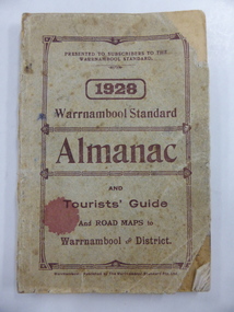
Book, Warrnambool Standard Almanac 1928, 1928
... a fold-out map of Warrnambool and other Warrnambol maps printed... are somewhat stained. The booklets have a fold-out map of Warrnambool ...These booklets were given to subscribers to the Warrnambool Standard newspaper as an almanac for the year 1928. These Standard Almanacs were published annually from 1875 to 1930. They contain much local information about Warrnambool and district on the businesses, government officials, banks, churches, schools, harbour management, societies and organizations etc. The Warrnambool Standard newspaper was established in 1872 and continues to this day. These booklets are of high significance as they contain much valuable information on Warrnambool and district for the year 1928. They are an important research tool for those studying and writing the history of Warrnambool and district. These are booklets of 114 pages, with several pages of advertisements at the front and the back of the booklets. The covers are light brown with dark brown lettering. Copy One has a piece of string tied to the top right hand corner. Copy Two is dog-eared, with the cover and some pages torn at the bottom right hand corners. The covers of both booklets are somewhat stained. The booklets have a fold-out map of Warrnambool and other Warrnambol maps printed on pink paper. The booklets contain photographs in blue and brown tonings and several other illustrations. warrnambool standard newspaper, history of warrnambool, standard almanac 1928 -
 Warrnambool and District Historical Society Inc.
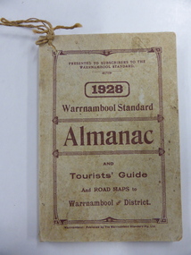
Book, Warrnambool Standard Almanac 1928, 1928
... a fold-out map of Warrnambool and other Warrnambool maps printed... are somewhat stained. The booklets have a fold-out map of Warrnambool ...These booklets were given to subscribers to the Warrnambool Standard newspaper as an almanac for the year 1928. These Standard Almanacs were published annually from 1875 to 1930. They contain much local information about Warrnambool and district on the businesses, government officials, banks, churches, schools, harbour management, societies and organizations etc. The Warrnambool Standard newspaper was established in 1872 and continues to this day. These booklets are of high significance as they contain much valuable information on Warrnambool and district for the year 1928. They are an important research tool for those studying and writing the history of Warrnambool and district. These are booklets of 114 pages, with several pages of advertisements at the front and the back of the booklets. The covers are light brown with dark brown lettering. Copy One has a piece of string tied to the top right hand corner. Copy Two is dog-eared, with the cover and some pages torn at the bottom right hand corners. The covers of both booklets are somewhat stained. The booklets have a fold-out map of Warrnambool and other Warrnambool maps printed on pink paper. The booklets contain photographs in blue and brown tonings and several other illustrations. warrnambool standard newspaper, history of warrnambool, standard almanac 1928 -
 Ballarat Tramway Museum
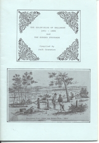
Book, Jack Cranston, "The Goldfields of Ballarat 1851 - 1886 and The Eureka Stockade", 1970's?
... cover with 28 pages folded and stapled inside and fold out map... with 28 pages folded and stapled inside and fold out map glued ...Book - "The Goldfields of Ballarat 1851 - 1886 and The Eureka Stockade", compiled by Jack Cranston. Comprises blue cover with 28 pages folded and stapled inside and fold out map glued to the inside of the rear cover, "Map of Ballaarat and Sebastopol" showing the various leads and gold bearing reefs of the goldfields. Also shows the location of Eureka Stockade and Sovereign Hill. Published for the Sovereign Hill Association, 1970's? Looks at the Goldfields, sources of Nuggets, mining population and statistics, the Miners Rebellion and the Stockade. Has numerous illustrations and copies of posters.trams, tramways, gold, eureka, sovereign hill -
 Kew Historical Society Inc
Book, Plan of General Development, Melbourne : Report of the Metropolitan Town Planning Commission
... xii, 308 p., [25] leaves of plates (24 folded) : ill., maps... suburbs. Includes photographs and 15 folding maps (some in rear ...The 1929 report of the Metropolitan Town Planning Commission covering Melbourne and its suburbs. Includes photographs and 15 folding maps (some in rear pocket) This was a planning scheme to prevent 'misuse' of land and protect property values. It highlighted traffic congestion, the distribution of recreational open space and haphazard intermingling of land uses. The plan identified a number of problems, such as the congestion at St Kilda Junction, that were not addressed until decades later. The plan also recognised the value of Melbourne's waterways as an open space network.xii, 308 p., [25] leaves of plates (24 folded) : ill., maps (some col.), ports., plans ; 34 cm. CONTENTS Part 1 Surveys and studies Part II Communications Part III The execution of improvement schemes - a programme of urgent works Part IV Zoning Part V Public Recreation Part VI Public Utilities Part VII Housing and Land Subdivision Part VIII Civic Art and Amenities Part IX Miscellaneous Part X Legislation Part XI Conclusionnon-fictionThe 1929 report of the Metropolitan Town Planning Commission covering Melbourne and its suburbs. Includes photographs and 15 folding maps (some in rear pocket) This was a planning scheme to prevent 'misuse' of land and protect property values. It highlighted traffic congestion, the distribution of recreational open space and haphazard intermingling of land uses. The plan identified a number of problems, such as the congestion at St Kilda Junction, that were not addressed until decades later. The plan also recognised the value of Melbourne's waterways as an open space network.city planning -- victoria. -- maps, city planning -- victoria -- melbourne, city planning -- victoria, civic improvement -- victoria -- melbourne, melbourne -- (vic.), cartography -
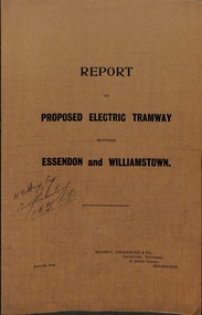 Melbourne Tram Museum
Document - Report, McCarty Underwood & Co, "Report on Proposed Electric Tramway between Essendon and Williamstown", 1914
... report with a three part fold out map, glued into the rear cover... pages, stapled into a brown cover report with a three part fold ...Report - 16 foolscap pages, stapled into a brown cover report with a three part fold out map, glued into the rear cover, titled "Report on Proposed Electric Tramway between Essendon and Williamstown". Prepared by McCarty Underwood & Co. Consulting Engineers, August 1914. Details the route, estimate of construction costs, revenue, expenditure and engineer difficulties. Also reports on the use of Motor Buses and of Railless Electric Traction (Trolley Buses). Includes a detailed map showing the proposed route, existing cable and electric tramways.Has inked inscription on front cover "H. S. Dix Esq, compliments of F.O. McCarty"trams, tramways, new tramway, footscray, essendon, williamstown rd, trolley buses, buses -
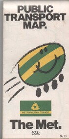 Melbourne Tram Museum
Map, Metropolitan Transit Authority (MTA), "Public Transport Map", c1984
... Fold out map (36 sections 9 across x 4 deep), "Public... The Met Neighbourhood tickets Fold out map (36 sections 9 across x ...Fold out map (36 sections 9 across x 4 deep), "Public Transport Map", coloured of Melbourne's Tram and Bus routes, route numbers, rail lines, detailed for the central part of Melbourne and the outer Metropolitan services. Includes description of tram and bus routes, private bus routes. On the front cover is The Met's Buzz symbol and their logo. Has contact details for bookings and lost property etc and how to use the map. Priced at 69c, issue No. 13 of c1984. Two copies held.trams, tramways, melbourne, map, tram & bus services, railways, the met, neighbourhood tickets -
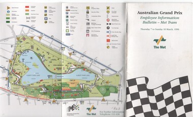 Melbourne Tram Museum
Pamphlet, The Met, "Australian Grand Prix - Employee Information Bulletin - Met Tram", Mar. 1996
... on paper with a fold out map at the rear, centre stapled titled... or booklet - 20 pages, full colour printed on paper with a fold out ...Pamphlet or booklet - 20 pages, full colour printed on paper with a fold out map at the rear, centre stapled titled "Australian Grand Prix - Employee Information Bulletin - Met Tram". Published by The Met for the 1996 Grand Prix. Has details of the services, major loading points, rosters at the depot, traffic management, door procedures, crew arrangements and a calendar of events. Includes maps in the front of the Albert Park and the race course and loading points. Published for crew use. pdf copy added 28/9/17.trams, tramways, grand prix, albert park, events, the met -
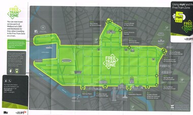 Melbourne Tram Museum
Map, Public Transport Victoria (PTV), "Using myki and the Free Tram Zone", 2015
... Folded paper map with glued card in two of the corners... Folded paper map with glued card in two of the corners to give ...Folded paper map with glued card in two of the corners to give the document some strength or usability (24 folds), titled "Using myki and the Free Tram Zone" details the extent of the free tram zone or showing the tram lines that the free travel is allowed, locations, land marks, contact numbers and has the PTV logo in the top right hand corner and the Myki logos. The reverse details how the Myki system works, the various types of tickets, how to buy, visitor packs and using and managing Myki tickets.trams, tramways, yarra trams, ptv, maps, free tram, melbourne, myki -
 Melbourne Tram Museum
Map, Ministry of Transport, "Melbourne Public Transport Map", c1977
... Fold out map (27 sections 9 across x 3 deep), coloured... Minister For Transport Fold out map (27 sections 9 across x 3 deep ...Fold out map (27 sections 9 across x 3 deep), coloured of Melbourne's Tram and Bus routes, route numbers, rail lines, detailed for the central part of Melbourne and insert section for Frankston. On rear description of routes, private bus routes and map of Melbourne metro lines. Has contact details for bookings and lost property etc. Priced 20c Dated 1977, says No. 6 on bottom of rear cover. Note shows route 59 being cut back to the highway.trams, tramways, melbourne, map, tram & bus services, railways, mmtb, minister for transport -
 Melbourne Tram Museum
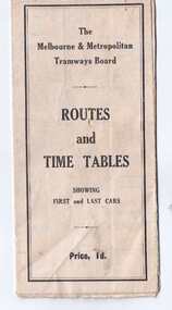
Map, Melbourne & Metropolitan Tramways Board (MMTB), "Routes and Time tables showing first and last cars", c1927
... Folded map (5 x 3) by Melbourne and Metropolitan Tramways... indicating it. Folded map (5 x 3) by Melbourne and Metropolitan ...Folded map (5 x 3) by Melbourne and Metropolitan Tramways Board, c1927, of Melbourne tramways, showing tram routes (cable, electric and VR), railway lines, major points of interest and major streets. Titled "Routes and Time tables showing first and last cars". On rear shows maps of lines for the Eastern, Southern, Connection to Beaches and the Essendon, Maribyrnong and West Coburg lines. Dated c1927, shows the St Kilda Road lines to electric. On the bottom right hand corner has a reference to the Tramway Tourist Car - and the tours it does. (Reg Item 800 dated March 1927, shows the tram under construction). Second copy from Keith Kings Collection - in poor condition - added 10/8/2017The VR line has various hand written notations indicating it.trams, tramways, map, mmtb, tourist trams, y class, vr, cable trams, routes, timetables -
 Melbourne Tram Museum
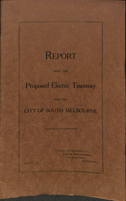
Document - Report, McCarty Underwood & Co, "Report upon Proposed Electric Tramways for the City of South Melbourne", 1913
... with a two part fold out map, glued into the rear cover, titled... report with a two part fold out map, glued into the rear cover ...Report - 16 foolscap pages, sewn into a brown cover report with a two part fold out map, glued into the rear cover, titled "Report upon Proposed Electric Tramways for the City of South Melbourne", commencing at St Kilda Road and working around the various cable tram routes. Prepared by McCarty Underwood & Co. Consulting Engineers, August 1913. Details the route, estimate of construction costs, revenue, expenditure and engineering difficulties. Includes a detailed map showing the proposed route, existing cable and electric tramways and possible extensions in to the City of St Kilda.trams, tramways, new tramway, south melbourne, st kilda, albert park, cable trams -
 Melbourne Tram Museum
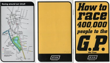
Pamphlet, The Met, "How to race 400,000 people to the GP", Mar. 1997
... on gloss paper with a fold out map at the rear, centre stapled... or booklet - 20 pages, full colour printed on gloss paper with a fold ...Pamphlet or booklet - 20 pages, full colour printed on gloss paper with a fold out map at the rear, centre stapled titled "How to race 400,000 people to the GP". Published by The Met for the 1997 Grand Prix. Has details of the services, major loading points, rosters at the depot, traffic management, door procedures, crew arrangements and a calendar of events. Includes maps in the front of the Albert Park and the race course and loading points. Published for crew use., but the Union went on strike for the period of the event and that it was not used. pdf copy added 28/9/17.trams, tramways, grand prix, albert park, events, the met -
 Melbourne Tram Museum
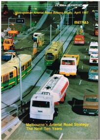
Document - Report, Ministry of Transport, Metropolitan Arterial Road Access Study, Apr. 1987
... Report - 88 pages - perfect bound +card covers + fold out... For Transport Report - 88 pages - perfect bound +card covers + fold out ...Report - 88 pages - perfect bound +card covers + fold out map, looks at the development of arterial roads in the various Melbourne regions, includes recommendations and road, management. Has table of contents, diagrams and maps. Includes findings of the studies, issues with freight transport, improvement proposals. Little work on public transport as such. Title "Metropolitan Arterial Road Access Study, April 1987 - Melbourne's Arterial Road Strategy the next 10 years - METRAS" - Has foreword signed off by Tom Roper, Minister for Transport. Report M6trams, tramways, public transport, road transport, minister for transport -
 Melbourne Tram Museum
Map, Ministry of Transport, "Melbourne Transport Services Map - Tram, Train and Bus Services", c1975
... Fold out map (27 sections 9 across x 3 deep), coloured... right hand corner and "4 G 33" along bottom edge. Fold out map ...Fold out map (27 sections 9 across x 3 deep), coloured of Melbourne's Tram and Bus routes, route numbers, rail lines, detailed for the central part of Melbourne and insert section for Frankston. On rear description of routes, private bus routes and map of Melbourne metro lines. Has contact details for bookings and lost property etc. Not priced. Not dated, but circa 1975 - has map scale in kms and route 59 to Essendon Airport still extends into Airport. 2nd copy added 16/7/2014. See Reg Item 521 for issue No.. 2, 1974.On front cover in ink "issue #3" in top right hand corner and "4 G 33" along bottom edge.trams, tramways, melbourne, map, tram & bus services, railways, mmtb, minister for transport -
 Melbourne Tram Museum
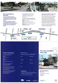
Pamphlet, Yarra Trams, "Your new accessible tram stops", Apr. 2007
... over the Yarra River - has map. 2 - 3 fold DL for stops 38, 42... River - has map. 2 - 3 fold DL for stops 38, 42, 48 and 52 ...Set of five Pamphlets - DL - 3 fold, full gloss paper titled "Your new accessible tram stops" about the introduction in April 2007 of upgrades stops in Burwood Highway - stops 59, 61, 62, and 63 to Superstops. Has VicRoads logos as well as Vic Government and Yarra Trams. Two copies held. 1 -2 fold DL - for stops 124A on routes 96, 109, and 112 - on the Specert St Bridge over the Yarra River - has map. 2 - 3 fold DL for stops 38, 42, 48 and 52 Dandenong Road - Nov. 2007 3 - 3 fold DL for stops 22, 23, 24 and 26 Queens Parade Fitzroy North, Nov. 2008 4 - 3 fold DL for stops 53 to 59 - Matthews Ave Airport West April 2008trams, tramways, yarra trams, burwood, vermont south, superstops, route 75, spencer st, route 96, route 109, route 112 -
 Melbourne Tram Museum
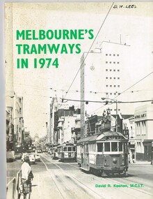
Book, David R. Keenan, "Melbourne's Tramways in 1974", 1974
... Book, 48 pages + card covers + fold out map at rear... + fold out map at rear, perfect bound, titled "Melbourne's ...Book, 48 pages + card covers + fold out map at rear, perfect bound, titled "Melbourne's Tramways in 1974". Written by David R. Keenan, published by the Transit Press NSW. Provides an overview of the Melbourne tram system at the transition point from being operated only by W class trams, to the start of operation of Z class trams. Gives a brief description of the system, the Board, trackwork, power supply, maintenance, Hawthorn Training Centre, tramway operations, fares, services in the CBD and from each of the depots. Has detailed map of the City area tramways and the suburban area, along with many photographs of the time."D. W. Lees on the top right hand corner on the front page in a fine felt pen ink.trams, tramways, mmtb, power supply, training, hawthorn, operations, maps, fares, depots -
 Melbourne Tram Museum
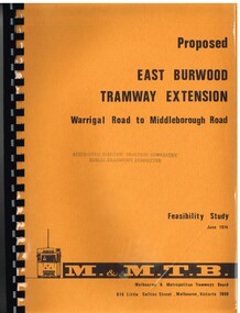
Document - Report, Melbourne & Metropolitan Tramways Board (MMTB), "Proposed East Burwood Tramway Extension - Warragul Road to Middleborough Road - Feasibility Study, Sep. 1974
... - cost analysis. Has many tables, diagrams including fold out... including fold out map. Showed that the benefit outweighed the costs ...Report - 68 pages, photocopied onto light cartridge paper with brown covers both sides, overlain with clear plastic covers and black comb bound. Titled "Proposed East Burwood Tramway Extension - Warragul Road to Middleborough Road - Feasibility Study June 1974", looks at the purpose of the extension, possible patronage, construction details, costs, existing services and impact on these, proposed services, operating costs, revenue and social benefit - cost analysis. Has many tables, diagrams including fold out map. Showed that the benefit outweighed the costs of the project. Prepared by the MMTB June 1974 - report on front page notes it is Amendment A, September 1974.Stamped "Australian Electric Traction Association Public Transport Committee" on both cover and inside front page.trams, tramways, burwood, east burwood, feasibility study, new tramway, mmtb, middleborough rd -
 Bendigo Historical Society Inc.
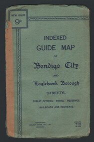
Map - INDEXED GUIDE MAP OF BENDIGO CITY & EAGLEHAWK BOROUGH, Early to mid 1920's
... . Folded map contained within blue booklet. Booklet is light blue.... Folded map contained within blue booklet. Booklet is light blue ...Map. Indexed Guide Map of Bendigo City & Eaglehawk Borough. Folded map contained within blue booklet. Booklet is light blue printed with dark blue ink. Copyright Bolton Bros. Pty. Ltd. Bendigo. Printed on front. Map shows the location of Sailors Gully, Peg Leg Gully, California Gully, Long Gully, Eaglehawk Creek, Bendigo Creek, Ironbark Creek. Shows location of Showgrounds between Park St, Baxter Street, Barnard St and Bridge Lane. Shows location of Golden Square Railway Station between Panton St and Allingham St. Shows what is now known as Creek St. Nth & Sth as Clark St Nth & Sth. Also shows Tramway Terminus along Carpenter St and Golden Square Tram Terminus on High St, Golden Square. Map has a street index and an index for Public Offices, Parks and Reserves.map, bendigo, township, indexed guide map of bendigo city and eaglehawk borough -
 Melbourne Tram Museum
Map, Melbourne & Metropolitan Tramways Board (MMTB), "Map and timetable of Melbourne Tram and Bus Services" - March 1952", Mar. 1952
... Fold out map (10 sections), coloured of Melbourne's Tram... services MMTB Fold out map (10 sections), coloured of Melbourne's ...Fold out map (10 sections), coloured of Melbourne's Tram and Bus routes, route numbers, rail lines, municipalities boundaries and location of major places of interest. Titled - "Map and timetable of Melbourne Tram and Bus Services" - May 1952". At base of map - timetable of all night trams and bus services. On rear index to routes, 1st and last services, time of Sunday am services, Latrobe St. services and photo of Wattle Park. Dated March 1952 - Bourke St shown as bus. See Reg Item 413 for the May 1956 version. Very high resolution scans held. See also Reg Item 3720 for a MMTB Map of the same era.trams, tramways, melbourne, map, tram & bus services, all night services, mmtb -
 Melbourne Tram Museum
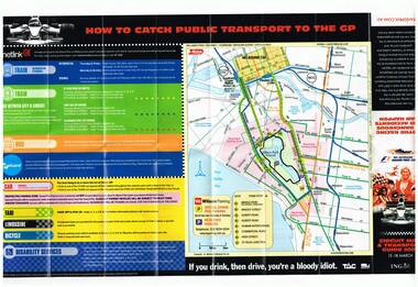
Map, Yarra Trams, "Circuit Map & Transport Guide 2007", Mar. 2007
... Fold out map, full colour printed on gloss paper - 8 x 2... Fold out map, full colour printed on gloss paper - 8 x 2 folds ...Fold out map, full colour printed on gloss paper - 8 x 2 folds. showing location of the race track, how tram and rail routes operated, restricted parking area, Metcard, where taxis and limousines could park, bicycle racks. On the reverse side has a detailed map of Albert Park showing the various race facilities and grandstands. Used for the 2007 Grand Prix. See Reg Item 1063 for associated booklet. Item contained with in a plastic envelope with a black neck band. 2 copies held. 1064.1 - similar map for the March 2004 event - see image i3. Added 11-3-2018 from donation of Hugh Waldron.trams, tramways, grand prix, metlink, formula 1, albert park, maps -
 Bendigo Historical Society Inc.
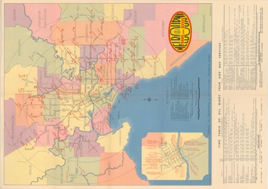
Map - GUIDE MAP OF BENDIGO & EAGLEHAWK, Late 1920's
... Map. Guide map of Bendigo & Eaglehawk. Folded map... of Bendigo & Eaglehawk. Folded map of Bendigo & Eaglehawk with blue ...Map. Guide map of Bendigo & Eaglehawk. Folded map of Bendigo & Eaglehawk with blue outer cover booklet. Map is compiled by E E Parker, Eaglehawk. Map shows tramways, bus routes and cost one shilling. Map shows Agricultural Showgrounds located between Park Street, Water Street, Barnard Street and Bridge Lane. Also shows Acclimitization Reserve located behind the Botanical Gardens at White Hills. Shows the location of Sailors Gully, Peg-Leg Gully, Jobs Gully, California Gully, Long Gully, Ironbark Gully, Golden Gully, Poverty Gully, Sheepshead Gully, Charcoal Gully, Eaglehawk Creek, Bendigo Creek and Back Creek.Contains interesting facts about Bendigo:- Area - 7,900 acres, Population - 26,000, First Council elected - 1855, Proclaimed a City - 1871. Gold Rush broke out - 1851. For first 10 years gold yield averaged 8,600 ozs. Per week. Total gold yield to 1923 - 572 tons valued at 82,000,000 pounds. Deepest mines - Victoria Quartz 4,614 ft., New Chum Railway 4,318 ft., 13 mines over 3,000ft. deep, 53 mines over 2,000 ft. deep. Sewering of City commenced 1922. All principal buildings now sewered. Map printed by Arnall & Jackson, General Printers, Stationers & Engravers, 476 Collins Street. Outer map blue cover printed in red and blue ink by J B Young, Lithographer. Map displays advertisement for Bendigo Timber Co. Outer blue cover displays advertisement for Campbell Connelly & Co. Pty. Ltd, Ironmongers, Timware Manufacturers, Plumbers, Sewerage Contractors, High and Forest Sts, Bendigo 9outside back cover) and for Hartleys ( J L Shoosmith) Bendigo, displaying Indian Motor Cycles (inside back cover).map, bendigo, township, guide map of bendigo & eaglehawk -
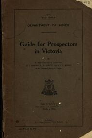 Federation University Historical Collection
Book, Guide for Prospectors in Victoria, 1931, 1931
... Grey soft covered book of 90 pages. Includes fold out map... Grey soft covered book of 90 pages. Includes fold out map ...The handbook was intended for those with little experience who wanted to prospect of fossick.Grey soft covered book of 90 pages. Includes fold out map of a portion of Victoria showing auriferous areas and mineral localities. Also show Counties of Victoria and localities of minerals such as tin, antimony, copper, silver lead, Malybdenite, tungsten ores, manganese, platinum, osmiridium and iron. Chapter heading s include: working alluvial deposits, equipment, geology of Victoria, gold deposits, quartz reefs, indicators, economic minerals, assistance to prospectors, Miners' Right, mining bye-law, mining leases, forest regulations and glossary. Descriptions are given of a god dish, puddling tub, cradle, puddling machine, ground sluicing, boring, windlass, whim, hand dollying, sweeping, California pump, and wing dam.mining, baragwanath, gold, prospector, geology, quartz reefs, alluvial deposits, indicators, victorian goldfields, miners rights, mining leases, forest regulations, sluicing, sluice box, puddling machine, miner's cradle, whim, whip, california pump, gold nuggets, saddle reef, ballarat indicators, state batteries -
 Ballarat Tramway Museum
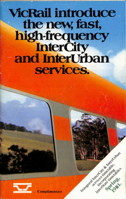
Ephemera - Timetable, Victorian Railways, VicRail timetable Spring 1981, Oct. 1981
... .1 - Timetable - 92 page + cover with fold out map, centre... Timetables Fares .1 - Timetable - 92 page + cover with fold out map ....1 - Timetable - 92 page + cover with fold out map, centre stapled. Printed at the time of the introduction of new rolling stock and faster services, both Intercity and Regional. Dated Spring 1981. Shows train services to Ballarat at the time and for the VicRail. Relevant pages including fares and a map have been scanned. .2 - "Fares" - 16 page centre stapled book providing fare information - dated 4/10/1981. .3 - Pocket Timetable - Melbourne Ballarat 22/8/1993 .4 - ditto 16/10/1994 - both .3 and .4 advertise Sorbothan insoles for shoes. See Reg Items 6824, 8116, 8117 and for 1998, 1957, 1981,1993 and 1994 and 2021 respectively.ballarat, railways, vicrail, timetables, fares -
 Glen Eira Historical Society
Letter - Rosstown Railway
... present in the region. 4/A fold-out map and guide of the Rosstown... railway lines present in the region. 4/A fold-out map and guide ...This file contains four items: 1/A black and white photocopy of a letter dated either 07/08/1889 or 09/08/1889, from Robert Lundon to an unidentified recipient discussing an agreement reached between the author – on behalf of the recipient – and Soon Hang Hi in regard, in regards to the allotment known as Webber’s. The agreement is outlined in the letter in what appears to be Chinese characters, and includes the marks of Robert Lundon and Soon Hang Hi. File note from Joy Wu states that the calligraphy is not Mandarin or traditional Chinese. 2/Three sheets of hand-written working notes with information taken from the Victorian Government Gazette on THE ROSSTOWN AND MURRUMBEENA LAND COMPANY LIMITED, THE ROSSTOWN JUNCTION RAILWAY AND PROSPERITY COMPANY LIOMITED, and THE ROSSTOWN JUNCTION, ELSTERNWICK, AND OAKLEIGH RAILWAY COMPANY LIMITED, covering dates between 1887 and 1894. The notes concern meetings and creditors claims relevant to the companies, with reference numbers for the information source. Date and author of the notes are not recorded. 3/A black and white photocopy of the a partial map of the Rosstown Railway and surrounding area, undated. The map includes the names of landholders in the areas of Brighton, Garden Vale and Elsternwick, as well as other railway lines present in the region. 4/A fold-out map and guide of the Rosstown Rail Trail, including a brief general history of Caulfield as well as a more extensive biography of William Murray Ross and the Rosstown Railway. The map marks and describes significant sites along the trail, including photographs of some of these sites, provided by DF Jowett.documents, correspondence, webber’s, lundon robert, chinese characters, ethnic communities, signatures, text, settlements, taxes, fraser john grieves, lovell r.h., price davies, meetings, communication activities, soon hang hi, commercial events and activities, the rosstown and murrumbeena land company limited, victorian government gazette, bulmer richard, parry john, osment henry, shareholders, creditors claims, the rosstown junction railway and property company limited, finch and best, lawyers, the rosstown junction elsternwick and oakleigh railway company limited, cameron w.c., phillips p.d., garden vale, elsternwick, elsternwick railway station, rosstown, rosstown railway, thomas street, bay street, kooyong road, melbourne and brighton railway, hawthorn road, bambra road, caulfield and frankston railway, booran road, grange road, koornang road, murrumbeena road, north road, north road railway station, east brighton railway station, south road, railway routes, railway lines, railways, land transport, murphy j., caulfield, hamilton t.f., dane p., holloway, webb, ailee john, payne t.b., brodie chas, dane john, o’neil h., mccombie john, mcmillane a., smyth c.d., cooper, ebden, landholders, jeffrey j.d., gill j., balcombe a.e., cooper h., mcnab j., white j., sutherland j., greeves a.f.a., newton m.c., chamley f.b., fowler j., inglis p., grant t., stooke j., swanson g., cochrane c., adams e.b., mccombie thas, keyes robert, brighton cemetery, burials grounds and graveyards, war-ein road, were j.b., holland j., mcmahon c., winter t.l.m., dendy henry, mitchell w., jackson s., were j.e., wickham francis dawe, bryant jane, east brighton railway station, railway stations, maps, allotments, land titles, roads and streets, rosstown rail trail, city of glen eira, tourism, trains, tourism information bureaus, tours, pamphlets, elsternwick railway park, oakleigh junction, princes park, ee gunn reserve, packer park, sites, jowett d.f., weickhardt i.g., return to rosstown: railways land sales and sugar beet ventures in caulfield, land sales, walking trails, ross william murray, transport objects, locomotion, walking, cycling, driving, sports, country mansions, people, caulfield john, builders, construction and demolition workers, occupations, careers, professionals, topography, geology, landforms, horticulture, market gardens, primary industry workers, city of caulfield, mood kee, pennington harold, annual general meetings, caulfield town hall, glen eira city council, carnegie, carnegie station, rosstown station, people by circumstance, migrants, sugar beet, sugar beet mill, sugar beet industry, mills, factories, sea beach lines, bent thomas, parliamentary representatives, neville street, miller street, lemann’s swamp reserve, koornang park, cane sugar industry, breweries, rabbit processing plants, health establishments, hospitals, food production establishments, abattoirs, thieves, social problems, vagrants, theft, squatting, financial economics, debt, finance industry, insurance companies, company managers, bentleigh, ross leila, the grange, leila road, wild cherry road, financial trouble, mortgages, gisborne street, archibald street, riddell parade, victoria railways, glen huntly road, clarence street, college street, gladstone parade, parrell street, aileen avenue, seaview street, drion estate, land subdivisions, dover street, sussex street, landfill, marara road, booran road, woodville avenue, dorothy avenue, ormond park, royal avenue, ormond railway station, oakleigh road, melten avenue, miller street, munro avenue, lord reserve, neerim road, toolambool road, the rosstown hotel, rosanna street, murrumbeena crescent, commercial establishments, the national bank, rosstown road, kangaroo road, poath road, freda street, hughesdale kindergarten, oakleigh council, hughesdale community centre, civic establishments, galbally reserve, plaques, warrigal road, out and about brochures -
 Melbourne Tram Museum
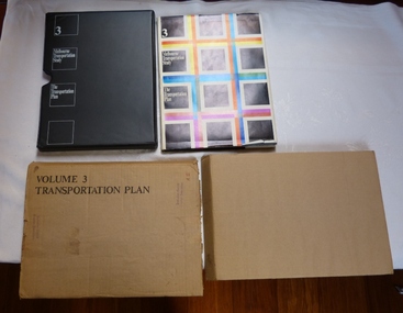
Document - Report, The Metropolitan Transportation Committee, "Melbourne Transportation Study - The Transportation Plan - Volume 3", 1969
... case, paper cover, bound, sewn with end papers, fold out maps... case, paper cover, bound, sewn with end papers, fold out maps ...Report titled "Melbourne Transportation Study - The Transportation Plan - Volume 3", presented in a black vinyl covered slip case, paper cover, bound, sewn with end papers, fold out maps, 74 pages. Each sheet within the report has rounded edges. Contained within a printed cardboard packing case. Includes many tables, graphs, charts and coloured sheets. Report prepared by The Metropolitan Transportation Committee - 1969, looking at the planning of all forms of transport for Melbourne with a timeframe of 1985. Chaired by Vernon Wilcox, Minister of Transport. Included Robert Risson - Chairman of MMTB. Set the basis for a very extensive freeway system that was only partly followed. Includes trams, trains (city loop), buses, parking, travel and population predictions, costs and implementation.Has numerous AETA stamps throughout the book. Inside front cover and on packing case "A12" in red ink.trams, tramways, melbourne, road transport, tramways, railways, public transport, transportation plan