
Showing 676 items matching "recreational"
-
 Vision Australia
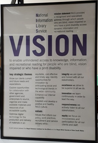
Image, National Information Library Service Vision, 200
... National Information Library Service Mission statement: NILS provides a recognised and specialised gateway through which people who are blind, vision impaired or who have a print disability access dynamic information and recreational reading. Vision: to enable unhindered access to knowledge, information and recreational reading for people who are blind, vision impaired or who have a print disability. ...Royal Blind Society of New South Wales Royal Victorian Institute for the Blind national information library service National Information Library Service Mission statement: NILS provides a recognised and specialised gateway through which people who are blind, vision impaired or who have a print disability access dynamic information and recreational reading. Vision: to enable unhindered access to knowledge, information and recreational reading for people who are blind, vision impaired or who have a print disability. ...The duplication of services between state based blindness and low vision agencies was not viable in the long term, with telecommunications and technology improving rapidly in the late 20th century. In 1999, a decision was made to merge the library and alternative production services of the RVIB and RBS, as a precursor to a possible larger merger in the future. Thus the National Information Library Service (NILS) was created. As part of establishing a new culture between staff who had retained their positions, a vision, mission and values statement was created under the new service name.1 digital imageNational Information Library Service Mission statement: NILS provides a recognised and specialised gateway through which people who are blind, vision impaired or who have a print disability access dynamic information and recreational reading. Vision: to enable unhindered access to knowledge, information and recreational reading for people who are blind, vision impaired or who have a print disability. Key strategic themes: Know our clients current and future needs and expectations. Explore opportunities for collaboration with other agencies, government and enterprises to source, organise and make available materials and resources of an acceptable quality. Optimise digital technology for the production and delivery of materials in an equitable, cost effective and timely way, identify opportunities for innovation by anticipating social and technological trends in the wider community. Enhance our internal capability. Establish and develop a positive and healthy NILS culture. Values: our values inform our policy, work practices, recruitment and service delivery ethic. Integrity - we are open and honest with all our stakeholders. Excellence - we strive to be superior in all we do. Innovation - we learn continuously in order to lead the way. Responsiveness - we actively listen to all our stakeholders. Equity - we focus on inclusiveness and participation for all our clients and staff. A joint venture between the Royal Victorian Institute for the Blind and the Royal Blind Society of New South Wales. royal blind society of new south wales, royal victorian institute for the blind, national information library service -
 Kiewa Valley Historical Society
Camera Tele Ektra, Circa 1970s to 1980s
... Items such as this camera (recreational/life style/non professional) capture of the altering socio economic balance of rural based activities provided the catalyst for greater appreciation by city dwellers to the benefits of rural life. ...Items such as this camera (recreational/life style/non professional) capture of the altering socio economic balance of rural based activities provided the catalyst for greater appreciation by city dwellers to the benefits of rural life. ...From the 1970's onward the relative isolation of regional areas was improving in "leaps and bounds". Social amenities, and life styles were changing at a great rate. Items such as this camera (recreational/life style/non professional) capture of the altering socio economic balance of rural based activities provided the catalyst for greater appreciation by city dwellers to the benefits of rural life. The greater levels of communicative avenues, especially the visual (photography, pictures, television and the internet), from the beginning of this period and throughout the time frame (1970 to the 2000s) has cut the major restraints of what was rural "isolationism".The significance of this type of camera, being a small two lens (normal, telescopic) and portable piece of equipment, allowed non professional tourists, locals or visitors to visually display the uniqueness of the Kiewa Valley and Alpine regions. This method of promotional and intimate visual reproduction of not only physical but also through personal involvement, of the photographer to the audience, a greater psychological impact, by the nature of intimacy involved. This type of photography is one of the most effective stimuli to promote the unique qualities of the Kiewa Valley region.This Item is dual lens (22mm,44mm) camera comprising of an elongated oblong shape, black hard plastic shell. It has a slightly rough surface(for a better fingers grip), two latches are located at the back, one to release the camera from its hinged protective cover and one to move to the next picture frame (film is within a cartridge).On swing cover "Kodak Tele 1 " on back in small print "MADE IN USA" On camera body "KODAK TELE EKTRA 1" underneath "CAMERA" and on slide switch(front) to change lenses:"Tele" and "Norm" kodak two lens camera, photographic hobby usa made camera -
 Vision Australia
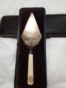
Ceremonial object - Object, Harrison Brothers & Howson, Ceremonial trowel
... In addition to the area housing the Braille collection itself, an entrance hall, reading room, secretarial office and hall also provided space for reading, administration of the collection and opportunities for social or recreational activities....In addition to the area housing the Braille collection itself, an entrance hall, reading room, secretarial office and hall also provided space for reading, administration of the collection and opportunities for social or recreational activities. Victorian Association of Braille Writers Sir Edward Wilson Presented to Sir Edward Mitchell K.C., K.C.M.C. on the occasion of his laying the foundation stone of the new library for the Victorian Association of Braille Writers October 28th 1918. ...Sir Edward Mitchell was the chairman of the Edward Wilson trust, which enabled the building of the Braille Library during a time of great economic turbulence due to the last months of World War 1. This commemorative trowel was given to him in thanks for his (and the trust's support) of the project, which would ultimately provide a great resource to blinded soldiers who were prepared and able to learn Braille. In addition to the area housing the Braille collection itself, an entrance hall, reading room, secretarial office and hall also provided space for reading, administration of the collection and opportunities for social or recreational activities.1 silver plated trowel with handle inside boxPresented to Sir Edward Mitchell K.C., K.C.M.C. on the occasion of his laying the foundation stone of the new library for the Victorian Association of Braille Writers October 28th 1918. (Inside box lid: By Special Appointment Harrison Bros & Howson, Sheffield, England Cutlers to His Majesty)victorian association of braille writers, sir edward wilson -
 Melbourne Legacy
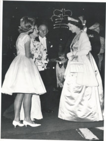
Photograph, HRH Queen Elizabeth, 1963
... Christine and her younger brother Robert, aged 9, both attended Legacy's Physical and Recreational Training classes....Christine and her younger brother Robert, aged 9, both attended Legacy's Physical and Recreational Training classes. A record of a junior legatee being chosen to present flowers to the Queen. royal visit junior legatee Queen Elizabeth Stamped Copyright of The Age in blue ink. ...Photograph of Queen Elizabeth II on a state visit to Melbourne in February 1963 receiving flowers from Christine Kelson, a junior legatee. An article in the Legacy's Weekly Bulletin on 26 February mentions the details. Christine was 14 years old and daughter of the late Signaller Arthur Kelson who served with the 9th division in Middle East and who was taken prisoner in North Africa and made a POW in Italy and Germany. Her mother Mrs Dorothy Kelson, served with the AMWAS. Christine and her younger brother Robert, aged 9, both attended Legacy's Physical and Recreational Training classes.A record of a junior legatee being chosen to present flowers to the Queen.Black and white photo of the Queen receiving flowers.Stamped Copyright of The Age in blue ink.royal visit, junior legatee, queen elizabeth -
 Falls Creek Historical Society
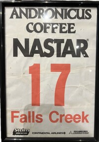
Memorabilia - NASTAR Racing Bib No. 17
... National Standard Race (abbreviated NASTAR) is the world's largest recreational ski and snowboard race program which was founded in 1968 by SKI magazine. ...Falls Creek Historical Society Slalom Street Falls Creek National Standard Race (abbreviated NASTAR) is the world's largest recreational ski and snowboard race program which was founded in 1968 by SKI magazine. ...National Standard Race (abbreviated NASTAR) is the world's largest recreational ski and snowboard race program which was founded in 1968 by SKI magazine. It uses a handicap system which allow skiers and boarders of all abilities to have a go at racing and compare their times to the best racers in the world. NASTAR courses are simple, open-gated slalom courses on mostly intermediate terrain, allowing skiers of all abilities and ages to experience racing. The NASTAR race course at Falls Creek is still the home of the Rossignol Children's Cup and the Cranky Charlie Cup each year, conditions permitting.This item is significant because it is linked to the NASTAR events held at Falls Creek throughout the 1980s.A paper number bib used by a participant in the NASTAR ski event at Falls Creek. It is primarily black and white, with the number and Falls Creek printed in red. It is in a frame under glass. It bears the names of major sponsors.ANDRONICUS COFFEE NASTAR 7 FALLS CREEK Steins World Ski Tours Continental Airlines Challenge Series DYNASTARnastar racing, falls creek race club -
 Kiewa Valley Historical Society
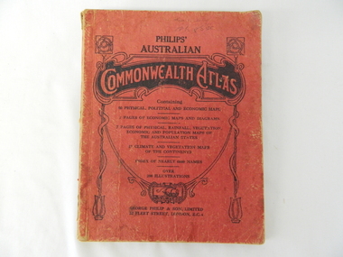
Atlas Australian Commonwealth, Philips' Australian Commonwealth Atlas, 1944
... This snap shot in time covers the major Australian cities, the major farming, grazing, industrial and sporting/recreational activities. Also there are snap shots of similar activities from other global areas. ...This snap shot in time covers the major Australian cities, the major farming, grazing, industrial and sporting/recreational activities. Also there are snap shots of similar activities from other global areas. ...This atlas, printed in 1944, details not only the geographic and political boundaries of the world as it was at that time but also the snap shot of life of the time. This snap shot in time covers the major Australian cities, the major farming, grazing, industrial and sporting/recreational activities. Also there are snap shots of similar activities from other global areas. The period also covered World War II, detailed by a photo of "shell making", munitions, required by Australian soldiers. The great political and territorial changes made as a result of World War II can be clearly identified for example , Israel (the Jewish homeland). The various prewar colonies of major European nations.This atlas was used by children of a Kiewa Valley family and shows the value and the general educational exposure that these children had at this time. The rural setting and within the backdrop of a world war did not severely alter the life style of children in this region. The "news reels" shown in cinemas of cities and larger towns were the only visual realisations of major events of global significance available to these children. The information provided by this atlas allowed students to glimpse at what the "outside world" was. The majority of these students would possibly never see these regions for themselves. The great communication facilities of the late 1900s and beyond, was still only science fiction.This atlas has a thick (350 g/m) red cardboard cover with bold black lettering and shading. The cover is set out within a shield like frame. The shield is held up by two square markings, each with a four part circular pattern and a cord entwining two pendulum structures ending with a bowl figure at the bottom. There is a semi circular form enclosing a printed book contents list. The inside cover has the atlas title and contents and the publisher details. The atlas contain 56 pages of world and Australian maps, vegetation and rainfall maps. Within this atlas there are 27 double sided pages of black and white photographs depicting life styles, buildings, landscapes and prominent and significant to Australia males from 1652 to 1944. The pages are of approximately 200 g/m and have the yellow aged appearance.On front cover "Philips' Australian COMMONWEALTH ATLAS" and underneath "Containing" underneath "60 PHYSICAL, POLITICAL AND ECONOMIC MAPS". Publisher George Philip & Son, Limited 32 Fleet Street, London E.C. 4. Inside cover are: written, in freehand and in ink the following names and dates; "J.Muller Form V 1945", "L L Muller Form IV 1946", "N.J. Muller Form I + II + III 1948 +49 + 50" and "D Muller Form I 1949". also handwritten and in pencil is "Peter Leslie". On the last page is a small freehand sketch of Australia in biro.1940s school curriculum, rural education, 1940s atlas, australian atlas -
 Eltham District Historical Society Inc
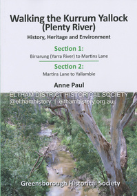
Book, Anne Paul, Walking the Kurrum Yallock (Plenty River), 25 July 2023
... While diminished since European settlement, the River provides an important environmental, wildlife corridor and recreational resource, along with many links to its settlement heritage. ...While diminished since European settlement, the River provides an important environmental, wildlife corridor and recreational resource, along with many links to its settlement heritage. ...Kurrum Yallock - the Plenty River is Melbourne's third river. It is a defining feature of the region weaving its way through local suburbs and parklands. It is often hidden from general view, emerging at bridges and along its extensive trail network. While diminished since European settlement, the River provides an important environmental, wildlife corridor and recreational resource, along with many links to its settlement heritage. The Kurrum Yallock walks aim to guide people along the River Trail, while providing insight into key aspects of our recent history, an opportunity for reflection and an enhanced enjoyment of the River's special environment and landscape.birrarung, greensborough historical society, kurrum yallock, martins lane, plenty river, yallambie, yarra river -
 Federation University Historical Collection
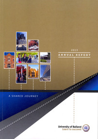
Book, University of Ballarat Annual Report, 2013, 2013
... The Manufacturing Technology Training Centre (MTTC) was opened at the SMB Campus, and the Science and Engineering Building, as well as the Sports and Recreational Centre were completed at the Mount Helen Campus. ...The Manufacturing Technology Training Centre (MTTC) was opened at the SMB Campus, and the Science and Engineering Building, as well as the Sports and Recreational Centre were completed at the Mount Helen Campus. ...On 01 January 2014 University of Ballarat became Federation University Australia. The 2013 University of Ballarat Chancellor was Dr Paul Hemming, and the Vice-Chancellor was Professor David Battersby. The Manufacturing Technology Training Centre (MTTC) was opened at the SMB Campus, and the Science and Engineering Building, as well as the Sports and Recreational Centre were completed at the Mount Helen Campus. Members of the 2013 University of Ballarat Council were Mashelle Parrett, George Fong, Michael Ryan, Peter Wilson, Tony Stone, Steve Davies, Warwick Spargo, Meredith Doig, Rowena Coutts, Deborah Spring, Karen Douglas, Paul Hemming, David Battersby, and Kim Dowling.52 pages soft covered annual report. Contents include the University charter, highlights of 2013, University of Ballarat Foundation, Sustainability, About the University, Council Members, Industrial relations, public information and financial statements.mashelle parrett, michael ryan, george fong, peter wilson, tony stone, steve davies, warwick spargo, meredith doig, rowena coutts, deborah spring, karen douglas, paul hemming, david battersby, kim dowling -
 City of Kingston
Photograph - Colour, 6 March 1993
... Edithvale Common and the former "Duck Inn" (Melbourne Water/Friends of Edithvale Seaford Wetlands) can be seen. Edithvale Recreational reserve, the valodrome and Edithvale Public Golf Course are prominent. ...Edithvale Common and the former "Duck Inn" (Melbourne Water/Friends of Edithvale Seaford Wetlands) can be seen. Edithvale Recreational reserve, the valodrome and Edithvale Public Golf Course are prominent. ...Edithvale is a suburb in the City of Kingston. It is located between Aspendale and Chelsea on the Port Phillip Bay and built within remnant areas of the Carrum Carrum swamp. The foreshore precinct comprises a wide sandy beach, with low sand dunes and numerous historic boat sheds. The suburb consists of older style dwellings and former holiday houses, combined with mid-century housing and newer homes. The large blocks are increasingly subdivided and the existing dwellings demolished to accommodate units and townhouses, thus changing the landscape of the area and reducing the tree canopy.The beachside suburb of Edithvale was previously part of the extensive Carrum Carrum Swamp. The area was once a source of fish and eels for the Mayone-Bulluk clan of the Bunurong people. Over time the area was drained and predominantly devoted to dairy farming and holiday houses. The farms were gradually sold and subdivided with a large number of homes built after World War II and in the 1960s. Edithvale is mainly residential with a shopping strip along Nepean Highway but little significant industry was ever established in the area apart from a plaster works and confectionary factory, both now closed.Laminated aerial colour photograph of Edithvale as viewed from Alexandra Avenue in the north to Ella Grove Chelsea/Edithvale in the south. regents Park Aspendale can be seen in the top left. The area is built-up with residential housing and facilities including Edithvale Primary School, numerous churches and the Edithvale Railway station. Large sections depict the remnant Carrum Carrum swamp. Edithvale Common and the former "Duck Inn" (Melbourne Water/Friends of Edithvale Seaford Wetlands) can be seen. Edithvale Recreational reserve, the valodrome and Edithvale Public Golf Course are prominent. The image shows vacant land in the area now known as Aspendale Gardens and the newer residential section of Chelsea Heights is not developed. A bike path has been established to cover the secondary drain. The Golf Links Court residential development located off Hughes Avenue is a large vacant block.Black type on white adhesive label: 6-3-93 Black type on white adhesive label: 25/9211, 6/3/93, 11.20 am Black type on white adhesive label: 9211 Yellow circular adhesive sticker Black pencil: 9211 6-3-93 arrow pointing Nedthvale, carrum carrum swamp, aspendale, chelsea -
 Kiewa Valley Historical Society
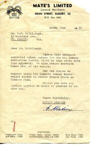
Photograph - Mt Beauty Community Centre original colour plan and photos of upgrade in 2000, 1. Dated March 22nd, 1962 2. Photographs taken during renovations in 2000
... The Community Centre was built in the early 1950’s as an all-purpose hall for the social and recreational use of the workers and families employed on the Victorian state government Kiewa Hydro-electric scheme. ...Kiewa Valley Historical Society Mount Beauty Information Centre 31 Bogong High Plains Rd Mt Beauty high-country The Community Centre was built in the early 1950’s as an all-purpose hall for the social and recreational use of the workers and families employed on the Victorian state government Kiewa Hydro-electric scheme. ...The Community Centre was built in the early 1950’s as an all-purpose hall for the social and recreational use of the workers and families employed on the Victorian state government Kiewa Hydro-electric scheme. The hall was originally called Mt Beauty Recreation Centre and later changed to Mt Beauty Community Centre. It has been the heart of the community for over 65 years and had a heritage listing put on it around the year 2000. The Alpine Shire secured a heritage grant and the hall was restored to its former glory in 2000. In heritage circles it is claimed that the hall is the best example of a 1950’s construction town community hall, which is still functioning anywhere in AustraliaThe Community Centre was and is a very important part of life in the small remote community of Mount Beauty and a range of activities have taken place in the Community Centre over the past 65 years- Picture theatre; Dances and balls; A physical education and boxing club run by Alex McCollough for 30 years; School and social club concerts; Girls gymnastics; Drama group productions, revues and pantomimes; Callisthetics and ballet; Badminton; Wedding receptions and birthday parties; Music festival events; Staging area in times of natural disaster; The library for many years; Shire and community meetings; Secondary College gymnasium for many years and shelter for the Community Market in inclement weather 1 – 1972 specifications for colour scheme of original Mt Beauty Recreation centre, Typed on buff foolscap paper with small colour swatches and letter of explanation to Mr A.J. McCullough. 2 – Set of 10 colour photographs of the upgrade and extension to Mt Beauty Community Centre undertaken in 2000. Photos mounted 2 to a page on blue copy paper. 3. Second copy of No.1 above. Also - typed A4 sheet re history of "The Mount Beauty Community Centre"1 – Header on pages-Mate’s Colour Bar Personal Colour Scheme for Recreation Centre Mt Beauty Vic. 21/3/62. Accompanying letter to A.J McCullough signed by Colour Consultant Ena Chatuein 2. First page of photos, written in black felt marker – Mt Beauty Community Centre 30/11/00 mt beauty, community centre -
 Greensborough Historical Society
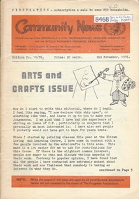
Newsletter, Greenhills and North Greensborough Progress Association, Community News: official journal of the Greenhills and Nth. Greensborough Progress Association and the Apollo Parkways Progress Association. 2nd November, 1976. Edition No. 10/76, 02/11/1976
... Supplement to "Community News" No. 10/76. Women's Recreational Program. A digital copy of this Newsletter is available from Greensborough Historical Society. ...Supplement to "Community News" No. 10/76. Women's Recreational Program. A digital copy of this Newsletter is available from Greensborough Historical Society. ...This edition includes a report on the The Apollo Parkways Progress Association's October 1976 meeting, Arts & crafts issue, A local art/craft who's who, Keeping embroidery alive, Creation pangs, We're hooked!, Warp & weft, Road signs, symbols and your child's art, Hooking your own rug, Cameo of Ron Reynolds, Diamond Valley Arts Society, From the Council Chamber, Letter to the Editor, Nursing Mothers Association, Diamond Valle Repertory, Kinder news, Scout and Guide news. Supplement to "Community News" No. 10/76. Women's Recreational Program. A digital copy of this Newsletter is available from Greensborough Historical Society. Newsletter, 28 p., illus.greenhills and north greensborough progress association, greenhills, apollo parkways progress association -
 Sunshine and District Historical Society Incorporated
Photograph - Kororoit Creek Photograph Compilation
... It is a vital ecological corridor and recreational trail, known for its basalt cliffs, revegetation efforts, and community significance. ...It is a vital ecological corridor and recreational trail, known for its basalt cliffs, revegetation efforts, and community significance. ...Kororoit Creek flows through Albion, Deer Park & Sunshine. It is a vital ecological corridor and recreational trail, known for its basalt cliffs, revegetation efforts, and community significance. Kororoit Creek has deep Aboriginal significance, with evidence of long-standing occupation and cultural practices along its banks. The area surrounding Kororoit Creek is part of the traditional lands of the Wurundjeri Woi-wurrung people, who belong to the Kulin Nation. The name Kororoit is thought to have been derived from an Aboriginal word meaning male kangaroo, but the meaning is in dispute, the name may be also derived from the Woiwurrung language, meaning “Creek on the western plain".Korotoit Creek 8/6/2010kororoit creek -
 Eltham District Historical Society Inc
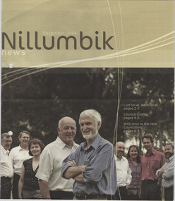
Journal - Newsletter, Nillumbik Shire Council, Nillumbik News, December 2004
... Support for families, seniors, and young people through recreational and learning programs. Community engagement remains a priority for council planning and activities. ...Support for families, seniors, and young people through recreational and learning programs. Community engagement remains a priority for council planning and activities. ...The newsletter reports on local council initiatives, community programs, environmental activities, and cultural events taking place across Nillumbik Shire in late 2004. It emphasizes community participation, environmental sustainability, infrastructure improvements, and local cultural life. Key Points Council Projects and Infrastructure: Updates on road maintenance, capital works, and improvements to local facilities across the shire, Continued development of community infrastructure such as recreational facilities, parks, and public spaces, Council planning initiatives aimed at supporting sustainable growth and maintaining rural character. Environment and Sustainability: Programs encourage residents to protect local waterways, conserve native vegetation, and control invasive weeds, Environmental initiatives involve Landcare groups, wildlife monitoring, and sustainability education, Residents are encouraged to participate in community environmental projects and conservation activities. Community Services and Programs: Promotion of community services, volunteer programs, and educational opportunities through local centres. Support for families, seniors, and young people through recreational and learning programs. Community engagement remains a priority for council planning and activities. Arts, Culture and Events: The newsletter highlights local arts initiatives, exhibitions, festivals, and performances. Programs support local artists and cultural organisations, reinforcing the area’s reputation as an artistic community. Tourism and Local Economy: Promotion of local tourism, wineries, markets, and cultural attractions in the region. Efforts to strengthen the local economy and regional identity through tourism and community events. Also includes interviews with Councillors, 2004 Nillumbik Sports Awards and calandar of events. council newsletters, nillumbik news, nillumbik shire council, warwick leeson, peter yates, bo bendtsen, helen coleman, bill penrose, greg johnson, howard bulmer, bronnie hattam, michael young, living & learning nillumbik, sally hansen, julie french, julie graham, steven wells, robert hayley, greg champion, ev hales, marjorie lapworth, jan kelly, robina summers, janet mason, karen coulton, elizabeth gardner, matthew dean, madison caulfield, nicole pless, mathew munro, sten nigol, christopher armet, rachel khaw, melinda bpuer, david parsons, anton woods, erin lorenzini, zoe carr, troy sandley, marrissa filipou, ben cukier, nillumbik reconciliation group, montsalvat, eltham craft & produce market, eltham festival, nillumbik artists open studios, hurstbridge high school, family services, kangaroo ground preschool, alan marshall short story award, tom dell'anno, gayle knight -
 Warrnambool and District Historical Society Inc.
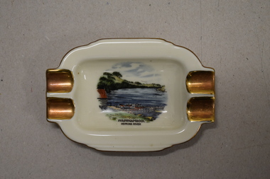
Ashtray, Alka Kunst, Warrnambool Hopkins River, c. 1960
... The boatshed is no longer there with sections of the building being relocated to a site in Henna Street and used for indoor recreational purposes....The boatshed is no longer there with sections of the building being relocated to a site in Henna Street and used for indoor recreational purposes. This ash tray is retained as an example of a local tourist souvenir sold to tourists in the 1960s. ...This item was bought as a souvenir of Warrnambool in the mid 20th century when cigarette smoking was more widespread and was socially acceptable. Tourism in Warrnambool has been an important industry for over 100 years. In the late 19th century Warrnambool was promoted as a spa resort with its mild climate, sea bathing and its hot and cold sea water baths complex. Today visitors come in winter for the May Racing Carnival and to see the Southern Right whales at Logans Beach and in summer they come for a beach holiday. The image on the dish shows the Warrnambool Hopkins River near its mouth. The boatshed is no longer there with sections of the building being relocated to a site in Henna Street and used for indoor recreational purposes.This ash tray is retained as an example of a local tourist souvenir sold to tourists in the 1960s. This is a small white china dish made in an oval shape and slightly raised from the surface on which it sits. The ends of the dish have four gold coloured indents for stubbing cigarettes. There is a gold rim around the edge of the dish and a coloured image of the old boat shed and jetty on the Hopkins River in Warrnambool. On the base of the dish is the logo of the maker and printed details.Warrnambool Hopkins River Alka Kunst Bavaria tourism in warrnambool, history of warrnambool -
 Kew Historical Society Inc
Photograph, J F C Farquhar, The Yarra in Hyde Park, 1891
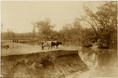
... Farquhar’s point-of-view emphasises both the pastoral and recreational elements of the scene: the grazing cows, three boys, and in the distance two figures, seated on the bank with a parasol. ...Farquhar’s point-of-view emphasises both the pastoral and recreational elements of the scene: the grazing cows, three boys, and in the distance two figures, seated on the bank with a parasol. ...At the beginning of the 1890s, the Kew businessman and Town Councillor, Henry Kellett, commissioned J.F.C. Farquhar to photograph scenes of Kew. These scenes included panoramas as well as pastoral scenes. The resulting set of twelve photographs was assembled in an album, Kew Where We Live, from which customers could select images for purchase.The preamble to the album describes that the photographs used the ‘argentic bromide’ process, now more commonly known as the gelatine silver process. This form of dry plate photography allowed for the negatives to be kept for weeks before processing, hence its value in landscape photography. The resulting images were considered to be finely grained and everlasting. Evidence of the success of Henry Kellett’s venture can be seen today, in that some of the photographs are held in national collections.It is believed that the Kew Historical Society’s copy of the Kellett album is unique and that the photographs in the book were the first copies taken from the original plates. It is the first and most important series of images produced about Kew. The individual images have proved essential in identifying buildings and places of heritage value in the district.Hyde Park is now a small recreation reserve bordered by Willsmere and Kilby Roads and White Avenue. In 1982, Hyde Park was cut off from the Yarra River by the construction of the Eastern Freeway. The building of the latter was to transform the natural landscape, including the Yarra, as well as Hyde Park. The construction of the Freeway makes it difficult to view the scene with the photographer’s eye. Today’s Hyde Park is located on land purchased in 1847 by John Cowell, and in 1851 Catherine Cowell, yet the scene selected by the photographer may well have been located on farmland owned by the Wills family. Farquhar’s point-of-view emphasises both the pastoral and recreational elements of the scene: the grazing cows, three boys, and in the distance two figures, seated on the bank with a parasol. By 1891, an environmental consequence of human activity, including farming, was deforestation, leading to the erosion of the south bank of the Yarra. In contrast, the land on the Alphington side of the river in 1891 included remnant bushland.The Yarra in Hyde Parkkew illustrated, kew where we live, photographic books, henry kellett, yarra river -
 Warrnambool and District Historical Society Inc.
Badges, Australian Comfort Fund 1940, C 1940
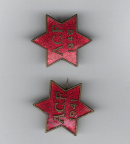
... It also offered recreational facilities and rest rooms etc in Australia for service personnel. ...It also offered recreational facilities and rest rooms etc in Australia for service personnel. ...It is presumed that the 'A.C.F.' on two of these badges stands for 'Australian Comforts Fund'. The Australian Comforts Fund was one of two wartime welfare groups recognized by the Australian Government. The other was the Australian Red Cross. The Australian Comforts Fund was established in 1916 to co-ordinate the welfare efforts to assist Australian servicemen and women in World War One. It was dissolved in 1920 and re-established in 1939. It was staffed largely by women volunteers and supplied such articles as singlets, socks, pyjamas, toiletries, writing materials, tobacco and Christmas hampers to servicemen and women. It also offered recreational facilities and rest rooms etc in Australia for service personnel. It was closed in 1946. These badges were issued, two in 1941, as part of fund-raising for the Australian Comforts Fund.These badges are interesting mementos of the welfare work undertaken in World War Two by the Australian Comforts Fund. Two six pointed star badges which are enamelled in red and have plain metal edge..1 ACF 1940 with P J King on the reverse. .2 ACF 1941 with P J King on the reverse.australian comforts fund, australian red cross -
 Eltham District Historical Society Inc
Photograph, Sugarloaf Reservoir from Skyline Drive, 1989, 1989
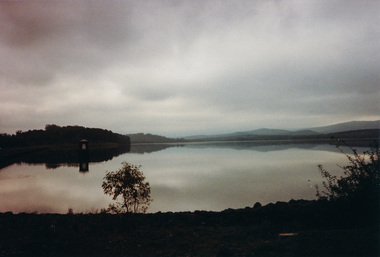
... Within the visitor areas are two picnic grounds and other recreational facilities. Below its massive rock embankment is located the Winnecke Treatment Plan designed to purify its water before being piped into Melbourne. ...Within the visitor areas are two picnic grounds and other recreational facilities. Below its massive rock embankment is located the Winnecke Treatment Plan designed to purify its water before being piped into Melbourne. ...Originally contained in a 'magnetic' photo album believed to have been donated by Mr Eric Stephenson, Jingalong, 110 Ryans Road, Eltham, Vic. 3095; relocated to archival safe storage. Sugarloaf Reservoir is situated on former farmland. This large water storage was completed in 1982 and serves Melbourne's northern suburbs. Within the visitor areas are two picnic grounds and other recreational facilities. Below its massive rock embankment is located the Winnecke Treatment Plan designed to purify its water before being piped into Melbourne. The dam partly inundated the old firing ranges of the former Christmas Hills Rifle Club. Source: Christmas Hills Now and then: Yarra Glen & District Historical Society, 2004. Two colour photographsskyline drive, sugarloaf reservoir -
 Vision Australia
Audio - Sound recording, Paterson Hall Story: an oral history told by the people who were there, 2002
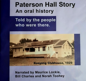
... Paterson Hall Story is told through the reminiscences of 23 people who played an active part in the life of a popular recreational and entertainment hub from 1929 to 1999. ...Vision Australia 454 Glenferrie Road Kooyong melbourne Paterson Hall Story is told through the reminiscences of 23 people who played an active part in the life of a popular recreational and entertainment hub from 1929 to 1999. ...Paterson Hall Story is told through the reminiscences of 23 people who played an active part in the life of a popular recreational and entertainment hub from 1929 to 1999. They relate how a simple concrete structure in Glenferrie Road, Kooyong became a 'home away from home' for people who were blind or vision impaired, their families and friends. The hall was originally built as a clubhouse for blind cricketers in 1927, but by 1929 it had been extended to include a social hall and other facilities including a verandah where spectators could watch the cricket. Over the years the hall was used for activities as diverse as square dancing, singing, craft classes, ball games, art and craft shows, drama groups and annual meetings.60 MP3 sound files of oral history interviews and book excerptsNarrated by Maurice Lockie, Bill Charles and Norah Tooheypaterson hall, association for the advancement of the blind, victorian blind cricket association -
 Melbourne Legacy
Photograph, HDC Camp at Somers Camp
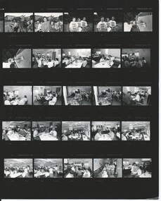
... Every month Legacy's handicapped dependents were invited to go on outing for take part in recreational and educational activities. These programmes aim to develop independence and thus lessen the need for reliance on others for simple routine functions. ...Melbourne Legacy 293 Swanston Street Melbourne melbourne Every month Legacy's handicapped dependents were invited to go on outing for take part in recreational and educational activities. These programmes aim to develop independence and thus lessen the need for reliance on others for simple routine functions. ...Every month Legacy's handicapped dependents were invited to go on outing for take part in recreational and educational activities. These programmes aim to develop independence and thus lessen the need for reliance on others for simple routine functions. Once a year there is a two week camp at Somers, believed to be the Somers School Camp. The date of these photos are not known. An article in the widows' newsletter in 1992 explains more detail on the 1992 camp. The article mentions that the annual camps run for two weeks at Somers Camp. It is a wonderful gathering of Junior Legatees, Legatees, and dedicated helpers. 50 junior legatees attended the 1992 camp with the personal attention almost one-to-one. With ages ranging from 22 to into the 60s, Legacy has to ensure it caters for the differing needs. A record of the type of activities Legacy provided for the handicapped dependents of the Legacy families.Black and white proof sheet of photos taken at a HDC at Somers.junior legatee outing, handicapped dependents, hdc -
 Warrnambool and District Historical Society Inc.
Pamphlet - Special Places Lady Bay Warrnambool, Philprint Warrnambool, 1989
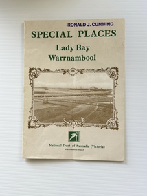
... Areas covered in the written information include: Formation of the Coast, Archaeological survey, Gunditjmara History, vegetation, history and recreational uses of the Lady Bay area. The map shows special places of interest including past and present navigational aids, sites of shipwrecks and other historical places of interest. ...Areas covered in the written information include: Formation of the Coast, Archaeological survey, Gunditjmara History, vegetation, history and recreational uses of the Lady Bay area. The map shows special places of interest including past and present navigational aids, sites of shipwrecks and other historical places of interest. ...This pamphlet was produced for the Warrnambool Branch of the National Trust of Australia (Victoria) for Heritage Week, April 16-23, 1989 and contains information written by Warrnambool residents about their locality. This was a co-operative venture by people with a common interest in protecting the natural environment near their home. Areas covered in the written information include: Formation of the Coast, Archaeological survey, Gunditjmara History, vegetation, history and recreational uses of the Lady Bay area. The map shows special places of interest including past and present navigational aids, sites of shipwrecks and other historical places of interest. The Warrnambool Branch of the National Trust was originally formed in March 1969 and merged with the Port Fairy Branch in late 1970. In October 1979, the Warrnambool Branch was reformed and operated into the late 1990's. This is an example of a publication produced by the Warrnambool Branch of the National Trust Australia (Victoria). It provides historical information and perspectives of the recreational uses in and around Lady Bay Warrnambool.An A2 piece of buff coloured thick paper folded into eight to make an A5 pamphlet. The front cover has green printing with the National Trust symbol of three eucalyptus leaves in green. There is a brown sepia photograph showing a view across Lady Bay with the suspension bridge across the Merri River in the foreground, Viaduct Road in the middle ground and the breakwater in the background. There is a purple inked stamp on the top right hand corner. The rear cover has brown writing and includes logos of bodies who assisted with the publication. There is a brown line drawing of the viaduct and pier at the Warrnambool Breakwater. The inside of the unfolded pamphlet contains a map of Lady Bay and adjacent area showing places of interest and shipwrecks marked in red circlesFront cover: Special Places Lady Bay Warrnambool National Trust of Australia (Victoria) Warrnambool Branch Ronald J. Cummingwarrnambool, lady bay warrnambool, national trust australia victoria warrnambool branch, heritage week 1989, lady bay shipwrecks -
 Warrnambool and District Historical Society Inc.
Camera tripod and case, Early 20th century
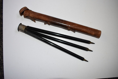
... Dr Holmes also had many recreational interests, including fishing, bowls and golf. ...Dr Holmes also had many recreational interests, including fishing, bowls and golf. ...This item belonged to Dr Horace Iles Holmes (1877-1959). He was born and educated in Tasmania and completed a medical degree at Melbourne University. He commenced a medical practice in Warrnambool in 1906 and was the Honorary Medical Officer at the Warrnambool Hospital and Warrnambool’s Health Officer. His practice was at ‘Ierne’ at the corner of Spence and Kepler Streets. Dr Holmes was an early member of the Royal Australian College of Surgeons and was prominent in Warrnambool community affairs (foundation President of the Warrnambool Rotary Club, a member of the local Masonic Lodge for over 50 years, a Warrnambool Hospital Committee member, a long-term Trustee of the Warrnambool Methodist Church and President of the Lyndoch Hostel for the Aged Committee). Dr Holmes also had many recreational interests, including fishing, bowls and golf. This item is of considerable interest as one coming from the collection of Horace Iles Holmes, a doctor who was prominently associated with the professional and community life of Warrnambool for well over 50 years..1 This is a cylindrical-shaped brown leather case with white stitching along the sides and at the ends. The top end has a leather lid attached to the body of the case with a metal pin. The leather attachment here is broken away. On the side of the case is a leather handle. The case is much scuffed. .2 This is a metal tripod with three legs and pointed ends for embedding into the ground area. The three legs sit on a rounded metal top with a screw for attachment to a camera. The metal top has white printing. The top part of the tripod is slightly rusted. ‘Normal Marque Deposee’warrnambool, dr horace holmes, photographic accessories, history of warrnambool -
 Warrnambool and District Historical Society Inc.
Letterhead, The Boat House Warrnambool, Mid 20th century
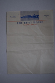
... Thomas Proudfoot built the boathouse near the mouth of the Hopkins River in 1885 and it was an accommodation and dining place for tourists, especially for those interested in fishing and other recreational pursuits and it was the base for the Hopkins Rowing Club. ...Thomas Proudfoot built the boathouse near the mouth of the Hopkins River in 1885 and it was an accommodation and dining place for tourists, especially for those interested in fishing and other recreational pursuits and it was the base for the Hopkins Rowing Club. ...This is a letterhead from Proudfoot’s Boathouse in Warrnambool. Thomas Proudfoot built the boathouse near the mouth of the Hopkins River in 1885 and it was an accommodation and dining place for tourists, especially for those interested in fishing and other recreational pursuits and it was the base for the Hopkins Rowing Club. Proudfoot built additions in 1888 and 1893 and after he died in 1900 his wife Catherine continued on the business for over 30 years, transferring the licence to her son. In 1939 Thomas Proudfoot’s granddaughter, Ena Hunt gained the licence and operated the business with her husband Percy until 1979. It is Percy Hunt’s name on the letterhead described here. The business today is mainly centred around catering and dining. In the 1990s other buildings were added to the boathouse complex, with the original buildings now being heritage-listed. This item is of some interest as it is the only memento we have of the Hunt family’s 40 years proprietorship of Proudfoot’s Boathouse, a significant set of buildings in Warrnambool.This is a single sheet of cream coloured paper with blue and red printing and a blue-coloured photograph of Proudfoot’s Boat House. It is slightly creased.The Boat House Warrnambool P.J.Hunt Proprietor Telephone 131 proudfoots boat house warrnambool, p.j.hunt, the boat house warrnambool, history of warrnambool -
 Kiewa Valley Historical Society
Mantle for Gas Lantern
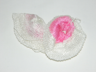
... The age of open flame recreational lighting is fast coming to a close. ...The age of open flame recreational lighting is fast coming to a close. ...Originally these mantles where produced to be used in gas street lights in Europe and North America cities.There use started in 1891. These mantles were used before electrical power street lighting was installed. They have been used ever since until safety concerns regarding radiation from their thorium infused particles made alternate mobile lamps more attractive. The age of open flame recreational lighting is fast coming to a close. The greater use of battery and generator powered lighting(ease of operation) has brought the costing of these alternative lighting to an acceptable level. The age of miniaturisation and volatility of the open flame has seen a greater swing to smaller and more stable lighting. These incandescent gas mantles were initially used in the Coleman White Gas LanternsThe Kiewa Valley, with its closeness to the Victorian Alps, allows greater opportunity for the "happy" campers to enjoy the outdoors. The lighting provided by the incandescent gas lamps allow the adventurer at heart to enjoy an alternative lifestyle and still having the comforts of "home" at their finger tips. The numerous camping facilities in the Kiewa Valley and the upper alpine region is testament that those living in the cities need a break from the day to day grind and go to a quieter and more spiritual environment. Artificial lighting, as provided by mobile apparatus, is highly valued by the urban gypsy. The outdoor recreational industry has significantly provided for, if only at holiday time, an industry that has a relatively high employment rate and beneficial to local communities.The gas mantle is in a fabric, pear shaped, of rayon fabric impregnated with cerium. It's appearance is similar to a very small fishing net. The fabric is very ply-able until it is heated by an open flame then it becomes more rigid and lets out an incandescent white light. Its colour is white to off white. It has a draw string fastened a t the bottom (to wrap around the flame source)lighting, gas, heating, camping, outdoor equipment lamp -
 Queenscliffe Maritime Museum
Functional object - Vortex Pump
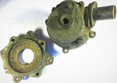
... For over 45 years, Richard has used Wendy regularly for recreational fishing and occasional sailing out of Queenscliff. ...Queenscliffe Maritime Museum 2 Wharf St Queenscliff geelong-and-the-bellarine-peninsula For over 45 years, Richard has used Wendy regularly for recreational fishing and occasional sailing out of Queenscliff. ...For over 45 years, Richard has used Wendy regularly for recreational fishing and occasional sailing out of Queenscliff. He has the original cotton canvas sails that were fitted on the boat when she was built, and which still are in working condition. Richard says that one of his favourite pastimes has been trolling for pike around Swan Island, close by Queenscliff, ensuring that the heritage of this Lacco-built boat fishing boat is preserved. In about 2015, Wendy underwent a rebuild including: a new centre-case, ribs and deck, and a new Yanmar engine. The works were done by Bryon Miller of Peninsula Wooden Boats. Wendy remains berthed, fore and aft, at Number 12 pile in front of Queenscliff Lonsdale Yacht Club. Well known couta boat in QueenscliffeAustralian made Kopsen vortex bilge pump.Kopsen Vortexcouta boats, 'wendy", bilge pump -
 Broadmeadows Historical Society & Museum
Photograph - Group Photograph, Santa in the Sunshine: A Park Day Surprise, 1990
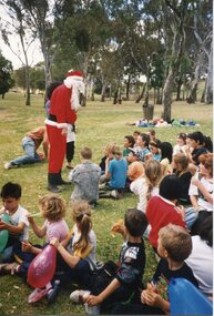
... This photograph, taken during Jacana Primary School’s 1990 Christmas picnic, captures a relaxed and festive moment believed to have occurred at Greenvale Reservoir, a popular recreational destination in Melbourne’s northern suburbs. ...Broadmeadows Historical Society & Museum 21 Pearcedale Parade Broadmeadows melbourne This photograph, taken during Jacana Primary School’s 1990 Christmas picnic, captures a relaxed and festive moment believed to have occurred at Greenvale Reservoir, a popular recreational destination in Melbourne’s northern suburbs. ...This photograph, taken during Jacana Primary School’s 1990 Christmas picnic, captures a relaxed and festive moment believed to have occurred at Greenvale Reservoir, a popular recreational destination in Melbourne’s northern suburbs. The image shows a group of children seated on the grass, engaging with a person dressed as Santa Claus, who is standing and interacting warmly with them. Balloons and a natural backdrop of trees contribute to the cheerful, outdoor atmosphere. The event reflects the community spirit and traditions of the time, where schools often organised end-of-year gatherings to celebrate the holiday season. Greenvale Reservoir, known for its open spaces and family-friendly environment, served as an ideal location for such festivities. This photograph offers a glimpse into the social and cultural fabric of suburban Melbourne in the early 1990s, highlighting the importance of communal celebration and childhood joy.This photograph holds cultural and historical value as a visual record of Jacana Primary School’s 1990 Christmas picnic, believed to have taken place at Greenvale Reservoir, a cherished recreational site in Melbourne’s northern suburbs. It captures a moment of community celebration, showcasing the traditions of Australian public schools in the late 20th century, where end-of-year gatherings fostered social bonds among students, families, and staff. The presence of Santa Claus engaging with children in an informal outdoor setting reflects the blending of festive customs with local recreational culture. The image is significant not only for its depiction of childhood joy and seasonal festivity but also for its connection to the broader social history of Melbourne’s suburban communities. It offers insight into the ways schools and families utilised public spaces to create meaningful shared experiences, contributing to the collective memory of the area. As a document of place, time, and tradition, this photograph is a valuable artifact for understanding the lived experiences of school communities and the role of public spaces in fostering social cohesion.Colour photograph on glossy paper in portrait format.PH18289 (crossed out) PH4209 (crossed out) PH-4868jacana, jacana primary school, christmas picnic, 1990, father christmas -
 Vision Australia
Equipment - Object, Swish ball, yellow, 199
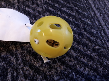
... It is played on both a recreational and competitive level; and allows blind, vision impaired and sighted people to compete on almost equal terms. ...It is played on both a recreational and competitive level; and allows blind, vision impaired and sighted people to compete on almost equal terms. ...The plastic ball has bells inside to make it audible when it is hit by the rectangular wooden 'Swish bat'. 'Swish' is a fast, invigorating game, and was developed by blind people in Australia and has been played here for many years. It is played on both a recreational and competitive level; and allows blind, vision impaired and sighted people to compete on almost equal terms. Swish is like table tennis, but instead of hitting a ball over a net, the ball is hit under a net and must travel along the surface of the table. The net is at a height that so that those players with various degrees of sight do not have an advantage over blind players. Swish is either played as a doubles or singles competition. The game can be played from one game to the best of five, and the first to eleven or the advantage of 2 after eleven.1 swish ball with 26 holes containing 3 metal bellsrecreation, swish -
 Vision Australia
Leisure object - Object, Swish ball, red, 199
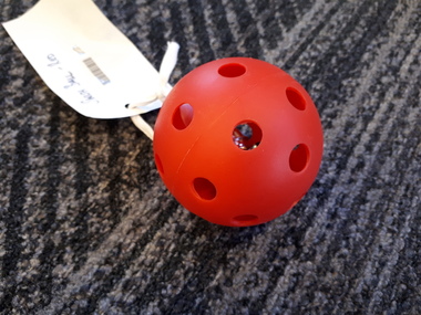
... It is played on both a recreational and competitive level; and allows blind, vision impaired and sighted people to compete on almost equal terms. ...It is played on both a recreational and competitive level; and allows blind, vision impaired and sighted people to compete on almost equal terms. ...The plastic ball has bells inside to make it audible when it is hit by the rectangular wooden 'Swish bat'. 'Swish' is a fast, invigorating game, and was developed by blind people in Australia and has been played here for many years. It is played on both a recreational and competitive level; and allows blind, vision impaired and sighted people to compete on almost equal terms. Swish is like table tennis, but instead of hitting a ball over a net, the ball is hit under a net and must travel along the surface of the table. The net is at a height that so that those players with various degrees of sight do not have an advantage over blind players. Swish is either played as a doubles or singles competition. The game can be played from one game to the best of five, and the first to eleven or the advantage of 2 after eleven.1 swish ball with 28 holes containing 4 metal bellsrecreation, swish -
 Parks Victoria - Mount Buffalo Chalet
Spittoon
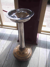
... Appendix A.3, Snow sports equipment and other recreational items. (Pg 166 Historica). "Smoker's were well-catered for at the Chalet, and Smoking Rooms in similar resort establishments were considered to be a necessary facility. ...Appendix A.3, Snow sports equipment and other recreational items. (Pg 166 Historica). "Smoker's were well-catered for at the Chalet, and Smoking Rooms in similar resort establishments were considered to be a necessary facility. ...Probably original to Mt Buffalo Chalet. Listed in the Draft Inventory of Significant Collection items. Appendix A.3, Snow sports equipment and other recreational items. (Pg 166 Historica). "Smoker's were well-catered for at the Chalet, and Smoking Rooms in similar resort establishments were considered to be a necessary facility. A guest house in the Blue Mountains in 1905 offered the' full comforts of a refined home' with views, spacious verandahs, tennis court and smoking room. James Boyce commented on expectorating smokers in the the Chalet's public rooms and recommended the provision of spittoons." (Pg 101. Historica) PROV . Undated photo of bedroom sitting room with same chrome ashtray, there are 3 in the MBC Collection. (Fif 52. Pg 63 Historica) Similar ashtray sighted on Ebay listed as Victorian Railways Spitoon, February 2012.3 x Brass and chrome standing spittoons with bulbous bases and bowl on a stem. -
 Bendigo Military Museum
Photograph - Staff Retirement - Army Survey Regiment, Fortuna, Bendigo, c1989
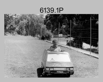
... Kev was a qualified pilot and often took time on weekends to take unit staff and their families on recreational flights over Bendigo and Albury-Wodonga. ...Kev was a qualified pilot and often took time on weekends to take unit staff and their families on recreational flights over Bendigo and Albury-Wodonga. ...These two photos were most likely taken in the volleyball court area of the Army Survey Regiment, part of the grounds of Fortuna, Bendigo, in c1989. The occasion was probably to farewell SSGT Kevin Boehm, who was a cartographic draughtsman, after 22 years of service in the ADF. It is likely Bendigo Toyota was approached to loan their miniature Toyota Tarago; a vehicle used for marketing purposes. The novelty of this quirky “drive past” event was that Kev was well known as a part-time car salesman and often took the opportunity of assisting new staff in buying a car. Kev was a qualified pilot and often took time on weekends to take unit staff and their families on recreational flights over Bendigo and Albury-Wodonga. His other claim to fame was he was “charge happy”, a tendency to prefer charges against offending soldiers rather than offer them a warning.These two photos were most likely taken in the volleyball court area of the Army Survey Regiment, part of the grounds of Fortuna, Bendigo, in c1989. The photographs were on 35mm negative film and were scanned at 96 dpi. They are part of the Army Survey Regiment’s Collection. .1) and .2) - Photo, black & white, c1989, SSGT Kevin Boehm. No personnel are identifiedroyal australian survey corps, rasvy, army survey regiment, army svy regt, fortuna, asr -
 Kiewa Valley Historical Society
Photograph of Snow Covered Catchment Area Vic, Snow Covered Catchment Area Victorian Alps - 1950s, Circa 1950
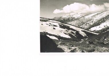
... This photograph details (early to mid1950s), the Victorian Alpine region when this remote area was part of a "lay back" rural landscape,occasionally visited by recreational adventurers and some wayward tourists. ...The Kiewa Valley is loosing its hiding place and is becoming more and more a source of untapped residential land and winter time recreational adventure lands. The changes brought about by modern technologies involving recreational activities such as hang gliding, gliding (local airstrip), mountain bikes, car rallies and their associated clubs is providing for an increased short term population boost. ...This photograph details (early to mid1950s), the Victorian Alpine region when this remote area was part of a "lay back" rural landscape,occasionally visited by recreational adventurers and some wayward tourists. The mountain ranges had provided an adequate barrier against the way-would traveller, but with the opening up of this region by the provision of improved roadways and accommodation facilities, courtesy of the Kiewa Valley Hydro Electricity Scheme, changes such as tourism and its impact upon the "natural" state started to show its side effects (clearing of the land). The expansion of the European immigration numbers (1950s) coming into Australia was increasing after World War II which not only provided increased construction workers to the region but also immigrants who appreciated alpine regions. Some of these immigrants contributed to the expansion of the region and provided for a greater degree of diverse professions and rural related work force.This photograph depicts the borderline in time between an exclusively rural based population and respective activities(early 1900s)to the present (2000 on wards) integrated village, tourist and retiree/holiday area. The time when land was exclusively used in agriculture and Alpine grazing lands is over. The Kiewa Valley is loosing its hiding place and is becoming more and more a source of untapped residential land and winter time recreational adventure lands. The changes brought about by modern technologies involving recreational activities such as hang gliding, gliding (local airstrip), mountain bikes, car rallies and their associated clubs is providing for an increased short term population boost. These together with the attractions for retirees is changing not only the physical nature of the Kiewa valley but also its "soul".This item is a black and white photograph of a section of snow covered catchment area in the Victorian Alps in the mid 1900. It is on 200 gms paper but not on photographic paper and has a white boarder (3 mm).kiewa valley tourism, victorian alps, alternate energy supplies, alpine population growth
