
Showing 19 items matching "barwon street"
-
 Box Hill Historical Society
Photograph - Barwon Street Family Centre, Simon Fox, 1/12/1994
... Barwon Street Family Centre......Barwon Street...Barwon Street Family Centre, located at 15 Barwon Street, Box Hill North, provides services such as Maternal and child health, family day care, family counselling, visiting specialists and playgroups. ...Barwon Street Family Centre, located at 15 Barwon Street, Box Hill North, provides services such as Maternal and child health, family day care, family counselling, visiting specialists and playgroups. ...Barwon Street Family Centre, located at 15 Barwon Street, Box Hill North, provides services such as Maternal and child health, family day care, family counselling, visiting specialists and playgroups. It is a modern brick building, built in 1993 and the first of two planned for the City. (See p.27 "The Days We Remember")B&w photoday care, maternal and child health centres, welfare services, barwon street, box hill north, the days we remember -
Box Hill Historical Society
Photograph - Hagenauer's Reserve, Elgar Road, Box Hill
... ...Barwon Street...Hagenauer's Reserve, Elgar Road, Box Hill, between Willow Street and Barwon Street. Sports ground for Box Hill Athletic Club....Hagenauer's Reserve, Elgar Road, Box Hill, between Willow Street and Barwon Street. Sports ground for Box Hill Athletic Club. ...Hagenauer's Reserve, Elgar Road, Box Hill, between Willow Street and Barwon Street. Sports ground for Box Hill Athletic Club.hagenauer reserve, box hill athletics club, sport, elgar road, willow street, barwon street, sportsgrounds, athletic clubs, parks and reserves -
 City of Greater Geelong
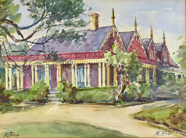
Watercolour, Win Trigg, Barwon Grange - Fernleigh Street, Newtown
... Barwon Grange - Fernleigh Street, Newtown...Barwon Grange - Fernleigh Street, Newtown Watercolour Win Trigg ... -
 National Wool Museum
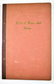
Book - A Forecast of the textile vogues for the coming season from R. S. & S. Woollen Mill, Geelong Part IV, Returned Soldiers and Sailors Mill, 1941
... The Returned Soldiers and Sailors Mills was located near the Barwon river on Pakington Street, Geelong, where its building still stands. ...The Returned Soldiers and Sailors Mills was located near the Barwon river on Pakington Street, Geelong, where its building still stands. ...The Returned Soldiers and Sailors Mills was located near the Barwon river on Pakington Street, Geelong, where its building still stands. The mill was established in October 1922 with capital acquired from War Gratuity Bonds. The mill produced fine grade woollen products with its speciality being ‘Retsol’ travelling rugs.31 page red book bound with metal pins containing fabric samples glued onto paper, with some printed text.cover: [printed] A FORECAST OF TEXTILE VOGUES / FOR THE COMING SEASON / FROM / R. S. & S. Woollen Mill. / Geelongr. s. & s mill, soldiers, sailors, geelong, war, wool, mill -
 National Wool Museum
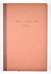
Book - A Forecast of the textile vogues for the coming season from R. S. & S. Woollen Mill, Geelong Part 1, Returned Soldiers and Sailors Mill, 1941
... The Returned Soldiers and Sailors Mills was located near the Barwon river on Pakington Street, Geelong, where its building still stands. ...The Returned Soldiers and Sailors Mills was located near the Barwon river on Pakington Street, Geelong, where its building still stands. ...The Returned Soldiers and Sailors Mills was located near the Barwon river on Pakington Street, Geelong, where its building still stands. The mill was established in October 1922 with capital acquired from War Gratuity Bonds. The mill produced fine grade woollen products with its speciality being ‘Retsol’ travelling rugs.25 page red book bound with metal pins containing fabric samples glued onto paper, with some printed text.cover: [printed] A FORECAST OF TEXTILE VOGUES / FOR THE COMING SEASON / FROM / R. S. & S. Woollen Mill. / Geelongr. s. & s mill, soldiers, sailors, geelong, war, wool, mill -
 National Wool Museum
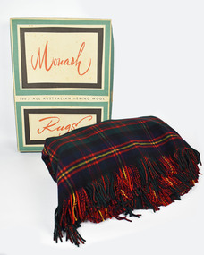
Textile - Rug, Returned Soldiers and Sailors Mill, 1963
... The Returned Soldiers and Sailors Mills was located near the Barwon river on Pakington Street, Geelong, where its building still stands. ...The Returned Soldiers and Sailors Mills was located near the Barwon river on Pakington Street, Geelong, where its building still stands. ...The Returned Soldiers and Sailors Mills was located near the Barwon river on Pakington Street, Geelong, where its building still stands. The mill was established in October 1922 with capital acquired from War Gratuity Bonds. The mill produced fine grade woollen products with its speciality being ‘Retsol’ travelling rugs. The mill first began to run into financial troubles with the ‘Credit Squeeze’ or the ‘Holt Jolt’ of the early 1960s. This saw import restrictions lifted which triggered the start of a minor recession and a rise in unemployment. Included in these troubles was the RS&S Mill which saw the number of employees gradually decrease and business declining with cheaper imports beginning to grab an expanding part of the market share. The mill was eventually purchased by Godfrey Hirst in 1973 who tried to continue operations without success and in June 1975 textile production at the site ceased. Outside of financial considerations contributing to the closure of Woollen Mills in this period was the declining need for heavier fabrics as in-home heating and insulation improved. This need had been replaced for a demand for ever softer, finer and lighter worsted fabrics for more casual clothing. Modern day textile production requires fewer steps in the processing of materials for this use. This meant large factory complexes such as early woollen mills like the RS&S mills were no longer required. Compared to modern textile production which can spin a fine yarn out of synthetic fibre or imported cotton easily, spinning fine yarn from medium quality wool at a textile factory was cumbersome and no longer financially viable to suit new consumer demands. This rug provides context to this statement. It was gifted to Shirley and Gordon Green as a wedding present in November 1963 by one of Gordon's colleagues in the wool industry. Living in areas such as Neutral Bay, the Hornsby area and later in life retiring to the Central Coast, the blanket was too heavy for use in these weather conditions and hence it stayed in its original box for nearly 60 years. Top and bottom of rug has frilled edges. Pattern is titled the 'Clan Cameron' and is repeated in a 7x7 grid. Front of rug has a red background with 4 vertical and horizontal lines. All is surrounded by a yellow boarder. Label is stitched into the bottom right corner. Reverse of rug also has a repeating 7x7 grid. Blue background with thick green horizontal stripe. Yellow and red boarder to the grid with 4 red vertical and horizontal lines making up the interior. Rug measure 1550 x 2040mm, approximately the same size as a queen size mattress.Wording, Bottom right corner. THE GEELONG R.S&S. WOOLEN MILLS/ PURE/ WOOL/ AUSTRALIA/ The John Monash Rug (cursive)/ The Clan Cameron (cursive)rs&s mills, textile manufacture, rug, clan cameron, sydney greasy wool exchange -
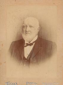 Phillip Island and District Historical Society Inc.
Photograph - Photograph, black + white, c. 1900
... street east, Melbourne, the starting place for all Cobb and Co's lines of up-country coaches, and kept it for 22 years, marrying whilst there Miss Blake, of Mornington. Shortly before leaving the hotel he purchased 7000 acres of land at Phillip Island for breeding purposes, and there bred Wollomai, who won the Melbourne Cup in 1875. In 1881 he retired to his magnificent estate, besides which he has another 1000 acres at Bass and other properties. He also once owned racing stables at Brighton, where he had Barwon...street east, Melbourne, the starting place for all Cobb and Co's lines of up-country coaches, and kept it for 22 years, marrying whilst there Miss Blake, of Mornington. Shortly before leaving the hotel he purchased 7000 acres of land at Phillip Island for breeding purposes, and there bred Wollomai, who won the Melbourne Cup in 1875. In 1881 he retired to his magnificent estate, besides which he has another 1000 acres at Bass and other properties. He also once owned racing stables at Brighton, where he had Barwon ...John Cleeland JP of Newhaven, 1826-1914, a native of County Down, Ireland, came to Victoria in 1840 with his parents and settled at Darebin Creek. After a few years spent there he went to sea in his schooner yacht of 200 tons, the Harriet, visiting the South Sea Islands and the west coast of South America. In 1859 he took the well known Albion Hotel, Bourke-street east, Melbourne, the starting place for all Cobb and Co's lines of up-country coaches, and kept it for 22 years, marrying whilst there Miss Blake, of Mornington. Shortly before leaving the hotel he purchased 7000 acres of land at Phillip Island for breeding purposes, and there bred Wollomai, who won the Melbourne Cup in 1875. In 1881 he retired to his magnificent estate, besides which he has another 1000 acres at Bass and other properties. He also once owned racing stables at Brighton, where he had Barwon (which won the Champion race) and other valuable horses. Mr Cleeland is a member of the Phillip Island Council and is a justice of the peace for the central bailiwick. Taken from Victoria and its Metropolis: past and present, 1888. Donated by Ivy Cleeland, John Cleeland's grand-daughter.Portrait of John Cleeland of Wollomai House, Phillip Island.On front: Paris, 119 Swanston Street, Melbourne On back: John Cleeland of Wollomai House.john cleeland, ivy cleeland -
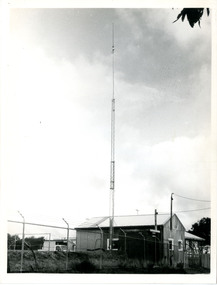 Victoria Police Museum
Police Stations (Anglesea)
... Before 1967 policing in Anglesea was on a seasonal basis with a 'shop front' police station and caravan in the main street. Anglesea Police Station (Barwon District) was opened on 7 February 1967 on the corner of Wray Street and The Great Ocean Road. ...Before 1967 policing in Anglesea was on a seasonal basis with a 'shop front' police station and caravan in the main street. Anglesea Police Station (Barwon District) was opened on 7 February 1967 on the corner of Wray Street and The Great Ocean Road. ...Anglesea is a town on the Great Ocean Road in the Surf Coast Shire local government area. It is 110km from Melbourne. Before 1967 policing in Anglesea was on a seasonal basis with a 'shop front' police station and caravan in the main street. Anglesea Police Station (Barwon District) was opened on 7 February 1967 on the corner of Wray Street and The Great Ocean Road. It was a residential police station, brick veneer with an iron roof with 3 rooms, a bathroom, laundry and a garage. When the station opened it was staffed by one Senior Constable and two First Constables. List of staff from 1967-2002 is available from Victoria Police Museum10 photographs comprising: 8 black and white photos, 2 colour photospolice stations; anglesea police station -
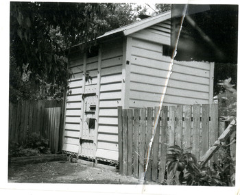 Victoria Police Museum
Police Stations (Apollo Bay)
... It came under the Barwon District in 1948 and "Lima" Western District from 4 March 1990. In 1930 the police station was located to 29 Nelson Street. ...It came under the Barwon District in 1948 and "Lima" Western District from 4 March 1990. In 1930 the police station was located to 29 Nelson Street. ...Apollo Bay is a coastal town in southwestern Victoria. It is situated on the eastern side of Cape Otway, along the edge of the Barham River and on the Great Ocean Road, in the Colac Otway Shire. The original township was surveyed in 1853 and named Middleton. In 1881 the town was renamed Krambruk which was changed to Apollo Bay in 1898. The Krambruk Police Station was opened on 7 March 1888 in the Southern District on land opposite the site of the current Mechanics' Institute and changed its name to the Apollo Bay Police Station on 1 September 1990. It came under the Barwon District in 1948 and "Lima" Western District from 4 March 1990. In 1930 the police station was located to 29 Nelson Street. It was a seven-roomed weather-board dwelling on three-quarters of an acre of land. It consisted of six rooms of pine, lined and painted; one pantry; one bathroom and wash-house; one hall; one office and one W.C.. There was stabling for one horse and one cell for prisoners. It was staffed by one Mounted Constable. In the early 1970s land was acquired at 31 Nelson Street and a new police station was constructed. This was a three-roomed brick building with a cell block at the rear. By the time it closed in 2005 it had been extended twice. On 17 November 2006 the current Apollo Bay Police Station opened in its current location at 35a Nelson Street, on the corner of Cartwight Street). Outside the peak summer season, the station is open 16 hours per day and staffed by one sergeant and five other members. 3 black & white photos and 2 coloured photospolice stations; apollo bay police station -
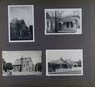 Glen Eira Historical Society
Album - Album page, Orrong Road, Circa 1972
... Other Victorian cases of detailing derived from Viollet-le-Duc include Barwon Park (1868), the Presbyterian Church at Skipton (1871), the Bourke Street West Police Station by Bindley and Brittingham (PWD) dating from 1888-9 and the Lutheran Manse, East Melbourne by JAB Koch (1890). ...This photograph is part of the Caulfield Historical Album 1972. This album was created in approximately 1972 as part of a project by the Caulfield Historical Society to assist in identifying buildings worthy of preservation. The album is related to a Survey the Caulfield Historical Society developed in collaboration with the National Trust of Australia (Victoria) and Caulfield City Council to identify historic buildings within the City of Caulfield that warranted the protection of a National Trust Classification. Principal photographer thought to be Trevor Hart, member of Caulfield Historical Society. Most photographs were taken between 1966-1972 with a small number of photographs being older and from unknown sources. All photographs are black and white except where stated, with 386 photographs over 198 pages. Victorian Heritage Database H0704 FORMER UNION CHURCH 84-86 ORRONG ROAD ELSTERNWICK https://vhd.heritagecouncil.vic.gov.au/places/428 The Former Union Church, Elsternwick, designed by the architect George de Lacy Evans, and erected in 1889-90 is a building of historical and architectural significance for the following reasons:- (1) it is a rare and well- developed example of the early French Gothic manner as popularised through the muscular Victorian re-interpretation of English architect William Burgess, which in turn were derived from the publications of EE Viollet-le-Duc. Other Victorian cases of detailing derived from Viollet-le-Duc include Barwon Park (1868), the Presbyterian Church at Skipton (1871), the Bourke Street West Police Station by Bindley and Brittingham (PWD) dating from 1888-9 and the Lutheran Manse, East Melbourne by JAB Koch (1890). However, none of these buildings relates closely in form to the Union Church, Elsternwick. The only building which has been identified as closely comparable is The Bairnsdale Court House by AJ Macdonald (PWD) which dates from 1892. (2) the use of bright red brickwork is of significance, as the Former Union Church is believed to be only the second church building in Victoria to employ this material as a matter of conscious choice. Amongst red brick churches, it is thought to be preceded only by Reed, Henderson And Smart's Sacred Heart (1884), a Renaissance inspired design. (3) the building is believed to be a rare, possibly unique, surviving example of a church building erected for dual use by the Congregationalists and Baptists. In 1894 it was bought by the Congregationalists and continued as a Congregational Church until the formation of the Uniting Church.Page 165 of Photograph Album with four photographs, two of a church with the other two of houses on Orrong Road.Handwritten: ELSTERNWICK CONGREGATIONAL CHURCH [under top left photo] / 82 ORRONG ROAD [under top right photo] / 663-1 ORRONG ROAD / SEMI - DETACHED PAIR / 165 [bottom left]trevor hart, elsternwick congregational church, king street, orrong road, church, elsternwick, red brick, former union church, early french gothic style, architects, george de lacy evans, baptist church, conical towers, houses -
 Bendigo Historical Society Inc.
Photograph - PITTOCK COLLECTION: FIVE PITTOCK FAMILY PHOTOGRAPHS
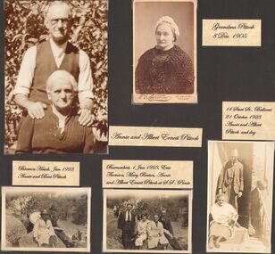
... Barwon Heads (?) 4. 1 Jan. 1923, Eric Thompson, Mary Beeton, Annie & Albert Pittock, Burrumbeet (?) at Sunday School Picnic 5. 21 October 1923, Annie & Albert Pittock and dog, 14 Sturt Street, Ballarat...Barwon Heads (?) 4. 1 Jan. 1923, Eric Thompson, Mary Beeton, Annie & Albert Pittock, Burrumbeet (?) at Sunday School Picnic 5. 21 October 1923, Annie & Albert Pittock and dog, 14 Sturt Street, Ballarat Photograph PITTOCK COLLECTION: FIVE PITTOCK FAMILY PHOTOGRAPHS ...Five Pittock photographs: 1. Grandma Pittock 8 Dec. 1905 2. Annie & Albert Pittock 3. Jan 1923, Annie & Albert Pittock, Barwon Heads (?) 4. 1 Jan. 1923, Eric Thompson, Mary Beeton, Annie & Albert Pittock, Burrumbeet (?) at Sunday School Picnic 5. 21 October 1923, Annie & Albert Pittock and dog, 14 Sturt Street, Ballarat -
 Sunshine and District Historical Society Incorporated
Archive - Sunshine North Subdivision History
... Typed Report Land on the western side of McIntyre Rd Allotments L and M Section 9|Typed Report Land on the western side of McIntyre Rd Allotments E Section 10|Photocopy of Certificate of Title David Newll of Cowper Street Footscray|Photocopy of Certificate of Title Patrick Joseph Prendergast of Bourke Street Melbourne|Photocopy of Certificate of Title Charles Brown Fisher of Maribyrnong|Photocopy of Certificate of Title The Maribyrnong Estate Company Limited|Photocopy of Certificate of Title The Maribyrnong Estate Company Limited|Photocopy of Certificate of Title Annie St Clair Jenkins of 24 Cole Street Elwood|Typed Report Sunshine North Allotment B Section 22 Parish of Cut Paw Paw|Map Allotments 1 2 and 3 of D Sections 9 and 10 Parish of Maribyrnong|Map Part of Parish of Maribyrnong Map 1957 including pre 1957 details Drawn and reprinted at the Department of Lands and Survey|Enlarged detail of map dated 1865 Section 22 Parish of Cut Paw Paw McIntyre Road and Ayton Street to Somers Street|Enlarged detail of Map photographed at the Department of Lands and Survey by WJ Butson Map 2 versions 1916 to 1952 including pre 1916 details|Original Crown Grant Closer Settlement Allotment to Colin Munro18 August 1924|Sunshine North aerial photograpth McIntyre Rd Sandford Ave Dunkeld Ave Clayton St Cranbourne Ave Barwon Ave Camperdown Ave Boisdale Ave Melton Ave Albion to Broadmeadows Railway Line Stony Creey|Flyer LUMA Community Update Newletter October 2023 Former MMBW Site St Albans Rd|Aerial photographs Part of North Sunshine February 1956...Sunshine North Typed Report Land on the western side of McIntyre Rd Allotments L and M Section 9|Typed Report Land on the western side of McIntyre Rd Allotments E Section 10|Photocopy of Certificate of Title David Newll of Cowper Street Footscray|Photocopy of Certificate of Title Patrick Joseph Prendergast of Bourke Street Melbourne|Photocopy of Certificate of Title Charles Brown Fisher of Maribyrnong|Photocopy of Certificate of Title The Maribyrnong Estate Company Limited|Photocopy of Certificate of Title The Maribyrnong Estate Company Limited|Photocopy of Certificate of Title Annie St Clair Jenkins of 24 Cole Street Elwood|Typed Report Sunshine North Allotment B Section 22 Parish of Cut Paw Paw|Map Allotments 1 2 and 3 of D Sections 9 and 10 Parish of Maribyrnong|Map Part of Parish of Maribyrnong Map 1957 including pre 1957 details Drawn and reprinted at the Department of Lands and Survey|Enlarged detail of map dated 1865 Section 22 Parish of Cut Paw Paw McIntyre Road and Ayton Street to Somers Street|Enlarged detail of Map photographed at the Department of Lands and Survey by WJ Butson Map 2 versions 1916 to 1952 including pre 1916 details|Original Crown Grant Closer Settlement Allotment to Colin Munro18 August 1924|Sunshine North aerial photograpth McIntyre Rd Sandford Ave Dunkeld Ave Clayton St Cranbourne Ave Barwon Ave Camperdown Ave Boisdale Ave Melton Ave Albion to Broadmeadows Railway Line Stony Creey|Flyer LUMA Community Update Newletter October 2023 Former MMBW Site St Albans Rd|Aerial photographs Part of North Sunshine February 1956 Collection of documents relating the Sunshine North Subdivision History Archive Sunshine North Subdivision History ...Typed Report Land on the western side of McIntyre Rd Allotments L and M Section 9|Typed Report Land on the western side of McIntyre Rd Allotments E Section 10|Photocopy of Certificate of Title David Newll of Cowper Street Footscray|Photocopy of Certificate of Title Patrick Joseph Prendergast of Bourke Street Melbourne|Photocopy of Certificate of Title Charles Brown Fisher of Maribyrnong|Photocopy of Certificate of Title The Maribyrnong Estate Company Limited|Photocopy of Certificate of Title The Maribyrnong Estate Company Limited|Photocopy of Certificate of Title Annie St Clair Jenkins of 24 Cole Street Elwood|Typed Report Sunshine North Allotment B Section 22 Parish of Cut Paw Paw|Map Allotments 1 2 and 3 of D Sections 9 and 10 Parish of Maribyrnong|Map Part of Parish of Maribyrnong Map 1957 including pre 1957 details Drawn and reprinted at the Department of Lands and Survey|Enlarged detail of map dated 1865 Section 22 Parish of Cut Paw Paw McIntyre Road and Ayton Street to Somers Street|Enlarged detail of Map photographed at the Department of Lands and Survey by WJ Butson Map 2 versions 1916 to 1952 including pre 1916 details|Original Crown Grant Closer Settlement Allotment to Colin Munro18 August 1924|Sunshine North aerial photograpth McIntyre Rd Sandford Ave Dunkeld Ave Clayton St Cranbourne Ave Barwon Ave Camperdown Ave Boisdale Ave Melton Ave Albion to Broadmeadows Railway Line Stony Creey|Flyer LUMA Community Update Newletter October 2023 Former MMBW Site St Albans Rd|Aerial photographs Part of North Sunshine February 1956sunshine north -
 Ballarat Tramway Museum
Photograph - Ballarat Tram 43, Ballarat Tram 43 in Drummond Street South
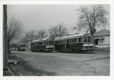
... Photograph taken by Campbell Duncan. 1914 prahran & malvern tramways trust geelong tramways tram 40 ballarat 1956 tram 43 apex club of barwon newtown chilwell 1974 tramway museum society of victoria 1987 campbell duncan photographer Black and white photograph Ballarat Tram 43 in Drummond Street South Photograph Ballarat Tram 43 ...This tram was built in 1914 for the Prahran & Malvern Tramways Trust. It became part of the Geelong Tramways Fleet where it was No.40. It came to Ballarat in 1956 and numbered 43. It was sent to the Apex Club of Barwon on behalf of the City of Newtown and Chilwell (City of Newtown from 1974). Acquired by the Tramway Museum Society of Victoria in Bylands in 1987. Photograph taken by Campbell Duncan.Black and white photograph1914, prahran & malvern tramways trust, geelong tramways, tram 40, ballarat, 1956, tram 43, apex club of barwon, newtown, chilwell, 1974, tramway museum society of victoria, 1987, campbell duncan, photographer -
 National Wool Museum
Clothing - Paisley Shawl, 1800 - 1830
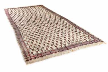
... Street; Ada and Myrtle Downie in 1884. Jane’s youngest son William (1848-1932) was a spinning master, timekeeper and pay clerk at the Victorian Woollen Mill (later the Godfrey Hirst Excelsior Number Two mill) and together with William Cook owned a wool scour on the Barwon River at Marnockvale. ...Street; Ada and Myrtle Downie in 1884. Jane’s youngest son William (1848-1932) was a spinning master, timekeeper and pay clerk at the Victorian Woollen Mill (later the Godfrey Hirst Excelsior Number Two mill) and together with William Cook owned a wool scour on the Barwon River at Marnockvale. ...Shawl of Jane Francis (nee Piper) 1809-1891 This fine woven silk and woollen shawl is from Shetland, Scotland and belonged orginally to Jane Francis. Jane was born in Devon near the village of Bradworthy. She married Joseph Francis (1803-1878) in 1830 in the Bradworthy Parish, Devon, England and wore the shawl over her wedding dress on her wedding day. Jane and Joseph came to Geelong in 1853 with their family. Jane’s sister and brother were in Geelong and their eldest daughter Elizabeth had arrived in 1849. They arrived on the ship 'Euphemus' at Point Henry, Geelong, on July 20, 1853 and travelled across the bay in the steamer Duncan Hoyle. Jane was wearing the shawl on her arrival in Geelong. They went to live in Sharp Street Chilwell in a house owned by their son in law, John Price, which they later purchased. Jane became well known as a ‘midwife’ having had 10 children of her own. She is known to have delivered twin girls in Fyans Street; Ada and Myrtle Downie in 1884. Jane’s youngest son William (1848-1932) was a spinning master, timekeeper and pay clerk at the Victorian Woollen Mill (later the Godfrey Hirst Excelsior Number Two mill) and together with William Cook owned a wool scour on the Barwon River at Marnockvale. William’s grandson Arthur (1917-1992) was a wool classer undertaking his course at the Gordon Institute and became a wool valuer at Strachan & Co. For a time he taught part time in the Gordon course. Arthur’s son Robert was also a wool classer and worked at the Australian Wool Testing Authority. The shawl was used as a bed spread at 'Woodstock' by Jane's son William and then by his two children Laura and Eve. After their deaths, Eve in 1947 and Laura in 1963, the shawl was passed to their youngest sister Ethel (Effie) Frier (nee Francis). She had no children and it was passed on to grandniece Pat Norman (nee Hughan). Pat then passed the shawl to cousin Carollyn Williams (nee Francis) who donated the shawl to the National Wool Museum. - Donor, 2026 The Francis family were tenant farmers, and the donor speculated that the shawl could potentially have been a wedding gift from the land owners.Wool and silk fringed cream coloured shawl featuring a paisley pattern in tones of maroon, green, blue, brown and cream.shawl, 19th century, fashion, clothing, design, paisley, migration, geelong, point henry -
 National Wool Museum
Badge
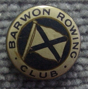
... BARWON ROWING CLUB MADE IN AUSTRALIA / ALFRED E.S. STOKES / Manufacturer of / Photographic reproduction, / colored Patriotic, Carnival, / & Campaign Buttons, Etc / 228 PITT STREET / SYDNEY...BARWON ROWING CLUB MADE IN AUSTRALIA / ALFRED E.S. STOKES / Manufacturer of / Photographic reproduction, / colored Patriotic, Carnival, / & Campaign Buttons, Etc / 228 PITT STREET / SYDNEY Badge ...Badge produced as a souvenir of the Barwon Rowing Club, and was possibly made for a regatta or carnival day.BARWON ROWING CLUB MADE IN AUSTRALIA / ALFRED E.S. STOKES / Manufacturer of / Photographic reproduction, / colored Patriotic, Carnival, / & Campaign Buttons, Etc / 228 PITT STREET / SYDNEYbarwon rowing club, sport -
 Ballarat Tramway Museum
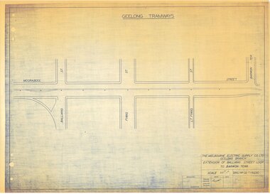
Document - GE-T1-6230, Melbourne Electric Supply Co. (MESCo), Extension of Balliang Street Loop to Barwon Terr, 1923
... Extension of Balliang Street Loop to Barwon Terr....MESco (Geelong Tramways) document GE-T1-6230; "Extension of Balliang Street Loop to Barwon Terr.". Drawn 23/02/1923. Beige paper copy of original dyeline print....MESco (Geelong Tramways) document GE-T1-6230; "Extension of Balliang Street Loop to Barwon Terr.". Drawn 23/02/1923. Beige paper copy of original dyeline print. ...Produced by Melbourne Electric Supply Company Limited (MESCo), Geelong Branch for the Geelong Tramways. No date on drawing, however other drawings in the sequence would indicate drawn in 1923.Print of a document showing in good detail a detailed plan for the extension of tramway including passing loop at Balliang Street.MESco (Geelong Tramways) document GE-T1-6230; "Extension of Balliang Street Loop to Barwon Terr.". Drawn 23/02/1923. Beige paper copy of original dyeline print.Copy of original dyeline print.geelong, geelong tramways, melbourne electric supply co. ltd., mesco geelong -
 Sunshine and District Historical Society Incorporated
Photograph - Sunshine North Photographs 2020, John Alchin, 2020
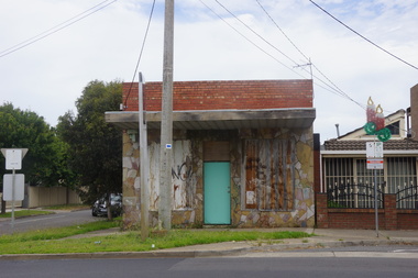
... Street...Northumberland Road...Warwick Road...Barwon...Sunshine North Berkshire Road Furlong Road McIntyre Road Metherall Street Northumberland Road Warwick Road Barwon avenue Maribyrnong Viaduct Suffolk Road Sunshine Band Hall Westend Market Hotel Dan Murphys Sunshine Harvester School Harvester Technical College 5609.01 - Berkshire Rd 49 Sunshine North 2020.JPG 5609.02 - Berkshire Rd 57 - 73 Sunshine North 2020.JPG 5609.03 - Furlong Rd 49 Sunshine North - Band Hall 2020 Photo 01.JPG 5609.04 - McIntyre Rd 55 - 63 Sunshine North 2020 Photo 01.JPG 5609.05 - McIntyre Rd 55 - 79 Sunshine North 2020 Photo 01.JPG 5609.06 - McIntyre Rd 63 - 73 Sunshine North 2020 Photo 01.JPG 5609.07 - McIntyre Rd 63 - 79 Sunshine North 2020 Photo 01.JPG 5609.08 - McIntyre Rd 69 - 79 Sunshine North 2020 Photo 01.JPG 5609.09 - McIntyre Rd 71 - 79 Sunshine North 2020 Photo 01.JPG 5609.10 - McIntyre Rd 81 - 93A Sunshine North 2020 Photo 03.JPG 5609.11 - McIntyre Rd 81 - 93A Sunshine North 2020 Photo 05.JPG 5609.12 - Metherall 57 - 61 Sunshine North - Shops 2020.JPG 5609.13 - Northumberland Rd 5 - 23C Sunshine North 2020 Photo 02.JPG 5609.14 - Northumberland Rd 23A - 23C Sunshine North 2020 Photo 01.JPG 5609.15 - Northumberland Rd 23B - 23C Sunshine North 2020 Photo 01.JPG 5609.16 - Northumberland Rd 55 - 71 Sunshine North 2020 Photo 01.JPG 5609.17 - Warwick Rd 66 - 76 Sunshine North 2020 Photo 01.JPG 5609.18 - Warwick Rd 66 - 76 Sunshine North 2020 Photo 02.JPG 5609.19 - Warwick Rd 66 - 78 Sunshine North 2020 Photo 01.JPG 5609.20 - Warwick Rd 66 - 86 Sunshine North 2020 Photo 01.JPG 5609.21 - Warwick Rd 86 Sunshine North 2020 Photo 01.JPG 5609.22 - Barwon Ave Sunshine North - Railway 2020 Photo 01.JPG 5609.23 - Maribyrnong Viaduct from Avondale Heights 2nd April 2020 Photo 05.JPG 5609.24 - Maribyrnong Viaduct from Avondale Heights 2nd April 2020 Photo 06.JPG 5609.25 - Suffolk Rd 15 - 21 North Sunshine 2020 Photo 01.JPG 5609.26 - Suffolk Rd 15 - 23 North Sunshine 2020 Photo 01.JPG 5609.27 - Suffolk Rd 23 North Sunshine 2020 Photo 01.JPG 5609.28 - Suffolk Rd 35 North Sunshine 2020 Photo 01.JPG 5609.29 - McIntyre Rd 47 Sunshine North - Westend Market Hotel (Former Wunderlich Tile) 2020 Photo 01.jpg 5609.30 - McIntyre Rd 47 Sunshine North - Dan Murphys (Former Wunderlich Tile) 2020 Photo 02.jpg 5609.31 - Suffolk Rd 9 Sunshine North - Sunshine Harvester School 7th March 2020 Photo 01.JPG 5609.32- Suffolk Rd 9 Sunshine North - Harvester Technical College 2nd March 2020 Photo 02.JPG 5609.33- Suffolk Rd 9 Sunshine North - Harvester Technical College 2nd March 2020 Photo 03.JPG Collection of digital photographs Photograph Sunshine North Photographs 2020 John Alchin ...These photographs provide a visual record of assorted buildings, street views, and notable locations throughout Sunshine North in 2020.This collection of photographs preserves a visual record of Sunshine North 2020.5609.01 - Berkshire Rd 49 Sunshine North 2020.JPG 5609.02 - Berkshire Rd 57 - 73 Sunshine North 2020.JPG 5609.03 - Furlong Rd 49 Sunshine North - Band Hall 2020 Photo 01.JPG 5609.04 - McIntyre Rd 55 - 63 Sunshine North 2020 Photo 01.JPG 5609.05 - McIntyre Rd 55 - 79 Sunshine North 2020 Photo 01.JPG 5609.06 - McIntyre Rd 63 - 73 Sunshine North 2020 Photo 01.JPG 5609.07 - McIntyre Rd 63 - 79 Sunshine North 2020 Photo 01.JPG 5609.08 - McIntyre Rd 69 - 79 Sunshine North 2020 Photo 01.JPG 5609.09 - McIntyre Rd 71 - 79 Sunshine North 2020 Photo 01.JPG 5609.10 - McIntyre Rd 81 - 93A Sunshine North 2020 Photo 03.JPG 5609.11 - McIntyre Rd 81 - 93A Sunshine North 2020 Photo 05.JPG 5609.12 - Metherall 57 - 61 Sunshine North - Shops 2020.JPG 5609.13 - Northumberland Rd 5 - 23C Sunshine North 2020 Photo 02.JPG 5609.14 - Northumberland Rd 23A - 23C Sunshine North 2020 Photo 01.JPG 5609.15 - Northumberland Rd 23B - 23C Sunshine North 2020 Photo 01.JPG 5609.16 - Northumberland Rd 55 - 71 Sunshine North 2020 Photo 01.JPG 5609.17 - Warwick Rd 66 - 76 Sunshine North 2020 Photo 01.JPG 5609.18 - Warwick Rd 66 - 76 Sunshine North 2020 Photo 02.JPG 5609.19 - Warwick Rd 66 - 78 Sunshine North 2020 Photo 01.JPG 5609.20 - Warwick Rd 66 - 86 Sunshine North 2020 Photo 01.JPG 5609.21 - Warwick Rd 86 Sunshine North 2020 Photo 01.JPG 5609.22 - Barwon Ave Sunshine North - Railway 2020 Photo 01.JPG 5609.23 - Maribyrnong Viaduct from Avondale Heights 2nd April 2020 Photo 05.JPG 5609.24 - Maribyrnong Viaduct from Avondale Heights 2nd April 2020 Photo 06.JPG 5609.25 - Suffolk Rd 15 - 21 North Sunshine 2020 Photo 01.JPG 5609.26 - Suffolk Rd 15 - 23 North Sunshine 2020 Photo 01.JPG 5609.27 - Suffolk Rd 23 North Sunshine 2020 Photo 01.JPG 5609.28 - Suffolk Rd 35 North Sunshine 2020 Photo 01.JPG 5609.29 - McIntyre Rd 47 Sunshine North - Westend Market Hotel (Former Wunderlich Tile) 2020 Photo 01.jpg 5609.30 - McIntyre Rd 47 Sunshine North - Dan Murphys (Former Wunderlich Tile) 2020 Photo 02.jpg 5609.31 - Suffolk Rd 9 Sunshine North - Sunshine Harvester School 7th March 2020 Photo 01.JPG 5609.32- Suffolk Rd 9 Sunshine North - Harvester Technical College 2nd March 2020 Photo 02.JPG 5609.33- Suffolk Rd 9 Sunshine North - Harvester Technical College 2nd March 2020 Photo 03.JPG sunshine north, berkshire road, furlong road, mcintyre road, metherall street, northumberland road, warwick road, barwon avenue, maribyrnong viaduct, suffolk road, sunshine band hall, westend market hotel, dan murphys, sunshine harvester school, harvester technical college -
 Sunshine and District Historical Society Incorporated
Photograph - Sunshine North Photographs 2023, John Alchin, 2023
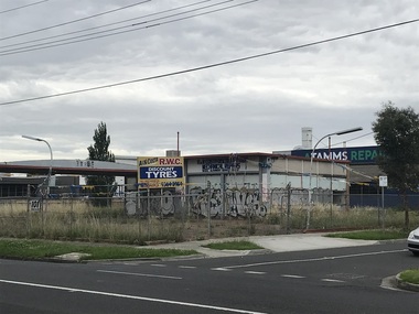
... street views, and notable locations throughout Sunshine North in 2023. This collection of photographs preserves a visual record of Sunshine North 2023. Sunshine North Gilmour Road McIntyre Road Railway Underpass Warwick Road 5632.01 - Gilmour Rd - Barwon Ave Sunshine North - Railway Underpass 2023 Photo 01.JPG 5632.02 - McIntyre Rd 101 Sunshine North - Former Service station 2023 Photo 01.JPG 5632.03 - McIntyre Rd 113 - 119 Sunshine North - Shops 2023 Photo 01.JPG 5632.04 - McIntyre Rd 113 - 131 Sunshine North - Shops 2023 Photo 01.JPG 5632.05 - McIntyre Rd 119 - 121 Sunshine North - Shops 2023 Photo 01.JPG 5632.06 - McIntyre Rd 129 - 131 Sunshine North - Shops 2023 Photo 01.JPG 5632.07 - McIntyre Rd 129 - 131 Sunshine North - Shops 2023 Photo 02.JPG 5632.08 - McIntyre Rd 133 - 137 Sunshine North - Shops 2023 Photo 01.JPG 5632.09 - McIntyre Rd 133 - 137 Sunshine North - Shops 2023 Photo 02.JPG 5632.10 - Warwick Rd 113 Sunshine North 2023 Photo 01.JPG Collection of digital photographs Photograph Sunshine North Photographs 2023 John Alchin ...These photographs provide a visual record of assorted buildings, street views, and notable locations throughout Sunshine North in 2023.This collection of photographs preserves a visual record of Sunshine North 2023.5632.01 - Gilmour Rd - Barwon Ave Sunshine North - Railway Underpass 2023 Photo 01.JPG 5632.02 - McIntyre Rd 101 Sunshine North - Former Service station 2023 Photo 01.JPG 5632.03 - McIntyre Rd 113 - 119 Sunshine North - Shops 2023 Photo 01.JPG 5632.04 - McIntyre Rd 113 - 131 Sunshine North - Shops 2023 Photo 01.JPG 5632.05 - McIntyre Rd 119 - 121 Sunshine North - Shops 2023 Photo 01.JPG 5632.06 - McIntyre Rd 129 - 131 Sunshine North - Shops 2023 Photo 01.JPG 5632.07 - McIntyre Rd 129 - 131 Sunshine North - Shops 2023 Photo 02.JPG 5632.08 - McIntyre Rd 133 - 137 Sunshine North - Shops 2023 Photo 01.JPG 5632.09 - McIntyre Rd 133 - 137 Sunshine North - Shops 2023 Photo 02.JPG 5632.10 - Warwick Rd 113 Sunshine North 2023 Photo 01.JPG sunshine north, gilmour road, mcintyre road, railway underpass, warwick road -
 Melbourne Tram Museum
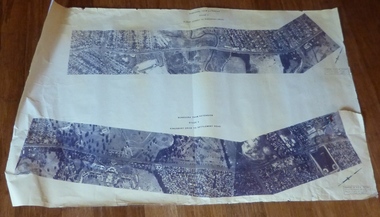
Drawing, Melbourne & Metropolitan Tramways Board (MMTB), Aerial photographs Bundoora Tram Extensions, Plenty Road – MMTB Drawings – 12/1979, Bundoora Extension – Metropolitan Transit Authority – 2/1983, John-Connell – Mott Hay and Anderson – Preliminary drawings for the Latrobe Modal Interchange – August 1984, 1979 to 1984
... Has written on rear at right hand end “Bundoora Tram Extension – Official MMTB Plans” 760H x 1190W Plenty Road – MMTB Drawings – 12/1979 P15123 Tyler St to Walsal Avenue P15124 Walsal Ave t McColl St P15125 McColl St to Dorrington Avenue Bundoora Extension – Metropolitan Transit Authority – 2/1983 P15400 Dorrington Avenue to Barwon Avenue P15401 Barwon Avenue to Nicholson Ave P15402 Nicholson St to Barling Park P15403 Barling Park to Darebin Creek P15404 Darebin Creek to Scott Grove P15405 Scott Grove to Clunes Street P15406 Clunes St to Cash St P15408 Cash St to Bundoora Park P15409 Bundoora Park to Larundel Hospital P15410 At Larundel Hospital P15411 Larundel Hospital to Marne Court P15412 Marne Court to Cherrywood Court P15413 Cherrywood Court to Morwell Ave P15414 Morwell Ave to Grimshaw St P15415 Grimshaw St to Nickson Street P15416 Nickson St to McLeans Road John-Connell – Mott Hay and Anderson – Preliminary drawings for the Latrobe Modal Interchange – August 1984. 8094-A-20 Set Out Plan and Paving Details 8094-A-21 Elevations 8094-A-22 Sections 8094-A-23 Roof Plan and Stormwater Layout 8094-A-24 Canopy Details 8094-A-25 Toilet Block and Waiting Room 8094-A-28 Miscellaneous Details...Has written on rear at right hand end “Bundoora Tram Extension – Official MMTB Plans” 760H x 1190W Plenty Road – MMTB Drawings – 12/1979 P15123 Tyler St to Walsal Avenue P15124 Walsal Ave t McColl St P15125 McColl St to Dorrington Avenue Bundoora Extension – Metropolitan Transit Authority – 2/1983 P15400 Dorrington Avenue to Barwon Avenue P15401 Barwon Avenue to Nicholson Ave P15402 Nicholson St to Barling Park P15403 Barling Park to Darebin Creek P15404 Darebin Creek to Scott Grove P15405 Scott Grove to Clunes Street P15406 Clunes St to Cash St P15408 Cash St to Bundoora Park P15409 Bundoora Park to Larundel Hospital P15410 At Larundel Hospital P15411 Larundel Hospital to Marne Court P15412 Marne Court to Cherrywood Court P15413 Cherrywood Court to Morwell Ave P15414 Morwell Ave to Grimshaw St P15415 Grimshaw St to Nickson Street P15416 Nickson St to McLeans Road John-Connell – Mott Hay and Anderson – Preliminary drawings for the Latrobe Modal Interchange – August 1984. 8094-A-20 Set Out Plan and Paving Details 8094-A-21 Elevations 8094-A-22 Sections 8094-A-23 Roof Plan and Stormwater Layout 8094-A-24 Canopy Details 8094-A-25 Toilet Block and Waiting Room 8094-A-28 Miscellaneous Details Aerial photographs Bundoora Tram Extensions, Plenty Road – MMTB Drawings – 12/1979, Bundoora Extension – Metropolitan Transit Authority – 2/1983, John-Connell – Mott Hay and Anderson – Preliminary drawings for the Latrobe Modal Interchange – August 1984. ...Set of drawings for the MMTB Plenty Road extension in 1979, MTA extension to Bundoora in 1983 and the Latrobe Uni Modal Interchange - 1984. Large print – Aerial photographs Bundoora Tram Extensions Stage 2 – Albert St to Kingsbury Drive Stage 3 – Kingsbury Drive to Settlement Road Has been rolled, left hand edge damaged, right hand edge torn Compiled by the ROW Division – 2/1981. Has written on rear at right hand end “Bundoora Tram Extension – Official MMTB Plans” 760H x 1190W Plenty Road – MMTB Drawings – 12/1979 P15123 Tyler St to Walsal Avenue P15124 Walsal Ave t McColl St P15125 McColl St to Dorrington Avenue Bundoora Extension – Metropolitan Transit Authority – 2/1983 P15400 Dorrington Avenue to Barwon Avenue P15401 Barwon Avenue to Nicholson Ave P15402 Nicholson St to Barling Park P15403 Barling Park to Darebin Creek P15404 Darebin Creek to Scott Grove P15405 Scott Grove to Clunes Street P15406 Clunes St to Cash St P15408 Cash St to Bundoora Park P15409 Bundoora Park to Larundel Hospital P15410 At Larundel Hospital P15411 Larundel Hospital to Marne Court P15412 Marne Court to Cherrywood Court P15413 Cherrywood Court to Morwell Ave P15414 Morwell Ave to Grimshaw St P15415 Grimshaw St to Nickson Street P15416 Nickson St to McLeans Road John-Connell – Mott Hay and Anderson – Preliminary drawings for the Latrobe Modal Interchange – August 1984. 8094-A-20 Set Out Plan and Paving Details 8094-A-21 Elevations 8094-A-22 Sections 8094-A-23 Roof Plan and Stormwater Layout 8094-A-24 Canopy Details 8094-A-25 Toilet Block and Waiting Room 8094-A-28 Miscellaneous DetailsOn rear of aerial photograph sheet - at right hand end “Bundoora Tram Extension – Official MMTB Plans” in felt pen.trams, tramways, plenty rd, bundoora, latrobe university, mmtb, construction, mta
