
Showing 301 items matching "gold reserve"
-
 Clunes Museum
Booklet, ALAN AND CHERYL JUST, ALL THAT GLISTENS
... JOHN ANDERSON AND THE SMEATON RESERVE GOLD MINE 1881 TO 1890 WITH PHOTOGRAPHS MAPS AND DESCRIPTION. 23 PAGES COMPILED BY CHERYL AND ALAN JUST......SMEATON RESERVE GOLD...MAPS AND DESCRIPTION SQUARE STICKER ON FRONT: NOT FOR SALE FIRST PAGE SIGNED BY CHERYL JUST AND ALAN JUST JOHN ANDERSON AND THE SMEATON RESERVE GOLD MINE 1881 TO 1890 WITH PHOTOGRAPHS MAPS AND DESCRIPTION. 23 PAGES COMPILED BY CHERYL AND ALAN JUST ALL THAT GLISTENS Booklet BOOKLET ALAN AND CHERYL JUST SMEATON RESERVE GOLD ...REPORT ON JOHN ANDERSON AND THE SMEATON GOLD MINE IN 1881 TO 1890 WITH PHOTOGRAPHS. MAPS AND DESCRIPTIONJOHN ANDERSON AND THE SMEATON RESERVE GOLD MINE 1881 TO 1890 WITH PHOTOGRAPHS MAPS AND DESCRIPTION. 23 PAGES COMPILED BY CHERYL AND ALAN JUSTnon-fictionREPORT ON JOHN ANDERSON AND THE SMEATON GOLD MINE IN 1881 TO 1890 WITH PHOTOGRAPHS. MAPS AND DESCRIPTIONsmeaton reserve goldmine, cheryl and alan just, john anderson -
 Bendigo Historical Society Inc.
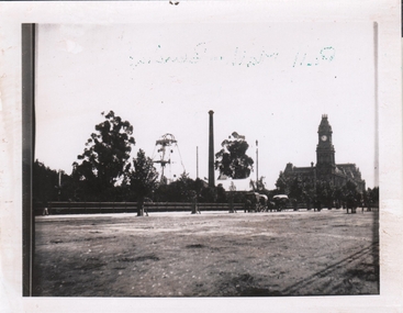
Photograph - HUSTLER'S ROYAL RESERVE GOLD MINE, ROSALIND PARK, BENDIGO
... HUSTLER'S ROYAL RESERVE GOLD MINE, ROSALIND PARK, BENDIGO...Image shows poppet head and chimney of Hustler's Royal Reserve Gold Mine, Rosalind Park, Bendigo. Oh RH side, Post Office building with clock tower. ...Photograph HUSTLER'S ROYAL RESERVE GOLD MINE, ROSALIND PARK, BENDIGO ...Black and white photo, copy. Image shows poppet head and chimney of Hustler's Royal Reserve Gold Mine, Rosalind Park, Bendigo. Oh RH side, Post Office building with clock tower. Horse drawn vehicles in foreground parked alongside fence.bendigo, mining, hustler's royal reserve mine -
 Bendigo Historical Society Inc.
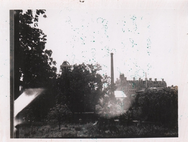
Photograph - HUSTLER'S ROYAL RESERVE (PARK) GOLD MINE BENDIGO
... HUSTLER'S ROYAL RESERVE (PARK) GOLD MINE BENDIGO...Image shows chimney and top of poppet head of Hustler's Royal Reserve Gold Mine, on boundary of (now) Rosalind Park, Bendigo. ...Image shows chimney and top of poppet head of Hustler's Royal Reserve Gold Mine, on boundary of (now) Rosalind Park, Bendigo. ...Black and white photograph, poor quality. Image shows chimney and top of poppet head of Hustler's Royal Reserve Gold Mine, on boundary of (now) Rosalind Park, Bendigo. Shamrock Hotel visible in RH background of photo.bendigo, mining -
 Bendigo Historical Society Inc.
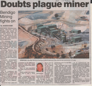
Newspaper - Kangaroo Flat Gold Mine Collection: Bendigo Mining N.L, Bendigo Advertiser, 1999, 2001
... ...gold reserve...Bendigo mining gold Douglas Buerger Steve Bracks gold reserve Two newspaper articles: 1. ' Doubts plague miner, Bendigo Mining fights on', Bendigo Advertiser, 17 October 2006. ...Two newspaper articles: 1. ' Doubts plague miner, Bendigo Mining fights on', Bendigo Advertiser, 17 October 2006. Aerial photo of photo of Bendigo Mining plant, right hand side of article. Article discusses the uncertainty being faced by Bendigo Mining. Gold was not found in the expected concentrations. 2. 'Gold shortfall', Bendigo Advertiser, 21 October 2006. Photo of 'Steve Bracks and Bendigo Mining Managing Director Doug Buerger during the official opening of the mine yesterday' on top of article. '35 - 45 per cent less gold than previously forecast' would be produced at the mine. bendigo mining n.l., bendigo, mining, gold, douglas buerger, steve bracks, gold reserve -
 Bendigo Historical Society Inc.
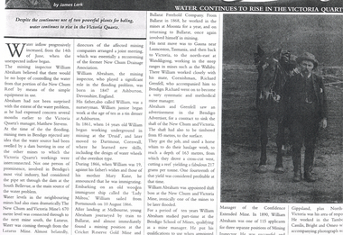
Newspaper - LONG GULLY HISTORY GROUP COLLECTION: WATER CONTINUES TO RISE IN THE VICTORIA QUARTZ
... ... Cricket Reserve Gold Mine...BENDIGO History long gully history group The Long Gully History Group - Water Continues to Rise in the Victoria Quartz James Lerk William Abraham New Chum Reef Matthew Stevens South Bellevue New Chum and Victoria Mine Lazarus Mine New Chum Drainage Association William Abraham Snr Mary Kane Lady Miltoa (Ship) Cricket Reserve Gold Mine Ballarat Freehold Company Wallaby Mine Richard Grenfell Bendigo Advertiser Bendigo School of Mines Confidence Extended Mine Photo of a newspaper article titled Water Continues to Rise in the Victoria Quartz by James Lerk. ...Photo of a newspaper article titled Water Continues to Rise in the Victoria Quartz by James Lerk. Article mentions William Abraham who was the mining inspector, who played a significant role in the flooding problem. Water levels had risen dramatically. Water flowed from one mine to another where they were connected. Article also mentions Abraham's birthplace, his early start to work at the age of 10 as a tin dresser at Ashburton, Devonshire, England and his working life after he migrated to Australia at the age of 19. His career in Australia is also mentioned. The article is accompanied by a photo of Abraham with his horse.bendigo, history, long gully history group, the long gully history group - water continues to rise in the victoria quartz, james lerk, william abraham, new chum reef, matthew stevens, south bellevue, new chum and victoria mine, lazarus mine, new chum drainage association, william abraham snr, mary kane, lady miltoa (ship), cricket reserve gold mine, ballarat freehold company, wallaby mine, richard grenfell, bendigo advertiser, bendigo school of mines, confidence extended mine -
 Bendigo Historical Society Inc.
Slide - ALBERT RICHARDSON COLLECTION: HUSTLERS ROYAL RESERVE NO. 2 GOLD MINE
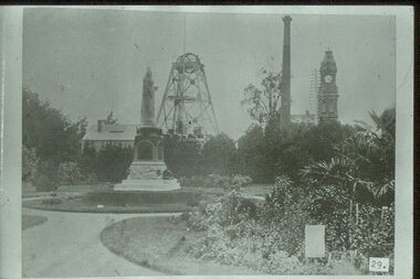
... ALBERT RICHARDSON COLLECTION: HUSTLERS ROYAL RESERVE NO. 2 GOLD MINE...Gold...hustlers royal reserve no.2....Hustlers Royal Reserve No.2 Gold Mine. Image taken in early 1900's. ...MINE Gold hustlers royal reserve no.2. Bendigo Mines-Jack Hattam Collection. ...Slide. Hustlers Royal Reserve No.2 Gold Mine. Image taken in early 1900's. Mine was sited where the RSL building in Pall Mall is now located. Poppet head in background, Queen Victoria Statue in foreground, brick chimney on RH side and Post Office clock tower extreme right. Gardens in foreground. Photo taken fro 'Healthy Golden Bendigo' book.No. 29 printed on bottom of slidemine, gold, hustlers royal reserve no.2., bendigo mines-jack hattam collection. -
 Bendigo Historical Society Inc.
Slide - ALBERT RICHARDSON COLLECTION: FORTUNA HUSTLERS GOLD MINE
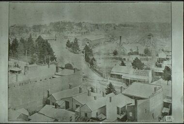
... Gold...fortuna hustlers(railway reserve)...Fortuna Hustlers Gold Mine ( Railway Reserve), right of centre, railway goods shed and railway station at top of image.Mitchell and Mollison Streets and Railway Place in image. ...Fortuna Hustlers Gold Mine ( Railway Reserve), right of centre, railway goods shed and railway station at top of image.Mitchell and Mollison Streets and Railway Place in image. ...Slide. Fortuna Hustlers Gold Mine ( Railway Reserve), right of centre, railway goods shed and railway station at top of image.Mitchell and Mollison Streets and Railway Place in image. Shop in Mitchell Street has 'F. Futterer', printed above verandah.No. 28 printed on bottom of slidemine, gold, fortuna hustlers(railway reserve), bendigo mines-jack hattam collection -
 The Beechworth Burke Museum
Photograph
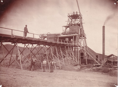
... Ultimately, the accessibility and availability of gold and precious metals decreased once the gold reserves dried up and alongside this, the large population moved away. ...Ultimately, the accessibility and availability of gold and precious metals decreased once the gold reserves dried up and alongside this, the large population moved away. ...This photograph depicts four men standing near a large unidentified building. This building is the entrance to a deep lead mine shaft. There is a bridge entering the building, which was used to access the elevator to the shaft. Deep lead mining involved placing large shafts into the ground which miners use to access deeper locations in order to excavate the rocks in the search for lead. Deep lead mining was highly dangerous as roofs could cave in of the soil was loose. Therefore, this particular mining considered to be highly undesirable profession as many miners did not want to work long hours nor risk their lives in the search for lead. Indigo Shire was a large area where deep lead mining took place, and thus the landscape and environment was largely impacted by these mining businesses. The Indigo Shire grew in population and wealth in the early 1850s when people came into this location in the hopes of finding gold and making a fortune. Ultimately, the accessibility and availability of gold and precious metals decreased once the gold reserves dried up and alongside this, the large population moved away. The Ovens was also heavily impacted environmentally as deep mining resulted in the change in land formation.The search for gold is ingrained into the history of Victoria and therefore, images like this one which portray an open cut sluicing site can reveal important information for society and technology for the date when the photograph was taken. This image is of important historical significance for its ability to convey information about the methods used to find gold in Indigo Shire. It also shows a location where deep mining was undertook which provides insight into the impact of deep mining on the environment at a time when it was done. This image is important for current research into the history of Indigo Shire, a region in Victoria's north-east. Therefore, this image has the capacity to be beneficial for research into society and the motivations of those living and working in this region during this period and therefore, has social significance. The Beechworth Burke Museum has additional images relating to deep lead mining and Indigo Shire which can be analysed and studied alongside images like this one.Sepia coloured retangular photo printed on gloss photographic paper.Reverse: 1997.2510/ A02510/ Deep Lead Mining/ page 94/ 65%/ Burke Museum, Photo 44beechworth, burke museum, indigo shire, deep lead mining, mining, gold, gold mining -
 Federation University Historical Collection
Plan, Creswick, Parish of Creswick, County of Talbot, 1928, 1928
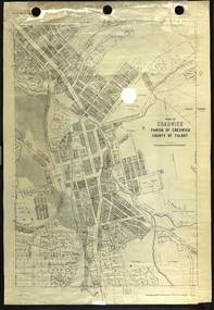
... Parish Plan of Creswick showing Slaty Creek, Old Gold Workings, Police Reserve, Railway Station, Public Gardens, Sawpit Gully, Hospital Reserve, Nigh Soil Depot, Eureka Terracotta Tile COmpany, Creswick Creek, Forest COmmission, Roycroft's Race...creswick Eureka Terracotta Tile Co parish plan Parish Plan of Creswick showing Slaty Creek, Old Gold Workings, Police Reserve, Railway Station, Public Gardens, Sawpit Gully, Hospital Reserve, Nigh Soil Depot, Eureka Terracotta Tile COmpany, Creswick Creek, Forest COmmission, Roycroft's Race Creswick, Parish of Creswick, County of Talbot, 1928 Plan Plan Department of Lands and Survey ...Parish Plan of Creswick showing Slaty Creek, Old Gold Workings, Police Reserve, Railway Station, Public Gardens, Sawpit Gully, Hospital Reserve, Nigh Soil Depot, Eureka Terracotta Tile COmpany, Creswick Creek, Forest COmmission, Roycroft's Racecreswick, eureka terracotta tile co, parish plan -
 Bendigo Historical Society Inc.
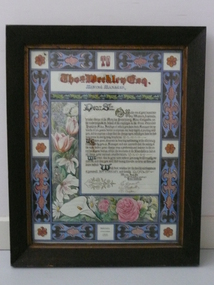
Award - THOMAS WEEKLEY COLLECTION: ILLUMINATED ADDRESS, 1895
... The accident is commemorated at the Hustlers Reef Gold Mining Reserve, Bendigo, on the former site of the mine. ...The accident is commemorated at the Hustlers Reef Gold Mining Reserve, Bendigo, on the former site of the mine. ...The illuminated address given to Thomas Weekley on his retirement from the Great Extended Hustlers Gold Mine, was presented to the Bendigo Historical Society by a descendant of Thomas in 2014, during a commemoration of the Great Extended Hustlers mine accident of 1914, where seven men were killed. The mine disaster occurred on May 2, 1914, when a dynamite explosion killed seven miners waiting at a plat to ascend the mine. The exact cause of the explosion was unknown, and the subsequent inquiry found no one to blame. The accident is commemorated at the Hustlers Reef Gold Mining Reserve, Bendigo, on the former site of the mine. Illuminated address presented to Thomas Weekley mine manager of The Great Extended Hustlers Mine Bendigo 14th November 1895, on his departure from the mine to take up a position in Coolgardie. Brown timber frame with gold borders and decorated with colourful Victorian blue and brown decoration. Inside this is flowers and foliage include pink roses, lilies, irises. Address states: "Dear Sir, on the eve of your departure to Western Australian to take charge of the Menzies Proprietary Mine, Coolgardie, we the undersigned on behalf of the employees of the Great extended Hustlers Mine, Bendigo of which you have been manager for upwards of ten years, desire to express our deep regret at the parting with you and to express a hope that the change upon which you have decided may provide in every way beneficial. WE have great pleasure in bearing testimony to the efficiency displayed by you as manager and are assured that the safety of the men under your duties, whist the interest of the shareholders had at all times your earnest consideration. We trsut that in your new sphere you may be thoroughly successful and that you will find many friends as true as those who you leave behind . With the best wishes for the health and happens of yourself, Mrs Weekley and family. We are, dear friends (on behalf of fellow employees) yours faithfully, E Guest, T Redpath, R Cooper.mining, thomas weekley, great extended hustlers gold mine, bendigo, hustlers hill, mine manager -
 Whitehorse Historical Society Inc.
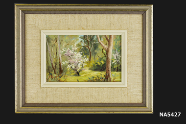
Painting - Oil Painting in frame (one of a set of 4), Yarran Dheren '88, 1988
... Outer frame of brown wood with gold trim. Yarran Dheren Reserve is located in Mitcham....Reserve, Mitcham by Whitehorse Historical Society member, Barbara Rogalski. One of a set of 4 paintings. Painting Yarran Dheren Barbara Rogalski Yarran Dheren '88 Barbara Rogalski. Small oil painting of bushland with bush of pink & white blossom in foreground. Mounted in beige cotton fabric with inner beige plastic frame. Outer frame of brown wood with gold ...Painting of Yarran Dheren Reserve, Mitcham by Whitehorse Historical Society member, Barbara Rogalski. One of a set of 4 paintings.Small oil painting of bushland with bush of pink & white blossom in foreground. Mounted in beige cotton fabric with inner beige plastic frame. Outer frame of brown wood with gold trim. Yarran Dheren Reserve is located in Mitcham.Yarran Dheren '88 Barbara Rogalski.painting, yarran dheren, barbara rogalski -
 Bendigo Historical Society Inc.
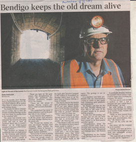
Newspaper - Kangaroo Flat Gold Mine Collection: Bendigo Mining N.L, Bendigo Advertiser, 21.10.2006
... Article discusses the consequences of Bendigo Mining over estimating the recovery of its gold grades. Cash reserves, investment and future possibilities are explored by Rod Hanson in the context of the poorer than expected results. ...Article discusses the consequences of Bendigo Mining over estimating the recovery of its gold grades. Cash reserves, investment and future possibilities are explored by Rod Hanson in the context of the poorer than expected results. ...'Bendigo keeps the old dream alive' Australian newspaper, 9 July 2007. Photo on top of article shows Rod Hanson inside the Kangaroo Flat gold mine entry to the Swan decline. Article discusses the consequences of Bendigo Mining over estimating the recovery of its gold grades. Cash reserves, investment and future possibilities are explored by Rod Hanson in the context of the poorer than expected results. bendigo mining n.l., bendigo, mining, gold, douglas buerger, mine opening, rod hanson, garden gully reef, sheepshead reef, deborah reef, grenfell reef, portal, swan decline -
 Federation University Historical Collection
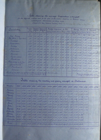
Book, Victorian Government Legislative Assembly, The Select Committee on Castlemaine and Sandhurst water supply, Report from the Select Committee on Castlemaine and Sandhurst Water Supply, together with the proceedings of the Committee, minutes of evidence and appendices, 19/5/1865 (exact)
... Gold Fields in 1866 - includes districts to be supplied under the Waterworks Act, 1965. It also includes: *Report of the Engineer-in-chief of Railways and Reply of the Chief Engineer of Water Supply on the works constructed by the Victorian Water Supply Department, 1869. * Coliban Water Scheme, 1864 * Ballarat and Ballarat East Water Supply (1869) including the Ballarat Water Supply List containing names of occupiers and nature of improvements on lands comprised within the proposed reserve of Gong Gong Reservoir, Ballaarat. ...Gold Fields in 1866 - includes districts to be supplied under the Waterworks Act, 1965. It also includes: *Report of the Engineer-in-chief of Railways and Reply of the Chief Engineer of Water Supply on the works constructed by the Victorian Water Supply Department, 1869. * Coliban Water Scheme, 1864 * Ballarat and Ballarat East Water Supply (1869) including the Ballarat Water Supply List containing names of occupiers and nature of improvements on lands comprised within the proposed reserve of Gong Gong Reservoir, Ballaarat. ...This book contains the report from the select committee on Castlemaine and Sandhurst water supply; with the proceedings of the committee, minutes of evidence and appendices. It also contains the report Of the Engineer-In-Chief of Railways, and reply of the Chief Engineer of Water Supply on the works constructed by the Victorian Water Supply Department, presented to both houses of parliament by His Excellency’s command. Ferdinand M. Krause, was a lecturer at the Ballarat School of Mines in Geology Mineralogy Mining Engineering and Surveying. He was a Fellow of the Geological Society and a Fellow of the Linnian Society. He was assistant engineer for the Ballaarat and Ballarat East Water Supply Committee and helped plan local reservoirs.A brown cloth hard cover, foolscap book with leather spine. Title is written in black on the title page. "Water Supply Reports" is engraved in gold on spine. It includes a table showing the monthly and yearly rainfall and shade temperature at Ballarat, 2nd February, 1885. It also includes two reports and two replies, a map No.7082.2 of Victorian Water Supply, Castlemaine and Sandhurst district general plan including lines of Aqueduct, Reservoirs. No. 7082.3 of Victorian Mining districts, Mining Divisions and The Gold Fields in 1866 - includes districts to be supplied under the Waterworks Act, 1965. It also includes: *Report of the Engineer-in-chief of Railways and Reply of the Chief Engineer of Water Supply on the works constructed by the Victorian Water Supply Department, 1869. * Coliban Water Scheme, 1864 * Ballarat and Ballarat East Water Supply (1869) including the Ballarat Water Supply List containing names of occupiers and nature of improvements on lands comprised within the proposed reserve of Gong Gong Reservoir, Ballaarat. At Warrenheip the names included: Honora McCallin, William Honan, C. McMahon, Patrick McMahon, J.P. Beach, J.H. Smith, Michael Nestor, Martin Quinn, Martin McIntyre, Robert Higgins, Coleman Kane, Robert Bond. At Ballarat: William Clarke, Richard White, John Hosking, Wesleyan Chapel, J. Hewitt, Robert McRobinson. At Bungaree: John Pullin, John Llewellyn. William Daw, Smith and Wynne, William Brough, A. Alexander. * Ballarat and Ballaarat East Water Supply report upon the advisability, or otherwise, of constructing a reservoir at the junction of the Yarrowee Creek and Gile's Creek, upon a site known as Gile's Reservoir (printed by Frank Pinkerton). This report has numerous notes written on it (most probably by Krause) and includes the capacity of Harry Beale's Reservoir, Pimcott's Reservoir and the Proposed Gong Gong Reservoir. * Statement as to the position of the Ballaarat and Ballaarat East Borough Councils in Connection with Water Supply, September 1869. * Ballarat and Ballaarat East Water Supply - General Statement upon the Ballaarat and Ballaarat east Scheme of Water Supply. Includes information on Moorabool reservoir, Harry Beale's Reservoir, Lal Lal Creek, Two Mile Creek, Beale's Dam, Yarrowee Creek, Gong Gong Reservoir, Kirk's Dam, Devil's Creek, Moorabool Creek. Additional handwritten notes (probably by Krause) * Engineer's Report on the resolution of the COmmittee of Water Supply, of the 7th July 1868. The report refers to the Country around Mount Warrenheip. Names mentioned are L. Abraham, Great North-West Gold Mining Company, Border Sawmills, Ferdinand Krause, Ohlfsen Bagge, W.H. Shaw, A signature by "Ferdinand M. Krause" at the top corner of the title page. A few pages have handwriting on the margins, it is believed to be his handwriting. water supply victoria, castlemaine directories, sandhurst directories, ballarat directories, james blackburn, edward wardle, daylesford water race, c j taylor, george avery fletcher, bagge, ohlfsen bagge, george foote, john h reilly, ambrose johnson, george francis, timber preservation, james forbes, alfred surplice, malcolm carmichael, robert adams, frederick hugh thomas, h o christerpherson, william downe, thomas lawrence brown, francis hadgson nixon, strangways, guildford, maldon, muckleford, lauriston, malmesbury, franklinford, walmer, strathloddon, downe, ferdinand krause, m7082, trentham, castlemaine, drummond, metcalfe, sutton grange, lockwood, ravenswood, mandurang, yandoit, c.h. ohlfsen bagge, moorabool reservoir, gong gong reservoir, harry beale's reservoir, pincott reservoir, frank pinkerton, water -
 Federation University Historical Collection
Book, Shire of Ballarat, 1963, 1963
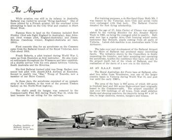
... gold memorial...miners rest reticulated water...australian timken...ballarat airport...joe white maltings...franklin caravans...kirk's reservoir...white swan reservoir...electricity...lucas...unilever australia...ballarat gas company...coronet caravans...lindsay gunn...martin stoneware...w. r. walton...m.b. john...ballarat agricultural and pastoral society...planning scheme...webcona estate...brown's heavy haulage...ballarat mental hospital...alfredton pre-school centre...wendouree recreaton reserve...ballarat shire shire of ballarat c.e. brown learmonth sire hall gold memorial miners rest reticulated water australian timken ballarat airport joe white maltings franklin caravans kirk's reservoir white swan reservoir electricity lucas unilever australia ballarat gas company coronet caravans lindsay gunn martin stoneware w. r. walton m.b. john ballarat agricultural and pastoral society planning scheme webcona estate brown's heavy haulage ballarat mental hospital alfredton pre-school centre wendouree recreaton reserve wendouree pre-school wendouree youth club corporation saleyards arch of victory lake burrumbeet perry park ballarat high school wendouree west state school ewing house ballarat grammar school ballarat teachers' college learmonth presbyterian church st mathew's wendouree st mary's redemptorist monastery norm doodt pre-mixed concrete wendouree bowls club ballarat shire councillors rex hollioake david baird thomas ford william troup wilfred hirst charles brown charles giot william walton david powell john pemberton hugh patterson alexander mcdonald edward edwards james mitchell White covered book with multiple images. ...White covered book with multiple images.ballarat shire, shire of ballarat, c.e. brown, learmonth sire hall, gold memorial, miners rest reticulated water, australian timken, ballarat airport, joe white maltings, franklin caravans, kirk's reservoir, white swan reservoir, electricity, lucas, unilever australia, ballarat gas company, coronet caravans, lindsay gunn, martin stoneware, w. r. walton, m.b. john, ballarat agricultural and pastoral society, planning scheme, webcona estate, brown's heavy haulage, ballarat mental hospital, alfredton pre-school centre, wendouree recreaton reserve, wendouree pre-school, wendouree youth club, corporation saleyards, arch of victory, lake burrumbeet, perry park, ballarat high school, wendouree west state school, ewing house, ballarat grammar school, ballarat teachers' college, learmonth presbyterian church, st mathew's wendouree, st mary's redemptorist monastery, norm doodt, pre-mixed concrete, wendouree bowls club, ballarat shire councillors, rex hollioake, david baird, thomas ford, william troup, wilfred hirst, charles brown, charles giot, william walton, david powell, john pemberton, hugh patterson, alexander mcdonald, edward edwards, james mitchell -
 Federation University Historical Collection
Map, Municipality of Ballarat East, 1857
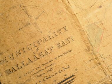
... gold locations of Ballarat East. It also shows the locality of the Eureka Stockade (1854) and the walking tracks and roads on the Ballarat East Goldfield. In 2007 this map was listed on the inaugural Ballarat Treasure's Register. mount pleasant golden point white flat nightingale malekoff old post office hill red streak gumtree flat old gravelpits bakery hill ballaarat flat the camp specimen gully pennyweight hill warrenheip gully gays gully pennyweight flat eureka black hill pinchgut crocodile hit or miss little bendigo brown hill mopoke cricket reserve canadian hotel ballarat eastm phillips john phillips field draughtsman ballarat east ballarat east map Large map backed onto linen. ...Gold was discovered in Ballarat in 1851. This plan was created six years later and names some of the great gold locations of Ballarat East. It also shows the locality of the Eureka Stockade (1854) and the walking tracks and roads on the Ballarat East Goldfield.In 2007 this map was listed on the inaugural Ballarat Treasure's Register.Large map backed onto linen. The map has read and blue highlights, and identifies areas such as Mount Pleasant, Golden Point, White Flat, Nightingale, Malekoff, Old Post Office Hill, Red streak, Gumtree Flat, Old Gravelpits, Bakery Hill, Ballaarat Flat, The Camp, Specimen Gully, Pennyweight Hill, Warrenheip Gully, Gays Gully, Pennyweight Flat, Eureka, Black Hill, Pinchgut, Crocodile, Hit or Miss, Little Bendigo, Brown Hill, Mopoke, Cricket Reserve, Canadian Hotel, Ballarat Eastmount pleasant, golden point, white flat, nightingale, malekoff, old post office hill, red streak, gumtree flat, old gravelpits, bakery hill, ballaarat flat, the camp, specimen gully, pennyweight hill, warrenheip gully, gays gully, pennyweight flat, eureka, black hill, pinchgut, crocodile, hit or miss, little bendigo, brown hill, mopoke, cricket reserve, canadian hotel, ballarat eastm phillips, john phillips, field draughtsman, ballarat east, ballarat east map -
 Federation University Historical Collection
Plan, Ballaarat East Town Allotments, 1891, 18/09/1891
... The streets developed along gold leads and early tracks. The Public Park Botanic Gardens and Recreation Reserve is now Mount Xavier Golf Course, and Ballarat Secondary College Eastern Campus. ...The streets developed along gold leads and early tracks. The Public Park Botanic Gardens and Recreation Reserve is now Mount Xavier Golf Course, and Ballarat Secondary College Eastern Campus. ...Ballarat East was historically a separate municipality than Ballaarat. The streets developed along gold leads and early tracks. The Public Park Botanic Gardens and Recreation Reserve is now Mount Xavier Golf Course, and Ballarat Secondary College Eastern Campus. The section with Bettle's Private Property is now Saint Francis Xavier Primary School. Elford Street now appears to be the continuation of Eureka Street.Plan of Town Allotments for a portion of Ballarat East in the County of Grant. It shows Victoria Street, Clifford Street, Finlay Street, Ryan Street, Bradbury Street, Elford Street, Fussell Street, Jones Street, Park Parade, Ballarat -Geelong Railway, Eureka Street, Ballarat East Public Park Botanic Garden and Recreation Reserve. The only allotment names is Bettle's Private Property. Gift of the Squire Family, 2014ballarat east, ballaarat east, victoria street, ballarat east botanical gardens, richard squire, squire, ryan street, jones street, bradbury street, humffray steet, fussell street, elford street -
 Federation University Historical Collection
Map, Ballaarat Gold Field, 1861, 21/10/1861
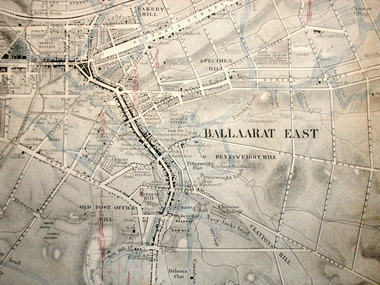
... reserve...survey corps...white flat...yarrowee...yarrowee creek...brache...j. brache...survey...ballaarat gold...reserves. It was compiled and drawn from the surveys of Mining Surveyors Davidson, Fitzpatrick and Cowan. Ballaarat Gold ...A party of surveyors camped by Yuille's Swamp (later Lake Wendouree) and surveyed the countryside for a map to be produced by the Geological Survey of Victoria. In November 2004 the Central Highlands Regional Library presented a special edition of 200 copies of the 1861 map reproduced from a copy in their collection. Original geological map of Ballarat showing property, waterways, mines, churches, schools, water races, and garden reserves. It was compiled and drawn from the surveys of Mining Surveyors Davidson, Fitzpatrick and Cowan.Compiled & Drawn from the Survey of Mining Surveyors Davidson, Fitzpatrick and Cowan & the Plans in the Surveyor General's Office by J. Brahe, 21st October 1861. R. Brough Smyth, Secretary for Mines. The Honourable J.B. Humffray, M.L.A. Commr of Mines.ballarat, map, davidson, robert brough-smyth, fitzpatrick, cowan, yuille's swamp, public garden reserve, manure depot, black hill, ballarat east, old post office hill, pennyweight hill, claytons hill, golden point, mining, railway, cricket ground, swamp creek, cemetery, sludge reserve, bakery hill, gaelic church, juvenile reformatory, orphanage, specimen hill, eureka lead, cattle yard hill, dalton's flat, chinese village, poverty hill, railway reserve, little bendigo diggings, pound reserve, allied armies, flour mill, agricultural reserve, marsh, survey reserve, survey corps, white flat, yarrowee, yarrowee creek, brache, j. brache, survey, ballaarat gold field 1861 -
 Federation University Historical Collection
Map, Ballaarat Gold Field, 1861, 1861
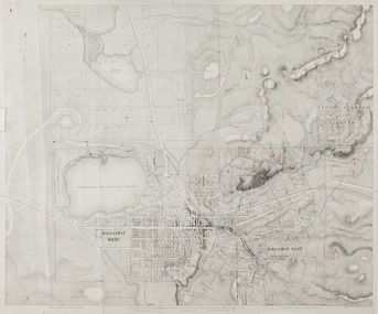
... gold leads...old post office hill...specimen hill...bakery hill...black hill...dead horse creek...brown hill...pennyweight hill...clayton hill...soldiers hill...golden point...gum tree flat...white flat...poverty hill...chinese village...robert brough smyth...Ballarat map 1861...Ballaarat Vineyard...Dead Horse Gully...Deadhorse Creek...Invermay...Black Hill Flat...Gaelic Church...Police Reserve...In November 2004 the Central Highlands Regional Library presented a special edition of 200 copies of the 1861 map reproduced from a copy in their collection. ballarat map ballarat east lake wendouree survey mines robert davidson ballarat gold field 1861 yuille's swamp wendouree swamp little bendigo diggings gold leads old post office hill specimen hill bakery hill black hill dead horse creek brown hill pennyweight hill clayton hill soldiers hill golden point gum tree flat white flat poverty hill chinese village robert brough smyth Ballarat map 1861 Ballaarat Vineyard Dead Horse Gully Deadhorse Creek Invermay Black Hill Flat Gaelic Church Police Reserve Magpie Range Dalton's Flat Caadian Lead Rifle Butts Powder Magazine Bathing House Government Camp Gold Office Chinese Llanberrris Victoria Theatre Charlie Napier Hotel United States Hotel Grape's Hoel Clayton's Hill Cattleyard Hill Free Trade Hotel Esmond Lead Bakery Hill Black Hill Lead Juvenile Reformatory Ballarat Orphanage Lady Barkly Lead Triffet's Slaughter Yard Little Bendigo Melbourne Road T. ...A party of surveyors camped by Yuille's Swamp (later Lake Wendouree) and surveyed the countryside for a map to be produced by the Geological Survey of Victoria. In November 2004 the Central Highlands Regional Library presented a special edition of 200 copies of the 1861 map reproduced from a copy in their collection. Original 1861 map of Ballarat showing streets and leads. Blue dots indicate gold leads, and red lines indicate auriferous quartz reef and outcrops of quartz veins."Compiled & Drawn from the Survey of Mining Surveyors Davidson, Fitzpatrick and Cowan & the Plans in the Surveyor General's Office by J. Brahe, 21st October 1861. R. Brough Smyth, Secretary for Mines. The Honourable J.B. Humffray, M.L.A. Commr of Mines.”ballarat, map, ballarat east, lake wendouree, survey, mines, robert davidson, ballarat gold field 1861, yuille's swamp, wendouree swamp, little bendigo diggings, gold leads, old post office hill, specimen hill, bakery hill, black hill, dead horse creek, brown hill, pennyweight hill, clayton hill, soldiers hill, golden point, gum tree flat, white flat, poverty hill, chinese village, robert brough smyth, ballarat map 1861, ballaarat vineyard, dead horse gully, deadhorse creek, invermay, black hill flat, gaelic church, police reserve, magpie range, dalton's flat, caadian lead, rifle butts, powder magazine, bathing house, government camp, gold office, chinese, llanberrris, victoria theatre, charlie napier hotel, united states hotel, grape's hoel, clayton's hill, cattleyard hill, free trade hotel, esmond lead, bakery hill, black hill lead, juvenile reformatory, ballarat orphanage, lady barkly lead, triffet's slaughter yard, little bendigo, melbourne road, t. cowan, thomas cowan -
 Federation University Historical Collection
Map, Ballarat Goldfield, c1898
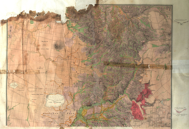
... reserve...Winter's swamp...Kneeshar Co...Monte Cristo line of reef...Chinaman's Gully or Black Snake...Milkmaid's Gully...Ballarat gold...The Ballarat Industrial School ran from 1869-1879, but the term Ballarat Industrial School Reserve was still in use in 1898 and possibly beyond. ballarat warrenheip lake wendouree ballarat east winters swamp winter swamp wyndholm premptive right cemetery vale park reserve little bendigo kneeshaw co. industrial school reserve kirks dam pincotts dam black hill wombat hill dead horse gully miners rest mt rowan salton and waldie rose hill co great north west no 1 rose's freehold co hand and band co police reserve police paddock mount rowan ballarat industrial school reserve market reserve Winter's swamp Kneeshar Co Monte Cristo line of reef Chinaman's Gully or Black Snake Milkmaid's Gully Ballarat gold field Bakery Hil Lead Old gravel pits lead Golden point lead Eureka Lead Miner's Rest Yarrowee Creek Leigh Creek Black Swamp Lead Yorkshire Reef Nil Desperandum reef Cockatoo Lead HIt or Miss Gully herbert werner frederick de nully Pennyweight Hill Esmond's Lead Ash's Lead Nightingale Lead John Bull Gully Gladstone Reef Whitehorse reef Petticoat Creek Pincott's Dam Frenchman's Gully Tim's Crushing Plant Jenkin's Gully California Gully Drake's Creek Sulton and Waldie Ballarat Undustrial School Ballarat & Mariborough Railway Geological Map of Ballarat with 3 holes in the left hand side. ...This map shows geological features, suggests the last basalt flow, and includes alotments and names of Mining Companies. Although this map has no date on it the Ballarat Industrial School is used for dating purposed. The Ballarat Industrial School ran from 1869-1879, but the term Ballarat Industrial School Reserve was still in use in 1898 and possibly beyond.Geological Map of Ballarat with 3 holes in the left hand side. The map indicates the position of Lake Wendouree, Township of Warrenheip, Ballarat East, Industrial School Reserve, Winters Swamp, Police Paddock, Wyndholm Premptive Right (Salton and Waldie), Black Hill, Vale Park Reserve, Pennyweight Hill, Little Bendigo, Black Swamp Lead, monte Christo Reef, Chinaman's Gully, Miners Rest, Pincotts Dam, Northumberland Gully. It also show the following goldmining companies: City of Ballarat, Kohinor, Hand and Band, Great North West, Northern Junction, Kneeshaw, Rossers Freehold, Silurial.ballarat, warrenheip, lake wendouree, ballarat east, winters swamp, winter swamp, wyndholm premptive right, cemetery, vale park reserve, little bendigo, kneeshaw co., industrial school reserve, kirks dam, pincotts dam, black hill, wombat hill, dead horse gully, miners rest, mt rowan, salton and waldie, rose hill co, great north west no 1, rose's freehold co, hand and band co, police reserve, police paddock, mount rowan, ballarat industrial school reserve, market reserve, winter's swamp, kneeshar co, monte cristo line of reef, chinaman's gully or black snake, milkmaid's gully, ballarat gold field, bakery hil lead, old gravel pits lead, golden point lead, eureka lead, miner's rest, yarrowee creek, leigh creek, black swamp lead, yorkshire reef, nil desperandum reef, cockatoo lead, hit or miss gully, herbert werner frederick de nully, pennyweight hill, esmond's lead, ash's lead, nightingale lead, john bull gully, gladstone reef, whitehorse reef, petticoat creek, pincott's dam, frenchman's gully, tim's crushing plant, jenkin's gully, california gully, drake's creek, sulton and waldie, ballarat undustrial school, ballarat & mariborough railway -
 Federation University Historical Collection
Plan, Station Reserve Bakery Hill, Ballaarat
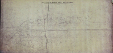
... reserve...bakery hill...railway...Ballarat...Mair Street...Humffray Street NOrth...Duke of York Hotel...Duke of richmond hotel...union hotel...kingston st...otway st...Wellington Claim...gravel pits...gold...Station reserve bakery hill railway Ballarat Mair Street Humffray Street NOrth Duke of York Hotel Duke of richmond hotel union hotel kingston st otway st Wellington Claim gravel pits gold workings Robert Burns Hotel .1) Oversized photocopy of large plan depicting railway right of way where Mair and Humffray Streets meet. ....1) Oversized photocopy of large plan depicting railway right of way where Mair and Humffray Streets meet. Main landmarks include Duke of Richmond Hotel, Prince of Wales Hotel, Duke of York Hotel, Welcome Nugget Claim and Shaft, Imperial Hotel, Union Hotel, Kingston St, Otway St, Wellington Claim, Gravel Pits Gold Working and Robert Burns Hotel. .2) Same of above. station reserve, bakery hill, railway, ballarat, mair street, humffray street north, duke of york hotel, duke of richmond hotel, union hotel, kingston st, otway st, wellington claim, gravel pits, gold workings, robert burns hotel -
Frankston RSL Sub Branch
Souvenir Tablecloth, 1915 (estimated)
... Gold coloured silk tablecloth with green braid edging and mauve silk fringing. It is heavily embroidered with various flags, crowns and flowers relating to the Gallipoli campaign. Possibly made in Eygpt. The flags featured are Australia, France, United Kingdom, Egypt, Japan, Italy, Belgium and Russia. Some fraying along folds. The RAN Bridging Train (RANBT) was a naval reserves...Gold coloured silk tablecloth with green braid edging and mauve silk fringing. It is heavily embroidered with various flags, crowns and flowers relating to the Gallipoli campaign. Possibly made in Eygpt. The flags featured are Australia, France, United Kingdom, Egypt, Japan, Italy, Belgium and Russia. Some fraying along folds. The RAN Bridging Train (RANBT) was a naval reserves ...Gold coloured silk tablecloth with green braid edging and mauve silk fringing. It is heavily embroidered with various flags, crowns and flowers relating to the Gallipoli campaign. Possibly made in Eygpt. The flags featured are Australia, France, United Kingdom, Egypt, Japan, Italy, Belgium and Russia. Some fraying along folds. The RAN Bridging Train (RANBT) was a naval reserves unit trained to provided engineering support such as assembling pontoons, temporary jetties and unloading stores. The 1st RANBT supported the British landing at Suvla Bay (north of ANZAC Cove) on the 7th of August 1915.In the centre of the tablecloth, embroidered in blue silk thread, are the following words "Suvla Bay 1915 6th October 1st RANBT" (Royal Australian Navy Bridging Train)gallipoli, trench, art, souvenir, embroidered, silk, flags, tablecloth, campaign, cloth -
 The Beechworth Burke Museum
Geological specimen - Coorongite
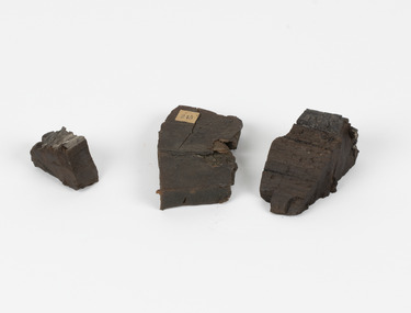
... reserves under the Coorong River. Between the 1860s and the 1930s the Coorong River became a place where mining oil and Coorongite became precedent. Nowadays, the local council and the South Australian Government are working together with the Ngarrindjeri people to sustain and preserve the Coorong River and the culture that is with it. Soon after gold...reserves under the Coorong River. Between the 1860s and the 1930s the Coorong River became a place where mining oil and Coorongite became precedent. Nowadays, the local council and the South Australian Government are working together with the Ngarrindjeri people to sustain and preserve the Coorong River and the culture that is with it. Soon after gold ...Coorongite is a dark, rubber-like, highly resilient structureless algal deposit. In the Coorong district of South Australia it occurs in moderate quantities associated with the coastal swamps and sand dunes which extend for a considerable distance east of the mouth of the Murray. This particular specimen was recovered from the south of the Coorong River, South Australia. A type of sediment rich in organic matter, Coorongite is the unlithified end-member of the sapropelic coal series. The members of the sapropelic coal series can be ranked in order as sapropel (the unlithified form), sapropelic-lignite, and sapropelic-coal (the lithified forms) based on increasing carbon content and decreasing volatile content. Sapropel (Coorongite) is an unlithified dark, pulpy, fine organic mud containing concentrations of algae and miospores that are more or less identifiable. Coorongite is typically found as an algae like substance, that can be found in irregular size pieces. Coorongite was believed to be dried up oil due to its rubber-like texture. The Coorongite is also soft to the point where it can be cut into with a knife or it can be broken and torn by hand. Otherwise known as 'Kurangk', the Coorong River is home to the Ngarrindjeri people, which acts as both a place for gathering food and a spiritual place. In 1852 the first sight of Coorongite was found along the Coorong River. The finders mistook the Coorongite for dried up oil, which lead to the belief that there were oil reserves under the Coorong River. Between the 1860s and the 1930s the Coorong River became a place where mining oil and Coorongite became precedent. Nowadays, the local council and the South Australian Government are working together with the Ngarrindjeri people to sustain and preserve the Coorong River and the culture that is with it. Soon after gold was discovered in 1851, Victoria’s Governor La Trobe wrote to the Colonial Office in London, urging ‘the propriety of selecting and appointing as Mineral Surveyor for this Colony a gentleman possessed of the requisite qualifications and acquaintance with geological science and phenomena’. Alfred Selwyn was appointed geological surveyor in Australia in 1852 which began the Geological Survey of Victoria. Selwyn went on to collect geological samples and catalogue thousands of specimens around Australia. In 1853-69 the Geological Survey issued under Selwyn's direction sixty-one geological maps and numerous reports; they were of such high standard that a writer in the Quarterly Journal of the Geological Society of London bracketed the survey with that of the United States of America as the best in the world. During his years spent in Australia, Selwyn collected numerous significant geological specimens, examples of which are held in collections such as the Burke Museum.Coorongite is considered to be a mineral with a unique texture, where it can be both hard and soft. Coorongite can also be considered to be a rare mineral, as it is only located along the Coorong River and due to the mining of it, has left very few sources. It was believed at one point that Coorongite could be used to replace oil. This specimen is part of a larger collection of geological and mineral specimens collected from around Australia (and some parts of the world) and donated to the Burke Museum between 1868-1880. A large percentage of these specimens were collected in Victoria as part of the Geological Survey of Victoria that begun in 1852 (in response to the Gold Rush) to study and map the geology of Victoria. Collecting geological specimens was an important part of mapping and understanding the scientific makeup of the earth. Many of these specimens were sent to research and collecting organisations across Australia, including the Burke Museum, to educate and encourage further study.Three solid varyingly hand-sized pieces of wooden appearing organic matter derived from the river in the Coorong District in South Australia. A rubber-like, highly resilient structureless algal deposit.Specimen 245 page 69 / in Descriptive Register / "Elcestic Bitumen, / Coorangite" South of / Coorung River, South Australia . / C. WIllman / 15/4/21burke museum, beechwoth, indigo shire, beechworth museum, geological, geological specimen, mineraology, coorong, coorong river, kurangk, ngarrindjeri, south australia, coorongite, coorongite specimen -
 Marysville & District Historical Society
Photograph (item) - Colour tinted photograph, Valentine Publishing Co. Pty. Ltd, Cumberland Falls, Marysville. No.3, 1923-1963
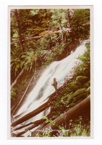
... Cambarville is notable for its giant mountain ash (Eucalyptus regnans) trees within the Cumberland Memorial Scenic Reserve, and relics from former sawmills and gold mining. The Big Culvert is located nearby on the Marysville-Woods Point Road, which was historically part of the Yarra Track. ...An early colour tinted photograph of the Cumberland Falls near Marysville in Victoria. This photograph was published by the Valentine Publishing Co Pty. Ltd. as a souvenir of Marysville.An early colour tinted photograph of the Cumberland Falls near Marysville in Victoria. These falls are located on the Marysville-Wood's Point Road. Cambarville is notable for its giant mountain ash (Eucalyptus regnans) trees within the Cumberland Memorial Scenic Reserve, and relics from former sawmills and gold mining. The Big Culvert is located nearby on the Marysville-Woods Point Road, which was historically part of the Yarra Track. Cambarville was established as a timber mill town in the 1940s. Timber mill owners A Cameron and FJ Barton named Cambarville. They established the mill to salvage timber from trees destroyed in the 1939 bushfires. Cambarville was impacted by the 2009 Black Saturday bushfires and any remaining structures were destroyed.cumberland falls, waterfalls, marysville, victoria, valentine publishing co, souvenir, a cameron, fj barton, cambarville, marysville-wood's point road, eucalyptus regnans, big culvert, yarra track, timber milling, 1939 bushfires, black saturday bushfires -
 Marysville & District Historical Society
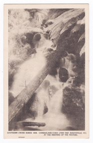
Postcard (item) - Black and white postcard, Rose Stereograph Company, Cumberland-Cora Lynn Trip, Marysville, Vic. At the Meeting of the Waters, 1913-1967
... Cambarville is notable for its giant mountain ash (Eucalyptus regnans) trees within the Cumberland Memorial Scenic Reserve, and relics from former sawmills and gold mining. The Big Culvert is located nearby on the Marysville-Woods Point Road, which was historically part of the Yarra Track. ...A postcard in a series produced by the Rose Stereograph Company in Victoria, Australia.A black and white photograph of the Cora-Lynn waterfalls at the Meeting of the Waters near the Cumberland Creek. These falls are located on the Marysville-Wood's Point Road. Cambarville is notable for its giant mountain ash (Eucalyptus regnans) trees within the Cumberland Memorial Scenic Reserve, and relics from former sawmills and gold mining. The Big Culvert is located nearby on the Marysville-Woods Point Road, which was historically part of the Yarra Track. Cambarville was established as a timber mill town in the 1940s. Timber mill owners A Cameron and FJ Barton named Cambarville. They established the mill to salvage timber from trees destroyed in the 1939 bushfires. Cambarville was impacted by the 2009 Black Saturday bushfires and any remaining structures were destroyed. This postcard was produced by the Rose Stereograph Company as a souvenir of Marysville.POST CARD. Correspondence/ Addresscora lynn falls, waterfalls, cumberland valley, cumberland creek, marysville, victoria, southern cross series, 4938, postcard, souvenir, meeting of the waters, marysville-wood's point road, cambarville, eucalyptus regnans, big culvert, cumberland memorial scenic reserve, a cameron, fj barton, 1939 bushfires, 2009 black saturday bushfires, rose stereograph company -
 Marysville & District Historical Society
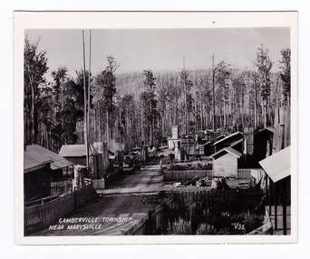
Photograph (item) - Black and white photograph, Valentine Publishing Co. Pty. Ltd, Camberville Township, Near Marysville. V. 35, 1923-1963
... Cambarville is notable for its giant mountain ash (Eucalyptus regnans) trees within the Cumberland Memorial Scenic Reserve, and relics from former sawmills and gold mining. The Big Culvert is located nearby on the Marysville-Woods Point Road, which was historically part of the Yarra Track. ...An early black and white photograph of the township of Cambarville near Marysville in Victoria.An early black and white photograph of the township of Cambarville near Marysville in Victoria. Cambarville is notable for its giant mountain ash (Eucalyptus regnans) trees within the Cumberland Memorial Scenic Reserve, and relics from former sawmills and gold mining. The Big Culvert is located nearby on the Marysville-Woods Point Road, which was historically part of the Yarra Track. Cambarville was established as a timber mill town in the 1940s. Timber mill owners A Cameron and FJ Barton named Cambarville. They established the mill to salvage timber from trees destroyed in the 1939 bushfires. Cambarville was impacted by the 2009 Black Saturday bushfires and any remaining structures were destroyed. This photograph was produced by Valentine Publishing Co as a souvenir of Marysville.marysville, victoria, photograph, valentine publishing co, souvenir, cambarville, cumberland valley, cumberland scenic reserve, big culvert, marysville-wood's point road, yarra track, a cameron, fj barton, 1939 bushfires, 2009 black saturday bushfires -
 Marysville & District Historical Society
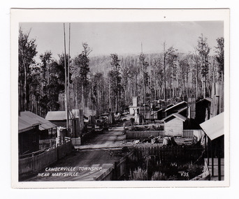
Photograph (item) - Black and white photograph, Valentine Publishing Co. Pty. Ltd, Camberville Township, Near Marysville. V. 35, 1923-1963
... Cambarville is notable for its giant mountain ash (Eucalyptus regnans) trees within the Cumberland Memorial Scenic Reserve, and relics from former sawmills and gold mining. The Big Culvert is located nearby on the Marysville-Woods Point Road, which was historically part of the Yarra Track. ...An early black and white photograph of the township of Cambarville near Marysville in Victoria.An early black and white photograph of the township of Camberville near Marysville in Victoria. Cambarville is notable for its giant mountain ash (Eucalyptus regnans) trees within the Cumberland Memorial Scenic Reserve, and relics from former sawmills and gold mining. The Big Culvert is located nearby on the Marysville-Woods Point Road, which was historically part of the Yarra Track. Cambarville was established as a timber mill town in the 1940s. Timber mill owners A Cameron and FJ Barton named Cambarville. They established the mill to salvage timber from trees destroyed in the 1939 bushfires. Cambarville was impacted by the 2009 Black Saturday bushfires and any remaining structures were destroyed. This photograph was produced by Valentine Publishing Co as a souvenir of Marysville.marysville, victoria, photograph, valentine publishing co, souvenir, cambarville, cumberland valley, cumberland scenic reserve, big culvert, marysville-wood's point road, yarra track, a cameron, fj barton, 1939 bushfires, 2009 black saturday bushfires -
 Marysville & District Historical Society
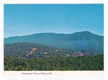
Postcard (item) - Colour postcard, Nucolorvue Productions Pty. Ltd, Panoramic View of Marysville, Pre 2009
... The Cumberland Valley is notable for its giant mountain ash (Eucalyptus regnans) trees within the Cumberland Memorial Scenic Reserve, and relics from former sawmills and gold mining. The Big Culvert is located nearby on the Marysville-Woods Point Road, which was historically part of the Yarra Track. ...A colour photograph of the view of Marysville from Barton's Lookout which is near the Cumberland Valley in Victoria.A colour photograph of the view of Marysville from Barton's Lookout which is near the Cumberland Valley in Victoria. The Cumberland Valley is notable for its giant mountain ash (Eucalyptus regnans) trees within the Cumberland Memorial Scenic Reserve, and relics from former sawmills and gold mining. The Big Culvert is located nearby on the Marysville-Woods Point Road, which was historically part of the Yarra Track. Cambarville, which is in the Cumberland Valley, was established as a timber mill town in the 1940s. Timber mill owners A Cameron and FJ Barton named Cambarville. They established the mill to salvage timber from trees destroyed in the 1939 bushfires. Cambarville was impacted by the 2009 Black Saturday bushfires and any remaining structures were destroyed. Barton's Lookout was named after a member of the Barton Family who were amongst Marysville's earliest pioneering families. This postcard was produced by Nucolorvue Productions as a souvenir of Marysville.NU-COLOR-VUE/ OF/ AUSTRALIA MARYSVILLE, VICTORIA Panoramic View of Marysville from/ CUMBERLAND. PLACE/ STAMP/ HERE POST CARD NUC.171 - NUCOLORVUE PRODUCTIONS PTY. LTD./ COPYRIGHT Printed in Australiamarysville, barton's lookout, victoria, nucolorvue productions, postcard, souvenir, cumberland valley, cumberland memorial scenic reserve, big culvert, marysville-wood's point road, yarra track, mining, timber mills, a cameron, fj barton, cambarville, 1939 bushfires, 2009 black saturday bushfires -
 Marysville & District Historical Society
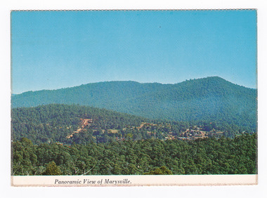
Postcard (item) - Colour postcard, Nucolorvue Productions Pty. Ltd, Panoramic View of Marysville, Pre 2009
... The Cumberland Valley is notable for its giant mountain ash (Eucalyptus regnans) trees within the Cumberland Memorial Scenic Reserve, and relics from former sawmills and gold mining. The Big Culvert is located nearby on the Marysville-Woods Point Road, which was historically part of the Yarra Track. ...A colour photograph of the view of Marysville from Barton's Lookout which is near the Cumberland Valley in Victoria.A colour photograph of the view of Marysville from Barton's Lookout which is near the Cumberland Valley in Victoria. The Cumberland Valley is notable for its giant mountain ash (Eucalyptus regnans) trees within the Cumberland Memorial Scenic Reserve, and relics from former sawmills and gold mining. The Big Culvert is located nearby on the Marysville-Woods Point Road, which was historically part of the Yarra Track. Cambarville, which is in the Cumberland Valley, was established as a timber mill town in the 1940s. Timber mill owners A Cameron and FJ Barton named Cambarville. They established the mill to salvage timber from trees destroyed in the 1939 bushfires. Cambarville was impacted by the 2009 Black Saturday bushfires and any remaining structures were destroyed. Barton's Lookout was named after a member of the Barton Family who were amongst Marysville's earliest pioneering families. This postcard was produced by Nucolorvue Productions as a souvenir of Marysville.NU-COLOR-VUE/ OF/ AUSTRALIA MARYSVILLE, VICTORIA Panoramic View of Marysville from/ CUMBERLAND. PLACE/ STAMP/ HERE POST CARD NUC.171 - NUCOLORVUE PRODUCTIONS PTY. LTD./ COPYRIGHT Printed in Australia Hi There! how are you? fine I hope....Hows school/ treating you?/ Isn't it beautiful now Autumns back again./ You'll have to come up soon and see us, where/ really you/ Ok! it beautiful, the air so fresh and/ clean it makes you want to cry. There are/ so many magnificent and brill marysville, barton's lookout, victoria, nucolorvue productions, postcard, souvenir, cumberland valley, cumberland memorial scenic reserve, big culvert, marysville-wood's point road, yarra track, mining, timber mills, a cameron, fj barton, cambarville, 1939 bushfires, 2009 black saturday bushfires -
 Marysville & District Historical Society
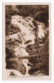
Postcard (item) - Black and white postcard, Rose Stereograph Company, Cora Lynn Falls, Marysville, Vic, 1913-1967
... Cambarville is notable for its giant mountain ash (Eucalyptus regnans) trees within the Cumberland Memorial Scenic Reserve, and relics from former sawmills and gold mining. The Big Culvert is located nearby on the Marysville - Woods Point Road, which was historically part of the Yarra Track. ...A postcard in a series produced by the Rose Stereograph Company in Victoria, Australia as a souvenir of Marysville.An early black and white photograph of the Cora Lynn Falls in Marysville, Victoria. These falls are located on the Marysville-Wood's Point Road. Cambarville is notable for its giant mountain ash (Eucalyptus regnans) trees within the Cumberland Memorial Scenic Reserve, and relics from former sawmills and gold mining. The Big Culvert is located nearby on the Marysville - Woods Point Road, which was historically part of the Yarra Track. Cambarville was established as a timber mill town in the 1940s. Timber mill owners A Cameron and FJ Barton named Cambarville. They established the mill to salvage timber from trees destroyed in the 1939 bushfires. Cambarville was impacted by the 2009 Black Saturday bushfires and any remaining structures were destroyed.POST CARD REAL PHOTO THE "ROSE" SERIES DE LUXE PRODUCED IN AUSTRALIA Published by The Rose Stereograph Co./ Armadale, Victoriamarysville, victoria, photograph, cora lynn falls, waterfalls, rose series postcard, rose stereograph company, souvenir, cambarville, marysville-wood's point road, eucalyptus regnans, cumberland memorial scenic reserve, mining, big culvert, yarra track, a cameron, fj barton, 1939 bushfires, 2009 black saturday bushfires, timber mills, p. 4947 -
 Marysville & District Historical Society
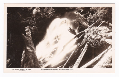
Postcard (item) - Black and white postcard, Rose Stereograph Company, Cumberland Falls, Marysville, Vic, 1913-1967
... Cambarville is notable for its giant mountain ash (Eucalyptus regnans) trees within the Cumberland Memorial Scenic Reserve, and relics from former sawmills and gold mining. The Big Culvert is located nearby on the Marysville - Woods Point Road, which was historically part of the Yarra Track. ...A postcard in a series produced by the Rose Stereograph Company in Victoria, Australia as a souvenir of Marysville.A black and white photograph of the Cumberland Falls which are in Cambarville. These falls are located on the Marysville-Wood's Point Road. Cambarville is notable for its giant mountain ash (Eucalyptus regnans) trees within the Cumberland Memorial Scenic Reserve, and relics from former sawmills and gold mining. The Big Culvert is located nearby on the Marysville - Woods Point Road, which was historically part of the Yarra Track. Cambarville was established as a timber mill town in the 1940s. Timber mill owners A Cameron and FJ Barton named Cambarville. They established the mill to salvage timber from trees destroyed in the 1939 bushfires. Cambarville was impacted by the 2009 Black Saturday bushfires and any remaining structures were destroyed.POST CARD The "Rose" Series/ De Luxe A Real Photograph/ Produced in Australia Published by the Rose Stereograph Co.,/ Armadale, Victoria.cumberland falls, cambarville, marysville, victoria, waterfalls, rose series postcard, postcard, souvenir, mountain ash, mining, timber mills, big culvert, yarra track, a cameron, fj barton, black saturday bushfires, 1939 bushfires, eucalyptus regnans, p. 4969
