
Showing 42 items matching "hume weir construction"
-
 City of Melbourne Libraries
Hume Weir construction, 1927-1936
... Hume Weir construction, 1927-1936...weirs construction 1930-1939 rivers dams and reservoirs Hume Weir construction, 1927-1936 ...weirs, construction, 1930-1939, rivers, dams and reservoirsweirs, construction, 1930-1939, rivers, dams and reservoirs -
 Wodonga & District Historical Society Inc
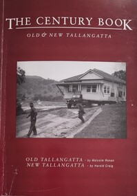
Book - The Century Book - Old & New Tallangatta, Malcolm Ronan et al, 2001
... Impact of Hume Weir Construction...Hume Weir on the township. Tallangatta Old Tallangatta Pioneer life Impact of Hume Weir Construction This work describes the establishment of Tallangatta on the junction of Tallangatta Creek and Mitta Creek and its move to Bolga on the Hume Weir. ...This work describes the establishment of Tallangatta on the junction of Tallangatta Creek and Mitta Creek and its move to Bolga on the Hume Weir. It offers insights into the life of the people and the institutions they created and represented. It shows the impact of the expansion of the Hume Dam in the 1950s and how the community adapted to the changes forced upon them.A publication of 88 pages including photographs. Illustrations and maps. The front cover features a photo of Ernie Nunn, contract house removalist in the foreground supervising an early house removal from Toorak to Bolga. The back cover has a panorama of Old Tallangatta in 1938, showing Toorak (foreground), Newtown (left), and Mount Charlie (right). This work describes the establishment of Tallangatta on the junction of Tallangatta Creek and Mitta Creek and its move to Bolga on the Hume Weir. It offers insights into the life of the people and the institutions they created and represented. It shows the impact of the expansion of the Hume Dam in the 1950s and how the community adapted to the changes forced upon them.tallangatta, old tallangatta, pioneer life, impact of hume weir construction -
 Rutherglen Historical Society
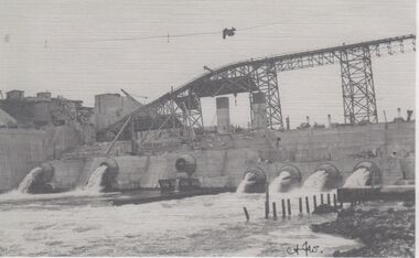
Image, October 1929
... hume weir...construction...Photocopies of Hume Weir photographs 1928-29 hume weir construction dam construction Written on paper next to photo: "Valves etc. at Hume Weir Oct '29" One of two black and white photographs, photocopied onto a single sheet of A4 paper. ...Photocopies of Hume Weir photographs 1928-29One of two black and white photographs, photocopied onto a single sheet of A4 paper. This one is of construction work on a dam, with scaffolding above a partially completed wall. Water is flowing through several valves in the wall.Written on paper next to photo: "Valves etc. at Hume Weir Oct '29"hume weir, construction, dam construction -
 Rutherglen Historical Society
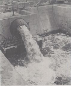
Image, October 1929
... hume weir...construction...Photocopies of Hume Weir photographs 1928-29 hume weir construction dam construction Written on paper next to photo: "Needle valve Hume Weir Albury Oct '29" One of two black and white photographs, photocopied onto a single sheet of A4 paper. ...Photocopies of Hume Weir photographs 1928-29One of two black and white photographs, photocopied onto a single sheet of A4 paper. This one is of construction work on a dam, showing lower part of dam wall, and featuring one of the valves.Written on paper next to photo: "Needle valve Hume Weir Albury Oct '29"hume weir, construction, dam construction -
 Wodonga & District Historical Society Inc
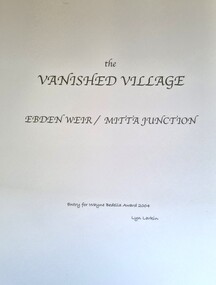
Booklet - The Vanished Village - Ebden Weir / Mitta Junction, Lyn Larkin, 2004
... ...Hume Weir construction...MItta Junction township Hume Weir construction Clark family Bonegilla This publication tells the story of the village of Mitta Junction which was established in about 1920 on the Victorian side of the Hume Dam construction site. ...This publication tells the story of the village of Mitta Junction which was established in about 1920 on the Victorian side of the Hume Dam construction site. The town was built to house workers and their families during the construction of the Hume Weir. It included houses, a shop, hall and school as well as tennis courts. After the completion of the weir the village and all its contents was sold at auction in June 1936 for £7000. The Mitta Junction school continued to operate until the mid 1980s. The book also documents aspects of the history of the Clark family of Bonegilla.A small publication by a local author. A4 size including photographs and a map.This publication tells the story of the village of Mitta Junction which was established in about 1920 on the Victorian side of the Hume Dam construction site. The town was built to house workers and their families during the construction of the Hume Weir. It included houses, a shop, hall and school as well as tennis courts. After the completion of the weir the village and all its contents was sold at auction in June 1936 for £7000. The Mitta Junction school continued to operate until the mid 1980s. The book also documents aspects of the history of the Clark family of Bonegilla.mitta junction township, hume weir construction, clark family bonegilla -
 Rutherglen Historical Society
Image, c 1930
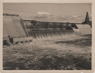
... hume weir...hume reservoir...lake hume...dam construction...Black and white photograph of the Hume Weir under construction....Peterson | Photographer | Hume Reservoir" Black and white photograph of the Hume Weir under construction. Image V. Peterson ...Black and white photograph of the Hume Weir under construction.On back of photo: "Hume Weir" and an oval rubber stamp "V. Peterson | Photographer | Hume Reservoir"hume dam, hume weir, hume reservoir, lake hume, dam construction -
 Rutherglen Historical Society
Image, c 1930
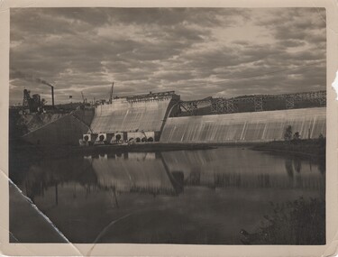
... hume weir...hume reservoir...lake hume...dam construction...Black and white photograph of the Hume Weir under construction....Peterson | Photographer | Hume Reservoir" Black and white photograph of the Hume Weir under construction. Image V. Peterson ...Black and white photograph of the Hume Weir under construction.On back of photo: "Hume Weir" and an oval rubber stamp "V. Peterson | Photographer | Hume Reservoir"hume dam, hume weir, hume reservoir, lake hume, dam construction -
 Rutherglen Historical Society
Image, c1935
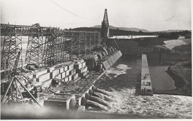
... hume weir...dam construction...On back of photo: "Construction of Hume Weir"...Donated by Mrs A Terrill, member of Rutherglen Historical Society hume weir dam construction On back of photo: "Construction of Hume Weir" Black and white reproduction of unmounted photograph of Hume Weir dam wall Image ...Donated by Mrs A Terrill, member of Rutherglen Historical SocietyBlack and white reproduction of unmounted photograph of Hume Weir dam wallOn back of photo: "Construction of Hume Weir"hume weir, dam construction -
 The Beechworth Burke Museum
Photograph, c.1927-1930
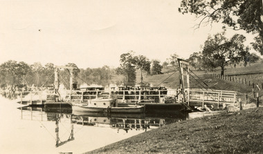
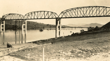
... The Hume Dam, formerly known as the Hume Weir, was in construction between 1919 and 1936, which swelled the Murray River into the floodplain to the East of the dam permanently, creating Lake Hume, and isolating the residents of Bethanga and nearby towns, for whom the trip all the way around the new lake to another river crossing was a massive undertaking. ...The Hume Dam, formerly known as the Hume Weir, was in construction between 1919 and 1936, which swelled the Murray River into the floodplain to the East of the dam permanently, creating Lake Hume, and isolating the residents of Bethanga and nearby towns, for whom the trip all the way around the new lake to another river crossing was a massive undertaking. ...This image shows the Punt (a kind of small boat) that took residents of Bethanga across the Murray River before the Bethanga Bridge was built. Bethanga Bridge was built between 1927 and 1930, and was made a necessity by the building of the Hume Dam. The Hume Dam, formerly known as the Hume Weir, was in construction between 1919 and 1936, which swelled the Murray River into the floodplain to the East of the dam permanently, creating Lake Hume, and isolating the residents of Bethanga and nearby towns, for whom the trip all the way around the new lake to another river crossing was a massive undertaking. The person who wrote on the back of this card instead chose to cross the river on a boat until the Bethanga Bridge became available. Interestingly, partially submerged trees can be seen in the lake in the background of this photograph, illustrating that the dam had already begun to fill the floodplain even before the bridge was built. This photograph shows the methods the residents of Bethanga used while the Bethanga Bridge was being built. This record is associated with the Heritage Listed sites of the Hume Dam and the Bethanga Bridge, and shows the environment during the process of construction and the creation of Lake HumeSepia rectangular photograph printed on matte photographic paperReverse: 1997.3189 / 84 -19 -1 / This is the snap of the Punt. / Our only means of getting out / of Bethanga for the present / Until the bridge is completed / it is 2 miles above the junction / of the Mitta + Murray. It is / 1/2 a mile wide + runs across / the Murray into NSW / Kodak Print / bethanga, bethanga bridge, hume, hume dam, artificial lake, lake hume, hume weir, flood, floodplain, boat, punt, weir, pier, dock, transport, transportation -
 Federation University Historical Collection
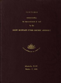
book, Truth & Sportsman Ltd, Souvenir commemorating the commencement of work by the Snowy mountains hydro-electric authority, 17/10/1949
... McGirr, Nelson Lemmon, Hume Weir, Jindabyne valley (now flooded), Jindabyne township (now flooded), illustration of water Power, survey team at Adaminaby, Snowy Mountains Relief Plan, Horseman crossing the Eucumbene River, Mildura, Burrinjuck Dam under construction, transmission lines, W. ...McGirr, Nelson Lemmon, Hume Weir, Jindabyne valley (now flooded), Jindabyne township (now flooded), illustration of water Power, survey team at Adaminaby, Snowy Mountains Relief Plan, Horseman crossing the Eucumbene River, Mildura, Burrinjuck Dam under construction, transmission lines, W. ...It is assumed that a member of the Ballarat School of Mines attended the commencement of work at the Snowy Mountains hydro-electric centre.Burgundy cover with gold printing. Black print, photos and diagrams on white paper (31 pages). Bound by 3 staples. The contents include the story of the Snowy. Images include W.J. McKell, J.B. (Ben) Chifley, J. McGirr, Nelson Lemmon, Hume Weir, Jindabyne valley (now flooded), Jindabyne township (now flooded), illustration of water Power, survey team at Adaminaby, Snowy Mountains Relief Plan, Horseman crossing the Eucumbene River, Mildura, Burrinjuck Dam under construction, transmission lines, W. Hudson.snowy mountains hydro-electricty scheme, snowy mountains hydro-electric authority -
 The Beechworth Burke Museum
Photograph
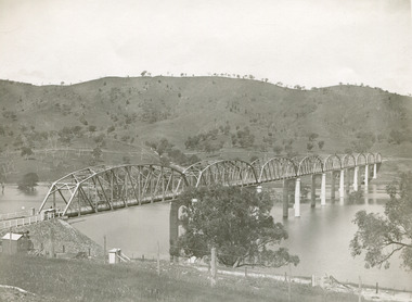
... construction. The Bridge was completed in 1930 and was built to assist residents of the Bethanga district to travel to Albury. Other bridges would become submerged by the backed-up water of the Murray and Mitta Rivers so the Bethanga bridge was built two miles above the Mitta Weir. The Bethanga Bridge was built north of the future Hume...construction. The Bridge was completed in 1930 and was built to assist residents of the Bethanga district to travel to Albury. Other bridges would become submerged by the backed-up water of the Murray and Mitta Rivers so the Bethanga bridge was built two miles above the Mitta Weir. The Bethanga Bridge was built north of the future Hume ...Taken between 1928 and 1930, depicted is the Bethanga Bridge under construction. The Bridge was completed in 1930 and was built to assist residents of the Bethanga district to travel to Albury. Other bridges would become submerged by the backed-up water of the Murray and Mitta Rivers so the Bethanga bridge was built two miles above the Mitta Weir. The Bethanga Bridge was built north of the future Hume Dam which would be completed in 1936. At 2430 feet long, Bethanga Bridge was the longest road bridge in Australia at the time of its completion. The Bridge is 20 feet wide and made up of nine 270 feet long spans. Materials used include ten tons of paint for the steel works; 1600 tons of steel; 900 tons of timber for the decking; and reinforced concrete for the piers. The tender for the construction was awarded to C. Ruwolt Pty. Ltd., engineers who were located on Victoria Street, West Richmond. The contract was awarded for £71,890. It was predicted between 250 and 300 men would find employment on the project. The news was well received by trade unions at the time as there had been a drop in available engineering work.This photograph is historically significant as it depicts the progress of the Bethanga Bridge construction, which was important infrastructure for the area. It is also a good example of methods used in the area to assist in travel over the river prior to the construction of the Hume Dam.Black and white rectangular photo printed on matte photographic paper.Reverse: 1997 3186 / 84-19-3 / This is the bridge. / It is not yet open to traffic / yet. will not be completed / until May next / It is a wonderful bridge the / pillars are 100 feet high. / KODAK PRINT Envelope Obverse: Peterson PHOTO / Hume Weir Envelope Reverse: BMM 84-20-1,2+3. bethanga bridge, lake hume, hume dam, hume weir, murray river, bridge, bethanga, albury -
 The Beechworth Burke Museum
Photograph, Unknown c.1930s
... Hume Reservoir. Because of its unique location, over the waters of a dam with the border running down the centre of the body of water, the Bethanga bridge is the only built structure shared by both New South Wales and Victoria. It was built 1.6 kilometres upstream of the dam and in 1961 was raised 300mm, with a concrete deck replacing the original wooden deck. The State Rivers and Water Supply Commission of Victoria and the New South Wales Department of Public Works were responsible for the construction works for the Hume Weir...Hume Reservoir. Because of its unique location, over the waters of a dam with the border running down the centre of the body of water, the Bethanga bridge is the only built structure shared by both New South Wales and Victoria. It was built 1.6 kilometres upstream of the dam and in 1961 was raised 300mm, with a concrete deck replacing the original wooden deck. The State Rivers and Water Supply Commission of Victoria and the New South Wales Department of Public Works were responsible for the construction works for the Hume Weir ...This image shows Bethanga Bridge, which was constructed between 1927 and 1930 in Albury, NSW. The bridge was a necessity due to the building of the Hume Dam (Wier), 1919-1936. Bethanga Bridge is a long, nine-span, riveted-steel, variable depth, Pratt Truss road bridge of nine principal spans of 82 metres and a total length of 752 metres over the flooded valley of the Murray River, now part of Hume Reservoir. Because of its unique location, over the waters of a dam with the border running down the centre of the body of water, the Bethanga bridge is the only built structure shared by both New South Wales and Victoria. It was built 1.6 kilometres upstream of the dam and in 1961 was raised 300mm, with a concrete deck replacing the original wooden deck. The State Rivers and Water Supply Commission of Victoria and the New South Wales Department of Public Works were responsible for the construction works for the Hume Weir under the River Murray Waters Agreement. It is apparent that a similar joint arrangement was made for the construction of the Bethanga Bridge as part of the Hume Weir works.This photograph of the Bethanga Bridge is of historical significance as it showcases the architectural skills of Percy Allen and Vincent Packer. Additionally, it reveals the environmental landscape of the 1920s-1930s, is linked to the Hume Dam and both New South Wales and Victorian heritage. Unmounted black and white rectangular photograph. Reverse: 1997.3196 84-20-3bethanga, bethanga bridge, hume dam, pratt truss, murray river, hume weir, transportation -
 The Beechworth Burke Museum
Photograph, c. 1927 - 1930
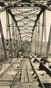
... Hume Dam...Bridges Album...construction...Road Construction...Hume Weir...construction of this well-known heritage site of significance to the Indigo Shire. It reflects upon a period of growth and change in the area. Bethanga Bridge Hume Dam Bridges Album construction Road Construction Hume Weir Reverse: 1997.3190 / Another snap of the bridge. taken on the bridge showing huge steel sides / 84-19-4 / V [in circle] 354 / KODAK PRINT Sepia, rectangular photograph printed on matt photographic paper, unmounted Photograph Photograph ...Taken during the construction of the Bethanga Bridge (1927-1930), this sepia photograph shows a view of the incomplete bridge taken from inside the structure and looking down the span of the bridge from where the photographer stands. The photograph depicts an incomplete deck, with loose-looking wooden planks/panels lain along the centre in groups of three. Once complete, the original decking of the bridge was made of timber before being replaced by cement in 1961 (Victorian Heritage Database).Bethanga Bridge is of historical significance to the Indigo Shire for its associations with the construction of Hume Dam, its associations with the River Murray Waters Agreement and the River Murray Commission, and illustration of the needs and influence of the farming communities along the river in this area - particularly in relation to the building of the Weir. It also represents the collaboration between New South Wales and Victoria on a large infrastructure project, being the only built structure shared by both New South Wales and Victoria due to its location. also reflecting on the Shire's geographical closeness to this neighboring state. This photograph is part of a series that documents the construction of this well-known heritage site of significance to the Indigo Shire. It reflects upon a period of growth and change in the area.Sepia, rectangular photograph printed on matt photographic paper, unmountedReverse: 1997.3190 / Another snap of the bridge. taken on the bridge showing huge steel sides / 84-19-4 / V [in circle] 354 / KODAK PRINTbethanga bridge, hume dam, bridges album, construction, road construction, hume weir -
 Kiewa Valley Historical Society
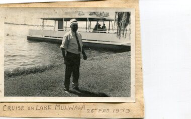
Photographs x 3- Cruise on Lake Mulwala, 25/2/1973
... Lake Mulwala is a man–made reservoir created through the construction of the Yarrawonga Weir across the Murray River, is located between Bundalong and Yarrawonga in Hume region of Victoria and Mulwala in the Riverina region of New South Wales, in eastern Australia. ...Lake Mulwala is a man–made reservoir created through the construction of the Yarrawonga Weir across the Murray River, is located between Bundalong and Yarrawonga in Hume region of Victoria and Mulwala in the Riverina region of New South Wales, in eastern Australia. ...Lake Mulwala is a man–made reservoir created through the construction of the Yarrawonga Weir across the Murray River, is located between Bundalong and Yarrawonga in Hume region of Victoria and Mulwala in the Riverina region of New South Wales, in eastern Australia. The weir was constructed in 1939 to provide water for irrigation of the surrounding district. The weir also serves as a crossing of the Murray between the two towns. It is a popular tourist destination for boating, fishing and other water recreation.Photographs demonstrate local Kiewa Valley residents enjoying a visit to the picturesque area of Lake Mulwala. Also provides a pictorial history of 1973.3 black and white photographs mounted on buff card. Photographs of a cruise on Lake Mulwala 25th Feb. 1973 1. Photo of unidentified man standing on the shore of Lake Mulwala beside cruise launch. 2. Group photo of people standing by cruise boat as others disembark. Woman in centre holding handbag may be Clare Roper (unconfirmed) 3. Photo of 2 men aboard cruise launch looking out over Lake Mulwala1. Handwritten at bottom of photo in black ink. 'Cruise on Lake Mulwala. 25th Feb. 1973' 2. Painted sign above cruise launch- Scenic Lake Cruises 3. No markingsclare roper -
 Tatura Irrigation & Wartime Camps Museum
Folder, Irrigation Structures, 1995
... Construction of new Torrumbarry Weir 1997 and newspaper report of Hume Dam and other Rural Water information....Construction of new Torrumbarry Weir 1997 and newspaper report of Hume Dam and other Rural Water information. irrigation documents reports books history local rural industry Grey plastic cover, black spine. ...Photos of Waranga Basin outlet. Construction of new Torrumbarry Weir 1997 and newspaper report of Hume Dam and other Rural Water information.Grey plastic cover, black spine. Title label insideirrigation, documents, reports, books, history, local, rural, industry -
 Wodonga & District Historical Society Inc
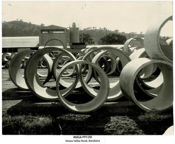
Photograph - ROCLA, Wodonga
... construction on 17 October 1949. They also provided pipes for the Kiewa Hydro Scheme. Another early major contract for ROCLA was with the Victorian State Rivers and Water Supply Commission for the provision of pipes for the new sewerage system in the new town of Tallangatta, relocated due to the enlargement of the Hume Weir. ...construction on 17 October 1949. They also provided pipes for the Kiewa Hydro Scheme. Another early major contract for ROCLA was with the Victorian State Rivers and Water Supply Commission for the provision of pipes for the new sewerage system in the new town of Tallangatta, relocated due to the enlargement of the Hume Weir. ...ROCLA was founded by two friends, Walter Robertson and Heaton Clarke, who combined the first letters of their surnames to create the brand name in 1922. The company first came to the Albury – Wodonga area in late 1927 when tenders were called for the construction of their works and office in Kiewa Street, Albury. They were a popular provider of concrete pipe culverts and reinforced concrete troughs for farm use. In 1949 ROCLA began operations at Bandiana. Initially this was to produce pipes for the Snowy Mountains Hydro-Electric Scheme which officially began construction on 17 October 1949. They also provided pipes for the Kiewa Hydro Scheme. Another early major contract for ROCLA was with the Victorian State Rivers and Water Supply Commission for the provision of pipes for the new sewerage system in the new town of Tallangatta, relocated due to the enlargement of the Hume Weir. This contract called for the supply of 21,000 six inch pipes and 7,000 nine inch pipes. At this time ROCLA employed 15 men and this job required about 80 bags of cement per day. By 1964 ROCLA Concrete Pipes was Wodonga’s largest secondary industry. A new concrete pole manufacturing plant was established in the early 1980s. ROCLA poles also dot the landscape in several Australian States. ROCLA poles also hold up many of the Hume Freeway bridge and support the Union Bridge which crosses the Murray River at Albury. After various changes in management, ROCLA was taken over by New Zealand's Fletcher Building group in 2005. In September 2021 ROCLA became part of the Civilmart Group. These images are significant because they record the history of a major manufacturing industry in Wodonga.A collection of photographs and advertisements representing the ROCLA, Wodonga company.manufacturing industries wodonga, rocla wodonga, wodonga industries -
 Wodonga & District Historical Society Inc
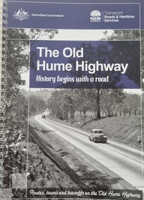
Book - The Old Hume Highway - History begins with a Road, 2014
... Hume who, with William Hovell, first found the overland path in 1824. Much of the original highway followed their overland route wherever the landscape allowed. The road connected many small communities and rural properties, although in many parts was narrow and unsurfaced. Over the following years alterations and some deviations occurred with changing transport needs and heavier traffic loads. One of these deviations was completed in 1933 at Table Top north of Albury between Ettamogah and Mullengandra due to the construction of the Hume Weir ...The Hume Highway was officially named in 1928, when both the New South Wales and Victorian governments agreed to give the unified inland route between Sydney and Melbourne the name, honouring explorer Hamilton Hume who, with William Hovell, first found the overland path in 1824. Much of the original highway followed their overland route wherever the landscape allowed. The road connected many small communities and rural properties, although in many parts was narrow and unsurfaced. Over the following years alterations and some deviations occurred with changing transport needs and heavier traffic loads. One of these deviations was completed in 1933 at Table Top north of Albury between Ettamogah and Mullengandra due to the construction of the Hume Weir which flooded the existing highway. Gradually sections of the road were converted to a dual carriageway. In 1961 the first modern freeway-standard, four-lane section was completed in Victoria at Craigieburn. The Hume Highway was also rerouted in Albury to avoid the town centre. Many major bypasses and duplications in New South Wales were completed throughout the 1980s and 1990s. In 1994 the last section of the Hume Highway in Victoria was duplicated with the completion of the Wangaratta bypass. The Albury-Wodonga bypass was opened in 2007 and in 2013 the final section, the Holbrook Bypass in NSW, was opened to traffic on August 7, completing the full Sydney-Melbourne dual carriageway link. In the course of this gigantic engineering achievement, many small, historic towns throughout Victoria and New South Wales were bypassed and often forgotten by passing commuters in a rush to reach their destination. This publication includes maps and information about the sites and landmarks in these towns. It encourages travellers to venture of the modern highway and rediscover the Old Hume Highway and the stories it holds about out past.A spiral bound volume of 122 pages including maps, photographs and illustrations prepared as a travel guide to the Old Hume Highway. It includes a Foreword by Peter FitzSimons.The Hume Highway was officially named in 1928, when both the New South Wales and Victorian governments agreed to give the unified inland route between Sydney and Melbourne the name, honouring explorer Hamilton Hume who, with William Hovell, first found the overland path in 1824. Much of the original highway followed their overland route wherever the landscape allowed. The road connected many small communities and rural properties, although in many parts was narrow and unsurfaced. Over the following years alterations and some deviations occurred with changing transport needs and heavier traffic loads. One of these deviations was completed in 1933 at Table Top north of Albury between Ettamogah and Mullengandra due to the construction of the Hume Weir which flooded the existing highway. Gradually sections of the road were converted to a dual carriageway. In 1961 the first modern freeway-standard, four-lane section was completed in Victoria at Craigieburn. The Hume Highway was also rerouted in Albury to avoid the town centre. Many major bypasses and duplications in New South Wales were completed throughout the 1980s and 1990s. In 1994 the last section of the Hume Highway in Victoria was duplicated with the completion of the Wangaratta bypass. The Albury-Wodonga bypass was opened in 2007 and in 2013 the final section, the Holbrook Bypass in NSW, was opened to traffic on August 7, completing the full Sydney-Melbourne dual carriageway link. In the course of this gigantic engineering achievement, many small, historic towns throughout Victoria and New South Wales were bypassed and often forgotten by passing commuters in a rush to reach their destination. This publication includes maps and information about the sites and landmarks in these towns. It encourages travellers to venture of the modern highway and rediscover the Old Hume Highway and the stories it holds about out past.old hume highway, hume highway, travel guide hume highway, \ -
 Rutherglen Historical Society
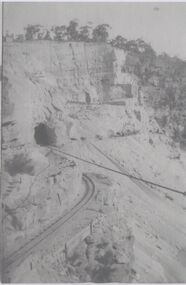
Image, c1928
... hume weir...suspension bridge...bridges...tunnels...construction...Photocopies of Hume Weir photographs 1928-29 hume weir suspension bridge bridges tunnels construction Written on paper next to photo: "Detail of open cut for [illeg.]. ...Photocopies of Hume Weir photographs 1928-29One of three black and white photographs, photocopied onto a single sheet of A4 paper. This one is of construction work on a cliff face, with train lines, tunnel and cable.Written on paper next to photo: "Detail of open cut for [illeg.]. Train lines for taking rock to crusher tunnel & stay ropes of suspension bridge showing"hume weir, suspension bridge, bridges, tunnels, construction -
 Wodonga & District Historical Society Inc
Photograph - Mrs. Ronan's Dining Room, Wodonga, c1914
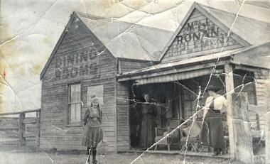
... Mrs Ronan persevered and beat all obstacles to finally move from the saleyards to the Wodonga Coffee Palace in High Street, beside the railway gates in 1921. The construction of the Hume Weir had begun and some construction workers boarded at the Coffee Palace. ...Mrs Ronan persevered and beat all obstacles to finally move from the saleyards to the Wodonga Coffee Palace in High Street, beside the railway gates in 1921. The construction of the Hume Weir had begun and some construction workers boarded at the Coffee Palace. ...When Mrs Julia Ronan nee Arundel lost her husband John to tuberculosis in 1906, she quickly decided to move from their small farm into Wodonga with her 3 children. She was granted the lease of the ground she needed to establish her eating house at one shilling per year in a shed on the Dalgety's saleyard block. Two established merchants Albert Schlink and John Whan and butcher Jack Garrett agreed to allow her credit which enabled her to open Ronan's Dining Rooms at the Saleyards. It was often a challenging environment, with drovers, and horse- breakers, auctioneers and bushmen bringing huge mobs of cattle and horses to the saleyards. Stories of the premises include the unexpected arrival in the passage of a lively bullock which finished up on the girls' bed. Mrs Ronan persevered and beat all obstacles to finally move from the saleyards to the Wodonga Coffee Palace in High Street, beside the railway gates in 1921. The construction of the Hume Weir had begun and some construction workers boarded at the Coffee Palace. Her 3 children achieved success due to their mother’s hard work to ensure their futures. Bill trained for the priesthood and was a parish priest, but died from tuberculosis 1n 1939 aged of 41. Katie became a highly accomplished music teacher, including 32 years at Albury Public School. In the 1930s she was able to buy a house at 49 High Street, Wodonga where she lived with her mother and sister Mary. Mary trained in office work at Edmondson’s solicitors and then worked on the Albury Council. After living with her daughters in the High Street house, Julia passed away on her 90th birthday in 1958. Mary died on 6 January 1983. Katie passed away in Wodonga at the age of 97 on the 16 September 1996. All members of the family are buried at Yackandandah, Victoria.A black and white image of Miss Mary Ronan, Mrs Julia Ronan and Miss Teresa Trudewind at the Old Saleyards Dining Room, Wodonga.On front of building: DINING ROOMS/ MRS. J. RONANmrs. ronan, dining rooms wodonga sale yards, wodonga businesses, wodonga pioneers -
 Wodonga & District Historical Society Inc
Photograph - Harry Stead Taxi Service
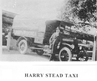
... Workmen from Albury and Wodonga were carried to the construction site of the Hume Weir. Drays, although slow, were used with room for 10 or 12 paying passengers, at times. ...Workmen from Albury and Wodonga were carried to the construction site of the Hume Weir. Drays, although slow, were used with room for 10 or 12 paying passengers, at times. ...Harry Stead, Snr., owned and operated Wodonga’s first taxi service. He had horse drawn cabs running between Wodonga, and Albury in 1868. He also ran a carrying business with wagons and drays. Workmen from Albury and Wodonga were carried to the construction site of the Hume Weir. Drays, although slow, were used with room for 10 or 12 paying passengers, at times. Stead’s paddocks ran back from Sydney Street (now High Street) with stable accommodation for his 70 and more horses. The Provincial Motel occupied part of the site in later years. Harry’s son, “young Harry” joined his Dad around 1892 as soon as his schooldays were over. After the horse drawn cabs, the Steads began a motorised taxi, hire car and bus services. Some of the taxis used were an A-Model Ford, 1934 Ford, Ford V8, Dodge Tourer, Hudson Six and, earlier, the 1923 Buick with dicky seat. Among the drivers were Stan Hogbin, Gerry Gerrard, Jack O’Neill, “Peggy” O’Neill, Ernie “Honey” Zeinert, Cliff Williams and Les Cole. Young Harry had four cars on the rank from 1930 to 1940 when competition for fares was fierce. He had his regulars who paid 4/- a week to go to and from Albury daily. In 1934, Harry was before the Albury Police Court, charged with having driven his taxi on a public road without a taxi licence. The Albury Municipal Council required all taxi drivers to have a NSW certificate of registration before collecting fares in NSW. The case was held as a test case and as a result the regulation was amended to enable the Council to issue public vehicle licenses to a Victorian registered vehicle as long it travelled no more than 10 miles over the border.These images are significant because they document an early transport service provided to the Wodonga community.Three black and white photos depicting Harry Stead and his Wodonga Taxi Service.harry stead wodonga, transport wodonga, wodonga services -
 Wodonga & District Historical Society Inc
Book - The Mitchells of Whiteford, Paul Mitchell, 2020
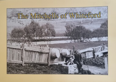
... This publication has local significance as it tells the story of a family from 1879 until the flooding of the valley by the construction of the Hume Weir. Mitta Mitta history Mitchell family history Whiteford Mitta Mitta Valley "Whiteford is a mystical place. ..."Whiteford is a mystical place. A small farm in north-east Victoria, rising from the rich flats of the Mitta Mitta River a few kilometres upstream from its confluence with the mighty Murray River. Taken up in 1879 from the large Bethanga run, Whiteford was home to the Mitchell family until it was flooded by the Hume Weir around 1934. Through this collection of family photos and small stories, we might glimpse something of family and farming in the fertile Mitta Mitta Valley before it was flooded by the Hume Weir" - Paul Mitchell, author.A family history of the Mitchell family of Whiteford, Victoria. This publication includes stories and many black and white images of the Mitchell family and their home."Whiteford is a mystical place. A small farm in north-east Victoria, rising from the rich flats of the Mitta Mitta River a few kilometres upstream from its confluence with the mighty Murray River. Taken up in 1879 from the large Bethanga run, Whiteford was home to the Mitchell family until it was flooded by the Hume Weir around 1934. Through this collection of family photos and small stories, we might glimpse something of family and farming in the fertile Mitta Mitta Valley before it was flooded by the Hume Weir" - Paul Mitchell, author.mitta mitta history, mitchell family history, whiteford mitta mitta valley -
 Wodonga & District Historical Society Inc
Souvenir - China Bowl - Hume Weir, Albury, Westminster Fine China Australia, c1957
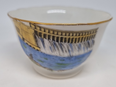
... The Hume Weir was constructed in the late 1920s and was a critical state in the development of water management in the Murray Darling Basin. At the time of its construction ...This item is from a collection donated by descendants of John Francis Turner of Wodonga. Mr Turner was born on 6 June 1885. He completed all of his schooling at Scots Boarding School in Albury, New South Wales. On leaving school, he was employed at Dalgety’s, Albury as an auctioneer. In 1924 John was promoted to Manager of the Wodonga Branch of Dalgety’s. On 15/03/1900 he married Beatrice Neal (born 7/12/1887 and died 7/2/1953) from Collingwood, Victoria. They had four daughters – Frances (Nancy), Heather, Jessie and Mary. In 1920, the family moved from Albury to Wodonga, purchasing their family home “Locherbie” at 169 High Street, Wodonga. "Locherbie" still stands in Wodonga in 2022. The collection contains items used by the Turner family during their life in Wodonga. Westminster Fine China Australia started in the Melbourne suburb of Cheltenham at 7 Arnold Street, in 1954 by Stanley Rogers and Son Ltd. They initially used imported blanks from Japan, which were made to their specifications, and which were then decorated locally. They produced a standard range of shapes for souvenir ware, later expanding into a wide range of tea sets, dinnerware and many other styles of china ware. The Abbey mark, based on Westminster Abbey in London, was used from the start of production until about 1962.The Hume Weir was constructed in the late 1920s and was a critical state in the development of water management in the Murray Darling Basin. At the time of its construction it was the largest water reservoir in the British Empire. Small bowl with gold trim printed with an image of the Hume Weir, Albury. The trademark of Westminster Fine China Australia is on the under side of the plate.On front beneath image "Hume Weir, Albury" Underneath the plate, surrounding an image of Westminster Abbey "FINE CHINA/WESTMINSTER CHINA /AUSTRALIA" souvenirs, westminster china, hume weir australia, memorabilia albury -
 Wodonga & District Historical Society Inc
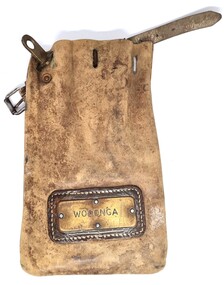
Functional object - Leather pouch and stamps - Cudgewa Railway Line
... In 1919, the line was used to carry materials for the construction of Hume Weir, and three years later a spur line connecting Ebden to the weir was opened. ...In 1919, the line was used to carry materials for the construction of Hume Weir, and three years later a spur line connecting Ebden to the weir was opened. ...Cudgewa Line -The Cudgewa railway line opened in stages between 1889 and 1921. The first section from Wodonga to Huon opened on 10 September 1889. It was extended to Bolga on 18 July 1890, Tallangatta on 24 July 1891 and then to Shelley on 13 June 1916. Shelley was the highest station in Victoria. It extended further on to Beetomba on 10 April 1919 and finally reached Cudgewa on 5 May 1921. The line had 1 in 30 grades and trestle bridges that have been heritage listed. In 1919, the line was used to carry materials for the construction of Hume Weir, and three years later a spur line connecting Ebden to the weir was opened. In the 1960s, Cudgewa became the railhead of materials for the Snowy Mountains Scheme. The last passenger service from Wodonga to Tallangatta ran on 30 September 1961. The turntable and passenger platform at Cudgewa were abolished in 1976. These stamps were used by Joh Murray who for many years worked with Victorian Railways based at Wodonga.A leather pouch with belt and lock. It bears a metal name tag inscribed with name of railway station. The pouch contains 3 station stamps, a date stamp and 2 carriage keys.On pouch WODONGA On stamps: BONEGILLA 1470/ EBDEN 1471/ BANDOLIER 1473cudgewa rail line, victorian railways, closed victorian railways, railway stamps -
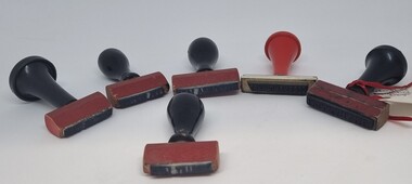 Wodonga & District Historical Society Inc
Functional object - Railway Station stamps Cudgewa Line
... In 1919, the line was used to carry materials for the construction of Hume Weir, and three years later a spur line connecting Ebden to the weir was opened. ...In 1919, the line was used to carry materials for the construction of Hume Weir, and three years later a spur line connecting Ebden to the weir was opened. ...Cudgewa Line -The Cudgewa railway line opened in stages between 1889 and 1921. The first section from Wodonga to Huon opened on 10 September 1889. It was extended to Bolga on 18 July 1890, Tallangatta on 24 July 1891 and then to Shelley on 13 June 1916. Shelley was the highest station in Victoria. It extended further on to Beetomba on 10 April 1919 and finally reached Cudgewa on 5 May 1921. The line had 1 in 30 grades and trestle bridges that have been heritage listed. In 1919, the line was used to carry materials for the construction of Hume Weir, and three years later a spur line connecting Ebden to the weir was opened. In the 1960s, Cudgewa became the railhead of materials for the Snowy Mountains Scheme. The last passenger service from Wodonga to Tallangatta ran on 30 September 1961. The turntable and passenger platform at Cudgewa were abolished in 1976.6 Rubber and wood stamps used in the stations along the Cudgewa Line. The stamps were primarily used to acknowledge receipt of small freight items carried on the Cudgewa LineOn individual stamps: 1. TALLANGATTA 1476 2. BULLIOH 1477 3. BEETOOMBA 1484 4. KOETONG 1480 5. SHELLEY 1482 6. CORRYONG 1487cudgewa rail line, victorian railways, closed victorian railways -
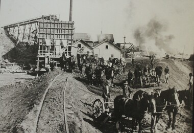 Wodonga & District Historical Society Inc
Photograph - Constructing the Hume Weir, c1928
... Hume dam construction...Hume Weir...A large black and white image of construction of the Hume Weir on the Murray River mounted on board....Hume Dam during its initial construction and ongoing development. Hume Dam took 17 years to construct from the turning of the first sod on 28 November 1919 by Sir Ronald Munro-Ferguson, Governor-General of Australia. The first filling was in December 1934 and it was officially opened on 21 November 1936. Between 1950 and 1961 further modifications were made which enlarged its storage capacity. Progressive improvements have been made since that time to ensure the dam meets modern safety standards. This photo reflects a major stage in the construction of the Hume Dam. Hume dam construction Hume Weir ...This image is from Wodonga Historical Society's large collection of photographs documenting the construction of the Hume Dam during its initial construction and ongoing development. Hume Dam took 17 years to construct from the turning of the first sod on 28 November 1919 by Sir Ronald Munro-Ferguson, Governor-General of Australia. The first filling was in December 1934 and it was officially opened on 21 November 1936. Between 1950 and 1961 further modifications were made which enlarged its storage capacity. Progressive improvements have been made since that time to ensure the dam meets modern safety standards.This photo reflects a major stage in the construction of the Hume Dam.A large black and white image of construction of the Hume Weir on the Murray River mounted on board.hume dam construction, hume weir australia -
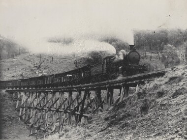 Wodonga & District Historical Society Inc
Photograph - Fred Rochow Railways Collection - Livestock Special, c1923 - 1940
... In 1919, the line was used to carry materials for the construction of Hume Weir, and three years later a spur line connecting Ebden to the weir was opened. ...In 1919, the line was used to carry materials for the construction of Hume Weir, and three years later a spur line connecting Ebden to the weir was opened. ...The Fred Rochow Railways Collection incorporates photos related to the operation of the Wodonga Railway Station including different types of trains and railways staff C. 1930 – 1990. It was donated to the Wodonga Historical Society by Fred Rochow, a railwayman who spent many years based in Wodonga. He joined the Victorian Railways on 17th June l947 and retired in 1988. For some time, he was a member of the Australian Federated Union of Locomotive Enginemen and served a term as a member of the Trades Hall Council. He had an extensive knowledge of the struggles that took place to achieve better conditions for railway workers. Fred worked for many years as a fireman and then worked his way up the ranks to driver, experiencing many changes from the days of steam locomotives through to diesel trains, locomotives and even the modern XPT train. He worked throughout Victoria at different stages of his career, with his final working years focused on the northeast of Victoria and the Albury to Melbourne line. After his retirement, Fred continued to share his love of steam miniature trains with the community.This collection has local and statewide significance as it captures images of trains, locomotives and personnel who operated the railway services in Wodonga and throughout Northeast Victoria. The railways played a critical role in opening up Victoria and connecting Australia for trade, business, social communication and transport.A livestock special being hauled by Locomotive K109 passing over a high trestle bridge between Bullion and Darbyshire on the Cudgewa Line. Cudgewa Line -The Cudgewa railway line opened in stages between 1889 and 1921. The first section from Wodonga to Huon opened on 10 September 1889. It was extended to Bolga on 18 July 1890, Tallangatta on 24 July 1891, Shelley on 13 June 1916 (the highest station in Victoria), Beetomba on 10 April 1919 and Cudgewa on 5 May 1921. The line had 1 in 30 grades and trestle bridges that have been heritage listed. In 1919, the line was used to carry materials for the construction of Hume Weir, and three years later a spur line connecting Ebden to the weir was opened. In the 1960s, Cudgewa became the railhead of materials for the Snowy Mountains Scheme. The last passenger service from Wodonga to Tallangatta ran on 30 September 1961 The turntable and passenger platform at Cudgewa were abolished in 1976. The K class was a branch line steam locomotive that ran on Victorian Railways in Australia from 1922 to 1979 Locomotive K190 entered service on Saturday, 30th June 1923. In 1940 it was renumbered as K149 The locomotive was eventually scrapped on Thursday, 12th October 1967.railways wodonga, fred rochow, wodonga railwaymen, cudgewa rail line, trestle bridges -
 Wodonga & District Historical Society Inc
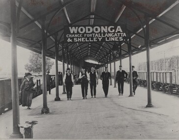
Photograph - Fred Rochow Railways Collection - Wodonga Railway Station, C. 1916 - 1930
... In 1919, the line was used to carry materials for the construction of Hume Weir, and three years later a spur line connecting Ebden to the weir was opened. ...In 1919, the line was used to carry materials for the construction of Hume Weir, and three years later a spur line connecting Ebden to the weir was opened. ...The Fred Rochow Railways Collection incorporates photos related to the operation of the Wodonga Railway Station including different types of trains and railways staff C. 1930 – 1990. It was donated to the Wodonga Historical Society by Fred Rochow, a railwayman who spent many years based in Wodonga. He joined the Victorian Railways on 17th June l947 and retired in 1988. For some time, he was a member of the Australian Federated Union of Locomotive Enginemen and served a term as a member of the Trades Hall Council. He had an extensive knowledge of the struggles that took place to achieve better conditions for railway workers. Fred worked for many years as a fireman and then worked his way up the ranks to driver, experiencing many changes from the days of steam locomotives through to diesel trains, locomotives and even the modern XPT train. He worked throughout Victoria at different stages of his career, with his final working years focused on the northeast of Victoria and the Albury to Melbourne line. After his retirement, Fred continued to share his love of steam miniature trains with the community.This collection has local and statewide significance as it captures images of trains, locomotives and personnel who operated the railway services in Wodonga and throughout Northeast Victoria. The railways played a critical role in opening up Victoria and connecting Australia for trade, business, social communication and transport.Railway men walking along the Wodonga Railway Platform. The sign overhead advises of changes to the Tallangatta and Shelley lines. Cudgewa Line -The Cudgewa railway line opened in stages between 1889 and 1921. The first section from Wodonga to Huon opened on 10 September 1889. It was extended to Bolga on 18 July 1890, Tallangatta on 24 July 1891 and then to Shelley on 13 June 1916. Shelley was the highest station in Victoria. It extended further on to Beetomba on 10 April 1919 and finally reached Cudgewa on 5 May 1921. The line had 1 in 30 grades and trestle bridges that have been heritage listed. In 1919, the line was used to carry materials for the construction of Hume Weir, and three years later a spur line connecting Ebden to the weir was opened. In the 1960s, Cudgewa became the railhead of materials for the Snowy Mountains Scheme. The last passenger service from Wodonga to Tallangatta ran on 30 September 1961. The turntable and passenger platform at Cudgewa were abolished in 1976. On sign hanging overhead "WODONGA/ CHANGE FOR TALLANGATTA AND SHELLEY LINES"railways wodonga, fred rochow, wodonga railwaymen, cudgewa rail line, wodonga railway station -
 Wodonga & District Historical Society Inc
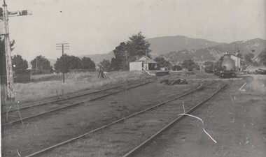
Photograph - Fred Rochow Railways Collection - Cudgewa - As most railwaymen knew it, C. 1950s - 1960s
... In 1919, the line was used to carry materials for the construction of Hume Weir, and three years later a spur line connecting Ebden to the weir was opened. ...In 1919, the line was used to carry materials for the construction of Hume Weir, and three years later a spur line connecting Ebden to the weir was opened. ...The Fred Rochow Railways Collection incorporates photos related to the operation of the Wodonga Railway Station including different types of trains and railways staff C. 1930 – 1990. It was donated to the Wodonga Historical Society by Fred Rochow, a railwayman who spent many years based in Wodonga. He joined the Victorian Railways on 17th June l947 and retired in 1988. For some time, he was a member of the Australian Federated Union of Locomotive Enginemen and served a term as a member of the Trades Hall Council. He had an extensive knowledge of the struggles that took place to achieve better conditions for railway workers. Fred worked for many years as a fireman and then worked his way up the ranks to driver, experiencing many changes from the days of steam locomotives through to diesel trains, locomotives and even the modern XPT train. He worked throughout Victoria at different stages of his career, with his final working years focused on the northeast of Victoria and the Albury to Melbourne line. After his retirement, Fred continued to share his love of steam miniature trains with the community.This collection has local and statewide significance as it captures images of trains, locomotives and personnel who operated the railway services in Wodonga and throughout Northeast Victoria. The railways played a critical role in opening up Victoria and connecting Australia for trade, business, social communication and transport.The space on the left was storage space for machinery for the Snowy Mountains Hydro Electric Scheme. A special train was used to cart wide loads such as turbines, and trucks were made for widening when required. Equipment was loaded onto trains t the docks in Melbourne. Cudgewa Line -The Cudgewa railway line opened in stages between 1889 and 1921. The first section from Wodonga to Huon opened on 10 September 1889. It was extended to Bolga on 18 July 1890, Tallangatta on 24 July 1891, Shelley on 13 June 1916 (the highest station in Victoria), Beetomba on 10 April 1919 and Cudgewa on 5 May 1921. In 1919, the line was used to carry materials for the construction of Hume Weir, and three years later a spur line connecting Ebden to the weir was opened. In the 1960s, Cudgewa became the railhead of materials for the Snowy Mountains Scheme. The last passenger service from Wodonga to Tallangatta ran on 30 September 1961 The turntable and passenger platform at Cudgewa were abolished in 1976.railways wodonga, fred rochow, cudgewa station, snowy mountains hydro electric scheme -
 Wodonga & District Historical Society Inc
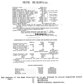
Album - Hume Reservoir Australia Album - Dimensions of Hume Reservoir, Department of Public Works, N.S.W, 1927
... Table outlining the Dimensions of the Hume Weir and comparisons with MAKWAR and BURRINJUCK DAMS, and some other comparisons. MAKWAR Dam is located on the Blue Nile about five miles south of Sennar and 175 miles south of Khartoum in Sudan. The construction...Hume Reservoir up to 1927. It was the largest water reservoir in the British Empire. The album records the pioneering engineering work that went into its construction. Hume Reservoir Australia River Murray Waters Scheme Hume dimensions Table outlining the Dimensions of the Hume Weir and comparisons with MAKWAR and BURRINJUCK DAMS, and some other comparisons. ...This set of photos is from a leather bound album bearing the inscription "HUME RESERVOIR AUSTRALIA" plus 'The Rt. Hon. L. C. M. S. Amery, P. C., M .P.' all inscribed in gold. It was presented to The Rt. Hon. L. C. M. S. Amery, P. C., M. P, Secretary of State for Dominion Affairs on the occasion of his visit to the Hume Reservoir on 2nd November 1927. This album is of local and national significance as it documents the planning and development of the Hume Reservoir up to 1927. It was the largest water reservoir in the British Empire. The album records the pioneering engineering work that went into its construction.Table outlining the Dimensions of the Hume Weir and comparisons with MAKWAR and BURRINJUCK DAMS, and some other comparisons. MAKWAR Dam is located on the Blue Nile about five miles south of Sennar and 175 miles south of Khartoum in Sudan. The construction of this dam started in 1922 and was completed in May 1925, while the British Empire colonised Sudan. It was officially opened on 21st January 1926. The BURRINJUCK DAM is situated in the upper catchment of the Murrumbidgee River, approximately 60 kms from Yass, N.S.W. It was built from 1907 to 1927 The stated purpose of the Hume Reservoir is to get storage to ensure regulated output for:- 1. Irrigation 2. Navigation 3. Hydro-electric Generation.hume reservoir australia, river murray waters scheme, hume dimensions -
 Wodonga & District Historical Society Inc
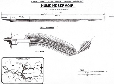
Album - Hume Reservoir Australia Album - Plans and Progress Photos - River Murray Water Scheme, Department of Public Works, N.S.W, 1927
... Hume Reservoir up to 1927. It was the largest water reservoir in the British Empire. The album records the pioneering engineering work that went into its construction. Hume Reservoir Australia River Murray Waters Scheme Hume Weir ...This set of photos is from a leather bound album bearing the inscription "HUME RESERVOIR AUSTRALIA" plus 'The Rt. Hon. L. C. M. S. Amery, P. C., M .P.' all inscribed in gold. It was presented to The Rt. Hon. L. C. M. S. Amery, P. C., M. P, Secretary of State for Dominion Affairs on the occasion of his visit to the Hume Reservoir on 2nd November 1927. This album is of local and national significance as it documents the planning and development of the Hume Reservoir up to 1927. It was the largest water reservoir in the British Empire. The album records the pioneering engineering work that went into its construction.1. Locality Plan and Plan of Dam. The dam is about ten miles by road upstream from Albury and about three-quarters of a mile below the confluence of the Mitta Mitta River and the Murray River. Its main features consist of a concrete portion across the bed of the river with earth embankment at both ends. The foundations throughout are on hard granite, found at an average depth of about 40 feet below the surface, the centre line being located to take advantage of the most favourable rock levels.Heading on page "WORKS UNDER RIVER MURRAY WATERS AGREEMENT/HUME RESERVOIR" Beneath top diagram "FIG. 1. ELEVATION" Beneath second diagram "FIG. 2. PLAN" On map "LOCALITY PLAN"hume reservoir australia, river murray waters scheme, hume weir diagrams, hume weir location
