
Showing 68 items matching "landing areas"
-
 Moorabbin Air Museum
Document (item) - CA-15 Emergency procedures during flight Survey of commercial pilots metal fatigue Die penetrants HPR3 Handley Page performance and design details Boeing A300 B767 Turkish airline DC10 crash 3 march 1974 Avro Anson Nomad N24A high speed flight WW1 Australian pilots Australian aircraft registration Aermacchi MB-326H Jim Bede CAC Wallaby ESAMS remote piloted helicopter types of British aircraft up to 1918 SR71 U2 Ken Wallis Little Nelly Jean Batten Bob Miles Gypsy Moth Molyneux helicopter CA 25 FLUT-R-Bug Chipmunk Chris Neale Perfectus Ellis Walker New Comet Beagle Landing areas in Australia Fishermans Bend airport Southern Cross Southern Cross Junior Akro Laser Short Scion Pierpont Langley Jeep plane Homebuilt plane criteria R33 R101 R100 Graf Zeppelin Corrosion DEF Aust 143 Weight control of aircraft DCA No.17 Airtruck F14 B-1 F-4 F-15 A-6 F-16 F/A-18 CH-53E AH-64 A-10 F-5 Space Shuttle Winjeel DC-3 Her Majesty the Queen ME 410 Nestler Scout Bellmodel 214 Loire 11 Schweizer model 300 Antonov An-8 camp Nanchang cj-6 Nieuport de Lage ni-D.122 Junker K 39 ICA Brasov IAR-823 Les Mureaux 120 F&W C-3603 Spitfire Lockheed C-36 Pilatus PC-6 Heinkel He 115 Canadair CL-215 Curtiss JN-4 Jenny Antonov An-2 colt Boeing KC-135 Stuka Liberator B-52 Morane Saulnier Bf-109 Dewoitine Yak-3 F-5 KFIR F-100 B-1B B-25 B-17 Fokker D VII Mustang F-16 Aeritalia Aermacchi Fishbed Mikoyan Hawker Hunter PZL P.11 Yakovlev Yak-11 Dassault Alpha jet Westland Lynx Magni PM-3-4 Letov S 50 Partenavia P.64 Piaggio P.149D Breda Ba 64 Aerotec A-122 Farman F.40 McCulloch H-30 Junkers K 53 Cessna U-3 Bf 161, CAC Keith Meggs collection
... CA-15 Emergency procedures during flight Survey of commercial pilots metal fatigue Die penetrants HPR3 Handley Page performance and design details Boeing A300 B767 Turkish airline DC10 crash 3 march 1974 Avro Anson Nomad N24A high speed flight WW1 Australian pilots Australian aircraft registration Aermacchi MB-326H Jim Bede CAC Wallaby ESAMS remote piloted helicopter types of British aircraft up to 1918 SR71 U2 Ken Wallis Little Nelly Jean Batten Bob Miles Gypsy Moth Molyneux helicopter CA 25 FLUT-R-Bug Chipmunk Chris Neale Perfectus Ellis Walker New Comet Beagle Landing areas in Australia Fishermans Bend airport Southern Cross Southern Cross Junior Akro Laser Short Scion Pierpont Langley Jeep plane Homebuilt plane criteria R33 R101 R100 Graf Zeppelin Corrosion DEF Aust 143 Weight control of aircraft DCA No.17 Airtruck F14 B-1 F-4 F-15 A-6 F-16 F/A-18 CH-53E AH-64 A-10 F-5 Space Shuttle Winjeel DC-3 Her Majesty the Queen ME 410 Nestler Scout Bellmodel 214 Loire 11 Schweizer model 300 Antonov An-8 camp Nanchang cj-6 Nieuport de Lage ni-D.122 Junker K 39 ICA Brasov IAR-823 Les Mureaux 120 F&W C-3603 Spitfire Lockheed C-36 Pilatus PC-6 Heinkel He 115 Canadair CL-215 Curtiss JN-4 Jenny Antonov An-2 colt Boeing KC-135 Stuka Liberator B-52 Morane Saulnier Bf-109 Dewoitine Yak-3 F-5 KFIR F-100 B-1B B-25 B-17 Fokker D VII Mustang F-16 Aeritalia Aermacchi Fishbed Mikoyan Hawker Hunter PZL P.11 Yakovlev Yak-11 Dassault Alpha jet Westland Lynx Magni PM-3-4 Letov S 50 Partenavia P.64 Piaggio P.149D Breda Ba 64 Aerotec A-122 Farman F.40 McCulloch H-30 Junkers K 53 Cessna U-3 Bf 161...CAC Keith Meggs collection Document CA-15 Emergency procedures during flight Survey of commercial pilots metal fatigue Die penetrants HPR3 Handley Page performance and design details Boeing A300 B767 Turkish airline DC10 crash 3 march 1974 Avro Anson Nomad N24A high speed flight WW1 Australian pilots Australian aircraft registration Aermacchi MB-326H Jim Bede CAC Wallaby ESAMS remote piloted helicopter types of British aircraft up to 1918 SR71 U2 Ken Wallis Little Nelly Jean Batten Bob Miles Gypsy Moth Molyneux helicopter CA 25 FLUT-R-Bug Chipmunk Chris Neale Perfectus Ellis Walker New Comet Beagle Landing areas in Australia Fishermans Bend airport Southern Cross Southern Cross Junior Akro Laser Short Scion Pierpont Langley Jeep plane Homebuilt plane criteria R33 R101 R100 Graf Zeppelin Corrosion DEF Aust 143 Weight control of aircraft DCA No.17 Airtruck F14 B-1 F-4 F-15 A-6 F-16 F/A-18 CH-53E AH-64 A-10 F-5 Space Shuttle Winjeel DC-3 Her Majesty the Queen ME 410 Nestler Scout Bellmodel 214 Loire 11 Schweizer model 300 Antonov An-8 camp Nanchang cj-6 Nieuport de Lage ni-D.122 Junker K 39 ICA Brasov IAR-823 Les Mureaux 120 F&W C-3603 Spitfire Lockheed C-36 Pilatus PC-6 Heinkel He 115 Canadair CL-215 Curtiss JN-4 Jenny Antonov An-2 colt Boeing KC-135 Stuka Liberator B-52 Morane Saulnier Bf-109 Dewoitine Yak-3 F-5 KFIR F-100 B-1B B-25 B-17 Fokker D VII Mustang F-16 Aeritalia Aermacchi Fishbed Mikoyan Hawker Hunter PZL P.11 Yakovlev Yak-11 Dassault Alpha jet Westland Lynx Magni PM-3-4 Letov S 50 Partenavia P.64 Piaggio P.149D Breda Ba 64 Aerotec A-122 Farman F.40 McCulloch H-30 Junkers K 53 Cessna U-3 Bf 161 ... -
 Montmorency–Eltham RSL Sub Branch
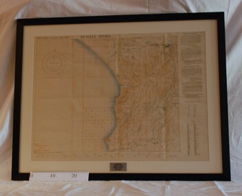
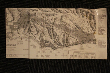
Map - Framed 1915 Anzac Cove Map, Gallipoli, 1915.ANZAC Cove Map, 1915
... ...landing areas...Depth soundings of landing areas off Anzac Cove....Depth soundings of landing areas off Anzac Cove. 1915.ANZAC Cove Map Map Framed 1915 Anzac Cove Map, Gallipoli Survey Department - Egypt ...A framed map depicting trench lines and the battlefields of the Gallipoli Campaign, 1915, made by the Survey Department Egypt. Depth soundings of landing areas off Anzac Cove.Gallipoli - Anzac Cove World War One Map - 1915world war one, anzac, gallipoli, 1915, anzac cove, map, dardenelles, trench lines, depth soundings, landing areas -
National Vietnam Veterans Museum (NVVM)
Film - Film, DVD, 1 AFH (Australian Field Hospital) shots of walkway
... Contains 6 photos incl. a walkway, stretchers near pad & other shots around the helicopter landing area....1st Australian Field Hospital Contains 6 photos incl. a walkway, stretchers near pad & other shots around the helicopter landing area. 1 AFH (Australian Field Hospital) shots of walkway Film Film, DVD ...Contains 6 photos incl. a walkway, stretchers near pad & other shots around the helicopter landing area.1st australian field hospital -
Lakes Entrance Historical Society
Photograph - jetty and shoreline at Lake Tyers Aboriginal Station. Lake Tyers Victoria c1949, c1949
... Tree in foreground obscures boat shed beside the landing area, shoreline on opposite bank of lake is timbered. ...Tree in foreground obscures boat shed beside the landing area, shoreline on opposite bank of lake is timbered. ...Black and white photograph of the jetty and shoreline at Lake Tyers Aboriginal Station. Showing a launch carrying tourists approaching, and a dozen or more people waiting on the jetty. Tree in foreground obscures boat shed beside the landing area, shoreline on opposite bank of lake is timbered. Lake Tyers Victoriaaboriginals, tourism, boats and boating -
 Bendigo Military Museum
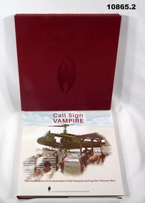
Book - VIETNAM, MEDICAL, Rod SEARLE, Denise BELL, Paul DANAHER, Gregory ANDERSON, "CALL SIGN VAMPIRE", 2021
... Illustrated - front, colour photograph of a helicopter, landing area and five army personnel. Back - two personnel in operating theatre scene. 280 pages - cut, plain white paper. ...Illustrated - front, colour photograph of a helicopter, landing area and five army personnel. Back - two personnel in operating theatre scene. 280 pages - cut, plain white paper. ...From Title page. "Call sign/ VAMPIRE/ The Inside Story of our Australian Field Hospital during the Vietnam War".1. Hard cover book with dust cover. Cover is cardboard with red colour buckram. Dustcover - paper, red and back print on front, spine and back. Illustrated - front, colour photograph of a helicopter, landing area and five army personnel. Back - two personnel in operating theatre scene. 280 pages - cut, plain white paper. Ilustrated in colour and black and white photographs, documents and newspaper clippings. 2. Slipcase - cardboard box shape with red buckram cover. Embossed with red print on front and back edge.publications, books, medical, vietnam -
 Bendigo Military Museum
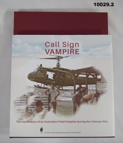
Book - VIETNAM, MEDICAL, Rod SEARLE, Denice BELL, Paul DANAHAR, Gregory ANDERSON, "CALL SIGN VAMPIRE", 2021
... Illustrated front, colour photograph of a helicopter, landing area and five Army personnel. Back - two personnel in operating theatre scene. 280 pages - cut, plain, white colour paper. ...Illustrated front, colour photograph of a helicopter, landing area and five Army personnel. Back - two personnel in operating theatre scene. 280 pages - cut, plain, white colour paper. ...From Title Page; "Call Sign/ Vampire/ The inside story of an Australian Field Hospital during the Vietnam War".1. Hard cover book with dust cover. Hard cover - with red coloured Buckram. Dust cover - paper, red and black print on front, spine and back. Illustrated front, colour photograph of a helicopter, landing area and five Army personnel. Back - two personnel in operating theatre scene. 280 pages - cut, plain, white colour paper. Illustrated - colour and black and white photographs, documents and newspaper clippings. 2. Slipcase. Slipcover - cardboard box shape with red Buckram cover - Embossed red print on front and back edge. publications, books, medical, vietnam -
 Lara RSL Sub Branch
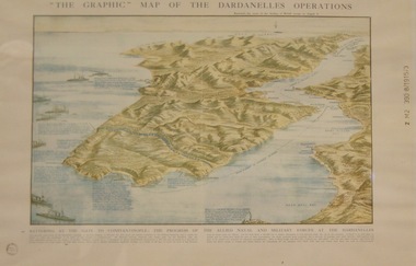
Topagraphical Map of the Dardanelles Operations, Graphic Map of The Dardanelles Operations
... Graphical representation of the Dardanelle's Operations displaying the Australia & New Zealand and the British operational areas and Landings. Military and Naval involvements in battering the gates to Constantinople....military naval battering of the gates of constantinople australia and new zealand (anzac) Small circular stamp on front left bottom - "State Library of N.S.W." and on he right hand border " Z M2 390 8/1915/3" Graphical representation of the Dardanelle's Operations displaying the Australia & New Zealand and the British operational areas and Landings. Military and Naval involvements in battering the gates to Constantinople. ...WW1, Dardanelles operational map of area of Operations. Military, Naval of the "battering of the Gates of Constantinople"WW! ANZAC, British Military and Naval Operations in the Dardanelles. "battering of the Gates of Constantinople"Graphical representation of the Dardanelle's Operations displaying the Australia & New Zealand and the British operational areas and Landings. Military and Naval involvements in battering the gates to Constantinople.Small circular stamp on front left bottom - "State Library of N.S.W." and on he right hand border " Z M2 390 8/1915/3"ww!, military, naval, battering of the gates of constantinople, australia and new zealand (anzac) -
 Orbost & District Historical Society
map, 1985
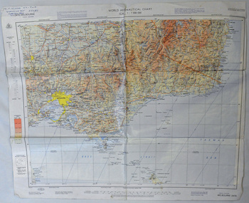
... Using these charts and other tools, pilots are able to determine their position, safe altitude, best route to a destination, navigation aids along the way, alternative landing areas in case of an in-flight emergency, and other useful information such as radio frequencies and airspace boundaries. ...Using these charts and other tools, pilots are able to determine their position, safe altitude, best route to a destination, navigation aids along the way, alternative landing areas in case of an in-flight emergency, and other useful information such as radio frequencies and airspace boundaries. ...An aeronautical chart is a map designed to assist in navigation of aircraft. Using these charts and other tools, pilots are able to determine their position, safe altitude, best route to a destination, navigation aids along the way, alternative landing areas in case of an in-flight emergency, and other useful information such as radio frequencies and airspace boundaries. World aeronautical charts have a scale of 1:1,000,000 and cover relatively large areas. Orbost Aero Club began in 1969 with Basil Dowie as Chair, David Nixon as Secretary/Treasurer. The group went into recess from 1977-1991 closing in 1997. The mid 1960s were boom years in flying training in Australia and the number of Aero Clubs grew rapidly. The Club played a significant role in the establishment of the small airport at Marlo and in the ongoing operation and development of the airport over the years particularly for patient transfer by aerial ambulance. The Orbost Aero Club Club played a significant role in the establishment of the small airport at Marlo and in the ongoing operation and development of the airport over the years.A laminated map of eastern Victoria. A World Aeronautical Chart. It shows elevations, longitude etc and is designed for pre-flight planning as well as pilotage. Top left hand corner - D.F.N.Nixon VH-FWD 12 Kristine Ct Cheletenham 27/7/87orbost-aero-club aeronautical-map -
 Flagstaff Hill Maritime Museum and Village
Book - Religious Book/Bilble, Oxford University Press, The Holy Bible, 1866
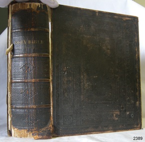
... Upon arriving in New South Wales, Joseph and Elizabeth initially settled in the Singleton area within the Hunter River Valley. In 1857, roughly two years after landing in Australia, Joseph made a choice that fundamentally altered his family's lifestyle: he converted from the Church of England to the Christian Israelites, a millenarian sect following the teachings of John Wroe. ...Upon arriving in New South Wales, Joseph and Elizabeth initially settled in the Singleton area within the Hunter River Valley. In 1857, roughly two years after landing in Australia, Joseph made a choice that fundamentally altered his family's lifestyle: he converted from the Church of England to the Christian Israelites, a millenarian sect following the teachings of John Wroe. ...To understand the nature of your 1866 Oxford University Press (OUP) Bible, it helps to look at how Bibles were produced in the 19th century and the massive historical scale of the publisher. The context of the King James Version Bible is indicated by the standard phrase on the flyleaf: "Translated out of the Original Tongues... By His Majesty's Special Command." This work is a historical 1866 reprint of the original version published in 1611. This particular volume served as the family Bible for Joseph and Elizabeth Bell, documenting their family history through the births and deaths noted on its end papers.Book, black hard cover with embossed pattern and gold test, metal locking clasp. King James Version of the Holy Bible, containing the Old and New Testaments. It was published by Oxford University Press in 1866. Inscriptions on the loose endpaper list the marriage of Joseph and Elizabeth Bell in 1854 at St Paul's, Bristol, England, and their ten children born from 1856 to 1878.non-fictionTo understand the nature of your 1866 Oxford University Press (OUP) Bible, it helps to look at how Bibles were produced in the 19th century and the massive historical scale of the publisher. The context of the King James Version Bible is indicated by the standard phrase on the flyleaf: "Translated out of the Original Tongues... By His Majesty's Special Command." This work is a historical 1866 reprint of the original version published in 1611. This particular volume served as the family Bible for Joseph and Elizabeth Bell, documenting their family history through the births and deaths noted on its end papers.flagstaff hill, flagstaff hill maritime museum and village, warrnambool, maritime museum, maritime village, great ocean road, shipwreck coast, holy bible, book, religious book, bell family, bell family bible, elizabeth bell, joseph bell, 1826, 1833, 1854, st paul's bristol -
 Marysville & District Historical Society
Photograph (item) - Colour photograph, 10-1984
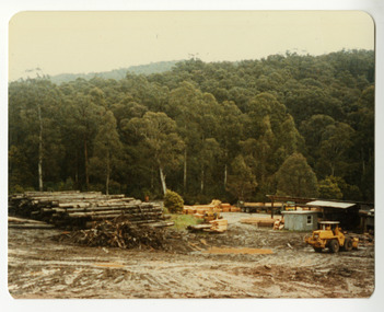
... According to Victoria Government Gazette records from 1958, the Sund brothers operated commercial goods vehicles to transport Mountain ash and other hardwood logs from forest landings in the Mt. Gordon area directly to their mill in Marysville. ...According to Victoria Government Gazette records from 1958, the Sund brothers operated commercial goods vehicles to transport Mountain ash and other hardwood logs from forest landings in the Mt. Gordon area directly to their mill in Marysville. ...A colour photograph taken at Sunds Bros Sawmill in Marysville. Sund's Sawmill (historically operated by Arthur & John Sund and often referenced locally as Sund Stenco) was a prominent mid-century timber mill located in Marysville, Victoria. It played a central role in the region's booming post-war logging era. The mill was highly active during the 1950s. This era marked a peak for Marysville's timber sector, with over 300 men employed across multiple local mills, sustaining nearly 1,000 residents. According to Victoria Government Gazette records from 1958, the Sund brothers operated commercial goods vehicles to transport Mountain ash and other hardwood logs from forest landings in the Mt. Gordon area directly to their mill in Marysville. Sawn timber from the Sund Bros mill was primary distributed to Millard's timber yards at Mt. Evelyn, eventually supplying building blocks across the rapidly growing eastern suburbs of Melbourne.A colour photograph taken at Sunds Bros Sawmill in Marysville.marysville, victoria, australia, arthur sund, john sund, sund stenco, sunds bros sawmill, victorian government gazette 1958, mountain ash, mount gordon, millard's timber yards, mt. evelyn, melbourne, photograph -
 Marysville & District Historical Society
Photograph (item) - Colour photograph, 1970s
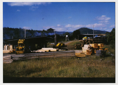
... According to Victoria Government Gazette records from 1958, the Sund brothers operated commercial goods vehicles to transport Mountain ash and other hardwood logs from forest landings in the Mt. Gordon area directly to their mill in Marysville. ...According to Victoria Government Gazette records from 1958, the Sund brothers operated commercial goods vehicles to transport Mountain ash and other hardwood logs from forest landings in the Mt. Gordon area directly to their mill in Marysville. ...A copy of a colour photograph taken at Sunds Bros Sawmill located in Marysville. The original photograph was taken in the 1970s. Sund's Sawmill (historically operated by Arthur & John Sund and often referenced locally as Sund Stenco) was a prominent mid-century timber mill located in Marysville, Victoria. It played a central role in the region's booming post-war logging era. The mill was highly active during the 1950s. This era marked a peak for Marysville's timber sector, with over 300 men employed across multiple local mills, sustaining nearly 1,000 residents. According to Victoria Government Gazette records from 1958, the Sund brothers operated commercial goods vehicles to transport Mountain ash and other hardwood logs from forest landings in the Mt. Gordon area directly to their mill in Marysville. Sawn timber from the Sund Bros mill was primary distributed to Millard's timber yards at Mt. Evelyn, eventually supplying building blocks across the rapidly growing eastern suburbs of Melbourne.A copy of a colour photograph taken at Sunds Bros Sawmill located in Marysville. The original photograph was taken in the 1970s.marysville, victoria, australia, arthur sund, john sund, sund stenco, sunds bros sawmill, victorian government gazette 1958, mountain ash, mount gordon, millard's timber yards, mt. evelyn, melbourne, photograph -
 Marysville & District Historical Society
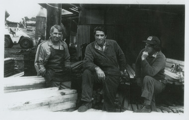
Photograph (item) - Black and white photograph, Unknown
... According to Victoria Government Gazette records from 1958, the Sund brothers operated commercial goods vehicles to transport Mountain ash and other hardwood logs from forest landings in the Mt. Gordon area directly to their mill in Marysville. ...According to Victoria Government Gazette records from 1958, the Sund brothers operated commercial goods vehicles to transport Mountain ash and other hardwood logs from forest landings in the Mt. Gordon area directly to their mill in Marysville. ...A copy of a black and white photograph of Bill, Allan and Len Sund who at one stage operated the Sunds Bros Sawmill in Marysville. Sund's Sawmill (historically operated by Arthur & John Sund and often referenced locally as Sund Stenco) was a prominent mid-century timber mill located in Marysville, Victoria. It played a central role in the region's booming post-war logging era. The mill was highly active during the 1950s. This era marked a peak for Marysville's timber sector, with over 300 men employed across multiple local mills, sustaining nearly 1,000 residents. According to Victoria Government Gazette records from 1958, the Sund brothers operated commercial goods vehicles to transport Mountain ash and other hardwood logs from forest landings in the Mt. Gordon area directly to their mill in Marysville. Sawn timber from the Sund Bros mill was primary distributed to Millard's timber yards at Mt. Evelyn, eventually supplying building blocks across the rapidly growing eastern suburbs of Melbourne.A copy of a black and white photograph of Bill, Allan and Len Sund who at one stage operated the Sunds Bros Sawmill in Marysville.marysville, victoria, australia, arthur sund, john sund, sund stenco, sunds bros sawmill, victorian government gazette 1958, mountain ash, mount gordon, millard's timber yards, mt. evelyn, melbourne, photograph, bill sund, allan sund, len sund -
 Marysville & District Historical Society
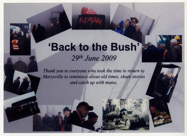
Ephemera (item) - Thank you card, 'Back to the Bush', 2009
... According to Victoria Government Gazette records from 1958, the Sund brothers operated commercial goods vehicles to transport Mountain ash and other hardwood logs from forest landings in the Mt. Gordon area directly to their mill in Marysville. ...According to Victoria Government Gazette records from 1958, the Sund brothers operated commercial goods vehicles to transport Mountain ash and other hardwood logs from forest landings in the Mt. Gordon area directly to their mill in Marysville. ...A thank you card that was sent by the Sund family to attendees of a function that was held some four months after the 2009 Black Saturday bushfires that destroyed the majority of the township of Marysville. The Sund family owned and operated a timber sawmill in Marysville. Sund's Sawmill (historically operated by Arthur & John Sund and often referenced locally as Sund Stenco) was a prominent mid-century timber mill located in Marysville, Victoria. It played a central role in the region's booming post-war logging era. The mill was highly active during the 1950s. This era marked a peak for Marysville's timber sector, with over 300 men employed across multiple local mills, sustaining nearly 1,000 residents. According to Victoria Government Gazette records from 1958, the Sund brothers operated commercial goods vehicles to transport Mountain ash and other hardwood logs from forest landings in the Mt. Gordon area directly to their mill in Marysville. Sawn timber from the Sund Bros mill was primary distributed to Millard's timber yards at Mt. Evelyn, eventually supplying building blocks across the rapidly growing eastern suburbs of Melbourne.A thank you card that was sent by the Sund family to attendees of a function that was held some four months after the 2009 Black Saturday bushfires that destroyed the majority of the township of Marysville. The Sund family owned an operated a timber sawmill in Marysville.marysville, victoria, australia, arthur sund, john sund, sund stenco, sunds bros sawmill, victorian government gazette 1958, mountain ash, mount gordon, millard's timber yards, mt. evelyn, melbourne, photograph, 2009 black saturday bushfires -
 Marysville & District Historical Society
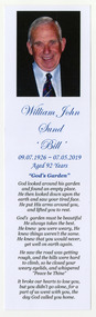
Ephemera (item) - Bookmark, Heritage & Heritage Funerals, 05-2019
... According to Victoria Government Gazette records from 1958, the Sund brothers operated commercial goods vehicles to transport Mountain ash and other hardwood logs from forest landings in the Mt. Gordon area directly to their mill in Marysville. ...According to Victoria Government Gazette records from 1958, the Sund brothers operated commercial goods vehicles to transport Mountain ash and other hardwood logs from forest landings in the Mt. Gordon area directly to their mill in Marysville. ...A bookmark that was available to attendees at Bill Sund's funeral. The Sund family owned and operated a timber sawmill in Marysville. Sund's Sawmill (historically operated by Arthur & John Sund and often referenced locally as Sund Stenco) was a prominent mid-century timber mill located in Marysville, Victoria. It played a central role in the region's booming post-war logging era. The mill was highly active during the 1950s. This era marked a peak for Marysville's timber sector, with over 300 men employed across multiple local mills, sustaining nearly 1,000 residents. According to Victoria Government Gazette records from 1958, the Sund brothers operated commercial goods vehicles to transport Mountain ash and other hardwood logs from forest landings in the Mt. Gordon area directly to their mill in Marysville. Sawn timber from the Sund Bros mill was primary distributed to Millard's timber yards at Mt. Evelyn, eventually supplying building blocks across the rapidly growing eastern suburbs of Melbourne.A bookmark that was available to attendees at Bill Sund's funeral. The Sund family owned and operated a timber sawmill in Marysville.marysville, victoria, australia, arthur sund, john sund, sund stenco, sunds bros sawmill, victorian government gazette 1958, mountain ash, mount gordon, millard's timber yards, mt. evelyn, melbourne, 2009 black saturday bushfires, william john sund, bookmark -
 Lara RSL Sub Branch
Group of Maps World War One, Group of Maps World War One - Dardanelles and Anzac Gallipoli Maps Circ 1915, Circ 1916
... Landings and later evacuation marked. 2. Details of Naval actions taken in the Dardanelles Passage 18 March 1918. 3. Local area...Landings and later evacuation marked. 2. Details of Naval actions taken in the Dardanelles Passage 18 March 1918. 3. Local area ...Gallipoli 1915 Maps and Naval plan of Operations World War One ANZACRare examples that explain both ANZAC and Naval Operations during World War One Gallipoli & Dardanelles Passage .!. Black and White Photocopy of Gallipoli 1915 ANZAC Battlefield - detailed positions of troops and Cemeteries. 2.The Allied Failure to Force The Dardanelles Passage 18 March 1915 - detailed line of Attack Naval Organisation, Mine layout, Plan of Attack (and copy).. 3. Map of Turkey and surrounding area written in Turkish and German Languages. C0olor version main roads and distances. (and copy).. 4. Map of ANZAC Trench Diagram. World War One.Color. (and copy). 5.Panorama of Chunuk Blair from 3 miles south of Nibrunesi Point, 3 November 1915 and Anzac from 1 mile N. E. of Ari Burnu, 21 November 1915. Black & White 6. Color Map of ANZAC positions with topographical Details, notes. 1. Artwork and copyright by Srewart Cownie, Gallipoli 1915 ANZAC Battlefield with Landings and later evacuation marked. 2. Details of Naval actions taken in the Dardanelles Passage 18 March 1918. 3. Local area Map or Turkey. Shows roads network and townships. 4. ANZAC Trench Diagram, copyright Whitcombe & Tombs Limited , Wellington N.Z. 1919 5. Panorama of two coast views of ANZAC area. Australian War Memorial, 6. Map of ANZAC positions of World War One, Gallipoli 1915. Published by H.E.C. Roberinson, George Street, Sydney N.S.W.18 April 1916maps operational of anzac and naval opations during 1915 etc, dardanelles naval opations -
 Lara RSL Sub Branch
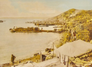
Framed Photograph of Anzac cove, Anzac Cove 1915
... It was on 29 April that General Birdwood recommended that the original landing site between the two headlands be known as "Anzac Cove" and that the surrounding, hitherto nameless, area occupied by his corps be known as "Anzac". ...It was on 29 April that General Birdwood recommended that the original landing site between the two headlands be known as "Anzac Cove" and that the surrounding, hitherto nameless, area occupied by his corps be known as "Anzac". ...Gallipoli Campaign 1915-6[edit] The first objective for soldiers coming ashore in enemy-held territory was to establish a beachhead, that is a safe section of beach protected from enemy attack where supplies and extra troops could be safely brought ashore. Anzac Cove was always within 1 kilometre (3,300 ft) of the front-line, well within the range of Turkish artillery though spurs from the high ground of Plugge's Plateau, which rose above Arıburnu, provided some protection. General William Birdwood, commander of Anzac, made his headquarters in a gully overlooking the cove, as did the commanders of the New Zealand and Australian Division and the Australian 1st Division. It was on 29 April that General Birdwood recommended that the original landing site between the two headlands be known as "Anzac Cove" and that the surrounding, hitherto nameless, area occupied by his corps be known as "Anzac". Anzac Cove is a small cove on the Gallipoli peninsula in Turkey. It became famous as the site of World War I landing of the ANZACs (Australian and New Zealand Army Corps) on 25 April 1915. The cove is 600 metres (2,000 ft) long, bounded by the headlands of Arıburnu to the north and Little Arıburnu, known as Hell Spit, to the south. Following the landing at Anzac Cove, the beach became the main base for the Australian and New Zealand troops for the eight months of the Gallipoli campaign. Rectangular shaped glass covered picture frame showing Anzac Cove.world war 1,gallipoli,anzac cove,lara r.s.l. ww1 -
 Marysville & District Historical Society
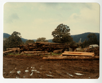
Photograph (item) - Colour photograph, 10-1984
... According to Victoria Government Gazette records from 1958, the Sund brothers operated commercial goods vehicles to transport Mountain ash and other hardwood logs from forest landings in the Mt. Gordon area directly to their mill in Marysville. ...According to Victoria Government Gazette records from 1958, the Sund brothers operated commercial goods vehicles to transport Mountain ash and other hardwood logs from forest landings in the Mt. Gordon area directly to their mill in Marysville. ...A colour photograph taken at Sunds Bros Sawmill in Marysville. Sund's Sawmill (historically operated by Arthur & John Sund and often referenced locally as Sund Stenco) was a prominent mid-century timber mill located in Marysville, Victoria. It played a central role in the region's booming post-war logging era. The mill was highly active during the 1950s. This era marked a peak for Marysville's timber sector, with over 300 men employed across multiple local mills, sustaining nearly 1,000 residents. According to Victoria Government Gazette records from 1958, the Sund brothers operated commercial goods vehicles to transport Mountain ash and other hardwood logs from forest landings in the Mt. Gordon area directly to their mill in Marysville. Sawn timber from the Sund Bros mill was primary distributed to Millard's timber yards at Mt. Evelyn, eventually supplying building blocks across the rapidly growing eastern suburbs of Melbourne.A colour photograph taken at Sunds Bros Sawmill in Marysville.marysville, victoria, australia, arthur sund, john sund, sund stenco, sunds bros sawmill, victorian government gazette 1958, mountain ash, mount gordon, millard's timber yards, mt. evelyn, melbourne, photograph -
 Marysville & District Historical Society
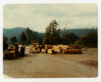
Photograph (item) - Colour photograph, 10-1984
... According to Victoria Government Gazette records from 1958, the Sund brothers operated commercial goods vehicles to transport Mountain ash and other hardwood logs from forest landings in the Mt. Gordon area directly to their mill in Marysville. ...According to Victoria Government Gazette records from 1958, the Sund brothers operated commercial goods vehicles to transport Mountain ash and other hardwood logs from forest landings in the Mt. Gordon area directly to their mill in Marysville. ...A colour photograph taken at Sunds Bros Sawmill in Marysville. Sund's Sawmill (historically operated by Arthur & John Sund and often referenced locally as Sund Stenco) was a prominent mid-century timber mill located in Marysville, Victoria. It played a central role in the region's booming post-war logging era. The mill was highly active during the 1950s. This era marked a peak for Marysville's timber sector, with over 300 men employed across multiple local mills, sustaining nearly 1,000 residents. According to Victoria Government Gazette records from 1958, the Sund brothers operated commercial goods vehicles to transport Mountain ash and other hardwood logs from forest landings in the Mt. Gordon area directly to their mill in Marysville. Sawn timber from the Sund Bros mill was primary distributed to Millard's timber yards at Mt. Evelyn, eventually supplying building blocks across the rapidly growing eastern suburbs of Melbourne.A colour photograph taken at Sunds Bros Sawmill in Marysville.marysville, victoria, australia, arthur sund, john sund, sund stenco, sunds bros sawmill, victorian government gazette 1958, mountain ash, mount gordon, millard's timber yards, mt. evelyn, melbourne, photograph -
 Marysville & District Historical Society
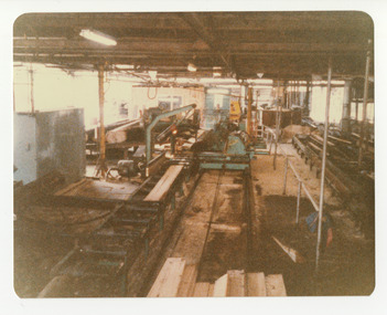
Photograph (item) - Colour photograph, 10-1984
... According to Victoria Government Gazette records from 1958, the Sund brothers operated commercial goods vehicles to transport Mountain ash and other hardwood logs from forest landings in the Mt. Gordon area directly to their mill in Marysville. ...According to Victoria Government Gazette records from 1958, the Sund brothers operated commercial goods vehicles to transport Mountain ash and other hardwood logs from forest landings in the Mt. Gordon area directly to their mill in Marysville. ...A colour photograph taken at Sunds Bros Sawmill in Marysville. Sund's Sawmill (historically operated by Arthur & John Sund and often referenced locally as Sund Stenco) was a prominent mid-century timber mill located in Marysville, Victoria. It played a central role in the region's booming post-war logging era. The mill was highly active during the 1950s. This era marked a peak for Marysville's timber sector, with over 300 men employed across multiple local mills, sustaining nearly 1,000 residents. According to Victoria Government Gazette records from 1958, the Sund brothers operated commercial goods vehicles to transport Mountain ash and other hardwood logs from forest landings in the Mt. Gordon area directly to their mill in Marysville. Sawn timber from the Sund Bros mill was primary distributed to Millard's timber yards at Mt. Evelyn, eventually supplying building blocks across the rapidly growing eastern suburbs of Melbourne.A colour photograph taken at Sunds Bros Sawmill in Marysville.marysville, victoria, australia, arthur sund, john sund, sund stenco, sunds bros sawmill, victorian government gazette 1958, mountain ash, mount gordon, millard's timber yards, mt. evelyn, melbourne, photograph -
 Marysville & District Historical Society
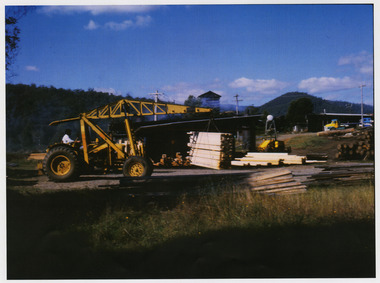
Photograph (item) - Colour photograph, 1970s
... According to Victoria Government Gazette records from 1958, the Sund brothers operated commercial goods vehicles to transport Mountain ash and other hardwood logs from forest landings in the Mt. Gordon area directly to their mill in Marysville. ...According to Victoria Government Gazette records from 1958, the Sund brothers operated commercial goods vehicles to transport Mountain ash and other hardwood logs from forest landings in the Mt. Gordon area directly to their mill in Marysville. ...A copy of a colour photograph taken at Sunds Bros Sawmill located in Marysville. The original photograph was taken in the 1970s. Sund's Sawmill (historically operated by Arthur & John Sund and often referenced locally as Sund Stenco) was a prominent mid-century timber mill located in Marysville, Victoria. It played a central role in the region's booming post-war logging era. The mill was highly active during the 1950s. This era marked a peak for Marysville's timber sector, with over 300 men employed across multiple local mills, sustaining nearly 1,000 residents. According to Victoria Government Gazette records from 1958, the Sund brothers operated commercial goods vehicles to transport Mountain ash and other hardwood logs from forest landings in the Mt. Gordon area directly to their mill in Marysville. Sawn timber from the Sund Bros mill was primary distributed to Millard's timber yards at Mt. Evelyn, eventually supplying building blocks across the rapidly growing eastern suburbs of Melbourne.A copy of a colour photograph taken at Sunds Bros Sawmill located in Marysville. The original photograph was taken in the 1970s.marysville, victoria, australia, arthur sund, john sund, sund stenco, sunds bros sawmill, victorian government gazette 1958, mountain ash, mount gordon, millard's timber yards, mt. evelyn, melbourne, photograph -
 Greensborough Historical Society
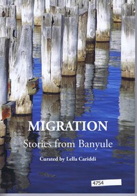
Book, Littlefox Press, Migration: stories from Banyule, curated by Lella Cariddi, 2017_
... Fourteen stories of people who migrated to Australia, landing at Station Pier, Melbourne and settling in the Banyule area....Fourteen stories of people who migrated to Australia, landing at Station Pier, Melbourne and settling in the Banyule area. immigration 122 p.paperback, col. and black and white photographs Migration: stories from Banyule, curated by Lella Cariddi Book Lella Cariddi Littlefox Press ...Fourteen stories of people who migrated to Australia, landing at Station Pier, Melbourne and settling in the Banyule area.122 p.paperback, col. and black and white photographsimmigration -
Glenelg Shire Council Cultural Collection
Pamphlet - Brochure - Glenelg River Canoeing Guide, Oct-88
... Front and back pages information, photos and images of various areas of the Glenelg River; inside pages - detailed map of river and landings/camp sites....Front and back pages information, photos and images of various areas of the Glenelg River; inside pages - detailed map of river and landings/camp sites. ...Glenelg River canoeing guide, 4 pages, single-fold. Front and back pages information, photos and images of various areas of the Glenelg River; inside pages - detailed map of river and landings/camp sites. -
 Orbost & District Historical Society
black and white photograph, Green, O. S, April 1897
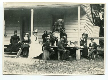
... area to Melbourne. The Snowy River Shipping Company was formed by Mr Henry James during the 1880s, with Captain McNeil as master. Captain Hegarty was the shipping agent at Marlo. Towing a line of small barges these paddle steamers plied their trade between the port of Marlo, and the farms along the river banks, churning their way almost twenty miles upstream to a landing beside what is now Frank Richardson’s property. ...area to Melbourne. The Snowy River Shipping Company was formed by Mr Henry James during the 1880s, with Captain McNeil as master. Captain Hegarty was the shipping agent at Marlo. Towing a line of small barges these paddle steamers plied their trade between the port of Marlo, and the farms along the river banks, churning their way almost twenty miles upstream to a landing beside what is now Frank Richardson’s property. ...This photograph shows the Richardson family having a picnic on the verandah of Captain McNeil' house at Marlo - April 1897. Snowy River Shipping Company formed in 1880. They were soon shipping produce (mainly vegetables) from the area to Melbourne. The Snowy River Shipping Company was formed by Mr Henry James during the 1880s, with Captain McNeil as master. Captain Hegarty was the shipping agent at Marlo. Towing a line of small barges these paddle steamers plied their trade between the port of Marlo, and the farms along the river banks, churning their way almost twenty miles upstream to a landing beside what is now Frank Richardson’s property. On these trips, the barges carried mail and supplies to the townspeople and farmers, loading their produce, mostly maize, on the return trip to the coast. The coming of the railway in 1915 spelt the end for the little river boats. ( ref. F. W. RODWELL in the “Snowy Review”) Frank Richardson 1877-1950 was a sawmiller at Tabbara and helped build and run paddle steamer "Curlip"as engineer. Captain McNeil was an always cheerful Marlo identity and local children had many times sailing with him on the river. Captain McNeil with tug went out through the entrance and brought in the schooners.This item is associated with the Richardson family, early settlers of the Orbost district.A black / white photograph of a group of people having afternoon tea on the end of a verandah of a wooden house. All are seated.on back - " The Richardson family picnic at Marlo"richardson-family-orbost-marlo mcneil-captain -
 Orbost & District Historical Society
book, Cassell and Company Limited, Captain Cook's Voyages, 1908
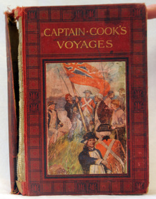
... area. This is a useful reference book. inside cover - :To Fred from his mother, mas 1910" A 446pp hard back book titled, "Captain Cook's Voyages" in gold print. It has a black and red cover with a coloured illustration of the landing ...James Cook was a British explorer, navigator, cartographer, and captain in the Royal Navy. Cook made detailed maps of Newfoundland prior to making three voyages to the Pacific Ocean, during which he achieved the first recorded European contact with the eastern coastline of Australia and the Hawaiian Islands, and the first recorded circumnavigation of New Zealand.Cook's 12 years sailing around the Pacific Ocean contributed much to European knowledge of the area. This is a useful reference book.A 446pp hard back book titled, "Captain Cook's Voyages" in gold print. It has a black and red cover with a coloured illustration of the landing of James Cook, his crew and the planting of the British red ensign. It has coloured illustrations. Includes Aboriginal encounters with explorers. inside cover - :To Fred from his mother, mas 1910" -
 Australian Commando Association - Victoria
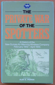
Book, The Private War of the Spotters: A history of the New Guinea Air Warning Wireless Company, February 1942-April 1945
... landings in Papua, marking the beginning of the Kokoda campaign. The dangers involved in the company’s work had also been made clear by this time. In July 1942 a party of spotters attempting to set up a station at Misima Island, off Milne Bay, was intercepted by a Japanese destroyer, resulting in the company’s first operational losses. Anticipating the direction of the campaign as a whole, the company’s focus moved north and north-west over the three years of its existence. In May 1942 a network was set up in the Wau area ...The history of the New Guinea Air Warning Wireless Company. This reprinted version contains a map of the dispositions of Spotting Stations August 1943, additional MID awards listed and some additions to the nominal roll. The New Guinea Air Warning Wireless Company was formed in Port Moresby in late January 1942 and was granted “Separate Independent Establishment” status in October 1943. The company’s “founding father” was Major Don Small, who had witnessed Japanese air raids on Rabaul and realised that having lacked an effective early-warning system around New Britain meant that the defenders were taken by surprise. At the time, gaps had also appeared in the coast-watching communications network because the territory administration ordered the withdrawal of civilian wireless operators when Japan entered the war. The first influx of men into the company consisted largely of volunteers from the 39th Infantry Battalion, which was stationed at Port Moresby. Initial training was rudimentary, hasty, and was sometimes even carried out on en route to a new station. The first party of company personnel, or “spotters”, left Port Moresby as early as 1 February 1942, bound for the strategically important Samarai area, at the tip of Papua. In the first month of the company’s existence 16 spotter stations were established on the coast of Papua and in the mountains around Port Moresby. At the end of 1942 there were 61 operational stations being run by 180 men. The company’s high-water mark was in late 1944, by which time over 150 stations had been set up in Papua and New Guinea behind enemy lines. On 3 February 1942 the company issued its first air warning in Papua, when spotters at Tufi saw Japanese aircraft about to attack Port Moresby for the first time. The following month the company was responsible for the first Japanese killed in action in Papua by Australian ground forces, when spotters from Gona engaged the crew of a downed Japanese bomber. And in July 1942 the station at Buna signalled Port Moresby with news of the Japanese landings in Papua, marking the beginning of the Kokoda campaign. The dangers involved in the company’s work had also been made clear by this time. In July 1942 a party of spotters attempting to set up a station at Misima Island, off Milne Bay, was intercepted by a Japanese destroyer, resulting in the company’s first operational losses. Anticipating the direction of the campaign as a whole, the company’s focus moved north and north-west over the three years of its existence. In May 1942 a network was set up in the Wau area in association with the activities of Kanga Force. As part of the Wau network, spotter Ross Kirkwood audaciously constructed an observation post overlooking the Japanese airstrip at Salamaua. Kirkwood’s position was photographed by Damian Parer on the understanding that the pictures would not be published. They nevertheless appeared in a Sydney newspaper. The day after the publication of the photographs the observation post was attacked by the Japanese and Kirkwood was lucky to escape. In June 1944 the company’s headquarters were moved to Nadzab. By that time, spotter stations existed behind Japanese lines, as far north as Hollandia, and the company began to train Americans to perform similar work in the Philippines. In early 1945 the company moved to Balcombe, Victoria, where its members were posted to other units of the Australian Corps of Signals.gray plasticnon-fictionThe history of the New Guinea Air Warning Wireless Company. This reprinted version contains a map of the dispositions of Spotting Stations August 1943, additional MID awards listed and some additions to the nominal roll. The New Guinea Air Warning Wireless Company was formed in Port Moresby in late January 1942 and was granted “Separate Independent Establishment” status in October 1943. The company’s “founding father” was Major Don Small, who had witnessed Japanese air raids on Rabaul and realised that having lacked an effective early-warning system around New Britain meant that the defenders were taken by surprise. At the time, gaps had also appeared in the coast-watching communications network because the territory administration ordered the withdrawal of civilian wireless operators when Japan entered the war. The first influx of men into the company consisted largely of volunteers from the 39th Infantry Battalion, which was stationed at Port Moresby. Initial training was rudimentary, hasty, and was sometimes even carried out on en route to a new station. The first party of company personnel, or “spotters”, left Port Moresby as early as 1 February 1942, bound for the strategically important Samarai area, at the tip of Papua. In the first month of the company’s existence 16 spotter stations were established on the coast of Papua and in the mountains around Port Moresby. At the end of 1942 there were 61 operational stations being run by 180 men. The company’s high-water mark was in late 1944, by which time over 150 stations had been set up in Papua and New Guinea behind enemy lines. On 3 February 1942 the company issued its first air warning in Papua, when spotters at Tufi saw Japanese aircraft about to attack Port Moresby for the first time. The following month the company was responsible for the first Japanese killed in action in Papua by Australian ground forces, when spotters from Gona engaged the crew of a downed Japanese bomber. And in July 1942 the station at Buna signalled Port Moresby with news of the Japanese landings in Papua, marking the beginning of the Kokoda campaign. The dangers involved in the company’s work had also been made clear by this time. In July 1942 a party of spotters attempting to set up a station at Misima Island, off Milne Bay, was intercepted by a Japanese destroyer, resulting in the company’s first operational losses. Anticipating the direction of the campaign as a whole, the company’s focus moved north and north-west over the three years of its existence. In May 1942 a network was set up in the Wau area in association with the activities of Kanga Force. As part of the Wau network, spotter Ross Kirkwood audaciously constructed an observation post overlooking the Japanese airstrip at Salamaua. Kirkwood’s position was photographed by Damian Parer on the understanding that the pictures would not be published. They nevertheless appeared in a Sydney newspaper. The day after the publication of the photographs the observation post was attacked by the Japanese and Kirkwood was lucky to escape. In June 1944 the company’s headquarters were moved to Nadzab. By that time, spotter stations existed behind Japanese lines, as far north as Hollandia, and the company began to train Americans to perform similar work in the Philippines. In early 1945 the company moved to Balcombe, Victoria, where its members were posted to other units of the Australian Corps of Signals.world war ii, special operations, new guinea, new guinea air warning wireless company -
 Australian Commando Association - Victoria
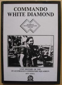
Book, Commando White Diamond: Unt History of the 2/8th Australian Commando Squadron
... landing site. As Jacquinot Bay was still in Japanese controlled territory, ‘C’ Troop from the 2/8th provided the protection for the reconnaissance party by establishing a position on the beach and by patrolling the surrounding country. Everything went well and the 5th Division later landed at Jacquinot Bay in November. The squadron too was on the move, and in October it sailed to Torokina, the main Australian base on Bougainville, where it joined the II Australian Corps. The campaign on Bougainville was dived into three areas ...The detailed history of the No.8 Independent Commando Company during World War II. Plastic protective cover over the book. The 2/8th Independent Company was formed at Wilson’s Promontory, Victoria, in July 1942 and travelled to Yandina, in Queensland, in September. While the other seven independent companies saw action in the islands off Australian and in New Guinea, the 2/8th spent most of the next two years based at Adelaide River, in the Northern Territory. While it was in the Territory, the independent companies underwent a series of reorganisations and the name of the 2/8th was changed from the 2/8th Independent Company to the 2/8th Cavalry (Commando) Squadron. This name was later simplified to just commando squadron. In July 1944, after years of waiting, the squadron left the Territory and sailed from Townsville to Lae, via Milne Bay. While at Lae, the squadron received an intake of 70 men from the 2/8th from the 2/3rd, 2/5th and 2/6th Cavalry (Commando) Squadrons, many of whom were veterans of the earlier New Guinea campaigns. Their experience was no doubt a useful reserve that would have been called upon during the 2/8th’s subsequent campaign in Bougainville. Others though, were able to implement some of their commando training when a small group from the 2/8th they made a secret landing on New Britain. Towards the end of the 1944 the 5th Division was preparing to make a landing at Jacquinot Bay in New Britain. Part of these preparations included landing a small group of officers from the division at Jacquinot Bay to make a secret reconnaissance of the potential landing site. As Jacquinot Bay was still in Japanese controlled territory, ‘C’ Troop from the 2/8th provided the protection for the reconnaissance party by establishing a position on the beach and by patrolling the surrounding country. Everything went well and the 5th Division later landed at Jacquinot Bay in November. The squadron too was on the move, and in October it sailed to Torokina, the main Australian base on Bougainville, where it joined the II Australian Corps. The campaign on Bougainville was dived into three areas, the Central, Northern and Southern Sectors. The 2/8th served in the latter two areas. The 2/8th made the first move of the Australian campaign in the Northern Sector, by patrolling from Torokina to Kuraio Mission and Amun once a week. The squadron did this from the second week of November unit the second week of December. The 2/8th was then transferred to the Southern Sector. The main battle for Bougainville was fought in the Southern Sector, as the 3rd Division advanced towards Buin – the main Japanese base on the island. As the division’s infantry brigades advanced along the coast, the 2/8th’s task was to protect their flank by conducting forward reconnaissance patrols, harassing the Japanese with raids and ambushes and conducting a form of guerrilla warfare. The squadron had a long campaign. For nine months, from the end of December until August 1945, the troopers were in action the whole time. After securing the Jaba River, they moved inland, first to Sovele Mission, then the villages of Opai, Nihero and Morokaimoro. They had reached Kilipaijino by the end of the war. Each village taken became a patrol base. Patrols were usually limited to two sections, although up to six sections could be operating at a time. Patrols generally lasted four to six days, but nine-day patrols were not unknown. The squadron collected and collated track information, terrain reports and located the enemy. Once patrols had gathered information, they were free to make a ‘strike’ against the Japanese by setting an ambush or taking a prisoner. These raids were very effective, as they forced the Japanese to deploy troops to their rear areas, removing men from the front created by the infantry. Following Japan’s surrender and the end of the war, the ranks of the squadron thinned quickly as men were discharged or were transferred to other units. For those who were left, the squadron returned to Australia at the end of December. In mid January 1946, at Liverpool, the 2/8th Commando Squadron was disbanded.non-fictionThe detailed history of the No.8 Independent Commando Company during World War II. Plastic protective cover over the book. The 2/8th Independent Company was formed at Wilson’s Promontory, Victoria, in July 1942 and travelled to Yandina, in Queensland, in September. While the other seven independent companies saw action in the islands off Australian and in New Guinea, the 2/8th spent most of the next two years based at Adelaide River, in the Northern Territory. While it was in the Territory, the independent companies underwent a series of reorganisations and the name of the 2/8th was changed from the 2/8th Independent Company to the 2/8th Cavalry (Commando) Squadron. This name was later simplified to just commando squadron. In July 1944, after years of waiting, the squadron left the Territory and sailed from Townsville to Lae, via Milne Bay. While at Lae, the squadron received an intake of 70 men from the 2/8th from the 2/3rd, 2/5th and 2/6th Cavalry (Commando) Squadrons, many of whom were veterans of the earlier New Guinea campaigns. Their experience was no doubt a useful reserve that would have been called upon during the 2/8th’s subsequent campaign in Bougainville. Others though, were able to implement some of their commando training when a small group from the 2/8th they made a secret landing on New Britain. Towards the end of the 1944 the 5th Division was preparing to make a landing at Jacquinot Bay in New Britain. Part of these preparations included landing a small group of officers from the division at Jacquinot Bay to make a secret reconnaissance of the potential landing site. As Jacquinot Bay was still in Japanese controlled territory, ‘C’ Troop from the 2/8th provided the protection for the reconnaissance party by establishing a position on the beach and by patrolling the surrounding country. Everything went well and the 5th Division later landed at Jacquinot Bay in November. The squadron too was on the move, and in October it sailed to Torokina, the main Australian base on Bougainville, where it joined the II Australian Corps. The campaign on Bougainville was dived into three areas, the Central, Northern and Southern Sectors. The 2/8th served in the latter two areas. The 2/8th made the first move of the Australian campaign in the Northern Sector, by patrolling from Torokina to Kuraio Mission and Amun once a week. The squadron did this from the second week of November unit the second week of December. The 2/8th was then transferred to the Southern Sector. The main battle for Bougainville was fought in the Southern Sector, as the 3rd Division advanced towards Buin – the main Japanese base on the island. As the division’s infantry brigades advanced along the coast, the 2/8th’s task was to protect their flank by conducting forward reconnaissance patrols, harassing the Japanese with raids and ambushes and conducting a form of guerrilla warfare. The squadron had a long campaign. For nine months, from the end of December until August 1945, the troopers were in action the whole time. After securing the Jaba River, they moved inland, first to Sovele Mission, then the villages of Opai, Nihero and Morokaimoro. They had reached Kilipaijino by the end of the war. Each village taken became a patrol base. Patrols were usually limited to two sections, although up to six sections could be operating at a time. Patrols generally lasted four to six days, but nine-day patrols were not unknown. The squadron collected and collated track information, terrain reports and located the enemy. Once patrols had gathered information, they were free to make a ‘strike’ against the Japanese by setting an ambush or taking a prisoner. These raids were very effective, as they forced the Japanese to deploy troops to their rear areas, removing men from the front created by the infantry. Following Japan’s surrender and the end of the war, the ranks of the squadron thinned quickly as men were discharged or were transferred to other units. For those who were left, the squadron returned to Australia at the end of December. In mid January 1946, at Liverpool, the 2/8th Commando Squadron was disbanded. -
 Orbost & District Historical Society
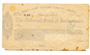
cheque, 1880's
... area to Melbourne. The Snowy River Shipping Company was formed by Mr Henry James during the 1880s, with Captain McNeil as master. Captain Hegarty was the shipping agent at Marlo. Towing a line of small barges these paddle steamers plied their trade between the port of Marlo, and the farms along the river banks, churning their way almost twenty miles upstream to a landing beside what is now Frank Richardson’s property. ...area to Melbourne. The Snowy River Shipping Company was formed by Mr Henry James during the 1880s, with Captain McNeil as master. Captain Hegarty was the shipping agent at Marlo. Towing a line of small barges these paddle steamers plied their trade between the port of Marlo, and the farms along the river banks, churning their way almost twenty miles upstream to a landing beside what is now Frank Richardson’s property. ...Snowy River Shipping Company formed in 1880. They were soon shipping produce (mainly vegetables) from the area to Melbourne. The Snowy River Shipping Company was formed by Mr Henry James during the 1880s, with Captain McNeil as master. Captain Hegarty was the shipping agent at Marlo. Towing a line of small barges these paddle steamers plied their trade between the port of Marlo, and the farms along the river banks, churning their way almost twenty miles upstream to a landing beside what is now Frank Richardson’s property. On these trips, the barges carried mail and supplies to the townspeople and farmers, loading their produce, mostly maize, on the return trip to the coast. The coming of the railway in 1915 spelt the end for the little river boats. ( ref. F. W. RODWELL in the “Snowy Review”) Frank Richardson 1877-1950 was a sawmiller at Tabbara and helped build and run paddle steamer "Curlip"as engineer.This item is associated with an early transport business of the local district. The Snowy River once had its own paddle steamers. This item is reminiscent of that time.A light blue and white blank cheque for the Snowy River Shipping Company. The cheque is for The National Bank of Australasia and is numbered 01,491 in bold black print. It has a one penny stamp duty imprint.snowy-river-shipping-company james-harry -
 Bendigo Military Museum
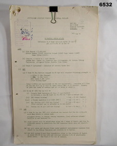
Administrative record - Royal Australian Survey Corps - Central Command Operation Order C/1/61 Northern Territory 1961, DAD Svy, HQ Central Command , Keswick Barracks, SA, 1961
... areas of Alligator River, Mt Evelyn, Coburg Peninsula, (including the offshore Islands, Melville Island and Bathurst Island. The Operation Order details the tasks for the 6 x Officers (or equivalent) and 34 x OR's (or equivalent) and the support that was allocated including Frigate HMAS Gasgoyne, LSM landing craft, Trucks amphibian (DUKW), Helicopter and Cessna aircraft....areas of Alligator River, Mt Evelyn, Coburg Peninsula, (including the offshore Islands, Melville Island and Bathurst Island. The Operation Order details the tasks for the 6 x Officers (or equivalent) and 34 x OR's (or equivalent) and the support that was allocated including Frigate HMAS Gasgoyne, LSM landing craft, Trucks amphibian (DUKW), Helicopter and Cessna aircraft. ...This is a Central Command Operation Order for the Royal Australian Survey Corps to conduct a Survey Operation in Northern Territory in 1961. The task is to acquire Survey Control for the production of maps coving the following 1:250 000 map areas of Alligator River, Mt Evelyn, Coburg Peninsula, (including the offshore Islands, Melville Island and Bathurst Island. The Operation Order details the tasks for the 6 x Officers (or equivalent) and 34 x OR's (or equivalent) and the support that was allocated including Frigate HMAS Gasgoyne, LSM landing craft, Trucks amphibian (DUKW), Helicopter and Cessna aircraft.A 11 x page foolscap size paper report and 1 x foldout map Annex held together with a paper clip. Two hole punched.Hand written File Number in top RH Corner "101-310-4". Distribution stamp in top LH Corner. Hand written No7 in Top RH Corner.royal australian survey corps, rasvy, fortuna, army survey regiment, army svy regt -
 Bendigo Military Museum
Map - MAP, DUTCH BORNEO
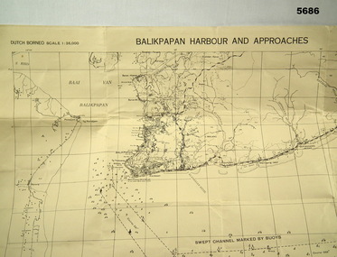
... Map identified height of land in area and depth of ocean on approached to Balikpapan Harbour. Identified piers, streets and defences and potentially used for landing or combat in the area. ...Map identified height of land in area and depth of ocean on approached to Balikpapan Harbour. Identified piers, streets and defences and potentially used for landing or combat in the area. ...Map identified height of land in area and depth of ocean on approached to Balikpapan Harbour. Identified piers, streets and defences and potentially used for landing or combat in the area. MAP PRODUCED BY 2/1 AUST ARMY TOPO SQN CO. Large Yellow paper map with scale of 1:36,000 of Dutch Borneo Balikpapan Harbour and it's approaches. Map folded into 8.balikpapan harbour, maps -
 Bendigo Military Museum
Photograph - PHOTOGRAPHS, KOREA, 1950-1953
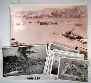
... .1) Photo, sepia tone, aerial view over a harbour with warships, bomb damage foreground, hills and buildings in the distance. .2) Photo, black & white, aerial view of harbour, city with several fires from shelling. .3) Photo, black & white, aerial view of island with landing craft. .4) Photo, black & white, aerial view over ships and harbour. .5) Photo, black & white, aerial view over four landing craft. .6) Photo, black & white, aerial view over city and fires. .7) Photo, black & white, aerial view over islands, boat .... small island. .8) Photo, black & white, aerial view over harbour with two boats on fire. .9) Photo, black & white, aerial view over structures covered. .10) Photo, black & white, aerial view over ship being attacked. .11) Photo, black & white, aerial view over harbour with sunken ship. .12) Photo, black & white, aerial view showing harbour, fire and sunken ship. .13) Photo, black & white, aerial view, five tanks along a road. .14) Photo, black & white, aerial view, same area as .13) showing a wider area. .15) Photo, black & white, aerial view showing tanks and armour. .16) Photo, black & white, aerial view road with armour, vehicles, people and smoke in distance. .17) Photo, black & white, aerial view showing three ships together. .18) Photo, black & white, aerial view showing a road control with targets either side on fire. .19) Photo, black & white, aerial view with aeroplane coming onto the deck of a carrier. .20) Photo, black & white, aerial view of a fighter plane. .21) Photo, black & white, on deck of a carrier. .22) Photo, black & white, rearming a plane with ammunition on carrier deck. ...Photos korea RN inchon .1) Photo, sepia tone, aerial view over a harbour with warships, bomb damage foreground, hills and buildings in the distance. .2) Photo, black & white, aerial view of harbour, city with several fires from shelling. .3) Photo, black & white, aerial view of island with landing craft. .4) Photo, black & white, aerial view over ships and harbour. .5) Photo, black & white, aerial view over four landing craft. .6) Photo, black & white, aerial view over city and fires. .7) Photo, black & white, aerial view over islands, boat .... small island. .8) Photo, black & white, aerial view over harbour with two boats on fire. .9) Photo, black & white, aerial view over structures covered. .10) Photo, black & white, aerial view over ship being attacked. .11) Photo, black & white, aerial view over harbour with sunken ship. .12) Photo, black & white, aerial view showing harbour, fire and sunken ship. .13) Photo, black & white, aerial view, five tanks along a road. .14) Photo, black & white, aerial view, same area as .13) showing a wider area. .15) Photo, black & white, aerial view showing tanks and armour. .16) Photo, black & white, aerial view road with armour, vehicles, people and smoke in distance. .17) Photo, black & white, aerial view showing three ships together. .18) Photo, black & white, aerial view showing a road control with targets either side on fire. .19) Photo, black & white, aerial view with aeroplane coming onto the deck of a carrier. .20) Photo, black & white, aerial view of a fighter plane. .21) Photo, black & white, on deck of a carrier. .22) Photo, black & white, rearming a plane with ammunition on carrier deck. ...The photos are a collection held by T. J. IRELAND C/K853677 P.O. STOKER MECHANIC RN while serving on HMS TRIUMPH, Korea 1950-53. Many are of the landings at INCHON, Sept. 1950. .1) Kure Harbour, Japan 1950. Ships assembling for the landings at INCHON, Korea. Ships across the top, left to right: HMAS SYDNEY, Fleet Oiler, VSS ANTIETAM, Hospital Ship & Japanese Coaster. In the foreground on the right, HMS BELFAST, HMS TRIUMPH, HMS CONSORT. On rear most photos are written on in blue pen. .2) INCHON landings Walmi-Do in background and landing barges - could be one I was driving. .3) Island - Walmi-Do - US landing craft. .4) INCHON landings. .5) US landing craft. .6) INCHON oil tanks and military targets on fire. .7) Grounded coaster after an air attack. .8) Two North Korean supply ships hit by rockets. .9) Korean supply vessels camouflaged. .10) Rocket attack on Korean supply vessel. .11) Sunken coaster that was carrying arms and food. .12) Sunken coaster in harbour. .13) & .14) North Korean armour taken from an observation flight. .15) & .16) Chinese tanks and armour. .17) HMS BELFAST, Fleet Oiler, HMAS WARRAMUNGA .18) Targets from rocket attacks. .19), .20) & .21) "Seafires" coming to land on HMS TRIUMPH. .22) Rearming cannon and rockets on a "Seafire'. Photos not written on, information was supplied by T.J. IRELAND. The "Seafire" was a naval adaption of the Supermarine Spitfire for carrier use..1) Photo, sepia tone, aerial view over a harbour with warships, bomb damage foreground, hills and buildings in the distance. .2) Photo, black & white, aerial view of harbour, city with several fires from shelling. .3) Photo, black & white, aerial view of island with landing craft. .4) Photo, black & white, aerial view over ships and harbour. .5) Photo, black & white, aerial view over four landing craft. .6) Photo, black & white, aerial view over city and fires. .7) Photo, black & white, aerial view over islands, boat .... small island. .8) Photo, black & white, aerial view over harbour with two boats on fire. .9) Photo, black & white, aerial view over structures covered. .10) Photo, black & white, aerial view over ship being attacked. .11) Photo, black & white, aerial view over harbour with sunken ship. .12) Photo, black & white, aerial view showing harbour, fire and sunken ship. .13) Photo, black & white, aerial view, five tanks along a road. .14) Photo, black & white, aerial view, same area as .13) showing a wider area. .15) Photo, black & white, aerial view showing tanks and armour. .16) Photo, black & white, aerial view road with armour, vehicles, people and smoke in distance. .17) Photo, black & white, aerial view showing three ships together. .18) Photo, black & white, aerial view showing a road control with targets either side on fire. .19) Photo, black & white, aerial view with aeroplane coming onto the deck of a carrier. .20) Photo, black & white, aerial view of a fighter plane. .21) Photo, black & white, on deck of a carrier. .22) Photo, black & white, rearming a plane with ammunition on carrier deck. Photos are various sizes.photos, korea, rn, inchon
