
Showing 202 items matching "local government amalgamation 1994"
-
 Greensborough Historical Society
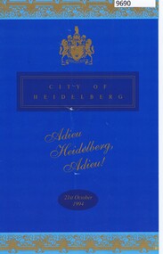
Programme - Program, City of Heidelberg, Adieu Heidelberg Adieu!, 21/10/1994
... ...local government amalgamation 1994...The City of Heidelberg celebrated its history with a dinner to celebrate the past and look forward to the future following local government amalgamations in 1994. The City of Heidleberg became the City of Banyule....The City of Heidelberg celebrated its history with a dinner to celebrate the past and look forward to the future following local government amalgamations in 1994. The City of Heidleberg became the City of Banyule. city of heidelberg heidelberg local government amalgamation 1994 banyule city council City of Heidelberg closure due to amalgamation Programme in colour with colour and black and white pictures and black text Adieu Heidelberg Adieu! ...The City of Heidelberg celebrated its history with a dinner to celebrate the past and look forward to the future following local government amalgamations in 1994. The City of Heidleberg became the City of Banyule.Programme in colour with colour and black and white pictures and black textcity of heidelberg, heidelberg, local government amalgamation 1994, banyule city council -
 Greensborough Historical Society
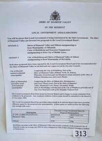
Document - Letter, Shire of Diamond Valley, Local Government Amalgamations 1994, 1994_
... ...local government amalgamation 1994...In 1994 the state government of Victoria proposed local government amalgamations. ...Local Government Amalgamations 1994 Document Letter Shire of Diamond Valley ...In 1994 the state government of Victoria proposed local government amalgamations. This letter to residents of the Shire of Diamond Valley outlines proposals for this area.Letter to residents of Shire of Diamond Valley. 2 pages.shire of diamond valley, local government amalgamation 1994, greensborough, diamond valley -
 Eltham District Historical Society Inc
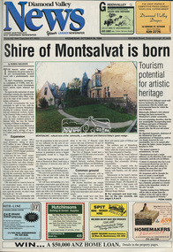
Newspaper - Newspaper article, Diamond Valley News, Shire of Montsalvat is born by Duska Sulicich, Diamond Valley News, October 26, p1, 1994
... Local Government Board...Council Amalgamation...1994...Montsalvat Local Government Board Council Amalgamation 1994 City of Banyule City of Heidelberg Shire of Eltham Shire of Diamond Valley Shire of Montsalvat Shire of Nillumbik Newsprint; Newspaper, bound volume Shire of Montsalvat is born by Duska Sulicich, Diamond Valley News, October 26, p1 Newspaper Newspaper article Diamond Valley News ...montsalvat, local government board, council amalgamation, 1994, city of banyule, city of heidelberg, shire of eltham, shire of diamond valley, shire of montsalvat, shire of nillumbik -
 Eltham District Historical Society Inc
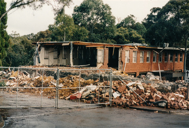
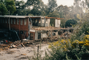
Photograph, Demolition of Eltham Shire Offices, 17 Aug 1996, 17/8/96
... This followed Victorian Local Government re-amalgamations in 1994. This was a multi-story building which also included the Eltham Library....This followed Victorian Local Government re-amalgamations in 1994. This was a multi-story building which also included the Eltham Library. ...Three colour photographs of the Shire of Eltham Council Offices, Main Road, Eltham being demolished. 17 August, 1996. This followed Victorian Local Government re-amalgamations in 1994. This was a multi-story building which also included the Eltham Library.shire of eltham, demolition, buildings -
 Eltham District Historical Society Inc
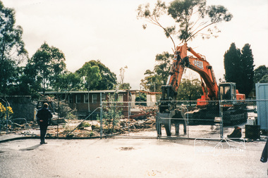
Photograph, Demolition of Eltham Shire Offices, 17 Aug 1996, 17/8/96
... This followed Victorian Local Government re-amalgamations in 1994. This was a multi-story building which also included the Eltham Library....This followed Victorian Local Government re-amalgamations in 1994. This was a multi-story building which also included the Eltham Library. ...Three colour photographs of the Shire of Eltham Council Offices, Main Road, Eltham being demolished. 17 August, 1996. This followed Victorian Local Government re-amalgamations in 1994. This was a multi-story building which also included the Eltham Library.shire of eltham, demolition, buildings -
 Eltham District Historical Society Inc
Photograph, Demolition of Eltham Shire Offices, 17 Aug 1996, 17/8/96
... This followed Victorian Local Government re-amalgamations in 1994. This was a multi-story building which also included the Eltham Library....This followed Victorian Local Government re-amalgamations in 1994. This was a multi-story building which also included the Eltham Library. ...Three colour photographs of the Shire of Eltham Council Offices, Main Road, Eltham being demolished. 17 August, 1996. This followed Victorian Local Government re-amalgamations in 1994. This was a multi-story building which also included the Eltham Library.shire of eltham, demolition, buildings -
 Broadmeadows Historical Society & Museum
Photograph (collection) - City of Broadmeadows Trucks, Don Woods, 1991
... The photographs document City of Broadmeadows municipal vehicles during the early 1990s, a period shortly before local government amalgamations in Victoria (1994). The images illustrate municipal branding, fleet composition, and public works operations in Broadmeadows....The photographs document City of Broadmeadows municipal vehicles during the early 1990s, a period shortly before local government amalgamations in Victoria (1994). The images illustrate municipal branding, fleet composition, and public works operations in Broadmeadows. ...Created as part of City of Broadmeadows municipal operations. Later retained and archived by the Broadmeadows Historical Society.To document City of Broadmeadows municipal vehicles for operational, promotional, or record keeping purposes.Two colour photographs physically joined together with adhesive tape along the centre, forming a single composite photographic item. Original order maintained as received.Two colour photographs depicting City of Broadmeadows service vehicles parked at a municipal works depot: • An International ACCO 2250 water tanker marked “Broadmeadows” • An Isuzu FSR 450 tray truck bearing City of Broadmeadows livery Both images show vehicles in situ at the Broadmeadows depot.municipal vehicles, city of broadmeadows, local government, local government infrastructure, public works, council works depots, truck fleets, water tankers, utility trucks, vehicle livery, municipal branding, broadmeadows (vic.), victoria (australia), 1990s, urban services, australian local governmentmunicipal vehicles, city of broadmeadows, local government, local government infrastructure, public works, council works depots, truck fleets, water tankers, utility trucks, vehicle livery, municipal branding, broadmeadows (vic.), victoria (australia), 1990s, urban services, australian local government -
 City of Moorabbin Historical Society (Operating the Box Cottage Museum)
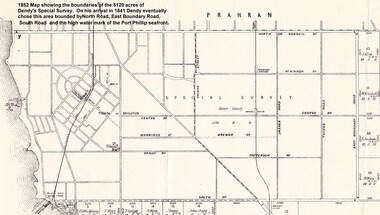
Photograph - Map of Dendy's Special Survey, 1852 Map of Henry Dendy's Special Survey of 1841, 19th Century
... Local Government Authority. Col. William Mair was elected as the first Chairman of the Moorabbin Roads Board. Moorabbin Shire 1871 developed further and was declared a City in1934. The City of Moorabbin was the largest Municipality in Melbourne before the Amalgamation of Councils in 1994 when it was divided in the south to City of Kingston and in the north to City of Glen Eira brighton moorabbin bentleigh cheltenham dendy henry bent thomas were jonathan special survey Moorabbin County of Bourke / Photo-Lithographed at the department of Lands and Survey. ...A Map drawn in 1852 that shows the 5,120 acres that formed Dendy's Special Survey of 1841. In 1840 Henry Dendy, a farmer in Surrey, England acquired a "Special Survey" from the Commissioners for Land and Emigration which gave Dendy the right to choose land in Port Phillip for the "bargain basement" price of only £1 per acre for 5120 acres, (an area of 8 square miles). The Special Survey also included the right to "the shipment of a worker for every £20 spent on land, whose free passage was paid by the Crown, equalling a total of 100 workers ". Accordingly Dendy sold his English holdings and paid the required £5120 and arrived in Melbourne in February 1841. However by this time land in the new colony was selling for £5 - £40 per acre. Because Henry Dendy possessed the order from the Colonial Office in London he was able to successfully oppose Governor LaTrobe's attempts to alter the price of the land. Dendy appointed Jonathan Were, (an entrepreneur, who had arrived in 1839), as his Manager and who later became a partner. Together, Dendy and Were decided on an area 5 miles south from Melbourne, bounded by North Road, East Boundary Road, South Road and to the west by Port Phillip Bay. Were and Dendy pitched their tents in the area now known as ' Park St, Brighton' and sank a well near the corner of 'St Andrew's St and Wells St'. By 1845 J.B Were and Company had bought almost half of Dendy's land and Were built himself "Moorabbin House" in Were St Brighton made from stone, quarried from local cliffs. It was still standing in 1924. Legend records Moorabbin is named after the Aboriginal word for ' Mother's Milk ' The soil is very fertile and well supplied with water especially in the area called 'East Brighton' - now known as Bentleigh and East Bentleigh - By 1850 the area had developed with numerous market gardens, dairy farms, fruit gardens and vineyards supplying food for the growing population of Melbourne.This Map shows the birth of the Brighton and Moorabbin area. On 18th January1859 Brighton was proclaimed a Municipality and a Borough by October 1863. Meanwhile, following a Petition, the area of East and South Brighton, incorporating Mordialloc, Cheltenham, Mentone, Sandringham and Oakleigh separated from Brighton to form the Moorabbin District Roads Board becoming the first Local Government Authority. Col. William Mair was elected as the first Chairman of the Moorabbin Roads Board. Moorabbin Shire 1871 developed further and was declared a City in1934. The City of Moorabbin was the largest Municipality in Melbourne before the Amalgamation of Councils in 1994 when it was divided in the south to City of Kingston and in the north to City of Glen Eira A Photo-lithographed 1852 Map showing the 5,120 acres that formed Dendy's Special Survey of 1841. Henry Dendy & Jonathan Were chose an area 5 miles south from Melbourne, bounded by North Road, East Boundary Road, South Road and to the west by Port Phillip Bay. Moorabbin County of Bourke / Photo-Lithographed at the department of Lands and Survey. /Melbourne. / Price 1/- brighton, moorabbin, bentleigh, cheltenham, dendy henry, bent thomas, were jonathan, special survey -
 City of Moorabbin Historical Society (Operating the Box Cottage Museum)
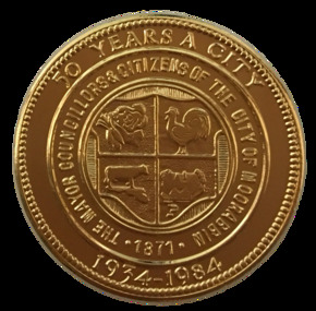
Badge - City of Moorabbin - 50 Years Medal, 1984-85
... When local government boundaries were changed in 1994 about half of Moorabbin city was united with Glen Eira city and about half with Kingston city. On 15 December, 1994 the City of Chelsea, parts of the Cities of Mordialloc, Moorabbin, Springvale and Oakleigh were amalgamated to create the City of Kingston by Order of the Governor in Council. ...A gold-plated medal issued by the City of Moorabbin to commemorate the quincentenary of Victoria in 1984-5. It features the City Shield incorporating vegetables, a rooster, a cow and a house, and the sesquicentenary logo. The township of Moorabbin, known as South Brighton until 1909, remained small, with the Plough and Harrow Hotel as its main building. In 1917 Sandringham borough was formed by severance from Moorabbin shire and in 1920 Mentone and Mordialloc were also severed. In the remaining Moorabbin shire the Moorabbin township was still small (1,770 persons), but the shire grew in population during the 1930s. On 10 October 1934 it was proclaimed a city. It existed as a separate municipality until 1995. When local government boundaries were changed in 1994 about half of Moorabbin city was united with Glen Eira city and about half with Kingston city. On 15 December, 1994 the City of Chelsea, parts of the Cities of Mordialloc, Moorabbin, Springvale and Oakleigh were amalgamated to create the City of Kingston by Order of the Governor in Council. On the same day Glen Eira City Council was formed from the City of Caulfield and the remaining part of the City of Moorabbin.Gold Plated Medal Side one: Within a wide rim formed by a line circle, the City Shield incorporating vegetables, a rooster, a cow and a house; around, THE MAYOR COUNCILLORS & CITIZENS OF THE CITY OF MOORABBIN; around on broad rim, 50 YEARS A CITY 1934 - 1984. Side 2: Logo of the Victorian sesquicentenary; below, VICTORIA 150 / GROWING TOGETHER 1984-5 at rim in small letters the mint name, BRIM MELBTHE MAYOR COUNCILLORS & CITIZENS OF THE CITY OF MOORABBIN; VICTORIA 150 / GROWING TOGETHER 1984-5.city of moorabbin, victorian sesquincentenary, moorabbin shire, councillors moorabbin, cheltenham, bentleigh, moorabbin, le page family, cr coates l.r, cr sheppard l.a., cr cooper j.c. -
 City of Moorabbin Historical Society (Operating the Box Cottage Museum)
Badge - City of Moorabbin Key Chain
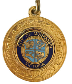
... When local government boundaries were changed in 1994 about half of Moorabbin city was united with Glen Eira city and about half with Kingston city. On 15 December, 1994 the City of Chelsea, parts of the Cities of Mordialloc, Moorabbin, Springvale and Oakleigh were amalgamated to create the City of Kingston by Order of the Governor in Council. ...When local government boundaries were changed in 1994 about half of Moorabbin city was united with Glen Eira city and about half with Kingston city. On 15 December, 1994 the City of Chelsea, parts of the Cities of Mordialloc, Moorabbin, Springvale and Oakleigh were amalgamated to create the City of Kingston by Order of the Governor in Council. ...“City of Moorabbin” The township of Moorabbin, known as South Brighton until 1909, remained small, with the Plough and Harrow Hotel as its main building. In 1917 Sandringham borough was formed by severance from Moorabbin shire and in 1920 Mentone and Mordialloc were also severed. In the remaining Moorabbin shire the Moorabbin township was still small (1,770 persons), but the shire grew in population during the 1930s. On 10 October 1934 it was proclaimed a city. It existed as a separate municipality until 1995. When local government boundaries were changed in 1994 about half of Moorabbin city was united with Glen Eira city and about half with Kingston city. On 15 December, 1994 the City of Chelsea, parts of the Cities of Mordialloc, Moorabbin, Springvale and Oakleigh were amalgamated to create the City of Kingston by Order of the Governor in Council. On the same day Glen Eira City Council was formed from the City of Caulfield and the remaining part of the City of Moorabbin.Gold Key ring with a dark blue circle surrounding the shield of the City of Moorabbin.City of Moorabbin, Victoria,city of moorabbin -
 City of Moorabbin Historical Society (Operating the Box Cottage Museum)
Programme - Two Programs for Mayoral Functions held in the City of Moorabbin. 1946 & 1953, City of Moorabbin Council, 1946 & 1953
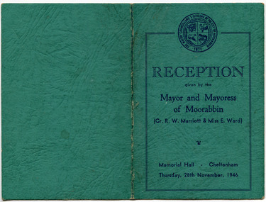
... When local government boundaries were changed in 1994 about half of Moorabbin city was united with Glen Eira city and about half with Kingston city. On 15 December, 1994 the City of Chelsea, parts of the Cities of Mordialloc, Moorabbin, Springvale and Oakleigh were amalgamated to create the City of Kingston by Order of the Governor in Council. ...When local government boundaries were changed in 1994 about half of Moorabbin city was united with Glen Eira city and about half with Kingston city. On 15 December, 1994 the City of Chelsea, parts of the Cities of Mordialloc, Moorabbin, Springvale and Oakleigh were amalgamated to create the City of Kingston by Order of the Governor in Council. ...“City of Moorabbin” The township of Moorabbin, known as South Brighton until 1909, remained small, with the Plough and Harrow Hotel as its main building. In 1917 Sandringham borough was formed by severance from Moorabbin shire and in 1920 Mentone and Mordialloc were also severed. In the remaining Moorabbin shire the Moorabbin township was still small (1,770 persons), but the shire grew in population during the 1930s. On 10 October 1934 it was proclaimed a city. It existed as a separate municipality until 1995. When local government boundaries were changed in 1994 about half of Moorabbin city was united with Glen Eira city and about half with Kingston city. On 15 December, 1994 the City of Chelsea, parts of the Cities of Mordialloc, Moorabbin, Springvale and Oakleigh were amalgamated to create the City of Kingston by Order of the Governor in Council. On the same day Glen Eira City Council was formed from the City of Caulfield and the remaining part of the City of Moorabbin.Official functions held in the City of Moorabbin 1946 & 1953Two program cards, one green 1946 and the other cream 1953. The inside lists the entertainment during the reception of the Mayoral functions of the City of Moorabbina) RECEPTION /given by the / MAYOR AND MAYORESS / of MOORABBIN / 1946 b) RECEPTION / given by the / MAYORESS of MOORABBIN / 1953mcc, marriott, ward, coates, city of moorabbin, reception, program cards, entertainment, market gardeners, early settlers, cheltenham, moorabbin, bentleigh -
 Glenelg Shire Council Cultural Collection
Functional object - Box of sealing wax, n.d
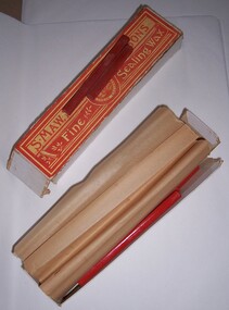
... The Glenelg Shire Council was established by an Order-in-Council under the Local Government Act 1989, published in the Victorian Government Gazette S63 on 23 September 1994. Three councils were amalgamated, the City of Portland and the Shires of Glenelg and Heywood, to form the new Glenelg Shire. ...Possibly from the Portland Town Council collection.Artefacts relating to the Portland Town Council represent the history of the Glenelg Shire and how it came to be. The Glenelg Shire Council was established by an Order-in-Council under the Local Government Act 1989, published in the Victorian Government Gazette S63 on 23 September 1994. Three councils were amalgamated, the City of Portland and the Shires of Glenelg and Heywood, to form the new Glenelg Shire.Cardboard box containing 11 full sticks and 5 partial sticks of sealing wax. Sealing wax embossed with maker detailsFront: Orange and yellow paper label on top. S. Maw, Son and Sons Fine sealing wax Crest in centre with London Englandportland town council, local government, glenelg shire, administration -
 Ballan Shire Historical Society
Memorabilia, Ballan Shire President's Board
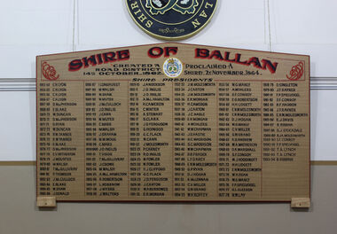
... This Memorial Board lists all the Presidents of the old Ballan Shire and is a complete record from the creation of a Road District in 1862, then the creation of a Shire in 1864 through to when the Shire was amalgamated into the Moorabool Shire in 1994. Ballan Shire President's Board. Ballan Local Government See photograph A large memorial board listing all the Presidents of the Ballan Shire. ...This Memorial Board lists all the Presidents of the old Ballan Shire and is a complete record from the creation of a Road District in 1862, then the creation of a Shire in 1864 through to when the Shire was amalgamated into the Moorabool Shire in 1994.A large memorial board listing all the Presidents of the Ballan Shire.See photographballan shire president's board., ballan local government -
 Orbost & District Historical Society
Equipment - Two stamps
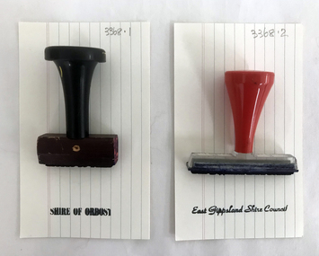
... 1994 as a merged shire, with Orbost Shire as part of this amalgamation. After 1994, Orbost Shire no longer existed. 3368.2 is the more modern stamp, from East Gippsland Shire Council. These business stamps are significant because they relate to the two eras of local government ...The oldest of these business stamps (3368.1) was used by Orbost Shire Council which was based in Orbost from 1892 - 1994. East Gippsland Shire Council was created in 1994 as a merged shire, with Orbost Shire as part of this amalgamation. After 1994, Orbost Shire no longer existed. 3368.2 is the more modern stamp, from East Gippsland Shire Council.These business stamps are significant because they relate to the two eras of local government in the Orbost/East Gippsland area. They show evidence of the transition from Orbost Shire Council to East Gippsland Shire Council. Two stamps. 3368.1 Shire of Orbost, black plastic handle. 3368.2 East Gippsland Shire Council, red plastic handle with clear plastic bottom. These are stamps which have the raised profile onto the bottom stamp and are used with an ink stamp-pad to stamp documents.3368.1 Shire of Orbost; 3368.2 East Gippsland Shire Councilbusiness stamps, orbost shire council, east gippsland shire council -
 Orbost & District Historical Society
plaque
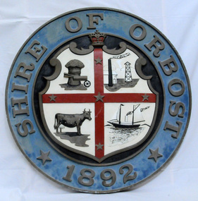
... The Shire coat of arms was on the wall on the right of the front entrance to the building and was removed from the current building when Orbost Shire Council was amalgamated into East Gippsland Shire in 1994.The current building was opened on Friday 28th February 1969 by the Premier of Victoria, The Hon. Sir Henry E. Bolte, K.C.M.G., M.P. Local governments ...The Coat of Arms of the Shire of Orbost has been designed in the form of a cross in which five stars are set on a shield. This was typical of those used by many shires and cities throughout Victoria and the Commonwealth. A small crown above the cross indicates the loyalty of the President, Councillors and Ratepayers to the reigning King or Queen. The inner circle of the shield contains four figures, a sheaf of wheat, a factory, a cow, and a ship, which represents the activities of agriculture, fishing, industry and dairying undertaken in the district. Originally part of the Bairnsdale district, Orbost split away as part of the Shire of Tambo in 1882, and became a Shire in its own right as the Shire of Croajingolong on the 30th may 1892. The name changed to the Shire of Orbost on 17 February 1893. Orbost was divided into four ridings on 31st May 1895, they were the North, South, East and Central riding, which was represented by three elected councillors. The Shire coat of arms was on the wall on the right of the front entrance to the building and was removed from the current building when Orbost Shire Council was amalgamated into East Gippsland Shire in 1994.The current building was opened on Friday 28th February 1969 by the Premier of Victoria, The Hon. Sir Henry E. Bolte, K.C.M.G., M.P. Local governments play an important role in the lives of citizens in Australia. Local government authorities exist to provide services and amenities to local communities, and are also responsible for regulating and providing services for land and property in their district. This item is representative of a time when Orbost had its own Shire Council. A large round metal plaque with the words SHIRE OF ORBOST1892 in gold letters around a crown and shield divided into four sections to represent four industries : Shipping ; farming - maize ; dairy and mining.SHIRE OF ORBOST 1892government orbost-shire-council coat-of-arms plaque -
 Orbost & District Historical Society
jumper, 1970's -1980's
... In 1994 it amalgamated to become part of East Gippsland Shire Council. Local governments play an important role in the lives of citizens in Australia. ...This jumper was worn by John Court as an employee of Orbost Shire Council. Orbost was at first included in the Bairnsdale Shire from 1882 and was later part of the Tambo Shire. Because of travelling distances the Croajingalong Shire was created in 1892 (name changed to Orbost Shire 17.2.1893 with James Cameron as the first Shire President. In 1994 it amalgamated to become part of East Gippsland Shire Council.Local governments play an important role in the lives of citizens in Australia. Local government authorities exist to provide services and amenities to local communities, and are also responsible for regulating and providing services for land and property in their district. This item is representative of a time when Orbost had its own Shire Council.A fawn coloured V - necked long-sleeved woollen jumper. It has a waratah emblem embroidered in red with green leaves. Below this is embroidered the word ORBOST in gold.uniform jumper orbost-shire-council court-john -
 Orbost & District Historical Society
black and white photograph, Howard D. Bulmer, 1907
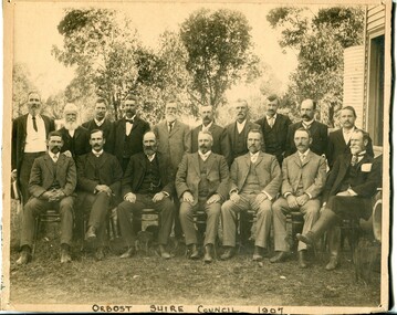
... 1994 it amalgamated to become part of East Gippsland Shire Council. This item is associated with the Orbost Shire Council. The shire covered an area of 9,347 square kilometres and existed from 1892 until 1994 when it became part of the East Gippsland Shire Council. orbost-shire-council-1907 local-government on front - "Orbost Shire Council - 1907" on back - "March, 1907, Shire Council" A large black / white photograph of a group of men in two rows - front row seated; back row standing. ...This photograph shows the Orbost Shire Council in 1907. In the back row are : A. Hillyard; John Draffin (sec.); David Jonson; Archie Rodwell; Hugh Cameron; Geotge Nixon; J. Hassett; Percy Watt; Wm Anderson (engineer); Wm Ross (S.R. Mail) Seated in front on chairs are : Sam Lynn; R. Pearse; John Johnston; Henry Luke (pres.); Donald Munro; Bill Cumming; Charles Grove The shire covered an area of 9,347 square kilometres and existed from 1892 until 1994 when it became part of the East Gippsland Shire Council. Orbost was at first included in the Bairnsdale Shire from 1882 and was later part of the Tambo Shire. Because of travelling distances the Croajingalong Shire was created in 1892 (name changed to Orbost Shire 17.2.1893 with James Cameron as the first Shire President. In 1994 it amalgamated to become part of East Gippsland Shire Council.This item is associated with the Orbost Shire Council. The shire covered an area of 9,347 square kilometres and existed from 1892 until 1994 when it became part of the East Gippsland Shire Council. A large black / white photograph of a group of men in two rows - front row seated; back row standing. The photograph has been taken outdoors with trees in the background and to the right a wooden building and tank. There is a copy.on front - "Orbost Shire Council - 1907" on back - "March, 1907, Shire Council"orbost-shire-council-1907 local-government -
 City of Moorabbin Historical Society (Operating the Box Cottage Museum)
Document, photocopy of Plan of Beaumaris 1853, c1960
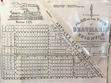
... local government authority. Beaumaris is a suburb in Melbourne, Victoria, Australia, 19 km south-east from Melbourne's central business district. .Since the Amalgamation of Councils 1994 the local government area is the City of Bayside which includes Brighton. ...local government authority. Beaumaris is a suburb in Melbourne, Victoria, Australia, 19 km south-east from Melbourne's central business district. .Since the Amalgamation of Councils 1994 the local government area is the City of Bayside which includes Brighton. moorabbin county of bourke brighton beaumaris pioneers early settlers. market gardeners cheltenham king. ...Beaumaris includes two early estates in the parish of Moorabbin developed by Josiah Holloway from 1852. Named Beaumaris Town and Beaumaris Estate (after the pastoral run in the area and ultimately after Beaumaris in Wales), the lots comprising them were marketed by Mr Holloway's suggesting that the railway was imminent and a canal would be built. The township developed slowly, a Post Office opened on 1 March 1868, but was replaced next month by Gipsy Village office (now Sandringham) In 1862 Beaumaris was one of the early settler communities within the boundaries of the Moorabbin District Roads Board , the region’s first local government authority. Beaumaris is a suburb in Melbourne, Victoria, Australia, 19 km south-east from Melbourne's central business district. .Since the Amalgamation of Councils 1994 the local government area is the City of Bayside which includes Brighton. A Photocopy of the Plan of Beaumaris 1853 A3moorabbin, county of bourke, brighton, beaumaris, pioneers, early settlers. market gardeners, cheltenham, king. john, holloway josiah, whorral charles, arthur’s seat road, nepean highway, morabbin district roads board, sandringham, mordialloc, mentone -
 Orbost & District Historical Society
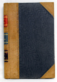
ledger, LOAN ACCOUNT CASH BOOK SHIRE OF ORBOST, 1935-1971
... local history group or museum. The shire covered an area of 9,347 square kilometres and existed from 1892 until 1994 when it became part of the East Gippsland Shire Council. Orbost was at first included in the Bairnsdale Shire from 1882 and was later part of the Tambo Shire. Because of travelling distances the Croajingalong Shire was created in 1892 (name changed to Orbost Shire 17.2.1893 with James Cameron as the first Shire President. In 1994 it amalgamated to become part of East Gippsland Shire Council. This item comprises records that belonged to the local government ...This ledger was used by the Shire of Orbost from 1935-1971. The item was donated to Orbost & District Historical society from P.R.O.V. as a Place of Deposit (POD) item for safe keeping by a local history group or museum. The shire covered an area of 9,347 square kilometres and existed from 1892 until 1994 when it became part of the East Gippsland Shire Council. Orbost was at first included in the Bairnsdale Shire from 1882 and was later part of the Tambo Shire. Because of travelling distances the Croajingalong Shire was created in 1892 (name changed to Orbost Shire 17.2.1893 with James Cameron as the first Shire President. In 1994 it amalgamated to become part of East Gippsland Shire Council. This item comprises records that belonged to the local government accounting system. The Shire of Orbost Council no longer exists having been absorbed by the East Gippsland Shire Council. This is a hand-written record created before the widespread use of computer accounting records.A black, hard cover ledger with light brown leather binding. it is titled "CASh BOOK LOAN ACCOUNT, SHIRE OF ORBOST". Records are hand-written. Inside the back cover is a loose-leaf typed document titled, "Shire Engineers Report 11 Sept 1970".cash-book ledger shire-of-orbost accounting -
 Orbost & District Historical Society
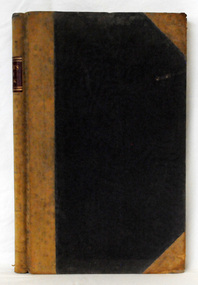
ledger, TREASURER'S CASH BOOK, 1898 - 1912
... local history group or museum. The shire covered an area of 9,347 square kilometres and existed from 1892 until 1994 when it became part of the East Gippsland Shire Council. Orbost was at first included in the Bairnsdale Shire from 1882 and was later part of the Tambo Shire. Because of travelling distances the Croajingalong Shire was created in 1892 (name changed to Orbost Shire 17.2.1893 with James Cameron as the first Shire President. In 1994 it amalgamated to become part of East Gippsland Shire Council. This item contains handwritten accounting records of the Shire of Orbost. The Orbost Shire local government ...This ledger was used by the Shire of Orbost from 1898 to 1912. The item was donated to Orbost & District Historical society from P.R.O.V. as a Place of Deposit (POD) item for safe keeping by a local history group or museum. The shire covered an area of 9,347 square kilometres and existed from 1892 until 1994 when it became part of the East Gippsland Shire Council. Orbost was at first included in the Bairnsdale Shire from 1882 and was later part of the Tambo Shire. Because of travelling distances the Croajingalong Shire was created in 1892 (name changed to Orbost Shire 17.2.1893 with James Cameron as the first Shire President. In 1994 it amalgamated to become part of East Gippsland Shire Council. This item contains handwritten accounting records of the Shire of Orbost. The Orbost Shire local government no longer exists as it was absorbed by the East Gippsland Shire Council.A black, hard cover ledger with light brown leather binding. It is titled "TREASURER'S CASH BOOK" and contains hand-written records.orbost-shire-council ledger-accounts -
 Orbost & District Historical Society
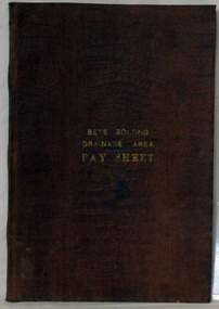
account book, BETE BOLONG DRAINAGE AREA PAY SHEET, 1910 - 1913
... local history group or museum. The shire covered an area of 9,347 square kilometres and existed from 1892 until 1994 when it became part of the East Gippsland Shire Council. Orbost was at first included in the Bairnsdale Shire from 1882 and was later part of the Tambo Shire. Because of travelling distances the Croajingalong Shire was created in 1892 (name changed to Orbost Shire 17.2.1893 with James Cameron as the first Shire President. In 1994 it amalgamated to become part of East Gippsland Shire Council. This item is a hand-written record of the accounts of the local government ...This account book was used by the Orbost Shire council to record payments made for work done on the Bete Bolong Drainage Area between 1910 and 1913. The item was donated to Orbost & District Historical society from P.R.O.V. as a Place of Deposit (POD) item for safe keeping by a local history group or museum. The shire covered an area of 9,347 square kilometres and existed from 1892 until 1994 when it became part of the East Gippsland Shire Council. Orbost was at first included in the Bairnsdale Shire from 1882 and was later part of the Tambo Shire. Because of travelling distances the Croajingalong Shire was created in 1892 (name changed to Orbost Shire 17.2.1893 with James Cameron as the first Shire President. In 1994 it amalgamated to become part of East Gippsland Shire Council. This item is a hand-written record of the accounts of the local government. The Orbost Shire Council no longer exists having been absorbed by the East Gippsland Shire Council.A brown leatherette, hard cover book. In gold lettering on the front is "BETE BOLONG DRAINAGE AREA PAY SHEET". It contains records of payments made for work done 1910-1913.In gold lettering on the front is "BETE BOLONG DRAINAGE AREA PAY SHEET".bete-bolong-drainage-area accounts orbost-shire -council -
 Orbost & District Historical Society
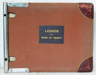
ledger, 1950's
... local history group or museum. The shire covered an area of 9,347 square kilometres and existed from 1892 until 1994 when it became part of the East Gippsland Shire Council. Orbost was at first included in the Bairnsdale Shire from 1882 and was later part of the Tambo Shire. Because of travelling distances the Croajingalong Shire was created in 1892 (name changed to Orbost Shire 17.2.1893 with James Cameron as the first Shire President. In 1994 it amalgamated to become part of East Gippsland Shire Council. This is a handwritten record of revenue accounts from local government ...This ledger was used by the Shire of Orbost in 1959. The item was donated to Orbost & District Historical society from P.R.O.V. as a Place of Deposit (POD) item for safe keeping by a local history group or museum. The shire covered an area of 9,347 square kilometres and existed from 1892 until 1994 when it became part of the East Gippsland Shire Council. Orbost was at first included in the Bairnsdale Shire from 1882 and was later part of the Tambo Shire. Because of travelling distances the Croajingalong Shire was created in 1892 (name changed to Orbost Shire 17.2.1893 with James Cameron as the first Shire President. In 1994 it amalgamated to become part of East Gippsland Shire Council. This is a handwritten record of revenue accounts from local government. The Shire of Orbost as a local government no longer exists havinb absobed into the East Gippsland Shire Council.A heavy ledger with a brown cover and steel bindings. The covers are probably wooden. It is alphabetically indexed and the ledger is lockable. it contains revenue accounts for 1959. On the front cover is "LEDGER (underlined) SHIRE OF ORBOST" in gold print. It is an "Emu Binder".accounts-shire-of-orbost local-government -
 Orbost & District Historical Society
ledger, 1950's -1960's
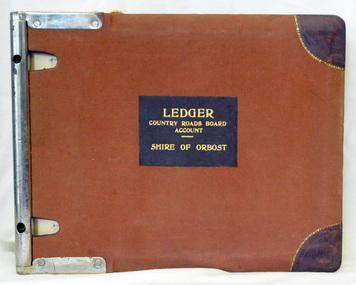
... local history group or museum. The shire covered an area of 9,347 square kilometres and existed from 1892 until 1994 when it became part of the East Gippsland Shire Council. Orbost was at first included in the Bairnsdale Shire from 1882 and was later part of the Tambo Shire. Because of travelling distances the Croajingalong Shire was created in 1892 (name changed to Orbost Shire 17.2.1893 with James Cameron as the first Shire President. In 1994 it amalgamated to become part of East Gippsland Shire Council. The Country Roads Board was the government...local history group or museum. The shire covered an area of 9,347 square kilometres and existed from 1892 until 1994 when it became part of the East Gippsland Shire Council. Orbost was at first included in the Bairnsdale Shire from 1882 and was later part of the Tambo Shire. Because of travelling distances the Croajingalong Shire was created in 1892 (name changed to Orbost Shire 17.2.1893 with James Cameron as the first Shire President. In 1994 it amalgamated to become part of East Gippsland Shire Council. The Country Roads Board was the government ...This ledger was used bt the Shire of Orbost local government to record Country Roads Board accounts 1950's and 1960's. The item was donated to Orbost & District Historical society from P.R.O.V. as a Place of Deposit (POD) item for safe keeping by a local history group or museum. The shire covered an area of 9,347 square kilometres and existed from 1892 until 1994 when it became part of the East Gippsland Shire Council. Orbost was at first included in the Bairnsdale Shire from 1882 and was later part of the Tambo Shire. Because of travelling distances the Croajingalong Shire was created in 1892 (name changed to Orbost Shire 17.2.1893 with James Cameron as the first Shire President. In 1994 it amalgamated to become part of East Gippsland Shire Council. The Country Roads Board was the government authority for the construction and maintenance of main roads in Victoria between 1913 and 1983. It was succeeded by the Road Construction authority on 1 July 1983 and later merged with the Road Traffic Authority on July 1 1989 to form the Roads Corporation. James Cameron, an Orbost farming pioneer and Member of the Legislative Assembly, fathered the Country Roads Board. This ledger is a hand-written record of accounts for the Orbost Shire local council. It pre-dates computer records. The Orbost Shire Council no longer exists having been absorbed into the East Gippsland Shire Council.A heavy brown coloured ledger with covered wooden covers. it has steel metal binding. Inside are strips of paper marking pages. It contains blue ink hand-written records of monies in/out (?) to Shire of Orbost Council. On the front cover inside a black rectangle in gold print is " LEDGER COUNTRY ROADS BOARD ACCOUNT ORBOST". It is an "Emu Binder".ledger orbost-shire accounts country-roads-board -
 Orbost & District Historical Society
ledger, 1950's ; 1960's
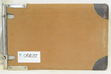
... local history group or museum. The shire covered an area of 9,347 square kilometres and existed from 1892 until 1994 when it became part of the East Gippsland Shire Council. Orbost was at first included in the Bairnsdale Shire from 1882 and was later part of the Tambo Shire. Because of travelling distances the Croajingalong Shire was created in 1892 (name changed to Orbost Shire 17.2.1893 with James Cameron as the first Shire President. In 1994 it amalgamated to become part of East Gippsland Shire Council. The Country Roads Board was the government...local history group or museum. The shire covered an area of 9,347 square kilometres and existed from 1892 until 1994 when it became part of the East Gippsland Shire Council. Orbost was at first included in the Bairnsdale Shire from 1882 and was later part of the Tambo Shire. Because of travelling distances the Croajingalong Shire was created in 1892 (name changed to Orbost Shire 17.2.1893 with James Cameron as the first Shire President. In 1994 it amalgamated to become part of East Gippsland Shire Council. The Country Roads Board was the government ...This ledger was used by the Shire of Orbost to record transactions with the Country Roads board in 1950's and 1960's. The item was donated to Orbost & District Historical society from P.R.O.V. as a Place of Deposit (POD) item for safe keeping by a local history group or museum. The shire covered an area of 9,347 square kilometres and existed from 1892 until 1994 when it became part of the East Gippsland Shire Council. Orbost was at first included in the Bairnsdale Shire from 1882 and was later part of the Tambo Shire. Because of travelling distances the Croajingalong Shire was created in 1892 (name changed to Orbost Shire 17.2.1893 with James Cameron as the first Shire President. In 1994 it amalgamated to become part of East Gippsland Shire Council. The Country Roads Board was the government authority for the construction and maintenance of main roads in Victoria between 1913 and 1983. It was succeeded by the Road Construction authority on 1 July 1983 and later merged with the Road Traffic Authority on July 1 1989 to form the Roads Corporation. James Cameron, an Orbost farming pioneer and Member of the Legislative Assembly, fathered the Country Roads Board. This item is a hand-written record of accounts of the Orbost Shire local Government. It pre-dates computer records,The Shire of Orbost Council no longer exists having been absorbed into th East Gippsland Shire council.A heavy brown coloured ledger with steel bindings. Covers are probably wooden. It contains hand-written records of transactions the Country Roads Board. -
 Orbost & District Historical Society
ledger, late 1950's - 1970's
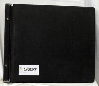
... local history group or museum. The shire covered an area of 9,347 square kilometres and existed from 1892 until 1994 when it became part of the East Gippsland Shire Council. Orbost was at first included in the Bairnsdale Shire from 1882 and was later part of the Tambo Shire. Because of travelling distances the Croajingalong Shire was created in 1892 (name changed to Orbost Shire 17.2.1893 with James Cameron as the first Shire President. In 1994 it amalgamated to become part of East Gippsland Shire Council. The Country Roads Board was the government...local history group or museum. The shire covered an area of 9,347 square kilometres and existed from 1892 until 1994 when it became part of the East Gippsland Shire Council. Orbost was at first included in the Bairnsdale Shire from 1882 and was later part of the Tambo Shire. Because of travelling distances the Croajingalong Shire was created in 1892 (name changed to Orbost Shire 17.2.1893 with James Cameron as the first Shire President. In 1994 it amalgamated to become part of East Gippsland Shire Council. The Country Roads Board was the government ...This ledger was used by the Shire of Orbost in the late 1950's - 1970's.The item was donated to Orbost & District Historical society from P.R.O.V. as a Place of Deposit (POD) item for safe keeping by a local history group or museum. The shire covered an area of 9,347 square kilometres and existed from 1892 until 1994 when it became part of the East Gippsland Shire Council. Orbost was at first included in the Bairnsdale Shire from 1882 and was later part of the Tambo Shire. Because of travelling distances the Croajingalong Shire was created in 1892 (name changed to Orbost Shire 17.2.1893 with James Cameron as the first Shire President. In 1994 it amalgamated to become part of East Gippsland Shire Council. The Country Roads Board was the government authority for the construction and maintenance of main roads in Victoria between 1913 and 1983. It was succeeded by the Road Construction authority on 1 July 1983 and later merged with the Road Traffic Authority on July 1 1989 to form the Roads Corporation. James Cameron, an Orbost farming pioneer and Member of the Legislative Assembly, fathered the Country Roads Board This item is a hand-written record of Orbost Shire Council accounts. It pre- dates computer records. The Shire of Orbost local council no longer exists having been absorbed by the East Gippsland Shire Council.A black ledger with wooden covers. It contains hand-written records of transactions between Orbost Shire Council and the Country Roads Board.bottom left corner - Orbost in black on a white East Gippsland Shire logoledger accounts shire-of-orbost country-roads-board -
 Orbost & District Historical Society
cash book, first half 20th century
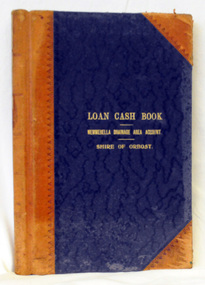
... local history group or museum. The shire covered an area of 9,347 square kilometres and existed from 1892 until 1994 when it became part of the East Gippsland Shire Council. Orbost was at first included in the Bairnsdale Shire from 1882 and was later part of the Tambo Shire. Because of travelling distances the Croajingalong Shire was created in 1892 (name changed to Orbost Shire 17.2.1893 with James Cameron as the first Shire President. In 1994 it amalgamated to become part of East Gippsland Shire Council. This item is a hand-written record of the accounts of the Orbost Shire local government ...This ledger was used by the Shire of Orbost to record transactions relating bto the Newmerella Drainage Area from 1927 to 1950. The item was donated to Orbost & District Historical society from P.R.O.V. as a Place of Deposit (POD) item for safe keeping by a local history group or museum. The shire covered an area of 9,347 square kilometres and existed from 1892 until 1994 when it became part of the East Gippsland Shire Council. Orbost was at first included in the Bairnsdale Shire from 1882 and was later part of the Tambo Shire. Because of travelling distances the Croajingalong Shire was created in 1892 (name changed to Orbost Shire 17.2.1893 with James Cameron as the first Shire President. In 1994 it amalgamated to become part of East Gippsland Shire Council.This item is a hand-written record of the accounts of the Orbost Shire local government. It pre-dates computer records. The Orbost Shire Council no longer exists having been absorbed into the East Gippsland Shire Council. A ledger with a black cover and brown binding. It has marbled end covers. It contains handwritten records of transactions relating to the Newmerella Drainage Area. On the front cover in gold print is "LOAN CASH BOOK (underlined) NEWMERELLA DRAINAGE AREA ACCOUNT (underlined) SHIRE OF ORBOST". on spine - "Newmerella Drainage Area Cash Book" in gold print.orbost-shire-council ledger accounts newmerella-drainage-area -
 Orbost & District Historical Society
ledger, first half 20th century
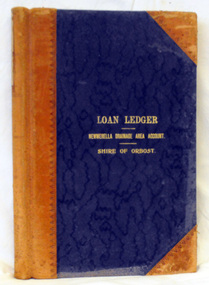
... local history group or museum. The shire covered an area of 9,347 square kilometres and existed from 1892 until 1994 when it became part of the East Gippsland Shire Council. Orbost was at first included in the Bairnsdale Shire from 1882 and was later part of the Tambo Shire. Because of travelling distances the Croajingalong Shire was created in 1892 (name changed to Orbost Shire 17.2.1893 with James Cameron as the first Shire President. In 1994 it amalgamated to become part of East Gippsland Shire Council. This item is a handwritten record of the accounts of the Orbost Shire local government ...This ledger was used by the Shire of Orbost from 1927 -1940. The item was donated to Orbost & District Historical society from P.R.O.V. as a Place of Deposit (POD) item for safe keeping by a local history group or museum. The shire covered an area of 9,347 square kilometres and existed from 1892 until 1994 when it became part of the East Gippsland Shire Council. Orbost was at first included in the Bairnsdale Shire from 1882 and was later part of the Tambo Shire. Because of travelling distances the Croajingalong Shire was created in 1892 (name changed to Orbost Shire 17.2.1893 with James Cameron as the first Shire President. In 1994 it amalgamated to become part of East Gippsland Shire Council. This item is a handwritten record of the accounts of the Orbost Shire local government. It pre-dates computer records. The Orbost Shire Council no longer exists having been absorbed by the East Gippsland Shire Council.A ledger with a black cover and brown leather binding. It has marbled end pages. On the front cover in gold print is " LOAN LEDGER (underlined) NEWMERELLA DRAINAGE AREA ACCOUNT (underlined) SHIRE OF ORBOST.on spine - "Newmerella Drainage Area Loan Ledger"ledger orbost-shire newmerella-drainage-area accounts -
 Orbost & District Historical Society
ledger, first quarter 20th century
... local history group or museum. The shire covered an area of 9,347 square kilometres and existed from 1892 until 1994 when it became part of the East Gippsland Shire Council. Orbost was at first included in the Bairnsdale Shire from 1882 and was later part of the Tambo Shire. Because of travelling distances the Croajingalong Shire was created in 1892 (name changed to Orbost Shire 17.2.1893 with James Cameron as the first Shire President. In 1994 it amalgamated to become part of East Gippsland Shire Council. This item is a hand-written record of the accounts of the Orbost Shire local government ...This ledger was used by the Shire of Orbost from 1910 -1925. The item was donated to Orbost & District Historical society from P.R.O.V. as a Place of Deposit (POD) item for safe keeping by a local history group or museum. The shire covered an area of 9,347 square kilometres and existed from 1892 until 1994 when it became part of the East Gippsland Shire Council. Orbost was at first included in the Bairnsdale Shire from 1882 and was later part of the Tambo Shire. Because of travelling distances the Croajingalong Shire was created in 1892 (name changed to Orbost Shire 17.2.1893 with James Cameron as the first Shire President. In 1994 it amalgamated to become part of East Gippsland Shire Council. This item is a hand-written record of the accounts of the Orbost Shire local government. It pre-dates computer records. The Orbost Shire council no longer exists having been absorbed by the East Gippsland Shire council.A ledger with ablack cover with brown leather binding.Pages have marbled edges. It contains hand-written records of transactions relating to the Bete Bolong South Drainage Area.on spine - gold lettering on red " Cash Book" and "Bete Bolong South Drainage Area" ; gold lettering on black " Shire of Orbost"ledger orbost-shire accounts bete-bolong-south-drainage-area -
 Orbost & District Historical Society
creditors' ledger, 1901 - 1960
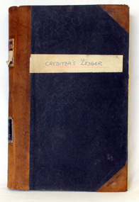
... local history group or museum. The shire covered an area of 9,347 square kilometres and existed from 1892 until 1994 when it became part of the East Gippsland Shire Council. Orbost was at first included in the Bairnsdale Shire from 1882 and was later part of the Tambo Shire. Because of travelling distances the Croajingalong Shire was created in 1892 (name changed to Orbost Shire 17.2.1893 with James Cameron as the first Shire President. In 1994 it amalgamated to become part of East Gippsland Shire Council. This item is a hand-written record of the accounts of the Orbost Shire local government ...This creditors' ledger records information about Shire purchases. The purpose of the Creditors Ledger is to provide knowledge about which suppliers the Shire has paid money to. This ledger was used by the Shire of Orbost pound keeper from 1901 -1960. The item was donated to Orbost & District Historical society from P.R.O.V. as a Place of Deposit (POD) item for safe keeping by a local history group or museum. The shire covered an area of 9,347 square kilometres and existed from 1892 until 1994 when it became part of the East Gippsland Shire Council. Orbost was at first included in the Bairnsdale Shire from 1882 and was later part of the Tambo Shire. Because of travelling distances the Croajingalong Shire was created in 1892 (name changed to Orbost Shire 17.2.1893 with James Cameron as the first Shire President. In 1994 it amalgamated to become part of East Gippsland Shire Council. This item is a hand-written record of the accounts of the Orbost Shire local government. It pre-dates computer records. The Orbost Shire council no longer exists having been absorbed by the East Gippsland Shire council.A large book with a black patterned cover with brown binding, it contains records handwritten in ink. These are records of money paid out by the local government. There are typewritten sheets of sundry creditors added to the back section of the book.hand-written on front cover on white sticker - " Creditor's Ledger" on spine in gold on red - "Ledger" ; on black - "Shire of Orbost" accounts ledger orbost-shire-council -
 Orbost & District Historical Society
credit ledger, 1892-1909
... local history group or museum. The shire covered an area of 9,347 square kilometres and existed from 1892 until 1994 when it became part of the East Gippsland Shire Council. Orbost was at first included in the Bairnsdale Shire from 1882 and was later part of the Tambo Shire. Because of travelling distances the Croajingalong Shire was created in 1892 (name changed to Orbost Shire 17.2.1893 with James Cameron as the first Shire President. In 1994 it amalgamated to become part of East Gippsland Shire Council. This is a hand-written record of the accounts of the local government ...This ledger was used by the Shire of Orbost from 1892 - 1909. The item was donated to Orbost & District Historical society from P.R.O.V. as a Place of Deposit (POD) item for safe keeping by a local history group or museum. The shire covered an area of 9,347 square kilometres and existed from 1892 until 1994 when it became part of the East Gippsland Shire Council. Orbost was at first included in the Bairnsdale Shire from 1882 and was later part of the Tambo Shire. Because of travelling distances the Croajingalong Shire was created in 1892 (name changed to Orbost Shire 17.2.1893 with James Cameron as the first Shire President. In 1994 it amalgamated to become part of East Gippsland Shire Council. This is a hand-written record of the accounts of the local government. The Orbost Shire Council no longer exists having been absorbed into the East Gippsland Shire Council.A heavy ledger with a dark brown cover and lighter brown binding. it has marbled end covers and marbled page edges. It contains accounts records hand-written in ink.on spine in gold lettering - on a red square : "Ledger" - on a black square : "Shire of Orbost"accounts ledger orbost-shire-council
