Showing 465 items matching "park west road"
-
 Eltham District Historical Society Inc
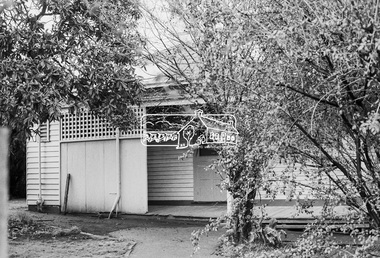
Photograph - Colour Print, Alan Marshall's bungalow, 13 Park West Road, Eltham, 22 July 1993
... Alan Marshall's bungalow, 13 Park West Road, Eltham......Park West Road...It was last updated March 2022. eltham Alan Marshall Alan Marshall Bungalow Heritage Assessment Heritage Protection Overlay houses Nillumbik Shire Council Park West Road Heritage Overlay HO147 Colour photo print 10 x 15 cm, originally stuck down on corflute for display Alan Marshall's bungalow, 13 Park West Road, Eltham Photograph Colour Print ...From 1955 Alan Marshall's home was a bungalow at the rear of his sister's house at Eltham. The first bungalow burnt down. Its replacement shown here still stands. In March 2020 the property was sold. It was last sold previously in November 1982. No mention was made in the advertising regarding the heritage protected bungalow in the rear yard and advertising material presented it as having future potential to develop STCA (Subject To Council Approval). Concerned local members of the community alerted to EDHS to the pending upcoming sale and Council was also alerted to the sale and the potential risk presented to the heritage protected bungalow. In 2021 an updated amendment, C133nill, was made to the Nillumbik Planning Scheme in response to a planning application to develop the property following its sale. The Minster of Planning approved and gazetted the Amendment. Gazettal occurred on 25th November 2021. A copy of the gazetted Amendment is available on website of the Department of Environment, Land, Water and Planning at www.planning.vic.gov.au/schemes-and-amendments/browse-amendments. It was last updated March 2022.Colour photo print 10 x 15 cm, originally stuck down on corflute for displayeltham, alan marshall, alan marshall bungalow, heritage assessment, heritage protection overlay, houses, nillumbik shire council, park west road, heritage overlay ho147 -
 Eltham District Historical Society Inc
Photograph - Aerial Photograph, Landata, Eltham, Vic, Apr. 1972
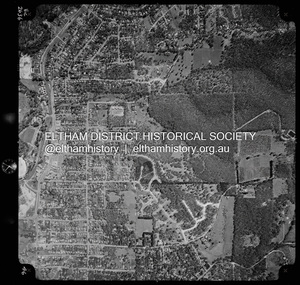
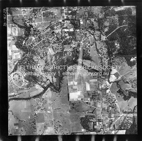
... ...Park West Road...Centred on present day Zig Zag Road near Coolabah Drive, Eltham bounded by Allendale Road to north, Park West Road to south, Parsons Road to east and Banks Road to west. ...Eltham District Historical Society Inc 728 Main Rd Eltham melbourne Centred on present day Zig Zag Road near Coolabah Drive, Eltham bounded by Allendale Road to north, Park West Road to south, Parsons Road to east and Banks Road to west. ...Centred on present day Zig Zag Road near Coolabah Drive, Eltham bounded by Allendale Road to north, Park West Road to south, Parsons Road to east and Banks Road to west. Historic Aerial Imagery Source: Landata.vic.gov.au Aerial Photo Details: Project No :985 Project : MELBOURNE 1972 Run : 26 Frame : 191 Date : 04/1972 Film Type : B/W Camera : RC10 Flying Height : 5700 Scale : 9600 Film Number : 2636 GDA2020 : 37°41'56"S, 145°09'26"E MGA2020 : 337533, 5826000 (55) Melways : 22 A1 (ed. 42)aerial photo, neil webster collection, 1972-04, allendale road, eltham, eltham north, zig zag road, banks road, coolabah drive, melway 22a1, park west road, parsons road -
 Eltham District Historical Society Inc
Photograph - Aerial Photograph, Landata, Eltham, Vic, Apr. 1972
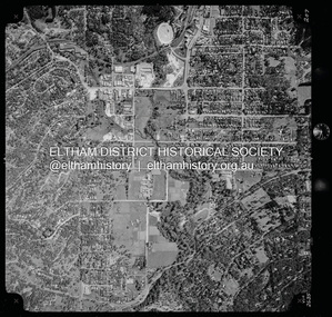
... ...Park West Road...Centred on present day Main Road at Pryor Street, Eltham bounded by Park West Road to north, Napoleon Street to south, Woodridge Estate to east and Ryans Road to west. ...Eltham District Historical Society Inc 728 Main Rd Eltham melbourne Centred on present day Main Road at Pryor Street, Eltham bounded by Park West Road to north, Napoleon Street to south, Woodridge Estate to east and Ryans Road to west. ...Centred on present day Main Road at Pryor Street, Eltham bounded by Park West Road to north, Napoleon Street to south, Woodridge Estate to east and Ryans Road to west. Historic Aerial Imagery Source: Landata.vic.gov.au Aerial Photo Details: Project No :985 Project : MELBOURNE 1972 Run : 27 Frame : 47 Date : 04/1972 Film Type : B/W Camera : RC10 Flying Height : 5700 Scale : 9600 Film Number : 2636 GDA2020 : 37°42'45"S, 145°09'12"E MGA2020 : 337223, 5824470 (55) Melways : 22 A4 (ed. 42)aerial photo, neil webster collection, 1972-04, eltham, eltham railway station, woodridge estate, eltham shops, main road, melway 22a4, napoleon street, park west road, pryor street, ryans road -
 Eltham District Historical Society Inc
Photograph - Aerial Photograph, Landata, Eltham, Vic, Apr. 1963
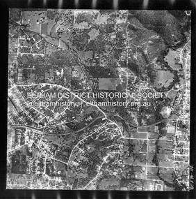
... ...Park West Road...Centred on present day Floriston Grove, Eltham bounded by Maroondah Aqueduct to north, Thompson Crescent and Diosma Road to south, Research Shops to east and Glen Park Road and Park West Road to west. Historic Aerial Imagery Source: Landata.vic.gov.au Aerial Photo Details: Project No :486 Project : MELBOURNE (1963) PROJECT Run : 5 Frame : 60 Date : 04/1963 Film Type : B/W Camera : RC8 Flying Height : 5100 Scale : 9600 Film Number : 1805 GDA2020 : 37°42'24"S, 145°09'29"E MGA2020 : 337622, 5825128 (55) Melways : 22 B3 (ed. 42)...Eltham District Historical Society Inc 728 Main Rd Eltham melbourne Centred on present day Floriston Grove, Eltham bounded by Maroondah Aqueduct to north, Thompson Crescent and Diosma Road to south, Research Shops to east and Glen Park Road and Park West Road to west. Historic Aerial Imagery Source: Landata.vic.gov.au Aerial Photo Details: Project No :486 Project : MELBOURNE (1963) PROJECT Run : 5 Frame : 60 Date : 04/1963 Film Type : B/W Camera : RC8 Flying Height : 5100 Scale : 9600 Film Number : 1805 GDA2020 : 37°42'24"S, 145°09'29"E MGA2020 : 337622, 5825128 (55) Melways : 22 B3 (ed. 42) Aerial Photo Neil Webster Collection Eltham 1963-04 Diosma Road Floriston Grove Maroondah Aqueduct Melway 22B3 Park West Road Research (Vic.) ...Centred on present day Floriston Grove, Eltham bounded by Maroondah Aqueduct to north, Thompson Crescent and Diosma Road to south, Research Shops to east and Glen Park Road and Park West Road to west. Historic Aerial Imagery Source: Landata.vic.gov.au Aerial Photo Details: Project No :486 Project : MELBOURNE (1963) PROJECT Run : 5 Frame : 60 Date : 04/1963 Film Type : B/W Camera : RC8 Flying Height : 5100 Scale : 9600 Film Number : 1805 GDA2020 : 37°42'24"S, 145°09'29"E MGA2020 : 337622, 5825128 (55) Melways : 22 B3 (ed. 42)aerial photo, neil webster collection, eltham, 1963-04, diosma road, floriston grove, maroondah aqueduct, melway 22b3, park west road, research (vic.), research shops -
 Eltham District Historical Society Inc
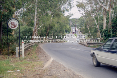
Slide - Photograph, Wattletree Road Bridge, Eltham, c.1993
... ...Park West Road...Eltham District Historical Society Inc 728 Main Rd Eltham melbourne infrastructure roads eltham Eltham North Level Crossing Main Road Park West Road railway crossing Sign Wattletree Road Wattletree Road Bridge 35mm colour positive transparency Mount - Black and White Wattletree Road Bridge, Eltham Slide Photograph ...35mm colour positive transparency Mount - Black and Whiteinfrastructure, roads, eltham, eltham north, level crossing, main road, park west road, railway crossing, sign, wattletree road, wattletree road bridge -
 Eltham District Historical Society Inc
Photograph, George Coop, Station Master's House, Eltham Railway Station, 21 August 1983, 1983
... It was sold for $1 and relocated to Park West Road and renovated....It was sold for $1 and relocated to Park West Road and renovated. eltham railway station eltham station masters house Digital TIFF file Scan of 35mm Kodak Safety 5062 black and white transparency Station Master's House, Eltham Railway Station, 21 August 1983 Photograph Photograph George Coop ...The Station Master's house was situated in what is now the short term car park and bus bay. It was sold for $1 and relocated to Park West Road and renovated.Digital TIFF file Scan of 35mm Kodak Safety 5062 black and white transparencyeltham railway station, eltham station masters house -
 Eltham District Historical Society Inc
Photograph, George Coop, Station Master's House, Eltham Railway Station, 21 August 1983, 1983
... It was sold for $1 and relocated to Park West Road and renovated....It was sold for $1 and relocated to Park West Road and renovated. Eltham Railway Station Eltham Station Masters House Digital TIFF file Scan of 35mm Kodak Safety 5062 black and white transparency Station Master's House, Eltham Railway Station, 21 August 1983 Photograph Photograph George Coop ...The Station Master's house was situated in what is now the short term car park and bus bay. It was sold for $1 and relocated to Park West Road and renovated.Digital TIFF file Scan of 35mm Kodak Safety 5062 black and white transparencyeltham railway station, eltham station masters house -
 Sunshine and District Historical Society Incorporated
Administrative record - City of Sunshine - Commissioner Mr Alexander Alex George Gillon Collection 1976 - 1982 - Matters Arising Agenda And Forward Committee 30th October 1979, City of Sunshine, 29th October 1979
... Road...Deer Park...Highpoint West...Station Road Deer Park Highpoint West Rosamond Road Maribyrnong Princess Street St. ...Station Road Widing Planning Permit Extensions to shopping centre Rosamond Road Princess Street Arcade car parkingstation road, deer park, highpoint west, rosamond road, maribyrnong, princess street, st. albans -
 Sunshine and District Historical Society Incorporated
Administrative record - City of Sunshine - Commissioner Mr Alexander Alex George Gillon Collection 1976 - 1982 - Matters Arising From Agenda Committee 22nd July 1980, City of Sunshine, 22nd July 1980
... Park Shopping Centre...Station Road...Deer Park...Highpoint West...Deer Park Shopping Centre Station Road Deer Park Highpoint West Rosamond Road Maribyrnong Proposed Markets at Deer Park and Highpoint West Shopping Centres Foolscap sized document. ...Proposed Markets at Deer Park and Highpoint West Shopping Centresdeer park shopping centre, station road, deer park, highpoint west, rosamond road, maribyrnong -
 Kew Historical Society Inc
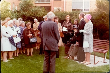
Photograph - Opening of the Dorothy Rogers Reserve, 1976
... The reserve is located on the north side of Studley Park Road just west of Kew Junction. ...parks -- kew (vic.) Inscribed verso: "Members and relatives of the late Dorothy Rogers. Memorial reserve named and unveiled in her honour by (Cr Whiting Mayor) and City Manager Mr Fell 1978. In respect for her great research and service to the history of early Kew, and other places." Faded colour positive photograph of the opening of the Dorothy Rogers Reserve in 1976. The naming of the reserve honoured the contribution of the historian Dorothy Rogers, foundation member of the Society. The reserve is located on the north side of Studley Park Road just west ...Dorothy Rogers wrote two major books on Kew's history: Lovely Old Homes of Kew (1961) and A History of Kew (1973). In addition to her published works, she was a regular contributor on issues of local history to suburban newspapers. Her archives are held in the collections of the State Library of Victoria and Kew Historical Society. Three years after her death in 1973, the Reserve was opened in her honour.Faded colour positive photograph of the opening of the Dorothy Rogers Reserve in 1976. The naming of the reserve honoured the contribution of the historian Dorothy Rogers, foundation member of the Society. The reserve is located on the north side of Studley Park Road just west of Kew Junction. Inscribed verso: "Members and relatives of the late Dorothy Rogers. Memorial reserve named and unveiled in her honour by (Cr Whiting Mayor) and City Manager Mr Fell 1978. In respect for her great research and service to the history of early Kew, and other places."dorothy rogers reserve, public parks -- kew (vic.) -
 Kew Historical Society Inc
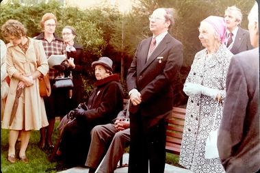
Photograph - Opening of the Dorothy Rogers Reserve, 1976
... The reserve is located on the north side of Studley Park Road just west of Kew Junction. ...parks -- kew (vic.) Inscribed verso: "Left to right: Mrs Rogers Jnr, Joy Stewart, Miss Jenkins sitting / Mrs Richardson and Mr Richardson, Brother of D. Rogers), Mayor Cr Whiting, City Manager Mr Fell, Background / KHS President Miss Hall, Mr B O'Neill KHS member, / taken during the memorial unveiling of the Dorothy Rogers Reserve" Faded colour positive photograph of the opening of the Dorothy Rogers Reserve in 1976. The naming of the reserve honoured the contribution of the historian Dorothy Rogers, foundation member of the Society. The reserve is located on the north side of Studley Park Road just west ...Dorothy Rogers wrote two major books on Kew's history: Lovely Old Homes of Kew (1961) and A History of Kew (1973). In addition to her published works, she was a regular contributor on issues of local history to suburban newspapers. Her archives are held in the collections of the State Library of Victoria and Kew Historical Society. Three years after her death in 1973, the Reserve was opened in her honour.Faded colour positive photograph of the opening of the Dorothy Rogers Reserve in 1976. The naming of the reserve honoured the contribution of the historian Dorothy Rogers, foundation member of the Society. The reserve is located on the north side of Studley Park Road just west of Kew Junction. Inscribed verso: "Left to right: Mrs Rogers Jnr, Joy Stewart, Miss Jenkins sitting / Mrs Richardson and Mr Richardson, Brother of D. Rogers), Mayor Cr Whiting, City Manager Mr Fell, Background / KHS President Miss Hall, Mr B O'Neill KHS member, / taken during the memorial unveiling of the Dorothy Rogers Reserve"dorothy rogers reserve, public parks -- kew (vic.) -
 Kew Historical Society Inc
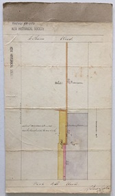
Plan, Survey Plan, Park Hill Road, Kew, 1880-1890
... The streets identified on the survey plan - Cotham Road, Park Hill Road East, Park Hill Road West in Kew were each gazetted by the Victorian Government in 1865. ...Kew Historical Society Inc Kew Court House 188 High Street Kew melbourne The streets identified on the survey plan - Cotham Road, Park Hill Road East, Park Hill Road West in Kew were each gazetted by the Victorian Government in 1865. ...The streets identified on the survey plan - Cotham Road, Park Hill Road East, Park Hill Road West in Kew were each gazetted by the Victorian Government in 1865. The hand-coloured survey plan was completed by Holland Loxton, Town Clerk and Surveyor of the Borough of Kew from 1866. The unnamed survey plan includes names of land owners in addition to measurements (2 chains to 1 inch) and streets. Named owners include Webster, Payne and Francom which will enable us to narrow down the creation date of the survey.Handdrawn survey plan by a former surveyor and town clerk of KewHand drawn and coloured survey plan created by Holland Loxton, Surveyor and Town Clerk of Kew, showing land owned by Payne in Park Hill Road, Kew. The plan includes street names, land measurements and land owners.surveys - kew, maps - kew, holland loxton, park hill road - kew, holland loxton -- surveyor, survey plans -- parkhill road -- kew (vic.) -
 Eltham District Historical Society Inc
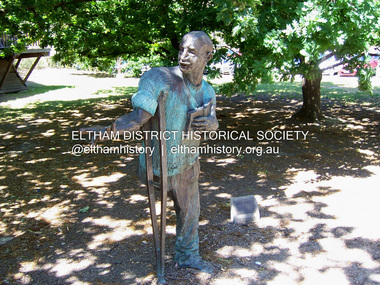
Photograph - Digital Photograph, Marguerite Marshall, Alan Marshall by Marcus Skipper (1995) outside Eltham Library, Panther Place, Eltham, 11 October 2006
... From 1955 to 1972 Marshall lived in a tiny fibro-cement bungalow at the rear of a house at Park West Road, Eltham, owned by his older sister, Elsie McConnell. ...From 1955 to 1972 Marshall lived in a tiny fibro-cement bungalow at the rear of a house at Park West Road, Eltham, owned by his older sister, Elsie McConnell. ...Sculture in bronze of Alan Marshall by Marcus Skipper, 1995 Alan Marshall, AM., O.B.E., Hon.LL,D. (1902-1984) was born at Noorat, Victoria and became one of Australia's most famous authors. His association with the Eltham area began in 1920 when he started his first job as a junior clerk at the Eltham Shire Offices, Kangaroo Ground. In the 1940's he spent some time living at Research. From 1955 he lived in Eltham for nearly 20 years. Disabilities resulting from polio as a young child did not prevent a wide range of experiences. Alan's occupations have been listed as clerk, night watchman, fortune teller, freelance journalist and author. He has been patron of many disadvantaged Children's Societies. Alan's books are numerous and include novels, short stories, children's books, history and travel. Among the best known are his autobiographies "I Can Jump Puddles" and "This is the Grass". Others include "These are My People", "Ourselves Writ Strange", "People of the Dreamtime"; "The Gay Provider" and "Wild Red Horses". In 1971 he wrote the Centenary History of the Shire of Eltham, "Pioneers and Painters". Covered under National Trust of Australia (Victoria), State significance. Published: Nillumbik Now and Then / Marguerite Marshall 2008; photographs Alan King with Marguerite Marshall.; p159 Outside the Eltham Library a bronze figure of a short one-legged man with a crutch invites people to the world of literature. The bronze statue, by Marcus Skipper, is of author Alan Marshall, who is famed for his autobiography I Can Jump Puddles, about growing up and overcoming the effects of polio. That plucky little boy later lived in the Nillumbik district for more than 50 years, and on his death in 1984, was buried in the Nillumbik Cemetery at Diamond Creek. Although a hugely successful author, his grave is modest with only a tiny boulder and simple bronze plaque on a grassed plot. From 1955 to 1972 Marshall lived in a tiny fibro-cement bungalow at the rear of a house at Park West Road, Eltham, owned by his older sister, Elsie McConnell. It was there that he wrote most of his autobiographical trilogy and his history of the former Eltham Shire, Pioneers and Painters. His long association with Eltham Shire began in 1918 when his family moved to Diamond Creek. Then in 1920 he began work as a junior clerk at the Eltham Shire Offices on Main Road, Kangaroo Ground near the Yarra Glen Road, while boarding at the hotel next door. Marshall later bought a block of land in Research, which had three bark huts. In one of these he wrote his first book These Are My People. He later sold the land but lived in a caravan there and in 1955 wrote I Can Jump Puddles.1 Proud of its citizen, the Eltham Shire named a park after Marshall at the corner of Main Road and Leanne Drive, Eltham. In 1985 the Shire initiated the Alan Marshall Short Story Award. It was Marshall’s early life in the country that taught him to live courageously in spite of his crippling polio, and he inspired many. This informed his writing – full of courage, championing the battler and love of the bush. Alan Marshall was born in 1902 at Noorat in Western Victoria, as the only son of Billy a drover, horse breaker, hawker and then general store owner. At the age of six, Marshall contracted infantile paralysis and was later hospitalised in Colac for 18 months. With his father’s encouragement, Marshall learnt to swim, wrestle and box, ride a bicycle (downhill), ride a horse and drive a car. Marshall won a scholarship to Stott’s Correspondence College to study accountancy. To help him continue his studies and find employment, his family bought 12 acres (4.8ha), in Ryans Road, Diamond Creek, opposite Windmill Court. There they ran cows, some poultry and an orchard. But life with a disability and during the Depression was hard for Marshall, who for 20 years, endured long periods of unemployment and loneliness and was often exploited at work.2 However, life improved in the 1930s, when he published short stories and articles in newspapers and magazines, including a column of advice to the lovelorn, which he wrote for nearly 20 years. At age 42 Marshall published his first book and in the next 30 years he published more than 20. His most successful book was I Can Jump Puddles, which sold more than three million copies internationally. It was made into a film, released in 1971, by Czechoslovakian director Karel Kachyna. Marshall was one of the first Australians to write about Aborigines who called him Gurrawilla - teller of tales - when he lived with them in Arnhem Land for eight months.3 In 1941 Marshall married Olive Dixon, with whom he had two daughters, Catherine and Jennifer. Marshall and Olive divorced in 1957. In 1972 Marshall was awarded an OBE for his work with the handicapped. He was also awarded an Honorary Doctor of Laws by Melbourne University, an Order of Australia for services to literature and the Soviet Order of Friendship of Peoples.This collection of almost 130 photos about places and people within the Shire of Nillumbik, an urban and rural municipality in Melbourne's north, contributes to an understanding of the history of the Shire. Published in 2008 immediately prior to the Black Saturday bushfires of February 7, 2009, it documents sites that were impacted, and in some cases destroyed by the fires. It includes photographs taken especially for the publication, creating a unique time capsule representing the Shire in the early 21st century. It remains the most recent comprehenesive publication devoted to the Shire's history connecting local residents to the past. nillumbik now and then (marshall-king) collection, alan marshall, art in public places, eltham, eltham library, marcus skipper, panther place, public art, sculpture -
 Warrnambool and District Historical Society Inc.
Booklet, The Temiangandeen Country Dergholm, 1973
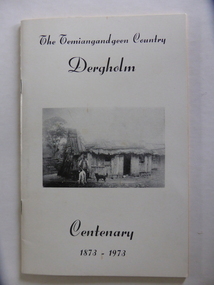
... road This booklet gives information on the settlement of Dergholm at the time of the centenary of its founding, 1973. The origin of the name Dergholm is unclear but it may have Irish connections. Europeans came to the area in the 1840s and 50s but it was not until the 1870s that the town was surveyed. Dergholm is in the far west of Victoria 334 kilometres from Melbourne and nearby is Dergholm State Park ...This booklet gives information on the settlement of Dergholm at the time of the centenary of its founding, 1973. The origin of the name Dergholm is unclear but it may have Irish connections. Europeans came to the area in the 1840s and 50s but it was not until the 1870s that the town was surveyed. Dergholm is in the far west of Victoria 334 kilometres from Melbourne and nearby is Dergholm State Park established in 1982. The booklet was produced for the Centenary Back to Dergholm Committee and the local centenary celebrations. This book is of some interest as it provides information on Dergholm, a settlement in the far west of Western Victoria. This is a soft cover booklet of 52 pages by Alistair Roper. It has a cream-coloured cover with a black and white photograph of early Dergholm on the front cover (Edward Quinn’s house). The booklet has printed material - a President’s Message, an Author’s Note, Acknowledgements, Contents, information on the Dergholm area, including a list of local birds, and References. There are several black and white photographs of the area and its people. The book is stapled. Front Cover: ‘The Temiangandgeen Country, Dergholm Centenary, 1873-1973’dergholm victoria, alistair roper, history of western district of victoria -
 Warrnambool and District Historical Society Inc.
Booklet, Samuel Baulch and the Original Rose Park
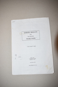
... road This booklet contains the first draft of an article on Samuel Baulch’s acquisition of his property, Rose Park which was in the Macarthur/Hawkesdale district. Samuel Baulch’s parents, Francis and Ann Baulch were pioneer settlers in the Kirkstall area and Samuel worked at the Dunmore Station in the Macarthur area before purchasing the property he named Rose Park in the early 1870s. In the 1890s he acquired property in the Dunmore Estate. Samuel’s son, Stan Baulch, acquired sections of the Dunmore property after his father’s death and he named his section, Rose Park, a property to the west ...This booklet contains the first draft of an article on Samuel Baulch’s acquisition of his property, Rose Park which was in the Macarthur/Hawkesdale district. Samuel Baulch’s parents, Francis and Ann Baulch were pioneer settlers in the Kirkstall area and Samuel worked at the Dunmore Station in the Macarthur area before purchasing the property he named Rose Park in the early 1870s. In the 1890s he acquired property in the Dunmore Estate. Samuel’s son, Stan Baulch, acquired sections of the Dunmore property after his father’s death and he named his section, Rose Park, a property to the west of the original Rose Park. This article is of historical interest and will be useful to researchers of local and family history. This is a booklet of 18 pages. It has a paper cover and the pages were originally stapled together but now have a plastic clip. The booklet has been home-produced and the material typed on a computer. Some of the pages are a little stained. samuel baulch, rose park, western victoria, history of warrnambool -
 Warrnambool and District Historical Society Inc.
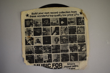
33.3 R.P.M. Record (Warrnambool Technical School), H.M.S. Pinafore, 1971
... Park, as its logo and label. The recording is of the 1971 production of ‘H.M.S. Pinafore’ by the students of Warrnambool Technical College. This school was established in 1913 in Timor Street and in 1973, as Warrnambool Technical School, was relocated to Caramut Road and re-named Brauer college in 1990. The Timor Street site is now the South West...road This record was made by a local business existing in the 1960s and early 70s, Warrnambool Recording Enterprises. This business used a local landmark, the Tower Hill State Park, as its logo and label. The recording is of the 1971 production of ‘H.M.S. Pinafore’ by the students of Warrnambool Technical College. This school was established in 1913 in Timor Street and in 1973, as Warrnambool Technical School, was relocated to Caramut Road and re-named Brauer college in 1990. The Timor Street site is now the South West ...This record was made by a local business existing in the 1960s and early 70s, Warrnambool Recording Enterprises. This business used a local landmark, the Tower Hill State Park, as its logo and label. The recording is of the 1971 production of ‘H.M.S. Pinafore’ by the students of Warrnambool Technical College. This school was established in 1913 in Timor Street and in 1973, as Warrnambool Technical School, was relocated to Caramut Road and re-named Brauer college in 1990. The Timor Street site is now the South West TAFE College. This record is of interest as a memento both of the Warrnambool Technical College’s musical performance in 1971 and of the production of records such as this one by a local business, Warrnambool Recording Enterprises in the early 1970s. This is a 33.3 R.P.M. record with a part-image of a guitar and a yellow label in the centre with black printing and typing. It is in a paper sleeve which is tattered with the bottom section mostly missing. The cover does not appear to belong to the record. Tower Hill HMS Pinafore presented by students of Warrnambool Technical School 1971 Custom Recording by Warrnambool Recording Enterprises P.O. Box 123 Warrnambool Phone 8223warrnambool technical school, warrnambool recording enterprises tower hill label, history of warrnambool, ‘h.m.s. pinafore’ -
 Warrnambool and District Historical Society Inc.
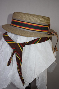
Hat & Neck Tie, Warrnambool Technical School, 1970s
... Park in Warrnambool. The Timor Street site is now the location of South West College of TAFE. The WarrnamboolTechnical School moved from Timor Street to its present-day site in Caramut Road Warrnambool in 1973 and was re-named Brauer College in 1990 after Alfred Brauer, a Warrnambool doctor and a prominent school patron. ...road These two hats and school tie were once part of the uniform for girls at Warrnambool Technical School. This school was established in 1913 in Timor Street, Warrnambool with the first Principal being John King. From this school evolved the Warrnambool Institute of Advanced Education which itself was subsumed into the present day Deakin University campus at Sherwood Park in Warrnambool. The Timor Street site is now the location of South West ...These two hats and school tie were once part of the uniform for girls at Warrnambool Technical School. This school was established in 1913 in Timor Street, Warrnambool with the first Principal being John King. From this school evolved the Warrnambool Institute of Advanced Education which itself was subsumed into the present day Deakin University campus at Sherwood Park in Warrnambool. The Timor Street site is now the location of South West College of TAFE. The WarrnamboolTechnical School moved from Timor Street to its present-day site in Caramut Road Warrnambool in 1973 and was re-named Brauer College in 1990 after Alfred Brauer, a Warrnambool doctor and a prominent school patron. It is believed that the owners of the hats, Jeannie and Sandra Cole were sisters.These two hats and the tie are interesting reminders of the uniform of a local school some 40 or 50 years ago..1 This is a girl’s boater-shape straw hat. It has a ribbon band in grey, brown, yellow, red and green colours with a bow at the back with overhanging ends of the band. The hat has a cloth lining with a tag. The owner’s name is inside the hat. .2 This is a girl’s boater-shape straw hat. It has the same band as the one above but the crown on this hat is semi-detached. The owner’s name is on the inside of the hat. .3 This is a school tie. It is brown with gold, dark green and red diagonal stripes. .1 Jeannie Cole Made of straw fibre .2 Sandra Cole Made of straw fibre Created by Effie Jay showerproof with water repellent formula KO/3420 warrnambool technical school, history of warrnambool -
 Warrnambool and District Historical Society Inc.
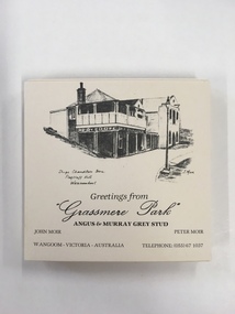
Souvenir, Coasters Grassmere Park x 11, Late 20th C
... Warrnambool and District Historical Society Inc. 2 Gilles Street (south of Merri St) Warrnambool great-ocean-road Grassmere Park is a property on the outskirts of Warrnambool at Wangoom. The scenes depicted are of historic buildings such as Star of the West in Port Fairy, the Koroit Post Office and various buildings at Flagstaff Hill in Warrnambool. ...Grassmere Park is a property on the outskirts of Warrnambool at Wangoom. The scenes depicted are of historic buildings such as Star of the West in Port Fairy, the Koroit Post Office and various buildings at Flagstaff Hill in Warrnambool. The drawings are all signed by John Moir a local artist.Social significance. A common item with local views with which local people would be familiar.A set of 11 square cream card coasters with black pen drawings of local scenes with text underneath the drawings.Greetings from Grassmere Park Angus and Murray Grey Stud. John Moir Peter Moir. Wangoom Victoria Australia telephone 055)671037warrnambool, grassmere park, wangoom, -
 Warrnambool and District Historical Society Inc.
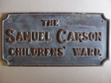
Plaque - Brass Plate, The Samuel Carson Childrens' Ward, C 1925
... Warrnambool and District Historical Society Inc. 2 Gilles Street (south of Merri St) Warrnambool great-ocean-road Samuel Carson was a local farmer who in the late 1800's acquired land to the West of Warrnambool in the Farnham park estate and towards Tower Hill near Gorman's lane. ...Samuel Carson was a local farmer who in the late 1800's acquired land to the West of Warrnambool in the Farnham park estate and towards Tower Hill near Gorman's lane. By the time of his death on May 23, 1920 he left an amount of 11666 pounds. Apart from amounts left to individuals, he bequeathed one hundred pounds each to ten different orphanages, and homes for neglected children and the blind and leaving the remainder to charitable organisations at the discretion of his trustees.The donation of 3500 pounds in August 1922 was in the latter category. This plaque commemorates Samuel Carson's generosity to the newly refurbished Warrnambool Base Hospital. He left a son William who farmed at Yangery at the time of his father's death. This item is significant in that it links a local identity through his generous donation to the local hospital. It therefore has strong social,historical and interpretative value. His generosity is a significant part of the history of Warrnambool Base Hospital.Heavy rectangular cast brass plate with raised edge and text in capitals. Corners have rounded cutouts and there is a hole in each corner for attachment. The Samuel Carson Childrens' Ward.warrnambool, warrnambool base hospital, samuel carson, samuel carson warrnambool, childrens' ward warrnambool 1928 -
 Kiewa Valley Historical Society
Map - Bogong High Plains - Grazing Runs, Grazing Run Boundaries 1960 - Soil Conservation Authority
... Cattle have been banned in the Alpine National Park due to their impact on the environment. cattlemen grazing runs bogong high plains kiewa valley families White paper with brown print. Bogong High Plains from Feathertop in the west to Mt Nelse in the east showing physical boundaries including the Kiewa Hydro Electric Scheme, roads, rivers and mountains. ...Cattle grazing on the Bogong High Plains during summer commenced in the 1840s and continued for many years. The Soil Conservation Authority recorded each family's area boundaries which were updated in June 1972 and continued to be adjusted until cattle were banned in 2005. The tradition of cattle grazing continues to be controversial.Holders of grazing rights for grazing on the Bogong High Plains were allocated specific areas recorded by the Soil Conservation Authority in 1972. Cattle have been banned in the Alpine National Park due to their impact on the environment.White paper with brown print. Bogong High Plains from Feathertop in the west to Mt Nelse in the east showing physical boundaries including the Kiewa Hydro Electric Scheme, roads, rivers and mountains. Names of families with grazing runs and the boundaries are shown.cattlemen, grazing runs, bogong high plains, kiewa valley families -
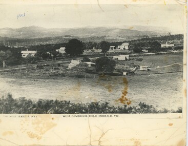 Emerald Museum & Nobelius Heritage Park
Postcard - Postcard of West Gembrook Road, Emerald, Rose Stereograph Company, West Gembrook Road, Emerald, Vic, Circa 1930s-45
... Emerald Museum & Nobelius Heritage Park 5 Crichton Rd Emerald yarra-valley-and-the-dandenong-ranges This photograph was taken as a postcard in the Rose Stereograph Company's Rose Series. It was number P. 1463 in the series, meaning it was likely taken in the 1930s or early 40s. It depicts 'West Gembrook Road ...This photograph was taken as a postcard in the Rose Stereograph Company's Rose Series. It was number P. 1463 in the series, meaning it was likely taken in the 1930s or early 40s. It depicts 'West Gembrook Road' - likely now Old Gembrook Road or Belgrave-Gembrook Road - surrounded by fields on one side and small home on the other. Over 14000 Rose Series postcards were produced over the lifetime of the Company, capturing everything from major landmarks to quiet scenic roads like this. It may have been taken by Karl Visser.The photograph depicts part of Emerald as it was in the 1930s. At the time, it was considered representative of the area, enough to be published as a postcard.Black and white photograph (copy) on gloss photographic paper. Below the photo is a label describing its location and denoting it as part of the Rose Series. The photo looks down at a road with hills in the background, a field in the foreground and occasional building along the roadside. The rear has writing in pencil and some pen scribbles, and there is a pen scribble on the upper left of the photograph.Front, Left, Below Photograph: "THE ROSE SERIES P. 1463" Front, Centre, Below Photograph: "WEST GEMBROOK ROAD, EMERALD, VIC." Rear: "KAPL VISSER / 600 511"emerald, photography, 1930s, 1940s -
 Federation University Historical Collection
Book, South West Gippsland Tourism Development Strategy, 1989, c1999
... west gippsland...gippsland...coal creek historical town...wilsons promontory...penguin parade...grand prix...grand ridge road...wonthaggi...phillip island...foster korumburra...inverloch...kilcunda...san remo...bass...bunurong marin park...Barker Library (top floor) Mount Helen goldfields tourism tourism strategy south west gippsland gippsland coal creek historical town wilsons promontory penguin parade grand prix grand ridge road wonthaggi phillip island foster korumburra inverloch kilcunda san remo bass bunurong marin park port franklin tarwin lower Black plastic binding on a report tourism and development strategy report. ...Black plastic binding on a report tourism and development strategy report.tourism, tourism strategy, south west gippsland, gippsland, coal creek historical town, wilsons promontory, penguin parade, grand prix, grand ridge road, wonthaggi, phillip island, foster korumburra, inverloch, kilcunda, san remo, bass, bunurong marin park, port franklin, tarwin lower -
 Eltham District Historical Society Inc
Photograph - Aerial Photograph, Landata, Eltham, Vic, Apr. 1963
... Centred on present day Eltham Lower Park bounded by Brougham Street to north, Yarra River and Fitzsimons Lane Bridge to south, Main Road at Kent Hughes Road to east and Bolton Street to west. ...Eltham District Historical Society Inc 728 Main Rd Eltham melbourne Centred on present day Eltham Lower Park bounded by Brougham Street to north, Yarra River and Fitzsimons Lane Bridge to south, Main Road at Kent Hughes Road to east and Bolton Street to west. ...Centred on present day Eltham Lower Park bounded by Brougham Street to north, Yarra River and Fitzsimons Lane Bridge to south, Main Road at Kent Hughes Road to east and Bolton Street to west. Historic Aerial Imagery Source: Landata.vic.gov.au Aerial Photo Details: Project No :486 Project : MELBOURNE (1963) PROJECT Run : 7 Frame : 232 Date : 04/1963 Film Type : B/W Camera : RC8 Flying Height : 5100 Scale : 9600 Film Number : 1805 GDA2020 : 37°44'03"S, 145°08'33"E MGA2020 : 336329, 5822040 (55) Melways : 21 H10 (ed. 42)aerial photo, neil webster collection, 1963-04, bolton steet, brougham steet, eltham, eltham lower park, fitzsimons lane bridge, kent hughes road, melway 21h10, yarra river -
 Eltham District Historical Society Inc
Photograph - Aerial Photograph, Landata, Eltham, Vic, Apr. 1963
... Centred on present day Griffith Park Road, Eltham bounded by Mount Pleasant Road to north, Yarra River and Templestowe to south, Main Road at Reynolds Road to east and Falkiner Street to west. ...Eltham District Historical Society Inc 728 Main Rd Eltham melbourne Centred on present day Griffith Park Road, Eltham bounded by Mount Pleasant Road to north, Yarra River and Templestowe to south, Main Road at Reynolds Road to east and Falkiner Street to west. ...Centred on present day Griffith Park Road, Eltham bounded by Mount Pleasant Road to north, Yarra River and Templestowe to south, Main Road at Reynolds Road to east and Falkiner Street to west. Historic Aerial Imagery Source: Landata.vic.gov.au Aerial Photo Details: Project No :486 Project : MELBOURNE (1963) PROJECT Run : 7 Frame : 233 Date : 04/1963 Film Type : B/W Camera : RC8 Flying Height : 5100 Scale : 9600 Film Number : 1805 GDA2020 : 37°44'04"S, 145°09'10"E MGA2020 : 337237, 5822053 (55) Melways : 22 A10 (ed. 42)aerial photo, neil webster collection, 1963-04, eltham, falkiner street, griffith park road, melway 22a10, mount pleasant road, reynolds road, templestowe, yarra river -
 Eltham District Historical Society Inc
Photograph - Aerial Photograph, Landata, Eltham, Vic, Apr. 1972
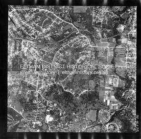
... Centred on present day Woodridge Estate, Eltham bounded by Park Road to north, Mount Pleasant Road to south, Stokes Orchard Estate to east and Eltham Railway Station to west. ...Eltham District Historical Society Inc 728 Main Rd Eltham melbourne Centred on present day Woodridge Estate, Eltham bounded by Park Road to north, Mount Pleasant Road to south, Stokes Orchard Estate to east and Eltham Railway Station to west. ...Centred on present day Woodridge Estate, Eltham bounded by Park Road to north, Mount Pleasant Road to south, Stokes Orchard Estate to east and Eltham Railway Station to west. Historic Aerial Imagery Source: Landata.vic.gov.au Aerial Photo Details: Project No :985 Project : MELBOURNE 1972 Run : 27 Frame : 46 Date : 04/1972 Film Type : B/W Camera : RC10 Flying Height : 5700 Scale : 9600 Film Number : 2636 GDA2020 : 37°42'49"S, 145°09'46"E MGA2020 : 338053, 5824365 (55) Melways : 22 C5 (ed. 42)aerial photo, neil webster collection, 1972-04, eltham, eltham railway station, melway 22c5, mount pleasant road, park road, stokes orchard estate, woodridge estate -
 Eltham District Historical Society Inc
Photograph - Aerial Photograph, Landata, Eltham, Vic, Apr. 1972
... Centred on present day Diamond Creek Trail at the Eltham Leisure Centre bounded by Central Park to north, Main Road at Falkiner Street to south, MacMahon Ball Paddock to east and Grand Boulevard at Buena Vista Drive to west. ...Eltham District Historical Society Inc 728 Main Rd Eltham melbourne Centred on present day Diamond Creek Trail at the Eltham Leisure Centre bounded by Central Park to north, Main Road at Falkiner Street to south, MacMahon Ball Paddock to east and Grand Boulevard at Buena Vista Drive to west. ...Centred on present day Diamond Creek Trail at the Eltham Leisure Centre bounded by Central Park to north, Main Road at Falkiner Street to south, MacMahon Ball Paddock to east and Grand Boulevard at Buena Vista Drive to west. Historic Aerial Imagery Source: Landata.vic.gov.au Aerial Photo Details: Project No :985 Project : MELBOURNE 1972 Run : 28 Frame : 207 Date : 04/1972 Film Type : B/W Camera : RC10 Flying Height : 5700 Scale : 9600 Film Number : 2635 GDA2020 : 37°43'25"S, 145°08'20"E MGA2020 : 335985, 5823223 (55) Melways : 21 G7 (ed. 42)aerial photo, neil webster collection, 1972-04, eltham, buena vista drive, central park, diamond creek trail, eltham leisure centre, falkiner street, grand boulevard, macmahon ball paddock, main road, melway 21g7 -
 Eltham District Historical Society Inc
Photograph - Aerial Photograph, Landata, Montmorency, Feb. 1956
... Road to east and Leach Street to west. Historic Aerial Imagery Source: Landata.vic.gov.au Aerial Photo Details: Project No :250 Project : MELBOURNE OUTER SUBURBS PROJECT Run : 17 Frame : 114 Date : 02/1956 Film Type : B/W Camera : EAG9 Flying Height : 10000 Scale : 12000 Film Number : 1176 GDA2020 : 37°42'50"S, 145°08'02"E MGA2020 : 335512, 5824286 (55) Melways : 21 F5 (ed. 42) Aerial Photo 1956-02 Neil Webster Collection Central Park Eltham leach street Main Road Melway 21F5 Montmorency Progress Road Withers Way Sherbourne Preschool Tahlee Place Reserve Digital jpg and electronic PDF file Montmorency Photograph Aerial Photograph Landata ...Centred on present day Tahlee Place Reserve and Sherbourne Preschool, Montmorency bounded by Progress Road to north, Withers Way to south, Main Road to east and Leach Street to west. Historic Aerial Imagery Source: Landata.vic.gov.au Aerial Photo Details: Project No :250 Project : MELBOURNE OUTER SUBURBS PROJECT Run : 17 Frame : 114 Date : 02/1956 Film Type : B/W Camera : EAG9 Flying Height : 10000 Scale : 12000 Film Number : 1176 GDA2020 : 37°42'50"S, 145°08'02"E MGA2020 : 335512, 5824286 (55) Melways : 21 F5 (ed. 42)aerial photo, 1956-02, neil webster collection, central park, eltham, leach street, main road, melway 21f5, montmorency, progress road, withers way, sherbourne preschool, tahlee place reserve -
 Eltham District Historical Society Inc
Photograph - Aerial Photograph, Landata, Montmorency, Feb. 1956
... Centred on present day Grand Boulevard and Olympic Way, Montmorency bounded by Diamond Street to north, Old Eltham Road and Eltham Lower Park to south, Bible Street to east and Para Road to west. ...Eltham District Historical Society Inc 728 Main Rd Eltham melbourne Centred on present day Grand Boulevard and Olympic Way, Montmorency bounded by Diamond Street to north, Old Eltham Road and Eltham Lower Park to south, Bible Street to east and Para Road to west. ...Centred on present day Grand Boulevard and Olympic Way, Montmorency bounded by Diamond Street to north, Old Eltham Road and Eltham Lower Park to south, Bible Street to east and Para Road to west. Historic Aerial Imagery Source: Landata.vic.gov.au Aerial Photo Details: Project No :250 Project : MELBOURNE OUTER SUBURBS PROJECT Run : 17 Frame : 115 Date : 02/1956 Film Type : B/W Camera : EAG9 Flying Height : 10000 Scale : 12000 Film Number : 1176 GDA2020 : 37°43'24"S, 145°07'55"E MGA2020 : 335375, 5823236 (55) Melways : 21 F7 (ed. 42)aerial photo, 1956-02, neil webster collection, eltham, main road, montmorency, bible street, diamond street, eltham lower park, grand boulevard, melway 21f7, old eltham road, olympic way, para road -
 Eltham District Historical Society Inc
Photograph - Aerial Photograph, Landata, Eltham, Feb. 1956
... Centred on present day Culla Hill and Petty's Orchard, Eltham bounded by Brougham Street and Mount Pleasant Road to north, Monckton Road, Templestowe to south, Reynolds Road to east and Eltham Lower Park and Hohnes Road to west. Historic Aerial Imagery Source: Landata.vic.gov.au Aerial Photo Details: Project No :250 Project : MELBOURNE OUTER SUBURBS PROJECT Run : 18 Frame : 92 Date : 02/1956 Film Type : B/W Camera : EAG9 Flying Height : 10000 Scale : 12000 Film Number : 1176 GDA2020 : 37°43'35"S, 145°09'31"E MGA2020 : 337735, 5822959 (55) Melways : 22 B8 (ed. 42)...Eltham District Historical Society Inc 728 Main Rd Eltham melbourne Centred on present day Culla Hill and Petty's Orchard, Eltham bounded by Brougham Street and Mount Pleasant Road to north, Monckton Road, Templestowe to south, Reynolds Road to east and Eltham Lower Park and Hohnes Road to west. Historic Aerial Imagery Source: Landata.vic.gov.au Aerial Photo Details: Project No :250 Project : MELBOURNE OUTER SUBURBS PROJECT Run : 18 Frame : 92 Date : 02/1956 Film Type : B/W Camera : EAG9 Flying Height : 10000 Scale : 12000 Film Number : 1176 GDA2020 : 37°43'35"S, 145°09'31"E MGA2020 : 337735, 5822959 (55) Melways : 22 B8 (ed. 42) Aerial Photo 1956-02 Neil Webster Collection Eltham Brougham Steet Culla Hill Eltham Lower Park Hohnes Road Melway 22B8 Monckton Road Mount Pleasant Road Petty's Orchard Reynolds Road Sweeneys Lane Templestowe Yarra River Digital jpg and electronic PDF file Eltham Photograph Aerial Photograph Landata ...Centred on present day Culla Hill and Petty's Orchard, Eltham bounded by Brougham Street and Mount Pleasant Road to north, Monckton Road, Templestowe to south, Reynolds Road to east and Eltham Lower Park and Hohnes Road to west. Historic Aerial Imagery Source: Landata.vic.gov.au Aerial Photo Details: Project No :250 Project : MELBOURNE OUTER SUBURBS PROJECT Run : 18 Frame : 92 Date : 02/1956 Film Type : B/W Camera : EAG9 Flying Height : 10000 Scale : 12000 Film Number : 1176 GDA2020 : 37°43'35"S, 145°09'31"E MGA2020 : 337735, 5822959 (55) Melways : 22 B8 (ed. 42)aerial photo, 1956-02, neil webster collection, eltham, brougham steet, culla hill, eltham lower park, hohnes road, melway 22b8, monckton road, mount pleasant road, petty's orchard, reynolds road, sweeneys lane, templestowe, yarra river