
Showing 320 items matching "sale of crown land"
-
 Bendigo Historical Society Inc.
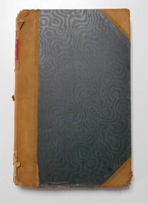
Document - LANDS OFFICE - SALE OF CROWN LAND BY AUCTION, 1892 - 1920
... LANDS OFFICE - SALE OF CROWN LAND BY AUCTION...crown lands in fee simple at various locations in northern Victoria. Printed details of auctions pasted for each sale. LH page: lot, county, parish, section, allotment, sold, unsold, why not sold, upset price, sold for. RH page: value of improvements if any, name of purchaser, residence, deposit forfeited, total amount. Document LANDS OFFICE - SALE OF CROWN LAND ...Document: dark green hard cover journal with buff spine and corners. Contains details of public auctions of crown lands in fee simple at various locations in northern Victoria. Printed details of auctions pasted for each sale. LH page: lot, county, parish, section, allotment, sold, unsold, why not sold, upset price, sold for. RH page: value of improvements if any, name of purchaser, residence, deposit forfeited, total amount.Lands Officelands office, crown lands, auction, northern victoria -
 Federation University Historical Collection
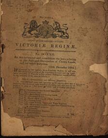
Booklet, An Act to amend and consolidate the laws relating to the Sale and Occupation of Crown Lands and for other purposes, 1884, 1884
... ...sale of crown land...Barker Library (top floor) Mount Helen goldfields queen victoria laws victoria sale of crown land occupation of crown lands selection land act 1884 Brown soft covered book of 48 pages. ...Brown soft covered book of 48 pages. queen victoria, laws, victoria, sale of crown land, occupation of crown lands, selection, land act 1884 -
 Clunes Museum
Document - LAND PURCHASE AGREEMENT, 1862
... SALE OF CROWN LAND IN VICTORIA 1862...LAND SITUATED IN ALLIANCE STREET, CLUNES. SALE OF CROWN LAND IN VICTORIA 1862 Document LAND PURCHASE AGREEMENT ...SIGNED IN MELBOURNE 29TH MARCH 1862 BY SIR HENRY BARKLEY GOVERNOR-IN-CHIEF OF THE COLONY OF VICTORIASALE OF CROWN LAND IN VICTORIA 1862TO ABEL GRENFELL OF CRESWICK. LAND SITUATED IN ALLIANCE STREET, CLUNES.local history, document, land purchase, government, colonial government -
 Bayside Gallery - Bayside City Council Art & Heritage Collection
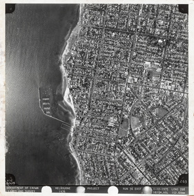
Photograph, Department of Crown Lands and Survey, Victoria, Melbourne Project: Brighton, 1976
... The Department of Crown Lands and Survey (1857-1983) was responsible for the administration of survey and mapping and the sale, occupation and management of crown land throughout its existence. ...Bayside Gallery - Bayside City Council Art & Heritage Collection Corner Wilson and Carpenter Streets Brighton melbourne The Department of Crown Lands and Survey (1857-1983) was responsible for the administration of survey and mapping and the sale, occupation and management of crown land throughout its existence. ...The Department of Crown Lands and Survey (1857-1983) was responsible for the administration of survey and mapping and the sale, occupation and management of crown land throughout its existence. This aerial photograph shows parts of Brighton and was taken on 1 December 1976brighton, department of crown lands and survey, aerial photograph, bayside, port phillip bay, map, cartographic material, melbourne project 1976, brighton yacht club, middle brighton baths, north road, st kilda street, new street -
 Bayside Gallery - Bayside City Council Art & Heritage Collection
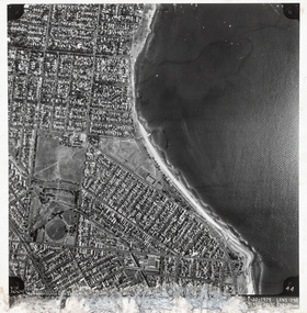
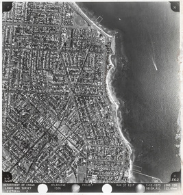
Photograph, Department of Crown Lands and Survey, Victoria, Melbourne Project: Brighton and Elwood, 1976
... The Department of Crown Lands and Survey (1857-1983) was responsible for the administration of survey and mapping and the sale, occupation and management of crown land throughout its existence. ...Bayside Gallery - Bayside City Council Art & Heritage Collection Corner Wilson and Carpenter Streets Brighton melbourne The Department of Crown Lands and Survey (1857-1983) was responsible for the administration of survey and mapping and the sale, occupation and management of crown land throughout its existence. ...The Department of Crown Lands and Survey (1857-1983) was responsible for the administration of survey and mapping and the sale, occupation and management of crown land throughout its existence. This aerial photograph shows parts of Brighton and Elwood and was taken on 1 December 1976brighton, elwood, department of crown lands and survey, aerial photograph, elsternwick park, point ormond, north road, ormond esplanade, st kilda street, glen huntly road, bayside, port phillip bay, map, cartographic material, melbourne project 1976 -
 Bayside Gallery - Bayside City Council Art & Heritage Collection
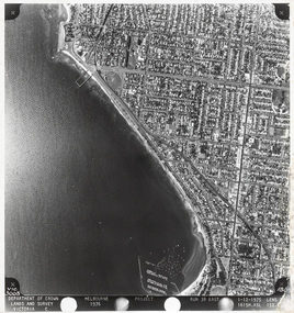
Photograph, Department of Crown Lands and Survey, Victoria, Melbourne Project: Brighton and Hampton, 1976
... The Department of Crown Lands and Survey (1857-1983) was responsible for the administration of survey and mapping and the sale, occupation and management of crown land throughout its existence. ...Bayside Gallery - Bayside City Council Art & Heritage Collection Corner Wilson and Carpenter Streets Brighton melbourne The Department of Crown Lands and Survey (1857-1983) was responsible for the administration of survey and mapping and the sale, occupation and management of crown land throughout its existence. ...The Department of Crown Lands and Survey (1857-1983) was responsible for the administration of survey and mapping and the sale, occupation and management of crown land throughout its existence. This aerial photograph shows parts of Brighton and Hampton and was taken on 1 December 1976. brighton, department of crown lands and survey, aerial photograph, bayside, port phillip bay, map, cartographic material, melbourne project 1976, brighton yacht club, middle brighton baths, hampton, green point, brighton beach, south road, the esplanade, hampton street -
 Bayside Gallery - Bayside City Council Art & Heritage Collection
Photograph, Department of Crown Lands and Survey, Victoria, Melbourne Project: Brighton, Hampton, Sandringham, 1976
... The Department of Crown Lands and Survey (1857-1983) was responsible for the administration of survey and mapping and the sale, occupation and management of crown land throughout its existence. ...Bayside Gallery - Bayside City Council Art & Heritage Collection Corner Wilson and Carpenter Streets Brighton melbourne The Department of Crown Lands and Survey (1857-1983) was responsible for the administration of survey and mapping and the sale, occupation and management of crown land throughout its existence. ...The Department of Crown Lands and Survey (1857-1983) was responsible for the administration of survey and mapping and the sale, occupation and management of crown land throughout its existence. This aerial photograph shows parts of Brighton, Hampton and Sandringham and was taken on 1 December 1976brighton, department of crown lands and survey, aerial photograph, bayside, port phillip bay, map, cartographic material, hampton, sandringham, green point, sandringham yacht club, south road, beach road, hampton street, melbourne project 1976 -
 Bayside Gallery - Bayside City Council Art & Heritage Collection
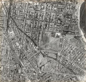
Photograph, Department of Crown Lands and Survey, Victoria, Brighton, Elwood and Elsternwick, c. 1965-71
... The Department of Crown Lands and Survey (1857-1983) was responsible for the administration of survey and mapping and the sale, occupation and management of crown land throughout its existence. ...Bayside Gallery - Bayside City Council Art & Heritage Collection Corner Wilson and Carpenter Streets Brighton melbourne The Department of Crown Lands and Survey (1857-1983) was responsible for the administration of survey and mapping and the sale, occupation and management of crown land throughout its existence. ...The Department of Crown Lands and Survey (1857-1983) was responsible for the administration of survey and mapping and the sale, occupation and management of crown land throughout its existence. This aerial photograph shows parts of Brighton, Elwood and Elsternwick and was taken circa 1965-71.brighton, department of crown lands and survey, aerial photograph, bayside, port phillip bay, map, cartographic material, elwood, elsternwick, elsternwick park, elwood tram depot, elwood pier, new street, glen huntly road, st kilda street, nepean highway -
 Bayside Gallery - Bayside City Council Art & Heritage Collection
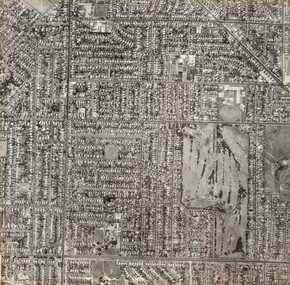
Photograph, Department of Crown Lands and Survey, Victoria, Brighton, Brighton East and Bentleigh, c. 1965-71
... The Department of Crown Lands and Survey (1857-1983) was responsible for the administration of survey and mapping and the sale, occupation and management of crown land throughout its existence. ...Bayside Gallery - Bayside City Council Art & Heritage Collection Corner Wilson and Carpenter Streets Brighton melbourne The Department of Crown Lands and Survey (1857-1983) was responsible for the administration of survey and mapping and the sale, occupation and management of crown land throughout its existence. ...The Department of Crown Lands and Survey (1857-1983) was responsible for the administration of survey and mapping and the sale, occupation and management of crown land throughout its existence. This aerial photograph shows parts of Brighton and Brighton East and was taken circa 1965-71.brighton, department of crown lands and survey, aerial photograph, bayside, port phillip bay, map, cartographic material, brighton east, dendy park, dendy street, centre road, nepean highway, south road, brighton golf course, golf -
 Bayside Gallery - Bayside City Council Art & Heritage Collection
Photograph, Department of Crown Lands and Survey, Victoria, Brighton, Brighton East and Bentleigh, c. 1965-71
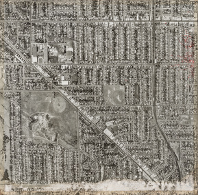
... The Department of Crown Lands and Survey (1857-1983) was responsible for the administration of survey and mapping and the sale, occupation and management of crown land throughout its existence. ...Bayside Gallery - Bayside City Council Art & Heritage Collection Corner Wilson and Carpenter Streets Brighton melbourne The Department of Crown Lands and Survey (1857-1983) was responsible for the administration of survey and mapping and the sale, occupation and management of crown land throughout its existence. ...The Department of Crown Lands and Survey (1857-1983) was responsible for the administration of survey and mapping and the sale, occupation and management of crown land throughout its existence. This aerial photograph shows parts of Brighton, Brighton East and Bentleigh and was taken circa 1965-71.brighton, department of crown lands and survey, aerial photograph, bayside, port phillip bay, map, cartographic material, bentleigh, brighton east, dendy park, dendy street, centre road, nepean highway, south road, football -
 City of Melbourne Libraries
Photograph, Bull, Hugh Jones, 1897-1993, Lord Mayor's Dinner, Melbourne Town Hall
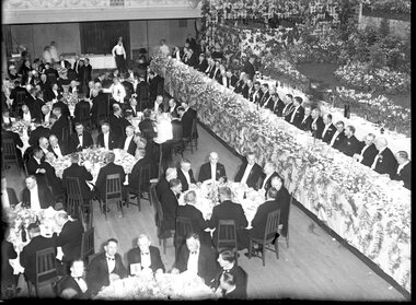
... As a small and interesting aside: Hoddle was appointed auctioneer for the first sale of crown land in Melbourne on 1 June 1837. His commission was 57 pounds 12s 7d. and he bought two allotments for himself at a cost of 54 pounds. ...As a small and interesting aside: Hoddle was appointed auctioneer for the first sale of crown land in Melbourne on 1 June 1837. His commission was 57 pounds 12s 7d. and he bought two allotments for himself at a cost of 54 pounds. ...Photographer notations on slide: "General View Of Lord Mayor's Dinner At Town Hall Nov 1936 B112" Published: The Age, Tuesday 10 November 1936, page 13 Published title: LORD MAYOR'S BANQUET Published caption: The brilliant scene inside the Melbourne Town Hall last night during the Lord Mayor’s banquet. Trove article identifier: http://nla.gov.au/nla.news-article205939431 Description: 700 guests (all men) are seated around numerous tables in the Melbourne Town Hall for the Lord Mayor's dinner in November 1936. Before the stage is a top table of 35 men, all dressed smartly in black dinner suits, with either a black or white bow tie. Many are wearing their medals. The Lord Mayor has on his Mayoral chains, and to his right is the Governor of Victoria, Lord Huntingfield. The stage is heavily decorated with fresh flowers. Research by project volunteer, Louise McKenzie: This image takes up one quarter of the photographic space on page 13 of The Age on 10 November 1936, reflecting the importance of the event and also the sheer dramatics of the image: 700 guests (all men), a top table of 35, and all dressed smartly in black dinner suits, with either a black or white bow tie. Many are wearing their medals. The Lord Mayor has on his Mayoral chains, and to his right is the Governor of Victoria, Lord Huntingfield. Further to his right is a man with an impressive sash across his chest. It is a very animated, and rather informal, moment. Banks of fresh flowers smother the stage, which is decorated in the manner of a terrace at an English stately home. Tables are laden with food, drink and decorations, and the wait staff (men and women) are also formally dressed, in the manner of Downton Abbey. It is spectacular, dramatic, and luxurious, and perpetuates the proud descriptor of “Marvellous Melbourne” as conferred by London Journalist George Augustus Sala when he visited the city in 1885. During its 1880s boom, Melbourne was the second-largest city in the British Empire, after London, and reputedly the richest city in the world. At times the expression was used with some irony, but "...in Victoria’s centenary year, 1934, with the city mired in another depression, a publisher bravely entitled a book of souvenir photographs Marvellous Melbourne, claiming that the subject ‘still finds apt expression in the happy one-time sobriquet’.” This photo seems to reflect an ongoing pride in Melbourne and a desire for it to live up to its descriptor and celebrate its post-centenary era in style. So it is no surprise to find that on page 11 of The Age on the same day, a second photo is to be found – a cropped view of one table – along with a very detailed description of the night, its purpose, and a surprise announcement. But, who was the Lord Mayor in whose honour the dinner was held? In 1934, the Lord Mayor of Melbourne was Cr. Alexander George Wales, (born Richmond, 11 October 1885, died Elsterwick, 31 May 1962). His father was a contractor and quarry-owner, but was blinded in an industrial accident in 1899. Consequently Alexander, then aged 14, left Brunswick State School to become a railway labourer working at a quarry, and in 1903 joined the Commonwealth public service as a clerk and began studying at night school, determined to improve himself. In 1907 he was appointed secretary of the Albion Quarrying Co. (in which the family had an interest), then its managing director and chairman. As the Australian Dictionary of Biography notes, he was instrumental in expanding the company’s interests, "...becoming director of the Hardware Co. of Australia Pty Ltd, the Twentieth Century Building and Investment Society, the Albion Sand Co. and the Geelong Brick Co.”. His public career began in 1914 when he was elected to the Brunswick council. He was mayor 1917-18, and in 1925 progressed to the Melbourne City Council where he remained for 29 years, being a member of most council committees. He served three successive terms as lord mayor (1934-37), was Chairman of the council’s decorations committee for Melbourne’s centenary, president of the Metropolitan Fire Brigades Board (1936), and Chairman of the Public Works Committee (1937-39). In 1936 he was elected to the Legislative Council with United Australia Party support, but later resigned over possible State government contract tender irregularities. Wales received "the customary reward” of a knighthood and was invested at Buckingham Palace by King George VI whose coronation he attended in 1937. He was an early director of what is now Ampol, and helped the development of the petroleum industry in Australia after visiting the USA in 1943 and 1946. He was impressed by that country’s wartime shipbuilding efforts and supported closer ties with the USA. “While president (1947-48) of the Melbourne Chamber of Commerce, Wales was a vocal critic of the Federal Labor Government, ...a staunch anti-socialist ... and a focus for conservative opposition to the Curtin and Chifley governments...” He is described as “a natural leader in business and civic politics,... a powerful force in the Melbourne City Council... opposing democratic reforms such as the creation of a Greater Melbourne Council and the abolition of plural voting, but advocat[ing] the redevelopment of city-owned property like the Eastern and Western markets...” So, this Lord Mayor’s dinner marks the third successive term in office for Governor Cr. A G Wales. The room is filled with powerful and influential men, and provided a platform for the Premier of Victoria, Albert Dunstan (1882-1950, United Country party) to announce that if the City Council would bear half the cost the State Government would build a bridge at Punt Road “at once”. He announced that the Government proposed to have the bridge built by the Country Roads Board, and allow the City Council to pay its share on convenient terms, and further, it would investigate the shared provision of more Yarra bridges. The proposal for the Punt Road Bridge was met with applause as the Yarra River constituted a serious traffic barrier. On 12 November 1936, two days after the Lord Mayor’s dinner, The Age published an article, “Building without a Plan”. It questions the appropriateness of the next Yarra bridge being the one at Punt Road, and encourages a “proper procedure” to look at the provision of additional Yarra bridges as a whole. But in fact this topic had been canvassed back in August when Melbourne City Council’s public works committee had recommended the replacement of the footbridge at Punt Road with a bridge, and if the Country Roads Board would declare this portion of Punt Road, including the river crossing, a State Highway, this could give the Board authority to construct the bridge and allocate the cost. Hence the reference at the dinner to a shared expense. Still an integral part of traffic management today, the Hoddle Bridge carries Punt Road over the Yarra River between Richmond and South Yarra in Melbourne. It is a five-lane road bridge with narrow footpaths on either side. It is of continuous reinforced concrete T-beam construction with five segmental arched spans, supported on transverse piers, and linked by concrete cross-beams. “The piers terminate in a series of tapered concrete pillars with Art Deco-styled steamlined decoration. Each pillar supports a Victorian-style lamp. The infill railings are geometric-patterned painted metal. Construction began in late 1937, and it was opened by Premier Albert Dunstan on 22 December 1938. It replaced an earlier footbridge, which in turn had replaced a punt service. The bridge (originally referred to as Punt Road Bridge) was named after Robert Hoddle, who planned central Melbourne’s Hoddle Grid, the grid of streets which form Melbourne’s central business district. Hoddle arrived in Australia from the UK in 1823 and went on to carry out surveys in NSW and Queensland before arriving in Melbourne in 1837. He designed layouts for both Melbourne and Williamstown, and later Geelong and other Victorian country areas. He was keen that major streets be at least 30 metres wide. ”With remarkable foresight he provided for wide boulevards from the city to the suburbs, but the subdivisions of early speculators in inner suburbs created the bottle-necks of today. After the separation of the colony in 1851, he became Victoria’s first surveyor-general... and advocated the provision of three-chain (60 m) roads and the widening of all existing main roads from one (20 m) to three chains." However, he was met with constant opposition and in 1853, was eased out of office. As a small and interesting aside: Hoddle was appointed auctioneer for the first sale of crown land in Melbourne on 1 June 1837. His commission was 57 pounds 12s 7d. and he bought two allotments for himself at a cost of 54 pounds. After he died his second wife married Richard Buckhurst Buxton, a member of the family which in 1860s Melbourne established the Australian property dynasty of Buxton Real Estate, Becton, MAB Corporation etc. Returning to the dinner and The Age article of 10 November 1836: Another topic of the after-dinner speeches was a reference to the upcoming Armistice Day. “The Minister of Customs (Mr White) said the proximity of Armistice day reminded us that eighteen years ago we had high hopes of prolonged peace.” The term “Armistice Day” was coined after WWI: “At 11 am on 11 November 1918, the guns on the Western Front fell silent after more than four years of continuous warfare. The Germans called for an armistice (suspension of fighting) in order to secure a peace settlement. They accepted the allied terms on unconditional surrender. Therefore on the 11th hour of the 11th day of the 11th month, a minute’s silence is observed and dedicated to those soldiers who died fighting to protect the nation. Originally known as Armistice Day, it was renamed Remembrance Day after World War Two to commemorate those who were killed in both World Wars. Today it refers to the loss of Australian lives from all wars and conflicts, accompanied by the words, "We will remember them, Lest we forget"." There was comment at the dinner about the need to remain firm in supporting the “democratic government in the British Empire to avoid a “plunge into savagery”. There was a grave responsibility on the British people to keep democracy alive, and that could not be done without adequate defence forces... Many weak governments in non-British countries had been swept aside by strong-fisted dictators, who now were the real threat to peace”. With the benefit of hindsight these were very pertinent comments and tragically prophetic. The Melbourne Shrine of Remembrance had only been dedicated two years earlier, at a ceremony attended by the Duke of Gloucester, son of King George V. Over 300,000 citizens attended: one third of the population of Melbourne. It became the location for the Anzac Day Dawn Service. Originally the march travelled from the Shrine into the city, however, in 1936, this was reversed, and the Shrine became the termination point for Anzac Day Marches. Also significant in 1936, was the installation of a statue in the west forecourt of the Shrine: “The Man with the Donkey” (aka 'Private John Simpson and his Little Donkey'). The work is said to represent the “valour and compassion of the Australian soldier”. Its full citation, according to the City of Melbourne City Collection is: West Side of Base: "The / Man with his Donkey / Gallipoli, April 25 to May 19 / in Commemoration / of the valour and compassion / of the Australian Soldier" AFTER LANDING AT GALLIPOLI, SIMPSON, WITH HIS LITTLE DONKEY, WORKED ALONE, DAY AND NIGHT TAKING WATER TO THE FRONT LINE AND CARRYING THE WOUNDED BACK TO THE DRESSING STATIONS. HE AND HIS DONKEY WERE KILLED BY A SHRAPNEL SHELL ON THE 19TH MAY, 1915. SIMPSON WAS MENTIONED IN DISPATCHES BY SIR IAN HAMILTON, COMMANDER-IN-CHIEF OF THE MEDITERRANEAN EXPEDITIONARY FORCE. / Erected by Public Subscription under auspices of the / Red Cross Society. East Side of Base: Private John Simpson." Their summary in background states: "A bronze figure of Simpson and his donkey with a wounded man on the donkey's back on a granite pedestal. Private John Simpson Kirkpatrick’s intrepid and short-lived exploits during the Gallipoli campaign have made him a popular figure of World War One. He has been mythologised to represent the lauded values of the digger, and he symbolises all those who went into battle unarmed. Born in England in 1892, he came to Australia in 1910. He enlisted to make his way back to England, but as a member of the 3rd Field Ambulance AIA was sent to Gallipoli. After just three weeks of bearing wounded soldiers across Shrapnel Gully on the back of his donkey, Simpson was killed by shrapnel fire. Simpson’s story became a powerful propaganda tool for enlistment in Australia, but following the war he was quickly forgotten. With the Shrine of Remembrance nearing completion in 1933, the memory of Simpson was rekindled to commemorate all who gave their lives to help others during the war. One plaque reads: ‘The / Man with his donkey / Gallipoli … / In commemoration / of the valour and compassion / of the Australian soldier’. In 1935, Wallace Anderson’s design for the memorial was selected though a competition organised by the Australian Red Cross. Anderson had served during the war and worked at the Australian War Memorial after his return. His Man with the Donkey was cast in Italy, and after some debate was sited near the shrine. Unveiled 20th June, 1936." The sculptor, Victorian-born William Wallace Anderson (1888-1975), served in France during WWI and afterwards produced a number of bronze war memorials and memorial portraits, predominantly in Victoria. “His most famous work is that of Simpson and his Donkey (1935), which he completed after winning a competition conducted by the Victorian Division of the Australian Red Cross. Anderson’s fee was 350 pounds; the cast, made by the Chiurazzi Foundry, Naples, Italy, cost 40 pounds. The work... has become well known as a symbol of the Anzac tradition.” A debate as to the siting of the statue arose from a strong view expressed by General Sir John Monash that no representation of individual members of the Australian Defence Force be located on the Shrine itself. Hence its location off to the northwest of the forecourt, in a garden of rosemary. And finally we return to the photo of the grand Lord Mayor’s dinner! An article in The Argus of 4 November 1936 refers to “Brilliant Scene at Lord Mayor’s Ball – Hall Becomes a Garden”. So now it becomes clear why the Town Hall, location of the Lord Mayor’s Dinner on 10 November 1934, only 6 days later, is so lavishly decorated. The floral decorations from the Ball are still in place - an early example of “recycling”, which is gratifying to note at a time of Depression. The reporter has captured the scene with enthusiasm: “Hundreds of tiny rose lights, hidden among pink roses, transformed the Melbourne Town Hall into a magical garden last night, when the Lord Mayor and Lady Mayoress (Councillor A. C. Wales, M.L.C., and Mrs. Wales) entertained about 3,500 guests at a ball. His Excellency the Governor (Lord Huntingfield) and Lady Huntingfield were present, while Rear-Admiral and Mrs. Lane Poole and officers from the visiting squadron were among the special guests. The balconies all round the hall were hidden by a white trellis, covered with pink blossoms and greenery. Rosy flowers were issued up every pillar, and great golden lamps, hanging from the door, were seated in greenery and trails of sweet peas. The organ gallery was converted into a terrace garden with stone steps leading to banks of pink azaleas, pink pelargoniums, masses of calceolarias, and the lovely deep mauve and blue of cinerarias. Slender Japanese maples and poplar trees grew from the higher slopes amid thickets of hostas, while a fascinating illusion was created by the lofty conservatory windows, which formed the background, and which were tinted cerulean blue to simulate the sky seen through glass. Large fern baskets hung from the conservatory roof, and the whole scene was enclosed in trellises of blossom. In the entrance palm green shrubs stood like sentinels round the passed floor, and flowers bloomed in misty golds. The long corridor upstairs leading to the council chamber was lined with an avenue of poplar trees in tubs. In the Lower Town Hall great banks of calceolarias and azaleas decked the upper dais, and each supper table was adorned with a different coloured flower with sprays of roses and Japanese maple laid on the snowy cloths. The adjoining supper-rooms were fragrant with the scent of huge bowls of stock in mauve, purple, and pink, while the white walls were covered with palm leaves and flowers. The roof garden below the clock tower was enclosed as a buffet with rose wreathed walls, and flowers were arranged attractively in the Lady Mayoress's rooms." References: LORD MAYOR'S BANQUET. CENTURY MAKERS AT THE M.C.G. BEFORE THE CHANGE. (1936, November 10). The Age (Melbourne, Vic. : 1854 - 1954), p. 13. Retrieved September 4, 2024, from http://nla.gov.au/nla.news-article205939431 'Portrait of Sir George Wales (Lord Mayor 1934-1937)', City Collection, City of Melbourne, https://citycollection.melbourne.vic.gov.au/portrait-of-sir-george-wales-lord-mayor-1934-37/ Graeme Davison, 'Marvellous Melbourne', eMelbourne, https://www.emelbourne.net.au/biogs/EM00906b.htm THE LORD MAYOR'S BANQUET. (1936, November 10). The Age (Melbourne, Vic. : 1854 - 1954), p. 11. Retrieved September 26, 2024, from http://nla.gov.au/nla.news-article205939643 BRILLIANT SCENE AT LORD MAYOR'S BALL Hall Becomes a Garden (1936, November 4). The Argus (Melbourne, Vic. : 1848 - 1957), p. 14. Retrieved September 26, 2024, from http://nla.gov.au/nla.news-article11932746 'Hoddle Bridge', Wikipedia, https://en.wikipedia.org/wiki/Hoddle_Bridge 'Hoddle Bridge', Victorian Heritage Database Report, Victorian Heritage Council, https://vhd.heritagecouncil.vic.gov.au/places/195689/download-report David Dunstan, 'Wales, Sir Alexander George (1885–1962)', Australian Dictionary of Biography, National Centre of Biography, Australian National University, https://adb.anu.edu.au/biography/wales-sir-alexander-george-8951/text15737, published first in hardcopy 1990, accessed online 26 September 2024. Marjorie J. Tipping, 'Hoddle, Robert (1794–1881)', Australian Dictionary of Biography, National Centre of Biography, Australian National University, https://adb.anu.edu.au/biography/hoddle-robert-2190/text2823, published first in hardcopy 1966, accessed online 26 September 2024. BUILDING WITHOUT A PLAN. (1936, November 12). The Age (Melbourne, Vic. : 1854 - 1954), p. 8. Retrieved September 26, 2024, from http://nla.gov.au/nla.news-article205949762 NEW BRIDGE AT PUNT ROAD (1936, August 12). The Argus (Melbourne, Vic. : 1848 - 1957), p. 10. Retrieved September 26, 2024, from http://nla.gov.au/nla.news-article11902131 'The Shrine of Remembrance', Beaconsfield’s Soldiers: https://beaconsfield.org.au/digitalmemorial/shrine-introduction/ 'Shrine of Remembrance', Wikipedia, https://en.wikipedia.org/wiki/Shrine_of_Remembrance Ken Scarlett, 'Anderson, William Wallace (1888–1975)', Australian Dictionary of Biography, National Centre of Biography, Australian National University, https://adb.anu.edu.au/biography/anderson-william-wallace-9362/text16441, published first in hardcopy 1993, accessed online 26 September 2024. 'Man with the Donkey', City Collection, City of Melbourne, https://citycollection.melbourne.vic.gov.au/man-with-the-donkey-aka-private-john-simpson-and-his-little-donkey/ 'Remembrance Day', Australian Army, https://www.army.gov.au/about-us/history-and-research/traditions/remembrance-day Photographer notations on slide: "General View Of Lord Mayor's Dinner At Town Hall Nov 1936 B112".melbourne town hall, mayors, lord mayors, centenaries, bridges, dinners, clothing and dress, festive decorations, dances and balls, eating and drinking, shrine of remembrance, governors, monuments and memorials, 1930-1939, plants -
 Warrnambool and District Historical Society Inc.
Legal record - Two documents regarding purchase and sale of land, George Barber, Port Fairy solicitor, early 1850s
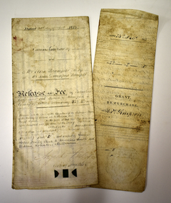
... sale of land near Warrnambool by Thomas Simpson. The first document, called a Grant by Purchase, is dated 1852 and shows that Thomas Simpson purchased from the Crown, Allotment 146 (22 acres two roods) adjoining the property of Wollaston on the Merri River and the Mortlake Road, north of Warrnambool. ...sale of land near Warrnambool by Thomas Simpson. The first document, called a Grant by Purchase, is dated 1852 and shows that Thomas Simpson purchased from the Crown, Allotment 146 (22 acres two roods) adjoining the property of Wollaston on the Merri River and the Mortlake Road, north of Warrnambool. ...Thes two documents deal with the purchase and sale of land near Warrnambool by Thomas Simpson. The first document, called a Grant by Purchase, is dated 1852 and shows that Thomas Simpson purchased from the Crown, Allotment 146 (22 acres two roods) adjoining the property of Wollaston on the Merri River and the Mortlake Road, north of Warrnambool. The cost was 90 pounds. The second document is dated 1853 and shows that Thomas Simpson sold this Merri River allotment of 22 acres to Eliza Bromfield, in conjunction with her husband, John Davenport Bromfield, for the sum of 110 pounds. The property of Wollaston was owned by the Manifold family and in the 1850s was leased to William Simpson, the brother of Thomas who had an adjoining property called Wooramoota. John Davenport Bromfield was a Colac farmer who played a prominent part in the early history of that town. His brother James Astley Bromfield, an early chemist in Warrnambool is important in Warrnambool's history.These two items are of considerable significance because they are amongst the earliest legal documents we have connected to Warrnambool's history and because they concern three early pioneers of the district. They also have a connection to Wollaston, an important early property in the Warrnambool district..1 A piece of light parchment paper, stained with age and folded in three places. It contains printed and handwritten material, a copy of a signature and a white seal. .2 A piece of parchment paper folded in half and then folded again in two places. It contains ruled red lines, handwritten material in black ink and the remains of a red seal. The top of the first page has a cut-out fluted pattern.wollaston, john davenport bromfield, thomas simpson, eliza bromfield, george barber solicitor -
 Warrnambool and District Historical Society Inc.
Documents, Swintons Paper att 18/53 Merri St. Contract. Map. Notes, 1959
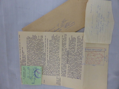
... The current Swinton business in Timor Street is the oldest family business in Warrnambool and, with the name Swinton associated with businesses in Timor Street Warrnambool for 152 years it is amongst the oldest family businesses in Australia. swinton family, warrnambool .2 ‘Plan of Survey of Part of Crown Allotment 18 Section 3 Township of .2 ‘Plan of Survey of Part of Crown Allotment 18 Section 3 Township of Warrnambool Parish of Wangoom County of Villiers’ .3 ‘Tuesday Dear Mr Swinton I am writing to say that I would like to have the ‘Office’ Thanking You George O’Grady’ The items here relate to the sale of land by Swintons Pty Ltd., Warrnambool. .1 These are three pages of white paper with typed material, a lawyer’s signature in blue ink, one green stamp and a sketch of the land location. .2 This is a sheet of thick paper containing a plan of the land sold. ...These documents relate to the sale of land in Merri Street Warrnambool in 1959 by Swintons Pty Ltd of Warrnambool. The buyer of the land was George O’Grady, a Warrnambool baker. The land sold for £4000 and there was a shed on the land (called the ‘Office’) which George O’Grady indicated he wished to be included in the sale. William and Ann Swinton migrated to Australia in 1854 and for a decade William Swinton worked as a builder and carpenter in the Warrnambool area, erecting many buildings, including the Wangoom Presbyterian Church. In 1865 he opened a store in Timor Street Warrnambool, selling groceries, hardware, china and glassware. By 1888 the business was known as William Swinton and Sons. Branch stores were opened in Wangoom, Cudgee, Nullawarre, South Warrnambool and West Warrnambool. After William Swinton died his son Robert became the first managing director of Swintons Pty Ltd. In 1934 the business split with George Swinton and Sons selling clothing, furnishings and glassware and Swintons Pty Ltd selling seeds, produce and hardware. Today the Swinton family still operates a furniture and bedding shop in Timor St Warrnambool.These items are of some interest as being connected to the Warrnambool business of Swintons Pty Ltd. They will be of interest to researchers. The current Swinton business in Timor Street is the oldest family business in Warrnambool and, with the name Swinton associated with businesses in Timor Street Warrnambool for 152 years it is amongst the oldest family businesses in Australia.The items here relate to the sale of land by Swintons Pty Ltd., Warrnambool. .1 These are three pages of white paper with typed material, a lawyer’s signature in blue ink, one green stamp and a sketch of the land location. .2 This is a sheet of thick paper containing a plan of the land sold. The paper has printed material and a sketch of the land with part of it coloured in pink. .3 This is a small piece of paper torn at the bottom right edge. It has handwritten material (a letter) in blue ink..2 ‘Plan of Survey of Part of Crown Allotment 18 Section 3 Township of .2 ‘Plan of Survey of Part of Crown Allotment 18 Section 3 Township of Warrnambool Parish of Wangoom County of Villiers’ .3 ‘Tuesday Dear Mr Swinton I am writing to say that I would like to have the ‘Office’ Thanking You George O’Grady’swinton family,, warrnambool -
 Eltham District Historical Society Inc
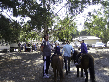
Photograph - Digital Photograph, Marguerite Marshall, Eltham Lower Park, 20 April 2008
... crown land for a racecourse and recreation. By 1858 the Eltham races had become an institution. ‘Many skirmishes occurred and the way home was paved with temptation, with sly-grog for sale.3 In the early 1870s, two jockeys were sons of the police officer in charge of the Eltham Police Station, Miles S Lyons. ...crown land for a racecourse and recreation. By 1858 the Eltham races had become an institution. ‘Many skirmishes occurred and the way home was paved with temptation, with sly-grog for sale.3 In the early 1870s, two jockeys were sons of the police officer in charge of the Eltham Police Station, Miles S Lyons. ...Originally a race course, the park has brought the community together with a variety of activities. Published: Nillumbik Now and Then / Marguerite Marshall 2008; photographs Alan King with Marguerite Marshall.; p45 Once used for horse racing, which attracted visitors from Melbourne, the Eltham Lower Park has brought the community together with a wide range of activities. Horse riding is now enjoyed as a recreation in the park as are other sports. The park also includes the Diamond Valley Railway miniature trains and a sanctuary for the rare and vulnerable Eltham Copper Butterfly. Eltham Lower Park, with other parks, forms an almost continuous green band from Eltham’s centre, along the Diamond Creek to the Yarra River.1 Before European settlement the Wurundjeri people met on this land, particularly at the junction of the Diamond Creek with the Yarra River, which they called Birr-arung. This is commemorated by the sculpture, Not just a Pretty Place by Aleks Danko, winner of the 2000 Nillumbik Art in Public Places Award. The first European to settle here was probably Henry Foley, who in 1841 used it as part of his pastoral run. Foley sold his leasehold to Joseph Wilson in 1845, who soon after sold it to Frederick Falkiner. During the 1840s the future park was part of a government square mile (2.6 sqkm) reserve, north of the Yarra, within the Parish of Nillumbik, later named Eltham. Soon the land was used for horse racing after nearby residents cleared ten acres (4ha) in the early 1850s. A three-quarter of a mile (1.2km) race secured the winner the £10 Publican’s Prize. In response to popular demand, the newly formed Eltham District Road Board petitioned the Surveyor General of the Colony of Victoria, in 1856, for 36 acres (14.6ha) of crown land for a racecourse and recreation. By 1858 the Eltham races had become an institution. ‘Many skirmishes occurred and the way home was paved with temptation, with sly-grog for sale.3 In the early 1870s, two jockeys were sons of the police officer in charge of the Eltham Police Station, Miles S Lyons. Another ten acres (4ha) was added to the area in 1866 and 12 acres (4.8ha) – Hohnes Hill – in 1870. In 1866, two acres (0.8ha) on the creek banks became an animal pound with William Walsh the pound keeper in 1870, but this was later incorporated into the park. By 1877 the area was called a public park but horse racing and training continued into the 1920s. In the mid-1900s trotters were trained on a circuit road. In 1953 the Eltham Pony Club was established and used a cross-country course on Hohnes Hill. From the mid 1950s the club held the Eltham Easter Fair at the park, later to include a procession along Main Road from the town centre to the park. The park also attracted picnic parties and campers from the inner suburbs as did Wingrove Park, and businesses catering for visitors, sprang up on the opposite side of Main Road. Bus-loads of school children visited the park for Gould League bird days in the 1960s. In 1979 the Eltham Shire Council bought Lenister Farm, linking the park with the Yarra River. The Lenister Farm wetland includes a bird hide, viewing platform and interpretive signs.5 Pioneer Henry Stooke, later Road Board chairman, bought the 11 acres (4.5ha) - later to become Lenister Farm - from the Crown in 1862. Stooke never lived on this site and the two houses at Lenister Farm were built in the 20th century. Since its formation in 1871, the Council has controlled this crown land, which it named Eltham Park. But in the 1920s Eltham Council bought land near the town centre for a park, which it named Eltham Central Park. To avoid confusion the Council renamed Eltham Park, Eltham Lower Park. Since 2004 the Yarra footbridge has linked the park with the Yarra Valley Metropolitan Park and the Main Yarra Trail.This collection of almost 130 photos about places and people within the Shire of Nillumbik, an urban and rural municipality in Melbourne's north, contributes to an understanding of the history of the Shire. Published in 2008 immediately prior to the Black Saturday bushfires of February 7, 2009, it documents sites that were impacted, and in some cases destroyed by the fires. It includes photographs taken especially for the publication, creating a unique time capsule representing the Shire in the early 21st century. It remains the most recent comprehenesive publication devoted to the Shire's history connecting local residents to the past. nillumbik now and then (marshall-king) collection, eltham lower park, eltham park -
 Bendigo Historical Society Inc.
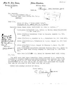
Document - MCCOLL, RANKIN AND STANISTREET COLLECTION: LETTER FROM MISS. G. ALICE JONES RE LAND SALE, 1941
... Crown Grant dated 12/10/1959 to John X. Walton with conveyance 21/3/1912 from F.O. Lacey to Deborah Reef Gold Mining Company no Liability No. 521 Book 460. Document MCCOLL, RANKIN AND STANISTREET COLLECTION: LETTER FROM MISS. G. ALICE JONES RE LAND SALE ...Document: Crown Grant dated 12/10/1959 to John X. Walton with conveyance 21/3/1912 from F.O. Lacey to Deborah Reef Gold Mining Company no Liability No. 521 Book 460.Miss G. Alice Jones, Barrister and Solicitororganization, mining, mccoll, rankin and stanistreet, mccoll, rankin and stanistreet: deborah gold mines nl., mr. j. j. stanistreet, bendigo, deborah reef gold mining co. nl -
 Bendigo Historical Society Inc.
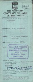
Document - H.A. & S.R. WILKINSON COLLECTION: CONTRACT OF SALE
... Watson, James & Rogers of Bull Street, Bendigo. Sale of piece of land part of Crown allotment 6, section 68c land described in Certificate of title volume 4472, folio 399, together with a right of carriageway over the road coloured brown on the map drawn on the said certificate of title, together with all floor coverings, blinds, curtains, electric light fittings and shades, gas fire and gas copper. ...Watson, James & Rogers of Bull Street, Bendigo. Sale of piece of land part of Crown allotment 6, section 68c land described in Certificate of title volume 4472, folio 399, together with a right of carriageway over the road coloured brown on the map drawn on the said certificate of title, together with all floor coverings, blinds, curtains, electric light fittings and shades, gas fire and gas copper. ...This business was owned by father and son, Henry Archibald Wilkinson and Samuel Ronald "Ron" Wilkinson. Henry (1882-1954) was born in Shepparton and died in Bendigo. He was married to Grace Hovendon in 1908. Samuel Ronald "Ron" (1914-1995), Henry's son, was married to Florence Jean McKerlie in 1937.Contract of sale of real estate between Mr. R.T. & Mrs J.V. Mitchell (Vendor) and Mr. R.W. Stretton (purchaser) for property at 28 Olinda Street, Bendigo dated 12th October, 1962. Solicitor for vendor: Messrs Watson, James & Rogers - Bull Street Bendigo. Solicitor for purchaser: Messrs. Watson, James & Rogers of Bull Street, Bendigo. Sale of piece of land part of Crown allotment 6, section 68c land described in Certificate of title volume 4472, folio 399, together with a right of carriageway over the road coloured brown on the map drawn on the said certificate of title, together with all floor coverings, blinds, curtains, electric light fittings and shades, gas fire and gas copper. Price 1,850 pounds.organization, business, h.a. & s.r wilkinson real estate -
 Bendigo Historical Society Inc.
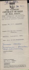
Document - H.A & S.R. WILKINSON COLLECTION: CONTRACT OF SALE
... Cohen, Victoria Lane, Bendigo. Sale of that piece of land being Crown allotment 4 section 10B described in Certificate of title volume 2757 folio 345 known as 145 Myrtle Street, Bendigo. ...Cohen, Victoria Lane, Bendigo. Sale of that piece of land being Crown allotment 4 section 10B described in Certificate of title volume 2757 folio 345 known as 145 Myrtle Street, Bendigo. ...Contract of sale of real estate between Sandhurst and Northern District Trustees executors and Agency Company Limited (Vendor) and Mr. R.V. Sprawson (Purchaser). Dated 22nd, September, 1962. Solicitor for vendor: Nil. Solicitor for purchaser: Mr. E.C. Cohen, Victoria Lane, Bendigo. Sale of that piece of land being Crown allotment 4 section 10B described in Certificate of title volume 2757 folio 345 known as 145 Myrtle Street, Bendigo. Price 1,250 pounds.organization, business, h.a. & s.r wilkinson real estate -
 Bendigo Historical Society Inc.
Document - H.A. & S.R. WILKINSON COLLECTION: CONTRACT OF SALE
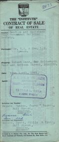
... sale of real estate dated 12th April, 1961 between Bendigo and Eaglehawk Star Permanent Building Society (vendor) and Mr.E.A. & Mrs. L.M. Spence (purchaser). Solicitor for vendor: Messrs. Watson, James & Rogers, Bull Street, Bendigo. Solicitor for purchaser: Messrs. Hyett, Willis & Hyett, Bull Street, Bendigo. Property: vacant land corner Holdsworth Road and Britton Street, Bendigo being lot 3 on plan of subdivision No. 52449, having a frontage of 56 feet 7 inches with a width at the rear of 58 feet 5 inches with a depth of 97 feet 5.5 inches being part of crown allotment 31 section F at Bendigo described in Crown volume 8242 folio 057. ...sale of real estate dated 12th April, 1961 between Bendigo and Eaglehawk Star Permanent Building Society (vendor) and Mr.E.A. & Mrs. L.M. Spence (purchaser). Solicitor for vendor: Messrs. Watson, James & Rogers, Bull Street, Bendigo. Solicitor for purchaser: Messrs. Hyett, Willis & Hyett, Bull Street, Bendigo. Property: vacant land corner Holdsworth Road and Britton Street, Bendigo being lot 3 on plan of subdivision No. 52449, having a frontage of 56 feet 7 inches with a width at the rear of 58 feet 5 inches with a depth of 97 feet 5.5 inches being part of crown allotment 31 section F at Bendigo described in Crown volume 8242 folio 057. ...Contract of sale of real estate dated 12th April, 1961 between Bendigo and Eaglehawk Star Permanent Building Society (vendor) and Mr.E.A. & Mrs. L.M. Spence (purchaser). Solicitor for vendor: Messrs. Watson, James & Rogers, Bull Street, Bendigo. Solicitor for purchaser: Messrs. Hyett, Willis & Hyett, Bull Street, Bendigo. Property: vacant land corner Holdsworth Road and Britton Street, Bendigo being lot 3 on plan of subdivision No. 52449, having a frontage of 56 feet 7 inches with a width at the rear of 58 feet 5 inches with a depth of 97 feet 5.5 inches being part of crown allotment 31 section F at Bendigo described in Crown volume 8242 folio 057. Price 410 pounds.organization, business, h.a. & s.r wilkinson real estate -
 Bendigo Historical Society Inc.
Document - H.A. & S.R. WILKINSON COLLECTION: CONTRACT OF SALE
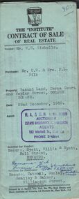
... sale of real estate dated 22nd December, 1960 between Mr. W. B. Nicholls (vendor) and Mr. C. W. & Mrs. F. L. Silk (purchaser). Solicitor for vendor: Messrs Hyett, Willis & Hyett, Bull Street, Bendigo. Solicitor for purchaser: Messrs. Tatchell, Dunlop, Smalloy & Balmer, Williamson Street, Bendigo. Property: vacant land corner Derna Court and Poplar Street, Golden Square, being lots 20,21,22,23,24, 25, 26 and 27 fronting Derna Courton plan of subdivision no. B80611 and lot 1 on plan of subdivision no. 51583 lodged in the office of titles and being part of Crown...sale of real estate dated 22nd December, 1960 between Mr. W. B. Nicholls (vendor) and Mr. C. W. & Mrs. F. L. Silk (purchaser). Solicitor for vendor: Messrs Hyett, Willis & Hyett, Bull Street, Bendigo. Solicitor for purchaser: Messrs. Tatchell, Dunlop, Smalloy & Balmer, Williamson Street, Bendigo. Property: vacant land corner Derna Court and Poplar Street, Golden Square, being lots 20,21,22,23,24, 25, 26 and 27 fronting Derna Courton plan of subdivision no. B80611 and lot 1 on plan of subdivision no. 51583 lodged in the office of titles and being part of Crown ...Contract of sale of real estate dated 22nd December, 1960 between Mr. W. B. Nicholls (vendor) and Mr. C. W. & Mrs. F. L. Silk (purchaser). Solicitor for vendor: Messrs Hyett, Willis & Hyett, Bull Street, Bendigo. Solicitor for purchaser: Messrs. Tatchell, Dunlop, Smalloy & Balmer, Williamson Street, Bendigo. Property: vacant land corner Derna Court and Poplar Street, Golden Square, being lots 20,21,22,23,24, 25, 26 and 27 fronting Derna Courton plan of subdivision no. B80611 and lot 1 on plan of subdivision no. 51583 lodged in the office of titles and being part of Crown allotment 11 section 24A at Bendigo described in Crown grant volume 8217 folio 121. Price 4,900 pounds .organization, business, h.a. & s.r wilkinson real estate -
 Bendigo Historical Society Inc.
Document - H. A. & S. R. WILKINSON COLLECTION: CONTRACT OF SALE
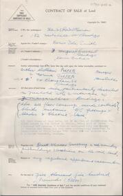
... sale of land dated 24th February, 1956 between Mrs. D. I. Smith (vendor) and Mr. A. W. & Mrs. N. Pulfer (purchaser). Solicitor for vendor: E. C. Cohen. Solicitor for purchaser: Hyett, Willis & Hyett. Property: land being lot 13on plan of subdivision No. 21180 lodged in the office of titles, being part of Crown...sale of land dated 24th February, 1956 between Mrs. D. I. Smith (vendor) and Mr. A. W. & Mrs. N. Pulfer (purchaser). Solicitor for vendor: E. C. Cohen. Solicitor for purchaser: Hyett, Willis & Hyett. Property: land being lot 13on plan of subdivision No. 21180 lodged in the office of titles, being part of Crown ...Contract of sale of land dated 24th February, 1956 between Mrs. D. I. Smith (vendor) and Mr. A. W. & Mrs. N. Pulfer (purchaser). Solicitor for vendor: E. C. Cohen. Solicitor for purchaser: Hyett, Willis & Hyett. Property: land being lot 13on plan of subdivision No. 21180 lodged in the office of titles, being part of Crown allotment 457 section H Parish of Sandhurst described in certificate of title volume7793 folio 150 and situate No. 3 Margaret Crescent, Bendigo, together with brick veneer dwelling and all sundry. Price: 5,500 pounds.organization, business, h.a. & s.r wilkinson real estate -
 Bendigo Historical Society Inc.
Document - H. A. & S. R. WILKINSON COLLECTION: CONTRACT OF SALE
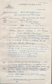
... sale of land dated 5th November 1955 between Mr. L. H. & Mrs. M Davis (vendor) and Misses T. A. & I. Pithie (purchaser). Solicitor for vendor: H. E. Every. Solicitor for purchaser: Neal Woodward. Property: Lot 4 on plan of subdivision No.21517 lodged in the office of titles being part of Crown...sale of land dated 5th November 1955 between Mr. L. H. & Mrs. M Davis (vendor) and Misses T. A. & I. Pithie (purchaser). Solicitor for vendor: H. E. Every. Solicitor for purchaser: Neal Woodward. Property: Lot 4 on plan of subdivision No.21517 lodged in the office of titles being part of Crown ...Contract of sale of land dated 5th November 1955 between Mr. L. H. & Mrs. M Davis (vendor) and Misses T. A. & I. Pithie (purchaser). Solicitor for vendor: H. E. Every. Solicitor for purchaser: Neal Woodward. Property: Lot 4 on plan of subdivision No.21517 lodged in the office of titles being part of Crown allotment 351 section E, land described in certificate of title volume 7731 folio 178, together with 5 room brick dwelling also all floor coverings, blinds, curtains, electric light fittings and shades, electric stovette and stand. Price: 6,000 pounds.organization, business, h.a. & s.r wilkinson real estate -
 Bendigo Historical Society Inc.
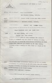
Document - H. A. & S. R. WILKINSON COLLECTION: CONTRACT OF SALE
... sale of land dated 4th October, 1955 between Mr. R. F. & Mrs. B. Wootton (vendor) and Mr. E. W. & Mrs. S. Peers (purchaser). Solicitor for vendor: Neal & Woodward. Solicitor for purchaser: Cohen, Kirby & Co. Property: land being part of Crown...sale of land dated 4th October, 1955 between Mr. R. F. & Mrs. B. Wootton (vendor) and Mr. E. W. & Mrs. S. Peers (purchaser). Solicitor for vendor: Neal & Woodward. Solicitor for purchaser: Cohen, Kirby & Co. Property: land being part of Crown ...Contract of sale of land dated 4th October, 1955 between Mr. R. F. & Mrs. B. Wootton (vendor) and Mr. E. W. & Mrs. S. Peers (purchaser). Solicitor for vendor: Neal & Woodward. Solicitor for purchaser: Cohen, Kirby & Co. Property: land being part of Crown allotment 201 section K land described in certificate of title volume 7304 folio 627 and situate No. 33 Moran Street, Bendigo, having a frontage of 100.5 links y a depth of 170 links, together with 5 room weatherboard dwelling also all blinds electric stovette, all linos and curtains with the exception of the curtains in the front 2 rooms. Price: 2,600 poundsorganization, business, h.a. & s.r wilkinson real estate -
 Bendigo Historical Society Inc.
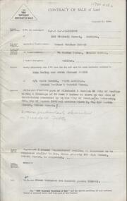
Document - H. A. & S. R. WILKINSON COLLECTION: CONTRACT OF SALE
... sale of land dated 30th August 1955 between Mr. E. M. Hopper (vendor) and Mr. J. H. & Mrs. E. E. Parker (purchaser). Property: land being part of Crown...sale of land dated 30th August 1955 between Mr. E. M. Hopper (vendor) and Mr. J. H. & Mrs. E. E. Parker (purchaser). Property: land being part of Crown ...Contract of sale of land dated 30th August 1955 between Mr. E. M. Hopper (vendor) and Mr. J. H. & Mrs. E. E. Parker (purchaser). Property: land being part of Crown allotment3 section 5A having a frontage of 38 feet 8 inches as shown on plan of subdivision consented by the city of Bendigo on Wednesday 6th August, 1955 and situate block 5, No. 110 Penton Street, Golden Square, together with 5 roomed weatherboard dwelling as inspected to be completed similar to Mrs. James property 650 High Street, Golden Square. Price: 3,200 pounds. .organization, business, h.a. & s.r wilkinson real estate -
 Bendigo Historical Society Inc.
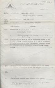
Document - H. A. & S. R. WILKINSON COLLECTION: CONTRACT OF SALE
... sale of land dated 17th August, 1955 between Mr. H. B. Morgan (vendor) and Mr. L. H. Parsons (purchaser). Property: land being lot 3 on plan of subdivision lodged in the office of titles, having a frontage of 50 feet by a depth of 150 feet, being part of Crown allotment 547section H and situate in Osborne Street, Bendigo, together with 5 roomed weatherboard dwelling and all sundry. ...sale of land dated 17th August, 1955 between Mr. H. B. Morgan (vendor) and Mr. L. H. Parsons (purchaser). Property: land being lot 3 on plan of subdivision lodged in the office of titles, having a frontage of 50 feet by a depth of 150 feet, being part of Crown allotment 547section H and situate in Osborne Street, Bendigo, together with 5 roomed weatherboard dwelling and all sundry. ...Contract of sale of land dated 17th August, 1955 between Mr. H. B. Morgan (vendor) and Mr. L. H. Parsons (purchaser). Property: land being lot 3 on plan of subdivision lodged in the office of titles, having a frontage of 50 feet by a depth of 150 feet, being part of Crown allotment 547section H and situate in Osborne Street, Bendigo, together with 5 roomed weatherboard dwelling and all sundry. Price: 3,300 pounds.organization, business, h.a. & s.r wilkinson real estate -
 Bendigo Historical Society Inc.
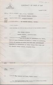
Document - H. A. & S. R. WILKINSON COLLECTION: CONTRACT OF SALE
... sale of land dated 12th July 1955 between Mr. C. Naismith (vendor) and Mr. J. M. Parsons (purchaser). Property: land being lot 20 on plan of subdivision No. 22101 part of Crown allotment 60 section D Parish of Mandurang, County of Bendigo and being land described in certificate of title volume 7925 folio 69 and situate Archer Street, Kangaroo Flat. ...sale of land dated 12th July 1955 between Mr. C. Naismith (vendor) and Mr. J. M. Parsons (purchaser). Property: land being lot 20 on plan of subdivision No. 22101 part of Crown allotment 60 section D Parish of Mandurang, County of Bendigo and being land described in certificate of title volume 7925 folio 69 and situate Archer Street, Kangaroo Flat. ...Contract of sale of land dated 12th July 1955 between Mr. C. Naismith (vendor) and Mr. J. M. Parsons (purchaser). Property: land being lot 20 on plan of subdivision No. 22101 part of Crown allotment 60 section D Parish of Mandurang, County of Bendigo and being land described in certificate of title volume 7925 folio 69 and situate Archer Street, Kangaroo Flat. Price: 140 pounds.organization, business, h.a. & s.r wilkinson real estate -
 Bendigo Historical Society Inc.
Document - H. A. & S. R. WILKINSON COLLECTION: CONTRACT OF SALE
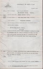
... sale of land dated 25th February, 1955 between Mr. E. C. Spence (vendor) and Mr. E. K. Pipkorn (purchaser). Property: land being part of Crown allotment 8 section 19 Parish of Sandhurst, City of Bendigo being land described in deed of conveyance No. 11 book No. 567 and situate 306 White Hills Road, Bendigo, together with 5 roomed weatherboard and rough cast dwelling and all sundry buildings on said land. ...sale of land dated 25th February, 1955 between Mr. E. C. Spence (vendor) and Mr. E. K. Pipkorn (purchaser). Property: land being part of Crown allotment 8 section 19 Parish of Sandhurst, City of Bendigo being land described in deed of conveyance No. 11 book No. 567 and situate 306 White Hills Road, Bendigo, together with 5 roomed weatherboard and rough cast dwelling and all sundry buildings on said land. ...Contract of sale of land dated 25th February, 1955 between Mr. E. C. Spence (vendor) and Mr. E. K. Pipkorn (purchaser). Property: land being part of Crown allotment 8 section 19 Parish of Sandhurst, City of Bendigo being land described in deed of conveyance No. 11 book No. 567 and situate 306 White Hills Road, Bendigo, together with 5 roomed weatherboard and rough cast dwelling and all sundry buildings on said land. Also all linos and blinds. Price: 2,250 pounds.organization, business, h.a. & s.r wilkinson real estate -
 Bendigo Historical Society Inc.
Document - H. A. & S. R. WILKINSON COLLECTION: CONTRACT OF SALE
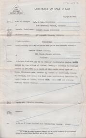
... sale of land dated 9th February 1955 between Mr. R. J. Sanderson (vendor) and Mr. L. A. Pitson (purchaser). Property: Lot 55 on plan of subdivision No. 16998 lodged in the office of titles, having a frontage to Burrell Street of 50 feet by a depth of 140 feet, being part of Crown allotment 432 section H Parish of Sandhurst County of Bendigo, land described in certificate of title volume 7314 folio 636 and situate Burrell Street, Bendigo, together with the fencing thereon. ...sale of land dated 9th February 1955 between Mr. R. J. Sanderson (vendor) and Mr. L. A. Pitson (purchaser). Property: Lot 55 on plan of subdivision No. 16998 lodged in the office of titles, having a frontage to Burrell Street of 50 feet by a depth of 140 feet, being part of Crown allotment 432 section H Parish of Sandhurst County of Bendigo, land described in certificate of title volume 7314 folio 636 and situate Burrell Street, Bendigo, together with the fencing thereon. ...Contract of sale of land dated 9th February 1955 between Mr. R. J. Sanderson (vendor) and Mr. L. A. Pitson (purchaser). Property: Lot 55 on plan of subdivision No. 16998 lodged in the office of titles, having a frontage to Burrell Street of 50 feet by a depth of 140 feet, being part of Crown allotment 432 section H Parish of Sandhurst County of Bendigo, land described in certificate of title volume 7314 folio 636 and situate Burrell Street, Bendigo, together with the fencing thereon. Price: 425 pounds.organization, business, h.a. & s.r wilkinson real estate -
 Bendigo Historical Society Inc.
Document - H. A. & S. R. WILKINSON COLLECTION: CONTRACT OF SALE
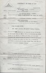
... sale of land dated 12th January, 1955n Mr. L. W. & Mrs. L. M. Dennis (vendor) and Mrs. A. M. Praetz (purchaser). Property: land delineated and coloured purple on the map in the margin being lot 11 on plan of subdivision 21180 lodged in the office of titles being part of Crown allotment 457 section H Parish of Sandhurst, City of Bendigo, land described in certificate of title volume 7793 folio 149 and situate 7 Margaret Crescent, Bendigo, together with 5 rooms weatherboard dwelling and all sundry buildings on said land, also all floor coverings, blinds and electric light fittings and shades. ...sale of land dated 12th January, 1955n Mr. L. W. & Mrs. L. M. Dennis (vendor) and Mrs. A. M. Praetz (purchaser). Property: land delineated and coloured purple on the map in the margin being lot 11 on plan of subdivision 21180 lodged in the office of titles being part of Crown allotment 457 section H Parish of Sandhurst, City of Bendigo, land described in certificate of title volume 7793 folio 149 and situate 7 Margaret Crescent, Bendigo, together with 5 rooms weatherboard dwelling and all sundry buildings on said land, also all floor coverings, blinds and electric light fittings and shades. ...Contract of sale of land dated 12th January, 1955n Mr. L. W. & Mrs. L. M. Dennis (vendor) and Mrs. A. M. Praetz (purchaser). Property: land delineated and coloured purple on the map in the margin being lot 11 on plan of subdivision 21180 lodged in the office of titles being part of Crown allotment 457 section H Parish of Sandhurst, City of Bendigo, land described in certificate of title volume 7793 folio 149 and situate 7 Margaret Crescent, Bendigo, together with 5 rooms weatherboard dwelling and all sundry buildings on said land, also all floor coverings, blinds and electric light fittings and shades. Price: 4,150 pounds.organization, business, h.a. & s.r wilkinson real estate -
 Bendigo Historical Society Inc.
Document - H. A. & S. R. WILKINSON COLLECTION: CONTRACT OF SALE
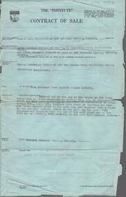
... sale dated 14th December, 1959 between Messrs. K. R. & K. S. Johnson (vendor) and Mr. T. E. Turner (purchaser). Solicitor for vendor: Hyett, Willis & Hyett, Bull Street, Bendigo. Solicitor for purchaser: Tatchell, Dunlop, Smalley & Balmer, Williamson Street, Bendigo. Property 189-191 Mitchell Street, Bendigo, being land coloured red on the map in the margin of the title part of Crown...sale dated 14th December, 1959 between Messrs. K. R. & K. S. Johnson (vendor) and Mr. T. E. Turner (purchaser). Solicitor for vendor: Hyett, Willis & Hyett, Bull Street, Bendigo. Solicitor for purchaser: Tatchell, Dunlop, Smalley & Balmer, Williamson Street, Bendigo. Property 189-191 Mitchell Street, Bendigo, being land coloured red on the map in the margin of the title part of Crown ...Contract of sale dated 14th December, 1959 between Messrs. K. R. & K. S. Johnson (vendor) and Mr. T. E. Turner (purchaser). Solicitor for vendor: Hyett, Willis & Hyett, Bull Street, Bendigo. Solicitor for purchaser: Tatchell, Dunlop, Smalley & Balmer, Williamson Street, Bendigo. Property 189-191 Mitchell Street, Bendigo, being land coloured red on the map in the margin of the title part of Crown allotment 8 section 51C, being land described in certificate f title volume 6511 folio 146, together with right of carriage way over the ponds coloured brown on the said map, and together with a right to use land coloured yellow on the said map for party wall purposes together with the use of the wall which was on the 11thOctober, 1905 standing on the said land coloured yellow. Price undisclosed. Attached: business card Hillier Parker, 6 hand written notes and drawing, 1 statement pursuant to section 34 of the estate agents act 1956, 1 cover note from the united insurance company, 2 copies of engagement or appointment in writing pursuant to section 33 of the estate agents act, 1956.organization, business, h.a. & s.r wilkinson real estate -
 Bendigo Historical Society Inc.
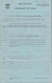
Document - H. A. & S. R. WILKINSON COLLECTION: CONTRACT OF SALE
... sale dated 17th October, 1957 between Mr. E. Buckland (vendor) and Mr. T. J. M. & J. C. B. Tweed (purchaser). Solicitor for vendor and purchaser: Watson, James & Rogers, Bull Street, Bendigo. Property: 163 King Street, Bendigo being Crown allotment 96A section C Parish of Sandhurst, City of Bendigo land...sale dated 17th October, 1957 between Mr. E. Buckland (vendor) and Mr. T. J. M. & J. C. B. Tweed (purchaser). Solicitor for vendor and purchaser: Watson, James & Rogers, Bull Street, Bendigo. Property: 163 King Street, Bendigo being Crown allotment 96A section C Parish of Sandhurst, City of Bendigo land described in certificate of title volume 4354 folio 608. ...Contract of sale dated 17th October, 1957 between Mr. E. Buckland (vendor) and Mr. T. J. M. & J. C. B. Tweed (purchaser). Solicitor for vendor and purchaser: Watson, James & Rogers, Bull Street, Bendigo. Property: 163 King Street, Bendigo being Crown allotment 96A section C Parish of Sandhurst, City of Bendigo land described in certificate of title volume 4354 folio 608. Price: 650 pounds. Attached: statement pursuant to section 34 of the estate agents act 1956 and engagement or appointment in writing pursuant to section 33 of the estate agents act 1956.organization, business, h.a. & s.r wilkinson real estate
