Showing 142 items matching "topographic survey"
-
 Bendigo Military Museum
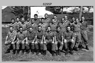
Photograph - A Section, 1st Topographic Survey Troop, Nui Dat, Vietnam, 1969
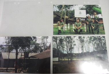
... A Section, 1st Topographic Survey Troop, Nui Dat, Vietnam...A Section, 1st Topographic Survey Troop, Nui Dat, Vietnam...This is a photograph of A Section, 1st Topographic Survey Troop taken at Nui Dat, Vietnam in 1969. ...This is a photograph of A Section, 1st Topographic Survey Troop taken at Nui Dat, Vietnam in 1969. ...A Section, 1st Topographic Survey Troop, Nui Dat, Vietnam Photograph A Section, 1st Topographic Survey Troop, Nui Dat, Vietnam Army Survey Regiment ...This is a photograph of A Section, 1st Topographic Survey Troop taken at Nui Dat, Vietnam in 1969. A nominal roll of personnel and their trade as of the 30th of September 1969, accompanies this photo. Their trades in this photo were as follows - Surveyors Topographic: WO1 Darby Munro, SGT Paddy Strunks, SGT Graeme Birrell, CPL Brian Knight, CPL Colin Laybutt, SPR Roderick Gilbert and SPR Rodney Offer. Draughtsmen Topographic: SGT Terrance Linz, CPL Robert Kay, SPR Peter Aukstinaitis, SPR Lloyd Patterson and SPR Ian Wark. Photographer Cartographic: CPL George Graham. Clerk Admin: CPL Oreste Biziak. Helioworker: CPL Geoffrey White, SPR Lance Percey. Cook AACC: PTE R. Johnston. The first Royal Australian Survey Corps troops arrived in South Vietnam on the 10th of June 1966. This was a detachment from 1st Topographic Survey Troop, which was to give cartographic support to the Australian Task Force. Their main tasks were to establish a Theatre Grid, map compilation and map revision. Engineer Survey Support in the camp and to the civil community and give assistance to the Cordon Search Missions by producing large scale plots from aerial photos with every house and fence etc plotted and then reproduce these by silk screening usually, within a 24-hour period. This support concluded with the withdrawal of Australian troops from Vietnam in 1972. For more information on the career of A Section’s OC MAJ Peter Constantine AM, refer to item 6159P or 6092P. He was the CO of the Army Survey Regiment from 1975 to 1976 and CO of the School of Military Survey (SMS) from 1976 to his retirement in January 1982. His memoirs of active duty in Vietnam ‘Surveyor - Printer Behind the Lines’ was published in 2022. 2IC CAPT Frank Thorogood SB St J’s career culminated at the rank of LTCOL as the CO Army Survey Regiment from 1980 to 1981. More information on the A Section, 1st Topographic Survey Troop and the Army Survey Regiment’s supporting role is provided in pages 89 to 94 of Valerie Lovejoy’s book 'Mapmakers of Fortuna – A history of the Army Survey Regiment’ ISBN: 0-646-42120-4.This is a photograph of A Section, 1st Topographic Survey Troop taken at Nui Dat, Vietnam in 1969. The black and white photograph was printed on photographic paper and is part of the Army Survey Regiment’s Collection. The photograph was scanned at 300 dpi. .1) - Photo, black & white, 1969. Back row L to R: SPR Lance Percey, SPR Bruce Grisdale, SPR Rodney Offer, SPR Roderick Gilbert, CPL Geoffrey White, PTE R. Johnston, CPL Colin Laybutt, SPR Lloyd Patterson. Centre row L to R: SPR Peter Aukstinaitis, SPR Ian Hanna, SPR Ian Wark, CPL Robert Kay, CPL George Graham, CPL Oreste Biziak, CPL Brian Knight. Front row L to R: SGT Terrance Linz, SSGT Gordon Haswell, 2IC CAPT Frank Thorogood SB St J, OC MAJ Peter Constantine AM, WO1 Darby Munro, SGT Paddy Strunks, SGT Graeme Birrell.An A4 nominal roll of personnel and their trade accompanies the photo, as of the 30th of September 1969. A torn paper identifies the personnel in the photo. Annotated on back of photo – ‘Unit Photo – 1 Topo Svy Tp 30 Sept 69’royal australian survey corps, rasvy, army survey regiment, army svy regt, fortuna, asr -
 Bendigo Military Museum
Photograph - A Section, 1st Topographic Survey Troop, Vung Tau, Vietnam, 1966
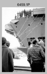
... A Section, 1st Topographic Survey Troop, Vung Tau, Vietnam. ...A Section, 1st Topographic Survey Troop, Vung Tau, Vietnam.......1st Topographical Survey Troop...This is a set of 12 photographs of A Section, 1st Topographic Survey Troop taken from the 25th of May to the 12th of June 1966 during their deployment to Vung Tau, Vietnam. ...This is a set of 12 photographs of A Section, 1st Topographic Survey Troop (1st Topo Svy Tp), taken from the 25th of May to the 12th of June 1966 during their deployment to Vung Tau, Vietnam. ...A Section, 1st Topographic Survey Troop, Vung Tau, Vietnam. Photograph A Section, 1st Topographic Survey Troop, Vung Tau, Vietnam. ...This is a set of 12 photographs of A Section, 1st Topographic Survey Troop taken from the 25th of May to the 12th of June 1966 during their deployment to Vung Tau, Vietnam. Led by OC CAPT Bob Skitch, the ten personnel from A Section 1st Topo Svy Tp and six personnel from supporting units were the first contingent from the Royal Australian Survey Corps deployed to provide topographic support to the Australian Task Force in Vietnam. They arrived in Saigon, Vietnam on the 10th of June 1966 enroute to the Australian Reinforcement Unit (ARU) “back beach” camp in Vung Tau. The ten RA Svy technical personnel from 1st Topo Svy Tp deployed were: WO2 David Christie, SGT Stan Campbell, SGT Dave King, CPL Jim Roberts, CPL Dennis Duquemin, CPL Des Ceruti, SPR Derek Chambers, SPR Brian Firns, SPR Joe O’Connor and SPR Ron Smith. External personnel deployed were: WO2 Snow Rollston from Northern Command Field Survey Unit, T/CPL Peter Clarke – orderly room corporal, T/CPL Alan Carew – Technical Storeman, SPR Stan Johns – Map Storeman, SPR Boots Campbell – batman/driver and PTE BNF Brunning – cook. The ship featured in photos .1P and .2P was the aircraft carrier HMAS Sydney on its 4th voyage to Vietnam. On board were SGT Stan Campbell and SPR Brian Firns, tasked to manage A Section’s stores and equipment. The rest of A Section deployed to Vietnam by air on the chartered Qantas 707B ‘City of Longreach'. A Section’s main tasks were to establish a Theatre Grid, map compilation and map revision; Engineer Survey Support in the camp and to the civil community; give assistance to the Cordon Search Missions by producing large scale plots from aerial photos with every house and fence etc plotted; and then reproduce these by silk screening usually, within a 24-hour period. RA Svy’s support concluded with the withdrawal of Australian troops from Vietnam in 1972. More information on the A Section, 1st Topographic Survey Troop and the Army Survey Regiment’s supporting role is provided in pages 89 to 94 of Valerie Lovejoy’s book 'Mapmakers of Fortuna – A history of the Army Survey Regiment’ ISBN: 0-646-42120-4.This is a set of 12 photographs of A Section, 1st Topographic Survey Troop (1st Topo Svy Tp), taken from the 25th of May to the 12th of June 1966 during their deployment to Vung Tau, Vietnam. The black and white photographs were printed on photographic paper and are part of the Army Survey Regiment’s Collection. The photographs were scanned at 300 dpi. .1) &.2) - Photo, black & white, 1966. HMAS Sydney departing Woolloomooloo wharf en-route to Vietnam. .3) - Photo, black & white, 1966. A Section 1 Topo Svy Tp relaxing in a bar before deployment. OC CAPT Bob Skitch in centre of photo. .4) - Photo, black & white, 1966. Unidentified A Section 1 Topo Svy Tp personnel and troops from other units relaxing in a bar before deployment. .5) - Photo, black & white, 1966. A Section 1 Topo Svy Tp personnel arrival by bus at Saigon (Tan Son Nhut) Airport. OC CAPT Bob Skitch 4th from right. .6) - Photo, black & white, 1966. A Section 1 Topo Svy Tp personnel boarding the USAF Hercules aircraft enroute from Saigon (Tan Son Nhut) Airport to Vung Tau Airfield. OC CAPT Bob Skitch on left. .7) - Photo, black & white, 1966. A Section 1 Topo Svy Tp personnel and troops from other units boarding the USAF Hercules aircraft enroute from Saigon (Tan Son Nhut) Airport to Vung Tau Airfield. .8) & .9) - Photo, black & white, 1966. A Section 1 Topo Svy Tp personnel arrive at the Australian Reinforcement Unit (ARU) “back beach” camp. .10) - Photo, black & white, 1966. A Section 1 Topo Svy Tp personnel in oppressive conditions work on map products. .11) - Photo, black & white, 1966. Group photo of A Section 1 Topo Svy Tp. OC CAPT Bob Skitch on far right. .12) - Photo, black & white, 1966. Group photo of A Section 1 Topo Svy Tp. OC CAPT Bob Skitch 3rd from right.Annotated with the photo set - ‘ DET 1 Topo Svy Tp Vung Tau 25 May to 12 of Jun 66’royal australian survey corps, rasvy, army survey regiment, army svy regt, fortuna, asr, 1st topographical survey troop -
 University of Melbourne, Burnley Campus Archives
Map - Topographic Survey, Grampians, 1969
... Topographic Survey......topographic survey...Australia 1:100,000 Topographic Survey Map of the Grampians, Victoria dated 1969. ...Grampians Map Topographic Survey ...Australia 1:100,000 Topographic Survey Map of the Grampians, Victoria dated 1969. Sheet 7323 (Edition 1) Series R 652. Produced by the Royal Australian Survey Corps.grampians, royal australian survey corps, topographic survey -
University of Melbourne, Burnley Campus Archives
Map - Topographic Survey, Ararat, 1970
... Topographic Survey...Australia 1:100,000 Topographic Survey map of Ararat district, Victoria dated 1970. ...Ararat Map Topographic Survey ...Australia 1:100,000 Topographic Survey map of Ararat district, Victoria dated 1970. Sheet 7423 (Edition 1) Series R 652. Produced by the Royal Australian Survey Corps.royal australian survey corps, ararat area, stawell area -
 National Vietnam Veterans Museum (NVVM)
Book, McMillan-Kay, Robert, Vietnam: A Technical Tour with the 1st Topographic Survey Troop (Copy 1)
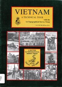
... Vietnam: A Technical Tour with the 1st Topographic Survey Troop (Copy 1)....Australia. Army. Topographical Survey Troop...Vietnam: A Technical Tour with the 1st Topographic Survey Troop (Copy 1). Book Book McMillan-Kay, Robert ...The political and personal controversy over our involvement in the Vietnam war still rages. Only those who were there can tell the story.The political and personal controversy over our involvement in the Vietnam war still rages. Only those who were there can tell the story.australia. army. topographical survey troop, 1st, military topography - vietnam, nui dat -
 National Vietnam Veterans Museum (NVVM)
Book, McMillan-Kay, Robert, Vietnam: A technical Tour with the 1st Topographic Survey Troop (Copy 2)
... Vietnam: A technical Tour with the 1st Topographic Survey Troop (Copy 2).......1st Topographical Survey Troop...Vietnam: A technical Tour with the 1st Topographic Survey Troop (Copy 2). Book Book McMillan-Kay, Robert ...The political and personal controversy over our involvement in the Vietnam war still rages. Only those who were there can tell the story.The political and personal controversy over our involvement in the Vietnam war still rages. Only those who were there can tell the story. military topography - vietnam, 1st topographical survey troop, nui dat -
Clunes Museum
Map - SURVEYERS MAP OF CLUNES, J. FINNIE, 1883
... GEOLOGICALLY AND TOPOGRAPHICALLY SURVEYED BY R.A.F. MURRAY....GEOLOGICALLY AND TOPOGRAPHICALLY SURVEYED BY R.A.F. MURRAY. Map SURVEYERS MAP OF CLUNES J. ...A SURVEYORS MAP OF CLUNES. GEOLOGICALLY AND TOPOGRAPHICALLY SURVEYED BY R.A.F. MURRAY.LITHOGRAPHED BY R. SHEPHERD AND PRINTED BY J. FINNIE MINING DEPARTMENT, MELBOURNE,1883document, surveyers map of clunes, map of clunes -
 Rutherglen Historical Society
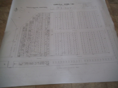
Carlyle Cemetery Map, Plan of Presbyterian Compartment, 1952
... Topographic Survey...Originally the layout was not well defined and it is difficult to use this plan to locate a particular grave, also the fact that not all graves are marked and foot paths are not defined has exacerbated this issue. Topographic Survey Cadastral Survey carlyle cemetery Burials Graves Lot boundary Rotunda References Grid Survey points at 50 feet centres shown (as a cross with the reference mark number in brackets) Lot Number shown at left side of graves. ...This is a map produced to attempt to bring order to the cemetery. Originally the layout was not well defined and it is difficult to use this plan to locate a particular grave, also the fact that not all graves are marked and foot paths are not defined has exacerbated this issue. Photocopy, White paper, black printing, black line work showing lot and compartment boundariesReferences Grid Survey points at 50 feet centres shown (as a cross with the reference mark number in brackets) Lot Number shown at left side of graves. Burial Number shown at right side of grave. Lots with unidentified burials show with dashed cross with in the lot. topographic survey, cadastral survey, carlyle cemetery, burials, graves, lot boundary, rotunda -
 Rutherglen Historical Society
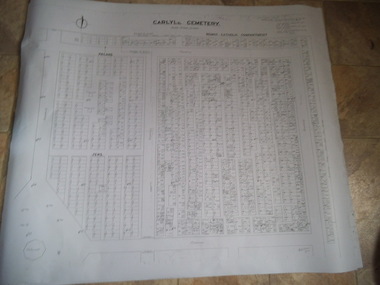
Carlyle Cemetery Map, Plan of Roman Catholic Compartment, 1952
... topographic survey...Originally the layout was not well defined and it is difficult to use this plan to locate a particular grave, also the fact that not all graves are marked and foot paths are not defined has exacerbated this issue. topographic survey cadastral survey carlyle cemetery burials graves lot boundary rotunda References Grid Survey points at 50 feet centres shown (as a cross with the reference mark number in brackets) Lot Number shown at left side of graves. ...This is a map produced to attempt to bring order to the cemetery. Originally the layout was not well defined and it is difficult to use this plan to locate a particular grave, also the fact that not all graves are marked and foot paths are not defined has exacerbated this issue. Photocopy, White paper, black printing, black line work showing lot and compartment boundariesReferences Grid Survey points at 50 feet centres shown (as a cross with the reference mark number in brackets) Lot Number shown at left side of graves. Burial Number shown at right side of grave. Lots with unidentified burials show with dashed cross with in the lot. topographic survey, cadastral survey, carlyle cemetery, burials, graves, lot boundary, rotunda -
 Rutherglen Historical Society
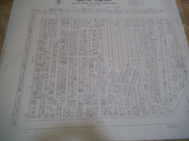
Carlyle Cemetery Map, Plan of Church of England Compartment, 1952
... topographic survey...Originally the layout was not well defined and it is difficult to use this plan to locate a particular grave, also the fact that not all graves are marked and foot paths are not defined has exacerbated this issue. topographic survey cadastral survey carlyle cemetery burials graves lot boundary rotunda References Grid Survey points at 50 feet centres shown (as a cross with the reference mark number in brackets) Lot Number shown at left side of graves. ...This is a map produced to attempt to bring order to the cemetery. Originally the layout was not well defined and it is difficult to use this plan to locate a particular grave, also the fact that not all graves are marked and foot paths are not defined has exacerbated this issue. Photocopy, White paper, black printing, black line work showing lot and compartment boundariesReferences Grid Survey points at 50 feet centres shown (as a cross with the reference mark number in brackets) Lot Number shown at left side of graves. Burial Number shown at right side of grave. Lots with unidentified burials show with dashed cross with in the lot. topographic survey, cadastral survey, carlyle cemetery, burials, graves, lot boundary, rotunda -
 Rutherglen Historical Society
Carlyle Cemetery Map, Plan of Wesleyan Compartment, 1952
... topographic survey...Originally the layout was not well defined and it is difficult to use this plan to locate a particular grave, also the fact that not all graves are marked and foot paths are not defined has exacerbated this issue. topographic survey cadastral survey carlyle cemetery burials graves lot boundary rotunda References Grid Survey points at 50 feet centres shown (as a cross with the reference mark number in brackets) Lot Number shown at left side of graves. ...This is a map produced to attempt to bring order to the cemetery. Originally the layout was not well defined and it is difficult to use this plan to locate a particular grave, also the fact that not all graves are marked and foot paths are not defined has exacerbated this issue. Photocopy, White paper, black printing, black line work showing lot and compartment boundariesReferences Grid Survey points at 50 feet centres shown (as a cross with the reference mark number in brackets) Lot Number shown at left side of graves. Burial Number shown at right side of grave. Lots with unidentified burials show with dashed cross with in the lot. topographic survey, cadastral survey, carlyle cemetery, burials, graves, lot boundary, rotunda -
 National Vietnam Veterans Museum (NVVM)
Poster - Poster, Information Board, Behind The Wire
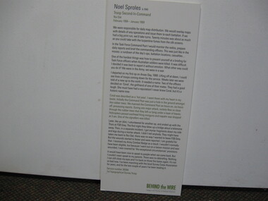
... ...1st Topographical Survey Troop...Service Number 36566, 1st Topographical Survey Troop...Service Number 36566, 1st Topographical Survey Troop Behind The Wire Poster Poster, Information Board ...Storyboard of Noel Sproles, troop Second In Command Nui Dat February 1968 - January 1963. Service Number 36566, 1st Topographical Survey Troopstoryboard, behind the wire, nui dat, noel sproles, 1st topographical survey troop -
Beechworth Honey Archive
Map- Albury
... Map centred on Albury, showing Wodonga, Beechworth, Yackandandah and Chiltern. Topographic survey scale 1:100,000. Map is colour, printed on paper. ...Map centred on Albury, showing Wodonga, Beechworth, Yackandandah and Chiltern. Topographic survey scale 1:100,000. Map is colour, printed on paper. ...Map centred on Albury, showing Wodonga, Beechworth, Yackandandah and Chiltern. Topographic survey scale 1:100,000. Map is colour, printed on paper. Produced by Department of Minerals and EnergySheet 8225 (ed.1) series R. 652 Notes written on side regarding brigade boundaries, constructed access roads and fire trails, dams suitable for quick fill pump and areas 'fuel reduction burns Autumn 76'.map, albury, wodonga, beechworth, yackandandah, chiltern, paper, topographic, beechworth honey -
 National Vietnam Veterans Museum (NVVM)
Photograph
... Seven Khaki clad men in front of sign Royal Australian Survey Corps 1st Topographical Survey Troop 2+3. Scenes of building and trees...Seven Khaki clad men in front of sign Royal Australian Survey Corps 1st Topographical Survey Troop 2+3. Scenes of building and trees Photograph Photograph ...Three Colour Photograph taken in Vietnam 1. Seven Khaki clad men in front of sign Royal Australian Survey Corps 1st Topographical Survey Troop 2+3. Scenes of building and treesphotograph, royal australian survey corps -
Federation University Historical Collection
Map, Creswick Gold Field Map, 1981
... Geologically and topographically surveyed by Ferdinand M Krause. Lithographed by R. ...See 116 creswick krause surveyor smeaton spring hill tourello ascot dean bullarook gold fields gold Geologically and topographically surveyed by Ferdinand M Krause. Lithographed by R. ...A fragment of the original 1880 map is also held in the collection. See 116Rectangular geological map with brown paper strip on top edge with 4 holes on top edge. Scale is 40 chains to one inch.Geologically and topographically surveyed by Ferdinand M Krause. Lithographed by R. Shepherd. Printed by J. Finnie. Mining Department, Melbourne. Preprinted with additional shaft and lead detail. F. D. Atkinson, Government Printer 1981creswick, krause, surveyor, smeaton, spring hill, tourello, ascot, dean, bullarook, gold fields, gold -
 Federation University Historical Collection
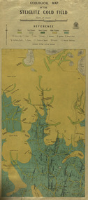
Map, Geological Map of The Stieglitz Gold Field, 1940
... At the bottom of the 2nd page, there is text that reads "Geologically and topographically surveyed in 1909 by W.H. Ferguson, Assistant Field Geologist. ...Barker Library (top floor) Mount Helen goldfields At the bottom of the 2nd page, there is text that reads "Geologically and topographically surveyed in 1909 by W.H. Ferguson, Assistant Field Geologist. ...At the bottom of the 2nd page, there is text that reads "Geologically and topographically surveyed in 1909 by W.H. Ferguson, Assistant Field Geologist. Published 1940."Rectangular geological map edged in masking tape showing Steiglitz, Victoria. Scale 48 chains to 4 inches.steiglitz, geology, geological map, north albion, moreep, mining, mine, caribald reef, durdidwarrah, gilbraltar hill, mount pleasant gully, township of steiglitz, w.h. ferguson, garibaldi reef, yankee gully, kinglock mine engine shaft, herbert werner frederick de nully, albion gully, virago reef, mulrooney's reef -
 Bendigo Military Museum
Map - Australian Topographical Survey NAGAMBIE SW Sheet, 1 inch:1 Mile, NW portion Plane Table Field sheet 1921, Australian Survey Corps, 1921
... Australian Topographical Survey NAGAMBIE SW Sheet, 1 inch:1 Mile, NW portion Plane Table Field sheet 1921...Australian Topographical Survey NAGAMBIE SW Sheet, 1 inch:1 Mile, NW portion Plane Table Field sheet 1921...Reprinted coloured Image of Australian Topographical Survey NAGAMBIE SW Sheet,1 inch:1 Mile, NW portion hand drawn Plane Table Field sheet. ...Australian Topographical Survey NAGAMBIE SW Sheet, 1 inch:1 Mile, NW portion Plane Table Field sheet 1921 Map Australian Topographical Survey NAGAMBIE SW Sheet, 1 inch:1 Mile, NW portion Plane Table Field sheet 1921 Australian Survey Corps ...This is a coloured reproduction print of an original Plane Table compilation map sheet of Nagambie area 1inch to 1 Mile scale compiled by Sgt Jack Cullen Australian Survey Corps 30 September 1921. Jack was one of the foundation members of the Australian Survey Corps. Of particular interest is the fact that this is a heighted compilation with contouring (required for Military use) as many early maps were purely planimetric. A table on the right hand side details the number of days that it took to produce the compilation. The reverse side of this print is a copy of the Tallarook plane table South East field sheet.Reprinted coloured Image of Australian Topographical Survey NAGAMBIE SW Sheet,1 inch:1 Mile, NW portion hand drawn Plane Table Field sheet. Includes an itemized summary of work, signed by Sgt J Cullen Australian Survey Corps September1921.royal australian survey corps, rasvy, fortuna, army survey regiment, army svy regt, asr -
 Bendigo Military Museum
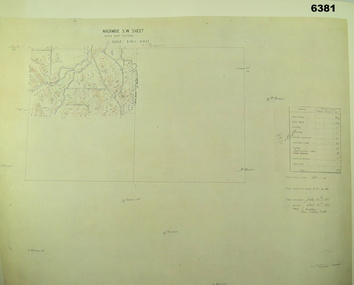
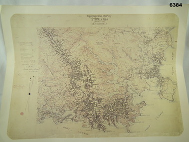
Map - Australian Topographical Survey SYDNEY / 56III Southern Half, NE Plane Table Field sheet 1915, Australian Survey Corps, 6 Dec 1915
... Australian Topographical Survey SYDNEY / 56III Southern Half, NE Plane Table Field sheet 1915...Australian Topographical Survey SYDNEY / 56III Southern Half, NE Plane Table Field sheet 1915...Reprinted coloured Image of Australian Topographical Survey SYDNEY /56 III Southern Half, hand drawn NE Plane Table field sheet. ...Australian Topographical Survey SYDNEY / 56III Southern Half, NE Plane Table Field sheet 1915 Map Australian Topographical Survey SYDNEY / 56III Southern Half, NE Plane Table Field sheet 1915 Australian Survey Corps ...This is a unique example of a hand drawn plane table sheet produced in the first year of the Australian Survey Corps by original members of the Corps. Roseblade and Lynch 5 Dec 1915. Of interest is the documented times that it took to create the original field sheet. Also of interest is the fact that this field sheet that was used to create the actual SYDNEY map sheet was contoured, many map sheets produced up until now were purely planimetric and lacked contouring that was needed for military use. This is a reproduction print of a photograph of the original field sheet and was printed at the Army Survey Regiment, Bendigo.Reprinted coloured Image of Australian Topographical Survey SYDNEY /56 III Southern Half, hand drawn NE Plane Table field sheet. Includes an itemized summary of work performed by HA Roseblade CSM Australian Survey Corps 1915, Signed by J Lynch Lieutenant.royal australian survey corps, rasvy, fortuna, army survey regiment, army svy regt, asr -
Bendigo Historical Society Inc.
Map - BENDIGO GOLDFIELD, 1873
... April 1873 Topographic map. Surveyed and completed by R Brough April 1873...April 1873 Topographic map. Surveyed and completed by R Brough April 1873 Map BENDIGO GOLDFIELD ...BHS CollectionBendigo Goldfieds mining Lease blocks. April 1873 Topographic map. Surveyed and completed by R Brough April 1873Dept of manufacturing and Industry Development.bendigo, gold mining, mining lease blocks -
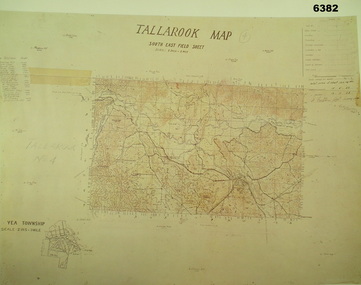 Bendigo Military Museum
Map - Australian Topographical Survey TALLAROOK SE Sheet, 1 inch:1 Mile, NW portion Plane Table Field sheet 1923, Australian Survey Corps, 1923
... Australian Topographical Survey TALLAROOK SE Sheet, 1 inch:1 Mile, NW portion Plane Table Field sheet 1923...Australian Topographical Survey TALLAROOK SE Sheet, 1 inch:1 Mile, NW portion Plane Table Field sheet 1923...Reprinted coloured Image of Australian Topographical Survey TALLAROOK SE field Sheet,1 inch:1 Mile, hand drawn contoured Plane Table Field sheet. ...Australian Topographical Survey TALLAROOK SE Sheet, 1 inch:1 Mile, NW portion Plane Table Field sheet 1923 Map Australian Topographical Survey TALLAROOK SE Sheet, 1 inch:1 Mile, NW portion Plane Table Field sheet 1923 Australian Survey Corps ...This is a coloured reproduction print of an original Plane Table compilation map sheet of Tallarook area 1inch to 1 Mile scale compiled by Sgt Jack Cullen Australian Survey Corps 12 November 1923 and signed by Capt J Lynch. Capt Lynch and Sgt Cullen were both foundation members of the Australian Survey Corps. Of particular interest is the fact that this is a heighted compilation with contouring (required for Military use) as many early maps were purely planimetric. The reverse side of this print is a copy of the Nagambie plane table South West field sheet.Reprinted coloured Image of Australian Topographical Survey TALLAROOK SE field Sheet,1 inch:1 Mile, hand drawn contoured Plane Table Field sheet. Signed by Sgt J Cullen Australian Survey Corps November1923. An enlargement of YEA Township 2 Inches to 1 Mile Scale.royal australian survey corps, rasvy, fortuna, army survey regiment, army svy regt, asr -
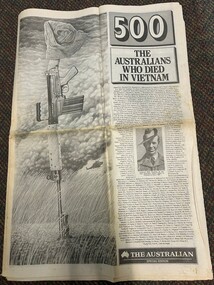 National Vietnam Veterans Museum (NVVM)
Newspaper, 500: The Australians Who Died in Vietnam, 1988
... ...1st Topographical Survey Troop...This item was donated by Cpl (Temp) Allan William Adsett( 1201433) who was with the Royal Australian Survey Corps and he served in Vietnam with A Section, 1st Topographical Survey Troop from April 1971 to November 1971....This item was donated by Cpl (Temp) Allan William Adsett( 1201433) who was with the Royal Australian Survey Corps and he served in Vietnam with A Section, 1st Topographical Survey Troop from April 1971 to November 1971. ...This item was donated by Cpl (Temp) Allan William Adsett( 1201433) who was with the Royal Australian Survey Corps and he served in Vietnam with A Section, 1st Topographical Survey Troop from April 1971 to November 1971.A special edition of the Australian dated Thursday August 18, 1988. The title is "500 The Australians Who Died In Vietnam". there are twenty pages dedicated to the soldiers with a photograph and a short story on each. On the front right hand side are the names of each soldier. In the middle of these there is a photograph of Sgt Bill Hacking who was the first Australian solder killed in Vietnam on June 1 1963. To the left of the front page there a sketch of a rifle stuck in the ground with a diggers hat on the butt. There is a helicopter in the background with dark clouds and long grass. See media information for more details.cpl (temp) allan william adsett, 1201433, royal australian survey corps, a section, 1st topographical survey troop, killed in action, australian soldiers, australian national serviceman -
 National Vietnam Veterans Museum (NVVM)
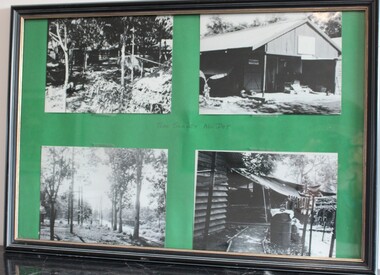
Photograph - Nui Dat images
... They were taken by Sapper Bruce Appleford, A Section, 1st Topographical Survey Troop 1970-71. ...They were taken by Sapper Bruce Appleford, A Section, 1st Topographical Survey Troop 1970-71. Nui Dat Appleford B r Appleford Topographical 'TOPO SURVEY NUI DAT' in blue ink, hand written in centre of the four photos. ...These images contribute to an understanding of the type of camps that were set up in Nui Dat during the conflict in Vietnam between 1962 - 1972. They were taken by Sapper Bruce Appleford, A Section, 1st Topographical Survey Troop 1970-71. A black plastic frame with four black and white images of camp at Nui Dat stuck on a green card mat. Left side: Camp in trees & Treed area near road. Right side: Shed, Camp'TOPO SURVEY NUI DAT' in blue ink, hand written in centre of the four photos.nui dat, appleford, b r appleford, topographical -
 Bendigo Military Museum
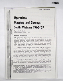
Booklet - Operational Mapping and Surveys - South Vietnam 1966/67, Royal Australian Survey Corps
... ...1st Topographical Survey Troop...This report describes in some detail the Australian 1st Topographical Survey Troop from its initial formation in Oct 1965 through its deployment to South Vietnam in May 1966 and its Operational activities during 1966/67 in support of the 1st Australian Task Force....Royal Australian Survey Corps RASvy Fortuna Army Survey Regiment Army Svy Regt ASR 1st Topographical Survey Troop South Vietnam "SSgt Learmonth" written on front cover. ...Report written for the "Australian?" Army Journal. This report describes in some detail the Australian 1st Topographical Survey Troop from its initial formation in Oct 1965 through its deployment to South Vietnam in May 1966 and its Operational activities during 1966/67 in support of the 1st Australian Task Force.A4 booklet, stapled in top left corner. "SSgt Learmonth" written on front cover.royal australian survey corps, rasvy, fortuna, army survey regiment, army svy regt, asr, 1st topographical survey troop, south vietnam -
 Bendigo Military Museum
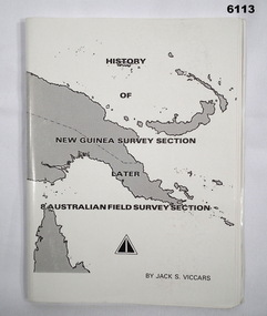
Booklet - History of the New Guinea Survey Section 1967 by LT Jack Viccars, Lt Jack Stewart Viccars, Circa 1967
... Military surveying in New Guinea began in in WWII with the formation of the New Guinea Force Field Survey Section which later became 8th Australian Field Survey Section and later 2 Field Survey Section of 6th Army Topographical Survey Section. This history was written by LT Jack Viccars and member of the Unit....Bendigo Military Museum 37 - 39 Pall Mall Bendigo goldfields Military surveying in New Guinea began in in WWII with the formation of the New Guinea Force Field Survey Section which later became 8th Australian Field Survey Section and later 2 Field Survey Section of 6th Army Topographical Survey Section. This history was written by LT Jack Viccars and member of the Unit. ...Military surveying in New Guinea began in in WWII with the formation of the New Guinea Force Field Survey Section which later became 8th Australian Field Survey Section and later 2 Field Survey Section of 6th Army Topographical Survey Section. This history was written by LT Jack Viccars and member of the Unit.A4 Booklet, Black and white, 43 Pages, 4 Annexes, Map Indexes, Gloss Paper Cover, Bound by staplesForward by Brigadier D. Macdonald (Retd) AM, Royal Australian Survey Corps 1936-1967, Preface by LT Jack J.S. Viccarsroyal australian survey corps, rasvy, fortuna, army survey regiment, asr -
 Bendigo Military Museum
Photograph - PHOTOGRAPH VIETNAM, FRAMED, est 1968
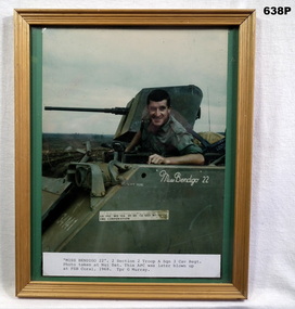
... A second tour of Vietnam was with A section 1st Australian Topographical Survey Regiment from 15.10.1969 to 15.10.1970....A second tour of Vietnam was with A section 1st Australian Topographical Survey Regiment from 15.10.1969 to 15.10.1970. ...Geoffrey Charles Murray (born Carlton Vic) No 3411521 served approximately 12 years in the Regular Army. Served Vietnam with A Sqd 3rd Cavalry Regiment (Armoured Personnel Carriers) from 27.11.1967 to 22.10.1968. Geoff was involved during that time in the Battles of Coral and Balmoral. A second tour of Vietnam was with A section 1st Australian Topographical Survey Regiment from 15.10.1969 to 15.10.1970.Colour photo Vietnam, Tpr G Murray sitting in his APC "Miss Bendigo 22". Photo is on a green background in wooden frame. Attached label explains time and place in Vietnam.apc’s, vietnam, military -
 National Vietnam Veterans Museum (NVVM)
Functional object - Wooden stamp, Vietnamese
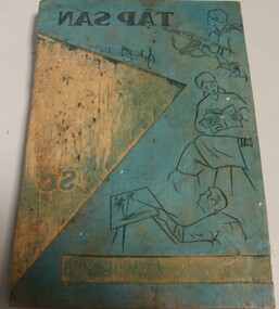
... Donated by National Serviceman Corporal L C Rotherham who served in the Royal Australian Survey Corps, in Headquarters, Australian Force Vietnam (Army Component) from 12 Dec 1966 - 03 Feb 1967 and A Section, 1st Topographical Survey Troop from 19 Jul 1967-18 Mar 1968. ...Donated by National Serviceman Corporal L C Rotherham who served in the Royal Australian Survey Corps, in Headquarters, Australian Force Vietnam (Army Component) from 12 Dec 1966 - 03 Feb 1967 and A Section, 1st Topographical Survey Troop from 19 Jul 1967-18 Mar 1968. ...This propaganda printing block was captured during clearing of the Long Hai Tunnels in the Minh Dam Secret Zone in December 1967. Donated by National Serviceman Corporal L C Rotherham who served in the Royal Australian Survey Corps, in Headquarters, Australian Force Vietnam (Army Component) from 12 Dec 1966 - 03 Feb 1967 and A Section, 1st Topographical Survey Troop from 19 Jul 1967-18 Mar 1968. Particle Board Stamp. Wooden Stamp. Blue laminate showing soldier, lady reading a book; someone taking photo and a person painting. Music notes. Captured Propaganda PrintCaptured Dec 1967 Long Hai's Tunnels - hand written on the back in blue penstamp, propaganda, vietnamese, print, rotherham, survey troop -
 Bendigo Military Museum
Administrative record - Geodetic Survey and Topographical Mapping in Australia - Report by BP Lambert 1968, 1968
... Geodetic Survey and Topographical Mapping in Australia - Report by BP Lambert 1968...Geodetic Survey and Topographical Mapping in Australia - Report by BP Lambert 1968...National coordination of their respective geodetic survey and topographic mapping activities is effected on the advice of a National Mapping Council. ...Geodetic Survey and Topographic Mapping a Report by BP Lambert Director of National Mapping, Department of National Development, Canberra, Australia, 1968....Geodetic Survey and Topographical Mapping in Australia - Report by BP Lambert 1968 Administrative record Geodetic Survey and Topographical Mapping in Australia - Report by BP Lambert 1968 BP Lambert, Director of National Mapping, Canberra ...Australia is governed by a Federal Government and by six State Governments. National coordination of their respective geodetic survey and topographic mapping activities is effected on the advice of a National Mapping Council. Twenty years ago, at least 95% of Australia was poorly mapped and what maps existed were in need of revision. only a small area of the continent was covered by horizontal geodetic control and there was no scheme for a national levelling survey. Over the intervening period there has been an urgent and increasing demand for topographic maps varying from large scale contoured maps in support of specific engineering projects to rapid reconnaissance maps required for mineral prospecting in remote areas. Superimposed on this has been a defence requirement, specifically for military training areas, and generally for maps of the whole country. During the period much progress has been made. This paper reports on the progress from early colonial days through to the present time and finally hazards a prediction of future trends.Photocopy of 18-page typed report including diagrams, stapled top left-hand corner. Geodetic Survey and Topographic Mapping a Report by BP Lambert Director of National Mapping, Department of National Development, Canberra, Australia, 1968.royal australian survey corps, rasvy, fortuna, army survey regiment, army svy regt, asr, national mapping -
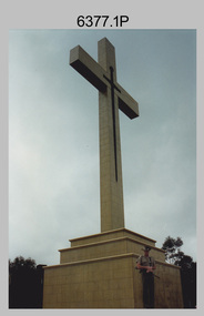 Bendigo Military Museum
Photograph - Army Survey Regiment Mount Macedon Memorial Cross Ceremony, 1995
... He served in the 2/1st Australian Topographical Survey Company in WW2 before reallocation to the 2/25th Australian Infantry Battalion. ...He served in the 2/1st Australian Topographical Survey Company in WW2 before reallocation to the 2/25th Australian Infantry Battalion. ...This set of six colour photographs of a Catafalque Party from the Army Survey Regiment was taken at the Mount Macedon Memorial Cross on the 19th of November 1995. The ceremony was held to commemorate the 60th anniversary and the refurbishment of the site. The refurbishment entailed the complete replacement of the cross and its surrounds. The cross is also known as the Cameron Memorial Cross and was built in 1935 as a memorial for those who lost their lives in the First World War. The Guest Speaker was Mr Bruce Ruxton AM MBE OBE, who at the time was the president of the Victorian RSL. He served in the 2/1st Australian Topographical Survey Company in WW2 before reallocation to the 2/25th Australian Infantry Battalion. He was the president of the Victorian RSL from 1979 to 2002 and was a staunch vocal advocate for the health and welfare of war veterans and their families. Refer to the Wikepedia web site for more detail on the history of the Mount Macedon Memorial Cross and Mr Bruce Ruxton AM MBE OBE.This set of six colour photographs of a Catafalque Party from the Army Survey Regiment was taken at the Mount Macedon Memorial Cross on the 19th of November 1995. The photographs were printed on photographic paper and are part of the Army Survey Regiment’s Collection. The photographs were scanned at 300 dpi. .1) - Photo, colour, 1995. Mount Macedon Memorial Cross Ceremony, SPR James Commons in foreground. .2) - Photo, colour, 1995. Mount Macedon Memorial Cross Ceremony, Guest Speaker - Mr Bruce Ruxton AM MBE OBE. .3) - Photo, colour, 1995. Mount Macedon Memorial Cross Ceremony, SPR Katie Royce, unidentified soldier in background. .4) - Photo, colour, 1995. Mount Macedon Memorial Cross Ceremony, James Commons. .5) - Photo, colour, 1995. Mount Macedon Memorial Cross Ceremony, L to R: SSGT Peter Coles, SPR James Commons. .6) - Photo, colour, 1995. Mount Macedon Memorial Cross Ceremony, SPR James Commons. Each photo is annotated ‘Mt Macedon Memorial Cross Ceremony 19 Nov 95. Mr Bruce Ruxton AM MBE, OBE, SSGT Peter Coles, SPR Katie Royce and SPR James Commons are identified on the photos. royal australian survey corps, rasvy, army survey regiment, army svy regt, fortuna, asr -
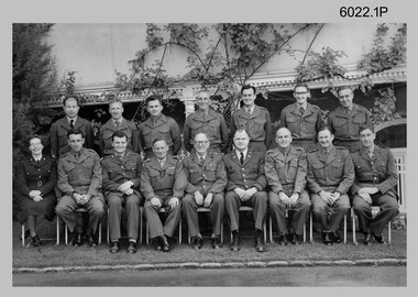 Bendigo Military Museum
Photograph - Commissioned Officers of the Army Survey Regiment, c1962-1965, 1972, c1973-1974
... Survey Regiment circa 1962-1965, 1972 and circa 1973-1974. Officer appointments to the Army Svy Regt were typically the CO, 2IC, Adjutant; and an OC, 2IC and Troop Officers assigned to the Headquarters, Topographic/Air Survey, Cartographic and Lithographic Squadrons. ...Survey Regiment circa 1962-1965, 1972 and circa 1973-1974. Officer appointments to the Army Svy Regt were typically the CO, 2IC, Adjutant; and an OC, 2IC and Troop Officers assigned to the Headquarters, Topographic/Air Survey, Cartographic and Lithographic Squadrons. ...These photographs of Royal Australian Survey Corps commissioned officers was taken at the Army Survey Regiment circa 1962-1965, 1972 and circa 1973-1974. Officer appointments to the Army Svy Regt were typically the CO, 2IC, Adjutant; and an OC, 2IC and Troop Officers assigned to the Headquarters, Topographic/Air Survey, Cartographic and Lithographic Squadrons. RAN and RAAF liaison officers were usually appointed to the Regiment; and occasionally exchange officers from other Corps, the USA or UK.This is a set of photographs of RASvy Officers at the Army Survey Regiment, Bendigo. The photographs were printed on photographic paper and are part of the Army Survey Regiment’s Collection. The photographs were scanned at 300 dpi. .1) - Back row – L to R: Unknown Philippines officer, LT Merv Marks, LT Jorge Gruszka, LT Bill Greer, CAPT Peter Constantine, LT Freddy High, MAJ Brian Dalton.Front row – L to R: CAPT Carol Castor, MAJ NRJ Hillier, MAJ Bill Howarth, CO LTCOL Frank Buckland, DSVY-A COL Don Macdonald, GEN Miller – US Director Mapping, MAJ John Nolan, MAJ Eddy Anderson MBE, unknown UK Exchange Officer. .2) - Photo, black & white, c1972. Back row – L to R: CAPT Jack Gore, LT Royal, FLT Sinclair, LT Fred Brown, LT John Winzar, LT Gary Kenney, LT Reg Smith, 2LT Terry Edwards, LT Bob Roche. Front row – L to R: CAPT McNeale, 2LT William, MAJ Keith Todd, MAJ Don Ridge, LTCOL Bill Howarth, MAJ Brian Dalton, MAJ John Bullen, LT C. Chittleborough, LT Bailey .3) - Photo, black & white c1972. Back row – L to R: 1st 2LT Terry Edwards, 7th LT Gary Kenney, 9th LT Bob Roche. Front row – L to R: 1st CAPT Jack Gore, 3rd LT Bailey, 4th MAJ Keith Todd, 5th MAJ Don Ridge, 6th LTCOL Bill Howarth, 7th MAJ Brian Dalton, 8th MAJ John Bullen, 9th FLT Sinclair, 10th CAPT McNeale. .4) - Photo, black & white, c1972. Personnel named as per .3) .5) - Photo, black & white, c1973-1974. Back row – L to R: 1st LT Graham Baker, 4th MAJ John Sinclair , 7th CAPT Reg Smith, 8th LT Terry Edwards. Front row – L to R: 3rd MAJ Peter Constantine, 4th LTCOL Don Ridge 5th MAJ John Cattell. .6) - Photo, colour print of .5), c1973-1974 Personnel named as per .5).1 no annotation, .2 Personnel (surnames, no rank) annotated on back, .3 to .6 no annotationroyal australian survey corps, rasvy, army survey regiment, army svy regt, fortuna, asr -
 Bendigo Military Museum
Photograph - CSP In-house Bid Announcement, Army Survey Regiment, Fortuna, Bendigo, 1994
... Other options offered to Survey Corps personnel were postings to 1st Topographic Survey Squadron in Enoggera, QLD, transfer to another Corps in the Australian Army or discharge from the ADF. ...Other options offered to Survey Corps personnel were postings to 1st Topographic Survey Squadron in Enoggera, QLD, transfer to another Corps in the Australian Army or discharge from the ADF. ...This is a set of 14 photographs of an All-Staff meeting held by the lake at the Army Survey Regiment, Fortuna, Bendigo on the 24th of April 1994. At this meeting CO LTCOL Duncan Burns announced that under Defence’s Commercial Support Program (CSP), the In-House bid submitted in 1993 by a team led by then CO LTCOL Bob McHenry was successful. The In-House bid proposed the establishment of an organisation based at Fortuna to carry out non-core production with 150 of the 373 Survey Corps positions converted to Defence civilian positions. 110 of the Defence civilian positions would be filled voluntarily by military personnel under Section 81B of the Public Service Act 1992 with the remaining 40 positions filled by Public Service recruitment. Other options offered to Survey Corps personnel were postings to 1st Topographic Survey Squadron in Enoggera, QLD, transfer to another Corps in the Australian Army or discharge from the ADF. The In-House bid also proposed 143 Survey Corps military positions to remain at Fortuna to perform ‘core strategic non-sovereign tasks.’ However, Army subsequently decided to abolish the 143 positions, disband 4th Field Survey Squadron, Adelaide, SA and lastly, the demise of the Royal Australian Survey Corp in June 1996. This period of the Army Survey Regiment’s history is covered in more detail in pages 160 to 162 of Valerie Lovejoy’s book 'Mapmakers of Fortuna – A history of the Army Survey Regiment’ ISBN: 0-646-42120-4.This is a set of 14 photograph of an All-Staff Meeting held at the Army Survey Regiment, Fortuna, Bendigo on the 24th of April 1994, to announce the success of Army’s Defence’s Commercial Support Program (CSP) In-house Bid. The Black and white photos are on photographic paper and scanned at 300 dpi. They are part of the Army Survey Regiment’s Collection. .1) to .3) - Photo, black & white, 1994. CO LTCOL Duncan Burns briefing Army Survey Regiment personnel and civilians. .4) to .5P - Photo, black & white, 1994. D-SVY COL Simon Lemon briefing Army Survey Regiment personnel and civilians. .6) - Photo, black & white, 1994. L to R: D-SVY COL Simon Lemon, unidentified civilian. .7) - Photo, black & 1994. L to R: SCMA WO1 Alan Hancox, unidentified civilian. .8) - Photo, black & 1994. RSM WO1 Phil Meagher. .9) - Photo, black & 1994. WO2 Rob Bogumil. .10) - Photo, black & 1994. Left Row: all unidentified. Centre Row L to R: unidentified (x2), SGT Jim Ash, CPL Steve Linane, CPL Andrew Quin, SGT Craig Kellet, unidentified. Back row L to R: unidentified (x2), SGT Barry Miller, SSGT Steve Winner, SPR Shane Campbell, SPR Karen McQuaigue, CPL Geoff Webb. .11) - Photo, black & 1994. L to R: CPL Warren ‘Waldo’ Shirley, COL COMDT COL Don Swiney MBE. .12) - Photo, black & 1994. L to R: LT Scott Seefeld, CAPT Bin Fashar Sutiman (Indonesian Army), LT Darren Radford, CAPT Gary Warnest, unidentified US exchange officer. .13) - Photo, black & 1994. L to R: unidentified, SGT Mark Host, LT Anthony Chamberlayne, unidentified (x2), Mr Tony Spurling. .14) - Photo, black & 1994. L to R: unidentified US exchange officer, CAPT Bill Griggs, CAPT Matt Jackson CSM, LT Darren Radford, unidentified, LT Scott Seefeld, SGT Mark Host, LT Gordon Muir, CAPT Gary Warnest, LT Anthony Chamberlayne, unidentified (x2), LT Colin Davidson.No personnel are identified. Annotated with date on folder sleeve.royal australian survey corps, rasvy, army svy regt, army survey regiment, fortuna, asr