Showing 70 items matching "tree of the month"
-
 Friends of Ballarat Botanical Gardens History Group
Work on paper - Wellingtonia, Autumn 2014, Tree of the Month, Autumn, 2014
... Tree of the Month......Tree of the Month...This is a printed page with 2 maps of the Globe, right-hand side of the page. Tree of the Month Work on paper Wellingtonia, Autumn 2014 ...This page gives historical information of Gondwana found in the Ballarat Botanical Gardens.These families of plants are confined originally to Australasia and South America and at least 15 are to be found in the Ballarat Botanical Gardensp.4 of the Friends of Ballarat Botanical Gardens periodical, The Wellingtonia. This is a printed page with 2 maps of the Globe, right-hand side of the page.None.john garner, doctor, doctor john garner, tree of the month, gondwana trees in the ballarat botanical gardens, friends of ballarat botanical gardens, history group, conifers, bunya bunya pine, monkey puzzle, wellingtonia, araucaria, john garner collection, gardens, ballarat -
 Ballarat Heritage Services
Photograph, Clare Gervasoni, Ann Gervasoni at the Guildford Big Tree, 2024, 02/04/2024
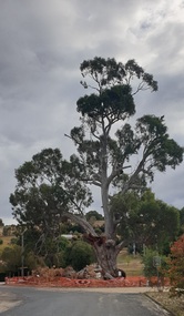
... Photograph of the Guildford Big Tree around a month after two big limbs dropped....Ballarat Heritage Services PO Box 2209 Bakery Hill Post Office goldfields Guildford Big Tree Guildford Photograph of the Guildford Big Tree around a month after two big limbs dropped. Ann Gervasoni at the Guildford Big Tree, 2024 Photograph Clare Gervasoni ...Photograph of the Guildford Big Tree around a month after two big limbs dropped.guildford big tree, guildford -
 National Wool Museum
Textile - Cloak, Dr Deanne Gilson, Campfire Gathering, Meeting Place Cloak, 2022
... Shields were taken from the tree in the colder months when the tree was cold as the wood came off cleaner. ...Shields were taken from the tree in the colder months when the tree was cold as the wood came off cleaner. ...Standing proud, still here, the spirit of ten ancestral matriarchs adorned in contemporary ceremonial cloaks. Representing our women past, present and future, her Spirit, our culture, our Country (spelt with a capital for its importance and this is part of First Peoples protocols on acknowledging Country, our strength, our resilience and healing towards a sustainable future). The circle and diamond pattern are ancient symbols used by Wadawurrung people dating pre-colonisation on possum skin and kangaroo skin cloaks, other artefacts like spear heads (carved), wooden shields, stone tools and caves were painted with blood, ochre and bound with grass tree sap, black wattle tree sap and kangaroo fats. The diamond pattern was a strong design used by men on shields and women on baskets and adornments. Shields were taken from the tree in the colder months when the tree was cold as the wood came off cleaner. Ochre colours of red, white, yellow and charcoal were often used to colour in and decorate the skin side of possum skin cloaks, wooden shields, spear heads, baskets and some coolamon bowls.The design for this cloak has been simplified from the original artefact design.Cloak with black and white diamond and circle design on outer cloak and coral and white line pattern within lining. Trimming is solid black. Cloak is machine sewn and handstitched with hand stitching on shoulder seam.deanne gilson, wadawurrung, first nations, cloak -
 Eltham District Historical Society Inc
Photograph, Tess Justine (Nillumbik Shire Council), Murray's Bridge over the Diamond Creek, Eltham North, 19 Feb 2022
... Flood damage was ongoing, and even more recently constructed raised bridges kept getting washed away, e.g., the new Wattle Tree Road bridge in 1958 just months after completion. Murray’s bridge was reinforced with steel some 30 years ago presumably to provide additional floodwater resistance, given the history of bridges disappearing in floodwaters...Flood damage was ongoing, and even more recently constructed raised bridges kept getting washed away, e.g., the new Wattle Tree Road bridge in 1958 just months after completion. Murray’s bridge was reinforced with steel some 30 years ago presumably to provide additional floodwater resistance, given the history of bridges disappearing in floodwaters ...Murray's Bridge over the Diamond Creek on the Diamond Creek Trail just prior to demolition and replacement with a new steel bridge. Heritage advice obtained by Nillumbik Shire Council, following a suggestion by the Eltham District Historical Society (EDHS), is that the original bridge appears to have been a simplified version of the Country Roads Board’s (CRB) standard timber bridge design of the early-to-mid 1920s. In c1990 Murray’s bridge was renovated with three recycled steel girders as part of a bike/pedestrian path in the reserve. During these alterations many parts of the bridge were removed, and some were replaced. Heritage advice indicates the condition of Murray’s bridge is poor. The remaining original parts are all in poor condition, with severe weathering, splitting and rot, especially to the stringers retained on the bridge. Heritage advice is that Murray’s Bridge does not have sufficient significance in the cultural history of the Nillumbik area to warrant inclusion in the Nillumbik Shire Heritage Overlay and also does not have sufficient significance as a rare survivor to warrant inclusion in the Nillumbik Shire Heritage Overlay. There are no indications in the historical record that this site was individually important to the cultural history of this area. EDHS is comfortable with the heritage advice provided to Council and has worked closely on this project with Council. EDHS has suggested some of the removed timbers be used in the vicinity of the bridge for landscaping and possibly seating, so as to retain these remnants close to the site of the original bridge, which is the last old timber bridge along the lower reaches of the Diamond Creek. Mary (Sweeney) Murray and John Wright Murray selected 80 acres, Lot C Section 16 and Lot 5 Section 17 Parish of Nillumbik, under an occupation license in 1866. John died in 1867 and freehold was granted to his son John in 1873. The farm was known as ‘Laurel Hill’. John Junior was an Eltham Shire councillor and sometime president from 1887 up until 1897. He added Lot A Section 16 to the farm in ca1888. John and his younger brother James arranged to rent/purchase Lot B Section 17, across Diamond Creek to the west, in ca1900. It appears that John and James farmed separately for a few years, with a new homestead built for James ad family on the high point of Lot B Section 17 in ca1910. John sold off Lot 5 Section 17 in 1912. When John died in 1912 James took over the land on both sides of the Diamond Creek. The old homestead on the west side of the Creek disappeared. A farm bridge over Diamond Creek from this period may have been located close to the northern boundary of the farm. John Langlands, owner of the farm known as ‘Ihurst’ on the west side of Diamond Creek to the south of the Murray’s land, died in 1907. In 1909 his land was then subdivided into 100 lots to become the ‘Glen Park Estate’. Other similar subdivisions of nineteenth century farms around Eltham in this period included the ‘Franktonia (or Beard’s) Estate’ to the northeast and ‘Bonsack’s Estate’ between Eltham and Greensborough. Soon after the opening of the railway extension line from Eltham to Hurstbridge in 1912, Glen Park and nearby residents including James Murray agitated for a railway station or siding to be located half-way between Eltham and Hurstbridge, so that the Glen Park residents who used the railway daily did not have to walk into the Eltham or Hurstbridge stations. Some believed Coleman’s Corner (opposite Edendale Farm) was an appropriate spot for the platform. James Murray was among those who thought the railway should be located on his land, closer to half-way between Eltham and Hurstbridge stations. The Railways Commissioners warned that the locals would have to fund these works themselves. The Glen Park Estate residents initially had difficulty accessing Eltham by road, with only an old low-level bridge over Diamond Creek at the south end of their estate. A new timber trestle bridge across the creek, now on Wattletree Road, was opened in 1915. Road access to the north was gained in 1927 when the new Murray’s Road, which crossed the Murray’s land, was built. Residents continued to agitate for a Glen Park station. By 1926 the Railways Commissioners’ preferred site was on the Murray’s land. They arranged an estimate of cost of a full-length platform. The estimate was too much for the locals, who in 1928 argued unsuccessfully for a shorter and hence cheaper platform. By 1929 Murray had agreed to donate the land, but the locals would still have to fund the works. Murray decided, unilaterally it would appear, to commence work on a timber trestle road bridge over Diamond Creek to link the new Murray Road to the proposed station. Late in 1929 he stopped work on the bridge, for reasons unknown, but started work again and completed the bridge in 1931. There is no further newspaper evidence of the campaign for the Glen Park station until 1939, when Murray and another local, Mr Maxwell, met the Railways Commissioner. The Glen Park locale now included 45 homes on the west side of the creek and 20 on the Eltham side. Most of the residents used the train every day. The Commissioner remained adamant that only a full-length platform could be built for safety reasons. It appears the campaign dissolved at this point. The increasing move to cars may have had an impact. There is no evidence of Murray’s bridge ever being connected to Murray’s Road, or of it having wide use for any purpose by locals. James Murray died in 1947 and the farm was taken over by his son James (Jim). Jim started to sell off parts of the farm in the 1980s, retaining a few acres around the ca1910 homestead and building a new house there. Recreation reserves were established along the creek. In ca1990 Murray’s bridge was renovated with steel girders as part of a bike/pedestrian path in the reserve. The old farmhouse was demolished in ca2014. * * * A theory posted on local community Facebook groups was that the bridge was built in the 1860s and was built to be more robust than was necessary for the movement of cows from one side of the creek to the other. It was suggested the robustness was necessary to support the weight of gold ore being transferred from a mine on Murray’s land to a railway siding near Murrays Bridge (presumably for transfer and processing at Diamond Creek). Perhaps this may have been one of the motivators for Murray, who really knows? Knowing when mining operations ceased on his land and how that fits the overall timeline would be useful but at the time the bridge was built, local gold production was minimal at best. The known facts are: • The railway line came to Eltham in 1902. • The extension of the railway from Eltham to Hurstbridge was constructed in 1912 so no railway line even existed through Murray's property until 1912 and the Victorian Railways maps at the time show no such siding on Murray’s property. • In 1923 a new company was formed in anticipation of the old Diamond Creek Gold Mine being re-opened. The mine had been previously closed and flooded. It was noted in the press at the time that the mine was within a mile of the railway. Nothing really came of this. • Construction of Murrays Bridge was commenced by James Murray in early 1929 in anticipation of a proposed flag station being nominated on his land, but work ceased shortly afterwards. The proposed flag station was commonly referred to as Glen Park as the residents of the Glen Park Estate wanted Option 1, located near them with the platform adjacent to Colemans corner. This was probably never going to fly as it was virtually in eyesight of Eltham station. Allandale Road was the third option, but the Commissioners' preferred option was No. 2 - on Murray's property. • The Railway Commissioners were not going to finance any such station and the works had to be funded by private landowners and residents, hence Murray investing in this himself. • Murray recommenced work two years later and finished his bridge in 1931 but unfortunately for him, the proposed flag station never eventuated. The bluestone siding you reference may well have been built by Murray as part of the proposed station platform. • Up until then, apart from the Main Road bridge, which was washed away in 1924, virtually all local crossings over the Diamond Creek were low lying bridges – Kaylocks Bridge at Brougham Street, Diamond Street bridge, Glen Park Road bridge. It is expected that Murray also had a low-lying bridge to connect his land either side of the creek. These were all washed away or severely damaged multiple times in the 1920s. Lessons were learnt, and Murrays Bridge appears to have been built in accordance with Country Road Board standards of the time. Flood damage was ongoing, and even more recently constructed raised bridges kept getting washed away, e.g., the new Wattle Tree Road bridge in 1958 just months after completion. Murray’s bridge was reinforced with steel some 30 years ago presumably to provide additional floodwater resistance, given the history of bridges disappearing in floodwaters. • In March 1932 it was reported in the Advertiser that there were still some prospectors operating around Eltham North who apart from further scarring the face of the earth over the previous two years had gained significant experience but little gold - hardly a driving factor for constructing a dedicated railway siding and bridge to transfer gold ore. It is far more probable that James Murray was hoping to have the railway station located on his property and invested his money by building the bridge to lead to it as well as a station platform. Had the station eventuated, it may well have driven up the value of his land for subdivision and new housing estates like the Glen Park Estate. That did not eventuate. Whilst the bridge was indeed old (90 years), the core structure being completed in 1931, it had been modified substantially from original and hence had no significant historic value – i.e., it was not a representative example of its type, construction, and age. Given that the bridge was not worthy of saving, the Eltham District Historical Society with Council’s support, and the Eltham Woodworkers group endeavoured to see what suitable sized timbers were salvageable to fabricate a commemorative seat. Unfortunately, the experts at the Woodworkers group were unable to salvage any suitable length/width timbers to fabricate the seat due to the presence of rot. Last remaining wooden trestle bridge on the Diamond Creek Trail just prior to demolition and replacementBorn digital image (27)diamond creek (creek), diamond creek trail, murrays bridge, ‘laurel hill’, john wright murray, mary (sweeney) murra, john murray jnr, james murray, john langlands, ‘ihurst’, ‘glen park estate’, beard's estate, franktonia, bonsack's estate, glen park estate, glen park railway station -
 Kiewa Valley Historical Society
Photograph - Mt Bogong - Tawonga, 06/05/1937
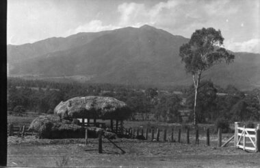
... months. It is around 30 kilometres (19 mi) by road and walking track or 12 kilometres (7.5 mi) direct to Mount Beauty. Falls Creek and Mount Hotham ski resorts are also nearby. Camping is relatively safe below the tree...months. It is around 30 kilometres (19 mi) by road and walking track or 12 kilometres (7.5 mi) direct to Mount Beauty. Falls Creek and Mount Hotham ski resorts are also nearby. Camping is relatively safe below the tree ...Mount Bogong located in the Alpine National Park and part of the Victorian Alps of the Great Dividing Range, is the highest mountain in Victoria, Australia, at 1,986 metres (6,516 ft) above sea level. The Big River separates the massif of the mountain from the Bogong High Plains to the south. From the nearby town of Mount Beauty to its summit, Mount Bogong rises more than 1,600 metres (5,200 ft), thus making it one of the highest peaks in Australia not only in terms of its elevation above sea level, but also in terms of actual base-to-summit prominence. Mount Bogong is a popular backcountry skiing mountain through winter but only has snow for the mid winter-spring months. It is around 30 kilometres (19 mi) by road and walking track or 12 kilometres (7.5 mi) direct to Mount Beauty. Falls Creek and Mount Hotham ski resorts are also nearby. Camping is relatively safe below the tree line but the summit ridgeline is very exposed. Emergency shelter is also available at Bivouac Hut on the Staircase Spur, and at Cleve Cole, above Camp Creek on the broad ridge to the south of the summit, and Michells Hut on the Eskdale Spur. Mt Bogong is a popular recreational venue in the Kiewa Valley for back country skiing and bush walking and is a favourite with sightseers and popular subject for photographersBlack and white photograph of Mt bogong taken from Tawonga - Thursday May 6th, 1937Handwritten on back of photograph. Thursday May 6th, 1937. Mt Bogong Tawongamt bogong, tawonga, kiewa valley -
 Kiewa Valley Historical Society
Sash, Mount Beauty Garden Sash
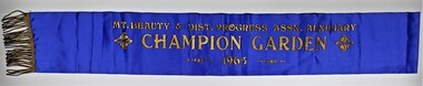
... trees and topsoil for their gardens. It was not long before there was very keen competition amongst the families to create the best garden. 1948 A Mount Beauty Garden competition started with a first prize of 15 pounds, second 7 pounds and third 3 pounds. As the oldest garden in the competition was only 25 months...trees and topsoil for their gardens. It was not long before there was very keen competition amongst the families to create the best garden. 1948 A Mount Beauty Garden competition started with a first prize of 15 pounds, second 7 pounds and third 3 pounds. As the oldest garden in the competition was only 25 months ...1947 The SEC created an Arboretum and Nursery on the bank of the West Kiewa River. Householder could collect free plants, trees and topsoil for their gardens. It was not long before there was very keen competition amongst the families to create the best garden. 1948 A Mount Beauty Garden competition started with a first prize of 15 pounds, second 7 pounds and third 3 pounds. As the oldest garden in the competition was only 25 months old and most were younger a handicap system of 4 points per month was devised. Tom Mitchell MLA was the donor and judge. 1965 This sash was possibility worn by Jean McCullough in 1965 when the Mt Beauty & District Progress Association Auxiliary ran the completion.An example of the social life at Mt Beauty during the construction of the Kiewa Hydro Electric Scheme.Royal blue sateen sash with gold fringe. Mt. BEAUTY & DIST. PROGRESS ASSN. AUXILIARY/CHAMPION GARDEN/1965textiles, arboretum, mount beauty, garden competition, kiewa hydro electric scheme -
 Kiewa Valley Historical Society
Photos, Postcards - Kiewa Valley
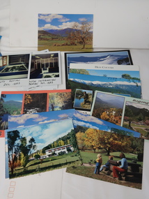
... During the winter months, Falls Creek provides access to Falls Creek Ski Village for snow sports. Tawonga, 6.5 km north of Mt Beauty, is famed for its trout fishing and camping on the Kiewa River. Deciduous trees ...Mt Beauty township, at the head of the Kiewa Valley, is situated at the foot of Mt Bogong. The town was established by the State Electricity Commission of Victoria during the construction of the Kiewa Hydro Electric Scheme on the High Plains.Mt Beauty is a popular tourist resort. The main highway from Mt Beauty to the Bogong High Plains is most picturesque throughout the year. During the winter months, Falls Creek provides access to Falls Creek Ski Village for snow sports. Tawonga, 6.5 km north of Mt Beauty, is famed for its trout fishing and camping on the Kiewa River. Deciduous trees make a show of colour during Autumn. The postcards are of historical value showing photos taken at an earlier time.The postcards can be compared to the attractions of the time as they do not include cycling (mountain bikes and road bikes), snow boarding, gliding and paragliding. Advertising for tourism has also changed as attractions are now available on-line. 1. 9 Coloured Photos of Bogong (5) and Visitors Information Centre display (4) 2. Two fold out coloured sets of postcards "Mt Beauty and the Kiewa Scheme", "Mt. Beauty Victoria" 3. x10 Coloured postcards Mt Beauty, Kiewa Valley, Bogong 4. x6 Coloured postcards High Country and Bogong Villagepostcards kiewa valley -
 Bendigo Military Museum
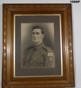
Photograph - PHOTOGRAPH WW1, FRAMED, c.1915 - 1918
... months leave. Worn on the arm it was to show they were not “Shirking” their duty. The War ended so after. Refer 1281 for his service history also 1283P. photography framed portrait WW1 Rear of frame: "Family Tree, Wife & Children. ...James Joseph Kirkham Regt No 685. The “A” on the Colour patch denotes he was an “Anzac”. The Rosette was called the “Anzac leave Rosette” Issued in September 1918 for 1914 enlistee’s who were sent home for 6 months leave. Worn on the arm it was to show they were not “Shirking” their duty. The War ended so after. Refer 1281 for his service history also 1283P.Coloured portrait, enhanced painted portrait of WW1 Soldier displaying on left arm a coloured A Patch above a red, white & blue rosette. Large, light timber frame with moulded decorations, brown boarded, with glass front.Rear of frame: "Family Tree, Wife & Children. James Joseph Kirkham. 8th Battalion. 1st Pioneers. 1st AIF ANZAC" "Married Elizabeth Cornelia Blackley, Wonthaggi Elsie Edith Kirlkham - Connell Olive Winifred Kirkham - Rothberger - Jenner Francis James Kirkham" Myrtle Florence Kirkham - McGillvray Alma Gwenth Kirkham - Baker George Thomas Philip Kirkhamphotography, framed, portrait, ww1 -
4th/19th Prince of Wales's Light Horse Regiment Unit History Room
Medal, Defence Medal, abt 1945
... months service in non-prescribed non-operational areas. Within Australia the area is the Northern Territory , north of 14 degrees 30 minutes south, and the Torres Strait Islands between 3 September 1939 and 2 September 1945. Overseas service includes the Middle East, east of the Suez Canal (less the period of the Syrian Campaign) or Malaya prior to the Japanese invasion on 8 December 1941. The Medal The Defence Medal is cupro-nickel, with the uncrowned effigy of King George VI on the obverse. The reverse has a conventional oak tree...months service in non-prescribed non-operational areas. Within Australia the area is the Northern Territory , north of 14 degrees 30 minutes south, and the Torres Strait Islands between 3 September 1939 and 2 September 1945. Overseas service includes the Middle East, east of the Suez Canal (less the period of the Syrian Campaign) or Malaya prior to the Japanese invasion on 8 December 1941. The Medal The Defence Medal is cupro-nickel, with the uncrowned effigy of King George VI on the obverse. The reverse has a conventional oak tree ...The Defence Medal was instituted to provide recognition for specified periods of service in non-operational areas subjected to air attack or closely threatened. Eligibility The Defence Medal is awarded for six months service in a prescribed non-operational area subject to enemy air attack or closely threatened, in Australia and overseas, or for 12 months service in non-prescribed non-operational areas. Within Australia the area is the Northern Territory , north of 14 degrees 30 minutes south, and the Torres Strait Islands between 3 September 1939 and 2 September 1945. Overseas service includes the Middle East, east of the Suez Canal (less the period of the Syrian Campaign) or Malaya prior to the Japanese invasion on 8 December 1941. The Medal The Defence Medal is cupro-nickel, with the uncrowned effigy of King George VI on the obverse. The reverse has a conventional oak tree centrally, with a crown above, with two lions counter rampart as supporters between the dates 1939 and 1945. The base of the medal reverse has the words ‘THE DEFENCE MEDAL'. The Ribbon The Defence Medal ribbon is orange with green outer stripes, each green stripe having a black pin-stripe running down the centre. The green represents the Islands of the United Kingdom, the orange represents enemy attacks, and the black represents the black outs.Full size and miniature medals with ribbonsnildefence medal -
 Kiewa Valley Historical Society
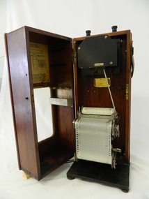
Meter Ammeter Recorder, Circa 1950
... month at locations experiencing unacceptable fluctuations of power. These locations would cover the North East regions of Victoria. They cover voltage drops at domestic and business properties especially those that were experiencing regular fluctuations(daily) at approximately the same time of the day. As the electrical network is required to operate within a set level of voltage, fluctuations outside of this has to be investigated and necessary remedial action taken. This is especially so for rural properties where power "drainage" can occur through animal/bird and tree...month at locations experiencing unacceptable fluctuations of power. These locations would cover the North East regions of Victoria. They cover voltage drops at domestic and business properties especially those that were experiencing regular fluctuations(daily) at approximately the same time of the day. As the electrical network is required to operate within a set level of voltage, fluctuations outside of this has to be investigated and necessary remedial action taken. This is especially so for rural properties where power "drainage" can occur through animal/bird and tree ...This testing voltmeter recorder was last certified by SEC Vic laboratories on the 17/4/77. It was used extensively as mobile recorder placed for periods of one month at locations experiencing unacceptable fluctuations of power. These locations would cover the North East regions of Victoria. They cover voltage drops at domestic and business properties especially those that were experiencing regular fluctuations(daily) at approximately the same time of the day. As the electrical network is required to operate within a set level of voltage, fluctuations outside of this has to be investigated and necessary remedial action taken. This is especially so for rural properties where power "drainage" can occur through animal/bird and tree interference. It can also be the result of defective wiring and overloading at peek operational times (milking machines).This mobile voltage recorder is very significant to the Kiewa Valley because it highlights the difficulties that can occur in maintaining a power supply that experiences fluctuating power demands by the rural industries that it supplies. The requirement of a mobile testing apparatus to cover the various sections in the Kiewa Valley and other rural areas in the northeast region is one of necessity as electricity once connected to a rural property is a labour saving supply as generators on rural properties require a higher degree of maintenance an ultimately at a higher cost. The testing of the SEC Vic supplied electricity to rural properties,those who had previously run on generators, had to be quick and unassuming with certainty of correct supply levels.The mechanism of this voltage recorder has been installed(by the manufacturer) into its own protective wooden box. This box has a front (swing open) lockable section which permits direct access to the installed measuring equipment (for servicing and data collection). The top section of the box has two screw on terminals for access to the machine being tested. This tester has its own inbuilt ink supply facilities and a mechanical clockwork device that unwinds a roll of paper onto a second roll at a rate of 10 mm per hour. The recording chart is marked with time slots against voltage. There is a recording arm which has an ink pen at the end. Both arm and pen carry the ink supply from the ink reservoir, located on the left side of the cabinet door in specially constructed bottle holder( three small bottle capacity). To record a suspect power problem to a home or business establishment the voltmeter is connected to a power supply outlet being tested and wind the recording clockwork mechanism (gives a four week running time). Before leaving the recorder in situ the electrician checks to see if the chart is recording the correct voltage and that the clock mechanism is advancing correctly.On the front of the access "door" at the top a metal label "RECORDING AMMETER" below this "MURDAY SYSTEM" below this "ALTERNATING CURRENT" and below this the manufacturer's registered number "No. 139156" Below this is a metal tag with State Electricity Commission of Victoria Electrical Engineer's Section equipment number "338" Below these tags and above the viewing window is the manufacturer's dtails "EVERSHED & VIGNOLES Led LONDON"sec vic kiewa hydro scheme, alternate energy supplies, alpine feasibility studies temperature, rainfall, power outages -
 Kiewa Valley Historical Society
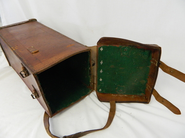
Case Volt Meter Recorder, Circa 1950 to 1977
... month at locations experiencing unacceptable fluctuations of power. These locations would cover the North East regions of Victoria. They cover voltage drops at domestic and business properties especially those that were experiencing regular fluctuations(daily) at approximately the same time of the day. As the electrical network is required to operate within a set level of voltage, fluctuations outside of this has to be investigated and necessary remedial action taken. This is especially so for rural properties where power "drainage" can occur through animal/bird and tree...month at locations experiencing unacceptable fluctuations of power. These locations would cover the North East regions of Victoria. They cover voltage drops at domestic and business properties especially those that were experiencing regular fluctuations(daily) at approximately the same time of the day. As the electrical network is required to operate within a set level of voltage, fluctuations outside of this has to be investigated and necessary remedial action taken. This is especially so for rural properties where power "drainage" can occur through animal/bird and tree ...This case is for a testing voltmeter recorder. The last time it was certified by SEC Vic laboratories on the 17/4/77. It was used extensively in the transportation of the mobile recorder which was sometimes placed for periods of one month at locations experiencing unacceptable fluctuations of power. These locations would cover the North East regions of Victoria. They cover voltage drops at domestic and business properties especially those that were experiencing regular fluctuations(daily) at approximately the same time of the day. As the electrical network is required to operate within a set level of voltage, fluctuations outside of this has to be investigated and necessary remedial action taken. This is especially so for rural properties where power "drainage" can occur through animal/bird and tree interference. See KVHS 0302 (A) for the instrument.This case for a mobile voltage recorder is very significant to the Kiewa Valley because it highlights the difficulties that can occur in maintaining a power supply that experiences fluctuating power demands by the rural industries that it supplies. The requirement of a mobile testing apparatus to cover the various sections in the Kiewa Valley and other rural areas in the northeast region is one of necessity as electricity once connected to a rural property is a labour saving supply as generators on rural properties require a higher degree of maintenance an ultimately at a higher cost. The testing of the SEC Vic supplied electricity to rural properties,those who had previously run on generators, had to be quick and unassuming with certainty of correct supply levels.This heavy and thick all leather case for the "easy" transportation of the Volt meter recorder has a opening top which pop riveted to the main body(rivets are aluminium). The all leather top has a shaped carrying handle which is also riveted on. There are two straps on the side of the top which can be fastened to the main body by metal "shoe" buckles. The bottom end is secured to the main bag by large rivets.Tick grade stitching is on all corners.Nilsec vic kiewa hydro scheme, alternate energy supplies, alpine growth in electricity consumption -
 Bendigo Military Museum
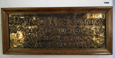
Plaque - BRONZE PLAQUE WW1, Post 1918 (estimated)
... months of age on 22.3.16 with the rank of Lieut in the 39th Batt. Embarked for England 27.5.16, embark for France 23.11.16, promoted Captain 23.4.17, WIA 7.6.17 shell wound to back, return to France 30.7.17, KIA 12.10.17 at Passchendaele. It is believed he was W.I.A and while being carried out by Stretcher Bearers a shell burst killing them all. No known grave. The plaque was one of many that were placed on trees...months of age on 22.3.16 with the rank of Lieut in the 39th Batt. Embarked for England 27.5.16, embark for France 23.11.16, promoted Captain 23.4.17, WIA 7.6.17 shell wound to back, return to France 30.7.17, KIA 12.10.17 at Passchendaele. It is believed he was W.I.A and while being carried out by Stretcher Bearers a shell burst killing them all. No known grave. The plaque was one of many that were placed on trees ...Henry Southby pre WW1 served 5 years in the Militia and 22 years on the Permanent staff. He is listed as No 2240 serving in the 4th Batt Aust Commonwealth Horse during the Boer War from March to September 1902. By the time he enlisted in the AIF he was 41 years 2 months of age on 22.3.16 with the rank of Lieut in the 39th Batt. Embarked for England 27.5.16, embark for France 23.11.16, promoted Captain 23.4.17, WIA 7.6.17 shell wound to back, return to France 30.7.17, KIA 12.10.17 at Passchendaele. It is believed he was W.I.A and while being carried out by Stretcher Bearers a shell burst killing them all. No known grave. The plaque was one of many that were placed on trees in Condon St. Bendigo as a memorial to those who lost their lives. Refer 1903.2, 1905P.Bronze plaque set in a wood frame re; H.SOUTHBY. Frame is brown, the plaque lettering is raised."CAPTAIN H. SOUTHBY 39th BATT. 10th INF. BGD. A.I.F KILLED IN ACTION OCTOBER 12th 1917"civic mementoes - plaques, handcrafts - woodwork, military history, southby -
 Bendigo Military Museum
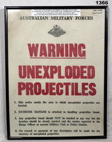
Poster - POSTER, FRAMED, C.1966
... On the back board - handwritten in red felt tip pen "The Tree Warning Poster/ was printed the same month/as the battle of Long Tan/ (18 Aug 1966 SVN) D Coy 6 RAR....Bendigo Military Museum 37 - 39 Pall Mall Bendigo goldfields David Waterston, refer Cat No 2410 for service details. documents - posters frame accessories signs- warnings On the back board - handwritten in red felt tip pen "The Tree Warning Poster/ was printed the same month/as the battle of Long Tan/ (18 Aug 1966 SVN) D Coy 6 RAR. ...David Waterston, refer Cat No 2410 for service details.Warning Unexploded Projectiles. Frame black painted metal, poster has red and black printed instructions on beige background. Small white label at top of frame contains information in black print.On the back board - handwritten in red felt tip pen "The Tree Warning Poster/ was printed the same month/as the battle of Long Tan/ (18 Aug 1966 SVN) D Coy 6 RAR.documents - posters, frame accessories, signs- warnings -
 Orbost & District Historical Society
Journal, Gippsland Heritage Journal, March 1996
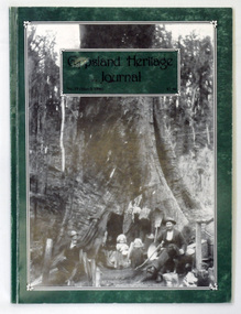
... Colin Silcock wrote of the tree on p.39 that the family lived int he hollowed-out butt for nine months in 1906-1907. ...Colin Silcock wrote of the tree on p.39 that the family lived int he hollowed-out butt for nine months in 1906-1907. ...The main photo is by Max Lowenhardt and shows John Green, Mrs Eva Penny (inside the tree and hardly visible) nursing Charlie, May, George and Nicolas Penny. Colin Silcock wrote of the tree on p.39 that the family lived int he hollowed-out butt for nine months in 1906-1907. It was 20 feet across at floor level with 12 feet of head room inside. Nicholas Penny ring-barked the tree in 1905, with it being 130 feet high with the top broken off. The fires the following year destroyed the tent in which he was living and hollowed out the tree. After "making a few alterations" Penny moved in and brought his wife and children across from Outtrim. They later built a more permanent home. The tree was destroyed in the 1926 bushfires. (ref Linda Barraclough)This magazine is a useful reference on Gippsland history.A 64 pp magazine, titled Gippsland Heritage Journal. It has a dark green cover with a photograph of the "Penny Tree" . The magazine is dated March 1996 and cost $7.50. It contains stories and photographs on the history of Gippsland.There is a library bar code on the outside back cover.gippsland-heritage-journal penny-tree history-gippsland -
 Orbost & District Historical Society
shakers, after WW11 (?)
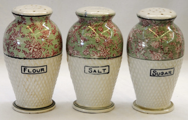
... months she travelled 9560 miles supervising their treatments. She eventually married Mr Hec Pow who had been left to bring up his three daughters after his wife died.. The Pows lived in Orbost where Hec Pow was worked with his father Fred at the saw mill in Cabbage Tree. ...months she travelled 9560 miles supervising their treatments. She eventually married Mr Hec Pow who had been left to bring up his three daughters after his wife died.. The Pows lived in Orbost where Hec Pow was worked with his father Fred at the saw mill in Cabbage Tree. ...These items were owned and used by Alice Pow (nee McWilliam), known as Maccie. Maccie was a nurse who came to Orbost in 1936. She was highly respected in Orbost for her nursing skills particularly during the 1938 outbreak of polio, Most patients were cared for in their homes and Miss McWilliam was sent out to care for them. Over 14 months she travelled 9560 miles supervising their treatments. She eventually married Mr Hec Pow who had been left to bring up his three daughters after his wife died.. The Pows lived in Orbost where Hec Pow was worked with his father Fred at the saw mill in Cabbage Tree. Maccie Pow was a member of the Orbost Bowling Club, Red Cross and Orbost Golf Club.Three vase shaped pottery shakers. Each has a cork stopper i n the base and sprinkle holes on the top. They are pale green coloured to half way and the rest is pale green with pink flowers. The surface is dimpled. On the base : ANDOVER Made in Japanchina tableware shakers pow-maccie mcwilliam-alice -
 Orbost & District Historical Society
food cover, 1940's (?)
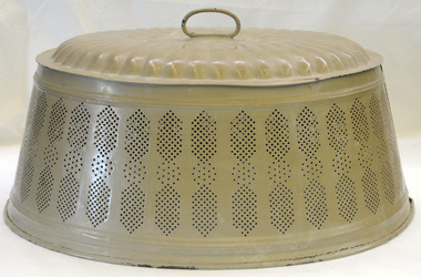
... months she travelled 9560 miles supervising their treatments. She eventually married Mr Hec Pow who had been left to bring up his three daughters after his wife died.. The Pows lived in Orbost where Hec Pow was worked with his father Fred at the saw mill in Cabbage Tree. ...months she travelled 9560 miles supervising their treatments. She eventually married Mr Hec Pow who had been left to bring up his three daughters after his wife died.. The Pows lived in Orbost where Hec Pow was worked with his father Fred at the saw mill in Cabbage Tree. ...This item was owned and used by Alice Pow (nee McWilliam), known as Maccie. Maccie was a nurse who came to Orbost in 1936. She was highly respected in Orbost for her nursing skills particularly during the 1938 outbreak of polio, Most patients were cared for in their homes and Miss McWilliam was sent out to care for them. Over 14 months she travelled 9560 miles supervising their treatments. She eventually married Mr Hec Pow who had been left to bring up his three daughters after his wife died.. The Pows lived in Orbost where Hec Pow was worked with his father Fred at the saw mill in Cabbage Tree. Maccie Pow was a member of the Orbost Bowling Club, Red Cross and Orbost Golf Club.An oval shaped metal food cover made of pressed tin painted tan. It has a loop handle on the top. The sides slope outwards and it is seamed on both sides. The bottom edge is rolled. The sides have a perforated design for air flow.food food-protection kitchen-ware pow-maccie mcwilliam-alice -
 Federation University Historical Collection
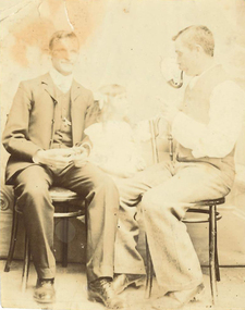
Photograph, James (Jim) Smith of Happy Valley
... months. George later married Annie Bolte with 2 more children being born. Annie later sold the property. The land was used for grazing and the two houses fell into disrepair. In 1995 George's grandson Ernest (Alf) Alfred Watson visited the site and reported a wrought iron gate at the site and a mulberry tree near the site of his grandmother's family home. ...months. George later married Annie Bolte with 2 more children being born. Annie later sold the property. The land was used for grazing and the two houses fell into disrepair. In 1995 George's grandson Ernest (Alf) Alfred Watson visited the site and reported a wrought iron gate at the site and a mulberry tree near the site of his grandmother's family home. ...James (Jim) Smith, (died 03/08/1974, aged 93 years) established an orchard growing snow apples near in Happy Valley after returning from mining activities in South Africa. The orchard was called "Springdallah" and was beside the Linton/Happy Valley Road across from the old Happy Valley railway station. Jim was the son of George Henry Smith (18/12/1840 - 26/11/1903) and Emma Keys Smith born Keys (07/08/1842 - 28/08/1888). George and Emma left Liverpool with other unassisted immigrants on the "Bates Family" ship with baby Clara on 08/06/1863 arriving in Melbourne on 08/06/1863. George and Emma emigrated to Australia on the invitation of Emma's brother Edward Keys who owned a property near the school at Happy Valley on which there were two houses. Teddy offered George and Emma the smaller one to live in. When "Teddy" decided to go into hotel keeping George took over the 200 acres of his property and made it a pleasant orchard and garden called "Cress Green Gardens". George had various secretarial jobs - rate collector; paymaster at the mines; until he became Shire Secretary for the Shire of Grenville, whose centre was Linton and Government Auditor for Western Victoria (1894-1903), the means of transport being horse and buggy. Another son followed his father as Shire Secretary. George and Emma had 14 children, Emma dying giving birth to Emma Keys who lived for 16 months. George later married Annie Bolte with 2 more children being born. Annie later sold the property. The land was used for grazing and the two houses fell into disrepair. In 1995 George's grandson Ernest (Alf) Alfred Watson visited the site and reported a wrought iron gate at the site and a mulberry tree near the site of his grandmother's family home. Bluestone blocks can still be seen in the paddocks from the roadside. The child in the photograph is Phyllis Joy Smith, Jim's eldest daughter. Jim Smith was the brother of Clara Emma Yung nee Smith.Sepia photo of two men and a girl. One of them is Jim Smith who established on orchard at Happy Valley. He also went to South Africa - mining activities. The orchard is now part of Clarkesdale Bird Sanctuary located at 360 Linton-Piggoreet Rd, Linton, Vic. 3360. Verso: Jim Smith South Africa (Mining) Established orchard halfway near Linton and Happy Valley. Clara Emma's brother. jim smith, james smith, clara emma smith, happy valley, yendon, piggoreet, south africa, mining, orchard, edward keys, george henry smith, emma keys smith, clara emma yung, annie bolte, shire of grenville, clarkesdale bird sanctury -
 Conservation Volunteers
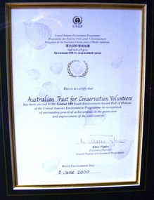
Award: Honour Roll, United Nations Environment Program (UNEP) - 1 June 2000 - The UNEP announced that the Australian Trust of Conservation Volunteers of Australia (ATCV), has been elected to the prestigious ranks of its Global 500 Roll of Honour for outstanding contributions to the protection of the environment, Award:United Nations Environment Program (UNEP) - 1 June 2000 - UNEP announced today that the ATCV has been elected to the prestigious ranks of its Global 500 Roll of Honour for outstanding contributions to the protection of the environment
... trees planted over the past 10 years. Community involvement totalled 200,000 project days in 1999 and more than 700,000 days since 1989. To encourage the involvement of young people, ATCV developed and manages the federal government-funded programme Green Corps. Green Corps is a six-month...trees planted over the past 10 years. Community involvement totalled 200,000 project days in 1999 and more than 700,000 days since 1989. To encourage the involvement of young people, ATCV developed and manages the federal government-funded programme Green Corps. Green Corps is a six-month ...THE AUSTRALIAN TRUST OF CONSERVATION VOLUNTEERS, ONE OF 14 INDIVIDUALS AND ORGANIZATIONS, TO RECEIVE UNITED NATIONS ENVIRONMENT AWARD NAIROBI, 1 June 2000 - The United Nations Environment Programme (UNEP) announced today that the Australian Trust of Conservation Volunteers of Australia (ATCV), has been elected to the prestigious ranks of its Global 500 Roll of Honour for outstanding contributions to the protection of the environment. ATCV is one of 14 individuals and organizations to receive this honour in 2000. Founded in 1982, ATCV is a national, not-for-profit community organization, whose mission is to attract and manage a force of volunteers in practical conservation projects for the betterment of the Australian environment. ATCV completes more than 4000 week-long conservation projects in urban, regional and remote areas of Australia each year. Activities range from bush regeneration, tree planting, seed collection, endangered species protection, weed control, flora and fauna surveys, walking trail construction, fencing, environmental monitoring and the protection of world heritage areas. ATCV community participation has resulted in more than 1.8 million trees being planted in 1999, and in more than 7.3 million trees planted over the past 10 years. Community involvement totalled 200,000 project days in 1999 and more than 700,000 days since 1989. To encourage the involvement of young people, ATCV developed and manages the federal government-funded programme Green Corps. Green Corps is a six-month traineeship for 17 to 20 year-olds, which incorporates conservation projects and accredited training. Since 1997, more than 4,000 trainees have completed the Green Corps programme. ATCV is a founding member of the International Conservation Alliance, which brings together organizations working in conservation volunteering, and is a member of the World Conservation Union (IUCN). " The award will be presented in Adelaide, Australia, at the World Environment Day ceremonies on 4 June 2000. World Environment Day, which is celebrated in some 120 countries around the world on 5 June, was established by the United Nations General Assembly in 1972 to focus global attention and action on environmental issues. Some 701 individuals and organizations, in both the adult and youth categories, have been honoured since UNEP launched the Global 500 award in 1987. Among prominent past winners are: French Marine explorer Jacques Cousteau; Sir David Attenborough, producer of environmental television programmes; Gro Harlem Brundtland, former Prime Minister of Norway; Anil Aggarwal, the prominent environmentalist from India; Ken Saro-Wiwa, the environmental and human rights activist from Nigeria who was executed for leading the resistance of the Ogoni People against the pollution of their Delta homeland; the World Wide Fund for Nature (WWF), Jimmy Carter, former President of the United States; Jane Goodall of the United Kingdom whose research on wild chimpanzees and olive baboons provided insight into the lives of non-human primates; and the late Chico Mendes, the Brazilian rubber tapper who was murdered during his fight to save the Amazon forest. To forge global links and to implement ideas, which can contribute to a more sustainable future, a network of all Global 500 laureates has been formed. Information about this unique network can be obtained at http://www.global500.org. The winners of UNEP's Global 500 Roll of Honour are members of a broad and growing environmental movement that is flourishing around the world. They have taken the path that most of us hesitate to take for want of time or caring," says UNEP's Executive Director, Klaus Toepfer. "In honouring the Global 500 laureates, UNEP hopes that others will be inspired by their extraordinary deeds."Certificatecva, conservation volunteers, conservation volunteers australia, conservation volunteers new zealand, colin jackson, better earth, environmental conservation, volunteers, volunteering, corporate volunteering, education – environmental, carbon footprint, climate change, ballarat, safety, training, partnerships, victoria, vic, nsw, queensland, act, australian capital territory, nt, northern territory, western australia, wa, south australia, sa, tasmania, new zealand, california conservation corps, atcv, unep, unep honour roll, united nations environment program -
 Eltham District Historical Society Inc
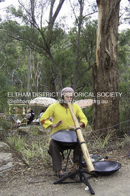
Photograph - Digital Photograph, Marguerite Marshall, Jesse Tree playing the Didgeridoo and Swiss Hang Drum at St Andrews Market, 29 March 2008
... tree roots from erosion and compaction. The Department of Sustainability and Environment threatened to close the market if the degradation was not rectified. After many months...tree roots from erosion and compaction. The Department of Sustainability and Environment threatened to close the market if the degradation was not rectified. After many months ...Published: Nillumbik Now and Then / Marguerite Marshall 2008; photographs Alan King with Marguerite Marshall.; p175 It’s Saturday morning and thousands of people are visiting St Andrews Market at the corner of Heidelberg-Kinglake Road and Proctor Street. It’s hard to find a park. Cars are banked up along the narrow road and crammed in a nearby parking area. Yet, at the market, people look relaxed and happy amongst the yellow box gums on the site where the Wurundjeri people used to gather. Stone artefacts unearthed there by Koorie researcher, Isabel Ellender, indicate the site was once a Wurundjeri meeting place, according to Aboriginal Affairs Victoria. Acoustic sounds mingle with quiet conversations. A guitarist blows a mouth organ while his bare toes tickle chimes. A tiny busker, perhaps five years old, plays a violin while sounds of a harp emerge from the hall. One stallholder, selling delicious-looking pastries, chats to another in Spanish, then to me in broad Australian. ‘I was born in Fitzroy but my mother came from Mexico and my dad from Serbia,’ she smiles. A New Zealander fell in love with Mongolia and now imports their hand-made embroidered clothes and Yurts (tents) and runs adventure tours. A young woman visited Morocco and when friends admired the shoes she bought, she decided to import them and sell them at the market. Oxfam sells Fair Trade toys and clothes and displays a petition to Make Poverty History. Other stalls sell Himalayan salt, jewellery made from seeds from northern Australia, glass paper-weights from China as well as locally grown vegetables, flowers and organic freshly baked bread. A woman sits in a state of bliss under the hands of a masseur. Another offers Reiki or spiritual healing. A juggler tosses devil sticks – ‘not really about the devil,’ he smiles. This skill was practised thousands of years ago in Egypt and South America he says. At the Chai Tent people lounge on cushions in leisurely conversation. The idea for the market was first mooted among friends over a meal at the home of famous jazz and gospel singer Judy Jacques.2 Jacques remembers a discussion with several local artists including Marlene Pugh, Eric Beach, Les Kossatz, Ray Newell and Peter Wallace. ‘We decided we wanted a meeting place, where all the different factions of locals could meet on common ground, sell their goodies and get to know one another,’ Jacques recalls. They chose the site opposite another meeting place, St Andrews Pub. A week later Jacques rode her horse around the district and encouraged her neighbours to come along to the site to buy or sell. On February 23, 1973, about 20 stallholders arrived with tables. They traded ‘second-hand clothes, vegetables, meat, cheese, eggs, chickens, goats, scones, tea, garden pots and peacock feathers’. Now around 2000 people visit each Saturday. People usually linger until dusk. The market – with around 150 stalls of wares from a wide variety of cultures – stands alongside Montsalvat as the most popular tourist attraction in Nillumbik. By the 1990s St Andrews Market was in danger of being loved to death, as the site was becoming seriously degraded. The market was spreading in all directions and the degradation with it. A local council arborist’s report in 1994 noted exposed tree roots from erosion and compaction. The Department of Sustainability and Environment threatened to close the market if the degradation was not rectified. After many months of research, discussions and lobbying by a few residents, the council formed a Committee of Management, with an Advisory Committee, and introduced an Environment Levy. The State Government, the council and the market, funded terracing of the site to stop erosion, and retain moisture and nutrients. Vehicles were excluded from some sensitive areas and other crucial zones reserved for re-vegetation. Volunteers planted more than 3000 locally grown indigenous species. The old Yellow Box trees fully recovered and are expected to give shade for many years to come.This collection of almost 130 photos about places and people within the Shire of Nillumbik, an urban and rural municipality in Melbourne's north, contributes to an understanding of the history of the Shire. Published in 2008 immediately prior to the Black Saturday bushfires of February 7, 2009, it documents sites that were impacted, and in some cases destroyed by the fires. It includes photographs taken especially for the publication, creating a unique time capsule representing the Shire in the early 21st century. It remains the most recent comprehenesive publication devoted to the Shire's history connecting local residents to the past. nillumbik now and then (marshall-king) collection, didgeridoo, jesse tree, st andrews market, swiss hang drum -
 Eltham District Historical Society Inc
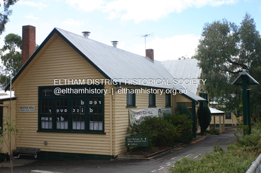
Photograph - Digital Photograph, Alan King, Panton Hill Primary School, 27 March 2008
... month Robert J Harris was appointed to the school and remained as head teacher until his death in 1887. His son R C Harris was apprenticed to Mr Rossiter, editor of the first local paper. The Evelyn Observer, first published in 1873. Harris later bought the newspaper which remained a family business until the 1920s. J Hughes of Cherry Tree...month Robert J Harris was appointed to the school and remained as head teacher until his death in 1887. His son R C Harris was apprenticed to Mr Rossiter, editor of the first local paper. The Evelyn Observer, first published in 1873. Harris later bought the newspaper which remained a family business until the 1920s. J Hughes of Cherry Tree ...The Panton Hill Primary School building, which has served the community since 1889, was not the area's first. Kingston School (an early name for Panton Hill) opened in May 1865. This was replaced in 1871 when the Panton Hill School number 1134 opened and in 1874 the school moved to its current location [September 2023] where many additions and renovations have taken place to meet the needs of local children in the 21st century. Covered under Heritage Overlay, Nillumbik Planning Scheme. Published: Nillumbik Now and Then / Marguerite Marshall 2008; photographs Alan King with Marguerite Marshall.; p63 The Panton Hill Primary School building, which has served the community since 1889, was not the area’s first. In 1871 Henry Edelman opened a Common School in a paling-clad hut, replacing the Kingstown No 786 school. The two-acre (0.8ha) site of crown land had previously been held under Miners Right. In 1875 the Education Department bought a building on the main road for State School No 1134, for £200 and remodelled it as a school.4 Panton Hill had as one of its teachers, Frank Tate, who was to become one of Victoria’s most influential educational reformers. It was his first school, when he began teaching on January 22, 1884, as a 20 year old.5 The following month Robert J Harris was appointed to the school and remained as head teacher until his death in 1887. His son R C Harris was apprenticed to Mr Rossiter, editor of the first local paper. The Evelyn Observer, first published in 1873. Harris later bought the newspaper which remained a family business until the 1920s. J Hughes of Cherry Tree Road succeeded Harris as teacher at Panton Hill and sold his land for the school site. Though now unrecognisable, the school building includes the classroom of the last Smiths Gully State School No 1737, which was built in 1882, and moved to Panton Hill in 1894. From 1922 each school day began with the ringing of the bell, which is still in its stand, and is an unusually old memorial of this kind. To accommodate the growing population, the building was remodelled, with additions in 1923 and classrooms were added in 1955, 1963 and 1970. The former teacher’s residence is the only surviving 19th century dwelling in the centre of Panton Hill, and is now used as part of the school. The residence was originally rectangular but is now L-shaped. Similar weatherboard State School buildings in the shire from this period are the Kangaroo Ground and the St Andrews Primary Schools. All were standard Education Department/Public Works Department designs.This collection of almost 130 photos about places and people within the Shire of Nillumbik, an urban and rural municipality in Melbourne's north, contributes to an understanding of the history of the Shire. Published in 2008 immediately prior to the Black Saturday bushfires of February 7, 2009, it documents sites that were impacted, and in some cases destroyed by the fires. It includes photographs taken especially for the publication, creating a unique time capsule representing the Shire in the early 21st century. It remains the most recent comprehenesive publication devoted to the Shire's history connecting local residents to the past. nillumbik now and then (marshall-king) collection, panton hill primary school -
 Bendigo Historical Society Inc.
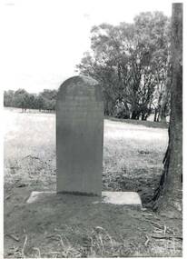
Photograph - HARRY BIGGS COLLECTION: BOORT CEMETERY
... trees in the back ground. The grave is of a child Samuel C. Sutlee? Description on the back of photo 2400 414a. This grave is that of a child who died on 'Boort' Station in 1871. The inscription reads 'Sacred to the memory of Samuel C. Sutlee?, who died April 1st 1871, aged 2 years 4 months...trees in the back ground. The grave is of a child Samuel C. Sutlee? Description on the back of photo 2400 414a. This grave is that of a child who died on 'Boort' Station in 1871. The inscription reads 'Sacred to the memory of Samuel C. Sutlee?, who died April 1st 1871, aged 2 years 4 months ...Black and White photo of a grave next to a tree in a field with trees in the back ground. The grave is of a child Samuel C. Sutlee? Description on the back of photo 2400 414a. This grave is that of a child who died on 'Boort' Station in 1871. The inscription reads 'Sacred to the memory of Samuel C. Sutlee?, who died April 1st 1871, aged 2 years 4 months. He is not dead but sleepeth. Photo taken Oct 1962 by Peter Coutts of Boortmemorials, graveboards, boort cemetery, boort cemetery samuel c. sutlee? -
 The Beechworth Burke Museum
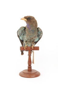
Animal specimen - Dollarbird, Trustees of the Australian Museum, 1860-1880
... months of September and April. These birds migrate to New Guinea and nearby islands in the Winter, but can be found in Japan and India also. This species resides in open wooded areas, preferring hollow-bearing trees for nesting. ...months of September and April. These birds migrate to New Guinea and nearby islands in the Winter, but can be found in Japan and India also. This species resides in open wooded areas, preferring hollow-bearing trees for nesting. ...The Dollarbird is so-named because of the coin-shaped patches on the tips of their wings, which is clear when in flight. They have distinctive blue-green colouring on their backs and wings, and a bright blue throat. This species migrates to northern and eastern Australia for breeding, between the months of September and April. These birds migrate to New Guinea and nearby islands in the Winter, but can be found in Japan and India also. This species resides in open wooded areas, preferring hollow-bearing trees for nesting. They can be found spending most of their time perched on high branches in search of insects, and will often 'hawk' at dusk above the tree-tops, hovering on the wing for lengthy periods. This specimen is a good example of this species, however the distinctive coin-patches on the tips of the wings are partially hidden by the tuck of the wing. This specimen is part of a collection of almost 200 animal specimens that were originally acquired as skins from various institutions across Australia, including the Australian Museum in Sydney and the National Museum of Victoria (known as Museums Victoria since 1983), as well as individuals such as amateur anthropologist Reynell Eveleigh Johns between 1860-1880. These skins were then mounted by members of the Burke Museum Committee and put-on display in the formal space of the Museum’s original exhibition hall where they continue to be on display. This display of taxidermy mounts initially served to instruct visitors to the Burke Museum of the natural world around them, today it serves as an insight into the collecting habits of the 19th century.This specimen is part of a significant and rare taxidermy mount collection in the Burke Museum. This collection is scientifically and culturally important for reminding us of how science continues to shape our understanding of the modern world. They demonstrate a capacity to hold evidence of how Australia’s fauna history existed in the past and are potentially important for future environmental research. This collection continues to be on display in the Museum and has become a key part to interpreting the collecting habits of the 19th century.This adult Dollarbird has a brown body and head, blue-green back and wings. It has a distinctive bright blue or purple plumage around its throat. The tips of the wings are brown. The pale-blue coin shaped patches on the tips of the wings are just visible. This specimen stands upon a wooden platform and has an identification tag tied around its leg.Swing-tag: 96a / Australian Roller / Catalogue, page, 25. taxidermy mount, taxidermy, animalia, burke museum, beechworth, australian museum, skin, reynell eveleigh johns, bird, dollarbird, australian birds, broad-billed roller -
 Phillip Island and District Historical Society Inc.
Photograph - Post Card, Color Offset (Aust.) Pty. Ltd, c 1970
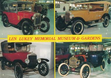
... They live in gum trees and feed upon their leaves. Babies are born every two years, spending nine months in mother's pouch and then on her back for about six months, then leaving its parents and looking for a tree with comfortable branches."...They live in gum trees and feed upon their leaves. Babies are born every two years, spending nine months in mother's pouch and then on her back for about six months, then leaving its parents and looking for a tree with comfortable branches." wildlife - seals wildlife - koala wildlife - penguins vintage cars t model ford len lukey musem cowes beach cowes pier bass coast op shop 276-01. ...A collection of nine postcards donated by the Bass Coast Op Shop. Information on the back of No. 276-05. "Koala Bears were first seen by white explorers in the Blue Mountains, 1798. Early colonists from N.S.W. called it a "monkey bear". Koala means in Aboriginal "does not drink" or "no drink". They are slow-moving, tree-climbing, friendly marsupials with thick woolly fur coats, large ears and rubber nose. They live in gum trees and feed upon their leaves. Babies are born every two years, spending nine months in mother's pouch and then on her back for about six months, then leaving its parents and looking for a tree with comfortable branches."Nine coloured postcards of Phillip Island and wildlife. 276-01. Postcard showing four vintage vehicles displayed in the Len Lukey Memorial Museum & Gardens at the GP Race Track. 1. 1928 Austin Chummy. 2. 1926 Maxwell. 3. 1924 Model T Ford. 4. 1913 Model T Ford. 276-02. Postcard showing penguin in burrow possibly on egg/s 276-03. Postcard with two photographs of penguins coming up the beach at dusk. 276-04. Postcard with three photographs of penguins coming up the beach and people looking over the railing at them. 276-05. Postcard of a koala sitting on a branch. 276-06. Postcard of seals at Seal Rocks with man sitting on the rocks beside one. 276-07. Postcard with four photographs of koalas, penguins, Cowes Jetty and Cowes beach. 276-08. Postcard with three photographs of koalas, penguins and a seal. 276-09. Postcard with four photographs of penguins, koalas, seals and penguins.276-01. Len Lukey Memorial Museum & Gardens. Vehicle description as above in Physical Description. 276-02. Phillip Island, Victoria, Australia. On back: Australian Penguin Reserve, Phillip Island Victoria. 276-03. Australian Penguin Parade Phillip Island. 276-04. Penguins at Phillip Island, Victoria, Australia 276-05. On back: Full description of Koalas - see Historical Information below. 276-06. On back: Making friends at Seal Rocks, Phillip island, Vic. 276-07. Cowes Phillip Island. 276-08. Phillip Island Victoria 276-09. Greetings from Phillip Island. On back: Phillip Island, Victoria, Australia. Interesting aspects of this fascinating Island which gives shelter to some of Australia's unique fauna.wildlife - seals, wildlife - koala, wildlife - penguins, vintage cars, t model ford, len lukey musem, cowes beach, cowes pier, bass coast op shop -
 Phillip Island and District Historical Society Inc.
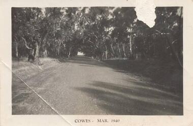
Photograph, 1940
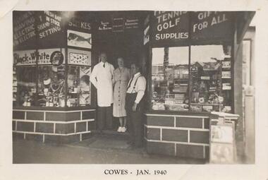
... month and year 1940. Photograph 215-01 Black & White photograph of 3 people standing in front of Mr Anderson's shop in Cowes. Miss D Winson?? Mr O S Kennedy & Mr R Anderson. Photograph 215-02 Black & White photograph of landing cranes on the Cowes pier. Cowes foreshore and mature trees ...Nine photographs from a collection of 33 donated by Leonie Brennan. Photographs belonged to Edward (Ted) Sands, hairdresser.Photograph 215-01 Black & White photograph of 3 people standing in front of Mr Anderson's shop in Cowes. Miss D Winson?? Mr O S Kennedy & Mr R Anderson. Photograph 215-02 Black & White photograph of landing cranes on the Cowes pier. Cowes foreshore and mature trees in background. Photograph 215-03 Black & White photograph of the early construction of Phillip Island bridge viewed from Phillip Island. Shows the base structure of the first bridge. Photograph 215-04 Black & White photograph of the Newhaven - San Remo Punt on the shore on the Phillip Island side. Photograph 215-05 Black & White photograph of Edward (Ted) Sands standing in front of R Anderson's shop in Cowes. Photograph 215-06 Black & White photograph of a koala in tree in front of shed and water tanks. Photograph 215-07 Black & White photograph of the Isle of Wight Hotel showing front footpath and shop next door. Photograph 215-08 Black & White Photograph of the Cowes beach at low tide, showing mature trees on the foreshore and boats in the water. Photograph 215-09 Black & White Photograph of Mr R Anderson's Shop in Cowes.All photographs except for one marked on front with "Cowes" the month and year 1940.cowes shop phillip island, mr anderson, mr o s kennedy, mr edward (ted) sands, isle of wight hotel phillip island, cowes pier phillip island, cowes beach phillip island, newhaven-san remo punt, wildlife - koala, koala cowes phillip island, phillip island first bridge, leonie brennan -
 Phillip Island and District Historical Society Inc.
Photographs, 1940's
... month and 1940. Photograph 215-10. Phillip Island Tourist Road (Cowes to Newhaven) in 1940, showing mature eucalypt trees on both sides of the road. ...Seven photographs from a collection of 33 donated by Leonie Brennan. Photographs belonged to Edward (Ted) Sands, hairdresser.Photograph 215-10. Phillip Island Tourist Road (Cowes to Newhaven) in 1940, showing mature eucalypt trees on both sides of the road. Photograph 215-11. Car and tent possibly on a foreshore area on Phillip Island. The car was owned by "Roy". Photograph 215-12. Phillip Island Hotel in Walpole Street, Cowes. Photograph 215-13. Newhaven Boys Home showing farm buildings. Photograph 215-14. Bayview Guest House, The Esplanade, Cowes, with distinctive front fence. Photograph 215-15. The Chapel at Newhaven Boys Home, Phillip Island. Photograph 215-16. The Alvina ferry with passengers on board. Photograph 215-17. Very dark photograph of shops in Cowes. One with sign showing ice-creams and a Grocer Shop next door.Four photographs with "Cowes" month and 1940.main tourist road, phillip island, camp site phillip island, phillip island hotel cowes, hotels, guesthouses cowes phillip island, bayview guesthouse cowes, newhaven boys home phillip island, newhaven boys home chapel, the alvina, ferries, shops at cowes phillip island, mr edward (ted) sands, leonie brennan -
 Phillip Island and District Historical Society Inc.
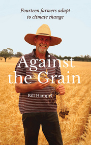
Book, Bill Hampel, Against the grain : fourteen farmers adapt to climate change, 2015
... months which are a challenge to farming cycles. Far from contributing to the problem with their farming practices, these farmers demonstrate how to reduce their greenhouse gases - to zero or below in some cases - while remaining profitable. They are all committed to pass on their farm in a better condition than when they first purchased or inherited it. With crops or livestock, big or small, they have worked cooperatively, mostly through land management, to plant thousands of trees...months which are a challenge to farming cycles. Far from contributing to the problem with their farming practices, these farmers demonstrate how to reduce their greenhouse gases - to zero or below in some cases - while remaining profitable. They are all committed to pass on their farm in a better condition than when they first purchased or inherited it. With crops or livestock, big or small, they have worked cooperatively, mostly through land management, to plant thousands of trees ...Can we humans simply ignore the fires, the floods, and the increase in deaths brought about by climate change? In this book, Australian farmers - who bear the brunt of climate change, yet accept the science - share their experiences with the unpredictable weather events, the reduction in rainfall, and the shift to hotter months which are a challenge to farming cycles. Far from contributing to the problem with their farming practices, these farmers demonstrate how to reduce their greenhouse gases - to zero or below in some cases - while remaining profitable. They are all committed to pass on their farm in a better condition than when they first purchased or inherited it. With crops or livestock, big or small, they have worked cooperatively, mostly through land management, to plant thousands of trees, which has led to the daily presence of over 100 bird species. The farmers' inspiring and informative stories will open up a new world to most urban dwellers. A summary of climate change impacts - and an account of the numerous economic, political, and media barriers toward change - combine to provide a context for their work. 280 pages : colour illustrations, colour maps, colour portraits ; 23 cm. Includes bibliographical references and index. Also available in digital formats: ebook & epdf. ISBN 9781925078503 Dewey number 338.10994 Chapter 5 : Bob & Anne Davie Donor : Anne Davie ; Date : 14.10.2015.agriculture -- environmental aspects -- australia., farmers -- australia -- economic conditions., rural development -- australia., climatic changes -- australia. -
 Mission to Seafarers Victoria
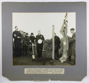
Photograph - Photograph, Black and white, Herald, Captain R. Sunter of the M.S. Manunda , at the invitation of the War memorial in Melbourne, plants a tree, 04 August 1934
... month later in Cairns. A window funded by crew of the Manunda and friends was dedicated to his memory in St Peter's Chapel, MtSV in February 1936 by Padre Oliver. (see item 0038). Depicts one of the few memorials specifically commissioned for Merchant seamen of WW1 and in later years also a focus for those who died in WW2 and other conflicts. padre oliver captain robert sunter m.s. manunda war memorial mercantile marine memorial tree melbourne shrine of remembrance wandilla hospital ship adelaide steamship company memorial trees queensland kauri Typed caption in upper case: CAPTAIN R. ...On the 4 August 1934, to mark the 20th anniversary of the Great Britain declaration of war on Germany, 106 trees were planted, during a ceremony, on the lawns of the newly created garden of the Shrine of Remembrance. The Shrine of Remembrance was built to provide a place to grieve and remember Victorians killed in the First World War (1914-18). Prince Henry, the Duke of Gloucester and son of King George V, officially opened the Shrine before a crowd of 300,000 people in November 1934. Captain Robert Sunter, commander of the coastal liner Manunda, Adelaide Steamship Company, was chosen to plant a Queensland kauri (tree - number 100) on the main avenue from Domain Rd leading to the Shrine of Remembrance. The photograph was published in the Herald (4 August 1934, p. 40). In the Argus (Melbourne, Vic. : 1848 - 1957), Friday 3 August 1934, page 8 In Memory of the Merchant Service- Captain Sunter to Plant Tree at the Shrine Tomorrow will be the 20th anniversary of Great Britain's declaration of war on Germany, and at 10 and. Captain R. Sunter, the commander of the coastal liner Manunda, will plant a tree in the Shrine! of Remembrance reserve In memory of the officers and men of the Australian merchant service who gave their lives during the war. The tree, , which will be No.100 in the reserve, will bear the following inscription based on the wording of the ' British Mercantile Marine memorial at Tower Hill. London: "1914-1918. In remembrance of the officers and men of the Australian Mercantile Marine who died for King and Country and have no grave but the sea. Planted August 4, 1934." During the war 12 ships of the Australian merchant service were sunk and 95 officers and men lost their lives.The Shrine of Remembrance committee recently asked the director of navigation (Captain J. K. Davis) to nominate a member of the mercantile marine to plant a tree in the reserve. Captain Davis passed on the request to the secretary of the Merchant Service Guild of Australia (Captain T. D. Snape) and, after having conferred with various sections of the sea-going service, Captain Snape announced yesterday that Captain Sunter had been chosen unanimously. Captain Sunter has a distinguished war record as commander of the hospital ship Wandilla. Born at South Shields, in England, in 1878, he is a son of the late Canon Sunter, of Adelaide. He served an apprenticeship in sailing ships, and soon after obtaining his master a certificate entered the service of the Adelaide Steamship Company, where he has remained. In the Wandilla during the war Captain Sunter became known to thousands of wounded soldiers and troops." Padre Frank Oliver of MtS can be seen assisting with dedication at far left. Captain Robert Sunter who also served in WW1, a friend of the seamen and the mission, died a month later in Cairns. A window funded by crew of the Manunda and friends was dedicated to his memory in St Peter's Chapel, MtSV in February 1936 by Padre Oliver. (see item 0038).Depicts one of the few memorials specifically commissioned for Merchant seamen of WW1 and in later years also a focus for those who died in WW2 and other conflicts. Mounted black and white photograph of a group of people at a tree planting, minister of religion at far left, on dark grey mount with typed caption label on the lower edge of mountTyped caption in upper case: CAPTAIN R. SUNTER OF THE M.S. “MANUNDA”, AT THE INVITATION OF THE TRUSTEES OF THE WAR MEMORIAL IN MELBOURNE , PLANTS A TREE IN THE AVENUE OF REMEMBRANCE TO COMMEMORATE THE OFFICERS AND MEN OF THE AUSTRALIAN MERCANTILE MARINE WHO BETWEEN 1914 AND 1918 DIED AS A RESULT OF ENEMY ACTION AND WHO HAVE NO GRAVE BUT THE SEA. AUGUST 4TH 1934padre oliver, captain robert sunter, m.s. manunda, war memorial, mercantile marine memorial tree, melbourne, shrine of remembrance, wandilla, hospital ship, adelaide steamship company, memorial trees, queensland kauri -
 Phillip Island and District Historical Society Inc.
Photograph Album, Kodak, Phillip Island Cemetery, c 1990
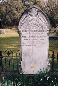
... trees. In all 25 acres of land were set aside as Crown Land in the land settlement of 1868. There are 6.2 acres of wetlands near the cemetery entrance. Phillip Island Cemetery Nancy McHaffie Edith Jeffery 466-25: William and Alice Richardson: Alice Barnard married William Richardson at Hawthorn, April 1887. Alice's father Fredrick was a Model Maker employed at the Melbourne Museum. Alice died in childbirth having her third child, Joseph in 1892. Baby Joseph died in April 1893, eight months ...The Album was compiled by Nancy McHaffie late 1990's, with the assistance of Edith Jeffery's, with her book "Garden of Memories" and extensive knowledge of Phillip Island. The Cemetery lies back from the road and is surrounded by Manna Gums, rare Peppermint Gums, Blackwoods and other native trees. In all 25 acres of land were set aside as Crown Land in the land settlement of 1868. There are 6.2 acres of wetlands near the cemetery entrance.466-25: William and Alice Richardson: Alice Barnard married William Richardson at Hawthorn, April 1887. Alice's father Fredrick was a Model Maker employed at the Melbourne Museum. Alice died in childbirth having her third child, Joseph in 1892. Baby Joseph died in April 1893, eight months later at Rhyll. 466-26: The Forrest Family: The Forrest family were amongst our early settlers. The Forrest Caves are named after them. Matthew Forrest arrived by dray from Tarradale on 9th November 1869. He died in 1916 at the age of 75. His Grandson, Peter Forrest Sr. has recorded that Matthew was the first to plant Marum Grass on the Island to prevent erosion.phillip island cemetery, nancy mchaffie, edith jeffery -
 Eltham District Historical Society Inc
Book, Percy Leason: an artist's life by Margot Tasca, 2016
... tree corridors in his cartoon, Electricity comes to Wiregrass. The family had now grown to seven. Jack was nearly nine, Jean was seven, Marjory was four, Nancy was two and the baby Patricia was seven months old. ...tree corridors in his cartoon, Electricity comes to Wiregrass. The family had now grown to seven. Jack was nearly nine, Jean was seven, Marjory was four, Nancy was two and the baby Patricia was seven months old. ..."Who would have thought that a boy born in 1889 from the Victorian Mallee would become a successful artist on New York’s Staten Island? This finely illustrated, exhaustively researched and beautifully written biography on Leason features the artist’s entire career as a painter and cartoonist renowned for his depictions of Australian society in the 1920s and 1930s. Leason’s story is a poignant one tracing his beginnings as a cartoonist, to the bohemian Melbourne art scene in the early 20th century, to his involvement in the artists’ camps of Eltham, to his important series of portraits of Lake Tyers Indigenous Australians, and his eventual move to the US where he has been acknowledged as making an enormous contribution to the New York arts scene. This story, as yet untold, fills a gap in the history of art in Australia and offers a new perspective on Australian art in the first half of the 20th century." - Thames and Hudson website A NEW HOME IN ELTHAM Once they had settled back into Melbourne, Perry and Belle began to look for a place to make a permanent home. Having enjoyed the bush setting of Mosman, they decided to explore the rural fringes of Melbourne. Each weekend they packed a picnic and travelled to the towns in the nearby hills - such as Ferntree Gully, Sassafras, Lilydale and, of course, Cockatoo Creek. Eventually deciding these places might be a little too far from The Herald office, they searched closer to the city. The Heidelberg and Box Hill regions that had inspired his old teacher McCubbin, had become busy, urban areas but further east, towards Warrandyte and Templestowe, there were still large tracts of bush. Finally they settled on Eltham, an area Percy knew very well, having often painted there with Jock Frater. Perry's old friend Dick McCann and his wife Margery had also settled in Eltham. The township was fifteen miles from Melbourne and serviced by an electric train that went to the central Melbourne station of Flinders Street, near where The Herald offices were located. Eltham was a small village in 1925, separated from Melbourne by the Yarra River, and surrounded by orchards and large tracts of bush. Small farms dotted the landscape and the main businesses revolved around ironmongers, blacksmiths, and farming supplies. Of particular appeal to artists was Eltham Park, a large expanse of bushland bounded by the Yarra River on the south side and the Diamond Creek on the east. The park included a playing field that was busy on weekends with cricket or football matches, but for the rest of the week it was mostly empty and an ideal place to paint. The scenery there provided the inspiration for many paintings by Leason, Meldrum and other artists such as Colin Colahan and Peter (A.E.) Newburv. The Leasons found a rundown old farmhouse on four-and-a-half acres of land in New Street, now known as Lavender Park Road. The site was splendid, at the top of a gentle slope which gave panoramic views east to the Dandenong hills, south over the Templestowe orchards and north to Kinglake. The front lawn was taken over by onion grass (or wiregrass as Leason called it) and scattered about the property were many wattles and gum trees. Aloe cacti covered much to the front of the house, while old quince and lucerne hedges separated the house and out-buildings from a rundown apple orchard. Here they would build a new home. ·with financial assistance from The Herald, Leason bought the property and immediately commissioned an architectural firm to design a new house in the popular bungalow style of the time. The old farm house was demolished but Percy saved the siding boards, bricks and corrugated iron for the outbuildings of his new home. The new house was a two storey, triple brick with a large, gabled, terracotta tiled roof. It was situated at the very top of the slope. The paint and varnish were barely dry when the family moved in during the summer of 1925-26 and the fumes were overpowering in the heat. Despite the house being wired for electricity, power poles had not yet reached the area and initially the family had to rely on kerosene lamps and candles. When electricity did arrive, Leason reflected on the community's reception of electricity at the expense of the old growth gum tree corridors in his cartoon, Electricity comes to Wiregrass. The family had now grown to seven. Jack was nearly nine, Jean was seven, Marjory was four, Nancy was two and the baby Patricia was seven months old. Jack and Jean were enrolled in the local primary school down the hill. A retired farmer, Jock McMillan, came to live on the property and help out with the general maintenance. Jock built himself a shack and Belle provided him with meals. He was kept occupied building structures around the property·, such as the garage, the outside toilet, garden beds, trellis arbours and a number of ponds. The elderly, bearded Scotsman with his old hat and baggy pants also provided the inspiration for one of the characters Leason regularly included in his cartoons. Like Leason, Jock smoked a straight stemmed pipe. A neighbour was employed to help Belle with domestic chores, and so the family settled down to live comfortably in their new Eltham house. Two dogs, Maginary and Wodger, completed the large and vibrant household. “Percy Leason; an artist’s life” by Margot Tasca, Thames & Hudson Australia Pty Ltd, Port Melbourne 2016, pp 63-64 Hardback Bookpercy leason, margot tasca, biography, artist, landscape -
 Monbulk RSL Sub Branch
Book, Paul Ham, Passchendaele : requiem for doomed youth, 2016
... The photographs never sleep of this four-month battle, fought from July to November 1917, the worst year of the war- blackened tree stumps rising out of a field of mud, corpses of men and horses drowned in shell holes, terrified soldiers huddled in trenches awaiting the whistle. ...Passchendaele epitomises everything that was most terrible about the Western Front. The photographs never sleep of this four-month battle, fought from July to November 1917, the worst year of the war- blackened tree stumps rising out of a field of mud, corpses of men and horses drowned in shell holes, terrified soldiers huddled in trenches awaiting the whistle. The intervening century, the most violent in human history, has not disarmed these pictures of their power to shock. At the very least they ask us, on the 100th anniversary of the battle, to see and to try to understand what happened here. Yes, we commemorate the event. Yes, we adorn our breasts with poppies. But have we seen? Have we understood? Have we dared to reason why? What happened at Passchendaele was the expression of the 'wearing-down war', the war of pure attrition at its most spectacular and ferocious. Paul Ham's Passchendaele- Requiem for Doomed Youth shows how ordinary men on both sides endured this constant state of siege, with a very real awareness that they were being gradually, deliberately, wiped out. Yet the men never broke- they went over the top, when ordered, again and again and again. And if they fell dead or wounded, they were casualties in the 'normal wastage', as the commanders described them, of attritional war. Only the soldier's friends at the front knew him as a man, with thoughts and feelings. His family back home knew him as a son, husband or brother, before he had enlisted. By the end of 1917 he was a different creature- his experiences on the Western Front were simply beyond their powers of comprehension. The book tells the story of ordinary men in the grip of a political and military power struggle that determined their fate and has foreshadowed the destiny of the world for a century. Passchendaele lays down a powerful challenge to the idea of war as an inevitable expression of the human will, and examines the culpability of governments and military commanders in a catastrophe that destroyed the best part of a generation. Collapse summaryIndex, bibliography, notes, ill (maps), p.565.non-fictionPasschendaele epitomises everything that was most terrible about the Western Front. The photographs never sleep of this four-month battle, fought from July to November 1917, the worst year of the war- blackened tree stumps rising out of a field of mud, corpses of men and horses drowned in shell holes, terrified soldiers huddled in trenches awaiting the whistle. The intervening century, the most violent in human history, has not disarmed these pictures of their power to shock. At the very least they ask us, on the 100th anniversary of the battle, to see and to try to understand what happened here. Yes, we commemorate the event. Yes, we adorn our breasts with poppies. But have we seen? Have we understood? Have we dared to reason why? What happened at Passchendaele was the expression of the 'wearing-down war', the war of pure attrition at its most spectacular and ferocious. Paul Ham's Passchendaele- Requiem for Doomed Youth shows how ordinary men on both sides endured this constant state of siege, with a very real awareness that they were being gradually, deliberately, wiped out. Yet the men never broke- they went over the top, when ordered, again and again and again. And if they fell dead or wounded, they were casualties in the 'normal wastage', as the commanders described them, of attritional war. Only the soldier's friends at the front knew him as a man, with thoughts and feelings. His family back home knew him as a son, husband or brother, before he had enlisted. By the end of 1917 he was a different creature- his experiences on the Western Front were simply beyond their powers of comprehension. The book tells the story of ordinary men in the grip of a political and military power struggle that determined their fate and has foreshadowed the destiny of the world for a century. Passchendaele lays down a powerful challenge to the idea of war as an inevitable expression of the human will, and examines the culpability of governments and military commanders in a catastrophe that destroyed the best part of a generation. Collapse summary world war 1914-1918 - campaigns - western front, france - campaigns - passchaendaele