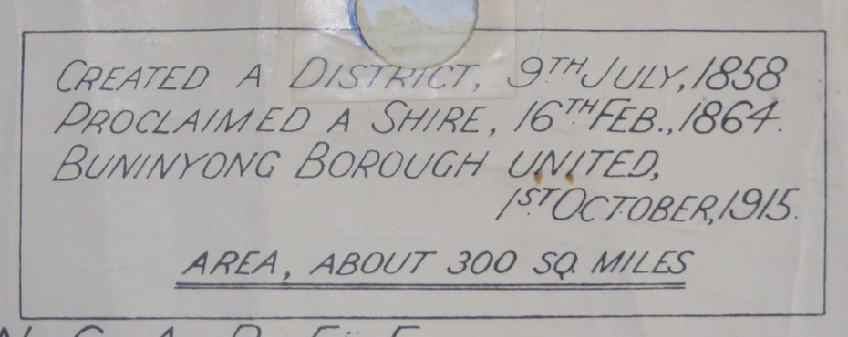


Historical information
The Shire of Buninyong was located on the southern side of Ballarat.
Physical description
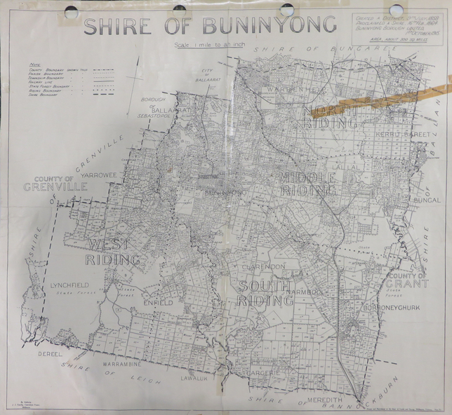
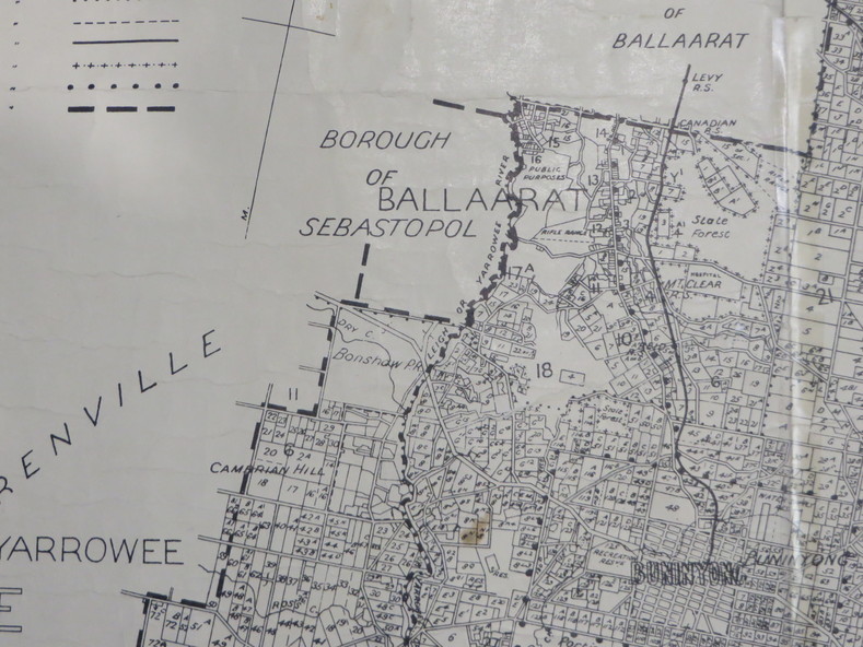
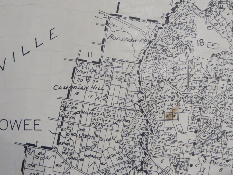
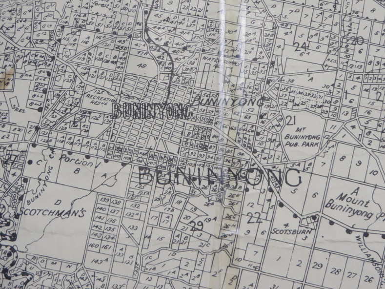
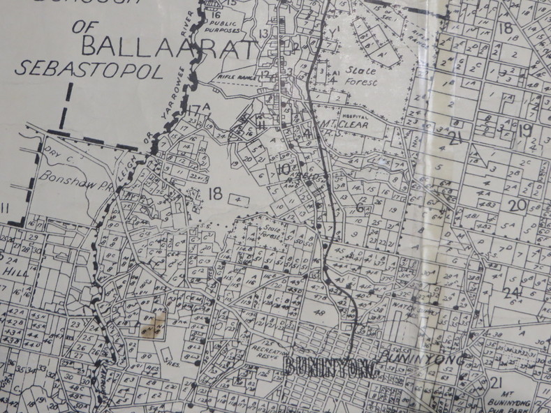
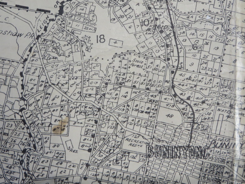
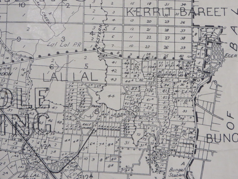
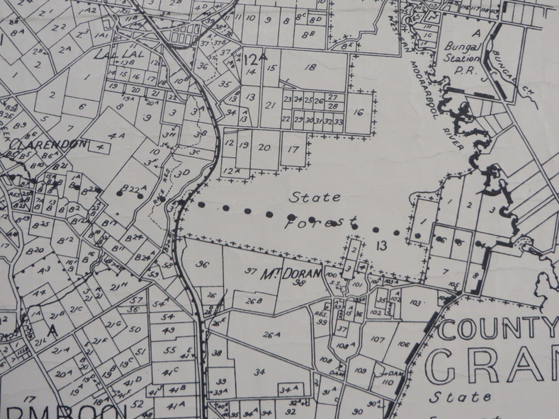
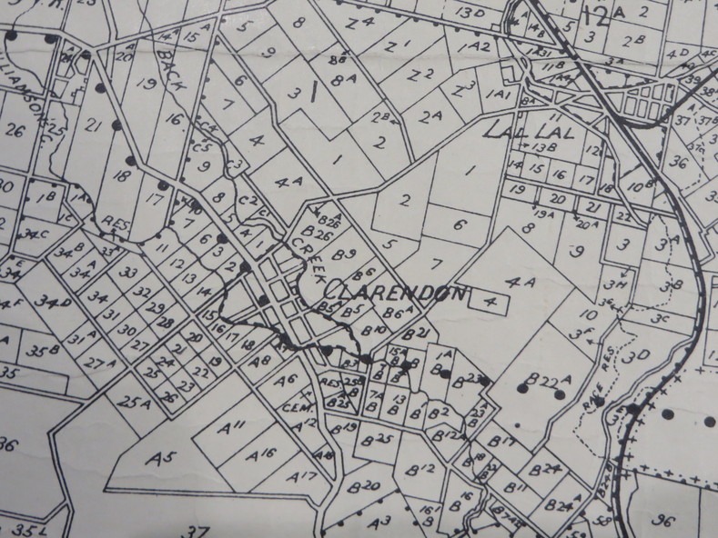
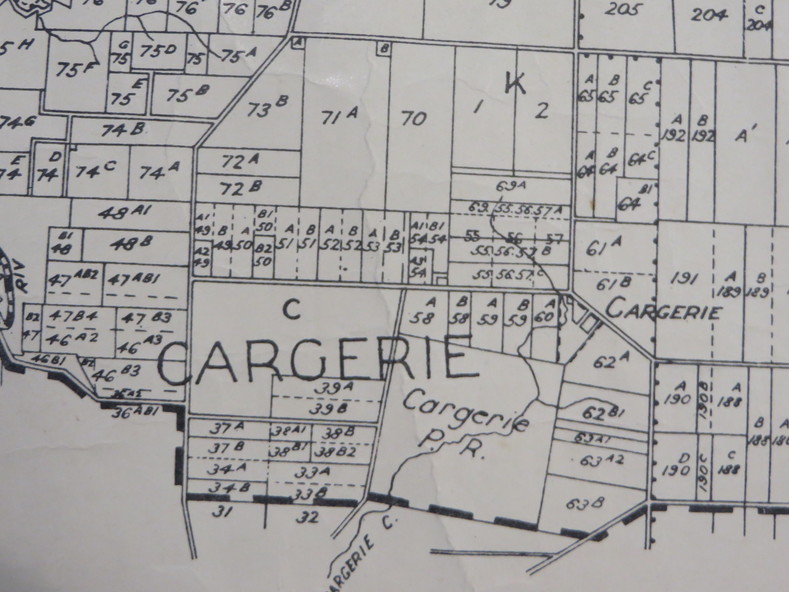
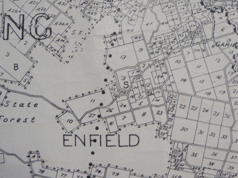
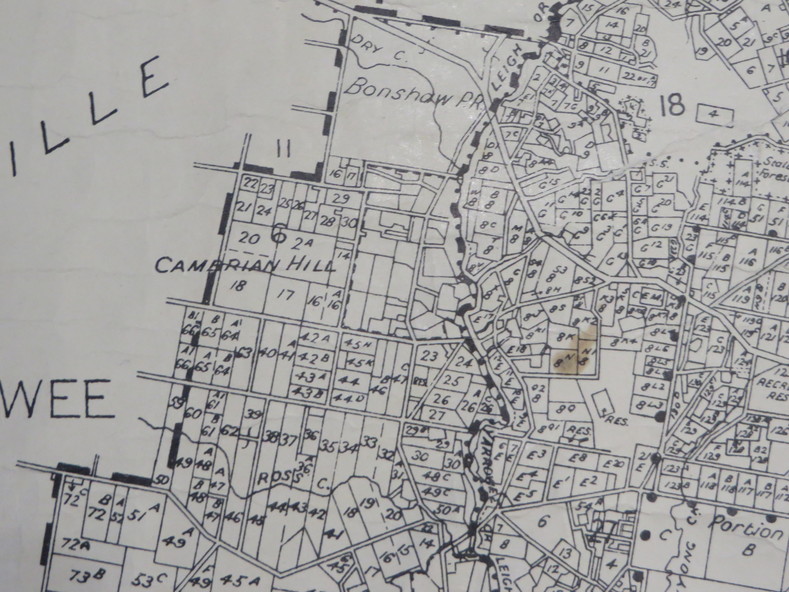
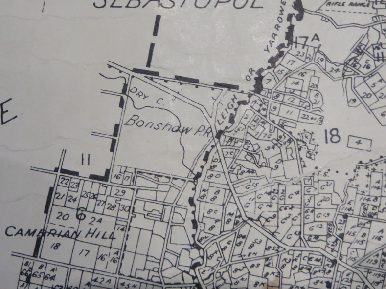
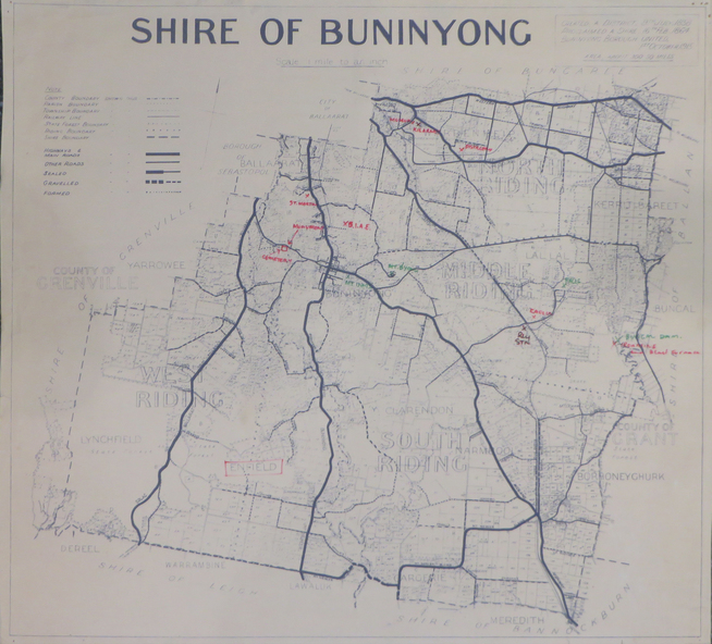
Two maps of the Shire of Buninyong.
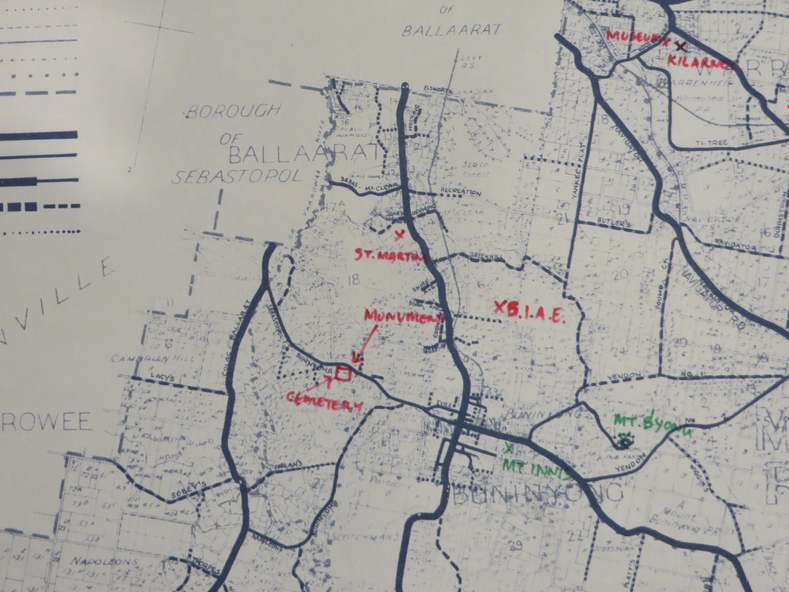
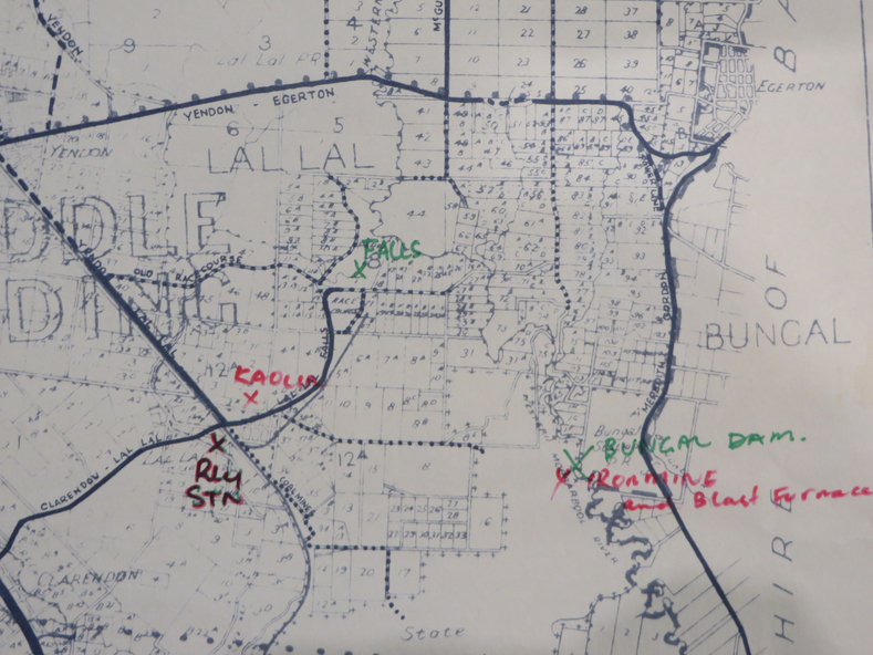
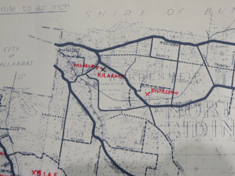
.1) Map showing the County divisions, township boundaries, Railway line, State Forest boundary, riding boundary and shire boundary. Identifying words have been added in red and green texta.
.2) Shire of Buninyong Parish Plan. Includes Buninyong, Clarendon, Narmbool, Enfield, Lychfield, SCotchman's, Navigators, Warrenheip, Scotsburn, mr Doran, Durham Lead, Cambrian Hill, Napoleons, Garibaldi, Mt Clear, Lal Lal, Bonshaw
Inscriptions & markings
.1) B.I.A.E., St Martin's, cemetery, mt Buninyong, mt Innes, rly stn
Subjects
- shire of buninyong,
- buninyong,
- clarendon,
- narmbool,
- enfield,
- lychfield,
- scotchman's,
- navigators,
- warrenheip,
- scotsburn,
- mt doran,
- durham lead,
- cambrian hill,
- napoleons,
- garibaldi,
- mt clear,
- lal lal,
- bonshaw,
- state forest,
- elaine,
- elaine north,
- cargerie,
- grenville,
- mt mercer,
- millbrook,
- wallace,
- yendon,
- canadian,
- kaolin deposits,
- mount helen campus