Showing 1970 items matching " thomas road"
-
 Glen Eira Historical Society
Document - Thomas, George
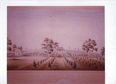
... on property of George Thomas in Orrong Road, dated 04/06/1985, author... report on property of George Thomas in Orrong Road, dated 04/06 ...This file contains three items Hand written report on property of George Thomas in Orrong Road, dated 04/06/1985, author unknown Photocopy of four page contract and conditions of sale for lot 262 county of Burke Parish of Prahran. George Thomas property was sold to George William Taylor, dated 20/10/1881 The original photograph of a water colour painting of home and garden of George Thomas, Orrong Road, Caulfield by W. Tibbits 1876thomas eric f, thomas george, beemery park, orrong road, seymour road, allison road, mullaly j, j. fulton, taylor george william, warrein road, north road, stone adelaide, orrong road t. fulton, business, farmers, farm workers, farms, gardeners, subdivisions, land subdivision, land sales, land prices, land development, land developers -
 Whitehorse Historical Society Inc.
Functional object - Business Card
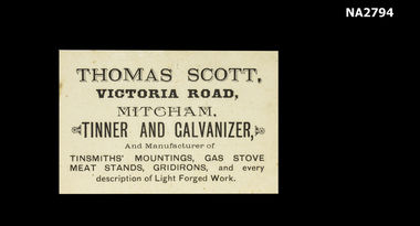
... Thomas Scott|Victoria Road, Mitcham.|Tinnner an Galvanizer....|Victoria Road is now Rooks Road. documents cards Thomas Scott ...Thomas Scott was a descendant of Sir. Walter Scott (uncle) and the grandfather of Chrissie Ottenback, mother of Mrs Ottenback the producer of tiles we have in the exhibition.|Victoria Road is now Rooks Road.White business card printed in black.Thomas Scott|Victoria Road, Mitcham.|Tinnner an Galvanizer and Manufacturer of Tinsmith's Mountings.|Meat Stands, Gridirons, and every description of light forge work.documents, cards -
 Ringwood and District Historical Society
Photograph, Mr. and Mrs. East camping in Illoura Ave., East Ringwood 1941
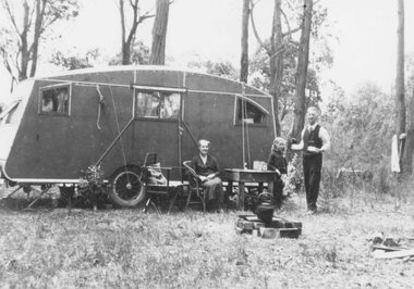
... opposite home of Mr. & Mrs. Harry Thomas, Alexander Road, Ringwood... opposite home of Mr. & Mrs. Harry Thomas, Alexander Road, Ringwood ...Black and white photograph (2 copies)Typed below one photograph: "Mr. and Mrs. East camping in Illoura Ave., East Ringwood opposite "Alexandra Ave. Christmas 1941." Written on back of other photograph: "Caravan in paddock opposite home of Mr. & Mrs. Harry Thomas, Alexander Road, Ringwood, Christmas 1941". Also shows a hand drawn map of location. -
 Greensborough Historical Society
Advertisement - Digital Image, Thomas Milkbar 1973, 09/06/1973
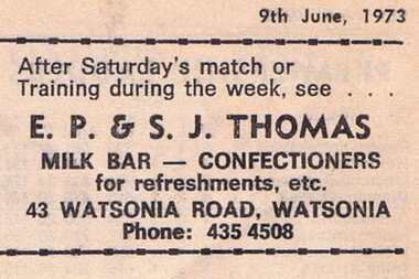
... Advertisement for E.P & S.J Thomas Milkbar of Watsonia Road... league watsonia road watsonia thomas milkbar Digital copy ...Advertisement for E.P & S.J Thomas Milkbar of Watsonia Road Watsonia. Copied from a Diamond Valley Football League football record from 1973.Digital copy of advertisement from booklet.diamond valley football league, watsonia road watsonia, thomas milkbar -
 Kew Historical Society Inc
Plan - Subdivision Plan, Thornton Estate, 1918
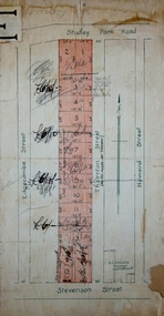
... of ‘Thornton’ in Studley Park Road. Thomas Cubitt Balmain originally... of ‘Thornton’ in Studley Park Road. Thomas Cubitt Balmain originally... Park Road. Thomas Cubitt Balmain originally owned Thornton ...The ‘Thornton Estate’ was the final subdivision of ‘Thornton’ in Studley Park Road. Thomas Cubitt Balmain originally owned Thornton, next to John Carson’s ‘Clutha’. Before its final subdivision, the Thomson family owned it. The Estate was a subdivision of 15 residential allotments running between Studley Park Road and Stevenson Street. The allotments faced these streets as well as Thornton Street, which the vendor undertook to make. Contemporary newspaper advertisements advised that ‘The estate possesses many advantages, notably its private and secluded, though convenient, position, splendid frontages and depths, and being close to the electric tram and Kew train, also within easy walking distance of the Victoria-street cable tram’. The terms offered purchasers were ten per cent deposit, with the balance to be paid in ten equal half-yearly payments at a rate of 5 per cent.The ‘Thornton Estate’ was the final subdivision of ‘Thornton’ in Studley Park Road. Thomas Cubitt Balmain originally owned Thornton, next to John Carson’s ‘Clutha’. Before its final subdivision, the Thomson family owned it. The Estate was a subdivision of 15 residential allotments running between Studley Park Road and Stevenson Street. The allotments faced these streets as well as Thornton Street, which the vendor undertook to make. Contemporary newspaper advertisements advised that ‘The estate possesses many advantages, notably its private and secluded, though convenient, position, splendid frontages and depths, and being close to the electric tram and Kew train, also within easy walking distance of the Victoria-street cable tram’. The terms offered purchasers were ten per cent deposit, with the balance to be paid in ten equal half-yearly payments at a rate of 5 per cent.subdivision plans - kew, thornton estate, studley park road -- kew (vic.), thornton avenue -- kew (vic.), stevenson street -- kew (vic.) -
 City of Moorabbin Historical Society (Operating the Box Cottage Museum)
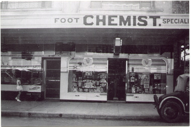
Photograph, Black & White, Mr Moore's 1st Chemist Shop Centre Road, Bentleigh c1930, c1930
... between Thomas Street and Jasper Road. Mr Arthur Moore established... between Thomas Street and Jasper Road. Mr Arthur Moore established ...Early settlers in the Parish of Moorabbin, County of Bourke, established market gardens and farms in the area of Henry Dendy's Special Survey 1841 Brighton. Small communities grew near Churches & Schools and shops and businesses were established. Following the opening of the Railway line from Caulfield to Mordialloc 1881 the shops and business moved from the Tucker Road /Centre Road ( East Brighton ) East Bentleigh area to be close to the transport. Shops, businesses and housing developed along Centre Road between Thomas Street and Jasper Road. Mr Arthur Moore established his 1st shop in 395 Centre Road c1930 and later moved along the road to a site next to Coles Variety Store.Following the opening of the Railway line from Caulfield to Mordialloc 1881 the shops and business moved from the Tucker Road /Centre Road East Bentleigh area to be close to the transport. Shops, businesses and housing developed along Centre Road between Thomas Street and Jasper Road. Mr Moore established his 1st shop in 395 Centre Road c1930 and later moved along the road to a site next to Coles Variety Store.Black & White photograph of Mr Arthur Moore's 1st Chemist Shop, 384 Centre Road Bentleigh c 1930 back Handwritten information unsignedbentleigh shopping centre c1930, east brighton, railway line caulfield -mordialloc 1881, chemists, pharmacy, moore's moorabbin shire, smith j l, smith mary ann, stanley helen, smith vic, smith harry redvers, chaff cutter, horse drawn carts, toll gates brighton, motor cars 1900, steam engines, early settlers, bentleigh, mckinnon, parish of moorabbin, city of moorabbin, county of bourke, moorabbin roads board, shire of moorabbin, henry dendy's special survey 1841, were j.b., bent thomas, o'shannassy john, king richard, charman stephen, highett william, ormond francis, maynard dennis, market gardeners, vineyards, orchards -
 Surrey Hills Historical Society Collection
Document - Account, C. L. Swift order docket re Mrs Matthews. 21/8/1957
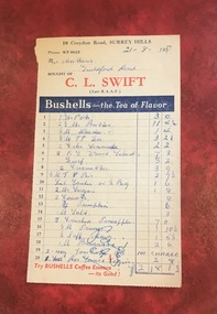
... or Thomas’ on Maling Road . ... on Union Road or Thomas’ on Maling Road . Dockets ...Clive Leslie Swift (RAAF 430415) was born in Elsternwick in 1924 and served in the RAAF in Borneo during WW2. He was mentioned in dispatches. He married Enid (Ina) Mary Smith in 1947. Together they ran the grocery store at 10 Croydon Road from 1949 until some time after 1954. In the 1980s they were living in Highbury Road, East Burwood and Clive was working for Unigate (later Bonlac) in a managerial position. (REF: Oral testimony, Libby Wilson, Canterbury History Group). The shop continued after the Swifts left but was later destroyed by fire. Clive Swift died in March 2014. This and other dockets were tucked into Ruth Matthews' recipe folder. Ruth and Harold Geoffrey (Geoff) Matthews lived at 42 Guildford Road, Surrey Hills. The donor recalled that her paternal grandmother (Ethel May Matthews) also occasionally shopped at the Swifts' shop as it was closer to her home (31 Guildford Road) than either than Griffith’s on Union Road or Thomas’ on Maling Road . Dockets such as these are reflective of shopping in the pre-supermarket era when women generally walked to the local shop or had proprietors or a staff member come to the house to take weekly orders. A pre-printed grocery docket for C. L. Swift (Late R.A.A.F.) on cream (discoloured) paper printed in black, red and blue filled in with 20 hand-written items, their prices and the total of the grocery order. Signed with initials as having been paid. Order was for Mrs Matthews of Guildford Road.On the rear in blue ink an addition in pounds, shillings and pence.clive leslie swift, miss enid (ina) mary smith, mrs enid (ina) mary swift, croydon road, guildford road, grocery store, docket, accounts, bushells tea, mrs ruth matthews, harold geoffrey matthews, 'geoff' matthews -
 Surrey Hills Historical Society Collection
Document - Account, C. L. Swift order docket re Mrs Matthews. 21/8/1957
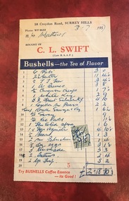
... or Thomas’ on Maling Road . ... on Union Road or Thomas’ on Maling Road . Dockets ...Clive Leslie Swift (RAAF 430415) was born in Elsternwick in 1924 and served in the RAAF in Borneo during WW2. He was mentioned in dispatches. He married Enid (Ina) Mary Smith in 1947. Together they ran the grocery store at 10 Croydon Road from 1949 until some time after 1954. In the 1980s they were living in Highbury Road, East Burwood and Clive was working for Unigate (later Bonlac) in a managerial position. (REF: Oral testimony, Libby Wilson, Canterbury History Group). The shop continued after the Swifts left but was later destroyed by fire. Clive Swift died in March 2014. This and other dockets were tucked into Ruth Matthews' recipe folder. Ruth and Harold Geoffrey (Geoff) Matthews lived at 42 Guildford Road, Surrey Hills. The donor recalled that her paternal grandmother (Ethel May Matthews) also occasionally shopped at the Swifts' shop as it was closer to her home (31 Guildford Road) than either than Griffith’s on Union Road or Thomas’ on Maling Road . Dockets such as these are reflective of shopping in the pre-supermarket era when women generally walked to the local shop or had proprietors or a staff member come to the house to take weekly orders. A pre-printed grocery docket for C. L. Swift (Late R.A.A.F.) on cream (slightly discoloured) paper printed in black, red and blue filled in with 19 hand-written items, their prices and the total of the grocery order. A green and cream duty stamp to the value of 3d is attached and over-signed with initials as having been paid. Order was for Mrs Matthews of Guildford Road.clive leslie swift, miss enid (ina) mary smith, mrs enid (ina) mary swift, croydon road, guildford road, grocery store, docket, accounts, bushells tea, mrs ruth matthews, harold geoffrey matthews, 'geoff' matthews -
 Surrey Hills Historical Society Collection
Document - Account, C. L. Swift order docket re Mrs Matthews. 21/8/1957
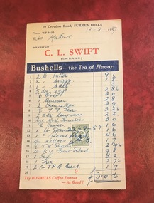
... or Thomas’ on Maling Road . ... on Union Road or Thomas’ on Maling Road . Dockets ...Clive Leslie Swift (RAAF 430415) was born in Elsternwick in 1924 and served in the RAAF in Borneo during WW2. He was mentioned in dispatches. He married Enid (Ina) Mary Smith in 1947. Together they ran the grocery store at 10 Croydon Road from 1949 until some time after 1954. In the 1980s they were living in Highbury Road, East Burwood and Clive was working for Unigate (later Bonlac) in a managerial position. (REF: Oral testimony, Libby Wilson, Canterbury History Group). The shop continued after the Swifts left but was later destroyed by fire. Clive Swift died in March 2014. This and other dockets were tucked into Ruth Matthews' recipe folder. Ruth and Harold Geoffrey (Geoff) Matthews lived at 42 Guildford Road, Surrey Hills. The donor recalled that her paternal grandmother (Ethel May Matthews) also occasionally shopped at the Swifts' shop as it was closer to her home (31 Guildford Road) than either than Griffith’s on Union Road or Thomas’ on Maling Road . Dockets such as these are reflective of shopping in the pre-supermarket era when women generally walked to the local shop or had proprietors or a staff member come to the house to take weekly orders. A pre-printed grocery docket for C. L. Swift (Late R.A.A.F.) on cream (slightly discoloured) paper printed in black, red and blue filled in with 19 hand-written items, their prices and the total of the grocery order. A green and cream duty stamp to the value of 3d is attached and over-signed with initials as having been paid. Order was for Mrs Matthews of Guildford Road.clive leslie swift, miss enid (ina) mary smith, mrs enid (ina) mary swift, croydon road, guildford road, grocery store, docket, accounts, bushells tea, mrs ruth matthews, harold geoffrey matthews, 'geoff' matthews -
 City of Moorabbin Historical Society (Operating the Box Cottage Museum)
Clothing - Clothing, City of Moorabbin Tie, Circa 1960s
... boundary Thomas Street ,and Bluff Road. In 1862 The Moorabbin... South East corner of Thomas Street and North Road , East ...The City of Moorabbin existed from 1934 until 1994. Henry Dendy's Special Survey in 1841 of 5,120 acres in the Parish of Moorabbin , extended from Port Phillip Bay , then East to Boundary Road, South to South Road and North to North Road and became known as Brighton. 1859 Brighton became a Borough with its boundary Thomas Street ,and Bluff Road. In 1862 The Moorabbin Roads Board was formed and the extended area now included Cheltenham, Hampton, Sandringham, Black Rock, Beaumaris, Mentone and Mordialloc .and Little Brighton became known as Bentleigh. In 1871 the area became known as The Shire of Moorabbin. Gradually the area was separated into The Borough of Sandringham 1917, ( Black Rock, Beaumaris , Sandringham and Hampton ) Borough of Mentone and Mordialloc 1920, ( Parkdale ). In 1934 The City of Moorabbin was established for the area from South East corner of Thomas Street and North Road , East to Warrigal Road, Clayton Road, Kingston Road , Lower Dandenong Road, then South along Nepean Highway to Balcombe Road and along Bluff Road, Cummins Road, Nepean Highway, Thomas Street to North Road In the 1994 Amalgamation of Councils the City of Moorabbin was divided between the new City of Kingston in the South ( from South Road) and the new City of Glen Eira to the North . It was the largest Municipality in Victoria with a population of 118,865 in 1974This tie c 1960 is a memento of the City of Moorabbin 1934 - 1994Maroon colour, polyester, man's tie with the crest of City of Moorabbin woven on front.around circle enclosing Coat of Arms ; CITY OF MOORABBIN city of moorabbin, moorabbin roads board, moorabbin, brighton, dendy's special survey 1841, early settlers, pioneers, market gardners, dendy henry, were jonathan b, cheltenham, bentleigh, mentone, sandringham, mair william, bent thomas -
 Bendigo Historical Society Inc.
Document - H.A. & S.R. WILKINSON COLLECTION: CONTRACT OF SALE
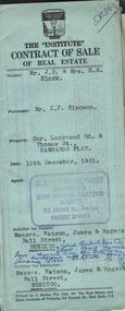
... Road & Thomas Street, Kangaroo Flat being allotment 29F..., Bull Street, Bendigo. Property Cnr. Lockwood Road & Thomas ...Contract of sale of real estate dated 13th December, 1961 between Mr. J.H. & Mrs. H.M. Hinck (vendor) and Mr. I. P. Simpson (purchaser). Solicitor for vendor: Messrs Watson, James & Rogers, Bull Street, Bendigo. Solicitor for purchaser Messrs. Watson, James & Rogers, Bull Street, Bendigo. Property Cnr. Lockwood Road & Thomas Street, Kangaroo Flat being allotment 29F of section 16 at Kangaroo Flat held under Residence licence Registered number 01686/129, together with all buildings and erections thereon. Price 1,800 pounds.organization, business, h.a. & s.r wilkinson real estate -
 Bendigo Historical Society Inc.
Document - THOMAS JAMES CONNELLY COLLECTION: LETTER 6 DEC ?
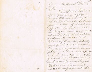
... The Thomas James Connelly collection. T. J. Connelly... TRADES Plumbing thomas james connelly Connelly Thomas James ...The Thomas James Connelly collection. T. J. Connelly - Brassfounder, Coppersmith, Plumber and Gasfitter. Located in High St. Bendigo. Items of correspondence. Letter headed Ballarat, December 6th, regarding the recommendation of two workmen who would be willing to come to Bendigo. The letter is from: Thomas Stewart, Tinsmith, Plank Road, Ballarat East, Post Office to be collected for. The letter is two columns on either side of the paper. There is a calculation written on the third side.trades, plumbing, thomas james connelly, connelly, thomas james. plumbers. -
 Ringwood and District Historical Society
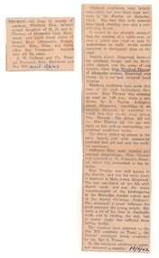
Newspaper - Clippings, Death of Miss Winifred Thomas of Alexander Avenue, Ringwood - June 1942
... . and A. Thomas of Alexander Road Ringwood, and much loved sister of Grace.... and A. Thomas of Alexander Road Ringwood, and much loved sister of Grace ...Death notice in local newspaper - Ringwood Mail 18/6/1942, and separate report of Miss Thomas being hit by a car driven by R. Naylor while crossing Station Street, Ringwood.Winifred Elva, beloved second daughter of H.O. and A. Thomas of Alexander Road Ringwood, and much loved sister of Grace,Rhys (deceased), Horace, Cornish, Rita, Elma and Gwen (Mrs Ron Westmore). Miss Thomas was well known in the district and for some years in business in Main Street, Ringwood. She was associated with church work including superintendent of the kindergarten at the Methodist Sunday school and the Junior Christian Endeavor. -
 City of Moorabbin Historical Society (Operating the Box Cottage Museum)
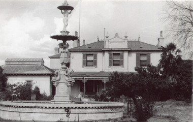
Photographs, x 4 Black & White, Whitmuir Hall / Killearnan / Bentleigh Club 1930, c1930
... estate bounded by McKinnon, Centre, Thomas and Wheatley Roads... by McKinnon, Centre, Thomas and Wheatley Roads is obscure. The gardens ...Whitmuir Hall was built 1850 using bricks hand -made from the clay of nearby Elster Creek. Early history of the 156 acre estate bounded by McKinnon, Centre, Thomas and Wheatley Roads is obscure. The gardens were laid out prior to 1850. Robert Gray Ford purchased 20 acres with mansion in 1872 for £ 1750 and it was valued at £ 25,000 in 1888 but sold after the Bank Crash 1890's for £ 5,000 in 1892. There were many owners over the years including Thomas Bent and in 1870 it was called 'Killearnan'. It is now is known as 'the Bentleigh Club and many original features have been restored and preserved . Whitmuir Hall, was a stately mansion built 1850 typical of the grandiose plans of successful early settlers. Stained glass Windows, furniture, imported from France and Italy have been preserved by the Bentleigh Club.4 of 13 Black & White photographs of Whitmuir Hall now Benleigh Club, Yawla St Bentleigh c 1930whitmuir hall, bentleigh club, killearnan, mansions, gold rush victoria, smith j l; smith mary ann, stanley helen, smith vic, smith harry redvers, chaff cutter, horse drawn carts, toll gates brighton, motor cars 1900, steam engines, early settlers, bentleigh, parish of moorabbin, city of moorabbin, county of bourke, moorabbin roads board, shire of moorabbin, henry dendy's special survey 1841, were j.b.; bent thomas, o'shannassy john, king richard, charman s, highett william, ormond francis, maynard -
 Eltham District Historical Society Inc
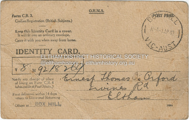
Photograph - Document, Identity Card: Ernest Thomas Orford, 1942
... Civilian Registration Identity Card issued to Ernest Thomas... Thomas Orford of Irvines Road, Eltham, farmer, signed by subject ...Civilian Registration Identity Card issued to Ernest Thomas Orford of Irvines Road, Eltham, farmer, signed by subject and witnessed by Elizabeth J. Cox of Eltham. This type of card was issued to British subjects who were civilians. During World War II everyone in Australia was issued with a personal identity card and was required to report changes of address to the government. These cards were particularly important in the identification and monitoring of Aliens (non-citizen residents) , particularly non-Europeans and Asian residents.1942, civilian registration (british subjects), elizabeth j. cox, eltham, ernest thomas orford, identity card, irvines road, second world war, ww2 -
 Kew Historical Society Inc
Archive (series) - Subject File, 'Bella Vista', (aka 'Malinda')
... which occupied the eastern corner of Thomas Street and Cotham... sources. malinda Bella vista Cotham road fr maas Abel hoadley ...Kew Historical SocietySince its foundation in 1958, members of the Kew Historical Society have been compiling and storing information about subjects relating to the history of Kew and its environs, of which this file is an example.Secondary values'Bella Vista' was a large Federation house built in 1902 which occupied the eastern corner of Thomas Street and Cotham Road. The house was built for Abel Hoadley who died in 1918. In 1937 Augustus Beker opened the property as a guest house named 'Malinda' Guest House. This closed in 1940. In 1941, the land was subdivided into four lots. During the 1940s, Fr. Maas opened a hostel for Dutch Catholic immigrants in the house. The house has now been demolished. The subject file contains an auction notice for the sale of Malinda in 1941 along with correspondence from 2016 detailing background information, a timeline of the demolition of th those, the name of the original owner, and other uses of the house's name.malinda, bella vista, cotham road, fr maas, abel hoadley, anthony heinemannmalinda, bella vista, cotham road, fr maas, abel hoadley, anthony heinemann -
 Kew Historical Society Inc
Plan - Subdivision Plan, Thornton Estate, 1918
... of ‘Thornton’ in Studley Park Road. Thomas Cubitt Balmain originally... Road. Thomas Cubitt Balmain originally owned Thornton, next ...The ‘Thornton Estate’ was the final subdivision of ‘Thornton’ in Studley Park Road. Thomas Cubitt Balmain originally owned Thornton, next to John Carson’s ‘Clutha’. Before its final subdivision, the Thomson family owned it. The Estate was a subdivision of 15 residential allotments running between Studley Park Road and Stevenson Street. The allotments faced these streets as well as Thornton Street, which the vendor undertook to make. Contemporary newspaper advertisements advised that ‘The estate possesses many advantages, notably its private and secluded, though convenient, position, splendid frontages and depths, and being close to the electric tram and Kew train, also within easy walking distance of the Victoria-street cable tram’. The terms offered purchasers were ten per cent deposit, with the balance to be paid in ten equal half-yearly payments at a rate of 5 per cent.subdivsion plans - kew, studley park, thornton estate -
Glen Eira Historical Society
Document - Memorials in Glen Eira
... Museum. - Rosstown Railway Marker, Bambra Road, Caulfield...’ in Caulfield Racing Museum. - Rosstown Railway Marker, Bambra Road ...This file contains one item: 1/A printout from the Victorian Memorials Database, undated and researcher unknown, containing records of 9 memorials in the Caulfield City municipality. These memorials are: - Caulfield Grammar School Site Pavement Marker, Elsternwick - Monument to racehorse ‘Jackstaff’ in Caulfield Racing Museum. - Rosstown Railway Marker, Bambra Road, Caulfield. - Thomas Alexander Browne Grave, Brighton Cemetery. - Grave of Sir John and Lady Monash, Brighton Cemetery. - Frederick Jowett Memorial Drinking Fountain, Caulfield Town Hall - Adam Lindsay Gordon Grave, Brighton Cemetery. - Jewish victims of World War 2 Memorial, Kadimah Centre, Elsternwick. - Hopetown Gardens Cannon, Elsternwick.historical markers, caulfield city, caulfield grammar school, elsternwick, regent street, caulfield racing museum, rosstown railway marker, caulfield, bambra road, curraweena road, marara road, city of caulfield, mayors, councillors, caulfield historical society, rosstown railway, caulfield grammar school pavement marker, monument to racehorse ‘jackstaff’, ross murray, browne thomas alexander, thomas alexander browne grave, brighton cemetery, rolf boldrewood, north road, caulfield south, browne margaret maria, grave of sir john and lady monash, monash john sir, monash hannah victoria lady, frederick jowett memorial drinking fountain, caulfield town hall, hawthorn road, glen eira road, jowett frederick, borough of caulfield, adam lindsay gordon grave, gordon adam lindsay, gordon annie lindsay, jewish victims of world war 2 memorial, kadimah jewish cultural centre and library, selwyn street, burston seddon, hopetoun gardens cannon, glenhuntly road, glen huntly road, schools, historic sites, plaques, footpaths, horseracing, horses, jackstaff, monuments and memorials, railways, authors, cemeteries, graves, gravestones, jewish community, town clerks, shire secretaries, town hall, drinking taps, poetry, children, libraries, world war 1939 – 1945, hopetoun, cannons, festivals and celebrations -
 Kew Historical Society Inc
Plan - Subdivision Plan, Bella Vista Estate, 1929
... Road and Alfred and Thomas Streets. In 1941, the land on which... Road and Alfred and Thomas Streets. In 1941, the land on which ...Pru Sanderson, in her groundbreaking ‘City of Kew Urban Conservation Study : Volume 2 - Development History’ (1988), summarised the periods of urban development and subdivisions of land in Kew. The periods that she identified included 1845-1880, 1880-1893, 1893-1921, 1921-1933, 1933-1943, and Post-War Development. These periods were selected as they represented periods of rapid growth or decline in urban development. An obvious starting point for Sanderson’s groupings involved population growth and the associated economic cycles. These cycles also highlighted urban expansion onto land that was predominantly rural, although in other cases it represented the decline and breakup of large estates. A number of the plans in the Kew Historical Society’s collection can also be found in other collections, such as those of the State Library of Victoria and the Boroondara Library Service. A number are however unique to the collection.The Kew Historical Society collection includes almost 100 subdivision plans pertaining to suburbs of the City of Melbourne. Most of these are of Kew, Kew East or Studley Park, although a smaller number are plans of Camberwell, Deepdene, Balwyn and Hawthorn. It is believed that the majority of the plans were gifted to the Society by persons connected with the real estate firm - J. R. Mathers and McMillan, 136 Cotham Road, Kew. The Plans in the collection are rarely in pristine form, being working plans on which the agent would write notes and record lots sold and the prices of these. The subdivision plans are historically significant examples of the growth of urban Melbourne from the beginning of the 20th Century up until the 1980s. A number of the plans are double-sided and often include a photograph on the reverse. A number of the latter are by noted photographers such as J.E. Barnes.Bella Vista (later ‘Malinda’) was a large Federation house designed by the architect Robert Haddon for Abel Hoadley. The house was built in 1902 and occupied the eastern corner of Thomas Street and Cotham Road. It was a single-storey, red brick house, set back from the road, featuring a central tower topped by a pagoda-like red terra cotta roof, on top of which was perched a very large terra cotta dragon. The Bella Vista subdivision of 1929 included Hoadley’s house as well as nine allotments facing Cotham Road and Alfred and Thomas Streets. In 1941, the land on which Hoadley’s house stood was to be further subdivided. Bella Vista is believed to have lasted until it was demolished in the 1980s.subdivision plans - kew, bella vista estate -
 Eltham District Historical Society Inc
Photograph - Digital Photograph, Alan King, Ore crusher, Golden King mine, Yarrambat, 22 January 2008
... of Ironbark Road at the corner of Yan Yean Road, and Thomas Ryenolds... of Ironbark Road at the corner of Yan Yean Road, and Thomas Ryenolds ...Prior to 1929 Yarrambat was known as Tanck's Corner or Reynold's Corner after Frederick Tanck who owned land north of Ironbark Road at the corner of Yan Yean Road, and Thomas Ryenolds who owned the property opposite. Tanck's Corner was at the centre of gold bearing country. Gold was mined here until 1984 when the last operating mine, the Golden King mine in North Oatlands Road closed. It was owned by the Clayton family and in the 1960s was the only private family gold mine in Victoria. Larger mines had their own batteries and stampers to process the ore. Covered under Heritage Overlay, Nillumbik Planning Scheme. Published: Nillumbik Now and Then / Marguerite Marshall 2008; photographs Alan King with Marguerite Marshall.; p23This collection of almost 130 photos about places and people within the Shire of Nillumbik, an urban and rural municipality in Melbourne's north, contributes to an understanding of the history of the Shire. Published in 2008 immediately prior to the Black Saturday bushfires of February 7, 2009, it documents sites that were impacted, and in some cases destroyed by the fires. It includes photographs taken especially for the publication, creating a unique time capsule representing the Shire in the early 21st century. It remains the most recent comprehenesive publication devoted to the Shire's history connecting local residents to the past. nillumbik now and then (marshall-king) collection, battery, clayton family, gold mining, golden king mine, ore crusher, tancks corner. reynolds corner, yarrambat -
 Warrnambool and District Historical Society Inc.
Title Search Document, 1930s to 1960s
... on Pertobe Road included Thomas King, Christopher Beattie, Thomas... identities who owned this property on Pertobe Road included Thomas ...These documents concern the property in South Warrnambool, Jetty Allotment 7, Section 4. They include a search made of the title of this property in 1937 and information on later purchasers of the property. The first owner of this property was James Cust who purchased it in April 1853. James Cust (1815-1860) came from Ireland to Australia in 1841. From 1847 on he farmed first at Woodford and then moved into Warrnambool and began land speculating.. In 1856 his property was valued at £20,000 but by 1858 he was declared insolvent following the insolvency of his financial backer, William Bateman and his properties were sold. He died in 1860 following an accident at a Ballarat gold mine. Other notable Warrnambool identities who owned this property on Pertobe Road included Thomas King, Christopher Beattie, Thomas Goodall, William McMahon and Alan Lane.These documents are of interest as they detail the history of a property in Warrnambool up to the 1960s. They are also an example of the type of property once owned by James Cust, an important early land speculator in Warrnambool. These are nine loose sheets of paper concerning a legal search made of a block of land in Warrnambool and later documents on the same property The papers contain handwriting in blue and black ink and pencil and one red stamp. One of the pages is an invoice for the charge made for the search.‘Searched 25/5/37 W.D. Richardson Titles Searcher 418 Little Collins Street Melbourne C1’james cust,, history of warrnambool -
 Kew Historical Society Inc
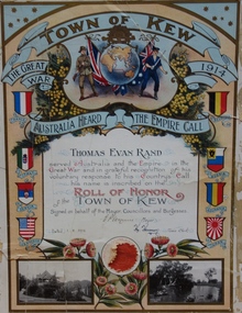
Certificate, Town of Kew, Thomas Evan Rand : Roll of Honor of the Town of Kew, 1918
... of Thomas Evan Rand of ‘Urangeline’, Barkers Road, Kew. Thomas Rand... of ‘Urangeline’, Barkers Road, Kew. Thomas Rand was an engineering ...Thomas Evan Rand was born at Hawthorn. He enlisted for service during World War One as an almost 20 year old engineering student, serving with the Australian Flying Corps.A commemorative certificate documenting the war service of Thomas Evan Rand of ‘Urangeline’, Barkers Road, Kew. Thomas Rand was an engineering student when he enrolled as a private in the Australian Army. He embarked on HMAT Orsova A67 on 16 March 1916. He was enlisted in the No 1 Squadron, Flying Corps. The formal certificate records that ‘ Thomas Evan Rand served Australia and the Empire in the Great War and in grateful recognition of his voluntary response to his Country’s Call his name is inscribed on the Roll of Honor of the Town of Kew’. The then Mayor and Town Clerk signed the certificate. [Kew did not become a ‘City’ until 1921]. The certificate highlights emblems and symbols of Australia and Great Britain, and includes the coats of arms of the allies in the war. The certificate is customised with two black and white photographs of Kew: the rotunda in the Alexandra Gardens at left, and boating on the Yarra River at right.Thomas Evan Rand served Australia and the Empire in the Great War and in grateful recognition of his voluntary response to his Country's Call his name is recorded on the Roll of Honor Town of Kew on behalf of the Mayor, Councillors and Burgesses. 1.8.18. E.P. Wynne [Mayor] H. Harrison [Town Clerk]roll of honor (kew), thomas evan rand, world war one, thomas rand, urangeline, kew, australian flying corps, alexandra gardens, wwi, yarra river -
 City of Moorabbin Historical Society (Operating the Box Cottage Museum)
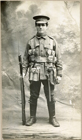
Photograph, 1916 William Henry Thomas in WW1 Uniform, 1916 William Henry Thomas in WW1 Uniform, 1916
... 1916 William Henry Thomas of Keys Road , South Brighton... William Henry Thomas of Keys Road , South Brighton (now Moorabbin ...1916 William Henry Thomas of Keys Road , South Brighton (now Moorabbin ) in WW 1 1914 -1918 1st AIF uniform. William was born in 1894 , Christened at the Wesleyan Church. (Methodist), Wickham Road, South Brighton and attended Moorabbin State School. . Private Thomas was a market gardener in Moorabbin prior to his enlistment in the Australian Imperial Force on 19 July 1915. Both his parents wrote separate letters giving their consent for their son to serve overseas due to " the pressing request of my son William Henry, also the urgent need of recruits do give my consent that he shall go to the front." September 29th 1915 he left Australia with the 5th Reinforcements of the 24th Battalion for Egypt. March 1916 he was hospitalised with Mumps and shortly after left Alexandria to join the British Expeditionary Force for France where he transferred to the 6th Australian Machine Gun Company.. Whilst on leave in England he received medical attention before returning to France and 13 November 1918 he spent a week in the care of the 7rh Field Ambulance suffering with influenza . Private Thomas returned to Australia on the hospital transport Castalia 13 April 1919 and his enlistment was terminated 26 September 1919Private William Henry Thomas and his family are examples of the patriotism exhibited by the market gardeners, and indeed throughout Australia, during the World War 1 1914-1918. Photograph is black and white. William Henry Thomas is standing straight and tall in the centre of the photograph, looking directly at the photographer while holding a weapon in his right hand. He is in his military uniform (WW1) .Front of Mount : Ainor Studio Auburn Back of Mount : William Henry Thomas / 1st World War 1916 / Keys Rd., Moorabbin / Born 1894 / Christened at Wesleyan ( Methodist ) Church / Wickham Rd., / South Brighton / now Uniting Church unsigned undatedwilliam henry thomas, 1916, 1894, first ww, world war one, uniform, wickham road, south brighton, moorabbin, world war 1 1914- 1918, thomas street,early settlers, pioneers, market gardeners, australian infantry force, soldiers, key's cup, victorian war memorials, cheltenham, mckinnon,, keys road moorabbin, ss castalia, british expeditionary force ww1 1914- 1918, 24th battalion 1st aif, 6th australian machine gun company 1st aif, influenza epidemic 1919, alexandria egypt, methodist church, -
 Surrey Hills Historical Society Collection
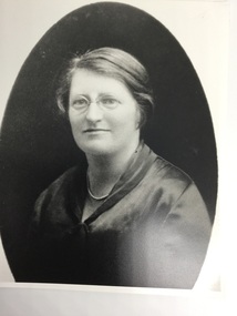
Photograph, Dr Roberta Donaldson
... uncle Thomas Emerson of Kent Road, Surrey Hills, talked her... to recover her health. Her uncle Thomas Emerson of Kent Road, Surrey ...Identified as Dr. Roberta Donaldson of "Luxmee", 4 Windsor Crescent, Surrey Hills. Dr. Donaldson was in practice in Surrey Hills for 50 years. After graduating in medicine at Melbourne University she was at the Royal Childrens Hospital when she decided to go to India as a member of the Zenana (?) Medical Women's Bible Group. She spent three years there but became ill and had to return home. It took a year or more to recover her health. Her uncle Thomas Emerson of Kent Road, Surrey Hills, talked her into commencing a practice at Surrey Hills which she did in Blackburn Street early in the 1920s. Within a short time she took over Dr. Navroji (Neville) Gandevia's practice in Windsor Crescent. Her sister Agnes joined her and their mother Amelia took over the care of the household enabling both sisters to concentrate on their practices. Her father had been a doctor at Linton, near Skipton and her brother was a doctor in Skipton. The practice ceased in 1970, Dr Roberta having given 50 years of service as a gynaecologist in Surrey Hills.A black and white photograph of a lady wearing round wire rimmed glasses. Her dark hair is pulled back from her face. She is wearing a satin-look top and a string of pearls.windsor crescent, house names, surrey hills, doctors, royal children's hospital, kent road, blackburn street, 'luxmee', dr roberta donaldson, thomas emerson, dr agnes donaldson, dr navroji (neville) gandevia -
 Wodonga & District Historical Society Inc
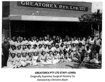
Photograph - Greatorex/ Supreme Surgical Hosiery Co. Wodonga
... Road (now Thomas Mitchell Drive). Due to expansion they later... in Beechworth Road, around the corner from Tallangatta Road (now Thomas ...The Greatorex company came to Wodonga in August 1945 under the Cain Government decentralisation policy. It initially had premises in Beechworth Road, around the corner from Tallangatta Road (now Thomas Mitchell Drive). Due to expansion they later relocated to the corner of Tallangatta Road and Anne Street Wodonga in 1952. Greatorex had its main manufacturing plant in Melbourne, Victoria. At their peak Greatorex Pty Ltd. which also operated as Supreme Surgical Hosiery Co., manufactured brassieres, swimsuits, elastic thread, surgical hosiery and employed 90 staff in Wodonga. The company which was operated by Thomas Greatorex with Mr M. P. Brain as Manager, also owned Fulflex Yarns Pty. Ltd. Fulflex produced elastic yarns to be used in the manufacture of garments at Supreme Surgical Hosiery. In 1960, due to the increasing cost of freight charges for moving raw materials and manufactured goods to and from Melbourne, the company was forced to close down. Plant and machinery valued at over £30,000 was moved to Melbourne. Some personnel were given the opportunity to also transfer to the parent company. In 2024, the company still operates as Greatorex Textile Industries P/L in Moorabbin, Victoria.These images are significant because they document an industry which operated in Wodonga in the 1940s and 1950s.A collection of black and white photos of workers at the Greatorex / Supreme Surgical Hosiery Co. in Wodonga.Names listed beneath one of the images.greatorex industries, wodonga industries -
 Glen Eira Historical Society
Document - Melbourne and Metropolitan Board of Works
... from Thomas St. to Wheatley Road, McKinnon. The periodical also... Creek drain from Thomas St. to Wheatley Road, McKinnon ...This file contains five items relating to Caulfield Council Visits with the Melbourne & Metropolitan Board of Works (MMBW) from 1919 to circa 1974: 1/A photo album containing photos from the MMBW ‘visit to the Headworks, Yan Yean Water Supply, Wallaby and Silvery Creeks’ from 28/02/1919 to 03/03/1919, attended by members of the Caulfield City Council. The album contains 13 original black-and-white photographs, 3 of which are of the council members. The album is accompanied by a report by Felicitie Campbell, written 11/2008, about these visits. 2/A publication from the MMBW documenting its review of operations for 1973-1974. The report contains information about water supply, sewerage and drainage infrastructure completed or in progress during this period including infrastructure in Caulfield, Ormond, Carnegie and Bentleigh. 3/A periodical feature from the MMBW titled ‘Living City’, issue no. 16, Spring/Summer 1974. Included in the article titled ‘Program’ is a notice that construction will continue on the Elster Creek drain from Thomas St. to Wheatley Road, McKinnon. The periodical also includes the names of commissioners W. R. Walters from Caulfield and G. R. Bricker from Moorabbin (back cover). 4/2 maps and 1 information booklet from the Thomson Project Open Day attended by Felicite and John Campbell as representatives of the Caulfield City Council. This was an annual MMBW open date. Date unknown. 5/Resarch notes by Kate Aldred about the photo album and Thomson Project Open Day booklet and their links to Felicite Campbell 01/04./2014.koornang road, draper street, hall street, centre road, brewers road, caulfield intercepting sewer, byron street, caulfield park, elster creek, caulfield, carnegie, ormond, bentleigh, thomas street, brighton east, wheatley road, mckinnon, city of caulfield, bricker g. r., walters w. r., caulfield city council, melbourne and metropolitan board of works, hall councillor, murray councillor, murphy councillor, wharington councillor, phillips councillor, blyth councillor, best robert sir, reid doctor, jowett mr., wooley mr., hindle mr., annual reports, water supply structures and establishments, sewerage and sanitation, sewerage establishments, drainage, town planning, business and finance, councillors, mayors, acqueducts, dams and reservoirs, creeks, waterfalls, rivers, construction sites, north road, north road pumping station, cities and towns, campbell felicitie -
 Kew Historical Society Inc
Plan, Melbourne & Metropolitan Board of Works : Borough of Kew : Detail Plan No.1569, 1905
... ). This plan covers parts of Sackville Street, John Street, Thomas... Street, John Street, Thomas Street and Cotham Road, and includes ...The Melbourne and Metropolitan Board of Works (MMBW) plans were produced from the 1890s to the 1950s. They were crucial to the design and development of Melbourne's sewerage and drainage system. The plans, at a scale of 40 feet to 1 inch (1:480), provide a detailed historical record of Melbourne streetscapes and environmental features. Each plan covers one or two street blocks (roughly six streets), showing details of buildings, including garden layouts and ownership boundaries, and features such as laneways, drains, bridges, parks, municipal boundaries and other prominent landmarks as they existed at the time each plan was produced. (Source: State Library of Victoria)This plan forms part of a large group of MMBW plans and maps that was donated to the Society by the Mr Poulter, City Engineer of the City of Kew in 1989. Within this collection, thirty-five hand-coloured plans, backed with linen, are of statewide significance as they include annotations that provide details of construction materials used in buildings in the first decade of the 20th century as well as additional information about land ownership and usage. The copies in the Public Record Office Victoria and the State Library of Victoria are monochrome versions which do not denote building materials so that the maps in this collection are invaluable and unique tools for researchers and heritage consultants. A number of the plans are not held in the collection of the State Library of Victoria so they have the additional attribute of rarity.Original survey plan, issued by the MMBW to a contractor with responsibility for constructing sewers in the area identified on the plan within the Borough of Kew. The plan was at some stage hand-coloured, possibly by the contractor, but more likely by officers working in the Engineering Department of the Borough and later Town, then City of Kew. The hand-coloured sections of buildings on the plan were used to denote masonry or brick constructions (pink), weatherboard constructions (yellow), and public buildings (grey). This plan covers parts of Sackville Street, John Street, Thomas Street and Cotham Road, and includes several very large houses in Sackville Street. Job Smith built ‘Berrington’ in about 1888-90 for himself, and ‘Pomeroy’ (now ‘Merridale’) in 1885 for James Mickleburgh. ‘Heathfield’ was built in 1888 for Henry Eeles, and was one of many fine homes in Kew, Hawthorn and surrounding suburbs designed by prolific architect John Beswicke; it later became “La Verna” and was a Franciscan monastery. Similarly, in Cotham Road, we can see ‘Bella Vista’ (now demolished), and ‘Charleville’, with its double-storeyed arcade frontage, built in 1889 for Charles Donaldson whose family occupied it until 1939. This was renamed ‘Ross House’ by the second owner, Dr. Thomas King, and then substantially restored in the 1960s by the Stillwell family, well known as car drivers and dealers. Bella Vista (later ‘Malinda’) was originally designed by the architect Robert Haddon and built for Abel Hoadley, inventor of the Violet Crumble Bar and many other delicious delicacies. He began by manufacturing jams and pickles in South Melbourne using fruit from his own orchard in East Burwood.melbourne and metropolitan board of works, detail plans, mmbw 1569, cartography -
 Eltham District Historical Society Inc
Photograph - Digital Photograph, Alan King, Golden King Mine poppet-head, Yarrambat Primary School, 1 February 2008
... Road, at the corner of Yan Yean Road, and Thomas Reynolds... Road, at the corner of Yan Yean Road, and Thomas Reynolds ...The Golden King Mine poppet-head stands at the school’s Yan Yean Road exit gate. Published: Nillumbik Now and Then / Marguerite Marshall 2008; photographs Alan King with Marguerite Marshall.; p23 Early Yarambat - Tanck's Corner Its early settlers, who in the 1840s were amongst the first non-Aboriginal people in the area, found life tough as they grazed their sheep and cattle. Yarrambat was then known as Tanck’s Corner or Reynolds Corner, after wood carter, Frederick Tanck, who owned land north of Ironbark Road, at the corner of Yan Yean Road, and Thomas Reynolds, owner of the opposite property. After Reynolds sold his land, the corner became known as Tanck’s Corner. In 1929 the district’s name was changed to Yarrambat, believed to mean ‘high hill’ in the Wurundjeri language. Tanck’s Corner was in the centre of gold-bearing country and the district is honeycombed with old tunnels and shafts. However although gold played a dominant role for decades, there was insufficient to develop a substantial township. Meat and agricultural produce made a greater impact. Until the mid-20th century the only substantial building was the primary school. The first gold rush occurred around 1860, the second after 1900; then during the Depression, the Government paid men to pan for gold. The first rush attracted hundreds of Chinese people to Smugglers Gully, who constructed round diggings to keep away spirits. Alluvial miners lived along the Plenty River in tents or humpies - some fenced with gardens - and some miners distilled their own ‘plonk’. It was a wild time and bushrangers - and later gangster Squizzy Taylor - were said to hide4 in the old Pioneer Tunnel in Dunne’s Gully between Heard Avenue and Pioneer Road. Mines opposite Tanck’s Corner included Beer’s Line, Golden Crown and Golden Stairs. Some of the big mines had batteries and stampers to process quartz. At first there was plenty of alluvial gold, as much as two ounces to the ton. At times gold was exposed after heavy rains so fossickers panned for gold around orchard irrigation trenches. Gold was mined until 1984 when Yarrambat’s last operating goldmine, the Golden King Mine, in North Oatlands Road, closed. The Clayton family operated it full-time, making a comfortable living and in the 1960s it was the only private family gold mine in Victoria.5 Gold was such an important part of Yarrambat’s history that a gold poppet-head is the Yarrambat Primary School’s logo. The Golden King Mine poppet-head stands at the school’s Yan Yean Road exit gate. However this school was built in 1988. The original school No 2054, at the corner of Ironbark and Yan Yean Roads, was opened in 1878 and modified to its present form in the 1920s. In 2000 it was relocated to the Heritage Museum at Yarrambat Park.7 The school, whose first head teacher was Charles Planner, consisted of one room with a three-roomed residence. The school was also the community centre. On Saturday nights it was crammed for dances or euchre parties, community singing or other social events. On Sundays, services for different denominations took turns each week. However the school had its teething problems. Parents accused Charles Planner of neglecting his duties and the school closed several times. When it closed in 1892, only church services continued. Social activities moved elsewhere, such as the tennis club to the Stuchbery tennis court opposite. A sports day and woodchop on Boxing Day around 1900 was held at the Evelyn Hill Hotel, also called Evelyn Arms and Tunnel Hill Hotel, on the Greensborough–Diamond Creek Road. An annual agricultural show in Diamond Creek paraded through the town, and New Year’s Day picnics at the Yan Yean Reservoir included highland dancing and competitions. Also popular were the Indian hawkers who visited every three months, selling trinkets, clothing and other items. One called Jimmy ‘Allem dem Bedi’, gave presents and told stories, played draughts and sold delicious curries he cooked over his camp fire at night.This collection of almost 130 photos about places and people within the Shire of Nillumbik, an urban and rural municipality in Melbourne's north, contributes to an understanding of the history of the Shire. Published in 2008 immediately prior to the Black Saturday bushfires of February 7, 2009, it documents sites that were impacted, and in some cases destroyed by the fires. It includes photographs taken especially for the publication, creating a unique time capsule representing the Shire in the early 21st century. It remains the most recent comprehenesive publication devoted to the Shire's history connecting local residents to the past. nillumbik now and then (marshall-king) collection, golden king mine, tanck's corner, yarrambat primary school -
 The Beechworth Burke Museum
Photograph
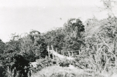
This rectangle black and white photograph shows a bush scene with part of a suspension rope and wooden plank bridge visible in the middle of the image. It is likely this suspension bridge was used by the Tannery workers to move between the town and the Ovens Tannery located South-West of Beechworth due to its secluded bush location, the bridge likely spanned the gorge across Spring creek. The tannery itself was located alongside Gimlet Creek, about three kilometres from town, down what is now known as Malakoff and Old Tannery Road but which at the time was remote and accessed through bushland. The Ovens tannery was stablished in 1858 by Matthew Dodd and Hallahan and later Matthew and his brother Thomas Dodd in 1866 who developed it over the years. According to Doyle, 'we have little information about its early operations except the tannery itself comprised four small buildings' by 1870 ‘a small village with gardens of vines and fruit trees surrounded the tannery’ (Woods, 121), and by 1887 the Tannery employed fifteen men. The Ovens tannery was among several new businesses establishing themselves such as a foundry that brought industrial manufacturing alongside the developing township and which strengthened the economic stability of Beechworth after the receding mining surge. According to Woods (p. 121) in the 1860’s the government spent considerable sums to establish several public buildings such as the Benevolent Asylum, the Hospital and Insane Asylum to support those in need of care in the area directly after the Indigo gold rush which had left Beechworth, a fairly remote regional and newly formed township (Gold was first discovered in Beechworth in 1852) with a number of infirm and destitute people in its wake and which due to the support and establishment of these facilities ‘made Beechworth a significant social welfare centre in Victoria’ (Woods, p. 121). The tannery provided employment and connected the regional centre with other parts of Victoria and the wider colonial outposts and would have been a welcome opportunity for those seeking work after gold was no longer a source of income.A good example of the ingenuity of regional settlers to achieve what would have been a difficult and remote construction of a bridge as a means of access. This bridge is evidence of planning and forethought and shows dedication to establishing a life in a remote landscape.Black and white rectangular photograph printed on paperreverse: / 2983 / / BMM2983 /black and white photograph, bush, suspension bridge, rope bridge, tannery, spring creek, ovens tannery, bushland, gimlet creek, matthew dodd, beechworth -
 The Beechworth Burke Museum
Audio - Oral History, Jennifer Williams, Miss Amy Elizabeth Porritt, 10th February 2000
... on Atkinson Road, Beechworth to Thomas Frederick Rodan and Maud Isabel... on Atkinson Road, Beechworth to Thomas Frederick Rodan and Maud Isabel ...Amy Elizabeth Porritt was born on the 21st of March 1915 on Atkinson Road, Beechworth to Thomas Frederick Rodan and Maud Isabel Dowling. Her family had strong associations with Australia's oldest continuously operating newspaper, the Ovens and Murray. Both her grandfather and father worked on this newspaper and played a significant role in continuing its operation. Amy was well-known in the Beechworth community and is remembered fondly for her generosity and her love of cats ‘they are all I live for’ she would often say. She was an avid gardener and had a beautiful garden at 47 Finch Street. This oral history recording was part of a project conducted by Jennifer Williams in the year 2000 to capture the everyday life and struggles in Beechworth during the twentieth century. This project involved recording seventy oral histories on cassette tapes of local Beechworth residents which were then published in a book titled: Listen to what they say: voices of twentieth century Beechworth. These cassette tapes were digitised in July 2021 with funds made available by the Friends of the Burke. Miss Amy Elizabeth Porrit's account of her life in Beechworth and the local area during the 20th century is historically and socially significant to the cultural heritage of the region. She details important historical events and hardships in the region's history that had a lasting local, regional and national impact, including Australia during war time, economic struggles, and women's societal roles in a rural area. This oral history account is socially and historically significant as it is a part of a broader collection of interviews conducted by Jennifer Williams which were published in the book 'Listen to what they say: voices of twentieth-century Beechworth.' While the township of Beechworth is known for its history as a gold rush town, these accounts provide a unique insight into the day-to-day life of the town's residents during the 20th century, many of which will have now been lost if they had not been preserved.This is a digital copy of a recording that was originally captured on a cassette tape. The cassette tape is black with a horizontal white strip and is currently stored in a clear flat plastic rectangular container. It holds up 40 minutes of recordings on each side.Miss Amy Elizabeth Porrit / listen to what they say, beechworth, oral history, burke museum, porritt, amy elizabeth porritt, gardener, ovens and murray newspaper, o&m