Showing 2222 items matching "old melbourne road"
-
 Ringwood and District Historical Society
Photograph, Ringwood City Band, Ringwood Band Members 1942 (Copy), 1942
copy of photo of two Ringwood band members sepia coloured taken in 1942 +Additional Keywords: 19 year old Len Polkinghorne and 74 year old Ted Allen photographed with their instruments. -
 Ringwood and District Historical Society
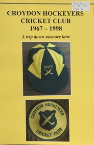
Book, Croydon Hockeyers Cricket Club 1967-1998 A trip down memory lane, Nov-16
Copy forwarded to Ringwood and District Historical Society by the author. The Society is included in Acknowledgements for facilitating access to old local newspapers for research.Season by season history of Croydon Hockeyers Cricket Club between 1967 and 1998, including fixtures, scores and photographs. Full page photo of the club's honour board included on the inside of the back cover. -
 Ringwood and District Historical Society
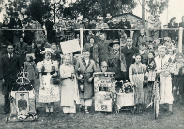
Photograph of Fancy-Dressed Children after WWI, Post-WWI
Photograph of Fancy-Dressed Children after WWI celebrating the end and victory of World War One. A child is dressed in a Dutch dress, others in a dressing gown, grass skirt, a soldier with gun. The parents and other adults are in the background, some learning on the fence. There is a building the top right corner. Possible the old Ringwood sports ground in Ringwood Street. Some children have displays with "Victory" on them. Another has the British and Australian flags. -
 Ringwood and District Historical Society
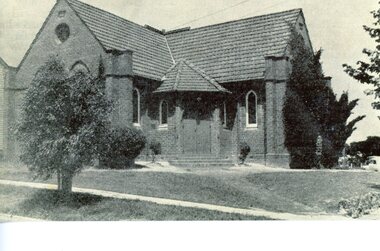
Photograph - Photographs, Ringwood Methodist Church, Station Street, before demolition in 1963 (undated)
... Road Ringwood North melbourne Old Methodist Church 2 Black ...2 Black and White photos of the Ringwood Methodist Church. Photos undated, but these buildings were demolished in 1963. These photographs are in the presentation album given to Vera Wigley in memory of her husband, builder Evan Wigley. See Registration Numbers 11002-00 to 11002-10 for the full set of photographs. Old Methodist Church -
 Ringwood and District Historical Society
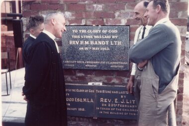
Photograph - Photographs, Ringwood Methodist Church, Station Street - Laying of Commemorative Plaques. 1963
B&W and Colour photos of the mounting of the old and new Commemorative Plaques on the Methodist Church 1963. Present are ministers and workman (unidentified in the photos). These photographs are in the presentation album given to Vera Wigley in memory of her husband, builder Evan Wigley. See Registration Numbers 11002-00 to 11002-10 for the full set of photographs. New Plaque: To the Glory of God. This stone was laid by Rev B.M. Bandt LTH on 18th May 1963. E.A.Wigley Builder; Rev H.J. Williams LTH, Minister. F.C.Armstrong Architect 1918 Plaque on Left: This Stone was laid to the glory of God By E.W. Greenwood Esq. M.L.A. on 23rd February 1918 1918 Plaque on Right: This Stone was laid to the glory of God By Rev. E.J.Little on 23rd February 1918 In Token of the Children's part in the Building of this Church. -
 Ringwood and District Historical Society
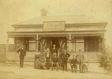
Photograph, Group outside Ringwood Coffee Palace c1890's
Copy of old sepia photograph of group outside Ringwood Coffee Palace, cnr Bedford Road and Greenwood Ave, Ringwood. Estimated to be c1890's but no identification on the photograph and source/original unknown. None -
 Ringwood and District Historical Society
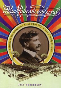
Book, Jill Robertson, MacRobertsonland, 2010
MacRobertson's chocolate factory in Fitzroy, Victoria, expanded to Ringwood at 323 Canterbury Road before takeover in 1968 by Cadbury-Schweppes P/L.Small paperback biography of Macpherson Robertson (1859-1945)"Meet the man behind some of Australia's favourite confectionery - including Freddo Frog, Cherry Ripe and Old Gold chocolate - a charming self-made millionaire and generous philanthropist whose spirit reflected the hopes and dreams of a young nation. MACROBERTSONLAND tells the amazing rags-to-riches tale of Macpherson Robertson, Austrlia's very own Willy Wonka." -
 Ringwood and District Historical Society
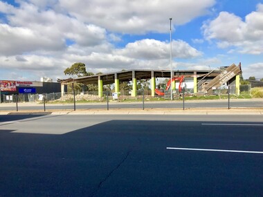
Photograph - Multiple, Demolition of Iceland Building, 28 Maroondah Highway, Ringwood 19 July 2019, 19/7/2019
Built in 1970 by Pat Burley, Iceland was a popular attraction, with bands as well as ice skating. It was sold in 1981, and subsequently was converted into various business units. 4 photos taken during the demolition if the old Ringwood Ice-skating Rink building, Iceland, 28 Maroondah Highway between New Street and the freeway. -
 Ringwood and District Historical Society
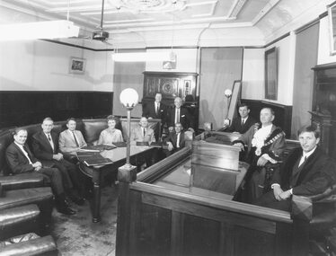
Photograph, Last Ringwood Council meeting in old Town Hall chambers - 1969
Black and white photograph"Written on back of photograph" Last Council meeting - Old Town Hall Chambers. 8/12/69 L to R Cr McCrae, Vergers, Morris, Palmer, Aus, Smart, McCubbin,(Standing), Martin, C/E Mr Robertson, Mayor Cr BJ Hubbard, T/C Mr Webster -
 Ringwood and District Historical Society
Flyer, Executor's Auction Subdivision Advertisement, Lilydale Road and Oban Road, Ringwood East, Vic. - 1937
... Road Ringwood North melbourne Subdivision includes Old Lilydale ...Single page advertisement for Executor's Auction of land in Ringwood East on Saturday, May 29, 1937 with locality map showing 26 building sites for auction highlighted in brown, and brief summary of local services available. Subdivision includes Old Lilydale Road, Joseph Street, Dynes Street, Albert Street (later Wyrunga Street), Carcoola Road, and Mount Dandeong Road. (Carcoola Road incorrectly shown as Oban Road on the subdivision plan). Auctioneer - C.E. Carter, (Phone Ringwood 24. -
 Ringwood and District Historical Society
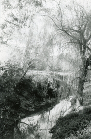
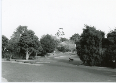
Photograph, Mullum Mullum Creek towards Ringwood Street, near old Melbourne Street off Miles Avenue, on 10th September 1989, 1989
Digital photograph -
 Ringwood and District Historical Society
Map, Allotments - Township of Ringwood - Parish of Ringwood - County of Mornington - 1886, 1886
[Page 3, Horse Shoes to High Heels - Richard Carter] ... "(In the year 1882) the railway was extended from Hawthorn through Ringwood to Lilydale and later to Ferntree Gully." Linen-backed map of Ringwood area lithographed at the Department of Lands and Survey, Melbourne, 5th November, 1886.old lilydale road, new lilydale road, victoria brick and tile co., ringwood brick co., federal brick co. -
 Ringwood and District Historical Society
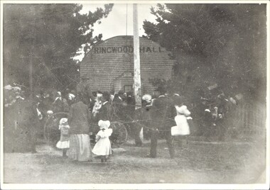
Photograph, Ringwood Hall, Mount Dandenong Road, Ringwood - circa 1900, Circa 1900
Ringwood Hall was located near the Club Hotel in Mount Dandenong Road prior to construction of Mechanics Institute/Town Hall in Maroondah Highway in 1909.Black & white photo of crowd gathered at original Ringwood Hall, Mount Dandenong Road, Ringwood. "Old Ringwood Hall nr. Club Hotel, later burnt down approx 1909". "Old Ringwood Hall prior to Mech Inst of 1909". -
 Ringwood and District Historical Society
Photograph, Eastland from Warrandyte Road, Ringwood. Site of the Esso Garage (Demolished) and Scots Church Hall (To be demolished) to build the Eastland carpark on 24 October 1992
Digital photographZania Palius in old Van Praet garden, demolished Xmas 1992 -
 Ringwood and District Historical Society
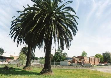
Photograph, Parking area at the rear of the old Ringwood Library in Pratt St, Ringwood on 10 September 1989
Digital photograph -
 Ringwood and District Historical Society
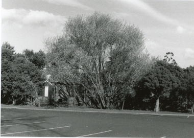
Photograph, Old Ringwood Library at the end of Pratt Street, Ringwood on 10 September 1989
Digital photograph -
 Warrnambool and District Historical Society Inc.
Audio - Audio CD, Tapestry: our Pye family history through all generations, Early 21st century
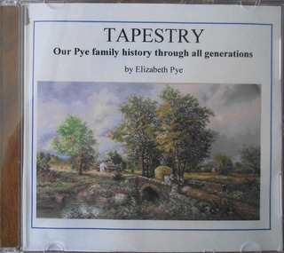
This DVD gives information about the Pye family. Thomas Pye came to Sydney as convict in 1837 and was assigned to work for Captain Sylvester Brown and came to the Port Philip district with his master. Sylvester's son, Thomas, travelled to the Western District in 1844 and took Thomas and his wife. Mary with him. Thomas Browne later wrote novels under the name of Rolf Boldrewood . In his book " Old Melbourne Memories " Thomas Pye is given the name Joe Burge. Thomas Browne established the property "Squattlesea Mere" and Thomas Pye and his family settled in Port Fairy and then in Bessiebelle. Today this little settlement has many Pye descendants. The other matter of interest is that Thomas Pye's son,Charles Pye, gained the Victoria Cross in India and is buried at Tower Hill. his DVD is of historical interest because it records the story of the Pye family in the Western District.This is a DVD with blue hand writing on the front and an accompanying sheet of paper showing an English country scene. It is enclosed in a plastic mesh envelope.TAPESTRY Our Pye Family history through all generations by Elizabeth Pye.pye family, warrnambool, captain sylvester brown, thomas browne, rolf boldrewood -
 Warrnambool and District Historical Society Inc.
Book, The Miner’s Right, 1922
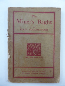
This book about the New South Wales goldfields was written by Rolf Boldrewood in 1890. It is retained because the author played a significant part in Warrnambool’s history. Rolf Boldrewood, the pen name of Thomas Browne, first came to the Warrnambool district in 1842, visiting the Bolden brothers’ property, Grasmere. He camped on the banks of the Merri River for about six months and described the area, including Warrnambool Bay, some years later in his book Old Melbourne Memories. In 1844 Thomas Browne established the property, Squattleseamere near Bessiebelle, north west of Portland. He remained there for ten years then moved to New South Wales. The last forty years of his life were spent writing and he became well-known for the classic Australian novel, Robbery Under Arms. This book is retained because it is a 19th century example of the writings of Rolf Boldrewood. He is important in Warrnambool’s early history as he was in the area in the early 1840s. His account of the area at that time is the most important one we have of the area that was later to be the site of the new settlement of Warrnambool.This is a soft cover book of 188 pages. The cover is brown with red edging and lettering and is partly detached from the binding. The spine is partly missing. The pages are dog-eared and there is some foxing. The text is printed in two columns to a page. Frank J. Donovanrolf boldrewood (thomas browne), bolden brothers in the warrnambool area, warrnambool history, the miners right -
 Warrnambool and District Historical Society Inc.
Photograph, Old Lyndoch - Photograph of Painting, Late 19th century (original painting); late 20th century (photograph of painting)
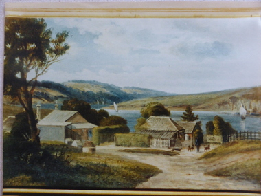
This is a photograph of a painting by the noted artist George Webb (1861-1949). Webb was best known for his portraits of civic dignitaries in Melbourne and Adelaide but he also produced many landscapes and seascapes. Some of these feature Warrnambool landmarks as he married, in the late 1890s, Christina Lake, the step-daughter of George Rolfe who owned the property known as ‘Lyndoch’, near the mouth of the Hopkins River. Webb painted the early cottages at ‘Old Lyndoch’ using a photograph taken some time earlier. The painting was given to Dick Allan, the chauffeur in the employ of Florence Lake, Christina’s sister. Florence Lake owned and resided at Lyndoch after her parents’ death. Dick Allan’s son, living in Tasmania, acquired the painting and Les O’Callaghan obtained the photograph of the painting from him. Although this is only a photograph of an original painting, it is of some considerable importance as the painting has great historical significance and this is the only representation we have of it. The man in the photograph represents George Rolfe and the story of Rolfe and his ownership and development of the property of Lyndoch is an important one in Warrnambool’s history. The original by George Webb is also an important work of art in its own right.This is a colour photograph of a painting. The frame of the original painting can be seen at the bottom of the photograph. The photograph is in on old frame which has two wooden edgings with the outer one having an ornate gold plaster edging and an inner one with a gold velvet insert next to the glass. The ornate gold plaster has a piece missing near the top left hand corner. The photograph is set into a gold-coloured wooden frame inside the glass. The photograph is mounted onto cardboard and covered with cardboard at the back with a small piece of wood attached (from the original frame). The backing is nailed on. lyndoch, george webb, george rolfe -
 Warrnambool and District Historical Society Inc.
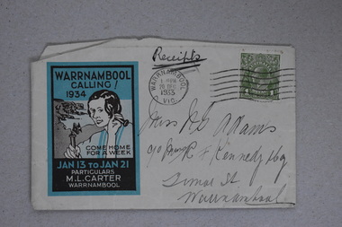
Document, Warrnambool calling, 1933
This is a souvenir of a ‘Back To’ celebration in Warrnambool in 1934. There had been a large-scale ‘Back To’ in Warrnambool in 1930, perhaps prompted by the growing interest in the history of the town ( this was evidenced in many country towns in Victoria at the time) and the need to gather together the remaining older local people as those regarded as pioneers of the district were fast dying out. In 1934 the State of Victoria was celebrating the centenary of the first permanent white settlement at Portland and many other places besides Melbourne took this opportunity to have a reunion of past and present citizens. Also Warrnambool had at the time two men very interested in the history of the settlement – Henri Worland and Patrick O’Grady and the first Warrnambool Historical Society was established the following year with Worland and O’Grady prominent in its establishment and Martin Carter on the first committee as well. Martin Carter, whose name appears on this envelope was the organizer of the 1934 reunion. The Carter family had long been established in Warrnambool as saddlers and Martin Carter was a Warrnambool Councillor from 1917 to 1925 and Mayor during three of those years. No information is available on the ‘Miss Adams ‘ in the address but ‘ R. F. Kennedy & Co.’ refers to the well-known pharmacy business in Timor Street Warrnambool.This envelope is of interest as a souvenir of a ‘Back To’ in Warrnambool in 1934. This is a small envelope with most of the back flap missing. The inside of the envelope has a blue lining. The envelope has a franked green Australian stamp and a Warrnambool Post Office stamp. A handwritten address is on the right side of the envelope. On the left side is a printed poster/advertisement in blue, black and grey colouring. The advertisement features an illustration of a woman speaking into a telephone with a coastal scene background. ‘Warrnambool Calling 1934 Come Home For a Week Jan 13 to Jan 21 Particulars M.L.Carter Warrnambool’ ‘Miss A. G. Adams C/O Messrs R.F.Kennedy & Coy Timor Street Warrnambool back to warrnambool 1934, history of warrnambool -
 Warrnambool and District Historical Society Inc.
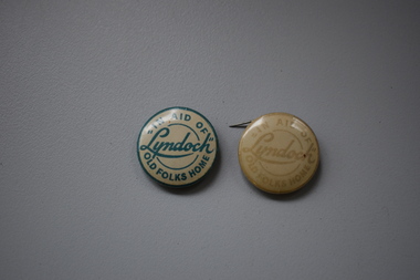
Badges, A.W.Patrick, Lyndoch, 1950s
These badges were produced in the 1950s to raise funds for the Lyndoch Old Folks Home in Warrnambool. This aged care facility at the mouth of the Hopkins River was opened in 1952 when the property known as Lyndoch was purchased. Lyndoch had been established in the 1880s by the Melbourne businessman George Rolfe who bought up a considerable amount of land in the Warrnambool district in the late 19th century. After George Rolfe died his step-daughter, Florence Lake built the bungalow known as Lyndoch and this building was the basis for the development of the property into an aged care facility. Today the facility has been considerably expanded and is known as Lyndoch Living. These badges are retained as mementoes of the type of fund-raising ventures conducted in the 1950s to raise funds for local charities in Warrnambool – in this case ‘Lyndoch’ Old Folks Home..1 A metal badge with green lettering on a cream-coloured background. The rusted back has a metal clip and the name of the maker is printed around the edge of the badge. .2 As above except that the lettering is very faded and the clip at the back does not work. In aid of “Lyndoch” Old Folks Home A.W.Patrick N. Fitzroy Vict. lyndoch living aged care facility, history of warrnambool -
 Warrnambool and District Historical Society Inc.
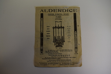
Document - Illustrative document of Alderdice Brassfounders Company Products, c.1950
This item advertises and describes a power pumping head and other products made by Alderdice Brassfounders of Warrnambool. Brothers William and Charles Downing came from Melbourne to Warrnambool in 1898 and established the Atlas Brassworks. In 1901, with the involvement of John Alderdice, the Downing brothers began the Alderdice Brassfounders Company situated at 64 Henna Street in Warrnambool, the site of an old cordial factory. This business which produces fittings used in farming, factories, public utilities, Government departments etc., still operates at the same address.This item is of considerable interest as an early example of the the business activities of Alderdice Brassfounders Co., a prominent business in Warrnambool for over 120 years.This is a sheet of paper describing a power pumping head one side and other products of the Alderdice Brassfounders Company on the other. It contains black printing and black and white illustrations on both sides of the paper. Three of the illustrated items have been crossed out.warrnambool industries -
 Eltham District Historical Society Inc
Photograph, Fay Bridge, Rosehill Homestead, EDHS Heritage Excursion, 6 July 2019
July Excursion July 6, 2019 - Exploring Lower Plenty The predominant feature of this walk in the Bonds Road area, Lower Plenty is the large number of magnificent old River Red Gums that line the route. These trees are of the spreading woodland form of this species indicating that they must have been originally growing in a reasonably open setting. The walk also includes parts of the historic Cleveland Estate and the homestead “Rosehill” established by pioneer farmer Henry Stooke. This area was the site of the first recorded European settlement in what was to become the Shire of Eltham when the Willis brothers arrived in the late 1830s. From the southern part of Cleveland Avenue there are extensive views across and along the Yarra Valley. An article on the history of this area was contained in Newsletter edition 201, November 2011. The walk will start at the at the corner of Bonds and Stawell Roads, Lower Plenty - EDHS Newsletter No. 246 June 2019fay bridge collection, 2019-07-06, blackburn bricks, eltham district historical society, heritage excursion, rosehill homestead, lower plenty -
 Eltham District Historical Society Inc
Photograph, Fay Bridge, Old footbridge, 195 Laughing Waters Road, Eltham, n.d
This old footbidge is situated close to the shack that Gordon Ford built on the Yarra at Laughing Waters Road. Bernie Bragg also used to live there for a period of time. Gordon Ford and photographer Sue Winslow were married in 1965. They set up home in an old log cabin on the property Gordon had purchased in 1954 on Laughing Waters Road. Situated between the Yarra River and Overbank Road, Gordon had built a small mud-brick shack on the river and a pontoon. Over the decades the shack has been locally referred to as “the love shack”, the “rooting shack” or simply “Gordon’s shack”. Gordon and Sue commissioned local builder Graeme Rose to do a wattle and daub renovation and extension to the old log cabin on the north side of Laughing Waters Road. The work had only just been completed in 1965 when a bushfire swept through the area and destroyed the cabin. Gordon and Sue relocated to his property, Fulling, in Pitt Street, Eltham. In 1970 work started on a new house at the Laughing Waters property. Originally known as the Banana House, it is now known as Boomerang. Designed by Alistair Knox, the mud-brick house includes iron window grilles made by Matcham Skipper that puncture the curved mud walls. The grilles were made from ‘off-pressings’ from the Sidchrome tool works in Heidelberg. Gordon, Sue and family moved into the house in 1972. Their marriage fell apart and Sue moved to Sydney with the children around the same time Gordon commenced building Birrarung just below Boomerang on the Laughing Waters Road block. After the Fords moved out, Boomerang it was rented out to various share households of students, musicians, artists and environmentalists for twenty-four years. Gordon Ford sold Birrarung and Boomerang to Melbourne Water in 1999. The Laughing Waters Artist in Residence Program was developed as a partnership between Parks Victoria and Nillumbik Shire Council. Boomerang was deemed unfit for habitation so was used as a day studio only. By 2001 Boomerang was in a poor state of repair and by 2002 the last artist in residence was to use the house as a studio. Nillumbik Shire Council had been granted funds from the Melbourne Community Fund to restore both Boomerang and Birrarung but it was apparent in early 2003 that the funds would be insufficient to restore both houses. Boomerang was infested with termites which presented a risk to any occupants and so the decision was made to close Boomerang and concentrate funding on Birrarung. Boomerang was fenced off for safety and to prevent intrusion and remains ‘caged’ today (2023). However, it is readily apparent the property has been occupied by squatters over the years. By 2023 it was clear that the squatters had abandoned the property and sections of the roof structure have given away in some areas and collapsed internally. For a more in-depth description and history of the property and that of Gordon and Sue Ford, see Jane Woollard's book, "Laughing Waters Road; Art, Landscape & Memory in Eltham" published 2016.fay bridge collection, bernie's hut, birrarung, footbridge, gordon ford, gordon's shack, laughing waters road, love shack, yarra river -
 Eltham District Historical Society Inc
Photograph - Aerial Photograph, Landata, Montmorency, Feb. 1956
Centred on present day Grand Boulevard and Olympic Way, Montmorency bounded by Diamond Street to north, Old Eltham Road and Eltham Lower Park to south, Bible Street to east and Para Road to west. Historic Aerial Imagery Source: Landata.vic.gov.au Aerial Photo Details: Project No :250 Project : MELBOURNE OUTER SUBURBS PROJECT Run : 17 Frame : 115 Date : 02/1956 Film Type : B/W Camera : EAG9 Flying Height : 10000 Scale : 12000 Film Number : 1176 GDA2020 : 37°43'24"S, 145°07'55"E MGA2020 : 335375, 5823236 (55) Melways : 21 F7 (ed. 42)aerial photo, 1956-02, neil webster collection, eltham, main road, montmorency, bible street, diamond street, eltham lower park, grand boulevard, melway 21f7, old eltham road, olympic way, para road -
 Eltham District Historical Society Inc
Photograph - Aerial Photograph, Landata, Lower Plenty, Feb. 1956
Centred on present day 217 Old Eltham Road, Lower Plenty bounded by Pitt Street to north, Yarra River to south, Main Road to east and Bonds Road to west. Historic Aerial Imagery Source: Landata.vic.gov.au Aerial Photo Details: Project No :250 Project : MELBOURNE OUTER SUBURBS PROJECT Run : 17 Frame : 116 Date : 02/1956 Film Type : B/W Camera : EAG9 Flying Height : 10000 Scale : 12000 Film Number : 1176 GDA2020 : 37°43'58"S, 145°07'49"E MGA2020 : 335237, 5822186 (55) Melways : 21 E10 (ed. 42)aerial photo, 1956-02, neil webster collection, eltham, main road, bonds road, elham, lower plenty, melway 21e10, pitt street, yarra river -
 Eltham District Historical Society Inc
Photograph - Aerial Photograph, Landata, Lower Plenty, Vic, Apr. 1963
Centred on present day Old Eltham Road near Araluen Centre, Lower Plenty bounded by Cromwell Street to north, Yarra River to south, Main Road at Mount Pleasant Road to east and Panorama Avenue to west. Historic Aerial Imagery Source: Landata.vic.gov.au Aerial Photo Details: Project No :486 Project : MELBOURNE (1963) PROJECT Run : 7 Frame : 231 Date : 04/1963 Film Type : B/W Camera : RC8 Flying Height : 5100 Scale : 9600 Film Number : 1805 GDA2020 : 37°44'03"S, 145°07'56"E MGA2020 : 335420, 5822027 (55) Melways : 21 F10 (ed. 42)aerial photo, neil webster collection, 1963-04, araluen, cromwell street, eltham, lower plenty, main road, melway 21f10, mount pleasant road, old eltham road, panorama avenue, yarra river -
 Eltham District Historical Society Inc
Photograph (Item) - Print, Michael Ridley, Untitled (Roycroft Bookshop, exterior), 1988
Roycroft Antiquarian Booksellers run by Lloyd Hollyoak and specialising in old, rare and out of print books was located at 1026 Main Road, Eltham next to present-day Flight Centre. In the early 1990s the store relocated to Kew and is now known as Abra Card Abra Roycroft. Michael Ridley 1988 Entrant No. 20 Ref: Series 34, Items 7, 8, 52-55 SHIRE OF ELTHAM COMMUNITY PHOTOGRAPHIC SURVEY Photography is an artform which many of us practice, sometimes purely for artistic pursuit, sometimes to record the people and events in our lives. In 1988, as part of a local Bicentennial project, the Shire of Eltham conducted the Eltham Community Photographic Survey. Up to 100 entries were to be selected by a panel of photographers for entry into the Eltham Photographic Survey Exhibition. Entries had to be submitted by May 13, 1988. Entrants whose images were selected for the exhibition were contacted and requested to further submit an entry form providing entrant’s name, area of residence, age, and proposed captions. These details were then used to produce labels for the exhibition mounts. Where negatives had not been supplied, these were requested to support the display of printed enlargements mounted on 10” x 8” cardboard. The mounted prints were made available post exhibition for sale at $8.50 each for colour prints and $7.00 for B&W prints. Residents in the Shire were invited to collect a free roll of film and take a photograph of what they either liked or did not like about the area. A total of 160 entrants submitted multiple entries for the exhibition. Of those selected for exhibition, entrants ranged in age from 9 to 70 years. All custom colour and black and white printing for the exhibition was completed by Wattle Studios of Eltham. The Eltham Photographic Survey was jointly auspiced by the Shire of Eltham and Wattle Studios, of 953 Main Road, Eltham. The project was greatly assisted by: • David McRitchie, Media Studies Lecturer Victoria College, Rusden Campus. • Ian and Annette Toohill of Wattle Studios • Tracy Naughton, Eltham Community Arts Officer • Neville Emerson Pty. Ltd. • Superior Press, Eltham • Kodak Australasia Pty. Ltd. • Agfa Gevaert Ltd. • Townsend Colourtech Pty. Ltd. • The Australian Bicentennial Authority • Eleanor Bowers, Secretary, Eltham Arts Council The exhibition was placed on display in the Woolworths Arcade, Eltham between Monday June 6th and Saturday June 11, 1988. It was also intended to hold the exhibition at a venue in the Shire’s North Riding from Monday, June 20 to Friday June 24. It was then displayed at the Were Street Theatre, Montmorency from Friday, June 24 to Thursday, July 7. Series 34: Eltham Community Photographic Survey 1988 - Prints & Documentation Series consists of 117 photographs of Shire scenes taken by members of the community. Items I - 41 are larger photographs mounted on card, which were exhibited. Items 42 - 117 are unmounted copies, alternative takes and other entries. Corresponding negatives contained in Series 35: Eltham Community Photographic Survey 1988 – Negatives which consists of 267 colour and B&W negatives and one colour slide of Shire scenes taken by members of the community. The negatives are arranged by the entrant number of the photographer. The Eltham Community Photographic Survey collection is significant to the local community as it was curated by the local community - ordinary people of all ages - representing what they liked and did not like in the area where they lived. It represents an unfiltered representation of the Shire of Eltham as it was in 1988. It also represents one of many projects as part of the national programme of events and celebrations to commemorate the bicentenary. It is a time capsule of life in the 1980s of this urban and rural municipality in Melbourne's north. Front: Entrant No. and name on printed label Rear: Entrant No., name and address on printed label; also 'Series 34' and the 'Item No.' in pencilshire of eltham archives, bicentennial project, eltham, eltham community photographic survey, eltham photographic survey exhibition, series 34, series 35, scan - 35mm negative, eltham shops, film - ilford fp4, main road, michael ridley, roycroft antiquarian booksellers -
 Eltham District Historical Society Inc
Photograph (Item) - Print, Michael Ridley, Untitled (Roycroft Bookshop interior), 1988
Roycroft Antiquarian Booksellers run by Lloyd Hollyoak and specialising in old, rare and out of print books was located at 1026 Main Road, Eltham next to present-day Flight Centre. In the early 1990s the store relocated to Kew and is now known as Abra Card Abra Roycroft. Michael Ridley 1988 Entrant No. 20 Ref: Series 34, Items 7, 8, 52-55 SHIRE OF ELTHAM COMMUNITY PHOTOGRAPHIC SURVEY Photography is an artform which many of us practice, sometimes purely for artistic pursuit, sometimes to record the people and events in our lives. In 1988, as part of a local Bicentennial project, the Shire of Eltham conducted the Eltham Community Photographic Survey. Up to 100 entries were to be selected by a panel of photographers for entry into the Eltham Photographic Survey Exhibition. Entries had to be submitted by May 13, 1988. Entrants whose images were selected for the exhibition were contacted and requested to further submit an entry form providing entrant’s name, area of residence, age, and proposed captions. These details were then used to produce labels for the exhibition mounts. Where negatives had not been supplied, these were requested to support the display of printed enlargements mounted on 10” x 8” cardboard. The mounted prints were made available post exhibition for sale at $8.50 each for colour prints and $7.00 for B&W prints. Residents in the Shire were invited to collect a free roll of film and take a photograph of what they either liked or did not like about the area. A total of 160 entrants submitted multiple entries for the exhibition. Of those selected for exhibition, entrants ranged in age from 9 to 70 years. All custom colour and black and white printing for the exhibition was completed by Wattle Studios of Eltham. The Eltham Photographic Survey was jointly auspiced by the Shire of Eltham and Wattle Studios, of 953 Main Road, Eltham. The project was greatly assisted by: • David McRitchie, Media Studies Lecturer Victoria College, Rusden Campus. • Ian and Annette Toohill of Wattle Studios • Tracy Naughton, Eltham Community Arts Officer • Neville Emerson Pty. Ltd. • Superior Press, Eltham • Kodak Australasia Pty. Ltd. • Agfa Gevaert Ltd. • Townsend Colourtech Pty. Ltd. • The Australian Bicentennial Authority • Eleanor Bowers, Secretary, Eltham Arts Council The exhibition was placed on display in the Woolworths Arcade, Eltham between Monday June 6th and Saturday June 11, 1988. It was also intended to hold the exhibition at a venue in the Shire’s North Riding from Monday, June 20 to Friday June 24. It was then displayed at the Were Street Theatre, Montmorency from Friday, June 24 to Thursday, July 7. Series 34: Eltham Community Photographic Survey 1988 - Prints & Documentation Series consists of 117 photographs of Shire scenes taken by members of the community. Items I - 41 are larger photographs mounted on card, which were exhibited. Items 42 - 117 are unmounted copies, alternative takes and other entries. Corresponding negatives contained in Series 35: Eltham Community Photographic Survey 1988 – Negatives which consists of 267 colour and B&W negatives and one colour slide of Shire scenes taken by members of the community. The negatives are arranged by the entrant number of the photographer. The Eltham Community Photographic Survey collection is significant to the local community as it was curated by the local community - ordinary people of all ages - representing what they liked and did not like in the area where they lived. It represents an unfiltered representation of the Shire of Eltham as it was in 1988. It also represents one of many projects as part of the national programme of events and celebrations to commemorate the bicentenary. It is a time capsule of life in the 1980s of this urban and rural municipality in Melbourne's north. Front: Entrant No. and name on printed label Rear: Entrant No., name and address on printed label; also 'Series 34' and the 'Item No.' in pencilshire of eltham archives, bicentennial project, eltham, eltham community photographic survey, eltham photographic survey exhibition, series 34, series 35, scan - 35mm negative, eltham shops, film - ilford fp4, main road, michael ridley, roycroft antiquarian booksellers -
 Eltham District Historical Society Inc
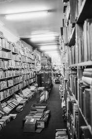
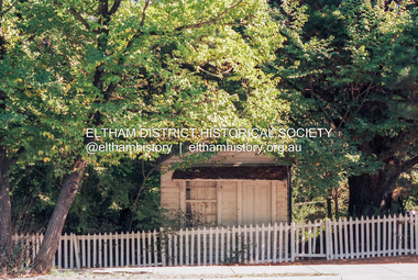
Photograph (Item) - Print, Craig Price, Old Bootmakers Shop in Main Road, Eltham - Eltham's history worth preserving, 1988
701 Main Road, Eltham Situated originally on the corner of the Dalton Street road reserve west of Main Road (now present-day Wingrove Park Trail), the former Jarrold Cottage (White Cloud) was purchased by Lena Skipper following Thekla Jarrold's death in 1943. It was built by William Jarrold in the early 1850s and was here that he married Hannah Coleman in 1856. The Bootmaker's shop was built by Thekla Jarrold in 1930 for use by her friend, John Clark, a local photographer who had boarded with the Jarrold family since about 1910. In 1930 he changed profession to a bootmaker and leather worker. The shop is one of only three remaining early 20th century shops in what was Little Eltham, the others being present-day San Antionio Barber Shop at 820 Main Road and Cafe Zen Den at 736 Main Road. Craig Price 1988 Entrant No. 148 Ref: Series 34, Items 37, 38, 109, 110 SHIRE OF ELTHAM COMMUNITY PHOTOGRAPHIC SURVEY Photography is an artform which many of us practice, sometimes purely for artistic pursuit, sometimes to record the people and events in our lives. In 1988, as part of a local Bicentennial project, the Shire of Eltham conducted the Eltham Community Photographic Survey. Up to 100 entries were to be selected by a panel of photographers for entry into the Eltham Photographic Survey Exhibition. Entries had to be submitted by May 13, 1988. Entrants whose images were selected for the exhibition were contacted and requested to further submit an entry form providing entrant’s name, area of residence, age, and proposed captions. These details were then used to produce labels for the exhibition mounts. Where negatives had not been supplied, these were requested to support the display of printed enlargements mounted on 10” x 8” cardboard. The mounted prints were made available post exhibition for sale at $8.50 each for colour prints and $7.00 for B&W prints. Residents in the Shire were invited to collect a free roll of film and take a photograph of what they either liked or did not like about the area. A total of 160 entrants submitted multiple entries for the exhibition. Of those selected for exhibition, entrants ranged in age from 9 to 70 years. All custom colour and black and white printing for the exhibition was completed by Wattle Studios of Eltham. The Eltham Photographic Survey was jointly auspiced by the Shire of Eltham and Wattle Studios, of 953 Main Road, Eltham. The project was greatly assisted by: • David McRitchie, Media Studies Lecturer Victoria College, Rusden Campus. • Ian and Annette Toohill of Wattle Studios • Tracy Naughton, Eltham Community Arts Officer • Neville Emerson Pty. Ltd. • Superior Press, Eltham • Kodak Australasia Pty. Ltd. • Agfa Gevaert Ltd. • Townsend Colourtech Pty. Ltd. • The Australian Bicentennial Authority • Eleanor Bowers, Secretary, Eltham Arts Council The exhibition was placed on display in the Woolworths Arcade, Eltham between Monday June 6th and Saturday June 11, 1988. It was also intended to hold the exhibition at a venue in the Shire’s North Riding from Monday, June 20 to Friday June 24. It was then displayed at the Were Street Theatre, Montmorency from Friday, June 24 to Thursday, July 7. Series 34: Eltham Community Photographic Survey 1988 - Prints & Documentation Series consists of 117 photographs of Shire scenes taken by members of the community. Items I - 41 are larger photographs mounted on card, which were exhibited. Items 42 - 117 are unmounted copies, alternative takes and other entries. Corresponding negatives contained in Series 35: Eltham Community Photographic Survey 1988 – Negatives which consists of 267 colour and B&W negatives and one colour slide of Shire scenes taken by members of the community. The negatives are arranged by the entrant number of the photographer. The Eltham Community Photographic Survey collection is significant to the local community as it was curated by the local community - ordinary people of all ages - representing what they liked and did not like in the area where they lived. It represents an unfiltered representation of the Shire of Eltham as it was in 1988. It also represents one of many projects as part of the national programme of events and celebrations to commemorate the bicentenary. It is a time capsule of life in the 1980s of this urban and rural municipality in Melbourne's north. Front: Entrant No. and name on printed label Rear: Entrant No., name and address on printed label; also 'Series 34' and the 'Item No.' in pencilshire of eltham archives, bicentennial project, eltham, eltham community photographic survey, eltham photographic survey exhibition, series 34, series 35, bootmaker's shop, craig price, film - kodak ga 100 5095, main road, scan - 35mm negative