Showing 10533 items
matching lander
-
 Ballarat Heritage Services
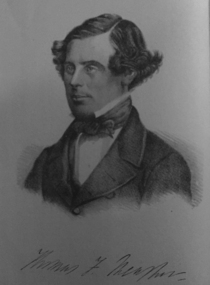
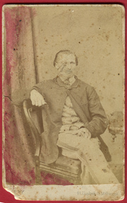
Photograph - Image, Thomas F. Meagher
Thomas Francis Meagher was an Irish nationalist and leader of the Young Irelanders in the Rebellion of 1848. After being convicted of sedition, he was first sentenced to death, but received transportation for life to Van Diemen's Land in Australia. (Wikipedia)Portrait of Thomas F. Meagher who was associated with the Young Ireland movement.young ireland, thomas f. meagher, convict, tasmania, van dieman's land -
 Queenscliffe Maritime Museum
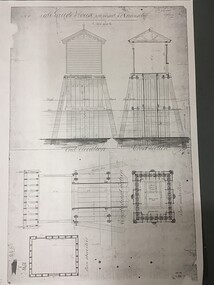
Plan - Plan for a tide gauge house
An extract from the Board of Land and Works building estimates for 1858 shows an allocation of 500 Pounds for the construction of Tide Gauge Houses at various places. A copy of this plan was obtained from the Hydrographic Survey Office in Queenscliff. https://www.parliament.vic.gov.au/papers/govpub/VPARL1857-58NoB1.pdfCopy of a plan for a tide gauge house at Queenscliff 1858Clerk of works office Geelong 27 July 1858queenscliff, tide gauge house, plan -
 Port Fairy Historical Society Museum and Archives
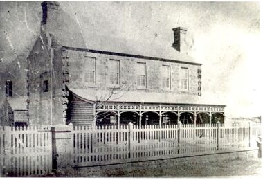
Photograph
The land for this building was granted to the Benevolent Society by James Atkinson in 1850. Tenders were being called for a new "Benevolent Asylum" in 1855, the foundation stone having been laid and by 1856 the first part of the Hospital was completed. This photo taken in 1860 shows the very first building made from local bluestone. The hospital is thought to be the first such building in VictoriaBlack and white photograph of Bluestone 2 story building with verandah and paling fencehospital, institution -
 City of Kingston
Pamphlet - Colour, J. F. Brady, Matthiesson's Estate, Highett, c. 1905
Sales plan for land in the suburb of Highett, bounded by Tennyson Street, James Street and Point Nepean Road and including Maher Street, Connors Street, Enright Street, Edward Street, James Street and Matthieson Street.The developing urban area of Highett within the City of Kingston. This land sale pamphlet illustrates the subdivision of land within the municipality and the changing demographic of the district as new houses are constructed close to infrastructure.Colour pamphlet advertising for private sale subdivisions in the Matthiesson's Estate, Highett. Incorporates a map of the estate bordered by Tennyson Street, James Street and Point Nepean Road and including Maher Street, Connors Street, Enright Street, Edward Street, James Street and Matthieson Street.Handwritten in blue pencil: x marked on every subdivision on the map Handwritten in grey pencil at the end of the Price List: x not sold Handwritten in grey pencil adjacent to subdivisions 58, 167 and 166: JP. Turner Handwritten in grey pencil adjacent to subdivision 164: [indecipherable] Markings in grey pencil around the edges of the subdivision map Handwritten in grey pencil on reverse: Matthiesson / Matthiesson Estate / Matthiesson Estateland sales, estate, highett -
 Eltham District Historical Society Inc
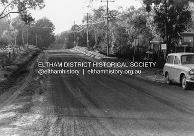
Photograph, R.J. Manuell, Briar Hill, c.1964
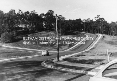
View of Squires land which was subdivided for housing - two parts Woodland Crest higher part off Woodland Grove and Calrossi Avenue, Briar Hill showing new roads with curb and channelling and footpaths. No date.Black and white photograph printed with white bordersVerso: COO2briar hill, real estate, woodland grove, squires, roads -
 Eltham District Historical Society Inc
Photograph, R.J. Manuell, Briar Hill, c.1964
View of Squires land which was subdivided for housing - two parts Woodland Crest higher part off Woodland Grove and Calrossi Avenue, Briar Hill showing new roads with curb and channelling and footpaths. No date.Black and white photograph printed with white bordersVerso: COO2briar hill, real estate, woodland grove, squires, roads -
 The Beechworth Burke Museum Research Collection
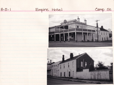
Card (Series) - Index Card, George Tibbits, Camp Street, Beechworth, 1976
George Tibbits, University of Melbourne. Faculty of Architecture, Building and Town & Regional PlanningIndex system that support the research for Beechworth : historical reconstruction / [by] George Tibbits ... [et al]Arranged by street names of BeechworthEach index card includes: street name and number of property, image of property, allotment and section number, property owners and dates of ownership, description of the property according to rate records, property floor plan with dimensions.beechworth, george tibbitsbeechworth, george tibbits -
 Mt Dandenong & District Historical Society Inc.
Photograph, Walker's LOT 2
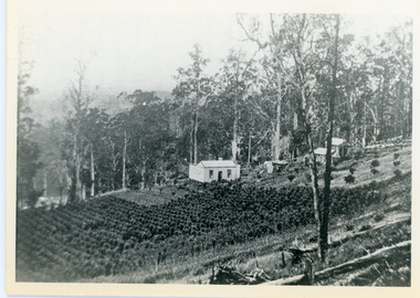
Lot 2 was bought by Harry Walker in the early 1900s. Harry was married to Eva Hand, one of the six daughters of Thomas and Eliza Hand. Harry cleared the land and planted half with raspberries that remained productive until c1928. Harry's son William took over the property. The land was cut in half when the new CRB road went through in the early 1920s. John Lundy-Clarke grew up in the Kalorama/Mt Dandenong area and later in life (1972-74) began to write a comprehensive history of the area working from an original settlement map in an effort to cover all areas.Black and white photograph showing a single storey white house in the centre surrounded by crops. Handwritten description on reverse by John Lundy-Clarke.VIEW 1908 OVER LOT 2 SECTION 1 VILLAGE SETTLEMENT. TAKEN FROM RIDGE ROAD THEN MAIN ROAD FROM HALFWAY BETWEEN MOUNTJOY AND FALLS RD. CRB MAIN RD RUNS BEHIND WALKER’S HOUSE. The house seen in the vista among the tall trees beyond the raspberry patch is “Forest Edge” which was George Barber’s home when the picture was taken. The tall trees to the right of the vista were on Price’s LOT 18 and it was while cutting up one of these for firewood that a length of log weighing about ½ a ton got away downhill and leaped in one bounce over Barbers Road and Logan’s house – 1931.harry walker, william walker, eva hand, crb road, raspberries, kalorama -
 Sunbury Family History and Heritage Society Inc.
Photograph, Former Sunbury Methodist Church
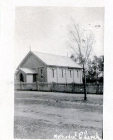
The church in the photograph is the former Methodist Church which is on the NW corner of Barkly and Harker Streets inn Sunbury. It was built on land donated by Thomas Woods at Lot 14 Barkly Street where in 1870 a small weatherboard building was built. In 1879 John Browning gifted land at 13 Barkly Street for the building of a new brick church on that site. The brick church continued to be a place of worship until the June 1977 when the Presbyterian, Methodist and Congregational churches came together and worshipped as the Uniting Church. St. Andrews Uniting Church have been the owners of this building since that time. A non-digital black and white photograph of a little Church building with the words Methodist Church written across the bottom of the image.methodist church, methodism, barkly street, harker street, uniting church -
 The Beechworth Burke Museum Research Collection
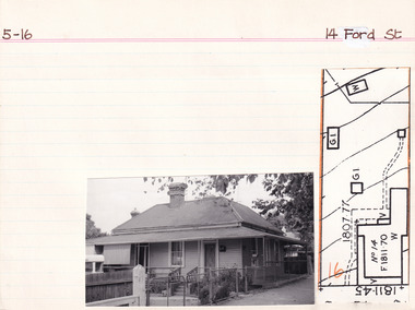
Card (Series) - Index Card, George Tibbits, 14 Ford Street, Beechworth, 1976
George Tibbits, University of Melbourne. Faculty of Architecture, Building and Town & Regional PlanningIndex system that support the research for Beechworth : historical reconstruction / [by] George Tibbits ... [et al]Arranged by street names of BeechworthEach index card includes: street name and number of property, image of property, allotment and section number, property owners and dates of ownership, description of the property according to rate records, property floor plan with dimensions.beechworth, george tibbitsbeechworth, george tibbits -
 Phillip Island Conservation Society Inc.
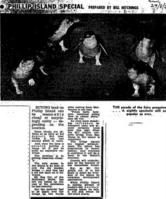
Work on paper - Photocopy of newspaper cutting, Melbourne Sun newspaper, "PHILLIP ISLAND SPECIAL PREPARED BY BILL HITCHINGS", 29.08.1969
This article by journalist Bill Hitchings describes the state of the land market and cost of transporting building materials, Phillip Island, late 1960s. At that stage a number of outlying residential estates had been created, especially on Phillip Island South Coast and at Cowes West. While blocks of land on the outlier estates were very cheap and poorly serviced, the Cowes blocks were selling at $3000 per residential block. Hitchings quotes the owner of the Hollydene motel, Reg Orr, as saying that when the new bridge opens shortly he did not expect it to create a rush of visitors or residents.Bill Hitching was a well-known Melbourne journalist. This article gives an idea of land values on Phillip Island in the late 1960s, the fact that business owners were prepared to upgrade and expand their businesses to cater for extra potential demand on accommodation, and the strong identification of Phillip Island with the Phillip Island Penguin Parade in the minds of the general public in Melbourne. The significance of the new Phillip Island bridge to Phillip Islanders and visitors, and the cost of the bridge, are also outlined. Reg Orr was highly active in the business community of that era on Phillip Island. The Hollydene motel was a well-known Phillip Island accommodation venue.T-shaped article cutting with large image at top of article, dark due to poor photcopy. Double collumn text under photo clearly readable. Black and white.Sun/29/8/6 (?) Probably: Melbourne Sun newspaper, 29 August, 1969phillip island, phillip island tourism, development, hollydene motel, reg orr, phillip island penguin parade, land values, phillip island first bridge, phillip island 2nd bridge, transportation costs -
 Darebin Art Collection
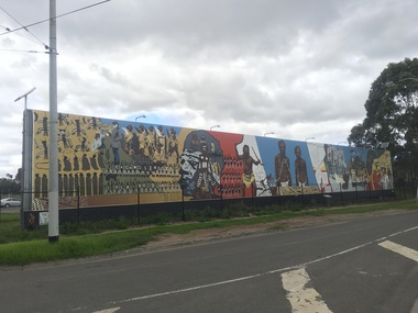
Artwork, other - Megan Evans, Millie Yarran, Ian Johnson, Les Griggs, Elaine Trott and Ray Thomas, Megan Evans, Millie Yarran, Ian Johnson, Les Griggs, Elaine Trott and Ray Thomas, Koori Mural, 1983
The Koori Mural was designed by artist Megan Evans in consultation with a committee from the Aborigines Advancement League consisting of the late Lin Onus, the late Molly Dyer, the late Ron Johnson and the late Elizabeth Hoffman. It was painted by Evans and renowned Aboriginal artist Ray Thomas along with Ian Johnson, Millie Yarram, Les Griggs, Elaine Trott and a number of volunteers. The mural has considerable historical and cultural significance and refers to the experiences of the the Aboriginal and Torres Strait Islander communities, from early colonial history to the more recent struggle for social justice. In 2014 the mural was replicated onto a vinyl banner and installed at its current site. The Northcote Koori Mural was originally located on Council land in High Street, Northcote, opposite the Northcote Town Hall. A huge, free-standing wall was built specifically to accommodate the mural which was painted on site. The land on which the mural was housed was later sold, however, and the mural was relocated to the Aborigines Advancement League in St. Georges Road, Thornbury. Conservation work in 2014 and original panels decommissioned and vinyl banner hung in its place (with Total Outdoor Media). In 2015 solar lights were installed along with landscaping to the front of the mural and a plaque depicting the history on the mural. -
 Eltham District Historical Society Inc
Photograph, View at Eltham, Vic, c.1924
Copy of possible Rose Stereograph Co. postcard “View at Eltham, Vic.”, c.1924 looking southwest from Main Road near York Street to Bridge Street and the original 1875 bridge across what is now the Alistair Knox Park The land in the foreground was first bought from the Crown by J.M. Holloway in 1851. The land was sub-divided and called "Little Eltham". Bridge Street was created as part of the sub-division. Most of the sub-division was residential lots but the creek valley was divided into lots for small farms. Council started to buy the land for the Eltham Town park in the early 1960s. The area was used as a garbage tip and filled above the flood plain of the creek. Development of the land for a park began in the early 1970s. The house on the right was owned for many years by the Hill family until Council bought it in the early 1960s. The house was built in the 1850s or 60s. The house on the left stood on what is now the southwest corner of Susan and Bridge Streets. The Braithwaite family was associated with this house. The double line of fencing in the foreground was a continuation of York Street to the creek. The Bridge Street bridge was built in 1875 and replaced in 1958. (Ref: Early view of Little Eltham; Byways of History by Colleen Ison, Publication unk, 24 August 1982) Reproduced on p61 of 'Pioneers & Painters' Date estimated on same as View at Hurstbridge featuring Wattle Valley EstateThis photo forms part of a collection of photographs gathered by the Shire of Eltham for their centenary project book,"Pioneers and Painters: 100 years of the Shire of Eltham" by Alan Marshall (1971). The collection of over 500 images is held in partnership between Eltham District Historical Society and Yarra Plenty Regional Library (Eltham Library) and is now formally known as the 'The Shire of Eltham Pioneers Photograph Collection.' It is significant in being the first community sourced collection representing the places and people of the Shire's first one hundred years.Digital image 120 format B&W negative Prints 17 x 25 cm and 10 x 15 cmsepp, shire of eltham pioneers photograph collection, eltham, bridge street, bridge, alistair knox park, braithwaite, bridge street bridge, eltham town park, hill family home, main road, pioneers and painters, york street -
 City of Moorabbin Historical Society (Operating the Box Cottage Museum)
Photograph, B&W Francis Box 1836-1912, c1900
Francis Box was born in Withyham, Sussex and came to Australia with his parents George and Mary Box and siblings in 1856. He was assigned to work in Beaufort and had various jobs including ‘gold miner’ at Heathcoat where he married Eliza Jane Thompson. Francis decided to return to market gardening after the death of his 1st child Francis George Box in 1875 aged 13months. The child was buried in Brighton Cemetery and Francis then rent/leased the land on the corner of Tucker Road and Elizabeth Street East Brighton ( now Bentleigh) owned by his brother Henry who with another brother John helped Francis clear the land, and establish a market garden. They had 4 children and began to prosper until in 1882 their 2year old child Lena Caroline Box was killed in a fire that destroyed their house. Francis was burned trying to rescue the child. The local community raised money to assist the family. The land boom brought prosperity again and Francis bought more land around Tucker Road which was bequeathed to his children. Francis and Eliza Jane had four more children but one died in infancy and another aged 2 years. Only 5 of their 9 children survived. Francis and Eliza Jane, who died in 1922, are also buried in Brighton CemeteryBox Cottage Museum, a reconstruction of an early settler hut, is named after the Box family who resided there 1865 -1913 . William Box who with his wife Elizabeth Avis Box and 13 children lived and farmed on the block of land in Jasper Road, East Brighton ( now McKinnon / Ormond) that was part of the Henry Dendy Special Survey 1841 Francis Box was born in Withyham, Sussex 1836 and came to Australia with his parents George and Mary Box and siblings in 1856. Francis, a brother of William Box, and his wife Eliza Jane Thompson had 9 children and established market gardens in Tucker Road, BentleighA black and white photograph of Francis Box 1836-1912FERRY ... Elizabeth St Melbournebox george, box mary, box william, box elizabeth honor, box alonzo, box mary louisa, dendy henry, were j b, dendy's special survey 1841, brighton, moorabbin, bentleigh, mckinnon, ormond, market gardeners, dairy farms, early settlers, pioneers, tucker road, box francis , thompson eliza jane, box william henry george, box charles francis, box-hembrow mable alma, box jessie melinda, box edith florence -
 Melton City Libraries
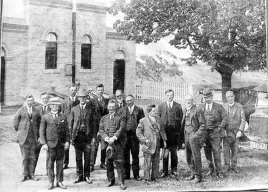
Photograph, Melton Shire Councillors, 1924
J.T Minns was president of the Shire Council from 1923-24 Isaac Robinson was president of the Shire Council from 1924-25. The Robinson family lived in the area. The following is from 100 Years at Melton: Isaac and Henrietta Robinson. Jeanette nee Rohner Robinson 1985. Creighton Melton. The Robinsons of Wyndham William Robinson married Ann Bee in 1952, Weardale, Durham England. They arrived in Australia on the ship “Ben Nevis” in 1852. They settled in Wyndham in 1855 and began dairying and haygrowing. They bought 50 acres and rented 300 acres until buying 300 acres in 1872 – Mt Pleasant Farm. Their children were sent to school even though Ann had been a school teacher in England. The older boys had to travel 5 ½ miles to Mt Cotterell school before one was built at Tarneit, a mile from their home. The children of William and Ann: George, Thomas, William, Isaac, Mary Ann, Mary Ann , John and Thomas. Thomas moved to Melton aged 19. When Ann died in 1898 Mt Pleasant farm was let then sold about 1920. In 1872 William Snr bought more land in Melton. William, Isaac and George worked on the land until 1887 when George and Isaac bought more land in Melton Creighton. Thomas and John also bought adjoining land. Outside Shire Offices, High Streetcouncil, local identities -
 Bendigo Historical Society Inc.
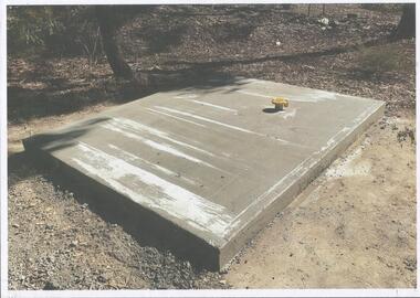
Photograph - Kangaroo Flat Gold Mine Collection: Catherine Reef South shaft
Kralcopic Pty Ltd, was a subsidiary of Bendigo-based company GBM Gold and had previously held mining licences around Bendigo, which incorporated sites including Kangaroo Flat, New Moon, Eaglehawk and the associated Woodvale Evaporation Ponds Complex. In August 2019, the Earth Resources Regulator decided not to renew Kralcopic’s three mining licences, due to the company’s inability to provide surety that it could finance its mining activities and site rehabilitation obligations. In October 2020, the company filed legal proceedings in the Supreme Court challenging the decision not to renew these licences. The Supreme Court later upheld the regulator’s decision not to renew the licences. On 23 April 2021, the Federal Court of Australia appointed KPMG as Kralcopic’s liquidators. On 14 May 2021, the liquidator lodged papers with the Australian Securities and Investment Commission (ASIC) to disclaim Kralcopic’s freehold land at Woodvale and parcels of land around the company’s former Bendigo sites, with the land to subsequently become Crown land. The Earth Resources Regulator has put a statutory exemption in place to preclude new mining licence applications on the sites while we undertake rehabilitation. The exemption also provides an opportunity for government to consider future uses of the sites in consultation with the City of Greater Bendigo and the local community. The Earth Resources Regulator holds rehabilitation bonds totalling $5.9 million, which it will use to rehabilitate the former sites.Colour photocopy of original photo. Image shows Catherine Reef South shaft with rectangular concrete capping. Ventilation pipe in concrete capping. On back in pencil: Catherine Reef South shaft with cap - Kralcopicwestern mining corporation, goldmining, capping, shaft, mining regulations, williams united shaft, kralcopic -
 Phillip Island and District Historical Society Inc.
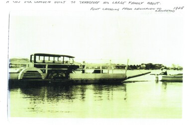
Photograph, Newhaven punt and Nobbies tea house, 1928, 1929
Historical4 A4 photocopies of black & white photos. A large bus on a punt with a person onboard. A small boat with 2 men towing the punt. Land in the background. Wooden building with a group of 6 people standing outside, one looking through telescope.with sloping roof and sign Ye Olde Tea House. Set on barren headland, sea in background with 2 small outbuildngs and a car parked beside building. Other photos show group of cars parked near the same building or on barren headland.A bus Dick Grayden built to transport his large family about 1928. Punt crossing from Newhaven to San Remo. Original tea house at Nobbies. 1929phillip island punt, richard grayden, the nobbies kiosk, point grant, motor car -
 Ringwood and District Historical Society
Voters' Roll, "Mail" Print Ringwood (Tel 65), Voters' Roll 1924, Borough of Ringwood, South Eastern Province, Ringwood Division, c.1924
Arthur Fisher was the grandfather of Arthur G Lunt, RDHS cataloguer.Voters' Roll 1924, Borough of Ringwood, South Eastern Province, Ringwood Division. Names are marked with red crayon, presumably as vote is made. Brown cover, 39 pages, 703 names. E.Winterbottom, Returning Officer, Borough of Ringwood. Typical examples:Entry 202, Fisher, Arthur, Mullum Road, Orchardist, Owner, House and land, Warrandyte, �40, Votes 1Entry 558, Schwerkolt, Francisco, Mitcham, Owner, House, Ringwood, �22, Votes 1 +Additional Keywords: Fisher, Arthur / Winterbottom, E. / Schwerkolt, Francisco -
 Ringwood and District Historical Society
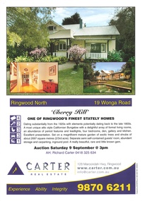
Memorabilia - Booklet, Real Estate history of "Cherry Hill", 19 Wonga Road, Ringwood North, with property titles and subdivision plans of the 35 acres in the triangle bounded by Oban, Wonga and Warrandyte Roads
16 plastic pockets containing the history of "Cherry Hill". Titles and subdivision plans of the 35 acres in the triangle bounded by Oban, Wonga and Warranyte Roads, Ringwood North. Multi pocket burgundy coloured spiral binder containing 34 pages of the property history, subdivisions, land titles and photographs of the house, compiled by Richard Carter pre-auction 9 September 2006. Includes architectural descriptions of "Cherry Hill" from original allotment in 1872 to 2006. Also history of well known residents who lived in it. -
 Federation University Historical Collection
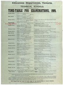
poster, J. Kemp, Education Department Victoria Technical School Timetable for Examinations, 1910, 1910
Large printed timetable for Technical School examinations in 1901. Subjects included Chemistry, Geology, Asssaying, Hydraulics, Agriculture, Engineering , Mine Surveying, Algebra, Mineralogy, petrology, Botany, Trigonometry, Euclid, Land Surveying, Steam and gas Engines, Applied Mechanics, Drawing, painting, engineering drawing, building construction, architecture, drapery, modelled design, casting clay models, composition of form and colour, Lettering, Wood Carving, historic ornament, Wood Carving. .1) Trade Subjects .2) Other subjects, including artexaminations, technical schools, trades, art, technical art school, timetable, clay modelling, ceramics -
Ringwood and District Historical Society
Document, et al, Notes of Heathmont History extracted from Place of Many Eagles (Russ Haines c2006), plus History of Land on which Heathmont East Primary School Built (Mervyn Chivers 1985), 2006
A4 document "Notes on Heathmont" in two parts: - Heathmonth History notes extracted by Russ Haines from Place of Many Eagles c2006 - Taxt of talk "A History of the Land on which Heathmont East Primary School is Built" by Mervyn Chivers, 1985 Also brief Notes: - Heathmont Progress League 1926 - Deplorable state of Canterbury Rd July 1928 - Letter from Ada Marden 16th May 1973 pdf Version loaded to VC. Original Word Document help in RDHS Archives -
 Bendigo Historical Society Inc.
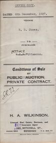
Document - H.A. & S.R. WILKINSON COLLECTION: CONTRACT OF SALE
Conditions of sale by private contract dated 6th December, 1937 between R.D. Jones (seller) and Mrs. M.P. Simmons (buyer) for land situate in Thisle Street, Bendigo, being part of Crown allotment 17 section 17B described in conveyance no. 793, book 555, part of Crown allotment 18A described in certificate of title volume 6145 folio 1228836. Also the south eastern portion of allotment 18 section 17B described in residence area No. 7757. Price 120 pounds. Office copy.organization, business, h.a. & s.r wilkinson real estate -
 Bendigo Historical Society Inc.
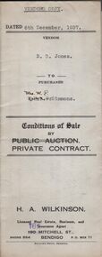
Document - H.A. & S.R. WILKINSON COLLECTION: CONTRACT OF SALE
Conditions of sale by private contract dated 6th December, 1937 between R.D. Jones (seller) and Mrs. M.P. Simmons (buyer) for land situate in Thisle Street, Bendigo, being part of Crown allotment 17 section 17B described in conveyance no. 793, book 555, part of Crown allotment 18A described in certificate of title volume 6145 folio 1228836. Also the south eastern portion of allotment 18 section 17B described in residence area No. 7757. Price 120 pounds. Vendor's copy.organization, business, h.a. & s.r wilkinson real estate -
 Bendigo Historical Society Inc.
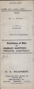
Document - H.A. & S.R. WILKINSON COLLECTION: CONDITION OF SALE
Conditions of sale by private contract dated 19th April, 1937 between Mr. T. Wilson (seller) and Miss E.E. Rogerson (buyer) for land situate 118 Violet Street, Bendigo, having a frontage of 100 links by a depth of 121.8 links on the South side and 132.4 links on the North side, being part of Crown allotment 14 section 12B described in Crown grant volume 2560 folio 515867, together with 5-roomed weatherboard dwelling and all sundry. Price 290 pounds.organization, business, h.a. & s.r wilkinson real estate -
 Bendigo Historical Society Inc.
Document - H.A. & S.R. WILKINSON COLLECTION: CONDITION OF SALE
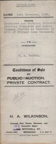
Conditions of sale by private contract dated 14th November, 1938 between Sandhurst and Northern District Trustees Executors and Agency Company Limited as Executor of will of Richard Lowe deceased (seller) and W. A. Rankin (buyer) for land situate No. 139 Olinda Street, Bendigo being part of Crown allotment 5 and 6 section 96C described in certificate of title volume 2367 folio 473243 and having 100 links to Olinda Street by a depth as fenced, together with 4-roomed weatherboard dwelling and all sundry. Price 800 pounds.organization, business, h.a. & s.r wilkinson real estate -
 Bendigo Historical Society Inc.
Document - H.A & S.R. WILKINSON COLLECTION: CONDITION OF SALE
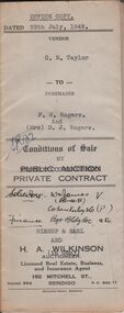
Conditions of sale by private contract issued by Bishop & Earl and H.A. Wilkinson and dated 25th July, 1949 between C.M. Taylor(seller) and F.W. Rogers + D.J. Rogers (buyers) land situate No. 47 Reginald Street Bendigo at present occupied by the purchaser as tenant, being part of Crown allotment 23 section 104C described in Crown grant volume 2052 folio 410334 as per plan of subdivision approved by the Bendigo Council, together with 4-roomed weatherboard dwelling and all sundry. Price 1,100 poundsorganization, business, h.a. & s.r wilkinson real estate -
 Bendigo Historical Society Inc.
Document - H.A. & S.R. WILKINSON COLLECTION: CONDITION OF SALE
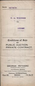
Conditions of sale by private contract issued by George Pethard Auctioneer and dated 10th October 1924 between H. A. Wilkinson as seller and H. A. Lindsay as buyer. Land situate corner of Peel and Hamlet Streets Bendigo being Crown allotment 2 section 145C Parish of Sandhurst City and county of Bendigo described in certificate of title volume 2935 folio 566916, together with 5-roomed weatherboard house and electric fittings, copper, bath and all sundry. Price 312 pounds and 10 shillings.organization, business, h.a. & s.r wilkinson real estate -
 Bendigo Historical Society Inc.
Document - H.A. & S.R. WILKINSON COLLECTION: CONDITION OF SALE
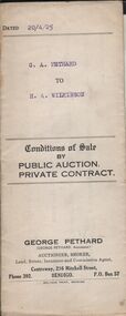
Conditions of sale by private contract dated 20th April 1925 between G. A. Pethard as seller and H. A. Wilkinson as buyer. Contract issued by George Pethard Auctioneer for sale of land situate in Elizabeth Street Nyah West being lot 100 on plan of subdivision No. 6415 lodged in the office of titles and being part of Crown Allotment 11 Parish of TynTynder West County of Tatchera described in certificate of title volume 4642 Folio 928297, together with 4-roomed weatherboard dwelling. Price 518 pounds.organization, business, h.a. & s.r wilkinson real estate -
 Bendigo Historical Society Inc.
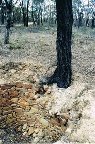
Photograph - DWYER COLLECTION: STONE WELL, MAIDEN GULLY
Photograph: image of stone well, Biffins Track, Maiden Gully. Circular structure lined with sandstone type stones. Measures 3.7 mt. across at widest point and is approx. 2.7 mt. deep. Large Ironbark on RH side of well. File contains letter from Mrs. Michele Dwyer, 27 Katherine Cres., Maiden Gully, dated 19th. Feb. 2003. Inspection by Kay MacGregor and Phil Wilkin in 2012 revealed well still intact, and on private property, not Crown Land. No heritage listing for well.bendigo, buildings, stone well, maiden gully, stone well, stonework, stone cutter. -
 Bendigo Historical Society Inc.
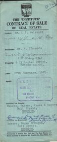
Document - H.A. & S.R. WILKINSON COLLECTION: CONTRACT OF SALE
Contract of sale of real estate dated 27th February, 1961 between Mr. L. J. Neivandt (vendor) and Mr. A. Simmonds (purchaser). Solicitor for vendor: Messrs. Watson, James & Rogers, Bull Street, Bendigo. Solicitor for purchaser: Messrs. Hogan& Hogan, Bull Street, Bendigo. Property: 9 Allingham Street, Golden Square land described in right to occupy residence area No. 032 together with all linos, window blinds, electric light fittings and shades and cupboard in vestibule as inspected. Price 2,000 pounds.organization, business, h.a. & s.r wilkinson real estate