Showing 3906 items matching "bricker"
-
 Orbost & District Historical Society
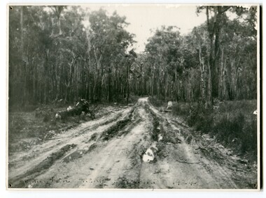
black and white photograph, 1924
This photograph shows the main road near Bellbird, East Gippsland, in 1924. This road would have been the Princes Highway, a main thoroughfare through to New South Wales. Bellbird Creek is a small rural location between Orbost and Cann River. There was no township at Cabbage Tree at this time. The Cabbage Tree Creek township was established to support the booming timber industry of the mid 20th century. Five timber mills worked full time supporting the families that were drawn to the area's wealth of natural resources. Nestled on the banks of the Cabbage Tree Creek, the township was built by those mills to house their workers. Today although the timber mills have disappeared, some of the buildings still remain. Little now remains to remind of the saw-milling history apart from photographs and some relics - a boiler and a brick furnace. There was also a thriving agricultural community farming dairy, beef, seed beans and fresh peas and beans that were sent to the Victoria Market in Melbourne. Dairy farming still plays an essential role in the township. this is a pictorial record of the Princes Highway, the main road from East Gippsland to the New South Wales border.A large black / white photograph of a very wet and boggy bush road.on front - "Main Rd near Bellbird 1924"road princes-highway bellbird-creek-1924 -
 Kiewa Valley Historical Society
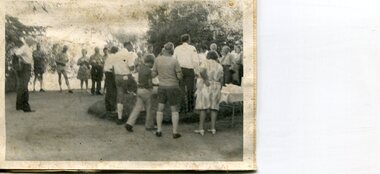
Photographs x 2 - Afternoon tea visit to Towong Hill
Towong Hill Homestead is a 110-year-old Federation style mansion situated on a rock outcrop, with views of about 260 degrees. It was built over 2 years by grazier Walter Mitchell from bricks made from local clay dug from the river bank, to be the family home for his new bride Winifred. They established their home in 1904. After the death of Walter in 1917, Winifred relocated her family, but the homestead remained in the families hands. In 1935, Thomas Mitchell (1906-1984) returned home to Australia, a successful Lawyer, and married city girl, Elyne Chauvel, and settled himself back at his childhood home, Towong Hill. Thomas was a world champion slalom skier, had been a prisoner of the Japanese at Changi, and was elected for the Country Party in 1946 and served as attorney-general in the McDonald government. His wife Elayne (1913-2002) is best remembered for her Silver Brumby series of novels for children. But Elyne also wrote a substantial number of non-fiction works about the Snowy Mountains. Photographs demonstrate local Kiewa Valley residents enjoying a community visit to the historic homestead at Towong Hill which holds significance to the early history of the area. Also demonstrates a pictorial history of social activities undertaken during this period2 black and white photographs mounted on buff card. Kiewa Valley residents attending afternoon tea at Towong HillHandwritten in black pen underneath photo - T.W.Mitchell Towong Hill. Afternoon Teat w mitchell, towong hill, kiewa valley -
 Eltham District Historical Society Inc
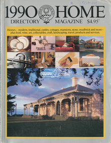
Magazine - Magazine Article, Rosscorp Pty Ltd, 1990 Home Directory Magazine, 1990
Articles featuring local Eltham mudbrick houses designed by Robert Marshall, Alistair Knox, etc and landscape bush gardens by Gordon Ford • “At Home with the Browns”, pp114-116 ‘Cherrytrees’, home of Margaret and Neil Brown, originally built in 1917 for eminent Collins Street surgeon, Dr. Kent-Hughes. • “The Mud Brick homes of Eltham”, pp148-149 References to Alistair Knox and Robert Marshall • “Mudbrick Collecting”, pp150-155 Features a Robert Marshall designed home built by Barry Wild and Geoff Williams • “Mudbrick sophistication”, pp156-158 Features a Robert Marshall designed home with Gordon Ford landscape garden • “It grew like topsy”, pp160-162 originally designed by Alistair Knox then extended upon • “A love of the environment”, pp163-164 Features artist and local Councillor Jenni Mitchell’s mudbrick cottage designed by Bohdan (Danny) Kuzyk with influences of Alistair Knox • “Build your own muddy”. Pp165-167 • “Pioneer of bush gardens; Gordon Ford and his no mowing no weeding approach”, pp174-177 robert marshall, alistair knox, gordon ford, mudbrick, margaret brown, neil brown, cherrytrees, dr kent-hughes, eltham, barry wild, geoff williams, jenni mitchell, bohdan (danny) kuzyk, bush gardens -
 Eltham District Historical Society Inc
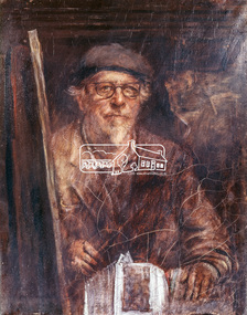
Photograph, Jorgensen, Justus, 1893-1975, Self portrait, Justus Jorgensen, founder of Montsalvat, c.1955
Founder of Montsalvat Reproduced Page 106 of Pioneers & Painters, edited by Alan Marshall (1971) Note: print in book and print copy are mirror imaged There was probably little earth building done in the district in this century until 1934, when Justus Jorgensen, architect and artist, bought land in Eltham and with his students and followers commenced to build the fascinating complex of buildings now know as ‘Montsalvat’. These buildings and his use of materials, both local stone and earth, and reclaimed materials, were to have a remarkable influence on the Eltham district-particularly in the period following World War II. The first building at ‘Montsalvat’ was a picturesque house of or rammed earth with a high-pitched roof. Jorgensen has used a variety of building materials but it is possibly his use of earth, both pise-de-terre and mud brick, which has had the most influence on the environmental building in Eltham in the post war years. By the end of the 1940s, an impressive array of adobe and pise buildings had been completed. – Alan Marshall, 1971, “Pioneers & Painters”This photo forms part of a collection of photographs gathered by the Shire of Eltham for their centenary project book,"Pioneers and Painters: 100 years of the Shire of Eltham" by Alan Marshall (1971). The collection of over 500 images is held in partnership between Eltham District Historical Society and Yarra Plenty Regional Library (Eltham Library) and is now formally known as the 'The Shire of Eltham Pioneers Photograph Collection.' It is significant in being the first community sourced collection representing the places and people of the Shire's first one hundred years.Digital image 4 x 5 inch Clr Reversal (3) Print 21 x 16.5 cm (printed in mirror image)justus jorgensen, montsalvat, pioneers and painters, shire of eltham pioneers photograph collection -
 Eltham District Historical Society Inc
Photograph, Willis Vale on the north bank of the Plenty River, Church Street, Greensborough, c.1950
Photo sourced from Heidelberg Historical Society reproduced on p63 of The Diamond Valley Story by Dianne H. Edwards, Shire of Diamond Valley 1979. "Willis Vale, Greensborough, situated on the north bank of the Plenty River at the end of Church Street. The home wasa built about 1840 by Jame Willis Mayger from bricks hand-made nearby. It was later passed to the Partington family and when this photo was taken the building was deserted. Vandals and finally a bushfire destroyed Willis Vale in the 1950s." Greensborough Historical Society has same image with more accurate information on the date/cause of fire damage https://victoriancollections.net.au/items/585b6c96d0ce2c1268f1c96b "House built by Edward Maygar, Robert Whatmough lived there mid 19th century and later sold to Partington family. It was located on the Plenty River at Partington's Flat Greensborough. The derelict Willis Vale house was destroyed in 1964 when a fire originating from North Plenty Gorge - Kurrak Road - was lit by two teenage boys and made its way several kilometres down to Partington's Flat Greensborough."Black and white copy of photo printed on glossy photographic paper 30.5 x 40.5 cm (12 x 16 inch); image size approx. 18.5 x 28 cmchurch street, diamond valley story, greensborough, james willis mayger, partington family, willis vale -
 Eltham District Historical Society Inc
Slide, "Kangaroo Hall" (c.1843-1969), Donaldsons Road, Kangaroo Ground, which was destroyed during the January 8, 1969 bushfire; c.1975, 1975c
Built by James and Isabella Donaldson at the centre of their 1 square mile property southwest of the present day Presbyterian Church. The Donaldsons first arrived in Port Phillip on 17 December 1841. Their first house was a bark hut which was replaced by this substantial brick home around the mid 1840s. James Donladson died 1856. Kangaroo Ground Presbyterian Church http://kgpc.pcvic.org.au/history-2.html Pictures of the farm and homestead (rented by Mr E. Hobson) were published in The Weekly Times, 18 March 1911, p27 1911 'MR. E. HOBSON'S FARM AT KANGAROO GROUND.', Weekly Times (Melbourne, Vic. : 1869 - 1954), 18 March, p. 27. , viewed 29 Feb 2020, http://nla.gov.au/nla.news-article222243528 A letter from Mr Hobson published in the following edition clarified that he only rented the property and that the owner was Mr John Donaldson of Sandringham 1911 'KANGAROO GROUND.', Weekly Times (Melbourne, Vic. : 1869 - 1954), 25 March, p. 47. , viewed 29 Feb 2020, http://nla.gov.au/nla.news-article22224117935 mm colour positive transparency Mount - Agfacolor Service (Blue)bushfire, donaldson home, donaldsons road, isabella donaldson, james donaldson, kangaroo ground, kangaroo hall, victorian bushfires - 1969 -
 Phillip Island and District Historical Society Inc.
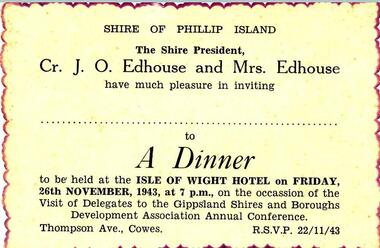
Documents, Shire of Phillip Island et al, 1940's
Documents and Photograph donated by the Woodhead family. Dorothy Edhouse was the only child of James & Frances Hill, who were Sylvia Woodhead's grandparents. "James Hill (Jimmy) came to Phillip Island in 1920 and purchased the Hotel, known as Woods Family Hotel. (Later, the Phillip Island Hotel in Walpole Street, now demolished). A milestone occurred whilst in his capable hands, when he installed an electric light plant, (32 volt), the first on the Island. He also made hundreds of cement bricks, when he built his own home. Later he purchased a building in Thompson Avenue, where he established a Billiard Saloon, with a small shop attached. He died in 1937, aged 68. His only child Dorothy Edhouse, is now 95 and has made arrangements to have her ashes added to her fathers' grave." This was added to the photograph of James Hill and Frances Edith Hill - not sure what date it was compiled by Richard Woodhead. Frances died in 1960. The write up was take from "Garden of Memories" by Edith Jeffrey. Four documents/photograph relating to Cr J O Edhouse and his wife Mrs Dorothy Edhouse. Also came with accompanying letter from Sylvia Woodhead. 361-01: An Invitation to a Dinner at the Isle of Wight Hotel - 26/11/1943 - on the occassion of the visit of Delegates to the Gippsland Shires and Boroughs Development Association Annual Conference. 361-03: Identity Card for Dorothy Symes Edhouse. 361-04: Circular from the Liquid Fuel Control Board dated 21st February 1942. 361-05: Photograph of James & Frances Edith Hill. A note saying that James (fondly called Jimmy) came to Phillip Island in 1920 and purchased a hotel - see history below. james & frances edith hill, shire of phillip island dinner invitation, identity card, cr j o edhouse, mrs edhouse, sylvia woodhead, documents -
 Eltham District Historical Society Inc
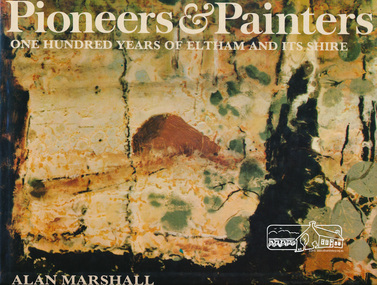
Book, Alan Marshall (1902-1984), Pioneers & painters : one hundred years of Eltham and its shire, 1971
Jacket painting by Clifton Pugh. "Eltham Shire is a well known as a district in which a large number of painters, sculptors, potters, writers and other creative people, The early settlers were, for the most part, resourceful and far-sighted ; the present residents are no less so. Mention the name Eltham and many things spring to mind ; conservation ; the integration of architecture with the environment ; mud-brick buildings; Montsalvat - the list is endless. In 1971, the centenary of the Shire's birth, the Council felt that the publication of a history would fittingly mark more than a century of achievement.." - Dust jacket. Contents: The Beginning Kangaroo Ground Education at Kangaroo Ground The Days of Gold Queenstown Panton Hill The Pioneer Women Christmas Hills and Yarra Glen Eltham Education at Eltham and Research Kinglake Hurstbridge by Sheila Ferguson Montmorency and Lower Plenty The New Way of Life Old Identities Eltham in modern times Educationalists and Writers Earth building in Eltham Early Painters by Peter Glass Painters Today by Peter Glass Warrandyte painters and Potters by Peter Glass Wildlife Present day This book provides a comprehensive history of the former Shire of Eltham and its first one hundred years. Hardback Book with Dust Jacket - 144 p. : illus. (part col.) ; ISBN 0170019489 eltham, alan marshall, shire of eltham, clifton pugh -
 Victoria Police Museum
Police Stations (Armadale)
Armadale is an inner suburb of Melbourne, Victoria, Australia, 7 km south-east of Melbourne's Central Business District, located within the City of Stonnington local government area. Armadale Police Station opened, in Melbourne Police District, on 11 May 1885. Its original location is unknown, but in 1890 it is listed in the Sands & McDougall directory as at 295 Hight Street. From 1985-1920 it was located at 20/22 Auburn Grove, 1925-1930 at 769 High Street and 1935-1946 at 3 Cheel Street. The station closed on 28 January 1946. The sub-division east of Orrong Rd was incorporated into Malvern Sub-district and west of Orrong Road into Prahran Sub-district. In a special 1930 issue of the Victoria Police Gazette the Armadale Police Station was described as a seven-roomed brick dwelling with a tiled roof on land measuring 127' x 104' x 98'. There was also a bathroom and W.C., a wash-house, office, and a lock-up (one cell). This is probably a description of the Cheel Street police station. It was staffed by one senior constable and three foot constables.12 photographs comprising 8 coloured images and 4 black and white images 1 sketch plan of Old Armadale Police Stationpolice stations; armadale police station -
 Glen Eira Historical Society
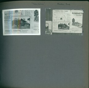
Album - Album page, Glenholme, Bambra Road, Circa 1972
This photograph is part of the Caulfield Historical Album 1972, showing an advertisement for the 21/04/1923 Glenholme Estate sale through real estate agents Knight and Harwood. This album was created in approximately 1972 as part of a project by the Caulfield Historical Society to assist in identifying buildings worthy of preservation. The album is related to a Survey the Caulfield Historical Society developed in collaboration with the National Trust of Australia (Victoria) and Caulfield City Council to identify historic buildings within the City of Caulfield that warranted the protection of a National Trust Classification. Principal photographer thought to be Trevor Hart, member of Caulfield Historical Society. Most photographs were taken between 1966-1972 with a small number of photographs being older and from unknown sources. All photographs are black and white except where stated, with 386 photographs over 198 pages. This polychrome brick and slate-roofed mansion was built by John Hart in 1871. Later owned by James McDougall (partner in Sands and McDougall; director of the first Caulfield horse tram company). Later again, it became a psychiatric hospital; demolished c1923.Page 36 of Photograph Album with two photographs of Glenholme Estate advertisements.Handwritten: "Glenholme" Bambra Road [top] / 36 [bottom right]trevor hart, caulfield north, bambra road, glenholme, advertisements, glenholme estate, knight and harwood, real estate agents, maps, polychrome bricks, slate roofs, john hart, james mcdougall, psychiatric hospitals -
 Kew Historical Society Inc
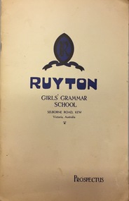
Document, Ruyton Girl's School, Ruyton Girls' Grammar School, Prospectus, 1950
Ruyton was founded in 1878 in the Bulleen Road, Kew, home of newly widowed Mrs Charlotte Anderson (now High Street South). There she hired a governess, Miss Flora Barton, to educate a small group of children, including her own, in her front parlour. Her school immediately flourished. By 1882 she was able to move it to larger premises at ‘Edgecomb’, in Studley Park Road, and name it Ruyton, after a family connection with the village of Ruyton-XI-Towns, Shropshire, England. Since that time Ruyton has continued to thrive, outgrowing its Edgecomb site, and another at A’Beckett Street, Kew, before settling into its current home in Selbourne Road in 1920. The centrepiece of this property is Henty House, now named for its original owners, Henry and Marion Henty, but once known as ‘Tarring’. The grand, polychrome brick home was built in 1872 and with nearly four acres of gardens and grounds around it, it has proved to be a place where Ruyton and its students could continue to prosper. (source: Ruyton website 2020)Prospectus provided in response to an enrolment inquiry in 1950 for Ruyton Girls' Grammar School. (See also Item 2016.0468)ruyton girls grammar school -
 Surrey Hills Historical Society Collection
Photograph, Surrey Hills Bowling Club opening in 1912, 1912
James Albon, far right, built a bowling green at his home on the corner of Mont Albert Road and Wilson Street (later occupied by the convent). This green was so popular with his friends that he organised the formation of a bowling club at the corner of Montrose and Wilson Streets. Mr John Kendrick Blogg, wearing the white hat, is standing in the doorway. Earliest club records date from 1916. This was the original club-house; it was rebuilt in 1922/23 using interlocking blocks as recommended by Walter Burley-Griffin. This was quite an innovative design at the time. In turn cream brick buildings replaced this building in the 1950s. The Surrey Hills Bowls Club disbanded in 1995. Our original is framed copy donated by the Surrey Hills Bowls Club (with a spare copy and negative). Someone from the club has the original. Thre is also a frames portrait of James Albon the 1st president in the collection. (NB/ Duplicate = 1813; No.1943 is from the Bowling Club). Some information from Mrs Merle Phillips (deceased) a member when the club closed.A black and white photograph of a group of men and women dressed in their finery. The ladies and men are wearing hats and most men in 3 piece suits. One lady is in position to roll a bowl. The women's dresses are all ankle length."SHBC 1912"mont albert road, wilson street, surrey hills, montrose street, surrey hills bowling club, 1912, clothing and dress, mr james albon, mr john kendrick blogg -
 Surrey Hills Historical Society Collection
Photograph, "Ancyra", 25 Weybridge Street, Surrey Hills
John Butler Maling, retired farmer, built his home on the corner of his property which extended from Weybridge Street to Whitehorse Road and from James to Ross Street. From 1853 he lived in a simple farmhouse located near the present Ross Street until he had 'Ancyra' built in c.1889 from bricks made from clay dug from a quarry on the property. This was located in the now-park in James Street. John Butler Maling Snr was born in Shepreth, Cambridgeshire. He married Kate Conlan in 1882 and they had 3 children - Silas, Alick and Zillah. He died in 1912 and is buried in Box Hill Cemetery. Often referred to as John Butler Maling Senior as he had a nephew by the same name. He also lived on a similar sized property known as 'The Willows', located to the west. He became the first Mayor of Camberwell. From c1936 til c1960 the property was used as a rest home (Ancyra Rest Home) and then a nursery (Pied Piper Nursery). This is one of relatively few surviving houses that provides links to pre0urban Surrey Hills. It is also built from locally quarried material.A black and white photograph of a house viewed through the front garden.ancyra, house names, weybridge street, surrey hills, james street, bricks, john butler maling senior, miss kate conlan, mrs kate maling, alick maling, silas maling, zillah maling, ancyra rest home, pied piper nursery, box hill cemetery -
 Wodonga & District Historical Society Inc
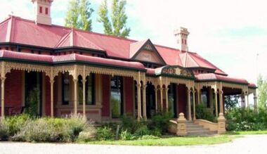
Photograph - Cambourne House
Cambourne homestead was built by 1903 for Rebecca S. Carkeek, who purchased the property in Wodonga in 1899. Cambourne is situated on the original Wodonga Run which was established in 1836. In 1855 the pre-emptive right of 171 acres of the Wodonga Run was granted and sold the following year. The allotments on which the five-acre Cambourne property developed, were purchased in 1873 and 1876, coinciding with the opening of the Railway from Melbourne. The property was purchased by Rebecca Carkeek in June 1899, wife of William Carkeek, Publican of Wodonga and Shire Councillor. Local architects Gordon and Gordon have been credited with the design of Cambourne. The house at Cambourne was built at some stage between 1900 and 1903 as a large single storey homestead. It was constructed in red brick with corrugated iron roof and encircling verandah. Cambourne is a probable work of architects Gordon and Gordon, it is amongst their best preserved and one of their few surviving buildings in Victoria. Today Cambourne remains on a reduced allotment due to the acquisition of land in 1972 by the Country Roads Board and in 2006 by Vic Roads for road works adjacent to the property.Cambourne, Wodonga is of architectural and historical significance to the State of Victoria.A set of coloured photos depicting Cambourne in Wodonga. Part of a collection documented a heritage listed pioneer home.cambourne wodonga, cambourne homestead wodonga, historic buildings wodonga -
 Federation University Historical Collection
Photograph - Photograph - Colour, Happy Valley School, 1985
This photo was taken in 1985. Alf Watson, a descendent of settlers of the district - the Smiths and the Yungs whose children attended this school, is standing to the right of the building. The history of Happy Valley State School 1863 The school opened as Lucky Woman's in 1863. The school was located in the Linton area, a small mining township. The first head teacher was Thomas Lea. 89 students had enrolled. 1883 The name of the school changed to Happy Valley. The brick school building was built in this period. 1920s Enrolment declined in the 1920s to around 10 students. 1932 Enrolment continued to decline and the school was closed. 1933 The school reopened briefly under head teacher Selina McFarlane. 1936 It closed again at some stage before reopening in 1936 under head teacher Maxwell Brown. The school was closed finally in 1936. 1940 The building was sold. 150 years: Happy Valley State School Learn about the history of Happy Valley State School, one of Victoria’s oldest public schools. Key information Address: Ballarat, 3350 Opened: 1 February 1860 Closed: 31 December 1940 School type: Primary School number: 376 Other names: Lucky Woman's Common School, Lucky Woman's State School Search for more school profiles The history of Happy Valley State School 1863 The school opened as Lucky Woman's in 1863. The school was located in the Linton area, a small mining township. The first head teacher was Thomas Lea. 89 students had enrolled. 1883 The name of the school changed to Happy Valley. The brick school building was built in this period. 1920s Enrolment declined in the 1920s to around 10 students. 1932 Enrolment continued to decline and the school was closed. 1933 The school reopened briefly under head teacher Selina McFarlane. 1936 It closed again at some stage before reopening in 1936 under head teacher Maxwell Brown. The school was closed finally in 1936. 1940 The building was sold. Can you help us find records for this school? The Public Record Office Victoria (PROV) only hold historical correspondence records for this closed school. If you have any, or if you know of any, please let us know by emailing [email protected] Updated 19 May 2022.1 Happy Valley State School photographed in June 1985. Alf Watson observing the building. .2 View from the back and side of the Happy Valley State School.1 Verso: Grandma Watson's school Happy Valley June 1985 (Grandma nearly 97 years) Alf in bacckground. Edith Emma Watson b Yung. Alf - son of Edith and John Richard Watson. .2 Verso: School where Grandma Watson eudcated. Happy Valley. June 1985happy valley state school, lucky womans, lucky woman's common school, lucky woman's state school -
 Eltham District Historical Society Inc
Photograph - Digital Photograph, Jim Connor, Boomerang House, 195 Laughing Waters Road, Eltham, 7 September 2013
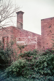
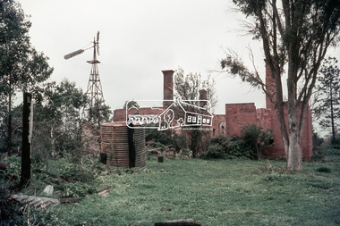
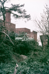
Laughing Waters Walk, 7 Sep 2013 This Society excursion was a follow up to the Laughing Waters Story told to us by Jane Woollard at our Annual General Meeting in March 2013. It involved a walk commencing from the corner of Laughing Waters and Overbank Roads along Laughing Waters Road to its eastern end and returning partly over the same route - a total distance of about 2.5km. On the way we visited the two artist in residence properties, River Bend and Birrarung, to view the houses on them that are associated with Alistair Knox, Gordon Ford and others in the local mud brick and artistic community. We also able to walk around the derelict ruin which was once home to Gordon and Sue Ford, Boomerang House. An unexpected afternoon tea was offered to us by the artists in residence at Birrarung House and we had a brief opportunity to view inside the house. Gordon Ford and photographer Sue Winslow were married in 1965. They set up home in an old log cabin on the property Gordon had purchased in 1954 on Laughing Waters Road. Situated between the Yarra River and Overbank Road, Gordon had built a small mud-brick shack on the river and a pontoon. Over the decades the shack has been locally referred to as “the love shack”, the “rooting shack” or simply “Gordon’s shack”. Gordon and Sue commissioned local builder Graeme Rose to do a wattle and daub renovation and extension to the old log cabin on the north side of Laughing Waters Road. The work had only just been completed in 1965 when a bushfire swept through the area and destroyed the cabin. Gordon and Sue relocated to his property, Fulling, in Pitt Street, Eltham. In 1970 work started on a new house at the Laughing Waters property. Originally known as the Banana House, it is now known as Boomerang. Designed by Alistair Knox, the mud-brick house includes iron window grilles made by Matcham Skipper that puncture the curved mud walls. The grilles were made from ‘off-pressings’ from the Sidchrome tool works in Heidelberg. Gordon, Sue and family moved into the house in 1972. Their marriage fell apart and Sue moved to Sydney with the children around the same time Gordon commenced building Birrarung just below Boomerang on the Laughing Waters Road block. After the Fords moved out, Boomerang it was rented out to various share households of students, musicians, artists and environmentalists for twenty-four years. Gordon Ford sold Birrarung and Boomerang to Melbourne Water in 1999. The Laughing Waters Artist in Residence Program was developed as a partnership between Parks Victoria and Nillumbik Shire Council. Boomerang was deemed unfit for habitation so was used as a day studio only. By 2001 Boomerang was in a poor state of repair and by 2002 the last artist in residence was to use the house as a studio. Nillumbik Shire Council had been granted funds from the Melbourne Community Fund to restore both Boomerang and Birrarung but it was apparent in early 2003 that the funds would be insufficient to restore both houses. Boomerang was infested with termites which presented a risk to any occupants and so the decision was made to close Boomerang and concentrate funding on Birrarung. Boomerang was fenced off for safety and to prevent intrusion and remains ‘caged’ today (2023). However, it is readily apparent the property has been occupied by squatters over the years. By 2023 it was clear that the squatters had abandoned the property and sections of the roof structure have given away in some areas and collapsed internally. For a more in-depth description and history of the property and that of Gordon and Sue Ford, see Jane Woollard's book, "Laughing Waters Road; Art, Landscape & Memory in Eltham" published 2016.2013-09-07, activities, eltham district historical society, heritage excursion, jim connor collection, laughing waters road, boomerang house, gordon ford -
 Eltham District Historical Society Inc
Photograph - Digital Photograph, Jim Connor, The Love Shack, 195 Laughing Waters Road, Eltham, 7 September 2013
Laughing Waters Walk, 7 Sep 2013 This Society excursion was a follow up to the Laughing Waters Story told to us by Jane Woollard at our Annual General Meeting in March 2013. It involved a walk commencing from the corner of Laughing Waters and Overbank Roads along Laughing Waters Road to its eastern end and returning partly over the same route - a total distance of about 2.5km. On the way we visited the two artist in residence properties, River Bend and Birrarung, to view the houses on them that are associated with Alistair Knox, Gordon Ford and others in the local mud brick and artistic community. We also able to walk around the derelict ruin which was once home to Gordon and Sue Ford, Boomerang House. An unexpected afternoon tea was offered to us by the artists in residence at Birrarung House and we had a brief opportunity to view inside the house. Gordon Ford and photographer Sue Winslow were married in 1965. They set up home in an old log cabin on the property Gordon had purchased in 1954 on Laughing Waters Road. Situated between the Yarra River and Overbank Road, Gordon had built a small mud-brick shack on the river and a pontoon. Over the decades the shack has been locally referred to as “the love shack”, the “rooting shack” or simply “Gordon’s shack”. Gordon and Sue commissioned local builder Graeme Rose to do a wattle and daub renovation and extension to the old log cabin on the north side of Laughing Waters Road. The work had only just been completed in 1965 when a bushfire swept through the area and destroyed the cabin. Gordon and Sue relocated to his property, Fulling, in Pitt Street, Eltham. In 1970 work started on a new house at the Laughing Waters property. Originally known as the Banana House, it is now known as Boomerang. Designed by Alistair Knox, the mud-brick house includes iron window grilles made by Matcham Skipper that puncture the curved mud walls. The grilles were made from ‘off-pressings’ from the Sidchrome tool works in Heidelberg. Gordon, Sue and family moved into the house in 1972. Their marriage fell apart and Sue moved to Sydney with the children around the same time Gordon commenced building Birrarung just below Boomerang on the Laughing Waters Road block. After the Fords moved out, Boomerang it was rented out to various share households of students, musicians, artists and environmentalists for twenty-four years. Gordon Ford sold Birrarung and Boomerang to Melbourne Water in 1999. The Laughing Waters Artist in Residence Program was developed as a partnership between Parks Victoria and Nillumbik Shire Council. Boomerang was deemed unfit for habitation so was used as a day studio only. By 2001 Boomerang was in a poor state of repair and by 2002 the last artist in residence was to use the house as a studio. Nillumbik Shire Council had been granted funds from the Melbourne Community Fund to restore both Boomerang and Birrarung but it was apparent in early 2003 that the funds would be insufficient to restore both houses. Boomerang was infested with termites which presented a risk to any occupants and so the decision was made to close Boomerang and concentrate funding on Birrarung. Boomerang was fenced off for safety and to prevent intrusion and remains ‘caged’ today (2023). However, it is readily apparent the property has been occupied by squatters over the years. By 2023 it was clear that the squatters had abandoned the property and sections of the roof structure have given away in some areas and collapsed internally. For a more in-depth description and history of the property and that of Gordon and Sue Ford, see Jane Woollard's book, "Laughing Waters Road; Art, Landscape & Memory in Eltham" published 2016.2013-09-07, activities, eltham district historical society, heritage excursion, jim connor collection, laughing waters road, boomerang house, gordon ford, gordon's shack, love shack -
 Eltham District Historical Society Inc
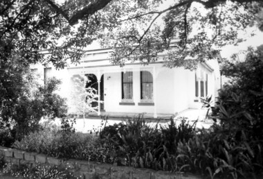
Photograph - Digital Photograph, Alan King, Shillinglaw Cottage, 6 January 2008
Covered under National Estate, National Trust of Australia (Victoria) Local Significance and Heritage Overlay, Nillumbik Planning Scheme. Published: Nillumbik Now and Then / Marguerite Marshall 2008; photographs Alan King with Marguerite Marshall.; p95 Thanks to an Australia first effort by local residents, the historic Shillinglaw Cottage still survives. The cottage at Panther Place, Eltham, once stood about 100 metres away on Main Road. But in 1963 it faced demolition to make room for the Eltham Shire Offices (since demolished). However residents rallied to save Shillinglaw Cottage and became the first in Australia to remove and reconstruct an early settler’s brick building. A fundraiser was the residents’ compilation of loved recipes into the cookery book, Flavour of Eltham. The cottage, built in the late 1870s by noted pioneer builder George Stebbing, is one of Eltham’s earliest buildings and associated with significant early settlers. It is on the National Estate and National Trust Registers. The cottage was constructed with handmade bricks in the Flemish Bond style, typical of cottages and farmhouses in Flanders, Europe. It features burnt ‘header’ bricks over the façade, which gives a chequered effect. The roof is made of slate, while the windows are 12-paned sash with relieving arches. It is not clear who were the first owners of the cottage. The National Trust claims that Stebbing built it for farmer Thomas Cochrane.1 Others say Cochrane first owned the land but Stebbing was Shillinglaw’s first owner and remained so until 1887. The Shillinglaw family then bought it and lived there for around 80 years until 1963 when they sold it to the Eltham Council.2 Farmer Thomas Cochrane bought the Shillinglaw Cottage site from land developer Josiah Holloway. The site was the largest in what Holloway called Little Eltham, of some 30 acres (12 ha), extending along the creek from Henry Street to Luck Street. In 1874 Cochrane sold the land to George Stebbing. Meanwhile in 1861, Stebbing was the owner and occupier of a house at Pitt Street, Eltham, which he had built. Evelyn Observer journalist James Rossiter rented the Pitt Street house, then in 1881 Phillip Shillinglaw occupied it. Stebbing constructed several buildings of note in the area, including the Uniting Church at John Street, the building beside it – a former bank – and St Margaret’s Church of England in Pitt Street. Stebbing was also an Eltham Shire Councillor from 1871 to 1873 and a trustee and treasurer of the Eltham Wesleyan Church.3 In the 1870s he is recorded as the owner of up to five houses. Earlier he had been described as a bricklayer and later became a farmer. In 1882 Stebbing returned to the Pitt Street house and Shillinglaw occupied the new house in Main Road, which he owned from 1887. Shillinglaw was a prolific poet and preached at the Eltham Primitive Methodist Church, where he also served as Sunday School superintendent and led the Young People’s Society Christian Endeavour. The Shillinglaws saw many changes in their property’s boundaries – the major one occurring at the turn of the century when land for the railway and Eltham station was acquired from their holding. The northern part of the remaining land was then used for some of the first commercial developments in what was to become the Eltham Shopping Centre. Later still, the land immediately north of the cottage was bought by the Eltham War Memorial Trust for the War Memorial Buildings and the fire station. The Trust’s land eventually passed to the council. The council bought the remaining two acres (0.8 ha) with the house, and with the exception of the commercial development between the fire station and the post office, all of the former Shillinglaw land is owned by the council or government instrumentalities.4 Since the late 20th century, the cottage has had varied uses, such as a handcrafts store and as a restaurant.This collection of almost 130 photos about places and people within the Shire of Nillumbik, an urban and rural municipality in Melbourne's north, contributes to an understanding of the history of the Shire. Published in 2008 immediately prior to the Black Saturday bushfires of February 7, 2009, it documents sites that were impacted, and in some cases destroyed by the fires. It includes photographs taken especially for the publication, creating a unique time capsule representing the Shire in the early 21st century. It remains the most recent comprehenesive publication devoted to the Shire's history connecting local residents to the past. nillumbik now and then (marshall-king) collection, shillinglaw cottage -
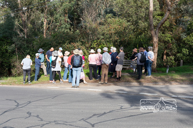 Eltham District Historical Society Inc
Photograph, Peter Pidgeon, Heritage Excursion: Mud Brick Meander, 6 March 2021
Corner of Diamond Street and Peter Street, Eltham. Walkers gather for the beginning of the walk led by local historian Russell Yeoman. The tree-covered hill that forms the western backdrop to the Eltham town centre exhibits many characteristics that are considered to contribute to the special character of Eltham. They include unmade streets, steeply sloping land, extensive tree cover and a large number of mud brick and pise (rammed earth) houses. A number of these were constructed in the 1940s and 50s by well-known builders John Harcourt and Alistair Knox. A significant proportion from this period were constructed by owner-builders. We walked around the upper part of the hill in the area of Kerrie Crescent and Peter Street. We visited several interesting houses (for external viewing only). The walk commenced at 2pm at the corner of Diamond Street and Peter Street (Melway ref 21H4) and was about 2 km. This free walk was open to the general public as well as Society members. Whilst COVID restrictions did not require the wearing of masks in the open, masks had to be carried and all attendees registered with name and contact number or via QR registration.Born Digital (8 images)covid-19, eltham, eltham district historical society, heritage excursion, mudbrick, peter street, diamond street, russell yeoman -
 Eltham District Historical Society Inc
Photograph, Jim Connor, Former C.B.A. Bank, 14 Jan 2017
The Former Commonwealth Bank of Australia branch forms part of the Eltham Gateway and the Little Eltham precinct and is located near 804 Main Road, Eltham. It is a significant building and registered on the Victorian Heritage Register. The bank was built in 1878. It is a one-room, bichromatic brick building. Imagine your bank only being open for one morning a week! These were the hours of the Commercial Bank’s Eltham branch early in the 20th century and customers were quite content. The bank stored gold from the Eltham/Research mining areas. It is famous for its bullet holes. These were the result of a hold up in 1949, in which a nervous youth opened an account in the name of John Henderson, then walked to the door and spun around pulling out a pistol he fired into the cedar bench but fled empty handed and was apprehended later, receiving a two year sentence. The Bank was purchased by the Methodist Church in 1954. (The Eltham church is right adjacent). Recent uses have included a meeting room, Sunday School and Opportunity Shop. It is currently used as a storage for the Combined churches opportunity shop which is located in the United church extension beside this location. Tomorrow's history documented todayeltham, jim connor collection, main road, eltham gateway, cba bank, opportunity shop -
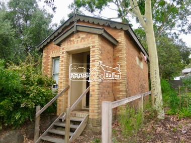
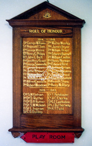 Eltham District Historical Society Inc
Photograph, Roll of Honour Board, Eltham War Memorial, 2005
This 1954 Roll of Honour board was an action of the WW2 Eltham War memorial Trust, for hanging in their Child Welfare Centre building on their property in Main Road, Eltham. The Johnstons Furniture Production Company made up the board and had the names of the local Eltham enlistees applied in gold lettering at a total cost of £13.10.00. The names were copied by the Eltham RSL from the obelisk which was first erected by the WW1 Eltham Peace Celebrations in August 1919 at the northwest corner of Bridge Street and Main Road. During road widening plans by the Council, the obelisk was moved to the garden area of the refurbished RSL branch building in Main Road for safekeeping. The Honour Roll Board was sent to the Eltham RSL sub-branch around 1999. Following the merger of the Eltham and Montmorency sub-branches and sale of the Eltham property, the obelisk was relocated to a location in front of the Eltham War Memorial. The Honour Roll Board was retrieved by former Eltham District Historical Society President, Harry Gilham in September 2004 who arranged for it to be hung in the Eltham War Memorial Hall (former Children's Library). It is attached to the brick wall face of the west (rear) wall of the Hall.Colour photo print and 18 photocopied and hand written mixed media pages1953, briar hill timber, cr. e.j. andrew, eltham rsl sub-branch, eltham war memorial, eltham war memorial hall, eltham war memorial trust, ernie andrew, harry gilham collection, honour roll, johnstons furniture production company, johnstons furniture productions, meeting minutes, minute book, montmorency-eltham rsl sub-branch, nillumbik shire council, roll of honour, stanley s addison collection, stanley simpson addison