Showing 1342 items
matching eltham north
-
 Eltham District Historical Society Inc
Photograph, Edendale Farm, Eltham Heritage Tour, 24 May 1992, 24/05/1992
... , and was provided to transport produce. At North Eltham we were privileged... the valley, and was provided to transport produce. At North Eltham we ...ELTHAM HERITAGE TOUR The Society excursion on 24th May 1992 was arranged by David Bick, leader of the team carrying out the Shire's heritage study. David selected a number of sites or buildings identified in the study, some of them lesser known components of the Shire's heritage. The tour commenced at the Eltham Shire Office at 10.00 am. Travel was by private car and mini-bus with stops at about twelve locations for commentary by David. It included a short walk in Hurstbridge and lunch at Kinglake. Highlights of the tour included: - 10 am Leave from Shire Offices - 3 Important Trees - A Physical Link to Eltham's First Settlers - Toorak Mansion Gates - A Surviving Farm House - An Intact Circa 1900 Main Street - First Settlers - Gold Miners, and Timber-getters - An Early Hotel - A Pioneering Homestead - Changing Eltham Shire - 20th Century - 4 pm Afternoon Tea and Finish Tour. Extract from ELTHAM CULTURAL HERITAGE TOUR (Newsletter No. 85, July 1992, by Bettina Woodburn) "The land was unprofitable for intensive farming, but there was always water in the Diamond Creek. The railway, a technological advance, followed the valley, and was provided to transport produce. At North Eltham we were privileged to tour a surviving farmhouse of the 1860-70 era at the Shire’s Edendale Farm, with the as yet unfinished Sculpture for a front fence - bulbous tree-trunks decorated with salt pots, with cross members from the old trestle bridge. As was usual these six veranda posted houses faced South (or East, away from the sun!) with the scullery, kitchen and pantry "out the back". The veranda, which must have been very narrow, no longer exists. It probably wrapped around three sides. The drive took us past the Dutch Windmill, only twenty years old and in the Shire of Diamond Valley, then the Diamond Creek Cemetery with impressive gateway, to a detour to see another old farmhouse, isolated on a hill off Murray Road Wattle Glen. Here was a particularly thick patch of exotic planting of pines and cypresses. Subsistence farming no longer pays. Following the rail-line we noticed on the left near Silvan Road an Edwardian cottage and on the right near Yates Road the old school residence for this Upper Diamond Creek area."Colour photograph1992, culture, edendale, edendale community farm, events -
 Eltham District Historical Society Inc
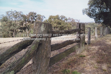
Photograph, Fay Bridge, Looking north towards Diamond Creek from the high point of Allendale Road, Diamond Creek, n.d
Situated opposite the driveway of 170 Allendale Road, Research, just east of where the Maroondah Aqueduct Trail crosses the roadfay bridge collection, allendale road, diamond creek, fences, research (vic.) -
 Eltham District Historical Society Inc
Photograph, Fay Bridge, Old footbridge, 195 Laughing Waters Road, Eltham, n.d
This old footbidge is situated close to the shack that Gordon Ford built on the Yarra at Laughing Waters Road. Bernie Bragg also used to live there for a period of time. Gordon Ford and photographer Sue Winslow were married in 1965. They set up home in an old log cabin on the property Gordon had purchased in 1954 on Laughing Waters Road. Situated between the Yarra River and Overbank Road, Gordon had built a small mud-brick shack on the river and a pontoon. Over the decades the shack has been locally referred to as “the love shack”, the “rooting shack” or simply “Gordon’s shack”. Gordon and Sue commissioned local builder Graeme Rose to do a wattle and daub renovation and extension to the old log cabin on the north side of Laughing Waters Road. The work had only just been completed in 1965 when a bushfire swept through the area and destroyed the cabin. Gordon and Sue relocated to his property, Fulling, in Pitt Street, Eltham. In 1970 work started on a new house at the Laughing Waters property. Originally known as the Banana House, it is now known as Boomerang. Designed by Alistair Knox, the mud-brick house includes iron window grilles made by Matcham Skipper that puncture the curved mud walls. The grilles were made from ‘off-pressings’ from the Sidchrome tool works in Heidelberg. Gordon, Sue and family moved into the house in 1972. Their marriage fell apart and Sue moved to Sydney with the children around the same time Gordon commenced building Birrarung just below Boomerang on the Laughing Waters Road block. After the Fords moved out, Boomerang it was rented out to various share households of students, musicians, artists and environmentalists for twenty-four years. Gordon Ford sold Birrarung and Boomerang to Melbourne Water in 1999. The Laughing Waters Artist in Residence Program was developed as a partnership between Parks Victoria and Nillumbik Shire Council. Boomerang was deemed unfit for habitation so was used as a day studio only. By 2001 Boomerang was in a poor state of repair and by 2002 the last artist in residence was to use the house as a studio. Nillumbik Shire Council had been granted funds from the Melbourne Community Fund to restore both Boomerang and Birrarung but it was apparent in early 2003 that the funds would be insufficient to restore both houses. Boomerang was infested with termites which presented a risk to any occupants and so the decision was made to close Boomerang and concentrate funding on Birrarung. Boomerang was fenced off for safety and to prevent intrusion and remains ‘caged’ today (2023). However, it is readily apparent the property has been occupied by squatters over the years. By 2023 it was clear that the squatters had abandoned the property and sections of the roof structure have given away in some areas and collapsed internally. For a more in-depth description and history of the property and that of Gordon and Sue Ford, see Jane Woollard's book, "Laughing Waters Road; Art, Landscape & Memory in Eltham" published 2016.fay bridge collection, bernie's hut, birrarung, footbridge, gordon ford, gordon's shack, laughing waters road, love shack, yarra river -
 Eltham District Historical Society Inc
Photograph, Fay Bridge, EDHS Heritage Walk: Shillinglaw Farm, Eltham, 2 September 2023
On Saturday September 2, 2023, Russell Yeoman led a group of 22 society members and interested others on a walk following trhe bounadries of the original Shillingalw farm. Commencing at the corner of Panther Place and Library Place, we proceeded up to Shillinglaw Cafe then the Shillinglaw trees at the former Eltham Shire Office site then along Main Road to the fire station then throughh St Laurence Lane and uinder the railway line , along Diamond Street then return via the Diamond Creek trail behind Andrew Park. The actual farm boundary went past the creek and further up the hill. The original farm comprised lot 90 of Holloway’s 1851 subdivision of Little Eltham. Its area was 30 acres lying east of the Diamond Creek and north of Henry Street. A number of stops were made to look at maps and early photos illustrating the gradual reduction of the farm area and the early history of the railway and other community uses, that occupied parts of the site.fay bridge collection, 2023-09-02, activities, eltham, eltham district historical society, heritage excursion, shillinglaw farm -
 Eltham District Historical Society Inc
Photograph, Liz Pidgeon, EDHS Heritage Walk: Shillinglaw Farm, Eltham, 2 September 2023
On Saturday September 2, 2023, Russell Yeoman led a group of 22 society members and interested others on a walk following trhe bounadries of the original Shillingalw farm. Commencing at the corner of Panther Place and Library Place, we proceeded up to Shillinglaw Cafe then the Shillinglaw trees at the former Eltham Shire Office site then along Main Road to the fire station then throughh St Laurence Lane and uinder the railway line , along Diamond Street then return via the Diamond Creek trail behind Andrew Park. The actual farm boundary went past the creek and further up the hill. The original farm comprised lot 90 of Holloway’s 1851 subdivision of Little Eltham. Its area was 30 acres lying east of the Diamond Creek and north of Henry Street. A number of stops were made to look at maps and early photos illustrating the gradual reduction of the farm area and the early history of the railway and other community uses, that occupied parts of the site.2023-09-02, activities, eltham, eltham district historical society, heritage excursion, shillinglaw farm, 895 main road, amplifon, andrew park, andrew pocket park, arthur street, bar de tapas, barber shop, barry plant estate agent, blockbuster, bus depot, car park, carparks, central park, cleaver & co hair, commonwealth bank, crust pizza, divine bridal, dr ash constance, dudley street, eltham book shop, eltham convenience store, eltham fire station, eltham library, eltham newsagency, eltham optical, eltham railway station, eltham shops, fay bridge, fire bell, flagpole, flight centre, grill'd, information sign, iso chook, jellis craig estate agent, judge book village, kebab nation, kx pilates, la zanyas, liquorland, little drop of poison, lorraine jones & associates solicitors, luck street, machan indian restaurant, main road, mecho en mexico, missing gorilla, morrison kleeman real estate, pavilion menswear, platform 3095, playtherapy melbourne, pryor street, ray white real estate, restaurants, sage bulk whole foods, shillinglaw trees, sign, snap fitness, southern cross medical imaging, specsavers, st laurence lane, st vincents care service, thompson's pharmacy, todaro, united service station, vyve body & skin, welcome to eltham town, westpac bank, yang's kitchen, youth road -
 Eltham District Historical Society Inc
Photograph - Aerial Photograph, Landata, Eltham / Research, Vic, Jan. 1951
Centred on Brinkkotter Road opposite Yarramie Reserve, Eltham bounded by Maroondah Aqueduct to north, Nyora Road to south, Eltham College to east and Leane Drive to west. Historic Aerial Imagery Source: Landata.vic.gov.au Aerial Photo Details: Project No :65 Project : MELBOURNE AND METROPOLITAN PROJECT NO. 2 Run : 7 Frame : 8 Date : 01/1951 Film Type : B/W Camera : EAG9 Flying Height : 12200 Scale : 12000 Film Number : 1419 GDA2020 : 37°42'32"S, 145°10'41"E MGA2020 : 339408, 5824924 (55) Melways : 22 F3 (ed. 42)Historical aerial photos and photo maps provide viusal evidence of the chronology of changes to the built landscape of the district and assist in dating other imagesaerial photo, 1951-01, eltham, neil webster collection, brinkkotter road, eltham college, leane drive, maroondah aqueduct, melways 22f3, nyora road, yarramie reserve -
 Eltham District Historical Society Inc
Photograph - Aerial Photograph, Landata, Eltham, Vic, Jan. 1951
Centred on Beard Street between Main Road and Frank Street, Eltham bounded by Maroondah Aqueduct to north, Arthur Street to south, Maroong Drive to east and Catholic Ladies College to west. Historic Aerial Imagery Source: Landata.vic.gov.au Aerial Photo Details: Project No :65 Project : MELBOURNE AND METROPOLITAN PROJECT NO. 2 Run : 7 Frame : 9 Date : 01/1951 Film Type : B/W Camera : EAG9 Flying Height : 12200 Scale : 12000 Film Number : 1419 GDA2020 : 37°42'23"S, 145°09'39"E MGA2020 : 337874, 5825170 (55) Melways : 22 B3 (ed. 42)Historical aerial photos and photo maps provide viusal evidence of the chronology of changes to the built landscape of the district and assist in dating other imagesaerial photo, 1951-01, eltham, neil webster collection, arthur street, beard street, catholic ladies college, frank street, main road, maroondah aqueduct, maroong drive, melway 22b3, research (vic.) -
 Eltham District Historical Society Inc
Photograph - Aerial Photograph, Landata, Eltham, Vic, Jan. 1951
Centred on Allison Crecent Reserve, Sherbrook Road and Scenic Crescent, Eltham bounded by Allendale Road to north, Dudley Street to south, Zig Zag Road to east and St Helena Road to west. Historic Aerial Imagery Source: Landata.vic.gov.au Aerial Photo Details: Project No :65 Project : MELBOURNE AND METROPOLITAN PROJECT NO. 2 Run : 7 Frame : 10 Date : 01/1951 Film Type : B/W Camera : EAG9 Flying Height : 12200 Scale : 12000 Film Number : 1419 GDA2020 : 37°42'14"S, 145°08'36"E MGA2020 : 336339, 5825416 (55) Melways : 21 H2 (ed. 42)Historical aerial photos and photo maps provide viusal evidence of the chronology of changes to the built landscape of the district and assist in dating other imagesaerial photo, 1951-01, eltham, neil webster collection, allendale road, allison crecent reserve, dudley street, melway 21h2, scenic crescent, sherbrook road, st helena road, zig zag road -
 Eltham District Historical Society Inc
Photograph - Aerial Photograph, Landata, Montmorency, Feb. 1956
Centred on present day Tahlee Place Reserve and Sherbourne Preschool, Montmorency bounded by Progress Road to north, Withers Way to south, Main Road to east and Leach Street to west. Historic Aerial Imagery Source: Landata.vic.gov.au Aerial Photo Details: Project No :250 Project : MELBOURNE OUTER SUBURBS PROJECT Run : 17 Frame : 114 Date : 02/1956 Film Type : B/W Camera : EAG9 Flying Height : 10000 Scale : 12000 Film Number : 1176 GDA2020 : 37°42'50"S, 145°08'02"E MGA2020 : 335512, 5824286 (55) Melways : 21 F5 (ed. 42)aerial photo, 1956-02, neil webster collection, central park, eltham, leach street, main road, melway 21f5, montmorency, progress road, withers way, sherbourne preschool, tahlee place reserve -
 Eltham District Historical Society Inc
Photograph - Aerial Photograph, Landata, Lower Plenty, Feb. 1956
Centred on present day 217 Old Eltham Road, Lower Plenty bounded by Pitt Street to north, Yarra River to south, Main Road to east and Bonds Road to west. Historic Aerial Imagery Source: Landata.vic.gov.au Aerial Photo Details: Project No :250 Project : MELBOURNE OUTER SUBURBS PROJECT Run : 17 Frame : 116 Date : 02/1956 Film Type : B/W Camera : EAG9 Flying Height : 10000 Scale : 12000 Film Number : 1176 GDA2020 : 37°43'58"S, 145°07'49"E MGA2020 : 335237, 5822186 (55) Melways : 21 E10 (ed. 42)aerial photo, 1956-02, neil webster collection, eltham, main road, bonds road, elham, lower plenty, melway 21e10, pitt street, yarra river -
 Eltham District Historical Society Inc
Photograph - Aerial Photograph, Landata, Eltham, Feb. 1956
Centred on present day Culla Hill and Petty's Orchard, Eltham bounded by Brougham Street and Mount Pleasant Road to north, Monckton Road, Templestowe to south, Reynolds Road to east and Eltham Lower Park and Hohnes Road to west. Historic Aerial Imagery Source: Landata.vic.gov.au Aerial Photo Details: Project No :250 Project : MELBOURNE OUTER SUBURBS PROJECT Run : 18 Frame : 92 Date : 02/1956 Film Type : B/W Camera : EAG9 Flying Height : 10000 Scale : 12000 Film Number : 1176 GDA2020 : 37°43'35"S, 145°09'31"E MGA2020 : 337735, 5822959 (55) Melways : 22 B8 (ed. 42)aerial photo, 1956-02, neil webster collection, eltham, brougham steet, culla hill, eltham lower park, hohnes road, melway 22b8, monckton road, mount pleasant road, petty's orchard, reynolds road, sweeneys lane, templestowe, yarra river -
 Eltham District Historical Society Inc
Photograph - Aerial Photograph, Landata, Eltham, Feb. 1956
Centred on present day Shalbury Avenue, Eltham bounded by Leane Drive and Parsons Road to north, Nyora Road to south, Reynolds Road to east and the Diamond Creek to west Historic Aerial Imagery Source: Landata.vic.gov.au Aerial Photo Details: Project No :250 Project : MELBOURNE OUTER SUBURBS PROJECT Run : 18 Frame : 95 Date : 02/1956 Film Type : B/W Camera : EAG9 Flying Height : 10000 Scale : 12000 Film Number : 1176 GDA2020 : 37°41'57"S, 145°09'51"E MGA2020 : 338145, 5825965 (55) Melways : 22 C1 (ed. 42)aerial photo, 1956-02, neil webster collection, eltham, diamond creek (creek), melway 22c1, nyora road, parsons road, reynolds road, shalbury avenue -
 Eltham District Historical Society Inc
Photograph - Aerial Photograph, Landata, Eltham, Vic, Feb. 1956
Centred on present day Parsons Avenue at Leane Drive near the Maroondah Aqueduct, Eltham bounded by Lorimer Road to north, Thompson Crescent and Norman Road to south, Bells Hill Road to east and Parsons Road to west Historic Aerial Imagery Source: Landata.vic.gov.au Aerial Photo Details: Project No :250 Project : MELBOURNE OUTER SUBURBS PROJECT Run : 19 Frame : 5 Date : 02/1956 Film Type : B/W Camera : EAG9 Flying Height : 10000 Scale : 12000 Film Number : 1176 GDA2020 : 37°42'04"S, 145°11'09"E MGA2020 : 340064, 5825786 (55) Melways : 22 H1 (ed. 42)aerial photo, 1956-02, neil webster collection, allendale road, bells hill road, eltham, leane drive, lorimer road, maroondah aqueduct, melway 22h1, norman road, parsons road, research (vic.), thompson crescent -
 Eltham District Historical Society Inc
Photograph - Aerial Photograph, Landata, Research, Vic, Feb. 1956
Centred on present day Thompson Crescent, Research bounded by Maroondah Aqueduct to north, Thompson Crescent and Nyora Road to south, Bells Hill Road to east and Eucalyptus Road to west Historic Aerial Imagery Source: Landata.vic.gov.au Aerial Photo Details: Project No :250 Project : MELBOURNE OUTER SUBURBS PROJECT Run : 19 Frame : 6 Date : 02/1956 Film Type : B/W Camera : EAG9 Flying Height : 10000 Scale : 12000 Film Number : 1176 GDA2020 : 37°42'38"S, 145°11'02"E MGA2020 : 339927, 5824736 (55) Melways : 22 H4 (ed. 42)aerial photo, 1956-02, neil webster collection, bells hill road, eltham, eucalyptus road, maroondah aqueduct, melway 22h4, nyora road, research (vic.), thompson crescent -
 Eltham District Historical Society Inc
Photograph - Aerial Photograph, Landata, Eltham, Vic, Apr. 1963
Centred on present day Zig Zag Road and Main Road, Eltham bounded by Maroondah Aqueduct to north, Thompson Crescent and Arthur Street to south, Parsons Road to east and Glen Park Road and Banks Road to west. Historic Aerial Imagery Source: Landata.vic.gov.au Aerial Photo Details: Project No :486 Project : MELBOURNE (1963) PROJECT Run : 5 Frame : 59 Date : 04/1963 Film Type : B/W Camera : RC8 Flying Height : 5100 Scale : 9600 Film Number : 1805 GDA2020 : 37°42'24"S, 145°08'52"E MGA2020 : 336716, 5825114 (55) Melways : 21 J3 (ed. 42)aerial photo, neil webster collection, eltham, 1963-04, arthur street, banks road, glen park road, maroondah aqueduct, melway 21j3, parsons road -
 Eltham District Historical Society Inc
Photograph - Aerial Photograph, Landata, Eltham, Vic, Apr. 1963
Centred on present day Floriston Grove, Eltham bounded by Maroondah Aqueduct to north, Thompson Crescent and Diosma Road to south, Research Shops to east and Glen Park Road and Park West Road to west. Historic Aerial Imagery Source: Landata.vic.gov.au Aerial Photo Details: Project No :486 Project : MELBOURNE (1963) PROJECT Run : 5 Frame : 60 Date : 04/1963 Film Type : B/W Camera : RC8 Flying Height : 5100 Scale : 9600 Film Number : 1805 GDA2020 : 37°42'24"S, 145°09'29"E MGA2020 : 337622, 5825128 (55) Melways : 22 B3 (ed. 42)aerial photo, neil webster collection, eltham, 1963-04, diosma road, floriston grove, maroondah aqueduct, melway 22b3, park west road, research (vic.), research shops -
 Eltham District Historical Society Inc
Photograph - Aerial Photograph, Landata, Research, Vic, Apr. 1963
Centred on present day Thompson Crescent and Nicholson Close, Research bounded by Maroondah Aqueduct to north, Nyora Road to south, Eltham College to east and Eltham Gateway Hotel to west. Historic Aerial Imagery Source: Landata.vic.gov.au Aerial Photo Details: Project No :486 Project : MELBOURNE (1963) PROJECT Run : 5 Frame : 61 Date : 04/1963 Film Type : B/W Camera : RC8 Flying Height : 5100 Scale : 9600 Film Number : 1805 GDA2020 : 37°42'24"S, 145°10'06"E MGA2020 : 338528, 5825143 (55) Melways : 22 D3 (ed. 42)aerial photo, neil webster collection, eltham, 1963-04, eltham college, eltham gateway hotel and conference centre, maroondah aqueduct, melway 22d3, nicholson close, nyora road, research (vic.), thompson crescent -
 Eltham District Historical Society Inc
Photograph - Aerial Photograph, Landata, Research, Vic, Apr. 1963
Centred on present day Marconi Court, Research bounded by Maroondah Aqueduct to north, Thompson Crescent to south, Joselyn Drive to east and Eltham Research Oval to west. Historic Aerial Imagery Source: Landata.vic.gov.au Aerial Photo Details: Project No :486 Project : MELBOURNE (1963) PROJECT Run : 5 Frame : 62 Date : 04/1963 Film Type : B/W Camera : RC8 Flying Height : 5100 Scale : 9600 Film Number : 1805 GDA2020 : 37°42'24"S, 145°10'43"E MGA2020 : 339434, 5825157 (55) Melways : 22 F3 (ed. 42)aerial photo, neil webster collection, 1963-04, joselyn drive, marconi court, melway 22f3, research (vic.), research oval, thompson crescent -
 Eltham District Historical Society Inc
Photograph - Aerial Photograph, Landata, Eltham, Vic, Apr. 1963
Centred on present day John Street, Eltham between Main and Bible streets bounded by Elsa Court to north, Main Road Bridge to south, Wattle Grove to east and Bolton Street to west. Historic Aerial Imagery Source: Landata.vic.gov.au Aerial Photo Details: Project No :486 Project : MELBOURNE (1963) PROJECT Run : 6 Frame : 123 Date : 04/1963 Film Type : B/W Camera : RC8 Flying Height : 5100 Scale : 9600 Film Number : 1805 GDA2020 : 37°43'12"S, 145°08'54"E MGA2020 : 336800, 5823623 (55) Melways : 21 J6 (ed. 42)aerial photo, neil webster collection, 1963-04, bolton steet, elsa court, eltham, john street, main road, main road bridge, melway 21j6, wattle grove -
 Eltham District Historical Society Inc
Photograph - Aerial Photograph, Landata, Eltham, Vic, Apr. 1963
Centred on present day Eltham Ridge, Bolton Street, Eltham bounded by Elsa Court to north, Main Road to south, Bible Street to east and Reichelt Avenue and Rattray Road to west. Historic Aerial Imagery Source: Landata.vic.gov.au Aerial Photo Details: Project No :486 Project : MELBOURNE (1963) PROJECT Run : 6 Frame : 124 Date : 04/1963 Film Type : B/W Camera : RC8 Flying Height : 5100 Scale : 9600 Film Number : 1805 GDA2020 : 37°43'12"S, 145°08'16"E MGA2020 : 335876, 5823604 (55) Melways : 21 G6 (ed. 42)aerial photo, neil webster collection, 1963-04, bible street, bolton street, eltham, eltham ridge, main road, montmorency, rattray road, reichelt avenue -
 Eltham District Historical Society Inc
Photograph - Aerial Photograph, Landata, Lower Plenty, Vic, Apr. 1963
Centred on present day Old Eltham Road near Araluen Centre, Lower Plenty bounded by Cromwell Street to north, Yarra River to south, Main Road at Mount Pleasant Road to east and Panorama Avenue to west. Historic Aerial Imagery Source: Landata.vic.gov.au Aerial Photo Details: Project No :486 Project : MELBOURNE (1963) PROJECT Run : 7 Frame : 231 Date : 04/1963 Film Type : B/W Camera : RC8 Flying Height : 5100 Scale : 9600 Film Number : 1805 GDA2020 : 37°44'03"S, 145°07'56"E MGA2020 : 335420, 5822027 (55) Melways : 21 F10 (ed. 42)aerial photo, neil webster collection, 1963-04, araluen, cromwell street, eltham, lower plenty, main road, melway 21f10, mount pleasant road, old eltham road, panorama avenue, yarra river -
 Eltham District Historical Society Inc
Photograph - Aerial Photograph, Landata, Eltham, Vic, Apr. 1963
Centred on present day Eltham Lower Park bounded by Brougham Street to north, Yarra River and Fitzsimons Lane Bridge to south, Main Road at Kent Hughes Road to east and Bolton Street to west. Historic Aerial Imagery Source: Landata.vic.gov.au Aerial Photo Details: Project No :486 Project : MELBOURNE (1963) PROJECT Run : 7 Frame : 232 Date : 04/1963 Film Type : B/W Camera : RC8 Flying Height : 5100 Scale : 9600 Film Number : 1805 GDA2020 : 37°44'03"S, 145°08'33"E MGA2020 : 336329, 5822040 (55) Melways : 21 H10 (ed. 42)aerial photo, neil webster collection, 1963-04, bolton steet, brougham steet, eltham, eltham lower park, fitzsimons lane bridge, kent hughes road, melway 21h10, yarra river -
 Eltham District Historical Society Inc
Photograph - Aerial Photograph, Landata, Eltham, Vic, Apr. 1963
Centred on present day Griffith Park Road, Eltham bounded by Mount Pleasant Road to north, Yarra River and Templestowe to south, Main Road at Reynolds Road to east and Falkiner Street to west. Historic Aerial Imagery Source: Landata.vic.gov.au Aerial Photo Details: Project No :486 Project : MELBOURNE (1963) PROJECT Run : 7 Frame : 233 Date : 04/1963 Film Type : B/W Camera : RC8 Flying Height : 5100 Scale : 9600 Film Number : 1805 GDA2020 : 37°44'04"S, 145°09'10"E MGA2020 : 337237, 5822053 (55) Melways : 22 A10 (ed. 42)aerial photo, neil webster collection, 1963-04, eltham, falkiner street, griffith park road, melway 22a10, mount pleasant road, reynolds road, templestowe, yarra river -
 Eltham District Historical Society Inc
Photograph - Aerial Photograph, Landata, Eltham, Vic, Apr. 1972
Centred on present day Parsons Road, Eltham bounded by Allendale Road to north, Frank Street to south, Research Shops and Raglan Road to east and Zig Zag Road to west. Historic Aerial Imagery Source: Landata.vic.gov.au Aerial Photo Details: Project No :985 Project : MELBOURNE 1972 Run : 26 Frame : 192 Date : 04/1972 Film Type : B/W Camera : RC10 Flying Height : 5700 Scale : 9600 Film Number : 2636 GDA2020 : 37°42'00"S, 145°09'59"E MGA2020 : 338360, 5825897 (55) Melways : 22 D1 (ed. 42)aerial photo, neil webster collection, 1972-04, allendale road, eltham, zig zag road, frank street, melway 22d1, parsons road, raglan road, research (vic.), research shops, eltham barrel -
 Eltham District Historical Society Inc
Photograph - Aerial Photograph, Landata, Research, Vic, Apr. 1972
Centred on present day Maroong Drive, Research bounded by Allendale Road to north, Thompson Crescent to south, Eltham College to east and Parsons Road to west. Historic Aerial Imagery Source: Landata.vic.gov.au Aerial Photo Details: Project No :985 Project : MELBOURNE 1972 Run : 26 Frame : 193 Date : 04/1972 Film Type : B/W Camera : RC10 Flying Height : 5700 Scale : 9600 Film Number : 2636 GDA2020 : 37°42'04"S, 145°10'33"E MGA2020 : 339187, 5825794 (55) Melways : 22 F1 (ed. 42)aerial photo, neil webster collection, 1972-04, allendale road, eltham, eltham barrel, eltham college, maroong drive, melway 22f1, parsons road, research (vic.), thompson crescent -
 Eltham District Historical Society Inc
Photograph - Aerial Photograph, Landata, Research, Vic, Apr. 1972
Centred on present day Main Road, Research near Maroondah Aqueduct and Eltham College bounded by Allendale Road to north, Research-Warrandyte Road to south, Swipers Gully Training Restaurant to east and Reynolds Road to west. Historic Aerial Imagery Source: Landata.vic.gov.au Aerial Photo Details: Project No :985 Project : MELBOURNE 1972 Run : 26 Frame : 194 Date : 04/1972 Film Type : B/W Camera : RC10 Flying Height : 5700 Scale : 9600 Film Number : 2636 GDA2020 : 37°42'07"S, 145°11'07"E MGA2020 : 340015, 5825692 (55) Melways : 22 H1 (ed. 42)aerial photo, neil webster collection, 1972-04, allendale road, eltham college, main road, maroondah aqueduct, melway 22h1, research (vic.), research-warrandyte road, reynolds road, swiper's gully -
 Eltham District Historical Society Inc
Photograph - Aerial Photograph, Landata, Eltham, Vic, Apr. 1972
Centred on present day Woodridge Estate, Eltham bounded by Park Road to north, Mount Pleasant Road to south, Stokes Orchard Estate to east and Eltham Railway Station to west. Historic Aerial Imagery Source: Landata.vic.gov.au Aerial Photo Details: Project No :985 Project : MELBOURNE 1972 Run : 27 Frame : 46 Date : 04/1972 Film Type : B/W Camera : RC10 Flying Height : 5700 Scale : 9600 Film Number : 2636 GDA2020 : 37°42'49"S, 145°09'46"E MGA2020 : 338053, 5824365 (55) Melways : 22 C5 (ed. 42)aerial photo, neil webster collection, 1972-04, eltham, eltham railway station, melway 22c5, mount pleasant road, park road, stokes orchard estate, woodridge estate -
 Eltham District Historical Society Inc
Photograph - Aerial Photograph, Landata, Eltham, Vic, Apr. 1972
Centred on present day Main Road at Pryor Street, Eltham bounded by Park West Road to north, Napoleon Street to south, Woodridge Estate to east and Ryans Road to west. Historic Aerial Imagery Source: Landata.vic.gov.au Aerial Photo Details: Project No :985 Project : MELBOURNE 1972 Run : 27 Frame : 47 Date : 04/1972 Film Type : B/W Camera : RC10 Flying Height : 5700 Scale : 9600 Film Number : 2636 GDA2020 : 37°42'45"S, 145°09'12"E MGA2020 : 337223, 5824470 (55) Melways : 22 A4 (ed. 42)aerial photo, neil webster collection, 1972-04, eltham, eltham railway station, woodridge estate, eltham shops, main road, melway 22a4, napoleon street, park west road, pryor street, ryans road -
 Eltham District Historical Society Inc
Photograph - Aerial Photograph, Landata, Eltham, Vic, Apr. 1972
Centred on present day Ryans Road at Sandra Avenue, Eltham bounded by Progress Road to north, Brougham Street to south, Bible Street to east and Outlook Crescent to west. Historic Aerial Imagery Source: Landata.vic.gov.au Aerial Photo Details: Project No :985 Project : MELBOURNE 1972 Run : 27 Frame : 48 Date : 04/1972 Film Type : B/W Camera : RC10 Flying Height : 5700 Scale : 9600 Film Number : 2636 GDA2020 : 37°42'41"S, 145°08'38"E MGA2020 : 336392, 5824574 (55) Melways : 21 H4 (ed. 42)aerial photo, neil webster collection, 1972-04, eltham, bible street, brougham steet, melway 21h4, outlook crescent, progress road, ryans road, sandra avenue, montmorency