Showing 486 items
matching kilometres
-
 Otway Districts Historical Society
Transport, Remains of Airspeed Oxford aeroplane, 12 April 1942
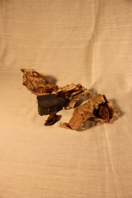
Leaving Point Cook airbase conducting a low visibility cross-country flight at 11.05 am on 12 April 1942 an A25 Airspeed Oxford crashed 5 kilometres from Beech Forest. The pilot, Sergeant T.W. Penn, and two pupils, LAC R.E. Johnston and LAC J.R. Black, were killed. The airframe and engine were extensively damaged.Two pieces of crumbled aluminium metal and one piece of solid black rubber recovered from an Airspeed Oxford aeroplane.beech forest; plane crash; airspeed oxford; world war 2; -
 Warrnambool and District Historical Society Inc.
Document, Norman McDowell docket, 1950s
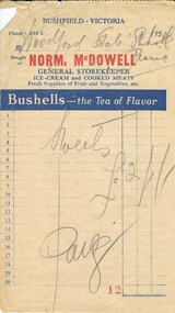
This is a docket indicating that the Woodford State school has purchased sweets in the 1950s for its annual picnic from Norm McDowell, a storekeeper at Bushfield. Bushfield and Woodford are small settlements seven kilometres north of Warrnambool. Woodford State School began in 1854 and is still operating today.No further information has been found on Norm McDowell but his general store was operating in the 1950sThis docket is of interest as the only memento we have of a Bushfield storekeeper some fifty tears agoA rectangular piece of paper torn from a dockets book. It has red, blue and cream text and some printed blue lines and figures. It also has hand written pencil notes. There is some damage in the top left hand corner. Norm. Mc Dowell GENERAL STOREKEEPER Sweets (Two Pounds, one shilling ) in symbols Paid. Woodford State School picnicbushfield, woodford state school -
 Warrnambool and District Historical Society Inc.
Scales, W. & T. Avery Ltd. Mill Lane Works, Nullawarre PO & tray + 2 weights, Early 20th century
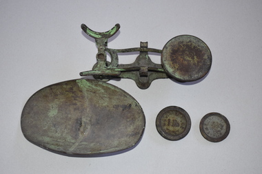
These scales come from the Nullawarre Post Office and would have been used there for most of the 20th century. Nullawarre is a small settlement 25 kilometres south east of Warrnambool. It was first settled in the late 1860s and 70s and the main agricultural pursuit for the area today is dairying. The first Nullawarre school was opened in 1878 and the Nullawarre Post Office operates today in the Nullawarre General Store. These scales are of interest as a memento of the type of weighing scales used in Post Offices in Victoria in the early to mid 20th century. They are also of local interest as they come from the Nullawarre Post Office.This is a metal set of scales with a balance mechanism on a metal stand. The balance has a circular tray at one end to hold weights An oval dish to hold items to be weighed is a separate item that sits at the other end of the balance. The scales were once painted green and some traces of the green paint are visible. Two weights are with this item. The scales are much rusted. ‘W & T Avery Ltd Birm.’nullawarre, victoria, history of warrnambool -
 Greensborough Historical Society
Map, Heidelberg: Historic River Landscape Assessment. Historical maps. Map E 1901-1934 "A Time of projects and improvements", 1985c
Geographical area of around 35 sq. kilometres marked with physical features such as major roads, railways (new extension to Eltham), rivers and properties, also housing sub-divisions and community facilities such as hospitals, parks and sporting reserves and indications of new small scale industries such as dairying. Bounded by Shire of Diamond Valley to the North, Darebin Creek to the West and Plenty River to the East. Black and white sketch map on white paperheidelberg, heidelberg - maps -
 Orbost & District Historical Society
newsletters, Goongerah Grapevine, July 1998 - August 2005
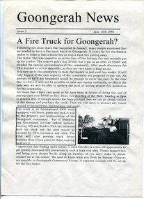
Goongerah is a community on the Brodribb River, located in Gippsland, about seventy kilometres north of Orbost. The town's population is about sixty. Goongerah Post Office opened on 21 November 1952 and closed in 1974. Goongerah had one of the smallest primary schools in Victoria, with about 11 students. The school no longer functions. These newsletters were produced by members of the community and distributed locally.In small rural communities newsletters have been important tools for facilitating community development while fostering a sense of belonging and attachment to the community.A yellow plastic covered folder containing black / white printed newsletters. There are fifteen copies of "Goongerah Community News" and thirty-nine copies of "Goongerah Grapevine". All include news from the C.F.A., Forest News and articles from Goongerah Primary School.label on front- "COMMUNITY NEWSLETTERS Goongerah 1998 - 2005" -
 Federation University Historical Collection
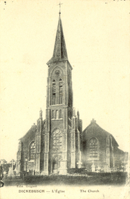
Postcard - black and white, Church at Dickebusch, c1916, c1916
A Commonwealth War Graves Commission (CWGC) burial ground, the Dickebusch Old Military Cemetery, is a burial ground for the dead of the First World War and the Second World War. It is located at Dickebusch in the Ypres Salient in Belgium on the Western Front of the first war. Dickebusch (now Dikkebusch) is a village and commune in the Province of West Flanders, 5 kilometres South-West of Ypres on the road to Bailleul.Black and white photograph of a church with a steeple with a clocktower. The church was bombed in 1917 during World War One. This card was purchased by an Australian soldier, probably Henry Smerdon Holmes, during World War One. chatham-holmes family collection, dickebusch, belgium, ypres salient, dikkebusch, world war one -
 Federation University Historical Collection
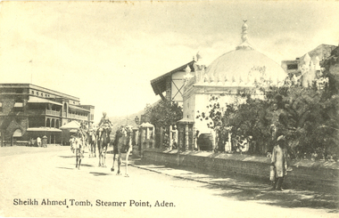
Postcard - black and white, Sheikh Ahmed Tomb, Steamer Point, Aden, c1914
Aden is a seaport city in Yemen, located by the eastern approach to the Red Sea (the Gulf of Aden), some 170 kilometres east of Bab-el-Mandeb. Aden was the capital of the People's Democratic Republic of Yemen until that country's unification with the Yemen Arab Republic. On that occasion, the city was declared a free trade zone.[citation needed] Aden gives its name to the Gulf of Aden. (Wikipedia)Black and white postcard showing Sheikh Ahmed's Tomb at Steamer Point, Aden. A number of camels are walking down the road. chatham-holmes family collection, aden, sheikh ahmed tomb, postcard, hotel de l'europe -
 Buninyong Visitor Information Centre
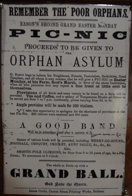
Document - Poster, Remember the Poor Orphans - Eason's Second Grand Easter Picnic, Scot's Marsh
This laminated copy of an advertisement promotes an Easter Monday picnic to be held at G. Eason's Farm in aid of the Ballarat Orphan Asylum. The original poster is undated. The farm was located at what was then known as Scot's March, later called Scotsburn, located a few kilometres southeast of Buninyong. The event promised a wide array of food, tea, coffee, games, sports and ended up with a Grand Ball. Laminated copy of an undated advertisement for a Grand Easter Picnic to be held at Eason's Farm, Scot's March, near Buninyong. Proceeds were to go to the Ballarat Orphan Asylum. Scot's Marsh is an earlier name for Scotsburn. The picnic was to include entertainments for up to 500 people with music, football, croquet, cricket, Aunt Sally, Smooth Pole climbing, all followed by a Grand Ball.easter, ballarat orphanage, eason family, picnics, entertainment, scotsburn -
 Orbost & District Historical Society
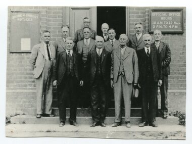
black / white photograph, first half 20th century
This is a photograph of some of the Orbost Shire councillors standing outside their council chambers. This photograph was taken before 1969 outside the previous council offices in Orbost. The current building was opened on Friday 28th February 1969 by the Premier of Victoria, The Hon. Sir Henry E. Bolte, K.C.M.G., M.P. The Shire of Orbost was a local government area about 380 kilometres east of Melbourne, the state capital of Victoria, Australia. The shire covered an area of 9,347 square kilometres and existed from 1892 until 1994. Originally, Orbost was part of the Bairnsdale Road District which was created on 30 April 1867. Splitting away as part of the Shire of Tambo in 1882, Orbost was first incorporated as a shire in its own right as the Shire of Croajingolong on 30 May 1892. It received its present name on 17 February 1893. On 3 January 1913 part of its western riding was annexed to Tambo as its Cunninghame Riding. Local governments play an important role in the lives of citizens in Australia. Local government authorities exist to provide services and amenities to local communities, and are also responsible for regulating and providing services for land and property in their district. This item is representative of a time when Orbost had its own Shire Council. A black / white photograph of a group of men standing in front of an open door of a brick building. On the left of the building is a Shire of Orbost notice board and on the right wall is a notice of the office opening hours - 10AM - 12 NOON 2PM - 4PMorbost-shire-council local government -
 Orbost & District Historical Society
statement of accounts, Shire of Orbost Statement of Accounts, 1963
This document was made by the Shire of Orbost, local government. The Shire of Orbost was a local government area about 380 kilometres (236 mi) east of Melbourne, the state capital of Victoria, Australia. The shire covered an area of 9,347 square kilometres (3,608.9 sq mi), and existed from 1892 until 1994. Originally, Orbost was part of the Bairnsdale Road District which was created on 30 April 1867. Splitting away as part of the Shire of Tambo in 1882, Orbost was first incorporated as a shire in its own right as the Shire of Croajingolong on 30 May 1892. It received its present name on 17 February 1893. On 3 January 1913 part of its western riding was annexed to Tambo as its Cunninghame Riding. On 2 December 1994, the Shire was abolished, and merged with City and Shire of Bairnsdale, Shire of Tambo, most of Shire of Omeo and the Boole Boole Peninsula from Shire of Rosedale into the Shire of East Gippsland. Local governments play an important role in the lives of citizens in Australia. Local government authorities exist to provide services and amenities to local communities, and are also responsible for regulating and providing services for land and property in their district. This item is representative of a time when Orbost had its own Shire Council. A document with a light blue cover, black print. It is a "statement of accounts for the Shire of Orbost for the year ended 30th September, 1963".document-statement-of-accounts orbost-shire -
 Federation University Historical Collection
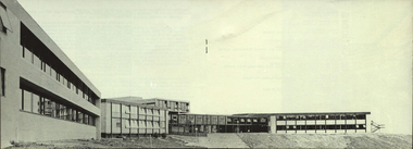
Photograph, The Knuckle at Gippsland Institute of Advanced Education, c1976
The Gippsland Institute of Advanced Education was established by an Order-in-Council in September 1968. The Council of the Institute included members of the Gippsland community who are prominent in local government, industry, commerce, education and the professions, the Director of the Institute, and representatives of the academic staff, students, and graduates. On its establishment, the institute assumed responsibility for the diploma courses previously offered by the Yallourn Technical College which had commenced diploma teaching in 1929. Initially, all the Institute's teaching was conducted in the diploma building of the Yallourn Technical College. In 1972 the Institute transferred part of its operations to the first of its permanent buildings on a large campus in rural surrounds near the township of Churchill, ten kilometres south of MOrwell and one hundred and sixty kilometres east of Melbourne. The Gippsland Institute of Advanced Education was opened on 20 November 1976 by the Honourable Lindsay Thompson, Deputy Premier of Victoria and Minister of Education; and Senator J.L. Carrick, Minister for Education in the Commonwealth Government. Image of an area in the Gippsland Institute of Advanced Education known as The Knuckle.gippsland institute of advanced education, gippsland campus collection, the knuckle, churchill -
 Federation University Historical Collection
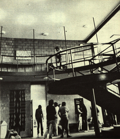
Photograph, Gippsland Institute of Advanced Education Ampitheatre, c1976
The Gippsland Institute of Advanced Education was established by an Order-in-Council in September 1968. The Council of the Institute included members of the Gippsland community who are prominent in local government, industry, commerce, education and the professions, the Director of the Institute, and representatives of the academic staff, students, and graduates. On its establishment, the institute assumed responsibility for the diploma courses previously offered by the Yallourn Technical College which had commenced diploma teaching in 1929. Initially, all the Institute's teaching was conducted in the diploma building of the Yallourn Technical College. In 1972 the Institute transferred part of its operations to the first of its permanent buildings on a large campus in rural surrounds near the township of Churchill, ten kilometres south of MOrwell and one hundred and sixty kilometres east of Melbourne. The Gippsland Institute of Advanced Education was opened on 20 November 1976 by the Honourable Lindsay Thompson, Deputy Premier of Victoria and Minister of Education; and Senator J.L. Carrick, Minister for Education in the Commonwealth Government. The Gippsland Institute of Advanced Education ampitheatregippsland institute of advanced education, gippsland campus collection, churchill, ampitheatre, buildings -
 Federation University Historical Collection
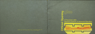
Booklet, Gippsland Printers, GIAE Official Opening, 1976, 1976
The Gippsland Institute of Advanced Education was established by an Order-in-Council in September 1968. The Council of the Institute included members of the Gippsland community who are prominent in local government, industry, commerce, education and the professions, the Director of the Institute, and representatives of the academic staff, students, and graduates. On its establishment, the institute assumed responsibility for the diploma courses previously offered by the Yallourn Technical College which had commenced diploma teaching in 1929. Initially, all the Institute's teaching was conducted in the diploma building of the Yallourn Technical College. In 1972 the Institute transferred part of its operations to the first of its permanent buildings on a large campus in rural surrounds near the township of Churchill, ten kilometres south of Morwell and one hundred and sixty kilometres east of Melbourne. The Gippsland Institute of Advanced Education was opened on 20 November 1976 by the Honourable Lindsay Thompson, Deputy Premier of Victoria and Minister of Education; and Senator J.L. Carrick, Minister for Education in the Commonwealth Government. Silver and yellow soft covered booklet celebrating the opening of the Gippsland Institute of Advanced Education at Churchill, Victoria. An introduction is written by C.H. Ford, President of Council. The book was designed and produced by the design Centre, G.I.A.E. SChool of Visual Arts.gippsland institute of advanced education, m.w. hopper, c.h. ford, lindsay thompson, j.l. carrick, r.w. muncey, churchill, yallourn, morwell, yallourn technical school, yuncken freeman architects, f.a. gray, f.r. goddard, j. milton-smith, j.r. lawry, b.r. groves, c.p.a. hos, c.w. tolley, k.f. smith, j. dowsley, robert charles bigelow, charles hartley ford, daniel eric kent, barbara lapin, john charles mcgauran, neville thompson, john charles vinall, leslie alfred galvin, maxwell francis gray, john alfred forster oram, donald robert hannington, john perrin kellaway, john james robertson, leslie lawrence shipp, valerie lorraine willington, leonard allan falk, kwong chiu lee dow, brenton robert groves, glen william drover, kenneth francis gibson, maxwell wallace hopper, teunis jan geerit korevaar, j.j. robertson, d.f. kretlow, chancellor and patrick, churchill campus, gippsland campus collection -
 Orbost & District Historical Society
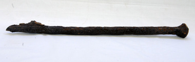
bridge spike
This spike came from the old Brodribb River bridge which is about 9.6 kilometres from Orbost. The Brodribb River joins the Snowy River north of Marlo. In 1906, a bridge replaced the punt over the Brodribb River, improving communication with Orbost. It was eventually replaced by a reinforced concrete bridge built by the Road Construction Authority in 1989 where the Princes Highway passes over the Brodribb RiverThis item belongs to a significant local structure which has been replaced.A very rusty iron bridge spike from the old Brodribb Bridge.brodribb-river bridge-spike -
 Otway Districts Historical Society
Book, The Text Publishing Company, Cliffy: the Cliff Young story, 2013
Cliff Young was a sixty-one-year-old potato farmer from Beech Forest in the Otway Ranges, a couple of hundred kilometres south-west of Melbourne. With his distinctive shuffle, friendly wave and innocent grin, he beat a field of professional runners to take out the inaugural Westfield Sydney to Melbourne Ultra-marathon starting on April 27 and finishing May 2 in 1983.Cliffy: the Cliff Young story. Julietta Jameson. 1st ed. Melbourne (Vic); The Text Publishing Company; 2013. vi, 218 p.; illus. ISBN 978 1922 0798 6 2 Soft covercliff young; beech forest; sydney; melbourne; ultra-marathon; otways; -
 Bendigo Military Museum
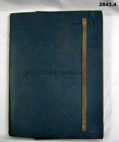
Administrative record - FOLDER, 2) & .3) Geographical Section, General Staff, No 4080 War Office 1941 et al, Navigator's Log Book, 2) & .3) 1941
.1) Navigator's Log Book, hard cover, blue colour buckram with dark blue paint on front cover. Back end paper includes a pocket for maps & has a Conversion Table & Nautical Miles, Statute Miles, Kilometres, tables in black print on beige paper included. Stiff card divider. .2) Map folded, black printing on beige paper. Gibraltar Scale 1:1,000,000 at 56 degrees N. .3) Map folded, black printing on beige paper. Algeria Scale 1:1,000,000 at 56 degrees N. .4) Pencil grey lead, timber colour. Stamped into pencil: HB Commonwealth of Australia..1) Hand written in black ink on front end paper: Wreck at Cape Juby. In pencil: S2 / MZ / W2 / 1Z . 35N .2) Hand written in blue pencil: Atlantic. Blue & red ink & lead pencil notations over map. .3) Hand written in blue pencil: Mediterranean. Blue & red ink numerous notations over map.documents - maps/records, military history, passchendaele barracks trust -
 Kew Historical Society Inc
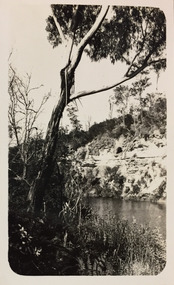
Photograph - Bruthen to Swan Reach, 1926
Henry Beater Christian (1886-1962) , was a descendant of one of the earliest settler families in Kew. Employed at the Kew Asylum as a 'public servant', he was a skilled amateur photographer, photographing numerous scenes in Kew and on his travels around Victoria. The majority of his photographs date from 1916 to 1929. His finest photographs are housed in two photograph albums. Digital copy of a photograph from page 31 of the 47-page photograph album containing 261 gelatinous silver images, loaned by Diane Washfold with permission given to digitise and hold a copy in our collection. John Chapman has written in 'Bushwalking Clubs - A Brief History', about the establishment in Victoria of the first bushwalking club in 1888, and the popularisation of bushwalking during the interwar period. Henry Christian's 'walks' appear to have been undertaken solely or with a companion/s. This black and white photo is part of a group of six photos taken on an 18 kilometre walking trip between Bruthen and Swan Reach in East Gippsland in 1926. The route of the walk followed the Tambo River."BRUTHEN TO SWAN REACH 1926"henry beater christian (1886-1962), landscape photography, christian-washfold collection, photograph albums, bushwalking, bruthen, swan reach, tambo river, east gippsland -
 Greensborough Historical Society
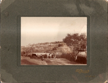
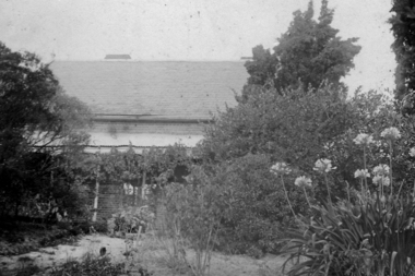
Photograph, Willis Vale 1906, taken from the hill, 1906_
'Willis Vale' home of the Partington family is shown in this photograph as well as the area now known as Partington's Flat. The area was owned and farmed by the Partington family from the 1870s. The derelict Willis Vale house was destroyed in 1964 when a fire originating from North Plenty Gorge - Kurrak Road - lit by two teenage boys - made its way several kilometres down to Partington's Flat Greensborough.Photograph shows an early view of Greensborough in 1906.Professional photograph in sepia mounted on dark green card. Shows Greensborough township in background with Willis Vale homestead in centre. On back: A.M.Partington Greensborough 1906.willis vale, partington family, greensborough, alan partington -
 Greensborough Historical Society
Photograph - Digital Image, Willis Vale, 1950c
House built by Edward Maygar, Robert Whatmough lived there mid 19th century and later sold to Partington family. It was located on the Plenty River at Partington's Flat Greensborough. The derelict Willis Vale house was destroyed in 1964 when a fire originating from North Plenty Gorge - Kurrak Road - was lit by two teenage boys and made its way several kilometres down to Partington's Flat Greensborough.Willis Vale was one of the earliest homes built in the area.Black and white digital photograph.willis vale, partington family -
 Warrnambool and District Historical Society Inc.
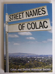
Book, Streets of Colac, 2008
This is a book giving information on the streets of Colac and the origins of the names. Colac is a city 150 kilometres south west of Melbourne and is a commercial centre for a major agricultural area. It is situated near the 3rd largest volcanic plain in the world and European settlement began in 1837. The book was commenced by Ian McIntosh in the 1970s and in 2005 the Colac and District Historical Society took on the project again with the major editors being Ida and Andrew McIntosh. This book is of interest, particularly those in the Western District of Victoria, as it contains information on Colac streets, many of which were named after pioneers of the district. The book will be useful for research. This is a soft cover book of 60 pages. The cover has a blue background and features a colour photograph (mainly in green, blue and white tonings) of a panorama of the Colac district. The photograph extends over the front and back covers. The book contains the names and name origins of Colac streets in alphabetical order and many black and white photographs. The pages have a glued binding. Front Cover: ‘Street Names of Colac’ ‘Colac and District Historical Society’ history of colac, colac and district historical society, street names of colac, ian mcintosh -
 Orbost & District Historical Society
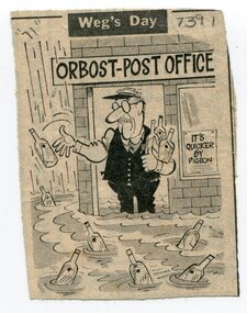
newspaper clippings, February 1971
These articles were compiled by Mary Gilbert who was the first curator of the Orbost Museum and a prominent historian / teacher in Orbost. The 1971 floods at Orbost were the worst on record. At Jarrahmond the river rose to a height of 11 metres and on the flats spread to one and a half kilometres wide. Considerable damage was done to railway infrastructure, roads and farms. More information from the APRIL, 2008 newsletter by John Phillips. (see orbosthistory.com.au)These articles are contemporary records of a significant historical event in Orbost.A manila folder containing black / white newspaper clippings from various publishers. They all relate to the 1971 floods in Orbost. (Details of contents in catalogue 735-900)floods-orbost-1971 -
 Orbost & District Historical Society
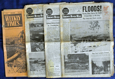
newspapers, February, March 1971
The 1971 flood was the the worst flood on record. At Jarrahmond it was at least 11 metres and up to one and a half kilometres wide on the flats causing enormous damage to the flood plain. Records say that "The brown floodwater stain in Bass Strait could be seen from passing airliners." Considerable damage was done to railway infrastructure, roads and farms. More information from the APRIL, 2008 newsletter by John Phillips. (see orbosthistory.com.au) These newspapers are contemporary records of a significant local event.Four newspapers relating to the floods in 1971. They contain news articles and photographs of the floods in Orbost in early 1971. 2556.1 is the Weekly Times dated 3.3.1971 and has an orange cover. 2556.2 is a Snowy River Mail dated 17.2.1971. 2556.3 is a Snowy River Mail dated 10.2.1971. 2556.4 is a Snowy River Mail dated 3.3.1971.floods-orbost-1971 snowy-river-mail weekly-times newspapers -
 Uniting Church Archives - Synod of Victoria
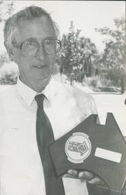
Photograph, Rev Alan Body, 1988
Rev Alan Body ministered at Wentworth (the Victorian parish in New South Wales) for 10 years, and was subsequently transferred to Boort. During his time at Wentworth he conducted a patrol ministry, travelling between 8000 and 10,000 kilometres per year visiting the area from Wentworth to Pooncarie, to Coombah on the Broken Hill road, out west to the South Australian border, south to the Murray and upstream to Wentworth.B & W waist length photograph of Rev. Alan Body with his Wentworth Shire Australia Day Citizen Award."Alan Body page 31 C&N 24/2/1988"rev alan body -
 Victoria Police Museum
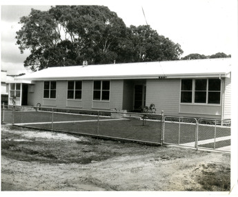
Police Stations (Apsley)
Apsley is a small town in Victoria, Australia. It is on the Wimmera Highway, in the Shire of West Wimmera, 420 kilometres north-west of Melbourne, and 7 kilometres east of the South Australian border. Apsley Police Station opened on 29th November 1884 and was originally located in Wallace Street. It was staffed by one Foot Constable (motor cycle). The building was described, in 1930, as a four-roomed dwelling with an iron roof, set on a quarter of an acre of land. There was a bathroom, a WC, wash-house and a garage. An office adjoined the house and there was also a lockup. The station moved several times until the mid 1960s when a timber residence was moved onto land adjacent to the Post Office. The building is believed to have been transported from the Stawell area. Apsley is one of a handful of one-man police stations in Victoria and its current location, including residence, is at 19 Splatt Street. Apsley was in the Western District when it opened, then in "L" (Wimmera) District from January 1948 and "M" (Highlands/Wimmera) District from March 1990. 4 black & white photos, 1965 3 colour photos, 1987police stations; apsley police station -
 National Wool Museum
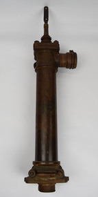
Tool - Water Pump, c.1960
A windmill may be considered one of the most iconic sights of Australian Farming life. A pump like this rest at the heart of all such windmills, turning wind energy into water for farmers both here in Australia and worldwide alike. The water windmills access is referred to as an aquifer, an underground layer of water trapped in rocks but accessible with use of water wells and windmills. Australia is home to an underground aquifer known as the Great Artesian Basin. It is the largest and deepest aquifer in the world. Stretching over 1,700,000 square kilometres, the Basin underlies nearly a quarter of the continent including most of Queensland, the south- east corner of the Northern Territory, the north-east part of South Australia and the northern part of New South Wales. The basin is 3,000 metres deep in places and is estimated to contain 64,900 cubic kilometres of groundwater. To try and give this number context, a megalitre is a million litres. The Great Artesian Basin contains 65,000 million megalitres of water. This would be enough to cover all the land on the planet in almost half a metre of water.Lift style piston pump typical of an Australian farm connected to a multi-bladed windmill. Bronze cylindrical construction coming up from removable wood base. Rotating lever is above outlet pipe which would send water to the storage tank.windmill, australian farming, great artesian basin, aquifer -
 Otway Districts Historical Society
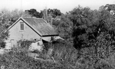
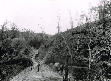
Photograph, Brucker, Powneys Cutting being excavated, c.1902, c.1902
Because of the vast quantity of piles for harbour works Pettit Bros. of Geelong arranged for an addition siding to be installed at Ferguson on the north side of the station in 1913. They then laid a tramway in a northerly direction along the original alignment of Charley's Creek road to the top of Powneys Cutting, 1.8 km from Ferguson, where a log winch was sited. This powerful winch hauled carefully selected piles from the north-west. Jim Facey and Jim, Ted and Tom Cashin formed a partnership to log an area along the Charley's Creek Road six kilometres from Ferguson, operating full-time from 1934. After leasing three Crown sites and cutting them out the partners shifted logging operations to Powneys farm, which they had purchased, and laid a log trail into the farm. The old road reserve was also purchased, and the log tram continued along the road reserve for one kilometre to Powneys Cutting. Logs were winched up to the tramline and despatched to the mill along the falling grade of the road.B/W. 201mm x 268mm. Powneys Cutting being excavated by four men, two men on either side of the slope, and a horse at the end of the line, in c.1902.ferguson; powneys cutting; tramways; powneys farm; pettit; jim facey; jim cashin; ted cashin; tom cashin; charley's creek road; -
 Orbost & District Historical Society
box of documents, 1980s - 1990s
These documents were used at the Slab Hut (Orbost Information Centre) from 1985 - 1992 to record l visitor numbers, employment, activities, events and incorporation details. The Orbost Visitor Information Centre is situated in Forest Park on Nicholson Street. The centre is housed in the historic Slab Hut. The hut was an original family dwelling built in 1872, on a site approximately three kilometres upstream from the junction of the Buchan and Snowy Rivers.These documents record the history of tourism in the Orbost district.A cardboard storage box of documents and records of the Orbost & District Tourist Association / Slab Hut. It includes minute books, visitor numbers, details of volunteers, correspondence and details of activitiess and events.tourism-orbost slab-hut-orbost -
 Warrnambool and District Historical Society Inc.
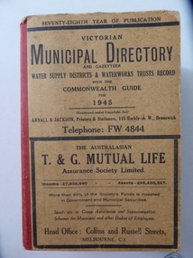
Stamp, W'bool Co.op Commons Seal, 1945
This is a Victorian Municipal Directory for 1945, containing general information on all municipalities in Victoria, a Gazeteer, a Commonwealth Guide and a Water Supply Record. Municipal Directories were published annually in Victoria from 1867 on. This directory came from the Shire of Mortlake which was established in 1864 when it had an area of 2137 square kilometres. The Shire of Mortlake was abolished in 1994 and merged with other neighbouring shires to form the present day Shire of Moyne. This book is very useful to researchers as it contains much information on the City, Borough and Shire structures, the Council employees and Government employees of all the municipalities. It has, therefore, important local information on Warrnambool and the surrounding areas in 1945. This is a soft cover book of 1114 pages. It has a buff- coloured cover with red binding on the spine. The printed material on the covers is printed in black. It has a blue stamp of the Shire of Mortlake on several pages. The book contains several advertisements for Melbourne businesses. ‘Shire of Mortlake’ shire of mortlake, local government in victoria, warrnambool history -
 Lara RSL Sub Branch
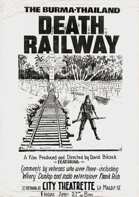
Newspaper Article, The Burma-Thailand Death Railway Film Poster
The Burma Railway, also known as the Death Railway, the Siam–Burma Railway, the Thai–Burma Railway and similar names, was a 415-kilometre railway between Ban Pong, Thailand, and Thanbyuzayat, Burma, built by the Empire of Japan in 1943 to support its forces in the Burma campaign of World War II. This railway completed the rail link between Bangkok, Thailand, and Rangoon, Burma. This is a poster advertising the showing of a film on the making of the railway.In all, 9,500 Australian prisoners of war worked on the construction of the Burma-Thailand Railway, which ran from Bampong, Thailand, to Thanbyuzayat, Burma . Building commenced at each end of the railway. Altogether, 2,646 Australians died working on the railway.Rectangular shaped black and white film poster.The Burma-Thailand Death Railway Film Posterposters, burma-thailand death railway film poster, world war two, lara r.s.l. -
 Greensborough Historical Society
Photograph - Digital image, Willis Vale, 1939c
Willis Vale: House built by Edward Maygar, Robert Whatmough lived there mid 19th century and later sold to Partington family. It was located on the Plenty River at Partington's Flat Greensborough. The derelict Willis Vale house was destroyed in 1964 when a fire originating from North Plenty Gorge - Kurrak Road - was lit by two teenage boys and made its way several kilometres down to Partington's Flat Greensborough.Home of the Partington family.Digital copy of black and white photograph.willis vale, partington family, maygar family, whatmough