Showing 731 items
matching high fire
-
 Kiewa Valley Historical Society
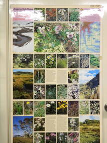
Map / Chart, Vegetation Map & Guide to Alpine Flora: Pretty Valley, 1982
This poster shows Pretty Valley is on the Victorian High Plains where the State Electricity Commission of Victoria worked on the Kiewa Hydro Scheme. Also cattle have grazed in the area over the years. This map is of interest to compare the flora in the area with times prior to 1982 and after 1982.This poster has historical and research value as it shows the flora in the pretty valley area therefore making it significant for people interested in plants. Also for those who would like to compare what plants are still in this area after 1982 and if the cattle grazing, climate change, of bush fires have had on the environment. Thus this poster also has good interpretive capacity of these reasons. Laminated double sided vegetation map and photographic guide to Alpine flora of the Pretty Valley areapretty valley. bogong. vegetation. plants. flowers. alpine. victorian high plains. cattle grazing. s.e.c.v. -
 Kiewa Valley Historical Society
Map / Chart, Vegetation Map & Guide to Alpine Flora: Hotham, 1982
This poster shows Mt Hotham is on the Victorian High Plains. This poster and map enables the comparison to be made of flora in other areas of the Victorian High Plains e.g.. which was previously known as the Bogong High Plains. This poster has historical and research value as it shows the flora in Mt Hotham area therefore making it significant for people interested in plants. Also for those who would like to compare what plants are still in this area after 1982 and if the cattle grazing, climate change, of bush fires have had on the environment. Thus this poster also has good interpretive capacity of these reasons.Laminated double sided vegetation map and photographic guide to Alpine flora of the Hotham area.hotham. vegetation. plants. flowers. alpine. high plains of victoria. -
 Kiewa Valley Historical Society
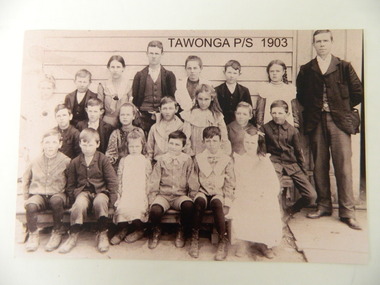
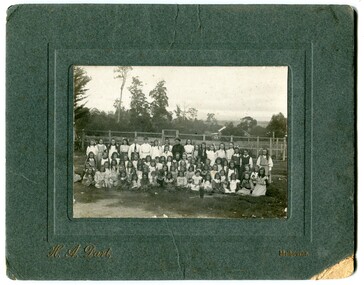
Photo - Copy of Tawonga Primary School 1903, Tawonga Primary School, 1903 - original
Tawonga is in the Kiewa Valley where farmers lived with their families. The school was opened on 27th July 1880 situated on 8 acres near the current township of Tawonga. This school was erased by fire in 1900 and all records were destroyed. The school then moved to the old Tawonga Hall. In 1910 the school was shifted to its present site on 3 acres of land donated by Frank Cooper. The school building and attendance continued to grow especially during the construction of the Kiewa Hydro Electric Scheme. Historic: Tawonga Primary school has educated the local farming and town children for many years. It is an excellent source of the names of the local families in 1903. The photo is taken outside the Old Tawonga hall where the school was situated in 1903 and shows the clothing worn by children and teachers at the time.Teacher and 20 students in school photo. "Tawonga Primary School 1903" added digitally when the photo was copied. There is a typed list of all names.Names of students. Back Row: Charlotte Cooper, John Cooper, Ada Cooper, Thomas Hollands, Irene Roper, Stewart Hollands, Lily Barnette. Teacher Donald Mc Cance. Centre Row: Edward Trebilcock, Alfred Hollands, Pearl Barnette, Frank Cooper, Nellie Higginson, Bert Roper, Reg Roper. Front Row: Ben Cooper, Raymond Cooper, Myrtle Barnette, Lewis Crotty, John Creamer, Annie Hollandstawonga primary school. education. kiewa valley. cooper family -
 Kiewa Valley Historical Society
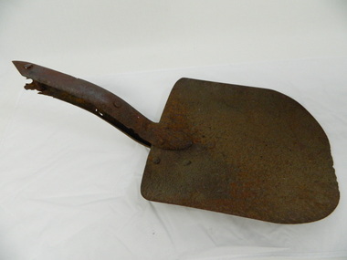
Shovel head - Fainter Falls
The Fainter Falls Walking Track was originally accessible via a fire fighting access trail, which was used by fire-fighters putting out spot fires caused by lightening strikes. The fires in the summer of 2003, highlighted the beauty of this area and provided the residents with the opportunity to consider the redevelopment of the trail. Work to establish a 700 metre grade 2 walking trail with a 50 metre grade 3 extension trail to the Falls began in 2005. It also includes 3 observation decks, a bridge over a creek crossing, car parking and interpretative signage.The shovel was found during work on the Fainter Falls track. It was left there some time ago by a previous visitor to the Falls indicating that the Falls were accessible and attracted visitors many years ago.Rusty metal shovel head curved on each side and rounded at the front. At the back of the blade it is attached on top with 3 nails to the top piece. The top metal piece overlaps the blade by 6.5 cm longitudinally x 5 cm across. On the back the metal piece overlaps the blade by 12 cm both longitudinally and across the handle end but tapers to a point. It has 6 nails attaching it. Both metal pieces are attached to the blade and curve parallel and around so that a wooden handle would fit between them. This would have 2 nails passing through both metal pieces and the handle. (The handle is missing.) shovel. fainters falls. bogong. walking track. fire track. water. -
 Kiewa Valley Historical Society
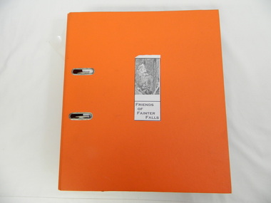
Folder - Fainter Falls, 2003 - 2008
The Fainter Falls Walking Track was originally accessible via a fire fighting access trail, which was used by fire fighters putting out spot fires caused by lightening strikes. The fires in the summer of 2003 highlighted the beauty of the area and provided the residents with the opportunity to consider the redevelopment of the trail. Work to establish a 700 metre grade 2 walking trail with a 50 metre grade 3 extension trail to the Falls began in 2005. It also includes 3 observation decks, a bridge over a creek crossing, car parking and interpretive signage.A Friends of Fainter Falls committee was formed to work towards the construction of a track to Fainter Falls. The contents of this folder is evidence of how a local community achieved its goals for such a project in 2003 - 2008.Large orange lever arch folder bound with 2 rings. Contains the history of the redevelopment of the Fainter Falls track 2003 - completion at the end of 2008. It is divided into: Funding Proposals. Correspondence Inwards & Outwards. Minutes and Letters of Support. Inserted separately in a large white and yellow Express Post envelope is additional information including chronology, minutes, newspaper cuttings Inserted separately is the 'Small Towns Development Fund' Application Form 2006.Cover blankfainter falls. bogong. walking trail. fire track. kiewa valley community. -
 Kiewa Valley Historical Society
Video - Fainter Falls, Fainter Falls, 2003 - 2008
Visual workings and development of the Fainter Falls Trail completed in 2008. The trail was originally accessible via a fire fighting access trail. The fire in the summer of 2003 highlighted the beauty of the area and provided the residents of the Kiewa Valley with the opportunity to consider the redevelopment of the trail. Work to establish a 700 metre grade 2 walking trail with a 50 metre grade 3 extension trail to the Falls began in 2005. It also includes 3 observation decks, a bridge over a creek crossing, car parking and interpretive signage.This video recording is a visual recording of the process of the establishment of the Fainter Falls Walking Trail giving an insight into the process, the work, tools and materials used for such work from 2003 to 2008. It also shows the vegetation in the area and the amount of water flowing at the time.White cardboard cover with black plastic video labelled "Fainter Falls" on outer edge."Fainter Falls"fainter falls. bogong. walking trail. fire track. national parks of victoria -
 Kiewa Valley Historical Society
Alex McCullough Collection - Notes and Photos on History of Mt Beauty
Alex McCullough was a resident of Mt Beauty for many years and wrote a book on the History of Mt Beauty. Mt Beauty was constructed by the State Electricity Commission of Victoria to house employees working on the Kiewa Hydro Electric Scheme. Alex was involved with many organisations in Mt Beauty and interested in history. He took many photos of events and new developments in town. He also collected individuals memoirs on life in the town.Mt Beauty's history is unique as it was built as a construction town in the late 1940s. The information in Alex's Collection records the town's development perhaps in more detail than in his book "The History of Mt Beauty". His folder includes his education, his work with the SECV (foreman working on Clover Dam), his war service, his community work (Mt Beauty & District Progress Association & Mt Beauty Neighbourhood Centre) and awards, work as Shire Councillor and Mayor, sporting (tennis & golf) interests. Alexander John McCullough 1916 - 2011's obituary is online ref. legacy.comA) Booklet - The Life of Alex McCullough B) Booklet - The Story of Kiewa by Alex McCullough C) Coloured photos 15cm x 10 cm of the renovation of the Mt Beauty Neighbourhood Centre mid 2001. Four photos are labelled by Alex McCullough on the back. Also, photos of various sizes both colored and black and white depicting sites and people in Mt Beauty. Not labelled.Also, six packets of negatives of older photos incl. Community Hall, Fire Brigade, School, School ski group, Back to Kiewa, Alpine Study, D) Alex McCulloughs 1951 Diary - Clover Dam E) Random Items from History Profile Kiewa by Alex McCullough F) Papers - 'Administration of Mt Beauty Township' - 2nd July 1957. SECV buildings in Mt Beauty shared with community groups notes re - arrangement between groups. G) Barrie Wilcox's Memories living in Marum's paddock from c1940s onwards. Written in June 1999 H) Mt Beauty website June 1998 - a lot of history I) Papers - Mt Beauty High School band developement J) The 1950s Development of the Birth of Community support organisations K) Community Centre Mt Beauty opening 3rd August 1951 L) Mt Beauty Fire Brigade History M) Folder Personal papers re Alex McCullough alex mccullough, mt beauty history, community work -
 Kiewa Valley Historical Society
Papers - Mt Beauty Airport Development
The SECV began investigating four possible sites for an airstrip in Mt Beauty in 1965. The land was owned by the SEC and leased by Mr J. Sharp. It became available on the condition that the land would only be available to the Municipal shire. This land was officially opened as an Airport as an official tourist activity in 1977. It continues to be available to tourists, fire fighters, the air ambulance and the local gliding club.The opening of Mt Beauty Airport has enhanced Mt Beauty township by enabling fire fighters to access the surrounding bush during bush fires, by enabling Ambulance helicopters to rush emergency patients to city hospital, by giving tourists the opportunity to fly in and to give the local Gliding Club the opportunity to store and fly their gliders. 1. Set of papers titled 'History Mt Beauty Airport Development' held together by large steel clip by Alex McCullough. 2. Set of papers titled 'Department of Transport' and 'Alpine Shire' both held together by one staple. 3.Mt Beauty Township Survey Plan of Airstrip 1975 4. Large folder titled Mr J. R. Sharp 1975 - Mt Beauty Airfieldmt beauty airport history, alex mccullough, transport, tourism -
 Kiewa Valley Historical Society
Book - Alpine Resorts - 2020 draft strategy, Alpine Resorts 2020 draft strategy
This is a commissioned report auspiced by the State Government of Victoria - Department of Sustainability and Environment 2003.This report was prepared to guide the sustainable long-term planning and management of Victoria's six Alpine Resorts. Falls Creek, Lake Mountain, Mount Baw Baw, Mount Buller, Mount Hotham and Mount Stirling, after the catastrophic bush fires of 2002- 2003.Colorured cardboard front cover with two people on air mattresses in foreground. Title white on bue top left corner. 40 glossy thick paper/card pages. A4Logo "Victoria / The Place to betourism in alpine resorts, sustainability and environment, victorian government, 2002-2003 bushfires -
 Kiewa Valley Historical Society
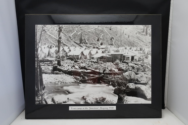
4 Photos framed - Kiewa Hydro Electric Scheme 1940s
These 4 black and white photos are very clear and are of Bogong in the 1940s when the Kiewa Hydro electric Scheme was being constructed. Bogong was the first construction site. Bogong was a township and construction site for the Kiewa Hydro Electric Scheme built by the State Electricity Commission of Victoria. These photos in the early 1940s (during WW2) tell the story of fire, flood and living conditions with the inference of transport being horses in 1940 compared with its development in 1944.1. Tent camp at the 'Junction', Bogong 1940 2. Junction Dam September 1940: floodwaters over coffer dam 3. 'Reservoir' Camp with Bogong Stables in foreground, 1940 4. Junction Dam and Bogong village in August 1944 Each photo has string attached on the back with tape - for hangingSticker on the back of each photo: 'Framing/ Colour Magic / Shop 7, Lismore Central / Carrington Street, Lismore / Phone (02) 6621 3289'bogong township 1940, junction dam 1944, reservoir camp 1940, bogong stables 1940, tent camp at bogong -
 Kiewa Valley Historical Society
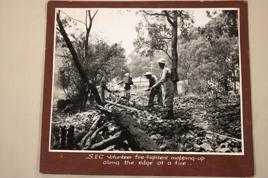
Photos - Kiewa Hydro Electric Scheme - Fire Fighting, Official S.E.C.V. photos
... Centre 31 Bogong High Plains Rd Mt Beauty high-country Fire ...Fire Fighting -
 Kiewa Valley Historical Society
Article - "This Week" - History of Green Tea, Green Tea - The Facts
'The Japanese company Ito En has been working solidly for the last five years to establish a green tea industry in this area .' The article includes assistance from the Alpine Shire, the cost and benefits of the schemeThis is of historic and social significance regarding industries in Mt Beauty and the Kiewa Valley especially as some no longer grow green tea as the affect of bush fires (smoke) made the industry not viable.Article with Title "Green Tea - The Facts" published on Page Seven from local publication "This Week" Falls Creek. Bogong. Mt. Beauty Summer Edition 21 Friday January 23rd 2004. Refers to properties of which there are 50% in the Kiewa Valley including Mt Beauty.green tea in mt beauty, japanese company ito en -
 Kiewa Valley Historical Society
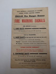
Notice -SECV Fire Brigade - Fire Warning Signals & Evacuation
The State Electricity Commission of Victoria, who constructed the Kiewa Hydro Electric Scheme, established and controlled the Mt Beauty Fire Brigade before it was handed over to the CFA.Bushfires and fires in the towns were a threat during the Fire Danger Season. The SECV was responsible for looking after the safety of the community. Interesting to compare the information on the notice to that of today.Cardboard Notice to the SECV Fire Brigade re Fire Warning Signals for the 1962-63 Fire Danger Season. There are 3 messages: 1. Long Blasts 2. Short Blasts 3. Continuous Blasts. On the back "Evacuation": Be Prepared. Things to Take. Protection of House Property - Before leaving the house and lastly Where to Gomt beauty fire brigade, khes fire brigade, fire warnings -
 Kiewa Valley Historical Society
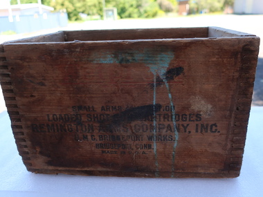
Ammunition Box - Remington America
... Centre 31 Bogong High Plains Rd Mt Beauty high-country ...Manufacturer of fire arms and ammunition. Founded in 1816. It was one of the oldest gun makers in the US. Used by hunters, farmers and recreational shooters in the Kiewa Valley.Wooden cubic shaped box with black print on each side including the makers name, Remington Arms Co. Inc. of Bridgeport, Conn., USAIn black print on each side. Varying quality of legible words.remington arms, ammunition box, hunters -
 Kiewa Valley Historical Society
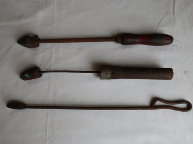
Soldering Irons x3
A soldering iron is a hand tool used in soldering. It supplies heat to melt solder so that it can flow into the joint between two workpieces. The iron was heated over a fire or in a charcoal brazier. Soldering irons were primarily used by tinsmiths and coppersmiths to work with thin sheet metal. These hand soldering irons have been replaced by electric ones.Used by coppersmiths and tinsmiths and workers in the Kiewa Valley.The soldering irons have a wooden handle, an iron rod and are made of copper at the pointy end (the bit).shaped like a pyramid.soldering iron, hand tool, coppersmith, tinsmith -
 Kiewa Valley Historical Society
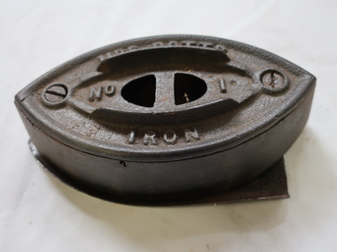
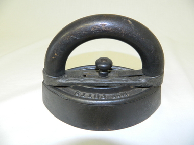
Iron - Mrs Potts No. 1
A clothes iron is used, when heated, to press clothes to remove wrinkles and creases.The early irons were heated over a stove or in a fire. Irons were used very early in time and cast-iron irons during the 18th century. Mrs. Potts invented many irons starting from an early age thus making a difference to the clothing industry. She invented clothes irons with detachable wooden handles. Her first patent was in October 1870.This iron was used in the Kiewa Valley.Vintage cast iron body invented by Mrs Mary Florence Potts 1890s to 1940s. Detachable wooden handle (not attached) was cooler than a metal handle. It is double pointed for ironing in both directions. Body is hollow the top part being held by two screws. It can be filled with a light material. The No. 1 size is for specific ironing task. compared with No. 2 or No. 3. One handle with other bases enabled some to be reheating while using one. This iron has a stand. Formerly KV88B)Mrs Potts / No. 1 / Iron"" embossed on the topmary florence potts iron, cast iron, laundry, mrs potts -
 Kiewa Valley Historical Society
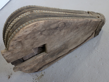
Blacksmith's Bellows
In the Middle Ages double-acting bellows was introduced. It had 2 parts, one operated by hand or foot, the other took air from it and was weighted so it forced air out while the part was filling. Blacksmithing is the shaping of hot iron and steel, usually by hammering. Very hot fires were produced by 1.a hot air blast. 2. burning charcoal (not wood). Bellows were used to make tools, fix equipment including machinery, drays, carriages, harnesses etc. Farmers in the Kiewa Valley often had their blacksmith forge. They made their own tools, were able to mend equipment, drays etc., gates, and most items that were made of iron and steel.Large Double Acting bellow with wooden top and bottom, shaped like a 'water drop' - narrow at one end and broad at the other. The wood is held by strips of wood and leather bound and placed around the perimeter. The wood on the top side has inscriptions (illegible). The wood on the bottom side has a rectangular hole. The narrow end feeds into a pipe to enable the fire to receive a hot blast of air. When the bellow is squeezed it allows both pieces of wood to be pushed together.Illegibleblackmiths, bellows, double acting bellow -
 Kiewa Valley Historical Society
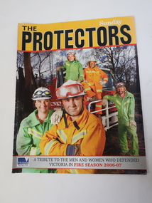
Magazine - The Protectors, A Tribute to the Men and Women who Defended Victoria in Fire Season 2006-07
The magazine covers details of the 2006-07 bushfires in Victoria. On page 31 Region 24 list includes towns in the Kiewa Valley. The Kiewa Valley is under constant threat of bush fires during summer. Local fire brigades assist in the protection of residents.The Kiewa Valley was affected by the 2006-07 bushfires. Residents are encouraged to have a fire plan, to be knowledgeable about bush fires and to be ready to leave their homes when under threat. The local towns each have a fire brigade which includes volunteers. On page 18, 'The Yellow Line" - Photo of Kiewa Valley (Mt Beauty and Tawonga) Crews.Glossy coloured photograph of firemen on the front cover and raging fire on the back cover. 31 pages2006 - 2007 bushfires, kiewa valley fire crews -
 Kiewa Valley Historical Society
Iron - Flat, Circa early 1900s
Historically this item was used before the spirit and the electrical iron took over Circa 1930s -1950s. The main body of the iron was placed on a flat heated surface of a stove (wood, coal or gas fired). It was mainly used by women in their domestic role, ironing the family clothes and linen. In the Kiewa Valley the supply of coal or gas was not available or too expensive than the locally cut hard wood trees. This particular iron was an improvement on the fixed handled iron because it allowed (by use of its easily detachable handle) to use multiple bases and thereby allowing a constant heat supply to be maintained and not having to waste time for a base to reheat to the required level of application.The significance of this item was that it allowed for a faster method of ironing clothes and linen. It's invention was a progress towards reducing the time it took to undertake a very labour and intensive domestic function. The reduction of time taken for this household duty provided women great flexibility to undertake other activities. These type of improvements to basic domestic tasks liberated housewives not only physically but also mentally from the isolation of the home environment.This flat iron has a removable, clip-on handle. The handle and its release knob are of wood. The base of the handle together with the heavy flat body are made of cast iron. The body of the iron is oval shaped tapered at each end and is 40mm thick.Underneath the handle frame and on the main body, on one side, in raised lettering is "Mrs Potts" and on the other side "Iron". Both are clearly visible when viewed from an aerial position. Under removable handle and on a plate (screwed onto the main body) is "No 2"iron, antique, household, pressing clothes, domestic, laundry -
 Kiewa Valley Historical Society
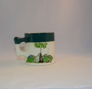
Mug Stoneware
This ceramic mug is titled "Bill Bogong's Mug" in honour of one of Australia's Scouting (Rovers) notable office holders, Mr.W.F."Bill" Waters. He was born on 22nd August 1897 in Taralgon, Victoria, Australia and died 8th October 1968 in Fitzroy, Victoria. He was instrumental in the Rovers building two chalets in the Victorian Alps. The Victorian Award of the National Rover Service Award(1980) has been named after Bill Waters. Bill Waters was also the leader of the first team that climbed Mount Bogong in winter in 1929. Also was part of rescue team of what is now know as the Cleve Cole tragedy on Mt Bogong in the mid 1930's. There is also a water fall named after him Waters Falls on the Bogong High Plains. W.F."Bill" Waters aka "Bill Bogong" (Bogong mountain, were his ashes were scattered), was not only a prominent bush walker (Melbourne Walking Club) of the high country (Victorian Alps) but was instrumental in establishing two Chalets. One of these Chalets was the first one to be built on the Bogong High Plains. This item, "Bill Bogong's Mug" is what the Flinders Petrie(famous English Egyptologist/Archaelogist) Rover Crew(formed in 1940) presented newly invested members of the exclusive(200 membership) Alpine Rover Crew. The Melbourne Walking Club has a long history with the Victorian High Plains area, of which the Kiewa Valley is an integral part of the Victorian Alpine Region. Due to the connections Bill Waters has with the Bogong High Plains and Mt Bogong this cup has a lot of significance to the social history of the area.. Round glazed stoneware mug, white in colour, with a heritage green coloured band covering the top rim and handle. Written inscription on the front "Bill Bogong's Mug" in large print and beneath it, in smaller print, "with compliments from Flinders Petrie Rover Crew" The other side of the mug is a free hand landscaped drawing of green bush and blue hills with a tree supporting a tent and a camp fire (with smoke rising from it).To the left of the inscription is the Scout (Rover) emblem coloured black with an unraveled and unwritten signage scroll fowler ceramics, local alpine history, alpine rovers, scouts, mugs, mt bogong, bogong high plains -
 Kiewa Valley Historical Society
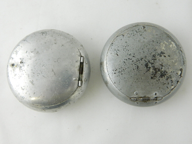
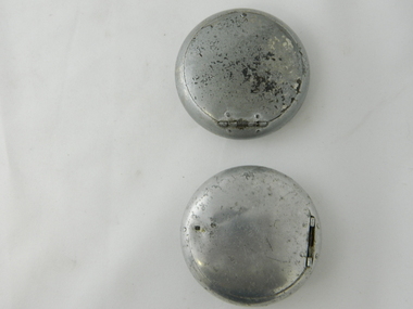
Ash Tray Pocket, Circa mid to late 1900s
This flip top pocket steel ash tray was at the beginning of the social "cleaning up" of cigarette ash and related products. This cigarette waste container was for those occasions when it was polite not to throw the cigarette ash and used up cigarettes "buts" on the ground, or if working in any rural area during a dry fire prone season, when discarding burning cigarette waste could set up a severe "bush" fire. It was also at the beginning of an intensive look at the affects of smoking upon the health of users. Later in the 1900s was a time when medical evidence supported a ground swell of the anti smoking movement which resulted in further restrictions of the use cigarette smoking in public places. Before the anti cigarette smoking revolution, it was both fashionable and manly to either roll your own cigarette or open up a packet of "tailor made's". In the rural and man's man environment the roll your own provided a visual acknowledgement that the user was "true blue" Aussie male and not a city boy. The cycle of use of cigarettes has drastically changed from when this item was first used. Today's society (post 2000) has produced a ground swell of government and non government organisations whose aim is provide a cigarette "ash" free environment and society. This is highlighted in the beginning of the 2000 millennium by a cigarette "Free" Australia campaign, and the pocket flip top personal ash tray as a practical solution for butt litter disposal.This pocket ash tray not only was used when social graces required it to, but also provided a container for any unfinished cigarettes or stogies (cheap half used cigars). In rural areas (open fresh air countryside), where time was always made available for the "smoko" (Australian rest period), at any time, especially after some hard physical work, the ability to have a self contained ashing apparatus, not to offend the gentler folk, was a pre-requisite . The rural environment, in the days of these cigarette ash containers,was one which could range from harsh and unforgiving to mild and relaxing. Smoking could be enjoyed anywhere and at any time without too much "fussing" around. This ash tray was mobile, convenient, unobtrusive and regarded by the user as being considerate to those around. It also eliminated the tell tale evidence that the "no smoking" signs had been ignored. The Kiewa Valley was like many rural ares that found it hard for smokers to come to grips with a governmental "non smoking policy" to indoor recreational and other "confined space" environments. Tin plated mild steel round container with a lid. The opening lid is spring loaded, hinged top, circular and fixed by a clasp, pop- riveted (4) onto the main housing. Opposite the hinge the lid is held closed by a small metal ball fitting tightly to the top wall of the container. The lid is opened by the use of a fingernail positioned at junction of lid to body. This edge is bevelled to allow access. personal effects, tobacco waste products, smoking accessories -
 Kiewa Valley Historical Society
Ash Tray Pocket
This flip top pocket aluminium ash tray was at the beginning of the social "cleaning up" of cigarette ash and related products. This cigarette waste container was for those occasions when it was polite not to throw the cigarette ash and used up cigarettes "buts" on the ground, or if working in any rural area during a dry fire prone season, when discarding burning cigarette waste could set up a severe "bush" fire. It was also at the beginning of an intensive look at the affects of smoking upon the health of users. Later in the 1900s was a time when medical evidence supported a ground swell of the anti smoking movement which resulted in further restrictions of the use cigarette smoking in public places. Before the anti cigarette smoking revolution, it was both fashionable and manly to either roll your own cigarette or open up a packet of "tailor made's". In the rural and man's man environment the roll your own provided a visual acknowledgement that the user was "true blue" Aussie male and not a city boy. The cycle of use of cigarettes has drastically changed from when this item was first used. Today's society (post 2000) has produced a ground swell of government and non government organisations whose aim is provide a cigarette "ash" free environment and society. This is highlighted in the beginning of the 2000 millennium by a cigarette "Free" Australia campaign, and the pocket flip top personal ash tray as a practical solution for butt litter disposal.This light weight aluminium pocket ash tray not only was used when social graces required it to, but also provided a container for any unfinished cigarettes or stogies (cheap half used cigars). In rural areas (open fresh air countryside), where time was always made available for the "smoko" (Australian rest period), at any time, especially after some hard physical work, the ability to have a self contained ashing apparatus, not to offend the gentler folk, was a pre-requisite . The rural environment, in the days of these cigarette ash containers,was one which could range from harsh and unforgiving to mild and relaxing. Smoking could be enjoyed anywhere and at any time without too much "fussing" around. This ash tray was mobile, convenient, unobtrusive and regarded by the user as being considerate to those around. It also eliminated the tell tale evidence that the "no smoking" signs had been ignored. The Kiewa Valley was like many rural ares that found it hard for smokers to come to grips with a governmental "non smoking policy" to indoor recreational and other "confined space" environments. The covered lid reduces odors and eliminates ashes from being blown around.Aluminium round container with a lid. The opening lid is spring loaded, hinged top, circular and fixed by a clasp, pop- riveted (4) onto the main housing. Opposite the hinge the lid is held closed by a small metal ball fitting tightly to the top wall of the container. The lid is opened by the use of a fingernail positioned at junction of lid to body. This edge is bevelled to allow access.personal effects, tobacco waste products, smoking accessories, tobacco -
 Kiewa Valley Historical Society
Book - Non Fiction History, The Kiewa Story, circa 1993
This book provides in chronological order the development of the Kiewa Hydro-electricity scheme from the first concept (1911) to final construction work (1961). It covers the first attempt to utilise the power of the Victorian Alps water system. It started from a private syndicate and developed to the current State Electricity Commission of Victoria. The incentive for the Hydro scheme was to make money and not as an alternative to the carbon producing coal fired power plants. These coal fired power plants were increasing in numbers to service an ever increasing demand made by population expansion, especially in cities and large rural settlements. This demand spiraled up after World War II when there was a tremendous spike in immigration numbers due to refugees and displaced persons in Europe. The ability to utilise the untapped water provided by the winter snow fields, for a higher yield in electricity, was a powerful incentive to overcome the physical hardships in this remote Alpine region. Future power requirements may initiate the re-installation of the other two power stations(Pretty Valley and Big Hill) covered in original Scheme. This publication not only covers the development of the Kiewa Valley region with respect to population (within a socio-economical framework) but also the subtle but yet strong physical changes of a relatively pristine alpine region. The demands that an ever growing regional population places on the environment is clearly documented in print and black and white photographs. The working and living conditions of those who constructed and gave life to this hydro scheme is well documented in this book. It may be viewed as spartan now but was relevantly good at that moment in time, especially for those workers fleeing a devastated European environment. The successful planning and consideration to minimising any intrusion upon the natural alpine forests and high plains can viewed as an example (compared to the Tasmanian Hydro schemes) of how future hydro schemes (an inevitable requirement) will proceed. Most rural towns (in the early 1900s) were built by unencumbered rural based citizens, with the exception of Mount Beauty and Falls Creek. These two settlements were brought into life by a State (Victorian) Authority for a specific function and program. They were a gated community, that is, only open to construction workers involved with the hydro scheme. All facilities within these communities were provided by the State Electricity Commission of Victoria. The impact on the social, financial and individual independency of the community, by the transition from the S.E.C .environment to one of local government (Shire of Bright), had in some cases a severe impact.This hard covered book has a green cover with pictures on the front and back covers. The front cover has a coloured picture of a snow covered Mount Bogong taken from the opposite mountain range. The valley between both ranges has a whisk of mist over it. At the bottom of this picture are three black and white photographs covering the construction of the Kiewa Hydro - Electricity Scheme. On the back cover is a photograph, (black and white) detailing the Bogong village and Junction dam containing lake Guy. The inside front cover is a black and white photograph which details the construction of the West Kiewa tailrace tunnel during April 1951. The inside back cover is a black and white photograph of the concrete pour at the Clover Dam circa 1952. All photographs and sketches are in black and white. The pages are approximately 160 g/m2 and those which have photographs are on gloss paper.Book spine: "The Kiewa Story Graham Napier Geoff Easdown" alongside this is a white framed circle with white spokes radiating out and underneath in white lettering SECkiewa valley, hydro scheme, victorian alpine region, electricity generators, graham napier, geoff easdown -
 Kiewa Valley Historical Society
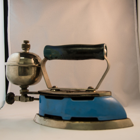
Iron Hand Kerosene, mid to late 1900s
The 1950's saw a revolution in small appliances for use in the average household. This hand held self heating(kerosene) iron was introduced as a time saving and more convenient iron for pressing clothes and other cloth fabrics. It replaced irons needing a separate fire source to heat the ironing plate. These irons continued to be in service, even when electricity was available in cities and larger rural towns (domestic electric steam irons were invented in 1938). This item was used before and during the electricity supplies available from the Kiewa Hydro Electricity Scheme. These irons remained in use within regional rural areas that had limited or unreliable electrical reticulation.In the 1950s and later the Kiewa Valley was still a relatively isolated region which was home to rural properties and small settlements. The availability of electricity and or the financial means to afford new types of electric hand irons ensured that older and sometimes less efficient ironing remained for an extended period covering the 1960s to 1970s. Kerosene products, such as this kerosene iron was a cheaper method for farm based domestic and other rural activities requiring a heat source. The use of kerosene as a heat/light source was able to be supplied in bulk and able to be used when floods severed vital roads into this region. The supply of electricity was in summer time subject to interruption from bush fire damaged wooden poles carrying the electrical cables. Self sufficiency by rural populations was the backbone of survival and the ability to store energy sources "on the farm" was a prerequisite of isolated regions, such as the Kiewa Valley, circa 1950s.This Coleman kerosene iron has a solid steel chrome plated(press) base with a painted (blue) wooden handle. The handle is stud fastened onto an oblong shaped rolled steel handle frame and screwed (two screws) onto the base plate. Both the heating plate and the top securing plate are shaped similar to a river boat. The main housing enclosing the heating element is enamel coated(blue in colour) steel and has a half hole for lighting the kerosene at the rear end. Behind the handle and protruding upwards is a stainless steel fully enclosed container (bowl shaped) for the main supply of kerosene to the burner or generator(enclosed within the main body of the iron. The bowl has an air valve and inlet for pressurised air intake (hand pump) On the bottom rear of the fuel bowl there is a screw regulated fuel pump. The fuel heated base plate provides the heat for this advertised "self heating iron(instant lighting). See KVHS 0347B- Instruction sheet; KVHS 0347C- Wrench; and KVHS 0347D Fuel can.Stamped on the base plate of the handle, front region "COLEMAN LAMP & STOVE CO." below this "WICHITA KAN" below this"TORONTO CAN". In the middle of the handle base and in larger print "COLEMAN Instant-Lite" At the rear location in large print "MODEL 4" in smaller print below "MADE IN U.S.A." below this "PAT#1718473"household appliances, alternative non electrical ironing appliances, domestic appliances, kerosene appliances -
 Kiewa Valley Historical Society
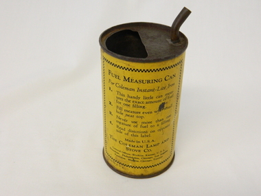
Can Fuel Measuring, circa 1950
The 1950's saw a revolution in small appliances for use in the average household. The hand held self heating(kerosene) iron for which this filling can was provided ,was introduced as a time saving and more convenient iron for pressing clothes and other cloth fabrics. It replaced irons needing an external fire source to heat the ironing plate. These irons continued to be in service, even when electricity was available in cities and larger rural towns. This item was used before and during the electricity supplies available from the Kiewa Hydro Electricity Scheme. These irons remained in use within regional rural areas that had limited or unreliable electrical reticulation and the ability to service them from this filling can was an essential part.n the 1950s and later the Kiewa Valley was still a relatively isolated region which was home to rural properties and small settlements. The availability of electricity and or the financial means to afford new types of electric hand irons ensured that older and sometimes less efficient ironing appliances remained for an extended period covering the 1960s to 1970s. Kerosene products, such as the kerosene self heating (KVHS 0347A) iron and this kerosene filling item, was a cheaper method for farm based domestic and other rural activities requiring a heat source. The use of kerosene as a heat/light source was able to be supplied in bulk and able to be used when floods severed vital roads into this region. The supply of electricity was in summer time subject to interruption from bush fire damaged wooden poles carrying the electrical cables. Self sufficiency by rural populations was the backbone of survival and the ability to store energy sources "on the farm" was a prerequisite of isolated regions, such as the Kiewa Valley, circa 1950s.This specially spout fitted can was provided with the Coleman self heating kerosene iron (see KVHS 0347A). On one side of the half enclosed top of the can there is a small spout(for poring the appropriate liquid into the egg shaped fount container) at the rear end of the hand iron. The can is made from tin. See KVHS 0347B- Instruction sheet; KVHS 0347C- Wrench.On one side of the can in black print on yellow background is "FUEL MEASURING CAN" underneath is "For Coleman Instant-Lite Iron" underneath are four numbered paragraphs detailing the use of this can. Below this is the name and places of manufacture. On the other side of the can is printed "BE SURE" with filling and maintenance instructionskerosene can, ironing, domestic appliances, household appliances -
 Eltham District Historical Society Inc
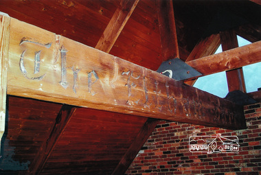
Photographs, Recycled timber beam from Eltham Barrel
The iconic Eltham Barrel restaurant operated in Eltham from the late 1960s to its demise in a fire in 1989. This piece of timber - itself recycled from elsewhere (possibly the Clivedon mansion) in the construction of the Barrel had the words "Eltham Barrel" burned into the timber. It formed part of the welcome to visitors on the high external covered portico entrance. This large timber beam was saved and used in the construction of a house in Eltham.Three colour photographstimber beam, eltham barrel -
 Eltham District Historical Society Inc
Photograph, Murchison Gap, Autumn Excursion, Hume and Hovell's 1824 expedition, 26 May 1996, 26/05/1996
[article by Bettina Woodburn in EDHS Newsletter No. 109, July 1996:] ON THE TRAIL OF HUME AND HOVELL - REPORT ON THE AUTUMN EXCURSION - On a green and fresh morning (Sunday 26th May 1996) the Cobb and Co coach (driven by the most obliging Peter Tampion) set off in a north easterly direction from Eltham to connect with Hume and Hovell's route on their 1824 explorations of central Victoria. The Society would follow a series of monuments erected for the 1924 centenary of the expedition from King Parrot Creek (Tuesday 7th December 1824), through Strath Creek, over Sunday Creek (Sunday 12th December 1824) at Broadford, Tullamarine, St Albans, Deer Park, through Werribee, skirting east of the You Yangs to Lara and Avalon Beach. Because their distance-measuring wheel had broken and a one degree mistake was made in calculations, the two leaders of the original group of six convict-companions arrived at Corio Bay, instead of the expected Western Port, discovered earlier by Flinders. From below Mt. Disappointment (Hume and Hovell's difficulties in "scrambling over brush and rock", "leeches in forest, as well as no water", "cutting grass 4-5 ft. high", dreadful scrub", "devil flies") we took an easier route, saw the Strath Creek memorial in ground fog and a wonderful "field of dreams", the Hume-Hovell privately owned cricket ground with its white picket boundary fence. Now, after a steep climb, in sunshine under gums we stretched and viewed magnificent rolling hills and fog-filled valleys - not "smoke from Aborigines' bush fires". After morning tea at Broadford we followed the Sunday Creek valley beside the Hume Freeway, passed the Wallan Wallan Rest Area (more appropriately Hume and Hovell Rest Area) to tum right at Beveridge. In Gellibrand Hill Park, near the headwaters of the Moonee Ponds Creek, we experienced the landscape the first European settlers saw - huge river red gums and rolling pastures. The gardens and sheltered courtyard of the 1840s, timber, brought from .....[?] prefabricated Woodlands Homestead, provided a pleasant lunch stop. We enjoyed a private tour, panoramic views over Melbourne and surroundings and the excitement of arriving and departing aircraft. Our next river crossing was at Werribee, "in a vast treeless plain", then we drove on by-ways no coach had previously travelled, to find "an immense sheet of water" salty Corio Bay, off-course to the west. In late afternoon of a super, calm, late autumn day we headed homewards. Back at Eltham we were rather surprised to find that we had travelled a total of 347 km. Thanks again to Russell Yeoman for his research and organization. What a wonderful day! Three colour photographsactivities, murchison gap, murchison valley -
 Eltham District Historical Society Inc
Photograph, Hume and Hovell Monument, Broadford, Autumn Excursion, Hume and Hovell's 1824 expedition, 26 May 1996, 26/05/1996
[article by Bettina Woodburn in EDHS Newsletter No. 109, July 1996:] ON THE TRAIL OF HUME AND HOVELL - REPORT ON THE AUTUMN EXCURSION - On a green and fresh morning (Sunday 26th May 1996) the Cobb and Co coach (driven by the most obliging Peter Tampion) set off in a north easterly direction from Eltham to connect with Hume and Hovell's route on their 1824 explorations of central Victoria. The Society would follow a series of monuments erected for the 1924 centenary of the expedition from King Parrot Creek (Tuesday 7th December 1824), through Strath Creek, over Sunday Creek (Sunday 12th December 1824) at Broadford, Tullamarine, St Albans, Deer Park, through Werribee, skirting east of the You Yangs to Lara and Avalon Beach. Because their distance-measuring wheel had broken and a one degree mistake was made in calculations, the two leaders of the original group of six convict-companions arrived at Corio Bay, instead of the expected Western Port, discovered earlier by Flinders. From below Mt. Disappointment (Hume and Hovell's difficulties in "scrambling over brush and rock", "leeches in forest, as well as no water", "cutting grass 4-5 ft. high", dreadful scrub", "devil flies") we took an easier route, saw the Strath Creek memorial in ground fog and a wonderful "field of dreams", the Hume-Hovell privately owned cricket ground with its white picket boundary fence. Now, after a steep climb, in sunshine under gums we stretched and viewed magnificent rolling hills and fog-filled valleys - not "smoke from Aborigines' bush fires". After morning tea at Broadford we followed the Sunday Creek valley beside the Hume Freeway, passed the Wallan Wallan Rest Area (more appropriately Hume and Hovell Rest Area) to tum right at Beveridge. In Gellibrand Hill Park, near the headwaters of the Moonee Ponds Creek, we experienced the landscape the first European settlers saw - huge river red gums and rolling pastures. The gardens and sheltered courtyard of the 1840s, timber, brought from .....[?] prefabricated Woodlands Homestead, provided a pleasant lunch stop. We enjoyed a private tour, panoramic views over Melbourne and surroundings and the excitement of arriving and departing aircraft. Our next river crossing was at Werribee, "in a vast treeless plain", then we drove on by-ways no coach had previously travelled, to find "an immense sheet of water" salty Corio Bay, off-course to the west. In late afternoon of a super, calm, late autumn day we headed homewards. Back at Eltham we were rather surprised to find that we had travelled a total of 347 km. Thanks again to Russell Yeoman for his research and organization. What a wonderful day! Colour photographactivities, broadford, hume and hovell, monument -
 Eltham District Historical Society Inc
Photograph, Hume and Hovell Monument, Autumn Excursion, Hume and Hovell's 1824 expedition, 26 May 1996, 26/05/1996
[article by Bettina Woodburn in EDHS Newsletter No. 109, July 1996:] ON THE TRAIL OF HUME AND HOVELL - REPORT ON THE AUTUMN EXCURSION - On a green and fresh morning (Sunday 26th May 1996) the Cobb and Co coach (driven by the most obliging Peter Tampion) set off in a north easterly direction from Eltham to connect with Hume and Hovell's route on their 1824 explorations of central Victoria. The Society would follow a series of monuments erected for the 1924 centenary of the expedition from King Parrot Creek (Tuesday 7th December 1824), through Strath Creek, over Sunday Creek (Sunday 12th December 1824) at Broadford, Tullamarine, St Albans, Deer Park, through Werribee, skirting east of the You Yangs to Lara and Avalon Beach. Because their distance-measuring wheel had broken and a one degree mistake was made in calculations, the two leaders of the original group of six convict-companions arrived at Corio Bay, instead of the expected Western Port, discovered earlier by Flinders. From below Mt. Disappointment (Hume and Hovell's difficulties in "scrambling over brush and rock", "leeches in forest, as well as no water", "cutting grass 4-5 ft. high", dreadful scrub", "devil flies") we took an easier route, saw the Strath Creek memorial in ground fog and a wonderful "field of dreams", the Hume-Hovell privately owned cricket ground with its white picket boundary fence. Now, after a steep climb, in sunshine under gums we stretched and viewed magnificent rolling hills and fog-filled valleys - not "smoke from Aborigines' bush fires". After morning tea at Broadford we followed the Sunday Creek valley beside the Hume Freeway, passed the Wallan Wallan Rest Area (more appropriately Hume and Hovell Rest Area) to tum right at Beveridge. In Gellibrand Hill Park, near the headwaters of the Moonee Ponds Creek, we experienced the landscape the first European settlers saw - huge river red gums and rolling pastures. The gardens and sheltered courtyard of the 1840s, timber, brought from .....[?] prefabricated Woodlands Homestead, provided a pleasant lunch stop. We enjoyed a private tour, panoramic views over Melbourne and surroundings and the excitement of arriving and departing aircraft. Our next river crossing was at Werribee, "in a vast treeless plain", then we drove on by-ways no coach had previously travelled, to find "an immense sheet of water" salty Corio Bay, off-course to the west. In late afternoon of a super, calm, late autumn day we headed homewards. Back at Eltham we were rather surprised to find that we had travelled a total of 347 km. Thanks again to Russell Yeoman for his research and organization. What a wonderful day! Two colour photographsactivities, hume and hovell, monument -
 Orbost & District Historical Society
black and white photograph, H.A. Dart, C1890
"The 19th of March 1886 proved an important day in the lives of many early settlers in the Orbost area, because on this day the Orbost State School opened. The fact that the school had first operated temporarily in a leased building, and on a half-time basis with SS2745 Jarrahmond, did not dampen the enthusiasm of the local inhabitants as they saw their offspring commence their education under the guidance of HT Campbell Mackay. However he remained in charge only until 12th of May 1886. The second HT, John Rowe, served until 1908. On 30th of June 1887, a portable room was provided; it being brought to the area by schooner. The school now had accommodation for 30 pupils; the teacher's welfare was considered because quarters of two rooms were attached. As the population increased so did the needs of the school. This was reflected in the provision of a larger classroom in 1898. During 1910-11 the first approaches were made to the Department for the establishment of a HES in Orbost and this became a reality in 1912. Orbost HES supplied post-primary education in the district until a high school was built in 1948. When fire destroyed the school in 1941 local halls were used as classrooms until a new school was built. Work was quite rapid and a new brick structure was opened by the Hon. A. E. Lind, MLA, on 13th of February 1942. This new building was a fine type of school of which both the pupils and the HT Leslie Collins were indeed proud. But Orbost continued to develop and the new school was soon overtaxed. This resulted in the erection of two Bristol classrooms in 1947. By 1950, when the school population had reached 500 pupils the opening of the new school at Orbost North was welcomed by all concerned. In 1963 the Department purchased land diagonally opposite the school and developed it as a playing area. In 1965 two LTCs were opened in November, and in October 1968 the Brodribb School building was moved to SS2744 Orbost for use as a general purpose room." This item is associated with the history of education in Orbost.A black / white photograph of a group of students, some kneeling, some sitting, in a school yard. It is framed in grey buff cardboard with a photographer's stamp at the bottom.H. A. Dart Melbourne in gold print at the bottom.photograph-orbost-state-school