
Showing 723 items matching "city of kew - collections"
-
 Kew Historical Society Inc
Archive (Sub-series) - Subject File, Boroondara, City of - Memorabilia Working Group, 1996
... ...city of kew - collections...Since its foundation in 1958, members of the Kew Historical Society have been compiling and storing information about subjects relating to the history of Kew and its environs, of which this file is an example. Typically files will contain primary and secondary sources. city of boroondara - collections kew historical society - collections city of kew - collections Working Brief (Jan 1996) and Interim Report of and to the City of Boroondara Memorabilia Working Group on which the representatives of Kew were Jill O’Brien and Dorothy Benyei. ...Various partiesReference, Research, InformationKHS OrderWorking Brief (Jan 1996) and Interim Report of and to the City of Boroondara Memorabilia Working Group on which the representatives of Kew were Jill O’Brien and Dorothy Benyei. The Brief described the items under consideration to include: “historic artefacts, photographic material, books, works on paper, textiles and a number of outdoor items”. The response in the Interim Report September 11, 1996 noted that in contrast to the submission by the Kew representatives for Kew-related material to be relocated to the Kew Library, the Society had been given a scarf, a ceremonial cover, and a cup and saucer. The items that the Kew representatives wanted returned to Kew included five paintings and a photograph. These are itemised in the report.city of boroondara - collections, kew historical society - collections, city of kew - collectionscity of boroondara - collections, kew historical society - collections, city of kew - collections -
 Kew Historical Society Inc
Photograph - Hard rubbish trailers
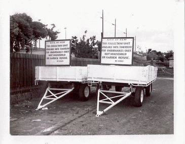
... Both trailers display the same sign reading: "City of Kew This collection unit available until tomorrow for unburnables only. ...City of Kew in and around 1980. Both trailers display the same sign reading: "City of Kew This collection unit available until tomorrow for unburnables only. ...One of eight photographs donated by the City Engineer of the former City of Kew, mostly of hard rubbish clearance during the period 1969-1985.One of a dated series of photographs of core local government services as practised by the City of Kew in the period 1969-1985. Original black and white photographic positive of rubbish collection units (trailers) used within the City of Kew in and around 1980. Both trailers display the same sign reading: "City of Kew This collection unit available until tomorrow for unburnables only. Not household or garden refuse. By Order" Stamp - J86K431 Annotation in ink on reverse: "Rubbish Units 18/1/80'. In envelope marked: "Kew City Council 12 photos / 1969 1979 18980 1985 / Unburnable rubbish units 18/1/80"garbage, hard rubbish, garbage removal, city of kew, local government -- city of kew, household waste, hard waste -
 Kew Historical Society Inc
Photograph - City of Kew Horse, Cart and Employee, Stuart Tompkins, c.1950
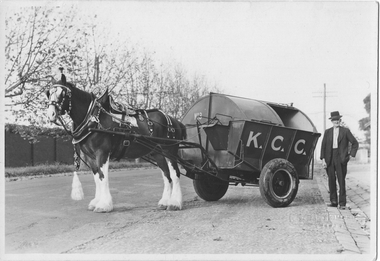
... city of kew...garbage waste collection - kew (vic)...The Kew City Council Depot was for a period situated on the corner of High Street and Disraeli Streets. The photo from the former City of Kew Municipal Collection was taken by a photographer from Stuart Tompkins Studio in Camberwell....The Kew City Council Depot was for a period situated on the corner of High Street and Disraeli Streets. The photo from the former City of Kew Municipal Collection was taken by a photographer from Stuart Tompkins Studio in Camberwell. city of kew garbage waste collection - kew (vic) Barry avery kew depot stuart tompkins "Cr Parkhill Rd & Hillcrest Ave Kew / Driver : Barry Avery" One of four black and white photographs (perhaps reproductions) of a horse and cart and a council employee in Parkhill Road, Kew. ...The Kew City Council Depot was for a period situated on the corner of High Street and Disraeli Streets. The photo from the former City of Kew Municipal Collection was taken by a photographer from Stuart Tompkins Studio in Camberwell.One of four black and white photographs (perhaps reproductions) of a horse and cart and a council employee in Parkhill Road, Kew. In a number of photos the cart has K.C.C., in large letters on its side. It is presumed to be the city garbage cart No.3 which was stationed at the old Council Depot on the corner of High and Disraeli Streets. "Cr Parkhill Rd & Hillcrest Ave Kew / Driver : Barry Avery"city of kew, garbage waste collection - kew (vic), barry avery, kew depot, stuart tompkins -
 Kew Historical Society Inc
Photograph - City of Kew Horse, Cart and Employee, Stuart Tompkins, c.1950
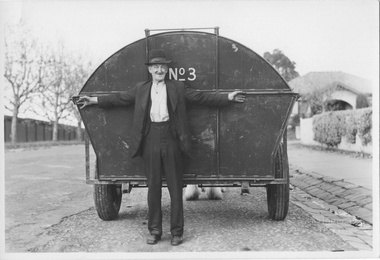
... city of kew...garbage waste collection - kew (vic)...The Kew City Council Depot was for a period situated on the corner of High Street and Disraeli Streets. The photo from the former City of Kew Municipal Collection was taken by a photographer from Stuart Tompkins Studio in Camberwell. ...The Kew City Council Depot was for a period situated on the corner of High Street and Disraeli Streets. The photo from the former City of Kew Municipal Collection was taken by a photographer from Stuart Tompkins Studio in Camberwell. city of kew garbage waste collection - kew (vic) Barry avery kew depot stuart Tompkins "Cr Parkhill Rd & Hillcrast Ave Kew / Driver Barry Avery" One of four original black and white photographs by Stuart Tompkins Camberwell of a horse and cart and a council employee, Barry Avery, in Parkhill Road, Kew. ...The Kew City Council Depot was for a period situated on the corner of High Street and Disraeli Streets. The photo from the former City of Kew Municipal Collection was taken by a photographer from Stuart Tompkins Studio in Camberwell. One of four original black and white photographs by Stuart Tompkins Camberwell of a horse and cart and a council employee, Barry Avery, in Parkhill Road, Kew. In a number of photos the cart has K.C.C., in large letters on its side. It is presumed to be the city garbage cart No.3 which was stationed at the old Council Depot on the corner of High and Disraeli Streets. "Cr Parkhill Rd & Hillcrast Ave Kew / Driver Barry Avery"city of kew, garbage waste collection - kew (vic), barry avery, kew depot, stuart tompkins -
 Kew Historical Society Inc
Photograph - City of Kew Horse, Cart and Employee, Stuart Tompkins, c.1950
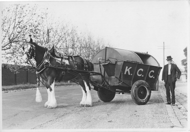
... city of kew...garbage waste collection - kew (vic)...The Kew City Council Depot was for a period situated on the corner of High Street and Disraeli Streets. The photo from the former City of Kew Municipal Collection was taken by a photographer from Stuart Tompkins Studio in Camberwell. ...The Kew City Council Depot was for a period situated on the corner of High Street and Disraeli Streets. The photo from the former City of Kew Municipal Collection was taken by a photographer from Stuart Tompkins Studio in Camberwell. city of kew garbage waste collection - kew (vic) stuart tompkins barry avery "Cr Parkhill Rd & Hillcrest Ave, Kew / Driver: Barry Avery" One of four original black and white photographs of a horse and cart and a council employee, Barry Avery, in Parkhill Road, Kew. ...The Kew City Council Depot was for a period situated on the corner of High Street and Disraeli Streets. The photo from the former City of Kew Municipal Collection was taken by a photographer from Stuart Tompkins Studio in Camberwell. One of four original black and white photographs of a horse and cart and a council employee, Barry Avery, in Parkhill Road, Kew. In a number of photos the cart has K.C.C., in large letters on its side. It is presumed to be the city garbage cart No.3 which was stationed at the old Council Depot on the corner of High and Disraeli Streets. "Cr Parkhill Rd & Hillcrest Ave, Kew / Driver: Barry Avery"city of kew, garbage waste collection - kew (vic), stuart tompkins, barry avery -
![High Street, East Kew [looking west], 1977](/media/collectors/550653872162f11fb04854aa/items/586f8bbfd0ce0e07f06d22ed/item-media/586f8c3ad0ce0e07f06d44cc/item-fit-380x285.jpg?cb=6) Kew Historical Society Inc
Kew Historical Society IncPhotograph, High Street, East Kew, 1977
... Kew Historical Society's Pictures Collection is comprised of photographs and original works of art. The photographs include original (mainly) images dating from the 1870s to the present. A number of these photographs derive from the former City...Kew Historical Society's Pictures Collection is comprised of photographs and original works of art. The photographs include original (mainly) images dating from the 1870s to the present. A number of these photographs derive from the former City ...The Kew Historical Society's Pictures Collection is comprised of photographs and original works of art. The photographs include original (mainly) images dating from the 1870s to the present. A number of these photographs derive from the former City of Kew's Civic Collection while others are the work of amateur and professional photographers. Most of the images in the collection depict people, places and objects within the suburbs of Kew and Kew East. Other photographs depict other locations in Melbourne and Victoria. A number of the photographs are of statewide and/or national significance.View from junction of High and Strathalbyn Sts., Kew East, looking approximately west toward Cemetery, October 1977. Inscription reverse: "KH-72. View from junction of High St. & Strathalbyn Sts, Kew E. Looking approx. west, towards Cemetery. October 1977."high street -- kew (vic.), streetscapes -- kew (vic.) -
 Kew Historical Society Inc
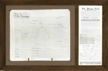
Legal record - The Indenture, Crown Portion 86, otherwise known as 'The Morgan Deed', 1852 (and later)
... This indenture once formed part of the City of Kew's Municipal Collection. Cr. W.D. Vaughan in his history 'Kew's Civic Century' (1960) records on page 194 that: "The original deed of conveyance of the land being all of Crown Portion 86, Kew, purchased by John Quick, James Venn Morgan, Samuel Derrick and William Derrick was presented by the Historical Society of Victoria on behalf of Mrs Fryer, a daughter of the later J.V. ...This indenture once formed part of the City of Kew's Municipal Collection. Cr. W.D. Vaughan in his history 'Kew's Civic Century' (1960) records on page 194 that: "The original deed of conveyance of the land being all of Crown Portion 86, Kew, purchased by John Quick, James Venn Morgan, Samuel Derrick and William Derrick was presented by the Historical Society of Victoria on behalf of Mrs Fryer, a daughter of the later J.V. ...This indenture once formed part of the City of Kew's Municipal Collection. Cr. W.D. Vaughan in his history 'Kew's Civic Century' (1960) records on page 194 that: "The original deed of conveyance of the land being all of Crown Portion 86, Kew, purchased by John Quick, James Venn Morgan, Samuel Derrick and William Derrick was presented by the Historical Society of Victoria on behalf of Mrs Fryer, a daughter of the later J.V. Morgan, to the [Kew] Council on August 5, 1941. Crown Portion 86, comprised all the land between Cotham Road and High Street to an alignment opposite the east boundary of Glenferrie Road. On it the first residential house was built by Mr. J.V. Morgan in 1852." Following the donation, the Indenture was surrounded by other original related text and explanatory notes and framed. The resulting framed documents are the largest framed objects in the collection.The Indenture and the accompanying contextual documents are some of the most historically significant manuscripts to have survived since the settlement of Kew in the 1850s. They provide a link to Kew's most famous pioneering families.Framed 1952 Indenture recording the sale of land in Kew to pioneering Kew families.james venn morgan, john quick, william derrick, samuel derrick, kew (vic) - history, kew (vic) - pioneers, samuel watts, kew (vic.) — municipal collection -
 Kew Historical Society Inc
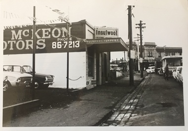
Photograph - Denmark Street, Kew, 1972
... The Engineer's Department of the former City of Kew had an extensive collection of photograph of sites in Kew requiring documentation to inform public works. ...The Engineer's Department of the former City of Kew had an extensive collection of photograph of sites in Kew requiring documentation to inform public works. ...The Engineer's Department of the former City of Kew had an extensive collection of photograph of sites in Kew requiring documentation to inform public works. It also kept images of engineering practice in other parts of Melbourne, and overseas, that could be used as models for local activity. Many of these photographs (and plans) were donated to our collection in the 1980s. A number of the photographs are annotated, either on the image itself or on the reverse.This photograph, and others sourced from the City Engineer's Department of the former City of Kew, qualifies as an important record of local streets, public works, street beautification, and engineering techniques of the period. Original black and white photographic positive of automobiles and buildings in Denmark Street, Kew, immediately before the road enters Kew Junction. On the left is McKeon Motors and a retailer of Insulwool, while in the distance is the pharmacy on the corner of High Street and Princess Street (later demolished during the widening of Kew Junction). Notable are the bluestone guttering and what appears to be vacant land on the apex of the triangle of land bounded by High Street South, Denmark Street and Barkers Road. This site was the original location of O'Shaughnessy's 'Kew Hotel', and after the destruction by fire of the latter, the location of a service station. [It is now the site of the Cresco Reserve].Annotation verso: "Indicating the existence of a vehicular entrance at Denmark St abuttal of No.188 High St prior to reconstruction of channeling &c 1972."denmark street -- kew (vic.), kew junction, luestone gutters, mckeon motors, insulwool -
 Villa Alba Museum
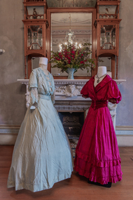
Album - Exhibition photographs, Textiles in Bloom, 2021
... The examples of fashion and design from the collection of the Kew Historical Society were located on the ground floor of the house: in the drawing room, dining room, morning room and in the vestibule, or ballroom as it was sometimes described in nineteenth century newspapers. The exhibition was supported by the City...The examples of fashion and design from the collection of the Kew Historical Society were located on the ground floor of the house: in the drawing room, dining room, morning room and in the vestibule, or ballroom as it was sometimes described in nineteenth century newspapers. The exhibition was supported by the City ...As part of the National Trust's Australian Heritage Festival 2021, the Kew Historical Society and the Villa Alba Museum collaborated to mount a fashion and design exhibition. The theme of the exhibition took its focus from the year-long program at the Museum featuring the use of flowers in design. The walls and ceilings of the house are notable for their use of floral and narrative painted decoration produced, in the early 1880s, for William and Anna Maria Greenlaw by the Melbourne art decoration firm the Paterson Brothers. The examples of fashion and design from the collection of the Kew Historical Society were located on the ground floor of the house: in the drawing room, dining room, morning room and in the vestibule, or ballroom as it was sometimes described in nineteenth century newspapers. The exhibition was supported by the City of Boroondara through Triennial Operational Grant funding for the Kew Historical Society and the Villa Alba Museum.Series of photographs taken by Mitchell Luo Photography of exhibition pieces in situ at the Villa Alba Museum in May 2021.textiles in bloom, exhibitions — villa alba museum, australian heritage festival 2021 -
 Kew Historical Society Inc
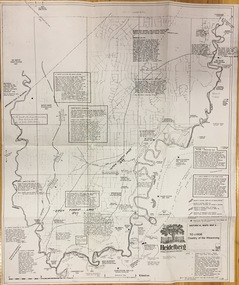
Plan, Loder & Bayly, Heidelberg: Historic River Landscape Assessment, 1982
... City. She was awarded the medal of the Order of Australia in 2001 ‘for service to the community of Hawthorn and district, particularly through the research, documentation and publication of its history.’ This map from her collection was donated to the Kew...City. She was awarded the medal of the Order of Australia in 2001 ‘for service to the community of Hawthorn and district, particularly through the research, documentation and publication of its history.’ This map from her collection was donated to the Kew ...Gwen McWilliam is well known as an authority on the history of Boroondara and the author of a large number of books and pamphlets about the City. She was awarded the medal of the Order of Australia in 2001 ‘for service to the community of Hawthorn and district, particularly through the research, documentation and publication of its history.’ This map from her collection was donated to the Kew Historical SocietyPlan of Heidelberg, annotated with details about the occupancy pre and post European settlement. The plan also contains geological references. The plan is included and analysed in volume 2 of the Heidelberg Conservation Study (1985). The original plan was published created in 1982. Printed annotationscity of heidelberg, yarra valley, historic plans -- heidelberg -
 Kew Historical Society Inc
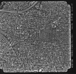
Photograph - Aerial photograph: City of Kew No.1/6, Department of Property & Services (Victoria), 12/12/1987
... Kew taken and produced by the Victorian Department of Property Services. Aerial photographs, of which the Society has a number in its collection, allow researchers to identify changes in urban infrastructure and demographics over time aerial photography aerial photograph -- kew (vic.) 4132-106 Ringwood M'Sheet 7922-3 Run 4 5600'ASL Vic DPS © 12-12-87 Aerial photograph of a part of Kew, taken by photographers employed by the Victorian Department of Property and Services in December 1987. Photograph Aerial photograph: City ...One of a series of six small square black and white aerial photographs of Kew taken and produced by the Victorian Department of Property Services.Aerial photographs, of which the Society has a number in its collection, allow researchers to identify changes in urban infrastructure and demographics over timeAerial photograph of a part of Kew, taken by photographers employed by the Victorian Department of Property and Services in December 1987.4132-106 Ringwood M'Sheet 7922-3 Run 4 5600'ASL Vic DPS © 12-12-87aerial photography, aerial photograph -- kew (vic.) -
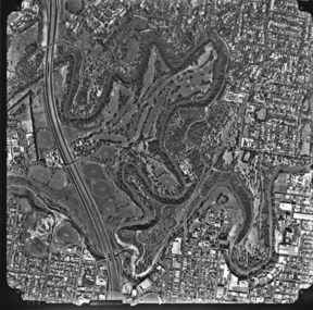 Kew Historical Society Inc
Photograph, Department of Property & Services (Victoria), City of Kew No.2/6, 12/12/1987
... Kew taken and produced by the Victorian Department of Property Services. Aerial photographs, of which the Society has a number in its collection, allow researchers to identify changes in urban infrastructure and demographics over time aerial photograph - kew Aerial photograph of a part of Kew, taken by photographers employed by the Victorian Department of Property and Services in December 1987. City ...One of a series of six small square black and white aerial photographs of Kew taken and produced by the Victorian Department of Property Services.Aerial photographs, of which the Society has a number in its collection, allow researchers to identify changes in urban infrastructure and demographics over timeAerial photograph of a part of Kew, taken by photographers employed by the Victorian Department of Property and Services in December 1987.aerial photograph - kew -
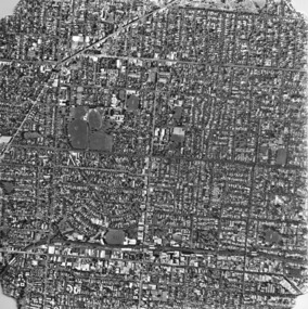 Kew Historical Society Inc
Photograph, Department of Property & Services (Victoria), City of Kew No.3/6, 12/12/1987
... Kew taken and produced by the Victorian Department of Property Services. Aerial photographs, of which the Society has a number in its collection, allow researchers to identify changes in urban infrastructure and demographics over time aerial photograph - kew aerial photographs Aerial photograph of a part of Kew, taken by photographers employed by the Victorian Department of Property and Services in December 1987. City ...One of a series of six small square black and white aerial photographs of Kew taken and produced by the Victorian Department of Property Services.Aerial photographs, of which the Society has a number in its collection, allow researchers to identify changes in urban infrastructure and demographics over timeAerial photograph of a part of Kew, taken by photographers employed by the Victorian Department of Property and Services in December 1987.aerial photograph - kew, aerial photographs -
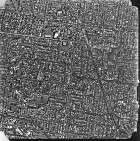 Kew Historical Society Inc
Photograph, Department of Property & Services (Victoria), City of Kew No.4/6, 12/12/1987
... Kew taken and produced by the Victorian Department of Property Services. Aerial photographs, of which the Society has a number in its collection, allow researchers to identify changes in urban infrastructure and demographics over time aerial photograph - kew aerial photographs Aerial photograph of a part of Kew, taken by photographers employed by the Victorian Department of Property and Services in December 1987. City ...One of a series of six small square black and white aerial photographs of Kew taken and produced by the Victorian Department of Property Services.Aerial photographs, of which the Society has a number in its collection, allow researchers to identify changes in urban infrastructure and demographics over timeAerial photograph of a part of Kew, taken by photographers employed by the Victorian Department of Property and Services in December 1987.aerial photograph - kew, aerial photographs -
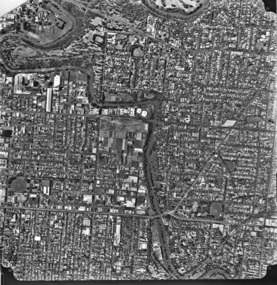 Kew Historical Society Inc
Photograph, Department of Property & Services (Victoria), City of Kew, No.5/6, 12/12/1987
... Kew taken and produced by the Victorian Department of Property Services. Aerial photographs, of which the Society has a number in its collection, allow researchers to identify changes in urban infrastructure and demographics over time aerial photograph - kew aerial photographs Aerial photograph of a part of Kew, taken by photographers employed by the Victorian Department of Property and Services in December 1987. City ...One of a series of six small square black and white aerial photographs of Kew taken and produced by the Victorian Department of Property Services.Aerial photographs, of which the Society has a number in its collection, allow researchers to identify changes in urban infrastructure and demographics over timeAerial photograph of a part of Kew, taken by photographers employed by the Victorian Department of Property and Services in December 1987.aerial photograph - kew, aerial photographs -
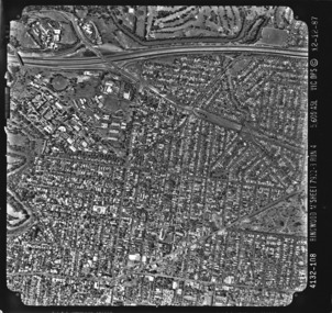 Kew Historical Society Inc
Photograph, Department of Property & Services (Victoria), City of Kew, No.6/6, 12/12/1987
... Kew taken and produced by the Victorian Department of Property Services. Aerial photographs, of which the Society has a number in its collection, allow researchers to identify changes in urban infrastructure and demographics over time aerial photograph - kew aerial photographs 4312-108 Ringwood M'Sheet 7922-3 Run 4 5600'ASL Vic DPS © 12-12-87 Aerial photograph of a part of Kew, taken by photographers employed by the Victorian Department of Property and Services in December 1987. City ...One of a series of six small square black and white aerial photographs of Kew taken and produced by the Victorian Department of Property Services.Aerial photographs, of which the Society has a number in its collection, allow researchers to identify changes in urban infrastructure and demographics over timeAerial photograph of a part of Kew, taken by photographers employed by the Victorian Department of Property and Services in December 1987.4312-108 Ringwood M'Sheet 7922-3 Run 4 5600'ASL Vic DPS © 12-12-87aerial photograph - kew, aerial photographs -
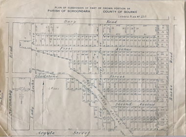 Kew Historical Society Inc
Plan - Subdivision Plan, Plan of Subdivision of Part of Crown Portion 84 / Parish of Boroondara / County of Bourke / Lodged Plan No. 2217, Twentieth Century
... A number of the plans in the Kew Historical Society’s collection can also be found in other collections, such as those of the State Library of Victoria and the Boroondara Library Service. A number are however unique to the collection. The Kew Historical Society collection includes almost 100 subdivision plans pertaining to suburbs of the City ...Pru Sanderson, in her groundbreaking ‘City of Kew Urban Conservation Study : Volume 2 - Development History’ (1988), summarised the periods of urban development and subdivisions of land in Kew. The periods that she identified included 1845-1880, 1880-1893, 1893-1921, 1921-1933, 1933-1943, and Post-War Development. These periods were selected as they represented periods of rapid growth or decline in urban development. An obvious starting point for Sanderson’s groupings involved population growth and the associated economic cycles. These cycles also highlighted urban expansion onto land that was predominantly rural, although in other cases it represented the decline and breakup of large estates. A number of the plans in the Kew Historical Society’s collection can also be found in other collections, such as those of the State Library of Victoria and the Boroondara Library Service. A number are however unique to the collection.The Kew Historical Society collection includes almost 100 subdivision plans pertaining to suburbs of the City of Melbourne. Most of these are of Kew, Kew East or Studley Park, although a smaller number are plans of Camberwell, Deepdene, Balwyn and Hawthorn. It is believed that the majority of the plans were gifted to the Society by persons connected with the real estate firm - J. R. Mathers and McMillan, 136 Cotham Road, Kew. The Plans in the collection are rarely in pristine form, being working plans on which the agent would write notes and record lots sold and the prices of these. The subdivision plans are historically significant examples of the growth of urban Melbourne from the beginning of the 20th Century up until the 1980s. A number of the plans are double-sided and often include a photograph on the reverse. A number of the latter are by noted photographers such as J.E. Barnes.Undated Plan of Subdivision of Crown Portion 84 in what is now Kew. The area shown is bordered by Burke Road, Harp Road, Arglye Road and Normanby Road.subdivision plans -- kew (vic), harp road, burke road, normanby road, lady loch's drive, gladstone street, second avenue, first avenue -
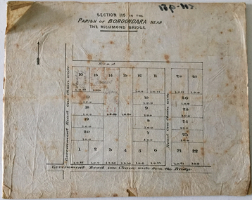 Kew Historical Society Inc
Plan - Subdivision Plan, J Hurrey, Section 115 in the Parish of Boroondara Near Richmond Bridge, 1853
... Kew. This subdivision plan is the earliest original map or plan in the collection which shows parts of what is now the City of Boroondara, dating from circa 1853. ...Despite the plans claims that it is a subdivision near the Richmond Bridge, Section 115 was located at what is now Camberwell Junction. While the plan only lists government roads rather than named streets, the section was located on the east side of Burke Road, stretching up the hill from the current Junction. Research on Trove, conducted by Kerry Fairbank, discovered an advertisement for unsold lots in Section 115 which clarifies the extent and location of subsequent land sales in the original section. The original article can be viewed through the link in the catalogue record. The interesting link to Kew is the reference to James Beavan as the purchaser of lots 14 and 15. The historian Gwen McWilliam has notes that a Mr Beavan changed his name from Bevan. The Bevans were descendants of the Derricks family of Kew. This subdivision plan is the earliest original map or plan in the collection which shows parts of what is now the City of Boroondara, dating from circa 1853. It provides important information for researchers on subsequent subdivisions following the original land sales in [Camberwell] Boroondara. The site, on the east side of Burke Road is a highly-significant and historic site. This is believed to be the only extant copy of the subdivision in public collections.A small plan on parchment listing 28 lots, between one and two acres each, for sale in Section 115 in the Parish of Boroondara, dating from 1853 when the portion was subdivided.Obverse: Lot 16 "Joseph Duval", Lots 14 & 15 "James Beavan". Other annotations (measurements) are unreadable. Reverse: "KH-981 / Section 115 in the Parish of Boroondara / Near Richmond Bridge / 1640T. / J Duval / 14-15 J. Beavanparish of boroondara, subdivision plans - camberwell, section 115 - boroondara, subdivision plans -- camberwell (vic), riverscape road, burke road, camberwell junction -
 Kew Historical Society Inc
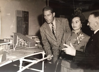
Photograph - Publicity Photograph, Herald Feature Service, Inspection of Architectural Models for a New Kew City Hall, circa 1959, 1959
... Kew Council from 1952 to 1968. He was elected Mayor for the 1959-60 term. He died in 1975, aged 75, and is buried in Boroondara Cemetery. An item of historical interest donated by members of the Dods family in 2006. The Dods-Ferguson Collection includes a number of items once in the possession of the families related to or descended from two mayors of Kew: Cr. Hugh Ferguson and Cr. Frederick Dods. kew city ...The original Kew Town Hall offices were located in Walpole Street, Kew. Before 1960, even though it had been much discussed over a number of decades, Kew did not have a 'civic hall'. When required, events such as balls, exhibitions or theatrical events were held in the Kew Recreation Hall in Walpole Street. A new City Hall was to be opened by Sir Robert Menzies in 1960. It was located beside the Alexandra Gardens in Cotham Road. It is now used as the Kew Library. Cr Hugh George Ferguson (at right) was born in June 1900 in Williamstown. After his family moved to Kew, they lived in Fernhurst Grove while his future wife’s family lived in Fellows Street. He married in 1940 and subsequently joined the Australian Imperial Forces. After the war he worked as a Billeting Affairs Organiser for the Dutch Government, resettling migrants in Australia. He also worked in advertising as an account manager, and was campaign director for Arthur Rylah is Victorian politics. He organised the first major trade fairs at the Royal Exhibition Buildings after the Second World War, including a World Trade Fair. He built a home in Brougham Street and represented North Ward on Kew Council from 1952 to 1968. He was elected Mayor for the 1959-60 term. He died in 1975, aged 75, and is buried in Boroondara Cemetery.An item of historical interest donated by members of the Dods family in 2006. The Dods-Ferguson Collection includes a number of items once in the possession of the families related to or descended from two mayors of Kew: Cr. Hugh Ferguson and Cr. Frederick Dods.Publicity photograph of two men and a woman inspecting architectural models for a new Kew City Hall. The man at the right of the photograph is Cr Hugh George Ferguson, Mayor of Kew 1959-60. The Hall, now occupied by the Kew Library, was opened by The Hon H.E. Bolte MLA, Premier of Victoria in 1960.Herald Sun Feature Service / Hugh G. Ferguson & Associates / New Kew City Hall. kew city hall, hugh g. ferguson & asociates, architectural models - kew, cr hugh george ferguson -
 Kew Historical Society Inc
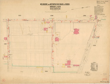
Plan, Melbourne & Metropolitan Board of Works : Borough of Kew : Detail Plan No.1291, 1905
... This plan forms part of a large group of MMBW plans and maps that was donated to the Society by the Mr Poulter, City Engineer of the City of Kew in 1989. Within this collection, thirty-five hand-coloured plans, backed with linen, are of statewide significance as they include annotations that provide details of construction materials used in buildings in the first decade of the 20th century as well as additional information about land ownership and usage. ...The Melbourne and Metropolitan Board of Works (MMBW) plans were produced from the 1890s to the 1950s. They were crucial to the design and development of Melbourne's sewerage and drainage system. The plans, at a scale of 40 feet to 1 inch (1:480), provide a detailed historical record of Melbourne streetscapes and environmental features. Each plan covers one or two street blocks (roughly six streets), showing details of buildings, including garden layouts and ownership boundaries, and features such as laneways, drains, bridges, parks, municipal boundaries and other prominent landmarks as they existed at the time each plan was produced. (Source: State Library of Victoria). This plan forms part of a large group of MMBW plans and maps that was donated to the Society by the Mr Poulter, City Engineer of the City of Kew in 1989. Within this collection, thirty-five hand-coloured plans, backed with linen, are of statewide significance as they include annotations that provide details of construction materials used in buildings in the first decade of the 20th century as well as additional information about land ownership and usage. The copies in the Public Record Office Victoria and the State Library of Victoria are monochrome versions which do not denote building materials so that the maps in this collection are invaluable and unique tools for researchers and heritage consultants. A number of the plans are not held in the collection of the State Library of Victoria so they have the additional attribute of rarity.Original survey plan, issued by the MMBW to a contractor with responsibility for constructing sewers in the area identified on the plan within the Borough of Kew. The plan was at some stage hand-coloured, possibly by the contractor, but more likely by officers working in the Engineering Department of the Borough and later Town, then City of Kew. The hand-coloured sections of buildings on the plan were used to denote masonry or brick constructions (pink), weatherboard constructions (yellow), and public buildings (grey). A detail plan of part of Studley Park bordered by the major streets of Hodgson Street, Stevenson Street and Studley Park Road. Included on the plan are a number of significant Studley Park mansions in existence at the beginning of the 20th century. The unnamed street shown in the middle of the plan is McEvoy Street. The most important house still extant is Campion House, formerly named Dalsraith [Dalswraith] and Glendalough, owned since the 1940s by the Society of Jesus. Campion House can be seen on the corner of Hodgson and Studley Park Road. Its stables at the rear of the block have now been incorporated into a contemporary residence. An interesting feature of the plan is the 1910 annotation by Ed Seitz, professional designing engineer. Is Seitz the contractor who modified the MMBW original?melbourne and metropolitan board of works, detail plans, mmbw 1291, cartography -
 Kew Historical Society Inc
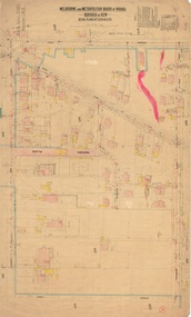
Plan, Melbourne and Metropolitan Board of Works, Melbourne & Metropolitan Board of Works : Borough of Kew : Detail Plan No.1294 & 1295, 1904
... City of Kew. The hand-coloured sections of buildings on the plan were used to denote masonry or brick constructions (pink), weatherboard constructions (yellow), and public buildings (grey).The streets and built structures in MMBW Detail Plan 1294 & 1295 were surveyed in 1903 and released to contractors in 1904. This plan is one of two in the collection...A number of the plans are not held in the collection of the State Library of Victoria so they have the additional attribute of rarity. melbourne and metropolitan board of works, detail plans mmbw 1294, mmbw 1295 cartography Original survey plan, issued by the MMBW to a contractor with responsibility for constructing sewers in the area identified on the plan within the Borough of Kew. The plan was at some stage hand-coloured, possibly by the contractor, but more likely by officers working in the Engineering Department of the Borough and later Town, then City ...The Melbourne and Metropolitan Board of Works (MMBW) plans were produced from the 1890s to the 1950s. They were crucial to the design and development of Melbourne's sewerage and drainage system. The plans, at a scale of 40 feet to 1 inch (1:480), provide a detailed historical record of Melbourne streetscapes and environmental features. Each plan covers one or two street blocks (roughly six streets), showing details of buildings, including garden layouts and ownership boundaries, and features such as laneways, drains, bridges, parks, municipal boundaries and other prominent landmarks as they existed at the time each plan was produced. (Source: State Library of Victoria). This plan forms part of a large group of MMBW plans and maps that was donated to the Society by the Mr Poulter, City Engineer of the City of Kew in 1989. Within this collection, thirty-five hand-coloured plans, backed with linen, are of statewide significance as they include annotations that provide details of construction materials used in buildings in the first decade of the 20th century as well as additional information about land ownership and usage. The copies in the Public Record Office Victoria and the State Library of Victoria are monochrome versions which do not denote building materials so that the maps in this collection are invaluable and unique tools for researchers and heritage consultants. A number of the plans are not held in the collection of the State Library of Victoria so they have the additional attribute of rarity.Original survey plan, issued by the MMBW to a contractor with responsibility for constructing sewers in the area identified on the plan within the Borough of Kew. The plan was at some stage hand-coloured, possibly by the contractor, but more likely by officers working in the Engineering Department of the Borough and later Town, then City of Kew. The hand-coloured sections of buildings on the plan were used to denote masonry or brick constructions (pink), weatherboard constructions (yellow), and public buildings (grey).The streets and built structures in MMBW Detail Plan 1294 & 1295 were surveyed in 1903 and released to contractors in 1904. This plan is one of two in the collection where the lithographers amalgamated two separate plans. Both plans include sections of Studley Park. Dominating the south and west corners of Kew Junction are the Clifton and Kew Hotels. The Kew Hotel, owned by Patrick O’Shaughnessy was one of the oldest in Kew. MMBW plans were amended over time to take account of new subdivisions such as that which created Merrion Place. Of the four mansions shown in Studley Park Road, three remain – ‘Field Place’, the home of Frances Henty, ‘Leaghur’ and ‘Darley’. ‘Byram’ (later ‘Goathland’, then ‘Tara Hall’) was an architectural marvel. Designed in 1888 by E.G. Kilburn for the paper magnate George Ramsden, it was demolished in 1960. While an earlier sale of the southern section of Byram had created Tara Avenue in 1927, the demolition of the house in 1960 enabled the extension of Tara Avenue northward.melbourne and metropolitan board of works, detail plans, mmbw 1294, mmbw 1295, cartography -
 Kew Historical Society Inc
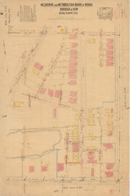
Plan, Melbourne & Metropolitan Board of Works : Borough of Kew : Detail Plan No.1296, 1904
... (Source: State Library of Victoria) This plan forms part of a large group of MMBW plans and maps that was donated to the Society by the Mr Poulter, City Engineer of the City of Kew in 1989. Within this collection, thirty-five hand-coloured plans, backed with linen, are of statewide significance as they include annotations that provide details of construction materials used in buildings in the first decade of the 20th century as well as additional information about land ownership and usage. ...The Melbourne and Metropolitan Board of Works (MMBW) plans were produced from the 1890s to the 1950s. They were crucial to the design and development of Melbourne's sewerage and drainage system. The plans, at a scale of 40 feet to 1 inch (1:480), provide a detailed historical record of Melbourne streetscapes and environmental features. Each plan covers one or two street blocks (roughly six streets), showing details of buildings, including garden layouts and ownership boundaries, and features such as laneways, drains, bridges, parks, municipal boundaries and other prominent landmarks as they existed at the time each plan was produced. (Source: State Library of Victoria)This plan forms part of a large group of MMBW plans and maps that was donated to the Society by the Mr Poulter, City Engineer of the City of Kew in 1989. Within this collection, thirty-five hand-coloured plans, backed with linen, are of statewide significance as they include annotations that provide details of construction materials used in buildings in the first decade of the 20th century as well as additional information about land ownership and usage. The copies in the Public Record Office Victoria and the State Library of Victoria are monochrome versions which do not denote building materials so that the maps in this collection are invaluable and unique tools for researchers and heritage consultants. A number of the plans are not held in the collection of the State Library of Victoria so they have the additional attribute of rarity.Original survey plan, issued by the MMBW to a contractor with responsibility for constructing sewers in the area identified on the plan within the Borough of Kew. The plan was at some stage hand-coloured, possibly by the contractor, but more likely by officers working in the Engineering Department of the Borough and later Town, then City of Kew. The hand-coloured sections of buildings on the plan were used to denote masonry or brick constructions (pink), weatherboard constructions (yellow), and public buildings (grey). This area was once known as O’Shaughnessy’s Paddock. O’Shaughnessy was the licensee of the Kew Hotel. The ‘Paddock’ or farm was for many years the closest farm to Melbourne. By 1903, when this plan was surveyed and lithographed, little of the farm remained. The area is dominated by a ‘clay hole’, on the site of the current Foley Reserve. It was used by Smart’s Brickyard from the 1880s until 1911, when the Council purchased it for a rubbish dump. It is notable as the site is one of the few industrial operations to have existed in Kew. By 1903, urban development was characterised by larger houses fronting Barkers Road and brick and weatherboard villas in Foley Street. Nearer the pit, weatherboard houses predominated. Foley Street bisected the triangular block and continued right to Denmark Street. At this stage, a house impeded the through road, only allowing access via a right of way to High Street.melbourne and metropolitan board of works, detail plans, mmbw 1296, cartography -
 Kew Historical Society Inc
Plan, Melbourne & Metropolitan Board of Works : Borough of Kew : Detail Plan No.1297, 1904
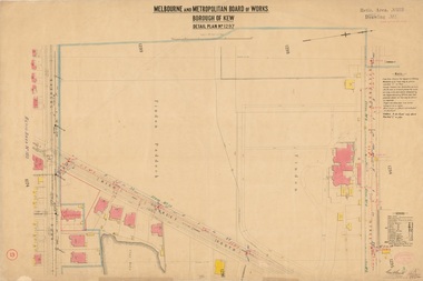
... A number of the plans are not held in the collection of the State Library of Victoria so they have the additional attribute of rarity. melbourne and metropolitan board of works, detail plans mmbw 1297 cartography Kew (Vic.) — municipal collection Original survey plan, issued by the MMBW to a sewage contractor with responsibility for constructing sewers in the area identified on the plan within the Borough of Kew. The plan was at some stage hand-coloured, possibly by the contractor, but more likely by officers working in the Engineering Department of the Borough and later Town, then City ...The Melbourne and Metropolitan Board of Works (MMBW) plans were produced from the 1890s to the 1950s. They were crucial to the design and development of Melbourne's sewerage and drainage system. The plans, at a scale of 40 feet to 1 inch (1:480), provide a detailed historical record of Melbourne streetscapes and environmental features. Each plan covers one or two street blocks (roughly six streets), showing details of buildings, including garden layouts and ownership boundaries, and features such as laneways, drains, bridges, parks, municipal boundaries and other prominent landmarks as they existed at the time each plan was produced. (Source: State Library of Victoria)This plan forms part of a large group of MMBW plans and maps that was donated to the Society by the Mr Poulter, City Engineer of the City of Kew in 1989. Within this collection, thirty-five hand-coloured plans, backed with linen, are of statewide significance as they include annotations that provide details of construction materials used in buildings in the first decade of the 20th century as well as additional information about land ownership and usage. The copies in the Public Record Office Victoria and the State Library of Victoria are monochrome versions which do not denote building materials so that the maps in this collection are invaluable and unique tools for researchers and heritage consultants. A number of the plans are not held in the collection of the State Library of Victoria so they have the additional attribute of rarity.Original survey plan, issued by the MMBW to a sewage contractor with responsibility for constructing sewers in the area identified on the plan within the Borough of Kew. The plan was at some stage hand-coloured, possibly by the contractor, but more likely by officers working in the Engineering Department of the Borough and later Town, then City of Kew. The hand-coloured sections of buildings on the plan were used to denote masonry or brick constructions (pink), weatherboard constructions (yellow), and public buildings (grey). This plan of Kew encompasses the area bounded by Barkers Road, High Street and Stevenson Street. Because of the angle created by High Street, a number of houses on the northern side of High Street are shown. The area is dominated by one of the great original landholdings in Kew, described here as the ‘Findon Paddock’. ‘Findon’, the house from which the name of the paddock was taken fronts Stevenson Street and was clearly a rambling structure. The best-known occupant of Findon was Henry ‘Money Miller’ who bought the house in 1871. Miller was a member of Victoria’s first parliament and assisted in the framing of its constitution. Findon was to be subdivided as early as 1912, when the Findon Subdivision was advertised to be sold by auction. In the plan of the subdivision, the original house is not shown, so, presumably it had previously been demolished. Fincham & Son moved the organ, built by Henry Willis, which was installed in the house, first to ‘Whernside’ in Toorak, and later to the Box Hill Methodist Church.melbourne and metropolitan board of works, detail plans, mmbw 1297, cartography, kew (vic.) — municipal collection -
 Kew Historical Society Inc
Plan, Melbourne & Metropolitan Board of Works : Borough of Kew : Detail Plan No.1301, 1910
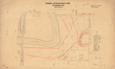
... (Source: State Library of Victoria) This plan forms part of a large group of MMBW plans and maps that was donated to the Society by the Mr Poulter, City Engineer of the City of Kew in 1989. Within this collection, thirty-five hand-coloured plans, backed with linen, are of statewide significance as they include annotations that provide details of construction materials used in buildings in the first decade of the 20th century as well as additional information about land ownership and usage. ...The Melbourne and Metropolitan Board of Works (MMBW) plans were produced from the 1890s to the 1950s. They were crucial to the design and development of Melbourne's sewerage and drainage system. The plans, at a scale of 40 feet to 1 inch (1:480), provide a detailed historical record of Melbourne streetscapes and environmental features. Each plan covers one or two street blocks (roughly six streets), showing details of buildings, including garden layouts and ownership boundaries, and features such as laneways, drains, bridges, parks, municipal boundaries and other prominent landmarks as they existed at the time each plan was produced. (Source: State Library of Victoria)This plan forms part of a large group of MMBW plans and maps that was donated to the Society by the Mr Poulter, City Engineer of the City of Kew in 1989. Within this collection, thirty-five hand-coloured plans, backed with linen, are of statewide significance as they include annotations that provide details of construction materials used in buildings in the first decade of the 20th century as well as additional information about land ownership and usage. The copies in the Public Record Office Victoria and the State Library of Victoria are monochrome versions which do not denote building materials so that the maps in this collection are invaluable and unique tools for researchers and heritage consultants. A number of the plans are not held in the collection of the State Library of Victoria so they have the additional attribute of rarity.Original survey plan, issued by the MMBW to a contractor with responsibility for constructing sewers in the area identified on the plan within the Borough of Kew. The plan was at some stage hand-coloured, possibly by the contractor, but more likely by officers working in the Engineering Department of the Borough and later Town, then City of Kew. The hand-coloured sections of buildings on the plan were used to denote masonry or brick constructions (pink), weatherboard constructions (yellow), and public buildings (grey). Throughout its history, the land in what is known today as Studley Ward of the City of Boroondara has been subject to continuing subdivision. This is evident in Plan 1301, where later hands have modified the original map to include streets created subsequent to the printing of the plan in 1904. Other annotations such as the ‘Reserved for Road Purposes’ beside the Yarra never eventuated. The plan continued to be modified to at least 1953, when a later hand noted that a particular site was ‘Property site P. McIntyre house’ in Swinton Avenue. Two significant houses in the area are outlined on the plan: ‘Swinton’ on the corner of the streets then named Effey and Maud Streets (now Swinton Avenue) and ‘Fairhaven’ [unnamed] in Stevenson Street. The gardens of the two David Syme owned mansions of ‘Blythswood’ and ‘Rockingham’, stretching down to the River Yarra, are also represented.melbourne and metropolitan board of works, detail plans, mmbw 1301, cartography -
 Kew Historical Society Inc
Plan, Melbourne & Metropolitan Board of Works : Borough of Kew : Detail Plan No.1302, 1910
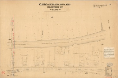
... (Source: State Library of Victoria) This plan forms part of a large group of MMBW plans and maps that was donated to the Society by the Mr Poulter, City Engineer of the City of Kew in 1989. Within this collection, thirty-five hand-coloured plans, backed with linen, are of statewide significance as they include annotations that provide details of construction materials used in buildings in the first decade of the 20th century as well as additional information about land ownership and usage. ...The Melbourne and Metropolitan Board of Works (MMBW) plans were produced from the 1890s to the 1950s. They were crucial to the design and development of Melbourne's sewerage and drainage system. The plans, at a scale of 40 feet to 1 inch (1:480), provide a detailed historical record of Melbourne streetscapes and environmental features. Each plan covers one or two street blocks (roughly six streets), showing details of buildings, including garden layouts and ownership boundaries, and features such as laneways, drains, bridges, parks, municipal boundaries and other prominent landmarks as they existed at the time each plan was produced. (Source: State Library of Victoria)This plan forms part of a large group of MMBW plans and maps that was donated to the Society by the Mr Poulter, City Engineer of the City of Kew in 1989. Within this collection, thirty-five hand-coloured plans, backed with linen, are of statewide significance as they include annotations that provide details of construction materials used in buildings in the first decade of the 20th century as well as additional information about land ownership and usage. The copies in the Public Record Office Victoria and the State Library of Victoria are monochrome versions which do not denote building materials so that the maps in this collection are invaluable and unique tools for researchers and heritage consultants. A number of the plans are not held in the collection of the State Library of Victoria so they have the additional attribute of rarity.Original survey plan, issued by the MMBW to a contractor with responsibility for constructing sewers in the area identified on the plan within the Borough of Kew. The plan was at some stage hand-coloured, possibly by the contractor, but more likely by officers working in the Engineering Department of the Borough and later Town, then City of Kew. The hand-coloured sections of buildings on the plan were used to denote masonry or brick constructions (pink), weatherboard constructions (yellow), and public buildings (grey). The absence of buildings and or property in Kew facing the Yarra is the most notable feature of this plan. Walmer Street and its bridge stretched, then and now, from Studley Park Road to Victoria Street, Richmond. On the Richmond side of the Yarra, there was evidence in 1904 of industry (‘Wool shed’; Soap Works’) and entertainment (‘Skittle Alley’). In reality, another Plan (No.1303) shows Chinese Gardens bordering the Yarra on the Kew side and buildings in Young Street.melbourne and metropolitan board of works, detail plans, mmbw 1302, cartography -
 Kew Historical Society Inc
Plan, Melbourne & Metropolitan Board of Works : Borough of Kew : Detail Plan No.1350, 1910
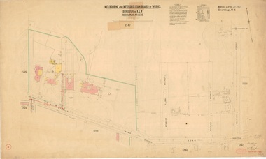
... This plan forms part of a large group of MMBW plans and maps that was donated to the Society by the Mr Poulter, City Engineer of the City of Kew in 1989. Within this collection, thirty-five hand-coloured plans, backed with linen, are of statewide significance as they include annotations that provide details of construction materials used in buildings in the first decade of the 20th century as well as additional information about land ownership and usage. ...The Melbourne and Metropolitan Board of Works (MMBW) plans were produced from the 1890s to the 1950s. They were crucial to the design and development of Melbourne's sewerage and drainage system. The plans, at a scale of 40 feet to 1 inch (1:480), provide a detailed historical record of Melbourne streetscapes and environmental features. Each plan covers one or two street blocks (roughly six streets), showing details of buildings, including garden layouts and ownership boundaries, and features such as laneways, drains, bridges, parks, municipal boundaries and other prominent landmarks as they existed at the time each plan was produced. (Source: State Library of Victoria). This plan forms part of a large group of MMBW plans and maps that was donated to the Society by the Mr Poulter, City Engineer of the City of Kew in 1989. Within this collection, thirty-five hand-coloured plans, backed with linen, are of statewide significance as they include annotations that provide details of construction materials used in buildings in the first decade of the 20th century as well as additional information about land ownership and usage. The copies in the Public Record Office Victoria and the State Library of Victoria are monochrome versions which do not denote building materials so that the maps in this collection are invaluable and unique tools for researchers and heritage consultants. A number of the plans are not held in the collection of the State Library of Victoria so they have the additional attribute of rarity.Original survey plan, issued by the MMBW to a contractor with responsibility for constructing sewers in the area identified on the plan within the Borough of Kew. The plan was at some stage hand-coloured, possibly by the contractor, but more likely by officers working in the Engineering Department of the Borough and later Town, then City of Kew. The hand-coloured sections of buildings on the plan were used to denote masonry or brick constructions (pink), weatherboard constructions (yellow), and public buildings (grey). MMBW Plan No. 1350 depicts the western end of Studley Park on the north side of the Studley Park Road. ‘Raheen’, then the home of Sir Henry Wrixon is named, the plan identifying those parts of the house that were built of brick and timber. The two houses between Raheen and the River Yarra are also shown. Other parts of the plan show neighbouring streets: Yarra Street, Studley Park Avenue, Studley Street and Fenwick Street. Each, apart from Fenwick Street was subsequently renamed. At the corner of Fenwick and Stawell Streets, the home of Joseph Butterworth Coombs, later called ‘Hope Mansell’, is represented but unnamed.melbourne and metropolitan board of works, detail plans, mmbw 1350, cartography -
 Kew Historical Society Inc
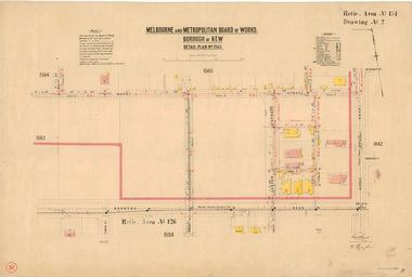
Plan, Melbourne & Metropolitan Board of Works : Borough of Kew : Detail Plan No.1561, 1905
... This plan forms part of a large group of MMBW plans and maps that was donated to the Society by Mr Poulter, City Engineer of the City of Kew in 1989. Within this collection, thirty-five hand-coloured plans, backed with linen, are of statewide significance as they include annotations that provide details of construction materials used in buildings in the first decade of the 20th century as well as additional information about land ownership and usage. ...The Melbourne and Metropolitan Board of Works (MMBW) plans were produced from the 1890s to the 1950s. They were crucial to the design and development of Melbourne's sewerage and drainage system. The plans, at a scale of 40 feet to 1 inch (1:480), provide a detailed historical record of Melbourne streetscapes and environmental features. Each plan covers one or two street blocks (roughly six streets), showing details of buildings, including garden layouts and ownership boundaries, and features such as laneways, drains, bridges, parks, municipal boundaries and other prominent landmarks as they existed at the time each plan was produced. (Source: State Library of Victoria). This plan forms part of a large group of MMBW plans and maps that was donated to the Society by Mr Poulter, City Engineer of the City of Kew in 1989. Within this collection, thirty-five hand-coloured plans, backed with linen, are of statewide significance as they include annotations that provide details of construction materials used in buildings in the first decade of the 20th century as well as additional information about land ownership and usage. The copies in the Public Record Office Victoria and the State Library of Victoria are monochrome versions which do not denote building materials so that the maps in this collection are invaluable and unique tools for researchers and heritage consultants. A number of the plans are not held in the collection of the State Library of Victoria so they have the additional attribute of rarity.Original survey plan, issued by the MMBW to a contractor with responsibility for constructing sewers in the area identified on the plan within the Borough of Kew. The plan was at some stage hand-coloured, possibly by the contractor, but more likely by officers working in the Engineering Department of the Borough and later Town, then City of Kew. The hand-coloured sections of buildings on the plan were used to denote masonry or brick constructions (pink), weatherboard constructions (yellow), and public buildings (grey). MMBW Detail Plan 1561 outlines those residences in the area bordered by Burke Road, Loxton Street, Mount Street and Barkers Road that had been constructed by 1905 when the land was surveyed. At this time, the area nearest Burke Road had been subdivided and developed whereas the lands to the west were as yet undeveloped. The houses represented are not named on the Plan.melbourne and metropolitan board of works, detail plans, mmbw 1561, cartography -
 Kew Historical Society Inc
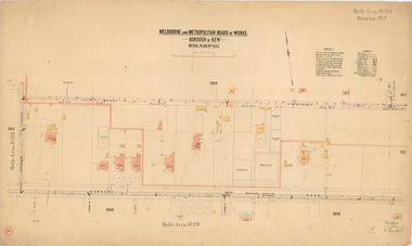
Plan, Melbourne and Metropolitan Board of Works, Borough of Kew : Detail Plan No.1562, 1905
... This plan forms part of a large group of MMBW plans and maps that was donated to the Society by the Mr Poulter, City Engineer of the City of Kew in 1989. Within this collection, thirty-five hand-coloured plans, backed with linen, are of statewide significance as they include annotations that provide details of construction materials used in buildings in the first decade of the 20th century as well as additional information about land ownership and usage. ...The Melbourne and Metropolitan Board of Works (MMBW) plans were produced from the 1890s to the 1950s. They were crucial to the design and development of Melbourne's sewerage and drainage system. The plans, at a scale of 40 feet to 1 inch (1:480), provide a detailed historical record of Melbourne streetscapes and environmental features. Each plan covers one or two street blocks (roughly six streets), showing details of buildings, including garden layouts and ownership boundaries, and features such as laneways, drains, bridges, parks, municipal boundaries and other prominent landmarks as they existed at the time each plan was produced. (Source: State Library of Victoria). This plan forms part of a large group of MMBW plans and maps that was donated to the Society by the Mr Poulter, City Engineer of the City of Kew in 1989. Within this collection, thirty-five hand-coloured plans, backed with linen, are of statewide significance as they include annotations that provide details of construction materials used in buildings in the first decade of the 20th century as well as additional information about land ownership and usage. The copies in the Public Record Office Victoria and the State Library of Victoria are monochrome versions which do not denote building materials so that the maps in this collection are invaluable and unique tools for researchers and heritage consultants. A number of the plans are not held in the collection of the State Library of Victoria so they have the additional attribute of rarity.Original survey plan, issued by the MMBW to a contractor with responsibility for constructing sewers in the area identified on the plan within the Borough of Kew. The plan was at some stage hand-coloured, possibly by the contractor, but more likely by officers working in the Engineering Department of the Borough and later Town, then City of Kew. The hand-coloured sections of buildings on the plan were used to denote masonry or brick constructions (pink), weatherboard constructions (yellow), and public buildings (grey). MMBW detail plan No.1562, in contrast to No.1561 includes the names of a large number of houses: in Barkers Road: ‘Ashwick’, ‘Owasso’, ‘Anadiha’, ‘Eurobin’, ‘Carlsruhe’, ‘Arlington’ and ‘Altyre’. Unnamed but clearly represented on the plan is what was then known as the ‘Auburn Heights Recreation Club’, which at this stage included a Bowling Green, a Croquet Green and two Tennis Courts. On the plan, Brougham Place, as it was then known, is represented. It was later renamed Daniell Place. The aforementioned Arlington is now the junior campus of Preshil. melbourne and metropolitan board of works, detail plans, mmbw 1562, cartography -
 Kew Historical Society Inc
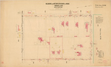
Plan, Melbourne & Metropolitan Board of Works : Borough of Kew : Detail Plan No.1563, 1905
... (Source: State Library of Victoria) This plan forms part of a large group of MMBW plans and maps that was donated to the Society by the Mr Poulter, City Engineer of the City of Kew in 1989. Within this collection, thirty-five hand-coloured plans, backed with linen, are of statewide significance as they include annotations that provide details of construction materials used in buildings in the first decade of the 20th century as well as additional information about land ownership and usage. ...The Melbourne and Metropolitan Board of Works (MMBW) plans were produced from the 1890s to the 1950s. They were crucial to the design and development of Melbourne's sewerage and drainage system. The plans, at a scale of 40 feet to 1 inch (1:480), provide a detailed historical record of Melbourne streetscapes and environmental features. Each plan covers one or two street blocks (roughly six streets), showing details of buildings, including garden layouts and ownership boundaries, and features such as laneways, drains, bridges, parks, municipal boundaries and other prominent landmarks as they existed at the time each plan was produced. (Source: State Library of Victoria)This plan forms part of a large group of MMBW plans and maps that was donated to the Society by the Mr Poulter, City Engineer of the City of Kew in 1989. Within this collection, thirty-five hand-coloured plans, backed with linen, are of statewide significance as they include annotations that provide details of construction materials used in buildings in the first decade of the 20th century as well as additional information about land ownership and usage. The copies in the Public Record Office Victoria and the State Library of Victoria are monochrome versions which do not denote building materials so that the maps in this collection are invaluable and unique tools for researchers and heritage consultants. A number of the plans are not held in the collection of the State Library of Victoria so they have the additional attribute of rarity.Original survey plan, issued by the MMBW to a contractor with responsibility for constructing sewers in the area identified on the plan within the Borough of Kew. The plan was at some stage hand-coloured, possibly by the contractor, but more likely by officers working in the Engineering Department of the Borough and later Town, then City of Kew. The hand-coloured sections of buildings on the plan were used to denote masonry or brick constructions (pink), weatherboard constructions (yellow), and public buildings (grey). This plan covers the area between Barkers Road, Wrixon Street, Sackville Street and Brougham Place, much of it now occupied by Carey Baptist Grammar and Preshil schools. This was an area of large and prestigious homes in 1903, some with formally laid-out gardens, such as ‘Tower Hill’ and ‘Opawa’. ‘Kalimna’ was built in 1890-91 for William H. Jarman, an accountant, and ‘Blackhall’ at the same time for W.H. Roberts. Blackhall was to be acquired by the Salvation Army in 1915 and renamed ‘Catherine Booth Girls’ Home’. The Home accommodated girls, aged between 4 and 16. Kalimna and Blackhall are of significance as typical and intact late Victorian mansions and as such are two key Victorian buildings to have been built in Kew. Both Blackhall and Kalimna are now part of Preshil. ‘Fairview’ was for a long time occupied by the Sisters of St. Joseph of Cluny as a care home for the elderly, but it is now part of Carey Grammar School, as are the grounds of ‘Wagga Merne’, ‘Weemutta’, ‘Blakely’, ‘Daheim’ and ‘Mildura’ (later ‘Urangeline’), the last being particularly impressive in 1903, with a tennis court, conservatory, outhouses, and two bathrooms!melbourne and metropolitan board of works, detail plans, mmbw 1563, cartography -
 Kew Historical Society Inc
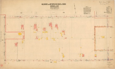
Plan, Melbourne & Metropolitan Board of Works : Borough of Kew : Detail Plan No.1564, 1905
... (Source: State Library of Victoria) This plan forms part of a large group of MMBW plans and maps that was donated to the Society by the Mr Poulter, City Engineer of the City of Kew in 1989. Within this collection, thirty-five hand-coloured plans, backed with linen, are of statewide significance as they include annotations that provide details of construction materials used in buildings in the first decade of the 20th century as well as additional information about land ownership and usage. ...The Melbourne and Metropolitan Board of Works (MMBW) plans were produced from the 1890s to the 1950s. They were crucial to the design and development of Melbourne's sewerage and drainage system. The plans, at a scale of 40 feet to 1 inch (1:480), provide a detailed historical record of Melbourne streetscapes and environmental features. Each plan covers one or two street blocks (roughly six streets), showing details of buildings, including garden layouts and ownership boundaries, and features such as laneways, drains, bridges, parks, municipal boundaries and other prominent landmarks as they existed at the time each plan was produced. (Source: State Library of Victoria)This plan forms part of a large group of MMBW plans and maps that was donated to the Society by the Mr Poulter, City Engineer of the City of Kew in 1989. Within this collection, thirty-five hand-coloured plans, backed with linen, are of statewide significance as they include annotations that provide details of construction materials used in buildings in the first decade of the 20th century as well as additional information about land ownership and usage. The copies in the Public Record Office Victoria and the State Library of Victoria are monochrome versions which do not denote building materials so that the maps in this collection are invaluable and unique tools for researchers and heritage consultants. A number of the plans are not held in the collection of the State Library of Victoria so they have the additional attribute of rarity.Original survey plan, issued by the MMBW to a contractor with responsibility for constructing sewers in the area identified on the plan within the Borough of Kew. The plan was at some stage hand-coloured, possibly by the contractor, but more likely by officers working in the Engineering Department of the Borough and later Town, then City of Kew. The hand-coloured sections of buildings on the plan were used to denote masonry or brick constructions (pink), weatherboard constructions (yellow), and public buildings (grey). In 1905, when Plan No.1564 was printed, that part of Kew bordered by Brougham Place (now Daniell Place), Mount Street, Sackville Street and Ross Street was already the location of a number of large mansions. Here, subdivisions, at least at this stage, produced larger blocks than in Central Kew. Many of the houses on this plan are named: ‘Faybrook’, ‘Northumbria’, ‘Parkholm[e]’, ‘Dunboe’, ‘Katoomba’ and ‘Eschol’ fronting Sackville Street. Eschol was once the home of the manufacturer Robert Harrison, whose cordial factory in Spring and Argyle Streets Fitzroy are noted on the Victorian Heritage Register. ‘The Hawthorns’ on the corner of Brougham Place and Mount Street was the home of the medical practitioner Frank William Fay, who won the military cross and other honours for conspicuous gallantry and devotion to duty in World War 1.melbourne and metropolitan board of works, detail plans, mmbw 1564, cartography
