Showing 55 items matching "environmental changes"
-
 The Beechworth Burke Museum
Photograph - Post Card, 1920-1930's
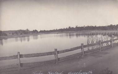
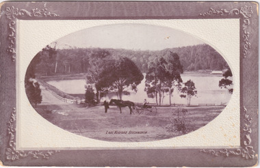
... ...environmental changes...George Briscoe Kerferd catchments Beechworth water reserve beechworth catchments Municipal Council St. james cathedral lakes reserve Water Supply political projects man-made fence environmental changes Obverse: Lake Kerferd, Beechworth / Reverse: 8164 / Post Card / Correspondence / Address Only / Kodak Austral [Kodak Australia Stamp] / Black and white rectangular postcard printed on paper. ...Taken between 1920-1930s, shown is the banks of Lake Kerferd with wooden man-made fencing. The construction on Lake Kerferd began in 1862 however it wasn't completed until 1874 due to engineering and funding issues. The lake was named after George Briscoe Kerferd (1831–1889) who was responsible for Beechworth's water scheme. George Briscoe Kerferd was born on 21 January 1831 in Liverpool, England and arrived in Melbourne April 1853. He spent his first years in Australia in Bendigo before settling down in Beechworth as a wine and spirits merchant. He married Ann Martindale on 17th December 1853 at St James Cathedral, Melbourne and between them they had three sons and five daughters. Kerferd began his political and legal career in Beechworth when he was first elected to the Municipal Council in May 1857. Later he would be elected to the Legislative Assembly for the Ovens District in November 1864, and continued to represent the area until February 1886.The postcard holds Historic significance due to its connection to Beechworth and its Lake Kerford. It demonstrates the interactions between nature and colonialists, especially how the lake has somewhat been 'protected' with the man made fencing. It also presents information on the environmental development or degradation for the area, with possible changes to the environment that may have been caused by human physical forces, natural decay or Global Warming.Black and white rectangular postcard printed on paper.Obverse: Lake Kerferd, Beechworth / Reverse: 8164 / Post Card / Correspondence / Address Only / Kodak Austral [Kodak Australia Stamp] /lake kerferd, beechworth, water scheme, water reserve, reservoir, legislative assembly, hon. george briscoe kerferd, catchments, beechworth water reserve, beechworth catchments, municipal council, st. james cathedral, lakes, reserve, water supply, political projects, man-made fence, environmental changes -
 The Beechworth Burke Museum
Photograph, 1960s
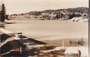
... ...environmental changes...Beechworth water scheme water reserve catchments Beechworth water reserve beechworth catchments Municipal Council lakes reserve Water Supply political projects environmental changes Mr. L. H. Sambell Sambell Rocky Mountain Mining Company recreational lake Minister of Lands Mr. ...Taken around 1960s, this photograph shows the banks of Lake Sambell. Lake Sambell is named after Mr. L. H. Sambell who was instrumental in the lake's formation. Lake Sambell is the original site of the open sluice operation of Rocky Mountain Mining Company in the 1800s and the early 1900s. In the early 1920s, it was reconstructed as a recreational lake and was formally opened to public on 6 October 1928. The opening event was attended by townspeople and Beechworth's Minister of Lands Mr. Bailey. In the late 1930s to early 1940s, Lake Sambell redeveloped. The first development aimed to raise the banks by six feet to double its present area and to make the water cleaner. Another redevelopment in the 1940s was made possible by the Beechworth and District Progress Association. It involved raising the banks to five feet to provide swimming facilities, paddling pool and caravan park. This photograph holds Historic significance because of its connection to the development of Beechworth district.Sepia rectangular photograph printed on matte photographic paperObverse: Reverse: 3533 /beechworth, water scheme, water reserve, catchments, beechworth water reserve, beechworth catchments, municipal council, lakes, reserve, water supply, political projects, environmental changes, mr. l. h. sambell, sambell, rocky mountain mining company, recreational lake, minister of lands, mr. bailey, swimming pool, paddling pool, caravan park, swimming facilities, lake redevelopment, funding -
 Melbourne Tram Museum
Book, Ministry of Transport, "Transport in Victoria - Yesteryear and Today", 1980
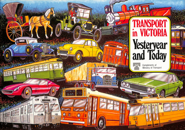
... Provides a short history of the state transport system, railways, roads, trams, Metropolitan planning, the Bland report, social changes, the underground loop, transport interchanges, West Gate Bridge, Roads and Freeways, transport inquiry of 1980 and environmental changes resulting from motor cars. 2nd copy added 14-5-2016 from the estate of Charles Craig....Provides a short history of the state transport system, railways, roads, trams, Metropolitan planning, the Bland report, social changes, the underground loop, transport interchanges, West Gate Bridge, Roads and Freeways, transport inquiry of 1980 and environmental changes resulting from motor cars. 2nd copy added 14-5-2016 from the estate of Charles Craig. ...Pamphlet or Book - 20 pages, full colour printed on gloss paper, centre stapled titled "Transport in Victoria - Yesteryear and Today", published by the Ministry of Transport giving an outline of Victoria's transport history from 1834. Provides a short history of the state transport system, railways, roads, trams, Metropolitan planning, the Bland report, social changes, the underground loop, transport interchanges, West Gate Bridge, Roads and Freeways, transport inquiry of 1980 and environmental changes resulting from motor cars. 2nd copy added 14-5-2016 from the estate of Charles Craig.trams, tramways, minister for transport, railways, trb, crb, murla, planning, history -
 Kiewa Valley Historical Society
Photograph Transmission lines Mount Beauty, 66 KVA Transmission lines from Clover Power Station, Circa 1950
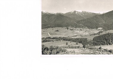
... This photograph is a "snap shot" in time circa 1950s detailing the rural environmental change and the progressive effects of the Kiewa Valley Hydro Scheme on the basic rural setting of the valley (note the sparsity of rural infrastructure). ...Kiewa Valley Historical Society Mount Beauty Information Centre 31 Bogong High Plains Rd Mt Beauty high-country This photograph is a "snap shot" in time circa 1950s detailing the rural environmental change and the progressive effects of the Kiewa Valley Hydro Scheme on the basic rural setting of the valley (note the sparsity of rural infrastructure). ...This photograph is a "snap shot" in time circa 1950s detailing the rural environmental change and the progressive effects of the Kiewa Valley Hydro Scheme on the basic rural setting of the valley (note the sparsity of rural infrastructure). This photograph shows the beginning of the accommodation and administration buildings for use by the construction workers and auxiliary administration employees of the Victorian State Electricity Commission. It also provides a view of the landscape before extensive development of Pondage and other non rural buildings.This photograph details a dramatic period in time which saw an enormous change to the exclusively rural area of the Kiewa Valley region in the mid 1900s (see sparse rural buildings/houses). This change presented both physical and mental challenges to the existing quiet rural inhabitants of the valley. The State of Victoria had to make adjustments to the changing demands imposed by population and industrial expansions. The development of cleaner energy supplies to a growing population has its downside ,which ever way the intrusion into the "natural" landscape is made. The construction of the large Pondage at the centre of the photograph is a good example.This black and white photograph of a panoramic view of the Kiewa Valley (Mount Beauty SEC construction workers village) shows the newly completed transmission line towers delivering electrical power(66KVA) from the Clover Power Station. The photo is on 200gms paper and not on special photographic paper.mount beauty 1940 to 1950s, development of sec kiewa hydro scheme, sec victoria -
 NMIT (Northern Melbourne Institute of TAFE)
Book: TAFE Curricula, Syllabi and Accreditation Documents 1994-1998, TAFE Curricula, Syllabi and Accreditation Documents 1994-1998, 1994-1998
... ...environmental change management...Certificate III in Environmental Change Management. Submission for accreditation. 1995. ...Certificate III in Environmental Change Management. Submission for accreditation. 1995. ...Contents: National Horticulture Curriculum Parts A and B 1997/98 National Horticulture Curriculum Level 4 1997/98 National Horticulture Curriculum Level 5 1997/98 National Horticulture Curriculum Level 6 1997/98 Pharmaceutical Manufacturing. Certificates 1,2,3 Core modules. !997/98 Pharmaceutical Manufacturing. Certificates 1,2,3 Special electives. !997/98 Associate Diploma of Applied Science (Food Technology) Syllabus Date not clear. [to Archives 1999] Certificate in Food Processing . Revised Core Modules. (Draft report) 1994 Certificate IV in Food Technology, Diploma of Food technology. 2 vols. Food industry Training accreditation board. National Certificate in food processing . Course advice. Core modules. Syllabus framework. Literacy, English language and numeracy. Nov 1993. Associate Diploma of Applied Science (Environmental Waste Management) and Advanced Certificate in Environmental waste management. Part 1 – Accreditation submission. 1988. Certificate III in Environmental Change Management. Submission for accreditation. 1995. Diploma in Natural Resource management. Primary Industries Training accreditation board. 1996. Advanced Building Studies. National curriculum module maintenance. 1997. Details of past courses and their accreditation.13 individual books in various bindings. Each details requirements for course accreditation in a variety of TAFE courses.tafe, technical and further education, environmental waste management, environmental change management, food technology, natural resource management, food processing, building studies, pharmaceutical manufacturing, horticulture, nmit, -
 Sunshine and District Historical Society Incorporated
Book - Joseph 'Joe' Wlodarczyk Collection - Morgan's Official Street Directory 1951, Val Morgan & Sons Pty Ltd, Morgan's Official Street Directory 1951, 1951
... . - Track land use: They document residential, commercial, and industrial activity, helping researchers understand zoning and environmental changes over time. - Reveal social patterns: Listings of trades, professions, and businesses offer insight into the economic and cultural makeup of a community. .... - Track land use: They document residential, commercial, and industrial activity, helping researchers understand zoning and environmental changes over time. - Reveal social patterns: Listings of trades, professions, and businesses offer insight into the economic and cultural makeup of a community. ...Hard copy book that includes a set of maps that cover the streets of MelbourneSmall hard covered book with green & yellow text on front. Inside has maps, index of street names & advertisementsnon-fictionHard copy book that includes a set of maps that cover the streets of Melbournedirectory, joseph 'joe' wlodarczyk, street directory -
 Victorian Aboriginal Corporation for Languages
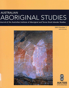
Periodical, Australian Institute of Aboriginal and Torres Strait Islander Studies, Australian Aboriginal studies : journal of the Australian Institute of Aboriginal and Torres Strait Islander Studies, 2007
... The floodplains of the north underwent dynamic environmental change from extensive mangrove swamps in the mid-Holocene, through a transition phase of variable estuarine and freshwater mosaic environments, to the freshwater environment that exists today. ...The floodplains of the north underwent dynamic environmental change from extensive mangrove swamps in the mid-Holocene, through a transition phase of variable estuarine and freshwater mosaic environments, to the freshwater environment that exists today. ...1. The moral lexicon of the Warlpiri people of central Australia LR Hiatt This paper discusses words that match ?Good? and ?Bad?; examples of ?Good? and ?Bad? behaviour; morality and law; and egalitarianism and dominance. It also presents a comparison with Gidjingarli (Burarra). 2. Mobs and bosses: Structures of Aboriginal sociality Patrick Mullins (Mount Druitt, NSW) A commonality of Aboriginal social organisation exists across the continent in communities as different as those from the Western Desert across to Cape York, from the towns of New South Wales and Western Australia to cities like Adelaide. This is found in the colloquial expressions ?mob? and ?boss?, which are used in widely differing contexts. Mobbing is the activity where relatedness, in the sense of social alliances, is established and affirmed by virtue of a common affiliation with place, common experience and common descent, as well as by the exchange of cash and commodities. Bossing is the activity of commanding respect by virtue of one?s capacity to bestow items of value such as ritual knowledge, nurturance, care, cash and commodities. Mobbing and bossing are best understood as structures in Giddens? sense of sets of rules and resources involved in the production of social systems, in this case social alliances. Mobbing and bossing imply a concept of a person as a being in a relationship. Attention needs to be given to the way these structures interact with institutions in the wider Australian society. 3. Recognising victims without blaming them: A moral contest? About Peter Sutton?s ?The Politics of Suffering: Indigenous Policy in Australia since the 1970s? and Gillian Cowlishaw?s replies Ma�a Ponsonnet (Universit� Paris- 8-Saint-Denis) Peter Sutton?s texts on Aboriginal violence, health and their politicisation are replied to using his methodology, and acknowledging his convincing points. Sutton rightly denounces a lack of lucidity and scientific objectivity in anthropological debates. These inadequacies impede identification of what Aboriginal groups can do to improve their situations for fear that this identification would lead to blame the victims. At the other end of the ethical spectrum, those who advocate a broader use of what I will call a ?resistance interpretation? of violence fail to recognise victims as such, on the implicit grounds that seeing victims as victims would deprive them of any agency, on the one hand, and entail blame, on the other hand. I aim to define a middle road between those views: the idea that victims should be acknowledged as such without being denied their agency and without being blamed for their own condition. This middle road allows identification of the colonisers? responsibilities in the contemporary situation of Indigenous communities in Australia, and to determine who can do what. Secondly, I show that Sutton?s texts convey, through subtle but recurrent remarks, an ideology of blame rather than a mere will to identify practical solutions. As a consequence, some of his proposals do not stand on a solid and objective causal analysis. 4. 'You would have loved her for her lore?: The letters of Daisy Bates Bob Reece (Murdoch University) Daisy Bates was once an iconic figure in Australia but her popular and academic reputation became tarnished by her retrograde views. Her credibility was also put in doubt through the exposure of her fictionalised Irish background. In more recent times, however, her ethnographic data on the Aborigines of Western Australia has been an invaluable source for Native Title claims, while her views on Aboriginal extinction, cannibalism and ?castes? are being seen as typical of her time. This article briefly reviews what has been the orthodox academic opinion of her scientific achievement before summarising what is reliably known of her early history and indicating what kind of person is revealed in the 3000 or more letters that she left behind. 5. What potential might Narrative Therapy have to assist Indigenous Australians reduce substance misuse? Violet Bacon (Curtin University of Technology) Substance misuse is associated with adverse consequences for many Australians including Aboriginal and Torres Strait Islander peoples. Extensive research has been conducted into various intervention, treatment and prevention programs to ascertain their potential in reducing substance misuse within Aboriginal and non-Aboriginal communities. I explore the potential of Narrative Therapy as a counselling intervention for assisting Indigenous Australians reduce the harm associated with substance misuse. 6. Bone points from the Adelaide River, Northern Territory Sally Brockwell (University of Canberra) and Kim Akerman (Moonah) Large earth mounds located next to the vast floodplains of the lower Adelaide River, one of the major tropical rivers draining the flat coastal plains of northern Australia, contain cultural material, including bone points. The floodplains of the north underwent dynamic environmental change from extensive mangrove swamps in the mid-Holocene, through a transition phase of variable estuarine and freshwater mosaic environments, to the freshwater environment that exists today. This geomorphological framework provides a background for the interpretation of the archaeology, which spans some 4000 years. 7. A different look: Comparative rock-art recording from the Torres Strait using computer enhancement techniques Liam M Brady (Monash University) In 1888 and 1898, Cambridge University?s Alfred C Haddon made the first recording of rock-art from the Torres Strait islands using photography and sketches. Systematic recording of these same paintings and sites was carried out from 2000 to 2004 by archaeologists and Indigenous Torres Strait Islander and Aboriginal communities as part of community-based rock-art recording projects. Computer enhancement techniques were used to identify differences between both sets of recordings, to reveal design elements that Haddon missed in his recordings, and to recover images recorded by Haddon that are today no longer visible to the naked eye. Using this data, preliminary observations into the antiquity of Torres Strait rock-art are noted along with recommendations for future Torres Strait region rock-art research and baseline monitoring projects. 8. Sources of bias in the Murray Black Collection: Implications for palaeopathological analysis Sarah Robertson (National Museum of Australia) The Murray Black collection of Aboriginal skeletal remains has been a mainstay of bio-anthropological research in Australia, but relatively little thought has been given to how and why this collection may differ from archaeologically obtained collections. The context in which remains were located and recovered has created bias within the sample, which was further skewed within the component of the collection sent to the Australian Institute of Anatomy, resulting in limitations for the research potential of the collection. This does not render all research on the collection unviable, but it demonstrates the importance of understanding the context of a skeletal collection when assessing its suitability for addressing specific research questions.maps, b&w photographs, colour photographs, illustrations, graphs, chartswarlpiri, sociology, daisy bates, substance abuse, narrative therapy, rock art, technology and art, murray black collection, pleistocene sites, watarrka plateau -
 Warrnambool and District Historical Society Inc.
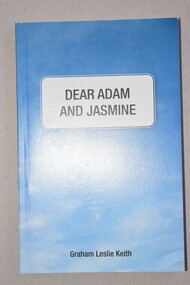
Book, Star Printing Service Pty Ltd, Dear Adam and Jasmine, 2015
... This book contains information on the environmental problems facing the world. The effects of climate change, over-population and fossil-fuel use are discussed and some alternatives to coal production and the use of nuclear power for peaceful purposes and for defence are proposed. ...Warrnambool and District Historical Society Inc. 2 Gilles Street (south of Merri St) Warrnambool great-ocean-road This book contains information on the environmental problems facing the world. The effects of climate change, over-population and fossil-fuel use are discussed and some alternatives to coal production and the use of nuclear power for peaceful purposes and for defence are proposed. ...This is a book detailing the environmental problems facing the world.This is a soft cover book of 158 pages. It has a blue cover with black printing on the front and a colour photograph of two children on the back. The book has 18 chapters of text and an index. The book contains some black and white photographs and a sketch. non-fictionThis is a book detailing the environmental problems facing the world.environmental issues, warrnambool -
 Warrnambool and District Historical Society Inc.
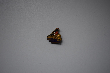
Badges, Swann & Hudson, Gould League of Bird Lovers, 1950s
... Today the aim of the group has been widened to include education for environmental sustainability. In 1967 the name was changed to Gould League and in 2006 it became Gould Group Ltd. ...Today the aim of the group has been widened to include education for environmental sustainability. In 1967 the name was changed to Gould League and in 2006 it became Gould Group Ltd. ...This is a badge of the Gould League of Bird Lovers. This organization was formed in 1909 in Victoria and was initially sponsored by the Education Department of Victoria. It was named after the English ornithologist, John Gould and his wife Elizabeth. The initial aim was to encourage school children to protect native birds and their eggs. Today the aim of the group has been widened to include education for environmental sustainability. In 1967 the name was changed to Gould League and in 2006 it became Gould Group Ltd. This badge has no known local provenance but many school children in Warrnambool in the 20th century and even today have belonged to the Gould League of Bird Lovers and the badge is retained as a memento of what was once an important organization for school children in Victoria. This is an irregular-shaped metal badge with the image of a red-capped robin, bronze-coloured tree branch and gold printing on a blue base. The back has a metal clip.Gould League of Bird Lovers Swann & Hudson Frankston gould league of bird lovers, history of warrnambool, john gould, ornithologist -
 Kiewa Valley Historical Society
Report - Alpine Study Area Volume 2 Maps, Land Conservation Council, 1970s
... Environmental Assessment Council and the former Environment Conservation Council (ECC) and Land Conservation Council (LCC) have completed 36 land use investigations over more than 35 years, including 27 regional reviews. They provide a framework for use of Public Land in Victoria. The Land Conservation Council was established by the Land Conservation Act 1970. These maps provide an assessment of the Alpine area at the time the maps were created. Some of the topics eg. Rainfall and water resources may change ...The Victorian Environmental Assessment Council and the former Environment Conservation Council (ECC) and Land Conservation Council (LCC) have completed 36 land use investigations over more than 35 years, including 27 regional reviews. They provide a framework for use of Public Land in Victoria. The Land Conservation Council was established by the Land Conservation Act 1970.These maps provide an assessment of the Alpine area at the time the maps were created. Some of the topics eg. Rainfall and water resources may change over the years thus providing a comparative analysis. Others may provide information for future development such as mineral exploration, building of a dam / tunnel etc.Blue box shaped folder containing 9 of 10 Maps of the Alpine Study Area produced by the Land Conservation Council. Maps include 1. Public land and descriptive blocks. 2. Physiography. 3. Topography. 4. Geology (missing). 5. Rainfall and water resources. 6. Vegetation 7. Land systems. 8. Recreation. 9. Primary production. 10. Minerals Ex library item. Stamped in red "Discarded From Stock / Swan Hill Regional Libraryalpine area, maps of alpine area, land conservation council -
 Kiewa Valley Historical Society
Papers - Observation Walk on the Bogong High Plains. x5
... Kiewa Valley Historical Society Mount Beauty Information Centre 31 Bogong High Plains Rd Mt Beauty high-country Students study the Bogong High Plains noting geology, history, vegetation and evolution / changes. Environmental studies includes the effect of people, horses, skiing, infrastructure etc. bogong high plains grazing vegetation Typed and hand written notes on the Bogong High Plains for students observing the vegetation. ...Students study the Bogong High Plains noting geology, history, vegetation and evolution / changes.Environmental studies includes the effect of people, horses, skiing, infrastructure etc.Typed and hand written notes on the Bogong High Plains for students observing the vegetation. It includes geology and early history.bogong high plains, grazing, vegetation -
 Kiewa Valley Historical Society
Timer Mechanical, Circa 1950
... environmental (carbon reduction) factor. This Timing Relay apparatus is very significant to the Kiewa Valley as its use was introduced during the Kiewa Hydro Scheme. Although only a relay apparatus, it was however part of the explosion of human resources into the valley. This influx of population transformed the region from that of a basically quiet rural region to one which evolved into both an industrial and a larger residential community. This evolution in the valley created a change ...This Timing Relay is quite a large (industrial type) apparatus. The Timer is started by having a voltage of 250 volts direct current (as supplied by batteries). A DC motor then rotates driving into a clockwork mechanism, the output of which is an arm rotating at the same speed as a minute hand on a clock. Attached to this arm is a mercury switch which tips and makes an electrical circuit operate in a sequence control system. The sequences that use these timers are when starting and stopping Hydro Generators. They check that the machine has connected to the power system grid before 20 minutes duration. Brakes must go on for a set time when shutting down a generator slowing at the right speed as measured by this apparatus. These generators are powered by the hydro force of "stored" water at a higher altitude. The establishment of both the NSW and Victorian Hydro schemes was achieved from the mid 1900's to the 1960's. At this point in time the need for additional power sources to quench both an industrial and domestic demand for electricity was purely an economic and not and environmental (carbon reduction) factor. This Timing Relay apparatus is very significant to the Kiewa Valley as its use was introduced during the Kiewa Hydro Scheme. Although only a relay apparatus, it was however part of the explosion of human resources into the valley. This influx of population transformed the region from that of a basically quiet rural region to one which evolved into both an industrial and a larger residential community. This evolution in the valley created a change, not only in the "physical" landscape but also the socio-economic expansion which permitted other "tourist" based industries into the valley. This Hydro Scheme was instigated by "the Government of the day" as a bold move and was the major force behind the acceptance of World War II refugee and "technical" workforce. Inclusion of skilled and unskilled migration into the Australian environment was of a higher priority than a selective quota system of later years.. Although this mass "invasion" of workers with families was thought of in some circles as intrusive, the expansion of population post war years and its integration into the Australian rural sector, produced the multi- lingual, multi-cultural diversity of later years.sec vic kiewa hydro scheme, alternate energy supplies, alpine population growth -
 Conservation Volunteers
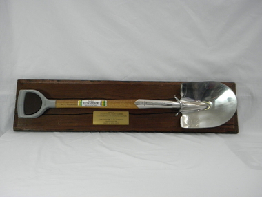
Memorabilia: Cyclone Sylvaspade, Australian Bicentenary 1988, Cyclone Sylvaspade - Senator Graham Richardson planted a tree using this spade at Sovereign Hill Outdoor Museum to mark ATCV's work at the Australian Bicentennial, 1988 (exact)
... This object is historically significant because it is a memento of a significant national event, the 200th anniversary of European settlement and the start of a process of environmental change which has had negative consequences and which demands a commitment to conserving the uniques Australian national environment. ...The spade is a memento of the planting of a tree by the responseible Commonealth Minister to recognise the contribution of ATCV and ATCV volunteers to repair of the Australian environment. At the time ATCV had been operating in Ballarat for six years. ATCV volunteers had planted 192,000 trees from April 1987- March 1988. Senator Richardson was then Minister for the Arts and the Environment in the Hawke ALP Government and on 17 November 1988 he planted a tree using this spade at Sovereign Hill Outdoor Museum (at which ATCV volunteers had planted trees which are (by 2010) fully grown and a significant feature of the site). Peter Hiscock was director of Sovereign Hill as well as President of ATCV and among the most significant leaders of ATCV (now CVA). The spade also symbolises the recovery of ATCV (then a small and struggling community group) from near closure owing to the effects of the 1987 recession. The Cyclone Sylvaspade concept was component project of the Australian Bicentennial celebrations aimed at recognising organisations which had contributed positively to conservation of Australia's environment. The concept was originated and driven by Dr Wilf Crane of the CSIRO Division of Forestry and a highly regarded forester and environmentalist and champion of the cause of rejuvenating Australia's degraded landscape with trees. At the naming of a road after him in Canberra he was described as a: "enthusiast, a man of conviction, action, humility and simplicity". Wilf conceived the project, developed the tree planting spade with Boral Cyclone and the Institute of Foresters of Australia and launched it with the then Governor-General Sir Ninian Stephens at the new Parliament House. Cyclone has been a brand name for a manufacturer of good quality hand tools for over a century. It is likely manufacturing was still done in Australia at the time of manufacture of the Sylvaspade. Much of it has now moved offshore, particuarly to China and Taiwan.This object is historically significant because it is a memento of a significant national event, the 200th anniversary of European settlement and the start of a process of environmental change which has had negative consequences and which demands a commitment to conserving the uniques Australian national environment. It recognised the achievement of ATCV in tree planting over six years. The Cyclone Sylvaspade is a practical memento and having the responsible Commonwealth Minister plant a tree with it was highly symbolic of ATCV's practical commitment to repair of our environment all over Australia. It was also used by the Victorian Premier, Hon John Brumby, to plant a tree at the reopening of the Boral Asphalt plant, Ballarat, in April 2010. The spade is No. 12 of a limited edition. This item is a functional tree planting spade called a "Cyclone Sylvaspade", mounted on a block of wood with a plaque. The handle of the spade is made of grey plastic, the haft is light, stained wood, and the blade is manufactured to resemble silver and has engravings. It was donated by the Boral company and presented to ATCV by the Minister of Arts and the Environment, Senator Graham Richardson after he had planted a tree to mark the occasion at Sovereign Hill Outdoor Museum, BallaratOn the stem of the spade here is a label showing the logo of the Boral company which reads "SYLVASPADE Tree Planting Spade - Made in Australia." On the blade is engraved "Cyclone - NUMBER 0012 - SYLVASPADE - 1788-1988" together with the logo of the Australian Bicentennial Authority. The spade is mounted on a sturdy polished wooden board on which there is a brass-coloured plate bearing the words: "PRESENTED BY SENATOR THE HON GRAHAM RICHARDSON TO AUSTRALIAN TRUST FOR CONSERVATION VOLUNTEERS IN RECOGNITION OF THEIR CONTRIBUTION TO THE ENVIRONMENT 17TH NOVEMBER 1988 DONATED BY BORAL LIMITED"of, trust, ballarat, memento, australian, australia, environment, conservation, atcv, for, volunteers, cyclone, sylvaspade, senator graham richardson, 1788 1988 australian, bicentennial, boral, spade, sovereign hill, 17th november 1988, 1988, minister for arts and environment, tree planting, institute, foresters, dr, wilf, crane -
 Conservation Volunteers
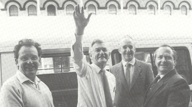
Photograph: Prime Minister Bob Hawke visits Ballarat and meets President of ATCV John Mewton and CEO Tim Cox
... Environmental...Carbon footprint...Climate change...CVA Conservation Volunteers Conservation Volunteers Australia Conservation Volunteers New Zealand Colin Jackson Better Earth Environmental Conservation Volunteers Volunteering Corporate volunteering Education – Environmental Carbon footprint Climate change Ballarat Safety Training Partnerships Victoria Vic NSW Queensland ACT Australian Capital Territory NT Northern Territory Western Australia WA South Australia SA Tasmania New Zealand Californi1a Conservation Corps ATCV Bob Hawke Prime Minister John Mewton Tim Cox Black and white photograph Photograph: Prime Minister Bob Hawke visits Ballarat and meets President of ATCV John Mewton and CEO Tim Cox Photograph: Prime Minister Bob Hawke visits Ballarat and meets President of ATCV John Mewton and CEO Tim Cox ...Prime Minister Bob HawkeAlthough determinedly apolitical ATCV/CVA has maintained good relations with all sides of politics.Black and white photographcva, conservation volunteers, conservation volunteers australia, conservation volunteers new zealand, colin jackson, better earth, environmental conservation, volunteers, volunteering, corporate volunteering, education – environmental, carbon footprint, climate change, ballarat, safety, training, partnerships, victoria, vic, nsw, queensland, act, australian capital territory, nt, northern territory, western australia, wa, south australia, sa, tasmania, new zealand, californi1a conservation corps, atcv, bob hawke, prime minister, john mewton, tim cox -
 Conservation Volunteers
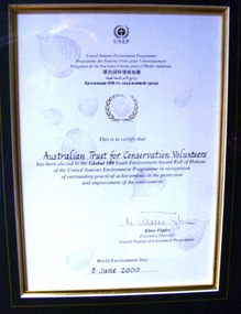
Award: Honour Roll, United Nations Environment Program (UNEP) - 1 June 2000 - The UNEP announced that the Australian Trust of Conservation Volunteers of Australia (ATCV), has been elected to the prestigious ranks of its Global 500 Roll of Honour for outstanding contributions to the protection of the environment, Award:United Nations Environment Program (UNEP) - 1 June 2000 - UNEP announced today that the ATCV has been elected to the prestigious ranks of its Global 500 Roll of Honour for outstanding contributions to the protection of the environment
... Environmental...Carbon footprint...Climate change...CVA Conservation Volunteers Conservation Volunteers Australia Conservation Volunteers New Zealand Colin Jackson Better Earth Environmental Conservation Volunteers Volunteering Corporate volunteering Education – Environmental Carbon footprint Climate change Ballarat Safety Training Partnerships Victoria Vic NSW Queensland ACT Australian Capital Territory NT Northern Territory Western Australia WA South Australia SA Tasmania New Zealand California Conservation Corps ATCV UNEP UNEP Honour Roll United Nations Environment Program Certificate Award:United Nations Environment Program (UNEP) - 1 June 2000 - UNEP announced today that the ATCV has been elected to the prestigious ranks of its Global 500 Roll of Honour for outstanding contributions to the protection of the environment. ...THE AUSTRALIAN TRUST OF CONSERVATION VOLUNTEERS, ONE OF 14 INDIVIDUALS AND ORGANIZATIONS, TO RECEIVE UNITED NATIONS ENVIRONMENT AWARD NAIROBI, 1 June 2000 - The United Nations Environment Programme (UNEP) announced today that the Australian Trust of Conservation Volunteers of Australia (ATCV), has been elected to the prestigious ranks of its Global 500 Roll of Honour for outstanding contributions to the protection of the environment. ATCV is one of 14 individuals and organizations to receive this honour in 2000. Founded in 1982, ATCV is a national, not-for-profit community organization, whose mission is to attract and manage a force of volunteers in practical conservation projects for the betterment of the Australian environment. ATCV completes more than 4000 week-long conservation projects in urban, regional and remote areas of Australia each year. Activities range from bush regeneration, tree planting, seed collection, endangered species protection, weed control, flora and fauna surveys, walking trail construction, fencing, environmental monitoring and the protection of world heritage areas. ATCV community participation has resulted in more than 1.8 million trees being planted in 1999, and in more than 7.3 million trees planted over the past 10 years. Community involvement totalled 200,000 project days in 1999 and more than 700,000 days since 1989. To encourage the involvement of young people, ATCV developed and manages the federal government-funded programme Green Corps. Green Corps is a six-month traineeship for 17 to 20 year-olds, which incorporates conservation projects and accredited training. Since 1997, more than 4,000 trainees have completed the Green Corps programme. ATCV is a founding member of the International Conservation Alliance, which brings together organizations working in conservation volunteering, and is a member of the World Conservation Union (IUCN). " The award will be presented in Adelaide, Australia, at the World Environment Day ceremonies on 4 June 2000. World Environment Day, which is celebrated in some 120 countries around the world on 5 June, was established by the United Nations General Assembly in 1972 to focus global attention and action on environmental issues. Some 701 individuals and organizations, in both the adult and youth categories, have been honoured since UNEP launched the Global 500 award in 1987. Among prominent past winners are: French Marine explorer Jacques Cousteau; Sir David Attenborough, producer of environmental television programmes; Gro Harlem Brundtland, former Prime Minister of Norway; Anil Aggarwal, the prominent environmentalist from India; Ken Saro-Wiwa, the environmental and human rights activist from Nigeria who was executed for leading the resistance of the Ogoni People against the pollution of their Delta homeland; the World Wide Fund for Nature (WWF), Jimmy Carter, former President of the United States; Jane Goodall of the United Kingdom whose research on wild chimpanzees and olive baboons provided insight into the lives of non-human primates; and the late Chico Mendes, the Brazilian rubber tapper who was murdered during his fight to save the Amazon forest. To forge global links and to implement ideas, which can contribute to a more sustainable future, a network of all Global 500 laureates has been formed. Information about this unique network can be obtained at http://www.global500.org. The winners of UNEP's Global 500 Roll of Honour are members of a broad and growing environmental movement that is flourishing around the world. They have taken the path that most of us hesitate to take for want of time or caring," says UNEP's Executive Director, Klaus Toepfer. "In honouring the Global 500 laureates, UNEP hopes that others will be inspired by their extraordinary deeds."Certificatecva, conservation volunteers, conservation volunteers australia, conservation volunteers new zealand, colin jackson, better earth, environmental conservation, volunteers, volunteering, corporate volunteering, education – environmental, carbon footprint, climate change, ballarat, safety, training, partnerships, victoria, vic, nsw, queensland, act, australian capital territory, nt, northern territory, western australia, wa, south australia, sa, tasmania, new zealand, california conservation corps, atcv, unep, unep honour roll, united nations environment program -
 Eltham District Historical Society Inc
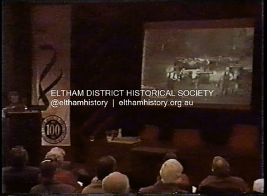
Film - Video (DVD), Melbourne and Metropolitan Board of Works, Yarra River Conference Proceedings; a Board of Works centenary event, 13-16 April 1991
... Tape 2 ( 1 1/2 hours) 1892-1934: People Begin to See Beauty and Romance to the River Henley-on-Yarra; realignment of the Yarra; MMBW is responsible for a sewerage system; new docks to cope with increased overseas trade; development of recreational parks; new reservoirs; timber production and timber tramways; bushfire; flood of 1934. 1935-1970: The River is Neglected Still, Except When it Proves Useful Bushfirs of 1939; the end of many sawmills; birth of tourism; increased interest in conservation and preservation of land for open space; further augmentation of water supply system; birth of containerisation changes the port; environmental concerns gain momentum. ...Tape 2 ( 1 1/2 hours) 1892-1934: People Begin to See Beauty and Romance to the River Henley-on-Yarra; realignment of the Yarra; MMBW is responsible for a sewerage system; new docks to cope with increased overseas trade; development of recreational parks; new reservoirs; timber production and timber tramways; bushfire; flood of 1934. 1935-1970: The River is Neglected Still, Except When it Proves Useful Bushfirs of 1939; the end of many sawmills; birth of tourism; increased interest in conservation and preservation of land for open space; further augmentation of water supply system; birth of containerisation changes the port; environmental concerns gain momentum. ...Yarra River Conference History Segment [Noted on VHS tape jackets "Due to unavoidable circumstances, the quality of these tapes in some setions is less than desired."] The Yarra River Conference, organised by the Board of Works as part of the Centenary Celebrations, was held in the Board's Head Office Theatrette from 13-16 April, 1991. A segment of the Conference focussed on the role that the Yarra River has played in relation to the historical development of Melbourne. Conceived and presented by a group of prominent historians as a chronological 'trip down the river in time', and profusely illustrated with slides, this segment traced the various impacts that urban and rural growth, development of marine commerce, recreational uses, and environmental problems have had on the Yarra during a century and a half of European occupation. As no formal written paper of this combined presentation is available, these two video-tapes provide a record for anyone who has an interest in tis fascinating aspect of the Yarra's history. The speakers who combined to present this segment are identified on the cover of Tape 2. Tape 1 (2 hours) 1838-1863 Deputy ?? to Utility Early navigators of the Yarra River; developing the port of Melbourne; the gold rush and its effect on the new colony; punts and bridges; water supply; pollution of the Yarra; the discovery of gold and early settlement of the Yarra valley; floods of 1839 and 1863. 1863-1891 Formation of the Harbour Trust; Coode Canal; pollution of the Yarra by industry; aborigines, gold miners, timber getters in the Upper Yarra areas; bridges; the flood of 1891. Tape 2 ( 1 1/2 hours) 1892-1934: People Begin to See Beauty and Romance to the River Henley-on-Yarra; realignment of the Yarra; MMBW is responsible for a sewerage system; new docks to cope with increased overseas trade; development of recreational parks; new reservoirs; timber production and timber tramways; bushfire; flood of 1934. 1935-1970: The River is Neglected Still, Except When it Proves Useful Bushfirs of 1939; the end of many sawmills; birth of tourism; increased interest in conservation and preservation of land for open space; further augmentation of water supply system; birth of containerisation changes the port; environmental concerns gain momentum. Speakers Dr Tony Dingle *, Department of Economic History, Monash University Dr Carolyn Rasmussen *, History Consultant Prof. Graeme Davison, History Department, Monash University Mr. Tom Griffiths, Lecturer in Public History, Monash Uiversity Mr. Patrick Miller, History Consultant Mr. Colin Jones, Author and Historian * Co-authors of the Board's history, 'Vital Connections'.video recording, yarra river, conference proceedings -
 Bendigo Historical Society Inc.
Document - FOSTERVILLE GOLD MINE COLLECTION: FOSTERVILLE GOLD PROJECT UPGRADE EXECUTIVE SUMMARUY
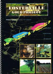
... Contents include: open pits, heap leaching, waste dumps, estimated project life, changes from previously approved project, estimated project life, main project components, expanded open pits and underground mines, processing sulphide ore, tailings storages, waste rock dumps. Principles of rehabilitation, site preparation, rehabilitation activities during operation and decommissioning activities. Environmental...Contents include: open pits, heap leaching, waste dumps, estimated project life, changes from previously approved project, estimated project life, main project components, expanded open pits and underground mines, processing sulphide ore, tailings storages, waste rock dumps. Principles of rehabilitation, site preparation, rehabilitation activities during operation and decommissioning activities. Environmental ...Black cover book, wire binding, 13 pages of text and maps. On front: Fosterville Gold Project' Map of ore body on cover - Central North, Central Ellesmere, Harringtons Hill. Contents include: open pits, heap leaching, waste dumps, estimated project life, changes from previously approved project, estimated project life, main project components, expanded open pits and underground mines, processing sulphide ore, tailings storages, waste rock dumps. Principles of rehabilitation, site preparation, rehabilitation activities during operation and decommissioning activities. Environmental issues, and summary of proposed new operating conditions.bendigo, mining, fosterville gold mine -
 The Beechworth Burke Museum
Photograph
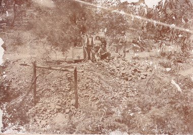
... changed several times throughout the nineteenth and twentieth centuries. Some sites were abandoned and forgotten, others were worked continuously over many decades. The names of mines were often repeated at different locations throughout the Victorian Goldfields. For example, there is a Mopoke Gully heritage mine near Fryers Creek, Victoria. 'Mopoke' is a common onomatopoeic name for Morepork and Australian Boobook owls. This image has historical, social and research significance for patterns of emigration during of the Victorian Gold Rush, and the historical, social and environmental ...This image is a reproduction of an 1899 original depicting the 'Williams Good Luck Mine' on the Mopoke Reef (also called 'Morepork Gully') in the Dingle Ranges, approximately three miles from Beechworth. A large opening to a mine can be seen behind the men in the photograph, with a wheeled cart on a track leading to the men's position, where the soil and rocks have been hauled away. This photograph interestingly contains dogs alongside the miners. While dogs have been recorded as deterrents to thieves in the Victorian goldfields, these dogs appear as companions to these men. Following the discovery of gold at Beechworth in 1852, rushes quickly followed at surrounding creeks and gullies in the district. In the late nineteenth and early twentieth centuries, small syndicates of miners continued to work old or abandoned quartz reefs, often persisting without the assistance of heavy machinery to remove the large amounts of rock, in order to obtain yields at ever greater depths. The group of miners in this photograph are Mr. Roger Williams and Sons, who revived operations at the ‘Old Good Luck’ mine on the Mopoke Reef in the Dingle Range near Beechworth around 1892, working the site for more than two decades. An emigrant from Cornwall with experience in the tin mining industry, 19 year old Roger Williams senior sailed to New Zealand in 1840, then to Australia where he spent time in the Bendigo Gold Fields before settling in Beechworth in the early 1860s. Mr Williams senior worked on various mining activities in the district, including the Rocky Mountain Tunnel project. Conversant with the character of gold-bearing reefs in the area, the syndicate dug an eight hundred foot tunnel, digging down as far down as two hundred feet with little capital save their labour, to connect and provide better working access to the mass of reefs and veins in the vicinity. Progress was hampered by poor air quality charged with fumes from dynamite and large quantities of rock had to be crushed to obtain payable yields. The Victorian Goldfields are filled with ruins and remnants of the area's rich mining history, ranging from small alluvial diggings to the remains of huge mining companies. Site names often changed several times throughout the nineteenth and twentieth centuries. Some sites were abandoned and forgotten, others were worked continuously over many decades. The names of mines were often repeated at different locations throughout the Victorian Goldfields. For example, there is a Mopoke Gully heritage mine near Fryers Creek, Victoria. 'Mopoke' is a common onomatopoeic name for Morepork and Australian Boobook owls.This image has historical, social and research significance for patterns of emigration during of the Victorian Gold Rush, and the historical, social and environmental impacts of mining at Beechworth at the turn of the nineteenth and twentieth centuries. As gold became scarce and government support and large company investment waned, poor hard-working miners laboured intensively to make a living through periods of high unemployment. This image can be compared and studied alongside other historical mining photographs and objects in the Burke Museum Collection. It has potential to improve our understanding of miners working conditions and the shifting character of mining in the Beechworth district.Sepia coloured rectangular photograph printed on gloss photographic paper mounted on card. Obverse: Williams/ Good/ Luck Reverse: A02498/ 1997. 2498/ Good Luck/ Mine/ 1899/ Mopoke. burke museum, beechworth museum, beechworth, gold fields, gold rush, victorian gold rush, gold ming history, colonial australia, australian gold rushes, mining technology, beechworth historic district, indigo gold trail, migration, indigo shire, good luck gold mine, victorian goldfields, mining syndicates, gold fever, quartz-mining, small-scale mining, old good luck mine, mopoke gully, quartz reefs beechworth -
 The Beechworth Burke Museum
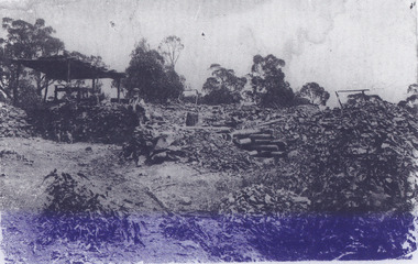
Photograph
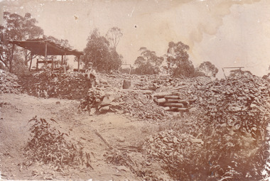
... changed several times throughout the nineteenth and twentieth centuries. Some sites were abandoned and forgotten, others were worked continuously over many decades. The names of mines were often repeated at different locations throughout the Victorian Goldfields. For example, there is a Mopoke Gully heritage mine near Fryers Creek, Victoria. 'Mopoke' is a common onomatopoeic name for Morepork and Australian Boobook owls. This image has historical, social and research significance for patterns of emigration during of the Victorian Gold Rush, and the historical, social and environmental ...This image is a reproduction of an 1899 original depicting the 'Williams Good Luck Mine' on the Mopoke Reef (also called 'Morepork Gully') in the Dingle Ranges, approximately three miles from Beechworth. The foreground of the image is littered with piles of smashed rock and detritus, known as ‘mullock’, beside a reinforced mine shaft, a vertical access passageway allowing miners to enter the mine and haul ore out using lifting technology such as a poppet heads, whims or windlasses. A group of miners and a dog appear close to an open-sided miner’s hut. Following the discovery of gold at Beechworth in 1852, rushes quickly followed at surrounding creeks and gullies in the district. In the late nineteenth and early twentieth centuries, small syndicates of miners continued to work old or abandoned quartz reefs, often persisting without the assistance of heavy machinery to remove the large amounts of rock, in order to obtain yields at ever greater depths. The group of miners in this photograph are Mr. Roger Williams and Sons, who revived operations at the ‘Old Good Luck’ mine on the Mopoke Reef in the Dingle Range near Beechworth around 1892, working the site for more than two decades. An emigrant from Cornwall with experience in the tin mining industry, 19 year old Roger Williams senior sailed to New Zealand in 1840, then to Australia where he spent time in the Bendigo Gold Fields before settling in Beechworth in the early 1860s. Mr Williams senior worked on various mining activities in the district, including the Rocky Mountain Tunnel project. Conversant with the character of gold-bearing reefs in the area, the syndicate dug an eight hundred foot tunnel, digging down as far down as two hundred feet with little capital save their labour, to connect and provide better working access to the mass of reefs and veins in the vicinity. Progress was hampered by poor air quality charged with fumes from dynamite and large quantities of rock had to be crushed to obtain payable yields. The Victorian Goldfields are filled with ruins and remnants of the area's rich mining history, ranging from small alluvial diggings to the remains of huge mining companies. Site names often changed several times throughout the nineteenth and twentieth centuries. Some sites were abandoned and forgotten, others were worked continuously over many decades. The names of mines were often repeated at different locations throughout the Victorian Goldfields. For example, there is a Mopoke Gully heritage mine near Fryers Creek, Victoria. 'Mopoke' is a common onomatopoeic name for Morepork and Australian Boobook owls.This image has historical, social and research significance for patterns of emigration during of the Victorian Gold Rush, and the historical, social and environmental impacts of mining at Beechworth at the turn of the nineteenth and twentieth centuries. As gold became scarce and government support and large company investment waned, poor hard-working miners laboured intensively to make a living through periods of high unemployment. This image can be compared and studied alongside other historical mining photographs and objects in the Burke Museum Collection. It has potential to improve our understanding of miners working conditions and the shifting character of mining in the Beechworth district.Sepia coloured rectangular photograph printed on gloss photographic paper mounted on card.Obverse: Reverse: A02497/ 1997.2497/ 'Good/ Luck/ Mine'/ Morepork/ Gully/ Mrs Joyce/ Bright/ Tunnel/ 800 ft/ 1899. burke museum, beechworth museum, beechworth, gold fields, gold rush, victorian gold rush, gold ming history, colonial australia, australian gold rushes, mining technology, beechworth historic district, indigo gold trail, migration, indigo shire, good luck gold mine, victorian goldfields, mining syndicates, gold fever, quartz-mining, small-scale mining, old good luck mine, mopoke gully, quartz reefs beechworth -
 The Beechworth Burke Museum
Postcard
... It also presents information on the environmental development or degradation for the area, with possible changes to the environment that may have been caused by human physical forces, natural decay or Global Warming. ...Black and white photograph depicts wide shot of Lake Kerford, where an older man stands with a horse and small carriage. On top of the carriage sits a small child, and both face towards the camera to pose. Photograph does not state when it was captured, but possibly been taken c. 1920.The postcard holds Historic significance due to its connection to Beechworth and its Lake Kerford. It demonstrates the interactions between nature and current European residents, especially how the lake has somewhat been 'protected' with the man made fencing and road. It also presents information on the environmental development or degradation for the area, with possible changes to the environment that may have been caused by human physical forces, natural decay or Global Warming. The social significance is due to the connection between the postcard and the individuals in the photograph.Black and white oval photograph on rectangular postcard, printed on card.Obverse: Lake Kerford / Beechworth Reverse: POST CARD / Stamp Here / Printed in Australia / This space may be used for Correspondence within the Commonwealth without extra postage / THIS SPACE IS FOR NAME AND ADDRESS / 84 - 108 - 1 / BMM3000lakes, lake kerford, beechworth, postcard, horse drawn carriage -
 The Beechworth Burke Museum
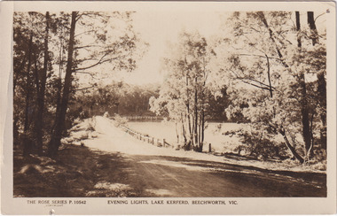
Photograph - Post Card, Rose Series Stereograph Co. Postcard
... It also presents information on the environmental development or degradation for the area, with possible changes to the environment that may have been caused by human physical forces, natural decay or Global Warming. ...The construction on Lake Kerferd began in 1862 however it wasn't completed until 1874 due to engineering and funding issues. The lake was named after George Briscoe Kerferd (1831–1889) who was responsible for Beechworth's water scheme. George Briscoe Kerferd was born on 21 January 1831 in Liverpool, England and arrived in Melbourne April 1853. He spent his first years in Australia in Bendigo before settling down in Beechworth as a wine and spirits merchant. He married Ann Martindale on 17th December 1853 at St James Cathedral, Melbourne and between them they had three sons and five daughters. Kerferd began his political and legal career in Beechworth when he was first elected to the Municipal Council in May 1857. Later he would be elected to the Legislative Assembly for the Ovens District in November 1864, and continued to represent the area until February 1886. The postcard holds Historic significance due to its connection to Beechworth and its Lake Kerford. It demonstrates the interactions between nature and colonialists, especially how the lake has somewhat been 'protected' with the man made fencing. It also presents information on the environmental development or degradation for the area, with possible changes to the environment that may have been caused by human physical forces, natural decay or Global Warming.Sepia rectangular postcard printed on paper.Obverse: The Rose Series P. 10542 / Copyright / Evening lights, Lake Kerferd, Beechworth, VIC Reverse: Farley / Published by the Rose Stereograph Co., / Armadale Victoria. / 84-132-1 / Post card / The "Rose" Series De Luxe / A Real Photograph Produced in Australia / BMM299 lake kerferd, beechworth, water scheme, water reserve, reservoir, legislative assembly, hon. george briscoe kerferd, catchments, beechworth water reserve, beechworth catchments, municipal council, st. james cathedral, lakes, reserve, water supply, political projects, rose series, postcard, rose series stereograph -
 The Beechworth Burke Museum
Photograph - Photograph - Reproduction, Unknown
... changed several times throughout the nineteenth and twentieth centuries. Some sites were abandoned and forgotten, others were worked continuously over many decades. The names of mines were often repeated at different locations throughout the Victorian Goldfields. For example, there is a Mopoke Gully heritage mine near Fryers Creek, Victoria. 'Mopoke' is a common onomatopoeic name for Morepork and Australian Boobook owls. This image has historical, social and research significance for patterns of emigration during of the Victorian Gold Rush, and the historical, social and environmental ...This image is a reproduction of an 1899 original depicting the 'Williams Good Luck Mine' on the Mopoke Reef (also called 'Morepork Gully') in the Dingle Ranges, approximately three miles from Beechworth. The foreground of the image is littered with piles of smashed rock and detritus, known as ‘mullock’, beside a reinforced mine shaft, a vertical access passageway allowing miners to enter the mine and haul ore out using lifting technology such as a poppet heads, whims or windlasses. A group of miners and a dog appear close to an open-sided miner’s hut. Following the discovery of gold at Beechworth in 1852, rushes quickly followed at surrounding creeks and gullies in the district. In the late nineteenth and early twentieth centuries, small syndicates of miners continued to work old or abandoned quartz reefs, often persisting without the assistance of heavy machinery to remove the large amounts of rock, in order to obtain yields at ever greater depths. The group of miners in this photograph are Mr. Roger Williams and Sons, who revived operations at the ‘Old Good Luck’ mine on the Mopoke Reef in the Dingle Range near Beechworth around 1892, working the site for more than two decades. An emigrant from Cornwall with experience in the tin mining industry, 19 year old Roger Williams senior sailed to New Zealand in 1840, then to Australia where he spent time in the Bendigo Gold Fields before settling in Beechworth in the early 1860s. Mr Williams senior worked on various mining activities in the district, including the Rocky Mountain Tunnel project. Conversant with the character of gold-bearing reefs in the area, the syndicate dug an eight hundred foot tunnel, digging down as far down as two hundred feet with little capital save their labour, to connect and provide better working access to the mass of reefs and veins in the vicinity. Progress was hampered by poor air quality charged with fumes from dynamite and large quantities of rock had to be crushed to obtain payable yields. The Victorian Goldfields are filled with ruins and remnants of the area's rich mining history, ranging from small alluvial diggings to the remains of huge mining companies. Site names often changed several times throughout the nineteenth and twentieth centuries. Some sites were abandoned and forgotten, others were worked continuously over many decades. The names of mines were often repeated at different locations throughout the Victorian Goldfields. For example, there is a Mopoke Gully heritage mine near Fryers Creek, Victoria. 'Mopoke' is a common onomatopoeic name for Morepork and Australian Boobook owls. This image has historical, social and research significance for patterns of emigration during of the Victorian Gold Rush, and the historical, social and environmental impacts of mining at Beechworth at the turn of the nineteenth and twentieth centuries. As gold became scarce and government support and large company investment waned, poor hard-working miners laboured intensively to make a living through periods of high unemployment. This image can be compared and studied alongside other historical mining photographs and objects in the Burke Museum Collection. It has potential to improve our understanding of miners working conditions and the shifting character of mining in the Beechworth district. Black and white rectangular reproduction photograph printed on matte photographic paper.Obverse: Williams Good Luck Mine Beechworth / Roger! / Reverse: 6858 / burke museum, beechworth museum, beechworth, gold fields, gold rush, victorian gold rush, gold ming history, colonial australia, australian gold rushes, mining technology, beechworth historic district, indigo gold trail, migration, indigo shire, good luck gold mine, victorian goldfields, mining syndicates, gold fever, quartz-mining, small-scale mining, old good luck mine, mopoke gully, quartz reefs beechworth -
 The Beechworth Burke Museum
Photograph, 1920-1950
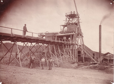
... This photograph has historic and research potential for understanding changes to the landscape, the evolution of mining methods, and the extensive construction, manipulation and management of water networks in the Beechworth district. burke museum beechworth museum beechworth gold fields gold rush victorian gold rush hydraulic sluicing spring creek netwown falls mining tunnels water races tailraces gold ming history colonial australia australian gold rushes mining technology beechworth historic district indigo gold trail indigo shire john pund water manipulation water engineering three mile creek three mile mine water race large-scale mining methods historical mining construction alluvial mining mining environmental impacts baarmutha water barons Reverse: 7597-1 / Sluice Mining / Copied from original on loan from Webb (Qld) / Donated Nov 2009 / Baarmutha Three Mile Mine c1920-1950 / Managed by the Plain Bros then Parkinsons / Current Location is: Beechworth Animal Shelter / used for Baarmutha Black and white rectangular photograph on matte paper Photograph Photograph ...This image taken between 1920-1930 depicts open-cut hydraulic sluicing at the Three Mile Mine, located about five kilometres south of Beechworth. Alluvial, or surface, mining began on this site in the 1850s, but was soon replaced by hydraulic sluicing methods. By the start of 1880 it is estimated that nine hundred miles of water races had been cut though soil and rock in the Beechworth district. Hydraulic sluicing employs high pressure jets of water to blast away large areas of earth and wash it down to be run through a sluice box. Gold gets caught in the sluice and the remaining slurry is washed away. Large water quantities were required for hydraulic sluicing, and the long water races and deep tailraces that were constructed were considered great engineering feats. This method of mining is extremely effective, but causes significant environmental damage and impacts to waterways and agricultural operations. Miners at Beechworth built extensive networks of races and dams to secure reliable supplies of water on a scale far greater than elsewhere in Victoria. By the 1880s Beechworth's water barons continued to hold more than half of all the water right licences on issue and undertook sluicing operations on a massive scale. The manipulation of surface and ground water via race networks was well planned and recorded in detail by local mining surveyors. The maps that were created, combined with modern geo-spatial technologies, provide a vital key in understanding the great lengths to which miners went to capture and control critical water resources. Today, Three Mile mine is called Baarmutha. The Three Mile Mine was unproductive until 1865 when John Pund and three other miners secured a fifteen year license and constructed a water race from Upper Nine Mile Creek to Three Mile Creek. In the early twentieth century Pund & Co. averaged over one thousand ounces of gold per year from the mine. After Pund's death in 1915, GSG Amalgamated Co operated the site, continuing sluicing until 1950. This image of hydraulic sluicing methods shows the extent of water-works engineering in the landscape. This photograph has historic and research potential for understanding changes to the landscape, the evolution of mining methods, and the extensive construction, manipulation and management of water networks in the Beechworth district. Black and white rectangular photograph on matte paperReverse: 7597-1 / Sluice Mining / Copied from original on loan from Webb (Qld) / Donated Nov 2009 / Baarmutha Three Mile Mine c1920-1950 / Managed by the Plain Bros then Parkinsons / Current Location is: Beechworth Animal Shelter / used for Baarmuthaburke museum, beechworth museum, beechworth, gold fields, gold rush, victorian gold rush, hydraulic sluicing, spring creek, netwown falls, mining tunnels, water races, tailraces, gold ming history, colonial australia, australian gold rushes, mining technology, beechworth historic district, indigo gold trail, indigo shire, john pund, water manipulation, water engineering, three mile creek, three mile mine, water race, large-scale mining methods, historical mining construction, alluvial mining, mining environmental impacts, baarmutha, water barons -
 The Beechworth Burke Museum
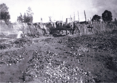
Photograph
... The Ovens was also heavily impacted environmentally as deep mining resulted in the change in land formation....The Ovens was also heavily impacted environmentally as deep mining resulted in the change in land formation. ...This photograph depicts four men standing near a large unidentified building. This building is the entrance to a deep lead mine shaft. There is a bridge entering the building, which was used to access the elevator to the shaft. Deep lead mining involved placing large shafts into the ground which miners use to access deeper locations in order to excavate the rocks in the search for lead. Deep lead mining was highly dangerous as roofs could cave in of the soil was loose. Therefore, this particular mining considered to be highly undesirable profession as many miners did not want to work long hours nor risk their lives in the search for lead. Indigo Shire was a large area where deep lead mining took place, and thus the landscape and environment was largely impacted by these mining businesses. The Indigo Shire grew in population and wealth in the early 1850s when people came into this location in the hopes of finding gold and making a fortune. Ultimately, the accessibility and availability of gold and precious metals decreased once the gold reserves dried up and alongside this, the large population moved away. The Ovens was also heavily impacted environmentally as deep mining resulted in the change in land formation.The search for gold is ingrained into the history of Victoria and therefore, images like this one which portray an open cut sluicing site can reveal important information for society and technology for the date when the photograph was taken. This image is of important historical significance for its ability to convey information about the methods used to find gold in Indigo Shire. It also shows a location where deep mining was undertook which provides insight into the impact of deep mining on the environment at a time when it was done. This image is important for current research into the history of Indigo Shire, a region in Victoria's north-east. Therefore, this image has the capacity to be beneficial for research into society and the motivations of those living and working in this region during this period and therefore, has social significance. The Beechworth Burke Museum has additional images relating to deep lead mining and Indigo Shire which can be analysed and studied alongside images like this one.Sepia coloured retangular photo printed on gloss photographic paper.Reverse: 1997, 2510/ A02570/ Deep Lead Mining/ page 94/ 65%/ Burke Museum, Photo 44beechworth, burke museum, indigo shire, deep lead mining, mining, gold, gold mining -
 Greensborough Historical Society
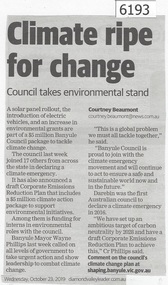
Newspaper Clipping, Diamond valley Leader, Climate ripe for change, 23/10/2019
... ...Environmental change...A solar panel rollout, the introduction of electric vehicles, and an increase in environmental grants are part of a $5 million Banyule Council package to tackle climate change....Greensborough Historical Society 34A Glenauburn Road Lower Plenty Lower Plenty melbourne A solar panel rollout, the introduction of electric vehicles, and an increase in environmental grants are part of a $5 million Banyule Council package to tackle climate change. banyule city council Environmental change News article 1 page, black text. ...A solar panel rollout, the introduction of electric vehicles, and an increase in environmental grants are part of a $5 million Banyule Council package to tackle climate change.News article 1 page, black text.banyule city council, environmental change -
 Phillip Island and District Historical Society Inc.
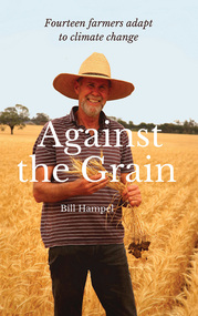
Book, Bill Hampel, Against the grain : fourteen farmers adapt to climate change, 2015
... A summary of climate change impacts - and an account of the numerous economic, political, and media barriers toward change - combine to provide a context for their work. agriculture -- environmental aspects -- australia. farmers -- australia -- economic conditions. rural development -- australia. climatic changes -- australia. ...Can we humans simply ignore the fires, the floods, and the increase in deaths brought about by climate change? In this book, Australian farmers - who bear the brunt of climate change, yet accept the science - share their experiences with the unpredictable weather events, the reduction in rainfall, and the shift to hotter months which are a challenge to farming cycles. Far from contributing to the problem with their farming practices, these farmers demonstrate how to reduce their greenhouse gases - to zero or below in some cases - while remaining profitable. They are all committed to pass on their farm in a better condition than when they first purchased or inherited it. With crops or livestock, big or small, they have worked cooperatively, mostly through land management, to plant thousands of trees, which has led to the daily presence of over 100 bird species. The farmers' inspiring and informative stories will open up a new world to most urban dwellers. A summary of climate change impacts - and an account of the numerous economic, political, and media barriers toward change - combine to provide a context for their work. 280 pages : colour illustrations, colour maps, colour portraits ; 23 cm. Includes bibliographical references and index. Also available in digital formats: ebook & epdf. ISBN 9781925078503 Dewey number 338.10994 Chapter 5 : Bob & Anne Davie Donor : Anne Davie ; Date : 14.10.2015.agriculture -- environmental aspects -- australia., farmers -- australia -- economic conditions., rural development -- australia., climatic changes -- australia. -
 Melbourne Water
I'm not a Wally with Water badge, 1980s
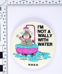
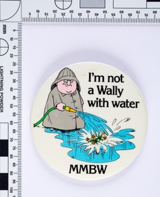
... environmentally and financially. Wally was both a cartoon character and played on television by the comedian Peter Moon. The campaign ran for several years and was designed to change attitudes towards water wastage. ...environmentally and financially. Wally was both a cartoon character and played on television by the comedian Peter Moon. The campaign ran for several years and was designed to change attitudes towards water wastage. ...Following the 1983 Victorian drought The Board of Works (MMBW) ran a television, radio and print campaign to encourage water conservation called ‘Don’t Be a Wally with Water’. The campaign followed Wally, a bumbling, habitual water waster, and is an early example of educating the public on water sustainability both environmentally and financially. Wally was both a cartoon character and played on television by the comedian Peter Moon. The campaign ran for several years and was designed to change attitudes towards water wastage. This MMBW branded item is associated with ‘Don’t Be a Wally with Water’ campaign, and demonstrates an early water sustainability education program. These badges would have been given out as promotional merchandise and at public events. Round metal badge with printed cartoon image and text. -
 Melbourne Water
I'm not a Wally with Water badge, 1980s
... environmentally and financially. Wally was both a cartoon character and played on television by the comedian Peter Moon. The campaign ran for several years and was designed to change attitudes towards water wastage....environmentally and financially. Wally was both a cartoon character and played on television by the comedian Peter Moon. The campaign ran for several years and was designed to change attitudes towards water wastage. ...Following the 1983 Victorian drought The Board of Works (MMBW) ran a television, radio and print campaign to encourage water conservation called "Don't Be a Wally with Water". The campaign followed Wally, a bumbling, habitual water waster, and is an early example of educating the public on water sustainability both environmentally and financially. Wally was both a cartoon character and played on television by the comedian Peter Moon. The campaign ran for several years and was designed to change attitudes towards water wastage.This MMBW branded item is associated with "Don't Be a Wally with Water" campaign, and demonstrates an early water sustainability education program. These badges would have been given out as promotional merchandise and at public events.Round metal badge with printed cartoon image and text. -
Glenelg Shire Council Cultural Collection
Booklet - Program, Portland Upwelling Festival 2010, 2010
... environmental phenomenon – the Bonney Upwelling. The Bonney Upwelling is a unique and epic natural ocean phenomena where the spring winds shift to the south-east driving a change in ocean currents that powers a seven month feeding frenzy of tuna, crayfish, giant crabs, squid, fish, seabirds, seals, krill and blue whales. ...environmental phenomenon – the Bonney Upwelling. The Bonney Upwelling is a unique and epic natural ocean phenomena where the spring winds shift to the south-east driving a change in ocean currents that powers a seven month feeding frenzy of tuna, crayfish, giant crabs, squid, fish, seabirds, seals, krill and blue whales. ...Program for the 2010 Upwelling Festival. The Upwelling Festival Portland is a community celebration of the Bonney Upwelling, presented by the Upwelling Festival Incorporated and including a partnership with other community groups. The Upwelling Festival celebrates what is unique about Portland and the community and show cases an important environmental phenomenon – the Bonney Upwelling. The Bonney Upwelling is a unique and epic natural ocean phenomena where the spring winds shift to the south-east driving a change in ocean currents that powers a seven month feeding frenzy of tuna, crayfish, giant crabs, squid, fish, seabirds, seals, krill and blue whales. An incredibly rich ecological food web, the Upwelling is at its greatest off the coast of Portland and is the cornerstone of the lucrative local fishing and tourism industry. The Festival is a free event maintaining the key elements of the Blessing of the Fleet, Street Parade, Festival markets, local entertainment, Marine Environment Talks and community art projects on the site.Upwelling FestivalA4 sheet folded in 4, to make program advertising Upwelling Festival 2010. Glossy white paper, illustrations on front cover in blues, greens. Back cover sponsors logos. Inside pages, Festival explanation and list of events. Two copies.upwelling festival, events, tourism, whales, portland -
 Federation University Historical Collection
Booklet, Eugene Kneebone, Explore Discover Apply: University of Ballarat Research Report, 2007, 2007
... It includes information on: * Institute for Regional and Rural Research and Innovation * Centre for Regional Innovation and Competitiveness * Teaching to Global Citizenship * Older BLokes and Their Sheds: Community based Men's Sheds in Australia * Education and Re-education in Child Sexual Abuse * Water Demand Management and Climate Change * An Indigenous History of Stonington * Key Drivers of Change in Adult and Community Education * Benchmaking Research * Training for Child Protection * Grabbing a Lifeline to Better Health * Enhancing Nurse Preparation for health care practice * ACT for depression in adolescence * FRom Pokies to Peremptory PErsonal Pleasures * Worksafe Awards * Mineral Sands that are not sinking * Rising Generation Inspired by Trace Elements * Environmental Research from Namibia to Ballarat * Evaluation of VicHealth Sport & Physical Activity Programs * A good Hard Look at Sports Grounds * Preventing Knee Injuries inn Community Australian Football * WIDCORP Beyond the Pipelines *Woodside Energy Ltd Optimizes its Production * Australian Defence Force Seeks Best Fit * Mapping Augmentation Structures Images include: David Battersby, Wayne Robinson, Joel Epstein, Georgina Tsolidis, Barry Golding, Caroline Taylor, Julian Lowe, Laura Kostanski, Ian D. ...It includes information on: * Institute for Regional and Rural Research and Innovation * Centre for Regional Innovation and Competitiveness * Teaching to Global Citizenship * Older BLokes and Their Sheds: Community based Men's Sheds in Australia * Education and Re-education in Child Sexual Abuse * Water Demand Management and Climate Change * An Indigenous History of Stonington * Key Drivers of Change in Adult and Community Education * Benchmaking Research * Training for Child Protection * Grabbing a Lifeline to Better Health * Enhancing Nurse Preparation for health care practice * ACT for depression in adolescence * FRom Pokies to Peremptory PErsonal Pleasures * Worksafe Awards * Mineral Sands that are not sinking * Rising Generation Inspired by Trace Elements * Environmental Research from Namibia to Ballarat * Evaluation of VicHealth Sport & Physical Activity Programs * A good Hard Look at Sports Grounds * Preventing Knee Injuries inn Community Australian Football * WIDCORP Beyond the Pipelines *Woodside Energy Ltd Optimizes its Production * Australian Defence Force Seeks Best Fit * Mapping Augmentation Structures Images include: David Battersby, Wayne Robinson, Joel Epstein, Georgina Tsolidis, Barry Golding, Caroline Taylor, Julian Lowe, Laura Kostanski, Ian D. ...University of Ballarat is a predecessor institution of Federation University AustraliaPredominantly white and gold soft covered book outlining Research at the University of Ballarat. It includes information on: * Institute for Regional and Rural Research and Innovation * Centre for Regional Innovation and Competitiveness * Teaching to Global Citizenship * Older BLokes and Their Sheds: Community based Men's Sheds in Australia * Education and Re-education in Child Sexual Abuse * Water Demand Management and Climate Change * An Indigenous History of Stonington * Key Drivers of Change in Adult and Community Education * Benchmaking Research * Training for Child Protection * Grabbing a Lifeline to Better Health * Enhancing Nurse Preparation for health care practice * ACT for depression in adolescence * FRom Pokies to Peremptory PErsonal Pleasures * Worksafe Awards * Mineral Sands that are not sinking * Rising Generation Inspired by Trace Elements * Environmental Research from Namibia to Ballarat * Evaluation of VicHealth Sport & Physical Activity Programs * A good Hard Look at Sports Grounds * Preventing Knee Injuries inn Community Australian Football * WIDCORP Beyond the Pipelines *Woodside Energy Ltd Optimizes its Production * Australian Defence Force Seeks Best Fit * Mapping Augmentation Structures Images include: David Battersby, Wayne Robinson, Joel Epstein, Georgina Tsolidis, Barry Golding, Caroline Taylor, Julian Lowe, Laura Kostanski, Ian D. Clark, Jessie Harman, Patrick White, Angela Murphy, Katrina Brown, John McDonald, Robert Watson, Sally Wellard, Louise Hayes, Stephen Cowley, Susan Leggett, Steve Hall, Stafford McKnight, Larissa Koroznikova, Patrick Graz, David Stratton, Andrew Stranieri, John Yearwood widcorp, water in drylands collaborative research project, eugene kneebone