
Showing 47 items matching "farm infrastructure"
-
 Friends of Westgarthtown
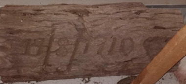
Sign - Wooden fence post sign, 1910
... ...farm infrastructure...The inscription '1910' records the year in which the gate post was installed, reflecting a practice of marking significant improvements to the farm's infrastructure. Henry Ziebell recalled that dates were chiselled into gate posts to record when they were installed. ...The inscription '1910' records the year in which the gate post was installed, reflecting a practice of marking significant improvements to the farm's infrastructure. Henry Ziebell recalled that dates were chiselled into gate posts to record when they were installed. ...This date marker was originally located on a gate post at the entrance to the Ziebell family farm at Westgarthtown, Thomastown, Victoria. The inscription '1910' records the year in which the gate post was installed, reflecting a practice of marking significant improvements to the farm's infrastructure. Henry Ziebell recalled that dates were chiselled into gate posts to record when they were installed. He identified Joe Adams as having been responsible for chiselling at least one of these dates, although it is not confirmed whether he inscribed this particular example. The marker provides a tangible connection to the development and maintenance of the Ziebell family farm during the early twentieth century, documenting a practical tradition associated with the construction of farm entrances and boundary fencing. The marker was donated to Ziebell's Farmhouse Museum by Lyn and James Ziebell.Date marker bearing the inscription '1910', originally located on a gate post at the entrance to the Ziebell family farm at Westgarthtown, Thomastown, Victoria.19/08/1910gate post, date marker, 1910, joe adams, farm entrance, farm infrastructure, westgarthtown, ziebell family. -
 Myrtleford and District Historical Society
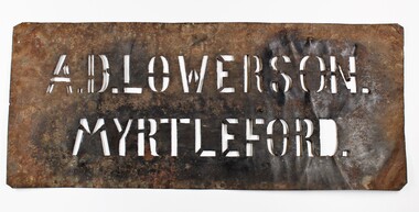
Tobacco bale stencil
... His success and status enabled him to lead a submission on farm debt and infrastructure problems when the soldier settlement scheme was being reviewed at government level. ...His success and status enabled him to lead a submission on farm debt and infrastructure problems when the soldier settlement scheme was being reviewed at government level. ...Stencil used by Sgt. Albert David Lowerson, VC, a soldier settler on Merriang Estate near Myrtleford. Lowerson acquired one of 19 blocks assigned by the Closer Settlement Board on the 700 acre estate in 1920. The stencil marked bales of cured tobacco leaves prior to shipment to Melbourne. Lowerson was one of the few successful soldier settler farmers in the district, operating a piggery, dairy farming and growing tobacco for almost 20 years on "St. Quentin". (Lowerson was awarded the Victoria Cross at Mont St. Quentin on September 1, 1918.) His success and status enabled him to lead a submission on farm debt and infrastructure problems when the soldier settlement scheme was being reviewed at government level. He was active locally on these issues and supported fund raising for a war memorial, memorial hall and veteran welfare.The stencil represents the achievements of A.D.Lowerson, VC as an isolated example of success as a WW1 soldier settler and as a local identity who stridently supported the need for recognition and support of ex-service personnel.Stencil made of thin sheet metal, rusted .Wording of stencil "A.D.LOWERSON. MYRTLEFORD." lowerson a.d., merriang estate, myrtleford, closer settlement board, tobacco, st. quentin, victoria cross, world war 1 -
 The Beechworth Burke Museum
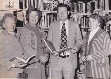
Audio - Oral History, Jennifer Williams, Mrs Val Mason, 5 January 2001
... Mason was instrumental in introducing a 'paddock to plate' philosophy and business model, opening a butcher shop on the farm in 1973. Concerned with improving infrastructure and developing economic opportunities in the region, Mrs. ...Mason was instrumental in introducing a 'paddock to plate' philosophy and business model, opening a butcher shop on the farm in 1973. Concerned with improving infrastructure and developing economic opportunities in the region, Mrs. ...Mrs. Valerie (Val) Mason (1927-2019) was a local sheep farmer, business-woman, Beechworth shire councillor, and mother to five children. With her husband, Charles, Mrs. Mason developed and managed the Big Valley farm estate, at Everton, which is now part of a vineyard and farm stay. Mrs. Mason was instrumental in introducing a 'paddock to plate' philosophy and business model, opening a butcher shop on the farm in 1973. Concerned with improving infrastructure and developing economic opportunities in the region, Mrs. Mason successfully stood as a local council representative for South Riding in the United Shire of Beechworth, and later become the first woman Shire President in 1979. Mrs Mason was a member of the local Business and Professional Women's Club for 37 years. This oral history recording was part of a project conducted by Jennifer Williams in the year 2000 to capture the everyday life and struggles in Beechworth during the twentieth century. This project involved recording seventy oral histories on cassette tapes of local Beechworth residents which were then published in a book titled: 'Listen to what they say: voices of twentieth century Beechworth. These cassette tapes were digitised in July 2021 with funds made available by the Friends of the Burke.Mrs. Mason's story is historically significant for understanding economic and social changes in the Beechworth region during the latter half of the twentieth century. As a council representative, issues such as road and infrastructure modernisation and the transition from traditional government employment sectors, like Beechworth's care institutions, were challenges for local government. As a farmer and local employer, Mrs. Mason's story is testimony to the region's economic diversification as businesses like Big Valley farm shop helped shape the region's contemporary character. Mrs. Mason was among the first women to broach the traditionally all-male Beechworth Council Chambers and her story is socially significant for understanding the changing role of women in rural and regional Australia. This oral history recording offers interpretive capacity for social history themes and may be compared with other oral histories in the Burke Museum's collection. This oral history account is socially and historically significant as it is a part of a broader collection of interviews conducted by Jennifer Williams which were published in the book 'Listen to what they say: voices of twentieth-century Beechworth.' While the township of Beechworth is known for its history as a gold rush town, these accounts provide a unique insight into the day-to-day life of the town's residents during the 20th century, many of which will have now been lost if they had not been preserved.This is a digital copy of a recording that was originally captured on a cassette tape. The cassette tape is black with a horizontal white strip and is currently stored in a clear flat plastic rectangular container. It holds up 40 minutes of recordings on each side.Mrs Val Mason /listen to what they say, beechworth, oral history, burke museum, working women, trail blazers, farm to plate, farm shop, paddock to plate, woman farmer, united shire of beechworth, rural and regional women, beechworth's first woman shire president, women in leadership positions, women leaders, australian settlement history, settler societies, victorian gold rush, heritage tourism, culinary tourism, regional land use, indigo winery, farm stay, social history -
 The Beechworth Burke Museum
Audio - Oral History, Jennifer Williams, Mrs Vanessa McDonald, 9 November 2000
... farm, and roaming the hills for wildflowers. As a young woman Mrs. McDonald attended religious and social gatherings in the local community. In 1940 she went to Melbourne to work as a mothercraft nurse during the Second World War. She met her husband at a Beechworth football match and was married at the Stanley Methodist Church in 1941. The gold diggings known as the 'Nine Mile' became the hamlet of Stanley, after the British Prime Minister, Lord Stanley, in 1858. By the late 1850s, Stanley boasted schools, an athenaeum, a church, a weekly newspaper and several hotels and other civic infrastructure...farm, and roaming the hills for wildflowers. As a young woman Mrs. McDonald attended religious and social gatherings in the local community. In 1940 she went to Melbourne to work as a mothercraft nurse during the Second World War. She met her husband at a Beechworth football match and was married at the Stanley Methodist Church in 1941. The gold diggings known as the 'Nine Mile' became the hamlet of Stanley, after the British Prime Minister, Lord Stanley, in 1858. By the late 1850s, Stanley boasted schools, an athenaeum, a church, a weekly newspaper and several hotels and other civic infrastructure ...Mrs. Vanessa McDonald was born in Beechworth in 1917. Christened, Agnes Bertha Collins, Vanessa changed her name in 1960. Mrs. McDonald's family's connection with gold mining in the district reach back to the first of Beechworth's gold rushes, when her great grandfather, a Dutchman who adopted the name Charles Collins, arrived in 1851-1852. Mrs. McDonald spent her childhood in the isolated hamlet of Stanley, in the area known as 'Little Scotland', where she recalls helping her mother to raise younger siblings, picking apples and walnuts on the family farm, and roaming the hills for wildflowers. As a young woman Mrs. McDonald attended religious and social gatherings in the local community. In 1940 she went to Melbourne to work as a mothercraft nurse during the Second World War. She met her husband at a Beechworth football match and was married at the Stanley Methodist Church in 1941. The gold diggings known as the 'Nine Mile' became the hamlet of Stanley, after the British Prime Minister, Lord Stanley, in 1858. By the late 1850s, Stanley boasted schools, an athenaeum, a church, a weekly newspaper and several hotels and other civic infrastructure to cater for a growing population. The area attracted large numbers of Chinese miners, whose presence was frequently resisted. Like other early Victorian mining settlements, Stanley was a hotbed of political and racial tensions during the gold rush. One side of the Nine Mile Creek was known as 'Little Scotland’, the other, 'Little Ireland'. A number of Christian denominations built congregations and churches in Stanley, including the Church of England, Methodist Church, the Catholic Church, and Presbyterian Church. Stanley became part of the United Shire of Beechworth in 1871. By 1880 timber was being cut and two sawmills were established by 1887. River-dredged gold mining consumed vast amounts of timber from the forests in the area, and in 1931 the first of several softwood plantations began. This oral history recording was part of a project conducted by Jennifer Williams in the year 2000 to capture the everyday life and struggles in Beechworth during the twentieth century. This project involved recording seventy oral histories on cassette tapes of local Beechworth residents which were then published in a book titled: 'Listen to what they say: voices of twentieth century Beechworth'. These cassette tapes were digitised in July 2021 with funds made available by the Friends of the Burke.Following the decline in the mining and associated industries during the early-mid-twentieth century, the Beechworth district experienced a period of general economic decline. On the east side of the Dingle Range, Mrs. McDonald's father, William Henry Collins, felled timber and the family were pioneer apple orchardists. The establishment of apple orchards in Stanley reflects changes to how land was used and contributes to our understanding of the historical development of rural communities following the gold rush. Mrs. McDonald's recollections are significant for understanding family and social life in a small rural town in years leading up to the Great Depression and prior to the Second World War. This oral history recording may be compared with other oral histories and items in the Burke Museum's collection. This oral history account is socially and historically significant as it is a part of a broader collection of interviews conducted by Jennifer Williams which were published in the book 'Listen to what they say: voices of twentieth-century Beechworth.' While the township of Beechworth is known for its history as a gold rush town, these accounts provide a unique insight into the day-to-day life of the town's residents during the 20th century, many of which will have now been lost if they had not been preserved.This is a digital copy of a recording that was originally captured on a cassette tape. The cassette tape is black with a horizontal white strip and is currently stored in a clear flat plastic rectangular container. It holds up 40 minutes of recordings on each side.Mrs Vanessa McDonald /listen to what they say, beechworth, oral history, burke museum, emigration, gold rush immigration, victorian gold rush, mining families, apple orchard, forestry, forest plantation, little scotland, stanley, twentieth century history, regional australia, rural australia, farming, harvest festival, great depression, dingle range, the nine mile, australian wildflowers, high country wildflowers, mothercraft nurse, rural and regional women, social history, collins, mrs. vanessa mcdonald, building community life, shaping cultural and creative life, fruit growers, family history, changes to land use in regional victoria -
 The Beechworth Burke Museum
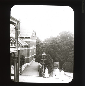
Photograph - Lantern Slide, c1900
... farm work and making clothes. She mentions a report in 1870 that the approximately 300 patients were clean and neat with 'no-one in restraint or seclusion' but that by 1905 the organisation had 623 patients which placed strain on building infrastructure such as heating and water supplies, leading to high turnover of nurses and other issues. ...farm work and making clothes. She mentions a report in 1870 that the approximately 300 patients were clean and neat with 'no-one in restraint or seclusion' but that by 1905 the organisation had 623 patients which placed strain on building infrastructure such as heating and water supplies, leading to high turnover of nurses and other issues. ...This image appears to show nurses at what is now the Mayday Hills Mental Asylum arriving for work in approximately 1900. These individuals are part of a long history of nursing in Beechworth. Three medical or social welfare facilities opened in the mid-1800s as part of a push by the township to become a regional centre for Government services. These were the Ovens District Hospital (opened in 1857), the Ovens Benevolent Asylum (opened in 1863), and the Beechworth Mental Hospital (opened in 1867 and renamed Mayday Hills Hospital at Centenary celebrations in 1967). It was recognised that the unsettled living conditions, poverty and relative isolation of the Goldfields environment could produce 'mental disturbances' which required local treatment facilities as services in Melbourne were too far away. Carole Woods' publication 'A Titan's Field' describes activities undertaken by patients at Beechworth Mental Hospital as including monthly balls and occasional concerts as well as work to make the facility self-supporting such as farm work and making clothes. She mentions a report in 1870 that the approximately 300 patients were clean and neat with 'no-one in restraint or seclusion' but that by 1905 the organisation had 623 patients which placed strain on building infrastructure such as heating and water supplies, leading to high turnover of nurses and other issues. A program of building works to extend and improve facilities followed over subsequent decades. Lantern slides, sometimes called 'magic lantern' slides, are glass plates on which an image has been secured for the purpose of projection. Glass slides were etched or hand-painted for this purpose from the Eighteenth Century but the process became more popular and accessible to the public with the development of photographic-emulsion slides used with a 'Magic Lantern' device in the mid-Nineteenth Century. Photographic lantern slides comprise a double-negative emulsion layer (forming a positive image) between thin glass plates that are bound together. A number of processes existed to form and bind the emulsion layer to the base plate, including the albumen, wet plate collodion, gelatine dry plate and Woodburytype techniques. Lantern slides and magic lantern technologies are seen as foundational precursors to the development of modern photography and film-making techniques This glass slide is significant because it provides insight into Beechworth's social and medical amenities in the early Twentieth Century, around the time of Australia's Federation into one nation. It is also an example of an early photographic and film-making technology in use in regional Victoria in the time period.Thin translucent sheet of glass with a rectangular image printed on the front and framed in a black backing. It is held together by metals strips to secure the edges of the slide.Obverse: i /burke museum, beechworth, lantern slide, slide, glass slide, plate, burke museum collection, photograph, monochrome, magic lantern, indigo shire, north-east victoria, nineteenth century, 1900s, twentieth century, emulsion slides, nursing, nurses, mental hospitals, lunatic asylums, asylums, social services, social welfare, insane asylums, mental health, infrastructure -
 The Beechworth Burke Museum
Photograph - Lantern Slide, c1900
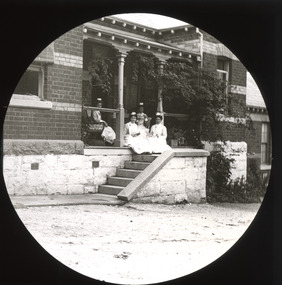
... farm work and making clothes. She mentions a report in 1870 that the approximately 300 patients were clean and neat with 'no-one in restraint or seclusion' but that by 1905 the organisation had 623 patients which placed strain on building infrastructure such as heating and water supplies, leading to high turnover of nurses and other issues. ...farm work and making clothes. She mentions a report in 1870 that the approximately 300 patients were clean and neat with 'no-one in restraint or seclusion' but that by 1905 the organisation had 623 patients which placed strain on building infrastructure such as heating and water supplies, leading to high turnover of nurses and other issues. ...This image appears to show nurses at what is now the Mayday Hills Mental Asylum in approximately 1900. These individuals are part of a long history of nursing in Beechworth. Three medical or social welfare facilities opened in the mid-1800s as part of a push by the township to become a regional centre for Government services. These were the Ovens District Hospital (opened in 1857), the Ovens Benevolent Asylum (opened in 1863), and the Beechworth Mental Hospital (opened in 1867 and renamed Mayday Hills Hospital at Centenary celebrations in 1967). It was recognised that the unsettled living conditions, poverty and relative isolation of the Goldfields environment could produce 'mental disturbances' which required local treatment facilities as services in Melbourne were too far away. Carole Woods' publication 'A Titan's Field' describes activities undertaken by patients at Beechworth Mental Hospital as including monthly balls and occasional concerts as well as work to make the facility self-supporting such as farm work and making clothes. She mentions a report in 1870 that the approximately 300 patients were clean and neat with 'no-one in restraint or seclusion' but that by 1905 the organisation had 623 patients which placed strain on building infrastructure such as heating and water supplies, leading to high turnover of nurses and other issues. A program of building works to extend and improve facilities followed over subsequent decades. Lantern slides, sometimes called 'magic lantern' slides, are glass plates on which an image has been secured for the purpose of projection. Glass slides were etched or hand-painted for this purpose from the Eighteenth Century but the process became more popular and accessible to the public with the development of photographic-emulsion slides used with a 'Magic Lantern' device in the mid-Nineteenth Century. Photographic lantern slides comprise a double-negative emulsion layer (forming a positive image) between thin glass plates that are bound together. A number of processes existed to form and bind the emulsion layer to the base plate, including the albumen, wet plate collodion, gelatine dry plate and Woodburytype techniques. Lantern slides and magic lantern technologies are seen as foundational precursors to the development of modern photography and film-making techniques.This glass slide is significant because it provides insight into Beechworth's social and medical amenities in the early Twentieth Century, around the time of Australia's Federation into one nation. It is also an example of an early photographic and film-making technology in use in regional Victoria in the time period.Thin translucent sheet of glass with a circular image printed on the front and framed in a black backing. It is held together by metals strips to secure the edges of the slide.burke museum, beechworth, lantern slide, slide, glass slide, plate, burke museum collection, photograph, monochrome, magic lantern, indigo shire, north-east victoria, nineteenth century, 1900s, twentieth century, emulsion slides, nursing, nurses, mental hospitals, lunatic asylums, asylums, social services, social welfare, insane asylums, mental health, infrastructure -
 The Beechworth Burke Museum
Photograph, 1999
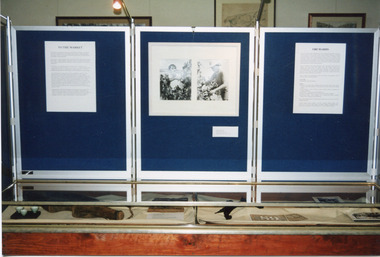
... farms under vineyards by 1865. There were 400 Chinese market gardeners and hawkers in the area in 1868. The growth of agriculture in the Ovens district in the mid -1860s led to advocacy by local farmers for the extension of railway infrastructure from Melbourne to improve access to distant markets. beechworth Burke Museum Promoting settlement Living in country towns Making regional centres Preserving traditions and commemorating Farming and agriculture orchards exhibitions Burke Museum exhibitions fruitpicking building local economies transforming land Victorian agricultural history Marketing and promoting agricultural products growing fruit and vegetables The Harvest exhibition harvests vineyards Victorian gold rush towns Obverse: TO THE MARKET / ORCHARDS/ Reverse: 2856 Colour rectangular photograph printed on matte AGFA photographic paper. ...This photograph features three display board sections showing information and photographs from 'The Harvest' exhibition inside the Burke Museum at Beechworth in 1999. The boards are titled 'To the Market' and 'Orchards'; the accompanying text cannot be read. The two accompanying photographs depict a man and woman picking fruit.This photograph is of social significance to Burke Museum and the Beechworth community, documenting an exhibition, The Harvest, held in 1999 to communicate the importance of agricultural development, specifically of orchards, in the area. The expansion of vineyards and horticulture in the Beechworth district followed gold rush prosperity in the mid-1850s, with nearly ninety acres of gardens and small farms under vineyards by 1865. There were 400 Chinese market gardeners and hawkers in the area in 1868. The growth of agriculture in the Ovens district in the mid -1860s led to advocacy by local farmers for the extension of railway infrastructure from Melbourne to improve access to distant markets.Colour rectangular photograph printed on matte AGFA photographic paper.Obverse: TO THE MARKET / ORCHARDS/ Reverse: 2856beechworth, burke museum, promoting settlement, living in country towns, making regional centres, preserving traditions and commemorating, farming and agriculture, orchards, exhibitions, burke museum exhibitions, fruitpicking, building local economies, transforming land, victorian agricultural history, marketing and promoting agricultural products, growing fruit and vegetables, the harvest exhibition, harvests, vineyards, victorian gold rush towns -
Federation University Historical Collection
Book, University of Ballarat - Daylesford: Product Development Plan
... infrastructure audit...hepburn mineral springs & springs reserve...hepburn springs bath house...lake daylesford...the convent gallery...road access to daylesford...rail and coach access to daylesford...the lake house...wombat gardens & victoria park...jubillee lake...jim crow...wombat...sir charles hotham...warren hastings...central, tipperary and golden mineral springs...lavandula lavender farm...University of Ballarat - Daylesford: Product Development Plan JT701/Tourism Planning and Development Lecturer/Tutor: Mary Hollick university of ballarat daylesford mary hollick andrew cyples todd edmonds kylie harrington nicole landers jess lewis hepburn shire council introduction methodology history of daylesford infrastructure audit hepburn mineral springs & springs reserve hepburn springs bath house lake daylesford the convent gallery road access to daylesford rail and coach access to daylesford the lake house wombat gardens & victoria park jubillee lake jim crow wombat sir charles hotham warren hastings central, tipperary and golden mineral springs lavandula lavender farm the macaroni factory smeaton guilford trentham maldon creswick castlemaine clunes dja dja wurrung swiss/italian mineral water hepburn mineral springs reserve jubilee lake Central Springs Tipperary Springs Golden springs White soft covered book of 68 pages including 13 appendices. ...University of Ballarat - Daylesford: Product Development Plan JT701/Tourism Planning and Development Lecturer/Tutor: Mary HollickWhite soft covered book of 68 pages including 13 appendices.university of ballarat, daylesford, mary hollick, andrew cyples, todd edmonds, kylie harrington, nicole landers, jess lewis, hepburn shire council, introduction, methodology, history of daylesford, infrastructure audit, hepburn mineral springs & springs reserve, hepburn springs bath house, lake daylesford, the convent gallery, road access to daylesford, rail and coach access to daylesford, the lake house, wombat gardens & victoria park, jubillee lake, jim crow, wombat, sir charles hotham, warren hastings, central, tipperary and golden mineral springs, lavandula lavender farm, the macaroni factory, smeaton, guilford, trentham, maldon, creswick, castlemaine, clunes, dja dja wurrung, swiss/italian, mineral water, hepburn mineral springs reserve, jubilee lake, central springs, tipperary springs, golden springs -
 Orbost & District Historical Society
black and white photograph, February 1971
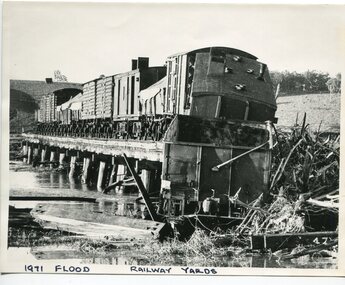
... Considerable damage was done to railway infrastructure, roads and farms. More information from the APRIL, 2008 newsletter by John Phillips. ...Considerable damage was done to railway infrastructure, roads and farms. More information from the APRIL, 2008 newsletter by John Phillips. ...The 1971 flood was the the worst flood on record. At Jarrahmond it was at least 11 metres and up to one and a half kilometres wide on the flats causing enormous damage to the flood plain. Records say that "The brown floodwater stain in Bass Strait could be seen from passing airliners." Considerable damage was done to railway infrastructure, roads and farms. More information from the APRIL, 2008 newsletter by John Phillips. (see orbosthistory.com.au) The railway line was destroyed and was not expected to be opened for a fortnight. Orbost was cut off by 50 square miles of Snowy River floodwater. This train was being shunted across the viaduct when waters smashed through washing away several trucks sending the crew running for their lives.This is pictorial evidence of a significant local event. It is connected to the history of the railway in East Gippsland.A large black / white photograph of flooded railway yards with a train engine stranded on a small section of track surrounded by water and debris.on front - "1971 Flood, Railway Yards"floods-1971-orbost orbost-railway natural-disasters-orbost -
 Orbost & District Historical Society
black and white photograph, 11 February 1971
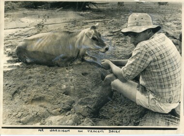
... Considerable damage was done to railway infrastructure, roads and farms. More information from the APRIL, 2008 newsletter by John Phillips. ...Considerable damage was done to railway infrastructure, roads and farms. More information from the APRIL, 2008 newsletter by John Phillips. ...This photograph was taken during the 1971 floods at Orbost. The 1971 flood was the the worst flood on record. At Jarrahmond it was at least 11 metres and up to one and a half kilometres wide on the flats causing enormous damage to the flood plain. Records say that "The brown floodwater stain in Bass Strait could be seen from passing airliners." Considerable damage was done to railway infrastructure, roads and farms. More information from the APRIL, 2008 newsletter by John Phillips. (see orbosthistory.com.au)This is a contemporary pictorial record of a significant local event.A large black / white photograph of a man, dressed in shorts and a checked shirt, sitting on a fence post surrounded by mud. He is holding on to the leg of a cow which is stuck in the mud.on front - "Mr Harrison on Tracey's Dairy" on back - " Herald 11 Feb 1971"floods-orbost-1971 tracey-dairy natural-disaster-flood -
 Orbost & District Historical Society
black and white photograph, February, 1971
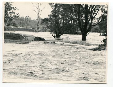
... Considerable damage was done to railway infrastructure, roads and farms. More information from the APRIL, 2008 newsletter by John Phillips. ...Considerable damage was done to railway infrastructure, roads and farms. More information from the APRIL, 2008 newsletter by John Phillips. ...This photograph shows the floodwaters during the 1971 flood at Orbost. The two mahogany trees in the photograph stopped the Snowy River from changing its course. The 1971 flood was the the worst flood on record. At Jarrahmond it was at least 11 metres and up to one and a half kilometres wide on the flats causing enormous damage to the flood plain. Records say that "The brown floodwater stain in Bass Strait could be seen from passing airliners." Considerable damage was done to railway infrastructure, roads and farms. More information from the APRIL, 2008 newsletter by John Phillips. (see orbosthistory.com.au)This is a pictorial record of a significant event in the history of floods in Orbost.A black / white photograph of raging floodwaters at the bottom of the Orbost township.orbost-flood-1971 -
 Orbost & District Historical Society
black and white photographs, 15th February 1971
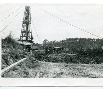
... Considerable damage was done to railway infrastructure, roads and farms. More information from the APRIL, 2008 newsletter by John Phillips. ...Considerable damage was done to railway infrastructure, roads and farms. More information from the APRIL, 2008 newsletter by John Phillips. ...The 1971 flood was the the worst flood on record. At Jarrahmond it was at least 11 metres and up to one and a half kilometres wide on the flats causing enormous damage to the flood plain. Records say that "The brown floodwater stain in Bass Strait could be seen from passing airliners." Considerable damage was done to railway infrastructure, roads and farms. More information from the APRIL, 2008 newsletter by John Phillips. (see orbosthistory.com.au) The railway line was destroyed and was not expected to be opened for a fortnight. Orbost was cut off by 50 square miles of Snowy River floodwater. These photographs are pictorial records of the 1971 floods which was a significant event in the history of Orbost. They are also associated with the East Gippsland Railway.Three black / white photographs of flood debris and flood waters near a railway line. 3102.l has a pile driver 3102.2 shows a gap in the viaduct and 3102.3 shows men with a tractor cleaning up the debris,3102.1 - on back - "1971 FLOOD REPAIRS TO ORBOST RAILWAY VIADUCT - 15th February 1971. Donated by Audrey Van Den Berg VRH 3693" 3102.2 - on back - " DAMAGE TO RAILWAY VIADUCT ACCUMULATED DEBRIS" 3102.3 - on back - "DAMAGE TO RAILWAY VIADUCT AT ORBOST. CLEAN UP BEGINS"orbost-flood-1971 orbost-viaduct-flood-damage orbost-railway -
 Orbost & District Historical Society
newspaper clippings, February 1971
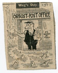
... Considerable damage was done to railway infrastructure, roads and farms. More information from the APRIL, 2008 newsletter by John Phillips. ...Considerable damage was done to railway infrastructure, roads and farms. More information from the APRIL, 2008 newsletter by John Phillips. ...These articles were compiled by Mary Gilbert who was the first curator of the Orbost Museum and a prominent historian / teacher in Orbost. The 1971 floods at Orbost were the worst on record. At Jarrahmond the river rose to a height of 11 metres and on the flats spread to one and a half kilometres wide. Considerable damage was done to railway infrastructure, roads and farms. More information from the APRIL, 2008 newsletter by John Phillips. (see orbosthistory.com.au)These articles are contemporary records of a significant historical event in Orbost.A manila folder containing black / white newspaper clippings from various publishers. They all relate to the 1971 floods in Orbost. (Details of contents in catalogue 735-900)floods-orbost-1971 -
 Orbost & District Historical Society
newspapers, February, March 1971
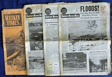
... Considerable damage was done to railway infrastructure, roads and farms. More information from the APRIL, 2008 newsletter by John Phillips. ...Considerable damage was done to railway infrastructure, roads and farms. More information from the APRIL, 2008 newsletter by John Phillips. ...The 1971 flood was the the worst flood on record. At Jarrahmond it was at least 11 metres and up to one and a half kilometres wide on the flats causing enormous damage to the flood plain. Records say that "The brown floodwater stain in Bass Strait could be seen from passing airliners." Considerable damage was done to railway infrastructure, roads and farms. More information from the APRIL, 2008 newsletter by John Phillips. (see orbosthistory.com.au) These newspapers are contemporary records of a significant local event.Four newspapers relating to the floods in 1971. They contain news articles and photographs of the floods in Orbost in early 1971. 2556.1 is the Weekly Times dated 3.3.1971 and has an orange cover. 2556.2 is a Snowy River Mail dated 17.2.1971. 2556.3 is a Snowy River Mail dated 10.2.1971. 2556.4 is a Snowy River Mail dated 3.3.1971.floods-orbost-1971 snowy-river-mail weekly-times newspapers -
 Orbost & District Historical Society
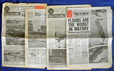
newspapers, February 1971
... Considerable damage was done to railway infrastructure, roads and farms. More information from the APRIL, 2008 newsletter by John Phillips. ...Considerable damage was done to railway infrastructure, roads and farms. More information from the APRIL, 2008 newsletter by John Phillips. ...The 1971 floods at Orbost were the worst on record. At Jarrahmond the river rose to a height of 11 metres and on the flats spread to one and a half kilometres wide. Considerable damage was done to railway infrastructure, roads and farms. More information from the APRIL, 2008 newsletter by John Phillips. (see orbosthistory.com.au)These newspapers are contemporary records of a significant local event.Four newspapers and a set of clippings from various papers. They contain information and photographs pertaining to the 1971 floods in Orbost. 2557.1 is a Sun News Pictorial dated 8.2.1971. 2557.2 is a Snowy River Mail dated 10.2.1971. 2557.3 is an east Gippsland News dated 12.2.1971. 2557.4 is a Snowy River mail dated 12.2.1971 and 2557.5 is a collection of various clippings.floods-orbost-1971 newspaper snowy-river-mail sun-news-pictorial -
 Orbost & District Historical Society
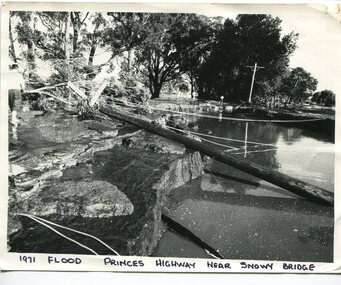
black and white photograph, February 1971
... Considerable damage was done to railway infrastructure, roads and farms. More information from the APRIL, 2008 newsletter by John Phillips. ...Considerable damage was done to railway infrastructure, roads and farms. More information from the APRIL, 2008 newsletter by John Phillips. ...This photograph was taken near the Snowy River Bridge on the the old Princes Highway in Orbost, near the caravan park. The 1971 flood was the the worst flood on record. At Jarrahmond it was at least 11 metres and up to one and a half kilometres wide on the flats causing enormous damage to the flood plain. Records say that "The brown floodwater stain in Bass Strait could be seen from passing airliners." Considerable damage was done to railway infrastructure, roads and farms. More information from the APRIL, 2008 newsletter by John Phillips. (see orbosthistory.com.au)This is pictorial evidence of a significant local event. Floods have been an integral part of Orbost's history for hundreds of years.A black / white photograph of debris, fallen power lines, a tree across the highway and floodwaters across the road.on front at bottom - handwritten in upper case print - " 1971 FLOOD PRINCES HIGHWAY NEAR SNOWY BRIDGE"floods-orbost-1971 -
 Orbost & District Historical Society
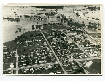
black and white photograph, February 1971
... Considerable damage was done to railway infrastructure, roads and farms. More information from the APRIL, 2008 newsletter by John Phillips. ...Considerable damage was done to railway infrastructure, roads and farms. More information from the APRIL, 2008 newsletter by John Phillips. ...This photograph is an aerial view of the township of Orbost taken by the Bairnsdale Advertiser newspaper. It was taken from the northern end of the town. The 1971 flood was the the worst flood on record. At Jarrahmond it was at least 11 metres and up to one and a half kilometres wide on the flats causing enormous damage to the flood plain. Records say that "The brown floodwater stain in Bass Strait could be seen from passing airliners." Considerable damage was done to railway infrastructure, roads and farms. More information from the APRIL, 2008 newsletter by John Phillips. (see orbosthistory.com.au)This is a pictorial record of a significant event in the history of Orbost,A black / white aerial photograph of a township with floodwaters in the background.on back - "Note main current through the lagoon 1971."orbost-floods-1971 bairnsdale-advertiser orbost-township -
 Eltham District Historical Society Inc
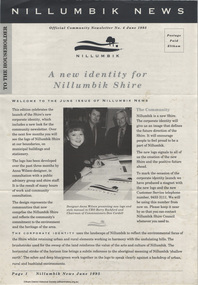
Journal - Newsletter, Nillumbik Shire Council, Nillumbik News, October 2000
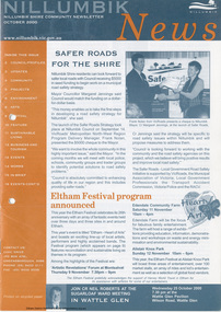
... infrastructure projects, and cultural activities occurring in the Nillumbik Shire around October–November 2000. It highlights council plans, community participation opportunities, and local developments aimed at improving quality of life in the region. October 2000 articles include: Safer roads for the Shire Eltham Festival program announced Commercial Place design released 2000-2003 Council Plan Released National Reconciliation Framework Living and Learning Centres More Playgrounds Susan St Pavilion completed Study to plan for BMX/skate track Wattle Glen Township Strategy Community Weed Control Program Count Koala Day Environment Centre proposed for Edendale Farm Open Space Strategy findings Neighbourhood Character Study and Residential Design Guidelines Friends groups Clean Drains – Living Creeks, National Water Week Nillumbik Shire Council Cultural Plan 2000-2005 adopted 2001 Alan Marshall Short Story Award Artists’ Open Studios program Kangaroo Ground Tower Advisory Committee Environment leaders at Eltham North primary Dollars saved by regular road maintenance Regional Road upgrades Rural roads grading program Stormwater Management Plan Locality boundary update ...infrastructure projects, and cultural activities occurring in the Nillumbik Shire around October–November 2000. It highlights council plans, community participation opportunities, and local developments aimed at improving quality of life in the region. October 2000 articles include: Safer roads for the Shire Eltham Festival program announced Commercial Place design released 2000-2003 Council Plan Released National Reconciliation Framework Living and Learning Centres More Playgrounds Susan St Pavilion completed Study to plan for BMX/skate track Wattle Glen Township Strategy Community Weed Control Program Count Koala Day Environment Centre proposed for Edendale Farm Open Space Strategy findings Neighbourhood Character Study and Residential Design Guidelines Friends groups Clean Drains – Living Creeks, National Water Week Nillumbik Shire Council Cultural Plan 2000-2005 adopted 2001 Alan Marshall Short Story Award Artists’ Open Studios program Kangaroo Ground Tower Advisory Committee Environment leaders at Eltham North primary Dollars saved by regular road maintenance Regional Road upgrades Rural roads grading program Stormwater Management Plan Locality boundary update Council Newsletters Nillumbik News Nillumbik Shire Council Council Plan 2000–2003 Municipal Road Safety Strategy Infrastructure services Stormwater Management Plan Locality boundary review Rates Sustainable agriculture rebate Capital works program road maintenance Better Roads Victorian program eltham - yarra glen road Warrandyte - Kangaroo Ground Road Rural roads grading program Commercial Place Public space public infrastructrue meals on wheels Eltham Living and Learning Centre Living and Learning Centre adult community education volunteer programs Australia Day Awards community groups environmental protection sustainability Community weed control landcare koalas Drainage works waterway protection indigenous grass environmental education Open Space public parkland playgrounds bike trail Adventure Playground community reserves Kangaroo Ground Tower reserve Cultural plan Eltham festival Artists Open Studios cultural tourism Alan Marshall Short Story Award Montsalvat community arts program garden walks Eltham Fun Run community market mudbrick tours CERES Environmental Education Centre Nillumbik Tourism Association Food and Wine trail Yarra Valley Tourism campaign road safety Adrian Cully Alan Marshall Andrew Port Anne Connor Catherine Dale Chris Wallace-Crabbe Claire Harris David Scott David Yencken Dean Stewart Deb Ganderton Debra Wilkinson Denis Ward drew gregory Daryl Taylor Fiona Austin Frank Butters Frank Nolan Gavin Jordan Glen Jameson Grace Mitchell Greg Scott Harry Gilham Helen Ash Jane Annois jane viola Jan Kelly Jenneke Korteweg Jenni Mitchell Jessica Davison Jill Forrest john hewish Jules Burns Julius Peiker kay steventon Kayte Nunn Lesley Shuttleworth leslie Avril Louise Heathcote Marg Jeffery Margaret Jennings Martin Wright Mathew Hodsnesse Maurice Stabb Megan McCarthy Mervyn Hannan Michael Jansz michael skewes Mick Woiwod nel ten wolde Nicholas Pelling Ona Henderson Peter Burn Piers Bateman reg cox Reg Evans Robert Boyle Robert Hay Robert Theobald shan shnookal Sigmund Jorgensen Stuart Menzies Steven White Vonnie Frazer Eltham District Historical Society Council for Aboriginal Reconciliation Eltham North Primary School Wattle Glen Primary School Eltham Arts Council Churinga Arts Harvey World Travel (Eltham) Eltham Little Book Shop Do Lunch Cafe Volumes Cafe Grovedale Cottage Lovegrove Winery Cottles Bridge Yarrambat Golf Club Eltham Football Club Eltham Rugby Football Club Lower Eltham Cricket Club Susan Street Oval Syd Tunn Jack Rasterhoff A4. monotone print, double stapled, 4 pages Nillumbik News Journal Newsletter Nillumbik Shire Council ...The newsletter outlines local government initiatives, community events, environmental programs, infrastructure projects, and cultural activities occurring in the Nillumbik Shire around October–November 2000. It highlights council plans, community participation opportunities, and local developments aimed at improving quality of life in the region. October 2000 articles include: Safer roads for the Shire Eltham Festival program announced Commercial Place design released 2000-2003 Council Plan Released National Reconciliation Framework Living and Learning Centres More Playgrounds Susan St Pavilion completed Study to plan for BMX/skate track Wattle Glen Township Strategy Community Weed Control Program Count Koala Day Environment Centre proposed for Edendale Farm Open Space Strategy findings Neighbourhood Character Study and Residential Design Guidelines Friends groups Clean Drains – Living Creeks, National Water Week Nillumbik Shire Council Cultural Plan 2000-2005 adopted 2001 Alan Marshall Short Story Award Artists’ Open Studios program Kangaroo Ground Tower Advisory Committee Environment leaders at Eltham North primary Dollars saved by regular road maintenance Regional Road upgrades Rural roads grading program Stormwater Management Plan Locality boundary update council newsletters, nillumbik news, nillumbik shire council, council plan 2000–2003, municipal road safety strategy, infrastructure services, stormwater management plan, locality boundary review, rates, sustainable agriculture rebate, capital works program, road maintenance, better roads victorian program, eltham - yarra glen road, warrandyte - kangaroo ground road, rural roads grading program, commercial place, public space, public infrastructrue, meals on wheels, eltham living and learning centre, living and learning centre, adult community education, volunteer programs, australia day awards, community groups, environmental protection, sustainability, community weed control, landcare, koalas, drainage works, waterway protection, indigenous grass, environmental education, open space, public parkland, playgrounds, bike trail, adventure playground, community reserves, kangaroo ground tower reserve, cultural plan, eltham festival, artists open studios, cultural tourism, alan marshall short story award, montsalvat, community arts program, garden walks, eltham fun run, community market, mudbrick tours, ceres environmental education centre, nillumbik tourism association, food and wine trail, yarra valley tourism campaign, road safety, adrian cully, alan marshall, andrew port, anne connor, catherine dale, chris wallace-crabbe, claire harris, david scott, david yencken, dean stewart, deb ganderton, debra wilkinson, denis ward, drew gregory, daryl taylor, fiona austin, frank butters, frank nolan, gavin jordan, glen jameson, grace mitchell, greg scott, harry gilham, helen ash, jane annois, jane viola, jan kelly, jenneke korteweg, jenni mitchell, jessica davison, jill forrest, john hewish, jules burns, julius peiker, kay steventon, kayte nunn, lesley shuttleworth, leslie avril, louise heathcote, marg jeffery, margaret jennings, martin wright, mathew hodsnesse, maurice stabb, megan mccarthy, mervyn hannan, michael jansz, michael skewes, mick woiwod, nel ten wolde, nicholas pelling, ona henderson, peter burn, piers bateman, reg cox, reg evans, robert boyle, robert hay, robert theobald, shan shnookal, sigmund jorgensen, stuart menzies, steven white, vonnie frazer, eltham district historical society, council for aboriginal reconciliation, eltham north primary school, wattle glen primary school, eltham arts council, churinga arts, harvey world travel (eltham), eltham little book shop, do lunch cafe, volumes cafe, grovedale cottage, lovegrove winery cottles bridge, yarrambat golf club, eltham football club, eltham rugby football club, lower eltham cricket club, susan street oval, syd tunn, jack rasterhoff -
 Eltham District Historical Society Inc
Journal - Newsletter, Nillumbik Shire Council, Nillumbik News, October 2000
... infrastructure projects, and cultural activities occurring in the Nillumbik Shire around October–November 2000. It highlights council plans, community participation opportunities, and local developments aimed at improving quality of life in the region. October 2000 articles include: Safer roads for the Shire Eltham Festival program announced Commercial Place design released 2000-2003 Council Plan Released National Reconciliation Framework Living and Learning Centres More Playgrounds Susan St Pavilion completed Study to plan for BMX/skate track Wattle Glen Township Strategy Community Weed Control Program Count Koala Day Environment Centre proposed for Edendale Farm Open Space Strategy findings Neighbourhood Character Study and Residential Design Guidelines Friends groups Clean Drains – Living Creeks, National Water Week Nillumbik Shire Council Cultural Plan 2000-2005 adopted 2001 Alan Marshall Short Story Award Artists’ Open Studios program Kangaroo Ground Tower Advisory Committee Environment leaders at Eltham North primary Dollars saved by regular road maintenance Regional Road upgrades Rural roads grading program Stormwater Management Plan Locality boundary update ...infrastructure projects, and cultural activities occurring in the Nillumbik Shire around October–November 2000. It highlights council plans, community participation opportunities, and local developments aimed at improving quality of life in the region. October 2000 articles include: Safer roads for the Shire Eltham Festival program announced Commercial Place design released 2000-2003 Council Plan Released National Reconciliation Framework Living and Learning Centres More Playgrounds Susan St Pavilion completed Study to plan for BMX/skate track Wattle Glen Township Strategy Community Weed Control Program Count Koala Day Environment Centre proposed for Edendale Farm Open Space Strategy findings Neighbourhood Character Study and Residential Design Guidelines Friends groups Clean Drains – Living Creeks, National Water Week Nillumbik Shire Council Cultural Plan 2000-2005 adopted 2001 Alan Marshall Short Story Award Artists’ Open Studios program Kangaroo Ground Tower Advisory Committee Environment leaders at Eltham North primary Dollars saved by regular road maintenance Regional Road upgrades Rural roads grading program Stormwater Management Plan Locality boundary update Council Newsletters Nillumbik News Nillumbik Shire Council Council Plan 2000–2003 Municipal Road Safety Strategy Infrastructure services Stormwater Management Plan Locality boundary review Rates Sustainable agriculture rebate Capital works program road maintenance Better Roads Victorian program eltham - yarra glen road Warrandyte - Kangaroo Ground Road Rural roads grading program Commercial Place Public space public infrastructrue meals on wheels Eltham Living and Learning Centre Living and Learning Centre adult community education volunteer programs Australia Day Awards community groups environmental protection sustainability Community weed control landcare koalas Drainage works waterway protection indigenous grass environmental education Open Space public parkland playgrounds bike trail Adventure Playground community reserves Kangaroo Ground Tower reserve Cultural plan Eltham festival Artists Open Studios cultural tourism Alan Marshall Short Story Award Montsalvat community arts program garden walks Eltham Fun Run community market mudbrick tours CERES Environmental Education Centre Nillumbik Tourism Association Food and Wine trail Yarra Valley Tourism campaign road safety Adrian Cully Alan Marshall Andrew Port Anne Connor Catherine Dale Chris Wallace-Crabbe Claire Harris David Scott David Yencken Dean Stewart Deb Ganderton Debra Wilkinson Denis Ward drew gregory Daryl Taylor Fiona Austin Frank Butters Frank Nolan Gavin Jordan Glen Jameson Grace Mitchell Greg Scott Harry Gilham Helen Ash Jane Annois jane viola Jan Kelly Jenneke Korteweg Jenni Mitchell Jessica Davison Jill Forrest john hewish Jules Burns Julius Peiker kay steventon Kayte Nunn Lesley Shuttleworth leslie Avril Louise Heathcote Marg Jeffery Margaret Jennings Martin Wright Mathew Hodsnesse Maurice Stabb Megan McCarthy Mervyn Hannan Michael Jansz michael skewes Mick Woiwod nel ten wolde Nicholas Pelling Ona Henderson Peter Burn Piers Bateman reg cox Reg Evans Robert Boyle Robert Hay Robert Theobald shan shnookal Sigmund Jorgensen Stuart Menzies Steven White Vonnie Frazer Eltham District Historical Society Council for Aboriginal Reconciliation Eltham North Primary School Wattle Glen Primary School Eltham Arts Council Churinga Arts Harvey World Travel (Eltham) Eltham Little Book Shop Do Lunch Cafe Volumes Cafe Grovedale Cottage Lovegrove Winery Cottles Bridge Yarrambat Golf Club Eltham Football Club Eltham Rugby Football Club Lower Eltham Cricket Club Susan Street Oval Syd Tunn Jack Rasterhoff A4. two colour print (orange/blue), double stapled, 16 pages Nillumbik News Journal Newsletter Nillumbik Shire Council ...The newsletter outlines local government initiatives, community events, environmental programs, infrastructure projects, and cultural activities occurring in the Nillumbik Shire around October–November 2000. It highlights council plans, community participation opportunities, and local developments aimed at improving quality of life in the region. October 2000 articles include: Safer roads for the Shire Eltham Festival program announced Commercial Place design released 2000-2003 Council Plan Released National Reconciliation Framework Living and Learning Centres More Playgrounds Susan St Pavilion completed Study to plan for BMX/skate track Wattle Glen Township Strategy Community Weed Control Program Count Koala Day Environment Centre proposed for Edendale Farm Open Space Strategy findings Neighbourhood Character Study and Residential Design Guidelines Friends groups Clean Drains – Living Creeks, National Water Week Nillumbik Shire Council Cultural Plan 2000-2005 adopted 2001 Alan Marshall Short Story Award Artists’ Open Studios program Kangaroo Ground Tower Advisory Committee Environment leaders at Eltham North primary Dollars saved by regular road maintenance Regional Road upgrades Rural roads grading program Stormwater Management Plan Locality boundary update council newsletters, nillumbik news, nillumbik shire council, council plan 2000–2003, municipal road safety strategy, infrastructure services, stormwater management plan, locality boundary review, rates, sustainable agriculture rebate, capital works program, road maintenance, better roads victorian program, eltham - yarra glen road, warrandyte - kangaroo ground road, rural roads grading program, commercial place, public space, public infrastructrue, meals on wheels, eltham living and learning centre, living and learning centre, adult community education, volunteer programs, australia day awards, community groups, environmental protection, sustainability, community weed control, landcare, koalas, drainage works, waterway protection, indigenous grass, environmental education, open space, public parkland, playgrounds, bike trail, adventure playground, community reserves, kangaroo ground tower reserve, cultural plan, eltham festival, artists open studios, cultural tourism, alan marshall short story award, montsalvat, community arts program, garden walks, eltham fun run, community market, mudbrick tours, ceres environmental education centre, nillumbik tourism association, food and wine trail, yarra valley tourism campaign, road safety, adrian cully, alan marshall, andrew port, anne connor, catherine dale, chris wallace-crabbe, claire harris, david scott, david yencken, dean stewart, deb ganderton, debra wilkinson, denis ward, drew gregory, daryl taylor, fiona austin, frank butters, frank nolan, gavin jordan, glen jameson, grace mitchell, greg scott, harry gilham, helen ash, jane annois, jane viola, jan kelly, jenneke korteweg, jenni mitchell, jessica davison, jill forrest, john hewish, jules burns, julius peiker, kay steventon, kayte nunn, lesley shuttleworth, leslie avril, louise heathcote, marg jeffery, margaret jennings, martin wright, mathew hodsnesse, maurice stabb, megan mccarthy, mervyn hannan, michael jansz, michael skewes, mick woiwod, nel ten wolde, nicholas pelling, ona henderson, peter burn, piers bateman, reg cox, reg evans, robert boyle, robert hay, robert theobald, shan shnookal, sigmund jorgensen, stuart menzies, steven white, vonnie frazer, eltham district historical society, council for aboriginal reconciliation, eltham north primary school, wattle glen primary school, eltham arts council, churinga arts, harvey world travel (eltham), eltham little book shop, do lunch cafe, volumes cafe, grovedale cottage, lovegrove winery cottles bridge, yarrambat golf club, eltham football club, eltham rugby football club, lower eltham cricket club, susan street oval, syd tunn, jack rasterhoff -
 Eltham District Historical Society Inc
Album - Photograph, J.A. McDonald, Eltham-Diamond Creek Road, 21 Oct. 1953
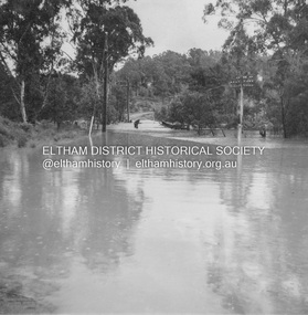
... Farm. This view is looking west across the Glen Park Bridge, and the beginning of Wattletree Road which sweeps around to the right in the distance. Progress Road does not exist though a road reserve is present on maps. Record of various Shire of Eltham infrastructure ...18 October 1956 Flood level on road at corner of Railway Parade. On the immediate left out of view is Mrs Lucy Egan's home. That house still stands today nestled up against the Wattletree Road Bridge on the other side built in 1959 and is owned by the Bakos family purchased by Mrs Heather Bakos in 1960.. Prior to the Wattletree Road bridge being built, Railway Parade extended up the alignment of present-day Gastons Road to the Eltham-Diamond Creek road which ran past the entrance of the present-day carpark for Edendale Farm. This view is looking west across the Glen Park Bridge, and the beginning of Wattletree Road which sweeps around to the right in the distance. Progress Road does not exist though a road reserve is present on maps.Record of various Shire of Eltham infrastructure works undertaken during the period of 1952-1962 involving bridge and road reconstruction projects, sometimes with Eltham Shire Council Project Reference numbers quoted. It was during this period that a number of significant improvements were made to roads and new bridges constructed within the shire that remain in place as of present day (2022). In many situations, the photos provide a tangible visible record of infrastructure that existed throughout the early days of the Shire. The album was put together by or under the direction of the Shire Engineer, J.A. McDonald.infrastructure, road construction, shire of eltham, bridge construction, eltham north, floods, floodwater, glen park bridge, 1956-10-18, diamond creek (creek), eltham, railway parade, wattletree road, wattletree road bridge, gastons road -
 Eltham District Historical Society Inc
Photograph, Roadworks prior to sealing along Mount Pleasant Road near the junction with Reynolds Road, Eltham, c.1988, 1988c
... infrastructure...mount pleasant road...reynolds road...road construction...Blueberry farm...Lou Siluzio's Blueberry farm, Lot 1, Mount Pleasant Road at corner of Reynolds Road 1988 eltham shire council infrastructure mount pleasant road reynolds road road construction Blueberry farm Lou Siluzio Fuji 100 Roll of 35mm colour negative film, 7 strips Roadworks prior to sealing along Mount Pleasant Road near the junction with Reynolds Road, Eltham, c.1988 Photograph ...Lou Siluzio's Blueberry farm, Lot 1, Mount Pleasant Road at corner of Reynolds RoadRoll of 35mm colour negative film, 7 stripsFuji 1001988, eltham shire council, infrastructure, mount pleasant road, reynolds road, road construction, blueberry farm, lou siluzio -
 Melbourne Water
Photographic View Book, The Melbourne & Metropolitan Board of Works - Water Supply, Sewerage etc. ...Photographic Views, 1908
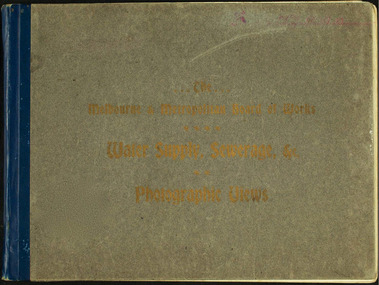
... A treatment farm was built at Werribee and a pumping station was built at Spotswood (now the site of the Scienceworks Museum) to send the city's waste to Werribee. The first Melbourne homes were connected to the sewerage system in 1897. This book showcases the MMBW's infrastructure ...In 1891 The Melbourne and Metropolitan Board of Works (MMBW) was formed and became responsible for Melbourne's water supply. Melbourne had grown to a city of half a million people. To provide water to this rapidly growing city (especially the eastern suburbs), and to supplement the 1857 Yan Yean Reservoir, Melbourne's first water supply, the Watts River (near Healesville) was tapped. It supplied water to Melbourne, via the Maroondah aqueduct. In May 1892 the MMBW's first engineer-in-chief, Mr William Thwaites began construction on Melbourne's sewerage system. A treatment farm was built at Werribee and a pumping station was built at Spotswood (now the site of the Scienceworks Museum) to send the city's waste to Werribee. The first Melbourne homes were connected to the sewerage system in 1897. This book showcases the MMBW's infrastructure achievements and documents costs, requirements and key personnel involved in the development of the water supply and sewerage schemes.The introduction states "The water supply sources and headworks are in many cases situated in remote places and the sewerage works are chiefly underground. The Board has therefore resolved that these photographs of some of the scenes and works should be collected and bound for general information. August 1908" This book is in excellent condition and provides a detailed insight into the previous 17 years of work and the Board personnel of the MMBW leading up to 1908. It is of historical importance to the history of Melbourne for the photographic documents of places that were not generally open to the public, and for Melbourne Water in its detailed history of the MMBW in the early twentieth century. Photographic view book with hard khaki coloured cardboard cover and blue fabric binding. 120 Pages. Glossy paper with black and white plates and text about the MMBW, and scenic views and places of interest in association with the MMBW. The Melbourne & Metropolitan Board of Works - Water Supply, Sewerage etc. ...Photographic Views...mmbw, board members, sewerage, water supply, historic views, photographs -
 Bendigo Historical Society Inc.
Book - BENDIGO - THE REGION TO LIVE, WORK & INVEST
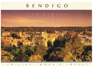
... Infrastructure, Labour Force, Business, Opportunity, Successes and Information. Each page has a colour picture, they are:- Hargreaves Mall, Eaglehawk Golf Course, Map of Victoria, La Trobe University, Big Hill, Regional Office Department of Planning & Development, Sandhurst Farms, Construction Activity, Products of the Region, Dr. ...Farms Construction Activity Products of the Region Capital Theatre Pale yellow 12 page book titled 'Bendigo the Region to Live Work & Invest'. On the front cover is a scenic view of Bendigo and on the back cover a picture of some quartz and gold nuggets on a green background. Sections in the book are: Live Work & Invest, Lifestyle, Access, Community, Infrastructure ...Pale yellow 12 page book titled 'Bendigo the Region to Live Work & Invest'. On the front cover is a scenic view of Bendigo and on the back cover a picture of some quartz and gold nuggets on a green background. Sections in the book are: Live Work & Invest, Lifestyle, Access, Community, Infrastructure, Labour Force, Business, Opportunity, Successes and Information. Each page has a colour picture, they are:- Hargreaves Mall, Eaglehawk Golf Course, Map of Victoria, La Trobe University, Big Hill, Regional Office Department of Planning & Development, Sandhurst Farms, Construction Activity, Products of the Region, Dr. Ian Macbean, Mr Evan Jones and the Capital Theatre with information on each.book, bendigo, bendigo, bendigo - the region to live, work & invest, bendigo regional development board, dr ian macbean, mr evan jones, kate mildren, richard gibbs, express printers, hargreaves mall, eaglehawk golf course, map of victoria, la trobe university, big hill, regional office department of planning & development, sandhurst farms, construction activity, products of the region, capital theatre -
 Kiewa Valley Historical Society
Photo - Mountain Creek Logging Camp, 1955
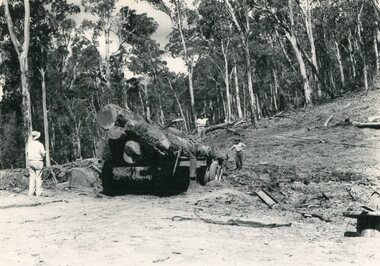
... farms. The logs could have been milled for timber at the State Electricity Commission's mill at Howman's Gap which provided a much needed source of timber for construction of McKay Creek Power Station which began construction in 1951 and also the camps and houses for the workers and their families. There was a need for housing and infrastructure...farms. The logs could have been milled for timber at the State Electricity Commission's mill at Howman's Gap which provided a much needed source of timber for construction of McKay Creek Power Station which began construction in 1951 and also the camps and houses for the workers and their families. There was a need for housing and infrastructure ...Hume and Hovell discovered the area in 1824 and by the end of the 19th century the valley was transformed by logging, dairy and beef cattle properties and tobacco farms. The logs could have been milled for timber at the State Electricity Commission's mill at Howman's Gap which provided a much needed source of timber for construction of McKay Creek Power Station which began construction in 1951 and also the camps and houses for the workers and their families. There was a need for housing and infrastructure for an increasing population of workers for the hydro-electric scheme as there was a general shortage of this commodity. A timber mill was started in Tawonga by Mates, of Albury, in 1945, and electricity became available in 1946 the S.E.C. bought the mill, and enlarged it. In 1960 it was purchase by a local family, they also started a timber mill in Mt Beauty worked both until 1980 when they closed it. The Tawonga mill and enlarged the mill called Mt. Beauty Timbers Pty Ltd employed approximately 50 people. An historical pictorial record of the general working conditions, type of machinery and vehicles in use in the 1950’s. Note the lack of protective clothing!Black and white photograph of the logging camp at Mountain Creek. November 1955Handwritten on the back of photograph - MOUNTAIN CREEK LOGGING CAMP NOV 55mountain creek logging camp, timber industry, tawonga -
 Kiewa Valley Historical Society
Photo - Logging. Mountain Creek, November 1955, November 1955
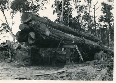
... farms. The logs could have been milled for timber at the State Electricity Commission's mill at Howman's Gap which provided a much needed source of timber for construction of McKay Creek Power Station which began construction in 1951 and also the camps and houses for the workers and their families. There was a need for housing and infrastructure...farms. The logs could have been milled for timber at the State Electricity Commission's mill at Howman's Gap which provided a much needed source of timber for construction of McKay Creek Power Station which began construction in 1951 and also the camps and houses for the workers and their families. There was a need for housing and infrastructure ...Hume and Hovell discovered the area in 1824 and by the end of the 19th century the valley was transformed by logging, dairy and beef cattle properties and tobacco farms. The logs could have been milled for timber at the State Electricity Commission's mill at Howman's Gap which provided a much needed source of timber for construction of McKay Creek Power Station which began construction in 1951 and also the camps and houses for the workers and their families. There was a need for housing and infrastructure for an increasing population of workers for the hydro-electric scheme as there was a general shortage of this commodity. A timber mill was started in Tawonga by Mates, of Albury, in 1945, and electricity became available in 1946 the S.E.C. bought the mill, and enlarged it. In 1960 it was purchase by a local family, they also started a timber mill in Mt Beauty worked both until 1980 when they closed it. The Tawonga mill and enlarged the mill called Mt. Beauty Timbers Pty Ltd employed approximately 50 people An historical pictorial record of the general working conditions, type of machinery and vehicles in use in the 1950’s. Black and white photograph of logging at Mountain Creek November 1955Small typed note attached to the back of photo - Logging Mountain Creek November 1955mountain creek logging camp, tawonga, timber industry -
 Kiewa Valley Historical Society
Photograph - Mt Beauty timber Industries, 1960's (estimate only)
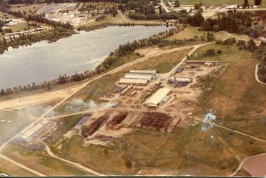
... farms. Timber was required for construction of McKay Creek Power Station which began construction in 1951 and also the camps and houses for the workers and their families. There was a need for housing and infrastructure...farms. Timber was required for construction of McKay Creek Power Station which began construction in 1951 and also the camps and houses for the workers and their families. There was a need for housing and infrastructure ...Hume and Hovell discovered the area in 1824 and by the end of the 19th century the valley was transformed by logging, dairy and beef cattle properties and tobacco farms. Timber was required for construction of McKay Creek Power Station which began construction in 1951 and also the camps and houses for the workers and their families. There was a need for housing and infrastructure for an increasing population of workers for the hydro-electric scheme as there was a general shortage of this commodity. A timber mill was started in Tawonga by Mates, of Albury, in 1945, and electricity became available in 1946 the S.E.C. bought the mill, and enlarged it. In 1960 it was purchase by a local family. They also started a timber mill in Mt Beauty and worked both until 1980 when they closed the Tawonga mill and enlarged the mill called Mt. Beauty Timbers Pty Ltd which employed approximately 50 people. A pictorial record of the development of the Mt Beauty community and the local timber industry.Colour photograph of aerial view of Mt Beauty Timber Mills and surrounding area including pondage and part of airfield. Photo taken in 1960’s (estimate only)Handwritten in ink on back of photograph in very faint writing – Recent photo of Mt Beauty Timber Industries Mt Beauty Operationsmt beauty timber industry, timber industry, timber mill, secv -
 Kiewa Valley Historical Society
Photograph - Mount Beauty Timber Industries, 1960's (estimate only)
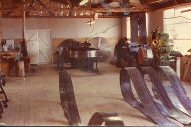
... farms. Timber was required for construction of McKay Creek Power Station which began construction in 1951 and also the camps and houses for the workers and their families. There was a need for housing and infrastructure...farms. Timber was required for construction of McKay Creek Power Station which began construction in 1951 and also the camps and houses for the workers and their families. There was a need for housing and infrastructure ...Hume and Hovell discovered the area in 1824 and by the end of the 19th century the valley was transformed by logging, dairy and beef cattle properties and tobacco farms. Timber was required for construction of McKay Creek Power Station which began construction in 1951 and also the camps and houses for the workers and their families. There was a need for housing and infrastructure for an increasing population of workers for the hydro-electric scheme as there was a general shortage of this commodity. A timber mill was started in Tawonga by Mates, of Albury, in 1945, and electricity became available in 1946 the S.E.C. bought the mill, and enlarged it. In 1960 it was purchase by a local family. They also started a timber mill in Mt Beauty and worked both until 1980 when they closed the Tawonga mill and enlarged the mill called Mt. Beauty Timbers Pty Ltd which employed approximately 50 people. A pictorial record of the development of the local timber industry in the Kiewa Valley showing equipment used in timber milling.Colour photograph of Mt Beauty Timber Industries Mill. Photo taken inside the workshop showing saw blades and equipmentmt beauty, mt beauty timber industry, timber mill -
 Kiewa Valley Historical Society
Photographs - 2 Colour photographs of logs being harvested and milled for timber in the Kiewa Valley
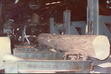
... farms. The logs could have been milled for timber at the State Electricity Commission's mill at Howman's Gap which provided a much needed source of timber for construction of McKay Creek Power Station which began construction in 1951 and also the camps and houses for the workers and their families There was a need for housing and infrastructure for an increasing population of workers for the hydro-electric scheme as there was a general shortage of this commodity. ...farms. The logs could have been milled for timber at the State Electricity Commission's mill at Howman's Gap which provided a much needed source of timber for construction of McKay Creek Power Station which began construction in 1951 and also the camps and houses for the workers and their families There was a need for housing and infrastructure for an increasing population of workers for the hydro-electric scheme as there was a general shortage of this commodity. ...: Hume and Hovell discovered the area in 1824 and by the end of the 19th century the Kiewa Valley was transformed by logging, dairy and beef cattle properties and tobacco farms. The logs could have been milled for timber at the State Electricity Commission's mill at Howman's Gap which provided a much needed source of timber for construction of McKay Creek Power Station which began construction in 1951 and also the camps and houses for the workers and their families There was a need for housing and infrastructure for an increasing population of workers for the hydro-electric scheme as there was a general shortage of this commodity. A timber mill was started in Tawonga by Mates, of Albury, in 1945, and electricity became available in 1946 the S.E.C. bought the mill, and enlarged it. In 1960 it was purchase by a local family, they also started a timber mill in Mt Beauty worked both until 1980 when they closed the Tawonga mill and enlarged the mill called Mt. Beauty Timbers Pty Ltd which employed approximately 50 people. An historical pictorial record of the type of machinery and vehicles in use in the 1950’s to harvest and mill the logs from surrounding forested areas.1. Colour photograph of large logs being milled for timber at a timber mill 2. Colour photograph of heavy machinery being used to harvest large logs for milling timber; timber mill; kiewa valley; forests; logging -
 Puffing Billy Railway
Equipment - Refreshments services Trolley, 1990s
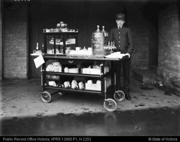
... Its scope expanded to include diverse activities such as stall rental; sales of advertising space on railways infrastructure; laundry services; operation of a hair-dressing salon, a bakery, a butchery and a poultry farm; and the management of the chalet guesthouse at Mt Buffalo. ...Its scope expanded to include diverse activities such as stall rental; sales of advertising space on railways infrastructure; laundry services; operation of a hair-dressing salon, a bakery, a butchery and a poultry farm; and the management of the chalet guesthouse at Mt Buffalo. ...The Refreshment Services Branch was established in 1920, and initially focused on providing station-based refreshment rooms and the dining car service. Its scope expanded to include diverse activities such as stall rental; sales of advertising space on railways infrastructure; laundry services; operation of a hair-dressing salon, a bakery, a butchery and a poultry farm; and the management of the chalet guesthouse at Mt Buffalo. The majority of staff worked in refreshment rooms and dining cars, both of which were a popular feature of the railway service. Previous to 1920 refreshment services had been provided by contractors, but after many complaints the Department decided to provide a standardised service across the system. It grew quickly: five years after it was established the Branch employed approximately 500 staff. Station refreshment facilities ranged from elaborate dining rooms to decorated push-carts. They were staffed predominately by women, who provided everything from a cup of tea to a three course meal. Most refreshment room services were closed in the 1970s. Reference from : Fielding, K. (2012) Victorian Railways - Refreshment Services Branch in Museums Victoria Collections http://collections.museumvictoria.com.au/articles/11470Historic - Replica of a a Victorian Railways Refreshment Services Serving Trolley used on Puffing Billy Railway Replica large wooden serving cart with fitted wooden cabinet featuring sliding glass doors and one glass shelf. Cart has chrome handles, two wooden shelves, a wooden drawer with chrome handle and a small chalkboard adhered to end. Cart has four small black rubber and metal wheels and a metal foot brake.puffing billy, serving trolley, replica, dining cart, refreshment services, victorian railways -
 Tarnagulla History Archive
Photograph of the newly completed bridge at Newbridge, Victoria, c.1894, The newly completed bridge at Newbridge, Victoria, c.1894, 1894
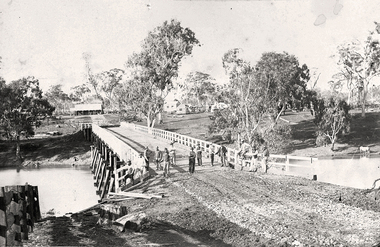
... This photograph is a well-preserved original. newbridge bridge loddon river infrastructure construction roads workers farms people Monochrome photograph depicting the newly completed wooden bridge at Newbridge, Victoria. ...Murray Comrie Collection. This photograph is a well-preserved original. Monochrome photograph depicting the newly completed wooden bridge at Newbridge, Victoria. Thirteen men are in the image, standing at one end of the bridge. These are most likely men who worked on constructing the bridge. Position of photographer is on the west bank of the Loddon, looking east.newbridge, bridge, loddon river, infrastructure, construction, roads, workers, farms, people
