
Showing 153 items matching "high plains road"
-
 Falls Creek Historical Society
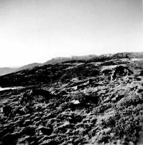
Photograph - Building Bridge at High Plains Road, Falls Creek 1950
... Building Bridge at High Plains Road, Falls Creek 1950...Building Bridge at High Plains Road, Falls Creek 1950...These images record construction of a bridge at High Plains Road, Falls Creek Falls Creek by volunteers in 1950 Fred Griffith Falls Creek Bridge building A set of black and white photographs showing steps in the construction of a bridge at Falls Creek on the King's Birthday weekend 05/06/1950 Building Bridge at High Plains Road, Falls Creek 1950 Photograph Building Bridge at High Plains Road, Falls Creek 1950 ...These photos are part of the Fred Griffith Collection. Frederick Charles “Fred” Griffith was born in Albury, NSW on 2 March 1910. Educated in Albury and Geelong Grammar. Beginning in 1927 he spent many years working first as a jackeroo and on a range of prominent pastoral and merino stud properties in NSW and Queensland. In 1935 he repurchased his former family property “Toonallook", Bowna, NSW and developed it to be the largest Romney Marsh stud in the world, exporting rams to Argentina. He introduced many innovative practices on his property including rabbit control measures and aerial crop dusting. He was an active member of the Albury Show Society and in 1949 established the Albury Sheep Show. Fred was also the Albury representative on the Graziers’ Association Council for over 30 years. He became a life member of both the Albury and Commercial Clubs. Fred’s greatest hobby was snow skiing. His first visit to the snow was to Kosciusko in 1919. The Albury Ski Club was formed in 1935 and Fred was an inaugural member. In 1949 they were granted a site at Falls Creek to build their own lodge. Fred guaranteed the Club for finance from the Bank of NSW. The first portion of the prefabricated building was constructed in Albury. It was transported to Falls Creek on the back of Fred’s truck and erected in one day. This was the bathroom section and the rest was completed in 1950. The original lodge was burned down in 1952 and a new one built the following year. In 1955, Fred also built the Bowna Lodge for his family in partnership with David Fairbairn. He became head of the North Eastern District Skiing Association (N.E.D.S.A.) and successfully applied to run the Australian Ski Championships. Fred also inaugurated children’s races at Falls Creek and ran them for about 20 years. He also formed the company “Falls Creek Ski Tows”. In 1956 Fred along with a group of key people selected the site for Thredbo Village. Fred and his brother sold Toonallook in sections between 1951 and 1974. He moved to Albury and set up as a landscape gardener and fencing contractor. After a serious work accident, Fred retired in 1985 and moved to Rosebud, Victoria where he died on 19 August 1992.These images record construction of a bridge at High Plains Road, Falls Creek Falls Creek by volunteers in 1950A set of black and white photographs showing steps in the construction of a bridge at Falls Creek on the King's Birthday weekend 05/06/1950fred griffith, falls creek, bridge building -
 Kiewa Valley Historical Society
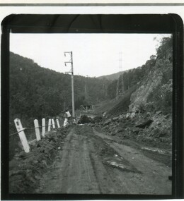
Bogong High Plains Road during construction
... Bogong High Plains Road during construction...Bogong High Plains Road...The SECV constructed the KHES and built a road from Mt Beauty to the Bogong High Plains. The road wound its way up the mountains and was susceptable to road slips especially during winter when the area received a lot of rain and, higher up, snow....Bogong High Plains Road Black and white very small photos scanned from negative strip. 11 photos altogther on 6 strips. all show the damage to the Bogong Higjh Plains Road afer rain. ...The SECV constructed the KHES and built a road from Mt Beauty to the Bogong High Plains. The road wound its way up the mountains and was susceptable to road slips especially during winter when the area received a lot of rain and, higher up, snow.Black and white very small photos scanned from negative strip. 11 photos altogther on 6 strips. all show the damage to the Bogong Higjh Plains Road afer rain. No date given but during the construction of the KHES by the SECV.bogong high plains road -
 Kiewa Valley Historical Society
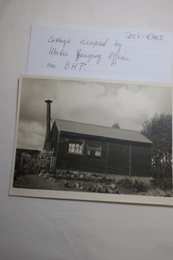
Photos - SECV Cottage and Flying Fox
... Cottage was occupied during the construction of the Kiewa Hydro Electric Scheme by the water gauging officer on the Bogong High Plains road. 2. Flying Fox was used prior to bridges being built across the Kiewa River...."Cottage occupied by Water Gauging Officer on Bogong High Plains Road." b & w, 2, "School girl (maybe Allie Coper) coming across the Kiewa River at Tawonga in a flying fox to go to the Tawonga School"...Cottage was occupied during the construction of the Kiewa Hydro Electric Scheme by the water gauging officer on the Bogong High Plains road. 2. Flying Fox was used prior to bridges being built across the Kiewa River. ...1. Cottage was occupied during the construction of the Kiewa Hydro Electric Scheme by the water gauging officer on the Bogong High Plains road. 2. Flying Fox was used prior to bridges being built across the Kiewa River.In the early days of the Kiewa Valley and during construction of the the KHES, the water gauging officer measured and recorded the flow, volume, and quality of water in the Kiewa River.b & w. 1. "Cottage occupied by Water Gauging Officer on Bogong High Plains Road." b & w, 2, "School girl (maybe Allie Coper) coming across the Kiewa River at Tawonga in a flying fox to go to the Tawonga School"Titles are on the back of both photos.water gauging officer, tawonga flying fox -
 Kiewa Valley Historical Society
Papers - Newspaper Obituary Harry Vyner and Family History Chart
... ...High Plains Road...Harry Vyner Country Roads Board High Plains Road A4 Sheet with family tree details of Harry Vyner / McKendrick families Newspaper cutting re Obituary of Harry Vyner dated December 1979 Papers - Newspaper Obituary Harry Vyner and Family History Chart ...The obituary is of Harry Vyner, who came to work for the SECV on the KHES in 1938This is an example of one man's life and how he came to live in the Kiewa Valley and his contribution to the development of Mount Beauty as a thriving community.A4 Sheet with family tree details of Harry Vyner / McKendrick families Newspaper cutting re Obituary of Harry Vyner dated December 1979harry vyner, country roads board, high plains road -
 Kiewa Valley Historical Society
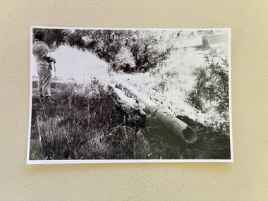
Photo - Mt Beauty Golf Course
... It is set into the landscape adjacent to the Bogong High Plains Road and attached to the Mt Beauty township. ...It is set into the landscape adjacent to the Bogong High Plains Road and attached to the Mt Beauty township. ...The Mt Beauty Golf Course was opened in 1948 providing recreation for the workers on the construction of the Kiewa Hydro Electric Scheme. It is set into the landscape adjacent to the Bogong High Plains Road and attached to the Mt Beauty township. Also see KVHS 1334 and KVHS 1413Early in the construction the SECV helped to build the Mt Beauty Golf Course to provide sport and recreation for its employees of the Kiewa Hydro Electric Scheme. It has also become a tourist attraction encouraging visitors to the area.b & w photo 12.5 cm x 8cm A pipe with an inscription written on the back"Ray Walters overlooking Drain Piping Hazard 9 th February / March 28th 86 / Mt Beauty Golf Club mt beauty golf course, sport and recreation -
 Falls Creek Historical Society
Photograph - Joan Meyer near Fitzgerald's Hut
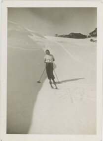
... high plains which included what is now the resort of Falls Creek. The six SEC employees, Toni St Elmo, Ray Meyer, Jack Minogue, Lloyd Dunn, Adrian Ruffenacht and Dave Gibson (together with their families) banded together to secretly build a 'hut' that was the first ski lodge at Falls Creek. Using a road...High Plains. The original Fitzgerald Hut was built in 1903 by George Silas Fitzgerald. Destroyed by fire in 1991, it was rebuilt using salvaged and recycled timber. It is located in a large clearing, three to four hours hike from the Bogong High Plains Road These images document Joan's first trip on skis carrying a pack on her back.The trip took about two weeks to complete....High Plains. The original Fitzgerald Hut was built in 1903 by George Silas Fitzgerald. Destroyed by fire in 1991, it was rebuilt using salvaged and recycled timber. It is located in a large clearing, three to four hours hike from the Bogong High Plains Road These images document Joan's first trip on skis carrying a pack on her back.The trip took about two weeks to complete. ...MEYER COLLECTION - FALLS CREEK PHOTOS In 1947 a determined group of like-minded State Electricity Commission (SEC) staff including Ray Meyer, the chief surveyor of the Kiewa Hydro-Electric Scheme, had a common interest that revolved around the skiing potential of the snow-covered high plains which included what is now the resort of Falls Creek. The six SEC employees, Toni St Elmo, Ray Meyer, Jack Minogue, Lloyd Dunn, Adrian Ruffenacht and Dave Gibson (together with their families) banded together to secretly build a 'hut' that was the first ski lodge at Falls Creek. Using a road built in 1930s to gain access to Falls Creek, their hut project was carried out in secret as efforts by other skiers were blocked by H.H.C. Williams – the engineer in charge of the Hydro Scheme. In 1946 Ray Meyer made a trip to the Lands Office in Melbourne. He came away with a 99-year lease on three acres that was ideally suited for a hut designed by Lloyd Dunn. Adrian Ruffenacht (Design Engineer for the KHS) had suggested where the group should build because of easy access to a spring for water. Much of the building material required was scavenged from derelict huts on the high plains. Due to the need for secrecy, the determined group worked on the hut in the evenings and weekends to avoid detection. During the building period the group had met at Echidna Rock (now known as Eagle Rock) where Skippy St Elmo announced, "This is my favourite ‘Skyline’.” And so the first lodge in the area at Falls Creek Ski Resort came into existence. With the development of the International Poma in the 1970s, the Skyline Lodge, which was sited between the ski-lift’s pole one and pole two, was demolished. However, the legacy of Ray Meyer, Toni St Elmo, Jack Minogue, Lloyd Dunn, Adrian Ruffenacht and Dave Gibson and Skyline lives on in the vibrant atmosphere of Falls Creek Resort. The MEYER COLLECTION documents developments on the Kiewa Hydro Scheme and their life at Falls Creek from the mid 1930s to 1960s.These images are significant because they depict aspects of the life of a pioneering family of Falls Creek and the founders of "Skyline", the first lodge at Falls Creek.Images of Joan Meyer near Fitzgerald's Hut on the Bogong High Plains. The original Fitzgerald Hut was built in 1903 by George Silas Fitzgerald. Destroyed by fire in 1991, it was rebuilt using salvaged and recycled timber. It is located in a large clearing, three to four hours hike from the Bogong High Plains Road These images document Joan's first trip on skis carrying a pack on her back.The trip took about two weeks to complete.falls creek, victorian snowfields, joan meyer, fitzgerald hut -
 Kiewa Valley Historical Society
Map - Bogong High Plains
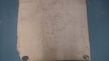
... Bogong high Plains showing mountains, places, roads and rivers...Bogong high Plains showing mountains, places, roads and rivers Historical changes of infrastructure on the Bogong High Plains bogong high plains map Bogong High Plains, hand written and 'copied with considerable simplification from F.C.V. ...Bogong high Plains showing mountains, places, roads and riversHistorical changes of infrastructure on the Bogong High PlainsBogong High Plains, hand written and 'copied with considerable simplification from F.C.V. (Falls Creek V.?) 'Feathetop' L 'Tawonga'. Paper is yellowed, writing is brown.bogong high plains map -
 Kiewa Valley Historical Society
Maps - Bogong High Plains & Mt Beauty Township
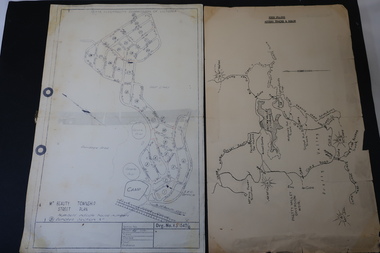
... Titled: High Plains Access Tracks & Roads 2. Mt Beauty Street Plan by SECV with Section Nos. and house numbers...Titled: High Plains Access Tracks & Roads 2. Mt Beauty Street Plan by SECV with Section Nos. and house numbers Maps - Bogong High Plains & Mt Beauty Township ...The SECV continually updated their mapsDuring the development of the KHES the SECV had to continually update their mapsBoth Foolscap 1. Titled: High Plains Access Tracks & Roads 2. Mt Beauty Street Plan by SECV with Section Nos. and house numbersBoth have sticky tape marks on their back.khes maps -
 Kiewa Valley Historical Society
Set of 2 hand coloured photographs of early Mount Beauty, photographs of Mount Beauty, 1947/48
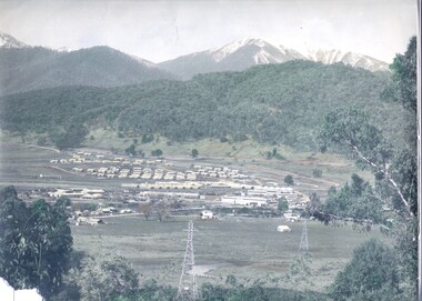
... This hostel was commenced in August/September 1948 and is clearly shown in photograph No. 2, dating this photo as 1948 as it is before the completion of the bypass road connecting to the main (high plains) road. This road was constructed in 1939 and in 1948 followed the route of Tawonga Crescent. ...This hostel was commenced in August/September 1948 and is clearly shown in photograph No. 2, dating this photo as 1948 as it is before the completion of the bypass road connecting to the main (high plains) road. This road was constructed in 1939 and in 1948 followed the route of Tawonga Crescent. ...Construction of the town of Mount Beauty commenced in 1946 and continued until 1952. It was built to provide family accommodation for workers engaged in the construction of the hydro electric power scheme. As well as housing, there was an administration building, staff hostel, merchandising centre, workmen's camps, base stores and workshops and the Mount Beauty Terminal Station. The first house was occupied in November, 1946 by the then manager of the trading store, with a frontage onto Hollonds Street. The total number of houses erected was 488, 162 custom built and 326 prefabricated. The main workmen's camp can be seen just left of the centre of the photograph and accommodated 144 men at the time of the photograph. By 1950 it could accommodate 1200men. Photo No. 1 is taken in 1947/early 1948 as there is no evidence of the staff hostel under construction. This hostel was commenced in August/September 1948 and is clearly shown in photograph No. 2, dating this photo as 1948 as it is before the completion of the bypass road connecting to the main (high plains) road. This road was constructed in 1939 and in 1948 followed the route of Tawonga Crescent. This remained in use until the bypass construction was completed in early 1949 and does not appear to be finished in this photograph.. Both photographs are taken from the power line easement adjacent to the Bright road.Significant historical pictorial record of the development of a town from grazing land. The type of terrain that had to be surveyed and then to construct roads and other infrastructure, with very little machinery, is also of prime significance in the development of the Kiewa Hydro Electric Scheme.Two photographs, both hand painted to show colours, and both of Mount Beauty c 1947/48 not long after commencement of construction of homes and facilities for workers.Photo No.1 - on back of photo, left upper corner, faintly in pencil, SPIKE, underneath this is written T Pay,. Photo No. 2 - on back of photo, left upper corner, faintly in pencil, Jmount beauty, housing, accommodation -
 Kiewa Valley Historical Society
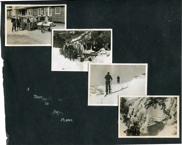
Photographs – Bogong High Plains - Set of 16 black and white photographs mounted back and front on 3 pieces of heavy black card likely removed from a photograph album
... Some pages display a brief description printed in white ink 1. 4 photographs- displayed diagonally across page. 2 pictures of a group of men standing in the snow in front of a car with a loaded trailer behind. 1 photo of skiers. 1 photo of show hanging in tree branches. 2. 2 photographs- showing Upper Kiewa Road with snow in the background 3. 3 photographs- of skiers and 1 photo of 2 of men posing in the snow & 1 photo of 2 men posing shirtless in warmer weather. 4. 2 photographs- arranged diagonally on page showing early buildings and construction at Bogong Village 5. 2 photographs- 1 showing view of Bogong Village from higher up the mountain. 1 showing early Bogong High Plains road 6. 1 photograph- showing view down along Kiewa Valley from higher up in the mountains ...High Plains and built one of the first ski lodges at Falls Creek. They were amongst those pivotal in the development of the skiing and tourist industry at Falls Creek and on the Bogong High Plains. bogong village; upper kiewa road; bogong high plains; falls creek; skiers 1. ...After World War II, the Kiewa Hydro-Electric Scheme was started in the Kiewa River Valley by the State Electricity Commission of Victoria. On land previously used only for summer cattle grazing in the natural alpine grasslands, the first ski lodge was built in 1948 by workers from the hydro scheme as skiing was a popular recreation. Many of the hydro employees were of European background and had grown up enjoying skiing and snow sports in their homelands and were keen to continue to pursue their winter sports interests. The first lift, a rope tow, was built at Falls Creek in 1951 and the first chairlift in Australia was constructed there in 1957. Two T-Bars were opened in 1961. In 1964, the Victorian Municipal Directory recorded that Falls Creek had 29 ski club lodges and 16 commercial lodges. The area became a popular tourist destination for both winter and summer sports.Employees of the State Electricity Commission of Victoria in the Kiewa River Valley were the earliest skiers on the Bogong High Plains and built one of the first ski lodges at Falls Creek. They were amongst those pivotal in the development of the skiing and tourist industry at Falls Creek and on the Bogong High Plains. Black and white photographs of varying sizes mounted decoratively on heavy black Card. Some pages display a brief description printed in white ink 1. 4 photographs- displayed diagonally across page. 2 pictures of a group of men standing in the snow in front of a car with a loaded trailer behind. 1 photo of skiers. 1 photo of show hanging in tree branches. 2. 2 photographs- showing Upper Kiewa Road with snow in the background 3. 3 photographs- of skiers and 1 photo of 2 of men posing in the snow & 1 photo of 2 men posing shirtless in warmer weather. 4. 2 photographs- arranged diagonally on page showing early buildings and construction at Bogong Village 5. 2 photographs- 1 showing view of Bogong Village from higher up the mountain. 1 showing early Bogong High Plains road 6. 1 photograph- showing view down along Kiewa Valley from higher up in the mountains 1. Handwritten in white ink – A TRIP TO THE PLAINS 2. Handwritten in white ink – UPPER KIEWA ROAD MT FAINTER IN BACKGROUND 3 – 6. No markings bogong village; upper kiewa road; bogong high plains; falls creek; skiers -
 Falls Creek Historical Society
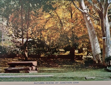
Postcard - Junction Dam, Kiewa Hydroelectric Scheme
... Samuel Keith Pearce died on 7 July 1994 in Mount Beauty, Victoria Junction Dam, also known as Lake Guy, is situated 16 kms from Mt Beauty, along the Bogong High Plains Road. It was built by the State Electricity Commission of Victoria as part of the Kiewa Hydro Electric Scheme. ...Samuel Keith Pearce died on 7 July 1994 in Mount Beauty, Victoria Junction Dam, also known as Lake Guy, is situated 16 kms from Mt Beauty, along the Bogong High Plains Road. It was built by the State Electricity Commission of Victoria as part of the Kiewa Hydro Electric Scheme. ...These photographs were taken in and around Mount Beauty and the Kiewa Valley by Samuel Keith Pearce and printed for him as a foldout postcard by NuColor Vue. The postcards state they were printed for S. K. Pearce Pty. Ltd of Tawonga and Mount Beauty. Samuel Keith Pearce was born on 24 June 1917 in Armadale, Victoria. By the late 1940s he owned the Mt Beauty Supermarket, Newsagency, Drapery and Hardware store at Mount Beauty and also a store at Tawonga in partnership with his brother Gordon Cathew Pearce. For some time, they operated as Pearce Brothers. In the early 1960s Keith also opened a mini mart In Falls Creek. As well as being a keen photographer and an astute businessman, Keith Pearce was a well-known identity in the Kiewa Valley, making many contributions to the development of the area over a long period. This included serving as a member of the Bright Shire Council for many years. He worked hard to promote the interests of the Upper Kiewa Valley. As a sign of recognition and appreciation for his contribution to the community, the park opposite the grocery store in Mount Beauty was named the SK Pearce Gardens in his honour. Samuel Keith Pearce died on 7 July 1994 in Mount Beauty, Victoria Junction Dam, also known as Lake Guy, is situated 16 kms from Mt Beauty, along the Bogong High Plains Road. It was built by the State Electricity Commission of Victoria as part of the Kiewa Hydro Electric Scheme. This collection of postcards and images is significant because they were commissioned by a highly successful businessman in Falls Creek, Victoria.A colour image of Junction Dam in the Upper Kiewa area, showing a bench and autumn trees.mt. beauty, junction dam, lake guy, kiewa hydroelectric scheme -
 Kiewa Valley Historical Society
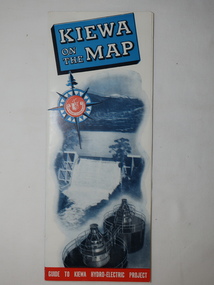
Map - Kiewa on the Map, Guide to Kiewa Hydro-Electric Project
... They controlled the roads from Mt Beauty to the Bogong High Plains and all other roads within the Kiewa works area. ...They controlled the roads from Mt Beauty to the Bogong High Plains and all other roads within the Kiewa works area. ...Published by the SECV in 1950. They controlled the roads from Mt Beauty to the Bogong High Plains and all other roads within the Kiewa works area. The roads are not open to general tourist traffic. Conducted tours of the Kiewa area are operated by Eastern Road Lines Pty. Ltd., AlburyThe SECV constructed the KHES and controlled all roads within the Kiewa works area.Large colored map folded in half and then in 3. Front third is mostly blue and white with titles.. When opened the cover has black and white photos beside it with print and 'Please Note'. Also in the other half, a 'Road Map to Kiewa' showing the south eastern side of Australia, mostly yellow (the land) and blue (the sea). Inside the map is a close up map of "Ground Plan of Kiewa Hydro Electric Project' with a 'Key Map Showing Distances'.map of kiewa 1950, khes map -
 Kiewa Valley Historical Society
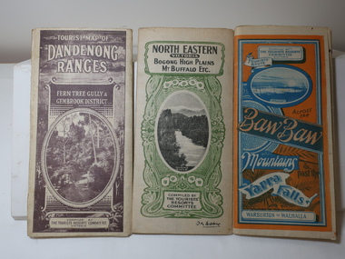
Maps - Tourist
... Main map and insert titled Bogong High Plains. Showing roads , tracks and tram ways. On insert showing snow poles. ...Main map and insert titled Bogong High Plains. Showing roads , tracks and tram ways. On insert showing snow poles. ...These maps were all dated 1933 which was before the construction of the Kiewa Hydro Electric Scheme and when Tawonga was spelt Towonga. North East Victoria in 1933 was before the construction of the Kiewa Hydro Electric Scheme so the townships of Mt Beauty and Bogong are not shown. The description of the Snow Lines was important as skiers, bushwalkers and campers relied on them. The details on the map include "ADB. Numbered from A.1-377 round plates. CD Numbered from C 1-235 square plates. Poles about 3 chains apart 27 to the mile." 3 Tourist location maps (folded) and printed on parchment. 1. Tourist map of the Dandenong Ranges. Brown cover. dated 6-4-33. Govt. printer showing roads, tracks in red and heights of the land. 2. Tourist Map of Warburton, Mt Baw Baw, and Walhalla. Blue and Orange cover. dated 23-5-33 Govt. printer. 3 different maps of each area showin roads, tracks and timber tramways.Also in red and blue. 3. Tourist Map of North Eastern Victoria including Bogong High Plains Mt Buffalo Etc. Green cover. dated June 1933 Govt. printer. Main map and insert titled Bogong High Plains. Showing roads , tracks and tram ways. On insert showing snow poles. Also Red and Blue and mountains.By Authority of H.J. Green - 6 pence. Dept of Lands and Survey, Melbourne1933 maps, tourism maps, bogong high plains map 1933, snow poles -
 Falls Creek Historical Society
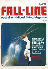
Magazine - Fall-Line - Australia's National Skiing Magazine April '79
... A lock-up storage shed will be built along Bogong High Plains Road, just below the oversnow terminal, for the use and convenience of all village commercial operators and site holders. ...A lock-up storage shed will be built along Bogong High Plains Road, just below the oversnow terminal, for the use and convenience of all village commercial operators and site holders. ...“Fall-Line” was one of a series of magazines published by the Victorian Ski Association. It was produced from 1979 until 1985. It superseded their previous publication, “Ski” magazine and was followed by the “Australian Skiing” magazine. The Victorian Ski Association was formed in 1955.This magazine is significant because it documents developments in the ski industry in Australia.A magazine featuring a coloured image on the cover and containing articles and advertising related to developments in skiing in Australia. This issue included an update on improvements being made at Falls Creek. FALLS CREEK The chairlift access area near the medical centre, long famous as the Mudpie Parlour of Falls Creek, has been sealed and Falls Creek itself, the waters of which have filled many an unsuspecting gum- boot, has been bridged, also near the medical centre. A lock-up storage shed will be built along Bogong High Plains Road, just below the oversnow terminal, for the use and convenience of all village commercial operators and site holders. Direct access will be possible by snowmobile. Falls Creek rates have risen to $82.50 per bed (less 10% discount if paid on time). The rise is the first in two years, and is less than the corresponding rise in the C.P.I. over that period. The access trail from the water tanks at the base of the Home Trail to the nursery slope has been smoothed and widened to 12 metres, and a new six metre wide access trail has been cut from Falls Creek Road, just behind Diana lodge to the chairlift bottom station. The Village Bowl comfort station is being extended and renovated, and the finishing touches are being put on the comfort station in the upper car park. Construction of an akja station/toilet block in Sun Valley will commence in 1980. The Management Committee is investigating the purchase of a Mercedes 800 series snow-clearing machine to supplement the CRB equipment in use in village parking areas The village water supply has been re- designed to ensure adequate supply at all times.australian ski magazines, skiing australia, victorian ski association -
 Falls Creek Historical Society
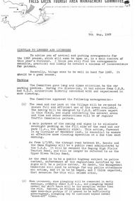
Document - Circular to Lessees and Licensees - Parking and other arrangements for the 1968 season
... Beauty and the Omeo Highway becoming a public road called the Bogong High Plains Tourist Road; snow clearing on roads and the use of chains; use of "Yellow Horse" shuttle service: slope preparation and the "Ratrac" snow packing machine; chair lift ticket prices; concerns re straying cattle and a water supply and sewerage update. ...Beauty and the Omeo Highway becoming a public road called the Bogong High Plains Tourist Road; snow clearing on roads and the use of chains; use of "Yellow Horse" shuttle service: slope preparation and the "Ratrac" snow packing machine; chair lift ticket prices; concerns re straying cattle and a water supply and sewerage update. ...Bob (Herman) Hymans (a former member of the Royal Netherlands Navy) was born in Bloemendaal, Holland on 30th September 1922. During World War II he fought against the Japanese in the Dutch East Indies (now Indonesia) and was imprisoned in Changi and on the Burma Railway. After gaining qualifications as a Ski Instructor, Bob arrived in Falls Creek in July 1950. Working as an Instructor and Supervisor at Bogong Lodge, Bob decided his future was in accommodation. He was successful in negotiating an indenture for land from the State Electricity Commission (SEC). It took Bob two years to build his Grand Coeur Chalet but, tragically, it was burned down in August 1961. Bob also built the first Chairlift in Australia. This was a single chairlift and the structure was built from wooden electricity poles. He was constantly full of new ideas and proposals for the village. Bob Hymans died on 7th July 2007. This Collection of documents and letters tells the story of Bob's endeavours to develop Falls Creek into the ski village it is today.This item is significant because it documents actions taken by the Falls Creek Tourist Area Management Committee in their role overseeing the Tourist Area.A detailed circular in preparation for the 1968 winter season. Key topics included:- the rezoning of car parking and some roads also involving the opening of the road between Mt. Beauty and the Omeo Highway becoming a public road called the Bogong High Plains Tourist Road; snow clearing on roads and the use of chains; use of "Yellow Horse" shuttle service: slope preparation and the "Ratrac" snow packing machine; chair lift ticket prices; concerns re straying cattle and a water supply and sewerage update. Over the summer some new buildings had been constructed bringing beds available on the mountain to about 1,350 and a clean up of the Village would be organised before the season began. Tobogganing areas were discussed, The need for publicity was stressed and the Committee saw this as the responsibility of those who would benefit most. Consistent approaches to snow reporting, loutishness and garbage were called for. Oversnow transport, Ski School, Snow Patrol were outlined. Finally the need to foster positive relations and a coordinated approach towards public relations was called for.falls creek tourist area management committee, falls creek administration -
 Kiewa Valley Historical Society
Photographs and copies of photographs of the pack horses and early horsemen who transported supplies to outposts in the Bogong High Plains, via cattle tracks before access roads were made
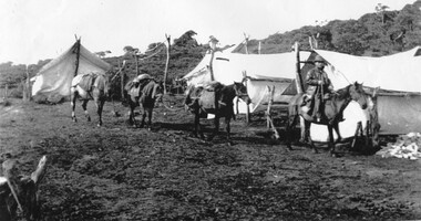
... In the mid to late 1930’s survey outposts were established to plot the early stages of the Kiewa Hydro Electric System for the SECV in the Bogong High Plains. Before any roads were built, the old cattleman’s tracks were used with packhorses to deliver supplies, wages and mail and collect timesheets and correspondence from the workmen and dam builders living in canvas tents and at the outlying survey posts. ...road below Howman’s Gap 11. Handwritten on back – Roper’s et al about to leave for the high plains 12. ...In the mid to late 1930’s survey outposts were established to plot the early stages of the Kiewa Hydro Electric System for the SECV in the Bogong High Plains. Before any roads were built, the old cattleman’s tracks were used with packhorses to deliver supplies, wages and mail and collect timesheets and correspondence from the workmen and dam builders living in canvas tents and at the outlying survey posts. ...In the mid to late 1930’s survey outposts were established to plot the early stages of the Kiewa Hydro Electric System for the SECV in the Bogong High Plains. Before any roads were built, the old cattleman’s tracks were used with packhorses to deliver supplies, wages and mail and collect timesheets and correspondence from the workmen and dam builders living in canvas tents and at the outlying survey posts. The trip up the mountain was long and hard and dangerous for both horse and man Most of the men of the survey teams were not bush-men and were often ill equipped for the harsh weather and living conditions of bush camping, often arriving in their city clothes ready for work. The tent city at Bogong was destroyed by bush fires in 1939 after which an access road was built from Mt Beauty to transport building materials for more permanent dwellings for workmen. Pack horses continued to be used for transporting goods etc. to workers further up the mountain.Without the work of horsemen and their pack horses providing supplies and communications for outlying outposts, surveying and early planning for the Kiewa Valley Hydro Electric scheme could not have gone ahead and the dams and power stations which support the system could not have been constructed. The Hydro-electric scheme, and the workers who planned and built it play a major part in the early history of the Kiewa Valley and many original families still remain living, or have ties with the local area.: Set of 21 black and white photographs and copies of photographs depicting the pack horses and the men who handled them, transporting supplies and correspondence to the outlying camps and survey posts in the Bogong High Plains, via the rough cattlemen’s tracks. Photographs also show the early tent camps of the workers. Some photos mounted on A4 white paper. Some photos enlarged to A3 poster size for display1. Handwritten on back – Max Lawrence 2. -8 No inscriptions 9. Handwritten on back- Packing in supplies for early workers of the Kiewa Hydro scheme. There were no roads in the early days of the scheme 10. Printed on bottom of photo- Roper’s cattle on road below Howman’s Gap 11. Handwritten on back – Roper’s et al about to leave for the high plains 12. Printed under photo- Syd Ryder at the Pretty Valley Cut-Out (JBR) 13-16. No markings 17. Printed under photo- Gwen Talbot visits the Camp area. 1937 18. Handwritten on back- 14/1 Barbara Talbot 19. No markings 20-21. No markings 22. Printed under photo- STATE ELECTRICITY COMMISSION OF VICTORIA. Date: 15-3-45 Time: 8.0pm No: K 1838 Kiewa Hydro-Electric Works, Investigations 1944-1945 – Survey Camp at Young’s Hut pack horses; bogong high plains; survey posts; supplies delivery -
 Flagstaff Hill Maritime Museum and Village
Decorative object - Brass Finial, Russell & Co, circa 1886
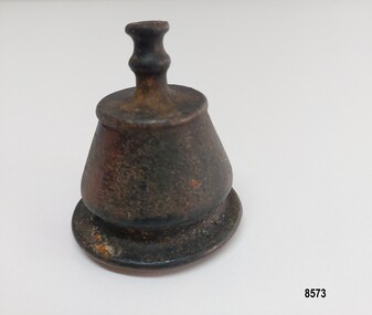
... The wreck is protected as a Historic Shipwreck under the Commonwealth Historic Shipwrecks Act (1976) Flagstaff Hill Flagstaff Hill Divers Flagstaff Hill Maritime Museum and Village Great Ocean Road Warrnambool Falls of Halladale Falls of Halladale Wreck Shipwreck artefact artefact Brass artefact Brass finial brass fitting Shipwreck coast diver John Laidlaw finial brass decoration handmade A brass, bell-shaped object with a body approximately 3 cm high. It has an outer lip, straight sides that taper in and a flat "cap". The inside of the object is plain ...In the 19th century, the Industrial Revolution meant that shipbuilders could build ships using iron. These iron ships could be much larger, with more space for cargo, and they didn't need as much work to keep them in good condition. Isambard Kingdom Brunel's "Great Britain" built in 1843, was the first ship to be built entirely of wrought iron. In the 1880's steel began to be used instead of iron. Ships also began to be fitted with steam engines, although a great deal of coal was needed to travel even short distances. For this reason, ships continued to be fitted out with sails even though many came with engines. The iron-hulled, four-masted barque, the Falls of Halladale, was a bulk carrier of general cargo. She left New York in August 1908 on her way to Melbourne and Sydney. In her hold, along with 56,763 tiles of unusual, beautiful green American slates (roofing tiles), 5,673 coils of barbed wire, 600 stoves, 500 sewing machines, 6500 gallons of oil, 14400 gallons of benzene, and many other manufactured items, were 117 cases of crockery and glassware. Three months later and close to her destination, a navigational error caused the Falls of Halladale to be wrecked on a reef off the Peterborough headland at 3 am on the morning of the 15th of November, 1908. The captain and 29 crew members all survived, but her valuable cargo was largely lost, despite two salvage attempts in 1908-09 and 1910. ABOUT THE ‘FALLS OF HALLADALE’ (1886 - 1908): - Built: in1886 by Russell & Co., Greenock shipyards, River Clyde, Scotland, UK. The company was founded in 1870 (or 1873) as a partnership between Joseph Russell (1834-1917), Anderson Rodger and William Todd Lithgow. During the period 1882-92, Russell & Co. standardised designs, which sped up their building process so much that they were able to build 271 ships over that time. In 1886, they introduced a 3000-ton class of sailing vessel with auxiliary engines and brace halyard winches. In 1890, they broke the world output record. Owner: Falls Line, Wright, Breakenridge & Co, 111 Union Street, Glasgow, Scotland. Configuration: Four-masted sailing ship; iron-hulled barque; iron masts, wire rigging, fore & aft lifting bridges. Size: Length 83.87m x Breadth 12.6m x Depth 7.23m, Gross tonnage 2085 ton Wrecked: the night of 14th November 1908, Curdies Inlet, Peterborough, south west Victoria Crew: 29 The Falls of Halladale was a four-masted sailing ship built in 1886 in Glasgow, Scotland, for the long-distance cargo trade and was mostly used for Pacific grain trade. She was owned by Wright, Breakenridge & Co of Glasgow and was one of several Falls Line ships, all of which were named after waterfalls in Scotland. The lines flag was of red, blue and white vertical stripes. The Falls of Halladale had a sturdy construction built to carry maximum cargo and was able to maintain full sail in heavy gales, one of the last of the ‘windjammers’ that sailed the Trade Route. She and her sister ship, the Falls of Garry, were the first ships in the world to include fore and aft lifting bridges. Previous to this, heavily loaded vessels could have heavy seas break along the full length of the deck, causing serious injury or even death to those on deck. The new, raised catwalk-type decking allowed the crew to move above the deck in stormy conditions. This idea is still used today on the most modern tankers and cargo vessels and has proved to be an important step forward in the safety of men at sea. On 4th August 1908, with new sails, 29 crew, and 2800 tons of cargo, the Falls of Halladale left New York, bound for Melbourne and Sydney via the Cape of Good Hope. The cargo on board was valued at £35,000 and included 56,763 tiles of American slate roofing tiles (roof slates), 5,673 coils of barbed wire, 600 stoves, 500 sewing machines, 6,500 gallons of oil, 14,400 gallons of benzene, plumbing iron, 117 cases of crockery and glassware and many other manufactured items. The Falls of Halladale had been at sail for 102 days when, at 3 am on the night of 14th November 1908, under full sail in calm seas with a six knots breeze behind and misleading fog along the coast, the great vessel rose upon an ocean swell and settled on top of a submerged reef near Peterborough on the south-west Victoria’s coast. The ship was jammed on the rocks and began filling with water. The crew launched the two lifeboats and all 29 crew landed safely on the beach over 4 miles away at the Bay of Islands. The postmistress at Peterborough, who kept a watch for vessels in distress, saw the stranding and sent out an alert to the local people. A rescue party went to the aid of the sailors, and the Port Campbell rocket crew was dispatched, but the crew had all managed to reach shore safely by the time help arrived. The ship stayed in full sail on the rocky shelf for nearly two months, attracting hundreds of sightseers who watched her slowly disintegrate until the pounding seas and dynamiting by salvagers finally broke her back, and her remains disappeared back into deeper water. The valuable cargo was largely lost, despite two salvage attempts in 1908-09 and 1910. Further salvage operations were made from 1974-1986, during which time 22,000 slate tiles were recovered with the help of 14 oil drums to float them, plus personal artefacts, ship fittings, reams of paper and other items. The Court of Marine Inquiry in Melbourne ruled that the foundering of the ship was entirely due to Captain David Wood Thomson’s navigational error, not too technical failure of the Clyde-built ship. The shipwreck is a popular site for divers, about 300m offshore and in 3 – 15m of water. Some of the original cargo can be seen at the site, including pieces of roof slate and coils of barbed wire. This particular artefact was one of many found by John Laidlaw (a local Warrnambool diver) when diving on the Falls of Halladale in the 1960's. In August 1973, John Laidlaw and Stan McPhee went on to discover the underwater location of the Schomberg - a passenger ship that ran aground on December 26th 1855 near Peterborough and which now lies in almost 9 metres of water. When John Laidlaw died, his family donated a number of artefacts to Flagstaff Hill. The brass finial may have been part of a larger decorative item such as a lamp or clock bracket.This item is significant as it was taken from the Falls of Halladale shipwreck which is listed on the Victorian Heritage Register (No. S255). She was one of the last ships to sail the Trade Routes. She is one of the first vessels to have fore and aft lifting bridges. She is an example of the remains of an International Cargo Ship and also represents aspects of Victoria’s shipping industry. The wreck is protected as a Historic Shipwreck under the Commonwealth Historic Shipwrecks Act (1976)A brass, bell-shaped object with a body approximately 3 cm high. It has an outer lip, straight sides that taper in and a flat "cap". The inside of the object is plain with evidence of vertigris. It has a decorative topping almost 2 cm high, which has a double concave hollow neck.flagstaff hill, flagstaff hill divers, flagstaff hill maritime museum and village, great ocean road, warrnambool, falls of halladale, falls of halladale wreck, shipwreck artefact, artefact, brass artefact, brass finial, brass fitting, shipwreck coast, diver, john laidlaw, finial, brass decoration, handmade -
 Flagstaff Hill Maritime Museum and Village
Container - Bottle, Ca. 1855
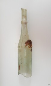
... The collection as a whole is historically significant for representing aspects of Victoria's maritime history and its potential to interpret social and historical themes. flagstaff hill warrnambool flagstaff hill maritime museum maritime museum shipwreck coast flagstaff hill maritime village great ocean road shipwreck artefact john chance glass bottle antique bottle handmade mouth blown blown bottle 19th century bottle collectable bottle two piece mould food bottle oil bottle salad oil bottle sauce bottle condiments bottle neck ring ribbed sides Bottle; slim, round, clear, slightly green-tinged, glass condiment bottle, possibly for salad oil or sauce. Handmade bottle with a broken and missing lip and base. The neck is straight and plain down to a high ...The slim, green-tinged clear glass condiment bottle was possibly used for storing and serving sauce or salad oil. The handmade bottle would have had an applied lip. It has hand blown into a two-piece mould that finished just below the neck ring, with the rest of the neck and mouth hand blown. It was recovered from the wreck of the Schomberg. ABOUT THE SCHOMBERG (October 6 to December 27, 1855)- When the ship Schomberg was launched in 1855, she was considered the most perfect clipper ship ever to be built. James Baine’s Black Ball Line had commissioned her for their fleet of passenger liners. The Aberdeen builders designed her to sail faster than the clippers designed the three-masted wooden clipper ship to be fast. The timber used for the diagonal planking was British oak with layers of Scottish larch. This luxury emigrant vessel was designed for superior comfort. She had ventilation ducts to provide air to the lower decks and a dining saloon, smoking room, library and bathrooms for the first-class passengers. The master for Schomberg’s maiden voyage was Captain ‘Bully’ Forbes. He drunkenly predicted at her launch that he would make the journey between Liverpool and Melbourne in 60 days. Schomberg departed Liverpool on 6 October 1855 with 430 passengers and 3000 tons of cargo including iron rails and equipment intended the build the Geelong Railway and a bridge over the Yarra from Melbourne to Hawthorn. The poor winds slowed Schomberg’s sail across the equator. She was 78 days out of Liverpool when she ran aground on a sand spit near Peterborough, Victoria, on 27 December; the sand spit and currents were not marked on Forbes’s map. The ship’s Chief Officer spotted the coastal steamer SS Queen at dawn and sent a signal. The master of the SS Queen approached the stranded vessel and all of Schomberg’s passengers safely disembarked. In 1975, 120 years after the Schomberg was wrecked, divers from Flagstaff Hill found an ornate communion set at the wreck site along with many other artefacts. In 1978 a diamond ring was discovered under the concretion in the lid of the communion set, which is currently on display. Former Director of Flagstaff Hill, Peter Ronald, had salvaged most of the artefacts from the wreck. This bottle is significant as an example of an item in common use in the mid-19th century. The Schomberg collection as a whole is of historical and archaeological significance at a State level. Flagstaff Hill’s collection of artefacts from the Schomberg is also significant for its association with the Victorian Heritage Registered shipwreck (VHR S 612). The collection is of prime significance because of the relationship between the objects salvaged, as together they help us to interpret the story of the Schomberg. The collection as a whole is historically significant for representing aspects of Victoria's maritime history and its potential to interpret social and historical themes.Bottle; slim, round, clear, slightly green-tinged, glass condiment bottle, possibly for salad oil or sauce. Handmade bottle with a broken and missing lip and base. The neck is straight and plain down to a high horizontal neck ring. The neck then flares outward towards the shoulder with a vertical ribbed design, finished with a scalloped border on the top of the body. The body has straight sides. Side seams run from below the neck ring to the heel. The glass has imperfections, bubbles and an uneven surface. There is brown sediment on its shoulder. A long white plug is in the narrow part of the neck. The bottle was recovered from the wreck of the Schomberg.flagstaff hill, warrnambool, flagstaff hill maritime museum, maritime museum, shipwreck coast, flagstaff hill maritime village, great ocean road, shipwreck artefact, john chance, glass bottle, antique bottle, handmade, mouth blown, blown bottle, 19th century bottle, collectable, bottle, two piece mould, food bottle, oil bottle, salad oil bottle, sauce bottle, condiments bottle, neck ring, ribbed sides -
 Eltham District Historical Society Inc
Film - Video (Digital), Geoff Paine, Skipper Cottage: Stories of the Nillumbik Shire with Geoff Paine, June 2020
... plain and how the house was moved to its present site on high ground due to flooding. The high ground came about due to dumping of rubble from the quarry where the school car park is which was used to source stone to build the schoolhouse across the road. ...plain and how the house was moved to its present site on high ground due to flooding. The high ground came about due to dumping of rubble from the quarry where the school car park is which was used to source stone to build the schoolhouse across the road. ...One of a series of videos "Stories from the Nillumbik Shire with Geoff Paine" A brief overview of the Skipper Cottage or Whitecloud and the Bootmakers cottage (mid 1850s) with Sue Thomas, partner of Adam Skipper who have lived there for about 40 years. Includes a view inside the Bootmaker's cottage. Discusses the flood plain and how the house was moved to its present site on high ground due to flooding. The high ground came about due to dumping of rubble from the quarry where the school car park is which was used to source stone to build the schoolhouse across the road. It was moved on horse and wagon approximately 200 metres. The cottage was previously a Cobb and Co stopping station for mail. When Montsalvat was being built in the 1940s, Lena Skipper who was originally from Sydney invested her money into buying Whitecloud rather than putting money into Montsalvat like many others. Upon her death, Matcham Skipper inherited the house. Seaweed was used as insulation in the ceiling and after Matcham owned it a spark from the fireplace set the seaweed on fire and gutted the front of the house which is now all one big room. Also illustrates some of the changes to the house over the years and its construction. The Elm forest has grown naturally from suckers spread from one tree.MP4 Digital file 00:05:50; 674MBvideo recording, bootmakers cottage, lena skipper, lena thomas, matcham skipper, school residence, skipper house, whitecloud cottage -
 Kiewa Valley Historical Society
Seal Skins Ski Straps / Soles
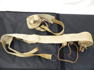
... High Plains. This equipment enabled them to travel over snow without slipping when going up hills. They took the skins off when they wanted to slide down hills. In later years, waxes were used for cross country skiing and then 'fish tail' markings on the back of skis to enable skiers to travel distances up and down mountains. Later developments also included motor transport (replacing horses to get to the snow line) and roads...High Plains. This equipment enabled them to travel over snow without slipping when going up hills. They took the skins off when they wanted to slide down hills. In later years, waxes were used for cross country skiing and then 'fish tail' markings on the back of skis to enable skiers to travel distances up and down mountains. Later developments also included motor transport (replacing horses to get to the snow line) and roads ...Seal skin straps and webbing were introduced into the Victorian Alps by European skiers. Enthusiasts travelled to enjoy the snow and to explore the Victorian Alps including the Bogong High Plains. This equipment enabled them to travel over snow without slipping when going up hills. They took the skins off when they wanted to slide down hills. In later years, waxes were used for cross country skiing and then 'fish tail' markings on the back of skis to enable skiers to travel distances up and down mountains. Later developments also included motor transport (replacing horses to get to the snow line) and roads to take skiers to the ski fields and mechanised tows to take skiers up mountains so they could ski down (downhill skiing). Skate skiing has also developed as another form of skiing.Skiers visited the Bogong High Plains during summer and winter to explore and enjoy the High Plains. The equipment used was a forerunner to the variety used today and the different types of skiing done today. Falls Creek was developed during the construction of the Kiewa Electric Hydro Scheme and was influenced by the number of Europeans working on the scheme and their desire to make use of the snow during winter.Each Seal skin has: Seal skin sewn onto one side of a strap of webbing. There is a webbing loop on the front that slips over a small point at the front of the ski. There is a webbing strap attached to the back of the seal skin sole coming over the back of the ski that clips metal fasteners onto a loop of webbing behind the boot.skiing. snow. high plains. seal skins. cross country skiing. alpine sports. -
 Kiewa Valley Historical Society
Booklet - Bogong, Photographic Booklet of Bogong Vic
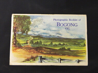
... roads. The photos indicate what the area around Bogong looked like c1958 towards the end of construction but before the bush grew back after the 1939 fires at Bogong village and after construction of the shopping centre at Mt Beauty. A sno' cat and snow plough are also shown emphasising the change in machinery over the years. This enables comparisons to be made in many areas of study. bogong. lake guy. howman gap hostel. mt beauty.bogong high plains ...This booklet was produced to advertise Bogong Village and surrounding areas. The photos depict the area's buildings and equipment being used at the time. Bogong Village housed the State Electricity Commission of Victoria's employees working on the Kiewa Hydro Electric Scheme which began in the 1930's and finished in the 1960's. Maisie describes her visit in May 1958 giving an insight into the area including the weather and the roads.The photos indicate what the area around Bogong looked like c1958 towards the end of construction but before the bush grew back after the 1939 fires at Bogong village and after construction of the shopping centre at Mt Beauty. A sno' cat and snow plough are also shown emphasising the change in machinery over the years. This enables comparisons to be made in many areas of study.A fold down booklet postcard size of 9 black and white photos of Bogong village and surrounds and a letter addressed to Mrs. A. Parnell of Sydney from Maisie. Maise's husband has 2 married sisters living near Bogong on farms. The booklet is in a clear plastic sleevePostage stamp arrived in Sydney 28th May 1958.bogong. lake guy. howman gap hostel. mt beauty.bogong high plains. -
 Kiewa Valley Historical Society
Photo - Tawonga Store
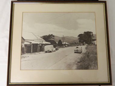
... road is sealed and telephone and electric wires are shown. The Pearce Bros owned the Tawonga Store in the 1950s when the population of the area in the Upper Kiewa Valley and High Plains was high due to the construction of the Kiewa Hydro Electric Scheme by the State Electricity Commission of Victoria. tawonga store. pearce bros. tawonga bakery. i.r.northey. ...This photo was taken in the 1950's when Pearce Bros. owned the Tawonga Store. I.R.Northey's van is parked outside the store. Kodak photos are advertised. The Bakery existed. The road is sealed and telephone and electric wires are shown. The Pearce Bros owned the Tawonga Store in the 1950s when the population of the area in the Upper Kiewa Valley and High Plains was high due to the construction of the Kiewa Hydro Electric Scheme by the State Electricity Commission of Victoria.Sepia photo of Pearce Bros. Tawonga Store including a house next door, cars in the sealed street and part of the Bakery opposite. It has a slim wooden frame & white cardboard border. It has a clear glass cover. The back is lined with brown paper with a white cord across for hanging the photo.tawonga store. pearce bros. tawonga bakery. i.r.northey. -
 Kiewa Valley Historical Society
Letters - Briggs Bros
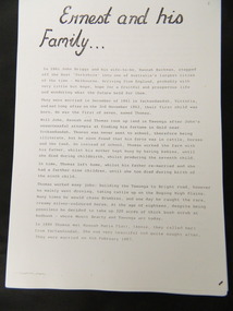
... Thomas assisted building the Tawonga to Bright road and drove cattle to the Bogong High Plains before marrying in 1887 and raising 7 children, 2 of whom, Ernest and Albert enlisted in WW1 in 1916. ...Thomas assisted building the Tawonga to Bright road and drove cattle to the Bogong High Plains before marrying in 1887 and raising 7 children, 2 of whom, Ernest and Albert enlisted in WW1 in 1916. ...The Briggs family lived in Tawonga. Thomas assisted building the Tawonga to Bright road and drove cattle to the Bogong High Plains before marrying in 1887 and raising 7 children, 2 of whom, Ernest and Albert enlisted in WW1 in 1916. Their letters from the war give an insight into its effects and the attitude of the time.The Briggs Bros. lived in the Kiewa Valley at Tawonga. Their letters give an insight into the war and an understanding of the times. Their parents lived and worked locally further enriching an understanding of the history of the Valley.30 pages of photocopies A4 size, of the Family Tree of the Briggs Family of Tawonga, including letters from two brothers from the trenches in WWI..briggs bros.. ww1. letters. tawonga. briggs family. droving. bright road. bogong high plains. -
 Kiewa Valley Historical Society
Diary Extract - Trip to Bogong High Plains Xmas 1934 & DVD photos, original diary 1934
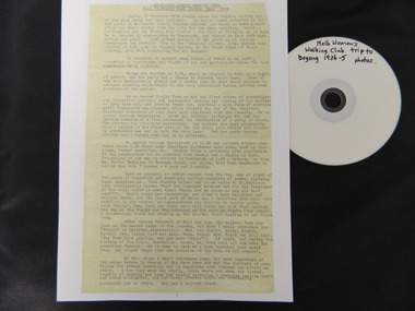
... High Plains in the mid 1930's before the Kiewa Hydro Electric Scheme opened up the area. The diary mentions a photo being taken by Mr Blackwell on the 9th day, New Year's Eve 'from a lovely bush track from which, looking back at intervals we got our final glimpse of Fainter. 5 miles from from our destination'. Historic: This extract from the diary of 'Bill', a member of the Melbourne Women's Walking Club gives an insight into walking in the mid 1930's and describes the Bogong High Plains as it was then before it was opened up with a road ...The Melbourne Women's Walking Club enjoyed bush walking as a hobby travelling to the north east of Victoria, using pack horses and camping on a 9 day hike. One of the woman, 'Bill' describes each day in detail - what they did, where they went and what they saw giving an insight into walking and the Bogong High Plains in the mid 1930's before the Kiewa Hydro Electric Scheme opened up the area. The diary mentions a photo being taken by Mr Blackwell on the 9th day, New Year's Eve 'from a lovely bush track from which, looking back at intervals we got our final glimpse of Fainter. 5 miles from from our destination'.Historic: This extract from the diary of 'Bill', a member of the Melbourne Women's Walking Club gives an insight into walking in the mid 1930's and describes the Bogong High Plains as it was then before it was opened up with a road built during the Kiewa Hydro Electric Scheme. It describes the area in summer including the flora & fauna, cattle grazing & cattlemen, the huts, the gauges set up by the State Electricity Commission of Victoria, the people working up there, the weather and the lifestyle of the walking group - their food, duties, swimming etc.. Six double sided typed photocopied yellow pages describing the Melbourne Women's Walking Club trip to the Bogong High Plains at Christmas in 1934. Also one page photocopied of the programme for Year 1934-35 with an arrow pointing to the above trip and a page with a photocopied sepia photo of the "Melbourne Women's Walking Club / Bogong High Plains / Dec. 1934. DVD 12 photos of the trip arrow showing trip from Programme. Title of photo "Melbourne Women's Walking Club / Bogong High Plains / Dec. 1934melbourne women's walking club. bogong high plains. camping. pack horses. cattlemen's huts. -
 Kiewa Valley Historical Society
Map - Topographical, Ski Club of Victoria Bogong High Plains and Adjacent Peaks, Early 1930's
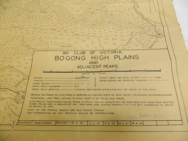
... It is historically significant as these people were involved in taking cattle up to the High Plains during summer and may have been used for bush walking and skiing. topographic map; kiewa valley; ryder family; high plains of victoria Rocky Valley Dam (Kiewa Hydro Electric Scheme) has been drawn on the map by hand with a biro. There is a wooden rod at the top of the map. This is a sepia coloured paper map which was originally printed copyright registered. It was revised in 20/6.33/4.4.37/8.4.40/24.8.43/19/6/54. It shows roads ...This map has been in the Ryder family for approx. 70 years. Probably used when bush walking and skiing in the early days on the Bogong High Plains. The Ryder family are farmers in the Kiewa Valley and were involved in taking their cattle up to the Bogong High Plains where they had a lease. The State Electricity Commission of Victoria constructed the Kiewa Hydro Electric Scheme opening up the area during the 1940's and 1950's. This type of map is an early one, used by people in the Kiewa Valley and possibly by surveyors prior to construction.The map is an early topographic map used by farmers living in the Kiewa Valley. It is historically significant as these people were involved in taking cattle up to the High Plains during summer and may have been used for bush walking and skiing.This is a sepia coloured paper map which was originally printed copyright registered. It was revised in 20/6.33/4.4.37/8.4.40/24.8.43/19/6/54. It shows roads / tracks / snow poles / snow pole numbers (27) / Snow pole spacing (3 chains. 66 yards) approximately 27 poles to the mile / height above sea level in feet - 5280. Water courses not definitely located etc.Rocky Valley Dam (Kiewa Hydro Electric Scheme) has been drawn on the map by hand with a biro. There is a wooden rod at the top of the map.topographic map; kiewa valley; ryder family; high plains of victoria -
 Kiewa Valley Historical Society
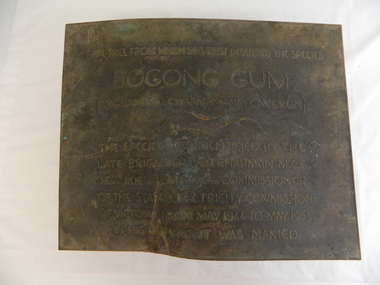
Plaque - Eucalypt Chapmanania, 1947
... High Plains. He was a Commissioner and later the Chairman of the State Electricity Commission of Victoria, the organisation in charge of building the Kiewa Hydro Scheme. The tree is a cross between two eucalypts. The trees are unique as they cannot procreate. There were two 'Bogong Gum' trees. One at Cranky Charlies and one on the way up to the High Plains passed by the Ryder family on their way up. This plaque was beside the Falls Creek Road ...W.D.Chapman had a keen interest in botany and was particularly interested in Eucalyptus species. He was first to discover the tree which now bears his name on his numerous visits to the Kiewa power station which is situated near the Bogong High Plains. He was a Commissioner and later the Chairman of the State Electricity Commission of Victoria, the organisation in charge of building the Kiewa Hydro Scheme. The tree is a cross between two eucalypts. The trees are unique as they cannot procreate. There were two 'Bogong Gum' trees. One at Cranky Charlies and one on the way up to the High Plains passed by the Ryder family on their way up.This plaque was beside the Falls Creek Road and indicated the location of the 'Bogong Gum' tree. The tree was burnt in the 2003 bush fires but survived only to be killed in the 2006 bush fires. There were two 'Bogong Gum' trees. One at Cranky Charlies and one on the way up to the High Plains passed by the Ryder family on their way up. Heavy bronze plaque embossed with inscription. On the back is a large rectangular steel piece bent at the bottom to form a 'U' shape. One end of the 'u' is attached to the plaque and the other end has two holes for bolts enabling the plaque to be attached near the tree. One bolt is in a hole."Type tree from which was first described the species / Bogong Gum / (Eucalyptus Chapmaniana, Cameron) / The species was identified by the / late Brigadier W. D. Chapman M.C.E., / D. Eng., M.I.E. Aust., M.I.C.E. Lond. Commissioner / of the State Electricity Commission / of Victoria from May 1944 to May 1955, / in his honour it was named."plaque; state electricity commission of victoria; w.d.chapman; eucalyptus; bogong gum tree; falls creek road -
 Kiewa Valley Historical Society
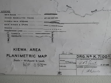
Map - Kiewa Area Planimetric Map
... roads, buildings, and bodies of water. A very clear map showing the Kiewa Hydro Electric Scheme in two dimensions to include the construction done by the SECV. Kiewa Hydro Electric Scheme 1966 Black and white Map of the Kiewa Area from Mt Beauty to the High Plains covering the Kiewa Hydro Electric Scheme and surrounds. ...Planimetric maps are two-dimensional representations of the Earth's surface, showing the location and spatial arrangement of features such as roads, buildings, and bodies of water.A very clear map showing the Kiewa Hydro Electric Scheme in two dimensions to include the construction done by the SECV.Black and white Map of the Kiewa Area from Mt Beauty to the High Plains covering the Kiewa Hydro Electric Scheme and surrounds. Drawn on 11th May 1966kiewa hydro electric scheme 1966 -
 Kiewa Valley Historical Society
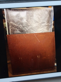
Maps 3D - National Parks
... roads etc. Digital information is now available. These photographs give the topography and contours of vast local areas eg. Mt Feathertop and Tawonga township.when used with a stereoscope. Maps showing topography National Parks stereoscope Identified and catalogued by National Parks Black and white large aerial photos of the Bogong High Plains area. 14 to 20 of them all on thick paper and the same size as the brown wooden box which holds them. ...Used by the employees of National Parks. The maps show the topography and contours in 3D when used with the stereoscope KVHS 0743. This enables the photographed area to be compared to previous photos and enables the planning of construction of eg. new roads etc. Digital information is now available.These photographs give the topography and contours of vast local areas eg. Mt Feathertop and Tawonga township.when used with a stereoscope. Black and white large aerial photos of the Bogong High Plains area. 14 to 20 of them all on thick paper and the same size as the brown wooden box which holds them. The box hasn't got a lid at the top.Identified and catalogued by National Parksmaps showing topography, national parks, stereoscope -
 Kiewa Valley Historical Society
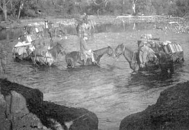
Photos: black and white - Working Horses
... roads and vehicles being available Working Horses Horses from the Kiewa Valley 1. Horses crossing river - 2 copies 2. Pack horses 3. Rider with pack horse -x2 and See (KVHS 1396) 4. Cattle entering river 5. Horses on High Plains ...Photo No. 9 Horses Crossing River - Packing in supplies for early workers on the Kiewa Hydro Scheme. There were no roads in the early days of the Scheme. Horses from the Kiewa Valley were used to transport goods prior to roads and vehicles being available1. Horses crossing river - 2 copies 2. Pack horses 3. Rider with pack horse -x2 and See (KVHS 1396) 4. Cattle entering river 5. Horses on High Plains x2 6. color - Horses in River 7. Pack horses and carts 8. 4 Cattlemen with dog in foreground 9. Color - Horses crossing river 10.Horses and tents - Harry Trimble x2working horses, horses from the kiewa valley -
 Kiewa Valley Historical Society
Tapes - x10 Native Orchids and Birds, Lake Guy
... High Plains and surrounds and the SECV construction on the Kiewa Hydro Electric Scheme were topics of interest for the workers living there. Taping them would have been an interesting hobby for Jack Farrell. Jack Farrell (1920s - 1990s) worked for the State Electricity Commission of Victoria on the KHES. He worked in the workshop and lived on the river side of Simmonds Creek Road ...Orchids, birds on the Bogong High Plains and surrounds and the SECV construction on the Kiewa Hydro Electric Scheme were topics of interest for the workers living there. Taping them would have been an interesting hobby for Jack Farrell.Jack Farrell (1920s - 1990s) worked for the State Electricity Commission of Victoria on the KHES. He worked in the workshop and lived on the river side of Simmonds Creek Road. x10 tapes of orchids, birds and Lake Guy etc. and 1 Panasonic Battery Pack VW-VBC4E for movie camera.The battery has a sticker on it "$99.00"orchids, birds, kiewa hydro electric scheme, movies of native flora, movies of birds
