Showing 37 items matching "maps of alpine area"
-
 Kiewa Valley Historical Society
Report - Alpine Study Area Volume 2 Maps, Land Conservation Council, 1970s
... ...maps of alpine area...Blue box shaped folder containing 9 of 10 Maps of the Alpine Study Area produced by the Land Conservation Council. ...These maps provide an assessment of the Alpine area at the time the maps were created. ...The Victorian Environmental Assessment Council and the former Environment Conservation Council (ECC) and Land Conservation Council (LCC) have completed 36 land use investigations over more than 35 years, including 27 regional reviews. They provide a framework for use of Public Land in Victoria. The Land Conservation Council was established by the Land Conservation Act 1970.These maps provide an assessment of the Alpine area at the time the maps were created. Some of the topics eg. Rainfall and water resources may change over the years thus providing a comparative analysis. Others may provide information for future development such as mineral exploration, building of a dam / tunnel etc.Blue box shaped folder containing 9 of 10 Maps of the Alpine Study Area produced by the Land Conservation Council. Maps include 1. Public land and descriptive blocks. 2. Physiography. 3. Topography. 4. Geology (missing). 5. Rainfall and water resources. 6. Vegetation 7. Land systems. 8. Recreation. 9. Primary production. 10. Minerals Ex library item. Stamped in red "Discarded From Stock / Swan Hill Regional Libraryalpine area, maps of alpine area, land conservation council -
 Kiewa Valley Historical Society
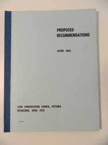
Report - Alpine Area Proposed Recommendations, Land Conservation Council, Victoria Melbourne, April 1978, April 1978
... Of interest for research on the changing ideas regarding the use of public land and the environment. alpine area land conservation council alpine study area report Blue book bound by dark blue cloth tape. It has 92 pages with maps at the end and an empty folder inside the back cover. ...The Land Conservation Council was established by the Land Conservation Act 1970. It makes recommendations to the Minister for Conservation with respect to the use of public land. Notices showing the boundary of the study area ... published in the Victorian Government Gazette Sept. 1973. A descriptive report was published in July 1977. Submissions (1538) on the future use of public land were received & included those representing a wide cross-section of the community. These were considered in the final report.Of interest for research on the changing ideas regarding the use of public land and the environment.Blue book bound by dark blue cloth tape. It has 92 pages with maps at the end and an empty folder inside the back cover.alpine area, land conservation council, alpine study area report -
 Kiewa Valley Historical Society
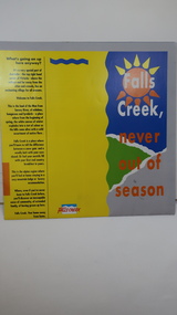
Brochure - Falls Creek Tourism, Falls Creek Never Out of Season
... area. falls creek ski resort; alpine region in victoria; mountain lodges; Glossy square brochure folded in in half and half again. Front page is yellow on the left with black print on the far left. The right side has the title with blue, green and grey background with yellow, orange and white as part of the title. The back is a man standing in front of a sunset with print in a column towards the right side. Inside includes a map ...Falls Creek is a Ski Resort in the north east of Victoria. This brochure has been produced to encourage tourists to visit throughout the year.Tourism to the Kiewa Valley is an important industry for the area. Falls Creek is a ski resort with accommodation during winter for skiers, snow boarders and other snow sports. It involves entertainment, restaurants and associated workers. This brochure is produced to promote the resort throughout the year to increase the occupancy of these lodges. The tourist industry has increased steadily with fishing, cycling and bush walking increasing numbers in the area.Glossy square brochure folded in in half and half again. Front page is yellow on the left with black print on the far left. The right side has the title with blue, green and grey background with yellow, orange and white as part of the title. The back is a man standing in front of a sunset with print in a column towards the right side. Inside includes a map with advertisements for accommodation surrounding it.falls creek ski resort; alpine region in victoria; mountain lodges; -
 Kiewa Valley Historical Society
Maps - Bogong x2, Tawonga, Omeo, Dargo, Victoria and others, 1. Bogong Alpine Area; 2. Bogong 8324; 3. Tawonga Topographical; 4. Omeo 8433; 5. Dargo 8323; 6. Victoria State
... Bogong Alpine Area (outdoor Leisure Map. survey & Mapping Victoria, Government of Victoria, Edition 2, reprinted 1991 with an image of Mt. ...Bogong Alpine Area (outdoor Leisure Map. survey & Mapping Victoria, Government of Victoria, Edition 2, reprinted 1991 with an image of Mt. ...1. Bogong Alpine Area (outdoor Leisure Map. survey & Mapping Victoria, Government of Victoria, Edition 2, reprinted 1991 with an image of Mt. Feathertop on the front. Information for tourist in the Alpine National Park: Bogong Area. Including: recreational activities, history, weather and vegetation and a list of walks together with locality maps and photographs. The front cover has an image of Mt Feathertop against a blue sky with yellow writing 'Bogong Alpine Area', there is a yellow triangular block on the right hand top corner with black writing 'Outdoor Leisure Map. On the bottom edge is a block of yellow with black writing 'Survey & Mapping Victoria' and a light green map of Victoria with 'VICMSP' printed in white. 2. 8324 Bogong Victoria, Edition 1, Commonwealth of Australia 1981. A topographical Map: 1:100,000 scale (1 cm to 1 KM). Map has a red cover with white writing together with a white block and black writing and a map insert. 3. Tawonga Topographical Map - Forests Commission Victoria, / revised 5/9/77, DEG No. 68-G/399. A Tawonga 803 folded map in a beige colour with the back blank. 4. Omeo 8433 Victoria, Edition 1, Department of Natural Resources. The map has a red and white cover with black writing and a simple map of Australia at the bottom. 5. 8323 Dargo, Edition 1, Commonwealth of Australia. A red and white cover with a map insert. 6. Victoria State Map, Hema Maps, 2002. Hema Maps, State Map, colourful cover with a map of Australia and four tourism photographs. Scale 1: 850,000 An inscription handwritten in blue pen "Trappers Gap to Mitta Mitta 1" to 1 mile". There are some pen markings and notations of tracks.maps, bogong, omeo, tawonga, dargo, victoria, bogong alpine area -
 Kiewa Valley Historical Society
Map - Bogong High Plains - Grazing Runs, Grazing Run Boundaries 1960 - Soil Conservation Authority
... areas recorded by the Soil Conservation Authority in 1972. Cattle have been banned in the Alpine National Park due to their impact on the environment. cattlemen grazing runs bogong high plains kiewa valley families White paper with brown print. Bogong High Plains from Feathertop in the west to Mt Nelse in the east showing physical boundaries including the Kiewa Hydro Electric Scheme, roads, rivers and mountains. Names of families with grazing runs and the boundaries are shown. Grazing Run Boundaries 1960 - Soil Conservation Authority Map ...Cattle grazing on the Bogong High Plains during summer commenced in the 1840s and continued for many years. The Soil Conservation Authority recorded each family's area boundaries which were updated in June 1972 and continued to be adjusted until cattle were banned in 2005. The tradition of cattle grazing continues to be controversial.Holders of grazing rights for grazing on the Bogong High Plains were allocated specific areas recorded by the Soil Conservation Authority in 1972. Cattle have been banned in the Alpine National Park due to their impact on the environment.White paper with brown print. Bogong High Plains from Feathertop in the west to Mt Nelse in the east showing physical boundaries including the Kiewa Hydro Electric Scheme, roads, rivers and mountains. Names of families with grazing runs and the boundaries are shown.cattlemen, grazing runs, bogong high plains, kiewa valley families -
 Kiewa Valley Historical Society
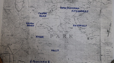
Map - Cattlemen from Kiewa Valley
... Photocopied topographical map of part of the Alpine National Park showing 11 families areas for cattle grazing. ...Photocopied topographical map of part of the Alpine National Park showing 11 families areas for cattle grazing. ...Cattle grazing on the Bogong High Plains occurred on most summers since the 1840s. The families were farmers from the Kiewa Valley. The 2003 fires interrupted this tradition which was discontinued altogether in 2005 for environmental reasons. This tradition is still controversial.History of Cattle grazing on the Bogong High Plains and farming in the Kiewa Valley and the families that lived there.Photocopied topographical map of part of the Alpine National Park showing 11 families areas for cattle grazing. Dated 1991/92 up to 2003 fires.91/92 Until fires in 2003 Families names have been added in blue texta. They are: 'Kelly, Faithful, Weston Briggs, Ryder, Cooper, Blair, Roper, Maddison, Fitzgeralds, Hicks.'cattlemen of the kiewa valley, cattle grazing on the bogong high plains -
 Kiewa Valley Historical Society
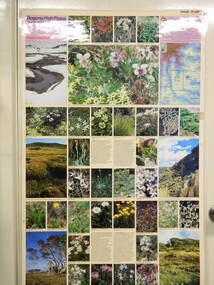
Map / Chart, Vegetation Map & Guide to Alpine Flora: Pretty Valley, 1982
... Laminated double sided vegetation map and photographic guide to Alpine flora of the Pretty Valley area...Laminated double sided vegetation map and photographic guide to Alpine flora of the Pretty Valley area Vegetation Map & Guide to Alpine Flora: Pretty Valley Map / Chart ...This poster shows Pretty Valley is on the Victorian High Plains where the State Electricity Commission of Victoria worked on the Kiewa Hydro Scheme. Also cattle have grazed in the area over the years. This map is of interest to compare the flora in the area with times prior to 1982 and after 1982.This poster has historical and research value as it shows the flora in the pretty valley area therefore making it significant for people interested in plants. Also for those who would like to compare what plants are still in this area after 1982 and if the cattle grazing, climate change, of bush fires have had on the environment. Thus this poster also has good interpretive capacity of these reasons. Laminated double sided vegetation map and photographic guide to Alpine flora of the Pretty Valley areapretty valley. bogong. vegetation. plants. flowers. alpine. victorian high plains. cattle grazing. s.e.c.v. -
 Kiewa Valley Historical Society
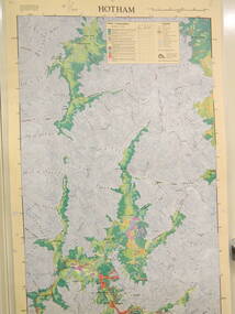
Map / Chart, Vegetation Map & Guide to Alpine Flora: Hotham, 1982
... Laminated double sided vegetation map and photographic guide to Alpine flora of the Hotham area....Laminated double sided vegetation map and photographic guide to Alpine flora of the Hotham area. Vegetation Map & Guide to Alpine Flora: Hotham Map / Chart ...This poster shows Mt Hotham is on the Victorian High Plains. This poster and map enables the comparison to be made of flora in other areas of the Victorian High Plains e.g.. which was previously known as the Bogong High Plains. This poster has historical and research value as it shows the flora in Mt Hotham area therefore making it significant for people interested in plants. Also for those who would like to compare what plants are still in this area after 1982 and if the cattle grazing, climate change, of bush fires have had on the environment. Thus this poster also has good interpretive capacity of these reasons.Laminated double sided vegetation map and photographic guide to Alpine flora of the Hotham area.hotham. vegetation. plants. flowers. alpine. high plains of victoria. -
 Kiewa Valley Historical Society
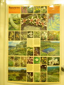
Map / Chart, Vegetation Map & Guide to Alpine Flora: Rocky Valley, 1982
... Laminated double sided vegetation map and guide to the Alpine flora of the Rocky Valley area, with photographs of plants and vegetation.... and guide to the Alpine flora of the Rocky Valley area, with photographs of plants and vegetation. Vegetation Map & Guide to Alpine Flora: Rocky Valley Map / Chart ...This poster is of Rocky Valley is on the Victorian High Plains where the State Electricity Commission of Victoria worked on the Kiewa Hydro Electric Scheme and also where cattlemen brought their cattle up during summer at various times. Its significance is due to it shows the flora of the area after the Kiewa Hydro Electric Scheme Rocky Valley damn has been build and therefore is a valuable for comparison to see what plants are there now after this information on this poster was complied. Historic: Comparison of the flora at Rocky Valley with other areas on the Victorian High Plains and with Rocky Valley before and after the Kiewa Hydro Scheme and / or grazing there. Is therefore research significance and interpretive capacity due to this compatibility value.Laminated double sided vegetation map and guide to the Alpine flora of the Rocky Valley area, with photographs of plants and vegetation.rocky valley. alpine. flora. vegetation. plants. s.e.c.v.. cattlemen. victorian high plains. -
 Kiewa Valley Historical Society
Document - Four Geological reports on the North-east Goldfields, Geological Survey of Victoria 1958 Bulletin
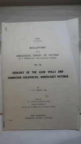
... area with maps and underground workings. Results were correlated and integrated and published by the Mines Department. The mines are in the Bogong Alpine ...Geological Surveys of N.E. Goldfields Victoria included mines and tunnels. A resurvey of goldfields was necessary to re-assess economic possibilities using modern techniques and structural interpretation. It included an examination of a considerable surface area with maps and underground workings. Results were correlated and integrated and published by the Mines Department.The mines are in the Bogong Alpine Area.Foolscap printed Victorian Bulletins. Each stapled in the top left corner and each with varying number of pages. Covering 1941-1958 a) Glen Wills and Sunnyside b) Sunnyside Tunnel c) Red Robin d) Maud and Yellow Girl Government Printer, Mines Department, Melbourne, Victoriageology in the north-east, gold fields, goldmines, glen wills -
 Kiewa Valley Historical Society
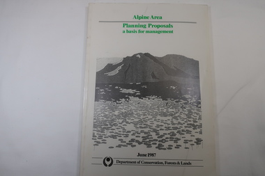
Book - Book - Alpine Area - Department of Conservation, Forests & Lands, Alpine Area / Planning Proposals / a basis for management. 1987
... Alpine Area Bogong National Park Victorian Department of Conservation Forests & Lands White bound book with green print for title at the top, black & white picture and black print at the bottom for the name of the government authority publishing the book.143 pages with fold out map after page 7. ...It is the policy of the Government that most of the State's alpine area will be proclaimed as an Alpine National Park, which would complement the Kosciusko National Park in N.S.W.. This is yet to be achieved (1987), however there is a need for sound, efficient and coordinated management based on the area's natural features, values and uses. Planning is proceeding on this basis.Victoria's alpine area is one of the State's most outstanding and spectacular natural areas. It is noted for its diverse plant and animal life, scenery, recreation opportunities and as a water catchment. This country is at the upper end of the Kiewa Valley and the planning for it is of interest to the Kiewa Valley inhabitants.White bound book with green print for title at the top, black & white picture and black print at the bottom for the name of the government authority publishing the book.143 pages with fold out map after page 7. The map is coloured green to indicate the planning area.alpine area, bogong national park, victorian department of conservation forests & lands -
 Kiewa Valley Historical Society
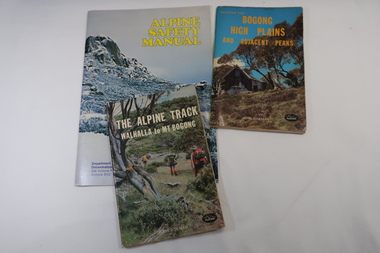
Books x3 - Walking on the Bogong High Plains, 1. The Alpine Track Walhalla to Mt Bogong. 2. Bogong High Plains and Adjacent Peaks both by John Siseman 3. Alpine Safety Manual
... areas increasing their safety and giving them independence. Bogong High Plains and Mt Bogong are at the upper end of the Kiewa Valley where local people and visitors spend their leisure time, walking. bush walking Bogong High Plais Walhalla to Mt Bogong Alpine Track 1. and 2. both written by John Siseman, small (pocket size), includes maps and black & white photos. ...Books were published to guide walkers travelling long distances in remote areas increasing their safety and giving them independence.Bogong High Plains and Mt Bogong are at the upper end of the Kiewa Valley where local people and visitors spend their leisure time, walking.1. and 2. both written by John Siseman, small (pocket size), includes maps and black & white photos. The covers are colored photos with the title at the top. 1. has 78 pages and 2. has 63 pages.The Alpine Safety Manual (in yellow) is twice the size of the others and published by the Department of State Development, Decentralization and Tourism.It has 40 pages, coloured and black & white photos and is held by 2 staples.bush walking, bogong high plais, walhalla to mt bogong, alpine track -
 Kiewa Valley Historical Society
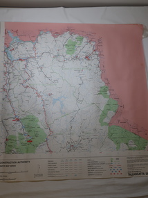
Map - Road Construction Authority 1986, Ref. Tallangatta 282008
... maps regularly. Historically of interest eg. 1. Pre dates the Alpine National Park. 2. 'Mt Beauty Estates' now known as Tawonga South. 3. Mt Niggerhead is named - It is now known as Mt Jaithmathang having been renamed in 2009. road construction authority map of Tallangatta area Colored map dated 1986 titled Road Construction Authority with an update of roads in the local Shires. ...Government authorities updated maps regularly.Historically of interest eg. 1. Pre dates the Alpine National Park. 2. 'Mt Beauty Estates' now known as Tawonga South. 3. Mt Niggerhead is named - It is now known as Mt Jaithmathang having been renamed in 2009.Colored map dated 1986 titled Road Construction Authority with an update of roads in the local Shires. It names places in the area and has a legion describing the rating of the roads and tracks. It also shows the main towns in the area and their roads.road construction authority, map of tallangatta area -
 Bendigo Historical Society Inc.
Document - JAMES LERK COLLECTION: BENDIGO CENTRAL BOTTLE CLUB NEWSLETTER
... map) and information on two of the seven vineyards in area by 1855 - A. Derivan (sic) De Ravin and William Jones, Wine Merchant; article on Bendigo Breweries - reference in it to Albion Brewery, Phoenix Brewery (Pheonix sic), Lucan St Brewery, Thunder & Co, Thunders Sandhurst Brewery, A Thunder & Co, Tankard Malting Co, Bendigo Cognac Distilling Coy, Norfolk Brewery, BB Brewery, Union Brewery, Dublin Porter Brewery, Hindmarsh Brewery, Liverpool Brewery, Edinborough Brewery, Adelaide Brewery, the City Brewing Co, Anchor Brewing Co, Kent Brewery, Alpine Brewery, Sandhurst Brewery; Page listing know Bendigo aerated water manufacturers who used the Hamilton Patent - W Bruce, J Heffernam (sic) ,Hefferman?...map) and information on two of the seven vineyards in area by 1855 - A. Derivan (sic) De Ravin and William Jones, Wine Merchant; article on Bendigo Breweries - reference in it to Albion Brewery, Phoenix Brewery (Pheonix sic), Lucan St Brewery, Thunder & Co, Thunders Sandhurst Brewery, A Thunder & Co, Tankard Malting Co, Bendigo Cognac Distilling Coy, Norfolk Brewery, BB Brewery, Union Brewery, Dublin Porter Brewery, Hindmarsh Brewery, Liverpool Brewery, Edinborough Brewery, Adelaide Brewery, the City Brewing Co, Anchor Brewing Co, Kent Brewery, Alpine Brewery, Sandhurst Brewery; Page listing know Bendigo aerated water manufacturers who used the Hamilton Patent - W Bruce, J Heffernam (sic) ,Hefferman? ...Bendigo Central Bottle Club Newsletter - James Lerk Collection (April 1976 by deduction). Reference to William Brude store owner/wine and spirit merchant. Involved in partnership in London Brewery and owned Norfolk Brewery - includes list of various bottles owned and used by William Bruce. Reference to Sheepwash being once a main thoroughfare to Bendigo (with sketch map) and information on two of the seven vineyards in area by 1855 - A. Derivan (sic) De Ravin and William Jones, Wine Merchant; article on Bendigo Breweries - reference in it to Albion Brewery, Phoenix Brewery (Pheonix sic), Lucan St Brewery, Thunder & Co, Thunders Sandhurst Brewery, A Thunder & Co, Tankard Malting Co, Bendigo Cognac Distilling Coy, Norfolk Brewery, BB Brewery, Union Brewery, Dublin Porter Brewery, Hindmarsh Brewery, Liverpool Brewery, Edinborough Brewery, Adelaide Brewery, the City Brewing Co, Anchor Brewing Co, Kent Brewery, Alpine Brewery, Sandhurst Brewery; Page listing know Bendigo aerated water manufacturers who used the Hamilton Patent - W Bruce, J Heffernam (sic) ,Hefferman?, G Pritchard, Hunter Bros, J Wharton, F G Beard, A Phillips, T Davies.bendigo central bottle club, newsletter, james lerk -
 Lakes Entrance Historical Society
Map - Grant Historic Adventurer, Paolett Adventure Maps, March 1998
... McMillans walking track, picnic areas, camping areas, Alpine National Park 1 page Included with map is a flyer for township of Grant compiled by Friends of Grant 10517A...McMillans walking track, picnic areas, camping areas, Alpine National Park 1 page Included with map is a flyer for township of Grant compiled by Friends of Grant 10517A Map Grant Historic Adventurer Paolett Adventure Maps ...Shows sealed and unsealed roads, rivers or creeks. McMillans walking track, picnic areas, camping areas, Alpine National Park 1 page Included with map is a flyer for township of Grant compiled by Friends of Grant 10517Aforest, recreation, townships, roads and streets, parks -
Lakes Entrance Historical Society
Book, Land Conservation Council, Proposed Recommendations Alpine Area Land Conservation 1978, 1978
... Lakes Entrance Historical Society 4 Marine Parade Lakes Entrance gippsland Land conservation Alpine Region recommendations Proposal by Land Conservation Council with recommendations for Alpine Area with maps Soft cover book blue cover with 100 pages Proposed Recommendations Alpine Area Land Conservation 1978 Book Land Conservation Council ...Proposal by Land Conservation Council with recommendations for Alpine Area with mapsSoft cover book blue cover with 100 pagesnon-fictionProposal by Land Conservation Council with recommendations for Alpine Area with mapsland conservation, alpine region, recommendations -
Lakes Entrance Historical Society
Book, Land Conservation Council, Final Recommendations Alpine Area, 1979
... Lakes Entrance Historical Society 4 Marine Parade Lakes Entrance gippsland Land conservation Reports recommendations Final recommendations for Alpine Area from Land Conservation Council of Victoria told on text and maps Blue cover 89 pages plus maps Final Recommendations Alpine Area Book Land Conservation Council ...Final recommendations for Alpine Area from Land Conservation Council of Victoria told on text and mapsBlue cover 89 pages plus mapsnon-fictionFinal recommendations for Alpine Area from Land Conservation Council of Victoria told on text and mapsland conservation, reports, recommendations -
Lakes Entrance Historical Society
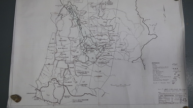
Map - Alpine Study Area Public Land and Blocks, Land Conservation Council
... Map showing public land and descriptive blocks in the Alpine area with names and numbers...Lakes Entrance Historical Society 4 Marine Parade Lakes Entrance gippsland study Land conservation Map No. 1 Map showing public land and descriptive blocks in the Alpine area with names and numbers Map Alpine Study Area Public Land and Blocks Land Conservation Council ...Map showing public land and descriptive blocks in the Alpine area with names and numbersMap No. 1study, land conservation -
Lakes Entrance Historical Society
Map - Alpine Study Area - Physiography, Land Conservation Council
... Lakes Entrance Historical Society 4 Marine Parade Lakes Entrance gippsland physiography study Land conservation Map No. 2 Map shows mountanous tracts, tablelands and plataux basins Map Alpine Study Area - Physiography Land Conservation Council ...Map shows mountanous tracts, tablelands and plataux basinsMap No. 2physiography, study, land conservation -
Lakes Entrance Historical Society
Map - Alpine Study Area - Topography, Land Conservation Council
... Lakes Entrance Historical Society 4 Marine Parade Lakes Entrance gippsland Topography study Conservation Map No. 3 Map shows Great Dividing Range Map Alpine Study Area - Topography Land Conservation Council ...Map shows Great Dividing RangeMap No. 3topography, study, conservation -
Lakes Entrance Historical Society
Map - Alpine Study Area - Geology, Land Conservation Council
... Lakes Entrance Historical Society 4 Marine Parade Lakes Entrance gippsland Geology study Land conservation Map No. 4 Map shows mountain ranges and rivers Map Alpine Study Area - Geology Land Conservation Council ...Map shows mountain ranges and riversMap No. 4geology, study, land conservation -
Lakes Entrance Historical Society
Map - Alpine Study Area - Rainfall, Land Conservation Council
... Signature Ruth Clark Map shows rainfall and water resources Golbourn River, Ovens River, Macalister Riverr Kiewa River, Mitta Mitta River, Murrary River and Snowy River Map Alpine Study Area - Rainfall Land Conservation Council ...Map shows rainfall and water resources Golbourn River, Ovens River, Macalister Riverr Kiewa River, Mitta Mitta River, Murrary River and Snowy RiverMap 5. Signature Ruth Clarkwater resources, rainfall, study -
Lakes Entrance Historical Society
Map - Alpine Study Area - Vegetation, Land Conservation Council
... Lakes Entrance Historical Society 4 Marine Parade Lakes Entrance gippsland Vegetation study Land conservation Map No. 6 Map shows tree names in each forest area as open forest, woodland and forest, cleared land. Map Alpine ...Map shows tree names in each forest area as open forest, woodland and forest, cleared land.Map No. 6vegetation, study, land conservation -
Lakes Entrance Historical Society
Map - Alpine Study Area - Land Systems, Land Conservation Council
... Lakes Entrance Historical Society 4 Marine Parade Lakes Entrance gippsland Topography Land Systems Conservation Map No. 7 Map shows land systems, bounderies in the Great Dividing Range Map Alpine Study Area - Land Systems Land Conservation Council ...Map shows land systems, bounderies in the Great Dividing RangeMap No. 7topography, land systems, conservation -
Lakes Entrance Historical Society
Map - Alpine Study Area - Recreation, Land Conservation Council
... Lakes Entrance Historical Society 4 Marine Parade Lakes Entrance gippsland Recreation Recreation Facilities study Map No. 8 Map shows historic features, natural features, facilities, road access, walking tracks Map Alpine Study Area - Recreation Land Conservation Council ...Map shows historic features, natural features, facilities, road access, walking tracksMap No. 8recreation, recreation facilities, study -
Lakes Entrance Historical Society
Map - Alpine Study Area - Primary Production, Land Conservation Council
... Lakes Entrance Historical Society 4 Marine Parade Lakes Entrance gippsland crops livestock study primary production Map No. 9 Map shows private land, cropping, sheep, cattle, dairy farm, tobacco farm, walnut, chestnuts, apples. Public area, uncleared area, cattle main stock route, Map Alpine Study Area - Primary Production Land Conservation Council ...Map shows private land, cropping, sheep, cattle, dairy farm, tobacco farm, walnut, chestnuts, apples. Public area, uncleared area, cattle main stock route,Map No. 9crops, livestock, study, primary production -
Lakes Entrance Historical Society
Map - Alpine Study Area - Minerals, Land Conservation Council
... Map shows Cassilis goldfields 1. Metallic mineral deposits. 2. Non metallic mineral deposits. 3. Fuel mineral deposits. 4. Extractive industries material Map Alpine Study Area - Minerals Land Conservation Council ...Map shows Cassilis goldfields 1. Metallic mineral deposits. 2. Non metallic mineral deposits. 3. Fuel mineral deposits. 4. Extractive industries materialMap 10minerals, study, goldfields -
Lakes Entrance Historical Society
Book, Johnson, Dick, The Alps at the Crossroads, 1974
... Contains historical evidence of the use and misuse of the Alpine area and the need for management of this special environment by the establishment of an Alpine National Park. Many illustrations and maps...Lakes Entrance Historical Society 4 Marine Parade Lakes Entrance gippsland Environment Settlement Contains historical evidence of the use and misuse of the Alpine area and the need for management of this special environment by the establishment of an Alpine National Park. Many illustrations and maps ...Contains historical evidence of the use and misuse of the Alpine area and the need for management of this special environment by the establishment of an Alpine National Park. Many illustrations and maps.environment, settlement -
 Wodonga & District Historical Society Inc
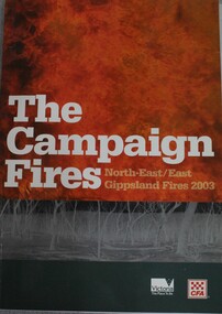
Book - The Campaign Fires - North-East/East Gippsland Fires 2003, Lyndel Hunter, 2003
... area burnt in Victoria was public land, 1.19 million hectares of parks and forests, including 60 per cent of the Alpine National Park and 81 per cent of the Mt Buffalo National Park. Firefighting efforts were made difficult in hard to access, remote forest terrain. Approximately 90,000 hectares of private land was burnt. At bottom of front cover:- CFA Victoria Logo Victorian Government Logo This publication of 119 pages features text, colour images, maps ...A description of efforts to fight the bushfires in Gippsland in 2003, including maps and illustrations This volume was published as a tribute to the work of staff and volunteers who put themselves at risk to protect local communities. It shows the impact on those communities in Victoria and the support they gave to those involved in fighting largest bushfires in Victoria for 60 years. The Alpine bushfires started on 8 January 2003, a day of Total Fire Ban. Lightning ignited 87 fires in the North-East and East Gippsland regions. Eight of these fires were unable to be contained; they joined together to form the largest fire in Victoria since the Black Friday fires in 1939. The majority of the area burnt in Victoria was public land, 1.19 million hectares of parks and forests, including 60 per cent of the Alpine National Park and 81 per cent of the Mt Buffalo National Park. Firefighting efforts were made difficult in hard to access, remote forest terrain. Approximately 90,000 hectares of private land was burnt.This publication of 119 pages features text, colour images, maps and detailed information related to the 2003 bushfires in Victoria.non-fictionA description of efforts to fight the bushfires in Gippsland in 2003, including maps and illustrations This volume was published as a tribute to the work of staff and volunteers who put themselves at risk to protect local communities. It shows the impact on those communities in Victoria and the support they gave to those involved in fighting largest bushfires in Victoria for 60 years. The Alpine bushfires started on 8 January 2003, a day of Total Fire Ban. Lightning ignited 87 fires in the North-East and East Gippsland regions. Eight of these fires were unable to be contained; they joined together to form the largest fire in Victoria since the Black Friday fires in 1939. The majority of the area burnt in Victoria was public land, 1.19 million hectares of parks and forests, including 60 per cent of the Alpine National Park and 81 per cent of the Mt Buffalo National Park. Firefighting efforts were made difficult in hard to access, remote forest terrain. Approximately 90,000 hectares of private land was burnt.forest fires -- victoria, bushfires, fires prevention and control -
Koorie Heritage Trust
Book, Beauglehole, A. C, The distribution and conservation of vascular plants in the alpine area, Victoria, 1981
... Alpine regions | Botany -- Victoria. One col. map on folded leaf in pocket. Bibliography: p. 9-11. The distribution and conservation of vascular plants in the alpine area, Victoria Book Beauglehole, A. ...One col. map on folded leaf in pocket. Bibliography: p. 9-11.indigenous vascular plants. distribution. victoria. alpine regions | botany -- victoria.