
Showing 33 items matching "parish of gembrook"
-
 Emerald Museum & Nobelius Heritage Park
Plan - Township Subdivision Plans and Advertisement, Parish of gembrook, 1921
... ...parish of gembrook...Auction set for Melbourne cup day 1/ 11 (also included is letter from Vic Racing Club confirming the cup was run on 1/11 in 1921) Original land title plans ( 1921) issued for the parish of Gembrook for the purchase by John R Phillips of 10 blocks - 5 Kings Ave and 5 Heroes Ave - back to back forming large block....Parish of gembrook...Plan Township Subdivision Plans and Advertisement Parish of gembrook ...Photographs and reproductions of Newspaper Clippings relating to Emerald - 1921 1) Emerald railway station, 2) Heroes Avenue 1921, 3) View from the Estate 4) Main Country Roads Board Road and the post office 5) Locality plan showing Main roads and railways 6) Town Estate Auction notice 7) Town Estate locality Plan and advertisements.Original copy of advertisement for "Town Estate Emerald Auction - 122 Magnificent allotments". Auction set for Melbourne cup day 1/ 11 (also included is letter from Vic Racing Club confirming the cup was run on 1/11 in 1921) Original land title plans ( 1921) issued for the parish of Gembrook for the purchase by John R Phillips of 10 blocks - 5 Kings Ave and 5 Heroes Ave - back to back forming large block.phillips, john phillips, town estate, t.w. butcher, parish of gembrook, kings rd, heroes avenue, peacock, land titles -
 Emerald Museum & Nobelius Heritage Park
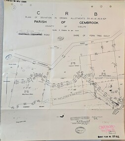
Map - Plan of deviation in Crown Allotments - parish of Gembrook, Gembrook-Belgrave Rd, Alterations to allotments 59, 60, 61,62 & 62A for the formation of Belgrave-Gembrook Rd., 1929, c1929
... Plan of deviation in Crown Allotments - parish of Gembrook, Gembrook-Belgrave Rd.,...Image of Plan of deviation in Crown Allotments - parish of Gembrook, Gembrook-Belgrave Rd., allotments 59, 60, 61,62 & 62A...CRB/Plan of deviation in Crown Allotments 59, 60, 61, 62 & 62A/Parish of Gembrook, County of Evelyn/Scale 4 chains to an inch/Gembrook-Belgrave Road/certification of plan (signed) WP BONWICK, Surveyor Licensed under Act 2679/5-2-29/Survey Plan 2240...CRB/Plan of deviation in Crown Allotments 59, 60, 61, 62 & 62A/Parish of Gembrook, County of Evelyn/Scale 4 chains to an inch/Gembrook-Belgrave Road/certification of plan (signed) WP BONWICK, Surveyor Licensed under Act 2679/5-2-29/Survey Plan 2240 Image of Plan of deviation in Crown Allotments - parish of Gembrook, Gembrook-Belgrave Rd., allotments 59, 60, 61,62 & 62A Alterations to allotments 59, 60, 61,62 & 62A for the formation of Belgrave-Gembrook Rd., 1929 Map Plan of deviation in Crown Allotments - parish of Gembrook, Gembrook-Belgrave Rd., ...Image of Plan of deviation in Crown Allotments - parish of Gembrook, Gembrook-Belgrave Rd., allotments 59, 60, 61,62 & 62ACRB/Plan of deviation in Crown Allotments 59, 60, 61, 62 & 62A/Parish of Gembrook, County of Evelyn/Scale 4 chains to an inch/Gembrook-Belgrave Road/certification of plan (signed) WP BONWICK, Surveyor Licensed under Act 2679/5-2-29/Survey Plan 2240 -
 Emerald Museum & Nobelius Heritage Park
Map - Municipality Road Classification - Beaconsfield-Emerald Rd., Shire of Gembrook 1973, Title Survey Division, Crown Description - Part of Crown Allotment 44, Parish of Gembrook, County of Mornington, c1973
... Title Survey Division, Crown Description - Part of Crown Allotment 44, Parish of Gembrook, County of Mornington...Image of Crown Survey Map for crown allotment 44 (Beaconsfield-Emerald Rd.) parish of Gembrook, County of Mornington...Title Survey Division/Crown Description/Part of Crown Allotment 44, Parish of Gembrook, County of Mornington/Municipality Road Classification, Shire of Berwick, Beaconsfeld-Emerald Rd. ...Title Survey Division/Crown Description/Part of Crown Allotment 44, Parish of Gembrook, County of Mornington/Municipality Road Classification, Shire of Berwick, Beaconsfeld-Emerald Rd. ...Image of Crown Survey Map for crown allotment 44 (Beaconsfield-Emerald Rd.) parish of Gembrook, County of MorningtonTitle Survey Division/Crown Description/Part of Crown Allotment 44, Parish of Gembrook, County of Mornington/Municipality Road Classification, Shire of Berwick, Beaconsfeld-Emerald Rd. (MR)/Francis J Webber of Kirkpatrick & Webber, 285 Maroondah Hwy., Ringwood/(Signed) - Principal Title Survey Office 16.1.73/SP13461 -
Emerald Museum & Nobelius Heritage Park
Map - Township of Emerald, Parish of Gembrook, Counties of Evelyn and Mornington, 6/03/2005 12:00:00 AM
... Township of Emerald, Parish of Gembrook, Counties of Evelyn and Mornington....Township of Emerald, Parish of Gembrook, Counties of Evelyn and Mornington - 1892...Township of Emerald, Parish of Gembrook, Counties of Evelyn and Mornington - 1892 Map Township of Emerald, Parish of Gembrook, Counties of Evelyn and Mornington. ...Township of Emerald, Parish of Gembrook, Counties of Evelyn and Mornington - 1892 -
Emerald Museum & Nobelius Heritage Park
Map - Plan of subdivision - Parish of Gembrook, Hill & Damson Licensed Surveyors
... Plan of subdivision - Parish of Gembrook...Plan of Subdivision of part of Crown Allotment 96 and Crown Allotment 96A. Parish of Gembrook. County of Evelyn. 2. Hand drawn map on tracing paper of adjacent land with included comments...Plan of Subdivision of part of Crown Allotment 96 and Crown Allotment 96A. Parish of Gembrook. County of Evelyn. 2. Hand drawn map on tracing paper of adjacent land with included comments Map Plan of subdivision - Parish of Gembrook Hill & Damson Licensed Surveyors ...1. Subdivision plan. Plan of Subdivision of part of Crown Allotment 96 and Crown Allotment 96A. Parish of Gembrook. County of Evelyn. 2. Hand drawn map on tracing paper of adjacent land with included comments -
 Emerald Museum & Nobelius Heritage Park
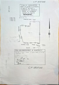
Map - Plan of Consolidation part of Crown Allotments 51 & 10B, Section A, Township of Emerald, Parish of Gembrook, County of Evelyn, Plan of consolidation for government allotment in Emerald, sealed on 19 November, 1984 (Property later to be known as Nobelius Heritage Park, Emerald), c1984
... Plan of Consolidation part of Crown Allotments 51 & 10B, Section A, Township of Emerald, Parish of Gembrook, County of Evelyn...CP159745, Plan of Consolidation Part of Crown Allotments 51 & 10B Section A, Township of Emerald, Parish of Gembrook, County of Evelyn, area bounded by Emerald Lake Rd., Princess Avenue, Crichton Rd., Kings Avenue. ...Consolidation of crown land in 1984, part of the Nobelius tract of land - nursery (Property later to be known as Nobelius Heritage Park, Emerald) CP159745, Plan of Consolidation Part of Crown Allotments 51 & 10B Section A, Township of Emerald, Parish of Gembrook, County of Evelyn, area bounded by Emerald Lake Rd., Princess Avenue, Crichton Rd., Kings Avenue. ...Image of Plan of Consolidation of Crown Allotments in township of Emeraldnon-fiction -
 Emerald Museum & Nobelius Heritage Park
Map - Survey Map - Municipality Road Classification - Beaconsfield-Emerald Rd. (near Downey Rd.) 1972, Title Survey Division, Crown Description - part of Crown Allotments 39A and 39D, Parish of Gembrook, County of Mornington, c1972
... Title Survey Division, Crown Description - part of Crown Allotments 39A and 39D, Parish of Gembrook, County of Mornington...Title Survey Division/Crown Description/Part of Crown Allotments 39A and 39D, Parish of Gembrook,County of Mornington/Municipality Road Classification - Shire of Berwick, Beaconsfield - Emerald Rd, Upper Beaconsfield - Upper Pakenham Road/John L Dwyer of Fisher Cleeland Turner & Dwyer Pty. ...Title Survey Division/Crown Description/Part of Crown Allotments 39A and 39D, Parish of Gembrook,County of Mornington/Municipality Road Classification - Shire of Berwick, Beaconsfield - Emerald Rd, Upper Beaconsfield - Upper Pakenham Road/John L Dwyer of Fisher Cleeland Turner & Dwyer Pty. ...Image of Crown survey map - changes to allotments bordering Beaconsfield-Emerald Rd. near Downey Rd. in 1972Title Survey Division/Crown Description/Part of Crown Allotments 39A and 39D, Parish of Gembrook,County of Mornington/Municipality Road Classification - Shire of Berwick, Beaconsfield - Emerald Rd, Upper Beaconsfield - Upper Pakenham Road/John L Dwyer of Fisher Cleeland Turner & Dwyer Pty. Ltd., 213 King Street, Melbourne - 14 April, 1972/S.R. CLARKE - Principal Title Survey Officer 5.9.72/SP 13072 -
 Emerald Museum & Nobelius Heritage Park
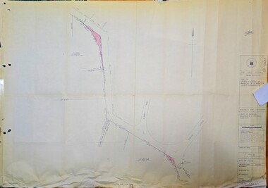
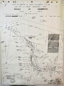
Map - Image of Plan of Deviation in Crown Allotments 57 & 58, Belgrave-Gembrook Rd., near Wright Rd. 1929, Plan of Deviation in Crown Allotments 57 & 58, Belgrave-Gembrook Rd., near Wright Rd. 1929, c1929
... Crown survey map showing plan of deviation in crown allotments 57 & 58, Belgrave-Gembrook Rd., near Wrights Rd., Parish of Gembrook...CRB/Plan of Deviation in Crown Allotments 57 & 58 and Part of Former Government Road/Parish of Gembrook, County of Evelyn/Belgrave-Gembrook Rd....CRB/Plan of Deviation in Crown Allotments 57 & 58 and Part of Former Government Road/Parish of Gembrook, County of Evelyn/Belgrave-Gembrook Rd. ...Crown survey map showing plan of deviation in crown allotments 57 & 58, Belgrave-Gembrook Rd., near Wrights Rd., Parish of GembrookCRB/Plan of Deviation in Crown Allotments 57 & 58 and Part of Former Government Road/Parish of Gembrook, County of Evelyn/Belgrave-Gembrook Rd./Scale 100 foot to an inch/Certification of Plan (Signed) W.P. BONWICK, Surveyor Licensed under Act 2679/5-2-29/Survey Plan No. 2239 -
Emerald Museum & Nobelius Heritage Park
Photograph - Gembrook Nurseries, 1908-1912, Unknown photographer, 1908-1912
... ...parish of gembrook...It was called the Gembrook Nurseries as it was located in the Parish of Gembrook, but it was commonly referred to as the Nobelius nurseries after its founder; especially as control of the remaining portions of the nurseries remained with the Nobelius family until 1955. ...It was called the Gembrook Nurseries as it was located in the Parish of Gembrook, but it was commonly referred to as the Nobelius nurseries after its founder; especially as control of the remaining portions of the nurseries remained with the Nobelius family until 1955. ...Carl Axel Nobelius established the Gembrook Nurseries in 1886 on sixty-three acres purchased from an original selector after the area's gold rush started to diminish. It was called the Gembrook Nurseries as it was located in the Parish of Gembrook, but it was commonly referred to as the Nobelius nurseries after its founder; especially as control of the remaining portions of the nurseries remained with the Nobelius family until 1955. The Nobelius Nurseries had a substantial impact on the development of the township of Emerald, as local farmers were able to earn funds during the winter by working at the nursery which gave them financial resources while waiting for their own farms to become productive. The need to transport plants and trees to port quickly also contributed to the development of rail infrastructure in the region; C.A. Nobelius was one of thirteen witnesses to the Parliamentary Standing Committee on Railways in 1898 debating a rail connection between Gembrook and Ferntree Gully, which became today's Puffing Billy tourist service. The nurseries occupied 280 acres at their peak in 1905, with more than one million trees available for sale at that time. The nursery focused on exotic fruit and ornamental species which were supplied to public parks and gardens all over the world. In several cases the nurseries were the first suppliers of the trees in Australia. Sales records show that trees were supplied to clients in Europe, Asia, the United States, Africa and New Zealand, as well as to many Councils and Government organisations around Australia, such as Melbourne's Fitzroy Gardens and Royal Botanic Gardens. Portions of the Gembrook Nurseries were sold at different times throughout the Twentieth Century, with the Emerald Country Club and Emerald Lake Park both occupying portions of the original land. In 1981 the final twelve acres were purchased by the Shire of Sherbrooke in recognition to be used as a heritage landmark in recognition of the site's significance.The photograph is significant because it demonstrates the extent of stock cultivation at the Gembrook Nurseries during the early decades of the Twentieth Century; a period in which the nurseries were the leading Southern-hemisphere supplier of plants and trees to public gardens around the world. Museum acquisition records indicate this photograph was taken in the period 1908-1912.Black and white rectangular photograph printed on photographic paper. The photograph depicts a central view of cultivated fields and trees along the skyline at the Gembrook Nurseries in approximately 1908-1912.Obverse: Gembrook Nurseries - Central View /1900s, 1910s, farming, agriculture, trees, gembrook nurseries, carl axel nobelius, emerald park lake, emerald country club, parish of gembrook, fitzroy gardens, royal botanic gardens, melbourne, shire of sherbrooke -
Emerald Museum & Nobelius Heritage Park
Plan - Surveyor's Plan, Department of Lands and Surveys, 1895
... Copy of original surveyor's plan of Township of Emerald, Parish of Gembrook, Counties of Evelyn and Mornington....Copy of original surveyor's plan of Township of Emerald, Parish of Gembrook, Counties of Evelyn and Mornington. ...Plan of Emerald Township Square Reserve, marked out 1859. The area was one mile square bounded by Boundary Road, Clematis Park-Telopea Roads, Prince Street, and Sherriff Road. Main roads are shown and large selections as at 1877.The township square was originally named 'Main Range near Emerald Diggings, Parish of Nangana'. Although the building blocks were marked at this time, little interest was taken in the area until 1877.Copy of original surveyor's plan of Township of Emerald, Parish of Gembrook, Counties of Evelyn and Mornington.This map has been prepared from the most reliable data in the possession of the Department up to date of compilation. Information respecting leases or licences which await final completion is not recorded.emerald, victoria, australia, land surveys, maps, emerald township square reserve, main range, department of lands and surveys -
 Emerald Museum & Nobelius Heritage Park
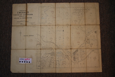
Two maps of Emerald Township 1955 and 1922, Emerald Township
... VEMU1659.1 Township of Emerald, Parish of Gembrook, Counties of Evelyn and Mornington; September 1955 VEMU1659.2 Township of Emerald, Parish of Gembrook, Counties of Evelyn and Mornington: Drafted 12 Sep 1892, Examined 30 Sep 1892, Additions 17 Jun 1922...VEMU1659.1 Township of Emerald, Parish of Gembrook, Counties of Evelyn and Mornington; September 1955 VEMU1659.2 Township of Emerald, Parish of Gembrook, Counties of Evelyn and Mornington: Drafted 12 Sep 1892, Examined 30 Sep 1892, Additions 17 Jun 1922 Emerald Township Two maps of Emerald Township 1955 and 1922 ...The Photo Lithographed Maps belonged to George and Mary A'Vard. They are early maps of Emerald Township in 1955 and 1922.VEMU1659.1 Township of Emerald, Parish of Gembrook, Counties of Evelyn and Mornington; September 1955 VEMU1659.2 Township of Emerald, Parish of Gembrook, Counties of Evelyn and Mornington: Drafted 12 Sep 1892, Examined 30 Sep 1892, Additions 17 Jun 1922 -
 Emerald Museum & Nobelius Heritage Park
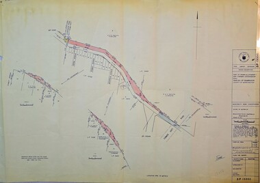
Map - Image of Surveyors Map of road classification - Beaconsfield-Emerald Rd. near Summit Ave., Emerald 1973, Crown allotment and former Govt. Road classification - Beaconsfield-Emerald Rd. near summit Ave., Emerald 1973, c1973
... Title Survey Division/Crown Description/Part of Crown Allotment and Former Government Rd., Parish of Gembrook, County of Mornington...Title Survey Division/Crown Description/Part of Crown Allotment and Former Government Rd., Parish of Gembrook, County of Mornington Image of Surveyors map indicating changes to Beaconsfield-Emerald Rd., near Summit Ave., Emerald Crown allotment and former Govt. ...Image of Surveyors map indicating changes to Beaconsfield-Emerald Rd., near Summit Ave., EmeraldTitle Survey Division/Crown Description/Part of Crown Allotment and Former Government Rd., Parish of Gembrook, County of Mornington -
 Emerald Museum & Nobelius Heritage Park
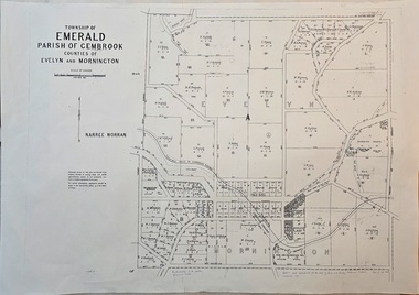
Map - Image of surveyor's map of the Township of Emerald, Surveyors map, Emerald Township 1955, c1955
... Township of Emerald/parish of Gembrook/Counties of Evelyn & Mornington/By Authority W.M.Huston, Government Printer/Drawn and reproduced at the Dept. of Lands and Survey, Melbourne, Victoria, September 1955...Emerald township map c1955 Township of Emerald/parish of Gembrook/Counties of Evelyn & Mornington/By Authority W.M.Huston, Government Printer/Drawn and reproduced at the Dept. of Lands and Survey, Melbourne, Victoria, September 1955 Image of surveyor's map - Township of Emerald 1955 Surveyors map, Emerald Township 1955 Map Image of surveyor's map of the Township of Emerald ...Emerald township map c1955Image of surveyor's map - Township of Emerald 1955Township of Emerald/parish of Gembrook/Counties of Evelyn & Mornington/By Authority W.M.Huston, Government Printer/Drawn and reproduced at the Dept. of Lands and Survey, Melbourne, Victoria, September 1955 -
Emerald Museum & Nobelius Heritage Park
Photograph - Gembrook Nursery, 1909, Unknown photographer, 1909
... The enterprise was called Gembrook Nurseries, being part of the Parish of Gembrook, but was more commonly known as Nobelius Nursery after its proprietor....The enterprise was called Gembrook Nurseries, being part of the Parish of Gembrook, but was more commonly known as Nobelius Nursery after its proprietor. ...In 1886, Carl Axel Nobelius purchased 63 acres of land from an original selector in the small settlement, in an area now mostly occupied by the Emerald Country Club. The enterprise was called Gembrook Nurseries, being part of the Parish of Gembrook, but was more commonly known as Nobelius Nursery after its proprietor.This record holds historic significance as it captures the history of agriculture in the 1910's within Gembrook and gives us an idea of the prominence agriculture had on the development of Emerald and surrounding suburbs. There is also strong research potential due to the presumed time period the photograph was taken.Black and white rectangular photograph printed on matte photographic paper. This black and white photograph consists of a central view of Gembrook Nursery. In the image, we can see the agriculture grown by Gembrook Nurseries on the rolling hills. Circa 1909.Obverse: GEMBROOK NURSERIES-A CENTRAL VIEW /1910s, emerald & district collection -
 Emerald Museum & Nobelius Heritage Park
Map - Municipality Road Classification - Beaconsfield - Emerald Rd., Shire of Berwick Alteration 1973, c1973
... Title Survey Division/Crown description/Crown allotment 47A and Part of Crown allotments1,46,47, 48A and former Government Rd., Parish of Gembrook, County of Mornington/Municipality Road Classification/Shire of Berwick, Beaconsfield-Emerald Road/Signed (Unreadable) Principal Title Survey Officer and Proper Officer 13.8.1973/SP13349...Title Survey Division/Crown description/Crown allotment 47A and Part of Crown allotments1,46,47, 48A and former Government Rd., Parish of Gembrook, County of Mornington/Municipality Road Classification/Shire of Berwick, Beaconsfield-Emerald Road/Signed (Unreadable) Principal Title Survey Officer and Proper Officer 13.8.1973/SP13349 Image of map indicating Municipality Road Classification - Beaconsfield - Emerald Rd., Shire of Berwick Alteration 1973 Municipality Road Classification - Beaconsfield - Emerald Rd., Shire of Berwick Alteration 1973 Map Municipality Road Classification - Beaconsfield - Emerald Rd., Shire of Berwick Alteration 1973 ...Image of map indicating Municipality Road Classification - Beaconsfield - Emerald Rd., Shire of Berwick Alteration 1973Title Survey Division/Crown description/Crown allotment 47A and Part of Crown allotments1,46,47, 48A and former Government Rd., Parish of Gembrook, County of Mornington/Municipality Road Classification/Shire of Berwick, Beaconsfield-Emerald Road/Signed (Unreadable) Principal Title Survey Officer and Proper Officer 13.8.1973/SP13349 -
Emerald Museum & Nobelius Heritage Park
Plan - Subdivision Plan, Atlas Press, 1911
... Subdivision Crown Lot 5 Parish of Gembrook was put up for auction on the estate on Boxing Day, 26 December 1911 at 1 o'clock. ...Subdivision Crown Lot 5 Parish of Gembrook was put up for auction on the estate on Boxing Day, 26 December 1911 at 1 o'clock. ...Plan of the Benson Estate situated in Emerald Township. Estate agent's notice. Benson selected 20 acres in Emerald Township square. The railway claimed part for Emerald Station. W. Benson lived on the property. Subdivision Crown Lot 5 Parish of Gembrook was put up for auction on the estate on Boxing Day, 26 December 1911 at 1 o'clock. Auctioneer T.W. Butcher, estate agent, lived on railway land adjoining Benson estate. Terms: one-fifth cash, balance two years without interest.Plan of subdivision, mounbted on heavy cardboard.emerald, victoria, australia, land sales, real estate agencies, maps, w. benson, t.w. butcher -
Emerald Museum & Nobelius Heritage Park
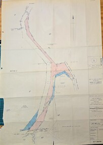
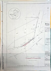
Map - Plan of Deviation in Crown Allotments 57 & 58 Wright Rd. & McNamara Rd. 1929, Property Acquisition Settlement Advice and plan of deviation in crown allotments in Wright Rd. and McNamara Rd, C 1929 & C 1984
... /Survey Plan 2239/Owner Roy and Judith Ward/dated 10 September, 1984/Signed P J McCulloch, General Manager Admin/ATTACHED MAP/Plan of Deviation in Crown Allotments 57 & 58and part of the formergovernment road, Parish of Gembrook, county of Evelyn/ certified by W.P. .../Survey Plan 2239/Owner Roy and Judith Ward/dated 10 September, 1984/Signed P J McCulloch, General Manager Admin/ATTACHED MAP/Plan of Deviation in Crown Allotments 57 & 58and part of the formergovernment road, Parish of Gembrook, county of Evelyn/ certified by W.P. ...Images of map and letter pertaining to land acquisition and deviation plan for crown allotments adjacent to Crown Allotments 57 & 58Road Construction Authority/Property Acquisition - Settlement advice letter addressd to General manager of Shire of Sherbrooke, Glanfern Way Upwey/Road - Belgrave-Gembrook Rd./Survey Plan 2239/Owner Roy and Judith Ward/dated 10 September, 1984/Signed P J McCulloch, General Manager Admin/ATTACHED MAP/Plan of Deviation in Crown Allotments 57 & 58and part of the formergovernment road, Parish of Gembrook, county of Evelyn/ certified by W.P. BONWICH - 5.2.29 -
 Emerald Museum & Nobelius Heritage Park
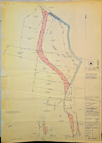
Map - Plan of Survey County of Evelyn Crown Allotment 51, Belgrave - Gembrook Rd. Acquire & declare, Near Lawson Rd, Acquire & declare Crown Allotment 51, Belgrave - Gembrook Rd, c1988
... RCA/Survey and Mapping/Plan of Survey/ County of Evelyn, Parish of Gembrook, Part of Crown Alloment 51/A.M.G. reference 792/55/364200/5801000/Municipality - Shire of Sherbrooke/Proposed Action Belgrave - Gembrook Road - Acquire & Declare/Plan prepared and signed by John E. ...RCA/Survey and Mapping/Plan of Survey/ County of Evelyn, Parish of Gembrook, Part of Crown Alloment 51/A.M.G. reference 792/55/364200/5801000/Municipality - Shire of Sherbrooke/Proposed Action Belgrave - Gembrook Road - Acquire & Declare/Plan prepared and signed by John E. ...Image of Plan of Survey County of Evelyn Crown Allotment 51, Belgrave - Gembrook Rd. Acquire & declare, Near Lawson Rd.RCA/Survey and Mapping/Plan of Survey/ County of Evelyn, Parish of Gembrook, Part of Crown Alloment 51/A.M.G. reference 792/55/364200/5801000/Municipality - Shire of Sherbrooke/Proposed Action Belgrave - Gembrook Road - Acquire & Declare/Plan prepared and signed by John E. Tulloch, 60 Denmark Street, Kew/10th March 1988/Approved Manager of Survey & Mapping - JD Murray 2-6-88/File number 87/17936/1/Survey Register Number 622/SP 17583 -
 Emerald Museum & Nobelius Heritage Park
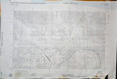
Map - Melbourne & Metropolitan Board of Works, Emerald Victoria, Topographical Map - Amendment 16.1.89, Melbourne and Metropolitan Board of Works, MMBW Topographical Map -Yarra 2500/28.01, 1989
... Mitchell, Chief Surveyor, Engineering Branch: May 1984/Survey Co-ordination Act plan classification BB2/Revised and re-issued/Latest cadastral amendment 16.1.89/Scale 1:2500/Township of Emerald 5280, Parish of Gembrook 2645, Municipalities of Pakenham 262 And Sherbrooke259/YARRA 2500/28.01 ...Mitchell, Chief Surveyor, Engineering Branch: May 1984/Survey Co-ordination Act plan classification BB2/Revised and re-issued/Latest cadastral amendment 16.1.89/Scale 1:2500/Township of Emerald 5280, Parish of Gembrook 2645, Municipalities of Pakenham 262 And Sherbrooke259/YARRA 2500/28.01 Image of printed Melbourne & Metropolitan Board of Works topographical map - Emerald - Yarra 2500/28.01 MMBW Topographical Map -Yarra 2500/28.01 Map Melbourne & Metropolitan Board of Works, Emerald Victoria, Topographical Map - Amendment 16.1.89 Melbourne and Metropolitan Board of Works ...Topographical map of Emerald township from 1989, based on photography from 1981Image of printed Melbourne & Metropolitan Board of Works topographical map - Emerald - Yarra 2500/28.01non-fictionTopographical map of Emerald township from 1989, based on photography from 1981emerald -
 Emerald Museum & Nobelius Heritage Park
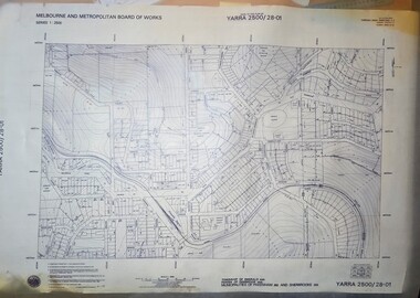
Map - Transparency edition - Melbourne & Metropolitan Board of Works, Emerald Victoria, Topographical Map - Amendment 16.1.89, Melbourne and Metropolitan Board of Works, MMBW Topographical Map -Yarra 2500/28.01, 1989
... Mitchell, Chief Surveyor, Engineering Branch: May 1984/Survey Co-ordination Act plan classification BB2/Revised and re-issued/Latest cadastral amendment 16.1.89/Scale 1:2500/Township of Emerald 5280, Parish of Gembrook 2645, Municipalities of Pakenham 262 And Sherbrooke259/YARRA 2500/28.01 ...Mitchell, Chief Surveyor, Engineering Branch: May 1984/Survey Co-ordination Act plan classification BB2/Revised and re-issued/Latest cadastral amendment 16.1.89/Scale 1:2500/Township of Emerald 5280, Parish of Gembrook 2645, Municipalities of Pakenham 262 And Sherbrooke259/YARRA 2500/28.01 Image of printed Melbourne & Metropolitan Board of Works topographical map - Emerald - Yarra 2500/28.01 MMBW Topographical Map -Yarra 2500/28.01 Map Transparency edition - Melbourne & Metropolitan Board of Works, Emerald Victoria, Topographical Map - Amendment 16.1.89 Melbourne and Metropolitan Board of Works ...Topographical map of Emerald township from 1988Image of printed Melbourne & Metropolitan Board of Works topographical map - Emerald - Yarra 2500/28.01non-fictionTopographical map of Emerald township from 1988emerald -
 Emerald Museum & Nobelius Heritage Park
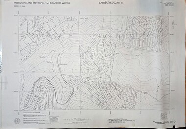
Map - Melbourne & Metropolitan Board of Works, Emerald Victoria, Topographical Map - Amendment 5.1.88, Melbourne and Metropolitan Board of Works, MMBW Topographical Map -Yarra 2500/29.01, 1988
... Marwick, Chief Surveyor, Engineering Branch: May 1986/Survey Co-ordination Act plan classification BB2/Revised and re-issued/Latest cadastral amendment 15.1.88/Scale 1:2500/Parish of Gembrook 2645, Municipalities of Pakenham 262 And Sherbrooke259/YARRA 2500/29.01 ...Marwick, Chief Surveyor, Engineering Branch: May 1986/Survey Co-ordination Act plan classification BB2/Revised and re-issued/Latest cadastral amendment 15.1.88/Scale 1:2500/Parish of Gembrook 2645, Municipalities of Pakenham 262 And Sherbrooke259/YARRA 2500/29.01 Image of printed Melbourne & Metropolitan Board of Works topographical map - Emerald - Yarra 2500/29.01 MMBW Topographical Map -Yarra 2500/29.01 Map Melbourne & Metropolitan Board of Works, Emerald Victoria, Topographical Map - Amendment 5.1.88 Melbourne and Metropolitan Board of Works ...Topographical map of Emerald township from 1989, based on photography from 1981Image of printed Melbourne & Metropolitan Board of Works topographical map - Emerald - Yarra 2500/29.01non-fictionTopographical map of Emerald township from 1989, based on photography from 1981emerald -
 Emerald Museum & Nobelius Heritage Park
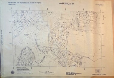
Map - Transparency of Melbourne & Metropolitan Board of Works, Emerald Victoria, Topographical Map - Amendment 5.1.88, Melbourne and Metropolitan Board of Works, MMBW Topographical Map -Yarra 2500/29.01, 1988
... Marwick, Chief Surveyor, Engineering Branch: May 1986/Survey Co-ordination Act plan classification BB2/Revised and re-issued/Latest cadastral amendment 15.1.88/Scale 1:2500/Parish of Gembrook 2645, Municipalities of Pakenham 262 And Sherbrooke259/YARRA 2500/29.01 ...Marwick, Chief Surveyor, Engineering Branch: May 1986/Survey Co-ordination Act plan classification BB2/Revised and re-issued/Latest cadastral amendment 15.1.88/Scale 1:2500/Parish of Gembrook 2645, Municipalities of Pakenham 262 And Sherbrooke259/YARRA 2500/29.01 Image transparency of printed Melbourne & Metropolitan Board of Works topographical map - Emerald - Yarra 2500/29.01 MMBW Topographical Map -Yarra 2500/29.01 Map Transparency of Melbourne & Metropolitan Board of Works, Emerald Victoria, Topographical Map - Amendment 5.1.88 Melbourne and Metropolitan Board of Works ...Topographical map of Emerald township from 1988Image transparency of printed Melbourne & Metropolitan Board of Works topographical map - Emerald - Yarra 2500/29.01non-fictionTopographical map of Emerald township from 1988emerald -
 Emerald Museum & Nobelius Heritage Park
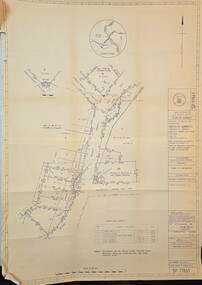
Map - Acquire & declare action for Belgrave-Gembrook Rd., Emerald 1988, Acquire & declare action for Belgrave-Gembrook Rd., Emerald 1988. near Beaconsfield-Emerald Rd. and Emerald Monbulk Rd, c1988
... Land Information and Survey Group/Plan of Survey/Counties of Evelyn and Mornington, Parish of Gembrook, Township of Emerald, Part of a Frmer Govt. ...Land Information and Survey Group/Plan of Survey/Counties of Evelyn and Mornington, Parish of Gembrook, Township of Emerald, Part of a Frmer Govt. ...Image of Map of Acquire & declare action for Belgrave-Gembrook Rd., Emerald 1988 near Beaconsfield-Emerald Rd. and Emerald Monbulk Rd.Land Information and Survey Group/Plan of Survey/Counties of Evelyn and Mornington, Parish of Gembrook, Township of Emerald, Part of a Frmer Govt. Road Section A, Part of Crown Allotment 18, Part of Recreation reserve (Crown Allotment 11C), Part of mechanics Institute & Free Library reserve (Crown Allotment 11B)/AMG Reference 7922/55/363 200/5800700/Municipality - Shire of Sherbrooke/Proposed Action/Belgrave -Gembrook Road acquire & Declare 1 & 4 to 6, revoke and declare 2 & 3.Albert McLaren Road Construction Authority, 60 Denmark Street, Kew/(signed) 5TH December 1988 a.m. LARSEN, licensed surveyor/Approved JD MURRAY, 9/12/88 - Manager - Land Information and Survey Group/SP17861 -
 Emerald Museum & Nobelius Heritage Park
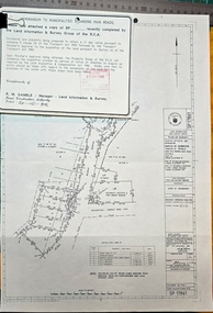
Map - Plan of Survey Acquire & Declare Proposed Action Belgrave-Gembrook Rd., Shire of Sherbrooke, Plan of Survey acquire and declare proposed action, Belgrave-Gembrook Rd, c1988
... SP17861/Land Information and survey Group/Plan of Survey/Counties of Evelyn and Mornington, Parish of Gembrook, Township of Emerald, part of former Govt. ...SP17861/Land Information and survey Group/Plan of Survey/Counties of Evelyn and Mornington, Parish of Gembrook, Township of Emerald, part of former Govt. ...Image of Plan of Survey Acquire & Declare Proposed Action Belgrave-Gembrook Rd., Shire of SherbrookeSP17861/Land Information and survey Group/Plan of Survey/Counties of Evelyn and Mornington, Parish of Gembrook, Township of Emerald, part of former Govt. Road Section A Part of Crown Allotment 18, Part of recreation Reserve (Crown Allotment 11C), Part of mechanics Institute & Free Library reserve (Crown Allotment 11B)/AMG REFERENCE 7922/55/363200/5800700/municipality, shire of Sherbrooke/Proposed Action, Belgrave-Gembrook Road Acquire & Declare 1 & 4 to 6, revoke & declare 2 & 3/Albert McLaren, Road Construction Authority, 60 Denmark Street, Kew 5th December 1988, (signed) A M Larson, Licensed Surveyor/Approved JD Murray 9/12/88, Manager - Land Information and Survey Group -
Emerald Museum & Nobelius Heritage Park
Postcard - Panorama at Emerald, Rose Stereographs Co, 1920s - 1940s
... It was called the Gembrook Nurseries as it was located in the Parish of Gembrook, but it was commonly referred to as the Nobelius nurseries after its founder; especially as control of the remaining portions of the nurseries remained with the Nobelius family until 1955. ...It was called the Gembrook Nurseries as it was located in the Parish of Gembrook, but it was commonly referred to as the Nobelius nurseries after its founder; especially as control of the remaining portions of the nurseries remained with the Nobelius family until 1955. ...Carl Axel Nobelius established the Gembrook Nurseries in 1886 on sixty-three acres purchased from an original selector after the area's gold rush started to diminish. It was called the Gembrook Nurseries as it was located in the Parish of Gembrook, but it was commonly referred to as the Nobelius nurseries after its founder; especially as control of the remaining portions of the nurseries remained with the Nobelius family until 1955. The nurseries occupied 280 acres at their peak in 1905, with more than one million trees available for sale at that time. The nursery focused on exotic fruit and ornamental species which were supplied to public parks and gardens all over the world. In several cases the nurseries were the first suppliers of the trees in Australia. Sales records show that trees were supplied to clients in Europe, Asia, the United States, Africa and New Zealand, as well as to many Councils and Government organisations around Australia, such as Melbourne's Fitzroy Gardens and Royal Botanic Gardens. This photograph shows a postcard from the Rose Stereograph Company's "Rose Series". Victorian photographer George Rose started the Rose Stereograph Company in the 1880s and produced stereographic views (an early form of 3D image production) of the Western Front during the First World War but switched to producing postcards in the 1920s. Photographers for the company produced thousands of views of Victoria and locations interstate during the following decades.The postcard is significant because it depicts the built environment and gardens at the Gembrook Nurseries during the early decades of the Twentieth Century; a period in which the nurseries were the leading Southern-hemisphere supplier of plants and trees to public gardens around the world.Black and white rectangular postcard printed on card. The postcard depicts cultivated fields, roads, fencing and buildings at the Gembrook Nurseries.Obverse: THE ROSE SERIES. P. 1626 / Copyright / PANORAMA AT EMERALD, VICTORIA /gembrook nurseries, nobelius nursery, farming, agriculture, rose stereograph company, george rose, postcards -
Emerald Museum & Nobelius Heritage Park
Photograph - Budding at Gembrook Nurseries, Unknown photographer, 1910s
... It was called the Gembrook Nurseries as it was located in the Parish of Gembrook, but it was commonly referred to as the Nobelius nurseries after its founder; especially as control of the remaining portions of the nurseries remained with the Nobelius family until 1955. ...It was called the Gembrook Nurseries as it was located in the Parish of Gembrook, but it was commonly referred to as the Nobelius nurseries after its founder; especially as control of the remaining portions of the nurseries remained with the Nobelius family until 1955. ...Carl Axel Nobelius established the Gembrook Nurseries in 1886 on sixty-three acres purchased from an original selector after the area's gold rush started to diminish. It was called the Gembrook Nurseries as it was located in the Parish of Gembrook, but it was commonly referred to as the Nobelius nurseries after its founder; especially as control of the remaining portions of the nurseries remained with the Nobelius family until 1955. The Nobelius Nurseries had a substantial impact on the development of the township of Emerald, as local farmers were able to earn funds during the winter by working at the nursery which gave them financial resources while waiting for their own farms to become productive. The need to transport plants and trees to port quickly also contributed to the development of rail infrastructure in the region; C.A. Nobelius was one of thirteen witnesses to the Parliamentary Standing Committee on Railways in 1898 debating a rail connection between Gembrook and Ferntree Gully, which became today's Puffing Billy tourist service. The nurseries occupied 280 acres at their peak in 1905, with more than one million trees available for sale at that time. The nursery focused on exotic fruit and ornamental species which were supplied to public parks and gardens all over the world. In several cases the nurseries were the first suppliers of the trees in Australia. Sales records show that trees were supplied to clients in Europe, Asia, the United States, Africa and New Zealand, as well as to many Councils and Government organisations around Australia, such as Melbourne's Fitzroy Gardens and Royal Botanic Gardens. Portions of the Gembrook Nurseries were sold at different times throughout the Twentieth Century, with the Emerald Country Club and Emerald Lake Park both occupying portions of the original land. In 1981 the final twelve acres were purchased by the Shire of Sherbrooke in recognition to be used as a heritage landmark in recognition of the site's significance.The photograph is significant because it depicts work processes at the Gembrook Nurseries during the early decades of the Twentieth Century; a period in which the nurseries were the leading Southern-hemisphere supplier of plants and trees to public gardens around the world. The photograph may also depict Carl Axel Nobelius overseeing his workers, which gives insights into work practices and social dynamics of the time.Black and white rectangular photograph printed on photographic paper. The photograph of a postcard or newspaper clipping depicts twelve men in clothes associated with the first decades of the Twentieth Century undertaking planting or other field work under the gaze of a man in a suit and top hat. The item is captioned 'Budding at Gembrook Nurseries.'Obverse: BUDDING AT GEMBROOK NURSERIES. /1910s, 1900s, 1890s, 1880s, 1886, 1905, carl axel nobelius, nobelius nursery, gembrook nurseries, emerald country club, emerald lake park, fruit growing, trees, farming -
Emerald Museum & Nobelius Heritage Park
Photograph - Nursery below 'Carramar', Unknown photographer, 1910s
... It was called the Gembrook Nurseries as it was located in the Parish of Gembrook, but it was commonly referred to as the Nobelius nurseries after its founder; especially as control of the remaining portions of the nurseries remained with the Nobelius family until 1955. ...It was called the Gembrook Nurseries as it was located in the Parish of Gembrook, but it was commonly referred to as the Nobelius nurseries after its founder; especially as control of the remaining portions of the nurseries remained with the Nobelius family until 1955. ...Carl Axel Nobelius established the Gembrook Nurseries in 1886 on sixty-three acres purchased from an original selector after the area's gold rush started to diminish. It was called the Gembrook Nurseries as it was located in the Parish of Gembrook, but it was commonly referred to as the Nobelius nurseries after its founder; especially as control of the remaining portions of the nurseries remained with the Nobelius family until 1955. The Nobelius Nurseries had a substantial impact on the development of the township of Emerald, as local farmers were able to earn funds during the winter by working at the nursery which gave them financial resources while waiting for their own farms to become productive. The need to transport plants and trees to port quickly also contributed to the development of rail infrastructure in the region; C.A. Nobelius was one of thirteen witnesses to the Parliamentary Standing Committee on Railways in 1898 debating a rail connection between Gembrook and Ferntree Gully, which became today's Puffing Billy tourist service. The nurseries occupied 280 acres at their peak in 1905, with more than one million trees available for sale at that time. The nursery focused on exotic fruit and ornamental species which were supplied to public parks and gardens all over the world. In several cases the nurseries were the first suppliers of the trees in Australia. Sales records show that trees were supplied to clients in Europe, Asia, the United States, Africa and New Zealand, as well as to many Councils and Government organisations around Australia, such as Melbourne's Fitzroy Gardens and Royal Botanic Gardens. Emerald Museum records indicate that this photograph of the Gembrook Nursery was taken in the vicinity of Carramar, the family home built by Carl Axel Nobelius. The sixteen-room mansion was one of the premier estates in the region and was visited by guests including Dame Nellie Melba and the Governor of Victoria, Sir Reginald Talbot. The building still stands amongst gardens that feature original Gembrook Nurseries plantings. Portions of the Gembrook Nurseries (and the Carramar estate) were sold at different times throughout the Twentieth Century, with the Emerald Country Club and Emerald Lake Park both occupying portions of the original land. In 1981 the final twelve acres were purchased by the Shire of Sherbrooke in recognition to be used as a heritage landmark in recognition of the site's significance.The photograph is significant because it depicts the built environment and stock cultivation at the Gembrook Nurseries during the early decades of the Twentieth Century; a period in which the nurseries were the leading Southern-hemisphere supplier of plants and trees to public gardens around the world. Museum acquisition records indicate this photograph was taken in the vicinity of the 'Carramar' estate, the home of the Nobelius family.Black and white rectangular photograph printed on photographic paper. The photograph depicts cultivated fields, roads, fencing and buildings at the Gembrook Nurseries; in the vicinity of the 'Carramar' estate.Obverse: 70 / (?) nt /1910s, 1890s, 1900s, carl axel nobelius, gembrook nurseries, nobelius nursery, carramar, farming, buildings, agriculture, dame nellie melba, reginald talbot, emerald country club, emerald lake park, shire of sherbrooke -
 Narre Warren and District Family History Group
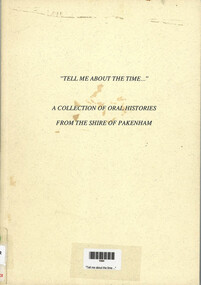
Book, "Tell me about the time--" : A collection of oral histories from the Shire of Pakenham
... Parish...Barbara Birch...Russell Clark...Lal & Roy Weatherhead...Alan Sillcock...Marjorie Elliott...Edward Knox...Eveline Staindl...Vin & Peg Tyler...Gay Failla...Vera Dell'Universita...Harold Ramage...Cr Jack Russell...Bruce Adamson...Darla Adamson...Frances Bishop...Eric Bumpstead...Stan Hamilton...Merv Horan...Audrey Ridgway...Nell Turnbull...Harry Blackburne...Edith Bumpstead...Agnes Cunningham...Dan Cunningham...Lorna & Murray Giles...Lorraine Noack...Allan Pownceby...Betty Purton...Bill Studd...Muriel & Fred Treloar...Noel & Marjorie Webster...Garfield Victoria...Bunyip Victoria...Tynong Victoria...Nar Nar Goon Victoria...Maryknoll Victoria...Cockatoo Victoria...Gembrook...Muriel Dick Ian Forte Bill Parish Barbara Birch Russell Clark Lal & Roy Weatherhead Alan Sillcock Marjorie Elliott Edward Knox Eveline Staindl Vin & Peg Tyler Gay Failla Vera Dell'Universita Harold Ramage Cr Jack Russell Bruce Adamson Darla Adamson Frances Bishop Eric Bumpstead Stan Hamilton Merv Horan Audrey Ridgway Nell Turnbull Harry Blackburne Edith Bumpstead Agnes Cunningham Dan Cunningham Lorna & Murray Giles Lorraine Noack Allan Pownceby Betty Purton Bill Studd Muriel & Fred Treloar Noel & Marjorie Webster Garfield Victoria Bunyip Victoria Tynong Victoria Nar Nar Goon Victoria Maryknoll Victoria Cockatoo Victoria Gembrook Victoria Beaconsfield Victoria Dewhurst Victoria Upper Beaconsfield Victoria Pakenham Victoria Bill & Ethel Shelton Oral histories given by many different people within the Shire of Pakenham "Tell me about the time--" : A collection of oral histories from the Shire of Pakenham Book ...Oral histories given by many different people within the Shire of Pakenhamnon-fictionOral histories given by many different people within the Shire of Pakenhammuriel dick, ian forte, bill parish, barbara birch, russell clark, lal & roy weatherhead, alan sillcock, marjorie elliott, edward knox, eveline staindl, vin & peg tyler, gay failla, vera dell'universita, harold ramage, cr jack russell, bruce adamson, darla adamson, frances bishop, eric bumpstead, stan hamilton, merv horan, audrey ridgway, nell turnbull, harry blackburne, edith bumpstead, agnes cunningham, dan cunningham, lorna & murray giles, lorraine noack, allan pownceby, betty purton, bill studd, muriel & fred treloar, noel & marjorie webster, garfield victoria, bunyip victoria, tynong victoria, nar nar goon victoria, maryknoll victoria, cockatoo victoria, gembrook victoria, beaconsfield victoria, dewhurst victoria, upper beaconsfield victoria, pakenham victoria, bill & ethel shelton -
 Narre Warren and District Family History Group
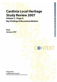
Book, Context Pty Ltd, Cardinia Local Heritage Study Review 2007 Stage A. Vol 1 : Key Findings And Recommendations Vol 2 : Heritage Place And Precinct Citations, 2007
... Parish School...Glen-Keith Farm Complex (Dalmore)...Emerald Lake Park...Emerald Railway Station...Emerald Country Club...Cambden Woolybutt Ros (Emerald)...Oak Lee (Emerald)...Sycamore Lodge (Emerald)...Cascades Guest house...Orchard Packing Shed (Garfield North)...Wattle Bank (Gembrook...Cardinia Shire (Vic.) heritage studies Kenilworth Coach House (Beaconsfield) Wood Street Residential Precinct (Beaconsfield) George Street Residential Precinct (Bunyip) Bunyip Post Office Railway Hotel (Bunyip) Cora Lynn Catholic Parish School Glen-Keith Farm Complex (Dalmore) Emerald Lake Park Emerald Railway Station Emerald Country Club Cambden Woolybutt Ros (Emerald) Oak Lee (Emerald) Sycamore Lodge (Emerald) Cascades Guest house Orchard Packing Shed (Garfield North) Wattle Bank (Gembrook) Coffee Palace (Gembrook) Tehennepe (Iona) Koo Wee Rup Public Hall Dustings Garage (Koo Wee Rup) Wattle Theatre (Koo Wee Rup) Koo Wee Rup Police Lockup Royal Hotel (Koo Wee Rup) Lang Lang Cemetery Misson's Butchers Shop & Residence (Lang Lang) ANZ Bank (Lang Lang) Maryknoll Residential & Civic Precinct Maryknoll Lawn Cemetery Mount Burnett Guesthouse Oakway (Nar Nar Goon) Nar Nar Goon Growers & Packers Shed Jesmond Dene (Officer South) Kings Picture Theatre (Pakenham) Pakenham Post Office I.Y.U. ...The overall objective of the Study was the identification, assessment and documentation of places of post-contact cultural significance for the Cardinia Shire.non-fictionThe overall objective of the Study was the identification, assessment and documentation of places of post-contact cultural significance for the Cardinia Shire.cardinia shire (vic.), heritage studies, kenilworth coach house (beaconsfield), wood street residential precinct (beaconsfield), george street residential precinct (bunyip), bunyip post office, railway hotel (bunyip), cora lynn catholic parish school, glen-keith farm complex (dalmore), emerald lake park, emerald railway station, emerald country club, cambden woolybutt ros (emerald), oak lee (emerald), sycamore lodge (emerald), cascades guest house, orchard packing shed (garfield north), wattle bank (gembrook), coffee palace (gembrook), tehennepe (iona), koo wee rup public hall, dustings garage (koo wee rup), wattle theatre (koo wee rup), koo wee rup police lockup, royal hotel (koo wee rup), lang lang cemetery, misson's butchers shop & residence (lang lang), anz bank (lang lang), maryknoll residential & civic precinct, maryknoll lawn cemetery, mount burnett guesthouse, oakway (nar nar goon), nar nar goon growers & packers shed, jesmond dene (officer south), kings picture theatre (pakenham), pakenham post office, i.y.u. pre-emptive right homestead site (pakenham), valley view orchards manager's house (pakenham upper), ruthdale reserve trees, rutter farm trees (tooradin), eve's house (tynong north), kia ora (upper beaconsfield), the steyne (upper beaconsfield), beaconsfield upper milk bar, staverton garden (upper beaconsfield), great southern railway -
Southern Sherbrooke Historical Society Inc.
Map, Dept of land s & Survey, Dandenong Ranges Area Sheet 28, Jan-56
... Aerial survey map of parts of Gembrook, Monbulk and Naree Worran parishes (Victoria). Scale: 10 chains to 1 inch, contour interval 20 feet. ...Aerial survey map of parts of Gembrook, Monbulk and Naree Worran parishes (Victoria). Scale: 10 chains to 1 inch, contour interval 20 feet. ...Owned by David Walker, previously of Menzies Creek. Given by him to Rex Breen in 2001 for donation to society.Aerial survey map of parts of Gembrook, Monbulk and Naree Worran parishes (Victoria). Scale: 10 chains to 1 inch, contour interval 20 feet. Shows Menzies Creek and parts of Kallista, Clematis, Selby and Belgrave South. Ringwood D2C or 849D2C, Zone 7"16563" in pen on top left corner of reverse.
