
Showing 60 items matching "railways – kew (vic.)"
-
 Kew Historical Society Inc
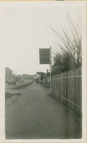
Photograph - Kew Railway Station: Denmark Street entrance, 1952
... Kew Railway Line...Transport -- Railways -- kew (Vic.)...Kew needed to cross over a footbridge at Hawthorn to change trains, and the main line trains were usually already crowded by the time they reached Hawthorn. At about the same time the off-peak trains were replaced by road buses. In 1952 all passenger trains were withdrawn, but the road bus service continued for many years. Goods trains were finally withdrawn in 1957, and the railway was dismantled in 1958-59. (Source: Frank Stamford, 'The Hawthorn - Kew Railway') Kew Railway Line Transport -- Railways -- kew (Vic ...The Kew railway was opened in 1887, and diverged from the main (Box Hill–Lilydale) line about half-way between Hawthorn and Glenferrie. From the point of divergence the line was slightly less than one mile long, and it had only one intermediate station — Barker. There were four road over-bridges and two level crossings, including one over the busy Barkers Road. The line supported a passenger and goods service, and was electrified in December 1922, at the same time as the main line to Box Hill. There were a number of peak hour services which ran from Flinders Street station (Melbourne) to Kew, but in 1938 all but one of these were diverted to the Ashburton line, where traffic was growing. This had an adverse effect on Kew traffic, as passengers from Kew needed to cross over a footbridge at Hawthorn to change trains, and the main line trains were usually already crowded by the time they reached Hawthorn. At about the same time the off-peak trains were replaced by road buses. In 1952 all passenger trains were withdrawn, but the road bus service continued for many years. Goods trains were finally withdrawn in 1957, and the railway was dismantled in 1958-59. (Source: Frank Stamford, 'The Hawthorn - Kew Railway')Small black and white snapshot of the entrance to Kew Station from Denmark Street in 1952. The photograph, one of 12, is part of a larger album of newspaper clippings, timetables, tickets and photos relating to the Kew Railway Line, taken and compiled by Lachlan Richardson, while a resident of Kew. The album dates from the 1950s. The album is part of a larger subject file on the Kew Line, compiled over time by members of the Kew Historical Society.kew railway line, transport -- railways -- kew (vic.), kew branch line, kew railway station -
 Kew Historical Society Inc
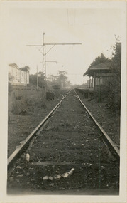
Photograph - Kew Station 22/4/51, F3
... Kew Railway Line...Transport -- Railways -- kew (Vic.)...Kew needed to cross over a footbridge at Hawthorn to change trains, and the main line trains were usually already crowded by the time they reached Hawthorn. At about the same time the off-peak trains were replaced by road buses. In 1952 all passenger trains were withdrawn, but the road bus service continued for many years. Goods trains were finally withdrawn in 1957, and the railway was dismantled in 1958-59. (Source: Frank Stamford, 'The Hawthorn - Kew Railway') Kew Railway Line Transport -- Railways -- kew (Vic ...The Kew railway was opened in 1887, and diverged from the main (Box Hill–Lilydale) line about half-way between Hawthorn and Glenferrie. From the point of divergence the line was slightly less than one mile long, and it had only one intermediate station — Barker. There were four road over-bridges and two level crossings, including one over the busy Barkers Road. The line supported a passenger and goods service, and was electrified in December 1922, at the same time as the main line to Box Hill. There were a number of peak hour services which ran from Flinders Street station (Melbourne) to Kew, but in 1938 all but one of these were diverted to the Ashburton line, where traffic was growing. This had an adverse effect on Kew traffic, as passengers from Kew needed to cross over a footbridge at Hawthorn to change trains, and the main line trains were usually already crowded by the time they reached Hawthorn. At about the same time the off-peak trains were replaced by road buses. In 1952 all passenger trains were withdrawn, but the road bus service continued for many years. Goods trains were finally withdrawn in 1957, and the railway was dismantled in 1958-59. (Source: Frank Stamford, 'The Hawthorn - Kew Railway')Small black and white snapshot of Kew Railway Station, looking south to Barker Station. The photograph, one of 12, is part of a larger album of newspaper clippings, timetables, tickets and photos relating to the Kew Railway Line, taken and compiled by Lachlan Richardson, while a resident of Kew. The album dates from the 1950s. The album is part of a larger subject file on the Kew Line, compiled over time by members of the Kew Historical Society.kew railway line, transport -- railways -- kew (vic.), kew branch line, kew railway station -
 Kew Historical Society Inc
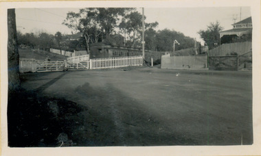
Photograph - Kew Branch Line : The Hawthorn Grove crossing, August 1952
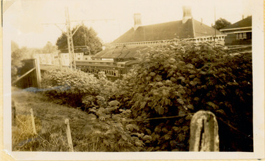
... Kew Railway Line...Transport -- Railways -- kew (Vic.)...Kew needed to cross over a footbridge at Hawthorn to change trains, and the main line trains were usually already crowded by the time they reached Hawthorn. At about the same time the off-peak trains were replaced by road buses. In 1952 all passenger trains were withdrawn, but the road bus service continued for many years. Goods trains were finally withdrawn in 1957, and the railway was dismantled in 1958-59. (Source: Frank Stamford, 'The Hawthorn - Kew Railway') Kew Railway Line Transport -- Railways -- kew (Vic ...The Kew railway was opened in 1887, and diverged from the main (Box Hill–Lilydale) line about half-way between Hawthorn and Glenferrie. From the point of divergence the line was slightly less than one mile long, and it had only one intermediate station — Barker. There were four road over-bridges and two level crossings, including one over the busy Barkers Road. The line supported a passenger and goods service, and was electrified in December 1922, at the same time as the main line to Box Hill. There were a number of peak hour services which ran from Flinders Street station (Melbourne) to Kew, but in 1938 all but one of these were diverted to the Ashburton line, where traffic was growing. This had an adverse effect on Kew traffic, as passengers from Kew needed to cross over a footbridge at Hawthorn to change trains, and the main line trains were usually already crowded by the time they reached Hawthorn. At about the same time the off-peak trains were replaced by road buses. In 1952 all passenger trains were withdrawn, but the road bus service continued for many years. Goods trains were finally withdrawn in 1957, and the railway was dismantled in 1958-59. (Source: Frank Stamford, 'The Hawthorn - Kew Railway')Small black and white snapshot of the Hawthorn Grove crossing, August 1952. The photograph, one of 12, is part of a larger album of newspaper clippings, timetables, tickets and photos relating to the Kew Railway Line, taken and compiled by Lachlan Richardson, while a resident of Kew. The album dates from the 1950s. The album is part of a larger subject file on the Kew Line, compiled over time by members of the Kew Historical Society.kew railway line, transport -- railways -- kew (vic.), kew branch line, hawthorn grove -- hawthorn (vic.), railway crossings -
 Kew Historical Society Inc
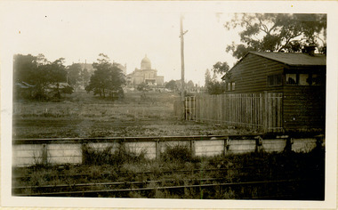
Photograph - Farewell to 'Our Lady of Fatima'. Xavier College 22/4/51
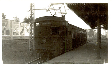
... Kew Railway Line...Transport -- Railways -- kew (Vic.)...Kew needed to cross over a footbridge at Hawthorn to change trains, and the main line trains were usually already crowded by the time they reached Hawthorn. At about the same time the off-peak trains were replaced by road buses. In 1952 all passenger trains were withdrawn, but the road bus service continued for many years. Goods trains were finally withdrawn in 1957, and the railway was dismantled in 1958-59. (Source: Frank Stamford, 'The Hawthorn - Kew Railway') Kew Railway Line Transport -- Railways -- kew (Vic ...The Kew railway was opened in 1887, and diverged from the main (Box Hill–Lilydale) line about half-way between Hawthorn and Glenferrie. From the point of divergence the line was slightly less than one mile long, and it had only one intermediate station — Barker. There were four road over-bridges and two level crossings, including one over the busy Barkers Road. The line supported a passenger and goods service, and was electrified in December 1922, at the same time as the main line to Box Hill. There were a number of peak hour services which ran from Flinders Street station (Melbourne) to Kew, but in 1938 all but one of these were diverted to the Ashburton line, where traffic was growing. This had an adverse effect on Kew traffic, as passengers from Kew needed to cross over a footbridge at Hawthorn to change trains, and the main line trains were usually already crowded by the time they reached Hawthorn. At about the same time the off-peak trains were replaced by road buses. In 1952 all passenger trains were withdrawn, but the road bus service continued for many years. Goods trains were finally withdrawn in 1957, and the railway was dismantled in 1958-59. (Source: Frank Stamford, 'The Hawthorn - Kew Railway')Small black and white snapshot of a train leaving Kew Station with the Xavier Chapel on the hill in the background, hence the ironic title provided by the photographer. The photograph, one of 12, is part of a larger album of newspaper clippings, timetables, tickets and photos relating to the Kew Railway Line, taken and compiled by Lachlan Richardson, while a resident of Kew. The album dates from the 1950s. The album is part of a larger subject file on the Kew Line, compiled over time by members of the Kew Historical Society."Farewell to 'Our Lady of Fatima'. Xavier College 22/4/51"kew railway line, transport -- railways -- kew (vic.), kew branch line, xavier college, kew railway station -
 Kew Historical Society Inc
Photograph - The last train at Kew Station, August 1952
... Kew Railway Line...Transport -- Railways -- kew (Vic.)...Kew needed to cross over a footbridge at Hawthorn to change trains, and the main line trains were usually already crowded by the time they reached Hawthorn. At about the same time the off-peak trains were replaced by road buses. In 1952 all passenger trains were withdrawn, but the road bus service continued for many years. Goods trains were finally withdrawn in 1957, and the railway was dismantled in 1958-59. (Source: Frank Stamford, 'The Hawthorn - Kew Railway') Kew Railway Line Transport -- Railways -- kew (Vic ...The Kew railway was opened in 1887, and diverged from the main (Box Hill–Lilydale) line about half-way between Hawthorn and Glenferrie. From the point of divergence the line was slightly less than one mile long, and it had only one intermediate station — Barker. There were four road over-bridges and two level crossings, including one over the busy Barkers Road. The line supported a passenger and goods service, and was electrified in December 1922, at the same time as the main line to Box Hill. There were a number of peak hour services which ran from Flinders Street station (Melbourne) to Kew, but in 1938 all but one of these were diverted to the Ashburton line, where traffic was growing. This had an adverse effect on Kew traffic, as passengers from Kew needed to cross over a footbridge at Hawthorn to change trains, and the main line trains were usually already crowded by the time they reached Hawthorn. At about the same time the off-peak trains were replaced by road buses. In 1952 all passenger trains were withdrawn, but the road bus service continued for many years. Goods trains were finally withdrawn in 1957, and the railway was dismantled in 1958-59. (Source: Frank Stamford, 'The Hawthorn - Kew Railway')Small black and white snapshot of the last passenger train at Kew Railway Station in 1952. The photograph, one of 12, is part of a larger album of newspaper clippings, timetables, tickets and photos relating to the Kew Railway Line, taken and compiled by Lachlan Richardson, while a resident of Kew. The album dates from the 1950s. The album is part of a larger subject file on the Kew Line, compiled over time by members of the Kew Historical Society."The last train at Kew Station, August 1952"kew railway line, transport -- railways -- kew (vic.), kew branch line, kew railway station -
 Kew Historical Society Inc
Photograph - Kew Railway Station, May 1950
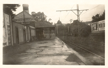
... Kew Railway Line...Transport -- Railways -- kew (Vic.)...Kew needed to cross over a footbridge at Hawthorn to change trains, and the main line trains were usually already crowded by the time they reached Hawthorn. At about the same time the off-peak trains were replaced by road buses. In 1952 all passenger trains were withdrawn, but the road bus service continued for many years. Goods trains were finally withdrawn in 1957, and the railway was dismantled in 1958-59. (Source: Frank Stamford, 'The Hawthorn - Kew Railway') Kew Railway Line Transport -- Railways -- kew (Vic ...The Kew railway was opened in 1887, and diverged from the main (Box Hill–Lilydale) line about half-way between Hawthorn and Glenferrie. From the point of divergence the line was slightly less than one mile long, and it had only one intermediate station — Barker. There were four road over-bridges and two level crossings, including one over the busy Barkers Road. The line supported a passenger and goods service, and was electrified in December 1922, at the same time as the main line to Box Hill. There were a number of peak hour services which ran from Flinders Street station (Melbourne) to Kew, but in 1938 all but one of these were diverted to the Ashburton line, where traffic was growing. This had an adverse effect on Kew traffic, as passengers from Kew needed to cross over a footbridge at Hawthorn to change trains, and the main line trains were usually already crowded by the time they reached Hawthorn. At about the same time the off-peak trains were replaced by road buses. In 1952 all passenger trains were withdrawn, but the road bus service continued for many years. Goods trains were finally withdrawn in 1957, and the railway was dismantled in 1958-59. (Source: Frank Stamford, 'The Hawthorn - Kew Railway')Small black and white snapshot of Kew Railway Station inMay 1950. The photograph, one of 12, is part of a larger album of newspaper clippings, timetables, tickets and photos relating to the Kew Railway Line, taken and compiled by Lachlan Richardson, while a resident of Kew. The album dates from the 1950s. The album is part of a larger subject file on the Kew Line, compiled over time by members of the Kew Historical Society."Kew Railway Station, May 1950"kew railway line, transport -- railways -- kew (vic.), kew branch line, kew railway station -
 Kew Historical Society Inc
Photograph - Kew Railway Station, 1951
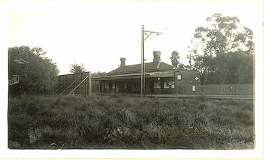
... Kew Railway Line...Transport -- Railways -- kew (Vic.)...Kew needed to cross over a footbridge at Hawthorn to change trains, and the main line trains were usually already crowded by the time they reached Hawthorn. At about the same time the off-peak trains were replaced by road buses. In 1952 all passenger trains were withdrawn, but the road bus service continued for many years. Goods trains were finally withdrawn in 1957, and the railway was dismantled in 1958-59. (Source: Frank Stamford, 'The Hawthorn - Kew Railway') Kew Railway Line Transport -- Railways -- kew (Vic ...The Kew railway was opened in 1887, and diverged from the main (Box Hill–Lilydale) line about half-way between Hawthorn and Glenferrie. From the point of divergence the line was slightly less than one mile long, and it had only one intermediate station — Barker. There were four road over-bridges and two level crossings, including one over the busy Barkers Road. The line supported a passenger and goods service, and was electrified in December 1922, at the same time as the main line to Box Hill. There were a number of peak hour services which ran from Flinders Street station (Melbourne) to Kew, but in 1938 all but one of these were diverted to the Ashburton line, where traffic was growing. This had an adverse effect on Kew traffic, as passengers from Kew needed to cross over a footbridge at Hawthorn to change trains, and the main line trains were usually already crowded by the time they reached Hawthorn. At about the same time the off-peak trains were replaced by road buses. In 1952 all passenger trains were withdrawn, but the road bus service continued for many years. Goods trains were finally withdrawn in 1957, and the railway was dismantled in 1958-59. (Source: Frank Stamford, 'The Hawthorn - Kew Railway')Small black and white snapshot of Kew Railway Station in 1950. The photograph, one of 12, is part of a larger album of newspaper clippings, timetables, tickets and photos relating to the Kew Railway Line, taken and compiled by Lachlan Richardson, while a resident of Kew. The album dates from the 1950s. The album is part of a larger subject file on the Kew Line, compiled over time by members of the Kew Historical Society."Kew Station / 14/51 / 22/4/51 F5"kew railway line, transport -- railways -- kew (vic.), kew branch line, kew railway station -
 Kew Historical Society Inc
Photograph - The last train at Barker Station, 1952
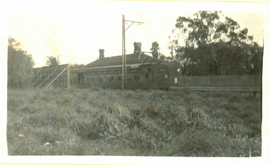
... Kew Railway Line...Transport -- Railways -- kew (Vic.)...Kew needed to cross over a footbridge at Hawthorn to change trains, and the main line trains were usually already crowded by the time they reached Hawthorn. At about the same time the off-peak trains were replaced by road buses. In 1952 all passenger trains were withdrawn, but the road bus service continued for many years. Goods trains were finally withdrawn in 1957, and the railway was dismantled in 1958-59. (Source: Frank Stamford, 'The Hawthorn - Kew Railway') Kew Railway Line Transport -- Railways -- kew (Vic ...The Kew railway was opened in 1887, and diverged from the main (Box Hill–Lilydale) line about half-way between Hawthorn and Glenferrie. From the point of divergence the line was slightly less than one mile long, and it had only one intermediate station — Barker. There were four road over-bridges and two level crossings, including one over the busy Barkers Road. The line supported a passenger and goods service, and was electrified in December 1922, at the same time as the main line to Box Hill. There were a number of peak hour services which ran from Flinders Street station (Melbourne) to Kew, but in 1938 all but one of these were diverted to the Ashburton line, where traffic was growing. This had an adverse effect on Kew traffic, as passengers from Kew needed to cross over a footbridge at Hawthorn to change trains, and the main line trains were usually already crowded by the time they reached Hawthorn. At about the same time the off-peak trains were replaced by road buses. In 1952 all passenger trains were withdrawn, but the road bus service continued for many years. Goods trains were finally withdrawn in 1957, and the railway was dismantled in 1958-59. (Source: Frank Stamford, 'The Hawthorn - Kew Railway')Small black and white snapshot of the last passenger train at Barker Railway Station in 1952. The photograph, one of 12, is part of a larger album of newspaper clippings, timetables, tickets and photos relating to the Kew Railway Line, taken and compiled by Lachlan Richardson, while a resident of Kew. The album dates from the 1950s. The album is part of a larger subject file on the Kew Line, compiled over time by members of the Kew Historical Society."Last train at Barker Station / 1 August 1952"kew railway line, transport -- railways -- kew (vic.), barker railway station, kew branch line -
 Kew Historical Society Inc
Photograph - Barker Station, August 1952
... Kew Railway Line...Transport -- Railways -- kew (Vic.)...Kew needed to cross over a footbridge at Hawthorn to change trains, and the main line trains were usually already crowded by the time they reached Hawthorn. At about the same time the off-peak trains were replaced by road buses. In 1952 all passenger trains were withdrawn, but the road bus service continued for many years. Goods trains were finally withdrawn in 1957, and the railway was dismantled in 1958-59. (Source: Frank Stamford, 'The Hawthorn - Kew Railway') Kew Railway Line Transport -- Railways -- kew (Vic ...The Kew railway was opened in 1887, and diverged from the main (Box Hill–Lilydale) line about half-way between Hawthorn and Glenferrie. From the point of divergence the line was slightly less than one mile long, and it had only one intermediate station — Barker. There were four road over-bridges and two level crossings, including one over the busy Barkers Road. The line supported a passenger and goods service, and was electrified in December 1922, at the same time as the main line to Box Hill. There were a number of peak hour services which ran from Flinders Street station (Melbourne) to Kew, but in 1938 all but one of these were diverted to the Ashburton line, where traffic was growing. This had an adverse effect on Kew traffic, as passengers from Kew needed to cross over a footbridge at Hawthorn to change trains, and the main line trains were usually already crowded by the time they reached Hawthorn. At about the same time the off-peak trains were replaced by road buses. In 1952 all passenger trains were withdrawn, but the road bus service continued for many years. Goods trains were finally withdrawn in 1957, and the railway was dismantled in 1958-59. (Source: Frank Stamford, 'The Hawthorn - Kew Railway')Small black and white snapshot of the last passenger train at Barker Railway Station in 1952. The photograph, one of 12, is part of a larger album of newspaper clippings, timetables, tickets and photos relating to the Kew Railway Line, taken and compiled by Lachlan Richardson, while a resident of Kew. The album dates from the 1950s. The album is part of a larger subject file on the Kew Line, compiled over time by members of the Kew Historical Society."Barker Station / August 1952"kew railway line, transport -- railways -- kew (vic.), barker railway station, kew branch line -
 Kew Historical Society Inc
Photograph - Seven Carriage Train at Barker Station
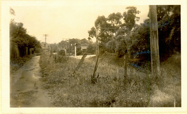
... Kew Railway Line...Transport -- Railways -- kew (Vic.)...Kew needed to cross over a footbridge at Hawthorn to change trains, and the main line trains were usually already crowded by the time they reached Hawthorn. At about the same time the off-peak trains were replaced by road buses. In 1952 all passenger trains were withdrawn, but the road bus service continued for many years. Goods trains were finally withdrawn in 1957, and the railway was dismantled in 1958-59. (Source: Frank Stamford, 'The Hawthorn - Kew Railway') Kew Railway Line Transport -- Railways -- kew (Vic ...The Kew railway was opened in 1887, and diverged from the main (Box Hill–Lilydale) line about half-way between Hawthorn and Glenferrie. From the point of divergence the line was slightly less than one mile long, and it had only one intermediate station — Barker. There were four road over-bridges and two level crossings, including one over the busy Barkers Road. The line supported a passenger and goods service, and was electrified in December 1922, at the same time as the main line to Box Hill. There were a number of peak hour services which ran from Flinders Street station (Melbourne) to Kew, but in 1938 all but one of these were diverted to the Ashburton line, where traffic was growing. This had an adverse effect on Kew traffic, as passengers from Kew needed to cross over a footbridge at Hawthorn to change trains, and the main line trains were usually already crowded by the time they reached Hawthorn. At about the same time the off-peak trains were replaced by road buses. In 1952 all passenger trains were withdrawn, but the road bus service continued for many years. Goods trains were finally withdrawn in 1957, and the railway was dismantled in 1958-59. (Source: Frank Stamford, 'The Hawthorn - Kew Railway')Small black and white snapshot of a seven carriage train approaching Barker Railway Station. The photograph, one of 12, is part of a larger album of newspaper clippings, timetables, tickets and photos relating to the Kew Railway Line, taken and compiled by Lachlan Richardson, while a resident of Kew. The album dates from the 1950s. The album is part of a larger subject file on the Kew Line, compiled over time by members of the Kew Historical Society."Seven Carriage Train at Barker Station"kew railway line, transport -- railways -- kew (vic.), barker railway station, kew branch line -
 Kew Historical Society Inc
Photograph - Kew Branch Line: Looking along cutting towards Barker Station 22/4/51
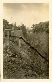
... Kew Railway Line...Transport -- Railways -- kew (Vic.)...Kew needed to cross over a footbridge at Hawthorn to change trains, and the main line trains were usually already crowded by the time they reached Hawthorn. At about the same time the off-peak trains were replaced by road buses. In 1952 all passenger trains were withdrawn, but the road bus service continued for many years. Goods trains were finally withdrawn in 1957, and the railway was dismantled in 1958-59. (Source: Frank Stamford, 'The Hawthorn - Kew Railway') Kew Railway Line Transport -- Railways -- kew (Vic ...The Kew railway was opened in 1887, and diverged from the main (Box Hill–Lilydale) line about half-way between Hawthorn and Glenferrie. From the point of divergence the line was slightly less than one mile long, and it had only one intermediate station — Barker. There were four road over-bridges and two level crossings, including one over the busy Barkers Road. The line supported a passenger and goods service, and was electrified in December 1922, at the same time as the main line to Box Hill. There were a number of peak hour services which ran from Flinders Street station (Melbourne) to Kew, but in 1938 all but one of these were diverted to the Ashburton line, where traffic was growing. This had an adverse effect on Kew traffic, as passengers from Kew needed to cross over a footbridge at Hawthorn to change trains, and the main line trains were usually already crowded by the time they reached Hawthorn. At about the same time the off-peak trains were replaced by road buses. In 1952 all passenger trains were withdrawn, but the road bus service continued for many years. Goods trains were finally withdrawn in 1957, and the railway was dismantled in 1958-59. (Source: Frank Stamford, 'The Hawthorn - Kew Railway')Small black and white snapshot looking along cutting towards Barker Station 22/4/51. The photograph, one of 12, is part of a larger album of newspaper clippings, timetables, tickets and photos relating to the Kew Railway Line, taken and compiled by Lachlan Richardson, while a resident of Kew. The album dates from the 1950s. The album is part of a larger subject file on the Kew Line, compiled over time by members of the Kew Historical Society."Looking along cutting towards Barker Station 22/4/51"kew railway line, transport -- railways -- kew (vic.), barker railway station, kew branch line -
 Kew Historical Society Inc
Photograph - Kew Branch Line: Weeds at Kew Station 14/51
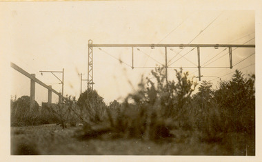
... Kew Railway Line...Transport -- Railways -- kew (Vic.)...Kew needed to cross over a footbridge at Hawthorn to change trains, and the main line trains were usually already crowded by the time they reached Hawthorn. At about the same time the off-peak trains were replaced by road buses. In 1952 all passenger trains were withdrawn, but the road bus service continued for many years. Goods trains were finally withdrawn in 1957, and the railway was dismantled in 1958-59. (Source: Frank Stamford, 'The Hawthorn - Kew Railway') Kew Railway Line Transport -- Railways -- kew (Vic ...The Kew railway was opened in 1887, and diverged from the main (Box Hill–Lilydale) line about half-way between Hawthorn and Glenferrie. From the point of divergence the line was slightly less than one mile long, and it had only one intermediate station — Barker. There were four road over-bridges and two level crossings, including one over the busy Barkers Road. The line supported a passenger and goods service, and was electrified in December 1922, at the same time as the main line to Box Hill. There were a number of peak hour services which ran from Flinders Street station (Melbourne) to Kew, but in 1938 all but one of these were diverted to the Ashburton line, where traffic was growing. This had an adverse effect on Kew traffic, as passengers from Kew needed to cross over a footbridge at Hawthorn to change trains, and the main line trains were usually already crowded by the time they reached Hawthorn. At about the same time the off-peak trains were replaced by road buses. In 1952 all passenger trains were withdrawn, but the road bus service continued for many years. Goods trains were finally withdrawn in 1957, and the railway was dismantled in 1958-59. (Source: Frank Stamford, 'The Hawthorn - Kew Railway')Small black and white snapshot of how the Kew Branch Line was allowed to run down. The photograph, one of 12, is part of a larger album of newspaper clippings, timetables, tickets and photos relating to the Kew Railway Line, taken and compiled by Lachlan Richardson, while a resident of Kew. The album dates from the 1950s. The album is part of a larger subject file on the Kew Line, compiled over time by members of the Kew Historical Society.kew railway line, transport -- railways -- kew (vic.), barker railway station, kew branch line -
 Kew Historical Society Inc
Archive (Series) - Railways - Kew Branch Line
... Barker Station – Kew (Vic.)...Railways...Kew (Vic.) Kew Station – Kew (Vic.) Barker Station – Kew (Vic.) Railways – Kew (Vic.) ...Various PartiesReference, Research, InformationArranged by Secondary Values (value of records to users)The Kew Branch line existed between the years of 1887 and 1957 and served as a railway line that split off from Hawthorn station and went through Barker station and terminated at Kew station. It ran along a single track and was proposed to extend all the way out to Doncaster, and perhaps further. It was decommissioned for passenger rail in 1952, and after serving another five years for freight trains, would be demolished come the next year. The file includes: Copies of the magazine ‘Newsrail’, a copy of ‘The Railway Comes to Kew: 1884-1887’ by Andrew Frost, multiple magazine, and newspaper articles with information regarding the Kew Railway and its history, a poem published in 1882 talking of the trains on the line, pictures of the line, and a collection of old tickets and timetables from the 1940s-50s.kew branch line – kew (vic.), kew station – kew (vic.), barker station – kew (vic.), railways – kew (vic.)kew branch line – kew (vic.), kew station – kew (vic.), barker station – kew (vic.), railways – kew (vic.) -
Kew Historical Society Inc
Archive (Series) - Railways - Outer Circle Line
... Outer Circle Line – Kew (Vic.)...Railways...Outer Circle Line – Kew (Vic.) Railways – Kew (Vic.) Archive Railways - Outer Circle Line ...Various PartiesReference, Research, InformationArranged by Secondary Values (value of records to users)The Outer Circle Line was a railway service that ran as far as between Oakleigh and Fairfield, and provided services from 1890 to 1897, but sections would re-enter and leave service up until 1942, before it would be demolished and turned into a walking trail. Remains of the railway line exist in the Alamein line, as well as road infrastructure. The file includes: Multiple documents that contain information about the Outer Circle line, especially in regard to the East Kew section, multiple committee reports in the early 1900s regarding the expansion, electrification and the maintenance of the lines, maps of the railway line and surrounding area, many different newspaper and magazine articles regarding the railway lines and their remains.outer circle line – kew (vic.), railways – kew (vic.)outer circle line – kew (vic.), railways – kew (vic.) -
 Ringwood and District Historical Society
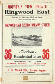
Flyer, Land Sale Brochure, Mountain View Estate, Ringwood East, Vic. - circa 1916
... Railway Station, Ringwood, Phone Ringwood 7. Vendor - T.J. Press, Builder, "Monterey", Second Avenue, Kew, Telephone Haw. 3428. Bi-fold advertisement for sale of residential allotments, including photographs, map, and summary of subdivision features and local facilities. Undated handwritten notation reads "streets don't exist today". Land Sale Brochure, Mountain View Estate, Ringwood East, Vic ...Bi-fold advertisement for sale of residential allotments, including photographs, map, and summary of subdivision features and local facilities. Undated handwritten notation reads "streets don't exist today".Subdivision layout includes Mullum Mullum Road, Rangeview Avenue, Press Avenue, and Mountview Avenue. Local Agent - J.B. McAlpin, Opposite Railway Station, Ringwood, Phone Ringwood 7. Vendor - T.J. Press, Builder, "Monterey", Second Avenue, Kew, Telephone Haw. 3428. -
 Sunshine and District Historical Society Incorporated
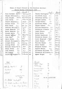
Certificate - Sunshine Rail Disaster death certificates, 1908
... Sunshine Railway Disaster Disaster Railways Sunshine Railway Station Printed List of Names of People killed in the Sunshine Accident Easter Monday 20 April 1908 Rose Acreman died Melbourne General Queen Vic Buried Footscray Thomas Atkinson died Sunshine Buried Williamstown John Blight died Melbourne General Queen Vic Buried Ballarat Old John Brown died Sunshine Buried Ballarat Old Stuart Bunyard died Sunshine Buried Oakleigh Archer Clark died Sunshine Buried Melbourne New Mary Clark died Sunshine Buried Melbourne New Frances Dalling died Sunshine Buried Warrick James Dannock died Sunshine Buried Kew Maria Dannock died Sunshine Buried Kew Joseph David died Sunshine Buried Melbourne New Ernest Denier died Sunshine Buried Ballarat New John Dent died Sunshine Buried Kew Denis Doran died Sunshine Buried Melbourne Albert Ellingsen died Sunshine Buried Ballarat New Joseph Gates died Sunshine Buried Footscray Leslie Gates died Sunshine Buried Footscray Matilda Giles died Melbourne General Queen Vic Buried Kew Ethel Green died Sunshine Buried Kew John Haekes died Sunshine Buried Kew Ada Hughes died Sunshine Buried Williamstown Griffith Hughes died Sunshine Buried Williamstown Thomas Huntington died Sunshine Buried Footscray Elizabeth Jones died Sunshine Buried Melbourne Catherine Laffan died Sunshine Buried Melbourne Bridget Laffan died Sunshine Buried Melbourne George McCall died Sunshine Buried Kew Alexander McKay died Sunshine Buried Melbourne Thomas McKean died Sunshine Buried Melbourne William Nankervis died Sunshine Buried Melbourne Frederick OConnor died Sunshine Buried St Kilda James Pascoe died Sunshine Buried Ballarat Old Harry Peate died Sunshine Buried Kew Esther Rushbrook died Sunshine Buried Kew Frederick Sawyer died Sunshine Buried Melbourne Oscar Skoglund died Alfred Buried Kew Janet Thomas died Sunshine Buried Ballarat Old William Thomas died Sunshine Buried Melbourne Annie Tucker died Sunshine Buried Coburg Margaret Tucker died Sunshine Buried Coburg Rupert Watson died Sunshine Buried Coburg Elizabeth Williams died Sunshine Buried Melbourne Frederick Williamson died Sunshine Buried Coburg Agnes Wright died Sunshine Buried Kew A3 photocopy of death registered in the District of East Melbourne in the State of Victoria Sunshine Rail Disaster death certificates Death certificates listing the 44 people who died as a result of the railway disaster at Sunshine Station 20th April 1908 Also lists names of those who did at Sunshine Melbourne and Alfred Hospital and place of burial Findings by coroner May and July inquest Certificate Sunshine Rail Disaster death certificates ...Printed List of Names of People killed in the Sunshine Accident Easter Monday 20 April 1908 Rose Acreman died Melbourne General Queen Vic Buried Footscray Thomas Atkinson died Sunshine Buried Williamstown John Blight died Melbourne General Queen Vic Buried Ballarat Old John Brown died Sunshine Buried Ballarat Old Stuart Bunyard died Sunshine Buried Oakleigh Archer Clark died Sunshine Buried Melbourne New Mary Clark died Sunshine Buried Melbourne New Frances Dalling died Sunshine Buried Warrick James Dannock died Sunshine Buried Kew Maria Dannock died Sunshine Buried Kew Joseph David died Sunshine Buried Melbourne New Ernest Denier died Sunshine Buried Ballarat New John Dent died Sunshine Buried Kew Denis Doran died Sunshine Buried Melbourne Albert Ellingsen died Sunshine Buried Ballarat New Joseph Gates died Sunshine Buried Footscray Leslie Gates died Sunshine Buried Footscray Matilda Giles died Melbourne General Queen Vic Buried Kew Ethel Green died Sunshine Buried Kew John Haekes died Sunshine Buried Kew Ada Hughes died Sunshine Buried Williamstown Griffith Hughes died Sunshine Buried Williamstown Thomas Huntington died Sunshine Buried Footscray Elizabeth Jones died Sunshine Buried Melbourne Catherine Laffan died Sunshine Buried Melbourne Bridget Laffan died Sunshine Buried Melbourne George McCall died Sunshine Buried Kew Alexander McKay died Sunshine Buried Melbourne Thomas McKean died Sunshine Buried Melbourne William Nankervis died Sunshine Buried Melbourne Frederick OConnor died Sunshine Buried St Kilda James Pascoe died Sunshine Buried Ballarat Old Harry Peate died Sunshine Buried Kew Esther Rushbrook died Sunshine Buried Kew Frederick Sawyer died Sunshine Buried Melbourne Oscar Skoglund died Alfred Buried Kew Janet Thomas died Sunshine Buried Ballarat Old William Thomas died Sunshine Buried Melbourne Annie Tucker died Sunshine Buried Coburg Margaret Tucker died Sunshine Buried Coburg Rupert Watson died Sunshine Buried Coburg Elizabeth Williams died Sunshine Buried Melbourne Frederick Williamson died Sunshine Buried Coburg Agnes Wright died Sunshine Buried Kew A3 photocopy of death registered in the District of East Melbourne in the State of Victoriasunshine railway disaster, disaster, railways, sunshine railway station -
Kew Historical Society Inc
Journal, Kew Historical Society, Newsletter No.127, June 2019
... kew historical society (vic.) -- periodicals. kew historical society (vic.) -- newsletters kew historical society (vic.) -- journals Yarra Views / Robert Baker p1. Society News: Events, Grants, New exhibition, [Donations to] The collection, RHSV award p3. Stitch Your Way into History / Collections Group p4. Broadcasting from Kew / David White p5. Kew Historical Society 1974-1989 / Robert Baker p7. Resurrection: the Outer Circle railway ...Yarra Views / Robert Baker p1. Society News: Events, Grants, New exhibition, [Donations to] The collection, RHSV award p3. Stitch Your Way into History / Collections Group p4. Broadcasting from Kew / David White p5. Kew Historical Society 1974-1989 / Robert Baker p7. Resurrection: the Outer Circle railway - Part 2 / Desley Reid p9. Edgevale Road: a small shopping strip in Kew / Judith Scurfield p10. Membership & Donations p12.Published quarterly since 1977, the newsletters of the Kew Historical Society contain significant research by members exploring relevant aspects of the Victorian and Australian Framework of Historical Themes. Frequently, articles on people, places and artefacts are the only source of information about an aspect of Kew, and Melbourne’s history.non-fictionYarra Views / Robert Baker p1. Society News: Events, Grants, New exhibition, [Donations to] The collection, RHSV award p3. Stitch Your Way into History / Collections Group p4. Broadcasting from Kew / David White p5. Kew Historical Society 1974-1989 / Robert Baker p7. Resurrection: the Outer Circle railway - Part 2 / Desley Reid p9. Edgevale Road: a small shopping strip in Kew / Judith Scurfield p10. Membership & Donations p12.kew historical society (vic.) -- periodicals., kew historical society (vic.) -- newsletters, kew historical society (vic.) -- journals -
Kew Historical Society Inc
Journal, Kew Historical Society, Newsletter No.126, March 2019
... kew historical society (vic.) -- periodicals. kew historical society (vic.) -- newsletters kew historical society (vic.) -- journals Embroidering a Theme / Robert Baker p1. Society News: Events, Fund raising, Grants, [Donations to] The Collection p3. Kew Festival 2019: 2019 McIntyre lecture, New exhibition p4. Tributes: Mel Lawrence, Max Sartori, Anne Glasson / Margaret Robinson p5. Grants / Robert Baker p5. Kew Historical Society 1958-1973 / Robert Baker p6. Much Huff and Puff: The Outer Circle railway ...Embroidering a Theme / Robert Baker p1. Society News: Events, Fund raising, Grants, [Donations to] The Collection p3. Kew Festival 2019: 2019 McIntyre lecture, New exhibition p4. Tributes: Mel Lawrence, Max Sartori, Anne Glasson / Margaret Robinson p5. Grants / Robert Baker p5. Kew Historical Society 1958-1973 / Robert Baker p6. Much Huff and Puff: The Outer Circle railway / Desley Reid p8. Good Roads: Thomas Hocart Flere / David White p10. Membership & Donations p12.Published quarterly since 1977, the newsletters of the Kew Historical Society contain significant research by members exploring relevant aspects of the Victorian and Australian Framework of Historical Themes. Frequently, articles on people, places and artefacts are the only source of information about an aspect of Kew, and Melbourne’s history.non-fictionEmbroidering a Theme / Robert Baker p1. Society News: Events, Fund raising, Grants, [Donations to] The Collection p3. Kew Festival 2019: 2019 McIntyre lecture, New exhibition p4. Tributes: Mel Lawrence, Max Sartori, Anne Glasson / Margaret Robinson p5. Grants / Robert Baker p5. Kew Historical Society 1958-1973 / Robert Baker p6. Much Huff and Puff: The Outer Circle railway / Desley Reid p8. Good Roads: Thomas Hocart Flere / David White p10. Membership & Donations p12.kew historical society (vic.) -- periodicals., kew historical society (vic.) -- newsletters, kew historical society (vic.) -- journals -
Kew Historical Society Inc
Journal, Kew Historical Society, Newsletter No.116, September 2016
... kew historical society (vic.) -- journals Back to Kew 1875 / Judith Scurfield p1. Heritage issues / Brad Miles p3. What's On - September to December / Brad Miles p3. New Strategic Plan / Brad Miles p4. Not a Ragbag Wagga: the Kew patchwork quilt / Suzanne McWha p5. The Great War in Kew: 1916 those who went / Andrew Frost p7. The Kew Festival Gazette 5 October 1895 / Don Garden p7. The Skilled Artisan: Bertie Robert Edgar Greenwood / Robert Baker, John Torpey, Judith Vimpani p9. Jill O'Brien / Robert Baker p9. More examples of Lost Kew - Clutha / Robert Baker; Fernhurst / Kerry Fairbank; Blackhall / Felicity Renowden; Kew Railway ...Back to Kew 1875 / Judith Scurfield p1. Heritage issues / Brad Miles p3. What's On - September to December / Brad Miles p3. New Strategic Plan / Brad Miles p4. Not a Ragbag Wagga: the Kew patchwork quilt / Suzanne McWha p5. The Great War in Kew: 1916 those who went / Andrew Frost p7. The Kew Festival Gazette 5 October 1895 / Don Garden p7. The Skilled Artisan: Bertie Robert Edgar Greenwood / Robert Baker, John Torpey, Judith Vimpani p9. Jill O'Brien / Robert Baker p9. More examples of Lost Kew - Clutha / Robert Baker; Fernhurst / Kerry Fairbank; Blackhall / Felicity Renowden; Kew Railway Station / Robert Baker p10. AGM Form of appointment of proxy p11. AGM Nomination form p11.Published quarterly since 1977, the newsletters of the Kew Historical Society contain significant research by members exploring relevant aspects of the Victorian and Australian Framework of Historical Themes. Frequently, articles on people, places and artefacts are the only source of information about an aspect of Kew, and Melbourne’s history.non-fictionBack to Kew 1875 / Judith Scurfield p1. Heritage issues / Brad Miles p3. What's On - September to December / Brad Miles p3. New Strategic Plan / Brad Miles p4. Not a Ragbag Wagga: the Kew patchwork quilt / Suzanne McWha p5. The Great War in Kew: 1916 those who went / Andrew Frost p7. The Kew Festival Gazette 5 October 1895 / Don Garden p7. The Skilled Artisan: Bertie Robert Edgar Greenwood / Robert Baker, John Torpey, Judith Vimpani p9. Jill O'Brien / Robert Baker p9. More examples of Lost Kew - Clutha / Robert Baker; Fernhurst / Kerry Fairbank; Blackhall / Felicity Renowden; Kew Railway Station / Robert Baker p10. AGM Form of appointment of proxy p11. AGM Nomination form p11.kew historical society (vic.) -- periodicals., kew historical society (vic.) -- newsletters, kew historical society (vic.) -- journals -
 Kew Historical Society Inc
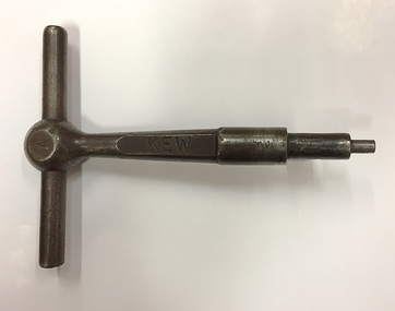
Equipment, Victorian Railways, 'A' Pattern Annett Key : Kew Railway Station, 20th Century
... kew railway station - denmark street - kew (vic)...Kew Railway Station was the second railway station on the Kew 'Spur' Line in Melbourne. The key unlocked signals equipment at the Station. The key was donated by Harry Jackson in 2019 during an exhibition at the Kew Court House on railway history in Kew. This piece of railway equipment is a rare oiece of railway memorabilia. kew railway station - denmark street - kew (vic ...Kew Railway Station was the second railway station on the Kew 'Spur' Line in Melbourne. The key unlocked signals equipment at the Station. The key was donated by Harry Jackson in 2019 during an exhibition at the Kew Court House on railway history in Kew.This piece of railway equipment is a rare oiece of railway memorabilia.'A' pattern Annett Key, used at the Kew Railway Station with signals equipment.KEWkew railway station - denmark street - kew (vic), annett keys -
 Kew Historical Society Inc
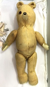
Leisure object, Teddy Bear, 1930-1955
... Railway Commissioners agreed to lease a site at the Kew Railway Station for a Baby Health Centre for a term of 21 years at 3 pounds per annum. A building, designed by Roland Chipperfield, was erected, and the Centre previously conducted at the Town Hall transferred there. This became known as the Denmark Street Baby Health Centre. (Cr. W.D. Vaughan, Kew’s Civic Century, W.D. Vaughan Pty Ltd., Kew, 1960, pp.96 & 97.) toys - teddy bears denmark street baby health centre - kew (vic ...In August, 1920, The Kew Town Council decided to establish a Baby Health Centre in Kew. The first Centre was opened in a room in the Town Hall in Walpole Street on 5 November 1920. In May 1939, the Railway Commissioners agreed to lease a site at the Kew Railway Station for a Baby Health Centre for a term of 21 years at 3 pounds per annum. A building, designed by Roland Chipperfield, was erected, and the Centre previously conducted at the Town Hall transferred there. This became known as the Denmark Street Baby Health Centre. (Cr. W.D. Vaughan, Kew’s Civic Century, W.D. Vaughan Pty Ltd., Kew, 1960, pp.96 & 97.)Small teddy bear with only one eye remaining and with a number of repairs. The bear was used by children at the Denmark Street Baby Health Centre in Kew.toys - teddy bears, denmark street baby health centre - kew (vic) -
 Kew Historical Society Inc
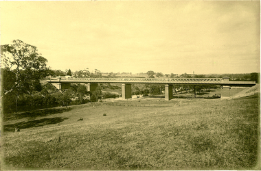
Photograph, J F C Farquhar, Railway Bridge Over the Yarra, 1891
... kew where we live...photographic books...henry kellett...railway viaduct - - kew (vic...The individual images have proved essential in identifying buildings and places of heritage value in the district. kew illustrated kew where we live photographic books henry kellett railway viaduct - - kew (vic) Railway Bridge Over the Yarra Completed in November 1890, the railway viaduct (now the Chandler Highway Bridge) linked Kew and Fairfield. ...At the beginning of the 1890s, the Kew businessman and Town Councillor, Henry Kellett, commissioned J.F.C. Farquhar to photograph scenes of Kew. These scenes included panoramas as well as pastoral scenes. The resulting set of twelve photographs was assembled in an album, Kew Where We Live, from which customers could select images for purchase.The preamble to the album describes that the photographs used the ‘argentic bromide’ process, now more commonly known as the gelatine silver process. This form of dry plate photography allowed for the negatives to be kept for weeks before processing, hence its value in landscape photography. The resulting images were considered to be finely grained and everlasting. Evidence of the success of Henry Kellett’s venture can be seen today, in that some of the photographs are held in national collections.It is believed that the Kew Historical Society’s copy of the Kellett album is unique and that the photographs in the book were the first copies taken from the original plates. It is the first and most important series of images produced about Kew. The individual images have proved essential in identifying buildings and places of heritage value in the district.Completed in November 1890, the railway viaduct (now the Chandler Highway Bridge) linked Kew and Fairfield. The viaduct is significant as the most substantial extant engineering remnant of the Outer Circle Railway Line. Opened in March 1891, the viaduct crossed the Yarra River in a single span, atop three supporting brick pillars. Following the closure of the railway line in 1927, and the construction of the Chandler Highway in 1930, the bridge was used for vehicular traffic. In 1891 when this panoramic photograph was taken, the grounds of what was then the Kew Lunatic Asylum extended down to the River and eastward beyond the viaduct. The landscape surrounding the Asylum was planted with traditional exotic trees such as Oaks, Pines and Cedars, and landmark trees from northern Australia such as the Hoop Pine. Remnant indigenous trees such as the River Red Gum, Yellow Box and Lightwood were scattered around the site, including beside the Yarra River.Railway Bridge Over the Yarrakew illustrated, kew where we live, photographic books, henry kellett, railway viaduct - - kew (vic) -
 Kew Historical Society Inc
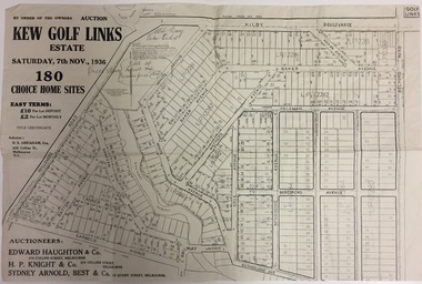
Plan - Subdivision Plan, Kew Golf Links Estate, 1936, 1936
... kew (vic) kodak factory - kew (vic) Monochrome printed, folded subdivision plan for the Kew Golf Links Estate, to be auctioned on 7 November 1936. Streets named include: Carnegie Avenue, Willsmere Road, Kilby Boulevarde, Kodak Avenue, Coleman Avenue, Beresford Avenue, McConchie Avenue, Cole Avenue, White Avenue, Baker Avenue, Spruzen Avenue, Tanner Avenue, Ratten Avenue, Mathers Avenue, Railway Avenue, Sutherland Avenue, and Belford Road. ...The Kew Golf Links Estate was a major subdivision in North Kew. It derived its title due to the land being previously occupied by the Kew Golf Club, which transferred its course to a number of locations before occupying its current site. The Plan advertises 180 choice home sites. The street names are somewhat different today as those on the map are named after the proposed Kodak Factory to be built on the site. The subdivision of the Kew Golf Links Estate was a major subdivision of farmland in Kew. The site was at one stage designated for industrial development and the building of a new Kodak factory. The decision by Council to oppose the redevelopment makes the beginning of the period when all industrial development was banned in Kew.Monochrome printed, folded subdivision plan for the Kew Golf Links Estate, to be auctioned on 7 November 1936. Streets named include: Carnegie Avenue, Willsmere Road, Kilby Boulevarde, Kodak Avenue, Coleman Avenue, Beresford Avenue, McConchie Avenue, Cole Avenue, White Avenue, Baker Avenue, Spruzen Avenue, Tanner Avenue, Ratten Avenue, Mathers Avenue, Railway Avenue, Sutherland Avenue, and Belford Road. The position of the Yarra River and a large Drainage Reserve are marked on the plan. Lots for sale are numbered. Existing buildings are designated with a square.subdivision plans - kew (vic), kodak factory - kew (vic) -
 Kew Historical Society Inc
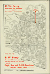
Map - Map of Kew and Hawthorn Districts
... kew (vic) maps - hawthorn (vic) R.W. Perry Real estate Agents -- Kew (Vic.) RW Perry / Real Estate & Insurance Agent, 602 High Street, East Kew Two-colour map of Kew and Hawthorn Districts produced for by R.L. Jarrett for RW Perry, Real Estate & Insurance Agent. The map has unusual features such as a planned railway ...Map of Kew, East Kew and Hawthorn produced for a Kew Real Estate Agent, RW Perry. The map is undated.Two-colour map of Kew and Hawthorn Districts produced for by R.L. Jarrett for RW Perry, Real Estate & Insurance Agent. The map has unusual features such as a planned railway link from Kew Station to the former Outer Circle Railway. RW Perry / Real Estate & Insurance Agent, 602 High Street, East Kewmaps - kew (vic), maps - hawthorn (vic), r.w. perry, real estate agents -- kew (vic.) -
Kew Historical Society Inc
Archive (series) - Subject File, ARGYLE, Sir Stanley Seymour (1867-1940), 1958
... kew (vic) first world war Stanley Seymour Argyle, later Sir Stanley, was Mayor of Kew for two terms: 1902-3, and 1903-4. He was later the Premier of Victoria (1932). While the file contains an article by Neville Pollard - Commonwealth Versus the States: Australia’s uniform gauge debacle (Australian Railway History, Feb 2014), most of the file is comprised of correspondence relating to the gift of a painting to Argyle in 1895. ...Various PartiesReference, Research, InformationKHS Imposed OrderStanley Seymour Argyle, later Sir Stanley, was Mayor of Kew for two terms: 1902-3, and 1903-4. He was later the Premier of Victoria (1932). While the file contains an article by Neville Pollard - Commonwealth Versus the States: Australia’s uniform gauge debacle (Australian Railway History, Feb 2014), most of the file is comprised of correspondence relating to the gift of a painting to Argyle in 1895. The correspondees include Ian Stanley Argyle, the grandson (Argyle Travel Coy. R.R, 172 St George’s Terrace, Perth, 6000), Kew Historical Society, and Kew City Council. A photocopy of the letter (poor quality) relating to the gift in 1895 is included in the file. The grandson’s letter advises that the gift was a small oil painting described as a ‘Field Scene’. An image of the painting is not in the file.sir stanley argyle, mayors of kew, premiers - victoria, medical practitioners - kew (vic), first world warsir stanley argyle, mayors of kew, premiers - victoria, medical practitioners - kew (vic), first world war -
 Kew Historical Society Inc
Album - Scrapbook, Eva Grant, Historic Buildings, Kew, 1958-78, 1970s
... kew (vic)...ellsmere (also ellesmere/ellsmore) - princess street - kew...fernhurst - 13 fernhurst grove - kew (vic)...kew civic centre - civic drive - kew (vic)...kew junction - kew (vic)...kew railway...Buildings included in the scrapbook include: Billy Hughes' house - 167 Cotham Road Congregational Church - Walpole Street (c.1978) Country Roads Board - Denmark Street (1960) Dorothy Rogers Reserve - Studley Park Road Ellsmere (also Ellesmere/Ellsmore) - Princess Street Field Place - 3 Henty Court Fernhurst - 13 Fernhurst Grove Kew Civic Centre (1959) Kew Junction (1958) Kew Railway Station (1902, 1959) Kew Recreation Hall - Wellington Street (1960) Neama (Hall) - Studley Park Road Southesk (formerly Ordsall) - Cotham Road (c.1960) St Anthony's Home for Babies (formerly Madford) - 43 Wellington Street (c.1976) Studley House - Nolan Avenue The scrapbook contains historically significant, rare and sometimes unique images of significant heritage buildings in Kew, including their erection and demolition. eva grant billy hughes' house - 167 cotham road congregational church - walpole street - kew country roads board - denmark street - kew dorothy rogers reserve - studley park road - kew field place - 3 henty court - kew (vic) ellsmere (also ellesmere/ellsmore) - princess street - kew fernhurst - 13 fernhurst grove - kew (vic) kew civic centre - civic drive - kew (vic) kew junction - kew (vic) kew railway station - denmark street - kew (vic) recreation hall - wellington street - kew neama - hall - studley park road - kew (vic) southesk - ordsall - cotham road- kew (vic) st anthony's home for babies - madford - 43 wellington street (vic) studley house - nolan avenue - kew (vic) Includes letter from donor 11-page scrapbook of photographs and newspaper clippings with annotations by Eva Grant, a past member of the Kew Historical Society. ...One of three scrapbooks of photographs and newspaper cuttings taken and or collected by Eva Grant, a past member of the Kew Historical Society, which were donated by her niece, Julie Thomson. The albums include many photographs of Kew from the 1950s to the 1970s. Buildings included in the scrapbook include: Billy Hughes' house - 167 Cotham Road Congregational Church - Walpole Street (c.1978) Country Roads Board - Denmark Street (1960) Dorothy Rogers Reserve - Studley Park Road Ellsmere (also Ellesmere/Ellsmore) - Princess Street Field Place - 3 Henty Court Fernhurst - 13 Fernhurst Grove Kew Civic Centre (1959) Kew Junction (1958) Kew Railway Station (1902, 1959) Kew Recreation Hall - Wellington Street (1960) Neama (Hall) - Studley Park Road Southesk (formerly Ordsall) - Cotham Road (c.1960) St Anthony's Home for Babies (formerly Madford) - 43 Wellington Street (c.1976) Studley House - Nolan AvenueThe scrapbook contains historically significant, rare and sometimes unique images of significant heritage buildings in Kew, including their erection and demolition. 11-page scrapbook of photographs and newspaper clippings with annotations by Eva Grant, a past member of the Kew Historical Society. The pages of the album can be viewed in the image carousel above. Based on the text and known dates of demolition of a number of the buildings, the scrapbook was assembled over a twenty year period between c.1958-c.1978.Includes letter from donoreva grant, billy hughes' house - 167 cotham road, congregational church - walpole street - kew, country roads board - denmark street - kew, dorothy rogers reserve - studley park road - kew, field place - 3 henty court - kew (vic), ellsmere (also ellesmere/ellsmore) - princess street - kew, fernhurst - 13 fernhurst grove - kew (vic), kew civic centre - civic drive - kew (vic), kew junction - kew (vic), kew railway station - denmark street - kew (vic), recreation hall - wellington street - kew, neama - hall - studley park road - kew (vic), southesk - ordsall - cotham road- kew (vic), st anthony's home for babies - madford - 43 wellington street (vic), studley house - nolan avenue - kew (vic) -
 Kew Historical Society Inc
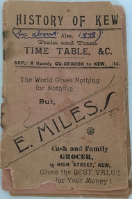
Booklet, H Sharpe Patterson, History of Kew; also Train and Tram Timetable, &c, c.1898
... Kew Flyer may have been the distributor and producer. There is no indication that it is an official tram or railway publication. During the second half of the 19th century when the booklet was produced there was only a horse tram (1887-1914) and the Kew Railway Line (1887-1952). The Kew section of the Outer Circle Line functioned until 1893. Historically significant item documenting Kew's history in the 19th century. The item is the earliest piece in the collection documenting aspects of the Kew Railway Line. kew (vic ...Train timetable including a history of Kew and advertisements for local retailers and merchants. Given the frequency of times mentioned, Coopers Kew Flyer may have been the distributor and producer. There is no indication that it is an official tram or railway publication. During the second half of the 19th century when the booklet was produced there was only a horse tram (1887-1914) and the Kew Railway Line (1887-1952). The Kew section of the Outer Circle Line functioned until 1893.Historically significant item documenting Kew's history in the 19th century. The item is the earliest piece in the collection documenting aspects of the Kew Railway Line.Small 30-page booklet containing a train and tram timetable for public transport in Kew (Vic). The booklet also contains a brief history of Kew and advertisements for local retailers. Pages can be viewed by scrolling through the attached images."Gift of C.W. Fairhall, Box Hill, 1990"kew (vic) - history, public transport - kew (vic), train timetables, tram timetables -
 Kew Historical Society Inc
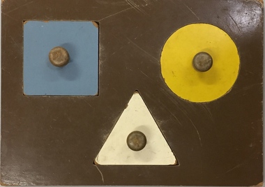
Leisure object, Child's Puzzle : Denmark Street Baby Health Centre, c.1950s
... Railway Commissioners agreed to lease a site at the Kew Railway Station for a Baby Health Centre for a term of 21 years at 3 pounds per annum. A building, designed by Roland Chipperfield, was erected, and the Centre previously conducted at the Town Hall transferred there. This became known as the Denmark Street Baby Health Centre. (Cr. W.D. Vaughan, Kew’s Civic Century, W.D. Vaughan Pty Ltd., Kew, 1960, pp.96 & 97.) denmark street baby health centre - kew (vic ...In August, 1920, The Kew Town Council decided to establish a Baby Health Centre in Kew. The first Centre was opened in a room in the Town Hall in Walpole Street on 5 November 1920. In May 1939, the Railway Commissioners agreed to lease a site at the Kew Railway Station for a Baby Health Centre for a term of 21 years at 3 pounds per annum. A building, designed by Roland Chipperfield, was erected, and the Centre previously conducted at the Town Hall transferred there. This became known as the Denmark Street Baby Health Centre. (Cr. W.D. Vaughan, Kew’s Civic Century, W.D. Vaughan Pty Ltd., Kew, 1960, pp.96 & 97.)One of a pair of wooden puzzles used in the Denmark Street Baby Health Centre in Kew.denmark street baby health centre - kew (vic), baby health centres - kew (vic), games and puzzles -
 Kew Historical Society Inc
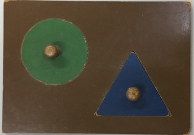
Leisure object, Child's Puzzle : Denmark Street Baby Health Centre, c.1950s
... Railway Commissioners agreed to lease a site at the Kew Railway Station for a Baby Health Centre for a term of 21 years at 3 pounds per annum. A building, designed by Roland Chipperfield, was erected, and the Centre previously conducted at the Town Hall transferred there. This became known as the Denmark Street Baby Health Centre. (Cr. W.D. Vaughan, Kew’s Civic Century, W.D. Vaughan Pty Ltd., Kew, 1960, pp.96 & 97.) denmark street baby health centre - kew (vic ...In August, 1920, The Kew Town Council decided to establish a Baby Health Centre in Kew. The first Centre was opened in a room in the Town Hall in Walpole Street on 5 November 1920. In May 1939, the Railway Commissioners agreed to lease a site at the Kew Railway Station for a Baby Health Centre for a term of 21 years at 3 pounds per annum. A building, designed by Roland Chipperfield, was erected, and the Centre previously conducted at the Town Hall transferred there. This became known as the Denmark Street Baby Health Centre. (Cr. W.D. Vaughan, Kew’s Civic Century, W.D. Vaughan Pty Ltd., Kew, 1960, pp.96 & 97.)One of a pair of wooden puzzles used in the Denmark Street Baby Health Centre in Kew.denmark street baby health centre - kew (vic), baby health centres - kew (vic), games and puzzles -
 Kew Historical Society Inc
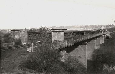
Photograph, Outer Circle Railway Bridge over River Yarra, c.1900
... ...railway bridges - kew (vic)...) sir john monash outer circle railway river yarra - kew (vic) Reverse: "Pre 1930. Outer Circle Railway Bridge over River Yarra (now Chandler Highway) - note bridge over line on Kew side for Asylum Farm". ...This photograph forms part of the Eric Sibly collection of images and information relating to the Outer Circle Railway which he donated to the Kew Historical Society in 1974. Heritage Victoria Citation (Abridged) "The Chandler Highway Bridge, a 137 metre wrought iron lattice-truss girder bridge with four spans supported on red brick piers with moulded bluestone cappings. The bridge has a cantilevered walkway along the west side. ...The Chandler Highway Bridge crosses the Yarra River and connects Alphington and Kew. It was completed in November 1890 as part of the Outer Circle Railway Line.Black & white photograph of the railway viaduct over Yarra River looking south towards Kew.Reverse: "Pre 1930. Outer Circle Railway Bridge over River Yarra (now Chandler Highway) - note bridge over line on Kew side for Asylum Farm". KH - 56. Kew Historical Society.chandler highway, railway bridges - kew (vic), sir john monash, outer circle railway, river yarra - kew (vic)
