Showing 154 items matching "state forests commission"
-
 Federation University Historical Collection
Letter, Inward Correspondence to the Ballarat School of Mines, 1910, 08/1910
... ...State Forests COmmission...Brennan L. Eddy State Forests COmmission Edwin Feild Royal Victorian Institute of Architects The STeel COmpany of Australia James MArtyn Clarke & Co Ludwig Alberti Scarsdale Thomas M. ...Inward Correspondence to the Ballarat School of Mines, August 1910letterhead, education department, gordon, c. brennan, l. eddy, state forests commission, edwin feild, royal victorian institute of architects, the steel company of australia, james martyn, clarke & co, ludwig alberti, scarsdale, thomas m. jude, justinian oxenham, clara davidson, robert davidson, j. roberts, h.b. silberberg & co, l. gilbert, macquarie steam brick yards, james dewar, r.j. flowerday, staffirdshire reef, john wilesmouth, bank of new south wales, victoria silicate brick company ltd, t.s. huggins, george f. roughhead, federal store, legislative assembly, andrew mckissock, city of ballarat, r. e. williams, ballarat school of mines battery assistant, edgar c. hurdsfield, bairnsdale school of mines, w. kingston, gordon technical college, h.l. langdon & co., felton grimwade, f.f. brunn, bendigo school of mines, gold buyers bill, chaffey salmon & dunne, h.j. thwaites, cobar, henry leahy, h. blyth, s. radcliff, archie buchanan, launceston, fairthorne and sons, sloanes and scotchmans united quartz mining company, james eton, albert bradford, 109 lyons st north -
 Southern Sherbrooke Historical Society Inc.
Photograph - Bagging potatoes on Hermon farm, Menzies Creek
... The Hermon family leased this land from the State Forest Commission....The Hermon family leased this land from the State Forest Commission. Photograph Bagging potatoes on Hermon farm, Menzies Creek ...Series of black and white photos showing workers bagging potatoes and loading onto trucks. These were taken on the Hermon farm on Black Hill Road, Menzies Creek. The Hermon family leased this land from the State Forest Commission. -
 Kiewa Valley Historical Society
Maps - Bogong x2, Tawonga, Omeo, Dargo, Victoria and others, 1. Bogong Alpine Area; 2. Bogong 8324; 3. Tawonga Topographical; 4. Omeo 8433; 5. Dargo 8323; 6. Victoria State
... Forests Commission Victoria, / revised 5/9/77, DEG No. 68-G/399. A Tawonga 803 folded map in a beige colour with the back blank. 4. Omeo 8433 Victoria, Edition 1, Department of Natural Resources. The map has a red and white cover with black writing and a simple map of Australia at the bottom. 5. 8323 Dargo, Edition 1, Commonwealth of Australia. A red and white cover with a map insert. 6. Victoria State...Forests Commission Victoria, / revised 5/9/77, DEG No. 68-G/399. A Tawonga 803 folded map in a beige colour with the back blank. 4. Omeo 8433 Victoria, Edition 1, Department of Natural Resources. The map has a red and white cover with black writing and a simple map of Australia at the bottom. 5. 8323 Dargo, Edition 1, Commonwealth of Australia. A red and white cover with a map insert. 6. Victoria State ...1. Bogong Alpine Area (outdoor Leisure Map. survey & Mapping Victoria, Government of Victoria, Edition 2, reprinted 1991 with an image of Mt. Feathertop on the front. Information for tourist in the Alpine National Park: Bogong Area. Including: recreational activities, history, weather and vegetation and a list of walks together with locality maps and photographs. The front cover has an image of Mt Feathertop against a blue sky with yellow writing 'Bogong Alpine Area', there is a yellow triangular block on the right hand top corner with black writing 'Outdoor Leisure Map. On the bottom edge is a block of yellow with black writing 'Survey & Mapping Victoria' and a light green map of Victoria with 'VICMSP' printed in white. 2. 8324 Bogong Victoria, Edition 1, Commonwealth of Australia 1981. A topographical Map: 1:100,000 scale (1 cm to 1 KM). Map has a red cover with white writing together with a white block and black writing and a map insert. 3. Tawonga Topographical Map - Forests Commission Victoria, / revised 5/9/77, DEG No. 68-G/399. A Tawonga 803 folded map in a beige colour with the back blank. 4. Omeo 8433 Victoria, Edition 1, Department of Natural Resources. The map has a red and white cover with black writing and a simple map of Australia at the bottom. 5. 8323 Dargo, Edition 1, Commonwealth of Australia. A red and white cover with a map insert. 6. Victoria State Map, Hema Maps, 2002. Hema Maps, State Map, colourful cover with a map of Australia and four tourism photographs. Scale 1: 850,000 An inscription handwritten in blue pen "Trappers Gap to Mitta Mitta 1" to 1 mile". There are some pen markings and notations of tracks.maps, bogong, omeo, tawonga, dargo, victoria, bogong alpine area -
 Kiewa Valley Historical Society
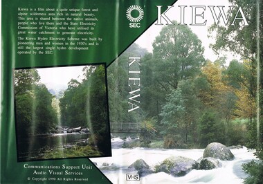
VHS Tape - Kiewa Hydro Electricity Scheme x2, Kiewa, Circa 1990
... This VHS was produced by the State Electricity Commission of Victoria, to show the pristine state of the Kiewa River and Valley post the completion of the Kiewa Hydro Electricity Scheme (Circa 1950s), The late 1970s on wards was the beginning of deeper social scrutineering by pro environmental groups such as the Australian Wilderness Society (1976) and the Greens (political Party), before, during and after the construction phases of any man made structures in forest/bush areas which may or could damage or adversely affect the natural flora and fauna of sites. ...Kiewa Valley Historical Society Mount Beauty Information Centre 31 Bogong High Plains Rd Mt Beauty high-country This VHS was produced by the State Electricity Commission of Victoria, to show the pristine state of the Kiewa River and Valley post the completion of the Kiewa Hydro Electricity Scheme (Circa 1950s), The late 1970s on wards was the beginning of deeper social scrutineering by pro environmental groups such as the Australian Wilderness Society (1976) and the Greens (political Party), before, during and after the construction phases of any man made structures in forest/bush areas which may or could damage or adversely affect the natural flora and fauna of sites. ...This VHS was produced by the State Electricity Commission of Victoria, to show the pristine state of the Kiewa River and Valley post the completion of the Kiewa Hydro Electricity Scheme (Circa 1950s), The late 1970s on wards was the beginning of deeper social scrutineering by pro environmental groups such as the Australian Wilderness Society (1976) and the Greens (political Party), before, during and after the construction phases of any man made structures in forest/bush areas which may or could damage or adversely affect the natural flora and fauna of sites. This promotional VHS, which was produced in the 1990s, was to project that unlike the Tasmanian State Electricity Commission (Franklin Dam issue), the Victorian State Electricity Commission acted in a way to protect the environment to the maximum level possible. With the passage of time since, and the issue of the global push to minimise carbon pollution, and as an alternative to coal fired power stations, the use of hydro electricity can now be seen as a highly efficient alternative to "coal powered" electricity. This VHS is a snap shot in time (1990) when the Kiewa Valley was still relatively under populated and holiday houses owned by city bound workers was still relatively insignificant. As more and more holiday makers retire to a small but friendly region(Kiewa Valley and Mount Beauty) the increase in visitor numbers will affect the local rural bush scene more and more. The changes that will occur (in time) can be measured against the scenes presented in this video. The additional resources provided by the State Electricity Commission of Victoria of "alpine bush" fire control and management, together with an ongoing educational scheme for school children in learning about what constitutes the Alpine country's unique environment, are a very important offshoot, benefitting to both the communities within the Kiewa Valley and regional Victoria.This VHS tape is stored within its own plastic cover which has a front side covered by a coloured photograph(both front and back cover) of the Kiewa River, just to the north east of the Mount Beauty township. The VHS tape is nestled within a formed inner structure which not only prevents the tape from moving to and fro but also unnecessary intrusion of foreign particles.Front cover "KIEWA" on the spine top circle with lines projecting out and below this "SEC". Middle of spine "KIEWA" and bottom of spine "VHS"secv, kiewa valley, dale-bromley, cy-duff, chris- harding, michael-glucz, forestation education, wilderness photography, nature film. -
 Kiewa Valley Historical Society
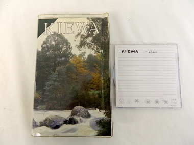
DVD - Kiewa Hydro Electricity Scheme, KIEWA, Circa 1990
... This DVD is a digital reproduction of a VHS produced by the State Electricity Commission of Victoria, to show the pristine state of the Kiewa River and Valley post the completion of the Kiewa Hydro Electricity Scheme (Circa 1950s), The late 1970s on wards was the beginning of deeper social scrutineering by pro environmental groups such as the Australian Wilderness Society (1976) and the Greens (political Party), before, during and after the construction phases of any man made structures in forest/bush areas which may or could damage or adversely affect the natural flora and fauna of sites. ...Kiewa Valley Historical Society Mount Beauty Information Centre 31 Bogong High Plains Rd Mt Beauty high-country This DVD is a digital reproduction of a VHS produced by the State Electricity Commission of Victoria, to show the pristine state of the Kiewa River and Valley post the completion of the Kiewa Hydro Electricity Scheme (Circa 1950s), The late 1970s on wards was the beginning of deeper social scrutineering by pro environmental groups such as the Australian Wilderness Society (1976) and the Greens (political Party), before, during and after the construction phases of any man made structures in forest/bush areas which may or could damage or adversely affect the natural flora and fauna of sites. ...This DVD is a digital reproduction of a VHS produced by the State Electricity Commission of Victoria, to show the pristine state of the Kiewa River and Valley post the completion of the Kiewa Hydro Electricity Scheme (Circa 1950s), The late 1970s on wards was the beginning of deeper social scrutineering by pro environmental groups such as the Australian Wilderness Society (1976) and the Greens (political Party), before, during and after the construction phases of any man made structures in forest/bush areas which may or could damage or adversely affect the natural flora and fauna of sites. This promotional VHS, which was produced in the 1990s, was to project that unlike the Tasmanian State Electricity Commission (Franklin Dam issue), the Victorian State Electricity Commission acted in a way to protect the environment to the maximum level possible. With the passage of time since, and the issue of the global push to minimise carbon pollution, and as an alternative to coal fired power stations, the use of hydro electricity can now be seen as a highly efficient alternative to "coal powered" electricity. This item provids a snap shot in time (1990) when the Kiewa Valley was still relatively under populated and holiday houses owned by city bound workers was still relatively insignificant. As more and more holiday makers retire to a small but friendly region(Kiewa Valley and Mount Beauty) the increase in visitor numbers will affect the local rural bush scene more and more. The changes that will occur (in time) can be measured against the scenes presented in this video. The additional resources provided by the State Electricity Commission of Victoria to "alpine bush" fire control and management, together with an ongoing educational scheme for school children in learning about what constitutes the Alpine country's unique environment, are a very important offshoot, benefitting to both the communities within the Kiewa Valley and regional Victoria. The DVD is nestled within a formed inner structure (case), which not only prevents the disc from moving to and fro but also unnecessary intrusion of foreign particles.This DVD is a TDK data/video recordable single sided 4.7 GB disc.It is a 1-16x speed."KIEWA" on disc.secv, kiewa valley, dale-bromley, cy-duff, chris- harding, michael-glucz, forestation education, wilderness photography, nature film. -
 Kiewa Valley Historical Society
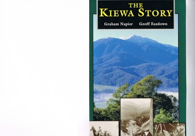
Book - Non Fiction History, The Kiewa Story, circa 1993
... forests and high plains can viewed as an example (compared to the Tasmanian Hydro schemes) of how future hydro schemes (an inevitable requirement) will proceed. Most rural towns (in the early 1900s) were built by unencumbered rural based citizens, with the exception of Mount Beauty and Falls Creek. These two settlements were brought into life by a State (Victorian) Authority for a specific function and program. They were a gated community, that is, only open to construction workers involved with the hydro scheme. All facilities within these communities were provided by the State Electricity Commission ...This book provides in chronological order the development of the Kiewa Hydro-electricity scheme from the first concept (1911) to final construction work (1961). It covers the first attempt to utilise the power of the Victorian Alps water system. It started from a private syndicate and developed to the current State Electricity Commission of Victoria. The incentive for the Hydro scheme was to make money and not as an alternative to the carbon producing coal fired power plants. These coal fired power plants were increasing in numbers to service an ever increasing demand made by population expansion, especially in cities and large rural settlements. This demand spiraled up after World War II when there was a tremendous spike in immigration numbers due to refugees and displaced persons in Europe. The ability to utilise the untapped water provided by the winter snow fields, for a higher yield in electricity, was a powerful incentive to overcome the physical hardships in this remote Alpine region. Future power requirements may initiate the re-installation of the other two power stations(Pretty Valley and Big Hill) covered in original Scheme. This publication not only covers the development of the Kiewa Valley region with respect to population (within a socio-economical framework) but also the subtle but yet strong physical changes of a relatively pristine alpine region. The demands that an ever growing regional population places on the environment is clearly documented in print and black and white photographs. The working and living conditions of those who constructed and gave life to this hydro scheme is well documented in this book. It may be viewed as spartan now but was relevantly good at that moment in time, especially for those workers fleeing a devastated European environment. The successful planning and consideration to minimising any intrusion upon the natural alpine forests and high plains can viewed as an example (compared to the Tasmanian Hydro schemes) of how future hydro schemes (an inevitable requirement) will proceed. Most rural towns (in the early 1900s) were built by unencumbered rural based citizens, with the exception of Mount Beauty and Falls Creek. These two settlements were brought into life by a State (Victorian) Authority for a specific function and program. They were a gated community, that is, only open to construction workers involved with the hydro scheme. All facilities within these communities were provided by the State Electricity Commission of Victoria. The impact on the social, financial and individual independency of the community, by the transition from the S.E.C .environment to one of local government (Shire of Bright), had in some cases a severe impact.This hard covered book has a green cover with pictures on the front and back covers. The front cover has a coloured picture of a snow covered Mount Bogong taken from the opposite mountain range. The valley between both ranges has a whisk of mist over it. At the bottom of this picture are three black and white photographs covering the construction of the Kiewa Hydro - Electricity Scheme. On the back cover is a photograph, (black and white) detailing the Bogong village and Junction dam containing lake Guy. The inside front cover is a black and white photograph which details the construction of the West Kiewa tailrace tunnel during April 1951. The inside back cover is a black and white photograph of the concrete pour at the Clover Dam circa 1952. All photographs and sketches are in black and white. The pages are approximately 160 g/m2 and those which have photographs are on gloss paper.Book spine: "The Kiewa Story Graham Napier Geoff Easdown" alongside this is a white framed circle with white spokes radiating out and underneath in white lettering SECkiewa valley, hydro scheme, victorian alpine region, electricity generators, graham napier, geoff easdown -
Federation University Historical Collection
Document, Zelda Martin, Central Victorian Goldmining towns - Boom Towns or Ghost Towns?, c1996
... State Forest...Arthur Worsley...Worsley Cottage...The Welcome Stranger...Moliagul...Moonambel...Redbank...St Arnaud...Sebastapol...Brown's...Scarsdale...Clunes...Chewton...Daylesford...Bushfires...Inkerman...Inglewood...Kingower...Lintons...Happy Valley...Piggoreet...McIvor...Majorca...Tarrangower...Taradale...The Coliban System...The Syphon...Sandy Creek...Wedderburn...Koorong...Arnold...Jones Creek...Waanyarra...The Golden Triangle...Census 1857...Blackwood...Buninyong...Durham Lead...Magpie...Carngham...Snake Valley...Alma...Amherst...Daisy Hill...Amphitheatre...Mountain Hut...Beaufort...Fiery Creek...Counties...population...gold fields commission...Forest Creek; Inhabitants of Heathcote and Gold Miners of McIvor; Residents and landholders of the District of Bacchus Marsh; Inhabitants of Kilmore and Vicinity. *Gold Fields Correspondence 1853: letter from Lieutenant Colonel Valiant, (Officer commanding the Troops in Victoria) to the Lieutenant Governor re threatened disturbance at Sandhurst (Bendigo) regarding the Gold License Fee. * Extracts from a book "Victoria" re Gold Fields Commission of Enquiry involving mainly Ballarat and Castlemaine and a chapter titled 'A Tour to the Victorian Gold-Fields' *Lists of central Victorian newspapers - listed by date published 1851to 1874; by first date available to State Library. ...Forest Creek; Inhabitants of Heathcote and Gold Miners of McIvor; Residents and landholders of the District of Bacchus Marsh; Inhabitants of Kilmore and Vicinity. *Gold Fields Correspondence 1853: letter from Lieutenant Colonel Valiant, (Officer commanding the Troops in Victoria) to the Lieutenant Governor re threatened disturbance at Sandhurst (Bendigo) regarding the Gold License Fee. * Extracts from a book "Victoria" re Gold Fields Commission of Enquiry involving mainly Ballarat and Castlemaine and a chapter titled 'A Tour to the Victorian Gold-Fields' *Lists of central Victorian newspapers - listed by date published 1851to 1874; by first date available to State Library. ...Zelda Martin was a PhD candidate at the University of Melbourne.[.1] 4th item in light blue display book titled Research Approach/Overview of Chapters/Confirmation of Canditure/Chapters1,2,3&4 of proposed thesis. *Twenty-seven page article on Victorian goldfields towns titled: Central Victorian Goldmining Towns - Boom Towns or Ghost Towns. The article was written during the author's PhD study. It outlines the context methodology, and resources and the chapters of the proposed thesis: (1) Central Victorian Goldmining Towns - The Context (2) Contemporary Views of the Factors Necessary for Town Growth (3) Outward Manifestations of Town Growth (4) The Trappings of Government (5-9) The Main Towns and Their Hinterland. [.2] 5th item in Light Blue display book as above item. *Chapter 1 of proposed thesis titled 'Pick, Shovel and Tin Dish Mining.' Covers in Section A: Central Victoria - Pre 1851: Aborigines in Central Victoria, Squatters, and Government. Section B: The years 1851-1854: The Early Gold Rushes, Government Reaction, Township Surveys, Legislation, Town Development, Local Government and Early Settlement. [.3] 6th item in Light Blue display book as above item. *2A of proposed thesis titled 'Contemporary Views of the Factors Necessary for Town Growth'. Similar information to Chapter 1 plus extra re towns and maps. Sections: Introduction, Context of Place - Geographical Towns Listed, The Context of Time - Pre1851 Aborigines, Governance of Port Phillip, The Squatters, The Villages of Central Victorian Highlands, Conclusion, Condensed Version of Chapter2B. [.4] 7th item in Light Blue display book as above item. *Chapter2B of proposed thesis. Sections: Area of Research, Schools, Banks, Newspapers, Progress Association, Town Development - Sandhurst (Bendigo), Ballarat, Castlemaine,, Maryborough, Ararat and Stawell. [.5] 8th item in Light Blue display book as above item. *Chapter 3 of proposed thesis titled 'Outward Manifestations of Town Growth'. Sections: Introduction, Contemporary Writing, Educationalists, The Bankers, The Townsfolk, Current Theory, General Theories of Urban Development, and Conclusion. [.6] 9th item in Light Blue display book as above item. *Chapter 4 of proposed thesis titled 'Trappings of Government' Sections: Introduction, Early Government Attitudes to Mining and Town Development, Law and Order, Township Surveys, Legislation, Local Government, Transport and Communication, The People and Lobbyists. [.7] 10th item in Light Blue display book as above item. *'The Rise and Fall of Central Victorian Goldmining Towns'. Includes a map showing main Goldfields, a table showing towns and villages at two points in time - 1857 and 1871; a Bibliography of Primary and Secondary Sources. [.8] Resource No1. Black display book titled Local Towns 1 : Alma: *Brief history *Directory *Maps Amphitheatre / Mountain Hut: *Brief History Post Office Directory Ararat: *Brief History *Post Office Directory 1869 - Alphabetical Listing by Occupation *Ararat - Prominent Citizens of 1858 *Langi-Morgala Museum Avoca: *Brief History *Excerpts from 'Avoca The Early Years', Margery and Betty Beavis; pg1 - Beginnings; pg11 - The Midas Touch; pg25 - Local Gold Escorts; pg27 - A Town is Born; pg51- The Administration of Justice; pg53 - The Ways of the Law; pg61 - News of the Day; pg65 - A Time to Play; pg72 - Land Ownership *Post Office Directory (Bailliere's) 1869 *Tourism Map and Information of area *Historic Avoca - A 5.5km Tour *Avoca & the Pyrenees Region - information pamphlet Ballarat: *Early History of Ballarat - Ballarat Historical Society, Publication No.1: origin of the name; Ballaarat - the Beginning; Fabulous Yields from the Ballaarat Goldfield; *Streetscape Lydiard Street. *Hand drawn map showing Leigh River, Old Portland Bay Road, plaque on road to Colac; etc. *Newspaper article re 'The Theatre Royal' ( which stood in the vicinity of the current Owen Williams store) - 'The News'15/04/1998 *Article - 'Ballarat's Mechanics' Institute Lives On' Ballarat Courier, 14/09/1985 *Article - Standing the Test of Time' The News 17/11/1993 re The Mechanics Institute & picture of the Reading Room *'Ballarat a Study of a City, Phyllis Reichl, pub. Nelson, 1968; no.3 place, time and people field studies series *Investigator Vol.33 No.2, 1998 Geelong Historical Society. Article on pg75 describes Ballarat in 1861 *Folded poster - 'Ballarat 100' a history of telegraph communication, pub. Telecom. Beaufort (Fiery Creek): *Brief history *Post Office Directory [.9] Resource No.2 Black Folder Titled Towns cont.No2 Bendigo (Sandhurst): *'Family & Local History at the Bendigo Library - 1851-2001 150 years of gold'. *Bendigo Government Camp in 1853 illustration; key to sketch and names of Government officers stationed there *Excerpts from 'Bendigo and Vicinity' Adolph Haman *The Bendigo Goldfield Registry - pgs 1-7 Introduction *Excerpt: 'Breaking the Grip' *Excerpt: The Most Go-Ahead Place *Excerpts from 'History of Bendigo' - anti license agitation; laying out of town; proposed railway; gold calls and dividends; the Sandhurst Municipality; journalism *Bibliography Blackwood: *Excerpts from 'Aspects of Early Blackwood - The Goldfield, the Landmarks, the Pioneers' Alan J Buckingham and Margaret F Hitchcock, JG Publishing,1980 Buninyong: *A Brief History *Investigator Vol1 No.2 Feb 1966 Geelong Historical Society. Pg3 - Article re gold escort route - Mt Alexander to Adelaide - (see a simple monument on the Western Highway a few miles out of Horsham. Pg 15 - Ballarat Excursion - re the finding of gold. *Three articles published by Buninyong and District Historical Society Inc: (Magpie Exploration; Finding Gold In The Green Hills; Magpie Exploration; Burnt Bridge to Cargarie to Mt Mercer) *Copies of newspaper articles/items *Buninyong Street Directory Carisbrook: *In the Beginning There Was Carisbrook *The History of the Carisbrook Racecourse Carngham / Snake Valley: *Brief History *Directory Castlemaine: *Directory 1865-1866 - Alphabetical and Street *Poster - Castlemaine A Contemporary Guide "The Great Centre" 1866 - A Contemporary Guide to the Fascinating Past *Pamphlet - Castlemaine District Community Hospital *Map - Castlemaine, Maldon & Surrounding Districts *Map and Information - The Dry Diggings Track - a 55kl walk among historic goldfields relics ( Castlemaine Fryerstown Vaughan Mt Franklin Hepburn Daylesford) *Postcard - Former Court House *Directory 1867 - Alphabetical, Trade [.10] Resource No.3 Grey folder Titled Towns 3 Creswick to Maryborough Creswick: *Brief History *Booklet - "Creswick Cemetery Walk" *Booklet - The Buried Rivers of Gold Heritage Trail Creswick *Creswick Historical Museum Information Sheet *Chronological History of Creswick *Alphabetical Directory of the Borough of Creswick *Creswick's Creek Directory 1856 *Historic Creswick Walking Tour *A Brief Account of the Schools of Creswick - Past and Present *100 Years of Railway Travel in Creswick *The Berry Deep Leads *The Spence Home at Jackass Gully in the Creswick State Forest ( William Guthrie Spence - Pioneer) *The New Australian Mine and the 1882 Disaster *Creswick District News, Issue 7, July August 1999 *The Creswick Miners Walk - Information and Map *Maps Chewton: *Brief History *Directory Clunes: *Brief History *Clunes Street Directory Daylesford: *Brief History *Notable Bushfires in Daylesford District Over More Than a Century - "Black Thursday" 1851; 1862; 1899; the Disastrous Hepburn Fire of 1906; 1939; 1944; 1969. *Post Office Directory -Daylesford and Hepburn Dunolly / Inkerman: *Brief History *Directory *Pamphlet - Goldfields Historical Museum *Pamphlet - Historic Dunolly - Victoria's Best Kept Secret *Map of Gold Workings at Dunolly Area - showing where the main gold rushes occurred *Brief History - Inglewood *Directory - Inglewood - Name Occupation, Dwelling Kingower: *Brief History *Directory - Name / Ocupation / Dwelling Linton / Happy Valley / Piggoreet: *Brief History *Directory - Lintons McIvor: *"A History of the Shire and the Township of Heathcote" by J.O. Randell Majorca: *Brief History *Official Post Office Directory 1869 - Name / Occupation/ Address Maldon (Tarrangower): *Brief History Part 1 *Brief History Part 2 *Post Office Directory *List - Alphabetical Order by Names plus Business and Trade (Tarrangower Times Oct/1858) *List - Alphabetical Order by Trade plus Name and Business *Directory - Name / Occupation / Dwelling Maryborough: *Worsley Cottage - built by Arthur Worsley, a contractor in stonework in 1894 [.11] Resource No. 4 Blue Display Book titled Towns 4 Moliagul to Stawell Moliagul: *Brief History *Moligul Legislative Assembly (Voting?) List - Names and Occupations *Moliagul Victorian Post Office Directory 1868 - Name / Ocupation / Address / Comments *"The Welcome Stranger" gold nugget *The Sunday School *The Welcome Stranger Discovery Walk - information and map Moonambel (Mountain Creek) Redbank *Brief History *List of names extracted from advertisments of the Pioneer and Mountain Creek Advertiser 16/02/1861. *Bailliere's Directory 1869 - Alphabetical List of Name / Occupation / Place St Arnaud: *Brief History Sebastapol: *Brief History *Directory 1869 - Alphabetical by Name; plus occupation and address. Browns and Scarsdale: *Brief History *Browns Street Directory - Name and Occupation Smythesdale: *Brief Description *Smythesdale Street Directory -Name and Occupation Stawell (Pleasant Creek) *Brief History *Victorian Official Post Office Directory - Name /Occupation / Dwelling *Chronology - 1841-1920 *Production of gold statistics - 1879 - 1900 *Big Hill *Extracts from "The Golden Years of Stawell". Chapt 1 - Stawell's Coming Out. Capt. 2 - The Gold Rush. Caapt.3 - Cradle of Democracy. Chapt.4 - The Reefs Becomes Stawell. Chapt. 5 - Rushing In. Chapt.6 - The Pioneers. Chapt 7 - The Decade of Optimism. [.12] Resource No. 5: Blue Display Book titled 'Towns Steiglitz to the The Golden Triangle. Steiglitz: Brief History Victorian Post Office Directory 1869 *Map of Steiglitz *List of maps relevant to Steiglitz history *Information 6 tables of data from "Reports of Mining Surveyors Talbot (Back Creek) Brief History Taradale: Post office Directory 1869 - Name/Occupation/Street. Also list in alphabetical order by Occupation Taradale *Chronological Reference to Taradale Mines *Water - The Coliban System of Waterworks *Joseph Brady *The Syphon Tarnagulla (Sandy Creek) *Brief History *Tarnagulla Businessmen Cameos to give depth to advertisments in 'The Tarnagulla Courier' various issues 1864-1871 *Directory - Name/Occupation /Address *List - Name/Business/Trade Wedderburn (Koorong) *Brief History *List - Name/Occupation The Golden Triangle: *The Early Rushes - Wedderburn / Moliagul / Sandy Creek - Tarnagulla / Jones Creek - Waanyarra / Kingower / Dunolly - Goldsborough / Inglweood *Census of 1857 - Population / Occupations *1858-1871 - A Time of Consolidation- Wedderburn / Moliagul / Sandy Creek- Tarnagulla / Arnold *Census 1871 - Population *Information gleaned from the census data - Demographics / Population / Occupations / marital / Birthplace / Religion / Literacy/ Occupation and Housing Cameos *Graphs - Birthplace of settlers /Male-Female Ratio / Married males / Children under 15 as Percentage of Population / Religion *Census 1857 - Statistical data *Maps *Bibliography [.13] Resource No. 6 - Black Display Book Information and Research in Central Victoria including: *Banking - Research from ANZ Bank Archives *Institutions - also includes articles listed from the Ballarat Times Newspaper *Australian mining History Association - A.M.H.A. Bibliography *Australia's Mining History * Bibliography - Land Surveys Victoria - *1853 Administration (Statistics and Other) includes: schools / ministers of religion / police / military / local administration / licences for sale of spirits / distances between various Victorian gold fields. * Victoria Government Gazette (Copy) - N0. 116, 12/12/1854 includes: Gold Felds Commission of Enquiry & No. 85, 15/09/1854 - Addresses presented to the Lieutenant Governor (Sir Charles Hotham) during his tour through the Gold Fields of Victoria,1854. Addresses on behalf of : the people of Bendigo; Members of the Church of England, Bendigo; Members of the Wesleyan Church on the Bendigo Gold Fields; Bendigo Gold District General Hospital; the Bendigo Prospecting Association; Committee of the Bendigo Local Exhibition; Bendigo District Medical Association; Coloured Americans Resident at Bendigo; German Inhabitants of Bendigo; Landowners, Inhabitants, and Miners of Castlemaine; Inhabitants of Forest Creek; Inhabitants of Heathcote and Gold Miners of McIvor; Residents and landholders of the District of Bacchus Marsh; Inhabitants of Kilmore and Vicinity. *Gold Fields Correspondence 1853: letter from Lieutenant Colonel Valiant, (Officer commanding the Troops in Victoria) to the Lieutenant Governor re threatened disturbance at Sandhurst (Bendigo) regarding the Gold License Fee. * Extracts from a book "Victoria" re Gold Fields Commission of Enquiry involving mainly Ballarat and Castlemaine and a chapter titled 'A Tour to the Victorian Gold-Fields' *Lists of central Victorian newspapers - listed by date published 1851to 1874; by first date available to State Library. *A list of cities and towns showing County, population in 1861 &1871, and municipal status. [.14] Resource no.7. Black display book. *Reference: Papers presented to Parliament Victoria - 1859-1860 4 volumes - relevant sections copied. Contains information on Branches of Government. General / Finance / Gold / Gazette / Commission and Warrant / Statistic. *Gold Fields Act. In accordance with the Act the gold fields are divided into six districts - Ballaarat, Castlemaine , Sandhurst, Avoca, Ararat, and Beechworth.. Official staff in each gold district consists of a Resident Warden, Wardens, Wardens' Clerks, Bailiffs, Chinese Protectors, Chinese Interpreters, and Mining Surveyors. *Gold Receiver *Gaols *Police magistrates and Clerks of Petty Sessions, etc. *Field Branch *Immigration and Emigration Overland - Chinese - 1859 *Population on the Goldfields *The Geological Survey - The Government Geologist is assisited by staff from four branches - the office Branch; the Publishing Branch; the Field Branch and the Museum Branch. *Commission to Enquire Into Sludge dated 10/02/1859 (Some sections copied) - Report to the Honorable Chief Commissioner of Public Works, Melbourne re the mode of carrying the sludge from the puddling mills in Sandhurst without interfering with the drainage of the town and the roads in the neighbourhood. [.15] Resource No.8: Camel display book titled Resource No. 8. Aborigines *Lists of book titles - +"Readings in Victorian prehistory" +"The Aborigines of Port Phillip" +Aboriginal languages and clans" +"A History of the Port Phillip District" +"Langi Ghiran 1: Aboriginal Rock...." +"Koorie History: sources for aboriginal studies in the State Library of Victoria", ed. Tom Griffiths, Melb. Friends of the State Library, 1989 +"The Public Lands of Australia Felix"; settlement and land appraisal in Victoria1834-91 with special reference to the Western Plains", J.M.Powell, Melb. Oxford University Press 1970 +*Bibliography of the Victorian Aborigines' from the earliest manuscripts to 31st December 1970, Massoa, Aldo, Melb. Hawthorn Press, 1971 +"Aborigines in Colonial Victoria, 1836-1886", M.F. Christie, Sydney University Press, 1979 +"Urban and Industrial Australia: readings in Human Geography" ed J.M. Powell, Melb. Sorrett Pub. 1974 *Extracts: -Processes of Pioneer Settlement - The Squatting Occupation of Victoria, 1834-60. J.M. Powell -Areal Variations in the Class Structure of the Central-Place Hierarchy. P. Scott - Volume1 and Volume 2: Notes Relating to the Habits of the Natives of Other Parts of Australia and Tasmania. Compiled from various sources for the Government of Victoria by R Brough Smyth. John Curry, O'Neil, Melb. 1st pub. Melb. 1876. p31-45 - Numbers and Distribution of the Aborigines in Victoria -Victorian Aborigines 1835-1901 - A Resource Guide to the Holdings of the Public Record Office, Victoria; published by the Government Information Centre 1984. *History of the Aboriginal Artefacts Displayed in the Daylesford Museum. F. G. Powell (4 page pamphlet) *Letter to Zelda Martin from Peter Lovett, Cultural Officer, Ballarat & District Aboriginal Co- Operative, 05/02/1997 *Map: Ian Clarke Victorian Tribunal Boundary Map - Clans of Central Victoria. *Victorian Rock Art and Mythology - Article about Mount Langhi Ghiran and myths of the Tjapwarong people. *Two Aboriginal myths relating to the Grampians - 'The Monster Emu' / 'The Aquisition of Fire', by the Aborigines in the Grampians Areas *Article titled (chapter 8) Ballarat - information re camping sites in the region. Lake Wendouree / Lake Burrumbeet (includes a myth) / Mt Bunninyong / Lal Lal / Pitfield / Mount Elephant / Mount Egerton / Meredith / Lake Goldsmith / Lake Learmonth / Ercildoune *Notes on the Aborigines of the Wider Ballarat Region plus European names=Aboriginal names. John Morris 26/07/1995 *Role of Aborigines in Town Development in Central Victoria. Mentions Native Police Force est. in Port Phillip 1842 and Central Board for Aborigines est. 1860 *The Grave of King Billy. (Frank Wilson) Pamphlet. *Camping Places in Central and Northern Victoria. Article re Lake Burrumbeet site. *Programme for the Unveiling of Memorial Cairn for Edward Stone Parker 1802-1865. Note portrait not accurate. Accurate portrait is available in the book "A Successful Failure A Trilogy The Aborigines and Early Settlers", Edgar Morrison, Graffiti Publications, 2002. * Large envelope addressed to Mr G Netherway containing newspaper cuttings regarding the life of Edward Stone Parker, the unveiling of the Memorial Cairn as mentioned above, articles titled 'Episodes from Our Early Days' (Edgar Morrison, Yandoit)- The Black's School, A School At Last and The Final years. Also a typed page titled 'Historical Background to E.S.Parker's Career. Includes an interesting tale titled 'When the cat lay doggo' re laying power leads for the unveiling ceremony at the memorial site. [.16] green display folder titled 'Research Aids' *List of references to Commissioners' & W'ardens' Reports (formerly held at La Trobe Library Archives, now at Public Records Office [PRO]). Indicates town referred to / date of report / name of camp if different to town. * Archive information re Anglican Records *Movement around the Goldfields - Miners and Storekeepers - usefulness of newspapers in providing information - areas covered - Castlemaine, Maldon, Ararat, Stawell, Tarnagulla, Dunolly. *Port Phillip /Victoria Directories 1839/1867 - Chronological list of Directories included in this series. *"Notes on the History of Local Government in Victoria" A.W. Greig Melb. University Press 1925 - Photo-copied extract p5-p40. (Source - Deakin University Library) - Introduction by W.Harrison Moore. Section 1 - Development in New South Wales Before Separation. Section 2 - Development in Victoria After Its Separation from New South Wales. Hand written notations: 'roads, markets, and local government 1855 on' ;'opportunity of squatters in parliament' and 'opportunities of matters in parliament p33' * Notes on the Establishment of Surveyor General's Department 1851and Commissioner of Crown Lands and Survey. * Newspaper articles from The Argus, 1849, re the discovery of gold in the Pyrenees region. * Excerpt - a report on schools - A.B.Orlebar, Inspector; re the need for permanent school buildings rather than tents. *Excerpt from - 'Approaches to Urban History', Sean Glynn: The Case for Caution * Except from - 'The Urban Sprinkle', Weston Bate: Country Towns and Australian Regional History *Reference- 'The History of Land Tenure in the Colony of Victoria', John Quick. References the Haines Land Bill, land tenure and Land Leagues. [.17] Light blue envelope folder titled 'Birtchnell's Ballarat, etc. Directory 1862 *Contains various directories for Smythesdale, Buninyong, Clunes, Brown's and Creswick. [.18] Red envelope folder no.2 titled Victorian Gazetteer *Selected pages from 1869 Victorian Gazetteer on A4 paper (with a handwritten note questioning if some pages are from 1868 Victorian Gazetteer as appears to be different sizes - A3 pages.) Information includes locations and descriptions of towns, hotels, banks, communications and populations. (Does not include names, residences and occupations) [.19] Red Envelope folder titled Bailliere's Official Post Office Directory 1868 (or1869 or a mixture of both?) *Preface *Contains a selection of pages of towns highlighted in yellow in the the index *Work on this directory was commenced in 1867. *Information includes: Municipalities - mayors and councilors; lists of towns naming male inhabitants and their occupations. [.20]Yellow manila folder titled Post Grad Seminar Presentation 1996 *Gives some background to Zelda Martin's proposed thesis and why she chose the topic Gold Mining Towns Boom or Bust [.21] A3 display book - No. 1A * A list of 'Relevant Newspapers collected: The Tarrangower Times and Maldon Advertiser (first published 1858) Includes dates 1858-1867. The Mount Alexander Mail. Includes dates 1854-1866 The Tarnagulla Courier. Includes dates from1864-1871 Dunolly and Burnt Creek Express. Includes dates from 1862-1871 * Selection of newspaper pages from The Mount Alexander Mail 1854 to 1856, mostly showing advertisements for businesses and services provided to that community. [.22] A3 display book - No. 1B * Selection of newspaper pages from The Mount Alexander Mail 1857 to 1866, mostly showing advertisements for businesses and services provided to that community. [.23] A3 display book -No. 2 * Selection of newspaper pages from The Tarnagulla Courier 1864 to 1871, mostly showing advertisements for businesses and services provided to that community. [.24] A3 display book - No. 3 *Selection of newspaper pages from The Tarrangower Times (and Maldon and Newstead) Advertiser 1858 to1867, mostly showing advertisements for businesses and services provided to that community. [.25] A3 display book - No.4 * Selection of newspaper pages from The Dunolly and Burnt Creek Express; and The Dunolly and Betbetshire Express 1862 to 1871, mostly showing advertisements for businesses and services provided for that community. [.26] A3 display book - No.5 Includes: * Bryce Ross's Diggings Directory. Includes instructions for using this directory. This directory was used by "all persons having connexion or desiring to communicate with 'working parties, private friends, or Stores at the Diggings." As a directory for each area wwas completed it was published in each month's issue of Bonwick's "Digger's Magazine." Years c1852/1853. This Directory commences first at the head of Forest Creek. Includes a directory for Bendigo and Ballarat. Of interest at the end of the Bendigo and Ballarat directory is a list of the number of storekeepers, butchers, doctors, smiths, eating houses, lemonade sellers and chapels. * The Castlemaine Directory and Book of General Information Comprehending Glass's Model Calendar for the Two Years 1862 and1863. "zelda martin, victorian goldfield towns, bendigo, castlemaine, ballarat, maldon, stawell, ararat, maryborough, creswick, avoca, heathcote, banks, bank of australasia, union bank of australia, government camp, sandhurst, water supply, tarnagulla, talbot, back creek, mountain creek, police court, carisbrook, dunolly, thompson's foundry, charles clacy, anthony trollope, robert cecil, mount alexander, urbanisation, national schools, education, govenrment, industry, railway, transport, settlement, land settlement in central victoria, steiglitz, joseph brady, the new australian mine, berry deep leads, william guthrie spence, creswick state forest, arthur worsley, worsley cottage, the welcome stranger, moliagul, moonambel, redbank, st arnaud, sebastapol, brown's, scarsdale, clunes, chewton, daylesford, bushfires, inkerman, inglewood, kingower, lintons, happy valley, piggoreet, mcivor, majorca, tarrangower, taradale, the coliban system, the syphon, sandy creek, wedderburn, koorong, arnold, jones creek, waanyarra, the golden triangle, census 1857, blackwood, buninyong, durham lead, magpie, carngham, snake valley, alma, amherst, daisy hill, amphitheatre, mountain hut, beaufort, fiery creek, counties, population, gold fields commission of enquiry1854, william westgarth, gold license fee, lieutenant colonel valiant, administration of the victorian gold fields, commission to enquire into sludge 1859, e.s. parker, edward stone parker, edgar morrison, mount franklin protectorate, dja dja wurrung, memorial cairn, franklinford, mt franklin memorial cairn, jajowurrong, dja dja wurung, tjaowarong, wothowurong, assistant protectors, daylesford museum, buluk, rock art - grampians, aboriginal mythology - grampians, aborigines, first nations people, mount franklin, aboriginal artifacts, lake burrumbeet, native police force, central board of aborigines, yandoit, commissioners' reports, wardens' reports, port phillip/victoria directories 1839-1867, local government - victoria 1853/1854, surveyor general's department - 1850's, victorian schools 1850's, a.b.orlebar, haines land bill, william charles haines, wilson gray, land tenure, land leagues, victorian gazetteer, the tarrangower times and maldon advertiser - 1858-1867, the mount alexander mail 1854-1866, the tarnagulla courier 1864, dunolly and burnt creek express 1862-1871, bryce rose's diggings directory, the castlemaine directory 1862-1863 -
Federation University Historical Collection
Book, Jacobs Lewis Vines Architects and Conservation Planners, Historic Sites Survey: Ballarat Study Area, 1980, 1980
... state forest...railways...explorers routes...early roads...land conservation council...ausralian hertiage commission...Barker Library (top floor) Mount Helen goldfields This survey was commissioned by the Land Conservation Council, Australian Heritage Commission and the Ministry for Conservation historic sites ballarat Wendy jacobs miles lewis gary vines berringa buninyong creswick dunnstown fiery creek lal lal langi logan cathcart mount cole Mount Egerton nerrina gong gong wombat state forest railways explorers routes early roads land conservation council ausralian hertiage commission department of planning ICOMOS (Burra) Charter nigel lewis richard aitken freehold land public land langi ghiran New jubille mine birthday tunnel mine pitfield plains smythesdale buninyong company Mount Clear mt clear canadian gully Warrenheip Distillery thomas mitchell waterloo trawalla beaufort raglan internment camps forestry mining mining mt egerton Mary Hollick Collection Jubilee Mine Burra Charter Historica areas data form explorers Egerton Company Black Horse mine Mt Egerton Government Battery kaolin Mines Anderson Brothers Barkstead Anderson's Tramway Clarkesdale Berry Leads Birthday Tunnel Mine Berringa Warrenheip Australasian Company Mount Mercer Lanvi-Kal-Kal water race 114 page report on historic sites in the Ballarat region. ...This survey was commissioned by the Land Conservation Council, Australian Heritage Commission and the Ministry for Conservation 114 page report on historic sites in the Ballarat region. It includes information on sites, a schexdule of sites, silte selection and designated areas (ie around towns)historic sites, ballarat, wendy jacobs, miles lewis, gary vines, berringa, buninyong, creswick, dunnstown, fiery creek, lal lal, langi logan, cathcart, mount cole, mount egerton, nerrina, gong gong, wombat state forest, railways, explorers routes, early roads, land conservation council, ausralian hertiage commission, department of planning, icomos (burra) charter, nigel lewis, richard aitken, freehold land, public land, langi ghiran, new jubille mine, birthday tunnel mine, pitfield plains, smythesdale, buninyong company, mount clear, mt clear, canadian gully, warrenheip distillery, thomas mitchell, waterloo, trawalla, beaufort, raglan, internment camps, forestry, mining, mining, mt egerton, mary hollick collection, jubilee mine, burra charter, historica areas data form, explorers, egerton company, black horse mine, mt egerton government battery, kaolin mines, anderson brothers, barkstead, anderson's tramway, clarkesdale, berry leads, birthday tunnel mine berringa, warrenheip, australasian company, mount mercer, lanvi-kal-kal, water race -
 Eltham District Historical Society Inc
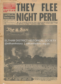
Newspaper - Newspaper articles, Sun News-Pictorial, They Flee Night Peril, The Sun News-Pictorial, Wednesday, January 17, p1, 1962
... Forest Commission Headquarters...Kallista...R.T. Seaton...Montrose...Yallourn...Central Gippsland...Smith’s Creek...Black Friday...Geoffrey Ockwell...Ronald Ockwell...Preston Town Hall...E.J. Tenner...Strathewen...Kangaroo Ground...Eric Farnsworth...Adele Farnsworth...Robin Farnsworth...Roy Cleland...Ann Cleland...Belgrave...Sassfras...Kaloramalice Commissioner Porter...Mansfield...Box Hill Hospital...Pound Bend...Ferntree Gully...Ferntree Gully State...Forest Commission Headquarters Kallista R.T. Seaton Montrose Yallourn Central Gippsland Smith’s Creek Black Friday Geoffrey Ockwell Ronald Ockwell Preston Town Hall E.J. Tenner Strathewen Kangaroo Ground Eric Farnsworth Adele Farnsworth Robin Farnsworth Roy Cleland Ann Cleland Belgrave Sassfras Kaloramalice Commissioner Porter Mansfield Box Hill Hospital Pound Bend Ferntree Gully Ferntree Gully State School W. ...Various news articles pertaining to the January 1962 Victorian bushfires in the Dandenong and Healesville districts which by the third day had encompassed large areas of the State. Specific Eltham Shire districts mentioned include Panton Hill and Hurstbridge on page 1, Warrandyte on page 2, 3, 4 and 5, Hurstbridge, Smith’s Gully, Kinglake on page 3 and 4, Strathewen, Kangaroo Ground, Panton Hill, St. Andrews, Smith’s Gully on page 4 and Pound Bend, Smith’s Gully and Warrandyte on pages 20-21 • They Flee Night Peril, p1 (Illust.) • Their grim picnic; A flash fire strikes, p2 (Illust.) • Night of terror as towns quitted, p3 • Fought till he dropped, p3 (Illust.) • Rain in fire area, p3 • Wye River town goes, p3 • Black Friday Hero Dies In Fire; with wife, grandsons, p4 • Surrounded!, p4 (Illust.) • Main street houses ablaze, p4 • Hurstbridge is evacuated, p4 • Scores jump in river at Warrandyte, p5 • Hills people leave homes, p5 • “Fire” cry at Parlt., p5 • Blind – he’s safe now, p5 (Illust.) • Police Chief Runs Battle, p7 • From Fire Front: Hospital treats 34, p7 • Firms send help, p7 • Tragedy and Ruin: Third Day; Ferntree Gully; Warrandyte; Pound Bend; Smiths Gully; Escape for 18, pp20-21 (Illust.) • Church was a haven for the hurt, weary, p39 (Illust.) • A home is lost, p40 (Illust.) tom fielding collection, victorian bushfires - 1962, victorian bushfires – 1962, panton hill, hurstbridge, five ways crossroads, warrandyte south, dandenongs, upwey, mt. evelyn, monbulk, olinda, sassafras, st. andrews, warrandyte, christmas hills, yarra river, mitcham, whitehorse roiad, donvale, park orchards, metropolitan fire chief, w.t. aldridge, loughnan’s hill, ringwood, woori yallock, leslie ockwell, linda ockwell, kalorama, healesville, daylesford, fire damage – buildings, wye river, portland, eganstown, ballarat, sherbrooke park forest, forest commission headquarters, kallista, r.t. seaton, montrose, yallourn, central gippsland, smith’s creek, black friday, geoffrey ockwell, ronald ockwell, preston town hall, e.j. tenner, strathewen, kangaroo ground, eric farnsworth, adele farnsworth, robin farnsworth, roy cleland, ann cleland, belgrave, sassfras, kaloramalice commissioner porter, mansfield, box hill hospital, pound bend, ferntree gully, ferntree gully state school, w. carew, ann quinton -
 Eltham District Historical Society Inc
Photograph - Digital Photograph, Alan King, Kinglake National Park, 27 March 2008
... State Government took over the management and the Committee of Management became an advisory committee, which disbanded in 1978. Originally, the park covered crown land in the Shires of Eltham and Whittlesea; then Wombelano Falls in Yea and other areas were added. In 1970 the park extended into the Shires of Eltham, Healesville, Whittlesea and Yea.5 Bush fires have been an ongoing problem. In 1939 hundreds of eucalypts and acacias had to be sown around the Jehosaphat Gully to rejuvenate the forest. To manage bushfires, the Committee of Management, then the State Government, worked closely with the Forestry Commission...State Government took over the management and the Committee of Management became an advisory committee, which disbanded in 1978. Originally, the park covered crown land in the Shires of Eltham and Whittlesea; then Wombelano Falls in Yea and other areas were added. In 1970 the park extended into the Shires of Eltham, Healesville, Whittlesea and Yea.5 Bush fires have been an ongoing problem. In 1939 hundreds of eucalypts and acacias had to be sown around the Jehosaphat Gully to rejuvenate the forest. To manage bushfires, the Committee of Management, then the State Government, worked closely with the Forestry Commission ...Fern gullies around Jehosaphat Gully Covered under National Estate. Published: Nillumbik Now and Then / Marguerite Marshall 2008; photographs Alan King with Marguerite Marshall.; p125 The magnificent Kinglake National Park, fringing Nillumbik’s north, is the largest national park close to Melbourne. Thanks to the vision and hard work of a band of local people, the park was created from what was rapidly becoming degraded land. Seeing a threat to Kinglake’s indigenous flora and fauna, several prominent local people campaigned for a national park, which was established in 1928.1 Since then, the park has grown through donations and acquisitions of land, from around 13,800 acres of land (5585ha) to 22,360 hectares. The Sugarloaf and Everard Blocks – of almost 8000 hectares – stand in Nillumbik and the park extends into Mitchell and Murrundindi Shires and the City of Whittlesea. Mt Everard commemorates William Hugh Everard, State member for Evelyn when the park was established. Before 1928, European settlers had degraded the Kinglake area, which was named after the celebrated English author and lawyer, Alexander William Kinglake. Remains of gold shafts and diggings in the park are reminders of Kinglake’s first settlers, who hoped to strike it rich at the gold diggings. But like other gold fields in this shire, they proved not very lucrative and soon timber cutting replaced mining in importance. However, before long, the accessible timber supply ran out, so in the 1920s agriculture took over – particularly potatoes and berry fruits – which involved large-scale clearing.2 The park’s instigator was retired Melbourne University Professor of Music, William Laver.3 As chair of the Kinglake Progress Association he began negotiations to have crown lands on the southern scarp of the Great Dividing Range reserved as a national park. Even before the park was proclaimed, from 1927, KPA members cut tracks to the major scenic points. Professor Laver was one of several people who gave land for the park, donating around 50 acres (20ha), including the Jehosaphat Gully.4 Laver chaired the park’s first Committee of Management, which raised money to employ a ranger and provide facilities, including tracks and roads for fire protection vehicles, toilets and shelters. The committee charged fees for firewood collection, some grazing of livestock, and visitor entrance, and obtained small State Government and Eltham Shire grants. In 1957 the State Government provided revenue for national parks. Then, in 1975, the State Government took over the management and the Committee of Management became an advisory committee, which disbanded in 1978. Originally, the park covered crown land in the Shires of Eltham and Whittlesea; then Wombelano Falls in Yea and other areas were added. In 1970 the park extended into the Shires of Eltham, Healesville, Whittlesea and Yea.5 Bush fires have been an ongoing problem. In 1939 hundreds of eucalypts and acacias had to be sown around the Jehosaphat Gully to rejuvenate the forest. To manage bushfires, the Committee of Management, then the State Government, worked closely with the Forestry Commission, shire councils and local fire brigades. Early national parks focussed on recreation. But by the 1980s, conservation, education and scientific research became more important, playing a vital role in preserving representative samples of the natural environment. Each year many thousands of people use the park’s extensive network of walking tracks amongst the protected plant and animal life as well as camping, cycling and horse riding. The park, along the slopes of the Great Dividing Range, has lookouts revealing magnificent views of the Melbourne skyline, Port Phillip Bay, the Yarra Valley and the You Yangs. Vegetation in the Masons Falls area includes messmate forest, Austral grass-trees, ferns and Hazel Pomaderris. In spring, orchids, lilies, everlasting daisies, correas, grevillea and heath appear. Around Jehosaphat Gully are wet and dry forest, fern gullies and banksia. Animal life includes wallabies, kangaroos, koalas, echidnas, possums, gliders and bandicoots. Male lyrebirds can be heard mimicking in the Jehosaphat Gully, particularly in the Everard Block in winter.This collection of almost 130 photos about places and people within the Shire of Nillumbik, an urban and rural municipality in Melbourne's north, contributes to an understanding of the history of the Shire. Published in 2008 immediately prior to the Black Saturday bushfires of February 7, 2009, it documents sites that were impacted, and in some cases destroyed by the fires. It includes photographs taken especially for the publication, creating a unique time capsule representing the Shire in the early 21st century. It remains the most recent comprehenesive publication devoted to the Shire's history connecting local residents to the past. nillumbik now and then (marshall-king) collection, kinglake national park, jehosaphat gully -
 Bendigo Historical Society Inc.
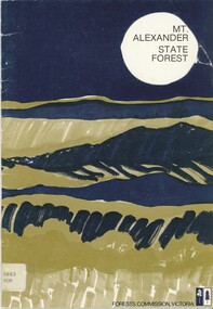
Book - MT. ALEXANDER STATE FOREST, 1979
... Alexander Forest Commission natural history Forests Commission Victoria Mt Alexander State Forest 24 pages, with photographs and illustrations, maps. ...Mt Alexander State Forest 24 pages, with photographs and illustrations, maps. Includes history of region, aboriginal history, flora and fauna. Painting illustrtaion on front cover.Forests Commission Victoriamt. alexander, natural history, mt. alexander, forest commission, natural history -
 Bendigo Historical Society Inc.
Booklet - The Goldfields Landscape, David Bannear, 2001
... Subjects covered in the presentation include: Early 1850's Gold Mining in north central Victoria Botanising diggers Quartz mining Deep lead mining, The state of the forests at the end of the nineteenth century State of the Central Victoria forests Settlement Charcoal production Wattle bark industry The railways Eucalyptus production State nurseries and plantations Thinning of forests Royalty system Creswick School of Forestry and Forestry Commission 1919: Pines and unemployed schemes 1931 - 1940: The Great Depression 1939: Black Friday 1939-45: Alien or interment forestry camps 1939- 45: Second World War charcoal production 1944-45 Prisoner of War Camps 1949-51: Migrant or refugee camps ...History House 11 Mackenzie Street Bendigo goldfields Early 1850's Gold Mining in north central Victoria Botanising diggers Quartz mining Deep lead mining The state of the forests at the end of the nineteenth century State of the Central Victoria forests Settlement Charcoal production Wattle bark industry The railways Eucalyptus production State nurseries and plantations Thinning of forests Royalty system Creswick School of Forestry and Forestry Commission 1919: Pines and unemployed schemes 1931 - 1940: The Great Depression 1939: Black Friday 1939-45: Alien or interment forestry camps 1939- 45: Second World War charcoal production 1944-45 Prisoner of War Camps 1949-51: Migrant or refugee camps David Bannear Eleven page typed booklet with clear plastic cover and white plastic ring binding. ...Eleven page typed booklet with clear plastic cover and white plastic ring binding. Booklet contains a presentation delivered to the Bendigo Historical Society on 1st June 2001, by David Bannear, BA, MA (University of Cambridge) Historical Archaeologist. Subjects covered in the presentation include: Early 1850's Gold Mining in north central Victoria Botanising diggers Quartz mining Deep lead mining, The state of the forests at the end of the nineteenth century State of the Central Victoria forests Settlement Charcoal production Wattle bark industry The railways Eucalyptus production State nurseries and plantations Thinning of forests Royalty system Creswick School of Forestry and Forestry Commission 1919: Pines and unemployed schemes 1931 - 1940: The Great Depression 1939: Black Friday 1939-45: Alien or interment forestry camps 1939- 45: Second World War charcoal production 1944-45 Prisoner of War Camps 1949-51: Migrant or refugee camps early 1850's gold mining in north central victoria, botanising diggers, quartz mining, deep lead mining, the state of the forests at the end of the nineteenth century, state of the central victoria forests, settlement, charcoal production, wattle bark industry, the railways, eucalyptus production, state nurseries and plantations, thinning of forests, royalty system, creswick school of forestry and forestry commission, 1919: pines and unemployed schemes, 1931 - 1940: the great depression, 1939: black friday, 1939-45: alien or interment forestry camps, 1939- 45: second world war charcoal production, 1944-45 prisoner of war camps, 1949-51: migrant or refugee camps, david bannear -
Bendigo Historical Society Inc.
Document - Forests Commission of Victoria Northern Area Fire Protection Policy, Statement, Future Bush Fire Policy, Plan for Fire Control, 1938-1939
... state forest, containing giant stands of Mountain Ash and other valuable timbers, were destroyed. As a result, approximately 575,000 hectares of reserved forest and 780,000 hectares of Crown land burned. history bendigo forests commision of victoria 1939 Bush Fires Four Files Forests Commission of Victoria Northern Area Report on the 1938-39 Fire Season; and the Fire Protection Policy in Respect of Field activities Prior to the Incidence of the 1939 Fires. ...Fanned by powerful winds, the Black Friday fires (13 January 1939) swept rapidly across large areas of Victoria, causing widespread destruction. Flames leaped large distances, and giant trees were blown out of the ground by fierce winds. Large pieces of burning bark (embers) were carried for kilometres, starting new fires in places that had not previously been affected by flames. Almost two million hectares burned across the state. Large areas of state forest, containing giant stands of Mountain Ash and other valuable timbers, were destroyed. As a result, approximately 575,000 hectares of reserved forest and 780,000 hectares of Crown land burned.Four Files Forests Commission of Victoria Northern Area Report on the 1938-39 Fire Season; and the Fire Protection Policy in Respect of Field activities Prior to the Incidence of the 1939 Fires. history, bendigo, forests commision of victoria, 1939 bush fires -
 Bendigo Historical Society Inc.
Document - DAVID BANNEAR, THE GOLDFIELDS LANDSCAPE - PROPOSED TALK, 2/11/2023
... Between 1878 and 1884, the government set up 5 nurseries to try and rectify the shortage of native softwoods and encouraged the growth of State plantations and the thinning of trees to encourage growth of those remaining. 1907 - Creswick School of Forestry and Forest Management was started 1919 Establishment of the Forests Commission and the planting of many pine plantations 1924 Establishment of the first fire spotting towers Forest management tasks became a main project for "Susso" recipients during the Great Depression and again for internees during WWII....Between 1878 and 1884, the government set up 5 nurseries to try and rectify the shortage of native softwoods and encouraged the growth of State plantations and the thinning of trees to encourage growth of those remaining. 1907 - Creswick School of Forestry and Forest Management was started 1919 Establishment of the Forests Commission and the planting of many pine plantations 1924 Establishment of the first fire spotting towers Forest management tasks became a main project for "Susso" recipients during the Great Depression and again for internees during WWII. ...The goldfields resulted in the almost complete denuding of trees for access to the gold bearing land, for firewood and for the tanning industry. The need for wood further increased with the advent of deep quartz mining that required timbers for shoring up the shafts and tunnels. At some point in time it became necessary for timber to be carted long distances to fulfil the need. Between 1878 and 1884, the government set up 5 nurseries to try and rectify the shortage of native softwoods and encouraged the growth of State plantations and the thinning of trees to encourage growth of those remaining. 1907 - Creswick School of Forestry and Forest Management was started 1919 Establishment of the Forests Commission and the planting of many pine plantations 1924 Establishment of the first fire spotting towers Forest management tasks became a main project for "Susso" recipients during the Great Depression and again for internees during WWII.An 8 page document by David Bannear about the various industries of the Bendigo Goldfields and their effects on terraforming the local environment david bannear, central goldfields -
 Otway Districts Historical Society
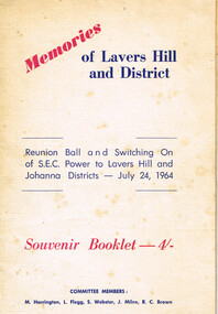
Book, Colac Herald Press, Memories of Lavers Hill and district, July 1964
... Otway Districts Historical Society Cliff Young Drive Beech Forest great-ocean-road A souvenir booklet of memories of the early days of the Otways giving some idea of the hardships, humour and identities that were an essential part of those times. otways; lavers hill; johanna; state electricity commission; memories; anecdotes; "Pop, Jim & I", Ray Milnes. ...A souvenir booklet of memories of the early days of the Otways giving some idea of the hardships, humour and identities that were an essential part of those times.Memories of Lavers Hill and district. Reunion Ball and switching on of S.E.C. power to Lavers Hill and Johanna districts, July 24, 1964. Colac (Vic); np; 1964. 20 p.; illus. Soft cover."Pop, Jim & I", Ray Milnes.otways; lavers hill; johanna; state electricity commission; memories; anecdotes; -
 Otway Districts Historical Society
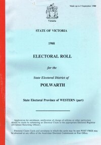
Document, Australian Electoral Commission, Victoria: 1988 Electoral Roll: Polwarth, September 1988
... Forest great-ocean-road electoral roll; polwarth; Document. State of Victoria. 1988 Electoral Roll for the State Electoral District of Polwarth. State Electoral Province of Western (part). Victoria: 1988 Electoral Roll: Polwarth. Document Australian Electoral Commission ...Document. State of Victoria. 1988 Electoral Roll for the State Electoral District of Polwarth. State Electoral Province of Western (part).electoral roll; polwarth; -
 Bendigo Historical Society Inc.
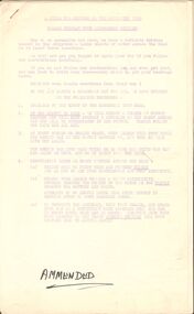
Document - PETER ELLIS COLLECTION: A GUIDE FOR DRIVERS ON THE WHIPSTICK TOUR
... Forests Commission Vincent Serventy Victorian National Parks Association Bendigo Field Naturalists Club A Guide for Drivers on the Whipstick Tour. First page gives assembly area, driving in convoy and negotiating water or boggy patches across the road. Amended written at the end of the page. Directions with mileage and items of interest for the tour on Sunday September 9th (no year). A Whipstick Map 1971 showing State ...A Guide for Drivers on the Whipstick Tour. First page gives assembly area, driving in convoy and negotiating water or boggy patches across the road. Amended written at the end of the page. Directions with mileage and items of interest for the tour on Sunday September 9th (no year). A Whipstick Map 1971 showing State Forest, Crown Lands, Uncleared Mallee - Private (shown in different colours) Water Reserve and Roads. Noted are Flora and Fauna - Plants, Birds & Mammals, and areas of State Forest and Southern State Forest with Mallee Scrub area noted. Also State Forest & Crown Lands Total Area and a map scale. The Bendigo Whipstick mentions area, suggestions of where the name Whipstick came from, shrubs and flowers with their flowering times, descriptions of some of them and some information on the Mallee Fowl. The Eucalyptus Oil Industry paragraph mentions the beginnings of the industry. Mentioned are the different uses of oils (perfumery, industrial and medicinal) and the different species of eucalypt used for each and various products. Also notes on the growing, harvesting and refining of eucalyptus. P Ellis at the end of the page. The next two and a half pages mentions reserves, and at the end acknowledgements. Includes a spare copy of 'The Bendigo Whipstick' by P Ellis.bendigo, history, early bendigo, peter ellis collection, a guide for drivers on the whipstick tour, the whipstick 1971 map, shire of marong, shire of east loddon, shire of huntly, borough of eaglehawk, city of bendigo, shire of strathfieldsaye, the bendigo whipstick, eucalyptus oil industry, eaglehawk town hall, lightning hill lookout, eaglehawk rifle range, new moon mines, blue jacket reservoir, maggetti's wine hall, camp hotel (ex), skylark dam, eucalyptus oil production, eucalyptus factory, whipstick eucalyptus farm, ruedin's eucalyptus factory, dutch bowls, governor philip, sir joseph banks, john white, baron von mueller, joseph bosisto, commonwealth government, perfumery oils, industrial oils, medicinal oils, p ellis, dr frith, csiro wildlife division, harley webster, forests commission, vincent serventy, victorian national parks association, bendigo field naturalists club -
 Bendigo Historical Society Inc.
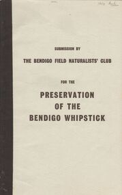
Book - 'PRESERVATION OF THE BENDIGO WHIPSTICK'' (SUBMISSION)
... State Whipstick Bendigo Whipstick The Bendigo Field Naturalists Club. Shire of Lodden Map. Bendigo Field Naturalist Club. Preservation of the Bendigo Whipstick'' (Third Edition of a Submission by the Bendigo Field Naturalists' Club 1971). An application to the Forests Commission ...Preservation of the Bendigo Whipstick'' (Third Edition of a Submission by the Bendigo Field Naturalists' Club 1971). An application to the Forests Commission for two areas to be declared Forest Parks under the Appropriate Act. (The two areas are indicated on a map submitted under separate cover). Supportive material includes listings of various categories e.g. flora i.e Whipstick native plants; Additional Plant Species; Species of Birds; Mammals of the Whipstick; historical summary; Whipstick nuggets; Bendigo Whipstick 'Statistics'. .Bendigo Field Naturalist Club.government, state, whipstick, bendigo whipstick, the bendigo field naturalists club. shire of lodden map. -
 Bendigo Historical Society Inc.
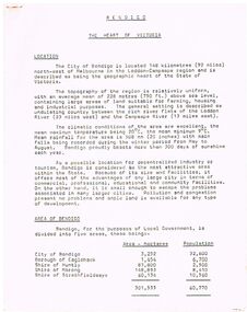
Document - BENDIGO - THE HEART OF VICTORIA
... History House 11 Mackenzie Street Bendigo goldfields DOCUMENT Bendigo - The Heart of Victoria City of Bendigo Borough of Eaglehawk Shire of Huntly Shire of Marong Shire of Strathfieldsaye Bendigo Development Committee Department of Agriculture Department of State Development decentralization and Tourism State Electricity Commission Gas & Fuel Corporation of Victoria State Rivers & Water Supply Commission Bendigo Sewerage Authority The Bendigo College of Advanced Education Home and Hospital for the Aged Home for the Blind Northern School of Nursing Art Gallery Historical Society Dudley House Sun Loong Central Deborah Gold Mine The vintage Talking Trams and Transport Museum BCV8 The Bendigo Advertiser Golden City Gazette 3BO 3CV Mr A J Kelly Typed article titled Bendigo, The Heart of Victoria. Items mentioned are Location, Area of Bendigo, The People, Work Force, Industrial Base, natural Resources, Agriculture and Livestock, Minerals, Forests ...Typed article titled Bendigo, The Heart of Victoria. Items mentioned are Location, Area of Bendigo, The People, Work Force, Industrial Base, natural Resources, Agriculture and Livestock, Minerals, Forests, Rail and Road, Sea and Air, Power and Water, Electricity, Natural Gas, Water, Sewerage, Industrial Land, Services, Community Services and Facilities, Educational Facilities, Hospitals, Culture and Tourism and Media.document, bendigo - the heart of victoria, city of bendigo, borough of eaglehawk, shire of huntly, shire of marong, shire of strathfieldsaye, bendigo development committee, department of agriculture, department of state development decentralization and tourism, state electricity commission, gas & fuel corporation of victoria, state rivers & water supply commission, bendigo sewerage authority, the bendigo college of advanced education, home and hospital for the aged, home for the blind, northern school of nursing, art gallery, historical society, dudley house, sun loong, central deborah gold mine, the vintage talking trams and transport museum, bcv8, the bendigo advertiser, golden city gazette, 3bo, 3cv, mr a j kelly -
 Glenelg Shire Council Cultural Collection
Sculpture - Bas-relief, Untitled (Early Forestry Industries), n.d
... Commissioned by State Bank to produce 5 copper bas-reliefs for 73 Percy Street, Portland. Spoke with Miss Betty Vivian (Member of the Portland Historical Society) re Portland's history. Commonwealth Bank stored objects in Melbourne (c.1991). Negotiations between Portland Historical Society and Commonwealth Bank of Australia led to gift of works to People of Portland. Stored at Council depot c.1998, retrieved for Maritime Discovery Centre display. sculpture bas-relief copper industry forestry forest ...Commissioned by State Bank to produce 5 copper bas-reliefs for 73 Percy Street, Portland. Spoke with Miss Betty Vivian (Member of the Portland Historical Society) re Portland's history. Commonwealth Bank stored objects in Melbourne (c.1991). Negotiations between Portland Historical Society and Commonwealth Bank of Australia led to gift of works to People of Portland. Stored at Council depot c.1998, retrieved for Maritime Discovery Centre display.Copper relief work. View of a man from behind sawing a tree. He is flanked by two tree trunks, and is leaning to his right while pulling a band saw through the tree on the left. Leaning against tree on right is a large axe. Houses are rudimentarily designated by lines in the background visible between the trees.sculpture, bas-relief, copper, industry, forestry, forest -
 Federation University Historical Collection
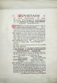
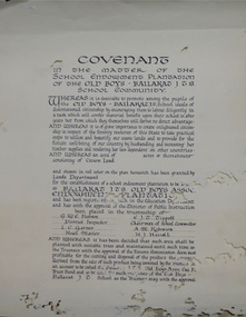
Certificate, Ballarat School of Mines Endowment Plantation, Nerrina Covenant, c1958, c1958
... Commission. While some plantations were established on private land donated or leased for the purpose, most were established on Crown Lands or Reserved Forest made available, without cost, by the State. ...Commission. While some plantations were established on private land donated or leased for the purpose, most were established on Crown Lands or Reserved Forest made available, without cost, by the State. ...Throughout the Nerrina district numerous areas of public land were set aside as school endowment plantations as part of various schools’ educational resources. The plantations were initially established to instil through community involvement a love of forests and an appreciation of their value, and in fact many of them are well suited for regular use as a teaching resource of this nature. It was expected that this use will increase as courses embracing various aspects of environmental science are developed. Many school plantations have been planted to radiata pine, and revenue from the sale of produce used to provide amenities required by the schools. In some cases, however, these plantations have not been very successful in providing revenue, as the sites are unsuitable for economic growth or the plantations are too small or the location too far from processing centres to allow economic harvesting. In some instances, radiata pine plantations have failed due to poor management. In 1982 the Land Conservation Council believed that all the existing plantations should be assessed in order to establish their value as a teaching resource. Those not needed or that are unsuitable for teaching purposes for some reason, such as their location, should be terminated. Those planted to radiata pine that have limited value as a teaching resource although satisfactory for wood production may continue to be used for such production, but should be reviewed when the pines are harvested. (http://www.veac.vic.gov.au/reports/354-Ballarat-Study-Area.pdf, acccessed 30/03/2017) The School Endowment Plantation Scheme was established in 1922 as a joint venture between the Education Department and the FCV. It was administered by the Education Department with technical supervision by the Commission. While some plantations were established on private land donated or leased for the purpose, most were established on Crown Lands or Reserved Forest made available, without cost, by the State. (https://www.victoriasforestryheritage.org.au/community/schools.html, accessed 26 September 2020)Covenant in the matter of the School Endowment Plantation of the School of Mines Ballarat School Community.nerrina pine plantation, ballarat school of mines endowment plantation, nerrina, pine plantation, nerrina, john r. lyall, richard w. richards, dick richards, edgar j. tippett, charles h. clamp, alfred k. mcbain, endowment plantation -
 Federation University Historical Collection
Certificate, Ballarat Junior Technical School Old Boys Association Endowment Plantation, c1928, c1928
... Commission. While some plantations were established on private land donated or leased for the purpose, most were established on Crown Lands or Reserved Forest made available, without cost, by the State. ...Commission. While some plantations were established on private land donated or leased for the purpose, most were established on Crown Lands or Reserved Forest made available, without cost, by the State. ...The School Endowment Plantation Scheme was established in 1922 as a joint venture between the Education Department and the FCV. It was administered by the Education Department with technical supervision by the Commission. While some plantations were established on private land donated or leased for the purpose, most were established on Crown Lands or Reserved Forest made available, without cost, by the State. (https://www.victoriasforestryheritage.org.au/community/schools.html, accessed 26 September 2020) Throughout the Nerrina district numerous areas of public land were set aside as school endowment plantations as part of various schools’ educational resources. The plantations were initially established to instil through community involvement a love of forests and an appreciation of their value, and in fact many of them are well suited for regular use as a teaching resource of this nature. It was expected that this use will increase as courses embracing various aspects of environmental science are developed. Many school plantations have been planted to radiata pine, and revenue from the sale of produce used to provide amenities required by the schools. In some cases, however, these plantations have not been very successful in providing revenue, as the sites are unsuitable for economic growth or the plantations are too small or the location too far from processing centres to allow economic harvesting. In some instances, radiata pine plantations have failed due to poor management. In 1982 the Land Conservation Council believed that all the existing plantations should be assessed in order to establish their value as a teaching resource. Those not needed or that are unsuitable for teaching purposes for some reason, such as their location, should be terminated. Those planted to radiata pine that have limited value as a teaching resource although satisfactory for wood production may continue to be used for such production, but should be reviewed when the pines are harvested. (http://www.veac.vic.gov.au/reports/354-Ballarat-Study-Area.pdf, acccessed 30/03/2017)Covenant in the matter of the School Endowment Plantation of the Ballarat Junior Technical School Old Boys Association Endowment Plantation.pine plantation, alfred k. mcbain, g.w.e. pearson, i.c. garner, a.m. robinson, h.j. hassell, ballarat junior technical school old boys association endowment plantation, ballarat junior technical school, alumni -
 Ballarat Tramway Museum
Document, State Electricity Commission of Victoria (SECV), "Automatic Signal System, General Instructions", 25/11/1937
... Yields information about the Forest City Signalling system in Ballarat. tramways tramcars SECV Forest City Signals signals instructions Document - five foolscap sheet, duplicated, stapled on left hand edge. "Automatic Signal System, General Instructions" Document State Electricity Commission of Victoria (SECV) ...Document or instruction titled "Automatic Signal System, General Instructions" for Ballarat Electric Tramways, dated 25/11/1937 giving instructions for the Forest City signals, how they operated, what to do if they fail to operate, power outage, trams operating to Victoria Park or Haddon St only, the depot and Bridge St. This instruction follows installation of the signal system after the collision between two trams in Wendouree Parade. See item 4638 for a later set of instructions.Yields information about the Forest City Signalling system in Ballarat.Document - five foolscap sheet, duplicated, stapled on left hand edge.tramways, tramcars, secv, forest city signals, signals, instructions -
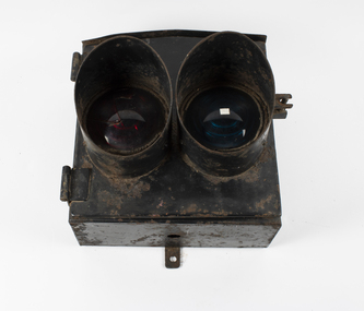 Ballarat Tramway Museum
Functional object - Forest City Signal Head, State Electricity Commission of Victoria (SECV), late 1930s
... Functional object Forest City Signal Head State Electricity Commission of Victoria (SECV) ...Used as part of the signalling system by the SEC in Ballarat, see reference for a detailed history of the signals and its use. This item was manufactured by the SEC itself when the system was extended.Demonstrates a SEC Ballarat signal system head or box.Rectangular steel box with two cylindrical headlight masks. Light covers are plastic red and blue. btm, forest city signals, lights, secv, signal box, signals -
 Ballarat Tramway Museum
Document - Instruction, State Electricity Commission of Victoria (SECV), "Forest City Signals", late 1960's?
... "Forest City Signals" Document Instruction State Electricity Commission of Victoria (SECV) ...Yields information about the instructions about Signalling system on Wendouree Parade and Bridge St - Forest City signals.Five page, foolscap duplicated document, stapled in the top left hand corner, titled Forest City Signals, undated, has letters S4 in top right hand corner of first sheet, giving details about the Forest City signalling system installed in Ballarat, particularly around Wendouree Parade and the depot. Explains how the system operates, gives instructions, details of the system, location of the loops, trams following each other, power failure. Also gives details of how the Bridge St system operated and the switch at Grenville St. Note: The locations of the signals may not be not as detailed as in the Driver Training Manual - See Reg Item 3486. Does not provide instructions for Lydiard St North or Sebastopol routes. See also Reg Item 3456 for another similar copy.trams, tramways, signals, crossing loop, forest city signals, grenville st, wendouree parade -
 Ballarat Tramway Museum
Document - Instruction, State Electricity Commission of Victoria (SECV), Set of four instructions, Nov. 1965
... Forest City” Signals – 5 pages – with handwritten notes on page 5, regarding “Shortening of signal section” dated 20 Jan 1965. – see Reg Item 3456 Tramcar Emergency Braking – 25/1/1965 – 2 pages – Reg Item 3457 Question and Answer paper – Brake Equipment Descriptions, etc. – 4 pages – Reg items 272, 3457, Special Order to Motorman (49/1) – 2 pages – 25/1/1965 – Reg item 3459 and 5371 for an undated issue. See the various Registered items for more details and 5370 for an undated version of the Tramcar Emergency Braking. Set of four instructions Document Instruction State Electricity Commission ...Significant in being an assembled set of instructions that were used by tram crews for reference by management.Set of four SEC staff instructions stapled together for reference by managers. Stapled along the top edge with staples. Comprise: “Forest City” Signals – 5 pages – with handwritten notes on page 5, regarding “Shortening of signal section” dated 20 Jan 1965. – see Reg Item 3456 Tramcar Emergency Braking – 25/1/1965 – 2 pages – Reg Item 3457 Question and Answer paper – Brake Equipment Descriptions, etc. – 4 pages – Reg items 272, 3457, Special Order to Motorman (49/1) – 2 pages – 25/1/1965 – Reg item 3459 and 5371 for an undated issue. See the various Registered items for more details and 5370 for an undated version of the Tramcar Emergency Braking. Page 5 of the first document has hand written notes about “Shortening of signal section” Top sheet has a number of initials of people who have read/sighted the document - dated 8/11/1965 and 11/12/1965.trams, tramways, sec, instructions, braking, emergency, forest city signals -
 Ballarat Tramway Museum
Document - Folder with papers, State Electricity Commission of Victoria (SECV), 1930's
... Widdop as a linesman - 18/11/1936 4913.1 - Letter dated 22/6/1937 from Agent General in London to the SEC Melbourne regarding shipment of the Non-Car Counting Signals. 4913.2 - Letter from the Forest City Electric Co 18/6/1937, regarding forwarding a blue print for the signals. 4914 - Letter from the Forest City Electric Co 23/6/1937, regarding forwarding sample insulators and booklet 15.2 4915 - Letter from Sands Hill Manufacturing Co to ESCo re regarding overhead crossings - dated 13/4/1928. 4916 - Memo dated 14/3/1934 to Mr Pringle, regarding tension in trolley wire. 4917 - Letter from T. Strickland MMTB to Bendigo re standard height for ears above rail level - 16/3/1934. Some of these document Scanned in pdf form to COTMA Library 1/2011 Document Folder with papers State Electricity Commission ...Yields information about how the SEC filed pamphlets or information papers about tramway overhead and associated equipment and letters.Green cardboard file folder with metal clip and binder - "The Acorn Individual File - Foolscap size with title blocks containing the following items: 4910 - Tangential Suspension - overhead 4911.1 - Letter from "The Forest City Electric Co. Limited" to ESCo re Point controllers, tramway signals and warning signs, dated 29/7/1936 - 2 pages 4911.2 - Collins Patent Automatic Point Turner - sheet 19 - 4 pages - sheet 19, two copies 4911.2a - ditto, sheet 18 QT - four pages 4911.3 - Electrically operated Point switches, overhead frogs and signals for tramcar depots. - four pages 4911.4 - Automatic Tramway Signals - five pages - sheet ATS1 4911.5 - Universal Insulator - Sheet 17 - 2 pages 4911.6 - Porcelain hangers - sheet 15/1 - 2 pages 4911.7 - Porcelain insulators for cap and cone supension - page 11, 1 page. 4911.8 - Motor Bus and Tramcar Stage and Fare Signs in Cast Aluminium - sheet MD2 - 1 page 4911.9 - Flashers and Spellers - Sheet F1 - 2 pages 4911.10 - Forest City Relays - 2 pages 4911.11 - Traffic light - 1 page, sheet 2A 4912 - Memo re Suitability of Mr A. Widdop as a linesman - 18/11/1936 4913.1 - Letter dated 22/6/1937 from Agent General in London to the SEC Melbourne regarding shipment of the Non-Car Counting Signals. 4913.2 - Letter from the Forest City Electric Co 18/6/1937, regarding forwarding a blue print for the signals. 4914 - Letter from the Forest City Electric Co 23/6/1937, regarding forwarding sample insulators and booklet 15.2 4915 - Letter from Sands Hill Manufacturing Co to ESCo re regarding overhead crossings - dated 13/4/1928. 4916 - Memo dated 14/3/1934 to Mr Pringle, regarding tension in trolley wire. 4917 - Letter from T. Strickland MMTB to Bendigo re standard height for ears above rail level - 16/3/1934. Some of these document Scanned in pdf form to COTMA Library 1/2011 On rear of file: Top of file - "Tramways", in title block "Tramway Overhead & Signals" and in bottom right hand corner - "230". On spine - in pencil - "Overhead Parts and Proceedings"trams, tramways, signals, overhead, pamphlets, manual -
 Ballarat Tramway Museum
Document - Letter/s, Forest City Electric Company and Victorian Agent General London, "State Electricity Commission of Victoria Type B Non-car counting signals", Jun. 1936
... 4913.1 - Duplicate copy of letters from the Forest City Electric Company, titled "State Electricity Commission of Victoria Type B Non-car counting signals" forwarding blueprints of drawing ST 51912 to the Agent General for Victoria London for the SEC, dated 18/6/1936, on watermarked paper. 4913.2 - Original of letter dated 22/6/1937 to the SEC Melbourne, received 27/7/1937 in Melbourne and forwarded to Ballarat by 29/7/1937 from the Agent General for Victoria London forwarding the Forest City letter. ...Trams tramways Overhead Signals Forest City Signals Trolley Wire 4913.1 - Duplicate copy of letters from the Forest City Electric Company, titled "State Electricity Commission of Victoria Type B Non-car counting signals" forwarding blueprints of drawing ST 51912 to the Agent General for Victoria London for the SEC, dated 18/6/1936, on watermarked paper. 4913.2 - Original of letter dated 22/6/1937 to the SEC Melbourne, received 27/7/1937 in Melbourne and forwarded to Ballarat by 29/7/1937 from the Agent General for Victoria London forwarding the Forest City letter. ...Yields information about how letters were exchanged between the Forest City Electric Co and the SEC using the Victorian Agent General in London. Yields information about the various parties processes and letterheads.4913.1 - Duplicate copy of letters from the Forest City Electric Company, titled "State Electricity Commission of Victoria Type B Non-car counting signals" forwarding blueprints of drawing ST 51912 to the Agent General for Victoria London for the SEC, dated 18/6/1936, on watermarked paper. 4913.2 - Original of letter dated 22/6/1937 to the SEC Melbourne, received 27/7/1937 in Melbourne and forwarded to Ballarat by 29/7/1937 from the Agent General for Victoria London forwarding the Forest City letter. Has various date stamps and hand written notes.trams, tramways, overhead, signals, forest city signals, trolley wire -
 Ballarat Tramway Museum
Pamphlet, State Electricity Commission of Victoria (SECV), "Overhead Line Material", Jun. 1937
... Limited of Manchester 23/6/1937, to the Agent General for Victoria and the SEC, notifying that they have included within the shipment free of charge, three sample insulators and booklet 15.2. 4914.2 - Booklet or Sheet 15.2, titled "Overhead Line Material" comprising 12 pages showing details of porcelain insulators available from The Forest City Electric Co., and other associated equipment, including cap and cone suspensions, wood strain insulators, Giant Strain Insulators, overhead frogs, crossings, bonding compressors and contactors. Each sheet had three staples on left hand side and two punch holes. There were removed for scanning and have not been replaced. "Overhead Line Material" Pamphlet State Electricity Commission ...Yields information about equipment made for Overhead tramway range and materials used and how correspondence was exchanged with the SEC via the Agent General.4914.1 - Letter from The Forest City Electric Co. Limited of Manchester 23/6/1937, to the Agent General for Victoria and the SEC, notifying that they have included within the shipment free of charge, three sample insulators and booklet 15.2. 4914.2 - Booklet or Sheet 15.2, titled "Overhead Line Material" comprising 12 pages showing details of porcelain insulators available from The Forest City Electric Co., and other associated equipment, including cap and cone suspensions, wood strain insulators, Giant Strain Insulators, overhead frogs, crossings, bonding compressors and contactors. Each sheet had three staples on left hand side and two punch holes. There were removed for scanning and have not been replaced.trams, tramways, overhead, forest city signals, insulation, trackwork, trolley wire -
 Marysville & District Historical Society
Book - Paperback book, An Introduction to Victorian Forest Trees, 1961
... state forests indicated. An Introduction to Victorian Forest Trees Book Paperback book Forests Commission, Victoria Bailey, Anne Bailey, Robin Mountain Home Press ...A history of forestry in Victoria Paperback. Cover is green with only the title on the front cover. On the inside back cover is a map of Victoria with the state forests indicated.Stamp of Marysville & District / Historical Society Inc / P.O. Box 22 / Marysville 3779victoria, forestry, forest, trees