Showing 416 items
matching department of lands and surveys
-
 Forests Commission Retired Personnel Association (FCRPA)
Beechworth FCV District office sign
... and Lands (CFL) along with the Crown Lands and Survey Department... and Lands (CFL) along with the Crown Lands and Survey Department ...This sign proudly hung outside the Forests Commission Victoria (FCV) Beechworth office which is now site of the Forestry Heritage Museum. The granite building in the Beechworth's historic precinct was once the Gold Warden's Office and is one of the town's original buildings. The FCV was the main government authority responsible for management and protection of State forests in Victoria between 1918 and 1983. The Commission was responsible for ″forest policy, prevention and suppression of bushfires, issuing leases and licences, planting and thinning of forests, the development of plantations, reforestation, nurseries, forestry education, the development of commercial timber harvesting and marketing of produce, building and maintaining forest roads, provision of recreation facilities, protection of water, soils and wildlife, forest research and making recommendations on the acquisition or alienation of land for forest purposes″. The Forests Commission had a long and proud history of innovation and of managing Victoria's State forests but in September 1983 lost its discrete identity when it was merged into the newly formed Victorian Department of Conservation, Forests and Lands (CFL) along with the Crown Lands and Survey Department, National Park Service, Soil Conservation Authority and Fisheries and Wildlife Service. After the amalgamation the management of State forests and the forestry profession continued but the tempo of change accelerated, with many more departmental restructures occurring over the subsequent four decades. Responsibilities are currently split between the Department of Energy, Environment and Climate Action (DEECA), Forests Fire Management Victoria (FFMV), Parks Victoria, Melbourne Water, Alpine Resorts Commission, the State Government-owned commercial entity VicForests and the privately owned Hancock Victorian Plantations (HVP).Large office sign. Hand painted in traditional FCV mission brown and gold colour scheme.forests commission victoria (fcv), forest signs -
 Eltham District Historical Society Inc
Photograph - Digital Photograph, Alan King, Former Police Residence, 728 Main Road, Eltham, 28 December 2007
... Section of the Department of Crown Lands and Survey. Prior... Section of the Department of Crown Lands and Survey. Prior ...The institutions of law and order in Colonial Victoria included the police, courts and prisons. The 1852 report of the Snodgrass Select Committee appointed to "identify the policing needs of the colony” noted there existed seven independent police forces that did not co-operate or regularly communicate. Following the committee's report all these police entities were merged into the Victoria Police, founded on 8 January 1853, to implement law and order responsibilities throughout the Colony of Victoria. The Eltham Courthouse (1860) and adjacent Police Residence (1859) formed a justice precinct established in the immediate aftermath of the 1852 police inquiry and the effects of the gold rush. The physical presence of these buildings, in the centre of the early Eltham township, defined centralised control over law and order. In the early days the Police Constable in charge would conduct his duties travelling around the district by horse; a stable was located at the rear of the residence. At times the horse would be grazed on the paddocks across the road. Horseshoes were forged by the blacksmith beside the Courthouse on the high side of “Policeman’s Hill”. Along with the stable, there was a two-cell bluestone lockup where prisoners were held awaiting trial in the adjacent Courthouse. Their meals were usually provided by the policeman’s wife or from the hotel just up the road. With the arrival of the railway in 1902 the town centre gradually shifted towards the railway station. The Police Station and operations were moved into the town centre in 1961 to a renovated house in Pryor Street, which was later replaced by the current Police Station. From 1961-1981 the residence was occupied by the Vermin and Noxious Weeds Destruction Section of the Department of Crown Lands and Survey. Prior to August 1967 the former Police Station was dragged to the rear of Police Residence to make way for the construction of a driveway and access from Main Road. The building was placed on the site of a former Scullery and modified for Lands Department use. In 1981 the Shire of Eltham took over management of the former Police Residence in Eltham. It remained unoccupied for a period whilst its future was discussed in Council. It was then used for a community job creation scheme until 1985. In 1985 the Shire of Eltham Parks and Environment occupied the residence. Council improved the driveway but later added a second rear access from Brougham Street due to the dangerous nature of the Main Road entrance. Additionally, a rear toilet facility between the Police Residence and the relocated former Police Station, which was doubling up as a lunchroom. Council also commenced discussions to re-establish a replica Police Station. Around November 1986 the former Police Station was demolished; believed to have been suffering termite damage. About 1989, after some years of discussion, a replica Police Station was built, based on photographs, to act as a lunchroom and meeting room for the Parks and Environment staff and volunteers doing community service. In 1996 Eltham District Historical Society held discussions with Nillumbik Shire Council commissioners throughout the year regarding a home for the Society. A proposal was put forward by the Society in October to occupy the former Police Residence. In March 1997 Eltham District Historical Society gained access to former Police Residence and on July 12, 1998, moved into its Local History Centre. In July 2018, Eltham District Historical Society gained access to the replica Police Station (which had been used as a music library and storage for the Eltham Concert Band) for use as part of regular heritage tours for schools and community-based groups. Covered under Heritage Overlay, Nillumbik Planning Scheme. Published: Nillumbik Now and Then / Marguerite Marshall 2008; photographs Alan King with Marguerite Marshall.; p65This collection of almost 130 photos about places and people within the Shire of Nillumbik, an urban and rural municipality in Melbourne's north, contributes to an understanding of the history of the Shire. Published in 2008 immediately prior to the Black Saturday bushfires of February 7, 2009, it documents sites that were impacted, and in some cases destroyed by the fires. It includes photographs taken especially for the publication, creating a unique time capsule representing the Shire in the early 21st century. It remains the most recent comprehenesive publication devoted to the Shire's history connecting local residents to the past. nillumbik now and then (marshall-king) collection, eltham, main road, eltham district historical society, eltham justice precinct, little eltham, local history centre, police residence, police station -
 Eltham District Historical Society Inc
Photograph, Tom Prior, Police Station and Residence, Maria Street, Eltham, c.1900
... Section of the Department of Crown Lands and Survey. Prior... Section of the Department of Crown Lands and Survey. Prior ...Situated near the top of what was known as 'Policeman's Hill' according to Miss Ivy Reynolds, neice of the photographer, Tom Prior. From the left, Eltham Court House, Police Residence and Police station on Main Road and corner of Brougham Street. These buildings formed part of Little Eltham and still stand (without the front fence) today though the Police Station was demolished in 1986 due to termite damage. A replica was built circa 1989. The institutions of law and order in Colonial Victoria included the police, courts and prisons. The 1852 report of the Snodgrass Select Committee appointed to "identify the policing needs of the colony” noted there existed seven independent police forces that did not co-operate or regularly communicate. Following the committee's report all these police entities were merged into the Victoria Police, founded on 8 January 1853, to implement law and order responsibilities throughout the Colony of Victoria. The Eltham Courthouse (1860) and adjacent Police Residence (1859) formed a justice precinct established in the immediate aftermath of the 1852 police inquiry and the effects of the gold rush. The physical presence of these buildings, in the centre of the early Eltham township, defined centralised control over law and order. In the early days the Police Constable in charge would conduct his duties travelling around the district by horse; a stable was located at the rear of the residence. At times the horse would be grazed on the paddocks across the road. Horseshoes were forged by the blacksmith beside the Courthouse on the high side of “Policeman’s Hill”. Along with the stable, there was a two-cell bluestone lockup where prisoners were held awaiting trial in the adjacent Courthouse. Their meals were usually provided by the policeman’s wife or from the hotel just up the road. With the arrival of the railway in 1902 the town centre gradually shifted towards the railway station. The Police Station and operations were moved into the town centre in 1961 to a renovated house in Pryor Street, which was later replaced by the current Police Station. From 1961-1981 the residence was occupied by the Vermin and Noxious Weeds Destruction Section of the Department of Crown Lands and Survey. Prior to August 1967 the former Police Station was dragged to the rear of Police Residence to make way for the construction of a driveway and access from Main Road. The building was placed on the site of a former Scullery and modified for Lands Department use. In 1981 the Shire of Eltham took over management of the former Police Residence in Eltham. It remained unoccupied for a period whilst its future was discussed in Council. It was then used for a community job creation scheme until 1985. In 1985 the Shire of Eltham Parks and Environment occupied the residence. Council improved the driveway but later added a second rear access from Brougham Street due to the dangerous nature of the Main Road entrance. Additionally, a rear toilet facility between the Police Residence and the relocated former Police Station, which was doubling up as a lunchroom. Council also commenced discussions to re-establish a replica Police Station. Around November 1986 the former Police Station was demolished; believed to have been suffering termite damage. About 1989, after some years of discussion, a replica Police Station was built, based on photographs, to act as a lunchroom and meeting room for the Parks and Environment staff and volunteers doing community service. In 1996 Eltham District Historical Society held discussions with Nillumbik Shire Council commissioners throughout the year regarding a home for the Society. A proposal was put forward by the Society in October to occupy the former Police Residence. In March 1997 Eltham District Historical Society gained access to former Police Residence and on July 12, 1998, moved into its Local History Centre. In July 2018, Eltham District Historical Society gained access to the replica Police Station (which had been used as a music library and storage for the Eltham Concert Band) for use as part of regular heritage tours for schools and community-based groups.This photo forms part of a collection of photographs gathered by the Shire of Eltham for their centenary project book,"Pioneers and Painters: 100 years of the Shire of Eltham" by Alan Marshall (1971). The collection of over 500 images is held in partnership between Eltham District Historical Society and Yarra Plenty Regional Library (Eltham Library) and is now formally known as 'The Shire of Eltham Pioneers Photograph Collection.' It is significant in being the first community sourced collection representing the places and people of the Shire's first one hundred years. The Reynolds family were early settlers in Research. The Reynolds/ Prior collection of photographs were taken by Tom Prior, the maternal uncle of Ivy Reynolds, around 1900 and the 60 photos in the album give a fine overview of many of the landmarks of Research and Eltham over 100 years ago. lvy lived in the family home for many years at 106 Thompson Cres Research. Ivy's father, Ernst Richard Reynolds and grandfather, Richard Reynolds, lived at the same address. Ivy's father Richard worked for Mr. Trail on his property in Research. Reynolds Road is named after the family. Mr Tom Prior (wife Eva) worked at the Melbourne zoo. He was very innovative and made his own camera, using the black cloth hood to exclude the light. The photographs are a reminder of the rural nature of Research and Eltham and its rich heritage.Digital imagechildren, court house, courthouse, eltham, eltham district historical society, eltham justice precinct, little eltham, local history centre, main road, police residence, police station, reynolds prior collection, sepp, shadow, shire of eltham pioneers photograph collection -
 Eltham District Historical Society Inc
Photograph, Peter Pidgeon, Birch Cottage, Eltham-Yarra Glen Road, Christmas Hills, 27 September 2018, 2018
... Lands Department records and showed that the property... Lands Department records and showed that the property ...Originally built by John Hill, a shoemaker at Kangaroo Ground around 1878. In the late 1970s when our Society was the Shire of Eltham Historical Society, an offer was made to the Society regarding use of an old cottage at Christmas Hills. The cottage sat beside Watsons Creek just outside the then Shire of Eltham but following municipal restructuring it now lies within the Shire of Nillumbik. For various reasons the offer ultimately lapsed. At that time some research on the cottage was carried out for the Society by Keith Chappel as part of a larger research project that he was doing. Keith’s notes were taken from Lands Department records and showed that the property was the subject of a permissive occupancy of Crown land comprising the creek reserve. In 1903 a Miner’s Right of one acre in area was granted to Edwin Samuel Birch. In 1907 Birch applied to purchase this land but was unable to because it was part of the creek reserve. The documents show that the cottage existed at that time. Upon Birch’s death in 1932, his daughter, Honor Mary Birch was granted a permit to occupy the residence. Honor Mary Birch, known as Nora, was born 1900, the daughter of Edwin Samuel Birch and Honor (nee Young). In 1939 she married George Henry Williams (aka Henry). Honor died 8 July 1976. Her siblings were Margaret Martin (dec), Bert Birch and Brigidene Brinkkotter. In her will she gave and bequeathed “all the improvements on the land held by me at Christmas Hills under Permissive Occupancy from the Department of Land and Survey consisting of the house property thereon and all the contents of the said house to my nephew Brian Joseph Martin of Christmas Hills aforesaid farmer”. The will described the property as a four room, five square house, about 100 years old with enclosed verandah, including kitchen, combined lounge dining room, bedroom and store room; built of ‘bush slabs’ with a corrugated iron roof. A dairy had been erected in 1935. After her death, the property was acquired by the Melbourne Metropolitan Board of Works in 1978. The property is listed on the Victorian Heritage Database HO200-Hill, later Birch farm complex, 945 Eltham-Yarra Glen Road, Watsons Creek and described as: The house has a steep but simply gabled roof form clad with corrugated iron, vertical adzed hardwood slab front wall construction, split palings to the gable ends; rubble freestone chimney at one end (with added gsi flue), pole-framed Graeme Butler & Associates, 2006: 101 Shire of Nillurnbik Planning Scheme Amendment C13 Heritage Assessments verandah (rebuilt?); six-pane double-hung sash windows; T&G bead-edge boarded ledged & braced door; and paling clad rooms added at verandah ends. A slab-clad large fireplace is at the north corner of the house, with a gsi upper cladding added and an internal lining of rubble stone. The rear facade is different construction, being drop-slab, and sits beneath a rear skillion addition to the main gabled form: this may be more recent construction. The house appears to have been once set up for public display and may have been recreated in part for that purpose. Outbuildings are reached by a track along the east side of the house, including what may have been a creamery (typical standard inter-war design clad with corrugated iron and lined with 1938 Lysaght Queens Head Australia galvanised sheet iron) and a paling clad gabled out-house. Timber outbuildings of differing eras are to the north-west of the house, with pole framing and paling infill construction and Redcliffe brand corrugated iron. Post and rail (front) and split paling (rear) fence remnants line the front boundary. Pepper trees part of house yard landscape49 born digital images (includes one panoramic stitch and nine frames from drone video)birch cottage, christmas hills, early settlers, edwin samuel birch, honor mary birch, john hill, watsons creek -
 Eltham District Historical Society Inc
Document - Binder, Eltham Justice Precinct, 1969-2020
... of the building 13. Letter: Department of Conservation Forests & Lands... of the building 13. Letter: Department of Conservation Forests & Lands ...EDHS_04863 - Binder: Eltham Justice Precinct 1. Courthouse 1. Eltham Courthouse interesting facts 2. Plan and elevation drawings 3. Other courthouse plans and fittings 1880s – Brunswick, Maffra, Dunolly , Sunbury, Landsborough and Wodonga 4. Newspaper articles: i. ELTHAM POLICE COURT. (1892, April 1). Evelyn Observer, and South and East Bourke Record (Vic. : 1882 - 1902), p. 2 (MORNING.). Retrieved July 5, 2022, from http://nla.gov.au/nla.news-article60667022 ii. BREAKING A PUBLICAN'S LEG. (1900, July 13). Evelyn Observer, and South and East Bourke Record (Vic. : 1882 - 1902), p. 2 (MORNING.). Retrieved July 5, 2022, from http://nla.gov.au/nla.news-article60688367 iii. ELTHAM COURT. (1901, March 1). Mercury and Weekly Courier (Vic. : 1878 - 1903), p. 3. Retrieved July 5, 2022, from http://nla.gov.au/nla.news-article58578953 iv. ANNIE CHASES A TINKER. (1902, October 3). Evelyn Observer, and South and East Bourke Record (Vic. : 1882 - 1902), p. 2 (MORNING.). Retrieved July 5, 2022, from http://nla.gov.au/nla.news-article64029968 v. ELTHAM POLICE COURT. (1927, May 6). Advertiser (Hurstbridge, Vic. : 1922 - 1939), p. 4 (AFTERNOON). Retrieved July 5, 2022, from http://nla.gov.au/nla.news-article57754748 vi. ELTHAM POLICE COURT. (1927, May 20). Advertiser (Hurstbridge, Vic. : 1922 - 1939), p. 3 (AFTERNOON). Retrieved July 5, 2022, from http://nla.gov.au/nla.news-article57754814 vii. Eltham Police Court (1931, January 9). Advertiser (Hurstbridge, Vic. : 1922 - 1939), p. 4. Retrieved July 5, 2022, from http://nla.gov.au/nla.news-article56734073 viii. Repairs to Eltham Police Station, The Advertiser (1929, May 24). Advertiser (Hurstbridge, Vic. : 1922 - 1939), p. 2 (AFTERNOON.). Retrieved July 5, 2022, from http://nla.gov.au/nla.news-article57759907 ix. ELTHAM COURT. (1929, August 2). Advertiser (Hurstbridge, Vic. : 1922 - 1939), p. 4 (AFTERNOON.). Retrieved July 5, 2022, from http://nla.gov.au/nla.news-article57760345 x. See also Trove list https://trove.nla.gov.au/list/116634 5. Letter: Shire of Eltham Historical Society to Shire of Eltham, 1 July 1969 regarding potential replacement of Eltham Courthouse and the building’s historical significance and acknowledgement 10 July 1969 6. Letter: Shire of Eltham Historical Society to Law Department, 26 May 1972, re preservation of Eltham Courthouse and potential classification and acknowledgement 7 June 1972 7. Newspaper article: Strangers around, so Eltham sought protection by Marguerite Marshall, Diamond Valley News, Tuesday, April 6, 1982, p2 (On reverse side, Top job for our Pauline, p1) 8. Eltham Courthouse Colour Scheme, Public Works Department, 10 September 1983 9. Newspaper article: Eltham Courthouse under threat of closure by Helen Gillman, Diamond Valley News, October 16, 1984 10. Newspaper article: Courthouse to close by Helen Gillman, Diamond Valley News, Tuesday, November 20, 1984, p1 (also on p2 an article about Diamond Valley Shire festivities for the State’s 150th) 11. We will keep your court – Kennett, Diamond Valley News (probable), c.Dec. 1984 12. Letter: Shire of Eltham to Shire of Eltham Historical Society, 15 March 1985, regarding potential for use of building as a museum and reply dated 17 April 1985 regarding Society’s interest in use of the building 13. Letter: Department of Conservation Forests & Lands to Shire of Eltham, August 1987, regarding expressions of interest in the building and letter from Shire (18 August 1987) to Society advising of same 14. Letter: Department of Conservation Forests & Lands to Shire of Eltham, 30 March 1988, advising Courthouse to be used by Eltham Youth Resources Centre and the rear section by other community groups. Noted that the historical society was suggested by Council as a future user of the adjoining police residence when Council first sought management of the building and that should be investigated. Includes Schedule of Repair and Maintenance Work (4 pages), Existing Conditions Survey 30/7/1987 (6 pages) and 1 page plan view diagram 15. Memo: Historic Places Section to Eltham Youth Resource Centre re paint analysis of Courthouse, 17/5/1988, (6 pages) 16. Newspaper article: Courthouse renovation by Jodie Haythorne, Diamond Valley News, November 23, 1992 17. National Trust of Australia Registration (classified 20 Oct 1977), printed March 2000 18. Letter: Heritage Victoria 28 Feb 2002 regarding the replacement of the Courthouse Stand (Witness Box) 19. Article: There’s still order in this stately court house, Eltham Shire (magazine), date unk., p22-23 20. Eltham Court House, Statement of Significance, Heritage Victoria Register, printed Nov 2004 21. Eltham 1860 Former Court House 730 Main Road Eltham, collated by Eltham District Historical Society Incorporated 2005 (4 pages) 22. Book Extract: Eltham, Historical Court Houses of Victoria by Michael Challinger, Palisade Press, 2001 23. Newspaper article: Courthouse rich with history by Harry Gilham, Nillumbik Mail, c.2001 (see also EDHS_03333) 24. Notes on history of site from Crown Reserve File Rs 12128, Municipal Buildings (Local Community Welfare Reserve) at Eltham, Department of Sustainability and Environment, April 2005 (4 pages) 25. Newspaper article: Historic building upgrade, Diamond Valley Leader, August 3, 2005, p17 26. Newspaper article: Courthouse regeneration secures boost, Valley Weekly, August 10, 2005 with picture of Harry Gilham, Steve Herbert and Greg Johnson 27. Newspaper article: Poets are summonsed, Diamond Valley Leader February 22, 2006, p37 features picture of Helen Lucas at the Eltham Courthouse 28. Newspaper article: Sharing a love of legalities, Diamond Valley Leader, March 1, 2006, p7 features a picture of Rob Hulls and Steve Herbert talking to students in the courthouse 29. Newspaper advertisement: Nillumbik Tender No. 2021-33, Building Restoration Works, Old Eltham Courthouse, The Age, November 7, 2020 30. Form: Police Officer’s Return To A Warrant Of Distress 31. Handwritten notes: three pages listing all 48 of the pigeon hole form listings in the cabinet in the courthouse 2. Police Quarters 1. 1971 Surveyors Plan of 728 Main Road and the Adjoining Courthouse 2. Letter: Shire of Eltham to Shire of Eltham Historical Society, 5 June 1981, requesting the society give consideration to the suitability of the existing buildings (former Vermin and Noxious Weeds Office, Department of Crown Lands and Survey) for historical purposes such as a museum 3. Minutes: Shire of Eltham Historical Society Committee Meeting, 10 June 1981 (2 pages) includes reference to possible use of building as a museum (also reference to Bills Horse trough to be retained) 4. Extract from Victoria Police Gazette 1930 with details of building and site 5. Newspaper article: Cubby haven, Diamond Valley News, October 28, 1991 about replica Police Station with picture of replica along with Monika Roitinger and Garry Bartlett outside the Police Station 6. Environment office up for sale? Mountain Views, Monday, June 12, 1995 (Nillumbik Shire Council proposing to sell property. Did not proceed as ownership held by the State of Victoria) 7. Extract from National Trust February 1998 edition, “Police Rescue” which states Heidelberg and Eltham Police Residences are the oldest known Police Residences in the Melbourne Metropolitan district 8. Newspaper article: The first police office by Harry Gilham, Nillumbik Mail, December 13, 2000 (also photocopy with notations on picture identifying buildings and Harry’s typed draft) 9. Fax Memo: Victoria Police List of Officers in Charge, Eltham Police Station, 1857-1991 onward, 21 Jan 2003 10. Former Police Quarters, Statement of Significance, Heritage Victoria Register, printed Nov 2004 11. Eltham 1860 Former Police Quarters 728 Main Road Eltham, collated by Eltham District Historical Society Incorporated 2005 (5 pages) 12. Report: Eltham District Historical Society to Living and Learning Nillumbik, 14 April 2010 regarding the poor state of condition of the former Police Residence 13. Photocopy of three photos of the former Police Residence, former Police Station (relocated to rear of site) and Stables, October 18, 1991 3. Lockup 1. Newspaper article: Heritage permit bid, Diamond Valley News, January 17, 2001 (also article “Eltham library tops”) includes picture of lockup located in Youth Road 2. Newspaper article: Old lockup in new site, Diamond Valley Leader, March 21, 2001, p15. Includes picture of Harry Gilham with lockup at justice Precinct 3. Letter: Victoria Police to Eltham District Historical Society, 20 March 1991 including laser print photo of lockup in 1963 at 23 Pryor Street 4. Fax: Graham Clark, Associated Crane Trucks Pty Ltd, 833 Main Road Hurstbridge; Quote 26.2.99 for $1,080 to move lockup from Youth Road to 728 Main Road 4. Local History Centre 1. Victoria Government Gazette: Photocopy, No. 165, Tuesday, December 7, 1858, establishment of a Court of Petty Sessions at Eltham, 7 December 1858 2. Victoria Government Gazette: Photocopy, September 16, 1859, contract issued for Police buildings at Eltham to Langridge and Co., McCarter, Baillie, Nicol and Co, Chadley, Amos and Co., Cameron, Payne, £1,150.7.0 3. Victoria Government Gazette: Photocopy, October 2, 1860, contract issued for Court of Petty Sessions at Eltham to James Duncan, £600 4. President’s Report, Eltham District Historical Society, Annual General Meeting, Wednesday, March 11, 1998 – covers the establishment of the Local History Centre and new home for the Society 5. Extract for EDHS Newsletter July 1998 – Eltham Local History Centre – Official Opening 6. Unveiling of 728 Street Sign, Speech notes by Cr Dianne Bullen, December 2000, includes invoice from John Sharp Signs Pty Ltd, 24/10/2000 and planning approval drawing dated 24/3/1999 reproduced in Newsletter No. 135 November 2000 7. Letter: Eltham District Historical Society to Living and Learning Centre, undated draft regarding being a member of the committee reviewing the development of the site 8. Notes from Rod Grant re funding of site development under the Community Jobs Program 9. Letter: Eltham District Historical Society to Nillumbik Living and Learning, 28 October 2004 re inclusion of the Society in enhancing the site under the Community Jobs Program 10. Letter: Department of Sustainability and Environment to Eltham District Historical Society, 28 February 2005 re preparing draft Conservation Plan and copy of cover letter in response 2 April 2005 11. Levels and Layout Plan, Nillumbik Shire Council, September 2005, AO copy 12. Letter: Department of Sustainability and Environment to Eltham District Historical Society, 12 September 2005 re Eltham Justice Precinct Conservation Management Plan 13. Letter: Living and Learning Nillumbik, 2 February 2006 to Eltham District Historical Society re forming a Committee to advise on the use, maintenance, management and preservation of the Justice Precinct 14. Minutes: Meeting of a Task group to explore the establishment of a Committee to manage the Eltham Justice Precinct, 20 December 2005 (with hand written notes) 15. President’s notes (EDHS), General Meeting item, 11 May 2006 pertaining to use and condition of the Eltham Justice Precinct 16. Paint estimates, Old Eltham Court House, undated 17. Notes from meeting 26 September (2006), Eltham Justice Precinct Committee 18. Notes from meeting 27 November (2006), Eltham Justice Precinct Committee 19. Terms of Reference for the Eltham Justice Precinct Committee, Draft for Living and Learning Committee Meeting 24 Jan 2007 (4 pages) 20. Newspaper article: Panel set up, Diamond Valley Leader, 7 March 2007 21. Minutes: Meeting of Eltham Justice Precinct Subcommittee, 10 May 2007 22. Minutes: Meeting of Eltham Justice Precinct Subcommittee, 5 July 2007 23. Minutes: Meeting of Eltham Justice Precinct Subcommittee, 11 October 2007 24. Minutes: Meeting of Eltham Justice Precinct Subcommittee, 7 February 2008 25. Minutes: Meeting of Eltham Justice Precinct Subcommittee, 10 April 2008 26. Minutes: Meeting of Eltham Justice Precinct Subcommittee, 14 August 2008 27. Letter: EDHS (Sue Law) to Living and Learning, 6 September 2008 re proposed signage 28. Agenda: Meeting of Eltham Justice Precinct Subcommittee, 16 October 2008 29. Suggested guidelines for use of the Court House for exhibitions 30. Handwritten note re Ken Eckersal and Uniting Church of possible donation of church organ for sale, proceeds to be used for activities at the Justice precinct 31. One page typed notes on each of the buildings in the Eltham Justice Precinct 5. Miscellaneous 1. Photocopy from Pioneers & Painters (2 pages) covering the establishment of Police and Court of Petty Sessions at Eltham 2. Photocopy of photo looking northeast across Little Eltham buildings c.1910 with notes 3. Photocopy of J.H Clarke photo looking up Maria Street from near Dalton Street with notes identifying precinct buildings 4. Photocopy of photo of Court House and Police Quarters with cow outside from Heather Jenkins scrapbook with notes identifying buildings 5. Sketch and notes with dimensions for blue stone lockup including other miscellaneous handwritten notes 6. Unidentified heritage review details of Justice Precinct (c.2004) 7. Hand written notes of telephone conversation held with Dennis McKay (6 May 1997) re Council use of site 8. Flyer: Victoria Police Historical Unit 9. Photocopy of thumbnail images of various Justice Precincts (not identified) 10. Email correspondence, 4 and 10 January 2008; J. Connor to Council and Councillors pertaining to proposed new toilet facilities at rear of Courthouse annexe. Two ring lever arch binder, white with various photocopies, printouts, newspaper clippingsHG Folders 15/52/59 integratedharry gilham collection, eltham courthouse, eltham justice precinct, eltham police residence, lockup, eltham community festival, eltham festival, eltham, heritage assessment, police residence -
 Federation University Historical Collection
Document, Zelda Martin, Central Victorian Goldmining towns - Boom Towns or Ghost Towns?, c1996
... of Surveyor General's Department 1851and Commissioner of Crown Lands... of Surveyor General's Department 1851and Commissioner of Crown Lands ...Zelda Martin was a PhD candidate at the University of Melbourne.[.1] 4th item in light blue display book titled Research Approach/Overview of Chapters/Confirmation of Canditure/Chapters1,2,3&4 of proposed thesis. *Twenty-seven page article on Victorian goldfields towns titled: Central Victorian Goldmining Towns - Boom Towns or Ghost Towns. The article was written during the author's PhD study. It outlines the context methodology, and resources and the chapters of the proposed thesis: (1) Central Victorian Goldmining Towns - The Context (2) Contemporary Views of the Factors Necessary for Town Growth (3) Outward Manifestations of Town Growth (4) The Trappings of Government (5-9) The Main Towns and Their Hinterland. [.2] 5th item in Light Blue display book as above item. *Chapter 1 of proposed thesis titled 'Pick, Shovel and Tin Dish Mining.' Covers in Section A: Central Victoria - Pre 1851: Aborigines in Central Victoria, Squatters, and Government. Section B: The years 1851-1854: The Early Gold Rushes, Government Reaction, Township Surveys, Legislation, Town Development, Local Government and Early Settlement. [.3] 6th item in Light Blue display book as above item. *2A of proposed thesis titled 'Contemporary Views of the Factors Necessary for Town Growth'. Similar information to Chapter 1 plus extra re towns and maps. Sections: Introduction, Context of Place - Geographical Towns Listed, The Context of Time - Pre1851 Aborigines, Governance of Port Phillip, The Squatters, The Villages of Central Victorian Highlands, Conclusion, Condensed Version of Chapter2B. [.4] 7th item in Light Blue display book as above item. *Chapter2B of proposed thesis. Sections: Area of Research, Schools, Banks, Newspapers, Progress Association, Town Development - Sandhurst (Bendigo), Ballarat, Castlemaine,, Maryborough, Ararat and Stawell. [.5] 8th item in Light Blue display book as above item. *Chapter 3 of proposed thesis titled 'Outward Manifestations of Town Growth'. Sections: Introduction, Contemporary Writing, Educationalists, The Bankers, The Townsfolk, Current Theory, General Theories of Urban Development, and Conclusion. [.6] 9th item in Light Blue display book as above item. *Chapter 4 of proposed thesis titled 'Trappings of Government' Sections: Introduction, Early Government Attitudes to Mining and Town Development, Law and Order, Township Surveys, Legislation, Local Government, Transport and Communication, The People and Lobbyists. [.7] 10th item in Light Blue display book as above item. *'The Rise and Fall of Central Victorian Goldmining Towns'. Includes a map showing main Goldfields, a table showing towns and villages at two points in time - 1857 and 1871; a Bibliography of Primary and Secondary Sources. [.8] Resource No1. Black display book titled Local Towns 1 : Alma: *Brief history *Directory *Maps Amphitheatre / Mountain Hut: *Brief History Post Office Directory Ararat: *Brief History *Post Office Directory 1869 - Alphabetical Listing by Occupation *Ararat - Prominent Citizens of 1858 *Langi-Morgala Museum Avoca: *Brief History *Excerpts from 'Avoca The Early Years', Margery and Betty Beavis; pg1 - Beginnings; pg11 - The Midas Touch; pg25 - Local Gold Escorts; pg27 - A Town is Born; pg51- The Administration of Justice; pg53 - The Ways of the Law; pg61 - News of the Day; pg65 - A Time to Play; pg72 - Land Ownership *Post Office Directory (Bailliere's) 1869 *Tourism Map and Information of area *Historic Avoca - A 5.5km Tour *Avoca & the Pyrenees Region - information pamphlet Ballarat: *Early History of Ballarat - Ballarat Historical Society, Publication No.1: origin of the name; Ballaarat - the Beginning; Fabulous Yields from the Ballaarat Goldfield; *Streetscape Lydiard Street. *Hand drawn map showing Leigh River, Old Portland Bay Road, plaque on road to Colac; etc. *Newspaper article re 'The Theatre Royal' ( which stood in the vicinity of the current Owen Williams store) - 'The News'15/04/1998 *Article - 'Ballarat's Mechanics' Institute Lives On' Ballarat Courier, 14/09/1985 *Article - Standing the Test of Time' The News 17/11/1993 re The Mechanics Institute & picture of the Reading Room *'Ballarat a Study of a City, Phyllis Reichl, pub. Nelson, 1968; no.3 place, time and people field studies series *Investigator Vol.33 No.2, 1998 Geelong Historical Society. Article on pg75 describes Ballarat in 1861 *Folded poster - 'Ballarat 100' a history of telegraph communication, pub. Telecom. Beaufort (Fiery Creek): *Brief history *Post Office Directory [.9] Resource No.2 Black Folder Titled Towns cont.No2 Bendigo (Sandhurst): *'Family & Local History at the Bendigo Library - 1851-2001 150 years of gold'. *Bendigo Government Camp in 1853 illustration; key to sketch and names of Government officers stationed there *Excerpts from 'Bendigo and Vicinity' Adolph Haman *The Bendigo Goldfield Registry - pgs 1-7 Introduction *Excerpt: 'Breaking the Grip' *Excerpt: The Most Go-Ahead Place *Excerpts from 'History of Bendigo' - anti license agitation; laying out of town; proposed railway; gold calls and dividends; the Sandhurst Municipality; journalism *Bibliography Blackwood: *Excerpts from 'Aspects of Early Blackwood - The Goldfield, the Landmarks, the Pioneers' Alan J Buckingham and Margaret F Hitchcock, JG Publishing,1980 Buninyong: *A Brief History *Investigator Vol1 No.2 Feb 1966 Geelong Historical Society. Pg3 - Article re gold escort route - Mt Alexander to Adelaide - (see a simple monument on the Western Highway a few miles out of Horsham. Pg 15 - Ballarat Excursion - re the finding of gold. *Three articles published by Buninyong and District Historical Society Inc: (Magpie Exploration; Finding Gold In The Green Hills; Magpie Exploration; Burnt Bridge to Cargarie to Mt Mercer) *Copies of newspaper articles/items *Buninyong Street Directory Carisbrook: *In the Beginning There Was Carisbrook *The History of the Carisbrook Racecourse Carngham / Snake Valley: *Brief History *Directory Castlemaine: *Directory 1865-1866 - Alphabetical and Street *Poster - Castlemaine A Contemporary Guide "The Great Centre" 1866 - A Contemporary Guide to the Fascinating Past *Pamphlet - Castlemaine District Community Hospital *Map - Castlemaine, Maldon & Surrounding Districts *Map and Information - The Dry Diggings Track - a 55kl walk among historic goldfields relics ( Castlemaine Fryerstown Vaughan Mt Franklin Hepburn Daylesford) *Postcard - Former Court House *Directory 1867 - Alphabetical, Trade [.10] Resource No.3 Grey folder Titled Towns 3 Creswick to Maryborough Creswick: *Brief History *Booklet - "Creswick Cemetery Walk" *Booklet - The Buried Rivers of Gold Heritage Trail Creswick *Creswick Historical Museum Information Sheet *Chronological History of Creswick *Alphabetical Directory of the Borough of Creswick *Creswick's Creek Directory 1856 *Historic Creswick Walking Tour *A Brief Account of the Schools of Creswick - Past and Present *100 Years of Railway Travel in Creswick *The Berry Deep Leads *The Spence Home at Jackass Gully in the Creswick State Forest ( William Guthrie Spence - Pioneer) *The New Australian Mine and the 1882 Disaster *Creswick District News, Issue 7, July August 1999 *The Creswick Miners Walk - Information and Map *Maps Chewton: *Brief History *Directory Clunes: *Brief History *Clunes Street Directory Daylesford: *Brief History *Notable Bushfires in Daylesford District Over More Than a Century - "Black Thursday" 1851; 1862; 1899; the Disastrous Hepburn Fire of 1906; 1939; 1944; 1969. *Post Office Directory -Daylesford and Hepburn Dunolly / Inkerman: *Brief History *Directory *Pamphlet - Goldfields Historical Museum *Pamphlet - Historic Dunolly - Victoria's Best Kept Secret *Map of Gold Workings at Dunolly Area - showing where the main gold rushes occurred *Brief History - Inglewood *Directory - Inglewood - Name Occupation, Dwelling Kingower: *Brief History *Directory - Name / Ocupation / Dwelling Linton / Happy Valley / Piggoreet: *Brief History *Directory - Lintons McIvor: *"A History of the Shire and the Township of Heathcote" by J.O. Randell Majorca: *Brief History *Official Post Office Directory 1869 - Name / Occupation/ Address Maldon (Tarrangower): *Brief History Part 1 *Brief History Part 2 *Post Office Directory *List - Alphabetical Order by Names plus Business and Trade (Tarrangower Times Oct/1858) *List - Alphabetical Order by Trade plus Name and Business *Directory - Name / Occupation / Dwelling Maryborough: *Worsley Cottage - built by Arthur Worsley, a contractor in stonework in 1894 [.11] Resource No. 4 Blue Display Book titled Towns 4 Moliagul to Stawell Moliagul: *Brief History *Moligul Legislative Assembly (Voting?) List - Names and Occupations *Moliagul Victorian Post Office Directory 1868 - Name / Ocupation / Address / Comments *"The Welcome Stranger" gold nugget *The Sunday School *The Welcome Stranger Discovery Walk - information and map Moonambel (Mountain Creek) Redbank *Brief History *List of names extracted from advertisments of the Pioneer and Mountain Creek Advertiser 16/02/1861. *Bailliere's Directory 1869 - Alphabetical List of Name / Occupation / Place St Arnaud: *Brief History Sebastapol: *Brief History *Directory 1869 - Alphabetical by Name; plus occupation and address. Browns and Scarsdale: *Brief History *Browns Street Directory - Name and Occupation Smythesdale: *Brief Description *Smythesdale Street Directory -Name and Occupation Stawell (Pleasant Creek) *Brief History *Victorian Official Post Office Directory - Name /Occupation / Dwelling *Chronology - 1841-1920 *Production of gold statistics - 1879 - 1900 *Big Hill *Extracts from "The Golden Years of Stawell". Chapt 1 - Stawell's Coming Out. Capt. 2 - The Gold Rush. Caapt.3 - Cradle of Democracy. Chapt.4 - The Reefs Becomes Stawell. Chapt. 5 - Rushing In. Chapt.6 - The Pioneers. Chapt 7 - The Decade of Optimism. [.12] Resource No. 5: Blue Display Book titled 'Towns Steiglitz to the The Golden Triangle. Steiglitz: Brief History Victorian Post Office Directory 1869 *Map of Steiglitz *List of maps relevant to Steiglitz history *Information 6 tables of data from "Reports of Mining Surveyors Talbot (Back Creek) Brief History Taradale: Post office Directory 1869 - Name/Occupation/Street. Also list in alphabetical order by Occupation Taradale *Chronological Reference to Taradale Mines *Water - The Coliban System of Waterworks *Joseph Brady *The Syphon Tarnagulla (Sandy Creek) *Brief History *Tarnagulla Businessmen Cameos to give depth to advertisments in 'The Tarnagulla Courier' various issues 1864-1871 *Directory - Name/Occupation /Address *List - Name/Business/Trade Wedderburn (Koorong) *Brief History *List - Name/Occupation The Golden Triangle: *The Early Rushes - Wedderburn / Moliagul / Sandy Creek - Tarnagulla / Jones Creek - Waanyarra / Kingower / Dunolly - Goldsborough / Inglweood *Census of 1857 - Population / Occupations *1858-1871 - A Time of Consolidation- Wedderburn / Moliagul / Sandy Creek- Tarnagulla / Arnold *Census 1871 - Population *Information gleaned from the census data - Demographics / Population / Occupations / marital / Birthplace / Religion / Literacy/ Occupation and Housing Cameos *Graphs - Birthplace of settlers /Male-Female Ratio / Married males / Children under 15 as Percentage of Population / Religion *Census 1857 - Statistical data *Maps *Bibliography [.13] Resource No. 6 - Black Display Book Information and Research in Central Victoria including: *Banking - Research from ANZ Bank Archives *Institutions - also includes articles listed from the Ballarat Times Newspaper *Australian mining History Association - A.M.H.A. Bibliography *Australia's Mining History * Bibliography - Land Surveys Victoria - *1853 Administration (Statistics and Other) includes: schools / ministers of religion / police / military / local administration / licences for sale of spirits / distances between various Victorian gold fields. * Victoria Government Gazette (Copy) - N0. 116, 12/12/1854 includes: Gold Felds Commission of Enquiry & No. 85, 15/09/1854 - Addresses presented to the Lieutenant Governor (Sir Charles Hotham) during his tour through the Gold Fields of Victoria,1854. Addresses on behalf of : the people of Bendigo; Members of the Church of England, Bendigo; Members of the Wesleyan Church on the Bendigo Gold Fields; Bendigo Gold District General Hospital; the Bendigo Prospecting Association; Committee of the Bendigo Local Exhibition; Bendigo District Medical Association; Coloured Americans Resident at Bendigo; German Inhabitants of Bendigo; Landowners, Inhabitants, and Miners of Castlemaine; Inhabitants of Forest Creek; Inhabitants of Heathcote and Gold Miners of McIvor; Residents and landholders of the District of Bacchus Marsh; Inhabitants of Kilmore and Vicinity. *Gold Fields Correspondence 1853: letter from Lieutenant Colonel Valiant, (Officer commanding the Troops in Victoria) to the Lieutenant Governor re threatened disturbance at Sandhurst (Bendigo) regarding the Gold License Fee. * Extracts from a book "Victoria" re Gold Fields Commission of Enquiry involving mainly Ballarat and Castlemaine and a chapter titled 'A Tour to the Victorian Gold-Fields' *Lists of central Victorian newspapers - listed by date published 1851to 1874; by first date available to State Library. *A list of cities and towns showing County, population in 1861 &1871, and municipal status. [.14] Resource no.7. Black display book. *Reference: Papers presented to Parliament Victoria - 1859-1860 4 volumes - relevant sections copied. Contains information on Branches of Government. General / Finance / Gold / Gazette / Commission and Warrant / Statistic. *Gold Fields Act. In accordance with the Act the gold fields are divided into six districts - Ballaarat, Castlemaine , Sandhurst, Avoca, Ararat, and Beechworth.. Official staff in each gold district consists of a Resident Warden, Wardens, Wardens' Clerks, Bailiffs, Chinese Protectors, Chinese Interpreters, and Mining Surveyors. *Gold Receiver *Gaols *Police magistrates and Clerks of Petty Sessions, etc. *Field Branch *Immigration and Emigration Overland - Chinese - 1859 *Population on the Goldfields *The Geological Survey - The Government Geologist is assisited by staff from four branches - the office Branch; the Publishing Branch; the Field Branch and the Museum Branch. *Commission to Enquire Into Sludge dated 10/02/1859 (Some sections copied) - Report to the Honorable Chief Commissioner of Public Works, Melbourne re the mode of carrying the sludge from the puddling mills in Sandhurst without interfering with the drainage of the town and the roads in the neighbourhood. [.15] Resource No.8: Camel display book titled Resource No. 8. Aborigines *Lists of book titles - +"Readings in Victorian prehistory" +"The Aborigines of Port Phillip" +Aboriginal languages and clans" +"A History of the Port Phillip District" +"Langi Ghiran 1: Aboriginal Rock...." +"Koorie History: sources for aboriginal studies in the State Library of Victoria", ed. Tom Griffiths, Melb. Friends of the State Library, 1989 +"The Public Lands of Australia Felix"; settlement and land appraisal in Victoria1834-91 with special reference to the Western Plains", J.M.Powell, Melb. Oxford University Press 1970 +*Bibliography of the Victorian Aborigines' from the earliest manuscripts to 31st December 1970, Massoa, Aldo, Melb. Hawthorn Press, 1971 +"Aborigines in Colonial Victoria, 1836-1886", M.F. Christie, Sydney University Press, 1979 +"Urban and Industrial Australia: readings in Human Geography" ed J.M. Powell, Melb. Sorrett Pub. 1974 *Extracts: -Processes of Pioneer Settlement - The Squatting Occupation of Victoria, 1834-60. J.M. Powell -Areal Variations in the Class Structure of the Central-Place Hierarchy. P. Scott - Volume1 and Volume 2: Notes Relating to the Habits of the Natives of Other Parts of Australia and Tasmania. Compiled from various sources for the Government of Victoria by R Brough Smyth. John Curry, O'Neil, Melb. 1st pub. Melb. 1876. p31-45 - Numbers and Distribution of the Aborigines in Victoria -Victorian Aborigines 1835-1901 - A Resource Guide to the Holdings of the Public Record Office, Victoria; published by the Government Information Centre 1984. *History of the Aboriginal Artefacts Displayed in the Daylesford Museum. F. G. Powell (4 page pamphlet) *Letter to Zelda Martin from Peter Lovett, Cultural Officer, Ballarat & District Aboriginal Co- Operative, 05/02/1997 *Map: Ian Clarke Victorian Tribunal Boundary Map - Clans of Central Victoria. *Victorian Rock Art and Mythology - Article about Mount Langhi Ghiran and myths of the Tjapwarong people. *Two Aboriginal myths relating to the Grampians - 'The Monster Emu' / 'The Aquisition of Fire', by the Aborigines in the Grampians Areas *Article titled (chapter 8) Ballarat - information re camping sites in the region. Lake Wendouree / Lake Burrumbeet (includes a myth) / Mt Bunninyong / Lal Lal / Pitfield / Mount Elephant / Mount Egerton / Meredith / Lake Goldsmith / Lake Learmonth / Ercildoune *Notes on the Aborigines of the Wider Ballarat Region plus European names=Aboriginal names. John Morris 26/07/1995 *Role of Aborigines in Town Development in Central Victoria. Mentions Native Police Force est. in Port Phillip 1842 and Central Board for Aborigines est. 1860 *The Grave of King Billy. (Frank Wilson) Pamphlet. *Camping Places in Central and Northern Victoria. Article re Lake Burrumbeet site. *Programme for the Unveiling of Memorial Cairn for Edward Stone Parker 1802-1865. Note portrait not accurate. Accurate portrait is available in the book "A Successful Failure A Trilogy The Aborigines and Early Settlers", Edgar Morrison, Graffiti Publications, 2002. * Large envelope addressed to Mr G Netherway containing newspaper cuttings regarding the life of Edward Stone Parker, the unveiling of the Memorial Cairn as mentioned above, articles titled 'Episodes from Our Early Days' (Edgar Morrison, Yandoit)- The Black's School, A School At Last and The Final years. Also a typed page titled 'Historical Background to E.S.Parker's Career. Includes an interesting tale titled 'When the cat lay doggo' re laying power leads for the unveiling ceremony at the memorial site. [.16] green display folder titled 'Research Aids' *List of references to Commissioners' & W'ardens' Reports (formerly held at La Trobe Library Archives, now at Public Records Office [PRO]). Indicates town referred to / date of report / name of camp if different to town. * Archive information re Anglican Records *Movement around the Goldfields - Miners and Storekeepers - usefulness of newspapers in providing information - areas covered - Castlemaine, Maldon, Ararat, Stawell, Tarnagulla, Dunolly. *Port Phillip /Victoria Directories 1839/1867 - Chronological list of Directories included in this series. *"Notes on the History of Local Government in Victoria" A.W. Greig Melb. University Press 1925 - Photo-copied extract p5-p40. (Source - Deakin University Library) - Introduction by W.Harrison Moore. Section 1 - Development in New South Wales Before Separation. Section 2 - Development in Victoria After Its Separation from New South Wales. Hand written notations: 'roads, markets, and local government 1855 on' ;'opportunity of squatters in parliament' and 'opportunities of matters in parliament p33' * Notes on the Establishment of Surveyor General's Department 1851and Commissioner of Crown Lands and Survey. * Newspaper articles from The Argus, 1849, re the discovery of gold in the Pyrenees region. * Excerpt - a report on schools - A.B.Orlebar, Inspector; re the need for permanent school buildings rather than tents. *Excerpt from - 'Approaches to Urban History', Sean Glynn: The Case for Caution * Except from - 'The Urban Sprinkle', Weston Bate: Country Towns and Australian Regional History *Reference- 'The History of Land Tenure in the Colony of Victoria', John Quick. References the Haines Land Bill, land tenure and Land Leagues. [.17] Light blue envelope folder titled 'Birtchnell's Ballarat, etc. Directory 1862 *Contains various directories for Smythesdale, Buninyong, Clunes, Brown's and Creswick. [.18] Red envelope folder no.2 titled Victorian Gazetteer *Selected pages from 1869 Victorian Gazetteer on A4 paper (with a handwritten note questioning if some pages are from 1868 Victorian Gazetteer as appears to be different sizes - A3 pages.) Information includes locations and descriptions of towns, hotels, banks, communications and populations. (Does not include names, residences and occupations) [.19] Red Envelope folder titled Bailliere's Official Post Office Directory 1868 (or1869 or a mixture of both?) *Preface *Contains a selection of pages of towns highlighted in yellow in the the index *Work on this directory was commenced in 1867. *Information includes: Municipalities - mayors and councilors; lists of towns naming male inhabitants and their occupations. [.20]Yellow manila folder titled Post Grad Seminar Presentation 1996 *Gives some background to Zelda Martin's proposed thesis and why she chose the topic Gold Mining Towns Boom or Bust [.21] A3 display book - No. 1A * A list of 'Relevant Newspapers collected: The Tarrangower Times and Maldon Advertiser (first published 1858) Includes dates 1858-1867. The Mount Alexander Mail. Includes dates 1854-1866 The Tarnagulla Courier. Includes dates from1864-1871 Dunolly and Burnt Creek Express. Includes dates from 1862-1871 * Selection of newspaper pages from The Mount Alexander Mail 1854 to 1856, mostly showing advertisements for businesses and services provided to that community. [.22] A3 display book - No. 1B * Selection of newspaper pages from The Mount Alexander Mail 1857 to 1866, mostly showing advertisements for businesses and services provided to that community. [.23] A3 display book -No. 2 * Selection of newspaper pages from The Tarnagulla Courier 1864 to 1871, mostly showing advertisements for businesses and services provided to that community. [.24] A3 display book - No. 3 *Selection of newspaper pages from The Tarrangower Times (and Maldon and Newstead) Advertiser 1858 to1867, mostly showing advertisements for businesses and services provided to that community. [.25] A3 display book - No.4 * Selection of newspaper pages from The Dunolly and Burnt Creek Express; and The Dunolly and Betbetshire Express 1862 to 1871, mostly showing advertisements for businesses and services provided for that community. [.26] A3 display book - No.5 Includes: * Bryce Ross's Diggings Directory. Includes instructions for using this directory. This directory was used by "all persons having connexion or desiring to communicate with 'working parties, private friends, or Stores at the Diggings." As a directory for each area wwas completed it was published in each month's issue of Bonwick's "Digger's Magazine." Years c1852/1853. This Directory commences first at the head of Forest Creek. Includes a directory for Bendigo and Ballarat. Of interest at the end of the Bendigo and Ballarat directory is a list of the number of storekeepers, butchers, doctors, smiths, eating houses, lemonade sellers and chapels. * The Castlemaine Directory and Book of General Information Comprehending Glass's Model Calendar for the Two Years 1862 and1863. "zelda martin, victorian goldfield towns, bendigo, castlemaine, ballarat, maldon, stawell, ararat, maryborough, creswick, avoca, heathcote, banks, bank of australasia, union bank of australia, government camp, sandhurst, water supply, tarnagulla, talbot, back creek, mountain creek, police court, carisbrook, dunolly, thompson's foundry, charles clacy, anthony trollope, robert cecil, mount alexander, urbanisation, national schools, education, govenrment, industry, railway, transport, settlement, land settlement in central victoria, steiglitz, joseph brady, the new australian mine, berry deep leads, william guthrie spence, creswick state forest, arthur worsley, worsley cottage, the welcome stranger, moliagul, moonambel, redbank, st arnaud, sebastapol, brown's, scarsdale, clunes, chewton, daylesford, bushfires, inkerman, inglewood, kingower, lintons, happy valley, piggoreet, mcivor, majorca, tarrangower, taradale, the coliban system, the syphon, sandy creek, wedderburn, koorong, arnold, jones creek, waanyarra, the golden triangle, census 1857, blackwood, buninyong, durham lead, magpie, carngham, snake valley, alma, amherst, daisy hill, amphitheatre, mountain hut, beaufort, fiery creek, counties, population, gold fields commission of enquiry1854, william westgarth, gold license fee, lieutenant colonel valiant, administration of the victorian gold fields, commission to enquire into sludge 1859, e.s. parker, edward stone parker, edgar morrison, mount franklin protectorate, dja dja wurrung, memorial cairn, franklinford, mt franklin memorial cairn, jajowurrong, dja dja wurung, tjaowarong, wothowurong, assistant protectors, daylesford museum, buluk, rock art - grampians, aboriginal mythology - grampians, aborigines, first nations people, mount franklin, aboriginal artifacts, lake burrumbeet, native police force, central board of aborigines, yandoit, commissioners' reports, wardens' reports, port phillip/victoria directories 1839-1867, local government - victoria 1853/1854, surveyor general's department - 1850's, victorian schools 1850's, a.b.orlebar, haines land bill, william charles haines, wilson gray, land tenure, land leagues, victorian gazetteer, the tarrangower times and maldon advertiser - 1858-1867, the mount alexander mail 1854-1866, the tarnagulla courier 1864, dunolly and burnt creek express 1862-1871, bryce rose's diggings directory, the castlemaine directory 1862-1863 -
 Ballan Shire Historical Society
Map - Map. Ballark, Department of Lands and Survey, Ballark. County of Grant, 31/08/1915
... Department of Lands and Survey.... Map Map. Ballark. Albert J. Mullett. Department of Lands ...A map of the Ballark area within the County of Grant showing roads, waterways, property boundaries and property owners in 1915.Significant to people researching land usage and ownership. Also those researching families in the area at that time.A map of Ballark in the County of Grant. Black printing on buff coloured paper. Extra notations by hand and various coloured highlighting of certain features. Details roads, rivers, property boundaries and names of property owners and districts. The map is easily readable although there is some physical damage to the borders and some sellotape residue. Shows a scale in Chains and the number L.6030Various numbers and directional arrows added to map.bungal, borhoneyghurk, bungeeltap, ballark, beremboke, moreep, meredith, morrisons, moorarbool river -
 Ballan Shire Historical Society
Map - Map. Kerrit Bareet, Department of Lands and Survey, Kerrit Bareet. County of Grant, 08/1944
... Department of Lands and Survey..... County of Grant. Map Map. Kerrit Bareet. Department of Lands ...A map of the Kerrit Bareet area within the County of Grant showing properties and names of owners in 1944.Significant to people researching land usage and ownership. Also those researching families in the area at that time.A map of Kerrit Bareet in the County of Grant. Black printing on buff coloured paper. Details roads, rivers, railways, property boundaries and names of property owners and towns and villages. The map is easily readable although there is some physical damage and that and the borders have been reinforced with sellotape. Shows a Scale in Chains and Price 2/.gordon, bungal, kerrit bareet, lal lal, moorarbool river, warrenheip, bungaree, wallace, moorarbool west -
 Ballan Shire Historical Society
Map - Map. Korweinguboora, Department of Lands and Survey, Korweinguboora. Counties of Talbot and Grant
... Department of Lands and Survey..... Korweinguboora. Department of Lands and Survey. ...A map of the Korweinguboora area showing roads, forests, railway lines and properties with the owners names.The inclusion of the names of landowners is of significance and value to historians.A map of the Korweinguboora area showing land subdivisions and names of owners and other physical features. There is a scale in chains. No date is certain but it could be 1902. The map has been repaired with sellotape.There are various pencil annotations but the are difficult to read.talbot, moorarbool west, wombat, bullarto, korweinguboora, moorarbool east, dean, wombat state forest, barkstead -
 Bendigo Military Museum
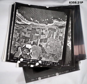
Photograph - Aerial Photography - Mohogany Ship Search Warrnambool Victoria, Victorian Lands Department, 3.1.1981
... Victorian Lands Department... Victorian Lands Department ...These Victorian Lands Dept Aerial Photographs were acquired by the Army Survey Regiment to help locate a Mohogany Ship wreck near Warrnambool Victoria as part of a unit Regimental Training ExerciseSeven Aerial photographic Prints and Film Negatives and positives of the same images. Images are Numbered 3562- 15,16,17,18,19, 29 and 30.royal australian survey corps, rasvy, fortuna, army survey regiment, army svy regt, asr -
 Warrnambool and District Historical Society Inc.
Map, Department of Lands and Survey (Lithographers), Caramut township, 1938
... Department of Lands and Survey (Lithographers)... township Map Department of Lands and Survey (Lithographers) ...This map of the township of Caramut was produced in 1938 but shows the original land owners of each town allotment and of the surrounding area. The size of all the allotments and the date of the original purchase are also shown. Caramut is a Victorian Western District town on Mustons Creek on the Hamilton Highway 48 kilometres from Warrnambool. This map was used by Rolf Crawley when he was the engineer for the Shire of Warrnambool from 1935 to 1968. The annotations on the map have probably been made by Rolf Crawley as they refer to the records and letter books of his father, John William Crawley, Junior (Shire of Warrnambool Engineer 1895 to 1935). Both Rolf Crawley and his father, John had private businesses as architects, surveyors and engineers and the map could have been used in connection with both their official Shire duties and their private businesses. The last owner of the map was the surveyor, Michael Hand who took over the business of Rolf Crawley in the late 1960s. This map is of great interest firstly because it has all the historical details of the land first purchased in the town of Caramut and area and secondly because it came from the office of Rolf Crawley, the engineer for the Shire of Warrnambool from 1935 to 1968. This is a buff-coloured paper map with a cloth backing. The map details are in black and white print. There are some handwritten red and black annotations on the map. “Town of Caramut Parish of Caramut County of Villiers’town of caramut, john william crawley junior, warrnambool, rolf crawley, warrnambool -
 Eltham District Historical Society Inc
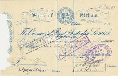
Cheque, Cancelled cheque from Shire of Eltham for 9 shillings to Department of Lands and Survey, Commercial Bank of Australia Ltd, No. 8837, 1 March 1937, 1 March 1937
... Department of Lands and Survey, Commercial Bank of Australia Ltd, No...Cheque, Commercial Bank of Australia, Department of Lands... melbourne Cheque, Commercial Bank of Australia, Department of Lands ...Paper document, serrated on two edgesDetails filled in by hand in ink. Paid stampings on both sides with signaturescheque, commercial bank of australia, department of lands and survey, shire of eltham -
 Federation University Historical Collection
Plan, Department of Crown Lands and Survey, Melbourne, Buninyong County of Grant, 23/07/1929
... Department of Crown Lands and Survey, Melbourne... County of Grant Plan Department of Crown Lands and Survey ...The plan was photo-lithographed at the Departmen tof Lands and Survey, MelbourneA parish plan of Buninyong, including Robert Scott's Mt Buninyong Pre-emptive Right, Mt Buninyong Public Park, Thomas Learmonth's land, John Learmonth's land, Scotchan's, Yendon. The Buninyong POst Office is Allotment 1. Pisition of tracks in 1859 have been marked on the plan in red.buninyong, scotchman's, mt buninyong, robert scott, clarendon, lal lal creek, yendon, warrenheip, yarowee, enfield, thomas learmonth, john learmonth, archibald fisken, g. schloo, george innes, peter inglis, durham lead, j. fry, j. forrest, parkin lee, buninyong recreation reserve -
 Wycheproof & District Historical Society Inc.
Bunguluke Map, Bunguluke District In 1923, 27.2.1923
... The Lands Department and Survey, Melbourne by W.J. Butson... District In 1923 Bunguluke Map The Lands Department and Survey ...By 1881 Bunguluke was a small settlement as recorded, December 5, in the Charlton "Mercury". It reports that in that year Draper's Store, Hotel and Post Office and residence at Bunguluke North was totally destroyed by fire. For years now there has been little sign of community life with houses few and far between and acreages have gone into larger holdings. The map references land blocks and owners for that era.This important map shows the local land ownership and local features that existed in 1923. This is a photocopied black and white map of Bunguluke in the County of Kara Kara, Number L5149. Marked - Photo Lithographed by W.J. Butson 27.2.1923. The details include numbers of allotments, property owners, roads, rivers. The boundaries marked are the Parish of Jeruk, Parish of Wycheproof, Parish of Cooroopajerrup. Wycheproof township location is shown with the Scale of Chains. Bunguluke maps for other years are also in the collection.map, bunguluke, jeruk, wycheproof, cooroopajerrup -
 Flagstaff Hill Maritime Museum and Village
Document - Map, Department of Lands & Survey, Victoria / Panmure, 1942
... Department of Lands and Survey...Department of Lands & Survey... Service Australian Army Department of Army Department of Lands ...This Emergency Edition of the map of Panmure, Victoria, is part of the W.R. Angus Collection. It was printed in 1942 during World War II. It is one of two maps donated to Flagstaff Hill Maritime Village by the family of Doctor William Roy Angus, who served as Surgeon Captain in the Australian Defence Department. The map was compiled for the Dept. of Army by the Dept. of Lands and Survey in Melbourne, prepared by the Australian Section of the Imperial General Staff, which was a British Government body created in 1907 to co-ordinate the defence of Britain and its Empire. It was printed by A.H.Q. Cartographic Company, Survey Corps, which was formed in 1941. The Corp changed its name to L.H.Q. Cartographic Company of Bendigo. In 1947 the name reverted back to the A.H.Q. Cartographic Company until 1955 when it became the A.H.Q. Survey Regiment. The W.R. Angus Collection includes historical medical equipment, surgical instruments and material once belonging to Dr Edward Ryan and Dr Thomas Francis Ryan, (both of Nhill, Victoria) as well as Dr Angus’ own belongings. The Collection’s history spans the medical practices of the two Doctors Ryan, from 1885-1926 plus that of Dr Angus who began practice in 1924. Dr. Angus served with the Australian Department of Defence as a Surgeon Captain during the Second World Was from 1942 to 1945. He served in Ballarat, Victoria, and in Bonegilla, N.S.W. until he suffering from a heart attack just before the war ended. ABOUT THE “W.R.ANGUS COLLECTION” - Doctor William Roy Angus M.B., B.S., Adel., 1923, F.R.C.S. Edin.,1928, was generally known as Dr Roy Angus. His working life included a position as a doctor with the Flying Doctor Service in Australia’s rural and remote areas. After many varied experiences Dr Angus and his family moved to Warrnambool in 1939 where he purchased “Birchwood,” the 1852 home and medical practice of Dr John Hunter Henderson. He was appointed on a part-time basis as Port Medical Officer in Warrnambool and held this position until the 1940’s when the government no longer required the service of a Port Medical Officer. Dr Angus was a surgeon at the Warrnambool Base Hospital 1939-1942. After further studies he commenced practice as an ophthalmologist in Warrnambool, pioneering in artificial eye improvements. He was Honorary Consultant Ophthalmologist to Warrnambool Base Hospital for 31 years and made monthly visits to Portland to perform eye surgery. Dr Angus and his wife Gladys were very involved in Warrnambool’s community with a strong interest in civic affairs. They were both involved in the creation of Flagstaff Hill Maritime Village, including the layout of the gardens. After his death on 28th March 1970 his family requested his practitioner’s plate, medical instruments and some personal belongings be displayed in the Port Medical Office surgery at Flagstaff Hill Maritime Village, and be called the “W. R. Angus Collection”. This Emergency Edition of the Map of Panmure is significant as an example of the documents prepared for the defence of Australia in World War 2. The Map is also significant for its connection between the Australian Army and the involvement of Dr WR Angus as a Surgeon in the Medical Services during World War II. The W.R. Angus Collection is significant for still being located at the site it is connected with, Doctor Angus being the last Port Medical Officer in Warrnambool. The collection of medical instruments and other equipment is culturally significant, being an historical example of medicine, administration, household equipment and clothing from late 19th to mid-20th century. Dr Angus assisted Dr Tom Ryan, a pioneer in the use of X-rays and in ocular surgery. The collection includes Dr Angus’s Army objects and is significant as an example of items issued to Doctors and Surgeons in the Medical Services of the Australian Army in World War IIMilitary map of Panmure, Victoria, Australia; part of the W.R. Angus Collection. Rectangular coloured map on cream paper for the Australian Army. Details include sea, waterways and land, contour lines, grid lines, names of districts, towns and roads, bridges, swamps, rail lines, cuttings, tracks, buildings (including blacksmiths), pumps, lighthouses, telegraph, telephones and electric transmission lines, and fire stations. The map has margin notes that include distances in miles to nearby towns. The map was compiled for the Dept. of Army by the Dept. of Lands and Survey in Melbourne, prepared by the Australian Section, Imperial General Staff and printed by A.H.Q. Cartographic Company, Melbourne in 1942. Crown Copyright Reserved. Inscriptions in red print state that it is and Emergency Edition and an Official document. An oval purple stamp includes the price.Printed in black; 'Victoria / Panmure", "No. 930 / Zone 6" Printed in red; “EMERGENCY EDITION”, “THIS MAP IS AN OFFICIAL DOCUMENT. IF FOUND, IT MUST BE HANDED / IN TO THE NEAREST MILITARY HEADQUARTERS OR POLICE STATION” Stamped: within concentric ovals (“- - - FOR SALE / PRICE 2/- / - - - - - OF THE ARMY”)flagstaff hill, warrnambool, flagstaff hill maritime museum, maritime museum, shipwreck coast, flagstaff hill maritime village, great ocean road, dr w r angus, dr ryan, warrnambool base hospital, flying doctor, surgeon captain, australian department of defence, royal australian army, world war 2, map panmure 1942, roy angus, port medical officer, nhill base hospital, military map, emergency map, military service australian army, department of army, department of lands and survey, a.h.q. cartographic company melbourne, panmure 1942, australian section, imperial general staff -
 Flagstaff Hill Maritime Museum and Village
Document - Map, Department of Lands & Survey, Victoria / Port Campbell, 1942
... Department of Lands and Survey...Department of Lands & Survey... Australian Army Department of Army Department of Lands and Survey ...This Emergency Edition of the map of Port Campbell, Victoria, is part of the W.R. Angus Collection. It was printed in 1942 during World War II. It is one of two maps donated to Flagstaff Hill Maritime Village by the family of Doctor William Roy Angus, who served as Surgeon Captain in the Australian Defence Department. The map was compiled for the Dept. of Army by the Dept. of Lands and Survey in Melbourne, prepared by the Australian Section of the Imperial General Staff, which was a British Government body created in 1907 to co-ordinate the defence of Britain and its Empire. It was printed by A.H.Q. Cartographic Company, Survey Corps, which was formed in 1941. The Corp changed its name to L.H.Q. Cartographic Company of Bendigo. In 1947 the name reverted back to the A.H.Q. Cartographic Company until 1955 when it became the A.H.Q. Survey Regiment. The W.R. Angus Collection includes historical medical equipment, surgical instruments and material once belonging to Dr Edward Ryan and Dr Thomas Francis Ryan, (both of Nhill, Victoria) as well as Dr Angus’ own belongings. The Collection’s history spans the medical practices of the two Doctors Ryan, from 1885-1926 plus that of Dr Angus who began practice in 1924. Dr Angus served with the Australian Department of Defence as a Surgeon Captain during the Second World Was from 1942 to 1945. He served in Ballarat, Victoria, and in Bonegilla, N.S.W. until he suffering from a heart attack just before the war ended. ABOUT THE “W.R.ANGUS COLLECTION” - Doctor William Roy Angus M.B., B.S., Adel., 1923, F.R.C.S. Edin.,1928, was generally known as Dr Roy Angus. His working life included a position as a doctor with the Flying Doctor Service in Australia’s rural and remote areas. After many varied experiences Dr Angus and his family moved to Warrnambool in 1939 where he purchased “Birchwood,” the 1852 home and medical practice of Dr John Hunter Henderson. He was appointed on a part-time basis as Port Medical Officer in Warrnambool and held this position until the 1940’s when the government no longer required the service of a Port Medical Officer. Dr Angus was a surgeon at the Warrnambool Base Hospital 1939-1942. After further studies he commenced practice as an ophthalmologist in Warrnambool, pioneering in artificial eye improvements. He was Honorary Consultant Ophthalmologist to Warrnambool Base Hospital for 31 years and made monthly visits to Portland to perform eye surgery. Dr Angus and his wife Gladys were very involved in Warrnambool’s community with a strong interest in civic affairs. They were both involved in the creation of Flagstaff Hill Maritime Village, including the layout of the gardens. After his death on 28th March 1970 his family requested his practitioner’s plate, medical instruments and some personal belongings be displayed in the Port Medical Office surgery at Flagstaff Hill Maritime Village, and be called the “W. R. Angus Collection”. This Emergency Edition of the Map of Port Campbell is significant as an example of the documents prepared for the defence of Australia in World War 2. The Map is also significant for its connection between the Australian Army and the involvement of Dr WR Angus as a Surgeon in the Medical Services during World War II. The W.R. Angus Collection is significant for still being located at the site it is connected with, Doctor Angus being the last Port Medical Officer in Warrnambool. The collection of medical instruments and other equipment is culturally significant, being an historical example of medicine, administration, household equipment and clothing from late 19th to mid-20th century. Dr Angus assisted Dr Tom Ryan, a pioneer in the use of X-rays and in ocular surgery. The collection includes Dr Angus’s Army objects and is significant as an example of items issued to Doctors and Surgeons in the Medical Services of the Australian Army in World War IIMilitary map of Port Campbell, Victoria, Australia; part of the W.R. Angus Collection. Rectangular coloured map on cream paper for the Australian Army. Details include sea, waterways and land, contour lines, grid lines, names of districts, towns and roads, bridges, swamps, rail lines, cuttings, tracks, buildings (including blacksmiths), pumps, lighthouses, telegraph, telephones and electric transmission lines, and fire stations. The map has margin notes that include distances in miles to nearby towns. The map was compiled for the Dept. of Army by the Dept. of Lands and Survey in Melbourne, prepared by the Australian Section, Imperial General Staff and printed by A.H.Q. Cartographic Company, Melbourne in 1942. Crown Copyright Reserved. Inscriptions in red print state that it is and Emergency Edition and an Official document. An oval purple stamp includes the price.Printed in black; 'Victoria / Port Campbell", "No. 932 / Zone 6" Printed in red; “EMERGENCY EDITION”, “THIS MAP IS AN OFFICIAL DOCUMENT. IF FOUND, IT MUST BE HANDED / IN TO THE NEAREST MILITARY HEADQUARTERS OR POLICE STATION” Stamped: within concentric ovals (“- - - FOR SALE / PRICE 2/- / - - - - - OF THE ARMY”)flagstaff hill, warrnambool, flagstaff hill maritime museum, maritime museum, shipwreck coast, flagstaff hill maritime village, great ocean road, dr w r angus, dr ryan, warrnambool base hospital, nhill base hospital, flying doctor, surgeon captain, map port campbell 1942, roy angus, port medical officer, military map, emergency map, australian department of defence, royal australian army, military service australian army, department of army, department of lands and survey, world war 2, a.h.q. cartographic company melbourne, australian section, imperial general staff, port campbell 1942 -
 Greensborough Historical Society
Map, Keelbundora. Counties of Bourke and Evelyn, 1950_11
... Victoria. Department of Lands and Survey... of Bourke and Evelyn Map Victoria. Department of Lands and Survey ...Covers area bounded by Merri Creek, Yarra River, Plenty River and Crown Portions 24 to 28, with section including Maroondah Aqueduct and Darebin Creek.Photocopy of digitised mapkeelbundora (parish) -
 Greensborough Historical Society
Map, Victoria. Department of Crown Lands and Survey, Keelbundoora; Counties of Bourke and Evelyn, 1950c
... Victoria. Department of Crown Lands and Survey...; Counties of Bourke and Evelyn Map Victoria. Department of Crown ...Map of the Victorian counties of Bourke and Evelyn showing parish boundaries and land ownership.Show the original landholders for this area.Map on light brown parchment, covered in plastic."L.5305" and "3462" -
 Orbost & District Historical Society
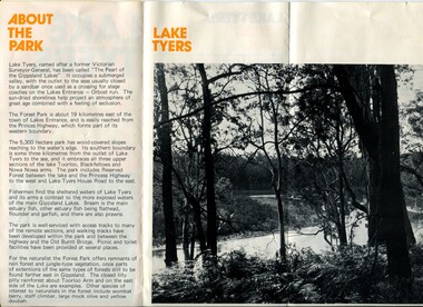
pamphlet, Lake Tyers Forest Park, 1960's
... Department of Crown Lands & Survey... Department of Crown Lands & Survey ...This pamphlet would have been produced as a tourist guide to East Gippsland.This item is a useful reference tool.A three fold glossy, pamphlet titled"Lake Tyers Forest Park". It contains information, a map and black / white photographs of Lake Tyers Park. Print colours are brown, white, yellow and black.pamphlet lake tyers-forest-park -
 Orbost & District Historical Society
plans, 1966?
... plans-survey Snowy-River-Flats Department-Crown-Lands...Department of Crown Lands & Survey...-survey Snowy-River-Flats Department-Crown-Lands-Victoria A flat ...These survey plans are a useful research tool.A flat green fabric folder with a white label with "SNOWY RIVER FLATS" hand-written in black. It contains plans.plans-survey snowy-river-flats department-crown-lands-victoria -
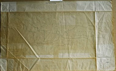 Orbost & District Historical Society
survey sheet, circa 1870's
... to Australia in 1854 and joined the Lands Department. He spent most... to Australia in 1854 and joined the Lands Department. He spent most ...E.L. Bruce, born in Ireland on July 1,1854, came to Australia in 1854 and joined the Lands Department. He spent most of his service in Gippsland. The journey to Sale then was made by ship to Port Albert and thence on horseback. He began his service in Gippsland as assistant district surveyor and for the last 12 years before retirement he was district surveyor and land officer. His territory extended from the boundary of Victoria in east Gippsland down to Wilson's Promontory with his headquarters at sale.This map is a useful reference tool.A survey map - Sheet No 3 SnowyRiver Survey. This is a copy of the original survey. It shows the properties of W.J.T. Clarke - two in Orbost and one in Newmeralla (sic),. it has a faded, undecipherable red stamp in the bottom right corner.Gipps Land Rivers No 32B E.L. Brucesurvey bruce-e.l snowy-river-c19th -
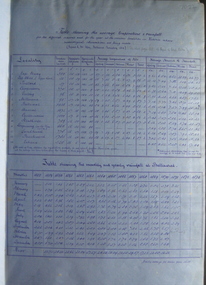 Federation University Historical Collection
Book, Victorian Government Legislative Assembly, The Select Committee on Castlemaine and Sandhurst water supply, Report from the Select Committee on Castlemaine and Sandhurst Water Supply, together with the proceedings of the Committee, minutes of evidence and appendices, 19/5/1865 (exact)
This book contains the report from the select committee on Castlemaine and Sandhurst water supply; with the proceedings of the committee, minutes of evidence and appendices. It also contains the report Of the Engineer-In-Chief of Railways, and reply of the Chief Engineer of Water Supply on the works constructed by the Victorian Water Supply Department, presented to both houses of parliament by His Excellency’s command. Ferdinand M. Krause, was a lecturer at the Ballarat School of Mines in Geology Mineralogy Mining Engineering and Surveying. He was a Fellow of the Geological Society and a Fellow of the Linnian Society. He was assistant engineer for the Ballaarat and Ballarat East Water Supply Committee and helped plan local reservoirs.A brown cloth hard cover, foolscap book with leather spine. Title is written in black on the title page. "Water Supply Reports" is engraved in gold on spine. It includes a table showing the monthly and yearly rainfall and shade temperature at Ballarat, 2nd February, 1885. It also includes two reports and two replies, a map No.7082.2 of Victorian Water Supply, Castlemaine and Sandhurst district general plan including lines of Aqueduct, Reservoirs. No. 7082.3 of Victorian Mining districts, Mining Divisions and The Gold Fields in 1866 - includes districts to be supplied under the Waterworks Act, 1965. It also includes: *Report of the Engineer-in-chief of Railways and Reply of the Chief Engineer of Water Supply on the works constructed by the Victorian Water Supply Department, 1869. * Coliban Water Scheme, 1864 * Ballarat and Ballarat East Water Supply (1869) including the Ballarat Water Supply List containing names of occupiers and nature of improvements on lands comprised within the proposed reserve of Gong Gong Reservoir, Ballaarat. At Warrenheip the names included: Honora McCallin, William Honan, C. McMahon, Patrick McMahon, J.P. Beach, J.H. Smith, Michael Nestor, Martin Quinn, Martin McIntyre, Robert Higgins, Coleman Kane, Robert Bond. At Ballarat: William Clarke, Richard White, John Hosking, Wesleyan Chapel, J. Hewitt, Robert McRobinson. At Bungaree: John Pullin, John Llewellyn. William Daw, Smith and Wynne, William Brough, A. Alexander. * Ballarat and Ballaarat East Water Supply report upon the advisability, or otherwise, of constructing a reservoir at the junction of the Yarrowee Creek and Gile's Creek, upon a site known as Gile's Reservoir (printed by Frank Pinkerton). This report has numerous notes written on it (most probably by Krause) and includes the capacity of Harry Beale's Reservoir, Pimcott's Reservoir and the Proposed Gong Gong Reservoir. * Statement as to the position of the Ballaarat and Ballaarat East Borough Councils in Connection with Water Supply, September 1869. * Ballarat and Ballaarat East Water Supply - General Statement upon the Ballaarat and Ballaarat east Scheme of Water Supply. Includes information on Moorabool reservoir, Harry Beale's Reservoir, Lal Lal Creek, Two Mile Creek, Beale's Dam, Yarrowee Creek, Gong Gong Reservoir, Kirk's Dam, Devil's Creek, Moorabool Creek. Additional handwritten notes (probably by Krause) * Engineer's Report on the resolution of the COmmittee of Water Supply, of the 7th July 1868. The report refers to the Country around Mount Warrenheip. Names mentioned are L. Abraham, Great North-West Gold Mining Company, Border Sawmills, Ferdinand Krause, Ohlfsen Bagge, W.H. Shaw, A signature by "Ferdinand M. Krause" at the top corner of the title page. A few pages have handwriting on the margins, it is believed to be his handwriting. water supply victoria, castlemaine directories, sandhurst directories, ballarat directories, james blackburn, edward wardle, daylesford water race, c j taylor, george avery fletcher, bagge, ohlfsen bagge, george foote, john h reilly, ambrose johnson, george francis, timber preservation, james forbes, alfred surplice, malcolm carmichael, robert adams, frederick hugh thomas, h o christerpherson, william downe, thomas lawrence brown, francis hadgson nixon, strangways, guildford, maldon, muckleford, lauriston, malmesbury, franklinford, walmer, strathloddon, downe, ferdinand krause, m7082, trentham, castlemaine, drummond, metcalfe, sutton grange, lockwood, ravenswood, mandurang, yandoit, c.h. ohlfsen bagge, moorabool reservoir, gong gong reservoir, harry beale's reservoir, pincott reservoir, frank pinkerton, water -
 Federation University Historical Collection
Plan, Haddon, County of Grenville, 1932, 13/04/1932
... Department of Crown Lands and Survey, Melbourne... Haddon, County of Grenville, 1932 Plan Plan Department of Crown ...The Haddon Parish Plan shows crown parcels government roads, Crown Reserves, Railway. Scale 40 chains to 1" (1:31, 680) WGS 84 Centroid Lat: 37 degrees 34' 00" S Long: 148 degrees 40' 20" E N.S. 9.3km E.W.: 16.1kmhaddon, grenville, cardigan, water supply reserve, nentingbook pre-emptive right, a. mclachlan, lake burrumbeet, e.a. wynne, p. russell, b. hepburn, benjamin hepburn, nentingbool, t.c. wilson, j. amoy, william collard smith, james roach, j. mitchell -
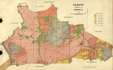 Federation University Historical Collection
Plan, Haddon, County of Grenville, 1887, 1889
... Crown Lands Department Melbourne...Crown Lands Department Melbourne... Crown Lands Department Melbourne Ferdinand M. Krause Crown Lands ...Ferdinand Krause taught at the Ballarat School of MinesGeological Map of Haddon in the County of Grenville surveyed by Ferdinand Krause. haddon, grenville, krause, ferdinand krause, cgt, lake burrumbeet, windermere, chepstowe, bailies creek, snake valley lead, nentingbool preemptice right, cardigan state forest, haddon state forest -
 Federation University Historical Collection
Plan, Scarsdale County of Grenville, 1889, 26/01/1889
Rectangular plan of a geological survey edged in masking tape. It is predominantly grey, pink and green, but has some yellow. scale is 40 chains to one inch. (see Cat. No. 1098 for report on the Parish of Scarsdale)scarsdale, grenville, krause, browns and scarsdale, mopianimum, watershed, yarrowee, woady yalloak, timber reserve, department of mines, plans, cgt, crown lands, ferdinand krause -
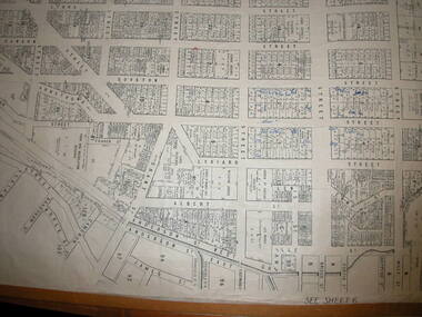 Federation University Historical Collection
Plan, Ballaarat City Parish Plans, 1931, 09/03/1931
... Department of Lands and Survey... Plan Department of Lands and Survey ...Large Scale plans showing streets, allotments, dimensions, crown grantees, dates granted, etc Sheet 2: Sturt Street, Rubicon Street, Pryor Street, Humffray Street, Sebastopol Street, Armstrong Street South, Fraser Street, Hickman Street ballarat, ballaarat, plans, city of ballarat -
Federation University Historical Collection
Map, Topographical Map Creswick A & B
... Department of Lands and Survey... Topographical Map Creswick A & B Map Map Department of Lands and Survey ...Printed map on papercreswick, clunes, lexton, waubra, smeaton -
 Federation University Historical Collection
Plan, Burrumbeep, 1884, 16/10/1884
... Department of Lands and Survey...Department of Lands and Survey... of the Squire Family Burrumbeep, 1884 Plan Department of Lands ...Auctions of Crown land were introduced in the Colony of Victoria from 1851 to encourage settlers to occupy and work the land. Many squatters purchased land at auction at the upset (minimum) price of £1 per acre. In some areas where demand was high, such as the goldfields, the price realised at auction was much more. Land was put up for sale in the study area on the Burrumbeep run in May 1855, on the Lexington run in 1857, and on the Gorrinn run in 1858. (http://www.ararat.vic.gov.au/library/document/thermatics.pdf, accessed 27 January 2015) For 70 years or more, Yalla-y-Poora, Burrumbeep, Edgarley, Mount William and Narrapumelap ranked in the leading wool producers in Victoria. 1 Stud owners at Yalla-y-Poora, Eurambeen, Burrumbeep and Challicum crossed merino sheep with sheep descended from John Macarthur's Camden Park in New South Wales. (http://www.ararat.vic.gov.au/library/document/thermatics.pdf, accessed 27 January 2015) In what was to become the Ararat Mining Division, gold was discovered in May 1854 on the Burrumbeep run at a place that became known as Pinky Point on the Mount William goldfield. By 21 June 1854, between 600 and 1,000 people had arrived. (http://www.ararat.vic.gov.au/library/document/thermatics.pdf, accessed 27 January 2015)\ Town allotment plan for Burrumbeep. Merrymbuela, Borung, Lexington and Langi Logan are neighbouring areas. The plan includes the Burrumbeep Pre-Emptive Right (Roger and Wright); licensed land holders including Stephen Young, John Carroll, William Walsh, Thomas Purcell, Martha M. Bond, Colin Johnson, John Charles Webb, Henry Withycombe, William Henry Barbridge, John Wall, Thomas Flatelly, William Jenkinson, Elisia Radford, V. Radford, Denis Byrne, George Cook. Land holders included Andrew Maloney, Richard Wingfield Harrocks, W. Sporton, Terence Lynch, F. S. Falkiner, A. Millman, H. Morris, George Upham, J. McCLure, S. Fletcher, W. Parker, Thomas Myers, William wright, W.C. Winter, C. Wordman, Oliver A. Winter This plan is associated with former Ballarat School of Mines student Richard Squire (1875-6) Gift of the Squire FamilyVerso written in pencil - Plan of Burrembeep Ararat Burrembeep Araratburrumbeep, corrinn, langi logan, merrymbuela, lexington, ararat, roger & wright, cook, rogers, upham, george upham, ross, parsans, morris, johnson, withycoombe, colin johnson, falkiner, dsporton, john carroll, donald gordon, denis bryne, maurice dooley, martha bond, william harricks, \william wingfield harricks, william l.c. harricks, michael houlihan, thomas purcell, martin ryan, michael cody, fletcher, mccaw, w. parker, j.m. clow, elisia radford, thomas radford, thomas myers, barbridge, e. wilde, j. wall, flatelly, g. wardman, w.c. winter, david ball, jenkinson, ballarat school of mines, richard squire, squire -
 Federation University Historical Collection
Plan, Smythesdale, County of Grenville, 01/12/1892
... Department of Lands and Survey...Department of Lands and Survey..., County of Grenville Plan Department of Lands and Survey T.F ...This plan is associated with former Ballarat School of Mines Student Richard Squire (1875-1876). Gift of the Squire FamilyA plan showing the Borough of Smythesdale, Smythesdale, Browns and Scarsdale, allotments, water reserve, Timber reserve, Nintingbool Pre-emptive Right, Reserve for public gardens, Reserve for Cricket Ground, Reserve for Reservoirsmythesdale, scarsdale, browns, yarrowee, carngham, samuel barlett, sheridan, wrigley, p. land, r. simpson, d. davis, nintingbool, mclachlan, a. mclachlan, c. taylor, w. c. smith, d. davies, w. williams, m. jones, t. mcgurk, r. selkirk, a. mooney -
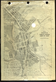 Federation University Historical Collection
Plan, Creswick, Parish of Creswick, County of Talbot, 1928, 1928
... Department of Lands and Survey..., County of Talbot, 1928 Plan Plan Department of Lands and Survey ...Parish Plan of Creswick showing Slaty Creek, Old Gold Workings, Police Reserve, Railway Station, Public Gardens, Sawpit Gully, Hospital Reserve, Nigh Soil Depot, Eureka Terracotta Tile COmpany, Creswick Creek, Forest COmmission, Roycroft's Racecreswick, eureka terracotta tile co, parish plan