Showing 527 items
matching land owners
-
 Surrey Hills Historical Society Collection
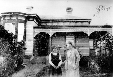
Photograph, "Warlingham", 85 Guildford Road, Surrey Hills, c1910
... of the land crash. The next owner was George Lumsden, grocer who... of the land crash. The next owner was George Lumsden, grocer who ...This photo was taken in c1910. ‘Warlingham’ has many typical Victorian features and has been restored and extended. The first owner was Thomas Kennedy Vernon Coburn, a solicitor. His wife was Sara Ethelwyn (Winnie) Cornell; they married on 26 March 1890. They had a large family and their eldest son (Arthur Wheeler Coburn) was born at 'Wannacul' Surrey Hills on 11 January 1891. The Coburns seem to have moved often and Thomas was declared insolvent in 1894, in part it would seem as a result of the land crash. The next owner was George Lumsden, grocer who is believed to have been there 1892-1896. He was married to Emma Louise Sim. During the years c1913-1919 Mr William Joseph Trenerry (manufacturer) and his wife Elsie (nee Capon) lived here. In the 1919 electoral roll the house name is given as 'Mosman', which may be a reference to Elsie Trenerry's origins; she came from Sydney. See also SHP1927 and SHP1384. A black and white photograph of a Victorian style house with lacework around the verandah. There is a lady and young girl with plaits wearing her school uniform standing in front of the house. Two young boys are watching and are standing on the verandah.clothing and dress, warlingham, guildford road, surrey hills, house names, mr william joseph trenerry, mrs elsie trenerry, miss elsie capon, mr thomas coburn, mr thomas kennedy vernon coburn, mr arthur wheeler coburn, mrs sara ethelwyn coburn, mrs wynnie coburn, miss sara ethelwyn cornell, mr george lumsden, miss emma louise sim, mrs emma louise lumsden -
 The Beechworth Burke Museum Research Collection
Card (Series) - Index Card, George Tibbits, Camp Street, Beechworth, 1976
... owner, land 16.5'x175, prem 12'x22' WB slabs & paling rf £12...-10 12-2 1866 Ditto owner, land 16.5'x175, prem 12'x22' WB ...George Tibbits, University of Melbourne. Faculty of Architecture, Building and Town & Regional PlanningIndex system that support the research for Beechworth : historical reconstruction / [by] George Tibbits ... [et al]Arranged by street names of BeechworthEach index card includes: street name and number of property, image of property, allotment and section number, property owners and dates of ownership, description of the property according to rate records, property floor plan with dimensions.beechworth, george tibbitsbeechworth, george tibbits -
 Eltham District Historical Society Inc
Document, Russell Yeoman, Tour of Historic Buildings and Locations, 1978
... and occupied a substantial leasehold prior to the first land sales... and occupied a substantial leasehold prior to the first land sales ...Self guided heritage tour information produced by the Shire of Eltham Historical Society for 1978 Eltham Community Festival of 36 locations each numbered on accompanying map. Locations and detail provided current to 1978: 1. ELTHAM SHOPPING CENTRE Whilst very little remains in the centre of historical importance, this area has interest as the "village" which developed over many years following the opening of the railway from Melbourne in 1902. Previously the shopping centre had been spread out over a long length of Main Road to the south. Shops have been continuously demolished or remodelled and the majority of buildings date from the 1950's or later. The recently erected Post Office replaced the "old" Post Office opened on the same site only in 1958. 2. WOOLWORTHS ELTHAM VILLAGE Part of the site of this modern shopping development was occupied by the former Eltham Shire Offices and Hall. The hall was paid for by public subscription whilst the Council raised a loan for the offices. The combined building was opened in 1941. It served as office and Council meeting place until 1965 and as the hall until its demolition in 1970. 3. ELTHAM WAR MEMORIAL The complex of buildings adjoining the present Shire Offices were financed by public subscription as a Memorial following World War II. Their construction and for many years their operation was organised by the now disbanded Eltham War Memorial Committee. The original buildings were the; Infant Welfare Centre, Children’s Library (now War Memorial Hall and Dental Clinic) and Kindergarten. In later years the Elderly Citizens Club was built at the rear. 4. ELTHAM SHIRE OFFICES These offices were opened in 1965 and extended in 1971 to provide additional office accommodation and the Eltham Library. They represent the last of a long line of offices and meeting places of the Eltham Shire Council and its predecessor the Eltham District Road Board. The building occupies the former site of Shillinglaw Cottage. The three tall cypress trees which stood in front of the Cottage have been retained as a feature of the office surrounds. 5. OUR LADY'S CHURCH AND SCHOOL The Catholic Church and School complex opposite the Shires Offices shows a number of stages in the development of Eltham township. The recently constructed church adjoins its predecessor (now the parish centre). Many years ago the Catholic Church was located opposite Wingrove Park and the present central site follows the northerly drift of the township. 6. SHILLINGLAW COTTAGE The Cottage was built in 1859 by George Stebbing, a local builder who was responsible for a number of other prominent buildings in the area. Its removal from the site of the Shire Offices and re-erection on the present site was financed by public subscription. It is built of handmade bricks laid in Flemish Bond with an unusual design featuring burnt "leader" bricks over the whole facade. The Cottage is occupied by Eltham Fleececrafts and will be open during the Festival and at other times during weekends. It is classified by the National Trust. 7. RAILWAY BRIDGE The timber trestle bridge over the Diamond Creek was built in 1901. Whilst all of its timbers have been replaced at various times over the years the only change to its character has been the addition of pylons and wiring for electric trains in 1923. It is one of very few similar bridges remaining in the metropolitan area. In 1976 a proposal to replace the bridge with an earth embankment and large culvert pipes was abandoned following community protests. The bridge, however, remains under threat because of the necessity for future deuplication of the railway line. 8. ELTHAM CENTPAL PARK The area between the railway and the creek has for many years been used as a park which included Eltham' s main football oval. The access road, Panther Place is named after Eltham's team playing in the Diamond Valley League. In recent years a large area extending to Bridge Street and locally known as the Town Park has been landscaped and added to the area. The excellent blending of the park with the natural landscape of the creek valley has earned a National Trust Landscape Classification. 9. OLD BAKERY On the southern corner of York Street and Main Road is an old house with a shop front which was for many years the local baker's shop. The brick bakery at the rear is of somewhat later vintage than the house. 10. BRIDGE STREET CUTTING Before reconstruction of Main Road this intersection had deep cutting embankments on all four corners, forming a distinctive feature of the entrance to Eltham. Roadworks and private development have levelled the land on the low side of the road. A memorial to the Eltham soldiers of World War I which was located at the north-western corner is now situated at the Eltham R.S.L. 11. HILLTOP MILK BAR For many years this was the site of the Eltham Post Office under the control of the Hunniford family and later their descendants the Burgoynes. It was transferred to this site in 1855, although at that time the building apparently fronted Bridge Str e et. The site contained Eltham's first telephone exchange. The post office was relocated in 1954 but the shop was operated until recently by the Burgoyne family who still own the surrounding land. 12. UNITING CHURCH and former C.B.A. BANK The former Methodist Church was built in 1880 by George Stebbing. The Sunday School extension was built in 1929 and there have been more recent extensions. The adjoining opportunity shop was built as a bank in 1874 and purchased by the Methodist Church in 1954. 13. R.S.L. HALL, TELEPHONE EXCHANGE These relatively recent buildings occupy the site of a row of shops forming part of the early ribbon of business development along Main Road. In front of the R.S.L. building is the World War I Memorial relocated from the corner of Bridge Street and Main Road. 14. ELTHAM COMMUNITY CENTRE Australia's first mudbrick "community building" was opened in April this year. Part of the site of the building was purchased in 1856 by Henry Dendy (of Brighton fame). At the rear of the land near the creek was a steam flour mill whilst Dendy's house was at the Main Road frontage of the land. His purchase totalled about 2 Ha (5 acres) and included land on the opposite side of Maria Street (Main Road). Dendy became a prominent member of the Eltham community and served one term as President of the Eltham District Road Board. In 1867 Dendy sold his land and business to William Ford of Malmsbury and shifted to Walhalla. The avenue of trees leading past the Community Centre to the creek may well have bordered the track to the mill. 15. ELTHAM HOTEL The original part of this hotel was built in 1927 following the burning of the former Watson's Eltham Hotel on the same site. The car park on the opposite side of Main Road was also the site of a hotel variously known over the years as; the Fountain of Friendship, the Fountain and the Evelyn Arms. As the Fountain of Friendship it was the first meeting place of the Eltham District Road Board in 1856. 16. ST. MARGARET'S CHURCH, PITT STREET In 1860 Henry Dendy was appointed Chairman of a committee to establish a church of England in Eltham. He donated part of his land in Pitt Street and in 1861 the church was opened. It was built by George Stebbing and remains in a well preserved state today. Th adjoining old vicarage is now named Dendy Hou se. A new mudbrick church hall is under construction on the site. The church and Dendy House are now listed on the Register of Historic Buildings. 17. NO. 86 PITT STREET Cottage built by George Stebbing and believed to be his home for some years in the 1850s. 18. LIVING AND LEARNING CENTRE The house was built in the 1850s with the kitchen at the front being added about 40 years later. By the creek below the house a number of early Eltham industries were located. These included a tannery and a brewery. 19. ELTHAM COURT HOUSE A Court of Petty Sessions was established in Eltham in 1858 and the present building dates from 1860. It is the oldest public building remaining in Eltham. In its early days the building was used as the meeting place and office of the Eltham District Road Board and as an overflow classroom for the local school. The Court House has been classified by the National Trust. The citation states that it is an example of the simple form of early brick Court House with gabled roof and porch. 20. LANDS DEPARTMENT OFFICE This building is the former police station and is probably of about the same age as the Court House. The lockup at the rear has been demolished but the old stables remain as garages. A licence was first granted for a police station at Eltham in 1856. 21. JARROLD COTTAGE The old Cottage opposite Dalton Street was formerly owned by the Jarrold family. Early records indicate that this was the building leased from the Jarrolds as a temporary police station prior to construction of the building on the corner of Brougham Street. The small building on the corner of the property was used as a boot repairer's shop. The elevated studio at the rear is a more recent construction by the present owners. 22. STATE SCHOOL RESIDENCE Erected in 1891 23. WINGROVE COTTAGE This building fills an important place in the history of Eltham and is now used as a medical clinic. It was built in 1858 for Charles S. Wingrove who was Secretary to the Eltham District Road Board and Shire Council from 1858 to 1904. During part of this period he was also Shire Engineer and was Secretary to the Heidelberg Road Board. The house was used as the office of the Board and Council for many years. Wingrove is buried in the cemetery at St. Helena. 24. WINGROVE PARK The parkland opposite Wingrove Cottage has been named after Charles Wingrove. The old Manna Gums are an outstanding feature of the park. 25. ELTHAM FRI.MARY SCHOOL NO. 209 The school first opened in the slab building in 1855 and operated from the present site since 1857. The oldest part of the present school is the stone building erected in 1876. The first school teacher, David Clark remained at the school until 1888. This school is the government township and has always been known as the Eltham School. An earlier school (no.371) known as Little Eltham School operated in Swan Street from 1853 to 1872. 26. "SHOESTRING" This house was built for school teacher David Clark. It has been extensively extended in recent years but the extensions do not detract from the character of the older part of the building. 27. ELTHAM CEMETERY The cemetery contains the graves of many of the district's pioneers . 28. MONTSALVAT This unique complex of buildings was commenced in 1935 by the late Justus Jorgensen and its development has extended over many years. Montsalvat has exerted a significant impact on Eltham The earth and stone construction of many of the buildings has influenced local architecture to a great extent and it has served as a "nerve centre" of the local artistic community. Montsalvat is open to the public for a small charge. 29. MAIN ROAD BRIDGE This location has been the main crossing of Diamond Creek since the earliest days of settlement. The present concrete bridge was erected in 1925 .and was preceded by a number of timber bridges. 30. ELTHAM LOWER PARK This park, being an unusually large flat area for Eltham, was originally the local racecourse. Horse races were held here from 1855 and the area was gazetted as a reserve for a racecourse and recreation reserve in 1857. The park is well known as a venue for school "bird days" and more recently as the site of the Diamond Valley Railway. This miniature railway features scale models of modern and old locomotives and rolling stock and has operated on this site since 1961 . Before that the railway operated at Chelsworth Park, Ivanhoe. 31. FALKINER HOUSE Frederick Falkiner was one of the earliest settlers in the Eltham township area and occupied a substantial leasehold prior to the first land sales. Early records show that Falkiner was the subject of a number of complaints from his neighbours but he has nevertheless been considered a prominent enough citizen to have a street named for him. This house was the home of Evelyn (Ely) Falkiner a member of Frederick's family. 32. WEST HOUSE Behind the large house on the hill is an early house built by the West family. This was relocated from a site near the front of the land by the present owner Mr. Fabbro. 33. FALKINER HOUSE This very old house is believed to have been the home of Frederick and may have been Eltham's first post office. Falkiner was the first post master for a short period. in 1854/55. 34. WITHERS HOUSE This house was the home of famous artist Walter Withers who shifted here from Heidelberg in 1903. 35. ELTHAM HIGH SCHOOL This school celebrated its jubilee this year, having commenced as the Eltham Higher Elementary School 50 years ago. 36. DIAMOND CREEK FOOTWAY If returning from the High School to the town centre the footpath by the bank of the Diamond Creek provides a pleasant route to finish your walk. The creek is a major tributary of the Yarra River. Together with its own major tributaries Arthurs Creek and Running Creek it commences on the southern slopes of the Dividing Range at Kinglake. It gives the name Diamond Valley to an area extending well beyond its actual drainage catchment.Recognition of the significance of various landmarks to the history of the Eltham community as of 1978‘shoestring’, 1978, bridge street cutting, burgoyne store, c.b.a. bank, diamond creek trail, eltham cemetery, eltham central park, eltham community centre, eltham community festival, eltham court house, eltham festival, eltham high school, eltham hotel, eltham lower park, eltham primary school, eltham railway trestle bridge, eltham shire offices, eltham shopping centre, eltham state school no. 209, eltham village, eltham war memorial, falkiner house, heritage trail, hilltop milk bar, jarrold cottage, lands department office, living, living and learning centre, main road bridge, montsalvat, old bakery, our eltham artistic recollections, our lady help of christian’s church, our lady help of christian’s primary school, pitt street, post office, r.s.l. hall, shillinglaw cottage, st margaret’s church, state school residence, stebbing cottage, telephone exchange, uniting church, west house, wingrove cottage, wingrove park, withers house, woolworths -
 Ringwood and District Historical Society
Archive - Biographical material, Maggs Family of Ringwood and District (Parent Record)
... : ELIZA ANN BARNES married SAMUEL MAGGS, son of neighbouring land...: ELIZA ANN BARNES married SAMUEL MAGGS, son of neighbouring land ...Transcript of the Maggs Family History, given by Joan Walker, former member of RDHS:- Pioneer Family - Maggs • James Maggs and wife Harriet Banfield migrated to Melbourne on the “Ticondergoa” which sailed from Birkenhead on 4th August 1852 with 812 assisted immigrants. • In 1856 James purchased 7 acres of land, part of section 75, in the parish of Nunawading where he developed an orchard. • Three children died young – Emma (before 1862), Jemima at Ticonderoga Bay and Mary Jane aged 3 weeks at Koonung Creek. Three sons and a daughter survived them. Harriet died in 1875, James in 1888 both buried in Box Hill cemetery. • Their sons Joseph, Samuel and James all established orchards in the Ringwood/Croydon district. Samuel Maggs • Born 11 May 1851, Somerset, England and grew up on his fathers property in Springfield Road, Blackburn, one block east of Surrey Road. • On 4 October 1876 Sam married Eliza Ann Barnes. • 1881 purchased a block, Allot. 39 Parish of Warrandyte and developed an apple and cherry orchard. The orchard occupied the area between White Horse Road and Mullum Mullum Creek from Oban Rd east to where White Horse Road takes a slight turn to the right, near Burnt Bridge. • Son George b.28 December 1876 Warrandyte married Annie Smith d.9 May 1947. • Daughter Eliza Jane b.27 July 1878 Ringwood married William Dobbin, d.31 May 1946 Camberwell. • Son James b.15 May 1880, Lilydale married Catherine Atkins d.28 July 1940 Ringwood buried Box Hill. • Daughter Jemima b.16 December 1881 Warrandyte married Edward Lindsay in 1905, d.2 November 1955 and buried in Box Hill. • Daughter Jane b.22 May 1884 Warrandyte married Thomas S Knee in 1912 d.31 January 1971, buried at Box Hill. • Son Samuel William b.1 Jan 1889 Ringwood married Mina Lillian Schuhkraft in 1911 d.15 Jan 1955 Ringwood. Joseph Maggs • Born 5 June 1845, Somerset England. • Married Mary Ann Reid in April 1867 at Templestowe. • Bought Sec. 26a, in Ringwood on the corner of Eastfield Road an Mt Dandenong Road in February 1870. Planted 4 acres with fruit trees. Was also a wood carter. During the 1880s white clay was mined here, which he carted for the Victorian Porcelain Clay Coy. • Daughter Emma b.8 Jan 1868 Templestowe d. 3 August 1939, Richmond married May 1890 Fredrick W. McGinnis. • Daughter Agnes b.16 June 1869 Templestowe married John D Miller c.1894. d.3 February 1912 Heathmont, buried Box Hill. • Son Albert b.1 May 1871 Nunawading d.15 Nov 1893. • Son Hubert b.10 May 1873 Nunawading married Isabella Atkins in 1898 Ringwood d.11 August Wagga Wagga and buried there. • Daughter Harriet Annis b.13 August 1875 Box Hill d.21 Sept 1875. • Son Joseph b.25 September 1876 Box Hill d.3 Oct 1900 Mitcham. • Daughter Harriet Annis b.18 Aug 1879, Ringwood married James R Miller d.8 May 1945. • Son William b.3 Sep 1881 married Mary E Hardidge. D.6 April 1950 South Melbourne. • Daughter Dora Jane Dulcie b.13 December 1883 Ringwood d.1973. • Daughter Delia Rose b.20 February 1886, Ringwood married William J Sharkie d.30 October 1914 James Maggs • Youngest (born 28 April 1862, Blackburn) and only Australian born son was also an orchardist. • Married Marianne Hardidge in 1880 (divorced in 1906) purchased land in what is now Kalinda Road, adjoining Sam’s land. • James lived with Teresa Shanks in the Hawthorn and Prahran districts and became a taxi driver. Died in 1925, buried at Box Hill. Marianne became a midwife who delivered over 500 babies in the area – was known as Nurse Polly Maggs, died in 1941 aged 81. • Daughter Mary Ann Hase Polly b.5 July 1881 Ringwood married Thomas Lawford d.9 November 1961 buried at Box Hill. • Daughter Jane Emma b.9 May 1883 Ringwood married Frederick Bloom 1910 d.28 July 1954. • Daughter James John b.17 Jan 1885 Ringwood married Johanna Ida Edith Bloom in 1912 d.24 August 1962 buried at Box Hill. • Daughter David Joseph b.31 Jan 1887 Ringwood married Violet Lepp married 1916, d.11 July 1966. • Son Samuel Arthur b.11 March 1888 Ringwood married Bertha Anna Pump in 1913 d.7 August 1957. • Son John William b.16 April 1890 Ringwood married Lillian Mabel May Smith in 1909 d.18 February 1959 Cobram. • Daughter Eliza Anne b.6 March 1892 Ringwood d.April 18 1892. • Son Robert Thomas b.7 March 1893 Ringwood married Edith E Britnell in 1919 d.12 March 1981 buried Box Hill. • Son Albert Edward b.12 April 1895 Ringwood married Florence Sarah Pearce in 1918 d.30 January 1976 buried at Springvale. • Daughter Evaleen Victoria b.28 Aug 1897, Ringwood married Sydney Till married 1920 d.5 September 1989 buried at Box Hill. • Daughter Harriet Banfield Chrissy b.14 December 1899 Ringwood d.28 Dec 1979 buried Box Hill. Jane Maggs • Born 19 December 1858 in Blackburn. Died 5 July 1926 buried at Box Hill. Married William Cook and had one child, Harriet Amy Cook who never married and lived in Whitehorse Road, Mitcham until her death in 1962. Details, extract from Family Tree Maker family tree:- Descendants of James Maggs Generation No. 1 1. JAMES5 MAGGS (JOSEPH4, WILLIAM3, WILLIAM2, SAMUEL1)1 died 24 Sep 18881. He married (1) HARRIET MARTHA BANFIELD1 23 Dec 1841 in Bristol, Somerset, England1. She was born 19 Jun 1817 in Clutton, Somerset, England1, and died 12 May 1875 in Nunawading, Victoria, Australia1. He married (2) ROSENA MAHON1 09 Dec 1875 in Fitzroy, Victoria, Australia1. She was born in Deptford, London, England1. Notes for JAMES MAGGS: JAMES MAGGS, and his wife HARRIET BANFIELD, migrated to Melbourne on the "Ticonderoga", which sailed from Birkenhead 4th Aug 1852 with 812 assisted immigrants aboard. In the close confines of the ship fever broke out and by the time she arrived off Port Phillip Heads on or about 2nd Nov, 100 deaths had been recorded in the log and hundreds were too weak to help themselves. Captain Wylie of the coastal trader "Champion", informed Captain Ferguson, the harbourmaster at Williamstown, of the tragic plight of the passengers and crew, and he came with two doctors, in the "Empire", to their aid. They anchored just inside Port Phillip Heads on 5 Nov. at the "Sanatory Station", declared but not yet established by the local authorities. Those who were well enough were put ashore in tents made of spars and sails. The "Lysander" was despatched from Melbourne to act as a hospital ship, and 2 houses, built of the local limestone, were commandeered as a quarantine station. For six weeks the survivors were held near Point Nepean at a place still known as Ticonderoga Bay while the fever, propably typhus, a louse borne epidemic disease, ran its course and a further 68 passengers, 2 crew members and 4 newborn babes succumbed to the scourge. Among them was Jemima Maggs, 3 year old daughter of James and Harriet. The dead were buried at the waters edge, in a grove of titree, a site now marked by Heaton's monument. The remainder of the family, including Samuel, just one year old, lived through the ordeal to make a new life in Australia. James obtained work with Robert Wilson of Bulleen for a period of 3 months at a wage of 52 pounds per annum with rations. By 1856 he was able to purchase 7 acres of land, part of section 75, in the parish of Nunawading at 5 pounds per acre. Here he developed an orchard by means of various mortgages including one taken out 17 July 1872 for 50 pounds from the Victorian Permanent Property Investment & Building Society. Three of their seven children died young, Emma before 1862, Jemima at Ticonderoga Bay, and Mary Jane, the first of their three Australian born children, aged 3 weeks at Konung Creek.Three sons and a daughter survived them. Harriet died in 1875, James lived until 1888 and both are buried at the Box Hill Cemetery. Their sons, Joseph, Samuel, and James all established orchards in the Ringwood/Croydon district. Bur Reg 308 Box Hill Grave #64 Presbyterian More About JAMES MAGGS: Ancestral File Number: LN0V-G01 Burial: 26 Sep 1888, Box Hill, Victoria, Australia1 Christening: 20 Oct 1816, Clutton, Somerset, England1 Record Change: 03 Oct 20041 More About HARRIET MARTHA BANFIELD: Ancestral File Number: LN0V-N11 Burial: 14 May 1875, Box Hill, Victoria, Australia1 Christening: 31 Aug 18171 Record Change: 29 Nov 20041 More About ROSENA MAHON: Record Change: 01 Dec 20011 Children of JAMES MAGGS and HARRIET BANFIELD are: i. EMMA6 MAGGS1, b. 13 Nov 1843, Clutton, Somerset, England1. More About EMMA MAGGS: Record Change: 08 Jul 20031 2. ii. JOSEPH MAGGS, b. 05 Jun 1845, Clutton, Somerset, England; d. 24 Jun 1886, Ringwood, Victoria, Australia. iii. JEMIMA MAGGS1, b. 25 Oct 1848, Clutton, Somerset, England1; d. 1852, Ticonderoga Bay, Victoria, Australia1. More About JEMIMA MAGGS: Record Change: 24 Jan 20031 3. iv. SAMUEL MAGGS, b. 11 May 1851, Clutton, Somerset, England; d. 30 Aug 1942, Croydon, Victoria, Australia. v. MARY JANY MAGGS1, b. 03 Dec 1855, Konung Creek, Victoria, Australia1; d. 27 Dec 18551. More About MARY JANY MAGGS: Record Change: 23 Jan 20051 4. vi. JANE MAGGS, b. 19 Dec 1858, Blackburn, Victoria, Australia; d. 05 Jul 1926, , Victoria, Australia. 5. vii. JAMES MAGGS, b. 1862, Nunawading; d. 1925, Fitzroy. Generation No. 2 2. JOSEPH6 MAGGS (JAMES5, JOSEPH4, WILLIAM3, WILLIAM2, SAMUEL1)1 was born 05 Jun 1845 in Clutton, Somerset, England1, and died 24 Jun 1886 in Ringwood, Victoria, Australia1. He married MARY ANN READ1 01 Apr 1867 in Templestowe, Victoria, Australia1. She was born Abt. 1847 in of Templestowe, Victoria, Australia1, and died 1925 in Ringwood, Victoria, Australia1. Notes for JOSEPH MAGGS: Joseph Maggs born 5 Jun 1845 at Clutton, Somerset, England, arrived in Australia age 7 years. He married Mary Ann Read, in Apr 1867 at Templestowe, selected land, Lot 26a,in Ringwood on the corner of Eastfield Road and Mt.Dandenong Road, approx 114 acres, at 11 o'clock 2 Feb 1870. He planted 4 acres with fruit trees valued at 80 pounds and by Sep 1874 his occupation was farmer and wood carter. A 4 room house of lathe and plaster with a paling roof, a kitchen, a slab and bark stable and a pigsty had been errected to a value of 71 pounds. A well, 3 dams, clearing and fencing valued at 96 pounds are also listed. He notes "from the nature of the land, being very poor and heavily timbered, I have not been quite able to clear the complement required, not having means sufficient to do so, neither will the land pay when cultivated." Traces of antimony were found on the land but not in commercial quantities, however during the 1880s white clay was mined here, which he carted for the Victoria Porcelain Clay Coy. In Mar 1880 he was granted freehold title at a price of one pound per acre. More About JOSEPH MAGGS: Burial: Box Hill, Victoria, Australia1 Record Change: 18 Feb 20011 More About MARY ANN READ: Burial: Box Hill, Victoria, Australia1 Record Change: 21 Jul 20021 Children of JOSEPH MAGGS and MARY READ are: 6. i. EMMA7 MAGGS, b. 08 Jan 1868, Templestowe, Victoria, Australia; d. 03 Aug 1939, Richmond, Victoria, Australia. ii. ALBERT MAGGS1, b. 01 May 1871, Nunawading, Victoria, Australia1; d. 15 Nov 1893, Ringwood, Victoria, Australia1. More About ALBERT MAGGS: Record Change: 12 Oct 19971 7. iii. HUBERT MAGGS, b. 10 May 1873, Ringwood, Victoria, Australia; d. 11 Aug 1956, Wagga Wagga, N.S.W., Australia. iv. HARRIET ANNIS MAGGS1, b. 13 Aug 1875, Box Hill, Victoria, Australia1; d. Ringwood, Victoria, Australia1. More About HARRIET ANNIS MAGGS: Burial: 21 Sep 1875, Box Hill, Victoria, Australia1 Record Change: 18 Feb 20011 v. JOSEPH MAGGS1, b. 25 Sep 1876, Box Hill, Victoria, Australia1; d. 03 Oct 1900, Mitcham, Victoria, Australia1. More About JOSEPH MAGGS: Record Change: 18 Feb 20011 8. vi. HARRIET ANNIS MAGGS, b. 18 Aug 1879, Ringwood, Victoria, Australia; d. 08 May 1945. vii. WILLIAM MAGGS1, b. 03 Sep 18811; d. 06 Apr 1950, South Melbourne, Victoria, Australia1; m. MARY ELIZA HARDIDGE1, 24 Dec 1912, Goulburn, N.S.W., Australia1; b. Abt. 1884, , of Victoria, Australia1; d. 1956, Lilydale, Victoria, Australia1. More About WILLIAM MAGGS: Record Change: 18 Feb 20011 More About MARY ELIZA HARDIDGE: Record Change: 18 Feb 20011 viii. DORA JANE DULCIE MAGGS1, b. 13 Dec 1883, Ringwood, Victoria, Australia1; d. 1973, Mitcham, Victoria, Australia1. More About DORA JANE DULCIE MAGGS: Record Change: 21 Jan 20021 9. ix. DELIA ROSE MAGGS, b. 20 Feb 1886, Ringwood, Victoria, Australia; d. 30 Oct 1914. 10. x. AGNES MAGGS, b. 16 Jun 1869, Templestowe, Victoria, Australia; d. 03 Feb 1912, Heathmont, Victoria, Australia. 3. SAMUEL6 MAGGS (JAMES5, JOSEPH4, WILLIAM3, WILLIAM2, SAMUEL1)1 was born 11 May 1851 in Clutton, Somerset, England1, and died 30 Aug 1942 in Croydon, Victoria, Australia1. He married ELIZA ANN BARNES1 04 Oct 1876 in Nunawading, Victoria, Australia1. She was born 19 Sep 1848 in St Lukes, London, England1, and died 17 Feb 1923 in Croydon, Victoria, Australia1. Notes for SAMUEL MAGGS: SAMUEL MAGGS grew up on his father's property in Springfield Road, Blackburn, one block east of Surrey Road. West of Surrey Road and fronting to White Horse Road was James Barnes' property, so by walking through the Maggs land and crossing Surrey Road, one might enter the back of the Barnes land, an easy way to visit ELIZA ANN BARNES. On the 4 Oct 1876 Sam and Eliza were married at her father's house. Sam wrote to the Secretary for Lands on the 29 Sep 1880, requesting that Allot. 39 Parish of Warrandyte be made available for selection. This block had been refused for selection earlier on the objection of the Mines Department as it was believed that the area was auriferous. When told that the block was available, Sam marked it at 5 o'clock December 3rd and applied for a lease of 12 acres 3 rods and 34 perches on the 6th December. On the application it is noted that he already had leasehold of 104 acres. His license was approved 7 Mar 1881 at a rate of 6 shillings and 6 pence per halfyear. Previously paid fees and rental came to 3 pounds 18 shillings, and he paid another pound for a certificate fee, a pound lease fee, plus the first half years rental, then proceeded to develop the land into an apple and cherry orchard.In 7 Mar 1898 he had succeeded in securing the freehold grant of the area by paying 2 pounds 18 shillings 6 pence fees due,plus a 1 guinea grant fee and assurance fund contribution of 7 pence, a total of 4 pounds and 1 penny. The orchard occupied the area between White Horse Rd and Mullum Mullum Creek,from Oban Rd east to where White Horse Road, now the Maroondah Highway, takes a slight turn to the right, near the Burnt Bridge. Sam and Eliza built a house on Sec38 and planted Fivecrown apples grafted on a Maggs Seedling stock at 24 ft spacing. Trees put in about 1875 were yielding up to twenty bushells 30 years later. He didn't approve of regulations which required spraying for codlin moth and was reputed to have said when denied coolstorage space until he sprayed his trees, "No one is going to tell me how to grow apples and anyway a bit of codlin is good for you". More About SAMUEL MAGGS: Ancestral File Number: LN0V-8X1 Record Change: 20 Aug 19971 Notes for ELIZA ANN BARNES: ELIZA ANN BARNES married SAMUEL MAGGS, son of neighbouring land owner, James Maggs, 4 Oct 1876 and had 6 children. She had a stroke about 1921 but was able to attend her seventyfourth birthday party held at her daughter Jane Knee's home in Sep 1922 when over forty family members gathered for the celebration(see photo). She died 17 Feb 1923 at Croydon. More About ELIZA ANN BARNES: Ancestral File Number: LN0V-2W1 Record Change: 20 Aug 19971 Children of SAMUEL MAGGS and ELIZA BARNES are: 11. i. GEORGE7 MAGGS, b. 28 Dec 1876, Warrandyte, Victoria, Australia; d. 09 May 1947, Ringwood, Victoria, Australia. 12. ii. ELIZA JANE MAGGS, b. 27 Jul 1878, Ringwood, Victoria, Australia; d. 31 May 1946, Camberwell, Victoria, Australia. 13. iii. JAMES MAGGS, b. 15 May 1880, Lilydale, Victoria, Australia; d. 28 Jul 1940, Ringwood, Victoria, Australia. iv. JANE MAGGS1, b. 22 May 1884, Warrandyte, Victoria, Australia1; d. 31 Jan 19711; m. THOMAS SAMUEL KNEE1, 1907, , Victoria, Australia1; b. 07 Aug 1881, Lilydale, Victoria, Australia1; d. 19 Apr 19601. More About JANE MAGGS: Burial: Box Hill, Victoria, Australia1 Record Change: 18 Feb 20011 More About THOMAS SAMUEL KNEE: Burial: 21 Apr 1960, Box Hill, Victoria, Australia1 Record Change: 22 Aug 20031 14. v. SAMUEL WILLIAM MAGGS, b. 01 Jan 1889, Ringwood, Victoria, Australia; d. 15 Jan 1955, Ringwood, Victoria, Australia. 15. vi. JEMIMA MAGGS, b. 16 Dec 1881, Warrandyte, Victoria, Australia; d. 02 Nov 1955. 4. JANE6 MAGGS (JAMES5, JOSEPH4, WILLIAM3, WILLIAM2, SAMUEL1)1 was born 19 Dec 1858 in Blackburn, Victoria, Australia1, and died 05 Jul 1926 in , Victoria, Australia1. She married WILLIAM COOK1 1880 in , Victoria, Australia1. He was born Abt. 1859 in Wickliffe, Victoria, Australia1, and died 09 Aug 19391. Notes for JANE MAGGS: Jane Maggs, the only surviving daughter of James and Harriet, married William Cook and had one child, Harriet Amy Cook, known to her relatives as Cousin Amy. She never married and lived in the house inWhitehorse Road, Mitcham built by her parents, for many years until her death in 1962. She took a keen interest in family history and was a great source of information and memorabilia about the early days of the Ringwood area. More About JANE MAGGS: Burial: Box Hill1 Record Change: 18 Feb 20011 More About WILLIAM COOK: Burial: 10 Aug 1939, Box Hill, Victoria, Australia1 Record Change: 05 Nov 20011 Child of JANE MAGGS and WILLIAM COOK is: i. HARRIET AMEY7 COOK1, b. 1881, Box Hill, Victoria, Australia1; d. 13 Sep 1962, Surrey Hills, Victoria, Australia1. More About HARRIET AMEY COOK: Burial: 17 Sep 1962, Box Hill, Victoria, Australia1 Record Change: 18 Feb 20011 5. JAMES6 MAGGS (JAMES5, JOSEPH4, WILLIAM3, WILLIAM2, SAMUEL1)2,3 was born 1862 in Nunawading4, and died 1925 in Fitzroy4. He married (1) THERESA BROWN4 in Christchurch, New Zealand5. She was born 1869 in Clunes, Victoria, Australia5, and died 1930 in Prahran, Victoria, Australia5. He married (2) MARIANNE HARDIDGE6 1880 in Kew6. She was born 1860 in Doncaster6, and died 1941 in Mitcham6. He married (3) ADA JANE CROY7 19127. She was born 1883 in ,Victoria, Australia7. Notes for JAMES MAGGS: James Maggs, the youngest child and only Australian born son of James and Harriet, was an orchardist like his older brothers. He married Marianne Hardidge in 1880 and selected an area in what is now Kalinda Road, adjoining Sam's land. They constructed a four roomed house measuring 26 feet square valued at fifty pounds and stables valued at forty pounds. The buildings were made of palings with an iron roof. Here they raised ten children and lost a little girl, Eliza, aged three weeks. In 1900 James became seriously ill with a kidney disease and was visited during his illness by a wide section of his neighbours, including Mrs Theresa Shanks. He and Theresa became attracted to each other and broke up their marriages, with James and Marianne being divorced in 1906. James and Theresa lived in the Hawthorn and Prahran districts and he became a taxi driver. He contributed to the upkeep of his children although the divorce was a bitter affair. He died in 1925 in Fitzroy and Theresa only survived him by five years. They are buried in the same grave at Box Hill. Marianne became a midwife who delivered over 500 babies in the neighborhood. She was known as Nurse Polly Maggs and the people of Ringwood presented her with a wireless set in appreciation of her service to the community. She died at the age of 81 years in 1941. More About JAMES MAGGS: Burial: Box Hill Cemetery8 Record Change: 01 Sep 20018 Notes for THERESA BROWN: [Ringwood.ged] Theresa had a son Jim Shanks born1902 (father was James Maggs) Reg No 12243R More About THERESA BROWN: Burial: 05 Feb 1930, Box Hill, Victoria, Australia9 Record Change: 01 Sep 200110 More About MARIANNE HARDIDGE: Burial: Box Hill Cemetery10 Record Change: 01 Sep 200110 Marriage Notes for JAMES MAGGS and MARIANNE HARDIDGE: [Ringwood.ged] divorced in 1906 More About ADA JANE CROY: Burial: 15 Apr 1932, Geelong, Victoria, Australia11 Record Change: 10 Aug 200211 Child of JAMES MAGGS and THERESA BROWN is: i. JIM7 MAGGS12, b. 190212. More About JIM MAGGS: Record Change: 01 Sep 200112 Children of JAMES MAGGS and MARIANNE HARDIDGE are: ii. MARY ANN HASE7 MAGGS12, b. 188112. More About MARY ANN HASE MAGGS: Record Change: 01 Sep 200112 16. iii. JANE EMMA MAGGS, b. 1883; d. 28 Jul 1954. 17. iv. JAMES JOHN MAGGS, b. 1885; d. 24 Aug 1962, Parkville, Victoria, Australia. v. DAVID JOSEPH MAGGS12,13, b. 188714; d. 11 Jul 1966, Mt. Waverley, Victoria, Australia15; m. VIOLET ADELINE LEPP15, 1916, , Victoria, Australia15; b. 1888, Ballarat, Victoria, Australia15; d. 26 Mar 1966, ,Victoria, Australia15. More About DAVID JOSEPH MAGGS: Record Change: 01 Sep 200116 More About VIOLET ADELINE LEPP: Record Change: 21 Jan 200217 18. vi. SAMUEL ARTHUR MAGGS, b. 1888; d. 07 Aug 1957, Doncaster, Victoria, Australia. 19. vii. JOHN WILLIAM MAGGS, b. 1890; d. 18 Feb 1959, Cobram, Victoria, Australia. viii. ELIZA ANN MAGGS18, b. 189218; d. 189218. More About ELIZA ANN MAGGS: Burial: Box Hill Cemetery18 Record Change: 01 Sep 200118 20. ix. ROBERT THOMAS MAGGS, b. 1893; d. 12 Mar 1981. 21. x. ALBERT EDWARD MAGGS, b. 1895; d. 1976. 22. xi. EVALEEN VICTORIA MAGGS, b. 1897; d. 05 Sep 1989. xii. HARRIET BANFIELD MAGGS18, b. 189918. More About HARRIET BANFIELD MAGGS: Record Change: 01 Sep 200118 23. xiii. MARY ANN HASE POLLY MAGGS, b. 05 Jul 1881, Ringwood, Victoria, Australia; d. 09 Nov 1961. xiv. HARRIET BANFIELD CHRISSY MAGGS19, b. 14 Dec 1899, Ringwood, Victoria, Australia19; d. 28 Dec 1979, Blackburn, Victoria, Australia19. More About HARRIET BANFIELD CHRISSY MAGGS: Burial: Box Hill19 Record Change: 18 Feb 200119 Children of JAMES MAGGS and ADA CROY are: xv. CLENCIE JOAN7 MAGGS19, m. ARTHUR RODERICK PITTER19. xvi. CLYDE MAGGS19, b. 1917, Collingwood, Victoria, Australia19; d. 1917, Collingwood, Victoria, Australia19. More About CLYDE MAGGS: Record Change: 10 Aug 200219 Generation No. 3 6. EMMA7 MAGGS (JOSEPH6, JAMES5, JOSEPH4, WILLIAM3, WILLIAM2, SAMUEL1)19 was born 08 Jan 1868 in Templestowe, Victoria, Australia19, and died 03 Aug 1939 in Richmond, Victoria, Australia19. She married FREDRICK WILLIAM MCGINNIS19 May 1890 in , Victoria, Australia19. He was born in , of Victoria, Australia19. More About EMMA MAGGS: Record Change: 18 Feb 200119 More About FREDRICK WILLIAM MCGINNIS: Record Change: 18 Feb 200119 Children of EMMA MAGGS and FREDRICK MCGINNIS are: i. RENIRA EDDA8 MCGINNIS19. ii. FREDRICK HENRY MCGINNIS19, b. 1894, , of Victoria, Australia19; d. 195819. More About FREDRICK HENRY MCGINNIS: Record Change: 18 Feb 200119 7. HUBERT7 MAGGS (JOSEPH6, JAMES5, JOSEPH4, WILLIAM3, WILLIAM2, SAMUEL1)19 was born 10 May 1873 in Ringwood, Victoria, Australia19, and died 11 Aug 1956 in Wagga Wagga, N.S.W., Australia19. He married ISABELLA ATKINS19 09 Mar 1898 in Ringwood, Victoria, Australia19. She was born Abt. 1875 in St Arnaud, Victoria, Australia19. More About HUBERT MAGGS: Burial: Wagga Wagga, N.S.W., Australia19 Record Change: 23 Jan 200519 More About ISABELLA ATKINS: Record Change: 23 Jan 200519 Children of HUBERT MAGGS and ISABELLA ATKINS are: i. HUBERT CARLYLE8 MAGGS19. ii. ANNE THORA MAGGS19. iii. RAYMOND MAGGS19, b. 09 Jun 1905, Ringwood, Victoria, Australia19; d. 20 Jul 190519. More About RAYMOND MAGGS: Record Change: 18 Feb 200119 8. HARRIET ANNIS7 MAGGS (JOSEPH6, JAMES5, JOSEPH4, WILLIAM3, WILLIAM2, SAMUEL1)19 was born 18 Aug 1879 in Ringwood, Victoria, Australia19, and died 08 May 194519. She married JAMES RICHARD MILLER19 26 Sep 1910 in Ringwood East, Victoria, Australia19. He was born 1878 in Collingwood, Victoria, Australia19. More About HARRIET ANNIS MAGGS: Record Change: 18 Feb 200119 More About JAMES RICHARD MILLER: Record Change: 18 Feb 200119 Children of HARRIET MAGGS and JAMES MILLER are: i. DUDLEY8 MILLER19. ii. IRENE DOROTHY MILLER19, b. 10 Nov 1913, , of Victoria, Australia19; d. 29 Sep 199019. More About IRENE DOROTHY MILLER: Burial: Lilydale, Victoria, Australia19 Record Change: 18 Feb 200119 iii. CYRIL MILLER19, b. 26 Sep 1915, , of Victoria, Australia19; d. 05 Apr 197319. More About CYRIL MILLER: Burial: Springvale, Victoria, Australia19 Record Change: 18 Feb 200119 9. DELIA ROSE7 MAGGS (JOSEPH6, JAMES5, JOSEPH4, WILLIAM3, WILLIAM2, SAMUEL1)19 was born 20 Feb 1886 in Ringwood, Victoria, Australia19, and died 30 Oct 191419. She married WILLIAM JAMES SHARKIE19. More About DELIA ROSE MAGGS: Burial: Box Hill, Victoria, Australia19 Record Change: 18 Feb 200119 Child of DELIA MAGGS and WILLIAM SHARKIE is: i. RONALD8 SHARKIE19, b. Abt. 1914, , of Victoria, Australia19; d. Abt. 1964, , N.S.W., Australia19. More About RONALD SHARKIE: Record Change: 15 Oct 200119 10. AGNES7 MAGGS (JOSEPH6, JAMES5, JOSEPH4, WILLIAM3, WILLIAM2, SAMUEL1)20,21 was born 16 Jun 1869 in Templestowe, Victoria, Australia21, and died 03 Feb 1912 in Heathmont, Victoria, Australia21. She married (1) JOHN DOMONIC MILLER22 189423,24, son of FRANK MILLER and KATE MADDEN. He was born 187025,26, and died 194227,28. She married (2) JOHN DOMINIC MILLER29 1894 in , Victoria, Australia30,31. He was born 1870 in Box Hill, Victoria, Australia31. More About AGNES MAGGS: Burial: Box Hill, Victoria, Australia31 Record Change: 11 Sep 200132 More About JOHN DOMONIC MILLER: Record Change: 11 Sep 200132 More About JOHN DOMINIC MILLER: Record Change: 18 Feb 200133 Children of AGNES MAGGS and JOHN MILLER are: i. ALBERT JOHN8 MILLER33, b. 1894, , of Victoria, Australia33. More About ALBERT JOHN MILLER: Record Change: 18 Feb 200133 ii. LOUIS NICHOLAS MILLER33, b. 1901, , of Victoria, Australia33; d. 197433; m. LILA MERTON33. More About LOUIS NICHOLAS MILLER: Record Change: 18 Feb 200133 iii. LESLIE DOMINIC MILLER33, b. 1904, , of Victoria, Australia33; d. 198933. More About LESLIE DOMINIC MILLER: Record Change: 18 Feb 200133 11. GEORGE7 MAGGS (SAMUEL6, JAMES5, JOSEPH4, WILLIAM3, WILLIAM2, SAMUEL1)33 was born 28 Dec 1876 in Warrandyte, Victoria, Australia33, and died 09 May 1947 in Ringwood, Victoria, Australia33. He married ANNIE GRACE SMITH33 26 Mar 1902 in , Victoria, Australia33. She was born Abt. 1878 in of Ringwood, Victoria, Australia33, and died 1967 in Box Hill, Victoria, Australia33. More About GEORGE MAGGS: Record Change: 18 Feb 200133 More About ANNIE GRACE SMITH: Record Change: 21 Jan 200233 Children of GEORGE MAGGS and ANNIE SMITH are: i. CLYDE8 MAGGS33, m. VIOLET OXENBURY33. 24. ii. GEORGE ALBERT MAGGS, b. 17 Jul 1902, Ringwood, Victoria, Australia; d. 1974, Heidelberg, Victoria, Australia. iii. HILDA GLADYS BILLIE MAGGS33, b. 05 Sep 1903, Ringwood, Victoria, Australia33; d. 15 Oct 198733; m. LENARD DRYSDALE REID33. More About HILDA GLADYS BILLIE MAGGS: Burial: Springvale, Victoria, Australia33 Record Change: 18 Feb 200133 iv. MYRTLE OLIVE MAGGS33, b. 24 Dec 1905, Kew, Victoria, Australia33; d. 02 Jan 198333; m. ROBERT SAMUEL BOB HEAD33, 1924, , Victoria, Australia33; b. 1898, , of Victoria, Australia33; d. 15 Oct 1980, Mermaid Beach, Queensland, Australia33. More About MYRTLE OLIVE MAGGS: Record Change: 18 Feb 200133 More About ROBERT SAMUEL BOB HEAD: Burial: 17 Oct 1980, Nerang, Queensland, Australia33 Record Change: 18 Feb 200133 v. FREDERICK STANLEY MAGGS33, b. 10 Jul 1907, of, Victoria, Australia33; d. 26 Jan 1975, Box Hill, Victoria, Australia33; m. (1) RUBY EMILY BRIERLEY33; m. (2) SARAH MRS FREDERICK MAGGS33; m. (3) ISABEL WOOD33. More About FREDERICK STANLEY MAGGS: Record Change: 21 Jul 200233 vi. ALFRED FRANCIS MAGGS33, b. 19 Jun 1909, Ringwood, Victoria, Australia33; d. 06 Feb 198733; m. FRANCES ESTELLE WILLOUGHBY33. More About ALFRED FRANCIS MAGGS: Record Change: 18 Feb 200133 vii. ERIC RAYMOND MAGGS33, b. 29 Nov 1910, Ringwood, Victoria, Australia33; d. 29 Jan 198633; m. THELMA THOMPSON33. More About ERIC RAYMOND MAGGS: Record Change: 18 Feb 200133 viii. MARJORIE FLORENCE MAGGS33, b. 21 Jun 1912, Ringwood, Victoria, Australia33; d. 20 Aug 197433; m. COLIN ADDISON33. More About MARJORIE FLORENCE MAGGS: Record Change: 18 Feb 200133 ix. CLARICE MAGGS33, b. 20 Dec 1913, , Victoria, Australia33; m. RONALD STONE33. More About CLARICE MAGGS: Burial: , Queensland, Australia33 Record Change: 18 Feb 200133 12. ELIZA JANE7 MAGGS (SAMUEL6, JAMES5, JOSEPH4, WILLIAM3, WILLIAM2, SAMUEL1)33 was born 27 Jul 1878 in Ringwood, Victoria, Australia33, and died 31 May 1946 in Camberwell, Victoria, Australia33. She married WILLIAM NEWCOMB DOBBIN33 14 Mar 1900 in Ringwood, Victoria, Australia34,35. He was born 02 Aug 1878 in Bendigo, Victoria, Australia35, and died 12 May 1960 in Brighton, Victoria, Australia35. More About ELIZA JANE MAGGS: Ancestral File Number: LN0T-NV35 Record Change: 20 Aug 199735 Notes for WILLIAM NEWCOMB DOBBIN: WILLIAM NEWCOMB DOBBIN, the second child of William Edward Jones Dobbin and Amelia Matilda Shoman, was born at Bendigo in the state of Victoria, on the 2 August 1878. He spent his early childhood years in the goldfields towns of Bendigo and Ballarat but by the time he was of age to start school his family had moved to Melbourne and he commenced his education at the Richmond State school. His first job as a baker's boy in Ringwood included delivering bread by bicycle to homes in that area, and that was how he met ELIZA JANE MAGGS. By the time he turned 17 he had decided to go to Western Australia so in 1895 he embarked on a ship named the "Inaminka" which carried a deck cargo of draught horses. While crossing the Great Australian Bight a severe storm was encountered and three of the fifteen horses on deck were killed. He found work in a timber camp in the south west,near Albany, and lived in a hut made of palings for a time with five other men. While he was there an itinerant Indian photographer named S.Bhan took a picture of the hut with its inhabitants standing outside. Approaching the turn of the century his mind turned to thoughts of marriage. He returned to Victoria and proposed to Eliza Jane. They were married on the 14 March 1900 at Lilydale Road Ringwood according to the rites of the Church of Christ by Thomas Hagger in the presence of George Maggs,the brother of the bride and Elizabeth Frances Bell. He and his bride returned to Western Australia on a ship called the "Oruba" and when their first child was born at Denmark, on the 18 January 1901 he named her VERA ORUBA DOBBIN. Eliza Jane found the living conditions very rough and because of poor health she returned to Victoria when Vera was three months old. William followed on a ship called the "Suvic". Their second child, Cyril William Dobbin was born at Ringwood in October 1902 where William worked an orchard owned by his father-in-law, Sam Maggs. He purchased from Sam an area in Wonga Park Rd, (now Kalinda Rd) north of the creek which had been planted as a cherry orchard and part of the area on the corner of Oban Road He also worked in a pottery and in the 1905 Sands and McDougall directory he is listed as a brick and tile maker. In 1917 he rented premises in Main Street (Whitehorse Road), Ringwood, then newly built by J.B.McAlpin, the estate agent, on the corner of Melbourne Street. The shop between A.C.Beilby's store and McAlpin's office on the corner was opened as "The Railway Fruit and Confectionary Palace" and a shop in Melbourne Street, which adjoined the Main Street shop at the rear, became "The Fernery Refreshment Rooms". Three more children were born at Ringwood, Leonard Suvic in 1905, Clarence Newcomb in 1907, and the youngest child, a daughter named Elvie Olive in 1909. A fruit shop in Melrose Street, Sandringham, "The Covent Garden Fruit Palace" was purchased in 1921 and later taken over by his son Cyril. During the early 1930's his marriage failed and he went to Williamstown and opened a florist shop in the name of Walter Dobson which did very well. He married again and settled down to a life of retirement in Prahran, but his second wife, Elsie Fritzlaff (formerly Mrs Wilson) died unexpectedly and he was left alone once more. His eyesight deteriorated badly in his later years and he eventually entered the Mair Street Home for the Blind in Brighton where he died on the 12 May 1960. More About WILLIAM NEWCOMB DOBBIN: Ancestral File Number: LN0S-PW35 Record Change: 31 Mar 200135 Children of ELIZA MAGGS and WILLIAM DOBBIN are: i. ELVIE OLIVE8 DOBBIN35, m. ROY STEWART35; b. 1904, Landsborough, Victoria, Australia35; d. 30 Jun 1992, , Victoria, Australia35. More About ROY STEWART: Record Change: 18 Feb 200135 ii. VERA ORUBA DOBBIN35, b. 18 Jan 1901, Denmark, W.A., Australia35; d. 16 May 1995, Warwick, W.A., Australia35; m. ALEXANDER FRANCIS LAIRD35, 16 May 1923, Hampton, Victoria, Australia35; b. 24 Sep 1898, Collingwood, Victoria, Australia35; d. 21 Jul 1981, Kallaroo, W.A., Australia35. More About VERA ORUBA DOBBIN: Record Change: 02 Sep 200435 More About ALEXANDER FRANCIS LAIRD: Ancestral File Number: LN0Q-QS35 Record Change: 02 Sep 200435 iii. CYRIL WILLIAM DOBBIN35, b. 22 Oct 1902, Ringwood, Victoria, Australia35; d. 10 Aug 1989, Frankston, Victoria, Australia35; m. FLORENCE CONSTANCE DAVIDSON35, 22 Mar 1925, Brighton, Victoria, Australia35; b. 08 Mar 1903, South Melbourne, Victoria, Australia35; d. Jun 1987, Australia35. More About CYRIL WILLIAM DOBBIN: Record Change: 18 Feb 200135 Notes for FLORENCE CONSTANCE DAVIDSON: Notes: written by Carol Humphrey (daughter) 2001 Florence Constance Davidson, born in South Melbourne, was the second eldest child in her family. Her father worked for the Victorian railways and while stationed in Hamilton, Victoria, had met and married her mother. The family moved to the city from Hamilton, in 1903. They spent a brief period in South Melbourne before taking up residence in Ringwood. Throughout her life Florence answered to many different versions of her name. When she was small could never manage to say her full name, the best she could come up with was “Wonnie Connie Davie”. All of her life her immediate family called her “Won” (a shortened version of “Wonnie”). Her husband, Cyril, called her Florrie and her close friends called her Flo. She attended State School 2997, at the corner of Whitehorse Road and Ringwood Street, Ringwood. In the later stages of her schooling, each Wednesday, she travelled to Glenferrie Technical College (now Swinburne College) in Burwood Road, to attended cooking and laundry classes. She travelled by train to attend these classes and was given 1/- (one shilling) to cover the expenses for the day. A three course meal, which she helped to prepare, cost 3d. (three pence), her train fare cost 8d. (eight pence), leaving her one penny. Depending on the family finances for that week, sometimes she was allowed to spend the change. After leaving school she signed up as an apprentice tailoress. She began her apprenticeship on 9th May 1919, with Charles Lane & Co., whose workroom was in Flinders Lane Melbourne, between Elizabeth and Market Streets; the shop was on the corner of Flinders Lane and Elizabeth Street. Her wages for the first six months were 7 shillings and 6 pence and they increased gradually over the four year period of the apprenticeship to 35 shillings. After completing her apprenticeship she worked at Jimmy Oliver’s workroom at the back of Melbourne Town Hall, in Little Collins Street. She left this position when she married Cyril Dobbin in 1925. During her married life Florence worked in the family business in Melrose Street, as well as raising a family of 6 children. She sewed and knitted for her children, was a great cook and she was very meticulous with her laundry, which was probably a reflection of her lessons in cooking and laundry taken years earlier. In later life, when she had more time to herself, she loved to read and was a wizard at crossword puzzles, cryptic crossword puzzles and Scrabble (a word game). More About FLORENCE CONSTANCE DAVIDSON: Record Change: 18 Feb 200135 iv. LEONARD SUVIC DOBBIN35, b. 04 Jan 1905, Ringwood, Victoria, Australia35; d. Jan 194435; m. ALMA WEBSTER35. More About LEONARD SUVIC DOBBIN: Record Change: 18 Feb 200135 v. CLARENCE NEWCOMB DOBBIN35, b. 17 Mar 1907, Ringwood, Victoria, Australia35; d. 22 Jun 1977, Prahan, Victoria, Australia35; m. ELLEN PEARL ISELIN35, 04 Jul 1936, Camberwell, Victoria, Australia35; b. 17 Nov 1910, Richmond, Victoria, Australia35; d. 24 Aug 1979, Burwood, Victoria, Australia35. More About CLARENCE NEWCOMB DOBBIN: Record Change: 18 Feb 200135 More About ELLEN PEARL ISELIN: Record Change: 18 Feb 200135 13. JAMES7 MAGGS (SAMUEL6, JAMES5, JOSEPH4, WILLIAM3, WILLIAM2, SAMUEL1)35 was born 15 May 1880 in Lilydale, Victoria, Australia35, and died 28 Jul 1940 in Ringwood, Victoria, Australia35. He married CATHERINE ATKINS35 24 Apr 1901 in , Victoria, Australia36,37. She was born 04 Nov 1882 in St Arnaud, Victoria, Australia37, and died 11 Oct 1960 in Ringwood, Victoria, Australia37. More About JAMES MAGGS: Burial: 30 Jul 1940, Box Hill, Victoria, Australia37 Record Change: 23 Jan 200537 More About CATHERINE ATKINS: Burial: 18 Oct 1960, Box Hill, Victoria, Australia37 Record Change: 18 Feb 200137 Children of JAMES MAGGS and CATHERINE ATKINS are: i. RUBY ISABEL GENIVEVE8 MAGGS37, m. (1) RODERICK CASSIDY37; m. (2) CHARLES BRUCE37. ii. BEULAH LEAH DRUCILLA DAPHNE MAGGS37, m. HERBERT BOPPEL37. iii. OLIVER SAMUEL JAMES MAGGS37, b. 10 Jan 1903, Ringwood, Victoria, Australia37; d. 1974, Box Hill, Victoria, Australia37; m. RITA MARGUERITE PICKETT37; b. Abt. 1903, of, Victoria, Australia37; d. 1971, Ringwood, Victoria, Australia37. More About OLIVER SAMUEL JAMES MAGGS: Record Change: 22 Jul 200237 More About RITA MARGUERITE PICKETT: Record Change: 21 Jan 200237 iv. DOUGLAS LINDSAY GORDON MAGGS37, b. 30 Dec 1904, Ringwood, Victoria, Australia37; d. 1977, ,Victoria, Australia37; m. EDITH EMMA ANNE MEYLAND37, Abt. 1930, , Victoria, Australia37; b. 01 Oct 1905, of, Australia37; d. 1980, ,Victoria, Australia37. More About DOUGLAS LINDSAY GORDON MAGGS: Record Change: 21 Jul 200237 More About EDITH EMMA ANNE MEYLAND: Record Change: 21 Jul 200237 v. LAURENCE REGINALD VIVIAN MAGGS37, b. 26 Jun 1906, Ringwood, Victoria, Australia37; d. 04 Jul 1955, Ashburton, Victoria, Australia37; m. DOROTHY CLAIRE SKURRIE37. More About LAURENCE REGINALD VIVIAN MAGGS: Record Change: 18 Feb 200137 vi. BASIL RODERICK SYLVESTER MAGGS37, b. 06 Sep 191037; d. 04 Oct 1969, Aspendale, Victoria, Australia37; m. DOROTHY BURLOCK37. More About BASIL RODERICK SYLVESTER MAGGS: Record Change: 21 Jan 200237 vii. LEWIS KEVIN MAXWELL MAGGS37, b. 30 May 1912, , of Victoria, Australia37; d. 11 Nov 1948, Ringwood, Victoria, Australia37. More About LEWIS KEVIN MAXWELL MAGGS: Record Change: 13 Jul 200037 viii. RONALD ALBURY RUSSEL MAGGS37, b. 25 Sep 1914, , Victoria, Australia37; d. 20 Mar 1960, St Kilda, Victoria, Australia37; m. ELVIE MARY IRENE MAGGS37, Abt. 1946, , Australia37; b. 02 Jun 1920, , of Victoria, Australia37; d. 04 Feb 196837. More About RONALD ALBURY RUSSEL MAGGS: Burial: 23 Mar 1960, Springvale, Victoria, Australia37 Record Change: 18 Feb 200137 More About ELVIE MARY IRENE MAGGS: Record Change: 18 Feb 200137 ix. JAMES RALPH MCKENNA MAGGS37, b. 17 Nov 1921, , Victoria, Australia37; d. 18 Aug 1973, Ashwood, Victoria, Australia37; m. SYLVIA GRACE MAGGS37, Abt. 194237; b. 1925, of, Victoria, Australia37; d. 22 May 200237. More About JAMES RALPH MCKENNA MAGGS: Burial: 22 Aug 1973, Templestowe, Victoria, Australia37 Record Change: 18 Feb 200137 More About SYLVIA GRACE MAGGS: Record Change: 24 Mar 200337 14. SAMUEL WILLIAM7 MAGGS (SAMUEL6, JAMES5, JOSEPH4, WILLIAM3, WILLIAM2, SAMUEL1)37 was born 01 Jan 1889 in Ringwood, Victoria, Australia37, and died 15 Jan 1955 in Ringwood, Victoria, Australia37. He married MINA LILLIAN SCHUHKRAFT37 21 Jun 1911 in , Victoria, Australia37. She was born 21 Jun 189037, and died 1974 in Leongatha, Victoria, Australia37. More About SAMUEL WILLIAM MAGGS: Record Change: 18 Feb 200137 More About MINA LILLIAN SCHUHKRAFT: Record Change: 21 Jan 200237 Children of SAMUEL MAGGS and MINA SCHUHKRAFT are: i. BRIAN LESLIE8 MAGGS37, m. JEAN AIRD37. ii. CLIVE LIONEL MAGGS37, m. ALBERTA HARRIS37. iii. DONALD FREDERICK MAGGS37, m. PAULEEN HIGGS37. iv. RUSSELL IAN MAGGS37, m. VINA ANDERSON MILLAR37; b. 21 Jan 1928, Kew, Victoria, Australia37; d. 04 Nov 199437. More About VINA ANDERSON MILLAR: Record Change: 10 Jul 200237 v. MINA LYLA MAGGS37, m. WILLIAM ERNEST MATTHEWS37. vi. NANCY ELIN MAGGS37, m. ROBERT JOHN BRUCE37. vii. KEITH ALAN MAGGS37. 15. JEMIMA7 MAGGS (SAMUEL6, JAMES5, JOSEPH4, WILLIAM3, WILLIAM2, SAMUEL1)38,39 was born 16 Dec 1881 in Warrandyte, Victoria, Australia39, and died 02 Nov 195539. She married EDWARD LINDSAY40,41 190542, son of JAMES LINDSAY and HELEN CORMLEY. He was born 188242, and died 194243,44. More About JEMIMA MAGGS: Burial: 04 Nov 1955, Box Hill, Victoria, Australia45 Record Change: 16 Jul 200146 Notes for EDWARD LINDSAY: [Ringwood.ged] See Borough Visitors Book 14 Borough Voters Roll 1924 Borough of Ringwood Voters List 12,13 More About EDWARD LINDSAY: Burial: Box Hill Cemetery46 Record Change: 15 Aug 200146 Children of JEMIMA MAGGS and EDWARD LINDSAY are: i. MYRTLE IVY8 LINDSAY46,47, b. 190648; d. 197948; m. BERT QUICK49. More About MYRTLE IVY LINDSAY: Record Change: 15 Aug 200150 ii. EUNICE EVELYN LINDSAY50,51, b. 190952; d. 197552; m. ROY LONG53. More About EUNICE EVELYN LINDSAY: Record Change: 15 Aug 200154 iii. CLUTHA BRUCE LINDSAY54,55, b. 191156; d. 198156. More About CLUTHA BRUCE LINDSAY: Record Change: 15 Aug 200156 16. JANE EMMA7 MAGGS (JAMES6, JAMES5, JOSEPH4, WILLIAM3, WILLIAM2, SAMUEL1)56,57 was born 188358, and died 28 Jul 195459. She married FREDERICK ALFRED BLOOM59 14 Oct 1910 in , Victoria, Australia59. He was born 1882 in Doncaster, Victoria, Australia59. More About JANE EMMA MAGGS: Record Change: 01 Sep 200160 More About FREDERICK ALFRED BLOOM: Record Change: 18 Feb 200161 Child of JANE MAGGS and FREDERICK BLOOM is: i. HAROLD GRIFFITHS8 BLOOM61, b. 25 Nov 191161; d. 18 Jun 200061; m. MARJORIE HORSBURGH61. More About HAROLD GRIFFITHS BLOOM: Burial: 23 Jun 2000, Anderson's Creek, Victoria, Australia61 Record Change: 13 Jul 200061 17. JAMES JOHN7 MAGGS (JAMES6, JAMES5, JOSEPH4, WILLIAM3, WILLIAM2, SAMUEL1)62,63 was born 188564, and died 24 Aug 1962 in Parkville, Victoria, Australia65. He married JOHANNA IDA EDITH BLOOM65 23 Oct 1912 in , Victoria, Australia65. She was born 1880 in Doncaster, Victoria, Australia65, and died 22 Sep 1964 in Box Hill, Victoria, Australia65. More About JAMES JOHN MAGGS: Burial: Springvale, Victoria, Australia65 Record Change: 01 Sep 200166 More About JOHANNA IDA EDITH BLOOM: Record Change: 18 Feb 200167 Children of JAMES MAGGS and JOHANNA BLOOM are: i. MERLE ADRIENNE8 MAGGS67, m. EDWARD BARNFATHER67. ii. LINTON DAVID MAGGS67, b. 31 Jan 1915, , Victoria, Australia67; d. 28 Nov 198667; m. DOROTHY JEEVES67. More About LINTON DAVID MAGGS: Burial: , Queensland, Australia67 Record Change: 26 Feb 199967 iii. RALPH LINDSAY MAGGS67, b. 05 May 1921, , Victoria, Australia67; d. 1960, , N.S.W., Australia67; m. MAVIS HYLAND67. More About RALPH LINDSAY MAGGS: Record Change: 15 Oct 200167 iv. BETTINA MIRIAM MAGGS67, b. 30 Apr 1923, , Victoria, Australia67; d. 12 Feb 194967. More About BETTINA MIRIAM MAGGS: Burial: Box Hill, Victoria, Australia67 Record Change: 05 Mar 199967 18. SAMUEL ARTHUR7 MAGGS (JAMES6, JAMES5, JOSEPH4, WILLIAM3, WILLIAM2, SAMUEL1)68,69 was born 188870, and died 07 Aug 1957 in Doncaster, Victoria, Australia71. He married BERTHA ANNA PUMP71 01 Oct 1913 in , Victoria, Australia71. She was born 1887 in Doncaster, Victoria, Australia71, and died 13 Nov 1963 in Box Hill, Victoria, Australia72,73. More About SAMUEL ARTHUR MAGGS: Record Change: 01 Sep 200174 More About BERTHA ANNA PUMP: Record Change: 18 Feb 200175 Children of SAMUEL MAGGS and BERTHA PUMP are: i. NELLIE8 MAGGS75, m. THOMAS WHITMORE75. ii. MARY MAGGS75, m. (1) HECTOR WHITMORE75; m. (2) THOMAS BAKER75. iii. LESLIE JOHN MAGGS75, m. PATRICIA BONNEY75. 19. JOHN WILLIAM7 MAGGS (JAMES6, JAMES5, JOSEPH4, WILLIAM3, WILLIAM2, SAMUEL1)76,77 was born 189078, and died 18 Feb 1959 in Cobram, Victoria, Australia79. He married LILLIAN MABEL MAY SMITH79 20 Nov 1909 in Fitzroy, Victoria, Australia79. She was born 1888 in Walhalla, Victoria, Australia79, and died 18 Jul 1969 in Fitzroy, Victoria, Australia79. More About JOHN WILLIAM MAGGS: Record Change: 01 Sep 200180 More About LILLIAN MABEL MAY SMITH: Record Change: 21 Jan 200281 Children of JOHN MAGGS and LILLIAN SMITH are: i. BASIL ROBERT BOB8 MAGGS81, m. (1) FRANCES MAY CUNNINGHAM81; b. 05 May 1907, North Melbourne, Victoria, Australia81; d. 21 Jan 1947, Lilydale, Victoria, Australia81; m. (2) MARGARET JESSIE PEG LINCOLN81. More About FRANCES MAY CUNNINGHAM: Record Change: 21 Jul 200281 ii. RONALD JNO. MAGGS81. iii. GLADYS ELLA MAGGS81, m. CHARLES KEATING81. iv. EDNA LILLIAN MAGGS81, m. ALBERT ROWE81. v. CLIFFORD HENRY MAGGS81, m. SHIRLEY SMITH81. vi. EVELYN CHRISTINA MAGGS81, m. (1) FREDERICK HENRY CROSS81; b. 18 Aug 1928, of, Australia81; d. 25 Aug 196881; m. (2) LEONARD LLEWELYN HUGHES81; m. (3) RONALD FRANK BOLLARD81. More About FREDERICK HENRY CROSS: Record Change: 18 Feb 200181 vii. IVOR CYRIL EDWARD MAGGS81, b. 03 Mar 1910, Ringwood, Victoria, Australia81; d. 09 Mar 1992, Lilydale, Victoria, Australia81; m. ISABELLA CUNNINGHAM81. More About IVOR CYRIL EDWARD MAGGS: Record Change: 18 Feb 200181 viii. LORNA AGNES MAGGS81, b. 31 Jul 1915, , Victoria, Australia81; d. 1981, Ararat, Victoria, Australia81; m. ALBERT HUNTER81. More About LORNA AGNES MAGGS: Record Change: 18 Feb 200181 ix. EDWARD WILLIAM TINY MAGGS81, b. 08 Feb 1918, , Victoria, Australia81; d. 24 Aug 198281; m. MURIEL EMILY MORELAND81, 23 Jan 194381; b. 07 Dec 1917, of, Australia81; d. 27 Dec 2001, Bega, N.S.W., Australia81. More About EDWARD WILLIAM TINY MAGGS: Record Change: 07 Jan 200281 More About MURIEL EMILY MORELAND: Record Change: 07 Jan 200281 x. JOHN DAVID JACK MAGGS81, b. 05 Jun 192281; d. 04 Feb 1942, Rabaul, New Guinea, Ww281. More About JOHN DAVID JACK MAGGS: Record Change: 18 Feb 200181 xi. MAUREEN LESLEY MAGGS81, b. 12 Jul 1929, , Victoria, Australia81; d. 05 Jul 1989, Melbourne, Victoria, Australia81; m. STEPHEN BELL81. More About MAUREEN LESLEY MAGGS: Record Change: 18 Feb 200181 20. ROBERT THOMAS7 MAGGS (JAMES6, JAMES5, JOSEPH4, WILLIAM3, WILLIAM2, SAMUEL1)82,83 was born 189384, and died 12 Mar 198185. He married EDITH ELLEN BRITNELL85 30 Mar 1919 in , Victoria, Australia85. She was born 1893 in , of Victoria, Australia85, and died 07 Sep 1973 in Box Hill, Victoria, Australia85. More About ROBERT THOMAS MAGGS: Burial: Box Hill, Victoria, Australia85 Record Change: 01 Sep 200186 More About EDITH ELLEN BRITNELL: Record Change: 18 Feb 200187 Children of ROBERT MAGGS and EDITH BRITNELL are: i. GRACE ANNIE8 MAGGS87, m. JACOB BENNETT87. ii. BERYL ELLEN MAGGS87. iii. DOROTHY OLIVE PAT MAGGS87, m. ARTHUR BRYAN87; b. 08 May 1928, of, Australia87; d. 06 Jun 2004, ,Victoria, Australia87. More About ARTHUR BRYAN: Record Change: 08 Jun 200487 iv. GORDON ROBERT MAGGS87, m. MARY ELIZABETH BETTY GRAHAM87; b. , , of Victoria, Australia87; d. 28 Oct 1995, Swan Hill, Victoria, Australia87. More About MARY ELIZABETH BETTY GRAHAM: Record Change: 18 Feb 200187 v. WINIFRED FLORENCE MAGGS87, m. FRANK MCMILLAN87. vi. ELVIE MARY IRENE MAGGS87, b. 02 Jun 1920, , of Victoria, Australia87; d. 04 Feb 196887; m. (1) JAMES ANDERSON87; m. (2) RONALD ALBURY RUSSEL MAGGS87, Abt. 1946, , Australia87; b. 25 Sep 1914, , Victoria, Australia87; d. 20 Mar 1960, St Kilda, Victoria, Australia87. More About ELVIE MARY IRENE MAGGS: Record Change: 18 Feb 200187 More About RONALD ALBURY RUSSEL MAGGS: Burial: 23 Mar 1960, Springvale, Victoria, Australia87 Record Change: 18 Feb 200187 vii. ALEXANDER NORMAN MAGGS87, b. 19 Jan 192787; d. 199387. More About ALEXANDER NORMAN MAGGS: Record Change: 18 Feb 200187 viii. ARTHUR THOMAS MAGGS87, b. 22 Jun 1936, , Victoria, Australia87; d. 15 Apr 1945, Ringwood, Victoria, Australia87. More About ARTHUR THOMAS MAGGS: Record Change: 21 Jan 200287 21. ALBERT EDWARD7 MAGGS (JAMES6, JAMES5, JOSEPH4, WILLIAM3, WILLIAM2, SAMUEL1)88,89 was born 189590, and died 197690. He married FLORENCE SARAH PEARCE91 06 Jul 1918 in Box Hill, Victoria, Australia91. She was born Abt. 1898 in , of Victoria, Australia91, and died 1973 in Ringwood, Victoria, Australia91. More About ALBERT EDWARD MAGGS: Burial: Springvale, Victoria, Australia91 Record Change: 01 Sep 200192 More About FLORENCE SARAH PEARCE: Record Change: 21 Jul 200293 Children of ALBERT MAGGS and FLORENCE PEARCE are: i. JEAN EVELYN8 MAGGS93, b. 31 Oct 1918, Mitcham, Victoria, Australia93; d. 31 Mar 199093; m. ALBERT ERNEST BENNETT93. More About JEAN EVELYN MAGGS: Record Change: 18 Feb 200193 ii. STANLEY EDWARD MAGGS93, b. 17 Mar 1920, Ringwood, Victoria, Australia93; d. 26 Mar 1980, Ringwood, Victoria, Australia93. More About STANLEY EDWARD MAGGS: Record Change: 22 Jul 200293 iii. RUTH FLORENCE MAGGS93, b. 20 Dec 1923, , Victoria, Australia93; d. 15 Aug 197193; m. THOMAS BOYCE93. More About RUTH FLORENCE MAGGS: Record Change: 18 Feb 200193 22. EVALEEN VICTORIA7 MAGGS (JAMES6, JAMES5, JOSEPH4, WILLIAM3, WILLIAM2, SAMUEL1)94,95 was born 189796, and died 05 Sep 198997. She married SYDNEY NORMAN TILL97 12 Jun 1920 in , Australia97. He died 10 Mar 193197. More About EVALEEN VICTORIA MAGGS: Burial: Box Hill, Victoria, Australia97 Record Change: 01 Sep 200198 More About SYDNEY NORMAN TILL: Record Change: 18 Feb 200199 Children of EVALEEN MAGGS and SYDNEY TILL are: i. ALISON8 TILL99. ii. ALWYN TILL99, b. 09 May 192199; d. 28 Aug 1944, , Ww299. More About ALWYN TILL: Record Change: 18 Feb 200199 23. MARY ANN HASE POLLY7 MAGGS (JAMES6, JAMES5, JOSEPH4, WILLIAM3, WILLIAM2, SAMUEL1)99 was born 05 Jul 1881 in Ringwood, Victoria, Australia99, and died 09 Nov 196199. She married THOMAS CAREY LAWFORD99 1906 in , Victoria, Australia99. He was born 1883 in Box Hill, Victoria, Australia99. More About MARY ANN HASE POLLY MAGGS: Burial: Box Hill, Victoria, Australia99 Record Change: 18 Feb 200199 More About THOMAS CAREY LAWFORD: Record Change: 18 Feb 200199 Children of MARY MAGGS and THOMAS LAWFORD are: i. LINDA ISOBEL8 LAWFORD99, b. 14 May 190799; d. 08 Mar 199699. More About LINDA ISOBEL LAWFORD: Record Change: 26 Feb 199999 ii. MELBA LAWFORD99, b. 08 May 190899; d. 199599. More About MELBA LAWFORD: Record Change: 26 Feb 199999 iii. OLIVE LAWFORD99, b. 30 Apr 190999; d. 24 Mar 198799; m. ERIC BLANCHFLOWER99. More About OLIVE LAWFORD: Record Change: 26 Feb 199999 Generation No. 4 24. GEORGE ALBERT8 MAGGS (GEORGE7, SAMUEL6, JAMES5, JOSEPH4, WILLIAM3, WILLIAM2, SAMUEL1)99 was born 17 Jul 1902 in Ringwood, Victoria, Australia99, and died 1974 in Heidelberg, Victoria, Australia99. He married THELMA LILIAN SMITH99 17 Oct 1923 in , Australia99. She was born Abt. 1906 in of, Victoria, Australia99, and died 1974 in Melbourne, Victoria, Australia99. More About GEORGE ALBERT MAGGS: Record Change: 21 Jan 200299 More About THELMA LILIAN SMITH: Record Change: 22 Jul 200299 Child of GEORGE MAGGS and THELMA SMITH is: i. SYLVIA GRACE9 MAGGS99, b. 1925, of, Victoria, Australia99; d. 22 May 200299; m. JAMES RALPH MCKENNA MAGGS99, Abt. 194299; b. 17 Nov 1921, , Victoria, Australia99; d. 18 Aug 1973, Ashwood, Victoria, Australia99. More About SYLVIA GRACE MAGGS: Record Change: 24 Mar 200399 More About JAMES RALPH MCKENNA MAGGS: Burial: 22 Aug 1973, Templestowe, Victoria, Australia99 Record Change: 18 Feb 200199 This is the parent record for the archives collection of the Maggs family in the Ringwood area. -
 Orbost & District Historical Society
framed document, Batman's Melbourne Deed, 1966
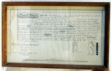
The Batman Deed is sometimes called the Batman Treaty, the Dutigullar Deed, the Dutigullar Treaty or the Melbourne Deed. The deeds had been drafted by JT Gellibrand, a leading lawyer in the colony. Batman's Treaty was a document signed on 6 June 1835 by John Batman, an Australian grazier, businessman and explorer, and a group of Wurundjeri elders, for the purchase of land around Port Phillip, near the present site of the city of Melbourne. The document came to be known as Batman's Treaty and is considered significant as it was the first and only documented time when Europeans negotiated their presence and occupation of Aboriginal lands directly with the traditional owners. The so-called treaty was implicitly declared void on 26 August 1835 by the Governor of New South Wales, Richard Bourke. The original Batman Deed is of enormous significance to the history of the European settlement of Victoria. Framed print of the Batman Deed, dated 1835. This is a printed copy of the Batman Deed, made in 1966 from the 'original' by the State Library of Victoria. The frame is wood. The document consists of handwritten text in black ink with eight signatures in the lower right hand side and three signatures in the lower left hand corner. It has been signed by John Batman beneath the eight signatures.document batman-deed melbourne -
 Ballan Shire Historical Society
Map - Map. Bungal, Department of Lands and Survey, Bungal, County of Grant, 09/09/1926
A map of Bungal in the 1920's showing the allotments, and the size, with the names of the residents. It shows the roads and the Western and Eastern Moorarbool River, and the Whipstick State Forest.Cream coloured map of Bungal in the County of Grant, bounded by the the East Moorarbool River on the East, and the State Forest on the South. It is marked with the scale of chains and the number L.358. Lithographed at the Department of Lands and Survey. Melbourne by W. J. Butson on 9.9.1926. It shows the land allotments with names of owners.Coloured pen marks and circled numbers on various areas. Price 2 shillings marked on bottom right hand edge.bungal, kerrit bareet, egerton, lal lal, borhoneyghurk, bungeeltap, ballark, yaloak, gorong, moorarbool west -
 Ballan Shire Historical Society
Map - Map. Ballark, Department of Lands and Survey, Ballark. County of Grant, 31/08/1915
A map of the Ballark area within the County of Grant showing roads, waterways, property boundaries and property owners in 1915.Significant to people researching land usage and ownership. Also those researching families in the area at that time.A map of Ballark in the County of Grant. Black printing on buff coloured paper. Extra notations by hand and various coloured highlighting of certain features. Details roads, rivers, property boundaries and names of property owners and districts. The map is easily readable although there is some physical damage to the borders and some sellotape residue. Shows a scale in Chains and the number L.6030Various numbers and directional arrows added to map.bungal, borhoneyghurk, bungeeltap, ballark, beremboke, moreep, meredith, morrisons, moorarbool river -
 Ballan Shire Historical Society
Map - Map. Kerrit Bareet, Department of Lands and Survey, Kerrit Bareet. County of Grant, 08/1944
A map of the Kerrit Bareet area within the County of Grant showing properties and names of owners in 1944.Significant to people researching land usage and ownership. Also those researching families in the area at that time.A map of Kerrit Bareet in the County of Grant. Black printing on buff coloured paper. Details roads, rivers, railways, property boundaries and names of property owners and towns and villages. The map is easily readable although there is some physical damage and that and the borders have been reinforced with sellotape. Shows a Scale in Chains and Price 2/.gordon, bungal, kerrit bareet, lal lal, moorarbool river, warrenheip, bungaree, wallace, moorarbool west -
 Ballan Shire Historical Society
Map - Map. Korweinguboora, Department of Lands and Survey, Korweinguboora. Counties of Talbot and Grant
A map of the Korweinguboora area showing roads, forests, railway lines and properties with the owners names.The inclusion of the names of landowners is of significance and value to historians.A map of the Korweinguboora area showing land subdivisions and names of owners and other physical features. There is a scale in chains. No date is certain but it could be 1902. The map has been repaired with sellotape.There are various pencil annotations but the are difficult to read.talbot, moorarbool west, wombat, bullarto, korweinguboora, moorarbool east, dean, wombat state forest, barkstead -
 Ringwood and District Historical Society
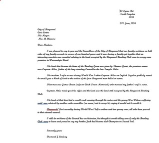
Letter, Cheevers, Margaret (Mayor), Letter from Margaret Cheevers to Desmond Lindsay referring to his work on the history of the site of the City of Ringwood Bowls Club - 2/08/1994, 2-Aug-94
Letter from Margaret Cheevers to Desmond Lindsay referring to his work on the history of the site of the City of Ringwood Bowls Club.Letter from Margaret Cheevers to Desmond Lindsay referring to his work on the history of the site of the City of Ringwood Bowls Club. One page,white paper, printed on Ringwood Council letter head. +Additional Keywords: Cheevers, Margaret (Mayor) / Lindsay, Desmond44 Lyons Rd. North Croydon 3134 27th. June, 1994 City of Ringwood Civic Centre The Mayor Mrs. B. Cheevers Dear Madam, I am pleased to say to you and the Councillors of the City of Ringwood that our family residence on both sides of my family exceeds in excess of one hundred years and it was during a family get together that an interesting anecdote was revealed relating to the land occupied by the Ringwood Bowling Club soon to occupy new premises in Warrandyte Road. The land that became the home of the Bowling Green was given by Thomas Grant, the previous owner was Captain Miles, father of the long standing Councillor the late Temple Miles. The incident I refer to was during World War 1 when Captain Miles an English Loyalist publicly stated he would give a block of land to the widow of the first Ringwood man killed in action. That man was James Brain (refer to Clock Tower Memorial) who married my father’s wife’s sister. Captain Miles made good his offer and the land was the land still occupied by the Ringwood Bowling Club. The land at that time had a small creek running through the centre and the young War Widow suffering grief was advised by another snide councillor (no name) not to accept it, saying it would not be worth it. Ringwoods’ first casualty during World War 1 left a widow and two young sons, all who have passed to their eternal reward. I still do not know if the Council has an historian, but thought it worth telling even if only the Bowling Club were to learn and proud to say my brother Jack had become club Champion on Sacred Soil. Sincerely yours Desmond J Lindsay -
 Ringwood and District Historical Society
Land Title, Land Department, Titles, Maps: George Thomas Wiggin. Near Cnr Whitehorse Rd and New St Ringwood. 1917-1953
7 photocopied pages of land area maps and titles showing names of owners from 1917 to 1953 - copied in 2004 +Additional Keywords: Wiggin, George Thomas -
 Bendigo Military Museum
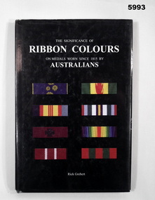
Book - BOOK, REFERENCE, Rick GREBERT/The Australian Army History Unit, "THE SIGNIFICANCE OF RIBBON COLOURS ON MEDALS WORN SINCE 1815 BY AUSTRALIAN", 2007
Peter Ball collection, refer Cat No 4704.Hardcover book with dust cover. Cover - cardboard with adhered paper cover. White print. Dust cover - paper with white print. On front and spine with black background. Illustrated in colour - front selection of 8 ribbons worn by Australians. Back - portrait of a soldier in uniform (Field Marshal Sir Thomas Blamey) 136 pages, cut, plain, white paper. Illustrated colour photographs of ribbons and medals. Handwritten - signature of author and owner's name.Handwritten - front end paper, owner's name "Peter C Ball". Title Page, signature of author "Rick Grebert".books, reference guide, history, military warfare -
 Bendigo Military Museum
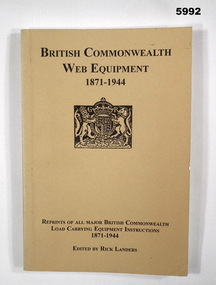
Book - BOOK, REFERENCE, Rick LANDERS, " BRITISH COMMONWEALTH WEB EQUIPMENT 1871-1944", 2005
Peter Ball collection, refer Cat No 4704.Soft cover book. Cover - cardboard, black print on front and spine, beige background, small illustration. British Coat of Arms. 192 pages, cut, plain, white paper. Illustrated black and white illustration, diagrams and photographs. Handwritten - signature of author and owner's name.Handwritten signatures - front end paper - owner "Peter C Ball". Title page - author - "Rick Landers".books, reference guide, history, military accoutrements, british -
 Warrnambool and District Historical Society Inc.
Document, Thomas Smith Probate 1880
... . This is a significant document as Thomas Smith was a prominent owner of land ...Tait collection: item 33 of 62 This probate document gives details of the will of Thomas Smith, a farmer in the Wangoom district who was a pioneer settler, having arrived in the area about 1848. He erected the Shamrock Hotel in Dennington in 1868 and it was opened for business in 1869 with David Duffy as the first licensee. Thomas Smith was the licensee in 1870 and members of his family (Cornelius, Robert and Mary Smith) held the licence of the hotel until 1880. A codicil to the will gave Mary Smith, Thomas’ daughter, the hotel land and building. This hotel closed in 2011. Thomas Smith signed the original will with a cross (his mark). Other names mentioned in the probate document are Frederick Wilkinson, Master-in-Equity, Ernest Chambers, Solicitor, John Drayton, Clerk to E. Chambers, William Ardlie, Senior, Solicitor, Thomas Goodall, Clerk to William Ardlie, Richard Sheldrick, Clerk to William Ardlie, Walter Davies, Stationer.This is a significant document as Thomas Smith was a prominent owner of land, especially in the Dennington area. The Shamrock Hotel in Dennington was built by Smith and still owned by him when he died in 1880. The will gives important details of the estate of Thomas Smith and adds to our knowledge of his life and work. Document – Probate, 1880/1907 - the Will and Codicil of Thomas Smith, Farmer of Dennington The will has six ruled paper pages of typewritten material. Each page has printed ruled red lines top, bottom and sides and all are tied with green corded string. There are handwritten corrections and signatures, including those of Ernest Chambers, Solicitor of Warrnambool and John Drayton, Clerk to E. Chambers.Thomas Smith Shamrock Hotel, Dennington Ernest Chambers, Solicitor thomas smith wangoom 1848, shamrock hotel dennington, warrnambool history, thomas smith 1880 -
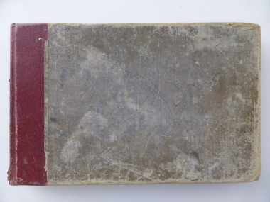 Warrnambool and District Historical Society Inc.
Book, To the Pound Keeper at Warrnambool, C1967
This book records the impounding of animals which have been found wandering on local roads or trespassing on land. Many are farm animals and give the various breeds of animals from red Ayrshire cows to bay ponies, and nanny goats. Impounded animals were either claimed by their owners after payment of a fee or if unclaimed , they were sold to defray the costs. It operated from Merrivale Drive.Black cloth covered card cover . Rectangular in shape. The pages are written in black and blue giving details of cattle and animals which have wandered from farms. It dates from 1967 to 1980.The top of each page reads: To the Poundkeeper at Warrnambool impounded by ............. of ............................... the following cattle.. . The pages are signed by J P O'Keefe at the front of the book followed by K Nixon, C Eales, P Eccles,warrnambool, warrnambool pound -
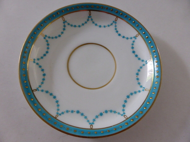 Warrnambool and District Historical Society Inc.
Plates, Rolfe Saucers x 6, 1864
These saucers are part of a crockery set that belonged to George Rolfe and his family. George Rolfe (1836-1919) was a tea merchant in Melbourne who bought land at the mouth of the Hopkins River in Warrnambool in the 1880s. He had adjoining land and the properties of ‘Shipley’ and ‘Fairy Hill’ and developed ‘Lyndoch’, adding stables, jetty, boat house, windmill and reservoir, chaff and bone sheds and an extensive garden. In 1891 he married Annie Lake and it was his stepdaughter, Florence Lake who built the ‘Lyndoch’ house still standing today. ‘Lyndoch’ today is now the site of an Aged Care Facility. This item is part of the Rolfe Dinnerset as described on Victorian Collections at VC001420 and VC001422.These saucers, part of a crockery set, are kept because they belonged to George Rolfe, a prominent property owner and farmer in Warrnambool in the late 19th century and early 20th century. The items, dating from 1864, have social significance showing the type of crockery used by a more affluent family in the 19th century. These are six circular china saucers with a gold rim and ornamentation in a scallop design in gold and teal around the rim and the outer edges. The base of the saucers has a gold rim. One of the saucers has a chip on the edge and four show significant wearing of the inner gold circle. Some of the outside gold edging also shows wear. The maker’s marks and name are indented on the bottom of the saucers ‘Minton’ lyndoch, warrnambool, rolfe and co., george rolfe, history of warrnambool, florence lake -
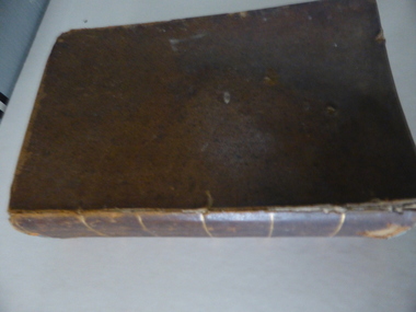 Warrnambool and District Historical Society Inc.
Book, A Complete Epitome of Practical Navigation - J W Norie, 1848
This book is a 19th Century treatise on aids to navigation. It belonged to John Cowtan who held land near the Cassady's Bridge area in Caramut Road today (he was related to the Cassady family) and who is mainly important in the history of Port Fairy. Captain John Cowtan was a ship's master for John Griffiths and a Launceston entrepreneur and ship owner between 1839 and 1844. In 1847 he went into partnership with John Bland, establishing a merchant's business with riverside buildings at the Port Fairy wharf. He left Port Fairy in the 1860s. The date of John Cowtan's signature in this book is 1849 (certainly a very early one in our history) and inside the front cover he has written notes about the local weather, mainly as it affected sailing conditions in late 1849 and early 1850. These notes are of great historical interestThis book is of great interest because it belonged to a Port Fairy historical figure and because of the hand written weather notes inside the front cover. This is a hard covered,leather bound book of 680 pages. It contains printed text, illustrations, tables, maps and sketches.One page is torn Some pages are stained. . J Cowtan 1849john cowtan, port fairy -
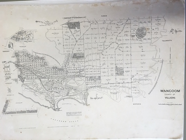 Warrnambool and District Historical Society Inc.
Document: Map, Map Wangoom County of Villiers, 1955
This map contains the names, acreage details and dates of the original property owners of the Parish of Wangoom (County of Villiers), excluding the township of Warrnambool. It also has details of the Crown Lands adjoining the Merri and Hopkins Rivers. This is a most important map as it has details on the original property owners. It is a most valuable research tool and is one of our most-used maps.This is a map, printed in black and white and mounted on cardboard. Where there was intensive land ownership the details have been reproduced in larger print on the margins of the map. There are scuff and dirt marks on the map but it is otherwise in good condition.‘Wangoom, County of Villiers’wangoom, warrnambool, county of villiers -
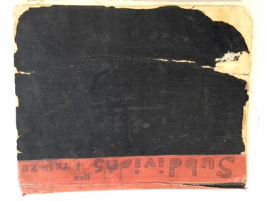 Warrnambool and District Historical Society Inc.
Book, Subdivision No 1 to 1420, 1930s
This is an exercise book listing subdivisions in Warrnambool from 1935 to 1977. There are 1420 entries. It gives details of the subdivisions – plan number, street, section number, allotment number, date, owner, solicitor and Titles Office number. The book is completely filled and today this information would be held in the Warrnambool City Council offices per electronic data storage. Warrnambool, founded in 1847, became a Municipality in 1856, a Borough in 1863, a Town in 1883 and a City in 1918. Subdivisions of land in the city continue to be made regularly for housing and business purposes.This book is of great historic interest because it details the subdivisions in the City of Warrnambool from 1935 to 1977. It shows the continuing growth of the city, particularly after World War Two. It will be a very useful resource for researchers. This is an exercise book with a black cardboard cover and red binding. It contains a list of City of Warrnambool subdivisions from 1935 to 1977. The cover and some of the pages are torn and ragged and the binding has come apart and has been glued together in places. The pages are ruled with blue and red lines. The pages contain handwritten material in black and blue ink. Front Cover: ‘Subdivions(sic), Nos 1 to 1420’ Inside Front Cover: ‘City of Warrnambool Subdivisions’ warrnambool city council, warrnambool subdivisions -
 Warrnambool and District Historical Society Inc.
Title Search Document, 1930s to 1960s
These documents concern the property in South Warrnambool, Jetty Allotment 7, Section 4. They include a search made of the title of this property in 1937 and information on later purchasers of the property. The first owner of this property was James Cust who purchased it in April 1853. James Cust (1815-1860) came from Ireland to Australia in 1841. From 1847 on he farmed first at Woodford and then moved into Warrnambool and began land speculating.. In 1856 his property was valued at £20,000 but by 1858 he was declared insolvent following the insolvency of his financial backer, William Bateman and his properties were sold. He died in 1860 following an accident at a Ballarat gold mine. Other notable Warrnambool identities who owned this property on Pertobe Road included Thomas King, Christopher Beattie, Thomas Goodall, William McMahon and Alan Lane.These documents are of interest as they detail the history of a property in Warrnambool up to the 1960s. They are also an example of the type of property once owned by James Cust, an important early land speculator in Warrnambool. These are nine loose sheets of paper concerning a legal search made of a block of land in Warrnambool and later documents on the same property The papers contain handwriting in blue and black ink and pencil and one red stamp. One of the pages is an invoice for the charge made for the search.‘Searched 25/5/37 W.D. Richardson Titles Searcher 418 Little Collins Street Melbourne C1’james cust,, history of warrnambool -
Warrnambool and District Historical Society Inc.
Correspondence (Rose Park), 1940s
These are four letters and a document regarding the proposal in the 1940s by the Victorian Department of Lands and Survey to acquire sections of the property, Rose Park, to establish several Soldier Settlement farms. Rose Park, near Willatook, was owned by Stan Baulch (1897-1980), the son of Samuel and Eliza Baulch. Samuel Baulch had acquired the property of Dunmore, between Macarthur and Hawkesdale, in 1893 and Stan had inherited portion of this property after his father’s death. He named his portion Rose Park. The Soldier Settlement Commission wanted to acquire 1500 acres of Rose Park but Stan Baulch argued successfully that the management of his farm could not withstand the loss of so much land and eventually 300 acres of Rose Park land was sold for closer settlement. Stan Baulch was a prominent member of the Warrnambool and District Historical Society for many years and contributed many articles and booklets on local historical matters. This correspondence is of interest as an example of the establishment of Soldier Settlement farms in Victoria post World War Two and the difficulties faced by some property owners opposed to the acquisition of their land. These items will be useful for research. .1 A six-page letter written in pencil .2 A two page letter in black typing ( contents as in .1 above) .3 A one page letter, typed, with a handwritten signature .4 A sheet of paper containing a statement re purchase of land with some inserted handwritten material .5 A two page letter with handwritten material baulch family, western district, victoria, history of warrnambool -
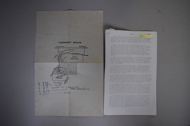 Warrnambool and District Historical Society Inc.
Map and Article, Dunmore, 1 1954 .2 1970
... farming land today under various owners. baulch family western ...Both these items deal with the property of Dunmore, in the Macarthur/Hawkesdale/ Woolsthorpe area of Western Victoria. The first item is a sheet of paper with a map and details of the sale of portion of Dunmore in 1954. This is an original document. The second item is a history written by Stan Baulch of the property Dunmore from its establishment up to 1970. Dunmore was first established by Charles Hamilton MacKnight and two partners in 1842 and it was purchased by Samuel Baulch in 1893. After Samuel Baulch’s death the property was bequeathed to his three sons. One son, Stanley Baulch (1897-1980) took over the eastern portion which he named Rose Park. Stan Baulch was a member of the Warrnambool and District Historical Society and wrote several articles on aspects of his life and work, including this valuable article on the history of Dunmore. These items are of significance as they concern the estate of Dunmore in Western Victoria, an early and important property which is still farming land today under various owners. .1 This is a sheet of paper containing a map of the Dunmore property on one side and details of the sale of portion of Dunmore on the other side. The map has been annotated in handwritten black ink. The page has been folded twice. .2 This is an article typed on 12 foolscap pages. The typing is somewhat faint in places. ‘Dunmore’ Estate Dunmore baulch family, western district, victoria, dunmore estate, macarthur/hawkesdale, history of warrnambool -
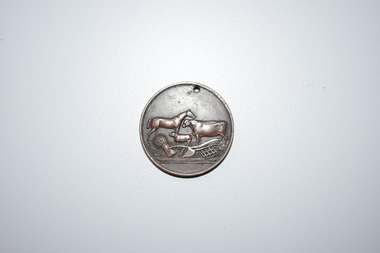 Warrnambool and District Historical Society Inc.
Medal, Stokes and Martin, Rutledge Brothers, 1877
This medal was made by Stokes and Martin. Thomas Stokes established a medal-making business in Melbourne in 1856 and from 1867 to 1893 he had a partner, George Frederick Martin. In 1962 the Stokes business became a public company and operates today in Melbourne. The medal was awarded at the Annual Show of the Villiers and Heytesbury Agricultural Association in 1877. One of the earliest agricultural associations in Victoria, the V.& H.A.A., the forerunner of the Warrnambool Agricultural Society, was established in 1854 and the first Warrnambool Show was held in 1855 at the first Royal Archer Hotel in Koroit Street. The Warrnambool Agricultural Show is still held annually. The medal, first prize for the best horse hay rake, was awarded in 1877 to the brothers, Thomas and William Rutledge, sons of Eliza and William Rutledge. The latter was a pioneer settler who came to the Warrnambool/Port Fairy district as the purchaser of the Special Survey, Farnham Park in 1841. His land stretched from Tower Hill to Dennington. William Rutledge Senior was a pioneer breeder of a Lincoln sheep stud, the owner of a mercantile business in Port Fairy, a member of the Legislative Council of Victoria and the pioneer developer of farming land around Tower Hill. His son Thomas (1846-1918) was a Warrnambool Shire Councillor who farmed in the Farnham Survey, living at Werronggurt . He went to the Geelong area at the end of the 19th century. His brother William (1849-1935) also farmed in the Farnham Survey, living at Farnham Park, He later lived at Airlie in Henna Street, Warrnambool and Sherwood on the Hopkins River and had land in the Otway Ranges. He later went to New Zealand.This medal is of considerable significance because of its age and its association with Thomas and William Rutledge and with the Villiers and Heytesbury Agricultural Association.This is a bronze medal with an image of agricultural implements, agricultural produce and farm animals on one side and etched printing on the other side. There is also printing around the edge of the medal. The medal has a small hole at the top for attaching the medal to a cord. Villiers & Heytesbury Agricultural Association 1st Prize awarded to Rutledge Bro. for Horse Hay Rake Annual Show Warrnambool 10 Oct. 1877 Stokes & Martin Melbourne thomas and william rutledge, farnham special survey, villiers and heytesbury agricultural association, warrnambool agricultural society, history of warrnambool -
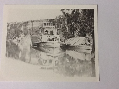 Port of Echuca
Black and white photograph, Approx.1980
... , S. A. 1876. Owner: A. L. Land seer. Information from.... Built at Goolwa, S.A., 1865!. Owner: Chas Oliver. Lengthened ...Details of P. S. Queen: construction: composite 16 h.p. Registered tonnage: gross 128, net 92. Dimensions:L.103.3 ft B.18.5ft. D 5.7ft. Port and date of registry:Adelaide, 1880, no.43, 154. Built at Goolwa, S.A., 1865!. Owner: Chas Oliver. Lengthened in 1872. Details of barge Bourke. Construction:wood. Tonnage: 124. Dimensions:L 108.5 ft X B 20.5 ft X D 8.0 ft. Port and date of registry:Adelaide, 1898, no. 74, 771. built at: Miland, S. A. 1876. Owner: A. L. Land seer. Information from "The register of Australian & N. Z. Shipping 1898. This photograph has historical and social significance being typical of transport on the rivers systems of Australia in the late 1800s. Paddlesteamers carried supples to settlers and then carried their produce such as Wool and other produce down the rivers to markets or to be transferred by rail to the major ports such as Melbourne or Adelaide. Black and white photograph of P. S. Queen with the barge Bourke rigged to its side. Photographed in a gorge where boats appear to be moored. Photograph taken from the bow of the Queen with 3 people visible on the port side of the boat and there appear to be sacks stacked on the front of the boat. The barge Bourke has a tent structured tarp over it. Copy of an original photograph (date unknown)Inscription in pencil on reverse:Queen. On the photograph can be seen "Queen" on the bow and partically on the wheelhouse. The barge has "Bourke" visible on its bow.p. s. queen, bourke barge, paddle steamers -
 Eltham District Historical Society Inc
Film - Video (DVD), Nillumbik Shire Council, Edendale Farm Community Environment Centre: History, c.2009
EDENDALE FARM Edendale Farm is Nillumbik Shire Council's environment centre situated in Gastons Road, Eltham between the railway and the Diamond Creek. The homestead on the property was built in 1896 and is of historical significance, being the subject of a Heritage Overlay under the Nillumbik Planning Scheme. The Edendale property was originally part of an extensive land purchase in 1852 from the Crown by pioneer Eltham farmer Henry Stooke. He initially purchased 51 acres and later expanded his holdings by purchasing another three adjacent Crown allotments extending northerly from Josiah Holloway's Little Eltham subdivision. Despite clearing the land, Stooke did not build on this property, choosing to live on his property "Rosehill" at Lower Plenty. In 1896 Thomas Cool, Club Manager of the Victoria Coffee Palace in Melbourne purchased 7 acres of the original Stooke land and built the house now known as Edendale. Cool did not farm the land, instead using it as a gentleman’s residence, retiring to Eltham at weekends. In 1918 he purchased an additional 7 acres but in 1919 he sold the property. Later owners included J.W. Cox, the Gaston family and D. Mummery. In the 1980s the Eltham Shire Council purchased the site for use as a Council depot, but this use did not proceed. Subsequently, it was used as the Council pound. The Edendale Farm Pet Education and Retention Centre was established in the summer of 1988/1989 and was set up to replace the existing dog kennels with a high standard pet retention centre. The design style of the building was established to compliment the features of the existing house. It was equipped with 10 retention pens, a veterinary room and a pet education area where school children and other interested parties learnt about pet care procedures. It was later developed into a community farm and was run by an advisory committee and in 2000 it became an Environment Centre. In early 2006 an advisory committee was established for the development of a master plan for future development at Edendale Farm. The committee included Russell Yeoman, a former long-time shire planner and founding member of the Eltham District Historical Society. At the time of filming the Master Plan and future for Edendale was about continuing to develop Edendale as a centre of environment learning and looking at expanding displays and school program, running a lot more of life-long learning and workshops around sustainable living.edendale community farm, eltham, gastons homestead, gastons road, shire of nillumbik, video recording -
 Eltham District Historical Society Inc
Document - News Clipping, Jodie Guest, Residents have their say on former shire offices, Diamond Valley News, October 16, p9, 1996
... family, one of the early settlers of the area and owner..., one of the early settlers of the area and owner of the land ...Nillumbik Commissioners used 'reserve power's to permit a controversial Shell service station and Hungry Jackls restaurant development at the former Eltham Shire Office site at 895 Main Road. More than 200 people attended the Council meeting in the public gallery and protested at the decision. 32 personal submissions were made to Council's Planning Special Committee meeting whose members vioted 3-2 against the development. The Committee consisted of the three Nillumbik Commissioners and three community members (Jim Connor, Bronwyn South and Janet Mattiske). Chief Commissioner Don Cordell, a former Shell employee excused himself from voting and the three communbity memebrs voted against the submission. The other two commissioners, Vin Heffernan and Kevin Abbott voted against it. They then immediately closed the meeting and opened a Council meeting lasting just seconds to use special reserve powers to overturn the decision. Community residents who made submissions included Russell Yeomans speaking on behalf of the Eltham Gateway Action Group and Eltham District Historical Society, Des Ryan on belaf of Eltham Senior Citizens, Angela Newhouse, others on behalf of Our Lady Help of Christians Primary School and Judge Book Village, Tom Munro, Ian Jennings, Margartet Ball a fifth generation descendant of the Shillinglaw family, one of the early settlers of the area and owner of the land that was sold to Council, Frank Burgoyne who said "there will be a lot of creaking and rumbling in the cemetery if this goes through. So many old people who have done so much for Eltham are buried up there and it is up to us to pass on what they left to the younger generation. Eltham is a beautiful spot; why louse it up?" A second article "Anger over reserve power" by Laeta Antonysen provides commentary from the three Planning Special Committee community members, former Eltham Shire Councillor Jim Connor, Bronwyn South and Janet Mattiske about the process that took place and the first time use of the spoecial reserve power to overturn the decision of the committee. Barry Rochford, Nillumbiuk CEO defends the use of the power.The demolition of the former Shire of Eltham offices and proposed sale and development driven by the Commissioners for Nillumbik Shire Council brought the community together in substantial protest at the infrigement of ratepayers democratic say in local government and ciommunity assets combined with protests about inappropraite development of Eltham's Gateway. This issue led to the formation of the Eltham Community Action Group which still operates strongly today (2023) on behalf of the community to ensure appropriate development within the community.895 main road, commissioners, dallas price homes, development application, eltham hub, hungry jacks, nillumbik shire council, re-zoning, shell service station, town planning, eltham gateway, eltham gateway action group, eltham shire offices, shillinglaw farm, shillinglaw trees, jim connor collection, dallas howgate, nillumbik planning special committee, jim connor, bronwyn south, janet mattiske, don cordell, vin heffernan, kevin abbott, russell yeomans, eltham district historical society, eltham senior citizens, des ryan, our lady help of christians primary school, judge book village, angela newhouse, tom munro, ian jennings, margaret ball, shillinglaw cottage, frank burgoyne, andrew biasci, barry rochford -
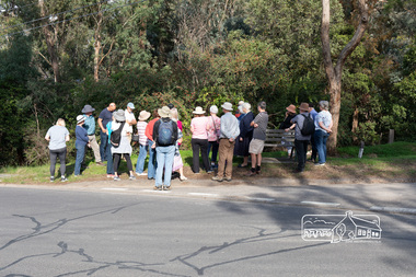 Eltham District Historical Society Inc
Photograph, Peter Pidgeon, Heritage Excursion: Mud Brick Meander, 6 March 2021
Corner of Diamond Street and Peter Street, Eltham. Walkers gather for the beginning of the walk led by local historian Russell Yeoman. The tree-covered hill that forms the western backdrop to the Eltham town centre exhibits many characteristics that are considered to contribute to the special character of Eltham. They include unmade streets, steeply sloping land, extensive tree cover and a large number of mud brick and pise (rammed earth) houses. A number of these were constructed in the 1940s and 50s by well-known builders John Harcourt and Alistair Knox. A significant proportion from this period were constructed by owner-builders. We walked around the upper part of the hill in the area of Kerrie Crescent and Peter Street. We visited several interesting houses (for external viewing only). The walk commenced at 2pm at the corner of Diamond Street and Peter Street (Melway ref 21H4) and was about 2 km. This free walk was open to the general public as well as Society members. Whilst COVID restrictions did not require the wearing of masks in the open, masks had to be carried and all attendees registered with name and contact number or via QR registration.Born Digital (8 images)covid-19, eltham, eltham district historical society, heritage excursion, mudbrick, peter street, diamond street, russell yeoman -
 Eltham District Historical Society Inc
Photograph - Digital Photograph, Jim Connor, Edendale Farm Homestead, 11 December 2014
Edendale Farm is Nillumbik Shire Council's environment centre situated in Gastons Road, Eltham between the railway and the Diamond Creek. The homestead on the property was built in 1896 and is of historical significance, being the subject of a Heritage Overlay under the Nillumbik Planning Scheme. The Edendale property was originally part of an extensive land purchase in 1852 from the Crown by pioneer Eltham farmer Henry Stooke. He initially purchased 51 acres and later expanded his holdings by purchasing another three adjacent Crown allotments extending northerly from Josiah Holloway's Little Eltham subdivision. Despite clearing the land, Stooke did not build on this property, choosing to live on his property "Rosehill" at Lower Plenty. In 1896 Thomas Cool, Club Manager of the Victoria Coffee Palace in Melbourne purchased 7 acres of the original Stooke land and built the house now known as Edendale. Cool did not farm the land, instead using it as a gentleman’s residence, retiring to Eltham at weekends. In 1918 he purchased an additional 7 acres but in 1919 he sold the property. Later owners included J.W. Cox, the Gaston family and D. Mummery. In the 1980s the Eltham Shire Council purchased the site for use as a Council depot, but this use did not proceed. Subsequently, it was used as the Council pound. The Edendale Farm Pet Education and Retention Centre was established in the summer of 1988/1989 and was set up to replace the existing dog kennels with a high standard pet retention centre. The design style of the building was established to compliment the features of the existing house. It was equipped with 10 retention pens, a veterinary room and a pet education area where school children and other interested parties learnt about pet care procedures. It was later developed into a community farm and was run by an advisory committee and in 2000 it became an Environment Centre. In early 2006 an advisory committee was established for the development of a master plan for future development at Edendale Farm. The committee included Russell Yeoman, a former long-time shire planner and founding member of the Eltham District Historical Society. At the time of filming the Master Plan and future for Edendale was about continuing to develop Edendale as a centre of environment learning and looking at expanding displays and school program, running a lot more of life-long learning and workshops around sustainable living.jim connor collection, edendale community farm, edendale farm, eltham, gastons road -
 Eltham District Historical Society Inc
Postcard - Photograph postcard, Old Bridge, Kaylock's Crossing, Brougham Street, Eltham, c.1912
... the owner of the adjoining land. It was most likely built from... the owner of the adjoining land. It was most likely built from ...Date estimated to be circa 1912 based on the style of printing on the reverse of the card - Kodak Austral paper for real photo postcards, the paper was manufactured c.1908-1914 (See also POSTCARDS ON KODAK PAPER - IS IT POSSIBLE TO "DATE" THEM? http://tps.org.au/bb/viewtopic.php?t=115) Brougham Street was created in Josiah Holloway's 1851 subdivision of Little Eltham. It was one of several east-west streets shown on the subdivision plan as crossing the Diamond Creek. The western part was named Wellington Street on the subdivision plan but was later changed to conform with the name of the eastern part as acknowledgement of the continuity of the street. It is not known when the first bridge was constructed in Brougham Street however it was certainly mentioned at Council’s meeting of 2 June 1884 as being in a dangerous state of repair. This photo (c.1895) of an old bridge shows a very low-level simple log girder bridge crossing the creek at a right angle and so the approaches involved bends in the road alignment. This bridge was generally known as Kaylocks Bridge or Kaylock’s Crossing after the owner of the adjoining land. It was most likely built from around the mid-1850s, or a crossing of some fashion established as Richard George Kaylock, butcher of Little Eltham and his wife Emily Ann settled there in 1854. His property was in Wellington Street (now Brougham Street) and apparently extended across the Diamond Creek. The land on the western side of the creek was farmed, the house being on the eastern side. Kaylock's Bridge formed part of the original coach road to Eltham and in 1922 was described as an "old rustic bridge". Its low level and insubstantial construction made it susceptible to flood damage, necessitating frequent closures until repairs could be carried out. In September 1922, Council called for tenders for a new timber bridge to be constructed at Kaylock’s crossing. An engineering assessment carried out for the Council by Macleod Consulting at the time of the replacement suggested that the construction details indicate that it was in the 1900s, however this dating could possibly have been the result of numerous repairs undertaken over the years to flood damage. The tender was awarded to Mr Weller of Kangaroo Ground who commenced work in February 1923 on a higher-level timber trestle bridge. Work was slowed due to illness of the contractor and the accidental death of a man in March 1923 following the collapse of the bank after he had jumped into a hole that had just been blasted. The bridge was completed around July 1923 at which point the old structure was pulled up, marking what was described in the ‘Advertiser’ newspaper as the passing of an old and well-loved landmark in the district. In April 1924 the approach to Kaylocks bridge was washed away during the heavy flooding that destroyed the Main Road bridge. The western side was repaired, and an extra span was added to the eastern side using timber from the destroyed Main Road bridge. The bridge was again severely damaged four months later in August 1924 When a lack of finances delayed repairs to the Bridge Street bridge in 1931 (also referred to as Obelisk Bridge at the time), traffic had to detour via Brougham Street for some time. Local residents feared that the Bridge Street bridge might never reopen. Kaylocks Bridge was constantly subject to damage by floods. In the 1934 flood it was submerged by two feet of water. In more recent times the bridge was again severely damaged by flooding and repairs made. A new bridge and adjoining footbridge were constructed in 2009.Digital file only Postcards scanned from the collection of Michael Aitken on loan to EDHS, 2 Sep. 2022michael aitken collection, eltham, postcards, bridge, brougham street, diamond creek (creek), kaylocks bridge, wellington street -
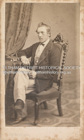 Eltham District Historical Society Inc
Photograph, Louis Buvelot, Possibly Phillip Shillinglaw, 1865
Famous Swiss landcape painter Louis Buvelot came to Melbourne in 1864 and set up a portrait photography studio which he operated for one year only in 1865. This photograph is believed to be the oldest photo in the Shillinglaw Family Album collection. It is believed that the subject is a young Phillip Shillinglaw, without beard, at age 22 or 23. Phillip Shillinglaw was born Melbourne, August 7, 1842. He married Sarah Ann Kidd in Heidelberg, Victoria, February 28, 1872. In 1881 Phillip and Sarah and their small family moved to Eltham and made home in what was later to become known as Shillinglaw Cottage but which Phillip named 'Wattle Brae'. Shillinglaw Cottage is significant to Eltham’s local history. It is one of the earliest known buildings still in existence. Records suggest that the cottage was built circa 1859 by a man named Cochrane, believed to be Thomas Cochrane, in conjunction with George Stebbings though it is not known what Stebbings’s contribution was. It is believed Stebbings owned the cottage between 1874 and 1888. According to Margaret Ball’s (2017) book Shillinglaw Family of Eltham 1660-2007, Thomas Cochrane and family lived there from 1867 to 1874 however this is contrary to the records of assessable rates levied by the Eltham District Road Board, established in 1858, which shows Cochrane was the owner occupier (in Little Eltham) of approximately 25 acres of cultivated land and 25 acres of pastureland upon which a hut was sited in 1860. It is suspected that George Stebbings may have acquired the property from Cochrane in 1874 as it is noted that he had a tenant for a period, James Rossiter, who was the editor for the Evelyn Observer in Kangaroo Ground in 1874 (LATE SHIRE OFFICE AT KANGAROO GROUND (1934, February 16). Advertiser (Hurstbridge, Vic. : 1922 - 1939), p. 5. Retrieved February 25, 2022, from http://nla.gov.au/nla.news-article56743657). In 1881 Phillip Shillinglaw became the ratepayer for the cottage though Stebbings retained ownership until 1888 at which time it was transferred to Shillinglaw. Photographer: Louis Buvelot Swiss landscape painter and portrait photographer, settled in Melbourne in 1864, admired by the artists from the Heidelberg area such as Tom Roberts and Arthur Streeton who bestowed him with the accolade of 'Father of Australian painting’. In the 1870s, his work increasingly drew elements from Australian landscape such as the bush land in works like Lilydale (1878) and Bush Track. "Louis Buvelot :: biography at :: at Design and Art Australia Online." Daao https://www.daao.org.au/bio/louis-buvelot/biography/. Accessed 9 Mar. 2023. On arriving in Melbourne in February 1865 Buvelot bought a photographer's studio at 92 Bourke Street East and took portraits for a year. In 1866 he moved to 88 La Trobe Street East and resumed his painting while Caroline-Julie gave French lessons to help Buvelot to establish himself as an artist in Melbourne. "Biography - Abram-Louis Buvelot." Australian Dictionary of Biography https://adb.anu.edu.au/biography/buvelot-abramlouis-3132. Accessed 2 Dec. 2022. CARTE-DE-VISITE (cdv) 1857-1890 Cartes-de-visite (cdv's) are the most common form of photograph from the nineteenth century, generally measuring two and a half inches by four and an eighth inches (6.3 x 10.5 cm) when mounted, sepia toned, mounted on a card which was generally printed with the photographer's name and address on the back or beneath the portrait. - Frost, Lenore; Dating Family Photos 1850-1920; Valiant Press Pty. Ltd., Berwick, Victoria 1991marg ball collection, shillinglaw family photo album 1, 1865, l. buvelot photographer, louis buvelot, phillip shillinglaw (1842-1914), unknown