Showing 759 items
matching stanley street
-
 The Beechworth Burke Museum
Audio - Oral History, Jennifer Williams, Mrs Vanessa McDonald, 9 November 2000
Mrs. Vanessa McDonald was born in Beechworth in 1917. Christened, Agnes Bertha Collins, Vanessa changed her name in 1960. Mrs. McDonald's family's connection with gold mining in the district reach back to the first of Beechworth's gold rushes, when her great grandfather, a Dutchman who adopted the name Charles Collins, arrived in 1851-1852. Mrs. McDonald spent her childhood in the isolated hamlet of Stanley, in the area known as 'Little Scotland', where she recalls helping her mother to raise younger siblings, picking apples and walnuts on the family farm, and roaming the hills for wildflowers. As a young woman Mrs. McDonald attended religious and social gatherings in the local community. In 1940 she went to Melbourne to work as a mothercraft nurse during the Second World War. She met her husband at a Beechworth football match and was married at the Stanley Methodist Church in 1941. The gold diggings known as the 'Nine Mile' became the hamlet of Stanley, after the British Prime Minister, Lord Stanley, in 1858. By the late 1850s, Stanley boasted schools, an athenaeum, a church, a weekly newspaper and several hotels and other civic infrastructure to cater for a growing population. The area attracted large numbers of Chinese miners, whose presence was frequently resisted. Like other early Victorian mining settlements, Stanley was a hotbed of political and racial tensions during the gold rush. One side of the Nine Mile Creek was known as 'Little Scotland’, the other, 'Little Ireland'. A number of Christian denominations built congregations and churches in Stanley, including the Church of England, Methodist Church, the Catholic Church, and Presbyterian Church. Stanley became part of the United Shire of Beechworth in 1871. By 1880 timber was being cut and two sawmills were established by 1887. River-dredged gold mining consumed vast amounts of timber from the forests in the area, and in 1931 the first of several softwood plantations began. This oral history recording was part of a project conducted by Jennifer Williams in the year 2000 to capture the everyday life and struggles in Beechworth during the twentieth century. This project involved recording seventy oral histories on cassette tapes of local Beechworth residents which were then published in a book titled: 'Listen to what they say: voices of twentieth century Beechworth'. These cassette tapes were digitised in July 2021 with funds made available by the Friends of the Burke.Following the decline in the mining and associated industries during the early-mid-twentieth century, the Beechworth district experienced a period of general economic decline. On the east side of the Dingle Range, Mrs. McDonald's father, William Henry Collins, felled timber and the family were pioneer apple orchardists. The establishment of apple orchards in Stanley reflects changes to how land was used and contributes to our understanding of the historical development of rural communities following the gold rush. Mrs. McDonald's recollections are significant for understanding family and social life in a small rural town in years leading up to the Great Depression and prior to the Second World War. This oral history recording may be compared with other oral histories and items in the Burke Museum's collection. This oral history account is socially and historically significant as it is a part of a broader collection of interviews conducted by Jennifer Williams which were published in the book 'Listen to what they say: voices of twentieth-century Beechworth.' While the township of Beechworth is known for its history as a gold rush town, these accounts provide a unique insight into the day-to-day life of the town's residents during the 20th century, many of which will have now been lost if they had not been preserved.This is a digital copy of a recording that was originally captured on a cassette tape. The cassette tape is black with a horizontal white strip and is currently stored in a clear flat plastic rectangular container. It holds up 40 minutes of recordings on each side.Mrs Vanessa McDonald /listen to what they say, beechworth, oral history, burke museum, emigration, gold rush immigration, victorian gold rush, mining families, apple orchard, forestry, forest plantation, little scotland, stanley, twentieth century history, regional australia, rural australia, farming, harvest festival, great depression, dingle range, the nine mile, australian wildflowers, high country wildflowers, mothercraft nurse, rural and regional women, social history, collins, mrs. vanessa mcdonald, building community life, shaping cultural and creative life, fruit growers, family history, changes to land use in regional victoria -
 The Beechworth Burke Museum
Photograph - Photograph - Reproduction, c1994
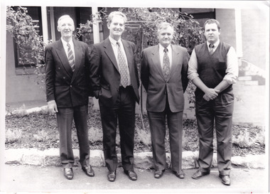
This photograph was taken in 1994 and depicts four Commissioners of the newly formed Shire of Indigo. The Commissioners were appointed on 18 November 1994 and served until the the election of Indigo Shire Councillor's on 15 March, 1997. The United Shire of Beechworth was established in 1871 following the merger of two entities: the Borough of Beechworth, established in 1856, and the Shire of Beechworth, which was created as the union of the Stanley and Wooragee Road Districts in 1865. This photograph is historically significant for its depiction of newly elected Indigo Shire Commissioners, who replaced the former United of Beechworth Shire Council. The only local government entity remaining in Victoria styled as a 'United Shire' at its dissolution in November 1994, the amalgamation of the United Shire of Beechworth, along with parts of the Shires of Chiltern, Rutherglen and Yackandandah into the Shire of Indigo, was part of an extensive restructuring of Victoria's Local Government Areas in the 1990s. The Victorian Governments restructuring of LGA's in the 1990s constituted a major transition in Victoria's systems of local governance. The reforms dissolved over two hundred councils and sacked sixteen hundred elected councillors. The Shire of Indigo was one of seventy-eight new councils that were subsequently created through amalgamations.Black and white rectangular photograph printed on photographic paper mounted on board.Reverse (original): Transcribed to DB / From left to right: Commissioner Kevin Gleeson ~ / Chairman of Commissioners, Mr Frank Burfitt ~ / Chief Executive Officer, Commissioner Kevin Crow, ~ / Commissioner Henry Brewer. / Commissioners were appointed to the Indigo Shire / on 18th November, 1994 and served until the / election of councillors on 15th March, 1997. / indigo shire council, shire councillors, indigo shire commissioners, governance, local government, beechworth, local representatives 1994-1997, lga restructuring, indigo shire amalgamation, victorian government, regional and rural governance, beechworth shire, yackandandah shire, chiltern shire, rutherglen shire -
 The Beechworth Burke Museum
Photograph - Lantern Slide, c1900
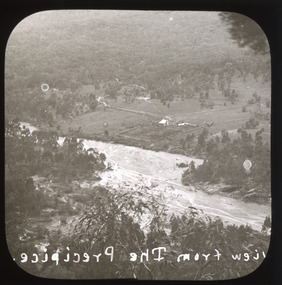
This image shows a semi-aerial view of a property along a river adjacent to Beechworth in approximately 1900. The photographer has capitalised words in the label, indicating that 'The Precipice' may have suggested a particular rather than a general vantage point to local people at the time. Although the exact location of the photograph is yet to be determined, Beechworth Gorge is popular today with hikers and nearby Mt Stanley is noted for its views. Lantern slides, sometimes called 'magic lantern' slides, are glass plates on which an image has been secured for the purpose of projection. Glass slides were etched or hand-painted for this purpose from the Eighteenth Century but the process became more popular and accessible to the public with the development of photographic-emulsion slides used with a 'Magic Lantern' device in the mid-Nineteenth Century. Photographic lantern slides comprise a double-negative emulsion layer (forming a positive image) between thin glass plates that are bound together. A number of processes existed to form and bind the emulsion layer to the base plate, including the albumen, wet plate collodion, gelatine dry plate and woodburytype techniques. Lantern slides and magic lantern technologies are seen as foundational precursors to the development of modern photography and film-making techniques.This glass slide is significant because it provides insight into Beechworth's built environment and natural landscape in the early Twentieth Century, around the time of Australia's Federation. It is also an example of an early photographic and film-making technology in use in regional Victoria in the time period.Thin translucent sheet of glass with a square image printed on the front and framed in a black backing. It is held together by metals strips to secure the edges of the slide.Obverse: Image from The Precipice. /burke museum, beechworth, lantern slide, slide, glass slide, plate, burke museum collection, photograph, monochrome, views, landscapes, farmsteads, rivers, beechworth gorge, mt stanley, emulsion, the precipice -
 Orbost & District Historical Society
photograph, H.M.S. Rattlesnake, leaving Port Essington 1846-1849 BY STANLEY, OWEN
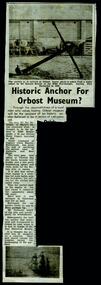
"The marine Hydrographers of the British Admiralty wanted desperately to chart a safe passage through the Great Barrier Reef and the gap between the northern tip of Australia and Papua New Guinea, which would open up the new colony to the East Indies trade. They commissioned the Rattlesnake, a 28 gun frigate of the Royal Navy, whose captain was a keen amateur artist and whose name, Owen Stanley, was given to the mountain ranges of PNG. After the passage out, Stanley brought aboard Oswald Brierly, later to be the marine painter to Queen Victoria, and together these men made two voyages through the Great Barrier Reef, painting and sketching all the while. They produced a visual record of 19th century contact between Europeans and the indigenous people of Northern Australia and New Guinea in an album which contains the original of this copy. It is held in the Mitchell Library in Sydney." (ref. State Library New South Wales) Sir Oswald Brierly, a young marine artist, arrived in Sydney in 1842 on the yacht Wanderer. Settling at the whaling station of Boyd Town in Twofold Bay, he painted extensively and left a vivid account of the whaling life during the five years he spent there. However it was the open sea and adventure that lead Brierly to accept a position on the HMS Rattlesnake as shipboard artist. This item is associated with the anchor of the The Rattlesnake. This anchor is in the main street of Orbost in front of what was once the museum.This is a copy of a picture of the H.M.S. Rattlesnake at sea with a canoe of Aborigines rowing towards it.h.m.s.-rattlesnake brierly-oswald stanley-owen -
 Orbost & District Historical Society
photograph / postcard, first half 20th century
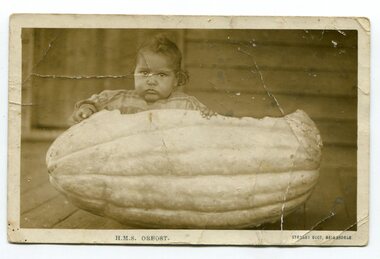
The child in the photograph is Delia Murray (Mrs Jack Kenny). She was one of eight children of Herbert Cecil Murray and Evelyn Murray. Photographs of children families sitting in hollowed out pumpkins were common in the first half of the 20th century. This item is associated with a popular activity of the Orbost community in the first half of the 20th century. Pumpkins have been been paat of the district's agricultural history since settlement.A black / white photograph / postcardof a small girl sitting in a hollowed out pumpkin. It appears to have been taken outside on a verandah of a wooden house.on front - " H. M. S. Orbost" ; "Stanley Vogt, Bairnsdale" on back is a letter - "I got the plants......."pumpkins-orbost murray-delia -
 Orbost & District Historical Society
black and white photograph, C1933
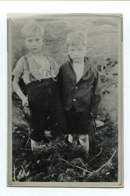
The two boys in this photograph are Stanley (7) and Maurice (5) Kelly. The two boys were lost in the bush near Orbost for three days. The had been sent by their mother, Mrs Parker, to borrow tea and sugar from a neighbour but became lost on the way home. They were found, scratched and with clothes torn, by a woodcutter, Mr W. Morell. There was a newspaper article on the front page of the Adelaide Mail , Saturday 22 July 1933,This photograph is linked with an event in Orbost's history.A small black / white photograph / postacrd of two small boys standing side by side in a paddock.on back - "The Kelly Kids, lost near L. Curlip"kelly-maurice kelly-stanley -
 Orbost & District Historical Society
black and white photograph, Vogt, Stanley, first half 20th century
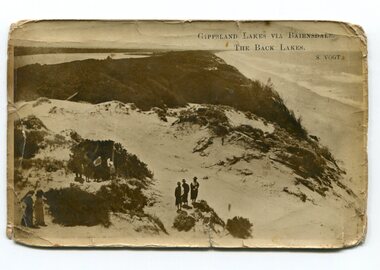
Back Lake track is near Metung, East Gippsland.This is a pictorial record of the Gippsland Lakes in the early 20th century.A black / white postcard photograph of a beach scene. Small groups of people are standing on a vegetated sand dune overlooking the water. on front - " Gippsland Lakes via Bairnsdale - the Back Lakes, S. Vogt"gippsland-lakes back-lake-bairnsdale -
 Orbost & District Historical Society
black and white photograph, Vogt, Stanley, first half 20th century
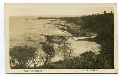
This is a scene of Cape Conran, East Gippsland taken by Bairnsdale photographer, Stanley Vogt. It was probably one of a collection of commercial post cards available to tourists or East Gippsland residents to send to friends or relatives. Cameras in the early 20th century were not a common family possession and a postcard was a common souvenir and way of sending a short message.Between 1901 and 1914 a wide range of subjects were recorded by often anonymous artists and photographers and published by everyone from major companies to enthusiastic individuals. As a result, postcards provide a comprehensive resource for anyone interested in how our forebears lived, laughed and loved one hundred years ago. They are very interesting records of places gone, architecture gone and people gone, showing social history such as dress, or early automobiles. Postcards form a vital part of social and historical records for researchers. A black / white postcard photograph of a scenic view of the beach and ocean at Cape Conran in Far East Victoria.on front - "Stanley Voigt - Bairnsdale - Cape Conran"postcard-cape-conran -
 Orbost & District Historical Society
framed photograph, Ian Clues Photography
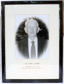
... Orbost & District Historical Society Ruskin Street Orbost ...Stanley J. Reed was an Orbost Shire Councillor from 1950-1993. He represented North Riding.A black and white photograph of Councillor Stan J. Reed in a black wooden frame.Cr Stan J. Reed Orbost Shire Councillor-Represented North Riding 1950-1993 Shire President: Four terms 1954-55 , 1955-56 1972-73 & 1973-74 municipal orbost-shire-council reed-stan government -
 Orbost & District Historical Society
badge, 1918
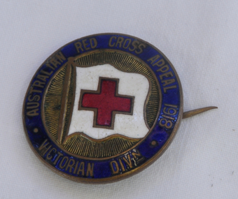
The Victorian Division of the Australian Branch of the British Red Cross Society was formed on August 21, 1914. Lady Margaret Stanley, the wife of the Governor of Victoria, was the first president. The first Red Cross volunteers focused on supplying care parcels for sick and wounded troops. After W.W.1 the Australian Red Cross continued to care for returned servicemen. The badge was sold as a fundraiser.This item is a reminder of the significant role played by the Australian Red Cross.Round bronze badge of blue, gold. red and white. It has a red cross on a white flag in centre. There is a pin on the back.red-cross badge numismatics -
 The Beechworth Burke Museum
Photograph, c1960
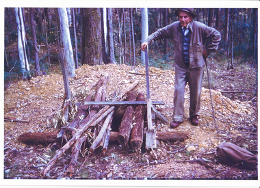
The date this photograph was taken is unknown. Estimated date 1960-70s. The gentleman in the photograph and location the photograph was taken are also unknown. Perhaps in the Beechworth or Stanley area. Unknown what the photo is referencing, however, there is perhaps an old wooden pump house near a large body of water. Located inside the pump house is an old rusted steam engine, dated c1900, which could have controlled the flow of water. The photo is associated to another record, 6856 as it has the same elderly gentlemen in the image. He is able to be identified through wearing the same clothes and distinctive hat in both photographs. The photograph could be associated to mining as the gentleman is standing next to a small mine site in a related record. Colour rectangular photograph printed on glossy photographic paper. Obverse: Reverse: 6857/ colour photograph, beechworth, burke museum, mining, miners, stanley -
 The Beechworth Burke Museum
Photograph
The date this photograph was taken is unknown. Estimated date 1960-70s. The gentleman in the photograph and location the photograph was taken are also unknown. Perhaps in the Beechworth or Stanley area. The photo is associated to another record, 6856 as it has the same elderly gentlemen in the image. He is able to be identified through wearing the same clothes and distinctive hat in both photographs. The photograph is associated to mining as the gentleman is standing next to a small mine site where perhaps a windless or whip was mounted over the entrance of the shaft. The windless was a structure mounted over the shaft, fitted with a hand-cranked winch, which was usually constructed from wood that would have been found in the surrounding area. Colour rectangular photograph printed on glossy photographic paper.Obverse: Reverse: 6856/ mining, windlass, whip, empty record -
 The Beechworth Burke Museum
Photograph, Late 1900s
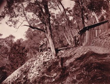
This photograph dating to the late 1900s depicts the entrance to a reef mine the in Beechworth division. The image depicts two men outside the entrance, which is covered by a hut, where one is standing near a mine cart. The mine car was used to haul soil from the mine. The Beewchworth divison consisted of 5 locations: Beechworth, Stanley, El Dorado, Hurdle Flat and Stony Creek. These locations were set up due to speculative fever that more gold could be found. In places such as El Dorado, Beechworth and Stanley there was profit, however Hurdle Flat and Stonry Creek, gold could not be found in the quantities that was required. By 1880 the Beechworth division was in depression due to the reserves being used up. However, in spite of the depression mining was continued until the late 20th Century.The search for gold is ingrained into the history of Victoria and therefore, images like this one which portray an open cut sluicing site can reveal important information for society and technology for the date when the photograph was taken. This image is of important historical significance for its ability to convey information about reef mining in the late 1900s. It also shows a location where reef mining was undertook which provides insight into the impact of reef mining on the environment at a time when it was done. This image is important for current research into the history of Beechworth , a town in Victoria's north-east. Therefore, this image has the capacity to be beneficial for research into society and the motivations of those living and working in this region during this period and therefore, has social significance. The Beechworth Burke Museum has additional images relating to reef mining and Beechworth which can be analysed and studied alongside images like this one.Sepia coloured retangular photograph printed on newspaper.Reverse: 7813beechworth, beechworth division, mining, reef mining, gold, gold mining, 1990 -
 The Beechworth Burke Museum
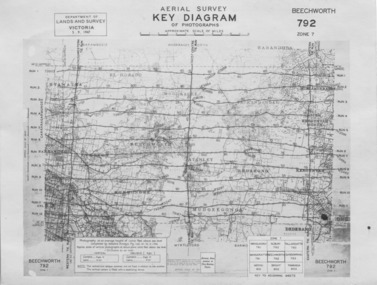
Photograph - Aerial Survey, 5/9/1947
This image is an Aerial Survey, Key Diagram of Beechworth and surrounding area. Issued by Department of Lands and Survey, Victoria in 1947. Photographed at an average height of 12300 feet above sea level, areas depicted are; Beechworth, Stanley, Bruarong, Baranduda, Muagegonga, Myrtleford, Everton, Wooragee North Tarrawinge, Dederang, Kergunyah North, Kergunyah, Yackandandah, El-Dorado, Barambogie, Murmungee, Barwidgee, Oxley, CarraragarmungeeBlack and white rectangular photograph. Image is printed on matt photographic paper and has a white un-printed border. Obverse: AERIAL SURVEY, KEY DIAGRAM OF PHOTOGRAPHS, APPROXIMATE SCALE OF MILES / DEPARTMENT OF LANDS AND SURVEY VICTORIA 5.9.1947. BEECHWORTH 792 ZONE 7. Reverse: BMM7010.1 (written in pencil) aerial survey, beechworth, burke museum, department of lands and survey, victoria, 1947 -
 The Beechworth Burke Museum
Photograph, 1890
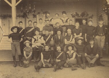
This photograph was taken of the “Wanderers” Football club at Barmutha Park, Beechworth in c1890. The Beechworth Football Club was formed in 1861 which then became affiliated to the Victorian Football Association (VFA) upon being founded in 1877. There were two football teams in Beechworth. One was the Beechworth FC and the other was the Wanderers FC, which was based at Hurdle Flat, near Stanley. In 1892, the two teams merged under the name "Beechworth District Wanderers Football Club." Those present include; Bob Wray, Jim Wray, Ike Brown, Jim Buckley, George Spencer, Jim McKenzie, Dave McAliece, Arite stone, Win Johnstone, Jack Tresize, Jim Shennan, Ned Turnbull, George Johnson, Jerry Sutherland, Jack Brown, Dick Hambleton, George Hacket, Jim Brown, Jack Johnson. The team adopted a red and black striped football jersey.The club joined the Ovens and King league, winning three consecutive premierships in 1912, 1913 and 1914, leaving the league that same year. The club suspended its activities from 1915 to 1918 during the WWI returning to the league in 1919. Sepia rectangular photograph printed on matte photographic paper mounted on board. Obverse: THE "WANDERERS" 1890 Reverse: From Mrs R. Scott beechworth, the wanderers, football, sports -
 The Beechworth Burke Museum
Photograph, c1910
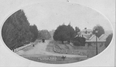
Taken in Beechworth c1910, this postcard depicts Victoria Road lined with trees and residential houses. A horse and buggy is also pictured driving towards the camera. This postcard was manufacture by SEMCO or SEMCO Art Needlework Company, which was a "music, post-card and fine art importers, indentors and publishers" established by Stanley Edward Mullen in c1910, Melbourne. One of the identifying features of the Semco postcards is the text printed on the reverse of the cards which read: “Semco Series, P.O. Box 545, G.P.O. Melbourne.” Black and white postcard within oval frame, grey decorative edge. Obverse: VICTORIA ROAD, BEECHWORTH Reverse: 1997.2839 (crossed-out) A02839 84-137-1 POST CARD Near our state school. BEECHWORTH about 1910 beechworth, victoria road, postcard, 1910, semco -
 The Beechworth Burke Museum
Photograph, 1944
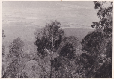
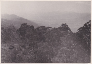
Taken in 1944, the photograph depicts the surrounding farmland from Mt. Stanley in Victoria. A secret experimental micro-wave radio station was established and tested at this site by the Army Signal Detachment Unit during World War II. It was part of an experimental Ultra High Frequency (UHF) link between Melbourne and Sydney. At the time, it was highly classified. It intended to enquire into the hitherto unexplored transmission of micro-waves; that is, a radio signal which could only be transmitted by line of sight, and thus required hill-top to hill-top location.The photograph is historically significant as it pertains to World War II; the largest global conflict in history. This significance is enhanced by Australia's prominent involvement in campaigns across the Pacific, particularly on land in New Guinea and across the Huon Peninsula. It was also the first time that the Australian mainland came under direct attack by the Axis, with Japanese forces targeting north-west Australia and Sydney Harbour. These battles became Australia's largest and most complex offensives during the war. The record is also historically significant as it relates to the Royal Australian Corps of Signals, or "RA Sigs". This significance is strengthened by Australia's unique distinction of having the first established signal unit under the British Empire. This unit provides electronic warfare. They enable commanders to implement highly dynamic battle control against opposing forces by using a number of methods including radio, fibre optic, micro-wave, information systems and satellite links. The record has strong research potential. This is due to the ongoing scholarly and public interest in war, military history, the ANZAC legend, and the ongoing existence of the RA Sigs. The historic context of this record can provide insight into Australia's history, military, technological innovation and advancements, as well as national economic, defence and foreign policies after 1945. Black and white rectangular photograph printed on matte photographic paper.Reverse: BMM5095.1 /military album, army album, wwii, world war ii, army signal detachment unit, mt. stanley, beechworth, victoria, 1940s, australian army, melbourne, sydney, royal australian corps of signals -
 The Beechworth Burke Museum
Photograph, 1944
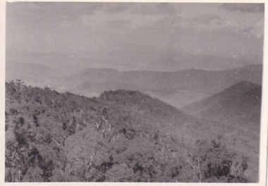
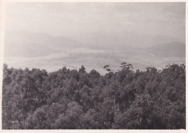
Taken in 1944, the photograph depicts the view of surrounding hills from Mt. Stanley. A secret experimental micro-wave radio station was established and tested at this site by the Army Signal Detachment Unit during World War II. It was part of an experimental Ultra High Frequency (UHF) link between Melbourne and Sydney. At the time, it was highly classified. It intended to enquire into the hitherto unexplored transmission of micro-waves; that is, a radio signal which could only be transmitted by line of sight, and thus required hill-top to hill-top location.The photograph is historically significant as it pertains to World War II; the largest global conflict in history. This significance is enhanced by Australia's prominent involvement in campaigns across the Pacific, particularly on land in New Guinea and across the Huon Peninsula. It was also the first time that the Australian mainland came under direct attack by the Axis, with Japanese forces targeting north-west Australia and Sydney Harbour. These battles became Australia's largest and most complex offensives during the war. The record is also historically significant as it relates to the Royal Australian Corps of Signals, or "RA Sigs". This significance is strengthened by Australia's unique distinction of having the first established signal unit under the British Empire. This unit provides electronic warfare. They enable commanders to implement highly dynamic battle control against opposing forces by using a number of methods including radio, fibre optic, micro-wave, information systems and satellite links. The record has strong research potential. This is due to the ongoing scholarly and public interest in war, military history, the ANZAC legend, and the ongoing existence of the RA Sigs. The historic context of this record can provide insight into Australia's history, military, technological innovation and advancements, as well as national economic, defence and foreign policies after 1945.Black and white rectangular photograph printed on matte photographic paper.Reverse: BMM5095.2 / 32 /military album, army album, wwii, world war ii, army signal detachment unit, royal australian signal army corps, war, beechworth, victoria, mt. stanley -
 The Beechworth Burke Museum
Photograph, 1944
Taken in 1944, the photograph depicts the view from Mt. Stanley. A secret experimental micro-wave radio station was established and tested at this site by the Army Signal Detachment Unit during World War II. It was part of an experimental Ultra High Frequency (UHF) link between Melbourne and Sydney. At the time, it was highly classified. It intended to enquire into the hitherto unexplored transmission of micro-waves; that is, a radio signal which could only be transmitted by line of sight, and thus required hill-top to hill-top location.The photograph is historically significant as it pertains to World War II; the largest global conflict in history. This significance is enhanced by Australia's prominent involvement in campaigns across the Pacific, particularly on land in New Guinea and across the Huon Peninsula. It was also the first time that the Australian mainland came under direct attack by the Axis, with Japanese forces targeting north-west Australia and Sydney Harbour. These battles became Australia's largest and most complex offensives during the war. The record is also historically significant as it relates to the Royal Australian Corps of Signals, or "RA Sigs". This significance is strengthened by Australia's unique distinction of having the first established signal unit under the British Empire. This unit provides electronic warfare. They enable commanders to implement highly dynamic battle control against opposing forces by using a number of methods including radio, fibre optic, micro-wave, information systems and satellite links. The record has strong research potential. This is due to the ongoing scholarly and public interest in war, military history, the ANZAC legend, and the ongoing existence of the RA Sigs. The historic context of this record can provide insight into Australia's history, military, technological innovation and advancements, as well as national economic, defence and foreign policies after 1945.Black and white rectangular photograph printed on matte photographic paper.Reverse: BMM5095.3 / 32 /military album, army album, beechworth, victoria, mt. stanley, australian army, wwii, world war ii, royal australian signal corps, army signal detachment unit -
 The Beechworth Burke Museum
Photograph, 1944
Taken in 1944, the photograph depicts the view from Mt. Stanley. A secret experimental micro-wave radio station was established and tested at this site by the Army Signal Detachment Unit during World War II. It was part of an experimental Ultra High Frequency (UHF) link between Melbourne and Sydney. At the time, it was highly classified. It intended to enquire into the hitherto unexplored transmission of micro-waves; that is, a radio signal which could only be transmitted by line of sight, and thus required hill-top to hill-top location.The photograph is historically significant as it pertains to World War II; the largest global conflict in history. This significance is enhanced by Australia's prominent involvement in campaigns across the Pacific, particularly on land in New Guinea and across the Huon Peninsula. It was also the first time that the Australian mainland came under direct attack by the Axis, with Japanese forces targeting north-west Australia and Sydney Harbour. These battles became Australia's largest and most complex offensives during the war. The record is also historically significant as it relates to the Royal Australian Corps of Signals, or "RA Sigs". This significance is strengthened by Australia's unique distinction of having the first established signal unit under the British Empire. This unit provides electronic warfare. They enable commanders to implement highly dynamic battle control against opposing forces by using a number of methods including radio, fibre optic, micro-wave, information systems and satellite links. The record has strong research potential. This is due to the ongoing scholarly and public interest in war, military history, the ANZAC legend, and the continuing existence of the RA Sigs. The historic context of this record can provide insight into Australia's history, military, technological innovation and advancements, as well as national economic, defence and foreign policies after 1945.Black and white rectangular photograph printed on matte photographic paper.Reverse: BMM5095.4 / 32 /military album, army album, wwii, world war ii, mt stanley, beechworth, victoria, melbourne, sydney, royal australian corps of signals, army signal detachment unit, military, war -
 The Beechworth Burke Museum
Photograph, 1944
Taken in 1944, depicted are two unidentified soldiers presumed to be part of the Army Signal Detachment Unit. They are cooking a meal outdoors around Mt. Stanley. A secret experimental micro-wave radio station was established and tested near this site by the Army Signal Detachment Unit during World War II. It was part of an experimental Ultra High Frequency (UHF) link between Melbourne and Sydney. At the time, it was highly classified. It intended to enquire into the hitherto unexplored transmission of micro-waves; that is, a radio signal which could only be transmitted by line of sight, and thus required hill-top to hill-top location.The photograph is historically significant as it pertains to World War II; the largest global conflict in history. This significance is enhanced by Australia's prominent involvement in campaigns across the Pacific, particularly on land in New Guinea and across the Huon Peninsula. It was also the first time that the Australian mainland came under direct attack by the Axis, with Japanese forces targeting north-west Australia and Sydney Harbour. These battles became Australia's largest and most complex offensives during the war. The record is also historically significant as it relates to the Royal Australian Corps of Signals, or "RA Sigs". This significance is strengthened by Australia's unique distinction of having the first established signal unit under the British Empire. This unit provides electronic warfare. They enable commanders to implement highly dynamic battle control against opposing forces by using a number of methods including radio, fibre optic, micro-wave, information systems and satellite links.Black and white rectangular photograph printed on matte photographic paper.Reverse: BMM5095.6 / Our Cookhouse / 32 /military album, army album, military, war, wwii, world war ii, army signal detachment unit, royal australian corps of signals, mt stanley, beechworth, victoria, melbourne, sydney -
 The Beechworth Burke Museum
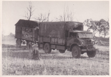
Photograph, 1944
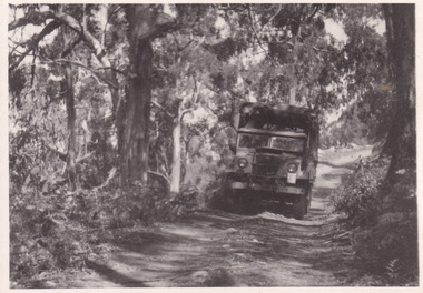
Taken in 1944, the photograph depicts an Australian Army truck driving along an unsealed road from Stanley to the top of Mt. Stanley. A secret experimental micro-wave radio station was established and tested at Mt. Stanley by the Army Signal Detachment Unit during World War II. It was part of an experimental Ultra High Frequency (UHF) link between Melbourne and Sydney. At the time, it was highly classified. It intended to enquire into the hitherto unexplored transmission of micro-waves; that is, a radio signal which could only be transmitted by line of sight, and thus required hill-top to hill-top location.The photograph is historically significant as it pertains to World War II; the largest global conflict in history. This significance is enhanced by Australia's prominent involvement in campaigns across the Pacific, particularly on land in New Guinea and across the Huon Peninsula. It was also the first time that the Australian mainland came under direct attack by the Axis, with Japanese forces targeting north-west Australia and Sydney Harbour. These battles became Australia's largest and most complex offensives during the war. The record is also historically significant as it relates to the Royal Australian Corps of Signals, or "RA Sigs". This significance is strengthened by Australia's unique distinction of having the first established signal unit under the British Empire. This unit provides electronic warfare. They enable commanders to implement highly dynamic battle control against opposing forces by using a number of methods including radio, fibre optic, micro-wave, information systems and satellite links. The record has strong research potential. This is due to the ongoing scholarly and public interest in war, military history, the ANZAC legend, and the continuing existence of the RA Sigs. The historic context of this record can provide insight into Australia's history, military, technological innovation and advancements, as well as national economic, defence and foreign policies after 1945.Black and white rectangular photograph printed on matte photographic paper.Reverse: BMM5095.7 / The track up (?) from / Stanley to the top / 32 /military album, army album, military, war, wwii, world war ii, army signal detachment unit, royal australian corps of signals, beechworth, victoria, stanley, mt stanley, melbourne, sydney -
 The Beechworth Burke Museum
Photograph, 1944
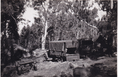
Taken in 1944, the photograph depicts two trucks and a trailer park at an undisclosed location inside the Stanley forest. An unidentified young man is standing in the background. There are also two tents installed on either side of the vehicles. A secret experimental micro-wave radio station was established and tested in Stanley, Victoria by the Army Signal Detachment Unit during World War II. It was part of an experimental Ultra High Frequency (UHF) link between Melbourne and Sydney. At the time, it was highly classified. It intended to enquire into the hitherto unexplored transmission of micro-waves; that is, a radio signal which could only be transmitted by line of sight, and thus required hill-top to hill-top location.The photograph is historically significant as it pertains to World War II; the largest global conflict in history. This significance is enhanced by Australia's prominent involvement in campaigns across the Pacific, particularly on land in New Guinea and across the Huon Peninsula. It was also the first time that the Australian mainland came under direct attack by the Axis, with Japanese forces targeting north-west Australia and Sydney Harbour. These battles became Australia's largest and most complex offensives during the war. The record is also historically significant as it relates to the Royal Australian Corps of Signals, or "RA Sigs". This significance is strengthened by Australia's unique distinction of having the first established signal unit under the British Empire. This unit provides electronic warfare. They enable commanders to implement highly dynamic battle control against opposing forces by using a number of methods including radio, fibre optic, micro-wave, information systems and satellite links. The record has strong research potential. This is due to the ongoing scholarly and public interest in war, military history, the ANZAC legend, and the continuing existence of the RA Sigs. The historic context of this record can provide insight into Australia's history, military, technological innovation and advancements, as well as national economic, defence and foreign policies after 1945.Black and white rectangular photograph printed on matte photographic paper.Reverse: BMM5095.8 /military album, army album, wwii, world war ii, army signal detachment unit, royal australian corps of signals, ra sigs, stanley, army truck, victoria, beechworth, melbourne, sydney -
 The Beechworth Burke Museum
Photograph, 1944
Taken in 1944, the photograph depicts an Australian Army vehicle with a trailer driving through bushland in Victoria. A secret experimental micro-wave radio station was established and tested in Stanley, Victoria by the Army Signal Detachment Unit during World War II. It was part of an experimental Ultra High Frequency (UHF) link between Melbourne and Sydney. At the time, it was highly classified. It intended to enquire into the hitherto unexplored transmission of micro-waves; that is, a radio signal which could only be transmitted by line of sight, and thus required hill-top to hill-top location.The photograph is historically significant as it pertains to World War II; the largest global conflict in history. This significance is enhanced by Australia's prominent involvement in campaigns across the Pacific, particularly on land in New Guinea and across the Huon Peninsula. It was also the first time that the Australian mainland came under direct attack by the Axis, with Japanese forces targeting north-west Australia and Sydney Harbour. These battles became Australia's largest and most complex offensives during the war. The record is also historically significant as it relates to the Royal Australian Corps of Signals, or "RA Sigs". This significance is strengthened by Australia's unique distinction of having the first established signal unit under the British Empire. This unit provides electronic warfare. They enable commanders to implement highly dynamic battle control against opposing forces by using a number of methods including radio, fibre optic, micro-wave, information systems and satellite links.Black and white rectangular photograph printed on matte photographic paper.Reverse: BMM5095.9 / Our outfit (fully mobile) / on the move / 32 /military album, army album, wwii, world war ii, army signal detachment unit, royal australian corps of signals, ra sigs, australian army, army truck, beechworth, stanley, victoria, melbourne, sydney -
 The Beechworth Burke Museum
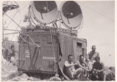
Photograph, 1944
Taken in 1944, the photograph depicts a van with two large, round satellite dishes installed on the roof stationed near Mt. Stanley, Victoria. There is a transmission tower in the background. Four unidentified young men are in the foreground on the right hand side. A secret experimental micro-wave radio station was established and tested at this site by the Army Signal Detachment Unit during World War II. It was part of an experimental Ultra High Frequency (UHF) link between Melbourne and Sydney. At the time, it was highly classified. It intended to enquire into the hitherto unexplored transmission of micro-waves; that is, a radio signal which could only be transmitted by line of sight, and thus required hill-top to hill-top location.The photograph is historically significant as it pertains to World War II; the largest global conflict in history. This significance is enhanced by Australia's prominent involvement in campaigns across the Pacific, particularly on land in New Guinea and across the Huon Peninsula. It was also the first time that the Australian mainland came under direct attack by the Axis, with Japanese forces targeting north-west Australia and Sydney Harbour. These battles became Australia's largest and most complex offensives during the war. The record is also historically significant as it relates to the Royal Australian Corps of Signals, or "RA Sigs". This significance is strengthened by Australia's unique distinction of having the first established signal unit under the British Empire. This unit provides electronic warfare. They enable commanders to implement highly dynamic battle control against opposing forces by using a number of methods including radio, fibre optic, micro-wave, information systems and satellite links. The record has strong research potential. This is due to the ongoing scholarly and public interest in war, military history, the ANZAC legend, and the continuing existence of the RA Sigs. The historic context of this record can provide insight into Australia's history, military, technological innovation and advancements, as well as national economic, defence and foreign policies after 1945.Black and white rectangular photograph printed on matte photographic paper.Reverse: BMM5095.10 / Our station set-up / in operation beside / the old Fire Watchers / Tower / 32 / It was man-handled / the last 50m. to the top /military album, army album, wwii, world war ii, army signal detachment unit, royal australia corps of signals, military, war, australian army, mt. stanley, victoria, beechworth -
 The Beechworth Burke Museum
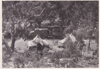
Photograph, 1944
Taken in 1944, depicted is an aerial view of an Australian military camp set up at Mt. Stanley in Victoria. There are two large tents along with a vehicle and trailer surrounded by bushland. A secret experimental micro-wave radio station was established and tested at this site by the Army Signal Detachment Unit during World War II. It was part of an experimental Ultra High Frequency (UHF) link between Melbourne and Sydney. At the time, it was highly classified. It intended to enquire into the hitherto unexplored transmission of micro-waves; that is, a radio signal which could only be transmitted by line of sight, and thus required hill-top to hill-top location.The photograph is historically significant as it pertains to World War II; the largest global conflict in history. This significance is enhanced by Australia's prominent involvement in campaigns across the Pacific, particularly on land in New Guinea and across the Huon Peninsula. It was also the first time that the Australian mainland came under direct attack by the Axis, with Japanese forces targeting north-west Australia and Sydney Harbour. These battles became Australia's largest and most complex offensives during the war. The record is also historically significant as it relates to the Royal Australian Corps of Signals, or "RA Sigs". This significance is strengthened by Australia's unique distinction of having the first established signal unit under the British Empire. This unit provides electronic warfare. They enable commanders to implement highly dynamic battle control against opposing forces by using a number of methods including radio, fibre optic, micro-wave, information systems and satellite links. The record has strong research potential. This is due to the ongoing scholarly and public interest in war, military history, the ANZAC legend, and the continuing existence of the RA Sigs. The historic context of this record can provide insight into Australia's history, military, technological innovation and advancements, as well as national economic, defence and foreign policies after 1945.Black and white rectangular photograph printed on matte photographic paper.Reverse: BMM5095.11 / Our camp / From the top. / (?) (?) /military album, army album, australian royal corps of signals, army signal detachment unit, mt. stanley, victoria, beechworth, wwii, world war ii, melbourne, sydney -
 Flagstaff Hill Maritime Museum and Village
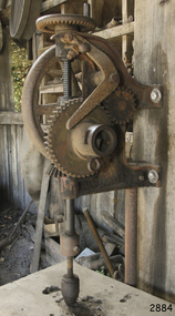
Drill Press, 1920s-1950s
This drill once belonged to Goodall and Sons, who were blacksmiths in Terang. The smith was called upon to do a variety of work. In the early 1900s he was often the nearest person to be able to perform an engineer’s services for many miles around. The Dawn Ball-bearing Post Drill no. 611 is described in McPherson’s Catalogue as a “drilling machine with adjustable automatic feed, with improved Dawn coupler and ball-bearing thrust’. The heavy design of the flywheel enables it to maintain momentum” and is “fitted with pulleys for belt drive if desired” The hand crank drives an automatic feed to work off a cam-follow system opposite a large wheel. Made by Dawn Manufacturing Co. Australia 1920-1950. DAWN MANUFACTURING CO. Dawn Manufacturing Co. was founded in Coburg, Melbourne, in 1917 by the four Blake brothers, who were all engineers. After World War I Dawn was supplying drills Australia wide and the company was growing at a healthy rate. During the depression they remained busy, with employees working 60-80 hour weeks. Dawn was contracted to supply vices and clamps to the Australian Defence Department and munitions factory during the World War II. In 1959 the company was taken over by G.N. Raymond Group, then in 1973 the Siddons Ramset Limited acquired Dawn. In December 1991, Dawn became a unit of the United States owned Stanley Works Pty. Ltd. In November 1998 Dawn became 100 per cent Australian owned. HENRY GOODALL & SONS Henry Goodall (1870-1936) was proprietor of garages as H. Goodall & Sons Pty. Ltd., at both Terang (McKinnon and High Streets) and Mortlake (Dunlop Street). His business was in operation in at least in 1916 and perhaps well before, considering the date of the tyre bender and its use for wagons with wooden wheels. It was still in operation in 1953, chasing up debtors in Mount Gambier Court. Amongst the employees of H. Goodall & Sons Pty. Ltd. was Ernie Entwistle, a blacksmith (a soldier who died in 1916 ) and Alfred Hodgetts, radio expert (killed in a fatal accident in 1943, when he was in his early 30s ). Henry Goodall was involved in the community as a Justice of Peace, a deputy coroner, President of the Mortlake Hospital, trustee of the Soldiers’ Memorial Hall, and as a prominent Freemason. He and his wife had two sons (Charles and John) and one daughter (Mrs. Chas. Newton, of Skipton). The drill is locally significant as it was used by a local company in Terang and Mortlake in their blacksmith, wheelwright and garage business. It is an example of the tools of the blacksmiths’ trade in Victoria in the 1920s-1950s.Dawn Ball-bearing Post Drill no. 611, made by Dawn of Melbourne, model no 611. Hand operated drill press. Self-feeding blacksmiths’ drill-press. This drill once belonged to Harry Goodall & Sons, blacksmiths of Terang. Dated 1920s-1950s. Gear ratio 2:1 main drive, 6" diam, 3:1 reduction gear. "Dawn", "Melbourne"flagstaff hill, warrnambool, shipwrecked-coast, flagstaff-hill, flagstaff-hill-maritime-museum, maritime-museum, shipwreck-coast, flagstaff-hill-maritime-village, h. goodall & sons of terang, terang blacksmith, h. goodall & sons pty ltd, mortlake, ernie entwistle blacksmith, alfred hodgetts radio expert, charles goodall, john goodall, mrs. chas. newton nee goodall, terang 1900s, warrnambool district 1900s, post drill, blacksmith’s drill, dawn post drill, dawn ball-bearing post drill no. 611, blacksmiths, dawn of melbourne -
 Flagstaff Hill Maritime Museum and Village
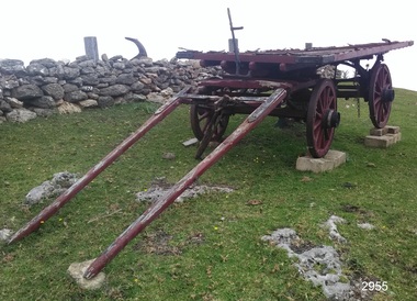
Wagon, circa 1850s
Bostock & Manifold were all from pioneering families in the Western District of Victoria almost from the time of settlement. Family history: The Bostock family were prominent in Warrnambool from the 1850s to the 1880s. Patriarch Robert Bostock had in 1813 been transported to Sydney from Sierra Leone for having 'felonious traded in slaves' and sentenced to 14 years transportation. He moved to Tasmania in 1821 where he died in 1847. A number of his children came to Port Phillip. Edward Robert Bostock held the Jellabad run from 1849 to 1853. George Bostock (1826-1858) was a Warrnambool Shire Councillor in 1856. Thomas Edward Bostock (1828-1874) was a Shire Councillor in the late 1860s. Augustus Bostock (1833-1920) lived in Warrnambool. Augustus Bostock was the 9th child of Robert and Rachael Bostock of Vaucluse Epping Forest, Van Diemen's Land. He was only 4 years old when his mother died. He was inspired by his father to seek his fortune in the Western District of Victoria. He arrived around 1850. He married Margaret Aitkin in July 1865. Augustus owned several properties in the district and leased others. He sat on the court of Warrnambool, Mortlake or Hexham as required. He resided at Marramook in Hawkesdale and later moved to Vaucluse in Hopetoun Road Warrnambool, where he died in 1920 at the age of 87. The Wagon is significant locally and state wide for its association with Augustus Bostock who was involved in many aspects of life in the Western District of Victoria, racing, cricket, and social activities to name a few. Bostock & Manifold were all from pioneering families in the Western District of Victoria almost from the time of settlement. The wagon is significant for its historical and economic association with the local Warrnambool business of Manifold & Bostock. These men had leased and owned vast tracts of land and operated businesses around the district together at various times often associated with the farming industry. One example is the Manifold & Bostock store and flour mill from which the wagon dray is believed to have been associated with for the delivery of goods. Their flour mill began operation in 1850 in 7-17 Stanley St South Warrnambool and was known as “Jetty Mills” Manifold and Bostock in 1858 purchased the Mill from John and G Elliot (brothers) with half an acre of ground and a cottage for £1600. It appears addresses of the company changed over the years as the town grew. These are listed in “Jones, Lewis & Peggy flour mills of Victoria” showing the company operating from, Fairy Street and later at the Merri River near the cutting, known as Banyan and Merri Streets. The company ceased trading in 1870. The Wagon Dray is also an example of agricultural freight and general transportation during the 1800 and 1900 century.A four-wheeled wooden horse-drawn wagon with flat top described as a Wagon Dray in historical writings. Painted brown and black. The wagon has rear brakes, wooden, operated from a metal handle at the front of the Wagon. Front wheels are attached to a turnstile to allow easy turning of the wagon. This flat-topped, horse driven, four-wheeled Wagon was used for cartage by the business of Manifold & Bostock, Warrnambool. The original sign writing of the wagon is obscured or painted over. There is a feint mark of lettering to the sides and back edges of the cart Manifold & Bostock. "Manifold and Bostock" very feintflagstaff hill, warrnambool, shipwrecked-coast, flagstaff-hill, flagstaff-hill-maritime-museum, maritime-museum, flagstaff-hill-maritime-village, cartage, manifold and bostock of warrnambool, manifold family of western victoria, bostock family of western victoria, four wheeled wagon, wagon, horse drawn wagon, farm wagon, aitkin, aitkin bostock manifold, dray, aitkin family, cart, aitken, flour mill -
 Flagstaff Hill Maritime Museum and Village
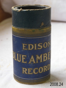
Gramophone cylinders, National Phonograph Co, A Hundred Fathoms Deep Stanley
Gramophone cylinders, black. 6 grooves on interior stored in cardboard round container with detachable lid. Edison Blue Amberol Record, made and sold by National Phonograph Co. at Orange N.J. U.S.A. Song: 879 A Hundred Fathoms Deep Stanley flagstaff hill, warrnambool, shipwrecked-coast, flagstaff-hill, flagstaff-hill-maritime-museum, maritime-museum, shipwreck-coast, flagstaff-hill-maritime-village, gramophone cylinders, edison blue amberol record, national phonograph co, a hundred fathoms deep stanley -
 Flagstaff Hill Maritime Museum and Village
Document - Navigation Chart, Admiralty Office, Lady Bay and Warrnambool Harbour, 03/04/1871
This Chart titled “Lady Bay and Warrnambool Harbour” was surveyed by Nav. Lieut. H.J. Stanley, of Britain's Royal Navy, in 1870 and printed in April 1871. The chart was made before the Warrnambool Breakwater was built (construction had begun in 1874 and was completed in 1890). The chart includes Directions for entering Lady Bay, Warrnambool Harbour. These are "Vessels entering Warrnambool Harbour must bring the Red Light in sight and steer in with it in line with the upper white Light bearing North, until the Green Light on the Jetty is opened, when steer towards it and anchor. The best anchorage is in 2 ¼ fms [fathoms)] of water, about a cable from ledge off Breakwater rock. Or where convenient, according to draught of water, only endeavouring to anchor as close as possible to Breakwater rock. It is not safe to enter or leave the Harbour in south westerly or Southerly gales.” This chart is significant for its strong connection to the maritime history of Warrnambool Harbour and Lady Bay, and eventually to the Warrnambool Breakwater. The Warrnambool Breakwater is registered as a place of significance on the Victorian Heritage Database (VHR H2024). A copy of the same chart was used to plan several submissions for future changes to the jetty and breakwater. The chart is a historical record of structures existing in 1870; the Warrnambool Jetties, Lady Bay, the leading lights (lighthouses), streets, roads, bridges and many buildings. It also shows the lay of the land and seabed.Canvas chart of Australia, South Coast, Victoria Title: Lady Bay and Warrnambool Harbour Surveyed by Nav. Lieut. H.J. Stanley, R.N., 1870. Magnet Variation, 1870 Published April 3, 1871, by the Admiralty, London. Directions for vessels entering Warrnambool Harbour are printed on the chart. The chart has a lacquer or seal over it.Top of chart has logo "HYDROGRAPHER OFFICE" "Price Eighteen Pence". "Engraved by Edward Weller" Along bottom of Chart: “London… Published at the Admiralty, 3rd April 1871, under the Superintendence of Rear Admiral G.H. Richards, F.R.S. Hydrographer, Corrections July 71” Bottom of chart “Australia South Coast Victoria Lady Bay and Warrnambool Harbour. 2494”flagstaff hill, warrnambool, chart of lady bay warrnambool 1870, warrnambool harbour, cartography, navigation, warrnambool breakwater, 1871, australia – south coast / victoria, lady bay, 1870, nav. lieut. h.j. stanley, r.n, directions for entering warrnambool harbour, hydrographer office, rear admiral g.h. richards, edward weller, port of warrnambool, flagstaff hill maritime museum & village, maritime museum, maritime village, shipwreck coast, map, chart, navigation chart, admiralty chart, breakwater, jetty, pier, vhr h2024