Showing 468 items matching "heritage studies"
-
 The Beechworth Burke Museum
Ceremonial object - Ushabti of Taweret-Khaiti, Circa 1292 BC
Ushabti are tiny anthropoid (human-shaped) figures placed in the tombs of wealthy Egyptians. They were intended to do the work of the deceased in the afterlife. This purpose is implied through their name, which may have derived from the Egyptian word “to answer”. The Burke Museum in Beechworth is home to a particular ancient Egyptian Ushabti figure. This artefact was donated to the Museum in 1875. No details about how it left Egypt, arrived in Australia, and where it was located before this donation are known. The Nineteenth Century, when this artefact was donated, was a period when many museums acquired items of ancient Egyptian heritage. Many of these items were procured in less than desirable circumstances, having often been looted from ancient tombs and sold to tourists without documentation as to their original location and/or accompanying grave goods. These artefacts were also divested through partage (the trading of artefacts for funds); however, the latter is unlikely to have been the case for this artefact. Since the Ushabti was donated by an unknown donor, it is likely to have been in a private collection rather than an institution. Ushabti can be dated using iconographic analysis which is non-invasive and provides a comprehensive study of the artefact. The later period of the 18th Dynasty marked the beginning of an increase in both the inclusion of Ushabti as essential funerary items and the creation of Ushabti with tools. From this period, they are no longer depicted without tools. Depictions of tools including gardening hoes are frequently depicted grasped in the Ushabti’s hands whilst items like the seed-bag are depicted hanging on the back rather than in an alternative position. This Ushabti figure grasps a gardening hoe and a mattock and a small seed bag surrounded by a yoke bearing water jars are depicted on the upper back of the Ushabti. These features are essential in helping narrow this dating to the late 18th and before the early 20th Dynasty. The position of this seed bag also provides dating information. In the early 18th Dynasty this bag was consistently drawn on the front of the figurine; however, by the reign of Seti I, this feature moved to the back. Thus, since the seed bag is located on the back of this Ushabti, it cannot date to the early 18th Dynasty. By the 19th Dynasty, Ushabti’s were increasingly made from either faience or terracotta. The availability of these materials in Egypt resulted in the increase of Ushabti production with tombs containing many more figurines than previously seen. The Ushabti held by the Burke collections is made from terracotta. Terracotta was rarely used for Ushabti before and during the early 18th Dynasty with only the odd appearance until the late 18th Dynasty and becoming common through that period until the late Third Intermediate Period. Whilst the face has been damaged, there is no evidence for the Ushabti having been provided with an Osirian false beard. This omission rules out a dating of later than the 25th Dynasty when beards became prominent. The inscriptions also date the Ushabti to the New Kingdom. This is because of the use of sḥḏ (“to illuminate”) with Wsjr (“Osiris”) which only occurs in these periods. Therefore, considering all these elements, the Ushabti can be confidently be dated to between the late 18th to early 19th dynasty.Artefacts like this Ushabti are no longer exclusively representative of their origins in burial assemblages and significance in the mythology of the Egyptian afterlife but are also significant for the accumulated histories they have gained through travel. The movement of this artefact from Egypt to Australia allows insight into the collecting habits of the 19th century, and in particular, the reception of ancient Egyptian artefacts in small rural museums. The procurement of Egyptian artefacts was a social trend around the late 1800s to early 1900s. Egyptian artefacts were considered curiosities and recognised for their ability to attract public attention to museums. They were also utilised in Australian museums, like the Burke Museum, to connect the collection to one of the oldest civilisations known to man and since Australia was considered a “young” country by European settlers, this was vital and derived from an interest in Darwin’s “Origin of the Species” 1859. Furthermore, there was a culture of collecting in the 1800s amongst the affluent in English society which led to the appearance of many Egyptian artefacts in private collections. The acquisition of this Ushabti figure is not certain, but it was likely donated from a private collection rather than an institution. This particular artefact is significant as an example of a high-quality Ushabti representative of those produced during the late 18th or early 19th century. It provides insight into the individualism of an Ushabti and the mythology of ancient Egypt. It also provides an example of the types of items required in the tomb assemblages of this period and reinforces the importance of ensuring the successful afterlife of the deceased through art. This Ushabti belonged to a woman named Taweret-Khaiti, Chantress of Amun, in the late 18th Dynasty or early 19th Dynasty (c.1292 BC) of the Egyptian New Kingdom. It likely comes from an undetermined tomb in the locality of Thebes. This figure is made from Nile silt clay (a polyester terracotta; clay sourced from the banks of the Nile River) which was a popular material for Ushabti construction in the early 19th Dynasty. It is in a fair state of preservation (with the exception of a break through the centre) and originally made to a high quality. The face has been damaged but the eyes and eyebrows are clearly marked with black ink and the sclera painted white. The Ushabti is painted a light brown/yellow colour and features a vertical line of inscription down the lower front. The Ushabti wears a large wig and and a schematic collar. The arms are painted light brown and depicted crossed with bracelets around the wrists. It grasps a hoe and mattock. A yellow seed-basket is depicted on the Ushabti’s back. These features represent the likelihood that this particular Ushabti was intended to complete farm work for the deceased in the next life. There would have been additional Ushabti of similar design within the tomb who worked under the supervision of a foreman Ushabti. The foreman Ushabti would be depicted dressed in the clothing of the living. The inscriptions are painted freehand in black ink and written in a vertical column from the base of the collar to the foot pedestal on the front of the Ushabti. The owner of the Ushabti could elect to have the figures inscribed with their name, the Ushabti spell and any other details they deemed necessary. In the case of this example, the Ushabti is inscribed with the owner’s details and is an abbreviated version of the standard Ushabti formula. This formula ensured that the Ushabti would complete the desired task in the afterlife when called upon by the deceased. Ushabti which were not inscribed would represent their intended purpose through design; however, this Ushabti, like most made in the late 18th Dynasty, conveys its purpose both through both design and inscription. The inscription is as follows: sHD wsir nbt pr Smayt imn tA-wr(t)-xai(ti) mAa xrw which translates to: "The illuminated one, the Osiris (the deceased), the mistress of the household, Chantress of Amun, Taweret-Khaiti, true of voice (justified)"ancient egypt -
 Flagstaff Hill Maritime Museum and Village
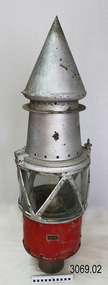
Functional object - Marine Navigation Light, Early 20th century
Breakwater navigation lights are placed at the end of the breakwaters to warn incoming vessels of the end of the structure, as a marine safety measure. The subject item was such a light believed to have been placed at the end of Warrnambool's breakwater around 1915 when it was extended. The light had remained in place for many years until it was probably removed when the structure was undergoing rock armouring repairs to the end of the breakwater in 1975. The light had been placed in a council storage shed probably from the time when the structure was undergoing these repairs in 1975. In 2014 the light was removed from the storage shed and donated to Flagstaff Hill museum. History: Warrnambool breakwater plans were drawn up by 1874 and approval was given for preliminary construction work to start but when the money ran out, the works stopped. With a number of quick changes of government the “Warrnambool” breakwater project was kicked from one Victorian state government to another. Then finally in 1879, the eminent British harbour engineer Sir John Coode was asked to design a breakwater. His first design was for a 1800 feet long structure but that was scaled back to 900 feet and construction finally began in 1884. This structure was attributed in causing major siltation of Lady bay, as a consequence the breakwater was again extended in 1915. In 1975, the rock armouring at the end of the breakwater was added but by 1979 another impact study was calling for the breakwater to be removed altogether. The Heritage Council Victoria, regard the Warrnambool breakwater is of historical significance to the state as one of the most important maritime engineering projects that was undertaken in Victoria during the late nineteenth century. The light is also as part of this structure regarded as a significant item of historical interest.Marker light or navigation light. Round light stand with conical top piece (2 separate pieces). Metal base painted red, clear glass middle section enclosed by metal frame, metal cone shaped top section painted silver. Electrical wiring can be seen inside centre section. Pole that light would have been on to elevate it is missing.Has metal plate screwed onto side of base engraved "23". flagstaff hill, warrnambool, shipreck coast, flagstaff hill maritime museum, maritime museum, great ocean road, warrnambool breakwater, marker light, naviagtion light, breakwater navigation light -
 Warrnambool and District Historical Society Inc.
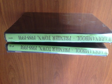
Book - Album, 1988-1991 Premier Town Volume 2, Circa 1988
The Premier towns is an award given by the Victorian state Government. It recognises positive actions by regional communities to protect and enhance their local environment. It is based on criteria relating to litter prevention and waste management, environmental and heritage management as well as activities among community groups and leadership. The following is taken from Hansard at the announcement of the awards in 1988 That the Senate- (a) congratulates the Mayor, Councillors, the Premier Town Committee, and the people of the City of Warrnambool, Victoria, for their achievement, on Saturday, 20 November 1988, in taking out the Victorian `Premier Town Award' for an unprecedented third time; (b) congratulates the business people of Warrnambool for their efforts in helping the city to win the Victorian Industrial and Commercial Development Award, including a special award for coastline preservation and studies This album is significant in that it documents an important award to the City of Warrnambool. It is also a comprehensive pictorial record of Warrnambool as it was in 1988.Volume 2. Covers Warrnambool rivers, bridges, coastal features, places of learning, clubs and sporting facilities and historical and general interest all of which have played an important role in the development of and history of the city and lives of its people.Soft brown vinyl cover with plastic cover. Pages are dark cream cover paper. A sticker with the Warrnambool Premier Town logo is inside the front cover. The album consists of photographs of various buildings and streetscapes with relevant descriptive text.Sticker inside front cover, Mr J Gietz Po Box 1007 Warrnambool Vic 3280. warrnambool, ideal town 1988-1991, victoria’s bicentennial premier town premier town awards -
 Eltham District Historical Society Inc
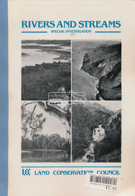
Book, Land Conservation Council, Rivers and Streams: Special Investigation, September 1989
In June 1987, the government directed the LCC to carry out a special investigation of the social, recreational, cultural and ecological values of rivers and streams in Victoria, and to make recommendations on the use of these rivers and how their identified values can best be protected. Notices announcing the commencement of the investigation were published in the Victoria Government Gazette and in Victorian newspapers in November 1987. A descriptive report was published in September 1989. The Council received 75 submissions following the publication of this report. After considering these submissions, the Council formulated its proposed recommendations, which were published in November 1990. The Council received 177 submissions commenting on the proposed recommendations. The Council published its final recommendations in June 1991. While welcomed by many, the study cut across the interests of other groups and was perceived to be particularly threatening to water authorities. The investigation resulted in a legislated system of 17 heritage rivers (with significant natural, recreational, scenic and heritage values) and natural catchment areas across Victoria. -
 Glen Eira Historical Society
Document - Heatherbrae
A three page photocopy from a Caulfield Conservation Study by Andrew Ward, on house Heatherbrae located at 73 Neerim Road. The study gives a brief history of the property, describes the house’s architectural features and heritage significance and includes a photograph (100mm x 152mm) of the exterior of the house. The file also includes a page of undated, unattributed, handwritten notes giving a partial list of Heatherbrae’s occupants from 1885 to 1900s and some description of the house. Also included in the file is an undated, unattributed one page handwritten list of the main occupants of Heatherbrae between 1880 and 1970. The file also includes one page of research notes by Dianne Visnovsky, dated 06/11/2009, with details of a publication that describes church fairs held at Heathrbrae circa 1910. These notes are accompanied by a handwritten annotation by Claire Barton dated 05/03/2012.heatherbrae, mansions, neerim road, caulfield conservation study, architectural features, architectural styles, holland john charles, booran road, glenhuntly road, kambrook roads, griffiths george f, vail e l junior, clarke alfred e, clarke margaret h, mcgowan beatrice, mcgowan leslie, macgowan leslie, buildings, caulfield, heatherbrae avenue, clarke street, stoddart j, ross william murray, wright william t, macgowan m h, mcgowan malcom, mcgowan jean, barton claire, visnovsky dianne -
 Eltham District Historical Society Inc
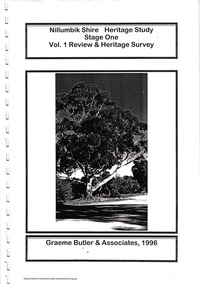
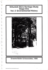
Document, Nillumbik Shire Council, Nillumbik Shire Heritage Study Stage One Vol. 1 Review & Heritage Survey, Graeme Butler & associates, 1996, 1996
... Nillumbik Shire Heritage Study Stage One Vol. 1 Review...nillumbik shire heritage study, graeme butler... in the shire nillumbik shire heritage study, graeme butler ISBN 0 646 ...Provide the foundation for future planning assessments in the shire76 A4 pages (single sided), spiral bound with clear pastic front and covers.ISBN 0 646 294547nillumbik shire heritage study, graeme butler -
 Eltham District Historical Society Inc
Document, Nillumbik Shire Council, Nillumbik Shire Heritage Study Stage One Vol. 1 Environmental History, Graeme Butler & associates, 1996, 1996
... Nillumbik Shire Heritage Study Stage One Vol. 1...nillumbik shire heritage study, graeme butler... in the shire nillumbik shire heritage study, graeme butler ISBN 0 646 ...Provide the foundation for future planning assessments in the shire81 A4 pages (single sided) and 9 A3 (single sided) fold-out pages, spiral bound with clear pastic front and covers.ISBN 0 646 294547nillumbik shire heritage study, graeme butler -
 Eltham District Historical Society Inc
Document, Nillumbik Shire Council, Nillumbik Shire Heritage Study Appendix 1, Graeme Butler & Associates, 2001, 2001
... Nillumbik Shire Heritage Study Appendix 1, Graeme Butler...nillumbik shire heritage study, graeme butler... in the shire nillumbik shire heritage study, graeme butler 86 A4 pages ...Provide the foundation for future planning assessments in the shire86 A4 pages (double sided) pages (photocopied) no binding or covers. Title page and pages 1, 74,75 and 76 missingnillumbik shire heritage study, graeme butler -
 Nhill Aviation Heritage Centre
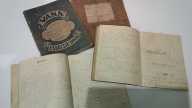
Memorabilia - Collection of four exercise books containing study notes for aircraft fitter and rigger
Study notes handwritten by by R.W.Harris while doing a Fitter's Course 159, Wing No 1 at IES Ascot Vale, Melbourne 1939-1945 Notes refer to Kitty Hawk , Bristol Beaufort , Wirraway, Avro Anson, metal rigging, systems etc Various exercise books, ruled with handwritten notes and diagramsR.W.Harris 52618 IES No 1 Wingr.w harris, fitters training notes, ies ascot vale, world war 2 -
Federation University Historical Collection
Photograph - Art Student, University of Ballarat Student study, c2005, c2005
Federation University Australia was established on 1 January 2014. Formerly known as the University of Ballarat, its enabling legislation was the University of Ballarat Amendment (Federation University Australia) Act 2013. Although formally created as a University in 1994, the University of Ballarat has a lineage back to 1870 with the establishment of the School of Mines Ballarat, making it the third institution of higher learning to be established in Australia and the first to be established in regional Australia. On 1 January 1994, Ballarat University College became the University of Ballarat and in 1998 the University merged with three TAFE Institutes to become a dual sector institution with multiple campuses. On 1 January 2014, the University of Ballarat amalgamated with the Monash University Gippsland Campus to form Federation University Australia. The Gippsland Campus also had a long lineage dating back to 1928 with the establishment of the Yallourn Technical School which became a predecessor institution to the Gippsland College of Advanced Education formed in 1968. In 1990, it was renamed the Monash University College and in 1993 became the Gippsland Campus of Monash University. In 2016, Federation University Australia announced plans to take possession, over a two-year period, of Monash’s Berwick Campus in the south-east corridor of Melbourne. Federation University Australia, or FedUni, is headquartered in Ballarat and offers programs in Higher Education and Vocational Education and Training to regional Victoria and beyond. The University’s commitment to educational and social equity, teaching excellence, research distinction, environmental sustainability and regional capacity building has enabled it to develop in a way that draws on its proud heritage to inform its future. Its regional character sets a framework for the University’s priorities but does not constrain it from serving wider community interests, nationally and internationally. The name Federation University Australia was chosen to convey the scope and capacity of an expanded regional university with a federated network of campuses.Colour photograph of students on the grass outside the Union Building on Mt Helen Campus.federation university, mount helen campus, students, alumni, art, painter -
 Federation University Historical Collection
Article - Article - Women, Federation University: Women of Note; Anne Beggs-Suntar, Historical Studies, Lecturer and Author
Dr. Anne Beggs-Sunter is an historian who lectures in the School of Arts at Federation University Ballarat in Wathawurrung country. Her major interests are in Australian social, cultural and political history. Her special interests relate to the colonial era, to the history of Ballarat and its heritage conservation, and the significance and commemoration of the Eureka Stockade. Anne is actively involved with a number of cultural institutions, including the Art Gallery of Ballarat, the Gold Museum and the Buninyong Historical Society, and serves on a number of City of Ballarat committees. She has written a number of books, exhibition catalogues and articles for different audiences ranging from specialised academic journals to newspapers.women of note, dr anne beggs-suntar, historian, school of arts, federation university, social cultural political histories, history of ballarat, heritage conservation, eureka stockade, ballarat art gallery, gold museum, author, books articles, lecturer, historical studies -
Federation University Historical Collection
Book - Book - Scrapbook, Ballarat School of MInes: Scrapbook of Newspaper Cuttings, Book 34, January 1988 to April 1988
Collection of newspaper articles related to Ballarat School Of Mines.They cover activities and advertisements for staff. The papers concerned are The Courier, Ballarat, The Australian, The Age over the period of 22 July to 3 October 1987.Book with green cover, front, spiral bound. teaching positions advertised, pre-employment courses, courses available, ricky hains receives highest state mark, draftsman, enrolment for smb courses, tafe state conference, next wave festival, sec pupils at smb, women's trade progam to continue, $60000grant for aboriginal studies, neville french pottery, latest equipment installed - catering, smb staff stop work, intellectually disabled stand on their own, gary bell appointed as music teacher, field work for students, the smeaton painting studio complex, small business course for women, wool prices, enriched life in twilight years, calligraphy course, eddie goodson american calligrapher, smb's heritage -
 Greensborough Historical Society
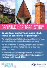
Flyer, Banyule Heritage Study, 2020
... Banyule Heritage Study... Heritage Study Flyer Flyer Banyule City Council ...Request by Banyule City Council for information about heritage places which should be considered for protection.Colour leaflet, printed on one side, with col. card, printed both sidesheritage places, banyule city council -
 Greensborough Historical Society
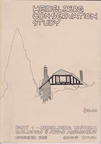
Book, Heidelberg Conservation Study: Part 1 Historic Buildings and Areas Assessment, 1985_
Report prepared by Graeme Butler on behalf of City of Heidelberg and Heidelberg Heritage Advisory Committee. Area covered is from Eaglemont in the south to Macleod in the north.This study identifies neighbourhood character, documents past development and the capacity of the environment for future development.Part one of set of three books. Paperback, 189 pages, Illus., maps. 2 copies.Stamps: Yarra Plenty Regional Library Service, and, Withdrawnheidelberg, macleod, heidelberg heritage advisory committee, graeme butler, plenty river, eaglemont -
 Greensborough Historical Society
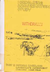
Book, Heidelberg Conservation Study: Part 2: Historic Riverland Landscape Assessment. Revised 1987, 1987_
Report prepared by Loder and Bayly and Marilyn McBriar on behalf of City of Heidelberg and Heidelberg Heritage Advisory Committee. Area covered is from Darebin Parklands in the south to Plenty River at Yallambie in the north. Revised 1987.This study identifies neighbourhood character, documents past development and the capacity of the environment for future development with particular emphasis on the river precincts - Plenty River, Yarra River and Darebin Creek.Part three of set of three books. Paperback, 333 pages, Illus., maps. 2 copies.Stamps: Yarra Plenty Regional Library Service, and, Withdrawnheidelberg, macleod, heidelberg heritage advisory committee, marilyn mcbriar, plenty river, yarra river, darebin creek -
 4th/19th Prince of Wales's Light Horse Regiment Unit History Room
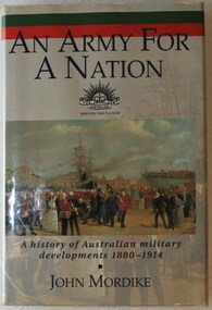
Book, John Mordike, An Army for a Nation, A history of Australian military developments 1880-1914, 1992
For many Australians, Australia's participation in World War 1 is both an essential part of their national identity and an inevitable consequence of their British heritage; it is a popular view that Australia perceived its national interests and those of Britain to be one. In this major study, John Mordike challenges this view of Australia's past by exposing the competing national and imperial influences which shaped the foundation of the Australian Army. The book reveals how political ambition and electoral pressures subordinated a farsighted policy of defence self-reliance to the demands of imperial defence.Hard cover book, 310 pagesISBN 1 86373 192 Xmilitary history, mordike, australian army, colonial era, perfidious albion, military history, mordike, australian army, colonial era, perfidious albion -
 Eltham District Historical Society Inc
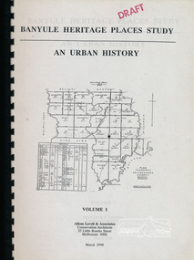
Book, Banyule City Council, Banyule Heritage Places Study - An Urban History, Volume 1 prepared by Allom Lovell & Associates, 1998 March
... Banyule Heritage Places Study - An Urban History, Volume 1... p, 30 cm Banyule Heritage Places Study - An Urban History ...Describes the broad patterns of development across Banyule in the post-European contact period, 92 p, 30 cmbanyule history, greensborough history, montmorency history, heidelberg history, ivanhoe history -
 Eltham District Historical Society Inc
Book, Banyule City Council Aboriginal Heritage Study prepared by Austral Heritage Consultants, 1998 July
... Banyule City Council Aboriginal Heritage Study prepared by.... Banyule City Council Aboriginal Heritage Study prepared by Austral ...A draft report on the pre-European Aboriginal achaeological sites in the city of Banyule, including results of previous field surveys; Banyule covers a small part of the former lands of the Woi Wurrung. The report discusses heritage overlay, planning issues and the proposed Victorian planning provisions.100p, 30 cm.Marked "Draft"aboriginal heritage banyule, woi wurrung -
 Eltham District Historical Society Inc
Book, Graem Butler, Heidelberg Conservation Study, Part 1 Heidelberg Historic Buildings and Areas Assessment by Graeme Butler, November 1985
Historic Buildings and Areas Assessment by Graeme Butler. Part 1 of award winning study carried out in 1982 in collaboration with a community advisory committee to Heidelberg City Council. Pioneering identification of a broad range of heritage assets varying from buildings, gravestones, farm structures, landscape areas, mileposts, divided street construction, in a time when buildings only were assessed in municipal studies.2 v. : ill., maps ; 29 cm.significant buildings heidelberg victoria, history development of heidelberg victoria, man-made landscape heidelberg victoria, significant precincts heidelberg victoria, conservation study, graeme butler -
 Warrnambool and District Historical Society Inc.
Book, Warrnambool Botanic Garden Masterplan, February 1995
This Warrnambool Botanic Gardens Study and Report was funded by the National Estate Grants Program of the Australian Heritage Commission and the City of Warrnambool. It was monitored in progress by a Steering Committee consisting of representatives of the Botanic and Public Gardens Advisory Committee, the Warrnambool City Council, Friends of the Warrnambool Botanic Gardens and National Estate Grants Program representatives and community representatives. The Warrnambool Botanic Gardens were first sited close to the Hopkins River in 1859. In 1869 the gardens were relocated to the present day location in Botanic Road. This plan is of some importance as it gives an overview of the history and current condition in 1995 of the Warrnambool Botanic Gardens and draws up a plan for its future development. It is useful for research and for consideration by the City Council today of policy making and further development of the gardens. This is a publication containing a master plan for the Warrnambool Botanic Gardens. It has a section on acknowledgements, a summary, eight chapters, and 14 appendices. The pages are bound with plastic rings, the front cover is plasticized with an aerial photograph of the Botanic Gardens and surrounds and the back cover is lightweight cardboard. The pages contain printed material, fold out maps, sketches and diagrams and many photocopied photographs.Front Cover: City of Warrnambool, Warrnambool Botanic Gardens, Conservation and Development Plan, Jill Orr-Young, Patrick Mallon, SF Consultants Pty Ltd, February 1995. warrnambool botanic gardens, warrnambool -
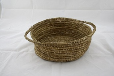 Emerald Museum & Nobelius Heritage Park
Woven basket, Kay Van Boekel, circa 1996
Made by Kaye Van Boekel whilst studying at Oonah Learning CentreWas taught basket weaving by Auntie Dot PetersHandmade Koori traditional two-handled basket Noneauntie dot peters, kaye van boekel at oonah learning centre -
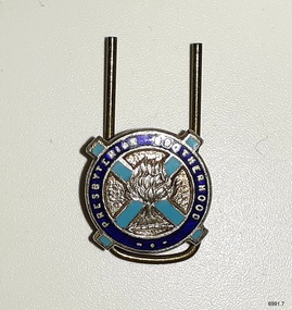 Flagstaff Hill Maritime Museum and Village
badge - Presbyterian Brotherhood badge, 1920s to 1940s
This badge is one of a set of badges collected by Dr W R Angus from the organisations in which he was involved. The set of badges is now part of Flagstaff Hill’s comprehensive W.R. Angus Collection, donated by the family of Dr W R Angus, surgeon and oculist. The badge represents the Australian Presbyterian Brotherhood. The Presbyterian church has used the burning bush logo from the 1800s. The logo describes the Biblical account of the prophet Moses, who saw the miracle of a bush on fire that did not burn and heard the voice of God giving his instructions. The light blue cross symbolises the origin of the Australian Presbyterian church, the Church of Scotland, which is Presbyterian. Its flag is blue with a white 'x' and a burning bush symbol in the centre. Dr William Roy Angus was of Scottish heritage. He sailed overseas to further his studies at Edinburgh Royal Infirmary and in 1928, was awarded FRCS (Fellow from the Royal College of Surgeons), Edinburgh, Scotland. He was e Presbyterian and treated Sunday as a Sabbath, a day of rest. He would visit three or four country patients on a Sunday, taking his children along ‘for the ride’ and visiting with him. Sunday evenings he would play the pianola and sing Scottish songs to his family. In 1928, Dr Angus was a Flying Doctor in the A.I.M. (Australian Inland Ministry) Aerial Medical Service, which was established by the Presbyterian Church in that year. The W.R. Angus Collection includes historical medical equipment, surgical instruments and material belonging to Dr Edward Ryan and Dr Thomas Francis Ryan, (both of Nhill, Victoria) and Dr Angus’ own belongings. The Collection’s history spans the medical practices of the two Doctors Ryan, from 1885-1926 plus that of Dr Angus, up until 1969. It includes historical medical and surgical equipment and instruments from the doctors Edward and Thomas Ryan of Nhill, Victoria. Dr Angus married Gladys in 1927 at Ballarat, the nearest big city to Nhill where he began as a Medical Assistant. He was also Acting House surgeon at the Nhill hospital where their two daughters were born. During World War II He served as a Military Doctor in the Australian Defence Forces. Dr Angus and his family moved to Warrnambool in 1939, where Dr Angus operated his own medical practice. He later added the part-time Port Medical Officer responsibility and was the last person appointed to that position. Both Dr Angus and his wife were very involved in the local community, including the planning stages of the new Flagstaff Hill and the layout of the gardens there. Dr Angus passed away in March 1970.This badge is significant for connecting Doctor Angus with organisations that he supported. The badge also associates Dr Angus with the history of the Presbyterian Church in Australia, showing the historic logo of the burning bush and the Scottish flag. The W.R. Angus Collection is significant for still being located at the site it is connected with, Doctor Angus being the last Port Medical Officer in Warrnambool. The Collection includes historical medical objects that date back to the late 1800s.Badge; a round badge with a blue enamel outer border in front of a light blue enamel ‘x’. A silver logo is on top of the 'X'. There is a silver inscription around the outer circle. It is the badge of the Presbyterian Brotherhood of Australia.This badge is part of a set of badges collected by Dr W R Angus. the set represents organisations that he was involved in, and is part of the W.R. Angus Collection.On the dark blue border: “PRESBYTERIAN BROTHERHOOD’ Logo [a bush on fire] a 'burning bush'flagstaff hill, warrnambool, maritime village, maritime museum, shipwreck coast, great ocean road, w.r. angus, badge, organisation badge, flagstaff hill maritime museum and village, badges, buttons, lapel badge, religious badge, denominational badge, presbyterian church, presbyterian brotherhood, hat pin, flying doctor, scottish heritage, w.r. angus collection -
Glen Eira Historical Society
Letter - ELSTERNWICK POST OFFICE
This file contains seven items about the significance of this building and how this was established : 1/ Photocopies of a handwritten application (in duplicate) by Walter Kay of Elsternwick dated 13/10/1985 and Rodney H Bush’s dated 16/10/1985 to the Historic Buildings Council to register the former Elsternwick Post Office building, and an original typewritten letter dated 17/10/1985 from the Historic Buildings Council to Caulfield and Historic Society advising them of an application and inviting them to submit relevant information about the building with a copy of application attached. 2/ Six pieces of correspondence between various interested parties (Caulfield Council , Caulfield Historical Society, National Trust, of Australia and Ministry for Planning and Environment on behalf of Historic Buildings Council, Victoria) about the significance of the former Elsternwick Post Office building and the progress of efforts to include it on the Register of Historic buildings. Dated between November 1985 and May 1986. 3/ Two pieces of correspondence between the Caulfield Progress Association and the Caulfield Historical Society dated April and May 1986, regarding the efforts of the Historical Society to save the former Elsternwick Post Office building. 4/ Two pieces of ephemera by the Caulfield Progress Association, one original undated and one photocopy undated in 1986. Both appealing to the public for support to help the former Elsternwick Post Office building and to protest a proposal to demolish it, by Caulfield Council. 5/Original newspaper article dated 07/06/1989 from the Malvern-Caulfield Progress newspaper written by Robert Carmody. The article talks about the approval by the Historic Buildings Council of Caulfield Council’s restoration program of the former Elsternwick Post Office building worth approximately $850,000. The refurbishment would consist of a shop and office space which would then be rented out. Mayor Emil Braun outlines the progress to implement the plans. 6/ Caulfield Conservation Study by Andrew Ward dated September 1994 of former Elsternwick Post Office Building. The building plans for the Elizabethan Style building were approved in 1891. The original timber verandahs were replaced by the present brickworks in circa 1918 rear extensions in 1941-42. Similar Post Offices were built at Kew, Queenscliff and Portarlington. 7/ Computer printout dated 19/03/2010 of Statement of Significance held by the Victorian Heritage database of the former Elsternwick Post Office Building. It was built in 1891 in the ‘Queen Anne’ style. The substantial two story red brick building was set on a bluestone plinth with an ornate façade incorporating cement dressings. There is a brief summary of the settlement and development of the Elsternwick area with mention of how important the building is to the Elsternwick Community. Original date and author is unknown.elsternwick post office, glenhuntly road, elsternwick, riddell parade, office buildings, postal services, caulfield city council, kay walter, regent street, caulfield, bush rodney h, gisborne street, city of caulfield, braun emil councillor, mayors, aylen doug, aylen douglas r, historic buildings council, caulfield historical society, ministry for planning and environment, head stephen, historic buildings act 1981, anderson p, national trust of australia (victoria), public works department, architectural styles, calder g.k. councillor, wills cathie, lyall kerry, marsden john hudson, town clerk, hill douglas, caulfield progress association, caulfield south, glen eira road, hawthorn road, mac neil j.r., neville street, glenhuntly, marten veronika, ballantyne richard, royal historical society of victoria, dunstan don, alfada street south, hardy joan, baird rob, snowball betty, ward andrew, hoddle robert, foot henry, ebden charles hodson, elster, oldham mary kate, english ‘queen anne’ revival style, rifle club, coulson herbert h., fick p.g., railway, city manager, austin g.b. h., architects, builders, architectural features, australia post, register of historical buildings, grey karen, planning appeal board, heritage overlay no h029, victorian government gazette no. 60 dated 16/07/1986, historic building no640, certificate of title volume 5817, kennan james harley, nelson ivor, blake alison, neale anne, telegraph offices, wardell, ward andrew -
Glen Eira Historical Society
Article - Grand Union Tramway Junction, Balaclava Road and Hawthorn Road
This file contains three items. 1. A three-page Caulfield Conservation Study of the Balaclava Road/Hawthorn Road Tramway Crossing, undertake by Andrew Ward and dated September 1994. Study includes a brief history of the junction and a statement of significance. Study also includes Four black and white photographs of the junction and of architectural details of the tram tracks. 2. A letter from the Conservation Manager of the National Trust of Australia (Victoria) to the manager of the Planning Section for the City of Glen Eira, dated 15/06/2001 and attached to a six-page Classification Report. The letter informs of the Classification of the Grand Union Junction at the intersection of Balaclava and Hawthorn Road by the national trust, signed by Conservation Manager Ian Pausacker. Classification Report includes details such as the date of construction, a statement of significance, history of the junction, physical description of the junction and the condition of the junction at the time of writing. Report also includes a map of the Melbourne Tram Network drafted by Keith Kings and dated 01/005/1956, with illustration of the layout of fifteen tram depots, and updated aerial illustration of the Grand Union Junction, and a further map of Melbourne Tramways developed by North Melbourne Electric Tramways and Lighting Co. and Prahran and Malvern Tramways Trust, drafted by Keith Kings and dated January 1914 with illustrations of three tram depots. 3. Two articles from the Caulfield Leader written by Aaron Langmaid and dated 13/02/2007 and the Melbourne Bayside Weekly dated 21/02/2007 written by Joanne Sim, both concerning the Grand Union Junction. The article from the Caulfield Leader includes a picture of Executive Officer of the council of Tramway Museum of Australia Craig Tooke in front of the intersection. The article from the Bayside Weekly includes a picture of a tram passing through the junction and a brief history of the junction and tram network in Caulfield. The article also refers to twp local tram shelters at the intersection of Dandenong Road and Alma Road and also Orrong Road and Balaclava Road.caulfield, caulfield conservation, study, balaclava road, hawthorn road, grand union junction, ward andrew, tramway crossings, transport, acland street, caulfield racecourse, tram tracks, race events, event, tram routes, thorough fares, melbourne and metropolitan tramways board, prahran and malvern tramway trust, prahran and malvern district tramways, caulfield electric tramways, caulfield city council, architectural detail, city of glen eira, balaclava road and hawthorn road intersection, balaclava road and hawthorn road junction, dandenong road, glenhuntly road, four-way tram junctions, access covers darling road, cast metal access covers, hadfields patent, caulfield park, tram systems, tram networks, heritage, tramway heritage, kings keith, tram depots, glenhuntly depot, maps, glen eira, melbourne electric tramways, north melbourne electric tramways and lighting co., prahran and malvern tramways trust, caulfield leader, bayside weekly, tooke craig, tourist attractions, grand union tramways junction, caulfield junction, cable car tramways, tram shelters, building, sheds, alma road, orrong road, caulfield electric line, balaclava junction, elsternwick railway station, caulfield station, caulfield station loop, tram services, transport establishments, thoroughfares, buildings, structures, establishments, parts of buildings or structures, documents, commercial industry, sites, historic sites, melbourne bayside weekly -
 Glen Eira Historical Society
Album - Album page, St Stephen's Presbyterian Church, Balaclava Road, Circa 1972
This photograph is part of the Caulfield Historical Album 1972. This album was created in approximately 1972 as part of a project by the Caulfield Historical Society to assist in identifying buildings worthy of preservation. The album is related to a Survey the Caulfield Historical Society developed in collaboration with the National Trust of Australia (Victoria) and Caulfield City Council to identify historic buildings within the City of Caulfield that warranted the protection of a National Trust Classification. Principal photographer thought to be Trevor Hart, member of Caulfield Historical Society. Most photographs were taken between 1966-1972 with a small number of photographs being older and from unknown sources. All photographs are black and white except where stated, with 386 photographs over 198 pages. From: Glen Eira Heritage Management Plan (1996) by Andrew Ward and Associates: In 1905, the land was vacant in Balaclava Road, north side, from Kooyong Road east to the right of way, except for one house. A block of this land was acquired by the Presbyterian community and a timber church erected there in 1910. In time, a larger church was required. After several years of fund raising led by George Kinross, a new red brick St Stephen's church was built in 1926 to the design of architects Haddon and Henderson. George Currie was the builder and the cost of construction was £5,100.Glen Eira Heritage Management Plan 1996 by Andrew Ward St Stephens has architectural importance as a noteworthy example of a Gothic Transitional design in the Arts and Crafts eclectic manner (see Stylistic Typology in National Trust's Historic Church's Study}. The facade treatment successfully combines Christian symbols with Gothic forms in the Arts and Crafts mode (comparable with Haddon's Presbyterian Church, Malvern (1906) and Haddon and Henderson's Oakleigh Church (1928). It is locally important as an example of Robert Haddon's work in Caulfield, where he also lived (4 Glenferrie St q.v.).Page 24 of Photograph Album with four black and white photographs of St Stephen's Presbyterian Church, with Balaclava Road written on the top right hand side. Three photos are of the exterior and one is a wide view of the inside towards the altar.Hand written: St Stephen's Presbyterian Church Balaclava Road [top right of page] / 24 [bottom right]trevor hart, caulfield north, balaclava road, george kinross, haddon and henderson, george currie, st stephen's, 1900's, 1920's, gothic transitional, christian symbols, arts and crafts, robert haddon, stylistic typology, gothic, presbyterian church, architects, red bricks, entrances -
 Glen Eira Historical Society
Album - Album page, St Stephen's Presbyterian Church, Balaclava Road, Circa 1972
This photograph is part of the Caulfield Historical Album 1972. This album was created in approximately 1972 as part of a project by the Caulfield Historical Society to assist in identifying buildings worthy of preservation. The album is related to a Survey the Caulfield Historical Society developed in collaboration with the National Trust of Australia (Victoria) and Caulfield City Council to identify historic buildings within the City of Caulfield that warranted the protection of a National Trust Classification. Principal photographer thought to be Trevor Hart, member of Caulfield Historical Society. Most photographs were taken between 1966-1972 with a small number of photographs being older and from unknown sources. All photographs are black and white except where stated, with 386 photographs over 198 pages. From: Glen Eira Heritage Management Plan (1996) by Andrew Ward and Associates In 1905, the land was vacant in Balaclava Road, north side, from Kooyong Road east to the right of way, except for one house. A block of this land was acquired by the Presbyterian community and a timber church erected there in 1910. In time, a larger church was required. After several years of fund raising led by George Kinross, a new red brick St Stephen's church was built in 1926 to the design of architects Haddon and Henderson. George Currie was the builder and the cost of construction was £5,100.From: Glen Eira Heritage Management Plan (1996) by Andrew Ward and Associates: St Stephens has architectural importance as a noteworthy example of a Gothic Transitional design in the Arts and Crafts eclectic manner (see Stylistic Typology in National Trust's Historic Church's Study}. The facade treatment successfully combines Christian symbols with Gothic forms in the Arts and Crafts mode (comparable with Haddon's Presbyterian Church, Malvern (1906) and Haddon and Henderson's Oakleigh Church (1928). It is locally important as an example of Robert Haddon's work in Caulfield, where he also lived (4 Glenferrie St q.v.).Page 25 of Photograph Album - four black and white photographs of St Stephen's Presbyterian Church, with two photographs in landscape mode across the top showing information about who designed the building in one and showing the church name and year founded in the other; and two in portrait mode in the bottom section showing 2 different heavy wooden doors.Hand written: 25 [bottom left]trevor hart, caulfield north, balaclava road, george kinross, haddon and henderson, george currie, st stephen's, 1900's, 1920's, gothic transitional, christian symbols, arts and crafts, robert haddon, stylistic typology, gothic, presbyterian church, architects, red brick, doors, memorials -
 Glen Eira Historical Society
Album - Album page, St Stephen's Presbyterian Church, Balaclava Road, Circa 1972
This photograph is part of the Caulfield Historical Album 1972. This album was created in approximately 1972 as part of a project by the Caulfield Historical Society to assist in identifying buildings worthy of preservation. The album is related to a Survey the Caulfield Historical Society developed in collaboration with the National Trust of Australia (Victoria) and Caulfield City Council to identify historic buildings within the City of Caulfield that warranted the protection of a National Trust Classification. Principal photographer thought to be Trevor Hart, member of Caulfield Historical Society. Most photographs were taken between 1966-1972 with a small number of photographs being older and from unknown sources. All photographs are black and white except where stated, with 386 photographs over 198 pages. From: Glen Eira Heritage Management Plan (1996) by Andrew Ward and Associates In 1905, the land was vacant in Balaclava Road, north side, from Kooyong Road east to the right of way, except for one house. A block of this land was acquired by the Presbyterian community and a timber church erected there in 1910. In time, a larger church was required. After several years of fund raising led by George Kinross, a new red brick St Stephen's church was built in 1926 to the design of architects Haddon and Henderson. George Currie was the builder and the cost of construction was £5,100.From: Glen Eira Heritage Management Plan (1996) by Andrew Ward and Associates: St Stephens has architectural importance as a noteworthy example of a Gothic Transitional design in the Arts and Crafts eclectic manner (see Stylistic Typology in National Trust's Historic Church's Study}. The facade treatment successfully combines Christian symbols with Gothic forms in the Arts and Crafts mode (comparable with Haddon's Presbyterian Church, Malvern (1906) and Haddon and Henderson's Oakleigh Church (1928). It is locally important as an example of Robert Haddon's work in Caulfield, where he also lived (4 Glenferrie St q.v.).Page 26 of Photograph Album including three black and white photographs of St Stephen's Presbyterian Church, with two photographs in portrait mode across the top showing 2 different stained glass windows from the inside; and one in landscape mode in the bottom section which appears to be a photograph of a framed photograph or drawing of the church.Hand written: St Stephen's Presbyterian Church Balaclava Road [top right] / 26 [bottom right]trevor hart, caulfield north, balaclava road, george kinross, haddon and henderson, george currie, st stephen's, 1900's, 1920's, gothic transitional, christian symbols, arts and crafts, robert haddon, stylistic typology, gothic, drawings, presbyterian church, architects, lead lights, stained glass windows -
 Glen Eira Historical Society
Album - Album page, St Stephen's Presbyterian Church, Balaclava Road, Circa 1972
This photograph is part of the Caulfield Historical Album 1972. This album was created in approximately 1972 as part of a project by the Caulfield Historical Society to assist in identifying buildings worthy of preservation. The album is related to a Survey the Caulfield Historical Society developed in collaboration with the National Trust of Australia (Victoria) and Caulfield City Council to identify historic buildings within the City of Caulfield that warranted the protection of a National Trust Classification. Principal photographer thought to be Trevor Hart, member of Caulfield Historical Society. Most photographs were taken between 1966-1972 with a small number of photographs being older and from unknown sources. All photographs are black and white except where stated, with 386 photographs over 198 pages. From: Glen Eira Heritage Management Plan (1996) by Andrew Ward and Associates In 1905, the land was vacant in Balaclava Road, north side, from Kooyong Road east to the right of way, except for one house. A block of this land was acquired by the Presbyterian community and a timber church erected there in 1910. In time, a larger church was required. After several years of fund raising led by George Kinross, a new red brick St Stephen's church was built in 1926 to the design of architects Haddon and Henderson. George Currie was the builder and the cost of construction was £5,100.From: Glen Eira Heritage Management Plan (1996) by Andrew Ward and Associates: St Stephens has architectural importance as a noteworthy example of a Gothic Transitional design in the Arts and Crafts eclectic manner (see Stylistic Typology in National Trust's Historic Church's Study}. The facade treatment successfully combines Christian symbols with Gothic forms in the Arts and Crafts mode (comparable with Haddon's Presbyterian Church, Malvern (1906) and Haddon and Henderson's Oakleigh Church (1928). It is locally important as an example of Robert Haddon's work in Caulfield, where he also lived (4 Glenferrie St q.v.).Page 27 of Photograph Album with one photograph of a drawing or perhaps a postcard of St Stephen's Presbyterian Church. It has a large block of formal writing in the bottom right corner which looks official.Hand written: 27 [bottom right]trevor hart, caulfield north, balaclava road, george kinross, haddon and henderson, george currie, st stephen's, 1900's, 1920's, gothic transitional, christian symbols, arts and crafts, robert haddon, stylistic typology, gothic, presbyterian church, architects, drawings -
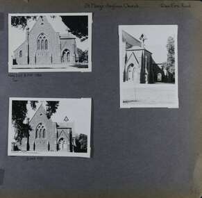 Glen Eira Historical Society
Album - Album page, St Mary's Anglican Church, Glen Eira Road, Circa 1972
This photograph is part of the Caulfield Historical Album 1972. This album was created in approximately 1972 as part of a project by the Caulfield Historical Society to assist in identifying buildings worthy of preservation. The album is related to a Survey the Caulfield Historical Society developed in collaboration with the National Trust of Australia (Victoria) and Caulfield City Council to identify historic buildings within the City of Caulfield that warranted the protection of a National Trust Classification. Principal photographer thought to be Trevor Hart, member of Caulfield Historical Society. Most photographs were taken between 1966-1972 with a small number of photographs being older and from unknown sources. All photographs are black and white except where stated, with 386 photographs over 198 pages.From the Victorian Heritage Register Database - Citation for St Mary's Anglican Church https://vhd.heritagecouncil.vic.gov.au/places/43715 (as at 14/10/2020) St Mary's has architectural significance as a representative example of French influenced Low and Mixed Gothic (see stylistic Typology in National Trust's Historic Churches Study) and is further distinguished by its use of bluestone, entirely without relief. French influence is demonstrated by the high nave, apsidal sanctuary, spirelet and trumeau. The building is locally important as a historic focus for Anglican worship and early mission activity whilst its architectural grandeur is expressive of mid Victorian Caulfield's status as a suburban location for the Metropolis gentry.Page 56 of Photograph Album with three exterior photographs (two portrait and one landscape) of St Mary's Anglican Church.Hand written: St Mary's Anglican Church Eira Road [top right] / Neg 235 8 Oct 1966 [under top left photo] / 3 Sep 1972 [under bottom left photo] / 56 [bottom right] trevor hart, 1880's, elsternwick, glen eira road, st kilda east, church of england, gothic, st mary's, bluestone, apsidal sanctuary, spirelet, trumeau, anglican, 1870's, caulfield north, french-influenced low and mixed gothic style -
Federation University Historical Collection
Book, Historic Sites Survey: North Central Study Area, 1979, 1979
The North Central Study Area included the Shires of Avoca, Bet Bet, east Loddon, Goulburn, Untly, Kara Kara, Korong, Maldon, Marong, Metcalfe, McIvor, Newstead, Strathfieldsaye, Stawell, Talbot, Clunes, Tullaroop and Waranga. 153 page book with white plastic binding. It is an historic sites survey for the North Central Study Area commissioned by the Land Conservation Council, the Ministry for COnservation and the Australian Heritage Commission. castlemaine, mount alexander goldfield, maldon, percydale, warrenmang, moliagul, tarnagulla, stuart mill, the whipstick, whroo, rushworth, graytown ironbark forest, st arnoaud, new bendigo, landsborough, inglewood, kurting, wedderburn, wehla, kooroora, langham flat, mcintyre, rheola, diamond hill, fosterville, coliban water works, green gully, newstead, muckleford forest, costerfield, graytown, bailieston, waranga irrigaiton system, eucalyptus distillery, mia mia bridge, korokubeal township researce, concegella slate quarry, chewton, fryerstown, kingower, timor, talbot, majorca, carisbroook, clunes, st arnaud, taradale, icomos, dunolly, limestone, castlemaine slate quarry, harcourt granite, taradale railway viaduct, loddon united waterworks trust, gouldburn weir, carisbrook lock-up, history of tree planting in streets, history of public reserves, r.u. nicholls nurseryman, thomas lang, francis moss, ballarat botanical gardens, ballarat school of mines botanical gardens, lake wendouree, victoria park, ballarat, muont holled smith, ballaarat old cemetery planting, eastern oval, ballarat east botanical gardens, ballarat east town hall gardens, eureka stockade reserve, ballarat observatory plantings, yarrowee creek plantings, yarrowee bluestone channels, ballarat woollen mill, band and albion mullock heap, black hill plantings, yarrowee creek channels, canadian creek channel, specimen vale channel, poverty point reserve, union jack reserve buninyong, imperial mine, buninyong, victoria street plantings, bridge mall, sturt street gardens, ballarat avenue of honour plantings, white flat oval plantings, camp street, elms, burnt creek