Showing 4077 items matching "surveying-terrestrial"
-
 Bendigo Military Museum
Photograph - Orthophotomap Workstation, Lithographic Squadron – Army Survey Regiment, Fortuna, Bendigo, 1988
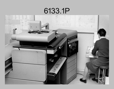
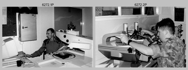
This collection of four photos was most likely taken at Lithographic Squadron, Army Survey Regiment, Fortuna, Bendigo in 1988. Orthophoto mapping provided the Survey Corps with the capability to produce map products quickly in the event of a crisis. These are four photographs of equipment used by the Army Survey Regiment to produce orthophotomaps. The OR1 orthophoto projector and workstation was introduced in the mid-1980s. It was the second-generation equipment used to orthorectify colour and monochrome film aerial photography, replacing the system introduced in 1973. Orthorectification is the process of removing geometric distortions and scale errors/variations from images. Images have tilt and relief distortions that make it difficult to compare accurately a map and an image of the same geographic area. Once an image is orthorectified, features on the image are shown in their planimetric locations. These four photographs of orthorectification equipment in operation were taken at the Army Survey Regiment at Fortuna, Bendigo, 1988. The photographs were on 35mm negative film and were scanned at 96 dpi. They are part of the Army Survey Regiment’s Collection. .1) to .4) - Photo, black & white, 1988, WILD OR-1 Orthorectification Workstation, SPR Carmel (Butler) Fauth.No personnel are identifiedroyal australian survey corps, rasvy, army survey regiment, army svy regt, fortuna, asr, litho -
 Bendigo Military Museum
Administrative record - Royal Australian Survey Corps - 1st, 2nd and 3rd Order Triangulation Precis, School of Military Survey, Balcombe, Circa 1948 - 1960
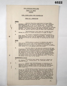
A School of Military Survey Precis, 8 x foolscap sized pages of typed text, stapled and two hole punched. The precis No 3 covers the Observation procedure to be used for 1st, 2nd and 3rd Order Triangulation using the Royal Australian Survey Corps standard Cooke, Troughton and Simms Tavistock or Wild T2. The geodetic model Tavistock with a 5.25" horizontal circle should be used for 1st Order Triangulation and maybe used for 2nd Order Triangulation if specially directed. The standard Tavistock with 3.5" horizontal circle or the Wild T2 should be used for 2nd and 3rd Order observations. The Precis discusses the types of errors, the source of errors and the best ways of managing them. In surveying, triangulation is the process of determining the location of a point by measuring only angles to it from known points at either end of a fixed baseline by using trigonometry, rather than measuring distances to the point directly as in trilateration.A School of Military Survey Precis, 8 x foolscap sized pages of typed text, stapled and two hole punched.royal australian survey corps, rasvy, fortuna, army survey regiment, army svy regt, asr, school of military survey, sms, balcombe -
 Bacchus Marsh & District Historical Society
Map, Coimadai Parish Map, County of Bourke. Circa 1890s-1900s
The cadastral Parish of Coimadai, a subdivision of the County of Bourke, lies directly north of the township of Bacchus Marsh. The date of this map is uncertain. T.F. McGauran the person who made a photo-lithographic copy of the map was in charge of photo-lithography at the Victorian Department of Lands and Survey in the late 19th century until about 1910.A single page paper map showing the map for the Parish of Coimadai in the County of Bourke. A cadastral map showing parish boundaries and land ownership. A rectangle shaped area is missing from the centre of the map due to a tear or deliberate excision. The map is pasted into a bound volume containing 76 maps or plans in total. High resolution digital image stored on BMDHS computer network. Photo-lithographed at the Department of Lands and Survey, Melbourne by T.F. McGauran 26.8.[??] NOTE. Photo litho from L.P showing temporary surveys and occupation of land prepared for departmental use onlybacchus marsh region parish plans, coimadai parish maps, coimadai parish plan -
 Glenelg Shire Council Cultural Collection
Photograph - Photograph - Aerial Photo railway line between Heywood and Rennick, 03/05/1952
Victorian Railways aerial survey record print of the railway line between Heywood and Rennick (S.A. border) Black and white, white vertical strip on imageBack: 'Heywood - Rennick 21581 - 19844 279m 70c 62 SA border ' - all black ink. Purple VR aerial survey stamp. '3 May 1952' - black stamp -
 Bendigo Military Museum
Map - Australian Topographical Survey TALLAROOK SE Sheet, 1 inch:1 Mile, NW portion Plane Table Field sheet 1923, Australian Survey Corps, 1923
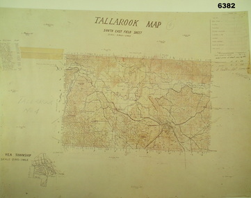
This is a coloured reproduction print of an original Plane Table compilation map sheet of Tallarook area 1inch to 1 Mile scale compiled by Sgt Jack Cullen Australian Survey Corps 12 November 1923 and signed by Capt J Lynch. Capt Lynch and Sgt Cullen were both foundation members of the Australian Survey Corps. Of particular interest is the fact that this is a heighted compilation with contouring (required for Military use) as many early maps were purely planimetric. The reverse side of this print is a copy of the Nagambie plane table South West field sheet.Reprinted coloured Image of Australian Topographical Survey TALLAROOK SE field Sheet,1 inch:1 Mile, hand drawn contoured Plane Table Field sheet. Signed by Sgt J Cullen Australian Survey Corps November1923. An enlargement of YEA Township 2 Inches to 1 Mile Scale.royal australian survey corps, rasvy, fortuna, army survey regiment, army svy regt, asr -
 Bendigo Military Museum
Administrative record - Operation Sunbird - Operation Report Jan 76 - Jun 77, 1 Fd Svy Sqn, 22 Aug 77
Operation Sunbird was a Royal Australian Survey Corps Operation conducted by 1 Fd Svy Sqn during the period Jan 76 - Jun 77. Originally the Operation was to consist of seven phases during the period Nov - Dec 76 to May to Jun 77. The original Operation was extended by the inclusion of Phase 8. .1 is Copy 1 and .2 is Copy 2Yellow Light Cardboard Covered report containing 30 x page report held together with Arnos Fasteners 6356.1 Copy 1, 6356.2 Copy 26356.1 has Army Survey Regiment Library Stamp on front coverroyal australian survey corps, rasvy, fortuna, army survey regiment, army svy regt, asr -
 Eltham District Historical Society Inc
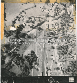
Photograph - Aerial Photograph, Main Road and Anzac Ave intersection, Hurstbridge, 12 Apr. 1954
Victorian Railways Aerial SurveyStamped VR Aerial Survey This print is not rectified Scale Approx 160' to 1 inch Date Photographed 12.4.54 Written Series 33, Item 9shire of eltham archives, aerial photo, main road, anzac avenue, hursbridge, parker road, hurstbridge railway station, rose road -
Whitehorse Historical Society Inc.
Map, Dandenong Ranges Area, 1956
Sheet 1. Parts of Parishes: Nunawading, Warrandyte and Ringwood. Scale: 10 chains : 1 inch. Contour intervals marked and locations of buildings.Sheet 1. Parts of Parishes: Nunawading, Warrandyte and Ringwood. Scale: 10 chains : 1 inch. Contour intervals marked and locations of buildings. Compiled from aerial photographs and cadastral survey information.Sheet 1. Parts of Parishes: Nunawading, Warrandyte and Ringwood. Scale: 10 chains : 1 inch. Contour intervals marked and locations of buildings. maps, ringwood, mitcham, warrandyte -
 Kiewa Valley Historical Society
Evacuation Plans for children during WWII, 1941
During World War 2 the State Emergency Council for Civil Defence (Victoria) sent out forms to Municipal Councils requesting a survey to be carried out regarding the suitability of householders to accommodate persons, especially children, in the more dangerous parts of Victoria. Also, surveying parents as to their wishes regarding the evacuation of their own children if necessary. The documents list householders living in the Kiewa Valley including Gundowring giving an insight into the families (size, age, religion, sex), the homes (size, number and type of rooms), Water supply, Conveyance (motor or horse drawn), distance from railway station and school. Papers created by the State Emergency Council for Civil Defence, Premier's Department 1941 requesting Municipal Councils to survey people in case of the billeting of persons who may be evacuated from the more dangerous parts of Victoria. The Accommodation Survey lists the householder, details of the house, how many people living there and how many could be accommodated.There are also forms asking householders if they wish their children to be evacuated if necessary.Forms filled out in ink. world war ii; evacuation plans; kiewa valley; gundowring -
 Bendigo Military Museum
Administrative record - Army Survey Regiment Map Production System Configuration GESS/RSSS, 11 May 1995
This minute encloses a copy of the Software Licence Agreement with Intergraph Corporation Pty Ltd that applies to the software packages within the Automap Raster Sub System (RSSS) and the Graphic Edit Sub System (GESS) at the Army Survey Regiment.A4 Army Survey Regiment Minute - Author AJ Spurling Manager Tech Spt Gp 11 May 95royal australian survey corps, rasvy, fortuna, army survey regiment, army svy regt, asr, intergraph corporation -
 Bendigo Military Museum
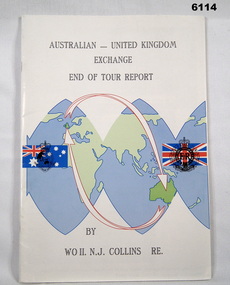
Administrative record - Australian - United Kingdom Exchange End of Tour Report by WO2 NJ Collins RE 1988, WO2 N.J. Collins RE, 19 April 1988
Contains the 1988 End of Tour Report by WO2 NJ Collins RE , a British Army SNCO on a two year exchange at the Army Survey Regiment, Bendigo A4 size, front cover has a world graphic with Australian and UK Flags superimposed. Each flag has relevant Corps Badges superimposed. Inside front cover has photos of parts of Villa Fortuna. Inside back cover has a list of ex-British Military Survey members presently serving with the Royal Australian Survey Corps.Green Highlight on parts of Pages 7,8 and 11royal australian survey corps, rasvy, fortuna, army survey regiment, army svy regt, asr -
 Bendigo Military Museum
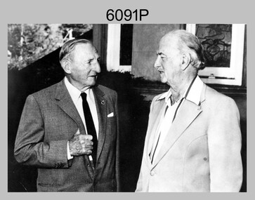
Photograph - Army Survey Regiment – CAPT Jack Cullen (Ret), Fortuna, Bendigo, c1978
This is a photograph of CAPT Jack Cullen (Ret) and an unidentified person besides the front steps of Fortuna Villa, Bendigo, c1978. Jack Cullen served for many years in the Royal Australian Survey Corps from 1920 to 1952, after active service with the AIF in WW1. His service at Fortuna began in 1944 when he was a Lieutenant in charge of a map compilation section. Jack Cullen’s service is covered in more detail with additional historic photographs, in Valerie Lovejoy’s book 'Mapmakers of Fortuna – A history of the Army Survey Regiment’ ISBN: 0-646-42120-4This is a photograph of CAPT Jack Cullen (Ret) and an unidentified person at the Army Survey Regiment, Fortuna, Bendigo, c1978. The photograph was printed on photographic paper and is part of the Army Survey Regiment’s Collection. The photograph was scanned at 300 dpi. Photo, black & white, c1988: L to R: CAPT Jack Cullen (Ret), unidentified person‘Jack Cullen’ is annotated on back of the photoroyal australian survey corps, rasvy, army survey regiment, army svy regt, fortuna, asr -
 Bendigo Military Museum
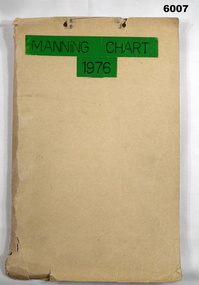
Document - Army Survey Regiment Manning Chart 1976, 1976
This document contains detailed photocopies of reports of Army Survey Regiment’s staff manning from December 1975 to August 1976. Each monthly report provided to Directorate of Survey covered the allocation of staff to Regimental Headquarters and its four sub units comprising Headquarters, Air Survey (Topographic), Cartographic and Lithographic Squadrons. Each Squadron’s troop or section structure was represented by a wire diagram with soldiers and/or civilians names assigned to rank based established positions. A detailed table at the end of each report sumarised Army Survey Regiment’s posted strength by employment category and rank.Manilla cardboard folder containing 83 photocopied pages of staff posted to the Army Survey Regiment. Pages are fixed to the folder by a metal fastener. The title of the folder is written in black ink on a green tape background.royal australian survey corps, rasvy, army survey regiment, army svy regt, asr, fortuna -
 Stawell Historical Society Inc
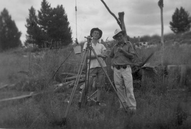
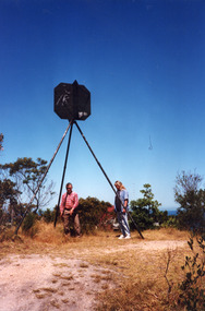
Photograph, Stawell Geodetic Survey at work. c1940's
Taken while surveying western half of Victoria to South Australian Border.Theodolite in foreground. Behind Surveyor in hat, shirt, long pants. Directly behind is Survey technician in hat, Tee shirt and shorts. Surveyor unknown. Assistant Alan Edward Tangey of Stawell. Reverse 4 2 2 6 -
 Bendigo Military Museum
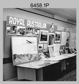
Photograph - Royal Australian Survey Corps role and technical capabilities display, c1960s
This is a collection of four photographs taken in the 1960s of Royal Australian Survey Corps displays promoting its role and technical capability to acquire, process and disseminate topographic information to the Australian Defence Force. Map products formed a large part of this topographic Support. The photos may have been taken at a Careers Expo or a Department of Defence promotion. It is possible the photos were taken at separate events. This is a collection of four photographs taken in the 1960s of Royal Australian Survey Corps displays promoting its role in Defence and technical capabilities. The black and white photographs were printed on photographic paper and are part of the Army Survey Regiment’s Collection. The photographs were scanned at 300 dpi. .1) to .4) - Photo, black & white, 1960s. Royal Australian Survey Corps Display at unknown location.There are no annotations.royal australian survey corps, rasvy, army survey regiment, army svy regt, fortuna, asr -
 Bendigo Military Museum
Administrative record - Army Survey Regiment Officers Mess Ball 1990, Army Survey Regiment, Bendigo, 12 Feb - 8 Mar 1990
The Army Survey Regiment held Annual Balls at Fortuna Villa. This folder contains the documentation for the Logistics and activities associated with the planning and running of the Officers Mess Summer Ball held in 1990.Manilla Correspondence Folder with grey cloth binding containing correspondence about the Army Survey Regiment Officers Mess Summer Ball of 1990.royal australian survey corps, rasvy, fortuna, army survey regiment, army svy regt, asr -
 University of Melbourne, Burnley Campus Archives
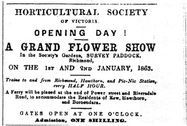
Newspaper - Newspaper Cutting, The Australian, Horticultural Society of Victoria Opening Day, 1862
The Survey Paddock eventually became part of the Burnley Horticultural College.Photocopy of the top half of the front page of The Australian, December 27, 1862. In the top right corner is a notice of the opening day of a grand flower show in the gardens of the Horticultural Society in the Survey Paddock, Richmond.the australian, flower show, survey paddock, horticultural society of victoria, opening of burnley gardens, advertisement -
 Bendigo Military Museum
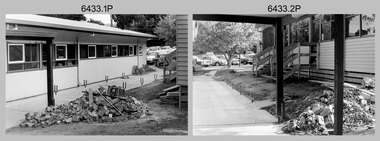
Photograph - Air Survey Squadron building refurbishment - Army Survey Regiment Fortuna, Bendigo, c1982
This set of 20 black & white photographs of the refurbishment of Air Survey Squadron’s production areas, was taken in circa 1982. These refurbishments were most likely in preparation of the AUTOMAP 2 production system and to accommodate the expansion of the Army Survey Regiment’s work force. This photo set also includes the exterior and interior of a new building - 16A, a modular building of several sections transported in and joined together as part of the expansion. Another modular building - 16B was added later in the 1980s to accommodate Technical Services. The two buildings eventually were removed after Fortuna was sold by Defence in 2008.This set of 20 black & white photographs of the refurbishment of Air Survey Squadron’s production areas, was taken in circa 1982. The photographs are on 35mm negative film. They are part of the Army Survey Regiment’s Collection. The photographic negatives were scanned at 96 dpi. .1) to .2) - Photo, black & white, c1982. Air Survey Squadron building refurbishment. Pathway between Building 16 and Building 16A. .3) to .4) - Photo, black & white, c1982. Air Survey Squadron Building 16 refurbishment. .5) - Photo, black & white, c1982. Air Survey Squadron’s CAPT Chris ‘Monty’ Gehrmann. .6) - Photo, black & white, c1982. AUTOMAP 1 system, L to R: SGT Jim Gill, unidentified. .7) - Photo, black & white, c1982. AUTOMAP 1 system, SGT Bruce Bowers. .8) - Photo, black & white, c1982. AUTOMAP 1 system, unidentified staff. .9) - Photo, black & white, c1982. Technical Services - L to R: Tony Spurling, Joe Farrrington. .10) - Photo, black & white, c1982. Technical Services - Tony Spurling. .11) to .12) - Photo, black & white, c1982. Technical Services, unidentified staff. .13) - Photo, black & white, c1982. Air Survey Squadron, L to R: SPR Nick Van Dalen, SSGT Les Dixon, unidentified. .14) - Photo, black & white, c1982. Air Survey Squadron, L to R: SGT Greg Byers, WO1 Graeme Birrell. .15) - Photo, black & white, c1982. Air Survey Squadron, L to R: SSGT Bruce Gordon, CPL Dave Irving, SGT Phil Meagher, SSGT Brett ‘Dutchy’ Van Leeuwin. .16) - Photo, black & white, c1982. Air Survey Squadron, L to R: SGT Mick Hogan, CPL John Gilbert, SPR Lorraine (Daly) Talbot-Smith, SPR Santina (Argetto) Straube. .17) - Photo, black & white, c1982. Air Survey Squadron, L to R: CPL Dave Irving, SSGT Bruce Gordon, SGT Phil Meagher, SSGT Brett ‘Dutchy’ Van Leeuwin. .18) - Photo, black & white, c1982. Air Survey Squadron, L to R: CPL Dave Irving, SGT Phil Meagher. .19) - Photo, black & white, c1982. Air Survey Squadron, L to R: SPR Lorraine (Daly) Talbot-Smith, SGT Mick Hogan, CPL Dave Irving. .20) - Photo, black & white, c1982. Air Survey Squadron, L to R: SGT Phil Meagher, CPL Dave Irving, SSGT Brett ‘Dutchy’ Van Leeuwin, SSGT Bruce Gordon,.1P to .20P – no annotationsroyal australian survey corps, rasvy, army survey regiment, army svy regt, fortuna, asr, photogrammetry, automap 1 -
 University of Melbourne, Burnley Campus Archives
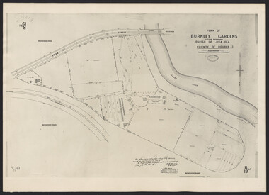
Photograph - Plan of Burnley Gardens
"This plan is a copy of a copy of the survey made by Mr. Turner in 1926. The original plan and field notes are missing _ file Rs 3529" Signed by _signature unreadable_ -
 Lakes Entrance Historical Society
Photograph - Lakes Entrance Grid location, 1999
... Surveying ...Lakes Entrance Grid reference, Cunninghame 8522.3.4 896.082, on ten acre site with trig point, it is from this point that all the survey for the surrounding areas was undertaken. Part of the Vic Geodetic Survey initiated in 1860 by Ellery Survey started from triangulation base in Werribee. (Grid ref B'dale 8422)Colour photograph of the Victoria Geodetic Survey Triangulation Station, Trig Station, situated off Ocean View Parade, Merrangbaur Hill. Location is indicated by ground point and standing structure, situated on an elevated bush block. Lakes Entrance Victoriasurveying, township planning -
 Flagstaff Hill Maritime Museum and Village
Map - Survey Map, F.F. McGovern, Yangery - County of Villiers, 1884
A surveyor was employed to measure the land designated as Yangery, County of Villiers, in the Borough of Warrnambool. The area on the map is similar to the earlier Farnham Survey undertaken by William Rutledge in the 1850's. Warrnambool was a Borough between 1863-1883. Coutours, waterways, sea and other significant points are shown. The distances are accurately measured. This survey map was used for planning future land sales, recreation areas and roads. WILLIAM RUTLEDGE (1806-1876) William Rutledge surveyed the land known as Farnham in southwest Victoria in 1843. His tenants made him a profitable business from working the land there. In 1863 Rutledge moved from nearby Port Fairy to Farnham and became very successful in breeding sheep, which he imported from J.R. Kirkham of Lincolnshire, England. He also bred horses on his land. The survey map of Yangery is important for its connection with renowned surveyor William Rutledge. The map shows the growth of landholders in the district when compared to the original Rutledge survey of the 1850's.Survey map of Yangery, titled "Yangery - County of Villiers". Printed on white paper, mounted on brown paper. c. 1863-1876. Comments printed on the Map include; Special Survey by William Rutledge, Photo-lithographed at the Department of Lands and Survey, Melbourne by W.J. Burson, Price 1/- [one shilling]. Scale is in Chains. Map has boundaries of Koroit Borough, Meerai, Purnim, Wangoom, Borough of Warrnambool, Mentions the Proposal of Tower HIll for Public Recreation. The map names the owners of the land at that time. Hand written pencil marks and figures and "Sauls fence" drawn on map. Hand written pencil markes and figures and "Sauls fence" drawn onto map. "For Department Use only". "Scale: 8 chains to 1 inch" flagstaff hill, warrnambool, shipwrecked-coast, flagstaff-hill, flagstaff-hill-maritime-museum, maritime-museum, shipwreck-coast, flagstaff-hill-maritime-village, county of villiers map, yangery district, w.j. burson, borough of warrnambool, koroit, purnim, meerai, wangoom, proposal of tower hill for public recreation, special survey by william rutledge, william rutledge, farnham, lincolnshire sheep, clydesdale -
 Bendigo Military Museum
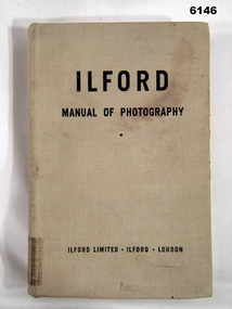
Manual - Ilford Manual of Photography, Ilford Limited, Henry Greenwood &Co. Ltd. & Percy Lund, Humphries & Co. Ltd, First Published in October 1942
Manual describing all facets of photography using Ilford Cameras and includes developing and printing of photographs. The map making production at the Army Survey Regiment, Bendigo, made extensive use of photographic processes.A5 sized book, Hard Covers front and back. 470 numbered glossy pages.Inside front cover - "L33", stamp - "EXPENDABLE STORES" (twice), "Unreadable signature - QM 30/7/82", Stamp- "AHQ Survey Regiment, Royal Australian Survey Corps" Handwritten - Accession No 167 (and then crossed out), Stamp "29" First Page "15/-", Stamp "2 Topo Svy Coy, Powlett Street Training Depot (partly crossed out), Stamp Technical Book and Magazine Co, 295 -299 Swanston St. Opp Old Melbourne Hospital cert 2041, Melbourne. Title Page - "Accession No16, stamp 2 Topo Svy Coy Powlett Street Training Depot, East Melbourne" Stamp - "AHQ Survey Regiment, Royal Australian Survey Corps" - Accession No 167 (faded). Back Cover - Stamp - "AHQ Survey Regiment, Royal Australian Survey Corps"royal australian survey corps, rasvy, fortuna, army survey regiment, army svy regt, asr -
 Kew Historical Society Inc
Plan, Survey Plan, Park Hill Road, Kew, 1880-1890
The streets identified on the survey plan - Cotham Road, Park Hill Road East, Park Hill Road West in Kew were each gazetted by the Victorian Government in 1865. The hand-coloured survey plan was completed by Holland Loxton, Town Clerk and Surveyor of the Borough of Kew from 1866. The unnamed survey plan includes names of land owners in addition to measurements (2 chains to 1 inch) and streets. Named owners include Webster, Payne and Francom which will enable us to narrow down the creation date of the survey.Handdrawn survey plan by a former surveyor and town clerk of KewHand drawn and coloured survey plan created by Holland Loxton, Surveyor and Town Clerk of Kew, showing land owned by Payne in Park Hill Road, Kew. The plan includes street names, land measurements and land owners.surveys - kew, maps - kew, holland loxton, park hill road - kew, holland loxton -- surveyor, survey plans -- parkhill road -- kew (vic.) -
 Orbost & District Historical Society
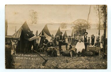
black and white photograph, July 27 1907
This is a camp of survey workers surveying the railway line . They were camped at Mossiface in 1907. It has been sent as a postcard - "Dear Miss Ross, Just a card, hoping you are well etc, trust you have not forgotten our trip. I forgot to get the name of the street in Hobart of Mr Benjamin or Temple?????? Sufficient. Yours sincerely H.R. Gordon". It has been dated September 30th 1907. There had been men surveying in East Gippsland from the late 19th century. Railway surveyors advocated two lines beyond Bairnsdale – one via Bruthen and the Tambo Valley to Omeo, the other via Swan Reach and Colquhoun to Orbost, then on to Bendoc and the border. With all the argument and feuding between the warring factions, by the end of 1891, the Parliamentary Railways Standing Committee gave up in despair of trying to reach any agreement and abandoned the idea altogether. Finally, with all problems solved, the first sod was turned at Mossiface on 9.1.1912, the government sticking to the original route in the 1890 survey .This is a pictorial record of a surveyors' camp in the early 20th century. The Bairnsdale to Orbost Railway was a significant contributor to the economy of Orbost until it closed.A black / white photograph / postcard of a group of men at a campsite. In the background is a row of tents. on the right side is a clothes line with several sheets hung over it. Two men are studying a map or chart; one man is sitting with a cloth around his shoulders while another is standing behind him cutting his hair; one man is washing cloth in a tin tub; another appears to be stirring a pot; others are sitting reading or just observing.on front - handwritten is " R.L.Y.S. SURVEY CAMP MOSSIFACE 27.7.07" on back is a letter - "Dear Miss Ross.............yours sincerely ????? Gordon"surveying-railway east-gippsland-railway mossiface-survey-camp -
 Bendigo Military Museum
Photograph - Lowering of the Australian Flag by Army Survey Regiment personnel, Australia Day, Kerang, 1996
These two photographs of a contingent from the Army Survey Regiment lowering the Australian flag were taken on Australia Day in Kerang, Victoria on the 26th of January 1996. Most units of the Australian Defence Force (ADF) provide contingents to regional towns in their local area to assist in commemoration ceremonies on days of national significance, such as Australia Day, ANZAC Day and Remembrance Day. This was most likely one of the last occasions before the closure of the Army Survey Regiment. The use of an improvised flagpole is unknown.These two photographs of a contingent from the Army Survey Regiment lowering the Australian flag, were taken on Australia Day in Kerang, Victoria on the 26th of January 1996. The photographs were printed on photographic paper and are part of the Army Survey Regiment’s Collection. The colour photographs were scanned at 300 dpi. .1) and .2) - Photo, colour, contingent of unidentified Army Svy Regt personnel. There are no annotations.royal australian survey corps, rasvy, army survey regiment, army svy regt, fortuna, asr, kerang shire, australia day -
 Bendigo Military Museum
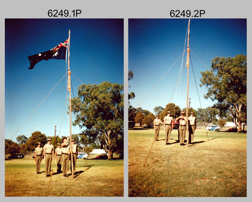
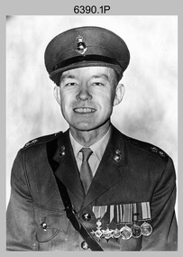
Photograph - CO of the Army Headquarters Survey Regiment - LTCOL Lionel ‘Bill’ Sprenger MBE MID, Fortuna, Bendigo, 1969
These three formal photos of LTCOL Lionel ‘Bill’ Sprenger MBE, MID were taken at the Army Headquarters (AHQ) Survey Regiment, Fortuna, Bendigo on the 30th of September 1969. LTCOL Bill Sprenger MBE, MID joined the Australian Army on the 10th of June 1940 and after rising through the ranks, his career culminated in his appointment as CO of the Army Survey Regiment from 1969 to 1970. Despite suffering debilitating poor health during his appointment, LTCOL Sprenger MBE, MID led the Regiment on the unit’s first Freedom of Entry Parade held in Bendigo on the 14th of June 1970. For more information on this occasion, refer to item 6020.8P. Unfortunately, LTCOL Bill Sprenger MBE, MID passed away on the 5th of December 1970 and was farewelled with a full military funeral. He is remembered as a model of good leadership. More information on LTCOL Sprenger’s tenure as CO of the unit is provided in pages 98 to 99, 102 and 134 of Valerie Lovejoy’s book 'Mapmakers of Fortuna – A history of the Army Survey Regiment’ ISBN: 0-646-42120-4.These three formal photos of LTCOL Lionel ‘Bill’ Sprenger MBE, MID were taken at the Army Headquarters (AHQ) Survey Regiment, Fortuna, Bendigo on the 30th of September 1969. The black and white photographs were printed on photographic paper and are part of the Army Survey Regiment’s Collection. Photo .1) was scanned at 300 dpi and photos .2) & .3) were scanned at 600 dpi. .1) to .3) - Photo, black & white, 1969, LTCOL Lionel ‘Bill’ Sprenger MBE, MID - CO of AHQ Survey Regiment.‘Unit Photos 30 Sept 1969’, ‘1 Topo Svy Tp’, ‘ LT COL Sprenger’ . Note - Yellow tag is annotated with incorrect date (1970). royal australian survey corps, rasvy, army survey regiment, army svy regt, fortuna, asr -
Glenelg Shire Council Cultural Collection
Photograph - Photograph - aerial view of railway line between Heywood and Rennick, 03/05/1952
Victorian Railways aerial survey record print of the railway line between Heywood and Rennick (S.A. border) Black and white, white vertical strip on imageBack: 'Heywood - Rennick 21450 - 19721 266m 72 c' - all black ink. White sticker, black print 'Marp' Purple VR aerial survey stamp. '3 May 1952' - black stampvictorian railways, aerial photography -
 Bendigo Military Museum
Photograph - Aerotriangulation Production – Army Survey Regiment, Fortuna, Bendigo, c1993
This is a collection of eight photographs of Air Survey Squadron personnel operating aerotriangulation equipment at the Army Survey Regiment at Fortuna, Bendigo, c1993. PUG4 devices were used by technicians to stereoscopically view the photography containing the survey control points and the mapping aerial photography. The Control points were transferred from the control photography to the mapping diapositives of aerial photography by drilling their locations into the photographic emulsion. The Zeiss (Jena) Stecometer analytic stereocomparator for air photography shown in photo .1P was introduced at Air Survey Squadron in 1963. Wild PUG4 point transfer devices shown in photos .2P to .4P were introduced in c1968 superseding the PUG2 devices. See item 6195.19P for more photos and descriptions of Air Survey Squadron personnel and aerotriangulation equipment.This is a set of eight photographs of Air Survey Squadron personnel operating aerotriangulation equipment at the Army Survey Regiment at Fortuna, Bendigo, c1993. The photographs were on 35mm negative film and were scanned at 96 dpi. They are part of the Army Survey Regiment’s Collection. .1) - Photo, black & white, c1993, Zeiss (Jena) Stecometer, SPR Kim Baker. .2) - Photo, black & white, c1993, Wild PUG4 point transfer device, CPL Paul Bouton. .3) to .4) - Photo, black & white, c1993, Wild PUG4 point transfer device, L to R: CPL Darren Scott, CPL Paul Bouton. .5) to .6P) - Photo, black & white, c1993, CPL Doug Willis. .7) - Photo, black & white, c1993, WO2 Noel ‘Macca’ McNamara. .8) - Photo, black & white, c1993, SGT Barry Miller..1P to .8P - There are no annotations.royal australian survey corps, rasvy, army survey regiment, army svy regt, fortuna, asr, aerotrig -
 Bendigo Military Museum
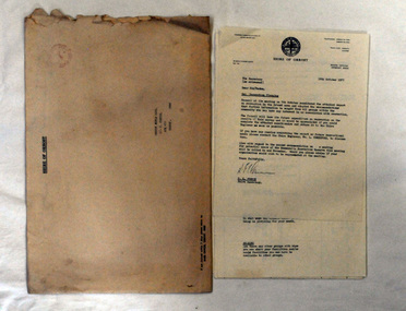
Administrative record - Army Survey Regiment Officers Mess - Insurance Invoices and Receipts, Army Headquarters Survey Regiment, 1957-1967
Various Insurance Company invoices and receipts, all pertaining to the Officers Mess at Army Headquarters Survey Regiment Foolscap size folder. All paper pages of various sizes from a number of different Insurance companies pertaining to the Officers Mess at AHQ Survey Regiment during the years 1957 to 1967.royal australian survey corps, rasvy, fortuna, army survey regiment, army svy regt, asr -
 Orbost & District Historical Society
document, 18th October, 1977
This survey had been sent to the Orbost Rifle Club c/- C. Curtis.The Shire of Orbost was a local government area about 380 kilometres (236 mi) east of Melbourne, the state capital of Victoria, Australia. The shire covered an area of 9,347 square kilometres (3,608.9 sq mi), and existed from 1892 until 1994 when it was merged as part of East Gippsland Shire Council.A nine page document stapled in the left-hand corner. It is a recreational survey issued by the Shire of Orbost. It is inside a a large manila envelope which is addressed to the Orbost Rifle club. It contains a covering letter and a form.survey shire-of-orbost orbost-rifle-club