
Showing 108 items matching " victoria hill reserve"
-
 Bendigo Historical Society Inc.
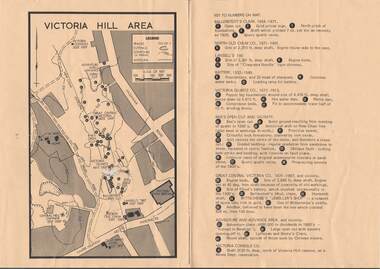
Map - VICTORIA HILL AREA
... victoria hill...Victoria Hill Area... Victoria Consols... New Chum anticline... Great Central Victoria... Rae's Open Cut... W Rae's Home... Victoria Quartz... Ballerstedt's Open Cut... Lansell's 180... North Old Chum... Central Nell Gwynne... John Brown Factory... Gold Mines Hotel... Cleopatra Needle type chimney... Floyd's Battery... Ballerstedt's 24yd Claim... Humboldt Shaft... Wittscheibe's Jeweller's Shop... Luffsman and Sterry's Claim... Victoria Hill Reserve...MAP Bendigo victoria hill Victoria Hill Area Victoria Consols New Chum anticline Great Central Victoria Rae's Open Cut W Rae's Home Victoria Quartz Ballerstedt's Open Cut Lansell's 180 North Old Chum Central Nell Gwynne John Brown Factory Gold Mines Hotel Cleopatra Needle type chimney Floyd's Battery Ballerstedt's 24yd Claim Humboldt Shaft Wittscheibe's Jeweller's Shop Luffsman and Sterry's Claim Victoria Hill Reserve Mines Dept Reervation Map of Victoria Hill Area printed on yellow paper. ...Map of Victoria Hill Area printed on yellow paper. Details of tracks, cuttings, contours (in Metres) and Anticline. Location of mines, open cuts and buildings are shown. Numbers on map are: Ballerstedt's Claim 1 - 5; North Old Chum Co. 6; Lansell's 180, 7,8,11; Battery 9.10.12; Victoria Quartz Co. 13 - 17; Rae's Open Cut and Vicinity 18 - 28, Great Central Victoria Co 29 - 36, Adventure and Advance Area and vicinity 37 - 40 and Victoria Consols Co 41.map, bendigo, victoria hill, victoria hill area, victoria consols, new chum anticline, great central victoria, rae's open cut, w rae's home, victoria quartz, ballerstedt's open cut, lansell's 180, north old chum, central nell gwynne, john brown factory, gold mines hotel, cleopatra needle type chimney, floyd's battery, ballerstedt's 24yd claim, humboldt shaft, wittscheibe's jeweller's shop, luffsman and sterry's claim, victoria hill reserve, mines dept reervation -
 Bendigo Historical Society Inc.
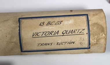
Plan - Victoria Quartz Gold Mine
... (Source, Goldfield Guide https://www.goldfieldsguide.com.au/explore-location/400/victoria-hill-mining-reserve/) Victorian Heritage Register information on mine: Statement of Significance Last updated on - July 14, 2005 The story of quartz mining on Victoria Hill lies at the heart of Bendigo's historical status as the world's richest and deepest reefing field. ...(Source, Goldfield Guide https://www.goldfieldsguide.com.au/explore-location/400/victoria-hill-mining-reserve/) Victorian Heritage Register information on mine: Statement of Significance Last updated on - July 14, 2005 The story of quartz mining on Victoria Hill lies at the heart of Bendigo's historical status as the world's richest and deepest reefing field. ...The Victoria Quartz Gold Mine was situated on Victoria Hill, Ironbark, (1877 - 1913). At the turn of the century, this was the site of one of the premier mines on the Bendigo goldfield. In 1908, it boasted the world's deepest shaft - 4,478 feet (1,365 metres). The shaft reached a depth of 4,613 feet (1,406 metres) in 1910. In 1857 eight small claims in this area had been merged to form the Victoria Reef Quartz Mining Co. Another merger in 1877 led to the formation of the Victoria Quartz Co. For the next three decades, the mine produced consistent profits. In 1910, water burst into the claim, flooding the shaft and halting operations. The company baled water for six months then handed the mine over to the tributers who worked the upper levels for the share of the profits. The mine closed in 1913, having produced over 48,000 ounces of gold and paid dividends of £99,600. (Source, Goldfield Guide https://www.goldfieldsguide.com.au/explore-location/400/victoria-hill-mining-reserve/) Victorian Heritage Register information on mine: Statement of Significance Last updated on - July 14, 2005 The story of quartz mining on Victoria Hill lies at the heart of Bendigo's historical status as the world's richest and deepest reefing field. Gold was discovered on Victoria Hill in 1854, and by early 1855 claims had been taken up over its entire extent. Shafts were first worked by windlass, whip or whim, and primitive crushing batteries were in operation. By 1861, Victoria Hill had yielded at least 1,200,000oz in gold. One of the early claims on Victoria Hill was owned by Prussian immigrants, Christopher Ballerstedt and his son Theodore. In 1854, they bought a claim on the hill for £80, to which they subsequently added other claims, and from the quartz veins (called spurs), worked both by shafts and a large open cut, obtained gold worth nearly £200,000. Christopher Ballerstedt was dubbed 'Father of the Hill' and has been credited as the first to debunk the theory at that time prevalent on the Bendigo field, that the gold content of reefs would diminish at depth. As his shafts plunged below the 200-foot level, the quartz remained rich in gold. His success inspired others, and so led the way to Bendigo's later status as the world's deepest and richest goldfield. The Ballerstedt's built Bendigo's grandest mansion, Fortuna. Theodore continued to work Victoria Hill after his father's death, but in 1871, convinced that his claim was exhausted, he sold both mine and mansion to George Lansell for £60,000. Lansell's mine on Victoria Hill was called the 180, and operated under his ownership until his death in 1906. The mine supplied the initial wealth that made Lansell Bendigo's 'Quartz King'. George Lansell was such a force in Bendigo's mining history that his death was cited as one of the reasons for the decline of Bendigo as a quartz mining centre, The Victoria Hill Quartz Gold Mines are of historical, archaeological and scientific importance to the State of Victoria. The Victoria Hill Quartz Gold Mines are historically significant as the symbolic heart of Bendigo's famous goldfield. The mines are linked to nineteenth-century individuals (Christopher Ballerstedt and George Lansell) who played prominent roles in the evolution of Bendigo. Both men's fortunes and their influence on Bendigo, originated from mining operations carried out on the hill. The Victoria Hill Quartz Gold Mines are historically and scientifically important as characteristic examples of an important form of gold mining. Gold mining sites are of crucial importance for the pivotal role they have played since 1851 in the development of Victoria. As well as being a significant producer of Victoria's nineteenth century wealth, quartz mining, with its intensive reliance on machinery, played an important role in the development of Victorian manufacturing industry. The Victoria Hill Quartz Gold Mines are important as a manifestation of this aspect of gold mining. The Victoria Hill Quartz Gold Mines are scientifically important, as they contain relics span nearly sixty years of mining (1854 to 1913), documenting the richest and most significant years of Bendigo's world-famous quartz mining industry. Enhancing the significance of the place are relics from the Victoria Quartz Company operations, ncluding, at 4,870 feet, the world's deepest nineteenth-century gold mining shaft. As a postscript to the chronology of gold mining is the surviving crushing machinery (formerly part of the Bendigo Crushing Works) which was erected near the foundations of Lansell's 180 mine in 1932, to crush quartz for nearby mines. The place has a potential to yield artefacts and evidence which will be able to provide significant information about the technological history of gold mining. [Source: Victorian Heritage Register] Hermes Number 8506 https://vhd.heritagecouncil.vic.gov.au/index.php/places/8506/download-report Hand drawn plan of the bottom section of the Victoria Quartz Gold Mine. Mine shaft shown from 2706 feet to 5200 (potential) feet shown, with annotation regarding geological features and gold obtained from different level crushings. Blue border sticker on outside of plan: '13 BC 23 Victoria Quartz Trans-Section'. Plan is not dated. The Victoria Quartz plan is part of the Margaret Roberts Collection.victoria hill quartz gold mine, victoria hill -
 Federation University Historical Collection
Book, Peter Lumley et al, Ballarat: Historic Landscapes, Trees & Gardens, 1983, 1983
... Victoria Park...Lake Wendouree...Ballaarat Old Cemetery...Eastern Oval...Ballarat East Town Hall Gardens...Ballarat School of Mines Botanical gardens...Eureka Stckade Recreation Reserve...Ballarat Observatory...Yarrowee Creek...Black Hill...275 page landscape study of Ballarat including Trees in the Victorian Landscape; Plant sources early Ballarat nurseries, Botanical Gardens, Lake Wendouree, Fairy Gardens, Victoria Park, Ballaarat Old Cemetery, Eastern Oval, City Oval, Ballarat East Town Hall Gardens, Eureka Stockade, Observatory, Yarrowee, Black Hill, Sovereign Hill, Cheek Channels, Canadian Creek, Poverty Point Reserve, Goldmining Relics, Woah Hawp, Buninyong, street plantings, Russell, Victoria, Bridge Mall, Sturt Street Gardens, Avenue of Honour, Webster, Elms, ...Lisa Green and Lisa Morcom of Ballarat College of Advanced Educatiion contributed to this report. ballarat trees nursery r.u. nicholls francis moss ballarat botanical gardens Victoria Park Lake Wendouree Ballaarat Old Cemetery Eastern Oval Ballarat East Town Hall Gardens Ballarat School of Mines Botanical gardens Eureka Stckade Recreation Reserve Ballarat Observatory Yarrowee Creek Black Hill Reserve Sovereign Hill Ballarat Avenue of Honour Victoria Street plantings Bridge Mall Plantings george longley 275 page landscape study of Ballarat including Trees in the Victorian Landscape; Plant sources early Ballarat nurseries, Botanical Gardens, Lake Wendouree, Fairy Gardens, Victoria Park, Ballaarat Old Cemetery, Eastern Oval, City Oval, Ballarat East Town Hall Gardens, Eureka Stockade, Observatory, Yarrowee, Black Hill, Sovereign Hill, Cheek Channels, Canadian Creek, Poverty Point Reserve, Goldmining Relics, Woah Hawp, Buninyong, street plantings, Russell, Victoria, Bridge Mall, Sturt Street Gardens, Avenue of Honour, Webster, Elms, Ballarat: Historic Landscapes, Trees & Gardens, 1983 Book Book Peter Lumley John Dyke Roger Spencer Eve Almond ...Lisa Green and Lisa Morcom of Ballarat College of Advanced Educatiion contributed to this report.275 page landscape study of Ballarat including Trees in the Victorian Landscape; Plant sources early Ballarat nurseries, Botanical Gardens, Lake Wendouree, Fairy Gardens, Victoria Park, Ballaarat Old Cemetery, Eastern Oval, City Oval, Ballarat East Town Hall Gardens, Eureka Stockade, Observatory, Yarrowee, Black Hill, Sovereign Hill, Cheek Channels, Canadian Creek, Poverty Point Reserve, Goldmining Relics, Woah Hawp, Buninyong, street plantings, Russell, Victoria, Bridge Mall, Sturt Street Gardens, Avenue of Honour, Webster, Elms, ballarat, trees, nursery, r.u. nicholls, francis moss, ballarat botanical gardens, victoria park, lake wendouree, ballaarat old cemetery, eastern oval, ballarat east town hall gardens, ballarat school of mines botanical gardens, eureka stckade recreation reserve, ballarat observatory, yarrowee creek, black hill reserve, sovereign hill, ballarat avenue of honour, victoria street plantings, bridge mall plantings, george longley -
 Federation University Historical Collection
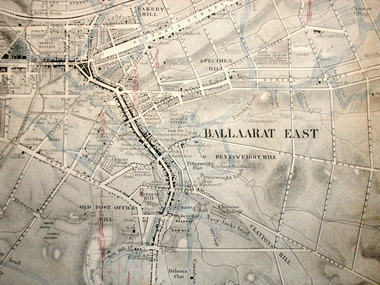
Map, Ballaarat Gold Field, 1861, 21/10/1861
... Victoria. In November 2004 the Central Highlands Regional Library presented a special edition of 200 copies of the 1861 map reproduced from a copy in their collection. ballarat map davidson robert brough-smyth fitzpatrick cowan yuille's swamp public garden reserve manure depot black hill ballarat east old post office hill pennyweight hill claytons hill golden point mining railway cricket ground swamp creek cemetery sludge reserve bakery hill gaelic church juvenile reformatory orphanage specimen hill eureka lead cattle yard hill dalton's flat chinese village poverty hill railway reserve little bendigo diggings pound reserve allied armies flour mill agricultural reserve marsh survey reserve survey corps white flat yarrowee yarrowee creek brache j. brache survey ballaarat gold field 1861 Compiled & Drawn from the Survey of Mining Surveyors Davidson, Fitzpatrick and Cowan & the Plans in the Surveyor General's Office by J. ...A party of surveyors camped by Yuille's Swamp (later Lake Wendouree) and surveyed the countryside for a map to be produced by the Geological Survey of Victoria. In November 2004 the Central Highlands Regional Library presented a special edition of 200 copies of the 1861 map reproduced from a copy in their collection. Original geological map of Ballarat showing property, waterways, mines, churches, schools, water races, and garden reserves. It was compiled and drawn from the surveys of Mining Surveyors Davidson, Fitzpatrick and Cowan.Compiled & Drawn from the Survey of Mining Surveyors Davidson, Fitzpatrick and Cowan & the Plans in the Surveyor General's Office by J. Brahe, 21st October 1861. R. Brough Smyth, Secretary for Mines. The Honourable J.B. Humffray, M.L.A. Commr of Mines.ballarat, map, davidson, robert brough-smyth, fitzpatrick, cowan, yuille's swamp, public garden reserve, manure depot, black hill, ballarat east, old post office hill, pennyweight hill, claytons hill, golden point, mining, railway, cricket ground, swamp creek, cemetery, sludge reserve, bakery hill, gaelic church, juvenile reformatory, orphanage, specimen hill, eureka lead, cattle yard hill, dalton's flat, chinese village, poverty hill, railway reserve, little bendigo diggings, pound reserve, allied armies, flour mill, agricultural reserve, marsh, survey reserve, survey corps, white flat, yarrowee, yarrowee creek, brache, j. brache, survey, ballaarat gold field 1861 -
 Federation University Historical Collection
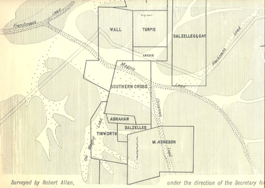
Plan, Underground Survey of Mines, Ballarat East, 1885, 09/1889
... hill gravel pitts lead golden point lead navy jack's lead mopoke lead eureka lead association lead warrenheip lead cgt plans Rectangular plan showing placement of mines in 1889. Mines include Hick's and Gilpin's lease, Comstock, Melbourne Company, Victoria United, Speedwell Company, New Normanby, Pasha Surprise, Central Sulieman, West Llanberris, Britannia United, Victoria Unites, Clinton's, Orient Company, North Sulieman, Sulieman Extended, Pasha Surprise, Golden Fountain, Prince regent, Clark and Company, Tinworth, North Woah Hawp, Detering, R.A. Thompson, Dazelles and buchanan, Barnett, Braybrook, Ladt Cornwall, Hanthorne, Dalzelles and gay, Southern Cross, M. Acheson, Cricket Reserve ...Surveyed by Robert Allan under the direction of the Secretary of Mines.Rectangular plan showing placement of mines in 1889. Mines include Hick's and Gilpin's lease, Comstock, Melbourne Company, Victoria United, Speedwell Company, New Normanby, Pasha Surprise, Central Sulieman, West Llanberris, Britannia United, Victoria Unites, Clinton's, Orient Company, North Sulieman, Sulieman Extended, Pasha Surprise, Golden Fountain, Prince regent, Clark and Company, Tinworth, North Woah Hawp, Detering, R.A. Thompson, Dazelles and buchanan, Barnett, Braybrook, Ladt Cornwall, Hanthorne, Dalzelles and gay, Southern Cross, M. Acheson, Cricket Reserveballarat east, mines, mining, underground survey, robert allan, chinese, ah chong, ah young, bakery hill, black hill, black hill lead, bakery hill lead, cricket, pennyweight hill, gravel pitts lead, golden point lead, navy jack's lead, mopoke lead, eureka lead, association lead, warrenheip lead, cgt, plans -
 Federation University Historical Collection
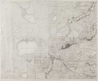
Map, Ballaarat Gold Field, 1861, 1861
... Hill Flat...Gaelic Church...Police Reserve...Magpie Range...Dalton's Flat...Caadian Lead...Rifle Butts...Powder Magazine...Bathing House...Government Camp...Gold Office...Chinese...Llanberrris...Victoria...Victoria. In November 2004 the Central Highlands Regional Library presented a special edition of 200 copies of the 1861 map reproduced from a copy in their collection. ballarat map ballarat east lake wendouree survey mines robert davidson ballarat gold field 1861 yuille's swamp wendouree swamp little bendigo diggings gold leads old post office hill specimen hill bakery hill black hill dead horse creek brown hill pennyweight hill clayton hill soldiers hill golden point gum tree flat white flat poverty hill chinese village robert brough smyth Ballarat map 1861 Ballaarat Vineyard Dead Horse Gully Deadhorse Creek Invermay Black Hill Flat Gaelic Church Police Reserve Magpie Range Dalton's Flat Caadian Lead Rifle Butts Powder Magazine Bathing House Government Camp Gold Office Chinese Llanberrris Victoria Theatre Charlie Napier Hotel United States Hotel Grape's Hoel Clayton's Hill Cattleyard Hill Free Trade Hotel Esmond Lead Bakery Hill Black Hill Lead Juvenile Reformatory Ballarat Orphanage Lady Barkly Lead Triffet's Slaughter Yard Little Bendigo Melbourne Road T. ...A party of surveyors camped by Yuille's Swamp (later Lake Wendouree) and surveyed the countryside for a map to be produced by the Geological Survey of Victoria. In November 2004 the Central Highlands Regional Library presented a special edition of 200 copies of the 1861 map reproduced from a copy in their collection. Original 1861 map of Ballarat showing streets and leads. Blue dots indicate gold leads, and red lines indicate auriferous quartz reef and outcrops of quartz veins."Compiled & Drawn from the Survey of Mining Surveyors Davidson, Fitzpatrick and Cowan & the Plans in the Surveyor General's Office by J. Brahe, 21st October 1861. R. Brough Smyth, Secretary for Mines. The Honourable J.B. Humffray, M.L.A. Commr of Mines.”ballarat, map, ballarat east, lake wendouree, survey, mines, robert davidson, ballarat gold field 1861, yuille's swamp, wendouree swamp, little bendigo diggings, gold leads, old post office hill, specimen hill, bakery hill, black hill, dead horse creek, brown hill, pennyweight hill, clayton hill, soldiers hill, golden point, gum tree flat, white flat, poverty hill, chinese village, robert brough smyth, ballarat map 1861, ballaarat vineyard, dead horse gully, deadhorse creek, invermay, black hill flat, gaelic church, police reserve, magpie range, dalton's flat, caadian lead, rifle butts, powder magazine, bathing house, government camp, gold office, chinese, llanberrris, victoria theatre, charlie napier hotel, united states hotel, grape's hoel, clayton's hill, cattleyard hill, free trade hotel, esmond lead, bakery hill, black hill lead, juvenile reformatory, ballarat orphanage, lady barkly lead, triffet's slaughter yard, little bendigo, melbourne road, t. cowan, thomas cowan -
 The Beechworth Burke Museum
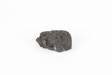
Geological specimen - Garnet crystals in galena, Unknown
... reserves amounting to 20.9 million tonnes of ore grading of 7.4% lead, 9.4% zinc, and 61.5 million oz of Silver. Throughout its history, it has produced over 200 million tonnes of ore throughout its 127 years of mining history dating back to 1885. Galena mineral ore found in Australia is considered rare, as it is only currently found in the Broken Hill Mine of Western New South Wales. It represents heritage value through the systematic collecting of the geological surveyers in Victoria ...Majority of Galena in Australia is found in hydrothermal deposits emplaced around 1680 million years ago which have been heavily metamorphosed. Galena is the natural mineral form of lead sulfaide. It occurs generally as fine to large crystals due to syntectonic remobilization at low temperatures and moves to a suitable location. The colour is a shining lead and silvery gray with high specific gravity between 7.2 and 7.6 gms/cm3 and contains 86.6 lead sulfaide in its purest form. Its cyrstal system is cubic with perfect cleavages, and contract penetration and lamellar twinning. This particular specimen is from the Broken Hill mine, it is one of the largest lead mines located in Western New South Wales and still has ore reserves amounting to 20.9 million tonnes of ore grading of 7.4% lead, 9.4% zinc, and 61.5 million oz of Silver. Throughout its history, it has produced over 200 million tonnes of ore throughout its 127 years of mining history dating back to 1885. Galena mineral ore found in Australia is considered rare, as it is only currently found in the Broken Hill Mine of Western New South Wales. It represents heritage value through the systematic collecting of the geological surveyers in Victoria and Australia during the early to late 19th Century. The fact that it is only found in one mining area of Australia, shows that this specimen is rare for examples of Australian Galena. This mineral specimen is one part to a larger collection, aquistion, and distribution of Garnet in Galena around Australia and parts of the world and donated to the Burke Museum between 1860-1880. While this specimen was not found by the Victorian Geological Survey, it shows the historical need for mapping geological areas around the Gold Rush region to further identify areas of precious metal and gem aquisition. Additionally, collecting these specimens was an important part of mapping the scientific make up of the earth's surface. Many were sent to institutions for further contribution to research and scientific knowledge of the specimens. A solid coin-sized lead and zinc sulphaide and zinc silicate ore mineral in shades of black and red with shiny black points. GARNET CRYSTALS in / GALENA (lead sulphide), / SPALERITE (zinc sulphide), / WILLEMITE (zinc silicate) ore. / Locality: Broken Hill, NSWburke museum, #beechworth, indigo shire, beechworth museum, geological, geological specimen, mineral, galena, galena quartz, broken hill mine, broken hill, nsw -
 Federation University Historical Collection
Book, Historic Sites Survey: North Central Study Area, 1979, 1979
... victoria park, ballarat...muont holled smith...ballaarat old cemetery planting...eastern oval...ballarat east botanical gardens...ballarat east town hall gardens...eureka stockade reserve...ballarat observatory plantings...yarrowee creek plantings...yarrowee bluestone channels...ballarat woollen mill...band and albion mullock heap...black hill...The North Central Study Area included the Shires of Avoca, Bet Bet, east Loddon, Goulburn, Untly, Kara Kara, Korong, Maldon, Marong, Metcalfe, McIvor, Newstead, Strathfieldsaye, Stawell, Talbot, Clunes, Tullaroop and Waranga. castlemaine mount alexander goldfield maldon percydale warrenmang moliagul tarnagulla stuart mill the whipstick whroo rushworth graytown ironbark forest st arnoaud new bendigo landsborough inglewood kurting wedderburn wehla kooroora langham flat mcintyre rheola diamond hill fosterville coliban water works green gully newstead muckleford forest costerfield graytown bailieston waranga irrigaiton system eucalyptus distillery mia mia bridge korokubeal township researce concegella slate quarry chewton fryerstown kingower timor talbot majorca carisbroook clunes st arnaud taradale icomos dunolly limestone castlemaine slate quarry harcourt granite taradale railway viaduct loddon united waterworks trust gouldburn weir carisbrook lock-up history of tree planting in streets history of public reserves r.u. nicholls nurseryman thomas lang francis moss ballarat botanical gardens ballarat school of mines botanical gardens lake wendouree victoria park, ballarat muont holled smith ballaarat old cemetery planting eastern oval ballarat east botanical gardens ballarat east town hall gardens eureka stockade reserve ballarat observatory plantings yarrowee creek plantings yarrowee bluestone channels ballarat woollen mill band and albion mullock heap black hill plantings yarrowee creek channels canadian creek channel specimen vale channel poverty point reserve union jack reserve buninyong imperial mine, buninyong victoria street plantings bridge mall sturt street gardens ballarat avenue of honour plantings white flat oval plantings camp street elms burnt creek 153 page book with white plastic binding. ...The North Central Study Area included the Shires of Avoca, Bet Bet, east Loddon, Goulburn, Untly, Kara Kara, Korong, Maldon, Marong, Metcalfe, McIvor, Newstead, Strathfieldsaye, Stawell, Talbot, Clunes, Tullaroop and Waranga. 153 page book with white plastic binding. It is an historic sites survey for the North Central Study Area commissioned by the Land Conservation Council, the Ministry for COnservation and the Australian Heritage Commission. castlemaine, mount alexander goldfield, maldon, percydale, warrenmang, moliagul, tarnagulla, stuart mill, the whipstick, whroo, rushworth, graytown ironbark forest, st arnoaud, new bendigo, landsborough, inglewood, kurting, wedderburn, wehla, kooroora, langham flat, mcintyre, rheola, diamond hill, fosterville, coliban water works, green gully, newstead, muckleford forest, costerfield, graytown, bailieston, waranga irrigaiton system, eucalyptus distillery, mia mia bridge, korokubeal township researce, concegella slate quarry, chewton, fryerstown, kingower, timor, talbot, majorca, carisbroook, clunes, st arnaud, taradale, icomos, dunolly, limestone, castlemaine slate quarry, harcourt granite, taradale railway viaduct, loddon united waterworks trust, gouldburn weir, carisbrook lock-up, history of tree planting in streets, history of public reserves, r.u. nicholls nurseryman, thomas lang, francis moss, ballarat botanical gardens, ballarat school of mines botanical gardens, lake wendouree, victoria park, ballarat, muont holled smith, ballaarat old cemetery planting, eastern oval, ballarat east botanical gardens, ballarat east town hall gardens, eureka stockade reserve, ballarat observatory plantings, yarrowee creek plantings, yarrowee bluestone channels, ballarat woollen mill, band and albion mullock heap, black hill plantings, yarrowee creek channels, canadian creek channel, specimen vale channel, poverty point reserve, union jack reserve buninyong, imperial mine, buninyong, victoria street plantings, bridge mall, sturt street gardens, ballarat avenue of honour plantings, white flat oval plantings, camp street, elms, burnt creek -
 Marysville & District Historical Society
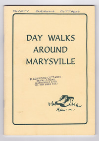
Booklet - Paperback booklet, Maroondah Bushwalking Club Inc, Day Walks Around Marysville, 1996
... victoria...day walks...bushwalking...maroondah bushwalking club...cathedral range...sugarloaf peak...neds gully...maroondah highway...woods lookout...cement creek...acheron...lake mountain...snowy hill...cumberland reserve...This booklet was produced by the Maroondah Bushwalking Club in 1996. marysville victoria day walks bushwalking maroondah bushwalking club cathedral range sugarloaf peak neds gully maroondah highway woods lookout cement creek acheron lake mountain snowy hill cumberland reserve wilks creek mount strickland the beeches mount margaret stevensons falls steavensons falls de la rue lookout oxlee lookout keppel lookout keppel hut north jawbone peak cumberland scenic reserve acheron road buxton man o war track phantom falls keppel falls athols abbey sunds road trestle track booklet A booklet outlining day walks of various difficulties in and around the surrounds of Marysville. ...A booklet outlining day walks of various difficulties in and around the surrounds of Marysville.Paperback booklet. Front cover shows title with a cartoon drawing of a pair of walking boots. Back cover shows details of the publisher and distributor of the publication.non-fictionA booklet outlining day walks of various difficulties in and around the surrounds of Marysville.marysville, victoria, day walks, bushwalking, maroondah bushwalking club, cathedral range, sugarloaf peak, neds gully, maroondah highway, woods lookout, cement creek, acheron, lake mountain, snowy hill, cumberland reserve, wilks creek, mount strickland, the beeches, mount margaret, stevensons falls, steavensons falls, de la rue lookout, oxlee lookout, keppel lookout, keppel hut, north jawbone peak, cumberland scenic reserve, acheron road, buxton, man o war track, phantom falls, keppel falls, athols abbey, sunds road, trestle track, booklet -
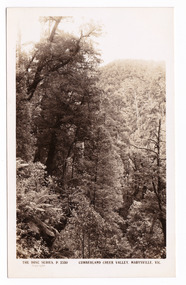 Marysville & District Historical Society
Postcard (item) - Black and white postcard, Rose Stereograph Company, Cumberland Creek Valley, Marysville, Vic, 1913-1967
... Victoria, Australia as a souvenir of Marysville. A black and white photograph of a heavily forested valley leading up to a forested hill. The Cumberland Valley is near Cambarville which was a timber town near Marysville. Cambarville is notable for its giant mountain ash (Eucalyptus regnans) trees within the Cumberland Memorial Scenic Reserve ...A postcard in a series produced by the Rose Stereograph Company in Victoria, Australia as a souvenir of Marysville.A black and white photograph of a heavily forested valley leading up to a forested hill. The Cumberland Valley is near Cambarville which was a timber town near Marysville. Cambarville is notable for its giant mountain ash (Eucalyptus regnans) trees within the Cumberland Memorial Scenic Reserve, and relics from former sawmills and gold mining. The Big Culvert is located nearby on the Marysville - Woods Point Road, which was historically part of the Yarra Track. Cambarville was established as a timber mill town in the 1940s. Timber mill owners A Cameron and FJ Barton named Cambarville. They established the mill to salvage timber from trees destroyed in the 1939 bushfires. Cambarville was impacted by the 2009 Black Saturday bushfires and any remaining structures were destroyed.POST CARD The "Rose" Series/ De Luxe A Real Photograph/ Produced in Australia Published by the Rose Stereograph Co.,/ Armadale, Victoria.cumberland valley, marysville, victoria, p. 2330, cumberland creek, rose series postcard, postcard, souvenir, mountain ash, timber mill, mining, a cameron, fj barton, cambarville, big culvert, yarra track, black saturday bushfires, 1939 bushfires -
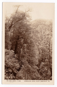 Marysville & District Historical Society
Postcard (item) - Black and white postcard, Rose Stereograph Company, Cumberland Creek Valley, Marysville, Vic, 1913-1967
... Victoria, Australia as a souvenir of Marysville. A sepia photograph of a heavily forested valley leading up to a forested hill. The Cumberland Valley is near Cambarville which was a timber town near Marysville. Cambarville is notable for its giant mountain ash (Eucalyptus regnans) trees within the Cumberland Memorial Scenic Reserve ...A postcard in a series produced by the Rose Stereograph Company in Victoria, Australia as a souvenir of Marysville.A sepia photograph of a heavily forested valley leading up to a forested hill. The Cumberland Valley is near Cambarville which was a timber town near Marysville. Cambarville is notable for its giant mountain ash (Eucalyptus regnans) trees within the Cumberland Memorial Scenic Reserve, and relics from former sawmills and gold mining. The Big Culvert is located nearby on the Marysville - Woods Point Road, which was historically part of the Yarra Track. Cambarville was established as a timber mill town in the 1940s. Timber mill owners A Cameron and FJ Barton named Cambarville. They established the mill to salvage timber from trees destroyed in the 1939 bushfires. Cambarville was impacted by the 2009 Black Saturday bushfires and any remaining structures were destroyed.POST CARD THE "ROSE"SERIES/ DE LUXE/ REAL PHOTOS PRODUCED IN/ AUSTRALIA Published by the Rose Stereographs/ Armadale, Victoriacumberland valley, marysville, victoria, p. 2330, cumberland creek, rose series postcard, postcard, souvenir, cambarville, mountain ash, mining, timber mills, big culvert, yarra track, a cameron, fj barton, black saturday bushfires, 1939 bushfires -
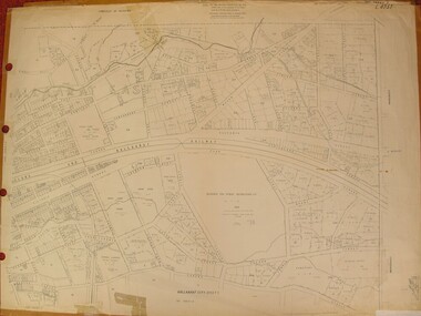 Federation University Historical Collection
Plan, Ballarat East, 1957, 1957
... Hill, Ballarat Observatory, Pearce Street, Bond Street. Sheet 13 - Murphy Street, Larter Street, midland Highway, Geelong Road, gales Street, Lal Lal Street, Clayton Street, Dodds Street, Elsworth Street Sheet 14 - Eureka Street, Eureka Stockade Memorial Park, Eureka Stockade Reserve. York Street, Joseph Street, Kline Street, Charlesworth Street, Chamberlain Street, Trevor Street, Belford Street, Queen Street, Murray Street, Eureka Tiles, Orphan Asylum, Ballarat Orphanage. Sheet 18 - Scotts Parade, Stawell Street, Fortune Street, Victoria...Dr George Clendinning and others were trustees of the Church of England (St Paul's) ballarat youth council, ballarat east bakery hill humffray street victoria street st paul's anglican church humffray street state school A number of enlargements of the Ballarat East maps. .4) Bakery Hill, Humffray Street, Victoria Street, Ballarat Youth Council .5) Specimen Vale, Victoria Street, Eureka Street, Housing Commission .10) - Tomber Reserve, York Street, Spencer Street, Bennett Street, Wilson Street, Rodier Street, Richard Street, Fussell Street, Turpie Street, Stockade Street, Ballarat Rifle Range Lal La Street, Clayton Street, Eureka Street Sheet 2 - Yarrowee Creek, High Street, Dinney's Dam, Binney Street, Oliver Street, Humffray Street, Morres Street, Finch Street, Scotts Parade, Rice Street, HOrnby Street, Queen Street, Newman street, King Street, Napier Street, Sim Street. ...Dr George Clendinning and others were trustees of the Church of England (St Paul's) A number of enlargements of the Ballarat East maps. .4) Bakery Hill, Humffray Street, Victoria Street, Ballarat Youth Council .5) Specimen Vale, Victoria Street, Eureka Street, Housing Commission .10) - Tomber Reserve, York Street, Spencer Street, Bennett Street, Wilson Street, Rodier Street, Richard Street, Fussell Street, Turpie Street, Stockade Street, Ballarat Rifle Range Lal La Street, Clayton Street, Eureka Street Sheet 2 - Yarrowee Creek, High Street, Dinney's Dam, Binney Street, Oliver Street, Humffray Street, Morres Street, Finch Street, Scotts Parade, Rice Street, HOrnby Street, Queen Street, Newman street, King Street, Napier Street, Sim Street. Sheet 3 - Russell Square, Victoria Street, Orphan Asylum, Ballarat Orphanage, Lofven Street, Haines Street, Yarrowee Creek, Ching Who Coey, Chinese, Stawell Street, Rice Street, Lane Street, Humffray Street, Nelson Street, Coffield Street, Morres Street, Western Highway, Rodier Street, Scott Parade, Canterbury Street Sheet 4 - Orphan Asylum, Ballarat Orphanage School, Fortune Street, Scotts Parade, Water Street, Ritchie Street, Humffray Street, Brophy Street, Thompson Street, Victoria Street,Humffray Street Church of England Reserve, Strickland Parade. Mount Xavier Recreation Reserve, Charlesworth Street Catholic Church Reserve. Sheet 5 - Western Highway, Mount Street, Fortune Street, Finlay Street, Jones Street, Ryan Street, Water Street, Brandbury Street, Humffray Street. Sheet 6 - Barkly Street, Ebden Street, Grenville Street, Cameron Street, Peel Street, Young Street, Victoria Street, Steinfeld Street, Haymes Street, Bond Street, Anderson Street, Eastwood Street, Mair Street, East Street, Haymes Crescent Sheet 7 - Murphy Street, Queen Street, Dyte Parade, Princes Street, Midland Highway, York Street, Dodds St, Wilson St Otway Street, Specimen vale, King Street, Gray Street, Little Dodds Street, Eureka Street. Sheet 9 - Richards Street, Fussell Street, Stockade Street, Orphan Asylum, Ballarat Orphanage, Elford Street, Russell Street, Ross Street, Charlesworth Street, Lalor Street, Stockade Street, Wilson Street, York Street, Eureka Street Sheet 10 - Eureka Street, York Street, Elford Street, Wilson Street, Mount Street, Turpie Street, Timber Reserve, Mount Xavier Sheet 11 - Yarrowee Creek, Humffray Street, Barkly Street, Morton Street, Cobden Street, Morton Street Wesleyan Church, Pryor Street, Albion Street, Bradshaw Street, Ballarat Woollen Mills, Tannery, Mount Pleasant. Sheet 12 - Magpie Street, Grant Street, Gladstone Street, Cobden Street, Fraser Street, Grenfell Street, Robertson Street, Bond Street, Barkly Street, Vine Street, Sovereign Hill, Ballarat Observatory, Pearce Street, Bond Street. Sheet 13 - Murphy Street, Larter Street, midland Highway, Geelong Road, gales Street, Lal Lal Street, Clayton Street, Dodds Street, Elsworth Street Sheet 14 - Eureka Street, Eureka Stockade Memorial Park, Eureka Stockade Reserve. York Street, Joseph Street, Kline Street, Charlesworth Street, Chamberlain Street, Trevor Street, Belford Street, Queen Street, Murray Street, Eureka Tiles, Orphan Asylum, Ballarat Orphanage. Sheet 18 - Scotts Parade, Stawell Street, Fortune Street, Victoria STreet, Railway Line, Haines Street, Eureka Street, Elford STreet, Brophy Street, York Street, Clayton Street, Elsworth Street, Barkly Street, Humffray Street, Midland Highway, Princes Street ballarat youth council, ballarat east, bakery hill, humffray street, victoria street, st paul's anglican church, humffray street state school -
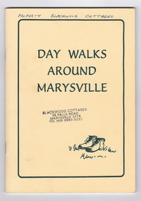 Marysville & District Historical Society
Booklet - Paperback booklet, Maroondah Bushwalking Club Inc, Day Walks Around Marysville, 1996
... victoria...day walks...bushwalking...maroondah bushwalking club...cathedral range...sugarloaf peak...neds gully...maroondah highway...woods lookout...cement creek...acheron...lake mountain...snowy hill...cumberland reserve...This booklet was produced by the Maroondah Bushwalking Club in 1996. marysville victoria day walks bushwalking maroondah bushwalking club cathedral range sugarloaf peak neds gully maroondah highway woods lookout cement creek acheron lake mountain snowy hill cumberland reserve wilks creek mount strickland the beeches mount margaret stevensons falls steavensons falls de la rue lookout oxlee lookout keppel lookout keppel hut north jawbone peak cumberland scenic reserve acheron road buxton man o war track phantom falls keppel falls athols abbey sunds road trestle track booklet A booklet outlining day walks of various difficulties in and around the surrounds of Marysville. ...A booklet outlining day walks of various difficulties in and around the surrounds of Marysville.Paperback booklet. Front cover shows title with a cartoon drawing of a pair of walking boots. Back cover shows details of the publisher and distributor of the publication.non-fictionA booklet outlining day walks of various difficulties in and around the surrounds of Marysville.marysville, victoria, day walks, bushwalking, maroondah bushwalking club, cathedral range, sugarloaf peak, neds gully, maroondah highway, woods lookout, cement creek, acheron, lake mountain, snowy hill, cumberland reserve, wilks creek, mount strickland, the beeches, mount margaret, stevensons falls, steavensons falls, de la rue lookout, oxlee lookout, keppel lookout, keppel hut, north jawbone peak, cumberland scenic reserve, acheron road, buxton, man o war track, phantom falls, keppel falls, athols abbey, sunds road, trestle track, booklet -
 Flagstaff Hill Maritime Museum and Village
Financial record - Medical Accounts, c. 1929
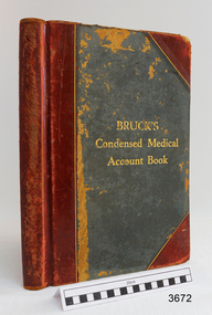
... In November of that year John Lee continued on as head master, now at the newly built Tower Hill Lake National School Number 618, on land that is now Victoria Park Recreation Reserve, on High Street, Koroit. ...In November of that year John Lee continued on as head master, now at the newly built Tower Hill Lake National School Number 618, on land that is now Victoria Park Recreation Reserve, on High Street, Koroit. ...The accounts records in the Medical Accounts book start in February 1929 and refer to many of Warrnambool’s local names and addresses. The ledger book belonged to Dr John Hunter Henderson who conducted his medical practice from his home and surgery at Birchwood, 214 Koroit Street, Warrnambool, from 1904-1939. This particular accounts book spans from February 1929 to May 1931. Dr Henderson retired in 1939 and moved to Melbourne. His home, medical practice and many of his surgery’s items, including the Medical Accounts Book, were transferred to Dr William Roy Angus in that same year. The patients’ addresses on page 1 of the ledger include John Lee of St Marys Road, Wangoom. John Lee’s name has two entries on this page. He Grandfather, also John Lee, was a notable pioneer of the district. JOHN LEE John Lee was born in 1884 and died in 1948. His father (1845-1892) and grandfather (1814-1887) were also named John Lee. John Lee’s Grandfather, Grandmother, Father and Uncle arrived in Australia from Ireland in 1852. The colonial family settled in St Marys Road, Wangoom, Victoria and have a long association with the district. John Lee, born in 1814, is proudly listed amongst the names on the commemorative Warrnambool Pioneers Board, having arrived in Australia In 1852. In 1855 John’s Grandfather John Lee, aged 41, was head teacher of the Tower Hill School on the south bank of Tower Hill. Two years later, in 1857, the north bank of Tower Hill was surveyed and named the township of Koroit. In November of that year John Lee continued on as head master, now at the newly built Tower Hill Lake National School Number 618, on land that is now Victoria Park Recreation Reserve, on High Street, Koroit. John died in Warrnambool in 1887 but even 50 years later an ex-student wrote a letter to The Age newspaper, recalling memories of John Lee, his head master of the 1860s at the Tower Hill Lake Common School in Koroit. DR WILLIAM ROY ANGUS Doctor Angus had previously practiced in Nhill. The accounts book and many more items of Dr Angus were donated to Flagstaff Hill Maritime Village by the family of Dr Angus, Surgeon and Oculist. The Medical Accounts Book is part of the “W.R. Angus Collection” that includes historical medical equipment, surgical instruments and material once belonging to Dr Edward Ryan and Dr Thomas Francis Ryan, (both of Nhill, Victoria) as well as Dr Angus’ own belongings. The Collection’s history spans the medical practices of the two Doctors Ryan, from 1885-1926 plus that of Dr John Henderson from 1904+1939 and Dr Angus until he retired, from 1923 - 1969. The Medical Accounts Book is significant as a record of the names, addresses and health of the people in Warrnambool and District in the early 20th century. The Book is significant for its early 20th century association with two local doctors, Dr John Henderson and Doctor William Roy Angus, whose practices span from 1904-1969. The Book is also significant historically for its association with the ancestors of patient John Lee, whose Grandfather is recognised on the Warrnambool pioneer Board as one of the early pioneers in Victoria, arriving in 1852. Ledger, Medical Accounts Book. Title is Bruck’s Condensed Medical Account Book. Book has hardback, green cover, bound and reinforced with red leather and printed title in gold lettering. The pages of index tabs in the beginning of the book have no entries. The first page of the accounts section of the book have the hand written heading “February 1929”. The book continues until the end of May 1931. Inside both front and back cover are hand written notes in different scrips. Both black and blue ink has been used. The book belonged to Dr John Hunter Henderson. It is part of the W.R. Angus Collection."Bruck’s Condensed Medical Account Book"flagstaff hill, warrnambool, shipwrecked coast, flagstaff hill maritime museum, maritime museum, shipwreck coast, flagstaff hill maritime village, great ocean road, medical treatment, medical history, medical accounts, medical administration, medical record 1929, ledger, bruck’s condensed medical account book, john hunter henderson, william roy angus, edward ryan, thomas francis ryan, john lee, tower hill school, tower hill lake national school, koroit primary school, victoria school 628, st marys wangoom, warrnambool pioneer, birchwood, 214 koroit street warrnambool -
 Flagstaff Hill Maritime Museum and Village
Functional object - Latch, before 1890
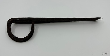
... Victoria’s oldest recorded shipwrecks. The identity of the vessel has the potential to change Australia’s history. warrnambool shipwrecked coast flagstaff hill maritime museum shipwreck coast mahogany ship latch relic old warrnambool museum ancient vessel ancient wreck oven latch fireplace latch galley oven Gold ship Gorman's Lane Coastal Reserve Tower Hill Latch, iron. ...Due to the interest of a public works inspector, James Gilroy, who in 1890 dug in the 'ship's remains' of a wreck now known as the Mahogany Ship, Ancient Wreck, Gold Ship, or Ancient Vessel, three relics were located. Two of these objects, a bronze bolt and an iron latch, are part of Flagstaff Hill’s collection of shipwreck artefacts. The third object was a heavily oxidised ‘quantity of ironwork’. - The iron latch was possibly from a galley oven door or fireplace - The bronze bolt, spike or pin Both the bolt and latch are listed on the same page in the records of the Old Warrnambool Museum, and noted that they were found by K.A.G. (or H.A.G.) on the site of the Ancient wreck in 1890. Interestingly, another item in these records is ‘Notes on Ancient wreck, near Gorman’s Lane’. Gorman’s Lane is just inland from the sand dunes of the Coastal Reserve at Tower Hill. The current location of these Notes is unknown. The Museum opened in 1886 and continued until 1963, when it was closed by the Warrnambool City Council and the whole collection was put into storage. The council then transferred items to various places, including Flagstaff Hill and the current Warrnambool Art Gallery. Flagstaff Hill’s early Accession Records book lists the items as being received from the Old Warrnambool Museum collection; the Latch is record 152 and the Pin is record 153. An article, ‘Birthplace of our History’ by Don Dean, is on file in the Warrnambool and District Historical Society. It was published in the Australian POST, on March 17, 1955. This article describes the findings of the items going back to 1890, along with other information about sightings of what has come to be known as the Mahogany Ship. The mystery of the Mahogany Ship began in 1836 when two shipwrecked sealers discovered the remains of an “ancient vessel” in the sand dunes about four miles west of Warrnambool. Since the last recorded sightings in the 1880’s the true origin of the Mahogany Ship has remained one of Australia’s most famous historical mysteries. One of the more recent theories is that the vessel was one of the Portuguese ships exploring the Australian coast in 1522. For over one hundred years, searchers have attempted to locate and identify the wreck. The search continues for the tangible evidence which will once and for all establish the Mahogany Ship’s place in Australia’s History. The latch has local historic significance as it was found in the sand dunes of Warrnambool in 1890. The latch is also significant for being part of the original 1886 Warrnambool Museum's collection. The latch is significant for its possible link to one of Victoria’s and Australia’s maritime mysteries, the Mahogany Ship (also known as the Ancient Wreck). It is one of the very few known relics that could give evidence of the existence and history of the vessel. The ship is listed on the Victorian Heritage Register S438 as it is one of Victoria’s oldest recorded shipwrecks. The identity of the vessel has the potential to change Australia’s history.Latch, iron. Flat iron latch tapers inward from loop handle to narrow end with prongs. Handmade. warrnambool, shipwrecked coast, flagstaff hill maritime museum, shipwreck coast, mahogany ship, latch, relic, old warrnambool museum, ancient vessel, ancient wreck, oven latch, fireplace latch, galley oven, gold ship, gorman's lane, coastal reserve, tower hill -
 Flagstaff Hill Maritime Museum and Village
Functional object - Bolt, before 1890
... Victoria’s oldest recorded shipwrecks. The identity of the vessel has the potential to change Australia’s history. warrnambool shipwrecked coast flagstaff hill maritime museum shipwreck coast mahogany ship relic pin spike old warrnambool museum nail ancient vessel ancient wreck portuguese ship Gold Ship Gorman’s Lane Coastal Reserve Tower Hill Bolt, also referred to as spike or pin. ...Due to the interest of a public works inspector, James Gilroy, who in 1890 dug in the 'ship's remains' of a wreck now known as the Mahogany Ship, Ancient Wreck, Gold Ship, or Ancient Vessel, three relics were located. Two of these objects, a bronze bolt and an iron latch, are part of Flagstaff Hill’s collection of shipwreck artefacts. The third object was a heavily oxidised ‘quantity of ironwork’. - The iron latch was possibly from a galley oven door or fireplace - The bronze bolt, spike or pin Both the bolt and latch are listed on the same page in the records of the Old Warrnambool Museum, and noted that they were found by K.A.G. (or H.A.G.) on the site of the Ancient wreck in 1890. Interestingly, another item in these records is ‘Notes on Ancient wreck, near Gorman’s Lane’. Gorman’s Lane is just inland from the sand dunes of the Coastal Reserve at Tower Hill. The current location of these Notes is unknown. The Museum opened in 1886 and continued until 1963, when it was closed by the Warrnambool City Council and the whole collection was put into storage. The council then transferred items to various places, including Flagstaff Hill and the current Warrnambool Art Gallery. Flagstaff Hill’s early Accession Records book lists the items as being received from the Old Warrnambool Museum collection; the Latch is record 152 and the Pin is record 153. An article, ‘Birthplace of our History’ by Don Dean, is on file in the Warrnambool and District Historical Society. It was published in the Australian POST, on March 17, 1955. This article describes the findings of the items going back to 1890, along with other information about sightings of what has come to be known as the Mahogany Ship. The mystery of the Mahogany Ship began in 1836 when two shipwrecked sealers discovered the remains of an “ancient vessel” in the sand dunes about four miles west of Warrnambool. Since the last recorded sightings in the 1880’s the true origin of the Mahogany Ship has remained one of Australia’s most famous historical mysteries. One of the more recent theories is that the vessel was one of the Portuguese ships exploring the Australian coast in 1522. For over one hundred years, searchers have attempted to locate and identify the wreck. The search continues for the tangible evidence which will once and for all establish the Mahogany Ship’s place in Australia’s History. The bolt has local historic significance as it was found in the sand dunes of Warrnambool in 1890. The bolt is also significant for being part of the original 1886 Warrnambool Museum's collection. The bolt is significant for its possible link to one of Victoria’s and Australia’s maritime mysteries, the Mahogany Ship (also known as the Ancient Wreck). It is one of the very few known relics that could give evidence of the existence and history of the vessel. The ship is listed on the Victorian Heritage Register S438 as it is one of Victoria’s oldest recorded shipwrecks. The identity of the vessel has the potential to change Australia’s history.Bolt, also referred to as spike or pin. Bronze bolt, round body with head on one end that has straight sides, tapers to a point at the other end.warrnambool, shipwrecked coast, flagstaff hill maritime museum, shipwreck coast, mahogany ship, relic, pin, spike, old warrnambool museum, nail, ancient vessel, ancient wreck, portuguese ship, gold ship, gorman’s lane, coastal reserve, tower hill -
 Flagstaff Hill Maritime Museum and Village
Postcard - Scenic, Warrnambool, Tower Hill and Lake, Warrnambool, 1902-1929
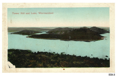
... Tower Hill and Lake, Warrnambool – Tower Hill Wildlife Reserve is in the crater of a dormant volcano. In 1892 the area was declared a National Park, the first in Victoria, preserving native animals and Indigenous plants. ...Tower Hill and Lake, Warrnambool – Tower Hill Wildlife Reserve is in the crater of a dormant volcano. In 1892 the area was declared a National Park, the first in Victoria, preserving native animals and Indigenous plants. ...The nine postcards in this set were donated together and date to the early 1900s. All but one postcard in this set shows images of Warrnambool, in the Western District of Victoria; the other has a London image. The postcards were all printed in Great Britain according to that country’s postal regulations. The fronts of all cards have titles printed in red. Most of the images on the cards are attributed to photographer Joseph Jordan and belong to the Jordan Series. The back of these cards has an outline for a postage stamp, a vertical dividing line and a heading on each side of the line to separate the Correspondence from the Address. Postcards or ‘correspondence cards’ appeared in Britain in 1894. They were plain cards with a space for the message on one side and an address on the other; regulations didn’t allow anything but the address to be written on the ‘address’ side. In 1902 the British regulations then allowed a picture to be printed on the front and the address on the back, so messages had to be written on the picture side. Soon, the regulations changed and the back was divided for a message and the address. Tower Hill and Lake, Warrnambool – Tower Hill Wildlife Reserve is in the crater of a dormant volcano. In 1892 the area was declared a National Park, the first in Victoria, preserving native animals and Indigenous plants. The rich volcanic soil in the area attracted early settlers including the families of Henry Giles, born at Tower Hill in 1858 and his wife Mary Jane (born Freckleton) born nearby at Cooramook in 1860. Henry and Mary worked in the local area where they also raised their six children. For a time, Henry was employed as a labourer on the Warrnambool Breakwater. Joseph Jordan - Joseph Jordan was born in 1841 in Leicester England. When he was 16 he joined the 7th Queen's Own Hussars and was sent to India at the outbreak of the mutiny. He took part in the relief of Lucknow and remained in India for eleven years. It was during this time that he became interested in photography. He was posted to New Zealand and later came to Victoria, becoming a sergeant major of the Mounted Rifles. In the mid-1880s he came to the Western district where he was responsible for establishing units of the Mounted Rifles in various country towns such as Dunkeld, Mortlake, Panmure, Bushfield, Koroit etc. He resigned from the army in 1889 and set up a professional photography studio in Liebig Street, Warrnambool. He became very well known in the Western District for family photographs, official photographs of local councillors and groups as well as views of local scenery. In 1891 he photographed the wrecked barque ‘Fiji’ at ‘Wrecks Beach’ near Princetown. His business was taken over by his son Arthur around 1917. Joseph was a keen rifle shot and in 1924 he donated the "Jordan Shield" as a prize to the Victorian Rifle Association. He was made a "Life Honorary Member" of the Warrnambool Returned Soldiers League and in 1933 he was recognised as being the oldest living soldier in Victoria. Joseph died in 1935 aged 95.The postcard of Tower Hill and Lake is connected to the location near Warrnambool where many of our early settlers lived and worked. One of these settlers was the Giles family, whose son Henry was born at Tower Hill. His family has donated many Victorian-era items which are now on display at Flagstaff Hill. Tower Hill National Park is the first place in Victoria to be named a National Park. As in the times when coastal trading ships brought passengers and cargo to the Port of Warrnambool, it continues to be a popular place to visit. Joseph Jordan is a significant figure in Warrnambool history as he helped to establish early units of the Mounted Rifles (G Company) in local towns during the late 1880's and later, photographed local scenes, groups and citizens of early Warrnambool.Postcard, one of nine, landscape orientation, coloured print within a rectangle and an impressed line around the image on the front. The picture shows several islands close together with hills around them and bushland in the foreground. There are dead trees amongst the vegetation and a sandy shore at the foot of some of the hills. The lower left corner shows what appears to be two white rails, possibly a lookout fence. There is no correspondence written on the card. The title is printed in red on the front and the back has inscriptions and outlines for a postage stamp. Jordan Series, printed in Great Britain. Front, in red: “Tower Hill Lake, Warrnambool” Back in green: “Jordan Series” “POST CARD” “PRINTED IN GREAT BRITAIN” “For correspondence” “The Address only to be written here”flagstaff hill maritime museum, flagstaff hill maritime village, flagstaff hill maritime museum and village, maritime museum, warrnambool, great ocean road, warrnambool and district, warrnambool scenes, local scenes, views of warrnambool, joseph jordan, jordan series, jordan photography, postcard, souvenir, correspondence, cameo postcard, tower hill, tower hill national park, victoria's first national park, henry giles, mary jane freckleton, breakwater, early settlers -
 Flagstaff Hill Maritime Museum and Village
Book - Referance Book, Field Naturalist Club of Victoria, A Census of The Plants of Victoria, 1928
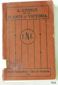
... Victoria's oldest field naturalists club, the FNCV also played an important role in the early efforts to reserve Wilson's Promontory as a National Park. The book's contents record the natural state of Victoria's plants and environment at the time (1928). The book is a useful reference for a wide range of plant enthusiasts, from the time it was written to modern times. Warrnambool Shipwreck Coast Flagstaff Hill ...The book, 'A Census of the Plants of Victoria', is a comprehensive reference book of plant varieties and their distribution in the Australian State of Victoria. This second edition was published by the Field Naturalists' Club of Victoria, and printed in Melbourne. It contains indexes to aid the students, botanists and plant enthusiasts in their search for information.Orange-brown front cover with black printed text, vertical lines and rectangular borders around the upper title, and lower publishing group, and a central circular logo of the publishing group, Field Naturalists' Club of Victoria. Title: (in full) A Census of the Plants of Victoria With their Regional Distributions and the Vernacular Names as adopted by the Plant Names Committee of the Field Naturalists' Club of Victoria. Publisher: Field Naturalists Club of Victoria Edition: Second Edition Date: 1928non-fictionThe book, 'A Census of the Plants of Victoria', is a comprehensive reference book of plant varieties and their distribution in the Australian State of Victoria. This second edition was published by the Field Naturalists' Club of Victoria, and printed in Melbourne. It contains indexes to aid the students, botanists and plant enthusiasts in their search for information.warrnambool, shipwreck coast, flagstaff hill maritime museum, flagstaff hill maritime village, book, a census of the plants of victoria, field naturalists' club of victoria, plant names, plant species, distribution of plants, victoria's plants, plant identification -
 Flagstaff Hill Maritime Museum and Village
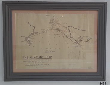
Document - Location Chart, The Mahogany Ship, 2007
... Victoria’s oldest recorded shipwrecks. The identity of the vessel has the potential to change Australia’s history. warrnambool shipwrecked coast flagstaff hill maritime museum shipwreck coast mahogany ship ancient vessel ancient wreck portuguese ship Coastal Reserve fabled wreck gold ship Griffiths Island Belfast (now Port Fairy) Koroit location plan Leuit. ...This chart shows a possible site for the fabled wreck called the 'Mahogany Ship'. Flagstaff Hill’s collection includes other objects that some say could be relics from this Ancient Wreck, (also called the Gold Ship, or the Ancient Vessel). The chart shows the coordinates for the Summits of Griffith Island and of Middle Island. It also has the depths of the sea at various intervals and shows the shore and sand dunes, lighthouses and other reference points. The mystery of the Mahogany Ship began in 1836 when two shipwrecked sealers discovered the remains of an “ancient vessel” in the sand dunes about four miles west of Warrnambool. Since the last recorded sightings in the 1880’s the true origin of the Mahogany Ship has remained one of Australia’s most famous historical mysteries or fables. One of the more recent theories is that the vessel was one of the Portuguese ships exploring the Australian coast in 1522. For over one hundred years searchers have attempted to locate and identify the wreck. The search continues for the tangible evidence which will once and for all establish the Mahogany Ship’s place in Australia’s History.The chart represents the worldwide interest in locating the wreck of the Mahogany Ship. Locating the actual wreck or proving the existence of a Portuguese ship's wreck could change the history of the discovery of Australia. A Mahogany Ship committee was formed to gather and research information about the discovery of the wrecked ship. A large amount of money was offered as a prize for finding the wreck or parts of it. People have written books, painted images, made videos and told tales of the ship but it continues to remain a mystery or even a fable. The chart is significant for its possible link to one of Victoria’s and Australia’s maritime mysteries, the Mahogany Ship (also known as the Ancient Wreck). It is one of very few known relics that could give evidence of the existence and history of the vessel. It is listed on the Victorian Heritage Register S438 as it is one of Victoria’s oldest recorded shipwrecks. The identity of the vessel has the potential to change Australia’s history.A chart in a wooden frame, behind glass. The chart shows the approximate position of the mystery Ancient Wreck, later called the "Mahogany Ship". The chart is a copy and is based on the Admiralty Chart by Lieut. Stanley, dated 1872. Lower left: "THE MAHOGANY SHIP" "LOCALITY PLAN, ENLARGED FROM LIEUT. STANLEY'S ADMIRALTY CHART 1872" "APPROXIMATE POSITION OF WRECK MARKED [symbol of a Portuguese cross]" Other labels on chart: "BELFAST" "PORT FIARY" "GRIFFITHS I" "RIVER MOYNE" "RIVER MERRI" "ARMSTRONG BAY" " GORMANS LANE" "TOWER HILL" "KOROIT" "HELEN ROCK" "WARRNAMBOOL" "LADY BAY" "MIDDLE I" "LIGHT HO." Lower right: "G 410 B" Label on the back; "This chart presented to the Mahogany Ship Committee and Flagstaff Hill by Avis Quarrell, April 2007"warrnambool, shipwrecked coast, flagstaff hill maritime museum, shipwreck coast, mahogany ship, ancient vessel, ancient wreck, portuguese ship, coastal reserve, fabled wreck, gold ship, griffiths island, belfast (now port fairy), koroit, location plan, leuit. stanley, admiralty chart 1872, tower hill, merri river, moyne river, middle island, helen rock, armstrong bay, griffiths land -
 Ringwood and District Historical Society
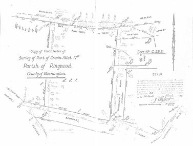
Document - Copy of Lands Department Field Notes - Parish of Ringwood, Victoria, Field Notes - Part of Crown Allotment 17D Surveyed 1952 (Amended in 1953)
... C.93151, Railway Reserve, Station Street, Bedford Road, multiple post & wire fences, multiple galv iron pipes put in, Government Road (Hill Street), Tooronga Road, multiple recent pegs found, Certification 52710 by J. Fitzgerald Licensed Surveyor 17/3/1952. Field Notes - Part of Crown Allotment 17D Surveyed 1952 (Amended in 1953). Document Copy of Lands Department Field Notes - Parish of Ringwood, Victoria ...5616b Double foolscap size photocopy of survey map with handwritten notations. References include Corr no. C.93151, Railway Reserve, Station Street, Bedford Road, multiple post & wire fences, multiple galv iron pipes put in, Government Road (Hill Street), Tooronga Road, multiple recent pegs found, Certification 52710 by J. Fitzgerald Licensed Surveyor 17/3/1952. -
 Ringwood and District Historical Society
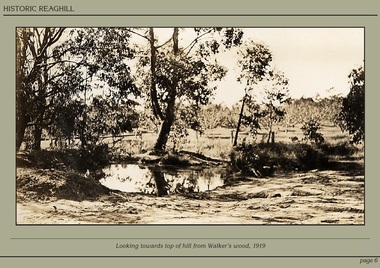
Photograph - Powerpoint Slide - Historic Reaghill - Ringwood East,Victoria, Caption: Looking towards top of hill from Walker's wood, 1919
... reserve and surrounding residential area around 1940s. Caption: Looking towards top of hill from Walker's wood, 1919 Photograph Powerpoint Slide - Historic Reaghill - Ringwood East,Victoria ...Slide 6 of 16 Powerpoint Presentation images scanned from an early 20th century family photo album centred around the Ringwood East "Reaghill" property prior to development of the Wombolano Park bushland nature reserve and surrounding residential area around 1940s. -
 Ringwood and District Historical Society
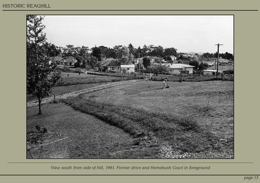
Photograph - Powerpoint Slide - Historic Reaghill - Ringwood East,Victoria, Caption: View South from side of hill, 1961. Former drive and Homebush Court in foreground
... reserve and surrounding residential area around 1940s. Caption: View South from side of hill, 1961. Former drive and Homebush Court in foreground Photograph Powerpoint Slide - Historic Reaghill - Ringwood East,Victoria ...Slide 13 of 16 Powerpoint Presentation images scanned from an early 20th century family photo album centred around the Ringwood East "Reaghill" property prior to development of the Wombolano Park bushland nature reserve and surrounding residential area around 1940s. -
 Eltham District Historical Society Inc
Photograph, Liz Pidgeon, Heritage Excursion; Eltham Lower Park Walk and Talk, 1 July 2017, 1 July 2017
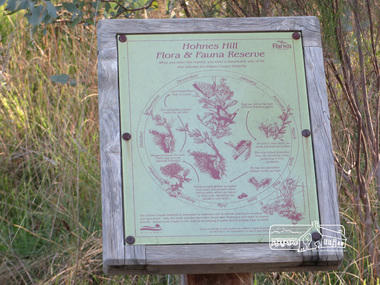
... Information board: Hohnes Hill Flora & Fauna Reserve produced by Shire of Nillumbik and Parks Victoria which includes text and images with references to the Eltham Copper Butterfly. ...Information board: Hohnes Hill Flora & Fauna Reserve produced by Shire of Nillumbik and Parks Victoria which includes text and images with references to the Eltham Copper Butterfly. ...Information board: Hohnes Hill Flora & Fauna Reserve produced by Shire of Nillumbik and Parks Victoria which includes text and images with references to the Eltham Copper Butterfly. Newsletter No., 234, June 2017 Heritage Excursion - Saturday 1st July - Eltham Lower Park - Walk and Talk Eltham Lower Park has played an important part in the history of our area since the early days of European settlement when it was used by local residents as an informal racecourse. Prior to that its location at the junction of the Diamond Creek and the Yarra River made it an important meeting place for the Wurundjeri people. The park combines formal elements and sporting facilities with remnant bushland that is of environmental significance. It is home to sporting and horse riding clubs, popular play spaces and the Diamond Valley Miniature Railway, which attracts large numbers of visitors. The park will be the venue for our July excursion which will comprise a walk of about 3.5 km around the park and adjacent areas. Along the way we will discuss the history and natural history of the area. The path along the creek and the river provides a pleasant and scenic walk. This walk on Saturday 1st July is about 3.5 km in length and will take 2 to 2.5 hours. It will start at 2pm at the Main Road car park at the front of the park. (Melway ref 21 H 10). Born Digitalheritage excursion, activities, eltham district historical society, eltham lower park, hohnes hill, reserve, eltham copper butterfly, sign -
 Eltham District Historical Society Inc
Folder, Warrandyte Miner's Cottage, 1984
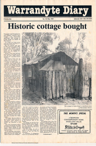
... Miller, Mrs Ruth Norman, Plaza Cafe Eltham, Professor's Hill, Senior Citizens, South Warrandyte Primary School, Stiggant Street, The Dean Guesthouse Strathewen, Warrandyte, Warrandyte Co-op, Warrandyte Football Club, Warrandyte Recreation Reserve Cafe, Warrandyte Slab Cottage HG Booklet 28 Complete issue of "Warrandyte Diary" No 145, May 1984 with feature article headed "Historic cottage bought". 12 pages with section cut out of back page. Also includes photocopy of Broadbents Roadguide: central Victoria ...Report and photograph about purchase of historically significant slab cottage in Castle Road, Warrandyte. Newspaper also includes articles relating to Jock Macneish and his ultra-light aircraft, construction of foot bridge over Andersons Creek, Mrs Ruth Norman, Warrandyte Co-op, local results of the 1981 census, construction of elderly citizens' flats in Stiggant Street (Warrandyte), South Warrandyte Primary School, Professor's Hill and Warrandyte Football Club. The road guide features advertisments for Inglenook Tea Rooms, Warrandyte, Warrandyte Recreation Reserve Cafe (Mrs C. Miller, Proprietress), Eltham Motor Garage, Plaza Cafe Eltham, Eltham Park Team Rooms, Diamond Creek Garage and Engineering Works and The Dean Guesthouse Strathewen.Complete issue of "Warrandyte Diary" No 145, May 1984 with feature article headed "Historic cottage bought". 12 pages with section cut out of back page. Also includes photocopy of Broadbents Roadguide: central Victoria, 1946 pages 230-231HG Booklet 281981 census, advertisment, andersons creek, castle road, diamond creek garage and engineering works, eltham motor garage, eltham park team rooms, footbridge, harry gilham collection, inglenook tea rooms, jock macneish, mrs c. miller, mrs ruth norman, plaza cafe eltham, professor's hill, senior citizens, south warrandyte primary school, stiggant street, the dean guesthouse strathewen, warrandyte, warrandyte co-op, warrandyte football club, warrandyte recreation reserve cafe, warrandyte slab cottage -
 Eltham District Historical Society Inc
Photograph, Mulberry Hill, Golf Links Road, Baxter; Spring Excursion to The Briars and Mulberry Hill, 27 October 1991, 27/10/1991
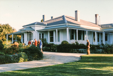
... reserve with walking paths and bird observation hides. "Mulberry Hill" was the home of Sir Darryl Lindsay and his wife Joan. Darryl (1889-1976) was a member of the famous art family of Lindsays and was a prominent artist in his own right. He was also a noted art administrator, being appointed Director of the National Gallery of Victoria...reserve with walking paths and bird observation hides. "Mulberry Hill" was the home of Sir Darryl Lindsay and his wife Joan. Darryl (1889-1976) was a member of the famous art family of Lindsays and was a prominent artist in his own right. He was also a noted art administrator, being appointed Director of the National Gallery of Victoria ...[from EDHS Newsletter No. 80, September 1991:] SPRING EXCURSION: As usual for October we have arranged a bus tour outside the local area. We will leave from the Eltham Shire Offices at 9.00 am on Sunday 27th October and travel to "The Briars" at Mornington and "Mulberry Hill" at Baxter. The cost will be $16.00 for adults and $8.00 for children. This includes admission to each of the houses and afternoon tea at "Mulberry Hill". Bring your own lunch to eat at "The Briars" and something for morning tea if you wish. "The Briars" is one of the oldest pastoral stations on the Mornington Peninsula. It has historical associations with the early settlement of the district and with Alexander Balcombe who settled in the area about 1843. Near the house is a wetland wildlife reserve with walking paths and bird observation hides. "Mulberry Hill" was the home of Sir Darryl Lindsay and his wife Joan. Darryl (1889-1976) was a member of the famous art family of Lindsays and was a prominent artist in his own right. He was also a noted art administrator, being appointed Director of the National Gallery of Victoria in 1942. Joan Lindsay (1896-1984) was an important writer. Her best known work was "Picnic at Hanging Rock". Members may find it interesting to read her autobiography "Time Without Clocks" prior to this trip. Members are welcome to bring their friends. Bookings will only be confirmed on payment. Please complete the attached form and return with payment to the September meeting or to our post office box. The trip is still some time off but there is no further Newsletter before then. Note the date in your diary how. As this will probably be the first day of daylight saving you will need to remember that in organizing yourself on the day. Please arrive at 8.45 am ready for a prompt start at 9.00 am.Two colour photographsactivities, mulberry hill, the briars -
 Bendigo Historical Society Inc.
Document - Geological Survey of Victoria, Hustlers Line of Reef, Bendigo, April, 2014
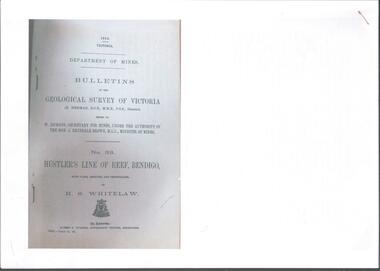
... Victoria, Hustlers Line of Reef, Bendigo, No. 33 by H.S. Whitelaw. Includes plan of Hustlers Royal Reserve No. 2, (main shaft) showing location on Pall Mall, and location of Post Office and Law Courts; plan of location of Hustlers Royal Reserve No. 2 (Park Shaft) showing Jail (sic), Camp Hill State School, two 'lagoons' in between tennis court, croquet court and bowling green; a plan of the Great Extended Hustler's Shaft and two copied images of Hustler's Hill showing mining buildings, poppet heads and chimneys. ...Hill in 2014. Great Extended Hustlers goldmining accident quartz mining K.K. Mine Comet Mine Hustler's Line of Reef Old Comet United Hustler's Redan Seven page photocopy of Department of Mines, Bulletin, Geological Survey of Victoria, Hustlers Line of Reef, Bendigo, No. 33 by H.S. Whitelaw. Includes plan of Hustlers Royal Reserve ...Seven men were killed at the Great Extended Hustler's mine disaster on 2nd May 1914 by an explosion of dynamite occurring as the men were waiting at the plat to ascend the mine at the end of their shift. No blame was attached to anyone in the findings of the inquisition. It was unknown what caused the dynamite to explode. This document formed part of the research done at the time by Bendigo Historical Society, of the 100 years commemoration of the mine disaster, held at Hustler's Hill in 2014. Seven page photocopy of Department of Mines, Bulletin, Geological Survey of Victoria, Hustlers Line of Reef, Bendigo, No. 33 by H.S. Whitelaw. Includes plan of Hustlers Royal Reserve No. 2, (main shaft) showing location on Pall Mall, and location of Post Office and Law Courts; plan of location of Hustlers Royal Reserve No. 2 (Park Shaft) showing Jail (sic), Camp Hill State School, two 'lagoons' in between tennis court, croquet court and bowling green; a plan of the Great Extended Hustler's Shaft and two copied images of Hustler's Hill showing mining buildings, poppet heads and chimneys. Comet, K.K., Hustler's No. 1, Old Comet and United Hustler's and Redan Mines are shown in the images. great extended hustlers, goldmining, accident, quartz, mining, k.k. mine, comet mine, hustler's line of reef, old comet, united hustler's, redan -
 Bendigo Historical Society Inc.
Newspaper - Albert Ernest Richardson, Peter Anderson's article 2020
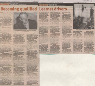
... Reserve...Victoria Hill...Victoria Hill. He examined mining reports and early newspaper articles to document its history. He envisaged the once fabulously rich hill as becoming a tourist attraction and campaigned vigorously to achieve this. In 1971 his dream was realised, when, with the help of South Bendigo Rotary Club 'The Hill' was cleaned up and historical site4s sign-posted. In 1972 the Bendigo Trust produced a booklet on Victoria Hill. Albert Richardson is acknowledged as the person ' on whose work and writings the text of this booklet has been based' The park adjoining Victoria Hill was named the Albert Richardson Reserve...Albert Richardson engine driver mining Bendigo boiler engine room mining cage Albert Richardson Reserve Victoria Hill George Ellis South Bendigo Rotary Club Four newspaper clippings on mining, focusing on Albert Richardson's life; his passion for mining history and more generally, the work of engine drivers on the Bendigo goldfield. ...Albert Richardson was born on 22nd. June, 1902 to George Albert Richardson and Catherine Agnes (nee Flynn). He married Mavis Irene Yarwood on 23rd. December, 1931. Albert Richardson's childhood activities in Duncan Street, Long Gully, were influenced strongly by the occupation of his father and grandfather, both of whom were engine drivers on the Bendigo field. Albert had his own model goldmine, complete with poppet head, baling tanks etc and was up and ready to start work with the sound of the 7 a.m. mine whistles. Albert spent a short time working as a motor mechanic and then took up0 welling insurance with T & G. However, his heart was with the mines and he worked daytimes with T. & G. and then took off to learn engine driving with night shift in one of the mines. He gained his engine drivers' ticket in 1938 and began work at the Nell Gwynne. His longest work time was at the North Nell but he also had shorter spells at other mines. His leter work years were spent at John Brown, from where he retired in 1968. Albert had a deep regard for the working man and worked for many years in the position of Secretary at the Trades Hall, Bendigo. (adapted from biography in BHS Collection, written by I. Hendry, 1972) The Bendigo Historical Society holds a wide range of Bendigo mining records researched and written by Mr. Albert Richardson. He was President of the Bendigo Branch of the Royal Historical Society of Victoria from 1969 to 1971.When he joined the Bendigo Branch in 1966 he began compiling a history of the Bendigo mines. He spent many long hours researching at the Bendigo Mines Department, summarising mine records. He gathered relevant mining material wherever it could be obtained. He devoted most of his spare time and energy to the Society, conducting tours of the goldfields, writing articles and presenting talks to various organisations. His first and foremost interest lay in Victoria Hill. He examined mining reports and early newspaper articles to document its history. He envisaged the once fabulously rich hill as becoming a tourist attraction and campaigned vigorously to achieve this. In 1971 his dream was realised, when, with the help of South Bendigo Rotary Club 'The Hill' was cleaned up and historical site4s sign-posted. In 1972 the Bendigo Trust produced a booklet on Victoria Hill. Albert Richardson is acknowledged as the person ' on whose work and writings the text of this booklet has been based' The park adjoining Victoria Hill was named the Albert Richardson Reserve in his honour. Four newspaper clippings on mining, focusing on Albert Richardson's life; his passion for mining history and more generally, the work of engine drivers on the Bendigo goldfield. Clippings taken from the 'Bendigo Weekly' 2016, dated September 29 'Learner Drivers' , October 7 'Becoming qualified', October 14 'Steam power in his veins' and November 11 ' Victoria Hill over the decades'. All articles written by James Lerk in a series titled 'Discover Bendigo'. One page biography on Albert Richardson, on yellow paper.albert richardson, engine driver, mining, bendigo, boiler, engine room, mining cage, albert richardson reserve, victoria hill, george ellis, south bendigo rotary club -
 Bendigo Historical Society Inc.
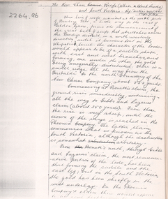
Document - ALBERT RICHARDSON COLLECTION: NEW CHUM LINE OF REEF MINES 1861, 1970's
... A reserve in Marong Road, adjoining Victoria Hill mine precint, is named in honour of Albert and his contribution to recording the mining history of Bendigo. ...A reserve in Marong Road, adjoining Victoria Hill mine precint, is named in honour of Albert and his contribution to recording the mining history of Bendigo. ...Albert Richardson was a past President of the Bendigo Historical Society. He had a great interest in the history of the Bendigo goldfield. A reserve in Marong Road, adjoining Victoria Hill mine precint, is named in honour of Albert and his contribution to recording the mining history of Bendigo. In this document, Albert has listed some early mines on the New Chum reefline. The Garibaldi Gold Mining Company, near the corner of Rose and Mackenzie Streets, Bendigo, was listed in the Victorian Government Gazettes on October 26th, 1860. Gazette 136 Page 2035. All the shareholders gave their place of residence as either Swanston or Collins Street, Melbourne. Bonati's Gold Mining Company was gazetted on 13th January, 1871 Gazette 2 Page 55. Carl Mueller was the Manager of the Company, which was situated on the 'New Chum Reef, Bendigo'. Fourteen page photocopy of information, written by Albert Richardson, regarding goldmines along the New Chum line of reef. Information includes owners of the mine; workings; reef and yield; cost and labor; drainage and machinery used, horses etc. Mines listed are: Garibaldi Company's Claim New Chum McDougall New Chum Quartz Mining Company Bonati and Company Denis's Claim Begelhole Company Watson and Company Gibbs and Lazarus Company Phoenix Company's Claim Burrows and Company gold mine, new chum reef line, garibaldi company's claim, new chum, mcdougall, new chum quartz mining company, bonati and company, denis's claim, begelhole company, watson and company, gibbs and lazarus company, phoenix company's claim, burrows and company -
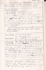 Bendigo Historical Society Inc.
Document - ALBERT RICHARDSON COLLECTION: Hercules and Energetic Mines, Albert Richardson, 1970's
... A reserve in Marong Road, adjoining Victoria Hill mine precint, is named in honour of Albert and his contribution to recording the history of Bendigo. ...A reserve in Marong Road, adjoining Victoria Hill mine precint, is named in honour of Albert and his contribution to recording the history of Bendigo. gold mine New Chum reef line Hercules and Energetic Albert Richardson Eight page photocopied document, originally written by Albert Richardson, of information on the Hercules and Energetic mines on the New Chum line of reef at Long Gully. ...The Hercules Mine was at Long Gully. It had a depth of 2383 feet ; 113,049 ounces of gold was obtained from the mine. Albert Richardson was a President of the Bendigo Historical Society. He had a great interest in the history of the Bendigo goldfield. A reserve in Marong Road, adjoining Victoria Hill mine precint, is named in honour of Albert and his contribution to recording the history of Bendigo. Eight page photocopied document, originally written by Albert Richardson, of information on the Hercules and Energetic mines on the New Chum line of reef at Long Gully. Information includes depths of shafts; locality; plant; engine room and gold obtained. gold mine, new chum reef line, hercules and energetic, albert richardson -
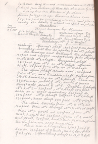 Bendigo Historical Society Inc.
Document - ALBERT RICHARDSON COLLECTION: Catherine Reef United Claimholders Gold Mine, Albert Richardson, 1970's
... A reserve in Marong Road, adjoining Victoria Hill mine precint, is named in honor of Albert and his contribution to recording the history of Bendigo. ...A reserve in Marong Road, adjoining Victoria Hill mine precint, is named in honor of Albert and his contribution to recording the history of Bendigo. gold mine New Chum reef line Albert Richardson Catherine Reef United Claimholders Gold Mine Eaglehawk Three page photocopy of handwritten information regarding the Catherine Reef United Claimholders Gold Mine, Eaglehawk. ...Albert Richardson was a President of the Bendigo Historical Society. He had a great interest in the history of the Bendigo goldfield. A reserve in Marong Road, adjoining Victoria Hill mine precint, is named in honor of Albert and his contribution to recording the history of Bendigo. Three page photocopy of handwritten information regarding the Catherine Reef United Claimholders Gold Mine, Eaglehawk. Information prepared by Albert Richardson. Depth of shaft; workings; levels; machinery and yield are described.gold mine, new chum reef line, albert richardson, catherine reef united claimholders gold mine, eaglehawk
